
PERUMIN 31: Integrated assessment of deep sedimentary structures: exploring groundwater resources in...
46
|
-
Upload
perumin-convencion-minera -
Category
Presentations & Public Speaking
-
view
92 -
download
7
Transcript of PERUMIN 31: Integrated assessment of deep sedimentary structures: exploring groundwater resources in...
|
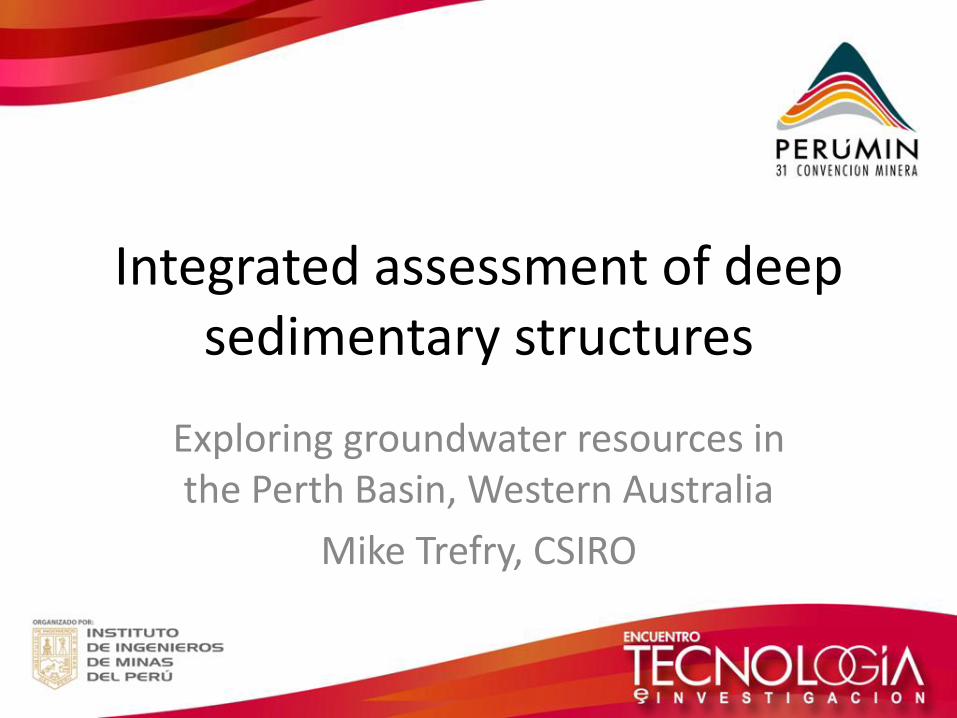
Integrated assessment of deep sedimentary structures
Exploring groundwater resources in the Perth Basin, Western Australia
Mike Trefry, CSIRO
Acknowledgements
• Thanks to the PERUMIN organizers!
• CSIRO Minerals Down Under (MDU) Flagship
• Colleagues in the Western Australian Geothermal Centre of Excellence
WAGCoE Colleagues
Klaus Regenauer-Lieb (Director), Nick Timms, Cedric Griffiths, Lynn Reid, Soazig Corbel, Thomas Poulet, Ludo Ricard, Oliver Schilling, Heather Sheldon, Florian Wellmann, Lionel Esteban, Jean-Baptiste Chanu, Paul Wilkes, Grant Douglas, Anna Kaksonen, Dan Lester, Guy Metcalfe, Lucas Pimienta, Sebastian Gutbrodt, Stephanie Tressler, Gemma Bloomfield, Cody Evans, Ali Karrech, Claudio Delle Piane, Remi Alix, Frank Horowitz, Moyra Wilson, Katy Evans, Laura Stütenbecker, Shankar Israni, Joseph Hamilton, Patricia Cope, Chris Dyt, Xiu Huang, Jacob Hopkins, David Champion, Hugo Olierook, Steve Reddy, Brendan Florio, Dariush Nadri, Joel Sarout, Hui-Tong Chua, Alex Christ, Peter Whittaker, Oliver Gaede, Christoph Schrank, Jie Liu, Lucy Leyland, Len Baddock, Klaus Gessner, Liam O’Bryan, Libby Colgan, Tom Beckerling, Allison Hortle, Sarah Glasson, JJ Leong, William Tran, Nathan White, Susan Lissiman, Dylan Irvine, Aspasia Kouhsen, Cate Walker, Andrew Minto, Chris Botman, Kristina Kazakoff, Lisa Miotti, Stephane Francois-Lubin, Guillaume Pons, Charlotte Dos Santos, Sunil Varma, Sean Webb, Margaret Pryor, Melina Ielati
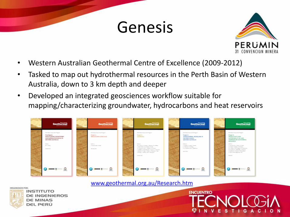
Genesis
• Western Australian Geothermal Centre of Excellence (2009-2012)
• Tasked to map out hydrothermal resources in the Perth Basin of Western Australia, down to 3 km depth and deeper
• Developed an integrated geosciences workflow suitable for mapping/characterizing groundwater, hydrocarbons and heat reservoirs
www.geothermal.org.au/Research.htm
Outline
1. Water in mining – basic context
2. Groundwater fundamentals
3. Integrated groundwater assessment in the Perth Basin
4. Lessons to share
1. Water in Mining
Water in Mining
• Water is fundamental to mining – used for heating, cooling, dust suppression, processing and treatment
• Water budgets are critical to below-ground and above-ground operations (in situ recovery operations rely on groundwater)
• Too much water, or too little, is a big problem
• Managing water quality throughout the mine life is key to efficient mining
• Water is a major vector for environmental impact
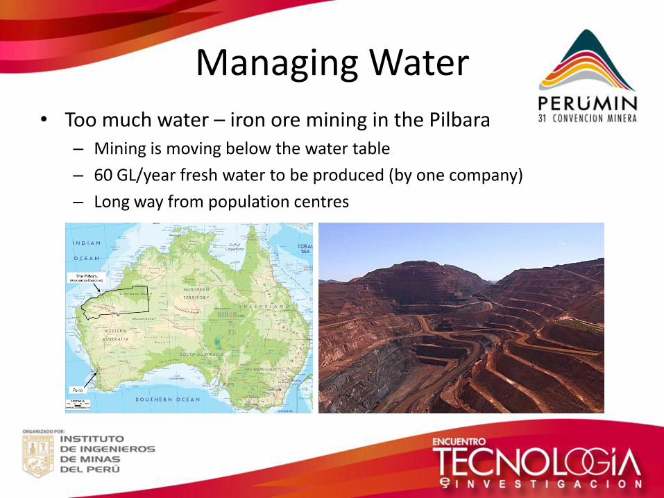
Managing Water
• Too much water – iron ore mining in the Pilbara – Mining is moving below the water table
– 60 GL/year fresh water to be produced (by one company)
– Long way from population centres
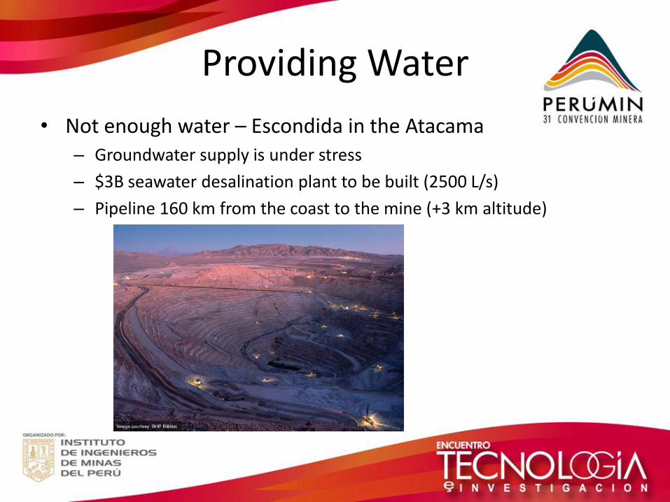
Providing Water
• Not enough water – Escondida in the Atacama – Groundwater supply is under stress
– $3B seawater desalination plant to be built (2500 L/s)
– Pipeline 160 km from the coast to the mine (+3 km altitude)
Responsibility
• Major mines need water strategy plans
• A plan should show how a mine will operate profitably and responsibly in cooperation with neighbouring water users
• Strategies must be informed by sound understandings of the local and regional hydrological resources
• Groundwater is always problematic! – Where? How deep?
– How much is there?
– Is it useable? What is the water quality?
– Is it replenished?
2. Groundwater Fundamentals
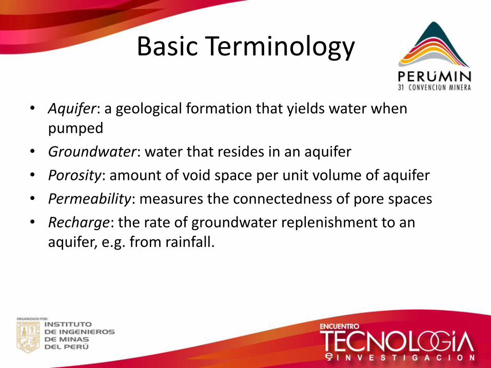
Basic Terminology
• Aquifer: a geological formation that yields water when pumped
• Groundwater: water that resides in an aquifer
• Porosity: amount of void space per unit volume of aquifer
• Permeability: measures the connectedness of pore spaces
• Recharge: the rate of groundwater replenishment to an aquifer, e.g. from rainfall.
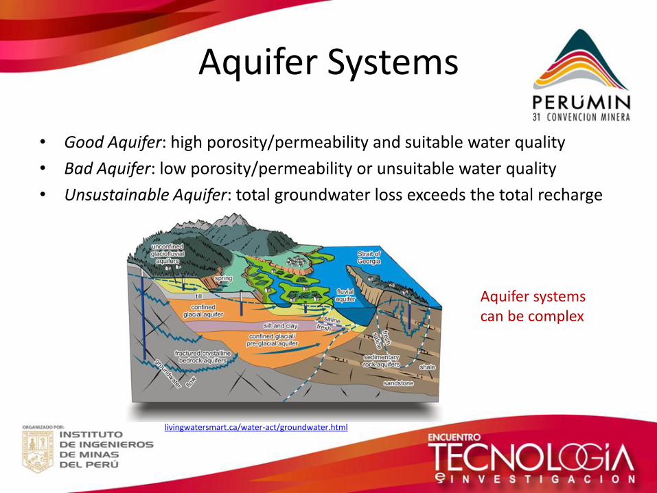
Aquifer Systems
• Good Aquifer: high porosity/permeability and suitable water quality
• Bad Aquifer: low porosity/permeability or unsuitable water quality
• Unsustainable Aquifer: total groundwater loss exceeds the total recharge
Aquifer systems can be complex
livingwatersmart.ca/water-act/groundwater.html
3. Integrated Groundwater Assessment in the Perth Basin
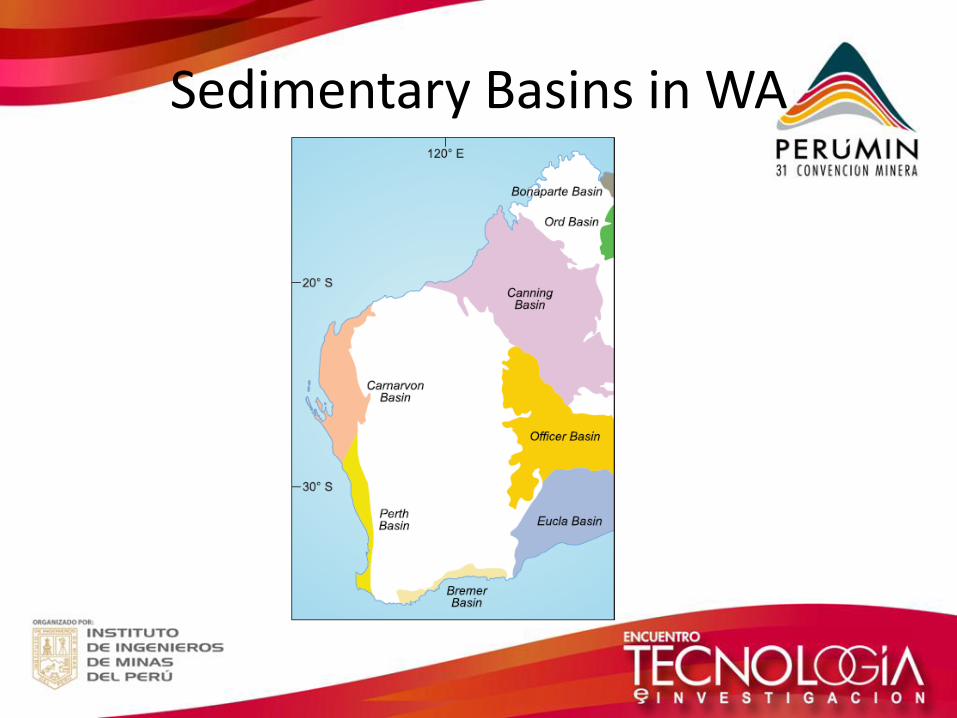
Sedimentary Basins in WA
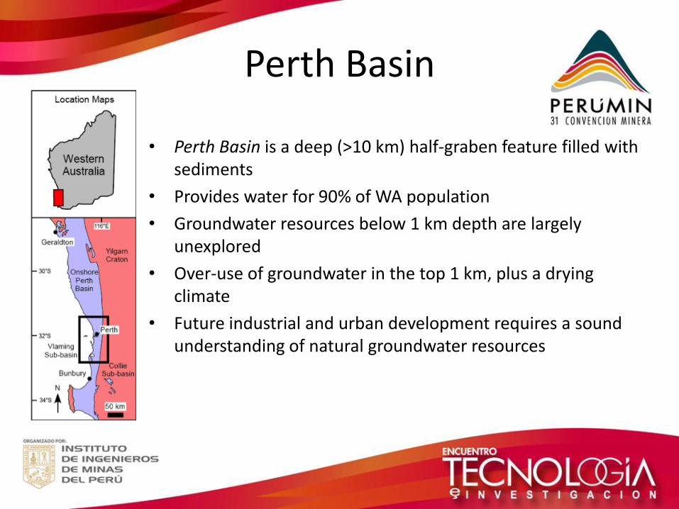
Perth Basin
• Perth Basin is a deep (>10 km) half-graben feature filled with sediments
• Provides water for 90% of WA population
• Groundwater resources below 1 km depth are largely unexplored
• Over-use of groundwater in the top 1 km, plus a drying climate
• Future industrial and urban development requires a sound understanding of natural groundwater resources
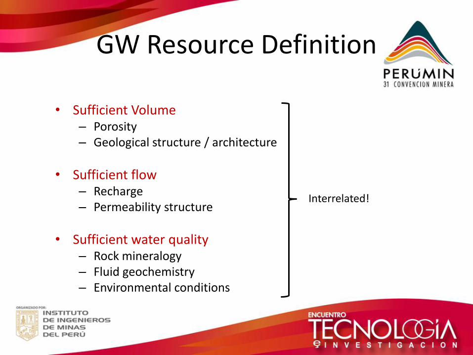
GW Resource Definition
• Sufficient Volume
– Porosity – Geological structure / architecture
• Sufficient flow – Recharge – Permeability structure
• Sufficient water quality – Rock mineralogy – Fluid geochemistry – Environmental conditions
Interrelated!
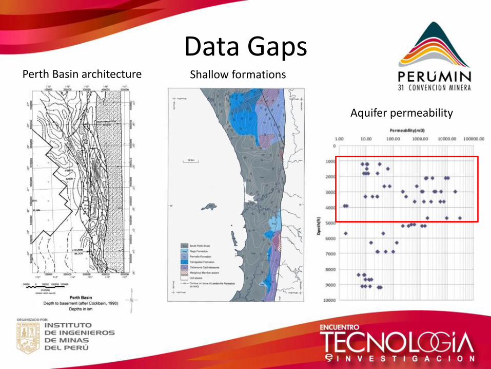
Aquifer permeability
Shallow formations
Data Gaps Perth Basin architecture
Building on the Past
How can we explore the deeper resources in the Perth Basin?
• An integrated study approach
• Compile, collate and QA/QC existing data
• Build a quantitative basin geomodel using all the data
• Assess uncertainties (structural, parametric)
• Recommend future investigations to minimize geomodel uncertainty
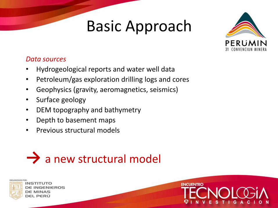
Basic Approach
Data sources
• Hydrogeological reports and water well data
• Petroleum/gas exploration drilling logs and cores
• Geophysics (gravity, aeromagnetics, seismics)
• Surface geology
• DEM topography and bathymetry
• Depth to basement maps
• Previous structural models
→ a new structural model
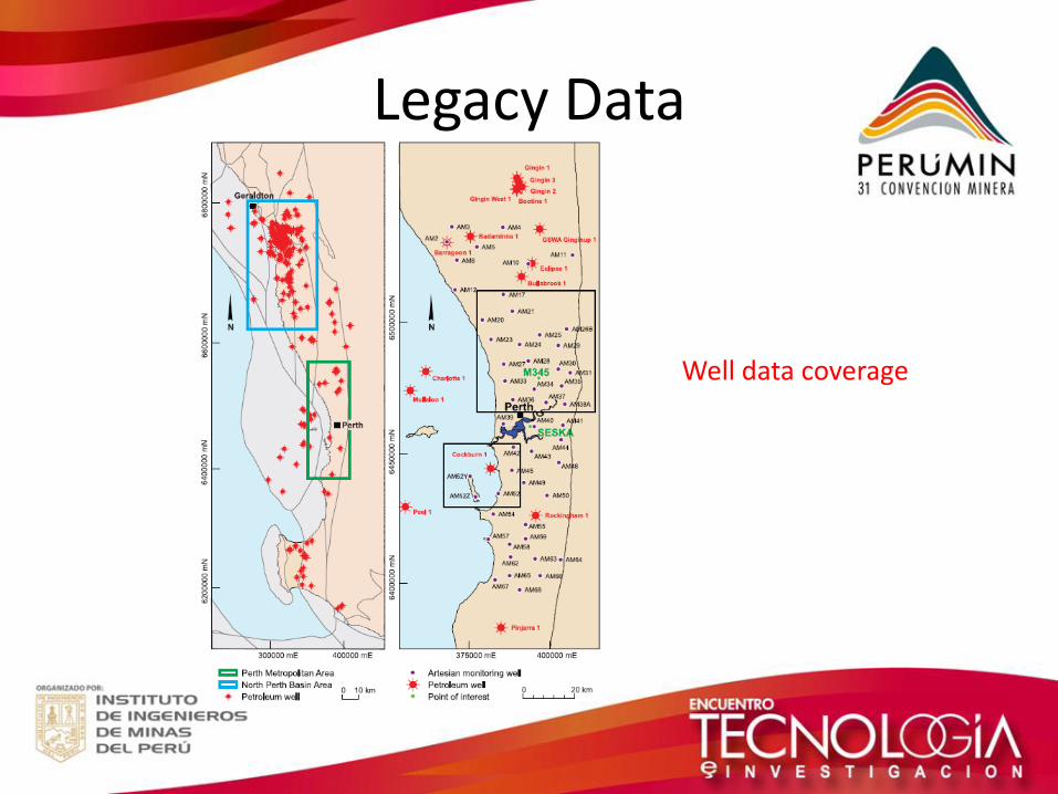
Legacy Data
Well data coverage
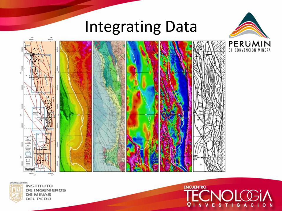
Integrating Data
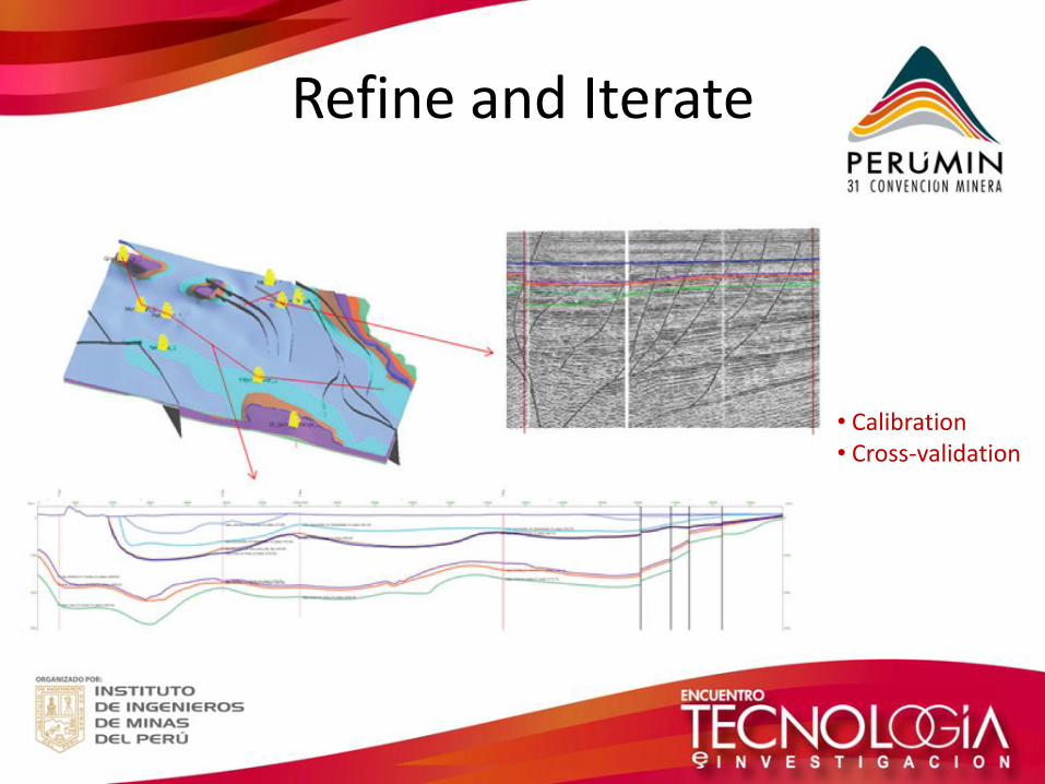
Refine and Iterate
• Calibration • Cross-validation
Faculty of Science and Engineering Department of Applied Geology
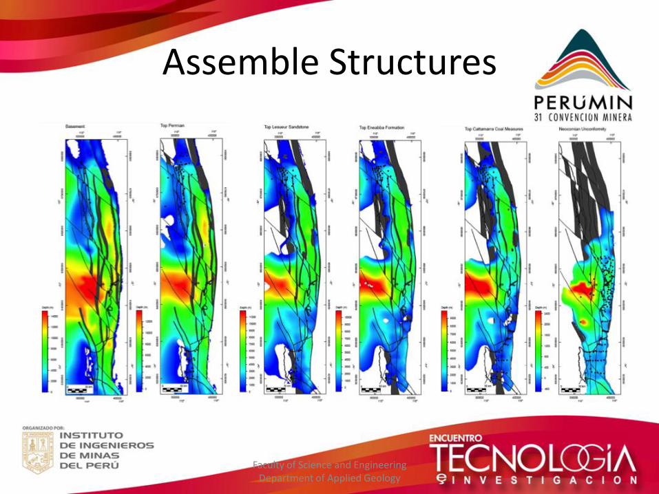
Assemble Structures
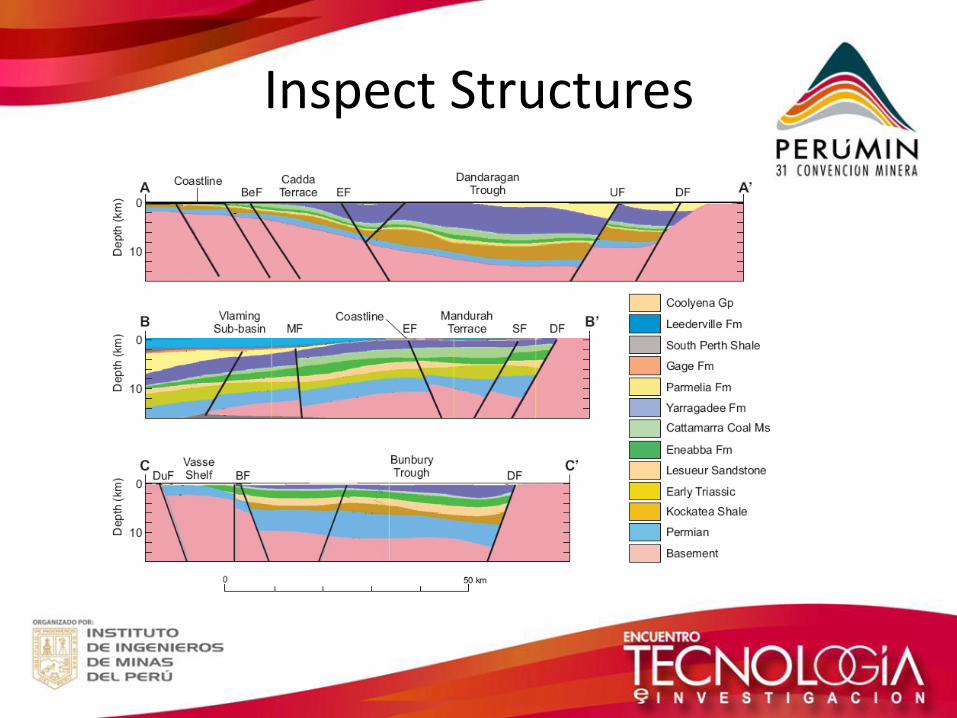
Inspect Structures
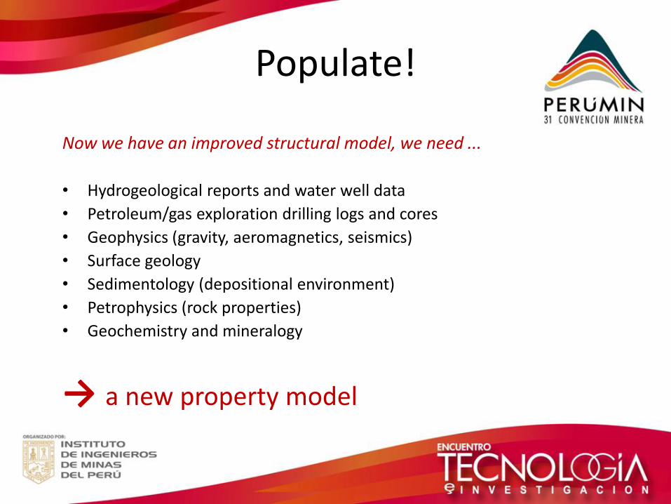
Populate!
Now we have an improved structural model, we need ...
• Hydrogeological reports and water well data
• Petroleum/gas exploration drilling logs and cores
• Geophysics (gravity, aeromagnetics, seismics)
• Surface geology
• Sedimentology (depositional environment)
• Petrophysics (rock properties)
• Geochemistry and mineralogy
→ a new property model
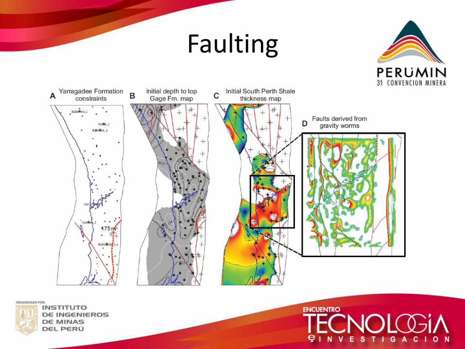
Faulting
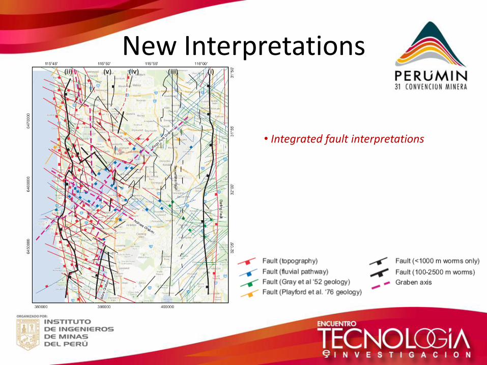
New Interpretations
• Integrated fault interpretations
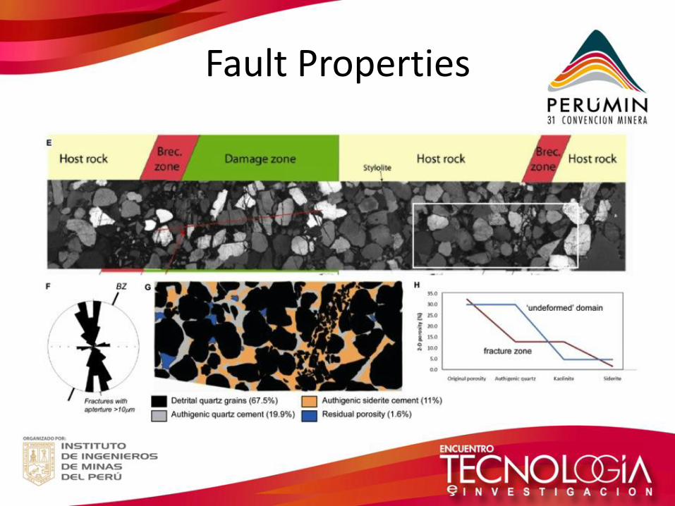
Fault Properties
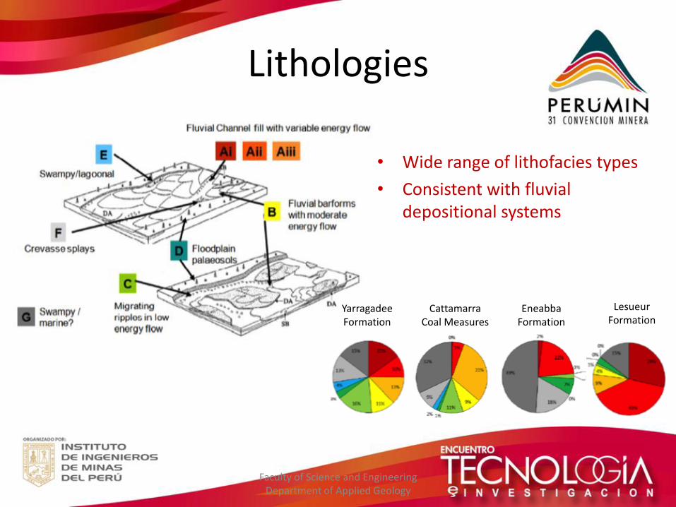
• Wide range of lithofacies types
• Consistent with fluvial depositional systems
Faculty of Science and Engineering Department of Applied Geology
Yarragadee Formation
Cattamarra Coal Measures
Eneabba Formation
Lesueur Formation
Lithologies
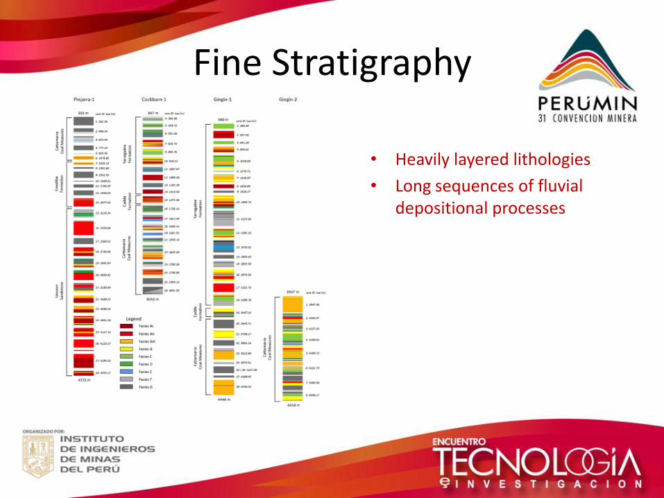
Fine Stratigraphy
• Heavily layered lithologies
• Long sequences of fluvial depositional processes
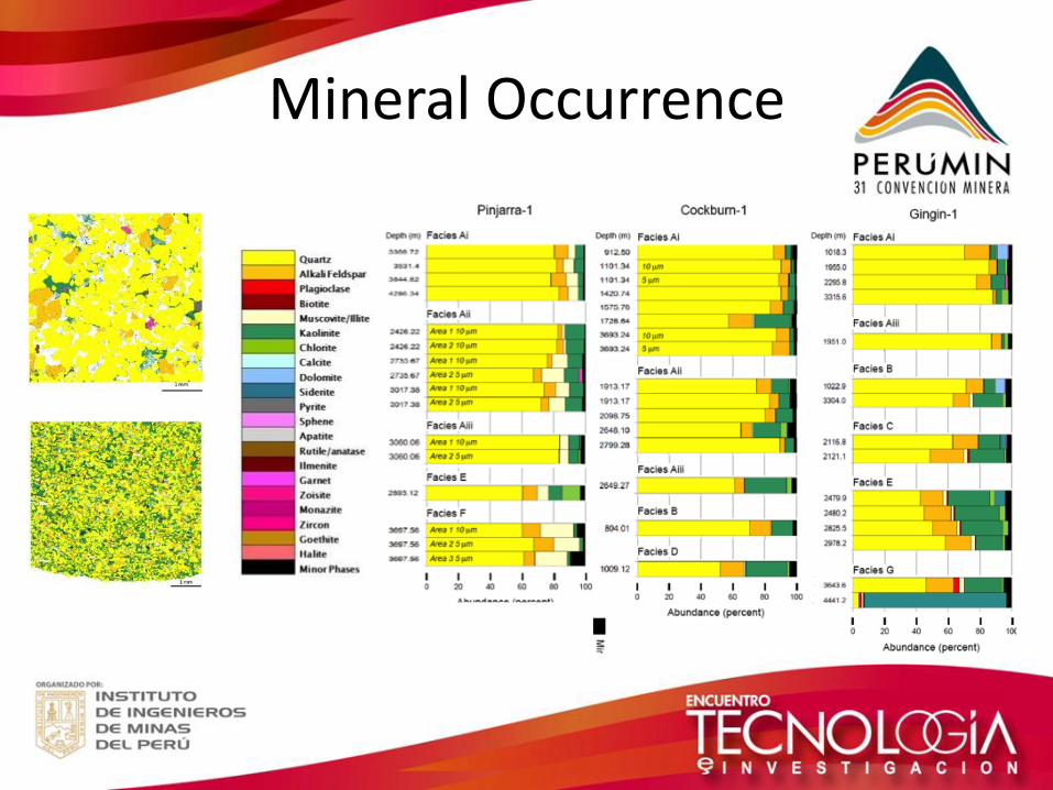
Mineral Occurrence
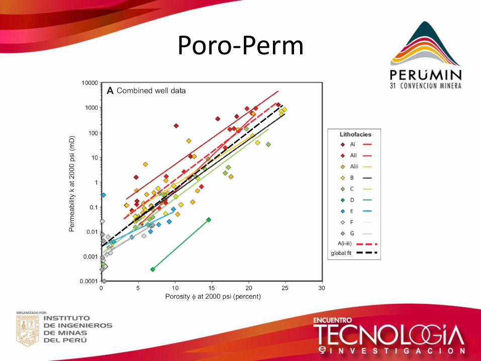
Poro-Perm
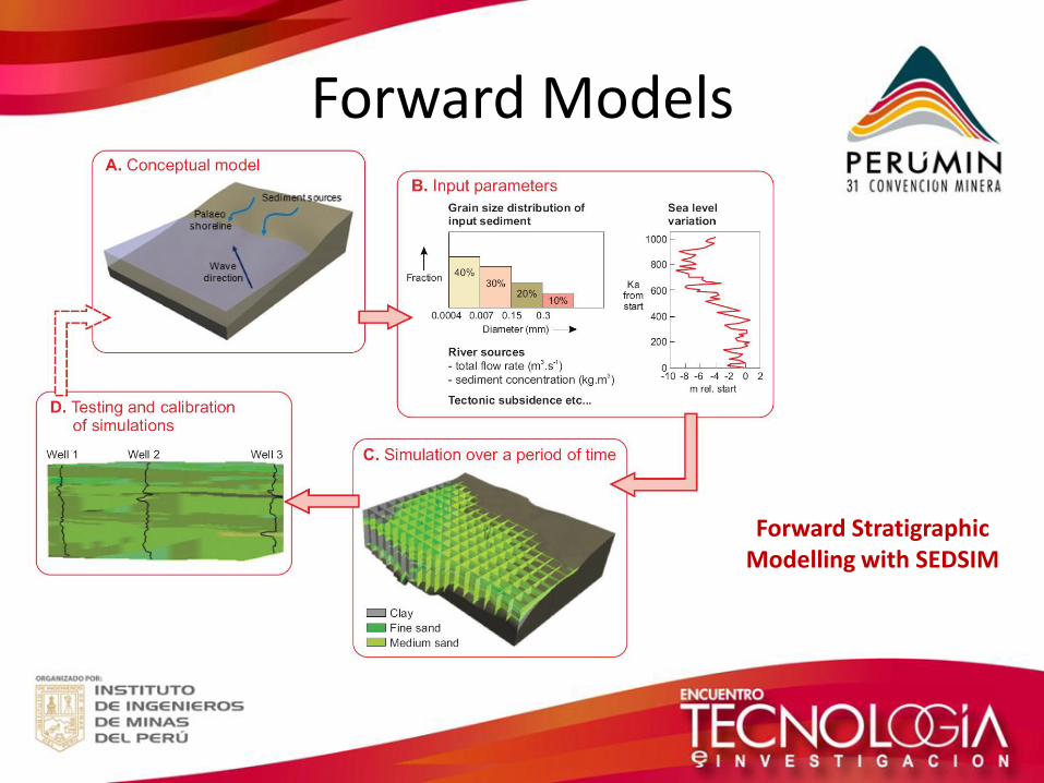
Forward Models
Forward Stratigraphic Modelling with SEDSIM
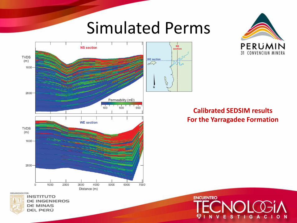
Simulated Perms
Calibrated SEDSIM results For the Yarragadee Formation
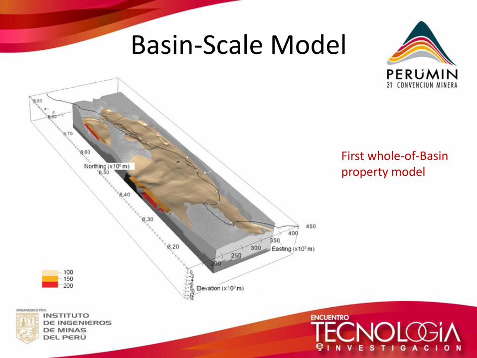
Basin-Scale Model
First whole-of-Basin property model
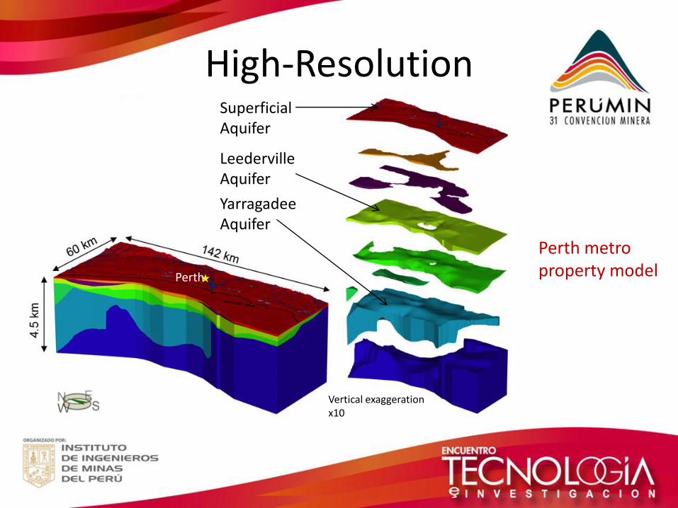
High-Resolution
Perth
Vertical exaggeration x10
Superficial Aquifer
Leederville Aquifer
Yarragadee Aquifer
Perth metro property model
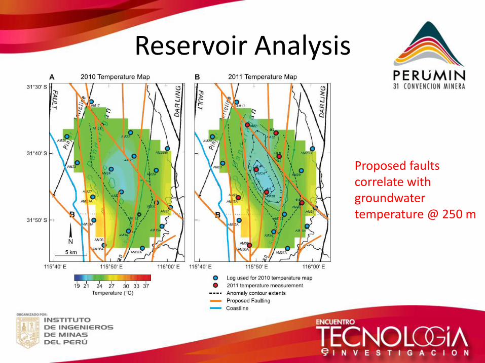
Reservoir Analysis
Proposed faults correlate with groundwater temperature @ 250 m
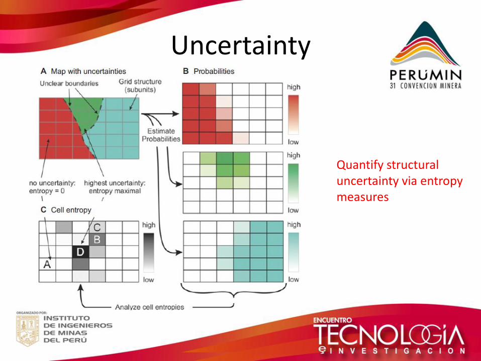
Uncertainty
Quantify structural uncertainty via entropy measures
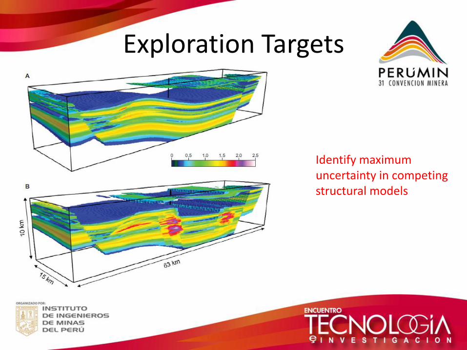
Exploration Targets
Identify maximum uncertainty in competing structural models
Summary
• Re-analyzed legacy data sets
• New geophysical data acquisition campaigns
• Integrated, calibrated and cross-validated
• New 3D structural and property models for Perth Basin
• Easy computations of aquifer locations, volumes and properties
• Quantified uncertainty using entropy measures
• Identified targets for subsequent investigation
4. Lessons to Share
Lessons to share
• Seismic studies can be expensive and difficult in populated areas
• Deep exploration drilling/coring may require more expensive drilling technology than shallow groundwater drilling
• Maximize the benefit of existing data by re-analyzing with modern tools
• Multidisciplinary approaches can help
• Do the thinking before committing to major capital expenditure on exploration

|