PERSATUAN GEOLOGI MALAYSIA WARTAGEOLOGI - … · hosts a small grill hut and a museum, which...
36
PERSATUAN GEOLOGI MALAYSIA Jilid 44 JANUARY – MARCH Volume 44 No. 1 2018 No. 1 ISSN 0126 - 5539 PP2509/07/2013(032786) NEWSLETTER of the GEOLOGICAL SOCIETY OF MALAYSIA
Transcript of PERSATUAN GEOLOGI MALAYSIA WARTAGEOLOGI - … · hosts a small grill hut and a museum, which...
WWWWWWARTAARTAARTAWARTAWWWARTAWARTAWARTAWWWARTAW GEOLOGIGEOLOGIGEOLOGIPERSATUAN GEOLOGI MALAYSIA
Jilid 44 JANUARY – MARCH Volume 44No. 1 2018 No. 1
ISSN 0126 - 5539 PP2509/07/2013(032786)
NEWSLETTER of the GEOLOGICAL SOCIETY OF MALAYSIA

Warta GeologiNewsletter of the Geological Society of Malaysia
EditorWan Hasiah Abdullah (University of Malaya)
Editorial BoardChow Weng Sum
Universiti Teknologi Petronas, MalaysiaAzman A. Ghani
University of Malaya, MalaysiaHarry Doust
The Netherlands & Vrije Universiteit, Amsterdam
Robert Hall University of London, UK
Howard Johnson Imperial College London, UK
Ibrahim Komoo Universiti Kebangsaan Malaysia, Malaysia
Alfredo Lagmay University of the Philippine, Philippine
Lee Chai Peng University of Malaya, Malaysia
Mohd Shafeea Leman Universiti Kebangsaan Malaysia, Malaysia
Ian Metcalfe University of New England, Australia
Ng Tham Fatt University of Malaya, Malaysia
Peter R. Parham Nanyang Technological University, Singapore
Joy J. Pereira Universiti Kebangsaan Malaysia, Malaysia
Rajib Shaw Keio University, Japan
Felix Tongkul Universiti Malaysia Sabah, Malaysia
SecretariatAnna LeeWan Aida Wan Zahari
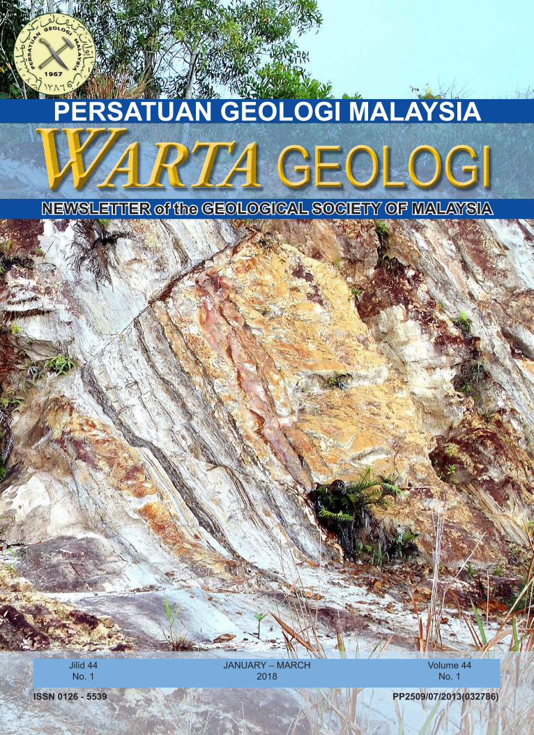
Cover photo: Faulted and thrusted sediments of the Tukau Formation at Kampung Lopeng, Miri, Sarawak (provided by Kessler & Jong, this issue).
PERSATUAN GEOLOGI MALAYSIAGeological Society of Malaysia
Council 2017/2018
President : Mr. Abd. Rasid JaaparVice President : Dr. Che Aziz AliSecretary : Mr. Lim Choun SianAssistant Secretary : Mr. Askury Abd KadirTreasurer : Mr. Ahmad Nizam Hasan Editor : Prof. Dr. Wan Hasiah AbdullahImmediate Past President : Dr. Mazlan MadonCouncillors : Ms. Marelyn Telun Daniel
Dr. Meor Hakif Amir HassanMr.MuhammadAshahadiDzulkafliDr. Norbet SimonMr. Nicholas JacobDr. Nur Iskandar TaibMr. Tan Boon KongDato’ Yunus Abdul Razak
The Geological Society of Malaysia was founded in 1967 with the aim of promoting the advancement of geoscience, particularly in Malaysia and Southeast Asia. The Society has a membership of about 600 local and international geoscientists.
Warta Geologi (Newsletter of the Geological Society of Malaysia) is published quarterly by the Society. Warta Geologi covers short geological communications and original research, as well as reports on activities and news about the Society. It is distributed free-of-charge to members of the Society. Further information can be obtained from:
The EditorGeological Society of Malaysiac/o Department of Geology, University of Malaya, 50603 Kuala Lumpur, MalaysiaTel: 603-79577036 Fax: 603-79563900 Email: [email protected]
ISSN 0126–5539 Warta Geologi, Vol. 44, No. 1, January-March 2018, pp. 1–7
CATATAN GEOLOGI GEOLOGICAL NOTES
Exploring medieval adits in a copper mine using ground-penetrating radar imaging (GPR)
Franz-Luitpold Kessler
Goldbach Geoconsultants, Glattbach, GermanyEmail address: [email protected]
Abstract: The Wilhelmine mine, roughly located in the center of Germany, has produced copper and other ores during the past five centuries, though in an on-off mode. Short periods of mining activity were interrupted by longer idle time intervals. Consequently, only the last phase of mining is reasonably well known. Since April 2017 we explored the area of the mine using outcrop geology measurements and ground penetrating radar from (a) frontal open-cast cliff b) from inside the mine and (c) meadows above the roof of the mining area. This way it was possible to construct a nearly three-dimensional picture using relatively simple software applications to integrate geological, geophysical and historical data. The GPR work indicates previously unknown adits at 6-7 m, and again at 12-14 m and occasionally 18 m beneath the surface.
Keywords: GPR, geophysics, mining, copper, exploration, medieval, Wilhelmine
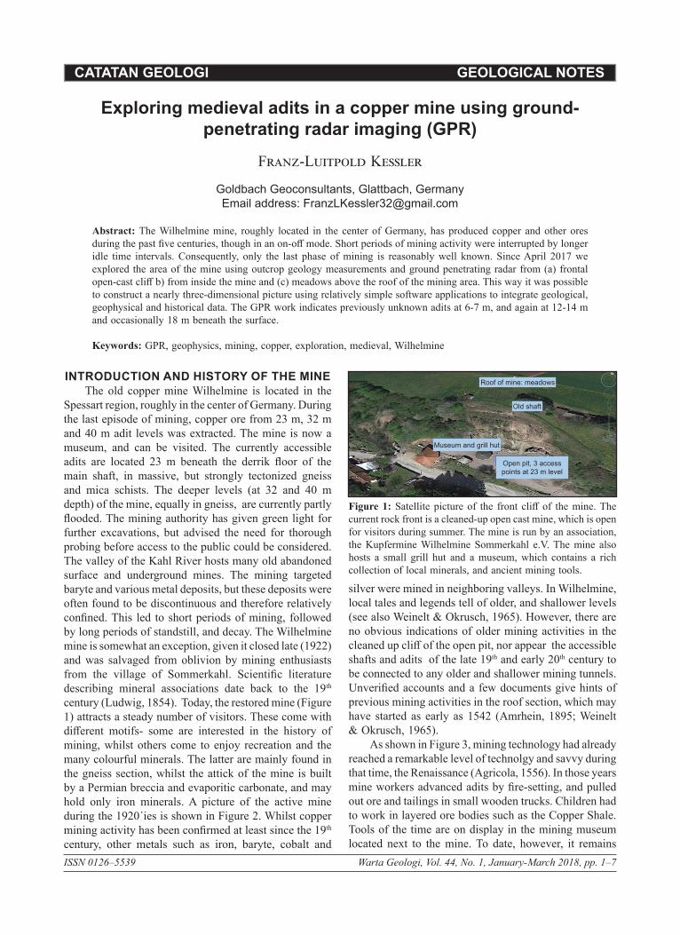
INTRODUCTION AND HISTORY OF THE MINEThe old copper mine Wilhelmine is located in the
Spessart region, roughly in the center of Germany. During the last episode of mining, copper ore from 23 m, 32 m and 40 m adit levels was extracted. The mine is now a museum, and can be visited. The currently accessible adits are located 23 m beneath the derrik floor of the main shaft, in massive, but strongly tectonized gneiss and mica schists. The deeper levels (at 32 and 40 m depth) of the mine, equally in gneiss, are currently partly flooded. The mining authority has given green light for further excavations, but advised the need for thorough probing before access to the public could be considered. The valley of the Kahl River hosts many old abandoned surface and underground mines. The mining targeted baryte and various metal deposits, but these deposits were often found to be discontinuous and therefore relatively confined. This led to short periods of mining, followed by long periods of standstill, and decay. The Wilhelmine mine is somewhat an exception, given it closed late (1922) and was salvaged from oblivion by mining enthusiasts from the village of Sommerkahl. Scientific literature describing mineral associations date back to the 19th century (Ludwig, 1854). Today, the restored mine (Figure 1) attracts a steady number of visitors. These come with different motifs- some are interested in the history of mining, whilst others come to enjoy recreation and the many colourful minerals. The latter are mainly found in the gneiss section, whilst the attick of the mine is built by a Permian breccia and evaporitic carbonate, and may hold only iron minerals. A picture of the active mine during the 1920´ies is shown in Figure 2. Whilst copper mining activity has been confirmed at least since the 19th century, other metals such as iron, baryte, cobalt and
silver were mined in neighboring valleys. In Wilhelmine, local tales and legends tell of older, and shallower levels (see also Weinelt & Okrusch, 1965). However, there are no obvious indications of older mining activities in the cleaned up cliff of the open pit, nor appear the accessible shafts and adits of the late 19th and early 20th century to be connected to any older and shallower mining tunnels. Unverified accounts and a few documents give hints of previous mining activities in the roof section, which may have started as early as 1542 (Amrhein, 1895; Weinelt & Okrusch, 1965).
As shown in Figure 3, mining technology had already reached a remarkable level of technolgy and savvy during that time, the Renaissance (Agricola, 1556). In those years mine workers advanced adits by fire-setting, and pulled out ore and tailings in small wooden trucks. Children had to work in layered ore bodies such as the Copper Shale. Tools of the time are on display in the mining museum located next to the mine. To date, however, it remains
Figure 1: Satellite picture of the front cliff of the mine. The current rock front is a cleaned-up open cast mine, which is open for visitors during summer. The mine is run by an association, the Kupfermine Wilhelmine Sommerkahl e.V. The mine also hosts a small grill hut and a museum, which contains a rich collection of local minerals, and ancient mining tools.
Roof of mine: meadows
Old shaft
Museum and grill hut
Open pit, 3 access points at 23 m level
Warta Geologi, Vol. 44, No. 1, January - March 20182
Franz-Luitpold Kessler
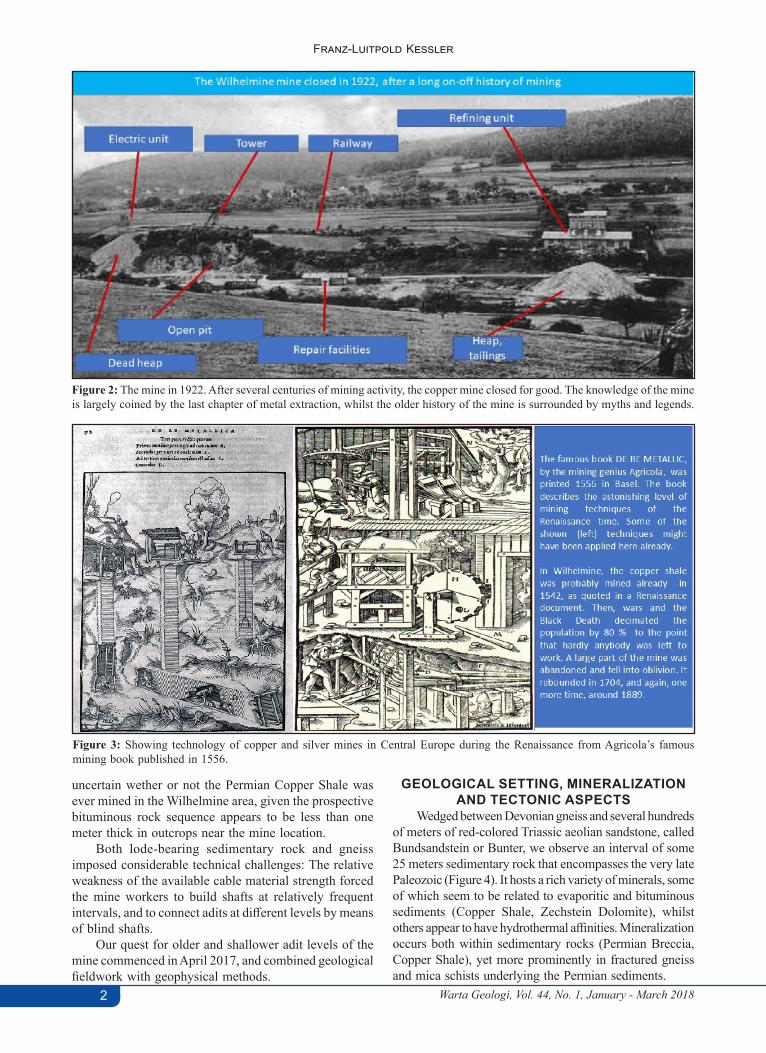
Figure 2: The mine in 1922. After several centuries of mining activity, the copper mine closed for good. The knowledge of the mine is largely coined by the last chapter of metal extraction, whilst the older history of the mine is surrounded by myths and legends.
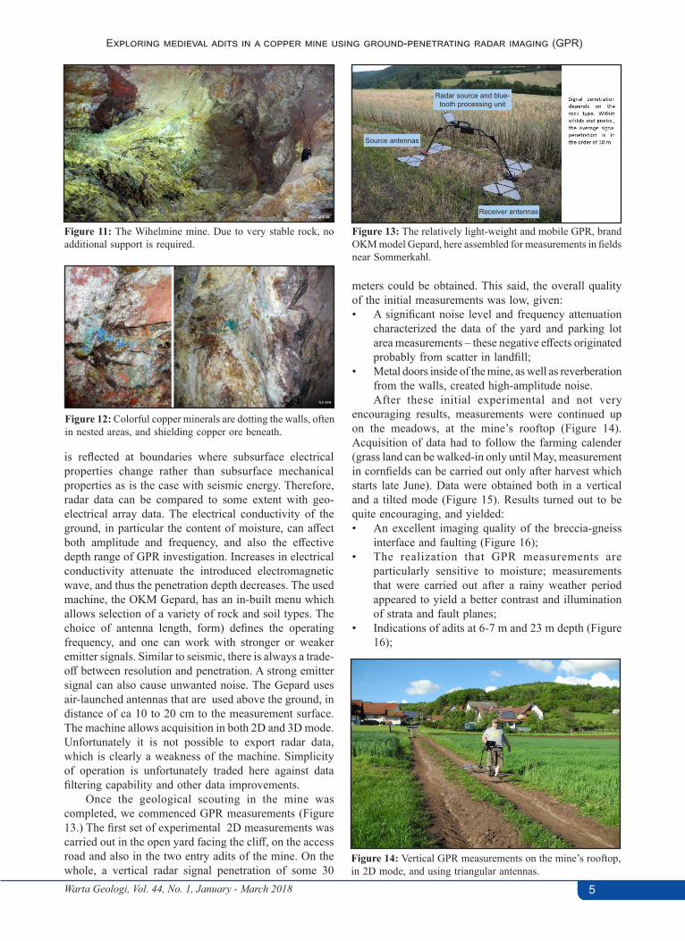
Figure 3: Showing technology of copper and silver mines in Central Europe during the Renaissance from Agricola’s famous mining book published in 1556.
uncertain wether or not the Permian Copper Shale was ever mined in the Wilhelmine area, given the prospective bituminous rock sequence appears to be less than one meter thick in outcrops near the mine location.
Both lode-bearing sedimentary rock and gneiss imposed considerable technical challenges: The relative weakness of the available cable material strength forced the mine workers to build shafts at relatively frequent intervals, and to connect adits at different levels by means of blind shafts.
Our quest for older and shallower adit levels of the mine commenced in April 2017, and combined geological fieldwork with geophysical methods.
GEOLOGICAL SETTING, MINERALIZATION AND TECTONIC ASPECTS
Wedged between Devonian gneiss and several hundreds of meters of red-colored Triassic aeolian sandstone, called Bundsandstein or Bunter, we observe an interval of some 25 meters sedimentary rock that encompasses the very late Paleozoic (Figure 4). It hosts a rich variety of minerals, some of which seem to be related to evaporitic and bituminous sediments (Copper Shale, Zechstein Dolomite), whilst others appear to have hydrothermal affinities. Mineralization occurs both within sedimentary rocks (Permian Breccia, Copper Shale), yet more prominently in fractured gneiss and mica schists underlying the Permian sediments.

Warta Geologi, Vol. 44, No. 1, January - March 2018 3
Exploring medieval adits in a copper mine using ground-penetrating radar imaging (GPR)
Figure 4: A zoomed segment of the Geological Map of the area, plus a simplified stratigraphy. The current map version shown here dates from 1965. The position of the mine is shown by the uppermost yellow circle. The other yellow circles are locations of adjacent mining locations, now mostly overgrown. The mineralized rock is usually found within tectonized gneiss, and the Paleozoic sediments above. The map shows folded gneiss (in pink), with a discordant cover of Late Paleozoic sediments (blue) and above, the Triassic Buntsandstein or Bunter (red-brown to pink).
In Wilhelmine, the extracted copper ore were mainly bornite, tennantite, and more rarely cuprite. These ores are found in nests and veins located within fractured gneiss and mica schists, and in close vicinity of faults and joints. There are no continuous, laterally connected lode veins.
There has been a longstanding debate about the origins of the mineralization (see Okrusch et al., 2007), which is not quite conclusively resolved yet. The old school believed hypersaline brines descended, leached mineral from the copper shale and redeposited it in the broken-up gneiss and overlying sediments. Proof being, that the sulfur in the minerals such as Bornite has an organic isotope signature. Temperature of mineral formation was calculated to be ca 60 degrees C. Another school of mineralogists believes the metals are hydrothermal deposits. There is a good argument in favor of that theory, too, given there are many hydrothermal veins in areas where the copper shale was not even deposited. Some other researchers believe in a compromise: Hydrothermal liquids percolated in Jurassic times through metal-rich sediment and deposited minerals in porous rock, as well as in tectonized gneiss, sediment, and conglomerate.
In respect to ores located within the gneiss and mica schist section, it is noted that mineralization occurred in permeability zones (open fractures as well as mylonite) created by strike-slip tectonism, which affected the basement rock during the Late Paleozoic era. This resulted in joint and fracture sets that rarely extend beyond 50 meters. The latter may explain why (likely to the frustration of ancient minors) no continuous lodes were encountered.
Our initial investigations centered on the cliff face. There are numerous steep and parallel faults. One major
fault is exposed on the upper cliff section (Figure 5) and displaces the gneiss/Zechstein boundary by some 4 meters. The frontal cliff section displays a strongly tectonized and copper-mineralized gneiss and mica schist section (Figure 6), fractured and distorted by an array of strike-slip faults. In the cliff, one can discriminate between strongly boudinaged reddish gneiss bodies, ´floating´ between belts of green-colored breccia, and mylonite. These host secondary copper minerals (Figure 6). Fault planes, mylonite, and a majority of joints are nearly vertical and represent shear zones between several branches of a ca. 80 m wide strike-slip fault zone (Figure 7). Major faults can be traced from the cliff face into the mine’s interior. Fault planes show slicken-sides, indicating a dominant horizontal component (Figure 8). A shear rhomboid, which developed between two strike slip fault branches, is shown in Figure 9. In weathered near-surface rock we observe formation of chrysocolla
Figure 5: Picture of the cliff area above the mine’s entrance. A fault (yellow line) is seen to displace the gneiss/conglomerate boundary by some 4 meters.
Z1 Zechstein conglomerate
Solid rock, Fe mineralisations
Z1 Zechstein conglomerate
gneiss
gneiss
complex fault

Warta Geologi, Vol. 44, No. 1, January - March 20184
Franz-Luitpold Kessler
Figure 6: The green rock belts are formed by mylonitic gneiss, which later became impregnated with copper minerals.
Figure 7: View of a major strike slip fault, forming a boundary between the mineralized gneiss section (right) and country rock.
Figure 8: Near to horizontal slickensides indicate strike slip mode as the major component in the faulting.
Figure 9: An example of joints in a small gneiss rhomboid wedged between two branches of a strike slip fault system.
(Figure 10). Inside of the mine, the unweathered gneiss walls are massive and strong, and consequently there is mostly no need of additional support in the adits (Figure 11). Minerals such as malachite and azurite are seen in roof sections and point to nests of weathered tennantite, cuprite and bornite (Figure 12).
GPR METHODOLOGY AND GEOPHYSICAL PROFILING
Ground-penetrating radar (GPR) is a geophysical method that uses radar pulses to penetrate and image
the subsurface. It uses electromagnetic radiation in the microwave band of the radio spectrum. Similar to seismic, GPR machines detect the reflected or refracted signals from buried rock surfaces. GPR can image rock, soil, ice, fresh water, pavements and structures. A GPR transmitter emits electromagnetic energy into the ground, with two emiter antennas, and recovers the reflected or refracted energy again with a pair of receiver antennas. When the energy encounters a buried object or a boundary between materials having different permittivities, it may be reflected or refracted or scattered back to the surface. The signal
Figure 10: Minerals in the strongly tectonized mylonite rock (left), strongly turquoise chrysocolla is seen forming patches on weathered gneiss (right).
Green belt
Green belt (mineralized
mylonite)
Warta Geologi, Vol. 44, No. 1, January - March 2018 5
Exploring medieval adits in a copper mine using ground-penetrating radar imaging (GPR)
is reflected at boundaries where subsurface electrical properties change rather than subsurface mechanical properties as is the case with seismic energy. Therefore, radar data can be compared to some extent with geo-electrical array data. The electrical conductivity of the ground, in particular the content of moisture, can affect both amplitude and frequency, and also the effective depth range of GPR investigation. Increases in electrical conductivity attenuate the introduced electromagnetic wave, and thus the penetration depth decreases. The used machine, the OKM Gepard, has an in-built menu which allows selection of a variety of rock and soil types. The choice of antenna length, form) defines the operating frequency, and one can work with stronger or weaker emitter signals. Similar to seismic, there is always a trade-off between resolution and penetration. A strong emitter signal can also cause unwanted noise. The Gepard uses air-launched antennas that are used above the ground, in distance of ca 10 to 20 cm to the measurement surface. The machine allows acquisition in both 2D and 3D mode. Unfortunately it is not possible to export radar data, which is clearly a weakness of the machine. Simplicity of operation is unfortunately traded here against data filtering capability and other data improvements.
Once the geological scouting in the mine was completed, we commenced GPR measurements (Figure 13.) The first set of experimental 2D measurements was carried out in the open yard facing the cliff, on the access road and also in the two entry adits of the mine. On the whole, a vertical radar signal penetration of some 30
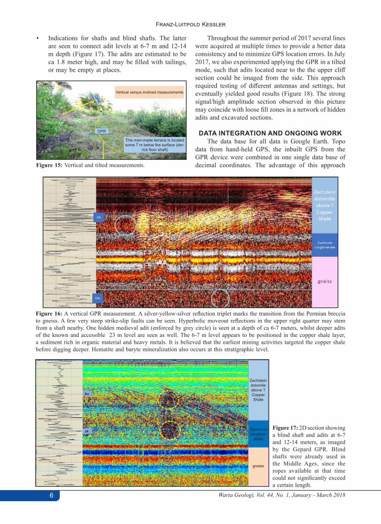
meters could be obtained. This said, the overall quality of the initial measurements was low, given:• A significant noise level and frequency attenuation
characterized the data of the yard and parking lot area measurements – these negative effects originated probably from scatter in landfill;
• Metal doors inside of the mine, as well as reverberation from the walls, created high-amplitude noise.After these initial experimental and not very
encouraging results, measurements were continued up on the meadows, at the mine’s rooftop (Figure 14). Acquisition of data had to follow the farming calender (grass land can be walked-in only until May, measurement in cornfields can be carried out only after harvest which starts late June). Data were obtained both in a vertical and a tilted mode (Figure 15). Results turned out to be quite encouraging, and yielded:• An excellent imaging quality of the breccia-gneiss
interface and faulting (Figure 16);• The realization that GPR measurements are
particularly sensitive to moisture; measurements that were carried out after a rainy weather period appeared to yield a better contrast and illumination of strata and fault planes;
• Indications of adits at 6-7 m and 23 m depth (Figure 16);
Figure 11: The Wihelmine mine. Due to very stable rock, no additional support is required.
Figure 12: Colorful copper minerals are dotting the walls, often in nested areas, and shielding copper ore beneath.
Figure 13: The relatively light-weight and mobile GPR, brand OKM model Gepard, here assembled for measurements in fields near Sommerkahl.
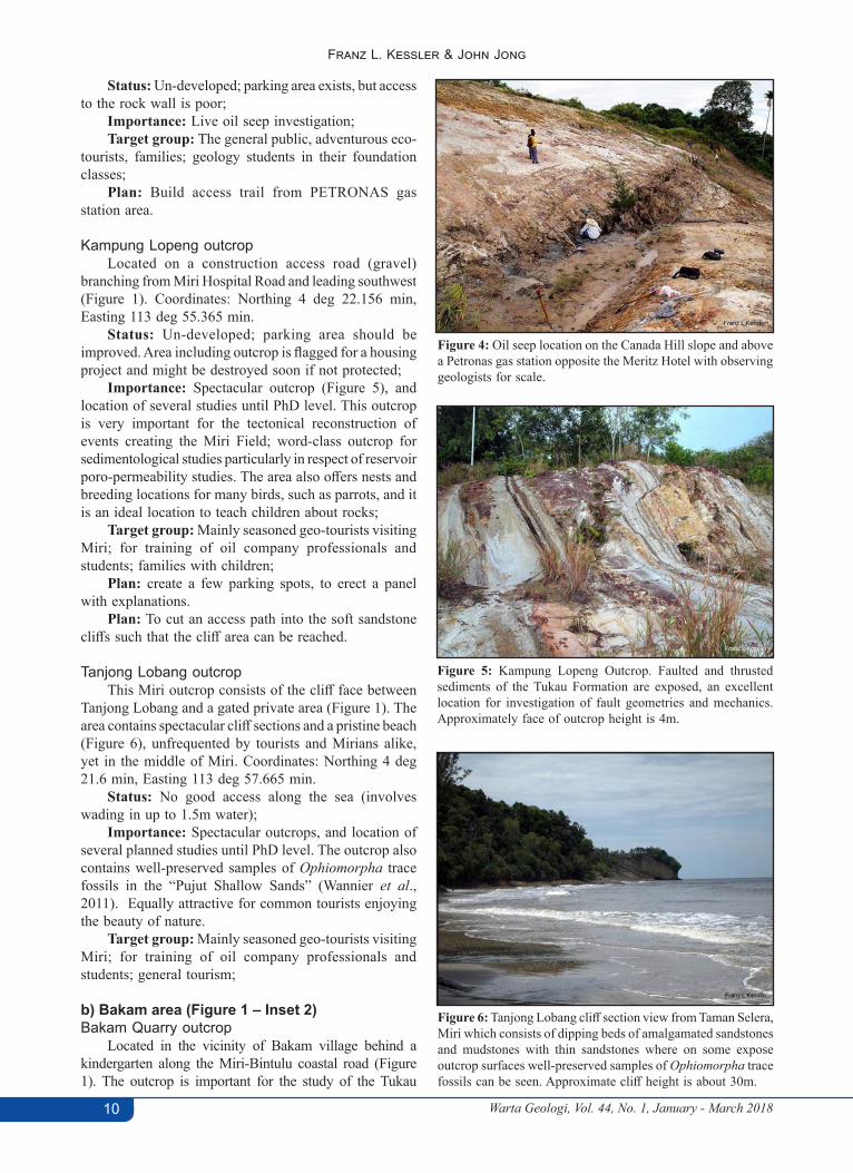
Figure 14: Vertical GPR measurements on the mine’s rooftop, in 2D mode, and using triangular antennas.
Source antennas
Receiver antennas
Radar source and blue-tooth processing unit
Warta Geologi, Vol. 44, No. 1, January - March 20186
Franz-Luitpold Kessler
Figure 15: Vertical and tilted measurements.
• Indications for shafts and blind shafts. The latter are seen to connect adit levels at 6-7 m and 12-14 m depth (Figure 17). The adits are estimated to be ca 1.8 meter high, and may be filled with tailings, or may be empty at places.
Throughout the summer period of 2017 several lines were acquired at multiple times to provide a better data consistency and to minimize GPS location errors. In July 2017, we also experimented applying the GPR in a tilted mode, such that adits located near to the the upper cliff section could be imaged from the side. This approach required testing of different antennas and settings, but eventually yielded good results (Figure 18). The strong signal/high amplitude section observed in this picture may coincide with loose fill zones in a network of hidden adits and excavated sections.
DATA INTEGRATION AND ONGOING WORKThe data base for all data is Google Earth. Topo
data from hand-held GPS, the inbuilt GPS from the GPR device were combined in one single data base of decimal coordinates. The advantage of this approach
Figure 16: A vertical GPR measurement. A silver-yellow-silver reflection triplet marks the transition from the Permian breccia to gneiss. A few very steep strike-slip faults can be seen. Hyperbolic moveout reflections in the upper right quarter may stem from a shaft nearby. One hidden medieval adit (enforced by grey circle) is seen at a depth of ca 6-7 meters, whilst deeper adits of the known and accessible 23 m level are seen as well. The 6-7 m level appears to be positioned in the copper shale layer, a sediment rich in organic material and heavy metals. It is believed that the earliest mining activities targeted the copper shale before digging deeper. Hematite and baryte mineralization also occurs at this stratigraphic level.
Figure 17: 2D section showing a blind shaft and adits at 6-7 and 12-14 meters, as imaged by the Gepard GPR. Blind shafts were already used in the Middle Ages, since the ropes available at that time could not significantly exceed a certain length.
GPR
GPR
This man-made terrace is located some 7 m below the surface (der-
rick floor shaft)
Vertical versus inclined measurements
gneiss
Zechsteinconglom-
erate
Zechsteindolomiteabove ? CopperShale

Warta Geologi, Vol. 44, No. 1, January - March 2018 7
Exploring medieval adits in a copper mine using ground-penetrating radar imaging (GPR)
being that data can be edited easily and adapted as new data are added to the data base. Two examples of maps are shown in Figures 19 and 20. Fault correlation was challenging given the nature of a braided strike-slip setting, where fault planes tend to be curved and relative short. Therefore it is planned to carry out GPR measurements in a 3D mode. There are also plans to investigate further the location of possible medieval adits, mouth holes and to carry out preliminary digging to validate the presence of older sections of the mine.
CONCLUSIONSThe “Gepard” GPR was successfully tested at
Wilhelmine. Faults could be identified, and fault planes imaged. Measurements revealed the existence of previously unknown levels of probably medieval adits at ca 6-7 and ca. 12-14 and more locally at 18 meters. These adits are interlinked by blind shafts at regular intervals.
ACKNOWLEDGEMENTSThe author would like to thank Obong Jau for
helping perform the measurement, and thank the
F i g u re 1 8 : Ti l t e d G P R measurement indicating a high amplitude/strong signal zone some 7-8 meters away from surface (top of section = datum of measurement). The high amplitude areas may indicate the presence of a hidden adit, and areas of excavation or blind shafts.
“KUPFERBERGWERK GRUBE WILHELMINE SOMMERKAHL 2000 E.V.” Association for their strong support and permission to publish some pictures of the mine.
REFERENCESAgricola, G., 1556. De Re Metallica, 12 chapters, 292 wood print
illustrations, 590 p., Basel.Amrhein, A., 1895. Der Bergbau im Spessart unter der Regierung
der Churfürsten von Mainz – Arch. Hist.Ver.Ufr. und Aschaffenburg, 6, Würzburg.
Ludwig, R., 1854. Die Kupferschiefer- und Zechsteinformation am Rande des Vogelsberges und Spessarts. Jb. Wetter.Ges. f.d. ges. Naturkunde, 1851/1853, p. 78-134, Hanau.
Okrusch, M., Lorenz, J. & Weyer, S., 2007. The Genesis of Sulfide Assemblages in the former Wilhelmine mine, Spessart, Bavaria.- The Canadian Mineralogist, Vol. 45, p. 723 - 750, 11 fig., 10 tab., Toronto, Canada.
Weinelt, W., Okrusch, M., 1965. Erläuterungen zur Geologischen Karte von Bayern, 1:25000, Blatt Nr. 5911 Schöllkrippen, München.
Figure 19: Map showing a simplified geological fault correlation pattern combining geological measurement with GPR detection, July 2017. Individual fault planes may be much shorter as shown.
Figure 20: Detailed map of the proximal mine area with improved fault correlation (orange pins), shafts (red purple squares), potentially collapsed adits and mouth hole areas (1,2,3,4) and GPR-identified 6-7 m adits (yellow pins, red solid line, and dashed lines).
Manuscript received 23 November 2017 Revised manuscript received 19 January 2018
Manuscript accepted 22 January 2018

CATATAN LAIN OTHER NOTES
ISSN 0126–5539 Warta Geologi, Vol. 44, No. 1, January-March 2018, pp. 8–12
Is there scope for a geopark project in greater Miri area,NW Sarawak?
Franz L. Kessler1 & John Jong2,*
1 Goldbach Geoconsultants O&G and Lithium Exploration, GermanyEmail address: [email protected]
2 JX Nippon Oil and Gas Exploration (Deepwater Sabah) Limited*Corresponding author email address: [email protected]
Abstract: The greater Miri area offers scope for development of a number of geological sites, which could constitute the backbone of a Geopark project. However, as it stands, most of the sites discussed in this article are endangered to fall prey to degradation by erosion and vegetation, and to some extent also to competing developments such as housing construction or palm oil plantations. To secure a successful Geopark development, one would need to place selected areas under heritage protection and then add infrastructure for a better access, seek guidance from the relevant authorities and promotion for geo-tourism.
Key words: Miri, NW Sarawak, geology, Geopark, tourism
INTRODUCTIONThe idea of developing a Geopark project in NW
Sarawak – securing the geological heritage plus making it accessible and understandable to the public has originated in ca. 1998, when a group of PETRONAS and Shell geologists started a conservation project on the Airport Road outcrop; this pioneer project was and is still very important for geological studies of fault styles, but needs a facelift.
In late 2009, discussions commenced with Nippon Oil (Mr. Hajime Kusaka and Dr. John Jong) on the initiation of a Geopark project. The company offered a once-off funding of RM15,000 for the year 2010 through a Curtin University Sponsorship Programme. Under the lead of Dr. Yudi Samyudia, then Dean, Faculty of Engineering, Curtin University; Shamsul Anwar, Head of the Curtin Consultancy Unit and Dr. Franz L Kessler, Head of Department (Applied Geology), it was decided to initiate a conservation project, with the aim of securing Miri’s geological heritage locations. The study team consisted of Dr. Tan Chong Keng, Dr. Rajalingam Sokkalingam, Dr. Zeya Ooy, Mr. Tay Chen Lim and Dr. Masatoshi Sone at the time.
Over the years, students of the Curtin University conducted additional site mapping, under the guidance of Dr. Nagarajan Ramasamy, Dr. Prasanna Mohan Viswanathan and Dr. Dominique Dodge Wan, mostly in the context of final year mapping projects, with some of these studies summarized by Kessler & Jong (2017a & 2017b). Additional information and data in the context of a Geopark project can be found in Wannier et al. (2011), and also in Dony Adriansyah et al. (2016).
CRITERIA FOR CHOOSING THE RIGHT LOCATIONS
For selection of areas to be included in a Geopark concept, it is important that the individual location satisfy
a number of criteria:(i) Accessibility. Locations should be in the (car)
perimeter of Miri, which would allow interested (geo)-tourists to spend a both leisurely and stimulating day in the field;
(ii) Attractivity. Heritage objects need to offer particular aspects such as natural beauty and uniqueness. Some locations will introduce visitors to a very general geological understanding, others will address the seasoned geological tourist;
(iii) Safety. All locations need to have a safe car parking location (in this case this means - secure from fast-flowing transit traffic) plus safe access, for example passenger bridges over rivers and ravines;
(iv) Being part of a larger story. Ideally, the selected outcrops should form an intellectual jigsaw puzzle, which could include the Petroleum Geology Museum and other Miri landmarks;
(v) Promotion of Miri. The initiative should also help to promote Miri as a location for multiple tourist activities.Figure 1 shows an area index map of the proposed
heritage locations in the greater Miri area for geological outcrop preservation.
CATALOGUE OF SELECTED AREASa) Greater Airport Road outcrop and Canada Hill in Miri (Figure 1 - Inset 1)Airport Road outcrop
Located along the Miri-Bintulu trunk road near Taman Awam in Miri (Figure 1). A world-class outcrop for the study of fault development and structural complexity of the Miri Field (Figure 2). The outcrop is the only heritage site maintains by the Miri City Council (Wannier et al., 2011). Coordinates: Northing 4 deg 22.037 min, Easting 113 deg 58.70 min.

Warta Geologi, Vol. 44, No. 1, January - March 2018 9
Is there scope for a geopark project in greater Miri area, NW Sarawak?
Status: Partly developed with updated infographic panels and an overhead bridge constructed recently connecting to Taman Awam; parking area can be improved further being the pioneer site preserved with ease of access located along the main road and a good flow of visitors;
Importance: Spectacular outcrops, and location of several studies until PhD level on micro-faulting;
Target group: Mainly seasoned geo-tourists visiting Miri, for training of oil company professionals and students;
Plan: Minor repairs and amendments.
Addition Jalan Mukah outcropLocated at Jalan Mukah No. 7 (Figure 1), on walking
distance from the Airport Road Outcrop, this so-far unsecured outcrop has world-class quality and a number of prominent geological studies (by local and overseas researchers) have been carried out (Figure 3). The outcrop is particularly precious for studying sealing properties in oil fields, where one can almost map the fault in three dimensions. Coordinates: Northing 4 deg 22.057 min, Easting 113 deg 58.66 min.
Status: Un-developed; parking area exists, but access to the rock wall is poor;
Importance: Spectacular outcrop with 3D fault exposure as shown in Figure 3;
Target group: The general public, adventurous eco-tourists, families; geology students in their foundation classes;
Plan: Fortify existing path way from Jalan Mukah No. 7.
Addition oil seep location Located on the opposite side of the Meritz Hotel in
Center Miri, along Miri-Lutong trunk road on the Canada Hill slope and above a PETRONAS gas station (Figure
Figure 1: Area index map from Google with the proposed heritage locations for outcrop preservation.
Figure 2: Miri Airport Road Outcrop. The main fault is interpreted as part of a crestal collapse structure of an inversion anticline, which forms the Miri Field. Approximately face of outcrop height is 6m. From Nichols & Baker, 2015.
Figure 3: Jalan Mukah No.7 Outcrop. The outcrop is particularly precious for studying of sealing properties in oil fields, where one can almost map the fault in three dimension. Approximately face of outcrop height is 4m to the right.
1). The area contains an oil seep (Figure 4), where oil can be collected in particular after rainy periods. The seep is located at the hinge of a scissor fault. Coordinates: Northing 4 deg 23.86 min, Easting 113 deg 59.78 min.
Warta Geologi, Vol. 44, No. 1, January - March 201810
Franz L. Kessler & John Jong
Status: Un-developed; parking area exists, but access to the rock wall is poor;
Importance: Live oil seep investigation;Target group: The general public, adventurous eco-
tourists, families; geology students in their foundation classes;
Plan: Build access trail from PETRONAS gas station area.
Kampung Lopeng outcropLocated on a construction access road (gravel)
branching from Miri Hospital Road and leading southwest (Figure 1). Coordinates: Northing 4 deg 22.156 min, Easting 113 deg 55.365 min.
Status: Un-developed; parking area should be improved. Area including outcrop is flagged for a housing project and might be destroyed soon if not protected;
Importance: Spectacular outcrop (Figure 5), and location of several studies until PhD level. This outcrop is very important for the tectonical reconstruction of events creating the Miri Field; word-class outcrop for sedimentological studies particularly in respect of reservoir poro-permeability studies. The area also offers nests and breeding locations for many birds, such as parrots, and it is an ideal location to teach children about rocks;
Target group: Mainly seasoned geo-tourists visiting Miri; for training of oil company professionals and students; families with children;
Plan: create a few parking spots, to erect a panel with explanations.
Plan: To cut an access path into the soft sandstone cliffs such that the cliff area can be reached.
Tanjong Lobang outcropThis Miri outcrop consists of the cliff face between
Tanjong Lobang and a gated private area (Figure 1). The area contains spectacular cliff sections and a pristine beach (Figure 6), unfrequented by tourists and Mirians alike, yet in the middle of Miri. Coordinates: Northing 4 deg 21.6 min, Easting 113 deg 57.665 min.
Status: No good access along the sea (involves wading in up to 1.5m water);
Importance: Spectacular outcrops, and location of several planned studies until PhD level. The outcrop also contains well-preserved samples of Ophiomorpha trace fossils in the “Pujut Shallow Sands” (Wannier et al., 2011). Equally attractive for common tourists enjoying the beauty of nature.
Target group: Mainly seasoned geo-tourists visiting Miri; for training of oil company professionals and students; general tourism;
b) Bakam area (Figure 1 – Inset 2)Bakam Quarry outcrop
Located in the vicinity of Bakam village behind a kindergarten along the Miri-Bintulu coastal road (Figure 1). The outcrop is important for the study of the Tukau
Figure 4: Oil seep location on the Canada Hill slope and above a Petronas gas station opposite the Meritz Hotel with observing geologists for scale.
Figure 5: Kampung Lopeng Outcrop. Faulted and thrusted sediments of the Tukau Formation are exposed, an excellent location for investigation of fault geometries and mechanics. Approximately face of outcrop height is 4m.
Figure 6: Tanjong Lobang cliff section view from Taman Selera, Miri which consists of dipping beds of amalgamated sandstones and mudstones with thin sandstones where on some expose outcrop surfaces well-preserved samples of Ophiomorpha trace fossils can be seen. Approximate cliff height is about 30m.
Warta Geologi, Vol. 44, No. 1, January - March 2018 11
Is there scope for a geopark project in greater Miri area, NW Sarawak?
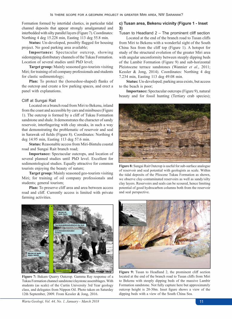
Formation formed by intertidal clastics, in particular tidal channel deposits that appear strongly amalgamated and interbedded with silty parallel layers (Figure 7). Coordinates: Northing 4 deg 15.228 min, Easting 113 deg 55.8 min.
Status: Un-developed, possibly flagged for housing project. No good parking area available;
Importance: Spectacular outcrop, showing sidestepping distributary channels of the Tukau Formation. Location of several studies until PhD level;
Target group: Mainly seasoned geo-tourists visiting Miri; for training of oil company professionals and students for clastic sedimentology;
Plan: To protect the (horseshoe-shaped) flanks of the outcrop and create a few parking spaces, and erect a panel with explanations.
Cliff at Sungai RaitLocated on a branch road from Miri to Bekenu, inland
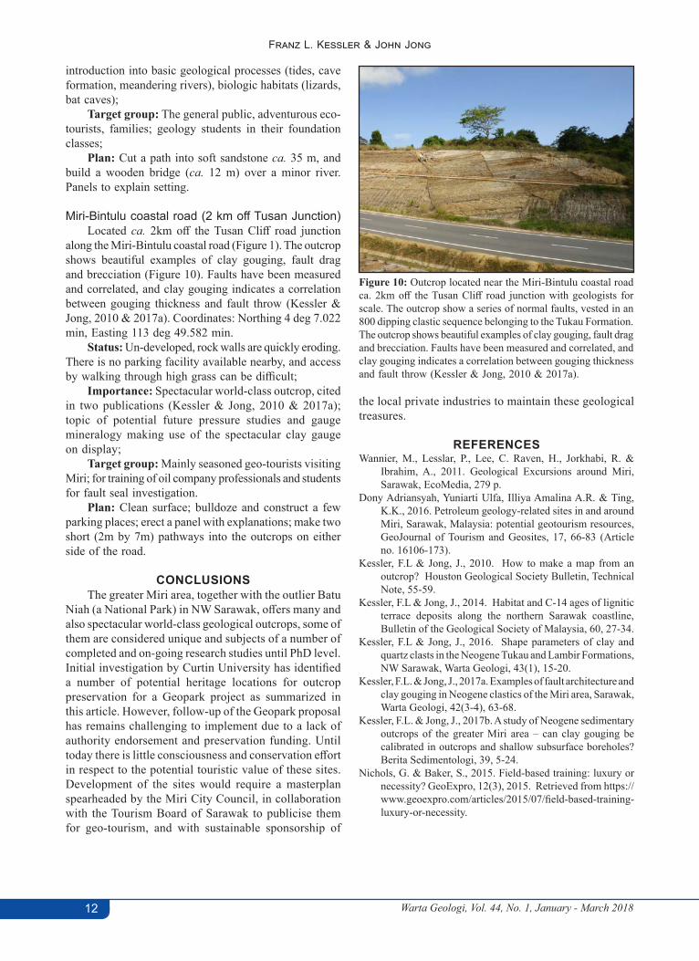
from the coast and accessible by cars and minibuses (Figure 1). The outcrop is formed by a cliff of Tukau Formation sandstone and shale. It demonstrates the character of sandy reservoir, interfingering with clay streaks, in such a way that demonstrating the problematic of reservoir and seal in Sarawak oil fields (Figure 8). Coordinates: Northing 4 deg 14.95 min, Easting 113 deg 57.6 min.
Status: Reasonable access from Miri-Bintulu coastal road and Sungai Rait branch road;
Importance: Spectacular outcrops, and location of several planned studies until PhD level. Excellent for sedimentological studies. Equally attractive for common tourists enjoying the beauty of nature;
Target group: Mainly seasoned geo-tourists visiting Miri; for training of oil company professionals and students; general tourism;
Plan: To preserve cliff area and area between access road and cliff. Currently access is limited with private farming activities.
c) Tusan area, Bekenu vicinity (Figure 1 - Inset 3)Tusan to Headland 2 – The prominent cliff section
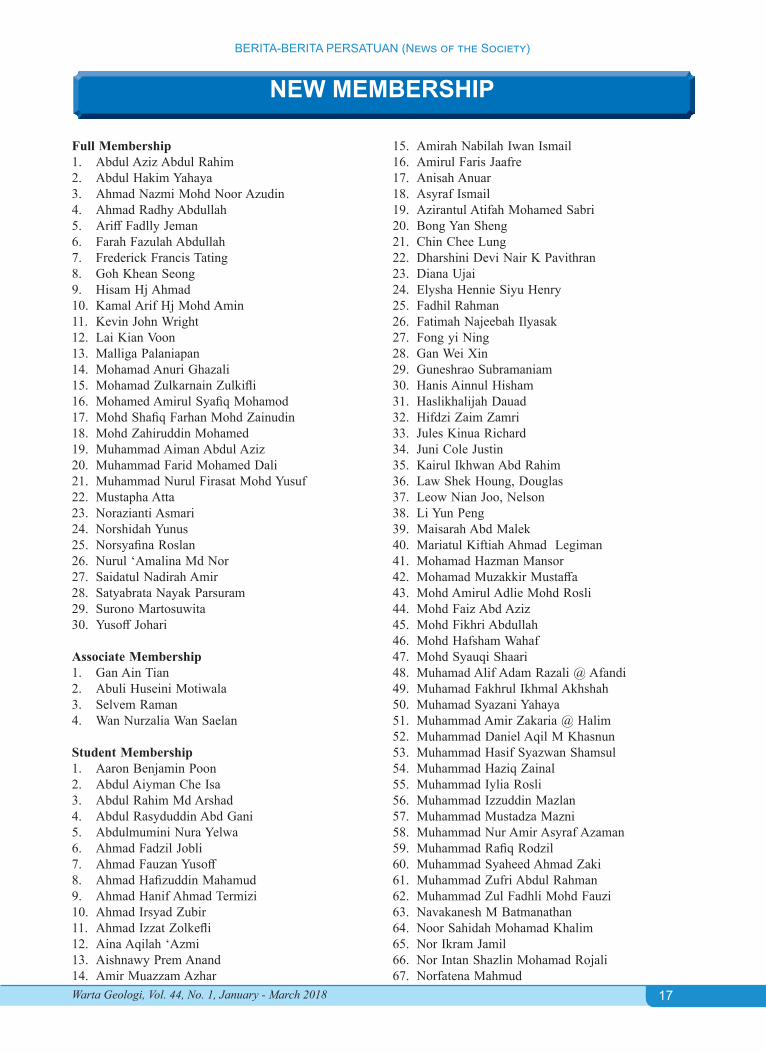
Located at the end of the branch road to Tusan cliffs from Miri to Bekenu with a wonderful sight of the South China Sea from the cliff top (Figure 1). A hotspot for study of the structural evolution of the greater Miri area with angular unconformity between steeply dipping beds of the Lambir Formation (Figure 9) and sub-horizontal Pleistocene terrace sandstones (Wannier et al., 2011; Kessler & Jong, 2014). Coordinates: Northing 4 deg 7.234 min, Easting 113 deg 49.08 min.
Status: Un-developed; parking area exists, but access to the beach is poor;
Importance: Spectacular outcrops (Figure 9), natural beauty and for fossil hunting (Tertiary crab species);
Figure 7: Bakam Quarry Outcrop. Gamma Ray response of a Tukau Formation channel sandstone/claystone assemblages. With students (as scale) of the Curtin University 3rd Year geology class, and delegates from Nippon Oil. Photo taken on Saturday 12th September, 2009. From Kessler & Jong, 2016.
Figure 8: Sungai Rait Outcrop is useful for sub-surface analogue of reservoir and seal potential with geologists as scale. Within the tidal deposits of the Pliocene Tukau Formation as shown, we observe clay-contaminated reservoirs as well as sandy/silty clay layers. Reservoirs and seals can be scoured, hence limiting potential of good hydrocarbon columns both from the reservoir and seal perspective.
Figure 9: Tusan to Headland 2, the prominent cliff section located at the end of the branch road to Tusan cliffs from Miri to Bekenu with steeply dipping beds of the massive Lambir Formation sandstone. Not fully capture here but approximately outcrop height is 20-30m. Inset figure shows a view of the dipping beds with a view of the South China Sea.
Warta Geologi, Vol. 44, No. 1, January - March 201812
Franz L. Kessler & John Jong
introduction into basic geological processes (tides, cave formation, meandering rivers), biologic habitats (lizards, bat caves);
Target group: The general public, adventurous eco-tourists, families; geology students in their foundation classes;
Plan: Cut a path into soft sandstone ca. 35 m, and build a wooden bridge (ca. 12 m) over a minor river. Panels to explain setting.
Miri-Bintulu coastal road (2 km off Tusan Junction)Located ca. 2km off the Tusan Cliff road junction
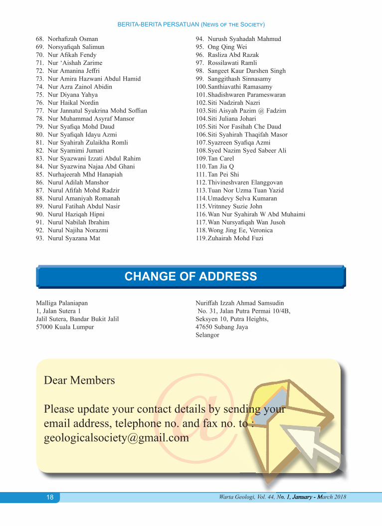
along the Miri-Bintulu coastal road (Figure 1). The outcrop shows beautiful examples of clay gouging, fault drag and brecciation (Figure 10). Faults have been measured and correlated, and clay gouging indicates a correlation between gouging thickness and fault throw (Kessler & Jong, 2010 & 2017a). Coordinates: Northing 4 deg 7.022 min, Easting 113 deg 49.582 min.
Status: Un-developed, rock walls are quickly eroding. There is no parking facility available nearby, and access by walking through high grass can be difficult;
Importance: Spectacular world-class outcrop, cited in two publications (Kessler & Jong, 2010 & 2017a); topic of potential future pressure studies and gauge mineralogy making use of the spectacular clay gauge on display;
Target group: Mainly seasoned geo-tourists visiting Miri; for training of oil company professionals and students for fault seal investigation.
Plan: Clean surface; bulldoze and construct a few parking places; erect a panel with explanations; make two short (2m by 7m) pathways into the outcrops on either side of the road.
CONCLUSIONSThe greater Miri area, together with the outlier Batu
Niah (a National Park) in NW Sarawak, offers many and also spectacular world-class geological outcrops, some of them are considered unique and subjects of a number of completed and on-going research studies until PhD level. Initial investigation by Curtin University has identified a number of potential heritage locations for outcrop preservation for a Geopark project as summarized in this article. However, follow-up of the Geopark proposal has remains challenging to implement due to a lack of authority endorsement and preservation funding. Until today there is little consciousness and conservation effort in respect to the potential touristic value of these sites. Development of the sites would require a masterplan spearheaded by the Miri City Council, in collaboration with the Tourism Board of Sarawak to publicise them for geo-tourism, and with sustainable sponsorship of
the local private industries to maintain these geological treasures.
REFERENCES Wannier, M., Lesslar, P., Lee, C. Raven, H., Jorkhabi, R. &
Ibrahim, A., 2011. Geological Excursions around Miri, Sarawak, EcoMedia, 279 p.
Dony Adriansyah, Yuniarti Ulfa, Illiya Amalina A.R. & Ting, K.K., 2016. Petroleum geology-related sites in and around Miri, Sarawak, Malaysia: potential geotourism resources, GeoJournal of Tourism and Geosites, 17, 66-83 (Article no. 16106-173).
Kessler, F.L & Jong, J., 2010. How to make a map from an outcrop? Houston Geological Society Bulletin, Technical Note, 55-59.
Kessler, F.L & Jong, J., 2014. Habitat and C-14 ages of lignitic terrace deposits along the northern Sarawak coastline, Bulletin of the Geological Society of Malaysia, 60, 27-34.
Kessler, F.L & Jong, J., 2016. Shape parameters of clay and quartz clasts in the Neogene Tukau and Lambir Formations, NW Sarawak, Warta Geologi, 43(1), 15-20.
Kessler, F.L. & Jong, J., 2017a. Examples of fault architecture and clay gouging in Neogene clastics of the Miri area, Sarawak, Warta Geologi, 42(3-4), 63-68.
Kessler, F.L. & Jong, J., 2017b. A study of Neogene sedimentary outcrops of the greater Miri area – can clay gouging be calibrated in outcrops and shallow subsurface boreholes? Berita Sedimentologi, 39, 5-24.
Nichols, G. & Baker, S., 2015. Field-based training: luxury or necessity? GeoExpro, 12(3), 2015. Retrieved from https://www.geoexpro.com/articles/2015/07/field-based-training-luxury-or-necessity.
Figure 10: Outcrop located near the Miri-Bintulu coastal road ca. 2km off the Tusan Cliff road junction with geologists for scale. The outcrop show a series of normal faults, vested in an 800 dipping clastic sequence belonging to the Tukau Formation. The outcrop shows beautiful examples of clay gouging, fault drag and brecciation. Faults have been measured and correlated, and clay gouging indicates a correlation between gouging thickness and fault throw (Kessler & Jong, 2010 & 2017a).

CATATAN LAIN OTHER NOTES
ISSN 0126–5539 Warta Geologi, Vol. 44, No. 1, January-March 2018, pp. 13–15
Advancing disaster resilience: Insights on landslide and karst susceptibility assessments
Joy Jacqueline Pereira1, Nurfashareena Muhamad1, Ng Tham Fatt2
& Zamri Ramli3 1Southeast Asia Disaster Prevention Research Initiative, Universiti Kebangsaan Malaysia
(SEADPRI-UKM)2Department of Geology, University of Malaya
3Department of Mineral and Geoscience Malaysia
INTRODUCTIONThe United Nations General Assembly adopted the Report of the
Open-ended Intergovernmental Expert Working Group on Indicators and Terminology Relating to Disaster Risk Reduction at its 71st session on 2 February 2017. The Report comprised terminology relating to disaster risk reduction to support coherence in implementing the Sendai Framework on Disaster Risk Reduction (2015-2030), a global agreement that was accepted by governments in 2015. Among the terms defined include nomenclature that is common in geoscience such as disaster, disaster risk, disaster risk assessment, exposure, hazard, hazardous event and vulnerability, among others. The term susceptibility, which is an integral concept in the assessment of hazards in geoscience is not explicitly defined in this global policy document. The term is only mentioned once in the entire document, in the context of vulnerability. Vulnerable conditions are expected to increase the “susceptibility of an individual, a community, assets or systems to the impacts of hazards”.
It is not possible to conduct a hazard or risk assessment without first evaluating an area for the presence of physical factors that may cause the hazard. These physical factors contribute to the susceptibility of an area to hazards, and include aspects that relate to both the surficial features as well as subsurface geology, which have to be evaluated in a systematic manner depending on the type of hazard that is being assessed. Given the absence of a common terminology for susceptibility in global policy, governments will have to develop operational definitions at the national level to

Warta Geologi, Vol. 44, No. 1, January - March 201814
Joy Jacqueline Pereira, Nurfashareena Muhamad, Ng Tham Fatt & Zamri Ramli
promote standard, comprehensive and robust susceptibility assessments for natural hazards. A sound definition would require drawing on current approaches and practices for assessing the susceptibility of hazards, and its linkage to the evaluation of risks.
This was partly the motivation for convening the Workshop on Landslide and Karst Susceptibility Assessment on 1 March 2018 at Pulse Grande Hotel, Putrajaya. The workshop was organised by partners of the project on “Disaster Resilient Cities: Forecasting Local Level Climate Extremes and Physical Hazards for Kuala Lumpur”, funded by the Newton-Ungku Omar Fund (NUOF) under the aegis of the Malaysian Industry-Government Group for High Technology (MIGHT) and Innovate-UK. The purpose of the workshop was to discuss processes and methodologies for assessing the susceptibility of landslide and karstic hazards. This would implicitly provide insights for advancing efforts to develop a national lexicon for enhancing disaster risk reduction in the country. Key matters from the workshop are highlighted in the following sections.
HIGHLIGHTSThe one-day workshop focused on landslide and karst
susceptibility assessment approaches in Malaysia and the UK, commencing with a discussion on terminology. It was conducted primarily by geoscientists from the British Geological Survey with support from the Department of Mineral and Geoscience Malaysia (JMG) and other NUOF project partners. A total of 67 participants from various local organisations attended the workshop. This included officials from the City Hall of Kuala Lumpur (DBKL) and State Disaster Management Unit of Selangor as well as geoscientists from Universiti Kebangsaan Malaysia (UKM), University of Malaya (UM), Universiti Tenaga Nasional (UNITEN), Geological Society of Malaysia (GSM), Institute of Geology Malaysia (IGM). Also present were representatives of the private sector.
Susceptibility maps delineate areas where a hazard event could occur. The susceptibility of an area depends on contributing surficial and subsurface factors as well as processes that vary depending on the hazard. The methods used for assessing susceptibility depends greatly on the objective and scale of the evaluation, type of hazard, size and complexity of the area, resource allocation and, most importantly, the availability of spatial and non-spatial data (Arnhard & Reeves, 2018). Susceptibility maps must be subjected to spatial and temporal validation to ensure that the product is of high quality. Emphasis on analysis of appropriate input data, integration of geological and structural geology information and inclusion of expert opinions are also important for quality assurance. The operational definition of susceptibility at the national level should be harmonised with current terminologies used in the global policy domain. Terms such as disaster risk, exposure, hazard, hazardous event and vulnerability, should also be clarified and linked to susceptibility for
Dr. Helen Reeves, Dr. Christian Arnhard and Dr. Vanessa Banks (front row on the left) shared the experience of BGS in producing reliable landslide and karst susceptibility maps for the UK.
improved understanding of geoscientists in Malaysia. The definition of susceptibility should emphasise the spatial component and take into account approaches that are currently being used to assess both fast and slow-onset hazards in the country. It is imperative that approaches adopted for susceptibility assessments result in products that remain valid in a changing climate.
In the UK, the national landslide inventory was initially produced in the 1990s, and currently, it has over 17,300 records of landslides and man-made engineered slope failures, with continuous addition of data (Reeves, 2018). Information in the landslide inventory includes, among others, the name and location of events, dimensions, type and style, material, age, cause, wider slope information, adjacent slope factors (angle, height, vegetation), damage caused by landslide, geology (only if vertical slope, or if map cannot be obtained), fatalities and injuries as well as costs. The source of the information includes BGS geological maps (historic and current), reports (confidential and mainstream), peer-reviewed journal papers and conference proceedings, regional and responsive surveys, graduate thesis, mainstream and social media reports as well as local government offices, among others. The national landslide inventory serves as the backbone to a variety of important landslide susceptibility projects in the UK. Susceptibility maps have been produced at the national level for using a heuristic/expert judgement-based approach while detailed assessment used bivariate statistical analysis. Susceptibility assessment has potential for rotational and translational failure but needs more work for debris flows, rock falls and earth flows. The UK is now advancing from static susceptibility modelling to dynamic landslide forecasting. A range of forecast scenarios for precipitationfeeds into a water balance model to produce probabilistic landslide hazard assessment, based on the probability of exceeding a threshold.
Landslide susceptibility assessment in Malaysia commences with the preparation of an inventory, followed

Warta Geologi, Vol. 44, No. 1, January - March 2018 15
Advancing disaster resilience: Insights on landslide and karst susceptibility assessments
by classification of causal parameters, analysis of susceptibility and validation of results (Tating, 2018). The landslide assessment of Sepanggar, Kota Kinabalu drew on an inventory of the occurrence and extent of landslides as well relevant factors that influence susceptibility, obtained from multiple sources including aerial photographs, satellite imagery, LiDAR, historical records and extensive field investigation. Causal parameters mapped include slope aspect, slope gradient, elevation, lithology, landuse, etc. Statistical bivariate analysis (information value method) and heuristic methods were used to yield a landslide susceptibility map of the area. Susceptibility assessment in Malaysia is limited to static modelling. The rainfall forecasts are not sufficiently advanced to facilitate dynamic landslide forecasting. Work led by the Malaysian Meteorology Department (MMD) and University of Cambridge is now ongoing under the NUOF project to develop the first mesoscale weather forecasting model for Kuala Lumpur. The products from this model, particularly for rainfall is expected to improve landslide assessment at the local level and lay the groundwork for dynamic landslide forecasting.
Karst susceptibility assessment is much more advanced in the UK compared to Malaysia. In the UK, karstic rocks are separated into five categories centred on age and characteristics (Banks, 2018). Maps, cave surveys and local knowledge enable further differentiation based on superficial deposit domains, thickness and permeability and glacial limit, which form the basis for a susceptibility assessment. There are many challenges in assessing karst susceptibility in Malaysia. These include clarification of karst terminology, processes and structural complexity as well as development of event inventories and methodologies for karstic hazard assessment. For example, the understanding of processes and conditioning factors for the Kuala Lumpur Limestone is challenged by limited information, particularly on subsurface conditions. The resolution of these issues require strong national leadership, particularly from the JMG to bring together geoscientists and other experts from government, universities and the private sector. This is currently being undertaken with support from the NUOF project.
The NUOF project is designed to adapt and test the viability of carefully selected meteorological and hazard models for tropical circumstances, and to integrate them into a multi-hazard platform designed for managing and communicating risk and enhancing disaster resilience in a changing climate. The project jointly led by SEADPRI-UKM and University of Cambridge, in partnership with
JMG, UM, GSM, BGS, MMD and other entities in the UK and Malaysia can serve as the avenue for advancing local level susceptibility assessments in Kuala Lumpur. The approach could then be replicated in other cities, towns and settlements to enhance disaster resilience in the country.
CONCLUDING REMARKSThere is urgent need for a national lexicon on disaster
risk reduction in the country, which is in harmony with current global terminologies in the policy domain. An operational definition of susceptibility should be developed and linked to common terms such as disaster risk, exposure, hazard, hazardous event and vulnerability. There is room for further improvement of hazard susceptibility maps in the country, particularly at the local level. The possibility of advancing from static susceptibility modelling to dynamic landslide forecasting based on the probability of exceeding rainfall thresholds merits investigation. A national level initiative is required to develop comprehensive event inventories and methodologies for karstic hazard assessment in the country. Approaches adopted for susceptibility assessments in Malaysia should be carefully developed to yield products that remain valid in a changing climate. The project on “Disaster Resilient Cities: Forecasting Local Level Climate Extremes and Physical Hazards for Kuala Lumpur”, funded by NUOF, will lay the pathway to resolve these issues and enhance disaster resilience in the country.
REFERENCESArnhard, C. & Reeves, H., 2018. Landslide susceptibility and
hazard assessment. Presentation Slides, Workshop on Landslide and Karst Susceptibility Assessment, 1 March 2018, Pulse Grande Hotel, Putrajaya, Malaysia.
Banks, V., 2018. Karst terminology, processes and hazard assessment. Presentation Slides, Workshop on Landslide and Karst Susceptibility Assessment, 1 March 2018, Pulse Grande Hotel, Putrajaya, Malaysia.
Reeves, H., 2018. BGS GeoSuremethodology for landslide hazard susceptibility. Presentation Slides, Workshop on Landslide and Karst Susceptibility Assessment, 1 March 2018, Pulse Grande Hotel, Putrajaya, Malaysia.
Tating, F.F., 2018. Landslide susceptibility assessment – a Malaysian approach. Presentation Slides, Workshop on Landslide and Karst Susceptibility Assessment, 1 March 2018, Pulse Grande Hotel, Putrajaya, Malaysia.
UNISDR, 2017. Report of the United Nations Open-ended Intergovernmental Expert Working Group on indicators and terminology relating to disaster risk reduction. UNGA 71st Session on 2 February 2017.

16
PERTEMUAN PERSATUAN (Meetings of the Society)
Warta Geologi, Vol. 44, No. 1, January – March 2018
Chairman’s Lecture No. 23Engineering Geology in Malaysia – Some case histories
Tan Boon KongDate: 10 January 2018Venue: Department of Geology, University of Malaya
This talk was presented by Sdr. Tan Boon Kong on 10th January, 2018 at the Department of Geology, Universitty of Malaya, as Chairman’s Lecture No. 23. The talk was presented as a Special Lecture at the recent GSM NGC 2017, October 2017. An abstract of the talk is attached below.As usual, there was a lively discussion session following the presentation.
Tan Boon Kong,Chairman, W/G on Engineering Geology & Environmental Geology.
Abstract: Engineering geology deals with the application of geology to civil engineering and construction works. The fundamental input in engineering geology would involve, among other things, studies on the lithologies, geologic structures and weathering grades of the rock masses since together they determine the characteristics and behaviours of the rock masses. In addition, project-specific requirements and problems need to be addressed. This lecture presents several case histories on Engineering Geology in Malaysia such as: Foundations in Limestone Bedrock, Limestone Cliff Stability, Rock Slope Stability, Dams, Tunnels, Riverbank Instability, Slope Failure due to Rapid Draw-down, Urban Geology & Hillsite Development, and Airports. The various case histories presented here are based mainly on the author’s ~35 years of past practice and experiences. Previous papers covering various case studies in engineering geology include Tan (1999, 2004, 2007, 2016 and 2017).Figures 1-6 show some examples of these case histories.
References:Tan, B.K., 1999. “Engineering Geology – Some Case Histories in Malaysia.” Proc. GEOTROPIKA 99, UTM, Johor Baru, p.
23-43 (Keynote Paper).Tan, B.K., 2004. The practice of engineering geology in Malaysia. Proc. Malaysian Geotechnical Conf. 2004, 16-18 March 2004,
IEM, Subang Jaya, Special Lecture, 131-148.Tan, B.K., 2007. “A glimpse of engineering geology and rock mechanics in Malaysia”. Proc. 16th SEAGC, KL, 40th Anniversary
Commemorative Volume of the S.E.Asian Geotechnical Society, May 2007, pp.147-157.Tan, B.K., 2016. “Another glimpse of engineering geology and rock mechanics in Malaysia”. Proc. 19th SEAGC & 2nd AGSSEA
Conf., KL, 31May-3June 2016, pp.893-899.Tan, B.K., 2017. “Engineering Geology in Malaysia – Some Case Studies.” GSM 50th Anniversary Volume (submitted for publication).
Figure 1: Limestone bedrock pinnacle, Sunway, Kuala Lumpur.
Figure 2: Limestone cliff, Batu Caves, Kuala Lumpur.
Figure 3: Slope failure in graphitic schist soils, Air Keroh.
Figure 4: Diversion tunnel in granite, Sg. Selangor.
Figure 5: Slope failure due to rapid draw-down.
Figure 6: Slope failure associated with housing project in hilly terrain, KL.
17
BERITA-BERITA PERSATUAN (News of the Society)
Warta Geologi, Vol. 44, No. 1, January - March 2018
NEW MEMBERSHIP
Full Membership1. Abdul Aziz Abdul Rahim2. Abdul Hakim Yahaya3. Ahmad Nazmi Mohd Noor Azudin4. Ahmad Radhy Abdullah5. Ariff Fadlly Jeman6. Farah Fazulah Abdullah7. Frederick Francis Tating8. Goh Khean Seong9. Hisam Hj Ahmad10. Kamal Arif Hj Mohd Amin11. Kevin John Wright12. Lai Kian Voon13. Malliga Palaniapan14. Mohamad Anuri Ghazali15. Mohamad Zulkarnain Zulkifli16. Mohamed Amirul Syafiq Mohamod17. Mohd Shafiq Farhan Mohd Zainudin18. Mohd Zahiruddin Mohamed19. Muhammad Aiman Abdul Aziz20. Muhammad Farid Mohamed Dali21. Muhammad Nurul Firasat Mohd Yusuf22. Mustapha Atta23. Norazianti Asmari24. Norshidah Yunus25. Norsyafina Roslan26. Nurul ‘Amalina Md Nor27. Saidatul Nadirah Amir28. Satyabrata Nayak Parsuram29. Surono Martosuwita30. Yusoff Johari
Associate Membership1. Gan Ain Tian2. Abuli Huseini Motiwala3. Selvem Raman4. Wan Nurzalia Wan Saelan
Student Membership1. Aaron Benjamin Poon 2. Abdul Aiyman Che Isa 3. Abdul Rahim Md Arshad 4. Abdul Rasyduddin Abd Gani 5. Abdulmumini Nura Yelwa 6. Ahmad Fadzil Jobli 7. Ahmad Fauzan Yusoff 8. Ahmad Hafizuddin Mahamud 9. Ahmad Hanif Ahmad Termizi 10. Ahmad Irsyad Zubir 11. Ahmad Izzat Zolkefli 12. Aina Aqilah ‘Azmi 13. Aishnawy Prem Anand 14. Amir Muazzam Azhar
15. Amirah Nabilah Iwan Ismail 16. Amirul Faris Jaafre 17. Anisah Anuar 18. Asyraf Ismail 19. Azirantul Atifah Mohamed Sabri 20. Bong Yan Sheng 21. Chin Chee Lung 22. Dharshini Devi Nair K Pavithran 23. Diana Ujai 24. Elysha Hennie Siyu Henry 25. Fadhil Rahman 26. Fatimah Najeebah Ilyasak 27. Fong yi Ning 28. Gan Wei Xin 29. Guneshrao Subramaniam 30. Hanis Ainnul Hisham 31. Haslikhalijah Dauad 32. Hifdzi Zaim Zamri 33. Jules Kinua Richard 34. Juni Cole Justin 35. Kairul Ikhwan Abd Rahim 36. Law Shek Houng, Douglas 37. Leow Nian Joo, Nelson 38. Li Yun Peng 39. Maisarah Abd Malek 40. Mariatul Kiftiah Ahmad Legiman 41. Mohamad Hazman Mansor 42. Mohamad Muzakkir Mustaffa 43. Mohd Amirul Adlie Mohd Rosli 44. Mohd Faiz Abd Aziz 45. Mohd Fikhri Abdullah 46. Mohd Hafsham Wahaf 47. Mohd Syauqi Shaari 48. Muhamad Alif Adam Razali @ Afandi 49. Muhamad Fakhrul Ikhmal Akhshah 50. Muhamad Syazani Yahaya 51. Muhammad Amir Zakaria @ Halim 52. Muhammad Daniel Aqil M Khasnun 53. Muhammad Hasif Syazwan Shamsul 54. Muhammad Haziq Zainal 55. Muhammad Iylia Rosli 56. Muhammad Izzuddin Mazlan 57. Muhammad Mustadza Mazni 58. Muhammad Nur Amir Asyraf Azaman 59. Muhammad Rafiq Rodzil 60. Muhammad Syaheed Ahmad Zaki 61. Muhammad Zufri Abdul Rahman 62. Muhammad Zul Fadhli Mohd Fauzi 63. Navakanesh M Batmanathan 64. Noor Sahidah Mohamad Khalim 65. Nor Ikram Jamil 66. Nor Intan Shazlin Mohamad Rojali 67. Norfatena Mahmud
18
BERITA-BERITA PERSATUAN (News of the Society)
Warta Geologi, Vol. 44, No. 1, January - March 2018
CHANGE OF ADDRESS
Malliga Palaniapan 1, Jalan Sutera 1Jalil Sutera, Bandar Bukit Jalil57000 Kuala Lumpur
Nuriffah Izzah Ahmad Samsudin No. 31, Jalan Putra Permai 10/4B, Seksyen 10, Putra Heights, 47650 Subang JayaSelangor
Warta Geologi, Vol. 44, No. 1, January - March 2018
@Dear Members
Please update your contact details by sending your email address, telephone no. and fax no. to :[email protected]
68. Norhafizah Osman 69. Norsyafiqah Salimun 70. Nur Afikah Fendy 71. Nur ‘Aishah Zarime 72. Nur Amanina Jeffri 73. Nur Amira Hazwani Abdul Hamid 74. Nur Azra Zainol Abidin 75. Nur Diyana Yahya 76. Nur Haikal Nordin 77. Nur Jannatul Syukrina Mohd Soffian 78. Nur Muhammad Asyraf Mansor 79. Nur Syafiqa Mohd Daud 80. Nur Syafiqah Idayu Azmi 81. Nur Syahirah Zulaikha Romli 82. Nur Syamimi Jumari 83. Nur Syazwani Izzati Abdul Rahim 84. Nur Syazwina Najaa Abd Ghani 85. Nurhajeerah Mhd Hanapiah 86. Nurul Adilah Manshor 87. Nurul Afifah Mohd Radzir 88. Nurul Amaniyah Romanah 89. Nurul Fatihah Abdul Nasir 90. Nurul Haziqah Hipni 91. Nurul Nabilah Ibrahim 92. Nurul Najiha Norazmi 93. Nurul Syazana Mat
94. Nurush Syahadah Mahmud 95. Ong Qing Wei 96. Rasliza Abd Razak 97. Rossilawati Ramli 98. Sangeet Kaur Darshen Singh 99. Sanggithash Sinnasamy 100. Santhiavathi Ramasamy 101. Shadishwaren Parameswaran 102. Siti Nadzirah Nazri 103. Siti Aisyah Pazim @ Fadzim 104. Siti Juliana Johari 105. Siti Nor Fasihah Che Daud 106. Siti Syahirah Thaqifah Masor 107. Syazreen Syafiqa Azmi 108. Syed Nazim Syed Sabeer Ali 109. Tan Carel 110. Tan Jia Q 111. Tan Pei Shi 112. Thivineshvaren Elanggovan 113. Tuan Nor Uzma Tuan Yazid 114. Umadevy Selva Kumaran 115. Vritnney Suzie John 116. Wan Nur Syahirah W Abd Muhaimi 117. Wan Nursyafiqah Wan Jusoh 118. Wong Jing Ee, Veronica 119. Zuhairah Mohd Fuzi
19
BERITA-BERITA LAIN (Other News)
Warta Geologi, Vol. 44, No. 1, January – March 2018
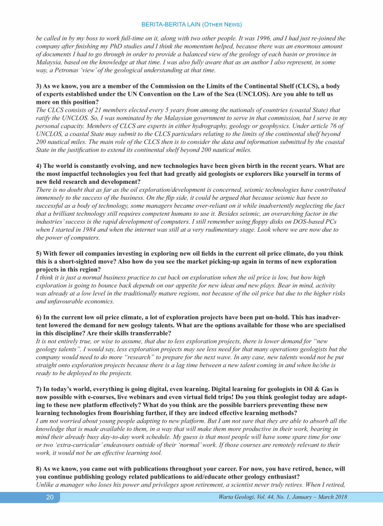
NrgTalk with Dr Mazlan Madon, Immediate Past-President of the Geological Society of MalaysiaArticle published by NrgEdge on 31 January 2018
https://www.nrgedge.net/article/1517366522-nrgtalk-with-dr-mazlan-madon
1) You are someone who has taken up many geologist positions with Petronas over the years. Are you able to share with us what kept your passion burning in order for you to be in the industry for more than 30 years?I consider the many positions that I was appointed to during my service with Petronas were merely following the “natural” course of a career progression, starting as a trainee geologist in 1984 to the penultimate technical position of “Custodian” in 2007. Since then I had held various Custodian positions within different parts of the organisation, doing slightly different things but essentially the same role. Whether one considers a span of 23 years to reach the “top” to be slow, ‘average’, or fast, is a different question altogether. I think, for me to have stayed in the same industry for more than 30 years is not unusual, especially in the oil/gas industry. A more interesting question that people often asked is what kept me going for so long in the same company. The simple answer is my passion for geology. It is fair to say that I care more about geology as a science than its application to oil/gas exploration, because in a way, passion for the science is more everlasting than one’s love for exploration (which tends to emulate the oil price). 2) During your years with Petronas, you wrote a book titled “Petroleum Geology and Resources of Malaysia” which was the main source of reference for the petroleum geologist within the region. What was the factor that inspired or influenced you to write this book? To be clear, the book was a team effort, and was a deliberate initiative by the management of Petronas at the time, to share the knowledge gained through decades of oil exploration in the country, with not just the oil industry people but the public at large. So a team was assembled and headed by a project manager/chief editor, and I was lucky to
NrgEdge interviews Dr Mazlan Madon who is an in-dependent geologist. He is also involved as a mem-ber of Commission on the Limits of the Continental Shelf and Academy of Sciences Malaysia. A passion-ate geologist with vast experience, Dr Mazlan Ma-don is considered among the top Geology experts.
20
BERITA-BERITA LAIN (Other News)
Warta Geologi, Vol. 44, No. 1, January – March 2018
be called in by my boss to work full-time on it, along with two other people. It was 1996, and I had just re-joined the company after finishing my PhD studies and I think the momentum helped, because there was an enormous amount of documents I had to go through in order to provide a balanced view of the geology of each basin or province in Malaysia, based on the knowledge at that time. I was also fully aware that as an author I also represent, in some way, a Petronas ‘view’ of the geological understanding at that time.
3) As we know, you are a member of the Commission on the Limits of the Continental Shelf (CLCS), a body of experts established under the UN Convention on the Law of the Sea (UNCLOS). Are you able to tell us more on this position? The CLCS consists of 21 members elected every 5 years from among the nationals of countries (coastal State) that ratify the UNCLOS. So, I was nominated by the Malaysian government to serve in that commission, but I serve in my personal capacity. Members of CLCS are experts in either hydrography, geology or geophysics. Under article 76 of UNCLOS, a coastal State may submit to the CLCS particulars relating to the limits of the continental shelf beyond 200 nautical miles. The main role of the CLCS then is to consider the data and information submitted by the coastal State in the justification to extend its continental shelf beyond 200 nautical miles.
4) The world is constantly evolving, and new technologies have been given birth in the recent years. What are the most impactful technologies you feel that had greatly aid geologists or explorers like yourself in terms of new field research and development? There is no doubt that as far as the oil exploration/development is concerned, seismic technologies have contributed immensely to the success of the business. On the flip side, it could be argued that because seismic has been so successful as a body of technology, some managers became over-reliant on it while inadvertently neglecting the fact that a brilliant technology still requires competent humans to use it. Besides seismic, an overarching factor in the industries’ success is the rapid development of computers. I still remember using floppy disks on DOS-based PCs when I started in 1984 and when the internet was still at a very rudimentary stage. Look where we are now due to the power of computers.
5) With fewer oil companies investing in exploring new oil fields in the current oil price climate, do you think this is a short-sighted move? Also how do you see the market picking-up again in terms of new exploration projects in this region? I think it is just a normal business practice to cut back on exploration when the oil price is low, but how high exploration is going to bounce back depends on our appetite for new ideas and new plays. Bear in mind, activity was already at a low level in the traditionally mature regions, not because of the oil price but due to the higher risks and unfavourable economics.
6) In the current low oil price climate, a lot of exploration projects have been put on-hold. This has inadver-tent lowered the demand for new geology talents. What are the options available for those who are specialised in this discipline? Are their skills transferrable? It is not entirely true, or wise to assume, that due to less exploration projects, there is lower demand for “new geology talents”. I would say, less exploration projects may see less need for that many operations geologists but the company would need to do more “research” to prepare for the next wave. In any case, new talents would not be put straight onto exploration projects because there is a lag time between a new talent coming in and when he/she is ready to be deployed to the projects.
7) In today’s world, everything is going digital, even learning. Digital learning for geologists in Oil & Gas is now possible with e-courses, live webinars and even virtual field trips! Do you think geologist today are adapt-ing to these new platform effectively? What do you think are the possible barriers preventing these new learning technologies from flourishing further, if they are indeed effective learning methods? I am not worried about young people adapting to new platform. But I am not sure that they are able to absorb all the knowledge that is made available to them, in a way that will make them more productive in their work, bearing in mind their already busy day-to-day work schedule. My guess is that most people will have some spare time for one or two ‘extra-curricular’ endeavours outside of their ‘normal’ work. If those courses are remotely relevant to their work, it would not be an effective learning tool.
8) As we know, you came out with publications throughout your career. For now, you have retired, hence, will you continue publishing geology related publications to aid/educate other geology enthusiast? Unlike a manager who loses his power and privileges upon retirement, a scientist never truly retires. When I retired,

21
BERITA-BERITA LAIN (Other News)
Warta Geologi, Vol. 44, No. 1, January – March 2018
they took away my company laptop, but I could still write. I consider writing technical articles as one of the two most important tasks for a scientist. The other one is reading. Writing is the best way to articulate one’s thoughts and understanding of a particular subject in the vast field of geoscience. It is erroneous to think that a geologist who happens to work in oil and gas must write only on petroleum geology. A musician does not have to just play the blues. So, yes I will do my best to continue to write and publish articles of interest.
9) As an industry expert, you have had considerable experience as a geologist/geoscientist. For someone who’s just beginning their career in the industry, what advice can you give him or her? Do you feel that youths today have more opportunities to nurture their passion and what life lessons are you able to share with them? I don’t consider myself an industry expert, but a geology or geosciences expert, maybe. So my only advice would be: to be honest in what you do, seek knowledge as truth, not half-truths, and not because your boss wants to hear it, but because you need to understand it yourself. Yes, young people are given ample opportunities, but they take too much time to decide what part of geoscience they like, before they can move forward in their career. Geoscience is a vast subject, with many inter-related sub-disciplines and topics. The problem in the way our industry has developed is to steer young people to want to do a very small part of geoscience, without wanting to or make it necessary to have a broader knowledge of the science. The result is a so-called ‘specialist’ but ironically with very little depth in understanding and lacking a broader appreciation of the scientific implications.
10) May I know what was the book you wrote that gained recognition? Are you able to elaborate more about this recognition and book? Do you think that the new generation can contribute in future? It was not a book I wrote. In 2017, the AAPG, as part of its 100th year celebration, wanted to publish a book, “The Heritage of the Petroleum Geologist” which is a sequel to its 2002 publication of the same name, which had honoured 43 “pioneering and notable geologists” for their contribution to the profession. So, what AAPG did was to invite another 58 “accomplished and distinguished” geologists to make the total number of honourees 101, symbolic of 100 for the centennial celebrations plus 1 additional individual “to symbolize the passing of our deep heritage to the next generation of energy-finders”. Like all the other honorees, I was asked to contribute two pages of my “achievements, disappointments, anecdotes, advice” for the next generation, and was lucky to be chosen as one of the 101 honorees at the AAPG Convention 2017 in Houston last April.
Of course, the new (meaning younger) generation can contribute, but they must do it with sincerity, honesty and passion. I was once young too, and came into geology by chance, like many geologists I know. In order to make meaningful contribution, people often say, we must be “passionate” about our work. The word “passionate” has been used a lot by managers during my time when they were trying to motivate the youngsters. But passion takes time to develop, and you cannot fake it. You have to first “like” what you’re doing, before you can be “passionate” about it. When you are young, you wouldn’t know where the career would take you, until you are really deep into the subject and develop a kind of “passion”. You cannot be passionate if you don’t know enough about the subject or the work that you’re doing.
By “contribution”, I take that you mean contribution to geology, as a science and as a profession. The new genera-tion can contribute to the science of geology by learning as much as they could, mainly by themselves, through read-ing and writing. After all, scientific knowledge grows from the ideas generated and written by scientists for people to read. Knowledge not shared is not knowledge. Attending conferences, making presentations, and writing technical papers are all part of the contribution to scientific knowledge but not all of it. For the geological profession, the new generation should join a scientific organization or geological society where they can interact with their peers as well as with other scientists and even students to share experiences and learn from them. These can be done in many ways, from organizing seminars, workshops, field trips to formal training sessions. Nowadays, there seem to be a lack of interest in joining scientific societies, like the Geological Society, for geologists, when especially in the petroleum industry wherein the perception is that all the knowledge and training are available within the industry or company and so joining a scientific society does not bring any benefit. I think this perception and attitude need to change. Contribution to geology and to the geological profession is not, and should not be, limited to making money for the oil companies, but also for the benefit of society at large.
11) With your intention to do a forum discussion, how will you work with us in terms of moderating those discussion at our NrgGuru section? As I understand it, NrgGuru is a platform for users to ask questions relating to the oil and gas industry. In that regard, I will try to answer mainly questions that relate to my own knowledge and experiences, and leave other questions for other experts.

22
BERITA-BERITA LAIN (Other News)
Warta Geologi, Vol. 44, No. 1, January – March 2018
University of Malaya American Association of Petroleum Geologists Student Chapter (UM AAPG Student Chapter)
2017/2018 Session
Event Report: COMMITTEES PARTICIPATION IN INTEGRATED PETROLEUM FESTIVAL (IPFest) in INSTITUT
TEKNOLOGI BANDUNG, INDONESIA
On 23rd and 24th January 2018, an annual International Petroleum Festival was held by Society of Petroleum Engineers ITB Student Chapter, Ikatan Ahli Teknik Perminyakan SM ITB, and Himpunan Mahasiswa Teknik Perminyakan (HMTM) “PATRA” ITB. It was a union event from two previous major events, Integrated Petroleum Week (IPWEEK) and Indonesian Petroleum Exhibition and Competition (IPEXC) ITB. This year, IPFEST was held with the theme of “Enhancing Energy Resilience through Innovative Collaboration” to propose solutions in enhancing Indonesia’s energy resilience.
As one of the national student chapters, University of Malaya American Association of Petroleum Geologists (AAPG) Student Chapter was also a part of the delegates to represent Malaysia. Nine committee members participated in two competitions which were Smart Competition and Mud Innovative Competition.
We departed from Kuala Lumpur International Airport on 21st January at 6 am and arrived in Bandung Husein Sastranegara International Airport at 8 am (GMT +7). On 22nd January, we arrived at Unpad Training Center (UTC) Hotel that was provided by ITB for the stay of all the delegates during the whole event. The registration started at 11 am (GMT + 7) followed by short and simple welcoming greetings from the organizer. Each delegate was provided with a Liaison Officer (LO) that would assist us during the entire event. Later in the evening, we had a technical talk and briefing session as a preparation for the competitions.
On the competition day, all the delegates departed from the hotel at 6 am (GMT + 7) by buses. We arrived at Bandung Technology Institute (ITB) which was not far from our hotel. More than 100 delegates from local and international universities were participating in this grand event and more than 10 oil and gas companies were the sponsors including well-known companies such as Conoco Phillips, Exxon Mobil, Santos, and Chevron. The opening ceremony was held in Center for Research and Community Service Auditorium (ITB) that began with a teaser video about the event. After the opening ceremony, all the delegates began to prepare themselves for the competition that was being held at different venues around ITB Campus.
As for the Smart Competition, it was held at the same building, Center for Research and Community Service Auditorium (ITB) with more than 10 delegates participating in this competition. UM AAPG SC was represented by the Ganonads Team which consisted of three members, Noor Mohamed, Gabriel Bradley and Nadhrah Mokhtar. This competition was conducted in 3 stages: Elimination, Semi-Final, and Final. Ganonads Team successfully passed the elimination round and went to the semifinal for upper bracket. At the upper bracket, unfortunately, they lose the game against ITB A team and again lose for the second chance against another local university.
For Mud Innovative Competition, UM AAPG SC was represented by two teams, which were Onyx’s Team (Wahid Muhammad, Nikita Khairina, NurAmeera Nadia) and The Horizons Team (Praveena, Amanna Ainani, Natasya Alyaa). This competition format required each team to come up with the best result for the study case based on the theme given “Innovation of Drilling Fluids to Enhance Drilling Processes Considering Energy Resilience”. Each team was given a total of 30 minutes consisting of presentation and Q&A from the judges. The participants were given a study case on how to create the best mud design for a particular wellbore condition. Therefore, they were required to provide and explain the drilling mud design with their own composition. Even though both Onyx and The Horizons did not get any placing in the competition, they tried their best to present their mud design and summary to the judges.
On the second day, we participated in Tour de Bandung that took place at one of the most wonderful tourist attractions in Bandung. The aim of this event was to give the delegates an unforgettable day while playing various games and challenges as well as to strengthen the bonds between the delegates. We visited Saung Angklung Udjo that was an art museum as a place to perform angklung art, an educational laboratorial as well as a cultural object typical of West Java.
Standing committees presenting UM AAPG SC.
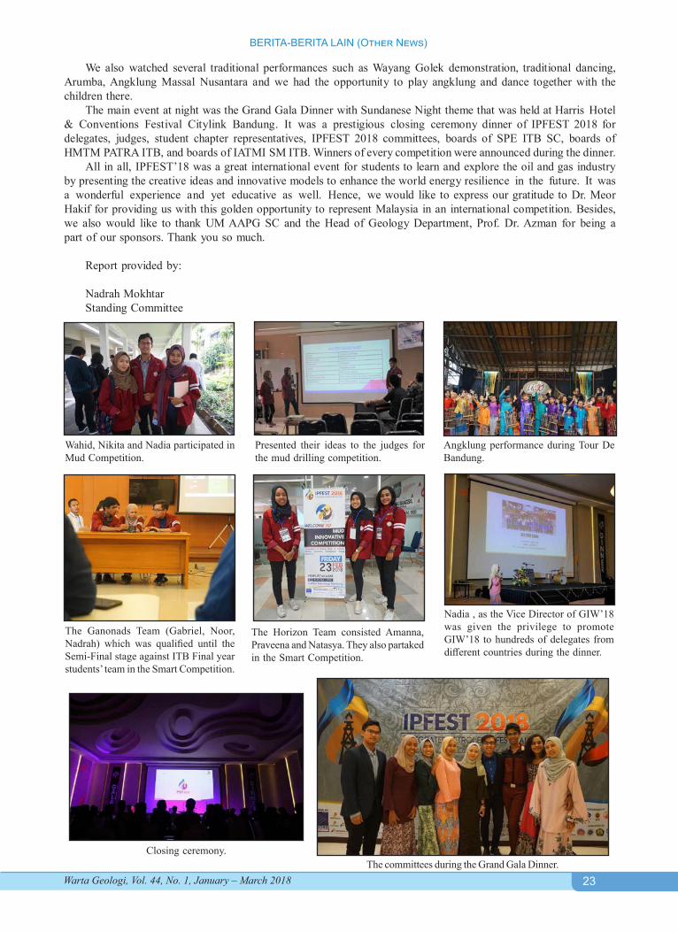
23
BERITA-BERITA LAIN (Other News)
Warta Geologi, Vol. 44, No. 1, January – March 2018
We also watched several traditional performances such as Wayang Golek demonstration, traditional dancing, Arumba, Angklung Massal Nusantara and we had the opportunity to play angklung and dance together with the children there.
The main event at night was the Grand Gala Dinner with Sundanese Night theme that was held at Harris Hotel & Conventions Festival Citylink Bandung. It was a prestigious closing ceremony dinner of IPFEST 2018 for delegates, judges, student chapter representatives, IPFEST 2018 committees, boards of SPE ITB SC, boards of HMTM PATRA ITB, and boards of IATMI SM ITB. Winners of every competition were announced during the dinner.
All in all, IPFEST’18 was a great international event for students to learn and explore the oil and gas industry by presenting the creative ideas and innovative models to enhance the world energy resilience in the future. It was a wonderful experience and yet educative as well. Hence, we would like to express our gratitude to Dr. Meor Hakif for providing us with this golden opportunity to represent Malaysia in an international competition. Besides, we also would like to thank UM AAPG SC and the Head of Geology Department, Prof. Dr. Azman for being a part of our sponsors. Thank you so much.
Report provided by:
Nadrah MokhtarStanding Committee
Wahid, Nikita and Nadia participated in Mud Competition.
Presented their ideas to the judges for the mud drilling competition.
The Horizon Team consisted Amanna, Praveena and Natasya. They also partaked in the Smart Competition.
The Ganonads Team (Gabriel, Noor, Nadrah) which was qualified until the Semi-Final stage against ITB Final year students’ team in the Smart Competition.
Angklung performance during Tour De Bandung.
The committees during the Grand Gala Dinner.
Nadia , as the Vice Director of GIW’18 was given the privilege to promote GIW’18 to hundreds of delegates from different countries during the dinner.
Closing ceremony.
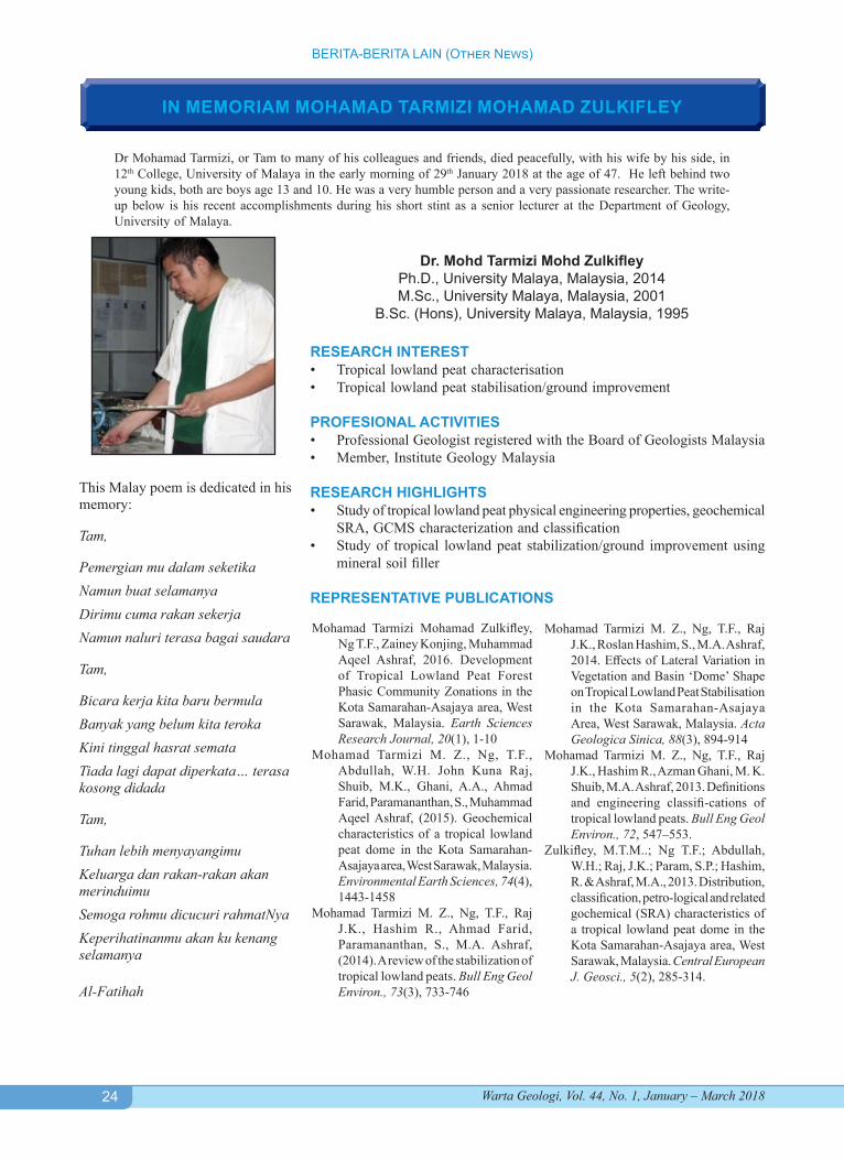
24
BERITA-BERITA LAIN (Other News)
Warta Geologi, Vol. 44, No. 1, January – March 2018
IN MEMORIAM MOHAMAD TARMIZI MOHAMAD ZULKIFLEY
Dr Mohamad Tarmizi, or Tam to many of his colleagues and friends, died peacefully, with his wife by his side, in 12th College, University of Malaya in the early morning of 29th January 2018 at the age of 47. He left behind two young kids, both are boys age 13 and 10. He was a very humble person and a very passionate researcher. The write-up below is his recent accomplishments during his short stint as a senior lecturer at the Department of Geology, University of Malaya.
Dr. Mohd Tarmizi Mohd ZulkifleyPh.D., University Malaya, Malaysia, 2014M.Sc., University Malaya, Malaysia, 2001
B.Sc. (Hons), University Malaya, Malaysia, 1995
RESEARCH INTEREST• Tropical lowland peat characterisation• Tropical lowland peat stabilisation/ground improvement
PROFESIONAL ACTIVITIES• Professional Geologist registered with the Board of Geologists Malaysia• Member, Institute Geology Malaysia
RESEARCH HIGHLIGHTS• Study of tropical lowland peat physical engineering properties, geochemical
SRA, GCMS characterization and classification• Study of tropical lowland peat stabilization/ground improvement using
mineral soil filler
REPRESENTATIVE PUBLICATIONS
Mohamad Tarmizi Mohamad Zulkifley, Ng T.F., Zainey Konjing, Muhammad Aqeel Ashraf, 2016. Development of Tropical Lowland Peat Forest Phasic Community Zonations in the Kota Samarahan-Asajaya area, West Sarawak, Malaysia. Earth Sciences Research Journal, 20(1), 1-10
Mohamad Tarmizi M. Z., Ng, T.F., Abdullah, W.H. John Kuna Raj, Shuib, M.K., Ghani, A.A., Ahmad Farid, Paramananthan, S., Muhammad Aqeel Ashraf, (2015). Geochemical characteristics of a tropical lowland peat dome in the Kota Samarahan-Asajaya area, West Sarawak, Malaysia. Environmental Earth Sciences, 74(4), 1443-1458
Mohamad Tarmizi M. Z., Ng, T.F., Raj J.K., Hashim R., Ahmad Farid, Paramananthan, S., M.A. Ashraf, (2014). A review of the stabilization of tropical lowland peats. Bull Eng Geol Environ., 73(3), 733-746
Mohamad Tarmizi M. Z., Ng, T.F., Raj J.K., Roslan Hashim, S., M.A. Ashraf, 2014. Effects of Lateral Variation in Vegetation and Basin ‘Dome’ Shape on Tropical Lowland Peat Stabilisation in the Kota Samarahan-Asajaya Area, West Sarawak, Malaysia. Acta Geologica Sinica, 88(3), 894-914
Mohamad Tarmizi M. Z., Ng, T.F., Raj J.K., Hashim R., Azman Ghani, M. K. Shuib, M.A. Ashraf, 2013. Definitions and engineering classifi-cations of tropical lowland peats. Bull Eng Geol Environ., 72, 547–553.
Zulkifley, M.T.M..; Ng T.F.; Abdullah, W.H.; Raj, J.K.; Param, S.P.; Hashim, R. & Ashraf, M.A., 2013. Distribution, classification, petro-logical and related gochemical (SRA) characteristics of a tropical lowland peat dome in the Kota Samarahan-Asajaya area, West Sarawak, Malaysia. Central European J. Geosci., 5(2), 285-314.
This Malay poem is dedicated in his memory:
Tam,
Pemergian mu dalam seketikaNamun buat selamanyaDirimu cuma rakan sekerjaNamun naluri terasa bagai saudara
Tam,
Bicara kerja kita baru bermulaBanyak yang belum kita terokaKini tinggal hasrat semataTiada lagi dapat diperkata… terasa kosong didada
Tam,
Tuhan lebih menyayangimuKeluarga dan rakan-rakan akan merinduimuSemoga rohmu dicucuri rahmatNyaKeperihatinanmu akan ku kenang selamanya
Al-Fatihah
25
BERITA-BERITA LAIN (Other News)
Warta Geologi, Vol. 44, No. 1, January – March 2018
UPCOMING EVENTSJune 6-7, 2018: Geosciences Technology Workshop on Pore Pressure and Geomechanics: From Exploration to Abandonment, Perth, Australia. For enquiries, contact: Programs Manager, AAPG Asia Pacific Region, tel. no.: +65 96536728 or visit www.aapg.org/career/training/in-person/workshops.
June 16-21, 2018: Resources for Future Genera-tions Conference, Vancouver, British Columbia. Visit RFG2018.Org for other information about the event.
June 18-19, 2018: Northeast U.S Petrochemical Con-struction Conference and Exhibition, Pittsburgh, USA. Details at: http://www.petchem-update.com/northeast/
June 25-29, 2018: International Conference on Environ-mental Science and Technology, Houston, Texas, USA. Visit the conference website at: http://www.AASci.org/conference/env/2018/index.html for more information or send email inquiries to [email protected].
June 25-29, 2018: World Gas Conference 2018, Wash-ington DC, USA. Visit website at https://wgc2018.com/ for details.
June 26-28, 2018: European Mantle Workshop (EMAW2018), University of Pavia, Italy. For more information, visit http://emaw2018iggpavia.unipv.it.
June 27-28, 2018: Asia-Pacific Conference, London, UK. More information at https://www.pesgb.org.uk/asia-pacific-ep-conference/
July 2-5, 2018: Hedberg Conferences: Geology of Middle America – The Gulf of Mexico, Yucatan, Carib-bean, Grenada and Tobago Basins and Their Margins, Sigüenza, Spain. Visit http://www.aapg.org/events/re-search/hedberg-conferences for more information.
July 3-4, 2018: SEGRM Symposium on Geo-engi-neering (SEGRM-GEO) in Tropical Region, Universiti Teknologi Malaysia, Kuala Lumpur. Contact Dr. Rini Asnida Abdullah, email add.: [email protected] for more details.
July 4-5, 2018: Automation Instrumentation Summit, Belgioioso, Italy. Further details at: https://automation-instrumentationsummit.com/.
July 9-12, 2018: The Potential For Groundwater in Malaysia’s Resilient Urban Future Workshop, Putra-jaya, Malaysia. Visit www.urban-groundwater.net for information.
July 10-13, 2018: Granulites & Granulites 2018 Confer-ence, by the Mineralogical Society of Great Britain
and Ireland, Ullapool, NW Scotland. Additional details can be obtained at the link: http://www.minersoc.co.uk/2018-meeting-granulites-granulites.html.
July 16-17, 2018: The Energy Pipeline Management Summit, Texas, US. Learn more at https://events.marcusevans-events.com/energy-pipeline-2018/2/.
July 16-18, 2018: Petrochemical & Refining Summit, Texas, US. For more information, visit: [email protected].
July 23-25, 2018: Unconventional Resources Technol-ogy Conference (URTeC 2018), Houstan, Texas. Visit: http://urtec.org/2018/ for more details.
August 13-14, 2018: 1st International Conference on Geosciences (ICG), under the banner of World Engi-neering, Science and Technology Congress (ESTCON 2018), Kuala Lumpur, Malaysia. Further information at: http://estcon.utp.edu.my/icg.
August 13-14, 2018: 5th International Conference on Geological and Environmental Sustainability, Bali, Indonesia. More details at https://geology.conferenc-eseries.com/
August 13-17, 2018: “Mineral Evolution and Mineral Ecology: Changes in Species Diversity and Complexity in Space and Time” at XXII International Mineralogi-cal Association meeting, Melbourne, Australia. More details can be obtained at https://www.ima2018.com/
August 19-22, 2018: Conjugate Margins Conference, Halifax, Nova Scotia. Visit http://conjugatemargins.com/2018/ for more information.
August 20-21, 2018: Asia Petrochemical Industry Con-ference (APIC 2018), Kuala Lumpur, Malaysia. Details at: http://www.apic2018.org.my/
August 27-30, 2018: Offshore North Sea Conference (ONC), Stavanger, Norway. Visit website at: http://www.ons.no/ for information.
September 6-8, 2018: GEO India, Noida, India. Further information is available at: http://www.apgindia.org/geo-india-2018.
September 12-13, 2018: International Conference on Oil & Gas, Singapore. Visit https://oil-gas.pulsusconference.com/ for more details.
September 17-19, 2018: 10th Asia Pacific Congress on Oil and Gas Conference & Exhibition, Beijing, China. Contact: Conferenceseries Ltd., Tel: +1 650 889 4686,
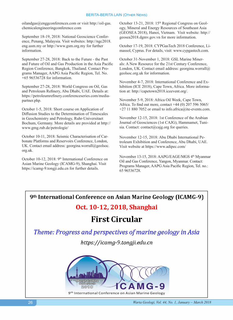
26
BERITA-BERITA LAIN (Other News)
Warta Geologi, Vol. 44, No. 1, January – March 2018
[email protected] or visit http://oil-gas.chemicalengineeringconference.com
September 18-19, 2018: National Geoscience Confer-ence, Penang, Malaysia. Visit websites: http://ngc2018.eng.usm.my or http://www.gsm.org.my for further information.
September 27-28, 2018: Back to the Future - the Past and Future of Oil and Gas Production in the Asia Pacific Region Conference, Bangkok, Thailand. Contact Pro-grams Manager, AAPG Asia Pacific Region, Tel. No. +65 96536728 for information.
September 27-28, 2018: World Congress on Oil, Gas and Petroleum Refinery, Abu Dhabi, UAE. Details at: https://petroleumrefinery.conferenceseries.com/media-partner.php.
October 1-5, 2018: Short course on Application of Diffusion Studies to the Determination of Timescales in Geochemistry and Petrology, Ruhr-Universitaet Bochum, Germany. More details are provided at http://www.gmg.rub.de/petrologie/
October 10-11, 2018: Seismic Characterisation of Car-bonate Platforms and Reservoirs Conference, London, UK. Contact email address: [email protected].
October 10-12, 2018: 9th International Conference on Asian Marine Geology (ICAMG-9), Shanghai. Visit https://icamg-9.tongji.edu.cn for further details.
October 13-21, 2018: 15th Regional Congress on Geol-ogy, Mineral and Energy Resources of Southeast Asia (GEOSEA 2018), Hanoi, Vietnam. Visit website: http://geosea2018.dgmv.gov.vn for more information.
October 17-19, 2018: CYPGasTech 2018 Conference, Li-massol, Cyprus. For details, visit: www.cypgastech.com.
October 31-November 1, 2018: GSL Marine Miner-als: A New Resource for the 21st Century Conference, London, UK. Contact email address: [email protected] for information.
November 4-7, 2018: International Conference and Ex-hibition (ICE 2018), Cape Town, Africa. More informa-tion at: http://capetown2018.iceevent.org/.
November 5-9, 2018: Africa Oil Week, Cape Town, Africa. To find out more, contact +44 (0) 207 596 5065/ +27 11 880 7052 or email to [email protected].
November 12-15, 2018: 1st Conference of the Arabian Journal of Geosciences (1st CAJG), Hammamet, Tuni-sia. Contact: [email protected] for queries.
November 12-15, 2018: Abu Dhabi International Pe-troleum Exhibition and Conference, Abu Dhabi, UAE. Visit website at https://www.adipec.com/
November 13-15, 2018: AAPG/EAGE/MGS 4th Myanmar Oil and Gas Conference, Yangon, Myanmar. Contact: Programs Manager, AAPG Asia Pacific Region, Tel. no.: 65 96536728.

27
BERITA-BERITA LAIN (Other News)
Warta Geologi, Vol. 44, No. 1, January – March 2018

28
BERITA-BERITA LAIN (Other News)
Warta Geologi, Vol. 44, No. 1, January – March 2018

29
BERITA-BERITA LAIN (Other News)
Warta Geologi, Vol. 44, No. 1, January – March 2018

30
BERITA-BERITA LAIN (Other News)
Warta Geologi, Vol. 44, No. 1, January – March 2018

Bulletin 1 (1968). Studies in Malaysian Geology. 79 p. Edited by P.H. Stauffer. (out of stock) Bulletin 2 (1968). Bibliography and Index of the Geology of West Malaysia and Singapore. 152 p. D.J. Gobbett. Price: RM5.00. Bulletin 3 (1970). Papers in Geomorphology and Stratigraphy (with Bibliography supplement). 146 p. Edited by P.H. Stauffer. Price: RM5.00. Bulletin 4 (1971). Papers in Petrology, Structure and Economic Geology. 100 p. Edited by P.H. Stauffer. Price: RM5.00. Bulletin 5 (1973). The Search for Tungsten Deposits. 70 p. K.F.G. Hosking. (out of stock)Bulletin 6 (1973). Proceedings, Regional Conference on the Geology of Southeast Asia. A Collection of papers, Kuala Lumpur, March, 1972. 334 p. Edited by B.K. Tan. Price: RM5.00. Bulletin 7 (1974). A collection of papers on geology. 138 p. Edited by B.K. Tan. Price RM5.00.Bulletin 8 (1977). A collection of papers on geology. 158 p. Edited by T.T. Khoo. (out of stock) Bulletin 9 (1977). The relationship between granitoids and associated ore deposits of the Circum Pacific region. 277 p. Edited by J.A. Roddick & T.T. Khoo. (out of stock) Bulletin 10 (1978). A collection of papers on geology. 95 p. Edited by C.H. Yeap. (out of stock) Bulletin 11 (1979). Geology of tin deposits. A collection of papers presented at the International Symposium on Geology of Tin Deposits. 393 p. Edited by C.H. Yeap. (out of stock) Bulletin 12 (1980). A collection of papers on geology. 86 p. Edited by G.H. Teh. (out of stock) Bulletin 13 (1980). A collection of papers on geology of Malaysia and Thailand. 111 p. Edited by G.H. Teh. Price RM5.00. Bulletin 14 (1981). A collection of papers on geology of Southeast Asia. 151 p. Edited by G.H. Teh. (out of stock) Bulletin 15 (1982). A collection of papers on geology. 151 p. Edited by G.H. Teh. (out of stock) Bulletin 16 (1983). A collection of papers on geology. 239 p. Edited by G.H. Teh. (out of stock) Bulletin 17 (1984). A collection of papers on geology. 371 p. Edited by G.H. Teh. (out of stock) Bulletin 18 (1985) Special issue on Petroleum Geology. 209 p. Edited by G.H. Teh. & S. Paramanathan. (out of stock) Bulletins 19 (1986). GEOSEA V Proceedings Fifth Regional Congress on Geology, Mineral and Energy Resources of SE Asia. Vol. I. 652 p. Edited by G.H. Teh & S. Paramanathan. Members: RM30.00: Non-members: RM60.00 Bulletins 20 (1986). GEOSEA V Proceedings Fifth Regional Congress on Geology, Mineral and Energy Resources of SE Asia. Vol. II. 881 p. Edited by G.H. Teh & S. Paramanathan. Members: RM30.00: Non-members: RM60.00 Bulletin 21 (1987). Special issue on Petroleum Geology. 271 p. Edited by G.H. Teh. Price: RM20.00. Bulletin 22 (1988). Special issue on Petroleum Geology. 272 p. Edited by G.H. Teh. Price: RM20.00. Bulletin 23 (1989). A collection of papers on the geology of Malaysia, Thailand and Burma. 215 p. Edited by G.H. Teh. Price: RM10.00. Bulletin 24 (1989). A collection of papers presented at Annual Geological Conference 1987 & 1988. 199 p. Edited by G.H. Teh. Price: RM10.00. Bulletin 25 (1989). Special issue on Petroleum Geology. 161 p. Edited by G.H. Teh. Price: RM20.00. Bulletin 26 (1990). A collection of papers presented at Annual Geological Conference 1989 and others. 223 p. Edited by G.H. Teh. Price: RM10.00. Bulletin 27 (1990). Special issue on Petroleum Geology 292 p. Edited by G.H. Teh. Price: RM20.00. Bulletin 28 (1991). Special issue on Petroleum Geology 292 p. Edited by G.H. Teh. Price: RM20.00. Bulletin 29 (1991). A collection of papers presented at Annual Geological Conference 1990 and others. 255 p. Edited by G.H. Teh. Price: RM10.00 Bulletin 30 (1992). Annotated bibliography of the geology of the South China Sea and adjacent parts of Borneo. 90 p. N.S. Haile. Price: RM10.00. Bulletin 31 (1992). A collection of papers presented at Annual Geological Conference 1991 and others. 176 p. Edited by G.H. Teh. Price: RM10.00. Bulletin 32 (1992). Special issue on Petroleum Geology. 283 p. Edited by G.H. Teh. Price: RM30.00. Bulletin 33 (1993). Proceedings Symposium on Tectonic Framework and Energy Resources of the Western Margin of the Pacific Basin. 419 p. Edited by G.H. Teh. Price: RM40.00. Bulletin 34 (1993). Bibliography and Index – Publications of the Geological Society of Malaysia 1967-1993. 181 p. Compiled by T.F. Ng. Edited by G.H. Teh. Price: RM20.00. Bulletin 35 (1994). A collection of papers presented at Annual Geological Conference 1992 and others. 174 p. Edited by G.H. Teh. (out of stock) Bulletin 36 (1994). Special issue on Petroleum Geology. 186 p. Edited by G.H. Teh. Price: RM50.00. Bulletin 37 (1995). Proceedings AAPG-GSM International Conference 1994. Southeast Asian Basins: Oil and Gas for the 21st Century. 506 p. Edited by G.H. Teh. Price: RM60.00. Bulletin 38 (1995). A collection of papers presented at GSM Annual Geological Conference 1994 and others. 190 p. Edited by G.H. Teh. Price: RM30.00. Bulletin 39 (1996). A collection of papers on geology. 258 p. Edited by G.H. Teh. (out of stock)
Bulletin 40 (1997). A collection of papers presented at Annual Geological Conference 1996 and others. 247 p. Edited by G.H. Teh. Price: RM30.00. Bulletin 41 (1997). A collection of papers presented at Petroleum Geology Conference 1996 and others. 165 p. Edited by G.H. Teh. (out of stock) Bulletin 42 (1998). Papers from Petroleum Geology Conference 1997, Seminar on Tertiary Basins of Peninsular Malaysia and others. 268 p. Edited by G.H. Teh. (out of stock) Bulletin 43 (1999). Papers from GEOSEA ’98 (Ninth Regional Congress on Geology, Mineral and Energy Resources of Southeast Asia). 698 p. Edited by G.H. Teh. Price: RM70.00.Bulletin 44 (2000). A collection of papers from Annual Geological Conference 1999. Western Belt & Paleozoic of Peninsular Malaysia Seminar 1999 & others. 178 p. Edited by G.H. Teh. Price: RM30.00 Bulletin 45 (2002). Annual Geological Conference 2002. Conference Issue. 375 p. Edited by G.H.Teh, Ismail Yusoff, Azman A. Ghani & T.F. Ng. Price: RM50.00. Bulletin 46 (2003). Annual Geological Conference 2003 Issue. 489 p. Edited by G.H. Teh, Alex Unya Ambun, Askury Abd. Kadir & T.F. Ng (out of stock) Bulletin 47 (2003). Petroleum Ceology Conference & Exhibition 2002. 179 p. Edited by G.H. Teh. Price: RM30.00. Bulletin 48 (2004). Annual Geological Conference 2004 Issue. 130 p. Edited by Lee Chai Peng, Mohd. Shafeea Leman, J.J. Pereira & T.F. Ng. (out of stock) Bulletin 49 (2006). Collection of Geological Papers. 167 p. Edited by K.K. Liew, Nur Iskandar Taib & T.F. Ng. Price: RM30.00. Bulletin 50 (2007). Bibliography and Index of GSM Publications 1994 – 2004. 160 p. Compiled by Robert B. Tate. Price: RM30.00 Bulletin 51 (2005). Annual Geological Conference 2005 Issue. 199 p. Edited by Nur Iskandar Taib. Price: RM30.00 Bulletin 52 (2006). Collection of geological papers. 135 p. Edited by Nur Iskandar Taib. Price: RM30.00. Bulletin 53 (2007). Collection of geological papers. 128 p. Edited by T.F. Ng, Nur Iskandar Taib & Joy J. Pereira. Price: RM30.00. Bulletin 54 (2008). Collection of geological papers. 169 p. Edited by T.F. Ng, Nur Iskandar Taib & Samsudin Hj Taib. Price: RM30.00. Bulletin 55 (2009). Collection of geological papers. 100 p. Edited by T.F. Ng & Y.L. Lau. Price: RM30.00. Bulletin 56 (2010). Collection of geological papers. 132 p. Edited by Mohd Shafeea Leman, Basir Jasin, T.F. Ng & C.S. Lim. Price: RM30.00. Bulletin 57 (2011). Collection of geological papers. 84 p. Edited by T.F. Ng, R.L. Kugler, J.J. Pereira & Ibrahim Komoo. Price: RM30.00.Bulletin 58 (2012). Collection of geological papers. 96 p. Edited by T.F. Ng & M. Johansson. Price: RM30.00.Bulletin 59 (2013). Collection of geological papers. 107 p. Edited by A.J. Reedman, Nguyen Thi Minh, C.S. Lim & T.F. Ng. Price: RM30.00.Bulletin 60 (2014). Charles S. Hutchison Memorial Issue. 99 p. Edited by Lee Chai Peng & T.F. Ng. Price: RM30.00.Bulletin 61 (2015). Collection of geological papers. 97 p. Edited by T.F. Ng. Price: RM30.00.Bulletin 62 (2016). Collection of geological papers. 142 p. Edited by Wan Hasiah Abdullah. Price: RM30.00.Bulletin 63 (2017). Collection of geological papers. 156 p. Edited by Lee Chai Peng & Wan Hasiah Abdullah. Price: RM30.00.Bulletin 64 (2017). Collection of geological papers. 139 p. Edited by Lee Chai Peng & Wan Hasiah Abdullah. Price: RM30.00.Proceedings of the Workshop on Stratigraphic Correlation of Thailand and Malaysia. Volume 1 Technical papers. (1983) Jointly published by Geological Society of Thailand and Geological Society of Malaysia. 383 p. (out of stock)Proceedings Annual Geological Conference 2000. 435 p. Edited by G.H. Teh, Joy J. Pereira and T.F. Ng. (out of stock) Proceedings Annual Geological Conference 2001. 320 p. Edited by G.H. Teh, Mohd. Shafeea Leman and T.F. Ng. Price: RM50.00. Geology of Borneo Island (2001) (CD, Map (2 sheets) and explanatory notes.Compiled by Robert B. Tate. Price: RM60.00. Stratigraphic Lexicon of Malaysia (2004). By Lee Chai Peng, Mohd. Shafeea Leman, Kamaludin Hassan, Bahari Md. Nasib & Roshidah Karim. 162 p. Price: RM30.00. Geological Evolution of Southeast Asia (1996) Reprinted Edition. By C. S. Hutchison. 368 p. (out of stock) Geological Evolution of Southeast Asia (2007) (Second Edition) by C. S. Hutchison. 433 p. Price: RM100.00; Student :RM50.00. Geology of Peninsular Malaysia (2009) 479 p. Hardcover. Edited by C.S. Hutchison & D.N.K. Tan. Inclusive of Geological Map of Peninsular Malaysia. Price: Member RM150.00; Student Member RM70.00; Non-Member RM200.00 Geological Map of Peninsular Malaysia (2008). Scale 1:1 000 000. Price: RM50.00; Student: RM20.00. Warta Geologi (Newsletter of the Geological Society of Malaysia). Price: RM5.00 per issue from July 1966.
All prices quoted are not inclusive of postage. Please write in for details on postage. Allow 8-10 weeks for delivery. For orders, please write to the Society and you will be invoiced. Cheques, money orders and bank drafs must accompany all orders.
Orders should be addressed to: Geological Society of Malaysia, c/o Department of Geology, University of Malaya,50603 Kuala Lumpur, MALAYSIA Tel: 603-79577036, Fax: 603-79563900, email: [email protected]
GEOLOGICAL SOCIETY OF MALAYSIA PUBLICATIONS

Price (excluding postage): RM30.00Please send your enquiry to : [email protected]

Geological Society of Malaysia Publications
General PolicyPapers should be as concise as possible.
They may include original results of basic, applied and policy research of national or international significance, current reviews, or discussions on techniques, research programs, organisations, information, or national and international policies in geoscience.
Submission of PapersOnly papers that have not been published
elsewhere will be considered for publication. Authors must agree not to publish elsewhere a paper submitted and accepted. All papers will be subjected to review by two or more reviewers. Authors wishing to include published and unmodified figures or text passages are required to obtain permission from the copyright owner(s). Authors of English papers are strongly urged to have their manuscript edited for language before submission by a person whose first language is English.
The Editor reserves the right to reject all or any part of the paper submitted. The Geological Society of Malaysia assumes no responsibility for statements made by authors.
Manuscript should be submitted to:The Editor, Geological Society of Malaysiac/o Department of GeologyUniversity of Malaya50603 Kuala Lumpur,MalaysiaTel: (603) 7957 7036 Fax: (603) 7956 3900Email: [email protected]
ManuscriptThe paper can be written in Bahasa
Malaysia (Malay) or English. For English papers, use either British or American spelling but not a combination of both. The paper should be checked thoroughly for spelling and grammar. The manuscript must be printed at 1.5 spacing in a single column on one side of A4 paper. All pages should be numbered. Length of paper should be between 3,000 and 6,000 words for the Bulletin and between 2,000 and 3000 words for Warta Geologi, excluding tables and illustrations. Metric units should be used and all non-standard symbols, abbreviations and acronyms must be defined.
TitleTitle must be informative and reflects
the content of the paper. Title in Malay should include an English translation. It should be concise (less than 20 words). Avoid using abbreviation in the title.
Author’s AddressAddresses of all authors must be provided.
The addresses should be sufficient for correspondence. Please include email address, telephone and fax of the corresponding author.
AbstractAbstract in both Malay and English, each
in one paragraph and should not exceed 300 words. It should clearly identify the subject matter, results obtained, interpretations discussed and conclusions reached.
KeywordsPlease include 3 to 8 keywords that best
describe the content of the paper.
ReferencesIn the text, references should be cited
by author and year and listed chronologically (e.g. Smith, 1964; Jones et al., 1998; Smith & Tan, 2000). For both Malay and English paper, all references must be listed in English. Title of non-English articles should be translated to English.
The list of references should only include articles cited in the text. The list should be arranged in alphabetical order. Please ensure that the reference list is complete and the bibliographical details are accurate. The references should be in the following manner:Journal article:Suntharalingam, T., 1968. Upper Palaeozoic
stratigraphy of the area west of Kampar, Perak. Geol. Soc. Malaysia Bull., 1, 1-15.
Book:Hutchison, C.S., 1989. Geological Evolution of
South-east Asia. Clarendon Press, Oxford. 368 p.
Chapter of book and Symposium volume:Hosking, K.F.G., 1973. Primary mineral deposits.
In: Gobbett, D.J. and Hutchison, C.S. (Eds.), Geology of the Malay Peninsular (West Malaysia and Singapore). Wiley-Interscience, New York, 335-390.
Article in Malay:Lim, C.H. & Mohd. Shafeea Leman, 1994.
The occurrence of Lambir Formation in Ulu Bok Syncline, North Sarawak. Geol. Soc. Malaysia Bull., 35, 1-5. (in Malay with English abstract).
TablesAll tables should be cited in the text and
numbered consecutively. Tables should have a title and a legend explaining any abbreviation or symbol used. Each table must be printed on a separate piece of paper. Do not insert the tables within the text. Data in tables should be aligned using tab stops rather than spaces. Avoid excessive tabulation of data.
IllustrationsPlease make sure that all illustrations
are useful, necessary and of good quality. A maximum of ten (10) illustrations (photographs, graphs and diagrams) are allowed and these should be cited in the text and numbered consecutively as Figures. The papers are usually published in black-and-white but it may sometimes be possible to include colour figures at the author’s expense. The scales for maps and photomicrographs should be drawn on the figure and not given as a magnification. Originals should not be greater than A4 size and annotations should be capable of being reduced down to 50 percent. The caption should be listed on a separate piece of paper. Do not insert the illustration within the text.
Submission of Electronic FilesSubmission should be made through
email as attachment files or using CD-ROM. The submission should be accompanied with a listing of all files and the software (name and version) used. The file names should reflect the content of the files (e.g. Ali_Fig1.tif).
Preferred SoftwareText: Microsoft Word. Do not insert tables and illustration within the text.Tables: Microsoft Word or Microsoft Excel. Please submit as separate files.Illustrations – Vector Graphics: Adobe Illustrator (preferred), CorelDraw and Freehand. Final line thickness should be at least 0.5 point or 0.17 mm. For other software, please submit one copy in the native file format and export one copy as a PDF file with all fonts embedded and one copy as a high resolution TIFF or JPEG image.Photographs or bitmap (raster) images:Adobe Photoshop. Please save as TIFF or PSD files. Save/scan line art at 600 to 1200 dpi and greyscale figures at 300 to 600 dpi. High resolution JPEG, TIFF or GIF files from other sources are also acceptable. The resolution must be high enough for printing at 300 dpi.
ReprintsTwenty five copies of each article
published are supplied free of charge. Additional reprints are available at cost price provided that orders are placed prior to publication. Authors will also received a softcopy of the article published in .pdf format.

PP2509/07/2013(032786) ISSN 0126-5539
PERSATUAN GEOLOGI MALAYSIANewsletter of the Geological Society of Malaysia
Jilid 44, No. 1 • Volume 44, No. 1 • January–March 2018
Published by the GEOLOGICAL SOCIETY OF MALAYSIADepartment of Geology, University of Malaya, 50603 Kuala Lumpur, MALAYSIA
Tel: 603-7957 7036 Fax: 603-7956 3900 E-mail: [email protected]
Printed by Art Printing Works Sdn. Bhd.29, Jalan Riong, 59100 Kuala Lumpur, MALAYSIA
KANDUNGAN (CONTENTS)
CATATAN GEOLOGI (Geological Notes)Franz L. Kessler: Exploring medieval adits in a copper mine using ground-penetrating radar imaging (GPR) 1
CATATAN LAIN (Other Notes)Franz L. Kessler & John Jong: Is there scope for a geopark project in greater Miri area, NW Sarawak? 8Joy Jacqueline Pereira, Nurfashareena Muhamad, Ng Tham Fatt & Zamri Ramli: Advancing disaster 13resilience: Insights on landslide and karst susceptibility assessments
PERTEMUAN PERSATUAN (Meetings of the Society)Tan Boon Kong: Engineering Geology in Malaysia – Some case histories 16
BERITA–BERITA PERSATUAN (News of the Society)New Membership 17Change of Address 18
BERITA LAIN (Other News)NrgTalk with Dr Mazlan Madon, Immediate Past-President of the Geological Society of Malaysia 19University of Malaya American Association of Petroleum Geologists Student Chapter (UM AAPG Student 22
Chapter) - Committees participation in Integrated Petroleum Festival (IPFest) in Institut Teknologi Bandung, Indonesia
In memoriam Mohamad Tarmizi Mohamad Zulkifley 24Upcoming Events 25
WARTA GEOLOGI