Peel Geographies March2015P1
4
Transcript of Peel Geographies March2015P1
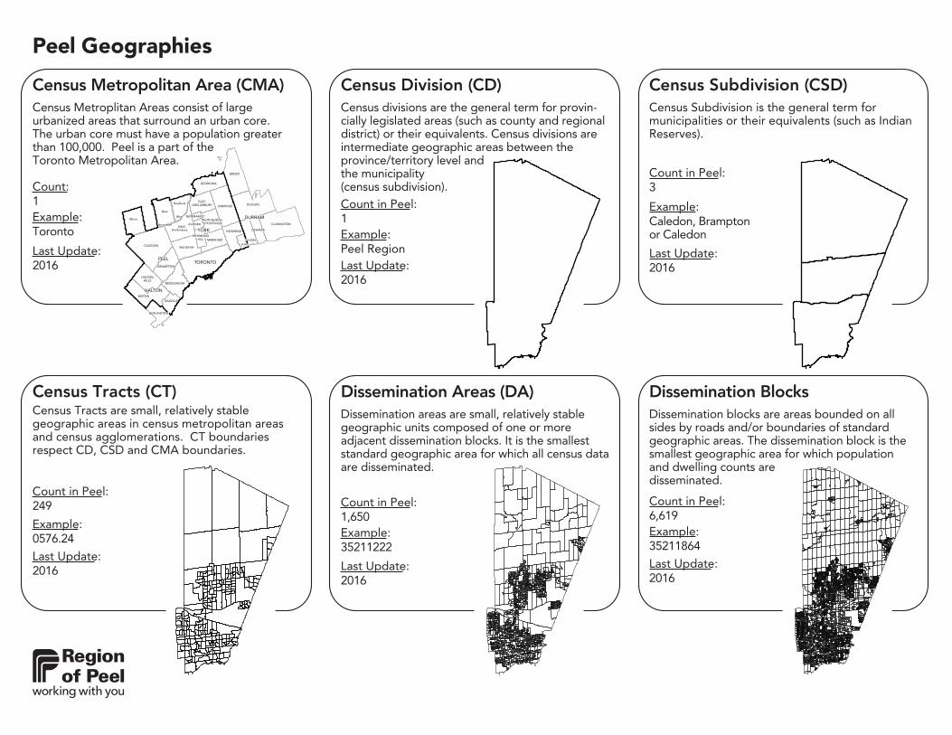
Example:Toronto
1Count:
Last Update:2016
Census Metropolitan Area (CMA)Census Metroplitan Areas consist of large urbanized areas that surround an urban core. The urban core must have a population greater than 100,000. Peel is a part of the Toronto Metropolitan Area.
MISSISSAUGA
HALTONHILLS
MILTON
OAKVILLE
BURLINGTON
BROCK
UXBRIDGE SCUGOG
CLARINGTONWHITCHURCH -
STOUFFVILLE
OSHAWA
WHITBY
PICKERING
MARKHAM
AJAX
GEORGINA
EASTGWILLIMBURY
KING
NEWMARKET
AURORA
RICHMONDHILL
VAUGHAN
BRAMPTON
CALEDON
MISSISSAUGA
HALTONHILLS
MILTON
OAKVILLE
BURLINGTON
BROCK
UXBRIDGE SCUGOG
CLARINGTONWHITCHURCH -
STOUFFVILLE
OSHAWA
WHITBY
PICKERING
MARKHAM
AJAX
GEORGINA
EASTGWILLIMBURY
KING
NEWMARKET
AURORA
RICHMONDHILL
VAUGHAN
BRAMPTON
CALEDON
Mono
New
Tecumseth
Bradford
West
Gwillimbury
Mono
New
Tecumseth
Bradford
West
Gwillimbury
PEEL
DURHAM
YORK
HALTON
TORONTOPEEL
DURHAM
YORK
HALTON
TORONTO
Peel Geographies
Census Division (CD)
Example:Peel Region
Count in Peel:1
Last Update:2016
Census divisions are the general term for provin-cially legislated areas (such as county and regional district) or their equivalents. Census divisions are intermediate geographic areas between the province/territory level and the municipality (census subdivision). 3
Example:Caledon, Brampton or Caledon
Count in Peel:
Last Update:2016
Census Subdivision (CSD)Census Subdivision is the general term for municipalities or their equivalents (such as Indian Reserves).
Dissemination Areas (DA)
Example:35211222
Count in Peel:1,650
Last Update:2016
Dissemination areas are small, relatively stable geographic units composed of one or more adjacent dissemination blocks. It is the smallest standard geographic area for which all census data are disseminated.
249
Example:0576.24
Count in Peel:
Last Update:2016
Census Tracts (CT)Census Tracts are small, relatively stable geographic areas in census metropolitan areas and census agglomerations. CT boundaries respect CD, CSD and CMA boundaries.
Example:35211864
6,619Count in Peel:
Last Update:2016
Dissemination BlocksDissemination blocks are areas bounded on all sides by roads and/or boundaries of standard geographic areas. The dissemination block is the smallest geographic area for which population and dwelling counts are disseminated.

Peel Geographies
26
Example:Mississauga Ward 1
Count in Peel:
Last Update:2014
WardsWards are districts in which a city or town is divided for the purpose of administration and elections. Each is represented by a local councillor.
5Example:Toronto
Count:
Last Update:2011
Greater Toronto Area (GTA)The Greater Toronto Area is a metropolitan area that includes the City of Toronto and the four surrounding regional municipalities of Durham, Halton, Peel and York.
MISSISSAUGA
HALTONHILLS
MILTON
OAKVILLE
BURLINGTON
BROCK
UXBRIDGE SCUGOG
CLARINGTONWHITCHURCH -
STOUFFVILLE
OSHAWA
WHITBY
PICKERING
MARKHAM
AJAX
GEORGINA
EASTGWILLIMBURY
KING
NEWMARKET
AURORA
RICHMONDHILL
VAUGHAN
BRAMPTON
CALEDON
MISSISSAUGA
HALTONHILLS
MILTON
OAKVILLE
BURLINGTON
BROCK
UXBRIDGE SCUGOG
CLARINGTONWHITCHURCH -
STOUFFVILLE
OSHAWA
WHITBY
PICKERING
MARKHAM
AJAX
GEORGINA
EASTGWILLIMBURY
KING
NEWMARKET
AURORA
RICHMONDHILL
VAUGHAN
BRAMPTON
CALEDON
PEEL
DURHAM
YORK
HALTON
TORONTOPEEL
DURHAM
YORK
HALTON
TORONTO
33
Example:L6R
Count in Peel:
Last Update:2016
Forward Sortation Areas (FSA)Forward Sortation Areas are the areas represented by the first three digits of a postal code.
6Example:Hamilton
Count:
2011Last Update:
Greater Toronto Area - Hamilton (GTA-H)The Greater Toronto & Hamilton Area is a metropolitan area that includes the City of Toronto and the four surrounding regional municipalities of Durham, Halton, Peel and York as well as the City of Hamilton.
MISSISSAUGA
HALTONHILLS
MILTON
OAKVILLE
BURLINGTON
BROCK
UXBRIDGE SCUGOG
CLARINGTONWHITCHURCH -
STOUFFVILLE
OSHAWA
WHITBY
PICKERING
MARKHAM
AJAX
GEORGINA
EASTGWILLIMBURY
KING
NEWMARKET
AURORA
RICHMONDHILL
VAUGHAN
BRAMPTON
CALEDON
MISSISSAUGA
HALTONHILLS
MILTON
OAKVILLE
BURLINGTON
BROCK
UXBRIDGE SCUGOG
CLARINGTONWHITCHURCH -
STOUFFVILLE
OSHAWA
WHITBY
PICKERING
MARKHAM
AJAX
GEORGINA
EASTGWILLIMBURY
KING
NEWMARKET
AURORA
RICHMONDHILL
VAUGHAN
BRAMPTON
CALEDON
PEEL
DURHAM
YORK
HALTON
TORONTO
HAMILTON
PEEL
DURHAM
YORK
HALTON
TORONTO
HAMILTON
12
Example:Brampton, South
Count in Peel:
Last Update:2016
Federal Electoral Districts (FED)Federal Electoral Districts are areas represented by a Member of Parliament & Member of Provincial Parliament. FED boundaries do not respect CSD boundaries.
Peel Geographies
Water Pressure Zones (WPZ)
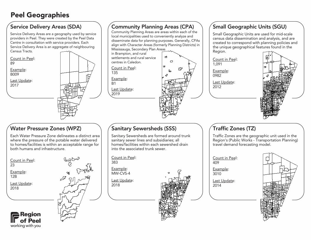
Example:12B
Count in Peel:23
Last Update:2018
Each Water Pressure Zone delineates a distinct area where the pressure of the potable water delivered to homes/facilities is within an acceptable range for both humans and infrastructure.
383
Example:MW-CVS-4
Count in Peel:
Last Update:2018
Sanitary Sewersheds (SSS)Sanitary Sewersheds are formed around trunk sanitary sewer lines and subsidiaries; all homes/facilities within each sewershed drain into the associated trunk sewer.
1,091
Example:0982
Count in Peel:
Last Update:2012
Small Geographic Units (SGU)Small Geographic Units are used for mid-scale census data dissemination and analysis, and are created to correspond with planning policies and the unique geographical features found in the Region.
89
Example:B009
Count in Peel:
Last Update:2017
Service Delivery Areas (SDA)Service Delivery Areas are a geography used by service providers in Peel. They were created by the Peel Data Centre in consultation with service providers. Each Service Delivery Area is an aggregate of neighbouring Census Tracts.
135
Example:B1
Count in Peel:
Last Update:2019
Community Planning Areas (CPA)Community Planning Areas are areas within each of the local municipalities used to conveniently analyze and disseminate data for planning purposes. Generally, CPAs align with Character Areas (formerly Planning Districts) in Mississauga, Secondary Plan Areas in Brampton, and rural settlements and rural service centres in Caledon.
409
Example:3010
Count in Peel:
Last Update:2014
Traffic Zones (TZ)Traffic Zones are the geographic unit used in the Region's (Public Works - Transportation Planning) travel demand forecasting model.
Peel Geographies
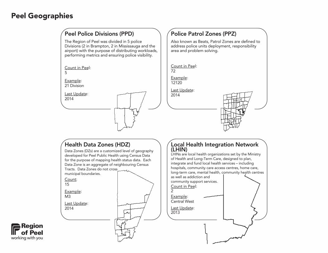
Police Patrol Zones (PPZ)
Example:12120
Count in Peel:72
Last Update:2014
Also known as Beats, Patrol Zones are defined to address police units deployment, responsibility area and problem solving.
15
Example:M3
Count:
Last Update:2014
Health Data Zones (HDZ)Data Zones (DZs) are a customized level of geography developed for Peel Public Health using Census Data for the purpose of mapping health status data. Each Data Zone is an aggregate of neighbouring Census Tracts. Data Zones do not cross municipal boundaries.
5
Example:21 Division
Count in Peel:
Last Update:2014
Peel Police Divisions (PPD)The Region of Peel was divided in 5 police Divisions (2 in Brampton, 2 in Mississauga and the airport) with the purpose of distributing workloads, performing metrics and ensuring police visibility.
2Example:Central West
Count in Peel:
Last Update:2013
Local Health Integration Network (LHIN)LHINs are local health organizations set by the Ministry of Health and Long-Term Care, designed to plan, integrate and fund local health services – including hospitals, community care access centres, home care, long-term care, mental health, community health centres as well as addiction and community support services.