Palms to Pines Scenic Byway CMP · PDF fileVisitor Demographic ... SWOT Analysis of the Palms...
187
June 2012 Palms to Pines Scenic Byway Corridor Management Plan P ALMS TO P INES S TATE S CENIC HIGHWAY C ALIFORNIA S TATE R OUTES 243 AND 74
Transcript of Palms to Pines Scenic Byway CMP · PDF fileVisitor Demographic ... SWOT Analysis of the Palms...

June 2012
Palms to Pines Scenic Byway Corridor Management Plan
PALMS TO PINES STATE SCENIC HIGHWAY
CALIFORNIA STATE ROUTES 243 AND 74

This document was produced by USDA Forest Service Recreation Solutions Enterprise Team
with support from the Federal Highway Administration and in partnership with the USDA Forest
Service Pacific Southwest Region, the Bureau of Land Management, the California Department
of Transportation, California State University, Chico Research Foundation and many local
partners. The USDA, the BLM, FHWA and State of California are equal opportunity providers
and employers.
In accordance with Federal law, U.S. Department of Agriculture policy and U.S. Department of
Interior policy, this institution is prohibited from discriminating on the basis of race, color,
national origin, sex, age or disability. (Not all prohibited bases apply to all programs.) To file a
complaint of discrimination, write USDA, Director, Office of Civil Rights, Room 326-W, Whitten
Building, 1400 Independence Avenue, SW, Washington, DC 20250-9410 or call (202) 720-
5964 (voice and TDD).

i
Table of Contents
Chapter 1 – The Palms to Pines Scenic Byway .........................................................................1
Introduction ................................................................................................................................. 1
Benefits of National Scenic Byway Designation .......................................................................... 2
Corridor Management Planning .................................................................................................. 3
Niche, Vision and Goals ............................................................................................................... 5
Chapter 2 – Intrinsic Qualities .................................................................................................7
Scenic Environment ..................................................................................................................... 7
Natural Environment ................................................................................................................... 9
Historical Resources .................................................................................................................. 14
Cultural Expressions .................................................................................................................. 18
Archaeological Resources .......................................................................................................... 23
Recreational Resources ............................................................................................................. 23
Chapter 3 – Land Management and Protection Strategies ..................................................... 39
Land Management .................................................................................................................... 39
Scenic Resource Strategies ........................................................................................................ 44
Natural Resource Strategies ...................................................................................................... 50
Historical, Cultural, Archaeological Resource Strategies .......................................................... 61
Recreation Resource Strategies ................................................................................................ 65
Chapter 4 – Highway Condition and Transportation Safety .................................................... 75
Designations .............................................................................................................................. 76
Roadway Maintenance .............................................................................................................. 76
California’s State Scenic Highway Program ............................................................................... 77
Average Daily Traffic .................................................................................................................. 78
Accidents ................................................................................................................................... 80
Law Enforcement ....................................................................................................................... 80
Desired Highway Features ......................................................................................................... 80
Projects and Proposals .............................................................................................................. 88
Chapter 5 – Commerce and Development ............................................................................. 91
Commerce ................................................................................................................................. 91
Development Plan ..................................................................................................................... 93

ii
Design Guidelines ...................................................................................................................... 95
Chapter 6 – Identity and Interpretation Signing .................................................................... 99
Signs, Icons, and Byway Identity ............................................................................................... 99
Information, Orientation, and Interpretive Signs ...................................................................... 99
Funding and Maintenance ....................................................................................................... 100
Outdoor Advertising Controls ................................................................................................. 100
Chapter 7 – Interpretive Plan .............................................................................................. 101
Interpretation .......................................................................................................................... 101
Intrinsic Features ..................................................................................................................... 102
Visitor Demographic ................................................................................................................ 103
Existing and Potential Interpretation ...................................................................................... 104
Creating a Visual Identity ........................................................................................................ 119
Priorities .................................................................................................................................. 121
Chapter 8 – Messaging About the Palms to Pines Scenic Byway ........................................... 125
Situation Analysis .................................................................................................................... 126
Trends (Demographic, Lifestyle, Travel) .................................................................................. 129
SWOT Analysis of the Palms to Pines Scenic Byway................................................................ 131
PEST (Political, Economic, Social, Technological) .................................................................... 132
Positioning Strategy and Message Development .................................................................... 132
Revisiting the Goals and Objectives for the Corridor Management Plan and Interpretation
Plan .......................................................................................................................................... 145
Interpretation Themes ............................................................................................................ 146
Messaging Goal and Communication Objectives .................................................................... 147
Chapter 9 – Implementation and Funding ........................................................................... 153
Implementation Activities and Responsibilities ...................................................................... 153
Funding Opportunities ............................................................................................................ 158
Appendix A – Map
Appendix B – References and Bibliography
Appendix C– Sign Inventory
Appendix D – 1969 Plan and Action Program for the “Pines to Palms” Scenic Corridor
Appendix E – Palms to Pines [National Forest] Scenic Byway Nomination Report

iii
LIST OF TABLES AND FIGURES
Table 1. Wildlife Watching Locations along the Byway ................................................................. 13
Table 2. Natural and Cultural History Organizations ..................................................................... 16
Table 3. Camping, Trail Access and Other Recreational Sites along the Byway ............................ 27
Table 4. AADT for SRs 74 and 243 over the previous decade. ...................................................... 79
Table 5. Site-specific Safety Improvement Suggestions* .............................................................. 82
Table 6. Hospitality Infrastructure along the Palms to Pines Scenic Byway ................................. 92
Table 7. New and Existing Interpretation Recommendations .................................................... 123
Table 8. Key Themes from Strengths, Weaknesses, Opportunities and Threats Analysis .......... 131
Table 9. Key Themes from Political, Economic, Social and Technological Analysis .................... 132
Table 10. Points of Agreement about the Nature of the Places Traversed by the Palms to Pines
Scenic Byway and the Local Stewardship Commitment ............................................................. 134
Table 11. Points of Agreement about Highways 74 and 243 and Drivers along these Routes ... 134
Table 12. Points of Agreement about Sharing the Story ............................................................. 135
Table 13. Points of Agreement about Population Growth in Southern California ...................... 136
Table 14. Summary of Messaging Elements for Three General Audiences ................................ 138
Table 15. Visitation and Population Statistics ............................................................................. 140
Table 16. Visitation Statistics for Mount San Jacinto State Park ................................................. 142
Table 17. Core Audiences and Communication/Message Distribution Systems ........................ 144
Table 18. Potential Future Projects along the Palms to Pines Scenic Byway* ............................ 154
Table 19. Federal Funding Opportunities .................................................................................... 160
Table 20. State Funding Opportunities ....................................................................................... 167
Table 21. Corporate, Local and Private Funding Opportunities .................................................. 169
Figure 1. Signage to Direct Visitors Away From Areas with No Public Access ............................ 139


1
CHAPTER 1 – THE PALMS TO PINES SCENIC BYWAY
Photo by Bonnie Adkins
Introduction The Palms to Pines Scenic Byway is one of the most naturally diverse scenic drives in
California. The route traverses four different Merriam’s life zones (Lower Sonoran, Upper
Sonoran, Transition and Boreal) in a mere 76 miles, while taking the byway traveler from
desert palms to high mountain pine forests and jagged rock outcrops, then back down
into the desert once again. The route is unparalleled in the array of wildland beauty
offered.
Approximately half of the byway traverses the San Jacinto Ranger District of the San
Bernardino National Forest (NF). The remaining portion travels through, or adjacent to,
the Mount San Jacinto State Park, the Santa Rosa and Morongo Indian Reservations,
and the Santa Rosa and San Jacinto Mountains National Monument (National
Monument).
The changing landscape, natural scenery, multiple public land management agencies,
communities and partners along the byway provide the perfect setting to bring
conservation education and public land stewardship to youth and their families while
engaging all Americans in healthy outdoor activities on public lands. The diverse and
unique natural landscape, cultural, historical, recreational, and scenic qualities serve
both as a backdrop and a conservation education laboratory for visitors.
The Palms to Pines Scenic Byway is a residential route as well as a visitor destination.
Often visitors are unfamiliar with mountain driving conditions and can cause conflicts that
impact quality of life for residents. Some communities along the byway are interested in
the economic benefit of attracting tourism while other communities would like to recede
from public view. The scenic byway plan is intended to address the positive potential of
managing visitor use in a way that preserves the unique aspects and natural resources
of the area while providing a safe travel corridor for all users.

Chapter 1 – The Palms to Pines Scenic Byway
2
Benefits of National Scenic Byway Designation Scenic byways provide an opportunity for travelers to enjoy the unique features of an
area, while providing local communities an opportunity to increase tourist revenue.
Designating and protecting scenic byways is a way to preserve America’s beauty and
heritage for everyone to enjoy. To receive the official designation as a National Scenic
Byway, a route must be a state-designated scenic route, possess multiple intrinsic
qualities that are nationally significant and have a completed corridor management plan.
A nomination packet must be submitted to the Federal Highway Administration (FHWA)
for consideration. Additional information can be found at
http://www.bywaysonline.org/nominations/.
The Palms to Pines Scenic Byway was designated as a California State Scenic Highway
in two sections (October 1971 and March 1972) and as a National Forest Scenic Byway
in July 1993. Formal recognition as a National Scenic Byway would provide additional
benefits to area visitors, nearby residents and businesses, and bring opportunities to
surrounding communities. Some of these benefits include:
National Recognition
National Scenic Byway
recognition identifies the
premier scenic routes in the
U.S., and brings recognition to
the agencies, organizations and
communities that sought
designation. Identification of the
Palms to Pines Scenic Byway
on state and federal maps and
on auto club brochures can
lead to more tourism
opportunities for the area.
Increased Pride
National Scenic Byways reflect
local pride and provide citizens an opportunity to showcase the beauty of their region.
The corridor management plan gives stakeholders a forum to discuss what they value
and want to feature in their communities. It also identifies how to preserve these qualities
while encouraging thoughtful economic growth.
Increased Funding Opportunities
If the Palms to Pines Scenic Byway was designated a National Scenic Byway, the route
would be eligible for federal funding through the National Scenic Byways Program.
These funds could be used to develop interpretive facilities, information kiosks,
restrooms and other needed byway improvements. In addition, implementation of the

Chapter 1 – The Palms to Pine Scenic Byway
3
corridor management plan could result in increased business, tax revenue and jobs from
tourist dollars.
Corridor Management Planning Corridor management plans (CMP) highlight the extraordinary values the public places
upon a scenic route. A CMP articulates the community’s vision for a scenic byway and
represents a commitment to maintain and enhance its intrinsic qualities. It specifies the
actions, procedures,
operational and administrative
practices and strategies that will
maintain the natural, scenic,
recreational, historic and
cultural qualities of a byway
corridor while recognizing the
primary transportation role of
the highway. A CMP is a
working document and intended
to be continually reviewed and
revised as new information
becomes available. Importantly,
the CMP process is guided by
community participation.
Contents of the Corridor Management Plan
This corridor management plan will serve to document the commitment of the
communities and land management agencies to preserve the unique character of the
byway corridor while providing for the safety of both visitors and residents. It provides a
vision for maintaining and enhancing the Palms to Pines Scenic Byway and prescribes
management strategies including:
Protection of the highway's intrinsic qualities
Improving roadway safety
Development of interpretive features to enhance the visitor's experience
Recommendations for existing and future byway visitor messaging - including communicating the appropriate locations visitors should seek amenities and recreation
Implementation strategy
Continued participation from local communities, the public, land management agencies and highway agencies
This plan has been cooperatively funded by a Federal Highway Administration
SAFETEA-LU Grant and the USDA Forest Service.

Chapter 1 – The Palms to Pines Scenic Byway
4
Public Involvement
Public Workshops
A community introductory meeting was held in July 2010 to introduce the National
Scenic Byway program. Emilyn Sheffield, California State University Research
Foundation, Chico then led a series of four 2-hour workshops between November 2010
and June 2011 to develop the content for the CMP. A fifth workshop series was held in
November 2011 to share the draft CMP and discuss “next steps” for the byway
communities. The workshops were well attended by community members, Santa Rosa
Tribal representatives and employees of the Forest Service, the Bureau of Land
Management (BLM) and Caltrans.
Each workshop was advertised via posters, newspaper (the Idyllwild Town Crier), the
San Bernardino NF Website (http://www.fs.fed.us/r5/sanbernardino/), the National
Monument Website (http://www.blm.gov/ca/st/en/fo/palmsprings/santarosa.html) and
emails. Letters were mailed prior to the first workshop. Throughout the process, the
email and mailing list grew, reflecting the growing interest in the planning process.
Workshop 1, held
November 8 through 10,
2010, included an
introduction and
background of the project,
description of a corridor
management plan, the
project timeline, a
discussion on National
Scenic Byway designation
and a conversation about
what the community
envisions for this highway
corridor.
During Workshop 2, held
January 31 through February 2, 2011, members of the community identified important
features (intrinsic values) along the route, interpretation themes and a discussion of how
they work together. Potential artwork (icons) was identified.
April 5 through 7, 2011, Workshop 3 participants discussed transportation safety
improvement desires and signing.
Workshop 4, held May 31 through June 2, 2011, focused on the byway vision,
positioning, and corridor management plan implementation.
Workshop 5, held November 15 through 17, 2011 included an introduction of the draft
document and discussions of the next steps the communities could take toward
implementing elements of the CMP when finalized.

Chapter 1 – The Palms to Pine Scenic Byway
5
The workshop series were held to determine the interest of the local public and
administering land entities in the management of the Palms to Pines Scenic Byway.
Participants identified concerns and opportunities, developed a vision statement and
goals, desired safety conditions and discussed seeking National Scenic Byway
designation for the byway. Opportunities and concern common to meeting participants
included:
Preserving the historic character and uses of the corridor
Helping visitors and residents to travel the roadway safely
Enhancing the visitor and resident experience by providing desired opportunities, information and services
Developing infrastructure and information to reduce congestion and direct visitors to areas that can best serve their needs
Increasing the visibility of selected intrinsic features along the route
Sharing the story of the place to engender a sense of caring and stewardship
Public Review of the CMP
The draft document was posted on the San Bernardino NF and the National Monument
Websites in December 2011. An email announcing the posting was sent to the mailing
list on December 6, 2011.
Niche, Vision and Goals Byway visitor traffic brings both benefits and impacts to local community residents. Visitor benefits include direct economic contributions and the opportunity to provide natural resource education. Impacts can include traffic congestion, inappropriate visitor behaviors and impacts to resources.

Chapter 1 – The Palms to Pines Scenic Byway
6
The question this corridor management plan strives to answer is how the local byway communities can plan for increasing population growth and manage visitor use to improve livability for residents while providing a safe, rewarding visitor experience.
Niche The Palms to Pines Scenic Byway appeals to travelers drawn to the unique locales of
the Coachella Valley and the resort community of Idyllwild; the rich settlement and
ranching history of the Hemet and Garner valleys; and the cultural heritage and
expression of the area’s first peoples, the Cahuilla Indians.
The vast public lands of the San Bernardino National Forest, Santa Rosa and San
Jacinto Mountains National Monument, Mount San Jacinto State Park and Riverside
County Regional Parks and Open Space District provide opportunities to learn more
about desert ecosystems and elevation-aligned life zones.
Vision Statement The vision statement for the corridor management plan was developed during public
meetings. It describes the future participants hope to see for the Palms to Pines Scenic
Byway. It also provides a foundation for establishing goals and management strategies
that will protect the intrinsic qualities of the byway. The vision statement reflects a
diverse set of interests.
The Palms to Pines Scenic Byway takes you safely from lush desert
palms to cool mountain pines and back again, offering travelers a
refreshing connection to nature and a respite from urban life. This
treasured place will continue to exist only if residents and visitors
actively work to conserve, protect and sustain it.
Goals Goals are developed to translate the vision into reality. Goals address specific steps that
can be implemented through policy and management. Management goals for the Palms
to Pines Scenic Byway identified at public workshops include:
Preserve the historic character and uses of the corridor.
Help visitors and residents to travel the roadway safely.
Enhance the visitor and resident experience by providing desired opportunities, information and services.
Develop infrastructure and information to reduce congestion and direct visitors to areas that can best serve their needs.
Increase the visibility of selected intrinsic features along the route.
Share the story of the place to engender a sense of caring and stewardship.

7
CHAPTER 2 – INTRINSIC QUALITIES The Palms to Pines Scenic byway is a state highway with world-class assets in all six
categories of intrinsic qualities. Byway travelers can observe the seemingly barren
desert hillsides, which hide relatively lush canyons, where Cahuilla and other Native
American tribes lived and thrived for thousands of years. The open spaces in the Garner
Valley tell a story of the early settlers making a living off the land, 100 years ago and
today. The gradual changes from desert to alpine forest offer opportunities to marvel at
the diversity of nature and encourage visitors to continue to care and explore public
lands. The awe-inspiring vistas allow travelers to wonder at the “wildness” of the public
lands that exist so close to one of the most crowded corners of the United States. The
past and recent history of fire, evident between Banning and Idyllwild, provides an
opportunity to address the importance of fire to both the natural environment and to the
people who care about public lands in southern California. The over 200 miles of trails,
22 campgrounds, interpretive sites and picnic areas along the byway provide diverse
opportunities encouraging visitors to stop and explore.
Intrinsic qualities are defined as inherent, essential, unique or irreplaceable features
representative or distinctly characteristic of an area. These qualities may be natural or
historic features and create a sense of place unique to an area. The six intrinsic qualities
that are evaluated are scenic, natural, historic, cultural, archaeological and recreational.
Although workshop participants developed an extensive list of intrinsic qualities for this
corridor management plan, it is by no means exhaustive. The rich history of the area has
inspired many authors. Refer to appendix B for a list of books and organizations that can
provide additional fascinating and detailed information.
(Note: Intrinsic qualities can be listed under multiple categories.)
Scenic Environment Scenic features are heightened visual experience derived from the view of natural and
manmade elements of the visual environment.
The Palms to Pines Scenic Byway showcases a scenic forested island along the
southern California desert divide. Traveling from a desert oasis to snow-peaked
mountains, this route is unparalled in the array of wild land beauty offered. The San
Jacinto Mountains are separated from other southern California ranges by the Sonoran
Desert, San Gorgonio Pass, and the Coachella and San Jacinto Valleys. Because they
stand alone, these mountains provide a dramatic contrast to the surrounding desert
landscape. The combination of white rocks, green pine trees and relatively undeveloped
mountain valleys make this region a paradise for weary-eyed urbanites. Drivers can pull-
off the winding and often steep road at pull-offs or lookout points for sweeping views of
spectacular mountain peaks or vast desert valleys.
The dramatic landscape and geologic diversity is accompanied by a sense of solitude
hard to find in this otherwise densely populated region of southern California. Locals and
visitors alike enjoy the lack of commercial development and franchising in the
communities along the byway. They describe a different energy “up here” and relish the

Chapter 2 – Intrinsic Qualities
8
clean, mountain air, the quiet, slower pace of life and the sense of community among
residents.
Community workshop participants identified the dramatic scenic vistas provided in this
unique desert-to-mountain setting as an important intrinsic quality. The steep topography
and diversity of terrain the route travels provides remarkable views either looking up to
the mountains above or down to the valleys below; with changing seasons to provide
snow-topped peaks in the winter and carpets of wildflowers in the spring.
Mount San Jacinto
The Mount San Jacinto escarpment is one of the steepest in the United States, rising in
a short distance from 1,200 feet above sea level to 10,834 feet. The sudden rise from
desert floor to high mountains creates a diverse range of life zones for the observant
visitor to enjoy.
Lily Rock The unmistakable cone shape of Lily Rock juts out of the forest above Idyllwild,
attracting photographers and rock climbers alike.
“Faces in the Rocks” Shifting daylight and changing season can provide travelers with a unique experience
along the National Monument portion of the byway route. The geologic features of the
terrain bear a striking resemblance to human faces or various animals for the careful
viewer. These illusive images in the rock formations evoke the ancient history and life
force of the seemingly barren desert landscape.

Chapter 2 – Intrinsic Qualities
9
Seven Level Hill
The aptly named “Seven Level Hill” is an approximately 5 mile stretch of the byway
between the San Bernardino NF boundary and the National Monument Visitor Center,
dropping a spectacular 1,500 feet down seven narrow switchbacks. On clear days,
travelers can see Salton Sea basin, as well as mountain peaks in Mexico from the
highest elevation. However attention to driving the road is necessary for navigating the
tight turns. The Coachella Valley Overlook provides a pull-off location to safely
appreciate the remarkable view.
Natural Environment Natural features are those in the visual environment that are in a relatively undisturbed
state. These features predated the arrival of human populations, and may include
geological formations, fossils, landforms, water bodies, vegetation and wildlife.
The Palms to Pines Scenic Byway is a mountain island of biodiversity surrounded by the
Colorado portion of the Sonoran desert on the east and the dry, alluvial farmlands of the
San Jacinto Valley on the west. Ranging from a few hundred feet above sea level to
over 6,000 feet in the Idyllwild area, the 76-mile Palms to Pines Scenic Byway
showcases an amazing diversity of habitat and wildlife. The effect of altitude on
ecosystems is readily apparent as one ascends the byway from any of the low elevation
communities. Rainfall in the lower elevations is relatively low and temperatures range
from extremely hot and dry in the lower elevations in summer to cold and snowy in the
upper elevations in winter.
Close to a dozen plant communities or ecosystems are represented along the route,
including dune, palm oasis, creosote scrub, riparian, desert wash, rocky hillside,

Chapter 2 – Intrinsic Qualities
10
chaparral, pinyon-juniper woodland, oak woodland and pine forest. One of the special
features of the byway is the ability to experience all of these communities and their
varied wildlife in a single day’s drive. It’s like taking a trip from Mexico to Canada
(California Watchable Wildlife).
Community workshop participants identified the “giant, old, irreplaceable trees” along the
byway as an exceptional intrinsic quality of the routes driving experience.
“I love coming up out of Hemet and you’re in the trees, in the mountains. Those
big trees are the character of the place.”
San Bernardino National Forest
While traversing the San Bernardino NF, the byway route passes through wildlife habitat
ranging from desert oases to expansive forests flanking towering mountains. A wide
diversity of plant and animal species are located in this area, including many rare
species. Flowers of the Ziegler’s tidy-tips, Johnson’s rock cress, California penstemon
and Munz’s hedgehog cactus are visible from the road in season. Bald eagles winter
along the shores of Lake Hemet and the rocky mountainsides are home to the
peninsular bighorn sheep. The opportunities for birding, botanical observation, nature
photography and general wildlife viewing are outstanding.

Chapter 2 – Intrinsic Qualities
11
The forest provides important
habitat for several endangered
and sensitive species like the
Quino checkerspot butterfly,
mountain yellow-legged frog,
the lemon lily and Peninsular
bighorn sheep, a critically
endangered species
synonymous with the desert
environment. The area
supports active recovery
efforts such as the partnership
between the San Jacinto RD
and the San Diego Zoo
Institute for Conservation
Research to establish the first captive bred population of mountain yellow-legged frogs
and the lemon lily restoration project.
The lemon lily is a fragrant flower native to Idyllwild that used to blanket the local creek
banks but came close to extirpation due to overharvest by bulb collectors and flower
pickers. Restoring lemon lily populations is a collaborative effort between Idyllwild
residents and the Forest Service. The Forest Service is working on a plan to restore the
lilies on national forest and wilderness lands, while local citizens with the help of the
Lemon Lily Festival at the Idyllwild Nature Center are undertaking the effort on privately
held lands.
Santa Rosa and San Jacinto Mountains National Monument The 280,000-acre National Monument was created on October 24, 2000 and is a
cooperative effort of the BLM, the FS, the Agua Caliente Band of Cahuilla Indians, state
agencies, local governments
and private partners. This
designation recognizes the
significance of this land to the
entire nation because of its
outstanding biological, cultural,
recreational, educational,
scientific and geological
values.
The National Monument is a
land of extremes. At lower
elevations where the land sits
just above sea level, the
summers are hot and dry with

Chapter 2 – Intrinsic Qualities
12
occasional monsoonal rains. Sparsely vegetated slopes here clearly expose a landscape
that has yielded to powerful geologic forces. In contrast, at more than 10,000 feet above
the desert floor, geometric chunks of granite tower above the mature forests. As light
shifts with the hour and the season on these canyons and mountains, the beauty of the
landscape continually surprises viewers.
This diverse elevational range creates incredible biodiversity. There are plants found in
the National Monument that exist nowhere else in the world and the region hosts many
rare and endangered animal species such as the Peninsular bighorn sheep, southern
yellow bat and the least Bell’s vireo. Plant species such as the creosote bush, desert
agave, pinyon pine and native California Fan Palm define the area botanically and
provide ideal habitat for the kangaroo rat, rosy boa, Costa’s hummingbird, Gambel’s
quail, roadrunner and other animal species.
The Idyllwild Nature Center Operated by Riverside County Regional Park and Open-Space District and located a
mile northwest of Idyllwild on Highway 243, the Idyllwild Nature Center offers field study
trips, environmental education
programs and guided tours by
appointment. Programs focus on
mountain ecology, habitats, flora
and fauna, Cahuilla Native
culture and the history of the
San Jacinto Mountains. The
area surrounding Idyllwild
Nature Center is filled with trails
perfect for hiking, biking or
horseback riding. Easy to
moderate effort trails can be
found. Picnic tables set amongst
the tall pine trees are available
for relaxing and enjoying a meal
after exploring the area.
Wildlife Watching The Palms to Pines Scenic Byway is California Watchable Wildlife Site No. 155.The
route showcases an amazing diversity of habitat and wildlife. Wildlife watching can be
enjoyed any month of the year. Early morning and early evening are usually the best
times to catch a glimpse of birds and mammals, especially on hot summer days. Lizards
and snakes can be seen during the heat of the day. A resident pair of Bald Eagles can
be viewed at Lake Hemet any season of the year.
There are several convenient locations along the byway to pull-off and observe wildlife.

Chapter 2 – Intrinsic Qualities
13
Visitors may see California ground squirrels, coyotes, gray foxes and occasional bobcats
anywhere along the route. Table 1 describes locations California Watchable Wildlife
recommends for specific wildlife viewing.
Table 1. Wildlife Watching Locations along the Byway
Facility Management Description Access
Lake Fulmor FS Lake Fulmor is home to mountain quail,
mountain chickadees, and purple finches. The
rare black swift may be seen in summer soaring
above the lake.
Look for ground squirrels, tree frogs, butterflies
and dragonflies along the trail winding around
the lake. Listen for the raucous chatter of
Steller’s jays.
Located 10
miles north of
Idyllwild on
Hwy 243.
Indian Vista FS The chaparral and oak woodlands surrounding
Indian Vista overlook may reveal views of mule
deer, acorn woodpeckers, western scrub jays,
towhees and other songbirds. Red-tailed hawks
and ravens may soar above. Lizards, including
western skinks, alligator lizards and coast
horned lizards may be found at ground level.
With patience you may see a bobcat, gray fox,
and coyote.
Located on
Hwy 243, 9.5
miles
northwest of
Idyllwild.
Alandale
Fire Station
FS Interpretive signs illustrate the wildlife of the area,
including woodpeckers, bluebirds, jays, deer,
squirrels, pack rats, hawks, and insects.
Located 5
miles north of
Idyllwild on
Hwy 243.
The Idyllwild
Nature
Center
Riverside
County
The trails at the Nature Center provide
opportunity to view and interpretation of the
flora and fauna common to this elevation of the
byway.
Located 1
mile
northwest of
Idyllwild on
Hwy 243
Idyllwild Watch the trees of Idyllwild for western gray
squirrels, white-headed woodpeckers and
Steller’s jays.
Garner
Valley
FS/Private/
Caltrans
Western bluebird nesting boxes in roadside
trees can be seen along the section of the route
passing through Garner Valley.
South of
Idyllwild on
Hwy 74

Chapter 2 – Intrinsic Qualities
14
Facility Management Description Access
Lake Hemet FS Lake Hemet hosts great blue herons, violet
green swallows, osprey, golden eagles and
Caspian terns and is a winter destination for
Canada geese, American white pelicans and
other waterfowl. A pair of bald eagles has taken
up residence in the pines bordering the lake.
White-tailed kites occasionally hunt the nearby
meadows, where you may also find western
meadowlarks and California quail. Look for
large, noisy flocks of pinyon jays along the
highway. Coyotes, deer and bobcat are
sometimes seen along the shore.
Located 8
miles
southeast of
Idyllwild on
Hwy74.
Cahuilla
Tewanet
FS The pinyon pines will thin and agave and yucca
will dominate the vegetation as you reach
Cahuilla Tewanet. Here you will enjoy views into
Deep Canyon and can listen for the flute-like
song of the Scott’s Oriole, a flashy black and
yellow bird common in the area. Golden eagles,
prairie falcons and peregrine falcons nest on
the canyon walls and may be spotted hunting or
flying to the nest.
Located 10
miles south of
Palm Desert
on Hwy 74
Santa Rosa
and San
Jacinto
Mountains
National
Monument
BLM/FS The Santa Rosa and San Jacinto Mountains
National Monument preserves approximately
280,000 acres of vital habitat for a number of
rare animal species including the desert
tortoise, the endangered Peninsular bighorn
sheep and the slender salamander
Located at
the south end
of the Palms
to Pines
Scenic Byway
along Hwy
74.
Historical Resources Historic features encompass legacies of the past that are distinctly associated with
physical elements of the landscape, whether natural or manmade, that are of such
historic significance that they educate the viewer and stir an appreciation of the past.
The area’s historical resources span centuries of use as the ancestral homeland of the
Cahuilla Indians through 19th century natural resource exploration and 20th century
ranching and recreation. The story of the byway route itself from its original development
as the Cahuilla’s trail for the collection of pinyon harvesting, hunting and ceremonial
events to the construction of the current paved route for recreation access to the cooler,
mountain climate and Mount San Jacinto State Park is an integral piece of the area’s
broader history.

Chapter 2 – Intrinsic Qualities
15
Penny Pines Plantations
Recognizing the need to
restore burned areas on the
Shasta-Trinity NF, the San
Francisco Sportswomen’s
Association sponsored the
first Penny Pines Plantation
in 1941. Since that
contribution, the number of
participating groups and
individuals has grown each
year. They include such
organizations as the Garden
and Women’s Clubs, Boy
and Girl Scouts of America,
civic and sportsmen’s clubs, and many others. Over the years these groups have
contributed more than a million dollars to the Penny Pines Reforestation Program.
Through these donations, more than 27 million of seedlings have been planted,
renewing 88,000 acres of national forest land in California--truly an outstanding
achievement.
A Penny Pines Plantation can be viewed from several locations along the Palms to
Pines Scenic Byway along Highway 243.
Lake Hemet Dam
Lake Hemet Water Company placed the first stone of the Hemet Dam on January 6,
1891. When this arched masonry structure was completed in 1895 at a height of 122.5
feet (37.3 m), it was the largest solid masonry dam in the world—a title it would retain
until the construction of Roosevelt Dam in Arizona in 1911.
Other important historical features identified by workshop participants include:
Rich ranching and settlement history including the Garner and Wellman families
Phony gold rush schemes
The DeAnza Expedition
Numerous historical references and organizations are available to provide a detailed
history of the Palms to Pines Scenic Byway corridor and surrounding area. The following
organizations listed below are excellent resources for learning more about the history of
the area. Please see appendix A, a bibliography with historical references.

Chapter 2 – Intrinsic Qualities
16
Table 2. Natural and Cultural History Organizations
Organization Description Contact Information
Idyllwild Area Historical
Society
The Museum displays many
historical artifacts that reflect the
richness and diversity of this
region, from Early Cahuilla
Indians, early ranchers, pioneer
lumber barons, the tourist trade,
vacation cabins, and organized
summer camps. Numerous
photos and documents are
displayed and tell the story of
Idyllwild and the interesting
characters who made it possible.
http://www.idyllwildhistory.org/
Located in a charming cabin at
54470 North Circle Drive in
Idyllwild.
The Hamilton Museum The Hamilton Museum is a one
of a kind facility that gives a
visitor an idea of the unique
western lifestyle the prevailed in
the local mountain communities
until recent years.
Through old photos, documents,
artifacts and a restored
homestead house, visitors
explore the past, learning how
Cahuilla people and early settlers
lived before the 1950s arrival of
paved roads, electricity and
telephones.
http://www.hamiltonmuseum.org
Located at 39991 Contreras
Road in Anza. a
The Santa Rosa and San
Jacinto Mountains National
Monument Visitor Center
The National Monument Visitor
Center has natural history
interpretive displays and visitor
programs.
http://www.blm.gov/ca/st/en/fo/p
almsprings/santarosa.html
Located just south of Palm
Desert on Hwy 74.

Chapter 2 – Intrinsic Qualities
17
Organization Description Contact Information
Malki Museum, Inc. Malki Museum is the oldest
museum founded by Natives on a
reservation in California, and has
been the inspiration for several
other Indian museums.
The museum collects and displays
art, artifacts and historical materials
of the Indians of the San Gorgonio
Pass area, and acts as a common
meeting ground for Natives and
non-Natives to learn about the
past.
http://www.malkimuseum.org/
Located at 11795 Fields Road
on the Morongo Reservation in
Banning.
Gilman Historic Ranch and
Wagon Museum
The Gilman Historic Ranch and
Wagon Museum preserves,
celebrates, and interprets the late
1800’s history of California, from
the Cahuilla Indians to the
exploration and settlement of
southern California and the San
Gorgonio Pass, including the
homestead ranch of James
Marshall Gilman.
http://www.rivcoparks.org/histori
c-sites/gilman/gilman-historic-
ranch-and-wagon-museum-
main-page/
Operated by Riverside County
Parks, the museum is located at
1901 West Wilson Street in
Banning.
Hemet Museum The exhibits at the Hemet
Museum, housed in the historic
Hemet Depot, showcase the
area's colorful history. You'll see
agricultural displays, Native
American artifacts, railroading
relics, rare historical photographs
from the Ramona Pageant and
more.
Located on the corner of State
Street and Florida Avenue in
downtown Hemet.
Chapter 2 – Intrinsic Qualities
18
Organization Description Contact Information
Agua Caliente Cultural
Museum
Inspires people to learn about the
Agua Caliente Band of Cahuilla
Indians and other Native
cultures. They keep the spirit
alive through exhibitions,
collections, research, and
educational programs.
http://www.accmuseum.org/
The Museum is located on the
Village Green Heritage Center in
the heart of downtown Palm
Springs at 219 S. Palm Canyon
Drive in Palm Springs.
The Historical Society of
Palm Desert
Located in the Old Palm Desert
Firehouse with a fascinating
collection of historical photos,
newspaper, magazine archives
and oral histories on the early
settlers.
http://www.hspd.org/
Located at 72-9861 El Paseo
just west of Hwy 74 in Palm
Desert .
Coachella Valley History
Museum
Shares the unique history of the
desert and the pioneers who
forged through the difficult
environment to create the valley
as is today.
http://www.coachellavalleymuse
um.org/
Located at 82-616 Miles Ave. in
Indio.
Anza Borrego Desert
Natural History Association
Connects members, nature and
history through education and
interpretation of the desert area.
http://www.abdnha.org/
Located in Borrego Springs.
Cultural Expressions Cultural features are the evidence and expressions of the customs or traditions of a
distinct group of people. Cultural features include, but are not limited to, crafts, music,
dance, rituals, festivals, speech, food, special events and vernacular architecture that
are currently practiced.
Native Cahuilla Cultural Expression Oral history describes the Cahuilla Indians as inhabitants of the area surrounding the
Palms to Pines Scenic Byway since the beginning of creation. The byway route crosses
reservation lands for the Santa Rosa Band of Cahuilla Indians and the Morongo Band of
Mission Indians and a large portion of the National Monument encompasses Agua
Caliente reservation lands. These communities are a vibrant and vital part of the local
culture and economy.

Chapter 2 – Intrinsic Qualities
19
The Agua Caliente Cultural Museum holds an annual Festival of Native Film and Culture
in March. The Morongo Bands hold an annual Cultural Heritage Days Celebration in late
spring featuring Bird Songs and dancing, a rodeo, peon games, softball tournament,
pageant, parade and cultural demonstrations and workshops.
Bird Songs recount the story of the Cahuilla creation and their life and migration after the
death of their Creator. After his death, the Cahuilla people circled the continent three
times, eventually coming back to Southern California. The Bird Songs are sung in
sequence and the songs describe everything from creation, to the things they
encountered on their journey including animals, weather, the land, etc. The full
sequence, no longer done, took nearly a week to sing but the individual songs are social
songs that are still sung at gatherings and holiday celebrations.
See Table 2 for area museum information featuring Cahuilla culture, traditions and
events.
Fire Ecology and Fire Safety Education Following the catastrophic wildland fire seasons of the last decade, national forests in
California have embarked on a proactive approach of fire management including fire
ecology and prevention education.
The San Bernardino NF offers interpretive information regarding fire ecology along the
byway in several locations including the Idyllwild Ranger Station and with the Esperanza
Fire Memorial at the Alandale Fire Station.

Chapter 2 – Intrinsic Qualities
20
Film Heritage
The Palms to Pines Scenic Byway corridor
has been part of the cinema industry since
the early days of filming. Beginning in 1914
with Cecil B. DeMille’s “The Squaw Man”, the
following decades featured the San Jacinto
Mountains, Idyllwild and Garner Valley as the
backdrop in silent pictures, Westerns, and
television series such as “Blind Heritage”
(1919), The Great Escape (1963), Bonanza
(1959-1973) and “Kid Galahad” with Elvis
Presley (1961). Seven Level Hill, on the south
end of the byway, is famously featured in the
opening scene of “It’s a Mad, Mad, Mad, Mad
World” (1963) as Jimmy Durante drives
recklessly down the mountain and crashes.
The byway and surrounding area is still featured today in automobile commercials and other commercial film endeavors.
Elvis Presley and Joan Blackman visiting with Idyllwild residents during a break while filming
Kid Galahad in 1961. Photo courtesy of the Idyllwild Historical
Society.
Camps and Retreat Centers For centuries, the Idyllwild area was the summer home for bands of Cahuilla Indians.
Commercial development for vacation and restorative retreat centers began in the 1870s
and include the 1901 Idyllwild Sanatorium built to accommodate and treat tuberculosis
patients. This tradition continues with a long history of summer camps programs and
conference and retreat centers.
The following list includes some of the current camp and retreat opportunities along the
byway corridor.
Camp Ronald McDonald for Good Times – Apple Canyon Center offers a variety of year-round residential camping opportunities for cancer patients, their siblings and parents.
Yokoji Zen Mountain Center is a Zen Buddhist training and retreat center on 160 acres north of Idyllwild.
Thousand Trails is a 200-acre camping preserve with panoramic scenery.
Camp Buckhorn is a 120-acre year-round facility for churches, music, Scouts, outdoor education, planning, training, family reunions, school clubs and holistic healing programs.
Astrocamp is a 90-acre kids’ summer camp focusing on exploration of the universe.

Chapter 2 – Intrinsic Qualities
21
Idyllwild Arts Academy offers a unique summer arts camp for students of all ages pursuing music, dance, filmmaking or creative writing.
Idyllwild Pines Camp and Conference Center is a 50-acre facility established in 1923. It provides facilities for rental groups and limited programming for adults, youth and children.
Camp Maranatha is a non-profit campground and conference center that has been located at its current location near Idyllwild since 1951. In addition to hosting guest groups throughout the year, Camp Maranatha hosts several conference sponsored camps.
Camp Emerson at Boseker Scout Reservation is owned and operated by the California Inland Empire Council, Boy Scouts of America.
Pathfinder Ranch is a 72-forested acre camp and private lake providing opportunities for hiking, exploration, self-discovery and fun.
Camp Alandale is a Christian non-profit organization serving abused and neglected children, 4th -12th grade, through a mountain camping program.
Spirit Mountain Retreat is open year round for individual, couple and small group retreats, programs and sabbaticals.
Alhatti Christian Resort and Retreat Center is located on 120 acres providing cottages, a meeting center, outdoor amphitheater and many amenities.
Idyllwild Sanatorium. Photo courtesy of the Idyllwild Historical Society.

Chapter 2 – Intrinsic Qualities
22
Idyllwild The quaint, alpine town of Idyllwild is home to locally owned shops and restaurants, free
from franchising and development. Named one of the “100 Best Small Art Towns in
America,” Idyllwild is home of the Idyllwild Arts Academy, an internationally renowned art
and music school. The well-developed arts and music community hosts a number of
music festivals and cultural events throughout the year. Annual events in Idyllwild
include:
Idyllwild Independent Film Festival of Cinema (January)
Earth Fair (May)
Wildlife and Art Exhibit (May)
AAI Plein Air Art Festival (June)
Lemon Lily Festival (July)
Summer Concert Series (July and August)
Jazz in the Pines (August)
Fall Acorn Gathering Festival at Idyllwild Nature Center (October)
Art Alliance of Idyllwild Art and Wine Walk (October)
Harvest Festival (November)
Winterfest and the Holiday Tree Lighting (December)
Other annual events near the byway corridor include:
Santa Rosa and San Jacinto Mountains National Monument’s Wildflower Festival (March)
Anza’s annual Earth Day Festivals (April)

Chapter 2 – Intrinsic Qualities
23
Archaeological
Resources Archaeological features
are historic and prehistoric
features that are on or
adjacent to the byway, are
still visible and capable of
being inventoried and
interpreted, and which are
appropriate to highlight.
The Palms to Pines Scenic
Byway corridor traverses the
ancestral homeland of the
Cahuilla Indians and
evidence of their use can be
found in many places. There are several locations providing interpretation for these
archaeological resources along the route, including the National Monument visitor center
and Cahuilla Tewanet.
Recreational Resources Recreation features involve outdoor recreational activities directly associated with, and
dependent upon, the natural and cultural elements of the corridor’s landscape.
The San Jacinto and Santa Rosa Mountains are a nearby oasis for millions of southern
Californians who want to escape for the weekend. The higher elevations of the forest
mean that the summertime temperatures are cooler than the valleys below. The byway
provides a rich variety of experiences for the visitor. Wilderness exploration,
photography, hiking, horseback riding, camping, mountain biking, historical research,
geological study, night sky viewing, rock climbing, off-highway vehicle driving, swimming,
fishing and hunting are some of the most popular activities.
San Bernardino National Forest and the National Monument Recreation
Facilities Developed campgrounds have various services and facilities; commonly with shaded
sites near streams or lakes. Many campgrounds are adjacent to beautiful natural areas
and you can find solitude on quiet wilderness trails. Most campgrounds can
accommodate both tent campers and RVs. All campgrounds have picnic tables and
restroom facilities, and some even have showers and other amenities. Some
campgrounds are open yearlong but most open in May and close October or November.
Visit http://www.fs.fed.us/r5/sanbernardino/ for more San Bernardino NF recreation
information.

Chapter 2 – Intrinsic Qualities
24
The Santa Rosa and San Jacinto Mountains have more than 200 miles of hiking trails
with varying degree of difficulty to explore. Many of these trails originated with the
Cahuilla Indians as they traversed the wooded canyons gathering food and other
resources. Others were developed by ranchers, 19th-century vacationers and the
Depression-era Civilian Conservation Corp. The granite peaks, sub-alpine forests,
mountain meadows and desert canyons offer the best opportunity to enjoy primitive
high-country views or serene palm oases in southern California.
The 2,660-mile Pacific Crest National Scenic Trail (PCT) can be accessed from two
locations along the byway. Trailhead access is located north of Idyllwild and the PCT
itself crosses the byway west of Pinyon Pines. Visit http://www.pcta.org/ for more
information.
Mountain biking is a growing sport in the mountains. Riding is permitted on
approximately 200 miles of dirt roads and more than 40 miles of trails offering varying
degrees of difficulty. The area plays host to two annual mountain biking events, the 24
Hour Adrenaline Mountain Bike Race in September and the Idyllwild Spring Challenge.
Horseback riding is permitted on all national forest roads and trails, except for nature
trails. Near the byway, McCall Memorial Equestrian Park and Ribbonwood Equestrian
Campground offer overnight camping with horse accommodations. Guided horse rides
are offered out of McCall in the spring and summer, and Ribbonwood in the fall and
winter.
The San Bernardino NF’s off-highway vehicle (OHV) trail system features many miles
of varied terrain for SUV/4-wheel drive vehicles, ATVs and motorcycles. The trail system
includes terrain suitable for novice, intermediate and expert uses, and the trails are
signed from easy to difficult. A small, designated OHV route system is located near the
byway. Current motor vehicle use maps (MVUM) are available at the San Jacinto
Ranger Station for route information. Non-highway vehicle legal registration (Green
Sticker or Red Sticker) and
U.S. Forest Service
approved spark arrester are
required.
Tahquitz (also known as Lily
Rock) and Suicide Rock
near Idyllwild are the
premiere, multi-pitch
traditional rock climbing
crags in southern California
and offer numerous climbs
of all levels from one to
seven pitches in length.
These internationally known
climbing rocks are integral

Chapter 2 – Intrinsic Qualities
25
to the US rock-climbing story beginning in the 1930s, including being the location where
the Yosemite Decimal System (YDS) for rating climbing technical difficulty was
developed by climbers in the 1950s.
Public lakes and streams in the area are stocked regularly by the California Department
of Fish and Game. Lake Hemet, Lake Fulmor and Strawberry Creek are all popular
locations for fishing along the byway.
See Table 3 for more information regarding trails, camping and other recreation facilities
located along the byway.
Mount San Jacinto State
Park
This 14,000-acre park can be
reached via Highway 243 from
Idyllwild or by tram from Palm
Springs. Its granite peaks,
subalpine forests and
mountain meadows offer the
best opportunity to enjoy a
primitive high-country
experience south of the Sierra
Nevada range. The park offers
two drive-in campgrounds
near the town of Idyllwild.
Most of the park is a
designated wilderness area enjoyed by hikers and backpackers. The park offers an
extensive trail system designed and developed over the years to minimize the impact on
scenic and wilderness values. See Table 3 for additional camping information in Mount
San Jacinto State Park.
Palm Springs Aerial Tramway Although not directly adjacent to the byway, The Palm Springs Aerial Tramway is
gateway to the National Monument traversing the north end of the monument from Palm
Springs and providing access to the upper elevations of the Mount San Jacinto State
Park.
The spectacular 10-minute ride provides an excellent view of the Mount San Jacinto
escarpment and five unique life zones. Mountain Station, at an elevation of 8,516 feet,
accesses 54 miles of hiking trails, primitive campgrounds, a ranger station and an
adventure center for winter activities during snow season. Mountain Station can be
accessed from the byway via national forest and state park trails.

Chapter 2 – Intrinsic Qualities
26
Riverside County Regional
Park and Open-Space District
(Park District) The Park District includes regional
parks, natural resources, trails,
open space and recreation
programs across Riverside
County. The district’s focus
encompasses providing high-
quality recreational opportunities
and preserving important features
of the county’s natural, cultural
and historical heritage.
Several facilities are located
along or near the Palms to Pines
Scenic Byway corridor including
Hurkey Creek Campground, Idyllwild Park, Idyllwild Nature Center, McCall Memorial
Equestrian Center and the Lawler Lodge and Alpine Cabin rentals. Table 3 for more
information regarding amenities offered at each of these locations.
Winter Recreation and Travel Snow can fall in the mountains any time between October and June. It can bring many
opportunities for outdoor fun but can be treacherous for those who are unprepared or
inexperienced. Always check mountain weather and road conditions at 1-800-427-2751
or at www.dot.ca.gov/hq/roadinfo and carry chains and extra clothing.
There are no designated snowplay areas along the Palms to Pines Scenic Byway. The
narrow, winding nature of the byway route limits parking along the shoulder. Parking
along the route that blocks private access or hinders traffic and snowplows is illegal and
can be dangerous.
Snow-seeking visitors can safely enjoy winter recreation at the Idyllwild Nature Center.
This location offers suitable areas for sledding and winter parking.

Chapter 2 – Intrinsic Qualities
27
Table 3. Camping, Trail Access and Other Recreational Sites along the Byway
Facility Management Description Location
Hwy 243 from Banning to Mountain Center
Black Mountain
Trail 2E35
FS The trail begins in chaparral at
4480’ and ends on the forested
slopes of Black Mountain at an
elevation of 7772’. There are
excellent views of the Banning
Pass and Mt. San Gorgonio. This
trail passes through a Research
Natural Area containing
ecosystems used for research and
study purposes.
This hike leaves Hwy 243 1.3
miles south of the Vista Grande
Fire Station at approximately
milepost 19.
Mellor Ranch
OHV Road
4S05
FS This trail runs 3.8 miles from State
Route 243 to the junction with
4S06 Indian Canyon OHV Road.
This hike leaves Hwy 243 1.3
miles south of the Vista Grande
Fire Station at approximately
milepost 19.
Lake Fulmor
Day Use Area
FS Lake Fulmor is a delightful oasis
for people and wildlife. On the trail
winding around the lake, look for
ground squirrels, tree frogs,
butterflies and dragonflies. Listen
for the raucous chatter of Steller’s
jays. There is a fully accessible
pier, picnic tables and toilet.
Rainbow trout are planted fall
through spring.
Milepost 14.5 on Highway 243.
Indian Vista FS Watch for songbirds in the
chaparral and oak trees and red-
tailed hawks and ravens soaring
above. In the warmer months,
varieties of lizards sun themselves
on the rocks. If you are lucky (and
patient) you may see deer, bobcat,
gray fox, and coyote.
This scenic viewpoint is on
Highway 243, 9.5 miles
northwest of Idyllwild.
Indian
Mountain OHV
Road 4S21
FS This 2.6-mile OHV Road 4S21
runs from State Highway 243 to
the junction with San Jacinto Ridge
OHV Road 5S09.
Accessed just west of Indian
Vista Overlook at
approximately milepost 14 on
Hwy 243.

Chapter 2 – Intrinsic Qualities
28
Facility Management Description Location
Pacific Crest
National Scenic
Trail (PCT)
FS The PCT is for horse and foot
traffic only; all motorized vehicles
and bicycles are prohibited. There
are two entry and exit points along
the byway, which makes the trail
ideal for short nature walks, half-
day hikes or day hikes, as well as
longer backpacking trips.
The PCT can be accessed
along the byway from two
locations on both Hwys 243
and 74. Access off Hwy 243 is
at approximately milepost 12.5
via the Black Mountain Road.
This also provides access to
the Fuller Ridge Trail and the
Black Mountain Group
Campground and Firetower.
Fuller Mill
Creek Picnic
Area
FS A nice beautiful area on a hot day,
this picnic area has plenty of
shade. Note: Fuller Mill Creek is
closed to public access by Forest
Order to protect the mountain
yellow-legged frog.
Milepost 12 on Highway 243
Fuller Mill
Creek –
National Wild
and Scenic
River
FS This 3.5-mile Wild and Scenic
River system finds its source on
the heights of San Jacinto Peak in
the Mount San Jacinto State Game
Preserve and Wilderness Area.
The Pacific Crest National Scenic
Trail crosses its upper reaches.
Above the confluence of Fuller Mill
Creek and the North San Jacinto
River is a picnic area and fishing
access location. Hike upstream
from here to see lovely waterfalls.
This area supports habitat for
many at-risk species, including
mountain yellow-legged frogs,
California spotted owls, the rubber
boa, and the San Bernardino flying
squirrel.
Can be accessed at milepost
12 on Highway 243

Chapter 2 – Intrinsic Qualities
29
Facility Management Description Location
San Jacinto
River North
Fork – Wild and
Scenic River
FS This 10.2-mile Wild and Scenic
River system finds its source on
the heights of San Jacinto Peak in
the Mount San Jacinto State Park
and Wilderness Area. The Pacific
Crest National Scenic Trail crosses
its upper reaches. Above the
confluence of Fuller Mill Creek and
the North San Jacinto River is a
picnic area and fishing access
location. Hike upstream from here
to see lovely waterfalls.
This area supports habitat for
many at-risk species, including
mountain yellow-legged frogs,
California spotted owls, the rubber
boa, and the San Bernardino flying
squirrel.
Can be accessed at milepost
11.5 on Hwy 243.
Lawler Lodge
and Alpine
Cabins
Riverside
County
Lawler Lodge & Lawler Alpine
Cabins is a reservation-only group
camping location. Open year-round,
the lodge was designed and
constructed by the same contractor
who built Yosemite Lodge in
Yosemite National Park in 1916.
Lawler Lodge and Lawler Alpine
Cabins is an ideal location for any
retreat. Two separate groups,
accommodating 126 people, can use
the park at the same time.
Milepost 11.4 on Highway 243
approximately 8 miles north of
Idyllwild on Highway 243.
Alandale Fire
Station
FS Interpretive signs illustrate the
wildlife of the area, including
woodpeckers, bluebirds, jays,
deer, squirrels, pack rats, hawks,
and insects.
This fire station is also the location
of the Esperanza Firefighter
Memorial.
Located at milepost 9.6 on Hwy
243.

Chapter 2 – Intrinsic Qualities
30
Facility Management Description Location
Deer Springs
Trail to Suicide
Rock 3E17 to
3E33
FS Follow the first 2.3-mile section to
a junction, take the cutoff trail to
the right and travel one mile to the
top of Suicide Rock with
panoramic views of Strawberry
Valley and Idyllwild. This route
starts in oak woodlands at 5600’
and ascends to 7300’ in the pines
on top of Suicide Rock. Back at the
junction of Deer Springs Trail and
Suicide Trail, the trail to the left
continues to San Jacinto Peak.
The Deer Springs Trail begins
on Hwy 243 one mile north of
Idyllwild.
Idyllwild Nature
Center
Riverside
County
Idyllwild Nature Center offers field
study trips, environmental education
programs and guided tours by
appointment. Programs focus on
mountain ecology, habitats, flora and
fauna, Cahuilla Native culture and
the history of the San Jacinto
Mountains.
The area surrounding Idyllwild
Nature Center is filled with trails
perfect for hiking, biking or
horseback riding. Easy to moderate
effort trails can be found. Afterwards,
enjoy your lunch at one of the
several picnic tables set amongst the
tall pines.
Milepost 5.25 on Highway 243
approximately 1 mile northwest
of Idyllwild on Hwy 243.
Mount San
Jacinto State
Park
State Developed campsites are available
in Mount San Jacinto State Park at
Idyllwild and Stone Creek
campgrounds.
Sites accommodate motor homes
or trailers up to 24 feet long.
Winter camping demands
preparation and good equipment.
Hike-in camping is available but
requires a Wilderness Camping
Permit.
The Idyllwild Campground is
accessed in the town of
Idyllwild off Hwy 243 across
from the San Jacinto Ranger
Station. Stone Creek
Campground is located 5 miles
north of Idyllwild off Hwy 243.

Chapter 2 – Intrinsic Qualities
31
Facility Management Description Location
Idyllwild Park Riverside
County
The park has 202 acres of
beautiful open space, mature
forest, breathtaking hiking trails
and a wonderful nature center.
Campers can enjoy access to fire
rings, picnic areas, restrooms and
showers while camping at one of
the 88 individual camping sites.
During the day, campers can hike
on one of the 5 breathtaking trails
overlooking the majestic skyline.
Or, for a more adventurous
experience, campers can enjoy
rock climbing on enormous granite
boulders.
Idyllwild Park is located less
than 1 mile north of Idyllwild at
the end of Riverside County
Playground Road.
Strawberry
Creek Fishing
Area
FS California Department of Fish and
Game plants rainbow trout twice
per month in the spring and early
summer at the Hwy 243 bridge and
downstream at the bridge near
Camp Emerson.
In Idyllwild at milepost 4 on
Hwy 243.
South Ridge
Trail 3E08
FS This moderate trail leads to
Tahquitz Peak Lookout. Both the
trail and peak provide spectacular
views of the Desert Divide,
Strawberry Valley and beyond.
Beginning at 6800’, the elevation
gain is 2000’. Recommended for
morning hours during the summer;
the trail can be warm and dry
during other parts of the day.
Access is off Hwy 243 south of
Idyllwild just before the
Mountain Center junction with
Hwy 74. Follow signs on
Saunders Meadow Road
leading to South Ridge Trail
and Forest access road 5S11.
Hwy 74 from San Bernardino NF Boundary near Hemet to Palm Desert
Bee Canyon
OHV Road
5S07
FS The 4.1-mile Bee Canyon OHV
Road runs from just north of State
Route 74 to the junction with San
Jacinto Ridge OHV Road 5S09.
The route is open to all
vehicles. Vehicle registration or a
Green or Red OHV sticker
registration is required.
Access is off Hwy 74 just
outside of Hemet and west of
the Cranston Fire Station.

Chapter 2 – Intrinsic Qualities
32
Facility Management Description Location
South Fork
Trail 2E17
FS This moderately strenuous trail
descends from the trailhead
elevation of 3800’ on SR74 to the
South Fork of the San Jacinto
River. The trail then ascends to
4600’ at Rouse Ridge Road
(5S15). The trail provides access
to fishing at the San Jacinto River.
This trail begins on the south
side of Highway 74, four miles
west of Mountain Center. Park
at the Caltrans cinder bin
turnout on Highway 74, west of
Mountain Center.
McCall
Memorial
Equestrian
Campground
Riverside
County –
Concession
Site
McCall Memorial Park is an
extraordinary park for its
commitment to equestrian camping
and is one of the few parks that
center its attention on trails and open
spaces for equestrians and their
horses. Accommodations for horses
include spacious troughs, 53 corrals
and 88 acres of open park space.
Human accommodations include
camping, biking, hiking and
equestrian trails, picnic areas,
barbeques, showers and a pet-
friendly policy.
McCall Memorial Park is
located in Mountain Center, 2
miles from the town of Idyllwild.
Hurkey Creek
Park -
Campground
and Picnic Area
Riverside
County
This beautiful park is a vast and
remote getaway with plenty of
luscious pine trees, seasonal
creek, numerous trails and
stunning mountain views.
There are 130 campsites, RV
accommodations, showers, and
the campground is pet friendly.
There is a seasonal creek located
within the park and fishing is
available nearby at Lake Hemet.
Extensive hiking/biking trails are
accessible from within the park. A
small general store is located
approximately 1 mile away. The
campground also has large group
areas with 5 separate loops that
can accommodate 80-100
campers each.
Located 3.5 miles South East
of Mountain Center off Hwy.

Chapter 2 – Intrinsic Qualities
33
Facility Management Description Location
Lake Hemet
Day Use Area
FS Lake Hemet offers plenty of shore
fishing to the angler. Campers can
stay overnight at the adjacent
campground operated by the Lake
Hemet Municipal Water District.
The Water District also has small
boats available for day rental.
California Department of Fish and
Game plant rainbow trout twice per
month from spring into fall. This
site is accessible.
Located approximately 3.75
miles south of Mountain Center
off Hwy 74.
Lake Hemet
Campground
Lake Hemet
Recreation
Company for
the Lake
Hemet
Municipal
Water
Department
Lake Hemet has 515 camping
sites that include both full hook-
ups and dry camping for tents or
RVs. Many dry sites have potable
water available nearby.
Available activities include fishing,
boating, hiking, bicycling, bird
watching, volleyball and baseball.
Located approximately 3.75
miles south of Mountain Center
on Hwy 74.
Access to Tool
Box Springs
camping sites.
FS These 6 remote camping sites
offer isolated scenic locations ideal
for tent and car camping or a
relaxing picnic far from the crowds.
Other than a pit for campfires,
these sites do not contain the
amenities found at developed
campgrounds. There is no water,
no picnic tables, no restrooms
nearby, and no trash containers.
All sites are first-come, first-
served.
Accessed via Forest Road
6S13 off Hwy 74 south of Lake
Hemet.
Fobes Ranch
Road and
Spurs
FS The roads are easy to moderate
and offer more than two miles of
mountain bike riding.
This trail is located three miles
south of Lake Hemet on
Highway 74 in Garner Valley.
Ramona Trail
3E26
FS Starting at 4400’, this moderate
trail climbs 1500’, offering views of
Garner Valley. The hike ascends
to Toolbox Spring on Thomas
Mountain Road (6S13). The 17-
mile Ramona and Thomas
Mountain loop is considered one of
the best mountain bike rides in the
area.
Trailhead sign is about 3.5
miles south of Lake Hemet on
Highway 74.

Chapter 2 – Intrinsic Qualities
34
Facility Management Description Location
Pacific Crest
National Scenic
Trail (PCT)
FS The PCT is for horse and foot
traffic only; all motorized vehicles
and bicycles are prohibited. There
are two entry and exit points along
the byway, which makes the trail
ideal for short nature walks, half-
day hikes or day hikes, as well as
longer backpacking trips.
The PCT can be accessed
along the byway from two
locations on both Hwys 243
and 74. Access off Hwy 74 is
approximately 1 mile east of
the Hwy 371 junction.
Pinyon Flat
Campground
FS First come, first serve with
overnight fee. Eighteen sites are
available. Accessible.
Accessed off Hwy 74 at
approximately milepost 80.25
via Pinyon Drive.
Pinyon Trail
5E03
FS This rolling, high desert trail is at
approximately 4000' elevation. The
area is within the Santa Rosa and
San Jacinto Mountains National
Monument.
Look for the Pinyon Flat
Campground sign. Parking in
the campground requires
payment of a day use or
overnight fee, or park outside
along Pinyon Drive. The trail
heads west, crossing Palm
Canyon Drive en route to
meeting up with the Palm
Canyon Trail
Palm Canyon
Trail 4E01
FS 8.1 miles of Palm Canyon Creek is
designated as a Wild & Scenic
River. This creek supports the
nation's largest fan palm oasis and
offers important habitat for
endangered Peninsular bighorn
sheep, the southwestern willow
flycatcher and many sensitive
songbirds.
Turn north past Pinyon Flat
Campground to the Palm
Canyon Trailhead.
Palm Canyon
Creek – Wild
and Scenic
River
FS This Wild and Scenic River is
accessed via the Pinyon and
Palm Canyon Trails.

Chapter 2 – Intrinsic Qualities
35
Facility Management Description Location
Ribbonwood
Equestrian
Campground
FS This campground is located in a
chaparral brush/high desert
environment. Amenities include
accessible flush toilets, hot
showers, hitch rack and drinking
water. All campsites have tables,
fire rings, two horse corrals (10' X
10"). Campfires are allowed within
the fire rings provided. Firewood is
not sold at the campground.
First come, first served sites are
NOT available. Reservations are
required through the National
Recreation Reservation Service at
www.recreation.gov.
Accessed off Hwy 74 at
approximately milepost 80.25
via the Pinyon Flat Transfer
Station Road
Cactus Spring
Trail 5E01
FS A high desert trail that begins in
Pinyon Flat at 4000’ descending
2.5 miles to Horsethief Creek It
then continues 2 miles to a spring
that is difficult to find, although the
trail is fairly easy to follow to this
point. The trail then continues
another 15 miles to Martinez
Canyon and Highway 86 in the low
desert and may become difficult to
follow. Much of the trail is within
the Santa Rosa Wilderness area.
Across from the Pinyon Flat
Campground, take the road
south to the designated parking
area (also for Sawmill Trail),
just before the Pinyon area
Riverside County Transfer
Station. Take the access trail
on the east end of the parking
area and look for the trailhead
sign. To enter the Santa Rosa
Wilderness register at the sign-
in box a short way beyond the
trailhead sign. This is serves as
your wilderness permit.
Sawmill Trail
5E02
FS Visitors can ride a horse or bicycle,
hike, or use a four-wheel drive
vehicle up the first 5.5 miles of the
rough Sawmill Truck Trail road.
The trail starts at the top of the
road and connects with Santa
Rosa Mountain Road. The road
and trail ascend 3000’ to 7000’ and
are within the Santa Rosa and San
Jacinto Mountains National
Monument. They offer spectacular
views of the desert areas below.
From Highway 74, across from
the Pinyon Flat Campground,
take the road south to the
designated parking area (also
for Cactus Spring Trail), just
before the Pinyon area
Riverside County Transfer
Station.

Chapter 2 – Intrinsic Qualities
36
Facility Management Description Location
Cahuilla
Tewanet
FS Cahuilla Tewanet is a nature
trail/overlook that tells the story of
the early Native Americans'
lifestyles.
Located 10 miles south of Palm
Desert on Hwy 74
Coachella
Valley Vista
Point
Caltrans Offers great views north and east
of Palm Desert, Indian Wells and
La Quinta, as well as awesome
views of the San Jacinto and San
Gorgonio mountains. On a nice
clear day (especially after a rain or
snowstorm) you can see the north
tip of the Salton Sea about forty
miles away to the southeast.
Vista Point is about five miles
up Hwy 74 as it snakes its way
out of the Coachella Valley
south of Palm Desert and into
the Santa Rosa Mountains.
Art Smith Trail BLM,
California
Dept. of Fish
and Game,
City of Palm
Desert
The Art Smith Trail is a strenuous
8.3-mile hike, with an elevation
change of 1465 ft. This is truly one
of the signature trails in the
National Monument, offering
scenic views across the Coachella
Valley to the Little San Bernardino
Mountains and Joshua Tree
National Park, and over the
bustling cities of Palm Desert and
Rancho Mirage. Hikers escape the
sights and sounds of the urban
area as the trail climbs through
hidden canyons and alongside
lush palm oases. Although the
oases beckon, stick close to the
trail to avoid disturbing desert
animals that depend on these vital
habitats.
The Art Smith Trail starts at
Highway 74 near the National
Monument Visitor Center.

Chapter 2 – Intrinsic Qualities
37
Facility Management Description Location
Randall
Henderson
Trail
City of Palm
Desert, BLM
This easy 2.4-mile trail offers a
good introduction to desert hiking
for the novice. Starting at the
National Monument Visitor Center
on Highway 74, this loop trail –
named for a founder of Palm
Desert – gently rises about 400’
over its 2.4-mile route. Typical
plants of the Colorado Desert,
such as creosote bush and cholla
cactus, adorn the trail as it
meanders through small canyons
and across low ridges.
Accessed from the National
Monument Visitor Center.
Check with Visitor Center staff
for times and dates of guided
hikes during the fall and winter
months. Parking is available at
the Visitor Center during
operating hours.

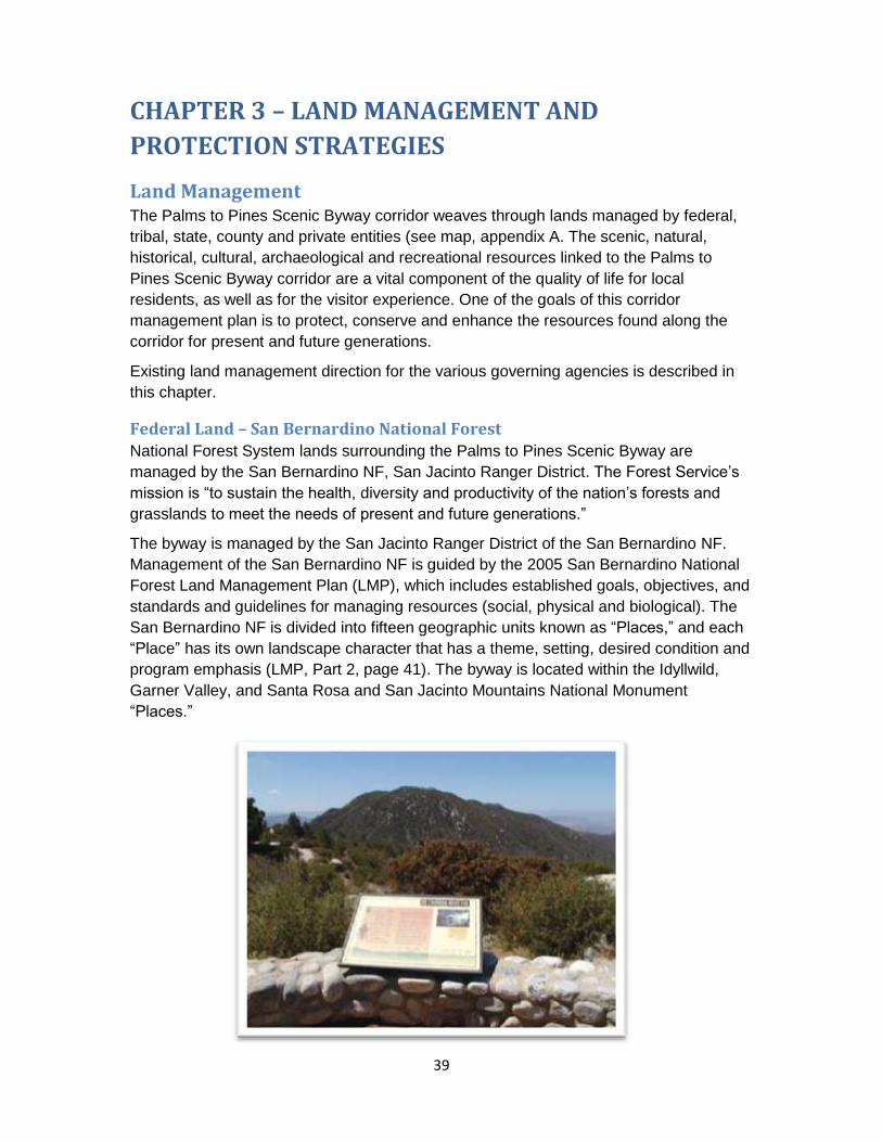
39
CHAPTER 3 – LAND MANAGEMENT AND
PROTECTION STRATEGIES
Land Management The Palms to Pines Scenic Byway corridor weaves through lands managed by federal,
tribal, state, county and private entities (see map, appendix A. The scenic, natural,
historical, cultural, archaeological and recreational resources linked to the Palms to
Pines Scenic Byway corridor are a vital component of the quality of life for local
residents, as well as for the visitor experience. One of the goals of this corridor
management plan is to protect, conserve and enhance the resources found along the
corridor for present and future generations.
Existing land management direction for the various governing agencies is described in
this chapter.
Federal Land – San Bernardino National Forest National Forest System lands surrounding the Palms to Pines Scenic Byway are
managed by the San Bernardino NF, San Jacinto Ranger District. The Forest Service’s
mission is “to sustain the health, diversity and productivity of the nation’s forests and
grasslands to meet the needs of present and future generations.”
The byway is managed by the San Jacinto Ranger District of the San Bernardino NF.
Management of the San Bernardino NF is guided by the 2005 San Bernardino National
Forest Land Management Plan (LMP), which includes established goals, objectives, and
standards and guidelines for managing resources (social, physical and biological). The
San Bernardino NF is divided into fifteen geographic units known as “Places,” and each
“Place” has its own landscape character that has a theme, setting, desired condition and
program emphasis (LMP, Part 2, page 41). The byway is located within the Idyllwild,
Garner Valley, and Santa Rosa and San Jacinto Mountains National Monument
“Places.”

Chapter 3 – Land Management and Protection Strategies
40
The Idyllwild Place is located in the higher elevations of the San Jacinto Mountains and
is characterized by steep canyons and jagged rocks, with elevations ranging from 2,000
to 10,834 feet at the top of San Jacinto Peak. In the Idyllwild Place, California State
Highway 243 (entering the national forest from the north at Banning) runs southeast as
the Palms to Pines scenic byway. The desired condition for the Idyllwild Place is
maintained as a natural appearing landscape that functions as a recreation setting and
wilderness gateway. Among the valued landscape attributes to be preserved over time
are the natural appearing views from the scenic byway. A more detailed description of
the Idyllwild Place can be found in the LMP, Part 2, pages 68-71.
The Garner Valley Place is located within the San Jacinto Mountain Range, and offers
access and views into the San Jacinto Wilderness. California State Highway 74 (Palms
to Pines scenic byway) traverses this area from southeast to northwest. The desired
condition for the Garner Valley Place is that the area is maintained as a historic and
natural appearing landscape that functions as a recreation setting offering scenic vistas
of open pine forests. Among the valued landscape attributes to be preserved over time
are the natural appearing landscape views from the scenic byway. A more detailed
description of the Garner Valley Place can be found in the LMP, Part 2, pages 65-67.
The Santa Rosa and San Jacinto Mountains National Monument Place encompasses
the area designated as a national monument in 2000. It was designated as a national
monument to protect nationally significant biological, cultural, recreational, geological,
educational, and scientific values found in the Santa Rosa and San Jacinto Mountains.
The monument includes both BLM and FS lands and the two agencies are joint
managers. The San Bernardino NF LMP provides land management direction for
National Forest System lands within the national monument. The desired condition for
this place is to maintain the area as a natural appearing and naturally evolving
landscape that functions as a rugged backdrop that provides remote recreation
opportunities and a refuge for unique plant and animal species. A more detailed
description of the Santa Rosa and San Jacinto Mountains National Monument Place can
be found in the LMP, Part 2, pages 89-92. (Additional management direction for the
lands within the National Monument is described in the following section.)
In addition to the geographical units called “Places”, the LMP also designates land use
zones (CFR 219.11(c)) which identify appropriate management activities consistent with
the achievement of desired conditions (LMP, Part 2, page 2). The byway is located
primarily within the Back Country land use zone, which includes areas of the national
forest that are generally undeveloped with few roads. Most of the national forest’s
remote recreation and administrative facilities are found in this zone, and the level of
human use and infrastructure is generally low.
Several sections of the byway adjacent to communities or concentrated use areas occur
in the Developed Area Interface land use zone, and one short section of the byway near
Lake Hemet occurs in the Back Country Motorized Use Restricted land use zone. A
more detailed description of the land use zones can be found in the LMP, Part 2, pages

Chapter 3 – Land Management and Protection Strategies
41
5-12. Tables that outline the suitable management activities for each land use zone can
be found in the LMP, Part 2, pages 2-5.
Federal Land – Santa Rosa and San Jacinto Mountains National Monument
(Bureau of Land Management (BLM) and Forest Service) The management of the National Monument is the responsibility of the BLM (Palm
Springs–South Coast Field Office) and Forest Service (San Jacinto Ranger District). The
National Monument was established through the National Monument Act of 2000 (Public
Law 106-351), and was the first congressionally designated national monument that was
to be jointly managed by the BLM and Forest Service.
As required by the National Monument Act of 2000, the BLM and Forest Service
completed a National Monument
Management Plan (NMP) in 2004.
The NMP provides management
guidance and identifies land use
decisions for the federal lands
within the National Monument
boundary. The NMP tiers to the
San Bernardino NF LMP (2005)
and BLM’s California Desert
Conservation Area (CDCA) Plan
(1980, as amended), which
provide management direction on
National Forest System lands and
BLM lands respectively, within the
monument boundary.
Although there are a multitude of other land ownerships within the established
monument boundary, including Agua Caliente Band of Cahuilla Indians lands, California
Department of Parks and Recreation lands, California Department of Fish and Game
lands, city lands and private lands, the NMP only directs management of federal lands
and federal interests within the monument boundary. However, the NMP established a
comprehensive interagency approach to land and resource management and provides a
mechanism for collaboration between the BLM, Forest Service, other federal and state
agencies, tribal governments, local government agencies, and interested private
landowners and holders of valid existing rights within the monument boundary. An
advisory committee comprised of individuals representing various jurisdictions and
interests makes recommendations that help guide management of the National
Monument.
Coachella Valley Multiple Species Habitat Conservation Plan
The federal lands within the National Monument are also part of a multi-jurisdictional
planning effort, led by the Coachella Valley Association of Governments. The 2007 Final

Chapter 3 – Land Management and Protection Strategies
42
Recirculated Coachella Valley Multiple Species Habitat Conservation Plan (CVMSHCP),
adopted in 2008, provides a regional vision for balanced growth to meet the
requirements of federal and state endangered species laws, while promoting enhanced
opportunities for recreation, tourism and job growth.
The CVMSHCP aims to conserve over 240,000 acres of open space and protect 27
plant and animal species. By providing comprehensive compliance with federal and state
endangered species laws, the plan not only safeguards the desert’s natural heritage for
future generations, it allows for more timely construction of roads and other infrastructure
that is essential to improving quality of life in the Coachella Valley.
State of California
State Park Lands
California State Public Resources Code, Section 5019.53, State Park Classification
governs management of state parks with the following direction:
State Parks consist of relatively spacious areas of outstanding scenic or natural
character, often times also containing significant historical, archaeological,
ecological, geological, or other such values. The purpose of State Parks shall be
to preserve outstanding natural, scenic and cultural values, indigenous aquatic
and terrestrial fauna and flora, and the most significant examples of such
ecological regions of California as the Sierra Nevada, northeast volcanic, great
valley, coastal strip, Klamath-Siskiyou Mountains, southwest mountains and
valleys, redwoods, foothills and low coastal mountains, and desert and desert
mountains.
Each State Park shall be managed as a composite whole in order to restore,
protect and maintain its native environmental complexes to the extent compatible
with the primary purpose for which the Park was established. Improvements
undertaken within State Parks shall be for the purpose of making the areas
available for public enjoyment and education in a manner consistent with the
preservation of natural, scenic, cultural, and ecological values for present and
future generations.
The April 2002 Mount San Jacinto State Park General Plan
(http://www.parks.ca.gov/pages/21299/files/ar_616_284.pdf) provides conceptual
parameters and guidelines for long-term management, development and operation of
Mount San Jacinto State Park, to allow for optimum use and enjoyment of the unit as
well as the protection of its unique visitor experience and pristine resource conditions.
Mount San Jacinto State Park (Park) consists of seven management zones delineated
by natural, geographical, cultural, aesthetic and recreation sensitivities and values. The
Idyllwild Gateway Zone in the western portion of the park is within the byway corridor
and supports a higher level of developed facilities and social activities than the rest of
the park. All management zones adhere to the appropriate goals and guidelines found in

Chapter 3 – Land Management and Protection Strategies
43
the Parkwide Goals and Guidelines Section and the Management Zone Matrix in the
2002 General Plan.
Scenic Highway Program
California's Scenic Highway Program was created by the California State Legislature in
1963. Its purpose is to protect and enhance the natural scenic beauty of California
highways and adjacent corridors, through special conservation treatment. The state laws
governing the Scenic Highway
Program are found in the
Streets and Highways Code,
Sections 260 through 263.
The status of a proposed state
scenic highway changes from
eligible to an official
designation when the local
governing body applies to
Caltrans for scenic highway
approval, adopts a corridor
protection program, and
receives notification that the
highway has been officially
designated a scenic highway.
When a city or county nominates an eligible scenic highway for official designation, it
must identify and define the scenic corridor of the highway. Scenic corridors consist of
land that is visible from the highway right of way, and is comprised primarily of scenic
and natural features. Topography, vegetation, viewing distance and/or jurisdictional lines
determine the corridor boundaries. The city or county must also adopt ordinances,
zoning and/or planning policies to preserve the scenic quality of the corridor or document
such regulations that already exist in various portions of local codes. They should be
written in sufficient detail to avoid broad discretionary interpretation and demonstrate a
concise strategy to effectively maintain the scenic character of the corridor. These
ordinances and/or policies make up the corridor protection program.
Riverside County implemented their plan for the protection and enhance of this scenic
byway corridor in: A Plan and Action Program for the Pines to Palms Scenic Highway,
dated April 1971, with subsequent official State Scenic Highway designations in 1971 for
SR 74 and 1972 for SR 243.
Riverside County The byway is located entirely within Riverside County, which was formed in 1893 from a
small portion of San Bernardino County and a larger part of San Diego County, taking its
name from the city of Riverside. Riverside County, population 2,189,641, is “the fourth
largest county in the state of California, stretching nearly 200 miles across and

Chapter 3 – Land Management and Protection Strategies
44
comprising over 7,200 square miles of fertile river valleys, low deserts, mountains,
foothills and rolling plains. Riverside County shares borders with densely populated
Imperial, Orange, San Diego and San Bernardino Counties…extending from within 14
miles of the Pacific Ocean to the Colorado River (www.countyofriverside.us).”
The county is responsible for land use regulations on private inholdings and private
lands surrounding the San Bernardino NF and BLM lands. Riverside County is guided by
the Riverside County General Plan (2003), which was updated as of 2008 to incorporate
amendments that have been adopted as of December 2008. The General Plan 2003 and
2008 documents can be found on the Riverside County Planning Department website at:
http://www.rctlma.org/genplan/
The Riverside County General Plan (2008) outlines policies, standards and programs to
guide day-to-day decisions concerning Riverside County’s future. The General Plan is
grounded in the Riverside County Integrated Project (RCIP) Vision, sets direction for the
county’s land use and development in strategic locations, as well as the development of
its economic base, the framework of its transportation system, and the preservation of
the extremely valuable natural and culture resources it contains. According to the 2008
General Plan (chapter 2, page V-2), the vision for Riverside County is simply
summarized as “Riverside County is a family of special communities in a remarkable
environmental setting.”
The General Plan covers the unincorporated portion of the county and is augmented by
19 detailed area plans, which provide more focus at the community level. The Palms to
Pines Scenic Byway occurs within the Riverside Extended Mountain Area Plan (REMAP)
and Western Coachella Valley Area Plan. Policies related to scenic corridors and scenic
highways are outlined in the Chapter 3, Land Use Element (pages 31-32), Chapter 4,
Circulation Element (page 46), Chapter 5, Multipurpose Open Space Element (pages
45-46), and the Area Plans (Volume 2). In general, the policies seek to protect and
conserve scenic resources along the scenic highways and to manage development so
as not to detract from the area’s natural character and scenic quality.
Scenic Resource Strategies
San Bernardino National Forest The San Bernardino NF manages National Forest System land and scenic resources
within the byway corridor. “The rugged wildland landscapes are increasingly valued for
the visual contrast they provide in a rapidly urbanizing region, and the contrast between
the urban and natural settings is the unique characteristic that distinguishes the southern
California area from other regions of the country. Driving for pleasure and viewing
scenery have become some of the more popular national forest activities, and visitors
expect a certain level of 'naturalness' in the recreation and tourism settings they pursue”
(LMP, FEIS, Volume 1, pages 10, 268).

Chapter 3 – Land Management and Protection Strategies
45
The LMP provides guidance for protecting the visual qualities of National Forest System
lands within the San Bernardino NF utilizing the scenery management system (SMS),
which is a tool for integrating the benefits, values, desires and preferences regarding
aesthetics and scenery for all levels of land and resource management planning.
Scenic integrity objectives, established through the SMS, have been designated for all
areas of the national forest. Scenic integrity objectives represent the minimum levels
of scenic integrity to which landscapes are to be managed. At the project level, all
national forest activities are subject to review of the scenic integrity objectives.
Six scenic integrity objectives have been established, derived from the landscape's
attractiveness and the public's expectations or concerns. Each scenic integrity objective
depicts a level of scenic integrity used to direct landscape management: very high
(unaltered), high (appears unaltered), moderate (slightly altered), low (moderately
altered), and very low (heavily altered). The scenic integrity objective along the scenic
byway is rated as “high” (LMP, Part 2, Appendix C, Scenic Integrity Objectives Map,
SBNF South).
The LMP also identified "Key Places" in the planning area that represent the most
picturesque national forest locations. These places possess their own distinct landscape
character and are particularly valued for their scenic quality. They generally serve as
urban backdrops or recreation-destination settings, or they contain scenic features along
scenic routes and byways. The Idyllwild, Garner Valley, and Santa Rosa and San
Jacinto Mountains National Monument areas were identified as “Key Places” (LMP,
FEIS, Volume 1, pages 269-270), each of which encompasses the scenic byway. There
are no specific standards for “Key Places,” but the identification of “Key Places”
essentially prioritizes these areas for landscape restoration and emphasizes the
maintenance of landscape character as part of the LMP strategy.
Part 2 of the LMP (San Bernardino NF Strategy) provides the forest-wide program
strategy and tactics (appendix B, pages 119-157) by resource area. Part 3 of the LMP
(Design Criteria for the Southern California National Forests, pages 3-16) contains
standards by primary resource area, which constitute the ‘rules’ that the Forest Service
will follow as the national forest implements projects and activities. The following are
program strategies that the forest may choose to make progress toward achieving the
desired conditions and goals related to protecting scenic values (LMP, part 2, appendix
B, page 144).
LM 1 - Landscape Aesthetics
Manage landscapes and built elements to achieve scenic integrity objectives:
Use best environmental design practices to harmonize changes in the landscape and advance environmentally sustainable design solutions.
LM 2 - Landscape Restoration
Restore landscapes to reduce visual effects of nonconforming features:

Chapter 3 – Land Management and Protection Strategies
46
Prioritize landscape restoration activities in key places (Arrowhead, Big Bear, Big Bear Back Country, Front Country, Garner Valley, Idyllwild, Lytle Creek, San Bernardino Front Country, San Gorgonio, and Santa Rosa and San Jacinto Mountains National Monument). Integrate restoration activities with other resource restoration.
Restoration of landscape should consider not only the existing condition but the sustainable natural appearing landscape that is the desired condition of the mature forest.
LM 3 - Landscape Character
Maintain the character of "Key Places" (see LM2) to preserve their intact nature
and valued attributes:
Maintain the integrity of the expansive, unencumbered landscapes and traditional cultural features that provide the distinctive character of the place.
Promote the planning and improvement of infrastructure along scenic travel routes.
The following are the Forest-wide Aesthetics Management Standards (LMP, Part 3,
page 6).
S9: Design management activities to meet the Scenic Integrity Objectives (SIOs)
shown on the Scenic Integrity Objectives Map.
S10: Scenic Integrity Objectives will be met with the following exceptions:
Minor adjustments not to exceed a drop of one SIO level is allowable with the Forest Supervisor's approval.
Temporary drops of more than one SIO level may be made during and immediately following project implementation providing they do not exceed three years in duration.
Santa Rosa and San Jacinto Mountains National Monument The BLM (Palm Springs–South Coast Field Office) and San Bernardino NF (San Jacinto
Ranger District) manage the scenic resources on the BLM lands and National Forest
System lands, respectively in the National Monument within the byway corridor. The
BLM CDCA Plan and the San Bernardino NF LMP provide guidance for protecting the
visual qualities of federal lands within the National Monument. Visual resource
management (VRM) class objectives established through the BLM’s CDCA Plan and the
Forest Service’s SMS are considered when management actions are proposed. (The
Forest Service’s scenic resource management on national forest lands is described in
the previous section above.)
The Coachella Valley portion of the CDCA was most recently amended in December
2002 (CDCA Plan Amendment). All CDCA land use allocations pertaining to lands within
the National Monument were brought forward into the NMP. Through the CDCA Plan
Amendment, non-Wilderness BLM lands within the National Monument were designated

Chapter 3 – Land Management and Protection Strategies
47
as VRM Class 2. BLM Wilderness lands within the National Monument were designated
as VRM Class 1. The VRM class objectives for Class 1 and 2 are defined as follows:
Class 1: Natural ecological changes and very limited management activity are allowed.
Any contrast created within the characteristic landscape must not attract attention. This
classification is applied to Wilderness areas, Wild and Scenic Rivers, and other similar
situations.
Class 2: Changes in any of the basic elements caused by management activity should
not be evident in the characteristic landscape. Contrasts are visible, but must not attract
attention.
The San Bernardino NF LMP (2005) identified the scenic quality objective within the
non-wilderness portions of the National Monument as “high” (appears unaltered), which
includes the scenic byway corridor. The LMP also identified the National Monument as a
“Key Place”. As described in the previous section, "Key Places" in the planning area
represent the most picturesque national forest locations. These places possess their
own distinct landscape character and are particularly valued for their scenic quality.
Mount San Jacinto State Park (Park) The 2002 Mount San Jacinto State Park General Plan contains development guidelines
for careful planning and siting of future visitor use and Park operations facilities including
roads, trails, campsites and buildings to ensure the protection of the natural and cultural
resources and to provide an integrated and aesthetically pleasing park setting.
The following guidelines pertain to all development within the Park regarding aesthetics:
Development shall blend with and complement the natural surroundings.
Development shall not dominate the site but rather remain in harmony with the native landscape.
Textures of the development, whether of material or of the over-all physical profile, shall be reflective of the surrounding environment.
Design aesthetics shall be equally weighed with the facilities function, without compromising the basic human needs for comfort and safety.
Retain existing viewsheds by strategically locating, minimizing or consolidating future developments.
Development shall not disturb or displace ridgelines or natural drainage systems.
Night lighting shall not obscure or intrude upon the nighttime sky. Park activity such as stargazing shall be fully considered in developing lighting concepts. If required for visitor safety, energy efficient light fixtures set low to the ground plane, to reduce glare and light pollution, will be used.
Offensive odors and other issues related to the sense of smell will be fully considered in the design process.

Chapter 3 – Land Management and Protection Strategies
48
Both existing and future utilities such as telephone and electric lines will be installed underground wherever possible or out of viewshed corridors.
Riverside County Riverside County’s vision builds heavily on the value of its “remarkable environmental
setting.” Riverside County contains abundant natural visual resources, including low-
lying valleys, mountain ranges, rock formations, rivers and lakes, and these scenic
resources play a significant role in defining that “remarkable environmental setting”.
Scenic resources are an important quality of life component for residents of the county,
and policies are found throughout the General Plan that are designed to conserve and
protect these significant scenic resources. The General Plan specifically outlines policies
that seek to protect and maintain resources along scenic highways under the scenic
corridors section found in chapter 3 (Land Use Element), chapter 4 (Circulation
Element), chapter 5 (Multipurpose Open Space Element), and the specific area plans.
The specific policies related to scenic corridors and scenic highways are outlined below.
Land Use Element (chapter 3, pages 31-32)
Scenic Corridors
LU 13.1 Preserve and protect outstanding scenic vistas and visual features for the enjoyment of the traveling public. (AI 32, 79)
LU 13.2 Incorporate riding, hiking, and bicycle trails and other compatible public recreational facilities within scenic corridors. (AI 33, 41)
LU 13.3 Ensure that the design and appearance of new landscaping, structures, equipment, signs, or grading within Designated and Eligible State and County scenic highway corridors are compatible with the surrounding scenic setting or environment. (AI 3, 32, 39)
LU 13.4 Maintain at least a 50-foot setback from the edge of the right-of-way for new development adjacent to Designated and Eligible State and County Scenic Highways. (AI 3)
LU 13.5 Require new or relocated electric or communication distribution lines, which would be visible from Designated and Eligible State and County Scenic Highways, to be placed underground. (AI 3, 32)
LU 13.6 Prohibit offsite outdoor advertising displays that are visible from Designated and Eligible State and County Scenic Highways. (AI 6)
LU 13.7 Require that the size, height and type of on-premise signs visible from Designated and Eligible State and County Scenic Highways be the minimum necessary for identification. The design, materials, color, and location of the signs shall blend with the environment, utilizing natural materials where possible. (AI 3)
LU 13.8 Avoid the blocking of public views by solid walls. (AI 3)

Chapter 3 – Land Management and Protection Strategies
49
Circulation Element (chapter 4, page 46)
Scenic Corridors
C 19.1 Preserve scenic routes that have exceptional or unique visual features in accordance with Caltrans Scenic Highways Plan. (AI 79)
C 19.2 Wind turbine generators have proven to be a unique tourist attraction.
Multipurpose Open Space Element (chapter 5, pages 45-46)
Scenic Resources
OS 21.1 Identify and conserve the skylines, view corridors, and outstanding scenic vistas within Riverside County. (AI 79)
Scenic Corridors
OS 22.1 Design developments within designated scenic highway corridors to balance the objectives of maintaining scenic resources with accommodating compatible land uses. (AI 3)
OS 22.2 Study potential scenic highway corridors for possible inclusion in the Caltrans Scenic Highways Plan.
OS 22.3 Encourage joint efforts among federal, state, and County agencies, and citizen groups to ensure compatible development within scenic corridors.
OS 22.4 Impose conditions on development within scenic highway corridors requiring dedication of scenic easements consistent with the Scenic Highways Plan, when it is necessary to preserve unique or special visual features. (AI 3)
OS 22.5 Utilize contour grading and slope rounding to gradually transition graded road slopes into a natural configuration consistent with the topography of the areas within scenic highway corridors. (AI 3)
Riverside Extended Mountain Area Plan (REMAP, Pages 35-36)
Scenic Highways
REMAP 11.1 Protect the scenic highways in REMAP from change that would diminish the aesthetic value of adjacent properties in accordance with the Scenic Corridors section of the General Plan Land Use, Multipurpose Open Space, and Circulation Elements.
REMAP 11.3 Enforce at least a 150 foot setback from the centerline of the scenic highway for new development, where such a setback requirement would not prohibit the use of a parcel.
Western Coachella Valley Area Plan (Pages 44-47, 52)
Signage
WCVAP 15.4a For premises adjacent to the right-of-way of scenic corridors, single support freestanding signs for on-site advertising shall be

Chapter 3 – Land Management and Protection Strategies
50
prohibited. A sign affixed to buildings, a free-standing monument sign, or a free-standing sheathed support sign which has minimal impact on the scenic setting shall be utilized for on-site advertising purposes along the referenced scenic corridors, [which includes State Route 74].
d. On-site advertising signs for businesses located along highway scenic
corridors shall comply with the following:
(1) Notwithstanding the other provisions of this policy, a single-
business monument sign may be approved with a maximum
height of 10 feet, and a maximum 150 square feet of sign surface
area. A multiple business monument sign may be approved with a
maximum height of 12 feet or less, and a maximum 200 square
feet of sign surface area.
(2) Notwithstanding the other provisions of this policy, a single-
business sheathed-support sign or a multiple business sheathed-
support sign shall not be erected along a highway scenic corridor.
(3) A sign affixed to a building, advertising the business contained
therein, shall not exceed 10 percent of the surface area of the
building wall facing the highway. A single sign, or a total of all
signs, affixed to a building and advertising multiple businesses
contained therein shall not exceed 10 percent of the surface area
of the building wall facing the highway.
Scenic Highways
WCVAP 19.1a Protect the scenic highways in the Western Coachella Valley from change that would diminish the aesthetic value of adjacent properties in accordance with policies in the Scenic Corridors sections of the Land Use, Multipurpose Open Space, and Circulation Elements.
Natural Resource Strategies
San Bernardino National Forest The San Bernardino NF LMP provides management direction for wildlife, fish, plants,
vegetation management, soil, water, riparian, and air resources. Part 2 of the LMP (San
Bernardino NF Strategy) provides the “Place” specific standards (pages 99-101) and the
forest-wide program strategy and tactics (appendix B, pages 119-157) by resource area.
Part 3 of the LMP (Design Criteria for the Southern California National Forests, pages 3-
16) contains standards by primary resource area, which constitute the ‘rules’ that the
Forest Service will follow as the national forest implements projects and activities. The
following highlights are brief excerpts of the LMP that may pertain to management
activities within the Palms to Pines Scenic Byway corridor. Please reference the LMP for
full management direction.

Chapter 3 – Land Management and Protection Strategies
51
Wildlife, Fish, and Plants
The following are program strategies that the forest may choose to make progress
toward achieving the desired conditions and goals related to managing wildlife, fish, and
plants (LMP, part 2, appendix B, pages 123-129, 137).
IS 1 - Invasive Species Prevention and Control
Prevent the introduction of new invaders, conduct early treatment of new
infestations, and contain and control established infestations through the
implementation of the Noxious Weed Management Strategy (see LMP, part 3,
appendix M) and other guidelines.
WL 1 - Threatened, Endangered, Proposed, Candidate, and Sensitive Species
Management
Manage habitat to move listed species toward recovery and de-listing. Prevent
listing of proposed and sensitive species through implementation of priority
conservation strategies (San Bernardino NF Conservation Strategy, Table 531,
LMP, Part 2, pages126-128) and other guidelines.
WL 2 - Management of Species of Concern (SBNF LMP, Part 2, page 129)
Maintain and improve habitat for fish, wildlife, and plants, including those with the
following designations: game species, harvest species, management indicator
species, and watch list species.
Link 1 - Landscape Linkages (SBNF LMP, Part 2, page 137)
Identify linkages to surrounding habitat reserves and other natural areas for
maintenance of biodiversity. Collaborate with local government, developers, and
other entities to complement adjacent federal and non-federal land use zones
and associated design criteria:
The following are place specific standards (SBNF LMP, Part 2, page 99) related to
wildlife, fish and plants that apply to the Garner Valley, Idyllwild, and Santa Rosa and
San Jacinto National Monument “Places.”
SBNF S4 - Where available, in suitable southern rubber boa habitat retain a
minimum of nine down logs per acre (minimum 12 inches diameter and 180 total
linear feet) except in Wildland/Urban Interface Defense Zones and fuelbreaks.
Give preference to large diameter logs (Arrowhead, Big Bear, Big Bear Back
Country, Front Country, Garner Valley, Idyllwild, Silverwood, San Gorgonio, and
Santa Rosa and San Jacinto National Monument Places).
SBNF S5 - Evaluate potential long-term impacts of new projects and activities on
important landscape level habitats that are identified in the places. These include
landscape linkages, wildlife movement corridors, key deer and bighorn sheep
fawning and lambing areas, and winter ranges, and raptor nesting sites. Minimize
or mitigate impacts to maintain their functionality over the long-term (all Places).

Chapter 3 – Land Management and Protection Strategies
52
SBNF S6 - Provide
compatible
management on
those portions of
National Forest
System land
designated as being
part of Multiple
Species Habitat
Conservation Plans
(MSHCP) under the
National
Memorandum of
Understanding with
the U.S. Fish and
Wildlife Service
(Coachella Valley Plan: San Bernardino Front Country, San Gorgonio, and Santa
Rosa and San Jacinto Mountains National Monument Places; Mojave Plan: Big
Bear, Cajon, Desert Rim, Mojave Front Country, and Silverwood Places; and
Western Riverside County Plan: Anza, Idyllwild, and San Bernardino Front
Country Places).
Soil, Water, and Riparian Areas
The following are program strategies that the forest may choose to make progress
toward achieving the desired conditions and goals related to protecting soil, water and
riparian areas (LMP, part 2, appendix B, pages 134 to 135).
WAT 1 - Watershed Function
Protect, maintain and restore natural watershed functions including slope
processes, surface water and groundwater flow and retention, and riparian area
sustainability.
WAT 2 - Water Management
Manage groundwater and surface water to maintain or improve water quantity
and quality in ways that minimize adverse effects over the long-term.
The following are the forest-wide soil, water, and riparian standards (LMP, Part 3, page
10 to12) applicable within riparian conservation areas:
S47: When designing new projects in riparian areas, apply the Five-Step Project
Screening Process for Riparian Conservation Areas as described in Appendix E -
Five-Step Project Screening Process for Riparian Conservation Areas.
S48: For non-hydroelectric and exempt hydroelectric surface water development
proposals (such as flood control reservoirs and municipal water supplies),

Chapter 3 – Land Management and Protection Strategies
53
instream flows favorable to the maintenance and restoration of riparian
dependent and aquatic resources and channel conditions will be required.
S49: Require fish passage instream flows associated with dams and
impoundments where fish passage will enhance or restore native or selected
nonnative fish distribution and not cause adverse effects to other native species.
Forest-wide standards applicable when implementing recreation activities:
S50: Mitigate negative long-term impacts from recreation use to soil, watershed,
riparian or heritage resources (refer to Appendix D - Adaptive Mitigation for
Recreation Uses).
Vegetation Management – Timber and Fuels
The following are program strategies that the forest may choose to make progress
toward achieving the desired conditions and goals related to vegetation management
(LMP, part 2, appendix B, pages 130-132, 157).
FH 1 - Vegetation Restoration
Restore vegetation through reforestation and revegetation or other appropriate
methods after stand replacing fires, drought, or other events or activities that
degrade or cause a loss of plant communities. Post reforestation activities may
require treatment of competing vegetation to ensure the ability of the planted
trees to out-compete vegetation for moisture, nutrients and sunlight. Treatment
may require use of pesticides including herbicides.
FH 2 - Prevention of Fire Induced Type Conversion
Minimize vegetation type conversion (permanent or long-term loss of plant
communities) resulting from increased human caused fires.
FH 3 - Restoration of Forest Health
Protect natural resource values at risk from wildland fire loss that are outside the
desired range of variability, or where needed for wildlife habitat improvement.
FH 4 - Insect and Disease Management
Protect natural resource values at risk due to insect or disease loss at levels
outside of the historic range of variability or where needed to improve habitat.
Fire 5 - Fuelbreaks and Indirect Community Protection
Maintain the existing system of roadside fuelbreaks and fuelbreaks along
watershed boundaries to minimize fire size and the number of communities
threatened by both fires and floods. Consider constructing new fuelbreaks on
land outside of wilderness or other special designations.
The following are the forest-wide vegetation management standards (LMP, part 3, pages
3-5).

Chapter 3 – Land Management and Protection Strategies
54
S3: Maximum Size Openings Created by Timber Harvest (36 CFR 219.27 (d)
(2)). Table 3.1: Appropriate Silviculture Systems and Vegetation Treatments
by General Forest Type (Part 3, page 3) identifies the maximum allowable
opening acreage for forest types. This limit shall not apply where harvests are
necessary as a result of catastrophic conditions, such as fire, insect and
disease attack, windstorm, or drought.
S4: Design fuelbreaks in forests to be open; averaging no more than 40
percent crown closure along the center corridor with an understory of
grasses, forbs, and small shrubs. Thinning of forests should favor retention of
large-diameter trees. Crown closure and understory vegetation increase
gradually, moving from the inside toward the outside of the shaded fuelbreak.
S6: Seed to be used on National Forest System lands will be certified to be free
of noxious weeds. Where available, only locally collected native seed will be
used, or seeds will be used from species that are noninvasive and nonpersistent.
When available, wattles, mulch and livestock feed to be used on National Forest
System lands will be certified free of noxious weeds.
S7: There are extensive areas within and adjacent to the national forests of
southern California meeting the definition of Wildland/Urban Interface (WUI) as
described in the Healthy Forests Restoration Act of 2003. WUI (as defined by the
Act) is a variable width up to 1.5 miles from communities at risk or as defined in
individual community fire protection plans. This forest plan further identifies a
direct protection buffer (WUI Defense Zone) and an indirect protection buffer
(WUI Threat Zone) that fall within the broader definition WUI. A WUI Defense
Zone is the area directly adjoining structures and evacuation routes that is
converted to a less-flammable state to increase defensible space and firefighter
safety. The WUI Threat Zone is an additional strip of vegetation modified to
reduce flame heights and radiant heat. The Threat Zone generally extends
approximately 1.25 miles out from the Defense Zone boundary. Yet, actual
extents of Threat Zones are based on fire history, local fuel conditions, weather,
topography, existing and proposed fuel treatments, and natural barriers to fire
and community protection plans, and therefore could extend well beyond the
1.25 mile. The two zones together are designed to make most structures more
defendable.
S8: Community protection needs within the WUI Defense Zone take
precedence over the requirements of other forest plan direction, including
other standards identified in Part 3 of the forest plan. If expansion beyond the
300-foot minimum width of the defense zone is needed due to site-specific
conditions, projects will be designed to mitigate effects to other resources to
the extent possible.

Chapter 3 – Land Management and Protection Strategies
55
Air
The following are program strategies that the forest may choose to make progress
toward achieving the desired conditions and goals related to protecting air resources
(LMP, part 2, appendix B, pages 133).
Air 1 - Minimize Smoke and Dust
Control and reduce smoke and fugitive dust to protect human health, improve
safety and/or reduce or eliminate environmental impacts.
Incorporate visibility requirements into project plans.
Use emission reduction techniques (ERT).
Air 2 - Forest Air Emissions
Maintain and update the inventory for wildland fire emissions and other national
forest resource management emissions within the current State Implementation
Plan (SIP). The SIP inventories establish levels of air pollution that meet the
long-term federal air quality goals for bringing the nonattainment areas to
attainment of the national ambient air quality standards.
Santa Rosa and San Jacinto Mountains National Monument The NMP, the BLMs CDCA Plan Amendment, and the San Bernardino NF LMP provide
direction for the management of biological resources (wildlife and plants), water
resources (surface and ground water), and geologic resources on the National
Monument. San Bernardino LMP direction that applies to the management of national
forest lands within the National Monument is outlined in the previous section. The
applicable direction from the Monument Plan and BLMs CDCA Plan Amendment is
provided below.
Biological Resources (Wildlife and Plants)
Management of Habitat (NMP, chapter 2, page 5; appendix E)
The Habitat Conservation Objectives described in the CDCA Plan Amendment for the Coachella Valley (Monument Plan, appendix E) provide criteria and guidance for the management of vegetative community types to ensure quality habitat for migratory songbirds, amphibians, and other wildlife species in the National Monument. For each of the eight vegetation community types (sand dunes and sand fields, desert scrub communities, chaparral communities, desert alkali shrub communities, marsh communities, dry wash woodland and mesquite communities, riparian communities, and woodland and forest communities), the habitat conservation objectives would be used to assess compatible uses and to develop appropriate mitigation measures within conservation areas on BLM-managed lands. Future activities would be required to conform to the objective established for a particular community type within the conservation areas.
No additional actions specific to addressing habitat-based management for wildlife are
found in the Monument Plan.

Chapter 3 – Land Management and Protection Strategies
56
Management of Peninsular Ranges Bighorn Sheep (NMP, chapter 2, page 5;
appendix E and F)
The Peninsular Ranges bighorn sheep recovery strategy established through the CDCA
Plan Amendment for the Coachella Valley (NMP, appendix E and F) outlines the
measures that BLM will follow to protect and promote the recovery of Peninsular Ranges
bighorn sheep within the National Monument. Those decisions that are applicable to the
National Monument are found in appendix C of the NMP. Guidelines that may pertain to
management in the Palms to Pines Scenic Byway corridor are outlined below. Additional
information is described under the recreational resources section of this corridor
management plan.
Acquire, or exchange to acquire, bighorn sheep habitat from willing landowners.
Manage road use on BLM-managed lands, consistent with the CDCA Plan (1980) as amended, to minimize habitat fragmentation or interference with bighorn sheep resource use patterns.
Develop and implement education and public awareness programs.
Coordinate all management and monitoring efforts with the U.S. Fish and Wildlife Service, California Department of Fish and Game, Coachella Valley Association of Governments, and local jurisdictions to ensure a landscape level approach to recovery of bighorn sheep populations.
Maintain existing water sources through tamarisk eradication and provide additional artificial water sources on public lands. Locations for artificial water sources would be carefully selected to reduce interactions between bighorn and the urban interface.
Reduce impacts to bighorn sheep (especially during the water stress and lambing season) using a combination of methods, including voluntary avoidance programs, closures, seasonal restrictions, and permit stipulations and mitigations. Projects emphasizing the least disturbing techniques available and practicable would be encouraged. Some level of disturbance to bighorn sheep may be permitted during water stress and lambing season to obtain information, resulting in more effective management of bighorn sheep and their habitat.
Construct fences across public lands to exclude bighorn sheep from urban areas where there is a demonstrated problem. Projects would be coordinated with local jurisdictions, U.S. Fish and Wildlife Service, and the California Department of Fish and Game to ensure that water is available before sheep are excluded from urban areas known to provide water.
Management of Noxious, Non-native, and Invasive Plant and Animal Species (NMP
ROD, page 4; NMP, chapter 2, page 6).
The BLM and Forest Service will seek partnership opportunities to manage and control
the spread of weeds, non-native and invasive plant and animal species, to manage and

Chapter 3 – Land Management and Protection Strategies
57
promote existing native plant resources, and to foster the reintroduction of species that
compose the site’s natural plant communities. While there are currently no species listed
as noxious by Animal and Plant Health Inspection Service (APHIS) within the National
Monument, the BLM and Forest Service would apply the actions listed below to control
plant and animal species listed as “noxious” in the future.
Inventory public lands to determine distribution of indigenous plant species and non-native species in the National Monument to assess protection and eradication needs, respectively.
Develop and implement an action plan for eradicating noxious, non-native, and invasive plant and animal species as well as an action plan for reintroducing indigenous species. Manage existing native vegetation, in coordination with tribes, federal, state and local agencies, experts and local interest groups such as the Southern California Indian Basketweavers Organization (SCIBO) or NEX’WETEM, California Native Plant Society (CNPS), and the Andreas Canyon Club.
Educate the public regarding non-native, invasive species in the National Monument, such as tamarisk and fountain grass, and their impacts to the environment.
Prepare and distribute an annual report describing noxious, non-native, and invasive plant and animal treatments and accomplishments.
Management of Special Status Species (NMP, ROD, page 4; NMP, chapter 2, page
7).
Special Status Species are plant and animal species, officially listed, proposed for listing,
or candidates for listing as threatened or endangered by the Secretary of the Interior
under the provisions of the ESA; those listed or proposed for listing by the State of
California under CESA, Native Plant Protection Act – CA “rare” plants, and those
designated by the BLM State Director and Regional Forester as sensitive. Special Status
Species will be managed in accordance with the ESA, BLM standards/policy (BLM
Manual 6840) and Forest Service standards/policy and guidelines (FSH 2670). Special
Status Species will be managed to facilitate recovery of listed species and prevent future
listings of plants and animals. The following Special Status Species strategy is outlined
in the NMP (ROD, page 4).
Work with partner agencies, tribes and volunteer groups to update existing inventories of plant and animal species occurrence and distribution to establish updated models for habitat and baseline conditions for monitoring.
Coordinate Special Status Species management with CDFG, USFWS, researchers and local jurisdictions to promote consistency, effectiveness and efficiency of recovery actions and monitoring activities.
Encourage research projects designed to enhance management activities that facilitate recovery of sensitive species, including federal and state listed species.

Chapter 3 – Land Management and Protection Strategies
58
Develop partnerships with entities such as CNPS for education and outreach.
Water Resources (Surface and Ground Water)
Best management practices (BMP) are required by the Federal Clean Water Act (as
amended by the Water Quality Act of 1987) to reduce non-point source pollution to the
maximum extent practicable. BMPs are considered the primary mechanisms to achieve
California water quality standards. All management activities and practices within the
National Monument will be consistent with the BMPs. In addition to following the BMPs
for achieving water quality standards, the BLM and Forest Service will increase levels of
interagency coordination as well as coordination with adjoining land managers. The
following water resources management strategy is outlined in the Monument Plan (ROD,
page 12; chapter 2, page 34). The BLM and Forest Service will coordinate with USGS,
tribes, Riverside County, local water districts, private water companies, and other private
water users to enhance current efforts to manage surface and ground water.
Geological Resources
The Santa Rosa and San Jacinto Mountains are among the most impressive of southern
California because of their great height and proximity to the Salton Trough. These
mountains are eroded from a greatly elevated mass of igneous and metamorphic rocks
formed deep in the earth’s crust, but adjacent to the deeply subsided and sediment-filled
Salton Trough (NMP, chapter 2, page 23). Geologic features are to be protected under
national monument legislation. The following geological resources strategy for the
National Monument is outlined in the NMP ROD for outreach and interpretation (pages
8-9), and protection and preservation (page 9).
Outreach and Interpretation
Develop interpretation such as guided walks using geologic features in the National Monument and include both general geologic processes, (e.g. erosion, mountain building, and earthquake faulting) and specific geologic features (e.g. Martinez Mountain Landslide, ancient Lake Cahuilla features, and the San Jacinto Fault Zones).
Work with volunteers to prepare geologic road guides for the Highway 74 and 111 corridors, focusing on the geology and geologic history of the Santa Rosa and San Jacinto Mountains, with emphasis on geologic features visible at specific, safe road turnouts. These road guides would be similar to other published road guides such as the Geologic Road Guide to Northern California.
Establish geologic points of interest within and adjacent to the National Monument by using interpretive signs or plaques describing the geologic feature or process visible at that point. Coordinate with the Caltrans for placement of signs off highways and rest stops. For example, an interpretive sign could be placed at the I-10 rest area at Whitewater, describing the significant elevation difference between the prominent uplifted slopes of Mt. San Jacinto and the downdropped Coachella

Chapter 3 – Land Management and Protection Strategies
59
Valley/Salton Trough. Information could also be provided concerning the tectonic origin of the mountain range and the basin and the San Andreas Fault Zone in the region.
Prepare a pamphlet and/or guide describing the mining history and mineral resources of the National Monument, which emphasizes that mineral development is no longer allowed on public lands within the National Monument; includes rules and regulations concerning the collection of rocks and minerals within the National Monument; and addresses safety issues concerning abandoned mined lands in the National Monument.
Develop partnerships and research agreements with USGS, academic departments, and other applicable entities to encourage geologic research in the National Monument; provide opportunities for student internships to prepare interpretive signs and pamphlets; and establish representative rock mineral collections and perform research on the unique geologic features within the National Monument such as the Martinez Mountain Landslide, the Santa Rosa Shear Zone, and ancient Lake Cahuilla features.
Protection and Preservation
Restrict the collecting of rocks and minerals within the “tufa” and “coral reef formations” located along the ‘watermark’ of the ancient Lake Cahuilla. These areas should be monitored periodically so as to confirm that the tufa and reef formations are not being disturbed or removed.
Mount San Jacinto State Park (Park)
All development in the Park is subject to the following guidelines regarding protection of
natural and cultural resources:
Development shall only occur in areas that will not adversely impact significant natural and/or cultural resources. Sacred and historical sites will be respected and protected.
Disturbance of native vegetation shall be minimized by integrating the development with the native landscape and topography. When appropriate, weave structures through forest areas rather than clear cutting or grubbing.
Sufficient setbacks or natural buffers shall be established to protect sensitive species, resources, and biocorridors.
Sustainable design and maintenance practices shall be prescribed that promote energy conservation, waste reduction, recycling, and other resource conservation practices. No development shall occur until such issues are addressed.
Technologies that improve upon the current waste management practices within the Park shall be utilized. Current sewage leach fields and pit toilets shall be evaluated for their impacts to the Park's scenic value and water resources.

Chapter 3 – Land Management and Protection Strategies
60
Natural resource management guidelines specific to the Idyllwild Gateway Zone of the Park include:
Maintain and protect the natural character including sensitive watersheds, wetlands and creeks.
Avoid, minimize or mitigate impacts on natural and cultural resources.
Riverside County Riverside County is known for its extraordinary environmental setting, which provides
recreational, ecological and scenic value. The county’s environmental setting is a critical
component of its vision for the future and its quality of life. The Riverside County
Integrated Project (RCIP) Vision states:
“We value the unusually rich and diverse natural environment with which we are
blessed and are committed to maintaining sufficient areas of natural open space
to afford the human experience of natural environments as well as sustaining the
permanent viability of the unique landforms and ecosystems that define this
environment.”
The county’s biological health and diversity is dependent upon the preservation of
natural open spaces. Policies to preserve and enhance open spaces are found under
the Land Use Element (chapter 3), and include restrictions on development of open
space, focusing urban growth, providing recreational and open space opportunities
within the built environment, and achieving a balance between urban uses and open
space/habitat. The Multipurpose Open Space Element (chapter 5) specifically addresses
open space issues within the context of policies that address the risk of poorly planned
growth and development, which would threaten to eliminate or degrade this essential
feature of the County. These policies were developed based on the RCIP Vision. The
Conservation and Open Space Resource System Vision Statement (chapter 2, pages
18-19) includes:
Conserved multi-purpose open space is viewed as a critical part of the County’s system of public facilities and services required to improve the existing quality of life and accommodate new development.
The open space system and the methods for its acquisition, maintenance and operation are calibrated to its many functions: visual relief, natural resource protection, habitat preservation, passive and active recreation, protection from natural hazards and various combinations of these purposes. This is what is meant by a multi-purpose open space system.
A major thrust of the multipurpose open space system is the preservation of components of the ecosystem and landscape that embody the historic character and habitat of the County, even though some areas have been impacted by man-made changes.
Native habitat for plants and animals endemic to this area that make up such important parts of our natural heritage now have interconnected

Chapter 3 – Land Management and Protection Strategies
61
spaces in a number of locations that allow these natural communities to prosper and be sustained.
An incentive-based market system for habitat protection is in operation that includes options to use transfers of development rights (TDRs), conservation credits, and management programs to achieve equitable sharing of costs and benefits.
The cost to the public of maintaining open space and critical habitat areas continue to be supported because of the habitat value, recreational contributions and economic benefits the areas provide.
Strategies and incentives for voluntary conservation on private land are an integral part of the County’s policy/regulatory system and are referred to nationwide as model approaches.
Where natural streams and watercourses are located within designated multipurpose open space systems, they have been preserved as natural living systems. Where they pass through areas that are developed or designated for development (including agriculture), to the extent allowed by existing conditions, their continuity is maintained and protected as environmental corridors linking open space areas. Their viability is enhanced in numerous cases by being included in publicly maintained open spaces rather than in narrow concrete channels.
Important watershed resources to support downstream habitat are being maintained. This includes watershed functions such as peak flows, water quality, recharge, and sediment transport, which are necessary for sustaining downstream resources.
Both the REMAP and Western Coachella Valley Area Plans are characterized by a vast
network of natural open space with tremendous natural resource values. The area plans
contain policies that seek to preserve the unique natural setting while minimizing the
impacts of encroaching urban uses. Policies specific to multipurpose open space are
found in the REMAP on pages 43-47. For the Western Coachella Valley Area, policies
specific to multipurpose open space are found in the area plan on pages 59-60.
Historical, Cultural, Archaeological Resource Strategies
San Bernardino National Forest Heritage resources (defined as cultural, historical, archaeological, ethnographic, and
tribal) represent past human activities or uses and, by their nature, are considered an
irreplaceable and nonrenewable resource if not managed for preservation over the long-
term (FEIS, volume 1, page 238). The San Bernardino NF LMP provides management
direction for heritage resources.
The following are program strategies that the forest may choose to make progress
toward achieving the desired conditions and goals related to heritage resource
management (LMP, Part 2, appendix B, pages 120, 140-141) which may relate to
management within the scenic byway corridor.

Chapter 3 – Land Management and Protection Strategies
62
Tribal 1 - Traditional and Contemporary Uses
Continue traditional uses and access to traditionally used areas (as well as
contemporary uses and needs) by tribal and other Native American interests.
Tribal 2 - Government to Government Relations
Establish effective relationships with federally and non-federally recognized
tribes.
Her 2 - Public Involvement Program Provide public involvement programs with
opportunities for the public to partner in the stewardship of heritage resource
sites.
Her 3 - Forest-wide Heritage Inventory
Increase knowledge of the occurrence, distribution, and diversity of site types for
heritage resources on the national forest.
Her 4 - Heritage Research
Document and strengthen the linkages between heritage research and
ecosystem management and research, and integrate knowledge and
appreciation of past cultures into today's diversity.
The following includes the forest-wide cultural and historic standards (LMP, Part 3, page
13).
S62: Protect the access to and the use of sensitive traditional tribal use areas.
Santa Rosa and San Jacinto Mountains National Monument The NMP provides for protection and preservation of cultural resources through
inventory, monitoring, site stewardship, physical protection of significant sites and areas,
and collection and curation of important artifacts and materials. The NMP also provides
for development of a Cultural Resources Management Plan that incorporates and
expands upon all of the above components and develops strategies for directing visitor
traffic away from significant and/or vulnerable sites, where possible.
The ancestral territory of the Cahuilla Indians includes lands within the boundaries of the
National Monument, therefore the National Monument and its management are of critical
concern to all the Agua Caliente Band of Cahuilla Indians. Portions of the Agua Caliente
Band of Cahuilla Indians reservation fall within the National Monument boundary, and
the Agua Caliente are cooperatively managing those lands as part of the National
Monument. Native American coordination and consultation is an integral part of the
NMP.
The following cultural resources strategy for the National Monument is outlined in the
NMP ROD for research (pages 4-5), inventory (page 5), existing cultural conditions
assessment (page 5), protection and preservation (page 5), interpretation and education
(page 6), management plan (page 6), access to traditional material collecting and

Chapter 3 – Land Management and Protection Strategies
63
gathering locations and ceremonial sites (pages 6-7), and Native American coordination
and consultation (page 7).
Research
Work with tribes to identify significant prehistoric, historic and cultural events.
Work with tribes, partners, state and local agencies, and volunteer groups to develop an oral history program and to identify and interview members of the public and Native Americans who have knowledge of historic and prehistoric use of the National Monument.
Inventory
Complete an annual, intensive survey of one specific area identified through archival and ethnographic research as having a high potential to contain significant or threatened sites. Include inventory of existing roads and trails to identify sites that are being adversely impacted by public visitation and access.
Record sites to current standards by including photos and sketch maps to document the overall site setting and condition, specific artifacts and features, and any damage whether due to natural or human causes.
Assess integrity and cultural significance of sites and make site-specific management recommendations for avoidance, protection, or interpretation.
Existing Cultural Conditions Assessments
Gather baseline condition data and identify threats to cultural resources through field inventory, review of existing site forms, and consultation with tribes and members of the public. Solicit input on resource conditions from BLM and Forest Service staff in all disciplines. Determine areas that are vulnerable to specific types of threats. Example: areas adjacent to trails may be most vulnerable to impacts from increased visitation while other areas may be vulnerable to erosion or other natural processes.
Develop and implement a monitoring program that includes a schedule for monitoring threatened sites, vulnerable areas, and resources along trails. Monitor at least five sites and five miles of trails each year. Develop, implement and maintain a site stewardship program. Provide stewardship training to members of the public and tribes, as identified during the public scoping process and through consultation.
Track changes over time in the condition of specific resources. Define key indicators of change.
Make recommendations for avoidance and mitigation of adverse impacts to significant cultural resources.

Chapter 3 – Land Management and Protection Strategies
64
Protection and Preservation
Develop a prioritized list of site-specific protection and preservation needs prior to the end of each fiscal year, in preparation for out-year planning and budgeting.
Identify and interpret “magnet” sites to attract visitors and satisfy their desire to experience the history and prehistory of the area. Prepare at least one historic and one prehistoric archaeological site for this type of visitor usage.
Propose trail management actions, subject to NEPA, to protect sensitive resources.
Interpretation and Education
Develop a program for public interpretation, education and environmental awareness for the National Monument, wherein cultural and ethnographic resources are addressed with other resources.
Involve interested tribes in development of interpretive programs (reviewing interpretive materials and programs, providing input, etc.).
Design and make available to the public educational brochures, pamphlets, monographs, web pages and other works of a popular and technical nature, emphasizing the relevance, fragility and other values of cultural and historic resources.
Provide information regarding historical use of the National Monument, including ranching, mining, and recreation.
Work with the Cahuilla Indian leadership, elders, and traditional practitioners to establish a mock village site to educate the public and provide an opportunity for sharing how the Cahuilla lived, gathered and prepared food, and created traditional materials such as basketry and pottery.
Develop a program of guided hikes and interpretive programs that utilize Tribal members as interpreters, guides and storytellers.
Develop programs in cooperation with and support of established Cahuilla cultural events and institutions such as the annual agave harvest and tasting sponsored by the Malki Museum.
Seek partnerships with tribes, agencies and volunteers to accomplish the above.
Riverside County
Policies that are intended to ensure the preservation of cultural, historical and
archaeological resources in Riverside County are outlined under the multipurpose open
space element (chapter 5, page 43).
Cultural Resources
OS 19.2 Review all proposed development for the possibility of archaeological
sensitivity.

Chapter 3 – Land Management and Protection Strategies
65
OS 19.3 Employ procedures to protect the confidentiality and prevent
inappropriate public exposure of sensitive archaeological resources when
soliciting the assistance of public and volunteer organizations.
OS 19.4 Require a Native American Statement as part of the environmental
review process on development projects with identified cultural resources.
Historical Resources
OS 19.5 Transmit significant development proposals to the History Division of the
Riverside County Regional Park and Open-Space District for evaluation in
relation to the destruction/preservation of potential historical sites. Prior to
approval of any development proposal, feasible mitigation shall be incorporated
into the design of the project and its conditions of approval.
OS 19.6 Enforce the Historic Building Code so that historical buildings can be
preserved and used without posing a hazard to public safety.
OS 19.7 When possible, allocate resources and/or tax credits to prioritize retrofit
of County historic structures, which are irreplaceable.
Mount San Jacinto State Park (Park) Management direction for cultural resources are grouped with natural resource values in
the Mount San Jacinto State Park General Plan and can be found in the natural resource
strategies section in this CMP.
Recreation Resource Strategies
San Bernardino National Forest The focus of outdoor recreation management is to provide a wide range of
environmentally sustainable opportunities in natural settings in order to meet the needs
and desires of visitors. Recreation in southern California is a complex social activity,
constantly changing and posing increased challenges for agency managers. Some
unique factors that affect the environmental sustainability of recreation management
within the southern California national forests include (FEIS, Volume 1, page 245):
The Forest Service has a unique niche of nature-based, day-use mountain recreation in southern California. Key attractions include scenic vistas, green forests, cool temperatures, lake and stream-based waterplay, picnicking, winter sports, wilderness areas and hundreds of miles of trail systems and motorized backcountry recreation routes. Visitors want to escape the stress of urban life, traffic and smog, and to relax in nearby mountain refuges.
Intensive, all-season recreation leads to resource and habitat impacts and a struggle for the Forest Service to maintain environmentally sustainable recreation opportunities. Competition for space, visitor group and community conflicts, and deterioration of facilities and areas occur in many parts of the national forests.

Chapter 3 – Land Management and Protection Strategies
66
There is no off-season in southern California. Use is year-round, often spontaneous (for example, snowplay after major winter storms), and the daily site turnover rate is often high at some facilities.
There is a lack of room to expand recreation facilities at some popular areas due to steep topography and limiting land boundaries.
Rapid urban development is occurring adjacent to and within national forest boundaries, leading to use pressures (such as "social" trails) and resource impacts. Urban social problems are migrating to this nearby open space, leading to public safety concerns.
Demographics are rapidly changing. Complex public information strategies are needed, based on urban orientations and many languages, cultures and class diversities.
Visitor expectations are higher than in some parts of the country. More amenities are expected, such as recreational vehicle utility hook-ups, flush toilets and hot showers.
Despite strong regional media markets, little Forest Service identity or branding is perceptible to most people in southern California. A perception exists that some parts of the national forests are, to a certain extent, more of a regional park than federal lands.
Many new recreation activities originate or become popular in southern California and are first practiced in these urban national forests. They include mountain biking, hang-gliding, radio-controlled airplanes, geocaching and paintball gaming, and more. Development of these new technologies often changes or increases visitors' ability to access and use the national forests.
There are increased opportunities for recreation and conservation education partnerships between the Forest Service and non-profit organizations, volunteers, and businesses.
The following are program strategies in the San Bernardino NF LMP that the forest may
choose to make progress toward achieving the desired conditions and goals related to
recreation resources (LMP, Part 2, appendix B, pages 142-143, 147).
REC 1 - Recreation Opportunity
Manage national forest land to achieve recreation opportunity spectrum (ROS)
classes.
REC 2 - Sustainable Use and Environmental Design
Analyze, stabilize and restore areas where visitor use is appreciably affecting
recreation experiences, public safety and environmental resources. Manage
visitor use within the limits of identified capacities.
REC 3 - Recreation Participation
Offer a wide range of high-quality, environmentally sustainable developed and
dispersed recreation opportunities to a rapidly growing and culturally diverse
visitor population. Ensure minimal visitor conflicts and effects to other resources:

Chapter 3 – Land Management and Protection Strategies
67
Develop new, environmentally sustainable recreation opportunities, areas and infrastructure to relieve concentrated demand within existing high-use areas and to accommodate future growth and new uses elsewhere.
Improve, remove or replace aging developed recreation infrastructure to meet current needs and future demand. As a priority compensate for opportunities lost due to closures.
Inventory and analyze existing and potential dispersed use, including recreational target shooting, plinking, waterplay, snowplay and camping opportunities. Identify areas where that use is consistent with resource protection and public safety, and mitigate or eliminate problems over time.
Implement adaptive management processes at recreation facilities to proactively respond to persons with disabilities, contemporary urban visitors, aging populations, diverse ethnic groups, and day-use emphasis (see Appendix C, Monitoring Requirements).
REC 4 - Conservation Education
Visitors have a greater understanding about the significance and importance of
forest ecosystems, heritage resources, and the interrelationship between people
and the natural environment:
The Forest Service plays a leadership role in the development of strong, well-supported conservation education partnerships with nonprofit groups, volunteer groups, communities, governments, organization camps, school districts, universities, colleges, and private entities, while emphasizing and enhancing the capability of field program and project delivery, especially to underserved populations. Coordination between national forests is promoted for maximum results and cost efficiencies of programs, projects and visitor centers.
Trans 1 - Transportation Management
Plan, design, construct and maintain the National Forest System roads and trails
to meet plan objectives, to promote sustainable resource conditions, and to
safely accommodate anticipated levels and types of use. Reduce the number of
unnecessary unclassified roads and restore landscapes:
Enhance user safety and provide adequate parking at popular destinations on high traffic passenger car roads, while also minimizing adverse resource effects.
Using priorities identified in the Roads Analysis Process, reduce the road maintenance backlog to provide safe, efficient routes for recreationists and through-traveling public, and to safely accommodate fire protection equipment and other high-clearance vehicles.
Trails
Develop an interconnected, shared-use trail network and support facilities that
complement local, regional and national trails and open space, and that also
enhance day-use opportunities and access for the general public:

Chapter 3 – Land Management and Protection Strategies
68
Construct and maintain the trail network to levels commensurate with area objectives, sustainable resource conditions, and the type and level of use. Manage the Pacific Crest National Scenic Trail for the conservation and enjoyment of its nationally important scenic, historic, natural, and cultural qualities.
Maintain and/or develop access points and connecting trails linked to surrounding communities.
Off-Highway Vehicles
Improve off-highway vehicle opportunities and facilities for highway licensed and
non-highway licensed vehicles:
Manage the National Forest System roads for a spectrum of 4-wheel drive opportunties in the easy, more difficult, and most difficult categories of route difficulty.
Develop motorized trails that address the needs of off-highway vehicle enthusiasts in conjunction with the designation of low-maintenance standard roads.
Submit candidate roads and trails to the state of California, Off-Highway Motor Vehicle Division, for designation as the California Backcountry Discovery Trail as opportunities to provide this experience are identified.
Santa Rosa and San Jacinto Mountains National Monument The National Monument was established “in order to preserve the nationally significant
biological, cultural, recreational, geological, educational, and scientific values found in
the Santa Rosa and San Jacinto Mountains and to secure now and for future
generations the opportunity to experience and enjoy the magnificent vistas, wildlife, land
forms, and natural and cultural resources in these mountains and to recreate therein”

Chapter 3 – Land Management and Protection Strategies
69
(Public Law 106-351). Recreation was a key component of the establishment of the
National Monument.
The NMP addresses recreational resources in chapter 2, pages 16-23. With the
exception of management decisions related to hang gliding, recreational paintball, and
recreational shooting, direction for recreational resources is contained within the BLM’s
CDCA Plan Amendment and the San Bernardino NF LMP.
Non-Motorized Recreation
Current non-motorized activities, including hiking, backpacking, camping, rock climbing,
mountain biking, picnicking and casual collecting of materials, within the National
Monument would continue provided such uses are consistent with related Plan decisions
and National Monument goals. Recreational activities would be monitored to ensure that
resource values within the National Monument would be protected and maintained. No
specific direction for non-motorized recreational uses is found in the NMP, with the
exception of pet restrictions within essential bighorn sheep habitat.
Pets would be allowed in designated areas only and must be on a leash (maximum length of 10 feet). Owners would be required to collect and properly dispose of their pet’s fecal matter. Designated pet areas will be identified in the comprehensive trails management plan (pending).
Use of BLM lands, including entry with pets, shall be managed in accordance with the recovery Strategy for Peninsular Ranges bighorn sheep described in the CDCA Plan (1980, as amended), i.e., impacts to bighorn sheep shall be reduced using a combination of methods, including voluntary avoidance programs, closures, seasonal restrictions, and permit stipulations and mitigations (see Appendix F of the Monument Plan). Specific management prescriptions are being developed through the comprehensive trails management plan. Interim management pending completion of the trails plan prohibits dogs on BLM lands east of Palm Canyon, except for specified areas west of Cathedral City Cove and south of La Quinta Cove.
A comprehensive trails plan has been developed through the Coachella Valley Multiple
Species Habitat Conservation Plan (CVMSHCP). The trails plan addresses non-
motorized recreation activities on both federal (BLM) and non-federal lands in the Santa
Rosa and San Jacinto Mountains. The non-federal portion of the CVMSHCP, including
the trails plan was approved on October 1, 2008. the federal portion of the trails plan will
be approved subject to issuance of a Biological Opinion by the USFWS (notes from the
Palm Springs-South Coast Field Office, California Desert District, Advisory Council
Meeting, June 3-4, 2011). The proposed trails plan would implement actions in
furtherance of the CDCA and the NMP.
The trails plan addresses the opportunities for public use of the lands within the Santa
Rosa and San Jacinto Mountains Conservation Area, including the development, use
and maintenance of trails and areas for hiking, equestrian and mountain bike use. The
trails plan was developed to address two primary goals: (1) minimize to the maximum
extent feasible the risk of potential adverse impacts to Peninsular bighorn sheep from

Chapter 3 – Land Management and Protection Strategies
70
recreational activities, and (2) provide recreational opportunities that are consistent with
recovery of bighorn sheep. The trails plan proposes cross-country travel restrictions,
restrictions on season of use, and camping restrictions for hiking, equestrian and
mountain bike use. In addition, the trails pan restricts dogs to two designated areas.
More detailed information about BLM trail plan implementation may be found on the
Santa Rosa and San Jacinto Mountains National Monument website at:
http://www.blm.gov/ca/st/en/fo/palmsprings/santarosa.html
Recreational Paintball (ROD, page 2)
The discharge of gas and air-propelled weapons and simulated weapons (including
paintball and paintball-like weapons) would not be allowed within the National
Monument.
Recreational Shooting (ROD, page 2)
No recreational shooting, except for hunting, would be allowed on federal lands within
the National Monument. Hunting would continue to be permitted according to CDFG
regulations.
Motorized Recreation
Vehicle routes on BLM lands within the National Monument have been designated as
open or closed, through the CDCA Plan Amendment. All motorized vehicles are
prohibited off designated roads and on roads designated as closed.
Routes on National Forest System lands were designated in the San Bernardino NF
LRMP and through the Motorized Travel Management Decision Notice and Finding of
No Significant Impact (2009). Cross-country motor vehicle traffic by the public is
prohibited off designated National Forest System roads and trails.
No specific direction for motorized recreation is found in the Monument Plan.
Hang Gliding (ROD, page 2)
Launches of hang gliders, paragliders, ultralights and similar aircraft from and landing on
the BLM and national forest lands within and adjacent to essential Peninsular Ranges
bighorn sheep habitat in the national monument, including Vista Point, would not be
allowed.
Identification of appropriate launching and landing sites outside Peninsular Ranges bighorn sheep habitat and dissemination of information about these sites would occur in coordination with hang gliding and other applicable associations.
BLM and Forest Service would identify federal lands outside Peninsular Ranges bighorn sheep habitat where these activities would be inappropriate.
Launching and landing of aircraft, including helicopters, hang gliders, hot air balloons, parasails and parachutes, is prohibited in designated wilderness areas.

Chapter 3 – Land Management and Protection Strategies
71
Mount San Jacinto State Park (Park) Traditionally, the recreational value of the Park has been associated with its wilderness
experience. The majestic views of the mountain ranges within and beyond its boundaries
have attracted hikers, climbers and backpackers.
Aside from the important characteristic of the wilderness experience - the opportunity for
solitude - visitors seek out other recreational opportunities such as cross-country skiing,
equestrian use, snow shoeing, bird watching, star gazing, astronomy and nature
appreciation.
Goals and guidelines in the California State Park General Plan include:
Goal: Provide for diverse recreational uses while protecting the wilderness experience
and cultural and natural resources.
Guidelines:
California State Parks will work to introduce recreational opportunities that interpret or enhance the wilderness experience.
Recreational uses will be carefully controlled to minimize impact on the
wilderness experience while allowing visitor enjoyment of the Park.
Where current recreational uses are deemed incompatible with the Park's purpose or are impacting natural or cultural resources, the recreational use will be modified or eliminated and restoration or enhancement of the undermined resources will be undertaken.
California State Parks will monitor public use and visitors' experience and where necessary develop management plans to address conflicts between recreational uses and between recreational use and the protection Park resources.
Recreational uses or opportunities that may adversely impact natural and cultural resources of the Park and that can be attractions in and of themselves will not be permitted.
Additional recreation goals and guidelines regarding trails, camping, climbing and stock use can be found in the General Plan on page 53.
Visitor experience and uses guidelines specific to the Idyllwild Gateway Zone of the Park include:
The visitor will have a broad spectrum of experiences within this zone, from the exploration of the natural environment to the participation in social activities and the enjoyment of conveniences of developed facilities. This zone will serve as the west gateway into the Park.
high level of use
frequent contact with others
overnight use permitted
hiking

Chapter 3 – Land Management and Protection Strategies
72
motorized equipment and vehicles allowed on designated Park roads
equestrian activities restricted to designated trails
cross country skiing/snow shoeing
scientific research
Riverside County The General Plan Multipurpose Open Space Element (chapter 5) allows for the public’s
access for recreational purposes to be expanded and stresses the importance of
recreational opportunity for both the community and tourism (economy). Open space
and recreation areas offer residents and visitors myriad recreational opportunities while
providing a valuable buffer between urbanized areas. The protection and preservation of
open space areas from urbanization is an increasingly important issue for Riverside
County. The following policies relate to the preservation, use and development of a
comprehensive open space system consisting of passive open space areas, and parks
and recreation areas that have recreational, ecological and scenic value. The following
policies pertain to parks and recreation (chapter 5, page 44-45).
OS 20.3 Discourage the absorption of dedicated park lands by nonrecreational
uses, public or private. Where absorption is unavoidable, replace park lands that
are absorbed by other uses with similar or improved facilities and programs. (AI
74)
OS 20.4 Provide for the needs of all people in the system of County recreation
sites and facilities, regardless of their socioeconomic status, ethnicity, physical
capabilities or age.
OS 20.5 Require that development of recreation facilities occur concurrent with
other development in an area. (AI 3)
OS 20.6 Require new development to provide implementation strategies for the
funding of both active and passive parks and recreational sites. (AI 3)
The General Plan Circulation Element (chapter 4) contains policies related to non-
motorized recreation, including multipurpose trails and bike ways. A well-planned and
built trail system can provide for an improved quality of life for Riverside County
residents by providing a recreational amenity and by providing a viable alternative to the
automobile. Ideally, this system would connect community centers, residential
neighborhoods, recreational amenities, employment centers, shopping areas and activity
areas. Providing a safe user environment can encourage utilization of trails within
commercial, office and residential areas. Use of trails within recreation and natural open-
space areas can be encouraged through proper signage and publicity.
The Riverside Extended Mountain Area Plan (REMAP) contains significant recreational
opportunities, including riding and hiking trails, parks, playgrounds and natural reserves.
It is vital for the future of this environment to provide adequate recreation opportunities

Chapter 3 – Land Management and Protection Strategies
73
for residents and visitors of all segments of the population. The following are policies
from the REMAP pertaining to recreation resources.
REMAP 6.1 Encourage the development of privately owned and operated
recreational and educational facilities such as camping areas, recreational
vehicle parks, equestrian stables, campgrounds and equestrian parks to
supplement public recreational facilities.
REMAP 6.2 Encourage the development of public and/or private campgrounds
which separate primitive camping from recreational vehicle-type camping.


75
CHAPTER 4 – HIGHWAY CONDITION AND
TRANSPORTATION SAFETYIn the 1920s a series of public
policy decisions promoted
coordinated efforts between local
and federal agencies to construct
a modern road to meet the
demands for automobile access
to mountain recreation areas in
southern California’s national
forests.
The origins of State Routes (SR)
74 and 243 can be traced to
aboriginal trails and nineteenth
century wagon roads that
provided access for timber
harvest. However, their period of
significance began when
automobiles became cheap and reliable enough to allow large numbers of southern
Californians access to mountain recreation.
As increasing numbers of vacationers headed for Idyllwild and the other nearby
mountain communities, it became clear that the original winding, steep, and narrow
roadways were inadequate for safe travel by numerous motor vehicles. By the mid-
1920s, the need for an all-year, “high gear” highway became apparent. Local
government efforts to establish San Jacinto National Park also spurred efforts to
construct better access to the high mountains.
After several years of planning and construction, Riverside County road crews, assisted
by prison labor, finished the Hemet to Idyllwild route in 1929. By 1932, Riverside County
prison labor crews and the Federal Bureau of Public Roads had constructed the
remainder of SR 74 from Mountain Center to Palm Desert. The original highway fulfilled
the utilitarian purpose of providing easier automobile access to Mount San Jacinto State
Park from Hemet, Banning and the desert side of the mountains, while affording
motorists diverse scenic panoramas along the way. Improvements to the original
highway were made in the 1940s, 1950s and 1960s, but today’s drivers essentially still
follow the original engineered route.
Although the Palms to Pines Scenic Byway is a working highway today, it still retains a
high degree of integrity with respect to its setting, location, and design. This historic road
continues to express the aesthetic sense of a scenic mountain highway, with wide-open
areas under western skies and dramatic mountain vistas, which has brought visitors to
the San Jacinto Mountains for over 100 years.

Chapter 4 – Highway Conditions and Transportation Safety
76
Designations The Palms to Pines Scenic
Byway was designated as a
California State Scenic
Highway in two sections
(October 1971 and March
1972) and as a National
Forest Scenic Byway in July
1993.
There are also several
memorial highway
designations along the
route. The 30-mile stretch of
the byway between Banning
and Mountain Center was
dedicated to the five U.S. Forest Service firefighters killed in the 2006 Esperanza Fire.
Two sections of Highway 74 near Palm Desert are dedicated to the late Riverside
County Supervisor, Roy Wilson. One section, within the Palm Desert city limits between
El Paseo Drive and the Monument Visitor Center, was dedicated by the city of Palm
Desert as the S. Roy Wilson Scenic Highway. The other section, between the Monument
Visitor Center and the Coachella Valley Vista Point, was dedicated by the state as the
Roy Wilson Memorial Highway. The late county supervisor was an avid environmentalist
who also loved Highway 74.
Roadway Maintenance State Route 74 entered the State Highway System in 1933. State Route 243 entered the
State Highway System in 1970. These two-lane paved highways serve residents,
tourists, motorcyclists, bicyclists and hikers. In addition, the portion of SR 74 from Palm
Desert to the junction with SR 371 serves as a desert to coast commuter route.
Existing law provides California Department of Transportation (Caltrans) with full
possession and control of all state highways. Caltrans District 8 covers Riverside and
San Bernardino Counties in southern California and is responsible for maintaining the
Palms to Pines Scenic Byway routes 243 and 74. In the months free of snow, crews are
responsible for asphalt work, shoulder work, drainage maintenance, storm water
management, roadside right-of-way vegetation management, and road sign installation
and maintenance. In winter, crews are responsible for snow removal and ice control.
The Santa Rosa and San Jacinto Mountains National Monument - Final Monument Plan
Record of Decision (NMP ROD) (2004) states Caltrans, the Forest Service and the BLM
will complete a memorandum of understanding (MOU) to identify the process for
communication, cooperation and consultation regarding activities along Highway 74.
Items to address include designing future safe interpretive opportunities, monitoring

Chapter 4 – Highway Conditions and Transportation Safety
77
vehicle use, coordinating outreach regarding safe passage through the National
Monument on Highway 74, identifying cooperative grants with local city and county
transportation agencies, coordinating grant and funding applications, and collaborating
future corridor management plans and scenic byway designation.
California’s State Scenic Highway Program California’s Scenic Highway Program was created by the legislature in 1963. Its purpose
is to protect and enhance the natural scenic beauty of California highways and adjacent
corridors, through special conservation treatment. The state laws governing the Scenic
Highway Program are found in the Streets and Highways Code, Sections 260 through
263.
Designation as a California State Scenic Highway requires local government bodies to
adopt protection measures in the form of ordinances, zoning, and/or planning policies
that apply to the scenic byway corridor. The five legislatively required elements of
corridor protection are:
1. Regulation of land use and density of development (i.e., density
classifications and types of allowable land uses),
2. Detailed land and site planning (i.e., permit or design review authority and
regulations for the review of proposed developments),
3. Control of outdoor advertising (i.e., prohibition of off-premise advertising signs
and control of on-premise advertising signs),
4. Careful attention to and control of earthmoving and landscaping (i.e., grading
ordinances, grading permit requirements, design review authority,
landscaping and vegetation requirements), and
5. The design and appearance of structures and equipment (i.e., design review
authority and regulations for the placement of utility structures, microwave
receptors, wireless communication towers, etc.).
Official designation of the Palms to Pines Scenic Byway occurred when Riverside
County implemented their plan for the protection and enhance of the scenic corridor in: A
Plan and Action Program for the Pines to Palms Scenic Corridor in April 1971. (Note:
Riverside County’s original designation named the route Pines to Palms Scenic Highway
but the route is now commonly referred to as the Palms to Pines Scenic Byway.)
Effects of Official Designation on Highway Construction, Emergency Repairs
and Maintenance Activities
According to California’s Scenic Highway Guidelines, highway construction and
emergency repairs proposed on designated State Scenic Highways are evaluated for
visual impact to scenic views as part of the environmental process. If impacts occur,
then appropriate mitigation measures are necessary. Generally, the designation of a
route as an official scenic highway does not substantially alter the type of project

Chapter 4 – Highway Conditions and Transportation Safety
78
proposed but it may limit the use of statutory or categorical exemption from the California
Environmental Quality Act (CEQA).
Caltrans works with appropriate agencies to ensure the protection of scenic corridors to
the maximum extent feasible. It identifies impacts to scenic corridors such as
degradation and obstruction of scenic views as an integral part of its project planning,
project development and maintenance operations.1
Average Daily Traffic Caltrans collects traffic data on routes in the state highway system using electronic
counters between October 1 and September 30 of each year. The results are adjusted to
account for seasonal influence and other variables and are used to determine the
average annual daily traffic (AADT) count at specific mileposts. The following table
displays the AADT data from the 2000, 2005, and 2010 Annual Average Daily Traffic
Reports2 for points along the Palms to Pines Scenic Byway (Caltrans Traffic Data
Branch).
1 http://www.dot.ca.gov/hq/LandArch/scenic/guidelines/scenic_hwy_guidelines.pdf
2 www.dot.ca.gov/hq/traffops/saferesr/trafdata accessed 2/2012

Chapter 4 – Highway Conditions and Transportation Safety
79
Table 4. AADT for SRs 74 and 243 over the previous decade.
Hwy Milepost Description 2000 AADT 2005 AADT 2010 AADT
% Increase Over Last Decade
74 48.29 – 59.25 San Bernardino NF Boundary to the
junction with SR 243 at Mountain Center
3,200 3,600 3,500 9%
74 59.25 – 71.75 Junction of SR 243 at Mountain Center to
the junction with SR 371
2,200 4,000 3,300 33%
74 71.75 – 94.44 Junction with SR 371 to the intersection
with Homestead Road in Palm Desert
2,600 2,800 3,400 24%
74 94.44 – 96.01 Intersection with Homestead Road to the
intersection with SR 111 in Palm Desert
19,000 19,300 19,000 0%
243 0.00 – 3.61 Junction with SR 74 in Mountain Center to
the intersection with Country Club Drive in
Idyllwild
3,300 3,500 3,400 3%
243 3.61 – 4.45 Intersection with Country Club Drive to the
intersection with Circle Drive in Idyllwild
4,550 5,000 5,000 9%
243 4.45 – 4.51 Intersection with Circle Drive to the
intersection with Pine Crest Avenue in
Idyllwild
4,550 6,000 6,100 25%
243 4.51 – 7.53 Intersection with Pine Crest Avenue in
Idyllwild to the intersection with Marion
Ridge Drive in Pine Cove
4,000 4,200 4,000 0%
243 7.53 – 28.28 Intersection of Marion Ridge Drive to the
intersection with San Gorgonio Avenue in
Banning
1,800 1,800 1,800 0%

Chapter 4 – Highway Conditions and Transportation Safety
80
Accidents There were 235 accidents in the 5-year period between 4/01/2005 and 3/31/2010 on
Highway 243 with 8 fatalities and 153 injuries. There were 749 accidents during the
same period on Highway 74 between the scenic highway beginning at the San
Bernardino NF boundary outside of Hemet and the junction with Highway 111 in Palm
Desert with 24 fatalities and 480 injuries.
No unusual highway conditions were present 98 percent of the time. Primary collision
factors were attributed to speeding (34 percent), improper turns (24 percent), failure to
yield (6 percent), alcohol (8 percent), other violations (25 percent) or factors other than
the driver (2 percent).
Source data is from Caltrans Accident Summary Data. This information is provided per
FHWA requirement for a general review of the routes’ safety record. Specific locations
and other accident detail are unavailable for this document’s scope and purpose.
Law Enforcement Law enforcement is provided by four entities along the Palms to Pines Scenic Byway.
The California Highway Patrol is responsible for traffic violations and responds to
accidents on State Routes 243 and 74. The Riverside County Sheriff Department is
responsible for protecting people and their property, including illegal drug use, disorderly
conduct, stolen camping gear, domestic violence or accidents. The Forest Service is
responsible for natural resource and forest property issues, such as vandalism or cutting
firewood without a permit. They also enforce Title 36, Code of Federal Regulations
(CFR) and forest issued orders such as keeping pets on a leash in campground areas or
prohibiting motor vehicle use on non-motorized trails. Similarly, the Bureau of Land
Management is responsible for natural resource and visitor protection, and enforces Title
43, CFR.
In addition to law enforcement, county fire departments generally are responsible for
responding to accidents and providing emergency medical treatment, while the Riverside
County Sheriff’s Department usually coordinates search and rescue efforts. The Forest
Service, county fire departments, and a number of volunteer crews assist with fire
prevention and suppression.
Community participants expressed a desire for better speed limit enforcement to reduce
speed related traffic accidents and fatalities. There is the potential to seek a Corridor
Safety Grant though the California Office of Traffic Safety to implement traffic safety
countermeasures.
Desired Highway Features Although State Routes 74 and 243 are modern, paved highways meeting Highway
Safety Act standards, increasing visitor and commuter traffic, improved automobile
performance and excessive speeds inappropriate for the two-lane, winding mountain
routes have contributed to repeated accidents in some locations.

Chapter 4 – Highway Conditions and Transportation Safety
81
Community participants strongly voiced the desire to increase traffic safety while
maintaining the highway’s current natural ambience. Residents recognized the need for
infrastructure improvements such as additional guardrails and improved traffic signing,
but high values were placed on the aesthetics of the winding nature of the route and the
roadside trees. A strong antipathy to any potential plans for widening or straightening the
route was expressed. Installing guardrails matching the aesthetics of the surrounding
environment or painting existing guardrails a desert brown color was suggested to
maintain the natural appearance of the route.
“Slow the traffic down; do not allow the highway to become a commuter shortcut! Look
ahead years from now…In 2030 the experience on the Highway will provide a vivid
contrast to the high speed ribbons of concrete all over the Nation.”
Safety Improvements
Participants at public meetings expressed concerns about traffic safety arising from
motorists driving at excessive speeds for roadway conditions, lack of guardrails,
insufficient pullout lanes for slower traffic, insufficient instructions for slower drivers to
use pullout lanes and inexperienced drivers unprepared for winter, mountain driving
conditions. Local first responders voiced concerns over traffic safety problems
associated with inappropriate use of public right-of-way for parking or snow play during
winter. They indicated that traffic congestion, stalled or stuck vehicles, and inappropriate
use of right-of-way slopes for sledding and other forms of snow play contribute to an
increasing number of injuries and other incidents requiring assistance or intervention by
public safety officials and emergency medical services.
Other concerns voiced by community members included the safety of non-motorized
users of the byway corridor such as bicyclists, equestrian users, and hikers, particularly
between trailheads associated with loop trails along the byway.

Chapter 4 – Highway Conditions and Transportation Safety
82
The following table lists community participant suggestions for route and signing safety
improvements along the byway. Not all participants were in complete agreement
regarding solutions. For example, some felt strongly that speed limits should be reduced
on portions of the route, while others felt enforcement of existing speed limits would be
sufficient to reduce traffic hazards. The table endeavors to represent the diverse views
of the community participants.
Table 5. Site-specific Safety Improvement Suggestions*
Location Description Potential Solutions Suggested by
Participants
*Note: Solutions are those proposed by community participants and are not regulatory changes. Any
changes within State right-of-way would require review by Caltrans and compliance with State
standards.
All route locations Mix of traffic as a scenic byway,
commuter route, commercial traffic
route, bicycle, motorcycle and other
recreation traffic such as hikers or
equestrians is unsafe.
Reduce speed limit along entire
route or within specific congested
location; consider placing limitation
on various modes of traffic. For
example: No motorcycles on
Saturday or Sunday between the
hours of 8am and 5pm or no
commercial truck traffic over 30,000
pounds or with more than 10 wheels.
Others suggested enforcement of
existing speed limits would mitigate
these hazards.
All route locations Drivers using excessive speeds and
motorcycle riders who race the route
to post their speed/time travelled on
the Web.
Reduced speeds; additional speed
limit signing; additional CHP
enforcement; other traffic calming
techniques such as full stop signs
along the continuous route.
Various locations
between Banning and
Idyllwild on Hwy 243
Visitors pull off at unsafe locations to
see the view or take photographs.
Consider additional viewpoint
parking or signing telling visitors to
park completely off the travel
corridor.

Chapter 4 – Highway Conditions and Transportation Safety
83
Location Description Potential Solutions Suggested by
Participants
Various locations
between Banning and
Idyllwild on Hwy 243
SR 243 does not have any slow
traffic lanes, very few turnouts, and
only has two locations where
passing is allowed. The two passing
lanes are not optimal for safe
passing. As local drivers become
frustrated with slow-going visitors,
they will pass in dangerous locations
out of frustration.
Additional signing indicating distance
to next passing lanes; additional
signing instructing slow drivers use
turnouts for others to pass; additional
information regarding mountain
driving conditions.
(Caltrans has a proposed project for
construction of additional turnouts
and passing lanes on SR 243 but
due to budget concerns, the project
is on hold.)
All route locations Better signage and direction as to
the “safe” pullout locations is
needed. Drivers unfamiliar with the
route are unsure of the locations of
upcoming turnouts and may miss
them or use and unsafe pullout
location in their haste to move out of
the way of traffic behind them.
Additional signing indicating distance
to next passing lanes; additional
signing instructing slow drivers use
turnouts for others to pass; additional
information regarding mountain
driving conditions.
Various locations Drivers cross the centerline in the
curves.
Additional centerline rumble strips or
Botts’ dots to keep traffic to their own
lane in the corners and curves;
additional warning signs
Various locations
between Banning and
Idyllwild on Hwy 243
Fog lines have deteriorated and/or
are hard to see.
Repair and maintenance of fog lines.
Hwy 243 near access to
PCT trailhead.
The turnoff is located following a
bend in the road and many travelers
unfamiliar with the location come
upon it unexpectedly.
Better signing indicating the trailhead
parking for the PCT is close (e.g.
“PCT trailhead parking ahead x
miles”).
Between MP 5.15 and
7.3 on Hwy 243 (Near
Pine Cove)
The highway lacks recessed
reflectors.
Install recessed reflectors (Recessed
reflector installation scheduled for
Summer 2012)
The Cedar Glen area on
Hwy 243
Traffic entering/exiting the highway
near the Cedar Glen area is
dangerous due to limited sight
distance.
Reduced speed limits and/or signage
regarding residential traffic.

Chapter 4 – Highway Conditions and Transportation Safety
84
Location Description Potential Solutions Suggested by
Participants
The Nature Center
Entrance on Hwy 243
As traffic has increased,
ingress/egress from the Nature
Center has gotten more dangerous.
Additional signing, possibly with
solar powered blinking lights to
indicate turning traffic/congestion
ahead. A slower speed limit in the
area approaching the Nature Center.
Various locations
between Idyllwild and
Pinyon on Hwy 74
As traffic has increased,
ingress/egress from the Hurkey
Creek Campground has gotten more
dangerous, particularly for
southbound traffic where sight
distance is limited.
Additional signing, possibly with
solar powered blinking lights to
indicate turning traffic/congestion
ahead. A slower speed limit in the
area approaching the Nature Center.
Hwy 74 near the Garner
Valley Ranch
The asphalt has broken away at the
edge of the road within the traffic
lane forcing bicycle traffic into the
lane of motor vehicle traffic.
Asphalt repair and maintenance.
Santa Rosa Reservation
entrance on Hwy 74
junction
The location and angle of approach
at the junction has limited sight
distance making turning traffic
dangerous both entering and exiting
the drive.
Additional signing, possibly with
solar powered blinking lights to
indicate turning traffic/congestion
ahead. A left hand turning lane for
northbound traffic to enter the
Reservation route would also be
beneficial.
Santa Rosa Reservation
entrance on Hwy 74
junction
Snow seeking visitors block the
approach, particularly when the
snow-plow leaves large piles in the
turnout at the entrance. This makes
climbing the grade on the snow
covered route difficult for residents.
“Emergency parking only” signing in
the turnout at the entrance.
Milepost 86.23 on Hwy
74
There is a gravel pull out that is used
as parking at this location. It is
located at the end of a paved turnout
creating congestion.
Close/block this location or pave it
and tie in with turnout for better
traffic flow.
Milepost 87.26 A 4-wheel drive road allows people
to access the National Monument in
violation of the intent of limiting
vehicular access in these kinds of
bighorn sheep areas in the
Monument. In addition, people park
in this driveway on what is a sharp
curve in the road. Access in and out
is hazardous.
Recommend that a gate with a lock
be installed so that BLM/FS and
Deep Canyon have exclusive use of
this road.

Chapter 4 – Highway Conditions and Transportation Safety
85
Location Description Potential Solutions Suggested by
Participants
Milepost 88.0 - Carrizo
Canyon trailhead (has a
locked gate)
There is a large uphill-bound pullout
that is often used as a pullout and a
parking area. This creates a conflict
for cars attempting to pull over to let
other vehicles pass. The grades on
this pullout make it difficult to make
the transition back to Hwy 74.
Improve parking; smooth grade
Milepost 89.67, 88.93
and 88.90
There are small single car turnouts
that are hazardous due to limited
sight distance for ingress/egress and
insufficient space to merge with
traffic flow.
Improve signing to direct traffic to
appropriate turnouts; eliminate
unsafe locations by extending
guardrails.
Milepost 90.4 There is a large gravel turnout and
parking area with several huge piles
of broken concrete rubble. This large
pullout has very poor sight lines
when approaching from downhill due
to the uphill road cut blocking a view
of the turnout. People in cars come
uphill at 60 - 65 mph and the “crotch
rockets” zoom through at 80 mph
plus.
Reduce speed limits or provide
solar-panel powered electronic
signs, which display driver’s speed to
discourage exceeding the speed
limit.
Mileposts 86.07, 91.09,
91.4, 91.95 and various
other locations on Hwy
74
These locations have gravel pull outs
that are hazards as drivers make
transition from gravel to asphalt.
Close or pave all pullouts to reduce
confusion as to which locations are
appropriate and safe to use.
Milepost 91.51 on Hwy
74
There is an old dirt road at mile post
91.51 that people try to use as a pull-
out and as a parking location to walk
that road to the north for hiking. The
road is not passable in passenger
vehicles and the gate is locked. This
is a dangerous ‘driveway’ because it
is too small to make a practical turn-
around so people back out onto Hwy
74.
Close/block this location as a pullout
or parking area; improve trailhead
parking.
Various route locations Equestrian use along and/or across
the route in poor site distance
locations.
Additional signing about horse-
crossings; reduced speed limits.

Chapter 4 – Highway Conditions and Transportation Safety
86
Location Description Potential Solutions Suggested by
Participants
Various route locations The narrow nature of the route is
accentuated by rock formations
immediately adjacent or overhanging
the roadway.
Remove/remediate rock formations
where possible without significantly
widening or straightening the route.
Various locations
between Pinyon and
Palm Desert on Hwy 74;
particularly between MP
75 and 85
There are several persistent
locations above the 2,000-foot and
4,000-foot elevation signs where
cars go over the edge of the road.
Guardrails are needed in these
locations. Other potential
suggestions included reduced
speeds; additional speed limit
signing; additional CHP
enforcement; other traffic calming
techniques such as full stop signs
along the continuous route.
Hwy 74 between the
Monument Visitors’
Center and Sugarloaf
This is the windiest section of the
south portion of the byway with the
biggest combination of slow visitor,
motorcycle and commuter traffic.
Additional guardrails; reduced
speeds; additional CHP
enforcement; other traffic calming
techniques such as full stop signs
along the continuous route.
Coachella Valley Vista
Point
Ingress/egress from the vista point is
dangerous due to limited site
distance and the high speed of
traffic. Uphill turning traffic often
comes to a complete stop on a blind
corner.
The existing pedestrian crossing sign
encourages people to park on the
shoulder opposite the vista point,
which requires crossing traffic lanes
in dangerous locations.
This is a place to look for innovation
and improvement. Consider slowing
traffic speeds to 35 mph, installing
stop signs to bring traffic to a
complete halt, or accommodate
through traffic with turning lanes for
those interested in stopping at the
Vista Point. Alternatively, eliminate
the downhill entrance (block and
paint for parking) so there is only one
entrance/exit in the location with
additional sight distance. It appears
that there is additional parking along
the cutslope, opposite the Vista Point
(newly painted solid white line and
pedestrian crossing signs) but foot
traffic crossing the highway at this
point is dangerous. There may be
room for a left-turning lane if space
from the shoulder is used.
All route locations with
elevation change
Although most of the road surface
may be dry and clear, there are
portions of the route that remain in
the shadow on winter mornings and
are unexpectedly icy.
Additional warning signs; reduced
speed limits.

Chapter 4 – Highway Conditions and Transportation Safety
87
Location Description Potential Solutions Suggested by
Participants
The 3,000 foot elevation
range on Hwy 74
A regular travel corridor for
peninsular sheep crosses the byway
in a blind corner near the 3,000-foot
elevation sign on the south side of
SR 74.
Additional wildlife crossing warning
signs are needed. A larger project to
consider could be a wildlife passage
or wildlife bridge type crossing. The
Bighorn Sheep Institute is a potential
partner for funding. Consider
possibility of project to address
wildlife viewing and safe crossing
installations for people and wildlife.
The Carrizo Road
intersection
Traffic coming around corner at
speed may not expect stopped traffic
waiting to turn left.
A turning lane is needed. Additional
residential traffic/turning traffic
signage is needed to warn through
traffic of congestion ahead. There is
a sign indicating the intersection is
400 feet a head (although only 350
feet) but as an information sign it
does not sufficiently warn visiting
traffic of potential danger.
The Carrizo Road
intersection
The turnout for uphill traffic has large
holes in the portion of the lane you
would use to merge back to the
traffic lane.
Asphalt repair and maintenance.
Approach to Cahuilla
Tewanet
There is insufficient signage
indicating the approach to the
Cahuilla Tewanet from the south.
(Signage is better approaching from
the north.)
A left turning lane would also
improve the safety for turning and
through traffic. Suggested signing
includes “Downhill Traffic Doesn’t
Stop” or stop signs on either side of
vista point to halt traffic
Various route locations There is no official “snow play” area.
Visitors come unprepared without
appropriate tires/chains or winter
mountain driving experience. They
engage in dangerous activities like
sledding on to the highway corridor
and obstruct local resident’s access
to their properties. The Idyllwild
Nature Center has volunteered to
serve as designated snow play area.
Increased education and signage
would be needed to direct visitors to
their location
Driver education through signing,
information kiosks, shared
information at the National
Monument Visitor Center, the Nature
Center, Idyllwild Ranger Station or
other locations.
Seek locations for designated snow-
play areas such as The Nature
Center or Hurkey Creek
Campground.

Chapter 4 – Highway Conditions and Transportation Safety
88
Location Description Potential Solutions Suggested by
Participants
Various route locations Some paddle markers are in
disrepair. For example MP 83 paddle
is bent over perpendicular to the
road.
Maintenance and repair of paddle
markers.
Various route locations Elevational signs are missing Sign maintenance to assist with
assessing ice and snow potential as
well as an interesting aspect of the
visitor experience.
Traffic Signing All three communities concur there is need for a comprehensive signing plan. Many find
the current signing inadequate and find it primarily designed for residential traffic.
Additional signage specifically geared toward visitor traffic would improve many safety
issues. There is also a desire for additional interpretation signing to educate visitors
about conserving and protecting this special place (see Chapter 7- Interpretation for
more information about this theme.)
The site-specific safety improvements in Table 5 include many suggested signing
improvements.
Trash The 4-mile stretch from the National Monument Visitor Center to the Coachella Valley
Vista Point accumulates trash, taxing the resources of both Caltrans and the National
Monument. Safety concerns along this stretch of the route preclude community volunteer
clean-up efforts. There is a need to identify methods to manage the trash along the
route, particularly at the Coachella Valley Vista Point. A possible solution may be found
using a trash and recycling trailer type operation and funding may be available through
recycling grants.
Additional Data Needs Anecdotal information indicates there are locations along the route with higher numbers
of traffic related fatalities. Some community participants would like to narrow down the
broad traffic accident data specific to these locations to highlight the need for safety
improvements.
Projects and Proposals In addition to maintenance and general upkeep, Caltrans projects for 2011 through 2015
on Highway 74 include pavement rehabilitation, guardrail installation, culvert extensions,
additional rumble strips and replacing Hurkey Creek Bridge. Five additional speed limit
signs were installed in the summer of 2011.

Chapter 4 – Highway Conditions and Transportation Safety
89
The construction of a left turning lane on Highway 74 at the Highway 371 junction,
completed in early 2011, greatly improved traffic flow along this portion of the byway.
Construction of additional recessed pavement markers in various locations along
Highway 243 is tentatively scheduled for the summer of 2012 and “SHARE THE ROAD”
signing (for bicycle safety) is pending upon the Caltrans sign crew schedule. Caltrans
had proposed a project to construct turnouts and or passing lanes on Highway 243,
however budget concerns have put the project on hold.


91
CHAPTER 5 – COMMERCE AND DEVELOPMENT
Commerce The Palms to Pines Scenic Byway is located almost entirely within the San Bernardino
NF or Santa Rosa and San Jacinto Mountains National Monument where limited
opportunities for private enterprise exist. However, Palm Desert and Idyllwild are
destination communities offering travelers a range of lodging, restaurants, shopping,
information, recreation activities and adventures. Idyllwild has been a popular mountain
resort for more than 100 years with gift shops, motels, restaurants, a thriving arts
community and numerous festivals throughout the year. In addition, the byway gateway
cities of Banning and Hemet provide a wide range of visitor services while smaller
communities such as Pine Cove and Mountain Center offer some limited roadside
amenities. Table 6 displays the hospitality infrastructure along the byway, from north to
south (including the Hemet portion of SR 74).
Although opportunities for growth and development are limited along the byway,
population growth figures for Riverside County and southern California are dramatic. The
route is within two hours drive from the Los Angeles basin on the west and directly
adjacent to the growing Coachella Valley metropolitan areas on the east. The route is
seeing increases in commuter traffic from both weekday working residents and weekend
vacationers travelling between Palm Desert and the San Diego metropolitan area.

Chapter 5 – Commerce and Development
92
Table 6. Hospitality Infrastructure along the Palms to Pines Scenic Byway
Banning Pine Cove Idyllwild
Mountain Center
Hemet Pinyon Pines Palm Desert
Visitor/ Information
Center X X X
Public Restrooms X X X X X
Lodging X X X X
Vacation Rentals X X X
RV Sites X X X X X
Restaurants
X X
X (Paradise
Valley
Restaurant)
X X X
Food Stores X X X X X X
Fuel X X X X X
Shopping X X X X
Guided Services X X
Rec. Rental
Equipment X X
Professional
Services X X X X
Emergency
Services X X X X X
Chapter 5 – Commerce and Development
93
Development Plan The Palms to Pines Scenic Byway corridor is predominantly managed as public land but
small patches of private land and development are found around the byway
communities. Private lands along the byway are subject to zoning established by
Riverside County. This corridor management plan recognizes the role and authority of
local governments and of private property owners to make decisions regarding the
development and use of private lands within the corridor. Some of the policies and
guidelines that are relevant to development of lands within and near the Palms to Pines
Scenic Byway corridor are summarized below.
Federal Land Acquisition Programs
Both the San Bernardino NF and the National Monument have active land acquisition
programs to improve administrative and public access, increase recreation opportunities,
and promote species recovery through habitat protection. Working with partners like the
Friends of the Desert Mountains, the San Bernardino Mountains Land Trust, the Trust
for Public Lands and others, isolated private land inholdings are purchased to reduce
effects of urbanization and preserve important habitat and watersheds.
A 110-acre parcel of the historic Garner Valley Ranch on Sugar Pine Ridge was
acquired by the San Bernardino in NF in 2011 and the forest is currently working toward
acquiring 480 acres of the Fleming Ranch located within and adjacent to the San Jacinto
Wilderness. Nearly 1,600 acres along the Highway 74 portion of the Palms to Pines
Scenic Byway near Pinyon were acquired in between 2003 and 2005 to protect the
scenic corridor and wildlife habitat.
Riverside County General Plan and Land Use Element: Scenic Corridors Riverside County contains abundant natural visual resources, including low-lying valleys,
mountain ranges, rock formations, rivers and lakes. These features are often enjoyed via
the county's many roadways. Due to the visual significance of many of these areas,
several roadways have been officially recognized as either Eligible or Designated State
or County Scenic Highways, including the Palms to Pines Scenic Byway.
The intent of the Scenic Corridor Land Use Element is “to conserve significant scenic
resources along designated scenic highways for future generations and to manage
development along scenic highways and corridors so as not to detract from the area's
scenic quality.”
Riverside County Land Use Policy Element 13: Scenic Corridors
LU 13.1 Preserve and protect outstanding scenic vistas and visual features for the
enjoyment of the traveling public. (AI 32, 79)
LU 13.2 Incorporate riding, hiking, and bicycle trails and other compatible public
recreational facilities within scenic corridors. (AI 33, 41)

Chapter 5 – Commerce and Development
94
LU 13.3 Ensure that the design and appearance of new landscaping, structures,
equipment, signs, or grading within Designated and Eligible State and County scenic
highway corridors are compatible with the surrounding scenic setting or environment. (AI
3, 32, 39)
LU 13.4 Maintain at least a 50-foot setback from the edge of the right-of-way for new
development adjacent to Designated and Eligible State and County Scenic Highways.
(AI 3)
LU 13.5 Require new or relocated electric or communication distribution lines, which
would be visible from Designated and Eligible State and County Scenic Highways, to be
placed underground. (AI 3, 32)
LU 13.6 Prohibit offsite outdoor advertising displays that are visible from Designated and
Eligible State and County Scenic Highways. (AI 6)
LU 13.7 Require that the size, height, and type of on-premise signs visible from
Designated and Eligible State and County Scenic Highways be the minimum necessary
for identification. The design, materials, color, and location of the signs shall blend with
the environment, utilizing natural materials where possible. (AI 3)
LU 13.8 Avoid the blocking of public views by solid walls. (AI 3)
(The AI reference indications the Action Item within the General Plan’s Implementation
Program related to the Land Use Policy.)
Riverside Land Use Plan: Communities within the Riverside Extended
Mountain Area Plan and Western Coachella Valley Area Plan
The land use plan focuses on preserving the unique features of the county while guiding
accommodations for growth. It reflects community desires to maintain the lifestyle
currently associated with this area’s predominantly remote and rugged environment.
Limited development will be focused in established communities under policies and
guidelines that will sustain the special character of these places. A vast majority of the
Riverside Extended Mountain Area (REMAP) (land use plan, pages 11-20) and Western
Coachella Valley (land use plan, pages 15-24) is designated for rural and open space
uses, including the areas along the byway.
Local land use policies within the REMAP (land use plan, pages 25-30) are designed to
maintain the unique character of the developed mountain communities, as well as
preserve the surrounding natural environment. These local land use policies address
local land use issues that are unique to the area or that require special policies that go
above and beyond those identified in the General Plan. An example of the local land use
policies that are addressed in the REMAP include design standards for new
development, community design and providing services to meet the needs of local
residents while preserving the “small town, semi-rural” atmosphere, and providing
adequate recreation opportunities for residents and visitors alike.

Chapter 5 – Commerce and Development
95
Within the land use plan for the Riverside Extended Mountain Area, the Idyllwild/Pine
Cove Village Tourist Area has been designated as a ‘policy area’ (REMAP, pages 21-
22). A ‘policy area’ is a portion of an area plan that contains special or unique
characteristics that merit detailed attention and focused policies. The policies within the
Idyllwild//Pine Cove Village Tourist Area focus on guiding development to support a
variety of uses serving both permanent residents and vacationing populations.
The Idyllwild Downtown Historic District was created in 2011 to meet public health and
safety requirements while preserving the historic character of buildings when alteration
or construction is proposed. At the time of this writing, the timeline and guidelines for
implementing the district had not been set.
Design Guidelines
Historic Places Property and structures eligible for listing in the National Register of Historic Places
located on federal land must be protected in accordance to the National Preservation Act
of 1966 and any alterations to national historic buildings must be in accordance with the
Secretary of Interiors Standards and Guidelines for Rehabilitating Historic Buildings.
Design Theme
The Palms to Pines Scenic
Byway passes through a
variety of ecosystems ranging
from clusters of desert palms
to high country conifer
forests. The byway winds
through mostly natural,
undeveloped areas and offers
dramatic scenery of
urbanized valleys to rugged
mountains.
The byway is located in the
“Southwest Province,”
described as a land of
dramatic landscapes dominated by plateaus, mountains, valleys, plains and canyons
with vast skies and long vistas. A hot, dry climate and arid landscape gives way to a
more semiarid climate with conifer forests in the higher elevations. The Southwest
Province is home to the oldest building traditions in the United States. The Native
American building model influenced Spanish colonists, and centuries of Spanish-
Mexican presence from southern California to central Texas created a design heritage
well adapted to climate, geography and scarcity of water (USDA FS 2001).

Chapter 5 – Commerce and Development
96
Design Elements The Forest Service published a guide for the built environment (USDA FS 2001), which
refers to the administrative and recreation buildings, landscape structures, site
furnishings, structures on roads and trails, and signs installed or operated by the Forest
Service, its cooperators and permittees. The Built Environment Image Guide (BEIG)
states that “the elements of the built environment constructed on National Forest lands
and grasslands, or those used for administrative purposes in rural areas, towns and
cities, shall--to the extent practicable--incorporate the principles of sustainability, reflect
their place within the natural and cultural landscape and provide optimal service to our
customers and cooperators.”
These elements will:
Be located, planned and designed with respect for the natural systems in which they reside.
Aesthetically integrate their natural, cultural and experiential context.
Contain design elements, including appropriate signs, which reinforce a national agency identity.
Emphasize efficiency of energy and materials consumption in construction and operation.
Serve as premier examples to interpret conservation of natural resources and sustainable development.
Create environments for people to enjoy and gain increased appreciation for the natural environment, and in which employees work productively, experiencing the connection to the resources they manage.
Architectural Guidelines Architectural guidelines for the Southwest Province are outlined in chapter 4.8 of the
BEIG (pages 213-230). The following are some of the site selection and architectural
guidelines for the Southwest Province outlined in the BEIG:
Choose site based on the availability of shade.
Locate buildings for views and access to water.
Avoid riparian areas—direct people to the water with trails, but do not locate facilities there.
Select site based on the form of the land; for example, site structures to match the horizontal plane of the landscape.
Structures are usually low, horizontal, blocky, and rectilinear. In California, foothills evoke taller, more vertical structures, especially in areas with taller oaks and mountain backdrops.
Create a solid, firm base as a connection to the ground.

Chapter 5 – Commerce and Development
97
Design a rock foundation if rocks are prevalent in the area. Stone bases are more prevalent in California landscape types. Employ more variety in base types, and design the base to be more vertical.
Site Design
Site design should incorporate simple solutions that emphasize the existing natural
features and use natural or natural appearing materials. Developed recreation sites or
private businesses will have more constructed features and more architectural features.
Roadside vistas and undeveloped interpretive sites may rely primarily on signage and
subtle manipulation of the existing site to accomplish objectives (See Chapter 7-
Interpretive Plan for more information on interpretive sites).
Developed Site Criteria
Construct elements that express the theme through design, material type and colors.
Incorporate universal design principles to accommodate the broadest possible spectrum of people, regardless of ability. Apply the most up-to-date standards, currently the Uniform Federal Accessibility Standards (UFAS) and Americans with Disabilities Act Accessibility Guidelines (ADAAG).
Apply sustainable measures to the architectural design through landscape planning, energy conservation, water conservation and recycling strategies. Architectural guidelines for sustainability can be found in the BEIG in chapter 4 (pgs. 42-44) and chapter 4.8 (pg. 226).
Many sites are located along the highway, within Caltrans right-of-way. They must approve any project and encroachment permits and a site-by-site review of the plans is required.
Materials and Color
The careful selection of
materials creates buildings
that are more ecologically
sound and a better match
for particular settings. Use
natural, nontoxic building
materials that require little
maintenance. Employ
materials with integral colors
that weather rather than
materials that must be
painted or stained. Some of
the architectural guidelines
for materials for the
Southwest Province include:

Chapter 5 – Commerce and Development
98
Select natural materials with integral colors that do not need to be painted or stained. Materials may be more varied in the mountains of California. If wood siding is used, use siding that is stained rather than painted.
Use strongly textured wall materials to create a pleasing play of light and shadow patterns.
Use decomposed granite and concrete to match surrounding earth tones for path ways.
Use native or locally produced materials when possible.
Parking and Structures
Parking areas should be located away from the focus of the site, subordinate to
landscape features and away from primary vistas. Provide adequate parking for
normal demand.
Pedestrian Routes
Visitors should be welcomed with convenient, safe, and attractive walkways and
circulation areas. Pedestrian routes are safe, accessible and recognizable.
Signage
Signs are carefully sited, properly sized and consistent with the corridor sign plan
(see chapter 6). Like any other built element, a sign should complement the
natural and cultural context. Directional, regulatory, safety, informational and
interpretive signs are effective but do not dominate their specific setting. Symbols
are used to provide uniformity between sites and reinforce the identity of the
route.

99
CHAPTER 6 – IDENTITY AND INTERPRETATION
SIGNINGSigns provide important messages to the visitor and familiarize them with their location.
Signs provide cautionary notices warning travelers of sharp curves and rockslide areas.
In addition, signs provide important locator information for restrooms, campgrounds, and
picnic areas. Scenic values and signs need to complement each other. It is important to
inventory and review what kinds of signs exist along the byway and to identify changes
needed to provide a more cohesive sign component for the byway. This may include
adding new signs, changing locations of existing signs, or even eliminating some signs
that are currently in place. It is beyond the scope of this plan to complete a thorough
analysis of all sign needs for the Palms to Pines Scenic Byway. It is recognized that
opportunities exist for improvement.
Signs, Icons, and Byway Identity The Palms to Pines Scenic Byway logo will be available for signs and written materials
featuring the byway. The logo will serve as a trademark or emblem, consistently used
throughout the corridor. As part of the grant, a series of six graphic icons highlight
specific intrinsic qualities found along the byway were developed in the same style as
the logo. The California State University, Chico, Department of Communication Design,
developed all icons.
List of Possible Icons/Identity Lake Hemet (recreation theme, with mountain backdrop, eagles)
Changing ecological zones along the route
Peninsular bighorn sheep
The National Monument (although will need to be integrated with existing identity)
Hurkey Creek Campground or other camping opportunities
Seven-level hill (possibly a night driving scene)
Hiking through the desert or forest
PCT
View from Indian Vista
Idyllwild’s cultural attractions (festivals, film, arts)
View of Santa Rosa and San Jacinto Mountains from Coachella Valley
Rock climbing
Information, Orientation, and Interpretive Signs Informational signs are located throughout the corridor at Forest Service offices, fire
stations and interpretive sites; historic places; Chamber of Commerce locations and
kiosks or information bulletin boards found at trailheads.

Chapter 6 – Identity and Interpretation Signing
100
Maps of the byway are currently located along the byway on kiosks at the Forest Service
and National Monument facilities, however additional signing regarding safely driving
mountain roads is needed at these locations and at byway gateway locations.
A complete sign inventory of the Palms to Pines Scenic Byway is located in appendix C.
Interpretive sign needs and design recommendations are described in depth in chapter
7.
Funding and Maintenance Signage construction, installation and maintenance responsibilities will be determined
based upon site-specific conditions. Caltrans District 8 must review and approve all
signs within the highway right-of-way.
Funding for continued care and maintenance of interpretation signs is a concern for all
land management agencies along the byway. Graffiti and other vandalism repair,
general wear and tear and other infrastructure maintenance and replacement costs must
all be considered when identifying byway sign needs.
Outdoor Advertising Controls Forest Service policy states, “Signs or advertising devices erected on National Forest
System lands shall have prior approval by the Forest Service as to location, design, size,
color, and message. Erected signs shall be maintained or renewed as necessary to neat
and presentable standards, as determined by the Forest Service. Additionally, any route
designated as a State or National Scenic Byway (post 1991) is prohibited from erecting
new billboards, either on forest or private lands. The purpose of this requirement is to
maintain an attractive right-of-way for the highway and avoid sign clutter (FSH 7102-11
and 2709.11).” The Palms to Pines Scenic Byway was designated as a State Scenic
Highway prior to 1992.
Riverside County Zoning Ordinance 348, Article IXb, defines typical uses of Zone C-P-S
Scenic Highway Commercial including limited commercial uses with Conditional Use
Permit and minimum setbacks for buildings greater than 35 feet in height.
Outdoor advertising displays are only permitted in the C-1/C-P, M-SC, M-M and M-H
Zones. Outdoor advertising displays are expressly prohibited in all other zones.

101
CHAPTER 7 – INTERPRETIVE PLAN
Interpretation Interpretation is a communication process that forges emotional and intellectual
connections between the interests of the audience and the inherent meanings in the
resource (National Association for Interpretation). The fourth principle held by Freeman
Tilden, considered by many to be the father of interpretation, is that the chief aim of
interpretation is not instruction but provocation. As such it can be a valuable tool for
affecting change and influencing attitudes and perceptions.
Interpretation implies a contract between the provider and the visitor. Visitors seek
interpretation at their leisure and in their free time. They decide to spend their time in
exchange for something of value – fascinating information or an interesting experience.
Effective interpretation provides a memorable moment for the visitor to take home – a
thought, image or a concept that reminds them of their visit. It also raises awareness and
appreciation in the visitor for the unique qualities and attributes found along the byway
and encourages them to behave in a way that protects or fosters those attributes.
Some common vehicles for interpretation include personal interpretation or programs
delivered to the public by guides or rangers, exhibits, displays, wayside signs,
brochures, audio tours, web-based information and guided or self-guided trails and
programs.
The following describes how interpretation supports the vision for the byway, how it can
assist with management concerns and what attributes and features lend themselves to
interpretation along the byway. It identifies themes that help focus interpretation,
discusses where and how those themes can be interpreted and suggests criteria for
prioritizing implementation of these recommendations.

Chapter 7 – Interpretive Plan
102
Public Input Residents who know and love this area understand best how to “read” the landscape.
Interpretation helps visitors learn to love the land the way residents do by making them
aware of some of those features recognized by residents. The public workshops held in
2010 and 2011 helped determine what features of the byway were most valued by local
residents and what the objectives of interpretive planning should be.
Intrinsic Features Visitors travel to experience new places. Interpretation highlights those qualities that
make a place unique. Several aspects of the Palms to Pines Scenic Byway were
identified by the communities as the intrinsic features that define and make this place
special. Many of these features have existing interpretation along the byway, others
have not yet been developed. The features and the opportunities they provide for
interpretation are discussed below.
Cultural and Archaeological Features Beginning with the ancient Cahuilla people and continuing to modern day communities,
camps and festivals, Palms to Pines traverses an area of rich culture. With a few
exceptions, such as the interpretation at Cahuilla Tewanet, orientation signs along the
byway will generally direct people to places where human cultural history is interpreted
and modern culture is celebrated.
Historic Features Evidence of historic road construction in the form or rock walls and barriers is a major
contributor to the unique character of the byway. Interpretation of this history is
appropriately placed along the byway. Interpretation of early settlement and ranching in
Garner Valley and the construction of the Hemet Dam, both adjacent to the byway, are
additional interpretive themes appropriately located. Several local museums (Table 2)
provide visitors interpretation of the area’s early history.
Recreation features Byway orientation maps and Forest Service, National Monument and State Park
information sites and publications highlight recreation opportunities such as day use
areas, camping, fishing, rock climbing and hiking, mountain biking, OHV and equestrian
trails.
Scenic features The steep terrain of Palms to Pines Scenic Byway takes travelers from dramatic desert
landscapes to snowcapped peaks and mountain meadows in a single odyssey of
discovery. From Mount San Jacinto and the iconic Lily Rock, along the winding route to
the desert below, visitors are treated to a wealth of dramatic vistas providing an
opportunity to interpret geology and the processes that shaped this land as well as
natural history themes such as fire ecology that can readily be illustrated at these sites.

Chapter 7 – Interpretive Plan
103
Natural features The Palms to Pines Byway travels through four biotic life zones in 76 miles. This diverse
habitat offers visitors a rare opportunity to easily compare the effects of temperature,
moisture and elevation on flora and fauna and to appreciate the diversity of life as they
pass from one zone to the next along this route. Exploration of these life zones and the
unique habitats they offer is a major focus of interpretation on the byway.
Visitor Demographic Although further work is required to identify a target visitor audience for the Palms to
Pines Scenic Byway, based on the available data from current studies, observation and
comments from local residents, some assumptions can be made about the typical
traveler on this road.
There is a long tradition of family vacations and summer camps in these mountain resort
communities, which continues today. With increasing populations in the urban
communities below, more and more people are seeking relief from the heat and busy
city life by traveling to the mountains, making these communities a popular destination.
Increasingly, some residents of these communities also commute to the lower urban
areas for work. There are also significant numbers of people who drive the road just for
the experience of visiting the mountains. This combination of experienced drivers
familiar with the road and leisurely drivers who may not be used to mountain driving
make safety a primary concern.
The aim of these interpretive recommendations is to reach a wide audience with
information that will help to increase awareness for safe driving, appreciation for the
diverse environment and direct visitation to areas that are equipped to handle it. This
information needs to be appropriate for a visitor public with varied capabilities and
cultural backgrounds.
Visitor Experience Interpretation is ultimately about visitor experience. The goal of interpretation is to
enhance the visitor’s experience while improving their understanding of the resource and
fostering an awareness of environmental and safety issues.
People have different learning styles and preferences. To be most effective, interpretive
information should appeal to a variety of learning styles and accommodate the range of
experiences offered on the byway. Interpretive recommendations should also be
designed to support management concerns and objectives such as safety and visitor
distribution.
Interpretive Objectives
Carefully planned interpretation can have a positive impact on tourism, communities and
resource management goals as well as on the visitors’ experience.
Interpretive objectives for the Palms to Pines Scenic Byway include:

Chapter 7 – Interpretive Plan
104
Support a safe driving experience for visitors and residents alike
Direct visitors to locations where they can safely and comfortably experience and appreciate the mountain environment
Protect and enhance resources along the corridor for present and future generations
Provide interpretive programs and facilities that are accessible to users of various ages, cultures and backgrounds, and abilities
Provide interpretive and educational programming using a variety of media, to facilitate understanding and appreciation of the natural, historic and cultural resources
Develop a unique and recognizable logo representing the byway for interpretive, orientation, and informational signs and other materials, such as brochures
Existing and Potential Interpretation Several interpretive signs and attractions are already located along the byway. Appendix
C identifies those sites and interpretive stories currently found within the Palms to Pines
Scenic Byway Corridor. This list identifies stories that are already being told and
provides a starting point for identifying future interpretive possibilities.
Recommendations for additional wayside interpretation
consider the necessity of safe wayside pull-offs along
the byway as well as the desirability of keeping people
moving along the byway rather than encouraging
frequent stops. Gateway locations near each of the
three communities where the byway begins could help
visitors prepare for their driving experience. Here
visitors could be given some basic safety information
about driving this road, they could also receive an
orientation to the four life zones, be directed to
interpretive and recreation opportunities that lie ahead
and be told where they can get interpretive products
such as audio tours or brochures to enjoy while they
are driving along the route.
Additional recommendations include establishing
byway identity at existing interpretive sites or at
recreation sites and identifying existing interpretation
that may need to be upgraded.
Interpretive Themes In this age, most people are bombarded with information and constantly need to filter out
the bits that don’t seem relevant. One objective of interpretive planning is to focus
information to essential ideas, which visitors recognize as something they can relate to

Chapter 7 – Interpretive Plan
105
personally and will retain as useful or of interest. Interpretive themes help create that
focus. Interpretive themes and sub-themes provide a way to organize information to
ensure that visitors come away with a clear understanding of key messages or ideas.
The following main theme and sub-themes suggest some of the stories that can be told
along the Palms to Pines Scenic Byway.
Main Theme:
The Palms to Pines Scenic Byway offers travelers a glimpse of adaptations to the
changing topography from lush desert palms to cool mountain pines.
Natural History
The Palms to Pines Scenic Byway crosses four biotic life zones providing homes to
many unique species and offering visitors a rich experience of the natural environment.
Safety Theme
Mountain driving requires special skills, awareness and considerations.
Native Culture
People have lived off this land for thousands of years.
Transportation History
This road, built on early trails, still exhibits the historic flavor of early engineering.
Settlement History
Mountain resources were attractive to early settlers.
Interpretive products The following is a brief description of some of the interpretive products that can be
developed. They are designed to appeal to a variety of visitors and to be appropriate for
various activities and locations. These products should complement the existing
programs to avoid duplication of efforts and to target underserved visitors or untapped
opportunities.
While there are a range of typical interpretive products that can be offered this byway
has some unique concerns. To accommodate safe travel along this winding route and
address the relatively few places for roadside pull-off, new opportunities for interpretation
should use established sites, as well as virtual, audio or other methods that can be
enjoyed while visitors drive, at their destination or while walking a trail on the byway.
Visitor Guide
A visitor guide containing a detailed map of the byway and describing points of interest,
services and available activities is valuable to all byway visitors. All of the main
interpretive themes can be introduced here to generate excitement and prepare visitors
for opportunities offered along the byway. The visitor guide should prominently display
the byway logo and use a color scheme and graphics that are consistent with other

Chapter 7 – Interpretive Plan
106
byway products. It could be a product offered at and supported by local businesses. It
could be made available at agencies, businesses and gateway communities through
their local visitor information centers.
Interpretive Signage
Wayside signage is a traditional roadside enhancement. It provides visitors an
opportunity to get out of their cars and experience something of the byway in a safe and
accessible way. Interpretive signage is relevant to the site, interpreting an event in the
vicinity or something the visitor
is able to see from that location.
Interpretive signage along the
byway should all have a similar
and recognizable look to make
the visitor’s experience
seamless and cohesive and to
reinforce byway identity and
themes. Interpretive signage
should be placed where it may
be appreciated by all visitors
who drive the byway. Specific
recommendations for wayside
signage are addressed in the
following section.
Auto Tour Brochure
Interpretive information in a brochure that is keyed to features along the driving route
can greatly enhance visitors’ experience as they drive the byway. Several themes can
be addressed including Native American, history, geology or natural history themes.
Brochures can also be offered in more than one language to accommodate international
visitors.
Auto Tour brochures may also offer visitors the option of following the theme beyond the
main route of the byway to explore nearby areas of interest. These brochures should be
recognizable as part of the byway family of interpretive products through the use of
graphics and the byway logo. These brochures could be made available at agencies,
businesses and gateway communities through their local visitor information centers.
Walking Tour Brochure
A walking tour brochure provides visitors with an opportunity to explore some of the
specific themes represented along the byway. They might highlight natural history
themes such as life zones featuring plants and animals or geology and could feature
some of the trails accessed along the byway. These brochures could be available at
agencies, businesses and gateway communities through their local visitor information
centers.
Chapter 7 – Interpretive Plan
107
Audio/Video Guided Tours
An emerging product in the interpretive world uses GPS technology to access digital
based interpretive information. These are location based, self-guided touring systems.
Several types of systems are available. Some use dedicated hardware and others can
be accessed through visitor’s cell phones or personal media devices. Examples of just a
few of these products can be found at www.gpsranger.com, www.antennaaudio.com,
www.guidebycell.com or www.tagwhat.com .
This technology allows the presentation of interpretive information to enhance a hiking or
auto touring experience. It can also be used to make information accessible to the
hearing or visually impaired.
The Idyllwild Nature Center has audio recordings of Native American elders that could
be adapted to this technology. A new series could be developed talking about life zones
or biotic communities. Each zone could be introduced by a naturalist and contain sounds
of animals in that zone and the voice of local residents talking about what they
appreciate about their environment. A geology tour highlighting some of the dramatic
vistas, faulting and mountain building that is visible from the byway would be interesting
and exciting for byway travelers.
Poster
An attractive poster that contains a map of the byway and information about byway
attractions and themes could be displayed at various locations in nearby communities. A
map-based poster, which used orientation sign information, would give visitors a tool to
plan activities and could be easily and inexpensively displayed at local businesses.
Offering these posters for sale to visitors further distributes the information while
supporting local commerce.
Stewardship Passport
Since engaging residents and the visitor public is a major objective of this CMP, a
stewardship program could be implemented that involves visitors in actual projects
caring for the land while educating them about various environmental issues. A
stewardship passport could be issued that could be filled with stamps representing the
various life zones and Forest Service personnel organizing the project could sign off on
projects completed in the various zones. Volunteers could be encouraged to participate
in a project in each zone and an incentive such as a pin or patch could be issued upon
completion. Use of the endangered mountain yellow-legged frog and/or lemon lily as
icons would tie to local concerns.
Wayside Interpretation
Locations along the byway corridor where visitors are expected to stop can be divided
into two categories based on visitor needs and desire for information. Portal or gateway
sites are considered primary sites. This is where visitors first enter the byway and where
all visitors are expected to stop (such as visitor information centers). At these locations

Chapter 7 – Interpretive Plan
108
visitors are primarily interested in orientation and specific byway information. They want
to know what lies ahead. Where can they plan their stops? Where do they want to spend
time? What choices do they have? Orientation sites typically contain a multi-paneled
kiosk with orientation and interpretive signs as well as a bulletin board that can be used
to inform visitors of changeable conditions or scheduled events. This is also an
appropriate location to introduce visitors to the main interpretive themes along the byway
and could present information to visitors about safe driving skills required for mountain
byway driving.
Secondary sites are points of interest where visitors may choose to stop if it is
convenient. They are located at pull out
points along the byway where it is convenient
and safe for visitors to leave the road. These
sites contain interpretive signs with a theme
that is specifically appropriate to that location.
Interpretation relates directly to something
visitors may be able to see at that location or
an event or item of interest at that site that
may not be apparent. The location in some
way contributes to the understanding of the
theme explored at that site. Interpretation at
these sites should not try to communicate
exhaustive information but instead leave the
visitor with one interesting concept, question
or thought to ponder and perhaps a lead for
more information.
Byway orientation at secondary sites should
contain the same byway map as gateway
sites but featured attractions focus on more
localized activities such as trails in the vicinity.
Interpretive Signage
The following discussion details interpretive recommendations at specific sites along the
Palms to Pines Scenic Byway. Because traffic concerns are paramount,
recommendations focus on three gateway locations and the existing safe and already
developed wayside sites along the byway. Orientation at these sites will direct visitors to
places where interpretation and other activities are available and visitors can be
accommodated safely and conveniently. It also makes recommendations for enhancing
interpretation at sites where interpretation already exists and establishing byway identity
at these locations to create a seamless and cohesive byway experience.

Chapter 7 – Interpretive Plan
109
Banning/Hemet/Palm Desert
From Highway 243 in Banning
and Highway 74 in both Palm
Desert and in Hemet, the road
heads up into the mountains.
This marks the beginning of the
byway in each of these cities.
Existing Conditions In general, visitor information
centers in these communities
do have not much awareness or
information about the byway or
driving conditions on the
highway.
Recommendation A poster, modeled after the byway orientation sign could be displayed at visitor
information centers in these communities inviting visitors to experience the byway and
reminding visitors of the special requirements of mountain driving. (For example, if there
is a car behind you, you are the slow vehicle and need to pull over at the next safest
location to allow them to pass.) This poster would help visitors prepare for their byway
experience and encourages them to explore the byway. Auto tour, digital programs and
visitor brochures available at these locations would help visitors to get the most out of
their byway driving experience by offering interpretation about the area they are driving
through.
Lake Fulmor
About 10 miles north of Idyllwild on Highway 243, Lake Fulmor provides day use
activities for the public. It is stocked with trout by the California Department of Fish and
Game from spring through
summer. The 2-acre lake, on
Forest Service property, offers
fishing and picnic areas with
grills, and a trail that circles the
lake and crosses a bridge. A
parking area is located across
the highway from the lake.
Existing Conditions Existing interpretation follows a
natural history theme with
information about fish,
ecosystems and the

Chapter 7 – Interpretive Plan
110
endangered mountain yellow-legged frog. These interpretive signs are uniquely mounted
on thematically shaped, naturally weathered metal, pedestal sign mounts.
Recommendations This is the first site along Highway 243 from Banning that lends itself to gateway
orientation information. The parking area across from the lake is large enough to
accommodate many visitors and is well marked. The parking area is in a naturalized
setting with islands planted with native vegetation. This is a good place to introduce
visitors to the life zones they will be driving through on the byway, provide advice about
the requirements of safe driving on mountain roads and alert them to the opportunities
along the byway for learning more about the area.
A three-panel kiosk at this site could display one map based orientation panel with
photos and descriptions of attractions along the byway such as the Idyllwild Museum,
trails and the Idyllwild Nature Center. This panel could also contain information about
driving safely on mountain roads. A second interpretive panel could introduce the life
zones along the byway with an overview of those zones and a graphic or color
corresponding to each one that establishes its thematic identity and a third interpretive
panel featuring species from the life zone at this site.
Gateway Kiosk Byway orientation featuring visitor attractions and safe mountain driving
awareness
Life zone overview
Natural history interpretation
Vista Grande
Vista Grande is a fire station that carries the name of an earlier historic Civilian
Conservation Corps (CCC) facility at this location. It is located just off Highway 243
beyond Lake Fulmor.
Existing Conditions A visitor orientation sign is
located in the back of the Fire
Station. The orientation sign is
not immediately visible, it isn’t
obvious that there are visitor
accommodations here and
visitors may feel like they are
intruding on the busy functioning
of the fire station.
Recommendations Visitor information could be
moved closer to the parking area
or otherwise made more visible

Chapter 7 – Interpretive Plan
111
by increasing the size of the signage and making access more obvious from the parking
area. This site would be a good place for natural history interpretation. Here visitors can
be invited to hike Black Mountain Trail, which leaves Highway 243 1.3 miles south of the
fire station and passes through a research natural area used for ecosystem research
and study. The trail begins in chaparral at 4,480 feet and ends on the forested slopes of
Black Mountain at an elevation of 7,772 feet. Trailhead orientation at this location would
alert visitors to indicators of the various life zones they will be walking through and other
interesting things they might see along the trail as well as ongoing research. This
location could also tell the story of the history of early forest road building and firefighting
by the CCC in the 1930s. There is also a Penny Pines Plantation nearby, a portion of
which was mechanically thinned in 2009. Interpretive opportunities include benefits of
managing the forest, the role of fire in nature and the importance of forest products in
today’s economy.
Interpretation Byway orientation featuring Black Mountain Trail
Life zone interpretation,
CCC road building and fire fighting interpretation
Indian Vista
Indian Vista is a large, well-
developed pullout on Highway 243
between Banning and Idyllwild. It
features an accessible, paved
overlook with river rock walls from
which visitors can look down onto
the valley below.
Existing Conditions This well-marked and well-
developed site easily can safely
accommodate visitors. Interpretive
signs are in good condition and
attractively mounted on the rock
wall at the overlook. There is a large rock construction at the entrance to the site with a
bulletin board and Palms to Pines orientation sign. One low angle interpretive sign is
mounted on the rock wall interpreting fire ecology and pine beetle damage. There is also
a peak identifier at the bottom of this sign.
Recommendations Replace the existing byway orientation panel with an updated version. Add an additional
interpretive sign on the life zone represented at this site and a second sign interpreting
the San Gorgonio Pass and San Andreas Fault, geology and mountain building.

Chapter 7 – Interpretive Plan
112
Interpretation Byway orientation
Life zone interpretation
Geology interpretation
Alandale Fire Station
This site is a fire station located on Highway 243. An attractive interpretive site with two
signs and a bench is located south of the station building. In front of the building, along
the byway, there is a large roofed firefighter memorial containing a monument and
interpretive signs.
Existing Conditions Interpretation on the north side of
the station consists of two, low
angled interpretive signs about oak
trees and the animals that live in
them. These are sited on a path
away from the parking area and
include a bench and attractive
landscaping. Closer to the road and
in the front of the building is a large
roofed kiosk with an orientation
panel, two fire interpretation signs
and a memorial to the firefighters
lost in the Esperanza Fire. The fire
interpretation and the natural
history interpretation on the side of the building are obviously two separate efforts. The
sign styles are different and the more obvious, larger fire interpretation overshadows the
less obvious natural history interpretation. Signs in the firefighter kiosk are placed under
plexi-glass, which is cracked and weathered.
Recommendations The addition of an interpretive panel identifying and interpreting this life zone would
establish byway identity and would tie the existing interpretation to the byway. The
firefighter kiosk signs could be remanufactured of high-density polyurethane or other
more durable material, which would eliminate the need for the plexi-glass cover,
eliminating signs of weathering. A byway orientation panel replacing the existing older
style orientation panel, of the same material and design as the life zone interpretive sign,
would help unify this site and relate it visually to the byway.
Interpretation Byway orientation panel
Life zone interpretive panel

Chapter 7 – Interpretive Plan
113
Idyllwild Nature Center
Located just one mile northwest of the town of Idyllwild on Highway 243, Idyllwild Nature
Center contains permanent indoor exhibits and displays and outdoor trails, as well as
offering visitors field trips, environmental education programs and tours. Programs focus
on mountain ecology, habitats, flora and fauna, Cahuilla Indian life ways and the history
of the San Jacinto Mountains.
Existing Conditions The nature center is open Tuesday through Sunday and holiday Mondays, from 9 am to
4:30 pm. The nature center has excellent displays both inside and outside, trails and
picnic areas as well as a variety of visitor programs.
Recommendations A byway interpretation panel placed near the parking area would tie this site to the
byway and offer visitors an attraction during times the center is closed. The Nature
Center could be a featured attraction on the gateway visitor orientation panel.
The Nature Center has a collection of native stories told by elders. This information
could be adapted to a personal digital device or smart phone for enjoyment by travelers
as they drive the byway. Byway tours and brochures could be offered to visitors at the
nature center.
Interpretation Life zone interpretation panel
Auto tours, audio tours, brochures
San Jacinto Ranger Station
Located near the center of the community of Idyllwild, the staffed, public reception area
of the ranger station contains interpretive information as well as visitor information, sales
items and information about a stewardship program.
Existing Conditions The ranger station has a 3-D
map of the area and an
attractive interpretive exhibit
displaying fire interpretation,
ecology and stewardship
information and interpretation
about the endangered mountain
yellow-legged frog. Sales items
including maps, Adventure
Passes and books are available.
This material is in good
condition and well displayed.

Chapter 7 – Interpretive Plan
114
Recommendations In addition to the information that is already on display, this is a good location for visitors
to find orientation to the byway in the form of visitor guides and brochures as well as
downloadable interpretation or audio tours. A byway orientation poster could be easily
displayed on the bulletin board in the reception area.
Interpretation Visitor guides, brochures and tours
Byway orientation poster
Idyllwild Museum
The Idyllwild Museum is located in a historic cabin near the center of the town of
Idyllwild. It is composed of the museum, and several outbuildings containing offices and
curation facilities.
Existing Conditions Interior displays at the museum focus
on local history from Cahuilla Indians
to ranchers, pioneer lumber barons,
the tourist trade, vacation cabins and
organized summer camps.
Numerous photos and documents
are displayed that tell the story of
Idyllwild and the interesting
characters who first lived here. The
attractively landscaped grounds
contain a display of native plants.
Recommendations This is an appropriate location for
visitors to the byway to get
information on the historic themes of the area. Byway orientation panels and other visitor
information products could direct visitors to this facility. The museum could have
brochures or posters with information about the byway. It could also be a location to offer
auto tours or brochures.
Interpretation Byway orientation poster
Brochures, auto tour and audio tours

Chapter 7 – Interpretive Plan
115
Cranston Station
This is a Forest Service fire station
located on Hwy 74 just east of Hemet
at milepost 48.25.
Existing Conditions A large graveled parking area, lawn
and picnic table, an interpretive kiosk,
water and a portable toilet
accommodate visitors. Interpretation
at this site includes two orientation
signs and a horned lizard interpretive
sign. It has good access and visibility
from the highway and ample parking.
Recommendations Upgrade the portable toilet and install a three-panel gateway kiosk with a byway
orientation sign featuring byway attractions, information about safe mountain driving, life
zone orientation and an interpretive panel detailing historic transportation. The road up
the mountains from Hemet was the original stage route and a toll road as well as being
used for historic logging. This is an ideal location to tell that story.
Gateway Kiosk Byway orientation featuring visitor attractions and safe mountain driving
awareness
Life zone overview
Historic transportation interpretation
Mountain Center
At this location, Highway 243 from Banning joins Highway 74. The road intersection
forms a triangle in which is
located a store with parking
area.
Existing Conditions There is currently no
interpretation at this site.
Recommendations Because this is a major
intersection where three parts of
the byway come together, it is a
good place for visitors to find
orientation information about
what choices lay in either
direction. A multiple sign kiosk

Chapter 7 – Interpretive Plan
116
at this location could contain byway orientation featuring local attractions and
interpretation. Hemet Dam interpretation and an E Clampus Vitus (a local history
organization) monument are currently located farther southeast along Hwy 74 at a
location that doesn’t lend itself to visitor stops. Interpretation for these locations could be
moved to Mountain Center making it safer for visitors to view them. Bluebird
interpretation, which is also found in the Garner Valley, can be included in this location
as well. This would also be an appropriate place to tell the story of Garner Valley,
historic ranching, notables who visited and archaeology of the area. If this location
proves to be unavailable, the same interpretation could be placed at the trailhead near
Hemet Lake.
Interpretation Byway orientation featuring attractions such as Lake Hemet and Hurkey
Creek Park, Cahuilla Tewanet and area trails
Life zone interpretation
Archaeology, historic settlement and ranching interpretation
Hurkey Creek Park
This is a Riverside County park with 130 sites accommodating up to six people per site
and a group area that accommodates 80 people at each of five sites.
Existing Conditions There is currently no interpretation at this site.
Recommendations This could be an opportunity for the Nature Center or Forest Service to partner in
offering interpretive programs. It would also be a good place for an orientation poster
featuring byway opportunities. This would help visitors locate other activities and
recreation opportunities along the byway.
Interpretation Live interpretive programs offered by the Nature Center
Byway orientation poster
Lake Hemet
Lake Hemet offers accessible shore fishing to the angler. Campers can stay overnight at
the adjacent campground operated by the Lake Hemet Municipal Water District. The
water district also has small boats available for day rental. The Forest Service maintains
a day use area at this location.

Chapter 7 – Interpretive Plan
117
Existing Conditions The day use area contains
interpretation of fish and fish
ecology. These signs are
mounted in thematic shaped,
upright sign mounts of blue
colored metal. One sign is
shaped like a bat, one like a fish
and one like a bird.
Recommendations The preferred spot for byway
interpretation at this location
would be at the large pull off
and trailhead just off Highway
74. This could have natural history interpretation of the life zone of Garner Valley. This
location is also an alternative to the Mountain Center junction for byway orientation.
Interpretation
Life zone interpretation
Byway orientation (alternate location)
Cahuilla Tewanet
Located on Highway 74 near Pinyon Flats and within the Santa Rosa and San Jacinto
Mountains National Monument, Cahuilla Tewanet is a nature trail/overlook, which tells
the story of the early Native Americans' lifestyles.
Existing Conditions The interpretive signs, which are fiberglass are badly weathered or damaged to the point
where some of them are difficult to read. One sign is missing.
Recommendations Replace the worn signs with an
updated version in high-density
polyurethane or other durable
material. Byway orientation and
life zone interpretation placed
near the entrance to this site
would assist byway travelers
and relate the natural history
interpretation of the trail to the
byway.
Interpretation Byway orientation
featuring attractions in the area

Chapter 7 – Interpretive Plan
118
Life zone interpretation of ecosystems and/or species at this elevation
Coachella Valley Overlook
Coachella Valley Overlook is
located about five miles up
Highway 74 from the National
Monument Visitor Center as it
snakes its way out of the
Coachella Valley south of Palm
Desert. It offers great views to the
north and east of Palm Desert,
Indian Wells and La Quinta, and
views of the San Jacinto and San
Gorgonio mountains.
Existing Conditions This large, paved parking area has
dry-laid rock style walls and
viewing areas along with a brass plaque welcoming visitors and remembering those who
have lost their lives on the highway. There is currently no interpretation at this site.
Recommendations A two or three panel interpretive kiosk with a shade structure over it would help visitors
understand what they are looking at and contribute to the quality of their experience at
this stop while offering some protection from the desert heat. Byway orientation could
feature local attraction, safe mountain driving reminders and life zone orientation with an
interpretive sign focused on lower Sonoran/creosote bush habitat. It could also describe
the geologic features on this side of the mountains such as the Martinez Mountain
landslide, ancient Lake Cahuilla and the San Andreas fault zones.
Interpretation Byway orientation featuring local attractions and safe mountain driving
awareness
Life zone interpretation of ecosystem at this elevation
Interpretation of geology
Santa Rosa and San Jacinto Mountains National Monument Visitor Center
The visitor center is located at the southern edge of Palm Desert on Highway 74. The
National Monument Visitor Center is jointly managed by Forest Service and BLM and is
supported by a nonprofit organization, the Friends of the Desert Mountains. Both inside
and outside exhibits focus on natural history. The center also has visitor information and
sales of related items.

Chapter 7 – Interpretive Plan
119
Existing Conditions Hikes and other events are
offered throughout the year at
the National Monument Visitor
Center. Primary topics of
information and/or interpretation
include an introduction to the
National Monument, its natural
and cultural resources and
opportunities for recreation. The
visitor center organizes bus tours
for birding and starry night
events.
Recommendations Excellent visibility from the highway, ample parking and proximity to the byway make this
a good location for a gateway orientation kiosk. The three-panel kiosk could contain
byway orientation, visitor attractions, life zone orientation and natural history
interpretation, and safe mountain driving awareness. The visitor center is also a good
place for people to get byway brochures, auto tours and audio tours.
Gateway Kiosk Byway orientation featuring visitor attractions and safe mountain driving
Life zone overview
Natural history interpretation
Creating a Visual Identity Just as with packaging and marketing a product, the visual identity of a scenic byway is
an important component of a successfully planned interpretive strategy. Discussion of
the byway logo can be found in another section of this plan. It features significant
aspects of the byway in an attractive visual format. Placement of this logo along the
roadway reassures visitors they are on the byway and helps them to recognize byway
related materials. A coordinated look to signage and a common approach to site
development ensures that visitor’s experience is seamless and of consistent quality
across the byway.
Built Environment The remnants of historic road construction, one of the defining characteristics of the
byway, could establish a historic theme. This historic look also suggests the long history
of recreation in these mountain communities. Use of rock for interpretive sites along the
byway would reinforce this theme. This would be consistent with the recommendations
in the Forest Service Built Environment Guide for this region. Rock walls reflect the
natural environment while providing a safe place from which visitors can view dramatic
vistas and at the same time defining the site. They also make attractive mounts for

Chapter 7 – Interpretive Plan
120
interpretive signs. Use of rock walls at Indian Vista and the Coachella Valley Vista Point,
as well as the numerous rock retaining structures at Lake Fulmor echo this early
construction and establish a strong visual element on the byway.
Kiosks and sign mounts along the
byway are currently of several
different styles. Kiosks at the fires
stations are constructed with roofs
and squared timbers. Individual
interpretive signs are mounted in
these kiosks on large plywood
panels set at a low angle. These
panels could easily accommodate
additional signage and the use of
a more durable material would
eliminate the need for a Plexiglass
cover, which in many locations are
weathered or damaged. Although
Plexiglass provides a means for
repair or replacement if the site is vandalized with graffiti, in recent years many sign
manufacturers have developed products that make it easier to remove graffiti. An
internet search will reveal sign materials that are designed to resist graffiti as well as
“green” products that will remove paint, ink and markers from signs. Most sign
manufacturers will supply samples of their material upon request. The advantages and
disadvantages of this more aesthetic option should be compared to Plexiglass for future
signage.
Interpretive sign mounts vary along the byway at other locations. At Indian Vista,
interpretive signs are mounted on low rock walls. At Lake Fulmor, low angle interpretive
signs use a rusted metal, two-pedestal type mount in the shape of a fish or other
element related to the theme of
the sign. Similar sign mounts
are used at Lake Hemet but
these are of blue metal and of a
more refined style. New byway
signage should use elements
from the gateway kiosk such as
rock and naturally weathered
(rust colored) round pipe similar
to what is used at the National
Monument Visitor Center on the
southern edge of Palm Desert.
Signage along the byway is
varied reflecting distinct,

Chapter 7 – Interpretive Plan
121
successive projects. Byway interpretation should strive to pull existing elements together
rather than adding another layer of interpretive design. While individual sites could
continue to have their own identity, consistent use of the byway logo and graphic
signature would help to unify the byway with a single identity.
Use of a gateway kiosk structure similar to the one found at the National Monument
Visitor Center would make a strong visual statement and help to unify the byway.
The picnic shelter at Lake Fulmor contains many of the same elements and is a similar
scale. Similar structures could provide shade for low angled interpretive signs along the
byway echoing the gateway structure.
Graphics
Because changing life zones form a major thematic component, an overview of this
theme could be introduced at the gateway kiosk where the four life zones are depicted
on one of the kiosk panels. Interpretation of natural history at the various sites along the
byway can be tied back to that initial depiction through the use of a color band or other
graphic device that identifies the life zone and which was introduced at the gateway
kiosk.
Priorities As with any project recommended within this corridor management plan, proper planning
is crucial. The following are recommendations for prioritizing the interpretive
recommendations in this plan.
1. An orientation map and visitor opportunity guide is the highest priority interpretive product. Building on the strengths of what already exists along the byway, the first product targets those attractions and directs visitors to where they can best be accommodated. The orientation map forms the basis for both interpretive signs, and brochures and could also be produced as a poster and used on a web site. Photos and brief text describing attractions would complement the map.
2. Along with orientation, visitor safety is a key issue. Driving these winding mountain roads in particular requires specific skills and awareness. Providing this information at multiple locations would improve both resident livability and visitor experience.
3. Byway identity is equally important to visitor orientation. Strategically placed highway markers containing the byway name and logo would raise visitor expectations and send a message that they are in a special place.
4. Moving interpretation such as the E Clampus Vitus memorial type bronze plaque and Hemet Dam interpretation to a location that can better accommodate visitors would help to make the byway experience a safer one by consolidating visitor stops at safe locations.

Chapter 7 – Interpretive Plan
122
5. After safety and orientation, quality visitor experience is the next most important aspect of interpretation. Introduction and overview of the life zones visitors travel through would prepare them to appreciate their byway driving experience and make the interpretation along the way more meaningful.
6. Digital or audio tours or driving brochures would also enhance the driving experience and encourage visitors to stop only at points that are safe and well marked.
7. Replacing old and damaged signs would upgrade the byway image and appeal.

Chapter 7 – Interpretive Plan
123
Table 7. New and Existing Interpretation Recommendations
Site Name Exist New Recommendation Priority
Banning/Hemet/
Palm Desert/
X Byway orientation poster or panel
including mountain driving information
1
Visitor Guide 1
Audio or Brochure tours 5
Lake Fulmor X
X Gateway kiosk
Byway orientation
Safe mountain driving
Life zone orientation
1
Fuller Mill X Byway identity marker 1
Vista Grande X Replace orientation panel with new
byway orientation
1
X Life zone interpretive panel 4
Indian Vista X Replace old byway map with new
byway orientation sign
1
X Life zone interpretive panel 4
Alandale X Replace worn interp signs 6
X Life zone interpretive panel 4
Idyllwild Nature
Center
X Refer visitors to Nature Center on
orientation panel and brochure
X Byway orientation panel
Life zone interpretive panel
4
San Bernardino
NF Ranger
Station
X
X Visitor guide byway orientation poster
or panel including mountain driving
information
1
Audio or brochure tours 5
Idyllwild
Museum
X Refer visitors to the museum for
historic information on orientation
panel and in visitor brochure
1

Chapter 7 – Interpretive Plan
124
Site Name Exist New Recommendation Priority
X Byway information, brochures and
audio tours
5
Cranston
Station
X Gateway kiosk
Byway orientation
Safe mountain driving
Life zone orientation
1
Mountain
Center
X Move e clampus vitus memorial and
Hemet Dam interpretation to this site
3
X Historic Garner Valley interpretation,
with sidebar on life zone
4
Byway orientation 1
Hurkey Creek
Park
X Partner with Nature Center to create
interpretive programs that can be
offered at the campground
5
Lake Hemet X Byway orientation panel 1
X Life zone interpretation featuring blue
birds
1
Cahuilla
Tewanet
X Replace worn interpretive signs with
updated material
6
X Byway orientation
Life zone interpretation
Geology interpretation
1
Coachella
Valley Vista
Point
X Gateway kiosk
Byway orientation
Safe mountain driving
Life zone orientation
1

125
CHAPTER 8 – MESSAGING ABOUT THE PALMS TO
PINES SCENIC BYWAYHighways 74 and 243, the two routes that combine to form the Palms to Pines Scenic
Byway, link the communities of the Coachella Valley, southern California’s Inland
Empire, north San Diego, and Orange and Los Angeles counties to deserts and forests
in a treasured and fragile place. The byway brings people to a national monument to
learn about and explore the desert. The byway brings people to a national forest and the
legendary Pacific Crest Trail for relaxation and active recreation. The byway brings
people to California State Parks, Riverside County parks and nature centers, the
community of Idyllwild and more than a dozen camps or retreat centers.
But the byway delivers visitors, albeit inadvertently, to private residential areas and tribal
lands, rather than the destination experiences they seek. Unsafe or inexperienced
drivers sometimes create accidents and cause injuries and fatalities, for themselves and
others, as they travel along the scenic byway.
The byway also transports desert and forest residents to outside retail centers,
workplaces, and other destinations. Many thousands of weekly commuter trips and
regular excursions along the route by year-round and seasonal residents add to the
traffic volume of the Palms to Pines Scenic Byway.
As the byway traverses the desert and forested landscapes of central Riverside County
it passes through four unique life zones, home to many – human and otherwise –
seeking life, leisure or livelihood in the desert and forest. People have sought out these
desert and forest areas for millennia and will continue to seek them as long as life
endures.
Can the roadway that transports tens of thousands through the forest and desert terrain
help to retain the special characteristics and intrinsic features of forests and deserts?
Can designation as a national scenic byway enable people to work together to secure a
better future for the Palms to Pines area than it might otherwise have? Will another
“named and national” asset serve as a mechanism for residents, business people,
landowners, tribal and agency leaders and travelers to come together to celebrate and
protect the landscapes and inhabitants of the area traversed by the Palms to Pines
Scenic Byway? Can a byway designation and engaged community advisory group draw
resources and attention–the right kinds of resources and attention–to help preserve this
special place?
Is it possible to protect the scenic byway’s intrinsic features, enhance the residents’ daily
experiences, improve roadway safety and engage the traveling public in the protection of
this special place? The core planning team for the Palms to Pines Scenic Byway
Corridor Management Plan believes so. This conviction is grounded in the legislation
that undergirds the scenic byway program and it is tempered by the ideas and passion of
local residents.
Residents, agency professionals and a far-flung army of allies cherish the area and want
it protected into the future. The purpose of this chapter is to describe a messaging

Chapter 8 – Scenic Byway Messaging
126
strategy that will respond to the unique characteristics and features of the Palms to
Pines Scenic Byway while responding to FHWA guidance that requires “a narrative
describing how the National Scenic Byway will be positioned for marketing” (America’s
Byways Resource Center, no date).
The route carries sufficient traffic so there is no need to increase the number of vehicles
on the Palms to Pines Scenic Byway. Rather, there is a need to develop key messages
and to establish a position in the thoughts and decision-making of existing travelers
along the scenic route. The heart of any message must be grounded in the intense
desire of residents to protect these special places and the lifestyles they support.
However, recognizing that more growth is projected for the Inland Empire and most
counties in the southwestern United States, and acknowledging that people have sought
these areas for millennia, the circumstances suggest that it is not possible to remain
“hidden in plain sight” as some might wish.
In the Palms to Pines area, population growth is projected in the millions but plant
growth is measured in fractions of inches and some of the area’s threatened or
endangered species continue to creep toward extinction. Open space and water grow
scarce. It seems counter-intuitive to increase the visibility of anything that has the
potential, as roadways do, to increase use. However a thoughtfully crafted message to
existing audiences about why these desert and forest ecosystems must be protected
could inspire new allies to steward these lands. The existing traffic along the Palms to
Pines Scenic Byway is sufficient to ensure community vitality but also capable of
overwhelming the surrounding ecosystems unless coordinated action is taken. The
Palms to Pines Scenic Byway can be a catalyst for positive change and coordinated
action. The messaging goals and objectives are designed to support this outcome.
Information from a variety of sources including the public meetings, and agency and
association sponsored research help to answer four important questions:
1. Where are we now?
2. Where do we want to be?
3. How do we get there?
4. How will we know when we have arrived?
A brief response to each of these four questions is followed by more extensive analysis
about key elements of the Palms to Pines Scenic Byway messaging strategy.
Situation Analysis Where are we now? There are many ways to approach this question, but for the
purposes of the corridor management plan the context is the FHWA National Scenic
Byway program and the 14 points identified in the Interim Guidelines for the program.
After working together for more than a year, it is clear that the Palms to Pines Scenic
Byway has the intrinsic features and visitor services required for designation as a

Chapter 8 – Scenic Byway Messaging
127
National Scenic Byway through FHWA. The chapter on the scenic byway’s intrinsic
qualities (chapter 2) identifies numerous intrinsic qualities in each of the six categories.
A byway can be nominated for one or more of six categories of intrinsic features. The six
categories are scenic, natural, historic, archaeological, cultural or recreation. The
dramatic terrain more than qualifies as a scenic feature and adds greatly to the driving
experience. Many of the area’s natural features – landforms, vegetation, wildlife, bodies
of water and geological formations – remain largely unchanged and many acres are
permanently protected as part of the national forest or national monument. The historic
features span thousands of years, remain accessible to contemporary travelers and are
interpreted or capable of being interpreted; archaeological features (historic and
prehistoric) continue to exist and may be appropriately shared. The cultural features are
diverse, spanning many generations and many perspectives. Outdoor recreation
resources abound with dozens of trails to support varied uses (e.g., hiking, mountain
biking, riding), and climbing, fishing, wildlife watching, water recreation and camping.
As the interpretive plan (chapter 7) makes clear, there are many interesting stories to
share and preserve. A main theme of adaptation and supporting themes focused on the
area’s natural, cultural and transportation history, including the need for safety, weave
compelling stories of permanence and change. These interpretation themes inform core
messages designed to increase safety and inspire stewardship to retain the intrinsic
features of the route and the area surrounding the highway corridors.
There are many historical associations and societies to assist with the interpretation of
the area’s stories, and tribal leaders and community members have a strong presence
along the corridor. Adequate infrastructure in the form of nature centers, picnic and
recreation areas, campgrounds and parks support outdoor recreation and environmental
education, but there are many opportunities to provide more consistent and compelling
interpretation and education along and about the corridor and its intrinsic features.
The Palms to Pines Scenic Byway is a well-traveled route with residents, commuters
and visitors contributing to traffic volume. At present, the scenic driving experience is
disconnected although there are several strong destination draws along the route.
Fortunately, there are many ways to share the stories of the Palms to Pines Scenic
Byway that fit the characteristics of the route, add to the scenic driving experience, utilize
contemporary communication technology and advance the preferences of local
residents. The roadway itself is challenging to visitors unfamiliar with mountain driving
and that, in turn, makes for a frustrating driving experience for residents and commuters
more familiar with the route.
There is little desire and no need to try to attract new markets for the scenic byway, but
there are numerous opportunities to better position the route with residents, commuters
and existing visitors. The number and type of existing drivers is sufficient to contribute to
community vitality. Adequate visitor services are available in gateway and destination
communities but inadequate signage leads to private property trespass and associated
negative impacts to en route residential areas.

Chapter 8 – Scenic Byway Messaging
128
Where do we want to be? A variety of scenic byway stakeholder groups (or potential
stakeholders) share some level of awareness of the route although not all are currently
aware of its designation as a national forest scenic byway or a state scenic highway.
Residents, not surprisingly, are more aware of the routes’ name and history than
commuters and visitors.
There is a valuable opportunity to use the routes’ designations as part of a larger
strategy to protect the intrinsic features of the surrounding ecosystems and to retain vital
communities along the route. The goals for the CMP reflect the consensus among
workshop participants (e.g., community residents and agency personnel) about their
vision for the route and their desires to:
Preserve the historic character and uses of the corridor,
Help visitors and residents to travel the roadway safely,
Enhance the visitor and resident experience by providing desired opportunities, information and services,
Develop infrastructure and information to reduce congestion and direct visitors to areas that can best serve their needs,
Increase the visibility of selected intrinsic features along the route,
Share the story of the place to engender a sense of caring and stewardship.
How do we get there? While there is consensus that the area is special and needs to
be protected in perpetuity, there is less agreement about the best approach to protecting
the corridor and the surrounding ecosystems. Some folks feel that another national
designation will simply draw more visitors to the area. Others feel that a national
designation will make it easier to secure resources to preserve the intrinsic features of
the scenic corridor, to encourage stewardship of these natural and cultural resources
and to create a better driving experience for all (e.g., visitors, commuters and residents).
Dramatic population growth in Riverside and surrounding southern California counties
make it challenging to protect the fragile ecosystems of the desert and forest and to
preserve the privacy and small town ambiance of the communities. Despite these
challenges, points of agreement that emerged during the corridor management plan
workshops suggest ways to achieve the goals of the corridor management plan. These
points of agreement form the basis of the proposed approach to scenic byway
messaging.
How will we know when we have arrived? Success measures, with or without the
national scenic byway designation, could include:
Greater awareness about the scenic byway’s intrinsic features among existing travelers along the route,
Greater cooperation between communities, agencies and organizations to protect the scenic corridor and its intrinsic features,

Chapter 8 – Scenic Byway Messaging
129
Decreasing numbers in metrics associated with traffic safety issues (e.g., accidents, injuries),
Stable or improved ecosystem metrics for desert and forest,
Improved economic conditions for Idyllwild and surrounding communities.
Trends (Demographic, Lifestyle, Travel) A trend, casually defined as a change in a data point between two periods of time,
provides a useful way to think about how things change and how they remain the same.
There are so many ways to think about trends and so many sources of trend data that it
can get a little overwhelming. A limited number of trends in three general categories –
demographic, lifestyle and travel – provide a context for the byway messaging elements
and the corridor management plan. Demographic trends deal with changes in the size,
composition and distribution of the population. Lifestyle trends examine how people
organize their work, social and home lives. Visitor trends highlight changes that people
are seeking in travel experiences. A few trends with far-reaching implications for the
Palms to Pines Scenic Byway include the growing populations of folks living near the
scenic byway corridor and the visitors seeking experiences in the area.
Demographic Trends Three demographic trends eclipse all others in terms of their societal impacts. The
population of the United States (and California) is growing larger, older and more
diverse. A brief description of each trend is followed by one or more implications for the
Palms to Pines area and the scenic route.
In the United States and California, the population, already large, continues to grow. The
U.S. population in 2010 was about 308 million. In California, the figure was 38 million.
Nationally, the 400 million mark will be passed in the late 2030s and California’s
population is projected to exceed 50 million sometime in the 2030 decade (State of
California Demographic Unit, 2007). Focusing closer, Riverside County’s 2010
population was 2,189,641 making Riverside County one of California’s four largest
counties in population size. Pre-recession data from the California Department of
Finance projected Riverside County to be the second largest California county by 2050,
growing over 200 percent between 2000 and 2050, and second only to Los Angeles
County for numerical growth in population (California Department of Finance, 2007).
Although most of Riverside County’s population currently lives in the western portion of
the long, narrow county, residential development continues to move east as more
residents call Riverside County home. Despite record unemployment levels and
foreclosure rates, the county’s population continued to grow during the recent recession
(Miller, 2010).
In 2011, the leading edge of the baby boom turned 65. It is always noteworthy when a
cohort hits a milestone such as the traditional retirement age, but with the baby boom,
the largest population cohort ever, the impacts will amplify as the recession tapers and
more boomers cross the retirement threshold. All of the communities adjacent to the

Chapter 8 – Scenic Byway Messaging
130
Palms to Pines Scenic Byway are strongly influenced by recreation (and tourism, a form
of recreation), retirement trends and housing patterns. Since the percentage of the
population over the age of the 65 is projected to double over the next few decades,
these portions of the population are likely to have even stronger impacts on local
communities. The baby boomers have transformed every life stage and they are likely to
transform retirement as well. With time and money to travel, recreate and volunteer,
baby boomers represent an important segment to consider.
The growing racial and ethnic diversity of the U.S. and California population is a third
important population trend. With large proportions of Latinos, African Americans, Asian
Americans and people from many other racial or ethnic backgrounds, California is the
country’s most diverse state. Riverside County in its entirety reflects this diversity but the
communities along the scenic byway are less diverse than the urbanized areas.
Culturally inclusive strategies to engage a wider variety of people will be important to
achieve the stewardship and protection goals expressed by workshop participants and
agency mission statements.
Lifestyle Trends Two of the many lifestyle trends are particularly important to gaining an understanding of
contemporary consumer decision-making, whether that of a resident, a commuter or a
visitor. Consumer attitudes and communication technology are changing every aspect of
contemporary life.
Consumer confidence is low and uncertainty and general anxiety are high. Stress levels
are high and people do not feel in control of their time or their lives. In tandem, these
trends create a sort of inertia or a retreat to the safety and security of familiar
experiences. The trend is toward shorter, closer and more affordable excursions, often
with a wider network of family and friends.
Running parallel to this “cocooning” mentality is an explosion of personal communication
technologies and associated social media applications. People now have ready access
to previously unknown amounts of information about everything, including leisure
opportunities and lesser-known destinations. Record numbers are sharing their
perceptions and opinions with a far-flung network of friends and like-minded enthusiasts.
The next generation of supporters and sustainers will be markedly different than current
travelers as virtual and physical realms become increasingly intertwined.
Visitor Trends Of the many trends about contemporary visitors, four are particularly important to people
concerned with the future of the communities and habitats traversed by the Palms to
Pines Scenic Byway. Today’s travelers are very value conscious but they define value
as more than price. Rather than just sightseeing, they want to experience a destination
and better understand it was well as themselves. Authenticity matters as much as price
point. With hectic lives and crowded schedules, simplified planning assumes greater
importance. Well-organized information, one-stop shopping and credible intermediaries

Chapter 8 – Scenic Byway Messaging
131
are elements of the hassle-free, easy planning experience that contemporary travelers
crave. The Palms to Pines Scenic Byway can become an important mechanism to link
disparate experiences into a pleasing integrated experience for visitors and residents
alike.
SWOT Analysis of the Palms to Pines Scenic Byway SWOT analysis emerged in the 1970s as a strategic planning tool. SWOT is an acronym
for strengths, weaknesses, opportunities and threats. Strengths and weaknesses are
internal. Opportunities and threats are external conditions that could affect the
organization, agency or area. Together, the SWOT characteristics form an
environmental scan. Selected strengths, weaknesses, opportunities and threats for the
Palms to Pines Scenic Byway appear in Table 8.
Table 8. Key Themes from Strengths, Weaknesses, Opportunities and Threats Analysis
STRENGTHS WEAKNESSES
National assets (monument, forest, trails)
Vibrant Native American presence
State and regional parks
Gateway communities with visitor services
Idyllwild’s reputation as an arts destination
Solid local involvement by community groups
Strong tradition of cooperative management
by Bureau of Land Management and USDA
Forest Service
Interstate highways are close
Adequate existing traffic along corridor
Lack of consensus about best approach to
projected population growth
Limited capacity for community volunteers to
take on additional activities
Some residential and reservation areas have
been negatively impacted by existing traffic
and congestion
Safety concerns about the highway
Roadway is a well-known and high speed
motorcycle route
Growing use of the route by road bicyclists
High volume transportation corridors
OPPORTUNITIES THREATS
Respond proactively to projected population
growth by planning together
Increase highway safety without radically
changing the roadway
Use the scenic byway to connect dispersed
assets and attractions to create a more
compelling experience for current drivers
Develop signage to get travelers to areas
available to support them
Direct snow play enthusiasts to safe and
secure experiences
Respond to growing interest in cultural
heritage
Convert drivers into safer and more engaged
supporters
Growing Inland Empire population could
overwhelm the natural resources and outdoor
recreation infrastructure of the area
Unplanned development could further
fragment habitat
Limited water
Seasonal weather conditions increase safety
risks
Reduction and/or consolidation within FHWA
of transportation enhancement and scenic
byway programs

Chapter 8 – Scenic Byway Messaging
132
PEST (Political, Economic, Social, Technological) A brief scan of PEST (political, economic, social and technological) themes provides
additional information to support decision-making and message development. Though
far from exhaustive, some themes are introduced in Table 9.
Table 9. Key Themes from Political, Economic, Social and Technological Analysis
POLITICAL ECONOMIC
Byway communities tend to focus on local
rather than area planning and issues
Southern California population increases
will create new development and open
space alliances
Western portions of the county will continue
as population centers but significant
political strength exists in
the Coachella Valley
Coachella Valley communities, Idyllwild
and many of the gateway communities
are recreation-dependent (e.g., tourism,
second-home, retirement)
Increased retirements in the baby boom
cohort is likely to increase the
recreation-retirement components of the
local economy
Need for alternative energy sources will
create new economic activity in the area
SOCIAL TECHNOLOGICAL
Interactions between long-time and recent
residents and residents and visitors vary
with the type of community, level of
services available to support visitation, and
role of visitor spending in the local economy
Communication technology provides
opportunities for end user control of
content and message development
Cost and compactness of
communication technology continues to
decrease
New safety and communication
technologies create new messaging
opportunities
Positioning Strategy and Message Development Many view the desert as an inhospitable place of little value and vitality. Because there
is little perceived value, there is little thought to the negative consequences of littering
and other types of depreciative behavior. On the other hand, those who love the desert
often seek to “position” it more favorably in the minds (and hearts) of those who live in or
near it or pass through it. Increasing the value of the desert in the minds of residents,
commuters and travelers, they believe, is a key means to ensuring its protection. The
same might be said for any valued asset or idea such as the value of forests or the
importance of respecting private property rights.
The natural and cultural resources of the Palms to Pines Scenic Byway hold different
positions in the minds of different stakeholders. The purpose of the messaging segment
of the corridor management plan is to: a) better describe the existing position held by the
Palms to Pines Scenic Byway and the resources it traverses in various stakeholder
groups; b) identify key messages to use in positioning the Palms and Pines Scenic

Chapter 8 – Scenic Byway Messaging
133
Byway with key audiences; and c) develop objectives and action steps to achieve the
communication goal for the Palms to Pines Scenic Byway.
To this end, this section identifies points of agreement that emerged during the
workshop series and key messages and audiences suggested by these points of
agreement. Objectives and action steps to achieve the messaging goal for the Palms to
Pines Scenic Byway Corridor Management Plan follow a more detailed analysis of core
audiences and associated message distribution systems.
Idyllwild Inn early in the 20th Century.
Photo courtesy of the Idyllwild Historical Society.
Points of Agreement Through the course of the workshop series numerous points of agreement emerged.
Rather than focus on differences, these points of agreement form the basis of the
messaging strategy for internal and external stakeholders. Agreement exists about the
special nature of the places traversed by the Palms to Pines Scenic Byway and the local
stewardship connections to these places. There are points of agreement about highways
74 and 243, the roadway and drivers. There is also agreement about the importance of
place-based stories and the best locations to share them with residents, commuters and
visitors. Finally, there are points of agreement about population growth in southern
California. Table 10 through Table 13 identify points of agreement and implications for
messaging, positioning and implementation. Internal stakeholders–community leaders,
agency decision-makers, planners, community members–who will guide the future of the
Palms to Pines Scenic Byway and the communities it connects are the intended
audience for these tables.

Chapter 8 – Scenic Byway Messaging
134
Table 10. Points of Agreement about the Nature of the Places Traversed by the Palms to Pines Scenic Byway and the Local Stewardship Commitment
Points of Agreement Implications and Ideas for Messaging, Positioning and Implementation
Palms to Pines Scenic Byway traverses special places
There are only 3 highways in US where you have this full transition across life zones; the corridor is not only special, it is very unique.
The key message–every audience, every time–care for this place the way we care for the place.
Caring people have preserved and protected this area for generations
- People have cared for generations – the Tribes, ranching families, families with cabins. - A point of community consensus is “help us preserve this and pass it on.” - There are few places in the US that have this number of generations tied to one place. - Some participants expressed frustration with the word conservation. They feel it’s lost its meaning of wise use and been usurped with a “keep out preservation” intent.
The Monument has an education mission as well as a preservation mission
The relatively new national monument has added to the environmental education mix along the scenic byway route and can serve as a gateway to the entire Palms to Pines Scenic Byway.
Table 11. Points of Agreement about Highways 74 and 243 and Drivers along these Routes
Points of Agreement Implications and Ideas for Communication, Positioning and Implementation
The historic character should be maintained
All participants were unanimously opposed to creating a wider four-lane corridor. One participant wrote he would like the year 2030 driving experience “to provide a vivid contrast to the high speed ribbons of concrete all over the nation.”
Consensus does not extend to how to enhance safety. Some feel enforcement of existing speed limits would mitigate hazards, some feel speed limits should be adjusted, and other support judicious route realignment in limited locations and strategic rock removal at road edges to improve sight distance.
Curbing and curves are
important features of the route.
The curbing near the Monument and the roadway curves are important features of the route. The route was engineered specifically as an experiment, with modern canting.
Inexperienced drivers are often scared, drive too slowly, pull-out in the wrong areas, or stop in the road to take pictures
There is near unanimous support for more and better-signed turnouts, additional turning and passing lanes, guardrails, rumble strips, and mountain driving information at route termini to improve route safety. Clearly signing appropriate pullouts with earlier messaging about mountain driving conditions has support as a starting point.

Chapter 8 – Scenic Byway Messaging
135
Points of Agreement Implications and Ideas for Communication, Positioning and Implementation
Scenic drivers often end up in the wrong places (e.g. trespass or areas with limited services)
Idyllwild and the Monument want to be destinations. There is a need to develop a signing/interpretation strategy that encourages visitors to respectfully bypass the Pinyon and Garner Valley communities and head straight to their destinations. The need for en route visitor information is an important difference between residents and non-residents. Directing visitors to available visitor services and opportunities will lessen the likelihood of trespass.
Some areas along the route prefer to “recede” from view/visitors
Pinyon communities and Garner Valley residents would prefer that travelers remain on SR 74 between Idyllwild and the Monument. When en route services are not available or visitors are not desired clear and consistent messaging is needed to get visitors through the destination areas that can support their needs.
Highway 74 is a well-traveled commuter route
Traffic and congestion are likely to increase and “style” conflicts may rise as the population in southern California grows. Commuters may represent a user group to strategically engage but further research is needed to determine the desirability of engaging these drivers.
There are numerous
opportunities for visitor contact
and environmental education
aligned with the byway corridor
Local, county, state and federal visitor contact stations, nature centers, trailheads and recreation areas provide many opportunities to communicate with scenic drivers. There are potential visitor contact opportunities along highways 74 and 243 at lower elevations to inform visitors about en route visitor services, the challenges of mountain driving, and to promote safety awareness along the corridor.
Table 12. Points of Agreement about Sharing the Story
Points of Agreement Implications and Ideas for Communication, Positioning and Implementation
There are numerous opportunities for visitor contact and environmental education aligned with the byway corridor
Most scenic byway storytelling needs to be concentrated at the national monument, in Idyllwild, the county parks (Nature Center, Hurkey Park, etc.), the FS Ranger District offices/visitor contact stations, fire stations and water recreation sites like Lake Fulmor. Focus en route interpretation at places with adequate parking and roadway entrance/egress. Avoid interpretation at pullouts. Augment visual experience with auditory elements (e.g., pod-casts, programs at destinations, campgrounds, visitor/nature centers.)
A strong visual identity will help create an integrated experience but it will also increase visibility
Creating a strong visual identity system can direct visitors to areas where visitor services exist. Highlight intrinsic features near the Monument and Idyllwild. Consider omitting Garner Valley form the identity system by only focusing on generic recreation opportunity for that portion of the route (e.g., do not create a Garner Valley mark/icon).

Chapter 8 – Scenic Byway Messaging
136
Points of Agreement Implications and Ideas for Communication, Positioning and Implementation
Locate recreation infrastructure thoughtfully
Recreation infrastructure can be designed to draw (or displace) different user groups. There is community consensus that adequate recreation infrastructure exists and that there is little or no need to add more.
Special events can be designed to draw (and displace) selected visitors
Use events and guided activities to attract visitors with values that are aligned with communities and inform existing byway drivers (visitors and commuters) about seasonal special events.
Table 13. Points of Agreement about Population Growth in Southern California
Points of Agreement Implications and Ideas for Communication, Positioning, and Implementation
Continued growth is projected for southern California and Inland Empire counties
Population increases forecast for Riverside County and southern California will affect traffic levels much more dramatically than national scenic byway designation. Regardless of designation, the CMP can be a useful tool to help plan for visitor management along the route. Scenic byway drivers are a like-minded recreation population to attract to your area.
Idyllwild and Coachella Valley communities are established destinations
These long-time destinations will continue their decades-long tourism and visitor development efforts with renewed attention real estate for retirees and second-home owners. There is value in working together but also in remembering that the burden of accidents and recovery calls on the local fire station.
Highway 74 is a well-traveled commuter route
Since it is not possible to eliminate visitation, a proactive effort to manage and direct the increasing traffic may help preserve the current character of the area. Garner Valley participants generally felt that anything that increased visitation and traffic, including a national scenic byway designation, was to be avoided.

Chapter 8 – Scenic Byway Messaging
137
Message Development (Note – It is important to note that messages are directed toward existing visitors rather
than drawing additional visitors.)
The key messages for the Palms to Pines Scenic Byway deal with safety and
stewardship of the natural and cultural resources of the area traversed by the route. For
internal stakeholders, there are additional messages about the potential value of the
Palms to Pines Scenic Byway as a way for local communities to work together to
achieve shared goals. These messages can be developed and refined for three general
types of audience–residents, commuters and visitors. In addition, there are key
messages about scenic byway designations, redirecting visitors away from residential
areas and redirecting three types of outdoor recreation to more suitable locations.
For residents and local decision-makers, the desired outcome for messaging is to
increase support for working together to care for these special places. The key message
is that scenic byways can provide a way to work together to protect the area and its
communities. The safety message deals with working together to increase safety and to
manage growth and change. The stewardship message is to communicate an intentional
strategy to engage residents, visitors and commuters in caring for areas through which
the Palms to Pines Scenic Byway passes.
For commuters, the desired outcome of messaging is to increase their awareness of the
unique features of the area so they come to care for it as much as the residents. The
scenic byway is presented as a way to enliven the daily commute and the core safety
message is to commute safely on a route that varies with the seasons. The stewardship
message contains an invitation to learn about the route while en route and to return to
the route’s destination areas with loved ones for special events, rest and relaxation, and
to participate in stewardship opportunities to help protect the area.
For existing visitors the desired outcomes of messaging are to increase visitor
satisfaction and to engage them as stewards in caring for the area. The scenic byway
message is that the experience begins with the byway (rather than at the destination).
The safety message focuses on getting visitors where they desire to go safely or where
they can safely go for the outdoor recreation opportunities they seek. The stewardship
message is an invitation to return often with loved ones to learn about and protect
nature. It is important to note that messages are directed to existing visitors rather than
toward attracting additional visitors.

Chapter 8 – Scenic Byway Messaging
138
Table 14. Summary of Messaging Elements for Three General Audiences
Residents Current and Future Commuters
Existing Visitors
Outcome Increase support for
working together to
sustain the area
Increase awareness of
need to sustain the area
Increase satisfaction
and engage visitors
as stewards
Idea A way to work
together to care for
this place
Please care for this
place as much as we do
Please help us care
for this place
About
scenic
byways
Scenic byways can
help sustain areas
and communities
Scenic byways provide
a way to enliven your
commute
Your experience starts
with the scenic byway
Safety Working together to
increase safety and
manage growth and
change
Be safe and learn about
area while en route
Get you where you
want to go safely
Stewardship Engaging all to care
for this special place.
Return with loved ones
for events, relaxation
and stewardship
Come back to learn
about and help care
for nature
Messages about Scenic Byway Designations: National Scenic Byway/All
American Road and the Palms to Pines Scenic Byway
The Palms to Pines Scenic Byway has been a named route for generations. Historically,
media and destination marketing materials have presented the route as a way to get to
Idyllwild. The recent designation of the Santa Rosa and San Jacinto National Monument
with its visitor center, overlook and interpretation has added a new dimension to the
route. The Palms to Pines Scenic Byway is one of two national (forest) scenic byways on
the San Bernardino National Forest and forest communications offer scenic byways as a
way to visit the forest.
The Palms to Pines Scenic Byway can become much more than a roadway. Scenic
byways provide a way for local groups to work together to protect the area. Scenic
byways can be a way for commuters to learn more about the area through which they
commute. Scenic byways can also provide a way for existing visitors to have a safer,
better and more coherent experience in the mountains, forest and desert.
These outcomes are consistent with a National Scenic Byways Program that seeks to
“create a distinctive collection of American roads, their stories and treasured places”
(FHWA, 2001). There are two types of national scenic byways in the FHWA program.
National Scenic Byways, currently 150 in number in 46 states (America’s Byways Fact
Sheet, 2011), were nominated by their local groups based on one or more of six intrinsic
qualities: scenic, natural, historic, archeological, cultural, or recreational. All American
Roads are the most exceptional scenic driving opportunities with attention to the
additional services required by international visitors and the group travel industry.

Chapter 8 – Scenic Byway Messaging
139
Presented collectively as “America’s Byways,” the purpose of the FHWA program is to
create unique travel experiences and enhance local quality of life through efforts to
preserve, protect, interpret and promote the intrinsic qualities of designated byways.
For each of the three general audiences, the key message about the national scenic
byway program and route designation is slightly different. Most residents are more
interested in enhancing local quality of life. Most visitors are interested in unique travel
experiences. Most commuters do not view themselves as travelers along a scenic
byway.
Messages about Residential Areas Several areas and three types of outdoor recreation activity require special messaging.
Several en route communities, residential areas and the reservation have never been
destination areas and do not seek to become destination areas for visitors. Three types
of outdoor recreation consistently create safety issues for residents, commuters and
visitors.
In the workshops attended by residents of Garner Valley, one or more of the Pinyon
communities and the Santa Rosa reservation, concerns were expressed about
trespassing and visitors leaving the byway to drive into reservation and residential areas.
The key message for these situations is to inform travelers about the boundary between
the public roadway and the residential or private areas. A secondary message is to
communicate the lack of visitor services and to direct them to destination areas or
needed services (e.g., nearest public facilities are X miles away).
Better signage can help visitors get to the destination areas that have services and
personnel to respond to their needs. Figure 1 shows signage that clarifies expectations
for visitors while helping visitors get to their intended destinations. It is excerpted from
the Cape Flattery Scenic Byway CMP (2006).
Figure 1. Signage to Direct Visitors Away From Areas with No Public Access

Chapter 8 – Scenic Byway Messaging
140
Messages about Repositioning Three Types of Outdoor Recreation
Workshop participants identified three types of outdoor recreation–snow play, high-
speed motorcycles and increasing use of the highway by bicyclists and bike touring
companies–as growing safety
hazards. The key message for
these audiences is two-fold.
The first message is to try to
direct them to areas more
suitable for their recreational
activities. A secondary
message is to communicate
with group organizers, when
known, to let them know about
special events, highway
construction or weather related
conditions that might
negatively impact the
recreational experience of their
groups.
Primary Audiences An adequate market already exists for the Palms to Pines Scenic Byway to ensure
community vitality and to engage existing visitors and traveling publics in learning about
and caring for areas traversed by Palms to Pines Scenic Byway. The diversity of
opportunity, the presence of national and state attractions, the existing traffic volumes,
proximity of destinations such as Idyllwild and the Coachella Valley, and growing
residential populations in the Inland Empire and southern California ensure an enduring
audience but also make it unlikely that the area can somehow become invisible. Table
15 summarizes selected population and visitation statistics relevant to the Palms to
Pines Scenic Byway. Adequate audiences are already affiliated with the route but the
driving experience for residents, commuters and visitors can be enhanced.
Table 15. Visitation and Population Statistics
Area Statistics
Riverside County Population Increased 41.7% from 2000 to 2010 growing from
1.5 to almost 2.2 million
San Bernardino Population Increased 19.1% from 2000 to 2010 growing from
1.7 to 2.0 million
Coachella Valley Population Increased nearly 37% from 2000 to 2010 growing
from 309,530 to 423,644 based on figures from the
Coachella Valley Economic Partnership website

Chapter 8 – Scenic Byway Messaging
141
Area Statistics
Idyllwild Population A mountain community of about 4,000 people, up
from about 3,500 in 2000.
Santa Rosa Reservation Currently, there are 110 recognized Tribal Members
(18 and over) and approximately 70 persons living
on the Reservation based on the Santa Rosa Band
of Cahuilla Indians Tribal website
San Bernardino National Forest Visitation increased by 23% between 2003 and
2008 based on National Visitor Use Monitoring data
collected by the USDA Forest Service
Santa Rosa and San Jacinto National
Monument
Estimated at 547,550 in 2002 monument
interpretation conceptual plan
San Jacinto State Park Divergent figures ranging from 60,000 to over
330,000 visitors according to California State Park
data
Highway traffic volumes Transportation chapter contains this data
Visitors to the San Bernardino National Forest
In 2008 the San Bernardino National Forest conducted a forest-wide survey of national
forest visitors. An estimated 2.4 million people visited the San Bernardino National
Forest in 2008, up 25 percent from 2003, the baseline year a similar survey was
conducted. Data from the National Visitor Use Monitoring (NVUM) database are not
available for the Idyllwild Ranger District but the forest-wide visitor profile still provides
useful information about visitors to the national forest, an important and valued aspect of
the local and visitor amenity mix.
Key findings and implications from the 2008 survey:
More than 50 percent of all forest visitors lived within 50 miles of the site where they were intercepting making the forest a local as well as national asset. Eighty-three percent were within 100 miles of home.
About 30 percent report traveling a scenic byway (there are two on the forest).
About 50 percent of the visits were to developed sites (day use and overnight) rather than general forest areas so focused messaging opportunities exist to communicate with visitors.
More than a quarter of the visitors come to the forest between six and 20 times annually (and another 50 percent make 1 to 5 visits) creating an excellent opportunity to promote stewardship messages about the area.
Median forest visit duration is 3 to 4 hours.
About three-quarters of the national forest visits included some type of physically active outdoor recreation such as hiking, biking, or skiing. The top five activities included hiking/walking (46.5 percent), relaxing (36.5 percent), viewing natural

Chapter 8 – Scenic Byway Messaging
142
features (31.4 percent), downhill skiing (30.2 percent), viewing wildlife (27.1 percent) and driving for pleasure (20.9 percent).
Nearly twenty special events located on national forest lands drew at least 1,000 participants in 2007 or 2008 forming a ready audience for additional messaging about the Palms to Pines Scenic Byway.
In terms of racial and ethnic background, nearly 90 percent of the forest visitors were white (a racial category). Almost 18 percent were Hispanic; Hispanics can be of any race.
The gender mix between men and women was about 2:1 male/female.
Group size averaged 2.8 persons and nearly 90 percent were only visiting one national forest site during their visit.
Twenty percent of the forest visitors were estimated to be younger than 16. Slightly less than 10 percent were over the age of 60. About 65 percent were between the ages of 20 and 59.
These findings, all from the NVUM website, demonstrate the “economic importance of
the national forest to communities across southern California. Recreation activities on
the national forest sustain jobs in communities within 50 miles of the forest, where
visitors purchase goods and services for their recreational activities…and lodging as well
as supplies from local businesses such as groceries, fishing tackle, and bicycle rentals”
(San Bernardino National Forest, 2010, page 1).
Visitors to Mount San Jacinto State Park
There is no park-wide visitor survey for Mount San Jacinto State Park but some
information is available for day use and overnight camping. Those figures are included
as Table 16. The vast differences in fee day use compared to camping, a reservation-
based activity, suggest a change in data collection protocols. Wassenberg, Hendricks
and Greenwood (2009) stated that Mount San Jacinto State Park had more than
400,000 visitors annually.
Table 16. Visitation Statistics for Mount San Jacinto State Park
Type of Park Use 2000 2005 2010
Paid Day Use 3,992 1,315 522
Free Day Use 294,619 316,801 33,584
Camping 31,820 22,562 28,392
Total 330,431 340,678 62,498
Source: California State Parks
Researchers at California Polytechnic University, San Luis Obispo completed visitor
study of the Mount San Jacinto Wilderness Area (Wassenberg et al. 2009). Key findings
from that effort are summarized in two extended quotations from the report:

Chapter 8 – Scenic Byway Messaging
143
The visitors are mostly married, white, about 46 years old, highly
educated, and with relatively high levels of annual household income.
Most of the visitors are from California and the majority of California
residents are from neighboring counties of Riverside, Los Angeles, San
Diego, Orange, and San Bernardino. However, the park also receives a
significant number of visitors from other states and countries. Nearly 16
percent of the visitors are from other states and approximately 11
percent reside in other countries.
Visit attributes are somewhat specific to Mount San Jacinto. The
average group size is between 3 and 4 individuals and the majority of the
subjects intend to hike trails within the park rather than to hike to San
Jacinto Peak. Nearly all subjects access the park by way of the Palm
Springs Aerial Tramway. The subjects frequent the park often with the
average person previously visiting the park 15 times. The subjects
primarily participate in hiking, photography, wildlife viewing, shopping at
the gift shop, bird watching, visiting the visitor center, and eating at the
snack bar (page 32).
Visitors to the Santa Rosa and San Jacinto National Monument
No recent visitor surveys have included the National Monument. Several estimates
about visitation were contained in the conceptual plan for interpretation (Interpretive Arts
Unlimited! 2002) and the Monument Management Plan (Bureau of Land Management
2003). Personal communication with monument staff suggests that greatly increased
visitation has not accompanied the designation as a National Monument.
Communication/Message Distribution Systems The audiences are there and the stories are compelling. The three general audiences –
residents, commuters and visitors – can be further segmented based on how they
interact with the route and its intrinsic qualities/features or by geography. Table 17
provides a brief description of each audience and an analysis of distribution systems
(means) available for communication and key messages to share (messages).

Chapter 8 – Scenic Byway Messaging
144
Table 17. Core Audiences and Communication/Message Distribution Systems
Audience Description Distribution Means Key Messages
Visitors to the
National
Monument and
other local, state
and federal
agency sites
(e.g., national
forest, state and
county parks)
Day-trippers and
overnight visitors
seeking outdoor
recreation and
environmental learning
opportunities
Web sites
Printed collateral
On site staff at Visitor
Center
On-site interpretive
information
Byway Orientation
Available Programs
and Events
Stewardship
Opportunities and
Messages
Idyllwild Visitors People staying
overnight in Idyllwild or
visiting the village as
part of a day-trip or
special event
Web sites
Printed collateral
On site staff at chamber
of commerce, in retail
businesses,
accommodations,
restaurants and the FS
Idyllwild Ranger Station
Byway Orientation
Available Programs
and Events
Stewardship
Opportunities and
Messages
Camps and
Retreat Center
Visitors
Overnight visitors to
retreat center and/or
program participants;
Adults dropping off or
retrieving campers
Web sites
Printed collateral,
especially registration
materials
On site staff
Learning about the
landscape as you
travel to your
destination
Helping to preserve
the landscape
Commuters Persons traveling point-
to-point along highways
74 or 243
Service stations
Repositionable roadside
messaging signs
Travel safely so you
can return with those
you love
Learning as you
commute
Residents Persons living in
communities along the
Palms to Pines Scenic
Byway
Local media
Word of mouth/social
media/blogs
Community groups
Community/merchant
bulletin boards
Local government
communications
The byway helps get
people where you’d
like them to go
Learning about nature
in your “America’s
backyard.”

Chapter 8 – Scenic Byway Messaging
145
Audience Description Distribution Means Key Messages
Event Planners
and Sponsors
Special event planners
and sponsors in
communities along the
route
Direct communication
with planners
Let your visitors know
about the route and
the places they can go
to get more
information about
Palms to Pines SB
Coachella Valley
residents and
visitors
Persons living in
Coachella Valley
communities or visiting
for business or
pleasure
Local media, Clubs and
Organizations, Friends
network
Accommodations sector
Visit your national
monument to learn
more about the desert
and its inhabitants
Southern
California
residents with
links to the
Palms to Pines
area
Persons living in the
Inland Empire counties
of Inland Empire and
Southern California
coastal counties.
Members of
organizations and
agencies with a current
presence or concern in
the area
Respond to media
inquiries with protection
messages
Special events provide
safe and fun ways to
learn about nature
Your national
monument and
national forests
provide new ways to
learn about and care
for nature
Snow Play Families seeking
opportunities to play in
the snow during the
winter
Riverside County PARD
Local media and local
ethnic media
Community
centers/gathering places
Safe places to enjoy
the snow
How to prepare for a
snowy adventure
Road Cycling
and Roady
Motorcycling
Individuals and groups
seeking exciting road
cycling opportunities
Club contacts, specialty
tour operators, social
media - especially on-line
forums
Alerts for high
congestion situations
(e.g., special events,
seasonal wildlife
migration/movement,
families dropping off
campers, highway
construction).
Revisiting the Goals and Objectives for the
Corridor Management Plan and Interpretation Plan Goals are developed to translate the vision into reality. Goals are supported by
objectives and action steps can be implemented through policy and management.
Strong alignment between the corridor management plan goals, the interpretation goals
and themes, and messaging is essential. Overall goals for the corridor management plan

Chapter 8 – Scenic Byway Messaging
146
and for interpretation are detailed in other sections of the document but they are
reproduced here because they frame the context for byway messaging and positioning.
Goals for the Corridor Management Plan
Management goals for the Palms to Pines Scenic Byway identified through the public
workshops include:
Preserve the historic character and uses of the corridor.
Share the story of the place to engender a sense of caring and stewardship.
Help visitors (first time and returnees), commuters and residents to travel the roadway safely.
Enhance the visitor and resident experience by providing desired opportunities, information and services.
Develop infrastructure and information to reduce congestion and direct visitors to areas that can best serve their needs.
Increase the visibility of selected intrinsic features along the route to increase public support for the protection of these features.
Objectives and Themes for Interpretation The objectives for the interpretation plan and the interpretation themes for the Palms to
Pines Scenic Byway appear here as a reminder of the purposes and important story
lines and concepts to convey to residents, commuters and visitors. Six objectives are
delineated in the interpretation plan (chapter 7). These objectives are to:
Support a safe driving experience for visitors and residents alike.
Direct visitors to locations where they can safely and comfortably experience and
appreciate the mountain environment.
Protect and enhance resources along the corridor for present and future
generations.
Provide interpretive programs and facilities that are accessible to users of various
ages, cultures and backgrounds and abilities.
Provide interpretive and educational programming using a variety of media, to
facilitate understanding and appreciation of the natural, historic and cultural
resources.
Develop a unique and recognizable logo representing the byway for interpretive,
orientation, and informational signs and other materials, such as brochures.
Interpretation Themes Interpretation themes form the basis of communication and help to structure the story of
the place. A main theme and five supporting themes will help to reinforce the overall goal
of protecting the special places traversed by the Palms to Pines Scenic Byway.

Chapter 8 – Scenic Byway Messaging
147
Main Theme: The Palms to Pines Scenic Byway offers travelers a glimpse of
adaptations to the changing topography from lush desert palms to cool mountain
pines.
Natural History Theme: The Palms to Pines Scenic Byway crosses four biotic life
zones offering visitors a rich experience of the natural environment.
Safety Theme: Mountain driving requires special skills, awareness and
considerations.
Native Culture: People have lived off this land for thousands of years.
Transportation History: This road, built on early trails, still exhibits the historic
flavor of early engineering.
Settlement History: Mountain resources were attractive to early settlers.
Messaging Goal and Communication Objectives The messaging goal and communication objectives developed for the Palms to Pines
Scenic Byway are designed to support the goals established for the corridor
management plan as well as to harmonize with the interpretation objectives and themes.
Based on the information developed from the workshop series and gleaned from the
planning documents or other research available to support the development of the
corridor management plan, a messaging goal and three objectives have been crafted for
the Palms to Pines Scenic Byway. A number of action steps to support goal attainment
have also been developed.
All messaging will focus on internal stakeholders, existing visitors and commuters, or
organizations and entities with an existing interest in the area. This messaging goal has
been established for these audiences.
The Palms to Pines Scenic Byway will increase highway safety and preserve the
intrinsic features of the route with focused communications designed to engage
existing visitors, commuters and residents to enjoy and protect the scenic
corridor and its intrinsic features.
Three messaging objectives will enhance the visitor and resident experience while
protecting the intrinsic features of the Palms to Pines Scenic Byway. The objectives are
presented below and followed by action steps to help accomplish each objective.
Messaging Objectives 1. Increase awareness of the Palms to Pines Scenic Byway as a regional asset to help
communities manage growth and change.
2. Improve way finding along the Palms to Pines Scenic Byway to increase safety and
reduce the negative impacts of visitation.
3. Increase visitor and resident stewardship through compelling byway-themed
interpretation and environmental education.

Chapter 8 – Scenic Byway Messaging
148
Messaging Action Steps Communication and messaging goals and objectives are important but specific action
steps propel change. Possible action steps are listed below for each messaging
objective. Action steps are SMART (Canter 2007) when they are Specific, Timely,
Achievable, Relevant and Trackable. Specific timelines are difficult to establish since
many of the action steps require local leadership to continue the byway collaboration or
require resources that have yet to be secured. Despite these obstacles, it is possible to
annotate each action step as near-term, long-term, resource-dependent or ongoing.
Near-term [NT] action steps can be pursued through the end of 2013. Longer term [LT]
action steps would not be expected to be completed prior to 2013 or cannot realistically
begin before. Resource dependent [RD] action steps can only be pursued if community
support and resources are available to implement these action steps. Ongoing [ON]
action steps are continuous.
1. Increase awareness of the Palms to Pines Scenic Byway as a regional asset to help
communities manage growth and change [NT].
Assemble byway organization/task force to serve in interim capacity to [NT]:
o Share the corridor management plan (CMP) with local elected officials,
national forest leadership, and stakeholder groups;
o Assist with development of identity system and its applications (e.g.,
stewardship guide, signage, websites);
o Establish a process to distribute the digital artwork files and design
standards;
o Manage implementation of selected strategies and tactics relating to
safety and messaging along the Palms to Pines Scenic Byway;
o Coordinate with the scenic byway community on behalf of the Palms to
Pines Scenic Byway;
o Seek common ground between the no-growth, balanced growth and high-
growth factions aligned with the corridor;
o Determine timing and decision process for decision to pursue designation
as National Scenic Byway or All American Road;
o Monitor the FHWA National Scenic Byway nomination/designation
process to determine when FHWA will invite new nominations;
o Investigate special safety designations for segments of the route that
would benefit from an increased law enforcement presence.
Continue to develop information and compile data to aid in decision-making and
strategy formation [NT, LT, RD, ON].

Chapter 8 – Scenic Byway Messaging
149
o Develop seasonal estimates of the proportions of residential, commuter,
and scenic/recreational driving segments in the existing travel corridor
[RD];
o Design a matrix that charts desired safety improvements and
enhancements with available transportation funding [NT, LT];
o Develop summary of research about the scenic driving segment of the
traveling public [NT].
Enhance outdoor recreation infrastructure within the national monument, at
county and state parks and nature centers, and in national forest recreation
areas along the scenic byway [RD].
o Connect infrastructure improvements identified in the Corridor
Management Plan with national forest and national monument funding
plans for improvements adjacent to the corridor [NT];
o Improve existing facilities along the route (e.g., vistas, campgrounds, day-
use areas, trailheads) [RD].
Retain the intrinsic features of the scenic corridor by securing protected status for
more acres within the view shed of the scenic byway [RD].
o Invite representative(s) from friends groups, cooperating associations or
land trusts to participate in the byway advisory committee [NT];
o Insert messages in the stewardship guide to invite people to join or
donate to “friends groups,” cooperating associations and/or land trusts
working to protect desert and forest ecosystems aligned with the Palms to
Pines Scenic Byway [NT];
o Identify lands within or adjacent to the national forest or national
monument that would also enhance the scenic driving experience if
additional protected status was secured [NT].
2. Improve way finding along the Palms to Pines Scenic Byway to increase safety and
reduce the negative impacts of visitation [RD].
Develop and implement an integrated signage plan for the Palms to Pines Scenic
Byway that adds portal signage at gateways, installs en route byway signage,
redirects travelers from residential areas, more clearly identifies pull-outs, and
includes interpretive signage at appropriate locations along the route [RD].
Coordinate with transportation planning authorities to seek transportation funding
for scenic byway safety, IT (intelligent transportation), CSS (context sensitive
solutions) and community sustainability projects that:
o Add better, more clearly identified pull-outs[RD];

Chapter 8 – Scenic Byway Messaging
150
o Implement elements of “complete streets” (e.g., better/safer transit for
pedestrians and bicyclists) in Idyllwild [RD];
o Model/beta test sustainable design (Forest Service), Service First (Forest
Service and BLM), sustainable communities (DOT, EPA, HUD) and
Context Sensitive Design (Caltrans, FHWA) [RD];
o Develop safety data collection systems to generate data for grant
applications [NT, RD].
Redirect outdoor recreation activities that decrease safety (e.g., on-road biking,
roadside snow play) to appropriate areas [NT, RD].
Redirect travelers from residential areas to destinations with visitor services [NT,
RD].
Manage or reduce the negative impacts, regardless of the source (e.g.,
residents, commuters, tourists, scenic drivers), in the scenic corridor [NT, RD].
3. Increase visitor and resident stewardship through integrated and compelling byway-
themed interpretation and environmental education [NT, RD].
Incorporate community preferences in the development and application of the
Palms to Pines Scenic Byway identity system [NT].
Use key messages to invite existing residents, commuters and visitors to learn
more about the features that make the Palms to Pines area special [NT].
Strengthen the use of key messages in agency collateral (e.g., websites, printed
materials) and information about the scenic byway [NT].
Expand byway messaging plan to communicate key messages to priority
stakeholders through existing distribution channels (e.g. print, non-print, web)
[NT]:
o Create an integrated special event calendar for byway adjacent
communities [NT];
o Contact national forest association camps and other group special use
permit holders to explore common interests [NT].
Develop a stewardship guide (e.g., passport or booklet) to the Palms to Pines
Scenic Byway that includes [NT]:
o Special events and public programs with byway and/or stewardship
themes;
o Information about Friends groups, cooperating association, land trusts
and other organizations that protection ecosystems and open space;
o Safety messages about mountain driving in areas with active outdoor
recreation and wildlife.

Chapter 8 – Scenic Byway Messaging
151
Develop and distribute family-oriented itineraries for the families coming to
organizational camps, retreat centers or short-term vacation rentals in Idyllwild
[NT, RD].
Increase interpretation, experiential education and stewardship opportunities
within the national monument, at county and state parks and nature centers,
museums, organization camps/facilities and in national forest recreation areas
along the scenic byway [NT, LT, RD]:
o Visitor welcome, orientation and stewardship invitation to the Palms to
Pines Scenic Byway at visitor centers or public contact stations [NT];
o Exhibits of seldom seen or difficult to see features (e.g., wildlife,
wildflowers, seasonal variations) [RD];
o Opportunities to download audio and podcasting/digital story-telling
materials for en route interpretation [RD].
Work with partners (e.g., outdoor recreation businesses, specialty tour
companies, non-profit organizations) to develop stewardship programs (e.g.,
habitat restoration, citizen science, environmental education) focused on the
intrinsic features of the Palms to Pines Scenic Byway [RD].


153
CHAPTER 9 – IMPLEMENTATION AND FUNDING
Implementation Activities and Responsibilities The full length of the Palms to Pines Scenic Byway has been recognized and managed
as a unique scenic resource by the State of California since 1972, and the Forest
Service since 1993. The Palms to Pines Scenic Byway has not been nominated nor
designated by the FHWA as a National Scenic Byway at the time of this writing. If the
local communities choose to nominate the Palms to Pines Scenic Byway, developing
this corridor management plan fulfils a FHWA prerequisite for nomination submissions.
National recognition increases opportunities for funding and would assist local
communities and agencies in managing this spectacular corridor and implementing this
plan.
However, regardless of designation as a National Scenic Byway, a corridor management
plan describes a publicly developed vision for the byway corridor and lists
implementation items or improvement projects desired by the communities and agencies
along the byway.
These projects could include planning, printed materials, presentations, exhibits,
infrastructure construction, highway safety improvements or any items the community
and agencies think are important. An additional part of this process is to evaluate the
current resources available to implement these projects.
Communities and agency personnel can use this list of criteria to set priorities in
accomplishing tasks. The documentation of public involvement, shared vision and land
management policy included in this CMP will provide a platform for future grant
applications that may improve an applicant’s competitiveness.

Chapter 9 – Implementation and Funding
154
Table 18. Potential Future Projects along the Palms to Pines Scenic Byway*
Project or Activity Health and
Safety
Enhance Resident
and Visitor Experience
Improve Accessibility
Funding and
Staffing
Long-term Maintenance Addressed
Completion of the MOU
between the FS, BLM and
Caltrans to identify the process
for communication, cooperation
and consultation regarding
activities along Highway 74.
Items to address include
designing future safe
interpretive opportunities,
monitoring vehicle use
coordinating outreach regarding
safe passage through the
National Monument on Highway
74, identifying cooperative
grants with local city and county
transportation agencies,
coordinating grant and funding
applications, and collaborating
future corridor management
plans and scenic byway
designation.
X X FS, BLM
and
Caltrans
Implement site-specific traffic
studies in areas with perceived
high accident rates. Determine
what site-specific safety
measures can be taken.
X X Grants,
Caltrans,
San Dimas
Technology
and
Developme
nt Center,
FS, BLM
Implement site-specific traffic
counts in areas along SR 74
between SR 371 and Palm
Desert. Time these counts to
determine commuter and
seasonal traffic volumes.
X X Grants,
Caltrans,
San Dimas
Technology
and
Developme
nt Center,
FS, BLM
Complete a comprehensive
study of sign and safety needs
along the route.
X X Grants,
Caltrans,
FS, BLM

Chapter 9 – Implementation and Funding
155
Project or Activity Health and
Safety
Enhance Resident
and Visitor Experience
Improve Accessibility
Funding and
Staffing
Long-term Maintenance Addressed
Improve slow vehicle turnout
signing both to indicate
locations and provide specific
traffic code violations for failing
to pull over and let vehicles
pass.
X X Caltrans
Improve turning lane at
entrance to Santa Rosa
Reservation to provide safer
ingress/egress for Tribal
residents and visitors.
X X Grants, BIA,
HUD, RTA,
Tribe,
Caltrans
Improve parking at the National
Monument Visitor Center to
reduce need for overflow
parking along SR 74.
Pedestrian traffic crossing the
highway at this location is a
safety concern for residents and
visitors.
X X Grants,
Community
Byway
Partners,
Caltrans,
FS, BLM
Repair pedestrian portion of
Lake Fulmor Bridge on SR 243.
Accident damage has rendered
this pedestrian path unusable
and visitors now use this narrow
highway bridge for recreation
access along the shore of Lake
Fulmor.
X X X Grants,
Community
Byway
Partners,
Volunteers,
Caltrans, FS

Chapter 9 – Implementation and Funding
156
Project or Activity Health and
Safety
Enhance Resident
and Visitor Experience
Improve Accessibility
Funding and
Staffing
Long-term Maintenance Addressed
Educate visitors at visitors’
centers (Nature Center,
National Monument Visitor
Center) on how to navigate the
scenic route. Describe
mountain driving conditions and
instruct drivers to use turnouts if
they have traffic behind them.
Need to create/nurture
relationships in Anza, Hemet
and Banning for consistent
messaging at access points
along the route. Strategically
located wayfinding kiosks with
similar messaging.
X X Grants,
Community
Byway
Partners,
Volunteers,
FS, BLM
Identify the route and give the
visitor confidence off Interstate
10 they are following the scenic
highway into mountains. This
could include National Forest
Scenic Byway signing. Provide
signing and education to be
prepared for mountain driving
conditions.
X X Grants,
Community
Byway
Partners,
Volunteers,
FS, BLM,
Caltrans
Improve “pack it out” signing at
the Coachella Valley Vista Point
and Cahuilla Tewanet. Seek
alternative methods to handle
trash at these sites; potentially
using a trash/recycling trailer
configuration
X X Grants,
Community
Byway
Partners,
Volunteers,
FS, BLM,
Caltrans
Research and submit proposals
to the California Office of Traffic
Safety’s grant program.
X X X Grants,
Community
Byway
Partners,
Volunteers,
FS, BLM
Develop an image and icon
system for the corridor.
X Part of CMP

Chapter 9 – Implementation and Funding
157
Project or Activity Health and
Safety
Enhance Resident
and Visitor Experience
Improve Accessibility
Funding and
Staffing
Long-term Maintenance Addressed
Update outdated and damaged
interpretive signs throughout
the corridor as outlined in the
Interpretive Inventory
X Grants,
Community
Byway
Partners,
Volunteers,
FS, BLM
Continue to make
improvements, such as
guardrails, and monitor traffic
speed to reduce accidents.
X X Caltrans,
California
Highway
Patrol
Develop scenic byway entry
portals and/or wayfinding
kiosks. Identify a wayfinding
system and disseminate
orientation materials from
portal.
X X Grants,
Community
Byway
Partners,
Volunteers,
FS, BLM
Develop an interpretive auto
tour brochure. Several versions
could be developed to highlight
various themes such as Native
American, historical, geologic or
natural history themes.
Brochures can also be offered
in more than one language to
accommodate international
visitors.
X Grants,
Community
Byway
Partners,
Volunteers,
FS, BLM
Audio/video guided tours.
These are location based, self-
guided touring systems. Some
use dedicated hardware and
others can be accessed through
cell phones or personal media
devices.
X X Grants,
Community
Byway
Partners,
Volunteers,
FS, BLM
Identify California Watchable
Wildlife and FS Nature Watch
sites along the byway. Look for
opportunities to nominate those
sites to those two Websites.
Look for opportunities to
provide local site interpretation
X Grants,
Community
Byway
Partners,
Volunteers,
FS, BLM

Chapter 9 – Implementation and Funding
158
Project or Activity Health and
Safety
Enhance Resident
and Visitor Experience
Improve Accessibility
Funding and
Staffing
Long-term Maintenance Addressed
Develop or participate in
development of smart phone
applications to enhance byway
interpretation.
X Grants,
Community
Byway
Partners,
Volunteers,
FS, BLM
Develop additional scenic vistas
in safe locations.
X X Grants,
Community
Byway
Partners,
Volunteers,
FS, BLM,
Caltrans
Rehabilitate/replace faded and
damaged interpretive signing at
Cahuilla Tewanet.
X Grants,
Community
Byway
Partners,
Volunteers,
FS, BLM
Update existing signage that is
currently in good condition to
redo the graphics and add
byway identity to bring the sign
into alignment with the rest of
the new signs on the byway.
X Grants,
Community
Byway
Partners,
Volunteers,
FS, BLM
*Some items addressed during development of the CMP included additional guardrail
installation, speed limit signs and rumble strips along SR 74 (scheduled Caltrans
maintenance) but workshop participants desire additional safety improvements. Caltrans
also improved the pack-it-out trash signing at the Coachella Valley Vista Point based on
workshop input.
Funding Opportunities Groups or individuals working to improve scenic byways or highway safety related
projects can seek special funding through various sources. Three main sources of
funding opportunities exist for scenic highways – federal government, state government
and private sources. The majority of funding is available at the federal and state levels
through government grants, trusts and assistance programs.
Each source of funding has specific application requirements and stipulations on how
the monies are used. Some require National Scenic Byway designation as a

Chapter 9 – Implementation and Funding
159
prerequisite. The Palms to Pines Scenic Byway has not been designated a National
Scenic Byway, but interested groups could seek national designation using this corridor
management plan.
When drafting a proposal or filling out an application, it is important to get the most up to
date information prior to submittal and work with state byway coordinators. Proper
research and documentation improve chances for successful grant proposals. For
example, important criteria to consider for FHWA funding opportunities include
considering:
Sustainability
Livability
Quality visitor experience
Accessibility
Potential for partners and volunteers
Readiness to Implement
Job creation
Opportunity for addressing long-term maintenance needs
The following tables list several funding opportunities and contact information.
Information was gathered from the following web sites: Catalog of Federal Domestic
Assistance (CDFA) https://www.cfda.gov/, Grants.gov http://www.grants.gov/, and
Foundation Center Source http://foundationcenter.org/.

Chapter 9 – Implementation and Funding
160
On July 6, 2012, the President signed a new surface transportation funding bill, Moving Ahead for Progress in the 21st Century
(MAP-21), which will sustain the Highway Trust Fund and provide States and communities with 2 years of steady funding to build
needed roads, bridges, and transit systems. Although the National Scenic Byway Program remains a FHWA program, MAP-21
does not include a discretionary grant program specific to scenic byways. Instead projects will be eligible for funding under a new
Transportation Alternatives Program and decisions will be made at the State level. The partnerships between community leaders
and state transportation offices established during the CMP development process are key to successful funding applications for
byway related projects.
Table 19. Federal Funding Opportunities
Grant Managing Organization
Type of Proposal Applicant Eligibility Contact / Address Typical Funding
Range
Federal Lands
Access Program
(FLAP)
Provides funds for projects that improve
access to federal lands on infrastructure
owned by states, counties, and local
governments.
Programming decisions will be
made by a committee comprised
of FHWA, a representative of the
state DOT, and a representative
of any appropriate political
subdivision of the state, such as
a county.
http://www.fhwa.dot
.gov/map21/
Allocates $250
million for the
FLAP for each
year (2013 and
2014), which is
divided by formula
to the states based
on visitation,
federal land area,
federal public road
miles, and federal
public bridges.
This formula will
result in 80
percent of the
funds going to 12
western states.

Chapter 9 – Implementation and Funding
161
Grant Managing Organization
Type of Proposal Applicant Eligibility Contact / Address Typical Funding
Range
Federal Lands
Transportation
Program (FLTP)
Eligible projects incude:
Program administration,
transportation planning, research,
preventive maintenance, engineering,
rehabilitation, restoration,
construction, and reconstruction of
Federal lands transportation facilities;
Adjacent vehicular parking areas;
Acquisition of necessary scenic
easements and scenic or historic
sites;
Provision for pedestrians and
bicycles;
Environmental mitigation in or
adjacent to Federal lands open to the
public;
Construction and reconstruction of
roadside rest areas, including sanitary
and water facilities;
Congestion mitigation;
Operation and maintenance of transit
facilities;
Other appropriate public road facilities
as determined by the Secretary;
Any other transportation project
eligible under title 23, USC, that is
within or adjacent to, or that provides
access to publicly accessible Federal
lands.
Authorized under MAP-21,
applicant eligiblity still
undetermined (July 2012).
http://www.fhwa.dot
.gov/map21/
Discretionary
funding program.
$300 Million total
appropration. $240
million to the NPS,
$30 million to the
FWS, and $30
million to the FS,
BLM, and Army
Corp of Engineers

Chapter 9 – Implementation and Funding
162
Grant Managing Organization
Type of Proposal Applicant Eligibility Contact / Address Typical Funding
Range
Forest Highway
Funds
For access to and within the national
forests.
For state agencies and USDA
Forest Service.
http://www.wfl.fha.d
ot.gov/
FHWA Planning
and Construction
Construction of facilities of scenic and
historic highway improvements.
State transportation
departments. In some instances
federal, state, or local agencies
and private community-based
organizations.
Federal Highway
Administration
Office Director,
(202) 366-9494
http://www.fhwa.dot
.gov
FHWA
Transportation
Alternatives
Program
Construction, planning, and design of on-
road and off-road trail facilities for
pedestirans, bicyclists, and other
nonmotorized forms fo transportation.
Conversion and use of abandoned
railroad corridors for trails. Construction of
turnouts, overlooks, and viewing areas.
Reduce vehicle-caused wildlife mortality
or to restore and maintain connectivity
among terrestrial or aquatic habitats.
State transportation
departments, metropolitan
planning organizations.
http://www.fhwa.dot
.gov/map21/
USDA Forest
Service
National Forest,
Dependent Rural
Communities
(10.670)
Develop strategic action plans to diversify
the economic base and to improve the
economic, social, and environmental well-
being of rural areas.
Local government or tribe
represented by a nonprofit
corporation or institution under
federal or state law to promote
economic development in rural
areas. Specifically, rural
communities economically
dependent upon forest
resources.
Deputy Chief, State
and Private
Forestry, (202)
205-1657
www.fs.fed.us/spf/i
ndex
$1000-$30,000

Chapter 9 – Implementation and Funding
163
Grant Managing Organization
Type of Proposal Applicant Eligibility Contact / Address Typical Funding
Range
USDI National
Park Service
Preserve America
Grant Program
Planning, development, and
implementation of innovative activities
and programs in heritage tourism such as
surveying and documenting historic
resources, interpreting historic sites,
planning, marketing, and training.
Designated Preserve America
Communities and
Neighborhoods, State Historic
Preservation Offices, Tribal
Historic Preservation Offices and
Certified Local Governments that
have applied for Preserve
America Community designation
are all eligible to apply for
Preserve America grants.
Historic
Preservation
Grants, (202) 354-
2020
Preservation_Grant
http://www.nps.gov/
history/hps/hpg/Pre
serveAmerica/index
.htm
USDI National
Park Service
Save America’s
Treasures Grant
Program
Preservation and conservation work on
nationally significant intellectual and
cultural collections and nationally
significant historic properties. Historic
properties include historic districts,
buildings, sites, structures and objects.
State Historic Preservation
Offices, Tribal Historic
Preservation Offices, Certified
local governments, educational
institutions, nonprofit
organizations and federal, state
and local governments.
Historic
Preservation
Grants, (202) 354-
2020
Preservation_Grant
http://www.nps.gov/
history/hps/treasure
s/index.htm
National Scenic
Byways Program
Interpretive Information and Signing,
Corridor Management Planning. National byway sponsors
http://bywaysonline.
org/grants/
or
http://www.nsbfoun
dation.com/

Chapter 9 – Implementation and Funding
164
Grant Managing Organization
Type of Proposal Applicant Eligibility Contact / Address Typical Funding
Range
FHWA
Recreation Trails
Program
Maintenance and restoration of existing
trails; development & rehabilitation of
trailhead facilities and trail linkages;
development and dissemination of
publications to promote safety and
environmental protection.
A state agency designated by
the Governor can accept
proposals from private
organizations, or government
entities.
FHWA –
Recreation Trails
Program Director;
(202) 366-3409
www.fhwa.dot.gov/
environment/rectrail
s/index.htm
To be determined
under 2012
surface
transportation
funding bill – MAP-
21
USDA Forest
Service
Rural
Development,
Forestry, &
Communities
(10.672)
Technical assistance, training, and
education.
Tribal nations, state and federal
agencies, local governments,
state foresters, non-profit and
others working in support of
community identified goals.
State and Private
Forestry
Headquarters;
(202) 205-1657
http://www.fs.fed.us
/spf/coop/programs
/eap/index.shtml
$1000 - $50,000
DOT Federal
Transit
Administration
Transit Planning
and Research
(20.514)
Assessing and improving local
transportation conditions including bus
routes.
Public entities, nonprofit
institutions, state and local
agencies, universities, and
legally constituted public
agencies and operators of public
transportation services, and
private for-profit organizations.
http://www.fta.dot.g
ov/grants_financing
.html

Chapter 9 – Implementation and Funding
165
Grant Managing Organization
Type of Proposal Applicant Eligibility Contact / Address Typical Funding
Range
USDI, USDA
Recreation
Enhancement Act
(REA)
Enforcement and maintenance of byways.
The majority of fee revenues (at
least 80% by law), are retained
locally to enhance recreation
sites/areas and services for
which fees are charged.
National recreation
fee program
information can be
found at:
http://www.fs.fed.us
/passespermits/abo
ut-rec-fees.shtml
California
Recreation
Resource Advisory
Committee
information can be
found at:
http://www.fs.fed.us
/r5/passes/rrac/
Collection on site,
amount varies.
AmeriCorps
Corporation for
National and
Community
Service
(94.018) Lean
and Serve
America
Innovative
Community-
Based Service-
Learning Program
Learn and Serve America grants are used
to create new programs or replicate
existing programs, as well as to provide
training and professional development to
educators and volunteers. Service-
learning programs allow schools,
community groups and colleges to
combine community service activities with
educational, civic, or leadership
objectives. All Learn and Serve America
programs work to support education, the
environment, public safety, and other
human needs.
For state or federal agencies,
and nonprofit organizations.
Learn and Serve America’s
School-Based programs
provides grants to State
Education Agencies and to
nonprofit organizations.
Corporation for
National and
Community Service
(202) 606-5000. Or
the eGrants Help
Desk: 1-888-677-
7849, ext. 533
http://www.national
service.gov/for_org
anizations/funding/i
ndex.asp
Project grants.
Matching funds for
operating and
volunteer living
expenses.

Chapter 9 – Implementation and Funding
166
Grant Managing Organization
Type of Proposal Applicant Eligibility Contact / Address Typical Funding
Range
Institute of
Museum and
Library Services,
National
Foundation on
the Arts and the
Humanities
(45.303)
Efforts to conserve the Nation’s historic,
scientific, and cultural heritage resources.
Public or nonprofit organization
responsible for operating a
museum (exhibiting for at least 2
years).
Institute of Museum
and Library
Services, (202)
653-4674
http://www.imls.gov
Grants will not
exceed $150,000
and require a 1:1
match on the total
request.

Chapter 9 – Implementation and Funding
167
State Funding Opportunities
Table 20. State Funding Opportunities
Organization Type Of Proposal Applicant Eligibility Contact / Address Typical Funding Range
California Coastal Commission – Whale Tail Grants
Environmental education grants for projects that enhance or protect inland watersheds.
Non-profit organizations or government entities
(800)-262-7848 http://www.coastal.ca.gov/publiced/plate/plgrant.html
Up to $50,000
California Department of Transportation
Transportation enhancement projects and recreational trail projects.
20% non-federal match local groups, through the regional transportation planning agency (RTPA)
http://www.dot.ca.gov/hq/TransEnhAct/TransEnact.htm
Specific project allocations
Dept of Parks and Recreation Environmental Enhancement & Mitigation Program
Design, construction, or expansion of new transportation facilities/trails.
Local Groups, through RTPA http://www.dot.ca.gov/hq/LandArch/
California State Heritage Network Plan and Grants Program
Development of heritage corridors within the state heritage network for disability access, interpretive facilities (including heritage corridor highway signs), interpretive programs and publications, etc.
Heritage corridors http://ohp.parks.ca.gov/
Up to $50,000
State Transportation Improvement Program (STIP)
Projects on or off the state highway system
Project must be identified as a priority to the region in the county’s regional plan, through the RTPA
http://www.dot.ca.gov/hq/LocalPrograms/STIP.htm

Chapter 9 – Implementation and Funding
168
Organization Type Of Proposal Applicant Eligibility Contact / Address Typical Funding Range
California Office of Traffic Safety
Office of Traffic Safety (OTS) has several priority areas for grant funding, including: alcohol and other drugs, police traffic services, occupant protection, traffic records, emergency medical services, roadway safety, pedestrian and bicycle safety, motorcycle safety
State or local agencies can apply for OTS grant funding and in turn subgrant to non-profit agencies including community based organizations. These state or local agencies are referred to as “host” agencies
http://www.ots.ca.gov/
Approximately $74.9 million was awarded to 225 grantees in 2005.

Chapter 9 – Implementation and Funding
169
Corporate, Local and Private Funding Opportunities
Table 21. Corporate, Local and Private Funding Opportunities
Organization Type Of Proposal Applicant Eligibility Contact / Address Typical Funding Range
Edwin W. and
Catherine M.
Davis
Foundation.
Addressing environmental
problems. Regional
30 7th St East, Ste
2000, St. Paul, MN.
55101
(651) 228-0935
varies
Ludwick Family
Foundation
Often tangible items such as
equipment, vehicles,
modernization and improvements
to facilities, educational materials.
Non-profit organizations
PO Box 1796
Glendora, CA 91740
www.ludwick.org/
$5000-
50,000
PowerBar Inc.
Corporate
Giving Program
Nonprofit organization involved
with natural resources
conservation and protection and
recreation.
Nationwide
2150 Shattuck Ave.,
Berkeley, CA 94704
(510) 665-2580
http://www.powerbar
.com/ Apply online
Resources for
Community
Collaboration
Multiple listing of grant
organizations supporting varying
project proposals.
Community-based
organizations
www.rccproject.org
http://www.communit
ycollaboration.net/

Chapter 9 – Implementation and Funding
170
Organization Type Of Proposal Applicant Eligibility Contact / Address Typical Funding Range
Robert V.
Sanford and
Laraine M.
Sanford
Charitable
Foundation
Wildlife preservation and
protection, recreation. California
5476 Quail
Meadows Dr,
Carmel, CA. 93923
The Mazda
Foundation
(USA), Inc.
Environmental or, natural
resources, education Nationwide
Washington, DC.
http://www.mazdafo
undation.org/
Sponsorship
of Student
Conservation
Assoc. (SCA)
employees,
also cash
awards.
The Raintree
Foundation
Children’s education,
Environment beautification California
6054 La Goleta
Road, Goleta, CA
93117
$500-5000
The Shapiro
Family
Charitable
Foundation
Environment and conservation. California
9401 Wilshire Blvd.,
Suite 1201 Beverly
Hills, CA 90212
(310) 550-0960
The Windfall
Foundation
Environment and natural
resources, historic preservation,
recreation
California
11355 West Olympic
Blvd.
Los Angeles, CA.
90064
(212) 246-7203

Chapter 9 – Implementation and Funding
171
Organization Type Of Proposal Applicant Eligibility Contact / Address Typical Funding Range
Larry and Phillis
Wilkinson
Foundation
Wildlife, preservation,
environment, natural resources,
education
National PO Box 223755,
Carmel, CA 93922
Will J. Reid
Foundation
Environment and supporting
organizations. National
2801 East Ocean
Blvd, Long Beach,
CA. 90803


173
APPENDIX A – MAP


175
APPENDIX B – REFERENCES AND BIBLIOGRAPHYAmerica’s Byways Consumer Research (n.d.). Retrieved from America’s Byways
Resource Center. Web. http://www.bywaysresourcecenter.org/topics/visitor-
experience/marketing/tools/1131/ .
Bureau of Land Management. 2003. Socio-economic analysis for the Santa Rosa and
San Jacinto Monument Management Plan. Available from the BLM website,
http://www.blm.gov/ca/st/en/fo/palmsprings/santarosa/management_plan.html
California Department of Finance. 2007. New state projections show 25 million more
Californians by 2050; Hispanics to be state's majority ethnic group by 2042.
Retrieved from department website.
California Department of Parks and Recreation, 2002. Mount San Jacinto State Park
General Plan. 128pp.
California Department of Transportation. 2012 California Manual on Uniform Traffic
Control Devices (FHWAs MUTCD 2009, as amended for use in California).
Interpretive Arts Unlimited! 2002, January. Santa Rosa and San Jacinto Mountains
National Monument Interpretation and Environmental Education Concept Plan.
Jaenke, Margaret Wellman 2002. Looking Back Anza and Garner Valley. Morris
Publishing, Kearney, Nebraska. 86 pp.
Margaret Wellman Jaenke is a fifth generation member of the intertwined
Wellman, Arnaiz and Hamilton families who have lived in the Anza and Garner
Valley area since the 1800s. A lifelong interest in the history of the entire
mountain and hill country has resulted in an extensive collection of information
including family stories, pictures, documents and other material. An essential
history to the early settlement in the country around the Palms to Pines Scenic
Byway.
Lech, Steve. 2007. Along the Old Roads – A History of the Portion of Southern California
that Became Riverside County, 1772-1893. Published by the author, Riverside,
California.
Steve Lech is a park planner by profession, but a local historian by heart. He has
spent over 25 years collecting nearly 500 books relating to Riverside, Riverside
County, Southern California and San Bernardino County. He is a published
author of several books covering various aspects of the history of Riverside
County and is currently preparing a history of the Pines to Palms Scenic
Highway. Visit his website for more information and to see a small sampling of
the 4,000 Riverside area picture postcards he has collected.
http://www.riversidecountyhistory.org/index.htm
Miller, J. (2010, December 10). Riverside County had state's highest growth rate. Press
Enterprise [on-line]. Retrieved from http://www.pe.com/local-news/politics/jim-
miller-headlines/20101210-riverside-county-had-state-s-highest-growth-rate.ece

Appendix B – References and Bibliography
176
Riverside County. 2008. Riverside County General Plan 2008 Update.
http://www.rctlma.org/genplan/default.aspx
Riverside County. 2003. Western Riverside County Multiple Species Habitat
Conservation Plan. http://www.rctlma.org/mshcp/
Smith, Robert B. 2009. Images of America Idyllwild and the High San Jacintos, Idyllwild
Historical Society. Arcadia Publishing. Charleston, South Carolina. 127 pp.
Robert B. Smith has forged a deep connection with the high San Jacintos over
the past 70 summers. Serving on the Idyllwild Historical Society’s board of
directors, he mined the archive to share this collection of around 200 previously
unpublished photographs of historic Idyllwild, California.
Southern California Association of Governments (SCAG). 2008. Final Regional
Comprehensive Plan. http://www.scag.ca.gov/rcp/index.htm
State of California, Department of Finance, Population Projections for California and Its
Counties 2000-2050, by Age, Gender and Race/Ethnicity, Sacramento,
California, July 2007.
United States Department of Agriculture, Forest Service (USDA-FS) 2001. The Built
Environment Image Guide. Forest Service, U.S. Department of Agriculture.
_____.2006. San Bernardino National Forest Vision, Strategy and Design Criteria of the
Southern California Forests Land and Resource Management Plan. Available on
the web at http://www.fs.usda.gov/main/sbnf/landmanagement/planning
_____. EM-7000-15 2005 Sign and Poster Guidelines for the Forest Service
_____. 2010. San Bernardino National Forest National Visitor Use Monitoring Data FY
2005 through 2009.
_____. 2010. Connecting People with America’s Great Outdoors: A Framework for
Sustainable Recreation. Web.
http://www.fs.fed.us/cdt/news/connecting_people_with_americas_great_outdoors
_june_2010.pdf .
_____. 1995. Interpretive Services Program Prospectus and Action Plan, San
Bernardino National Forest. 66pp.
United States Department of Interior, Bureau of Land Management (BLM) 2004. Santa
Rosa and San Jacinto Mountains National Monument Resource Management
Plan. Available on the web at:
http://www.blm.gov/ca/st/en/fo/palmsprings/santarosa/management_plan.html
_____. 1994. South Coast Resource Management Plan.
http://www.blm.gov/ca/st/en/fo/palmsprings/southcoastrmp.html
Wassenberg, K.E., Hendricks, W.W., and Greenwood, J.B. (2009). Mount San Jacinto
State Park Visitor Use Survey. Prepared for California State Parks.

177
APPENDIX C– SIGN INVENTORY(Separate Document)


251
APPENDIX D – 1969 PLAN AND ACTION PROGRAM
FOR THE “PINES TO PALMS” SCENIC CORRIDOR(Separate document)


253
APPENDIX E – PALMS TO PINES [NATIONAL FOREST]
SCENIC BYWAY NOMINATION REPORT(Separate Document)