Palmer Mountain Wilderness Characteristics · Existing inventory information regarding wilderness...
42
Palmer Mountain OR 134-05 Wilderness Characteristics Inventory Results Road Inventory Points · · · · · · · · · · · · · · · · · · · · · · Photo Location Boundary Features = ················ · ·· · · · · · · · ··· Road Unit Evaluation c::::::::l · · · · · · No - Wilderness Characteristics Surface Jurisdiction · · · · · · ·WA Dept. of Natural Resources · ·· · U.S. Bureau of Land Management - · · · · · · · · WA Dept. of Fish and Wildlife Unique 10 Evaluation Acres 326 N 1710 327 N 12 333 N 849 348 N 4697 355 N 50 Total 7318 R25E R26E -- I / \ 16 \ . ./ •, r \ / \ -, 5\1 '\ - 22 , 'I I 35
Transcript of Palmer Mountain Wilderness Characteristics · Existing inventory information regarding wilderness...

Palmer Mountain OR 134-05
Wilderness Characteristics Inventory Results
Road Inventory Points
~ · · · · · · · · · · · · · · · · · · · · · · Photo Location
Boundary Features
= ················ · ·· · · · · · · · ··· Road
Unit Evaluation
c::::::::l · · · · · · No - Wilderness Characteristics
Surface Jurisdiction
· · · · · · ·WA Dept. of Natural Resources
· ·· ·U.S. Bureau of Land Management
- · · · · · · · · WA Dept. of Fish and Wildlife
Unique 10 Evaluation Acres
326 N 1710
327 N 12
333 N 849
348 N 4697
355 N 50
Total 7318
R25E R26E
- I /
\ 16
\
~ . ./
•, r
\
/
\ -,5\1 '\
- ~I
22 , 'I
I
35
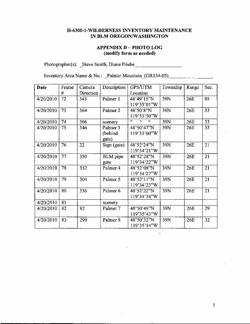
H-6300-1-WILDERNESS INVENTORY MAINTENANCE IN BLM OREGON/WASHINGTON
APPENDIX D- PHOTO LOG (modify form as needed)
Photographer(s): _Steve Smith, Diane Priebe ________
Inventory Area Name & No.: _Palmer Mountain_(OR134-05) _______
Date Frame #
Camera Direction
Description GPS/UTM Location
Township Range Sec.
4/20/2010 72 343 Palmer 1 48'49'15"N 119'35'01"W
39N 26E 05
4/20/2010 73 364 Palmer 2 48'50'8"N 119'33'50"W
39N 26E 33
4/20/2010 74 306 scenery " " " 39N 26E 33 4/20/2010 75 346 Palmer 3
(behind gate)
48'50'47"N 119'33'60"W
39N 26E 33
4/20/2010 76 22 Sign (gate) 48'52'24''N 119'34'21"W
39N 26E 21
4/20/2010 77 350 BLMpipe gate
48'52'28"N 119'34'22"W
39N 26E 21
4/20/2010 78 332 Palmer4 48'52'08"N 119'34'27"W
39N 26E 21
4/20/2010 79 304 Palmer 5 48'52'11"N 119'34'23"W
39N 26E 21
4/20/2010 80 336 Palmer 6 48'52'22"N 119'34'34"W
39N 26E 21
4/20/2010 81 scenery 4/20/2010 82 82 Palmer 7 48'50'49"N
119'35'43"W 39N 26E 29
4/20/2010 83 290 Palmer 8 48'50'32"N 119'35'14"W
39N 26E 32
1

----------------------
Year 2011 Inventory Unit Number/Name: Palmer Mountain (OR134-05)
FORMl
DOCUMENTATION OF BLM WILDERNESS INVENTORY FINDINGS ON RECORD:
1. Is there existing BLM wilderness inventory information on all or part of this area?
No X (Go to Form 2) Yes (ifmore than one unit is within the area, list the names/numbers ofthose units.): a) Inventory Source:--------
b) Inventory Unit Name(s)INumber(s): _________
c) Map Name(s)INumber(s):_________
d) BLM District(s)/Field Office(s): ________
2. BLM Inventory Findings on Record:
Existing inventory information regarding wilderness characteristics (if more than one BLM inventory unit is associated with the area, list each unit and answer each question individually for each inventory unit):
Existing inventory information regarding wilderness characteristics1:
Inventory Source:
Unit#/ Size Natural Outstanding Outstanding Supplemental Name (historic Condition? Solitude? Primitive & Values?
acres) YIN YIN Unconimed YIN Recreation? YIN

FORM2 Use additional pages as necessary
DOCUMENTATION OF CURRENT WILDERNESS INVENTORY CONDITIONS
a. Unit Number/Name: Palmer Mountain (OR134-05)
(1) Is the unit of sufficient size?
No ____Yes --"X'-"---
The lands total approximately 7318 acres ofpublic lands managed by the Wenatchee Field Office of the Spokane District, Bureau of Land Management. There is one area of private lands and mining claims (portions ofS19,20,29,30) within the boundary of the unit, but these lands are not under consideration by this effort. The unit is located in northern Okanogan County, just off of the Loomis-Oroville road.
DESCRIPTION OF CURRENT CONDITIONS: (Include land ownership, location, topography, vegetation features and summary of major human uses/activities).
Most of the 7318 acres of BLM ownership was acquired in the mid 1990's, from a private sheep ranch. Currently, public access to the unit is along the main Palmer Mountain road (Palmer 1 ), to the primitive recreation site above the lake, and on the north road (Palmer 2), for .5 miles to the turnaround.
The boundary of the unit is described as being private lands around almost all sides. The Washington State Department ofNatural Resources (DNR) manages two parcels ofland (S 16&36) at the west and north edges of the unit. Access to these areas is restricted.
The area consists ofhigh rolling hills and expansive vistas. Thickets of aspen snake through deeper draws and along the edges of small Washburn Lake. The lake is also surrounded by cattails and other wetland vegetation, and is stocked with tiger trout by Washington Department of Fish and Wildlife (WDFW). The top of the mountain is thickly forested with Douglas-fir that has had some timber thinning in the past. Old roads and skid roads can be found in this area, as well as remnants of old miners cabins in T. 39 N., R 26 E., Section 21. Grassy hillsides and meadows are characteristic of south facing slopes, intermixed with rocky outcrops. Some distant views of the Loomis-Oroville road and adjacent homes are possible from higher up the mountain.

----
The BLM maintains a primitive recreation site (kiosk, parking area and 3 parking spurs with fire rings) on a flat above Washburn Lake. There are also a number of other traditional primitive camping locations along the main Palmer Mountain (Palmer 1) road, mainly used during hunting season. The main uses of the area include camping, fishing, hunting, horseback riding, hiking and cattle ranching. BLM Recreation Management Information System (RMIS) visitor use numbers place the number of annual visitors to the area at 6000 people (20 10 RMIS figures).
Roads 2 and 3 extend to the private land boundary at the north edge of Palmer Mountain (east side). These roads form the eastern boundary of the unit, cutting off approximately 849 acres from the original 7318 acres. Road 1 forms a boundary on the south side of the unit, cutting off 50 acres in a small section. The Black Bear Road (Palmer 8) and the Palmer main road (Rd 1) together form the southern boundary to the unit, cutting off an additional 1710 acres. The Loomis-Oroville paved highway forms the boundary on the west side ofthe unit, cutting off another 12 acres ofBLM land. This results in a final unit size of approximately 4697 acres, which · will cause the unit not to meet size criteria. The 4697 acres remaining in the unit are cut by roads, and a sizeable area of private land in the center. Several active mining claims are located on this private land, contributing to some ofthe traffic on the unit's roads.
(2) Is the unit in a natural condition? Yes X No N/A
Description: Yes, the unit is in a natural condition. BLM maintains the access road (Palmer 1) to the primitive recreation site above the lake and for .5 miles to the north road (Palmer 2) turnaround for public use. Public use is restricted to the rest of the unit. Periodic range fences cut across the unit, and a few range improvements (water troughs, small spring developments) are visible off of these roads. Locked metal gates block public access from other routes, though private landowners/miners have keys to the gate north of the lake, to access the private land above the lake along Palmer 7 road. BLM has fenced off a dispersed camping area above the lake, with a cattleguard, small camping loop with 3 parking spurs, 3 fire rings and -a bulletin board. An entrance sign and bulletin board are located at the unit entrance off of the Loomis/Oroville road. Signs of past logging and mining activity can be observed at the far northern edge of the unit (S21 ), as old slash piles and stumps on BLM, and mining settling pond and berms on the private land at the north end ofS21. These improvements and/or signs of past use ofthe area occur mainly along the maintained roads (Palmer 1,2,7) in the unit. The rest of the unit is in a natural state and improvements are substantially unnoticeable.
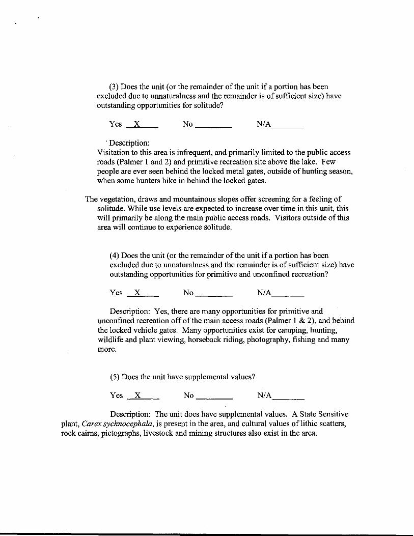
(3) Does the unit (or the remainder of the unit if a portion has been excluded due to unnaturalness and the remainder is of sufficient size) have outstanding opportunities for solitude?
No ____Yes X NIA----'=--- ---
· Description: Visitation to this area is infrequent, and primarily limited to the public access roads (Palmer 1 and 2) and primitive recreation site above the lake. Few people are ever seen behind the locked metal gates, outside ofhunting season, when some hunters hike in behind the locked gates.
The vegetation, draws and mountainous slopes offer screening for a feeling of solitude. While use levels are expected to increase over time in this unit, this will primarily be along the main public access roads. Visitors outside of this area will continue to experience solitude.
(4) Does the unit (or the remainder of the unit if a portion has been excluded due to unnaturalness and the remainder is of sufficient size) have outstanding opportunities for primitive and unconfined recreation?
No ____Yes ----::X~-- N/A___
Description: Yes, there are many opportunities for primitive and unconfined recreation off of the main access roads (Palmer 1 & 2), and behind the locked vehicle gates. Many opportunities exist for camping, hunting, wildlife and plant viewing, horseback riding, photography, fishing and many more.
(5) Does the unit have supplemental values?
No ____ Yes ----::X~-- N/A.___
Description: The unit does have supplemental values. A State Sensitive plant, Carex sychnocephala, is present in the area, and cultural values of lithic scatters, rock cairns, pictographs, livestock and mining structures also exist in the area.

Summary of Findings and Conclusion
Unit Name and Number: _ Palmer Mountain_(OR134-05)__________
Summary Results of Analysis:
1. Does the area meet any of the size requirements? Yes X No
2. Does the area appear to be natural? X Yes No
3. Does the area offer outstanding opportunities for solitude or a primitive and unconfined type of recreation? _ X_ Yes No NA
4. Does the area have supplemental values? X Yes No NA
Conclusion Check One:
The area--or a portion of the area- has wilderness character.
X The area does not have wilderness character.
Prepared by: Team Members:
Karen Kelleher - Field Office Manager Diane Priebe - Recreation Molly Boyter - Botany Dana Peterson - Range Brent Cunderla - Geology JA Vacca - Wildlife Joe Kelly - Fisheries Nick Stanton - Range Eric Riener - Fire Terry Syrnonds-Maintenance William Schurger - lands and Realty Francoise Sweeney - Archeologist Mark Williams- Forestry
Approved by:
h~ Jp/c2/;; Field Manager Date

---====~==~~~~-----
,...
This form documents information that constitutes an inventory finding on wilderness characteristics. It does not represent a formal/and use allocation or a final agency decision subject to administrative remedies under either 43 CFR parts 4 or 1610.5-2.
H-6300-1-WILDERNESS INVENTORY MAINTENANCE IN BLM OREGON/WASHINGTON
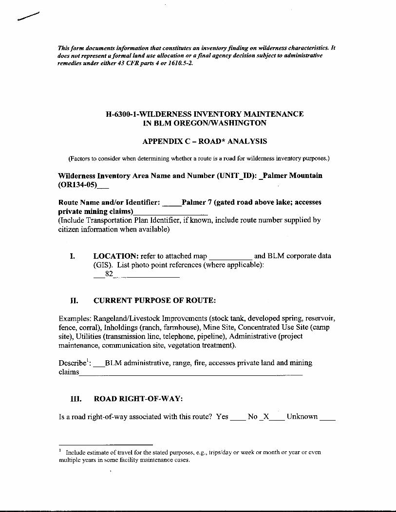
APPENDIX C- ROAD* ANALYSIS
(Factors to consider when determining whether a route is a road for wilderness inventory purposes.)
Wilderness Inventory Area Name and Number (UNIT_ID): _Palmer Mountain_(OR134-05)_
Route Name and/or Identifier: _Palmer 2 (north road to locked gate) ____ (Include Transportation Plan Identifier, if known, include route number supplied by citizen information when available)
I. LOCATION: refer to attached map and BLM corporate data (GIS). List photo point references (where applicable):
73_______
II. CURRENT PURPOSE OF ROUTE:
Examples: Rangeland/Livestock Improvements (stock tank, developed spring, reservoir, fence, corral), Inholdings (ranch, farmhouse), Mine Site, Concentrated Use Site (camp site), Utilities (transmission line, telephone, pipeline), Administrative (project maintenance, communication site, vegetation treatment).
Describe1: _Public access, range management, fire, administrative BLM
use_____________________________
III. ROAD RIGHT-OF-WAY:
Is a road right-of-way associated with this route? Yes __ No __ Unknown_X_
IV. CONSTRUCTION (Is there evidence that the route was originally constructed using mechanical means?)
1 Include estimate of travel for the stated purposes, e.g., tripsiday or week or month or year or even multiple years in some facility maintenance cases.
----
---- -----
--------------------------------------------------
------
------------------------------------
Yes X No
Examples: Paved Bladed X Graveled X Roadside----- ~--- ~----
Berms X Cut/Fill Other
Describe:
V. IMPROVEMENTS (Is there evidence of improvements to facilitate access?)
Yes X No ----
By Hand Tools_ X__ By Machine __ __
Examples: Culverts ____ Stream Crossings ____ Bridges ___ Drainage
X Barriers Other
Describe: __Drainage dip
VI. MAINTENANCE (Is there evidence ofmaintenance that would ensure continued use?):
A. Is there Evidence or Documentation of Maintenance using hand tools or machinery? Yes X No
Hand Tools (YIN)____ Machine __(YIN)_X.___
Explain: ____well graded and graveled
B. If the route is in passable condition, but there is no evidence ofmaintenance, would mechanical maintenance with hand tools or machines be approved by BLM to meet the purpose( s) of the route in the event this route became impassable? Yes X No
Comments:
VII. REGULAR AND CONTINUOUS USE:

-----
-------------
Yes X No
Describe evidence (e.g., direct: vehicle tracks observed, or indirect: evidence of use associated with purpose of the route, such as maintenance of facility that route accesses) and other rationale for whether use has occurred and will continue to occur on a relatively regular basis (i.e., regular use relative to the purpose(s) of the route). _Recent vehicle tracks observed
VIII. CONCLUSION: To meet the definition of a road, items IV or V, and VI-A orB, and VII must be checked yes. Road: Yes X No _______ Explanation:
Evaluator(s): _S. Smith, D. Priebe.____________ Date: 4/20/201 0 _____________
* road: An access route which has been improved and maintained by mechanical means to insure relatively regular and continuous use. A way maintained solely by the passage of vehicles does not constitute a road.
a. "Improved and maintained"- Actions taken physically by people to keep the road open to vehicle traffic. "Improved" does not necessarily mean formal construction. "Maintained" does not necessarily mean annual maintenance.
b. "Mechanical means"- Use ofhand or power machinery or tools.
c. "Relatively regular and continuous use" - Vehicular use that has occurred and will continue to occur on a relatively regular basis. Examples are: access roads for equipment to maintain a stock water tank or other established water sources; access roads to maintained recreation sites or facilities; or access roads to mining claims.
This form documents information that constitutes an inventory finding on wilderness characteristics. It does not represent a formal/and use allocation or a final agency decision subject to administrative remedies under either 43 CFRparts 4 or 1610.5-2.
H-6300-1-WILDERNESS INVENTORY MAINTENANCE IN BLM OREGON/WASHINGTON
APPENDIX C- ROAD* ANALYSIS
(Factors to consider when determining whether a route is a road for wilderness inventory purposes.)
Wilderness Inventory Area Name and Number (UNIT_ID): _Palmer Mountain(OR134-05)__
Route Name and/or Identifier: Palmer 3 (continuation of Palmer 2, but behind locked gate) ______ (Include Transportation Plan Identifier, if known, include route number supplied by citizen information when available)
I. LOCATION: refer to attached map and BLM corporate data (GIS). List photo point references (where applicable): _75, 76, 77______________
II. CURRENT PURPOSE OF ROUTE:
Examples: Rangeland/Livestock Improvements (stock tank, developed spring, reservoir, fence, corral), Inholdings (ranch, farmhouse), Mine Site, Concentrated Use Site (camp site), Utilities (transmission line, telephone, pipeline), Administrative (project maintenance, communication site, vegetation treatment).
Describe1: _BLM Administrative, range, access to private land (rangeland),
fire ---------------------------------------------------------
III. ROAD RIGHT-OF-WAY:
Is a road right-of-way associated with this route? Yes No Unknown X
Include estimate of travel for the stated purposes, e.g., trips/day or week or month or year or even multiple years in some facility maintenance cases.
1

IV. CONSTRUCTION (Is there evidence that the route was originally constructed using mechanical means?)
Yes X No ----
Examples: Paved Bladed Graveled X Roadside Berms ----- ----- --- ----Cut/Fill X Other -----
Describe: __some gravel in past, road has not been maintained as regularly as Palmer 2. ________________________________________________
V. IMPROVEMENTS (Is there evidence of improvements to facilitate access?)
Yes X No ------
By Hand Tools By Machine_X __
Examples: Culverts ______ Stream Crossings ______ Bridges ____ Drainage
X Barriers Other
Describe: Drain dip, metal road gate & associated signing. No recent ------improvements.-----------------------
VI. MAINTENANCE (Is there evidence of maintenance that would ensure continued use?):
A. Is there Evidence or Documentation of Maintenance using hand tools or machinery? Yes X No ------
Hand Tools Y (YIN)____ Machine __(YIN)___
Explain: _maintenance done in past (clearing drain dips, clearing downed trees to allow vehicle access, gate and sign maintenance, gravel in the past____________________
B. If the route is in passable condition, but there is no evidence ofmaintenance, would mechanical maintenance with hand tools or machines be approved by BLM to meet the purpose(s) of the route in the event this route became impassable? Yes X No

Comments: _Road would be kept maintained
VII. REGULAR AND CONTINUOUS USE:
Yes X No -----
Describe evidence (e.g., direct: vehicle tracks observed, or indirect: evidence of use associated with purpose of the route, such as maintenance of facility that route accesses) and other rationale for whether use has occurred and will continue to occur on a relatively regular basis (i.e., regular use relative to the purpose(s) of the route). _______ _ BLM administrative, maintenance and fire, range leasee, use this road several times each year. __
VIII. CONCLUSION: To meet the definition of a road, items IV or V, and VI-A orB, and VII must be checked yes. Road: Yes X No ------ Explanation:
Evaluator(s): _S. Smith, D. Priebe Date: 4/20/2010_______
* road: An access route which has been improved and maintained by mechanical means to insure relatively regular and continuous use. A way maintained solely by the passage of vehicles does not constitute a road.
a. "Improved and maintained" - Actions taken physically by people to keep the road open to vehicle traffic. "Improved" does not necessarily mean formal construction. "Maintained" does not necessarily mean annual maintenance.
b. "Mechanical means"- Use ofhand or power machinery or tools.
c. "Relatively regular and continuous use" - Vehicular use that has occurred and will continue to occur on a relatively regular basis. Examples are: access roads for equipment to maintain a stock water tank or other established water sources; access roads to maintained recreation sites or facilities; or access roads to mining claims.

This form documents information that constitutes an inventory finding on wilderness characteristics. It does not represent a formal/and use allocation or a final agency decision subject to administrative remedies under either 43 CFRparts 4 or 1610.5-2.
H-6300-1-WILDERNESS INVENTORY MAINTENANCE IN BLM OREGON/WASHINGTON
APPENDIX C- ROAD* ANALYSIS
(Factors to consider when determining whether a route is a road for wilderness inventory purposes.)
Wilderness Inventory Area Name and Number (UNIT_ID): _Palmer Mountain (OR134-05)_
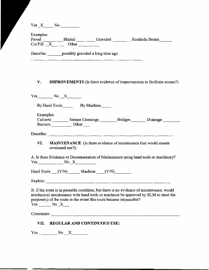
Route Name and/or Identifier: Palmer 4 (Dead end skid road). ______ (Include Transportation Plan Identifier, if known, include route number supplied by citizen information when available)
I. LOCATION: refer to attached map and BLM corporate data (GIS). List photo point references (where applicable): 78_____
II. CURRENT PURPOSE OF ROUTE:
Examples: Rangeland/Livestock Improvements (stock tank, developed spring, reservoir, fence, corral), Inholdings (ranch, farmhouse), Mine Site, Concentrated Use Site (camp site), Utilities (transmission line, telephone, pipeline), Administrative (project maintenance, communication site, vegetation treatment).
Describe1: _ BLM administrative, fire & range (monitoring), range lease
fire_____________________________
III. ROAD RIGHT-OF-WAY:
Is a road right-of-way associated with this route? Yes No X Unknown
IV. CONSTRUCTION (Is there evidence that the route was originally constructed using mechanical means?)
1 Include estimate of travel for the stated purposes, e.g., tl;ps/day or week or month or year or even multiple years in some facility maintenance cases.
------
-------- ----- ----- ---
--------
Yes X No
Examples: Paved Bladed Graveled Roadside Berms Cut/Fill X Other
Describe: possibly graveled a long time ago
V. IMPROVEMENTS (Is there evidence of improvements to facilitate access?)
Yes No X ---
By Hand Tools __ By Machine__
Examples: Culverts ____ Stream Crossings ____ Bridges ___ Drainage ____ Barriers Other
Describe: ------------------------------VI. MAINTENANCE (Is there evidence ofmaintenance that would ensure
continued use?):
A. Is there Evidence or Documentation of Maintenance using hand tools or machinery? Yes No X·-------
Hand Tools _(YIN)__Machine (YIN)___
Explain: ___________________________
B. If the route is in passable condition, but there is no evidence ofmaintenance, would mechanical maintenance with hand tools or machines be approved by BLM to meet the purpose(s) of the route in the event this route became impassable? Yes No X
Comments: -------------------------------------
VII. REGULAR AND CONTINUOUS USE:
Yes No X ----- ~---

---- -------
Describe evidence (e.g., direct: vehicle tracks observed, or indirect: evidence of use associated with purpose of the route, such as maintenance of facility that route accesses) and other rationale for whether use has occurred and will continue to occur on a relatively regular basis (i.e., regular use relative to the purpose(s) of the route). _______
VIII. CONCLUSION: To meet the definition of a road, items IV or V, and VI-A orB, and VII must be checked yes. Road: Yes No X Explanation:
Evaluator(s): _S. Smith, D. Priebe ____________________ Date: 4/20/2010_______
* road: An access route which has been improved and maintained by mechanical means to insure relatively regular and continuous use. A way maintained solely by the passage of vehicles does not constitute a road.
a. "Improved and maintained" - Actions taken physically by people to keep the road open to vehicle traffic. "Improved" does not necessarily mean formal construction. "Maintained" does not necessarily mean annual maintenance.
b. "Mechanical means"- Use ofhand or power machinery or tools.
c. "Relatively regular and continuous use" - Vehicular use that has occurred and will continue to occur on a relatively regular basis. Examples are: access roads for equipment to maintain a stock water tank or other established water sources; access roads to maintained recreation sites or facilities; or access roads to mining claims.

-------
This form documents information that constitutes an inventory finding on wilderness characteristics. It does not represent a formal/and use allocation or a final agency decision subject to administrative remedies under either 43 CFR parts 4 or 1610.5-2.
H-6300-1-WILDERNESS INVENTORY MAINTENANCE IN BLM OREGON/WASHINGTON
APPENDIX C- ROAD* ANALYSIS
(Factors to consider when determining whether a route is a road for wilderness inventory purposes.)
Wilderness Inventory Area Name and Number (UNIT_ID): _Palmer Mountain (OR134-05)_
Route Name and/or Identifier: Palmer 5 (Include Transportation Plan Identifier, if known, include route number supplied by citizen information when available)
I. LOCATION: refer to attached map and BLM corporate data (GIS). List photo point references (where applicable):
79______
II. CURRENT PURPOSE OF ROUTE:
Examples: Rangeland/Livestock Improvements (stock tank, developed spring, reservoir, fence, corral), Inholdings (ranch, farmhouse), Mine Site, Concentrated Use Site (camp site), Utilities (transmission line, telephone, pipeline), Administrative (project maintenance, communication site, vegetation treatment).
Describe': _BLM administrative (range management & monitoring, fire), access to mining (off of Palmer 6 at north end of S21)
III. ROAD RIGHT-OF-WAY:
Is a road right-of-way associated with this route? Yes No Unknown X
1 Include estimate of travel for the stated purposes, e.g., trips/day or week or month or year or even multiple years in some facility maintenance cases.

__
IV. CONSTRUCTION (Is there evidence that the route was originally constructed using mechanical means?)
Yes X No ----
Examples: Paved Bladed Graveled Roadside Berms ----- ----- ----- -----Cut/Fill X Other -----
Describe: __graveled a long time ago
v. IMPROVEMENTS (Is there evidence of improvements to facilitate access?)
Yes No X ---- ----
By Hand Tools ___ By Machine __
Examples: Culverts ____ Stream Crossings ____ Bridges ___ Drainage ____ Barriers Other
Describe: ----------------------------
VI. MAINTENANCE (Is there evidence ofmaintenance that would ensure continued use?):
A. Is there Evidence or Documentation of Maintenance using hand tools or machinery? Yes No X_____
Hand Tools _(YIN)____ Machine __(YIN)___
Explain: __none noticed
B. If the route is in passable condition, but there is no evidence ofmaintenance, would mechanical maintenance with hand tools or machines be approved by BLM to meet the purpose(s) of the route in the event this route became impassable? Yes NoX
-----------------------~c»~~-~~,~~~--~c~~ ~~~-~--- -====~

-----
------ ------
Comments: _If road were impassable, BLM would access this area via the road north of Washburn Lake (Palmer 7), or would go around the impassable section on ATV________________________________________________
VII. REGULAR AND CONTINUOUS USE:
Yes X No
Describe evidence (e.g., direct: vehicle tracks observed, or indirect: evidence ofuse associated with purpose of the route, such as maintenance of facility that route accesses) and other rationale for whether use has occurred and will continue to occur on a relatively regular basis (i.e., regular use relative to the purpose(s) of the route).
Regular and continuous use by BLM range vehicle over part ofPalmer 5 road (BLM Range travels road for monitoring and checking exclosures & range improvements 2-3 times/year. Has used ATV on westernmost portion of road (where meets private land) due to it being difficult to pass through with vehicle). BLM range use oflast 1;4 mile at west end before private property has been traveled by ATV. _____________
VIII. CONCLUSION: To meet the definition of a road, items IV or V, and VI-A orB, and VII must be checked yes. Road: Yes No X Explanation:
Evaluator(s): ___S. Smith, D. Priebe_________________ Date: 4/20/2010_______
* road: An access route which has been improved and maintained by mechanical means to insure relatively regular and continuous use. A way maintained solely by the passage ofvehicles does not constitute a road.
a. "Improved and maintained"- Actions taken physically by people to keep the road open to vehicle traffic. "Improved" does not necessarily mean formal construction. "Maintained" does not necessarily mean annual maintenance.
b. "Mechanical means"- Use ofhand or power machinery or tools.
c. "Relatively regular and continuous use" - Vehicular use that has occurred and will continue to occur on a relatively regular basis. Examples are: access roads for equipment to maintain a stock water tank or other established water
----------------
sources; access roads to maintained recreation sites or facilities; or access roads to mining claims.

--------------------~
---
--------------
-----------
This form documents information that constitutes an inventory finding on wilderness characteristics. It does not represent a formal land use allocation or a final agency decision subject to administrative remedies under either 43 CFRparts 4 or 1610.5-2.
H-6300-1-WILDERNESS INVENTORY MAINTENANCE IN BLM OREGON/WASHINGTON
APPENDIX C- ROAD* ANALYSIS
(Factors to consider when determining whether a route is a road for wilderness inventory purposes.)
Wilderness Inventory Area Name and Number (UNIT_ID): _Palmer Mountain (OR134-05)_
Route Name and/or Identifier: Palmer 6 (Include Transportation Plan Identifier, if known, include route number supplied by citizen information when available)
I. LOCATION: refer to attached map and BLM corporate data (GIS). List photo point references (where applicable):
80 -- -------
II. CURRENT PURPOSE OF ROUTE:
Examples: Rangeland/Livestock Improvements (stock tank, developed spring, reservoir, fence, corral), Inholdings (ranch, farmhouse), Mine Site, Concentrated Use Site (camp site), Utilities (transmission line, telephone, pipeline), Administrative (project maintenance, communication site, vegetation treatment).
Describe1: BLM administrative, range, fire, range lease
III. ROAD RIGHT-OF-WAY:
Is a road right-of-way associated with this route? Yes __ No_X__ Unknown __
IV. CONSTRUCTION (Is there evidence that the route was originally constructed using mechanical means?)
1 Include estimate of travel for the stated purposes. e.g., trips/day or week or month or year or even multiple years in some facility maintenance cases.

----
-----
-----------------------------
----------------------------
------
------------------------------
----
Yes X No
Examples: Paved _____ Bladed X'----- Graveled ____ Roadside Berms ___ Cut/Fill X Other
Describe:
V. IMPROVEMENTS (Is there evidence of improvements to facilitate access?)
Yes No X'---
By Hand Tools __ By Machine __
Examples: Culverts ____ Stream Crossings ____ Bridges ___ Drainage ____ Barriers Other
Describe:
VI. MAINTENANCE (Is there evidence ofmaintenance that would ensure continued use?):
A. Is there Evidence or Documentation of Maintenance using hand tools or machinery? Yes No X
Hand Tools _(YIN)___ Machine __(YIN)___
Explain: ____________________________
B. If the route is in passable condition, but there is no evidence ofmaintenance, would mechanical maintenance with hand tools or machines be approved by BLM to meet the purpose(s) of the route in the event this route became impassable? Yes No X
Comments:
VII. REGULAR AND CONTINUOUS USE:
Yes No X:____
---- -----
Describe evidence (e.g., direct: vehicle tracks observed, or indirect: evidence of use associated with purpose of the route, such as maintenance of facility that route accesses) and other rationale for whether use has occurred and will continue to occur on a relatively regular basis (i.e., regular use relative to the purpose(s) of the route). _______
VIII. CONCLUSION: To meet the definition of a road, items IV or V, and VI-A orB, and VII must be checked yes. Road: Yes No X Explanation:
Evaluator(s): _S. Smith, D. Priebe ___________ Date: 4/20/2010_______
* road: An access route which has been improved and maintained by mechanical means to insure relatively regular and continuous use. A way maintained solely by the passage of vehicles does not constitute a road.
a. "Improved and maintained"- Actions taken physically by people to keep the road open to vehicle traffic. "Improved" does not necessarily mean formal construction. "Maintained" does not necessarily mean annual maintenance.
b. "Mechanical means"- Use ofhand or power machinery or tools.
c. "Relatively regular and continuous use" - Vehicular use that has occurred and will continue to occur on a relatively regular basis. Examples are: access roads for equipment to maintain a stock water tank or other established water sources; access roads to maintained recreation sites or facilities; or access roads to mining claims.
This form documents information that constitutes an inventory finding on wilderness characteristics. It does not represent a formal/and use allocation or a final agency decision subject to administrative remedies under either 43 CFR parts 4 or 1610.5-2.
H-6300-1-WILDERNESS INVENTORY MAINTENANCE IN BLM OREGONIWASHINGTON
APPENDIX C- ROAD* ANALYSIS
(Factors to consider when determining whether a route is a road for wilderness inventory purposes.)
Wilderness Inventory Area Name and Number (UNIT_ID): _Palmer Mountain (OR134-05)_
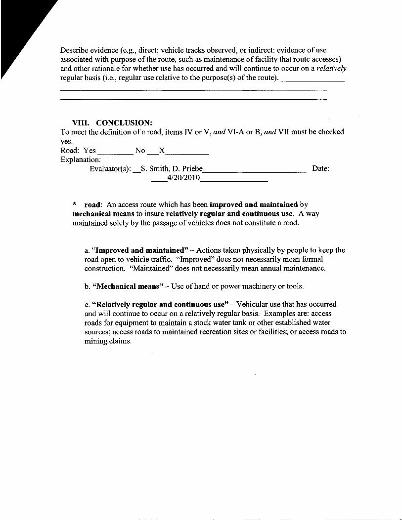
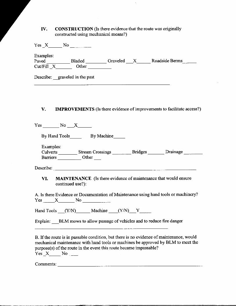
Route N arne and/or Identifier: __Palmer 7 (gated road above lake; accesses private mining claims) _________ (Include Transportation Plan Identifier, if known, include route number supplied by citizen information when available)
I. LOCATION: refer to attached map and BLM corporate data (GIS). List photo point references (where applicable):
82______________
II. CURRENT PURPOSE OF ROUTE:
Examples: Rangeland/Livestock Improvements (stock tank, developed spring, reservoir, fence, corral), Inholdings (ranch, farmhouse), Mine Site, Concentrated Use Site (camp site), Utilities (transmission line, telephone, pipeline), Administrative (project maintenance, communication site, vegetation treatment).
Describe1: __BLM administrative, range, fire, accesses private land and mining
claims -----------------------------
III. ROAD RIGHT-OF-WAY:
Is a road right-of-way associated with this route? Yes No X Unknown
1 Include estimate of travel for the stated purposes. e.g., trips/day or week or month or year or even multiple years in some facility maintenance cases.
-----------------------------
IV. CONSTRUCTION (Is there evidence that the route was originally constructed using mechanical means?)
Yes X No ----
Examples: Paved Bladed Graveled X Roadside Berms ------ ----- ---- ---Cut/Fill X Other ____
Describe: __graveled in the past
V. IMPROVEMENTS (Is there evidence of improvements to facilitate access?)
Yes _____ No X.____
By Hand Tools __ By Machine.__
Examples: Culverts ____ Stream Crossings ____ Bridges ____ Drainage ____ Barriers Other
Describe: ----------------------------
VI. MAINTENANCE (Is there evidence ofmaintenance that would ensure continued use?):
A. Is there Evidence or Documentation ofMaintenance using hand tools or machinery? Yes X No -------
Hand Tools _(YIN),___ Machine __(Y/N)_Y__
Explain: _BLM mows to allow passage ofvehicles and to reduce fire danger
B. If the route is in passable condition, but there is no evidence ofmaintenance, would mechanical maintenance with hand tools or machines be approved by BLM to meet the purpose(s) ofthe route in the event this route became impassable? Yes X No
Comments:

-------
VII. REGULAR AND CONTINUOUS USE:
Yes X No -----
Describe evidence (e.g., direct: vehicle tracks observed, or indirect: evidence of use associated with purpose of the route, such as maintenance of facility that route accesses) and other rationale for whether use has occurred and will continue to occur on a relatively regular basis (i.e., regular use relative to the purpose(s) of the route). _Vehicle tracks observed, access to private lands occurs all year._______
VIII. CONCLUSION: To meet the definition of a road, items IV or V, and VI-A orB, and VII must be checked yes. Road: Yes X No Explanation:
Evaluator(s): _S. Smith, D. Priebe___________ Date: 4/20/2010______
* road: An access route which has been improved and maintained by mechanical means to insure relatively regular and continuous use. A way maintained solely by the passage ofvehicles does not constitute a road.
a. "Improved and maintained"- Actions taken physically by people to keep the road open to vehicle traffic. "Improved" does not necessarily mean formal construction. "Maintained" does not necessarily mean annual maintenance.
b. "Mechanical means"- Use ofhand or power machinery or tools.
c. "Relatively regular and continuous use" - Vehicular use that has occurred and will continue to occur on a relatively regular basis. Examples are: access roads for equipment to maintain a stock water tank or other established water sources; access roads to maintained recreation sites or facilities; or access roads to mining claims.

- -
This form documents information that constitutes an inventory finding on wilderness characteristics. It does not represent a formal/and use allocation or a final agency decision subject to administrative remedies under either 43 CFRparts 4 or 1610.5-2.
H-6300-1-WILDERNESS INVENTORY MAINTENANCE IN BLM OREGON/WASHINGTON
APPENDIX C- ROAD* ANALYSIS
(Factors to consider when determining whether a route is a road for wilderness inventory purposes.)
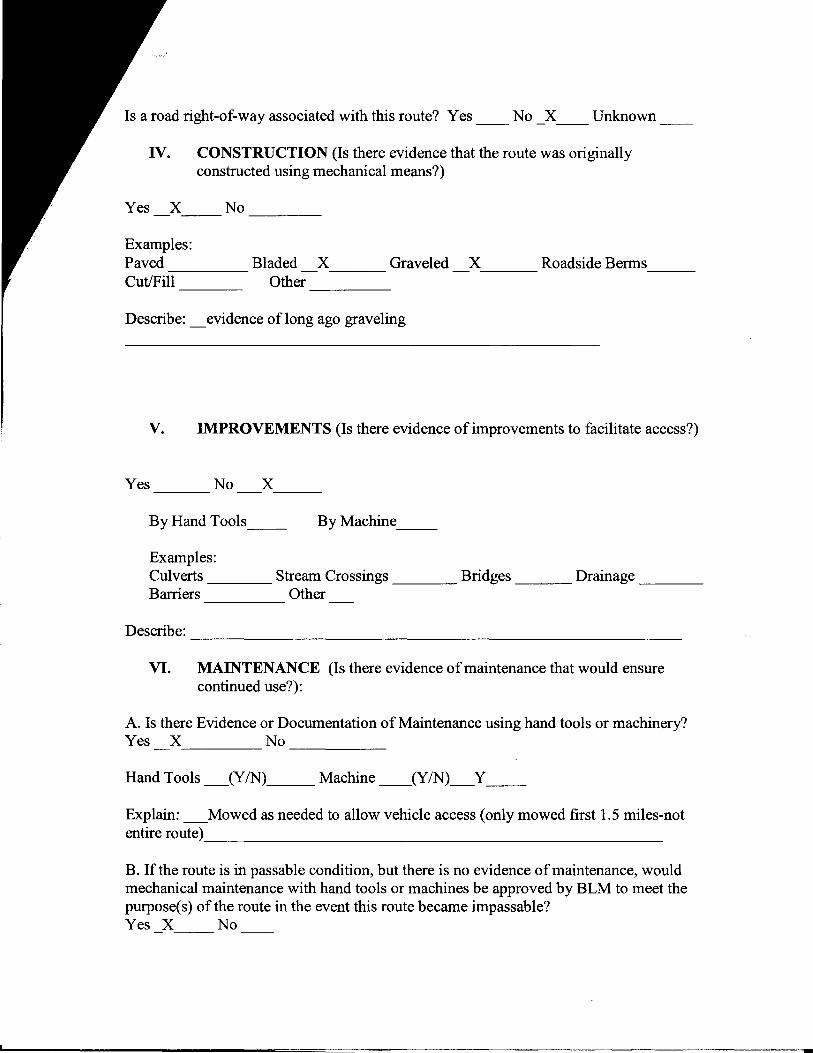
Wilderness Inventory Area Name and Number (UNIT ID): Palmer Mountain_(OR134-05)_
Route Name and/or Identifier: _Palmer 8 (road to Black Bear/War Eagle mining claims)._________ (Include Transportation Plan Identifier, if known, include route number supplied by citizen information when available)
I. LOCATION: refer to attached map and BLM corporate data (GIS). List photo point references (where applicable):
83_______
II. CURRENT PURPOSE OF ROUTE:
Examples: Rangeland/Livestock Improvements (stock tank, developed spring, reservoir, fence, corral), Inholdings (ranch, farmhouse), Mine Site, Concentrated Use Site (camp site), Utilities (transmission line, telephone, pipeline), Administrative (project maintenance, communication site, vegetation treatment).
Describe1: _BLM administrative, range, fire, range lease, route accesses mining claims
on private land. No public access, as access to this area is through locked BLM gate. BLM, range lease and mining claimant all have key to lock. BLM range travels portion of road 2-3 times/year to check on range improvements. Range lease travels route at least 23 times/year. Mining claimant travels road several times each year.
III. ROAD RIGHT-OF-WAY:
1 Include estimate of travel for the stated purposes, e.g., tripsiday or week or month or year or even multiple year; in some facility maintenance cases.
Is a road right-of-way associated with this route? Yes No X Unknown -- --- --
IV. CONSTRUCTION (Is there evidence that the route was originally constructed using mechanical means?)
Yes X No ----
Examples: Paved Bladed X Graveled X Roadside Berms ----- ---- ---- ---Cut/Fill Other -----
Describe: _evidence of long ago graveling
V. IMPROVEMENTS (Is there evidence of improvements to facilitate access?)
Yes No X --- ---
By Hand Tools __ By Machine __
Examples: Culverts ____ Stream Crossings ____ Bridges ___ Drainage ____ Barriers Other
Describe: ----------------------------
VI. MAINTENANCE (Is there evidence ofmaintenance that would ensure continued use?):
A. Is there Evidence or Documentation of Maintenance using hand tools or machinery? Yes X No ------
Hand Tools _(YIN)__ Machine __(Y/N)_Y__
Explain: _Mowed as needed to allow vehicle access (only mowed first 1.5 miles-not entire route) __________________________
B. If the route is in passable condition, but there is no evidence ofmaintenance, would mechanical maintenance with hand tools or machines be approved by BLM to meet the purpose(s) of the route in the event this route became impassable? Yes X No

-------
Comments: Range uses part of this route to access range improvements in S31________________________________________________
VII. REGULAR AND CONTINUOUS USE:
Yes X No -----
Describe evidence (e.g., direct: vehicle tracks observed, or indirect: evidence of use associated with purpose of the route, such as maintenance of facility that route accesses) and other rationale for whether use has occurred and will continue to occur on a relatively regular basis (i.e., regular use relative to the purpose(s) of the route)._BLM Range travels road 2-3 times/year to check range improvements, but only travels first 1.5 miles of road. Mining claimant travels road to DNR boundary several times each year.
VIII. CONCLUSION: To meet the definition of a road, items IV or V, and VI-A orB, and VII must be checked yes. Road: Yes X No Explanation:
Evaluator(s): __ D. Priebe ___________ Date: 10/5/2011_______
* road: An access route which has been improved and maintained by mechanical means to insure relatively regular and continuous use. A way maintained solely by the passage of vehicles does not constitute a road.
a. "Improved and maintained" - Actions taken physically by people to keep the road open to vehicle traffic. "Improved" does not necessarily mean formal construction. "Maintained" does not necessarily mean annual maintenance.
b. "Mechanical means"- Use of hand or power machinery or tools.
c. "Relatively regular and continuous use" - Vehicular use that has occurred and will continue to occur on a relatively regular basis. Examples are: access roads for equipment to maintain a stock water tank or other established water sources; access roads to maintained recreation sites or facilities; or access roads to mining claims.

H-6300-1-WILDERNESS INVENTORY MAINTENANCE IN BLM OREGON/WASHINGTON
APPENDIX D- PHOTO LOG (modify form as needed)
Photographer(s): _Steve Smith, Diane Priebe ________
Inventory Area Name & No.: _Palmer Mountain_(OR134-05) _______
Date Frame #
Camera Direction
Description GPS/UTM Location
Township Range Sec.
4/20/2010 72 343 Palmer 1 48'49'15"N 119'35'01"W
39N 26E 05
4/20/2010 73 364 Palmer 2 48'50'8"N 119'33'50"W
39N 26E 33
4/20/2010 74 306 scenery " " " 39N 26E 33 4/20/2010 75 346 Palmer 3
(behind gate)
48'50'47"N 119'33'60"W
39N 26E 33
4/20/2010 76 22 Sign (gate) 48'52'24"N 119'34'21"W
39N 26E 21
4/20/2010 77 350 BLMpipe gate
48'52'28"N 119'34'22"W
39N 26E 21
4/20/2010 78 332 Palmer4 48'52'08"N 119'34'27"W
39N 26E 21
4/20/2010 79 304 Palmer 5 48'52'1l"N 119'34'23"W
39N 26E 21
4/20/2010 80 336 Palmer 6 48'52'22"N 119'34'34"W
39N 26E 21
4/20/2010 81 scenery 4/20/2010 82 82 Palmer 7 48'50'49"N
119'35'43"W 39N 26E 29
4/20/2010 83 290 Palmer 8 48'50'32"N 119'35'14"W
39N 26E 32
1
I~

.,,.. . 1 • • : · ..

Sc.~


_ .... ~....