Overview of Week 2 September 6-September 9, 2016 · Overview of Week 2 September 6-September 9,...
52
Overview of Week 2 September 6-September 9, 2016 Concept: Geography Essential Question: How do people get the things that they need and want? Weekly Objective: Good Historians will … 1. Understand that Geography is a key element to the placement of societies. 2. Identify the 5 Big Concepts of Social Studies: History, Geography, Culture, Government, Economics Transfer Goal: Students will be able to understand geographic factors that influenced the emergence, expansion, and decline of civilizations, societies, and regions over time. Quote of the Week: “The best way to predict the future is to create it.” ~ Abraham Lincoln
-
Upload
truongtruc -
Category
Documents
-
view
216 -
download
0
Transcript of Overview of Week 2 September 6-September 9, 2016 · Overview of Week 2 September 6-September 9,...

Overview of Week 2September 6-September 9, 2016
Concept: Geography
Essential Question: How do people get the things that they need and want?
Weekly Objective: Good Historians will …
1. Understand that Geography is a key element to the placement of societies.
2. Identify the 5 Big Concepts of Social Studies: History, Geography, Culture, Government, Economics
Transfer Goal: Students will be able to understand geographic factors that
influenced the emergence, expansion, and decline of civilizations, societies, and regions over time.
Quote of the Week:“The best way to predict the future is to create it.”
~ Abraham Lincoln

Monday, September 5, 2016Labor Day Holiday
Quote of the Week:“The best way to predict the future is to create it.”
~ Abraham Lincoln

Tuesday, Septmeber 6, 2016Daily Objective: The 5 Big Concepts of Social Studies
Students will be able to independently use their learning to analyze and evaluate how societies change over time based on the interaction with other societies, technological
innovations, and the development of intellectual ideas.
Quote of the Week:“The best way to predict the future is to create it.”
~ Abraham Lincoln
To-Do List Upon Entry:1. Pick Up Homework Packet2. Write Homework in your Agenda3. Have Composition Book and Glue Stick on your desk
Social Studies:• Discuss Composition
Book and Binder• Fire Drill Practices• Geography Continents & Oceans PPT ● Cut & Label Continents and Oceans
*Finish your Neighborhood Map
Homework:“Are you Smarter Than a 6th Grader?” Packet and Finish Map!
• Due Friday
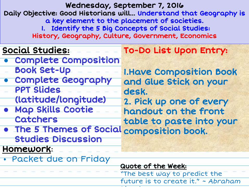
Wednesday, September 7, 2016Daily Objective: Good Historians will… Understand that Geography is
a key element to the placement of societies.1. Identify the 5 Big Concepts of Social Studies:
History, Geography, Culture, Government, Economics
Social Studies:● Complete Composition
Book Set-Up● Complete Geography
PPT Slides (latitude/longitude)
● Map Skills Cootie Catchers
● The 5 Themes of Social Studies Discussion
Homework:• Packet due on Friday
To-Do List Upon Entry:
1.Have Composition Book and Glue Stick on your desk.2. Pick up one of every handout on the front table to paste into your composition book.
Quote of the Week:“The best way to predict the future is to create it.” ~ Abraham Lincoln

Thursday, September 8, 2016Daily Objective: Geography
1.How does geography have an impact on a nation’s history? 2.How does environmental conditions influence modern societies?
Social Studies:1. Complete To-Do List 2. Review for Geography
Test Tomorrow3. Create Hemispheres Map4. Color and Label Compass Rose4. Geography Review PPT
Homework:• Complete your Social Studies
Homework Packet• TEST TOMORROW!!!
We would have time for Geographic Features, but we are on a WIN and Fundraiser Pep Rally Schedule.Time is Short
Pick Up List Upon Entry:1. World Map squares
2. Compass 3. Glue Stick4. Scissors
5. Composition Books
Quote of the Week:“The best way to predict the future is to create it.”
~ Abraham Lincoln
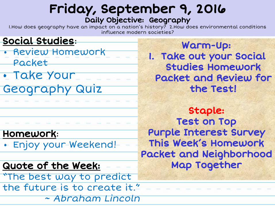
Friday, September 9, 2016Daily Objective: Geography
1.How does geography have an impact on a nation’s history? 2.How does environmental conditions influence modern societies?
Social Studies:• Review Homework
Packet• Take Your Geography Quiz
Homework:• Enjoy your Weekend!
Warm-Up:1. Take out your Social
Studies Homework Packet and Review for
the Test!
Staple: Test on Top
Purple Interest SurveyThis Week’s Homework
Packet and Neighborhood Map Together
Quote of the Week:“The best way to predict the future is to create it.”
~ Abraham Lincoln
Tuesday’s Lesson/Slides
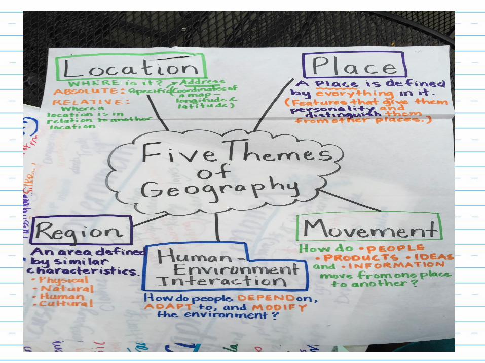
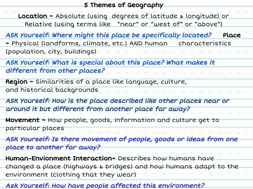
5 Themes of Geography
Location ~ Absolute (using degrees of latitude & longitude) orRelative (using terms like “near” or “west of” or “above”)
ASK Yourself: Where might this place be specifically located? Place ~ Physical (landforms, climate, etc.) AND human characteristics (population, city, buildings)
ASK Yourself: What is special about this place? What makes it different from other places?
Region ~ Similarities of a place like language, culture,and historical backgrounds
ASK Yourself: How is the place described like other places near or around it but different from another place far away?
Movement ~ How people, goods, information and culture get to particular places
ASK Yourself: Is there movement of people, goods or ideas from one place to another far away?
Human-Envionment Interaction~ Describes how humans have changed a place (highways & bridges) and how humans adapt to the environment (clothing that they wear)
Ask Yourself: How have people affected this environment?

See PowerPoint on Shared Drive


Wednesday’s Lesson/Slides
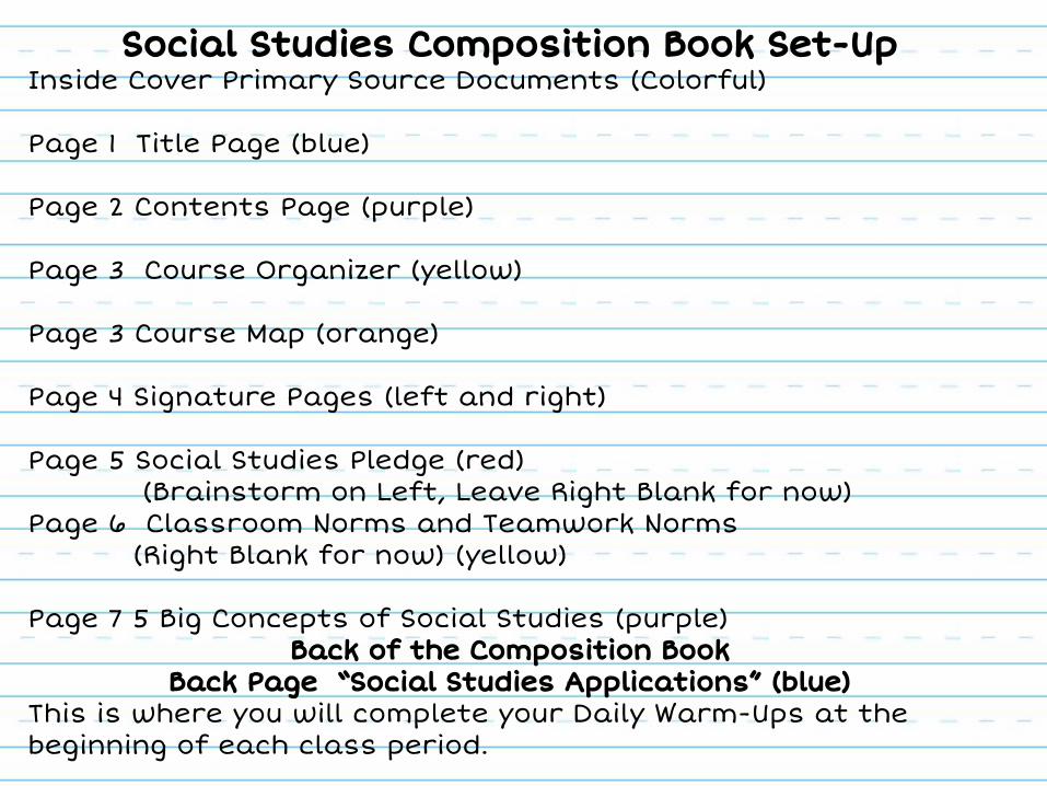
Social Studies Composition Book Set-UpInside Cover Primary Source Documents (Colorful)
Page 1 Title Page (blue)
Page 2 Contents Page (purple)
Page 3 Course Organizer (yellow)
Page 3 Course Map (orange)
Page 4 Signature Pages (left and right)
Page 5 Social Studies Pledge (red) (Brainstorm on Left, Leave Right Blank for now)
Page 6 Classroom Norms and Teamwork Norms(Right Blank for now) (yellow)
Page 7 5 Big Concepts of Social Studies (purple)Back of the Composition Book
Back Page “Social Studies Applications” (blue)This is where you will complete your Daily Warm-Ups at the beginning of each class period.
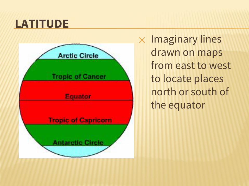
LATITUDE✕ Imaginary lines
drawn on maps from east to west to locate places north or south of the equator

LATITUDE✕ Lines run
horizontally
✕ measured in degrees.
✕ The Equator is 0 degrees Latitude.
✕ Latitude lines are called parallels.

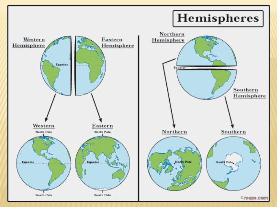
✕ imaginary belt that runs halfway point between the North Pole and the South Pole.
equator
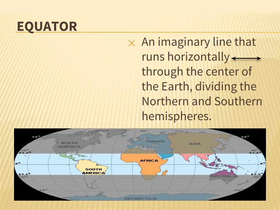
EQUATOR✕ An imaginary line that
runs horizontally through the center of the Earth, dividing the Northern and Southern hemispheres.

LONGITUDE✕ Imaginary lines
drawn on maps from north to south to locate places east or west of the prime meridian
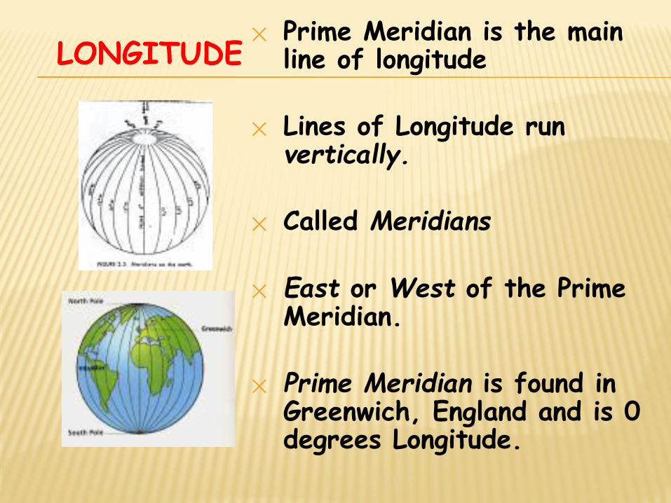
LONGITUDE✕ Prime Meridian is the main
line of longitude
✕ Lines of Longitude run vertically.
✕ Called Meridians
✕ East or West of the Prime Meridian.
✕ Prime Meridian is found in Greenwich, England and is 0 degrees Longitude.

LONGITUDE
Lines of longitude are numbered east from the Prime Meridian to the 180° line and west from the Prime Meridian to the 180° line.
PRIME MERIDIAN
West L
ongitude
East L
ongitude
180°N
EW
S
North Pole
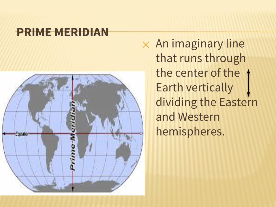
PRIME MERIDIAN✕ An imaginary line
that runs through the center of the Earth vertically dividing the Eastern and Western hemispheres.
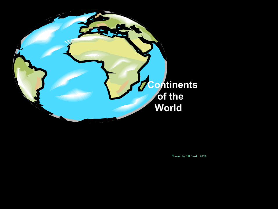
Continents of the World
Created by Bill Ernst 2009
CreaCreated by Billl Ernst 2009

Thursday’s Lesson/Slides
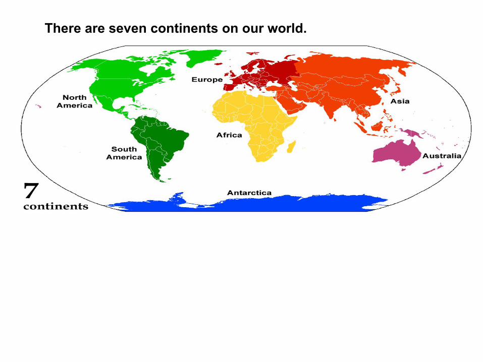
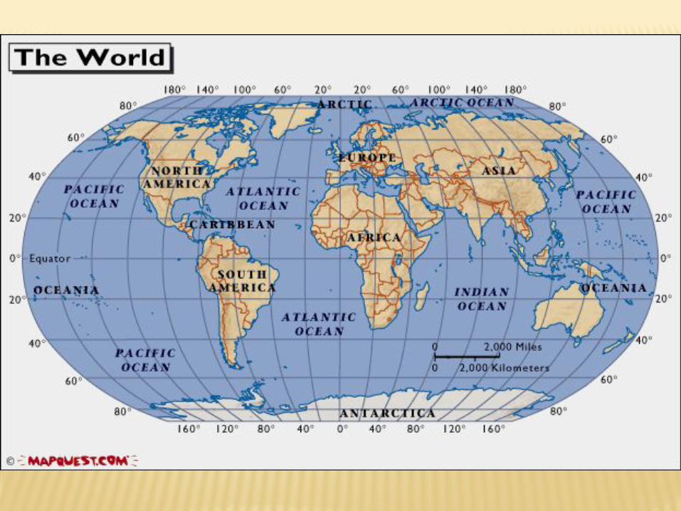
There are seven continents on our world.

North America and South America got married and went to Europe for their honeymoon. They had four children. The children's names all started with the letter A. The largest child was named Asia. The second largest was named Africa. The next child was Antarctica. The smallest child was named Australia.
Click the speaker icon to have the paragraph read out loud.
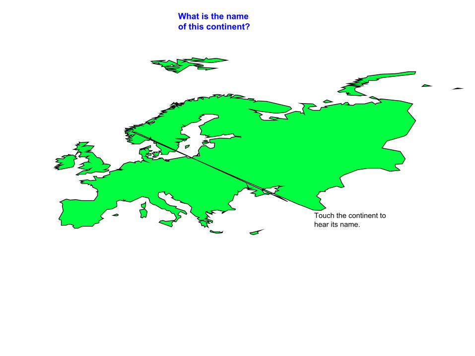
Europe
Asia
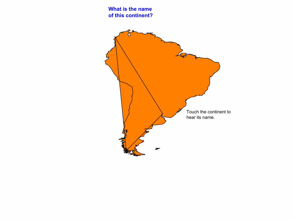
South America
Africa
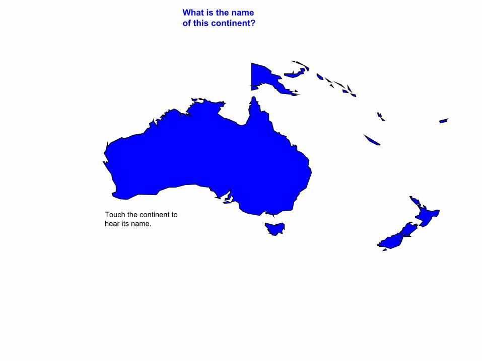
Australia
South America
Antarctica
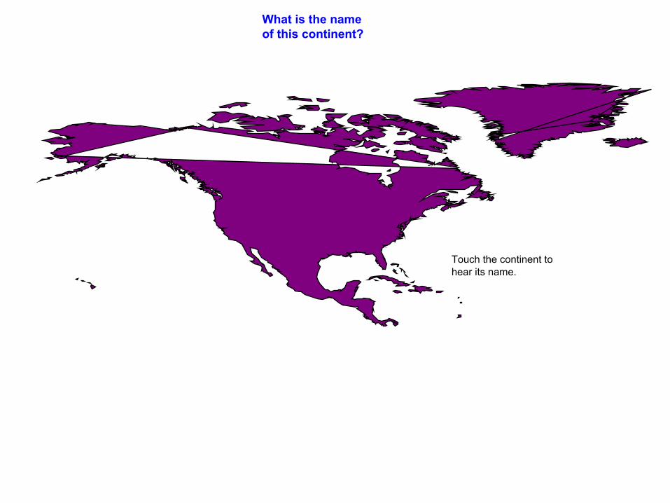
North America
Australia
Europe
Asia
Antarctica
Africa
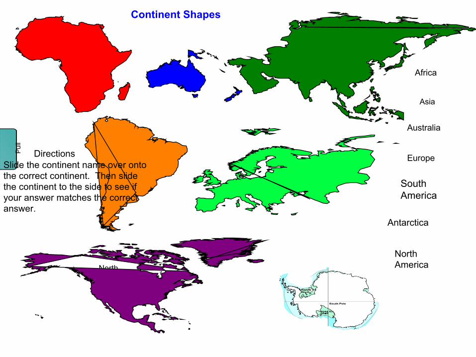
Continent Shapes
North America
DirectionsSlide the continent name over onto the correct continent. Then slide the continent to the side to see if your answer matches the correct answer.
Pul
l
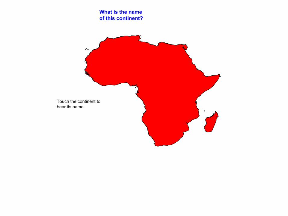
What is the name of this continent?
Touch the continent to hear its name.
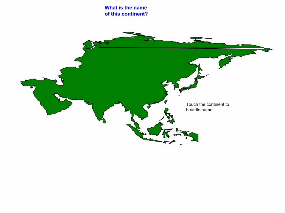
What is the name of this continent?
Touch the continent to hear its name.
What is the name of this continent?
Touch the continent to hear its name.
What is the name of this continent?
Touch the continent to hear its name.
What is the name of this continent?
Touch the continent to hear its name.
What is the name of this continent?
Touch the continent to hear its name.

What is the name of this continent?
Touch the continent to hear its name.
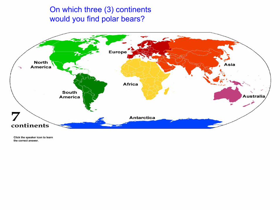
On which three (3) continents would you find polar bears?
Click the speaker icon to learn the correct answer.
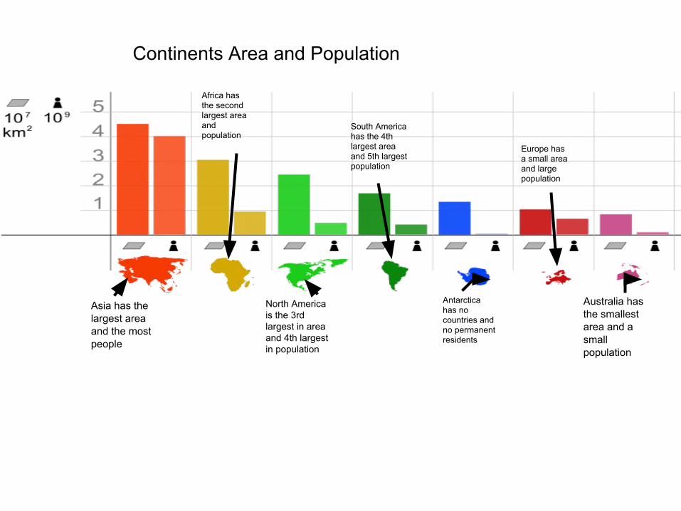
Continents Area and Population
Asia has the largest area and the most people
Antarctica has no countries and no permanent residents
Africa has the second largest area and population
Australia has the smallest area and a small population
Europe has a small area and large population
South America has the 4th largest area and 5th largest population
North America is the 3rd largest in area and 4th largest in population

How many continents are there?
Can you name them?
How many oceans are there?
Can you name them?
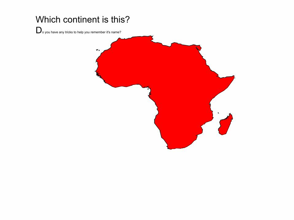
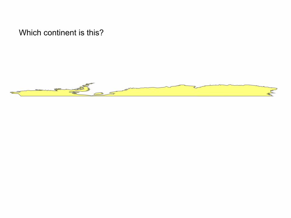
Which continent is this?Do you have any tricks to help you remember it's name?

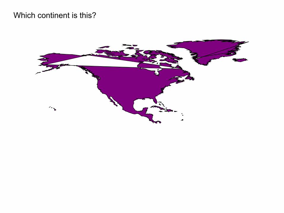
Which continent is this?
Which continent is this?

Which continent is this?

Which continent is this?

Which continent is this?
Which continent is this?
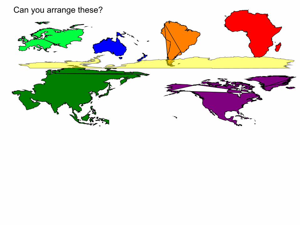
Can you arrange these?
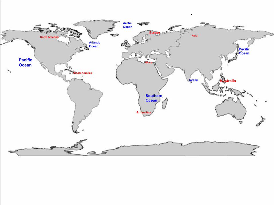
Africa
AsiaNorth America
South America
Australia
Europe
Antarctica
AtlanticOcean
SouthernOcean
Indian
ArcticOcean
PacificOcean
PacificOcean
`

AfricaAsia
North America
South America
Australia
Europe
Antarctica
Atlantic
Southern
Indian
Arctic
Pacific
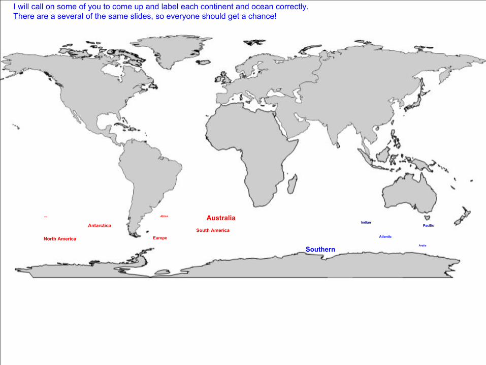
I will call on some of you to come up and label each continent and ocean correctly.There are a several of the same slides, so everyone should get a chance!

AfricaAsia
North America
South America
Australia
Europe
Antarctica
Atlantic
Southern
Indian
Arctic
Pacific
I will call on some of you to come up and label each continent and ocean correctly.There are a several of the same slides, so everyone should get a chance!
AfricaAsia
North America
South America
Australia
Europe
Antarctica
Atlantic
Southern
Indian
Arctic
Pacific
I will call on some of you to come up and label each continent and ocean correctly.There are a several of the same slides, so everyone should get a chance!

*Now get out your Agenda and turn to the world map toward the front.*You may notice the Southern Ocean is not labeled. Please label it now.
1) We will now complete a Continent and Ocean activity. You can use this to study for the quiz you will have next week!2) If/when you finish, get your continent creation activity from the bucket and finish it. ***These should be decorated according to Monday’s directions. Then s cut out each
continent and glue into a shape or arrangement of your choice. You can make a puzzle, animal, creature, etc. The continents should be glued down to the blank blue paper on the front table.