Overview of the USDOT Connected Vehicle Technology and ... · Carry-in –Carried in by...
18
Overview of the USDOT Connected Vehicle Technology and Applications Chen-Fu Liao Minnesota Traffic Observatory (MTO) Department of Civil, Environmental and Geo- Engineering (CEGE) University of Minnesota March 19, 2015
Transcript of Overview of the USDOT Connected Vehicle Technology and ... · Carry-in –Carried in by...

Overview of the USDOT Connected Vehicle Technology and Applications
Chen-Fu Liao
Minnesota Traffic Observatory (MTO)Department of Civil, Environmental and Geo- Engineering (CEGE)
University of Minnesota
March 19, 2015

Outline
• Transportation Challenges
• Connected Vehicle (CV)
• CV Technology for Safety
• Conceptual Relationship of CV Applications
• Safety and Mobility Applications
• Closing Remarks

Today’s Transportation Challenges
Safety 33,561 highway deaths in 2012 2.36 million people were injured in motor
vehicle traffic crashes
Mobility 5.5 billion hours of travel delay $121 billion cost of urban congestion
Environment 2.9 billion gallons of wasted fuel 56 billion lbs of additional CO2
Data Sources: FARS 2012 Data, National Highway Traffic Safety Administration; 2012 Annual Urban Mobility Report, Texas Transportation Institute

Connected Vehicle: 15+ years in the making
Research of technologies and applications that use wireless communications to provide connectivity: Among vehicles of all types Between vehicles and roadway infrastructure Among vehicles, infrastructure and wireless consumer
devices
FCC allocated 5.9 GHz (75 MHz band) spectrum –Dedicated Short Range Communications (DSRC) for transportation safety on Oct. 21, 1999 Low latency, line of sight High bandwidth, 300~500m range Now an established standard, IEEE 802.11p & SAEJ2735
(Wireless Access in Vehicular Environments – WAVE)
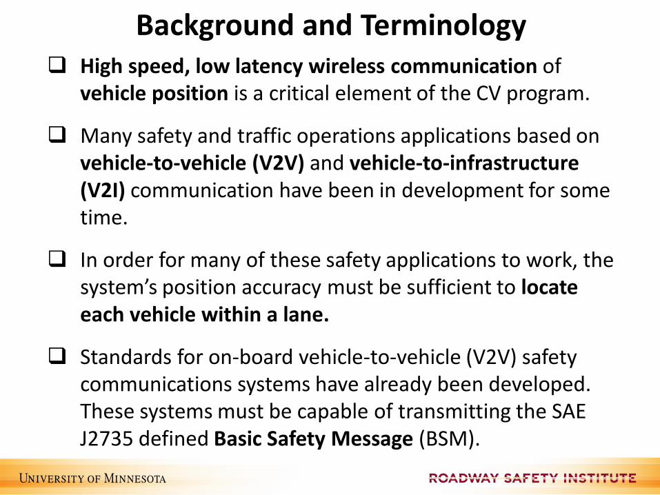
High speed, low latency wireless communication of vehicle position is a critical element of the CV program.
Many safety and traffic operations applications based on vehicle-to-vehicle (V2V) and vehicle-to-infrastructure (V2I) communication have been in development for some time.
In order for many of these safety applications to work, the system’s position accuracy must be sufficient to locate each vehicle within a lane.
Standards for on-board vehicle-to-vehicle (V2V) safety communications systems have already been developed. These systems must be capable of transmitting the SAE J2735 defined Basic Safety Message (BSM).
Background and Terminology

Technology for Safety – 5.9 GHz DSRC
What it is Wi-Fi radio adapted for vehicle environment Inexpensive to produce in quantity Original FCC spectrum allocation in 1999 FCC revised allocation in 2004 and 2006
How the technology works Messages transmitted 10 times/sec (line of sight) Basic Safety Message (BSM): vehicle position, speed, heading, acceleration, size,
brake system status, etc. Privacy is protected (vehicle location is NOT recorded or tracked)
Benefits of DSRC technology compared to radar/laser technology Reduced price Improved reliability → fewer false alarms Increased performance → addresses more crash scenarios
Drawback of the technology Both vehicles need to be equipped to gain benefit Requires security infrastructure
Image Source: USDOT

Fully Connected Vehicle
Image Source: USDOT
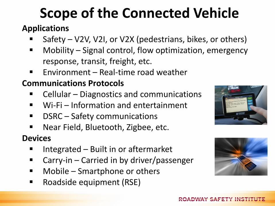
Scope of the Connected VehicleApplications Safety – V2V, V2I, or V2X (pedestrians, bikes, or others) Mobility – Signal control, flow optimization, emergency
response, transit, freight, etc. Environment – Real-time road weather
Communications Protocols Cellular – Diagnostics and communications Wi-Fi – Information and entertainment DSRC – Safety communications Near Field, Bluetooth, Zigbee, etc.
Devices Integrated – Built in or aftermarket Carry-in – Carried in by driver/passenger Mobile – Smartphone or others Roadside equipment (RSE)

Potential Benefit of the Connected Vehicle
Increases in safety, mobility, system efficiency, and access to resources for disadvantaged groups
Decreases in negative environmental impacts such as vehicle emissions, the need for physical expansion, and noise
Decreases in undesirable transportation impacts to the environment and society
Increased opportunities to partner with non-government groups, such as private industry and universities
Real-time and real-world data to help with transportation planning and transportation system operations
Reduction of fatalities through weather-related, safety, infrastructure-based, and other applications

Connected Vehicle (CV) Applications
V2V Safety
V2I SafetyRed Light Violation Warning Curve Speed Warning Stop Sign Gap Assist Spot Weather Impact Warning Reduced Speed/Work Zone Warning Pedestrian in Signalized Crosswalk Warning (Transit)
Emergency Electronic Brake Lights (EEBL) Forward Collision Warning (FCW) Intersection Movement Assist (IMA)Left Turn Assist (LTA)Blind Spot/Lane Change Warning (BSW/LCW)Do Not Pass Warning (DNPW)Vehicle Turning Right in Front of Bus Warning (Transit)
Probe-based Pavement Maintenance
Probe-enabled Traffic Monitoring
Vehicle Classification-based Traffic Studies
CV-enabled Turning Movement & Intersection
Analysis
CV-enabled Origin-Destination Studies Work Zone Traveler Information
Advanced Traveler Information SystemIntelligent Traffic Signal System(I-SIG)Signal Priority (transit, freight)Mobile Accessible Pedestrian Signal System (PED-SIG)Emergency Vehicle Preemption (PREEMPT)Dynamic Speed Harmonization (SPD-HARM)Queue Warning (Q-WARN)Cooperative Adaptive Cruise Control (CACC)Incident Scene Pre-Arrival Staging Guidance for Emergency Responders (RESP-STG)Incident Scene Work Zone Alerts for Drivers and Workers (INC-ZONE)Emergency Communications and Evacuation (EVAC) Connection Protection (T-CONNECT)Dynamic Transit Operations (T-DISP)Dynamic Ridesharing (D-RIDE)Freight-Specific Dynamic Travel Planning and Performance Drayage Optimization
Mobility
Agency Data
EnvironmentEco-Approach and Departure at Signalized Intersections
Eco-Traffic Signal Timing
Eco-Traffic Signal Priority
Connected Eco-Driving
Wireless Inductive/Resonance Charging
Eco-Lanes Management
Eco-Speed Harmonization
Eco-Cooperative Adaptive Cruise Control
Eco-Traveler Information
Eco-Ramp Metering
Low Emissions Zone Management
AFV Charging / Fueling Information
Eco-Smart ParkingDynamic Eco-Routing (light vehicle, transit, freight)Eco-ICM Decision Support System
Motorist Advisories and Warnings (MAW) Enhanced MDSSVehicle Data Translator (VDT)Weather Response Traffic Information (WxTINFO)
Road Weather
Smart RoadsideWireless InspectionSmart Truck Parking
Source: USDOT

Connected Vehicle Safety Applications
Forward Collision Warning (FCW) Emergency Electronic Brake Light (EEBL) Blind Spot/Lane Change Warning (BSW/LCW) Do Not Pass Warning (DNPW) Intersection Movement Assist (IMA) Left Turn Assist (LTA)
Curve Speed Warning (CSW) Red Light Violation Warning (RLVW) Spot Weather Information Warning (SWIW) Reduced Speed Zone Warning (RSZW) Stop Sign Gap Assist (SSGA) Smart Roadside Transit Pedestrian Warning
V2V
V2I

Conceptual Relationships of CV Applications
Source: CVTA, 2013

Architecture of multi-vehicle gang plow system. Each plow is equipped with DGPS and a wireless communication transceiver. Each vehicle is identified by its position in the gang. Each vehicle broadcasts its position and speed to every vehicle behind it in the formation.
(Figure 3.1 & 4.1 from “DGPS-Based Gang Plowing,” MnDOT report MN/RC – 2005-18, 2005)
V2V: Multi-vehicle Gang plowing (2005)

Using Wi-Fi / Cellular
Mobile Accessible Pedestrian Signal (MAPS)
Cellular
Geometry andWarning Info.
Digital Map
GPS
SPaTSSM

MAPS User InterfaceGeometry Information
Single tap for orientation and geometry information
Text-to-Speech message
Heading North to
Washington Ave 4-Lane
Heading West to
Oak Street 4-Lane
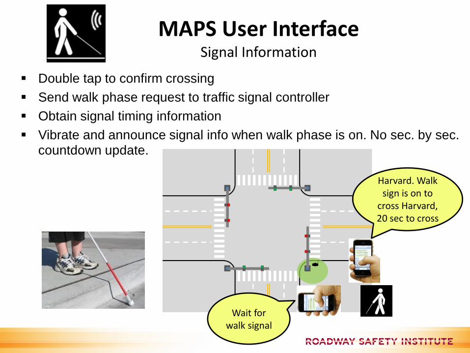
MAPS User InterfaceSignal Information
Double tap to confirm crossing
Send walk phase request to traffic signal controller
Obtain signal timing information
Vibrate and announce signal info when walk phase is on. No sec. by sec. countdown update.
Harvard. Walk sign is on to
cross Harvard, 20 sec to cross
Wait for walk signal

Source: USDOT
The Path to Deployment