
Open standards: A success factor for smart cities
45
® OGC Open Standards: A Success Factor for Smart Cities Dr. Ingo Simonis Director, Interoperability Programs & Science, OGC July 2015 © 2015 Open Geospatial Consortium
-
Upload
ingo-simonis -
Category
Technology
-
view
29 -
download
1
Transcript of Open standards: A success factor for smart cities

®
OGC
Open Standards: A Success Factor for Smart
Cities
Dr. Ingo SimonisDirector, Interoperability Programs & Science, OGC
July 2015
© 2015 Open Geospatial Consortium
OGC®
© 2015 Open Geospatial Consortium 2
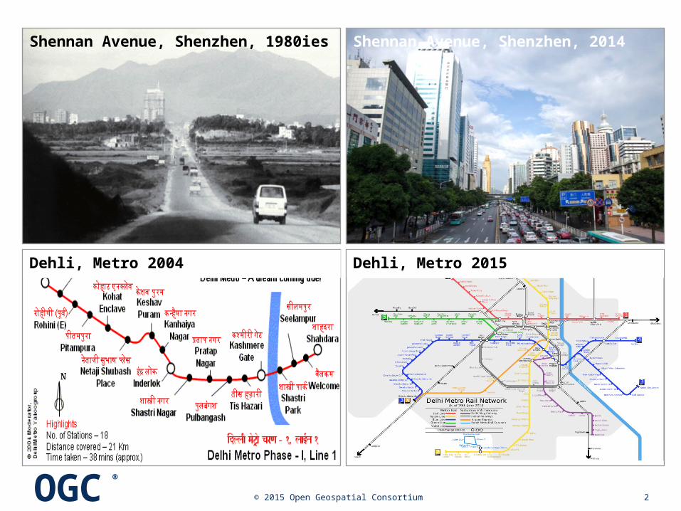
Shennan Avenue, Shenzhen, 1980ies Shennan Avenue, Shenzhen, 2014
Dehli, Metro 2004 Dehli, Metro 2015
OGC®
© 2015 Open Geospatial Consortium 3
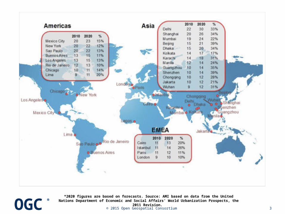
*2020 figures are based on forecasts. Source: AMI based on data from the United Nations Department of Economic and Social Affairs’ World Urbanization Prospects, the 2011
Revision.

OGC®
4
Today, 70% of global energy is consumed in cities
Today, 60-80% of GDP is generated in big cities
By 2050, 70% of the world’s population will live in cities

OGC®
© 2015 Open Geospatial Consortium 5
The bigger the city, the more of everything

OGC®
© 2015 Open Geospatial Consortium 6
The bigger the city, the more of everything
Creativity
Health facilities
Innovation
Culture
Education
Markets

OGC®
© 2015 Open Geospatial Consortium 7
The bigger the city, the more of everything
incr. Trans-
portation
Congestion
Pollution
Diseases
Housing shortcom
.
Crime

OGC®
© 2015 Open Geospatial Consortium 8
The bigger the city, the more of everything
Creativity
Health facilities
Innovation
Culture
Education
Markets
incr. Trans-
portation
Congestion
Pollution
Diseases
Housing shortcom
.
Crime
OGC®
© 2015 Open Geospatial Consortium 9
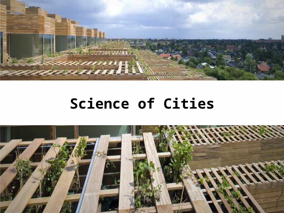
Science of Cities

OGC®
© 2015 Open Geospatial Consortium 10
No two cities are the same
No universal solutions
Keep pace with urban development
Keep pace with changing conditions

OGC®
© 2015 Open Geospatial Consortium 11

OGC®
© 2015 Open Geospatial Consortium 12
Aim to meet and exceed EU 20% CO2 reduction goal
Increase energy efficiency & use of renewable
Voluntarily commitment by local/regional authorities

OGC®
© 2015 Open Geospatial Consortium 13
OGC®
© 2015 Open Geospatial Consortium 14
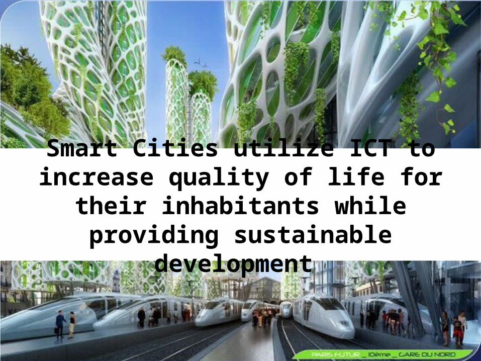
Smart Cities utilize ICT to increase quality of life for their inhabitants
while providing sustainable development
OGC®
© 2015 Open Geospatial Consortium 15
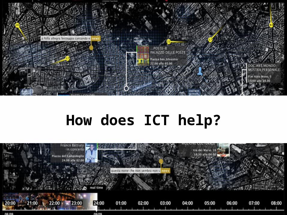
How does ICT help?
OGC®
© 2015 Open Geospatial Consortium 16
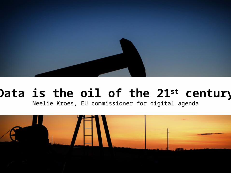
Data is the oil of the 21st centuryNeelie Kroes, EU commissioner for digital agenda

OGC®
© 2015 Open Geospatial Consortium 17
Smart City Sensor Model

OGC®
© 2015 Open Geospatial Consortium 18

OGC®
© 2015 Open Geospatial Consortium 19
Consumers & Producers
OGC®
© 2015 Open Geospatial Consortium
20

OGC®
© 2015 Open Geospatial Consortium 21
Smart Mobility
Smart Governance
Smart Living
Smart People
Smart Environment
Smart Economy
ICT: Bricks & Mortar
OGC®
© 2015 Open Geospatial Consortium 22
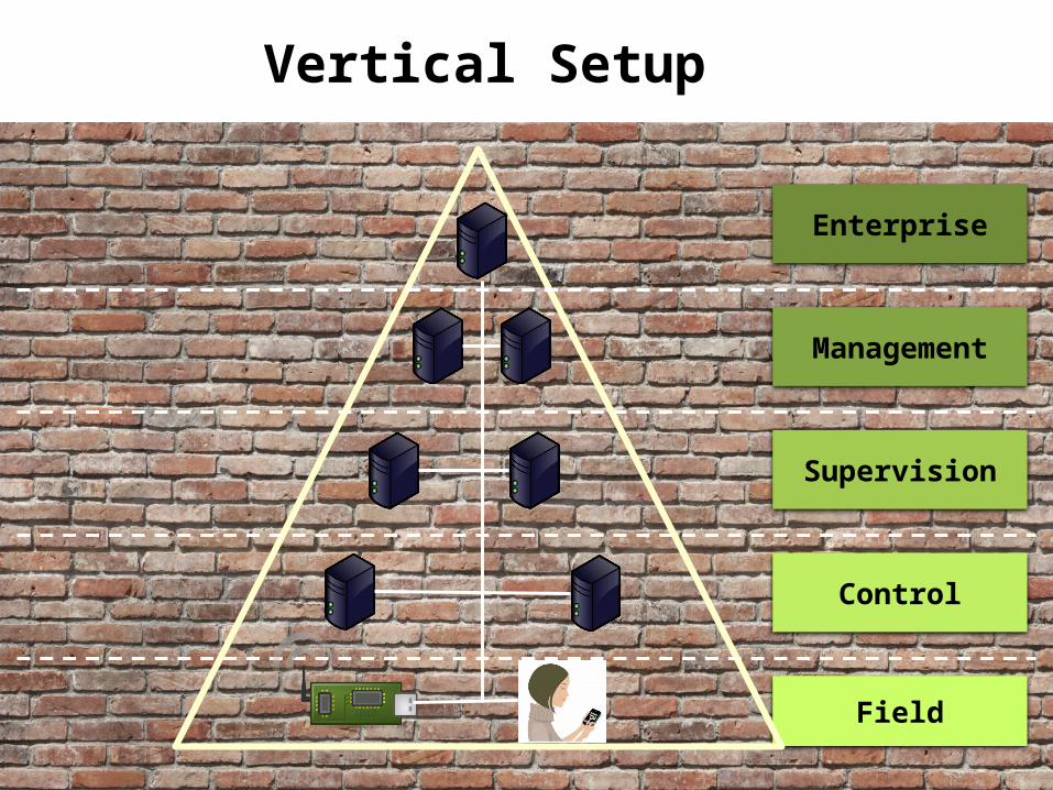
Enterprise
Management
Supervision
Field
Control
Vertical Setup
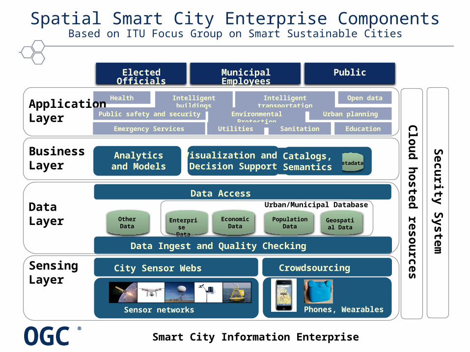
OGC®
Spatial Smart City Enterprise ComponentsBased on ITU Focus Group on Smart Sustainable Cities
City Sensor Webs
Sensor networks
Crowdsourcing
Phones, Wearables
Sensing Layer
Analyticsand Models Metadat
a
Catalogs, Semantics
BusinessLayer
Visualization and Decision Support
PopulationData
Data Access
Geospatial Data
DataLayer
Data Ingest and Quality Checking
OtherData
Enterprise
Data
Urban/Municipal Database
Economic
Data
HealthApplicationLayer
Intelligent buildings
Intelligent transportation
Open data
Environmental Protection
Public safety and security Urban planning
UtilitiesEmergency Services EducationSanitation
Elected Officials
PublicMunicipal Employees
Clo
ud
hoste
d re
sou
rces
Secu
rity S
yste
m
Smart City Information Enterprise

OGC®
Levels of Detail
Diagram: Filip Biljecki, TU Delft
OGC®
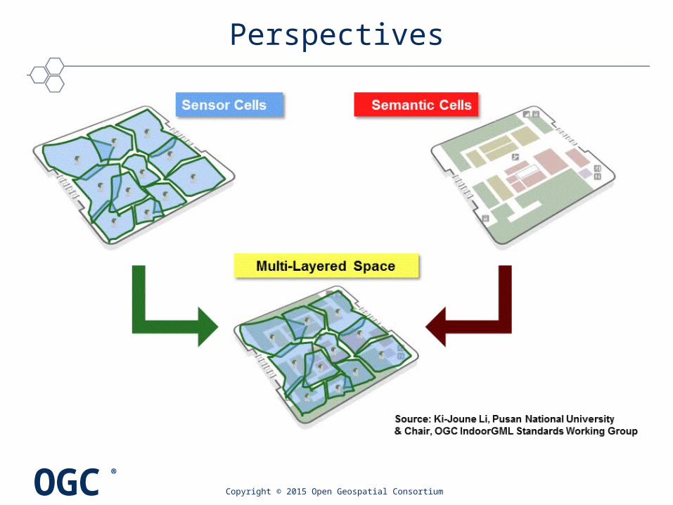
Perspectives
Copyright © 2015 Open Geospatial Consortium

OGC®
© 2015 Open Geospatial Consortium 26
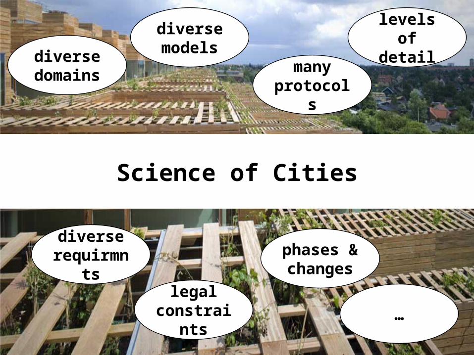
Science of Cities
OGC®
© 2015 Open Geospatial Consortium 27
Science of Cities
diverse domains
levels of detail
many protocols
diverse requirmn
ts
diverse models
legal constrain
ts
phases & changes
…

OGC®
© 2015 Open Geospatial Consortium 28
Open Standards
diverse domains
levels of detail
many protocols
diverse requirmn
ts
diverse models
legal constrain
ts
phases & changes
…

OGC®
© 2015 Open Geospatial Consortium 29http://mwpdigitalmedia.com/blog/wp-content/uploads/2015/04/1a.jpg
Boring…

OGC®
Benefits: German DIN Study
• Standards promote worldwide trade, encouraging rationalization, quality assurance and environmental protection, as well as improving security and communication.
• Standards have a greater effect on economic growth than patents or licenses.
• Standards facilitate procurement• Standards create “Markets”
• "Economic Benefits of Standardization" • Benefits to German economy of 17 billion Euros
in 2010!(c) 2015 Open Geospatial Consortium
OGC®
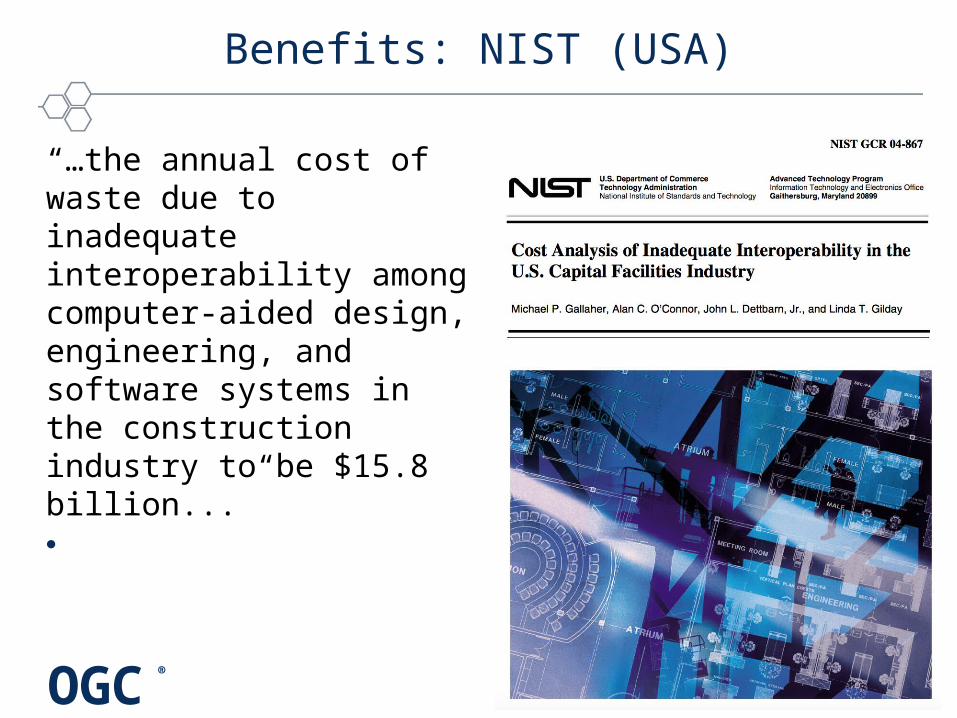
Benefits: NIST (USA)
“…the annual cost of waste due to inadequate interoperability among computer-aided design, engineering, and software systems in the construction industry to be $15.8 billion...”•

OGC®
What is a Standard?
• “An agreed way of doing something”
© 2015 Open Geospatial Consortium
EC: Practical standards guide for researchers - en

OGC®
What is a Standard?
• “An agreed way of doing something”
• Standards are the distilled wisdom of people with expertise in their subject matter and who know the needs of the organizations they represent – people such as manufacturers, sellers, buyers, customers, trade associations, users or regulators.
• Standards are knowledge. They are powerful tools that can help drive innovation and increase productivity. They can make organizations more successful and people’s everyday lives easier, safer and healthier.
© 2015 Open Geospatial Consortium
EC: Practical standards guide for researchers - en
OGC®
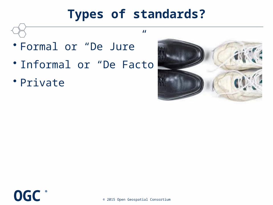
Types of standards?
• Formal or “De Jure”
• Informal or “De Facto”
• Private
© 2015 Open Geospatial Consortium

OGC®
Types of standards?
• “De Jure” (ISO, CEN, DIN, AFNOR, ANSI, …)– Through National Representation (NSB)
– Types:• National (NS), European (EN): CEN
• International Standards (IS): ISO
© 2015 Open Geospatial Consortium

OGC®
Types of standards?
• “De Facto” (IEEE, SAE, OGC, OASIS, W3C, …)– Organisation or individual representation
– Consensus process
– In Technical Committees
© 2015 Open Geospatial Consortium
OGC®
Types of standards?
• Private– E.g. ESRI Shape file
• Not based on consensus
© 2015 Open Geospatial Consortium
OGC®
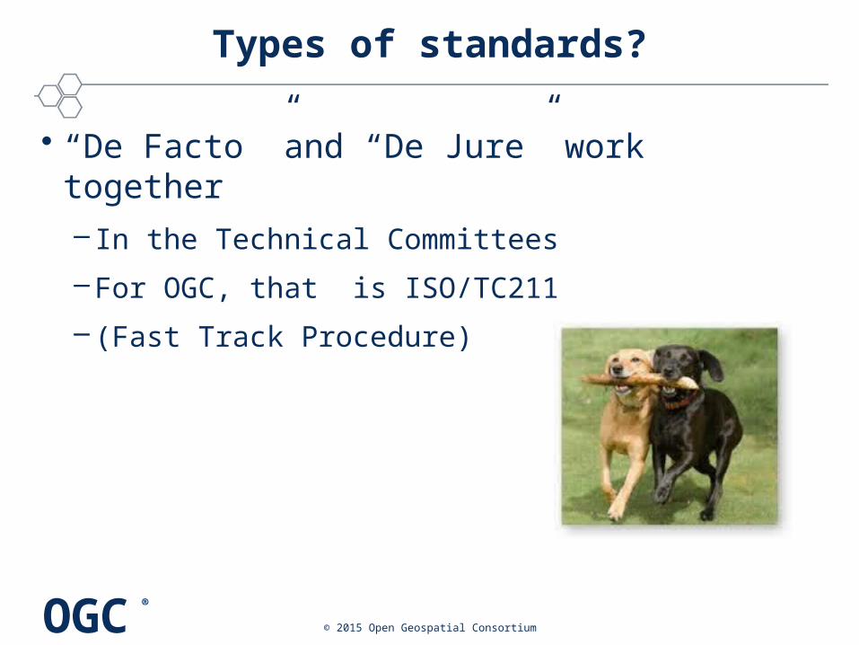
Types of standards?
• “De Facto ”and “De Jure” work together– In the Technical Committees
– For OGC, that is ISO/TC211
– (Fast Track Procedure)
© 2015 Open Geospatial Consortium
OGC®
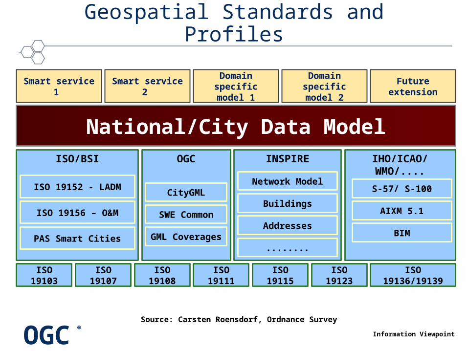
Geospatial Standards and Profiles
ISO/BSI
ISO 19103 ISO 19107 ISO 19108 ISO 19111 ISO 19115 ISO 19123 ISO 19136/19139
ISO 19152 - LADM
ISO 19156 – O&M
PAS Smart Cities
OGC IHO/ICAO/WMO/....INSPIRE
National/City Data Model
Smart service 1 Smart service 2 Domain specific
model 1Domain specific
model 2
S-57/ S-100
AIXM 5.1
Network Model
Buildings
Addresses
........
CityGML
SWE Common
BIM
Future extension
GML Coverages
Information Viewpoint
Source: Carsten Roensdorf, Ordnance Survey
OGC®
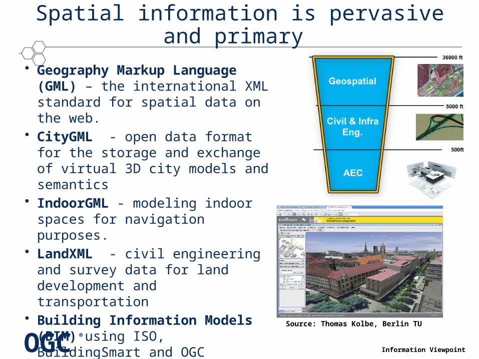
Spatial information is pervasive and primary
• Geography Markup Language (GML) – the international XML standard for spatial data on the web.
• CityGML - open data format for the storage and exchange of virtual 3D city models and semantics
• IndoorGML - modeling indoor spaces for navigation purposes.
• LandXML - civil engineering and survey data for land development and transportation
• Building Information Models (BIM) using ISO, BuildingSmart and OGC standards
Source: Thomas Kolbe, Berlin TU
Information Viewpoint
OGC®
CityGML Standards Family
• CityGML Standard– Version 2.0 – current adopted version – Version 3.0 Standards Working Group underway
• INSPIRE Data Specification on Buildings – Buildings Theme as in Annex III of the EU INSPIRE Directive– 3D representations of buildings using CityGML– Basis of visualization of noise mapping
• National 3D standard in The Netherlands – OGC Best Practice: CityGML ADE - Dutch 3D Standard
• Additional profiles are underway– 3D National Data Model for Kingdom of Bahrain
Copyright © 2014 Open Geospatial Consortium
OGC®
© 2015 Open Geospatial Consortium 42
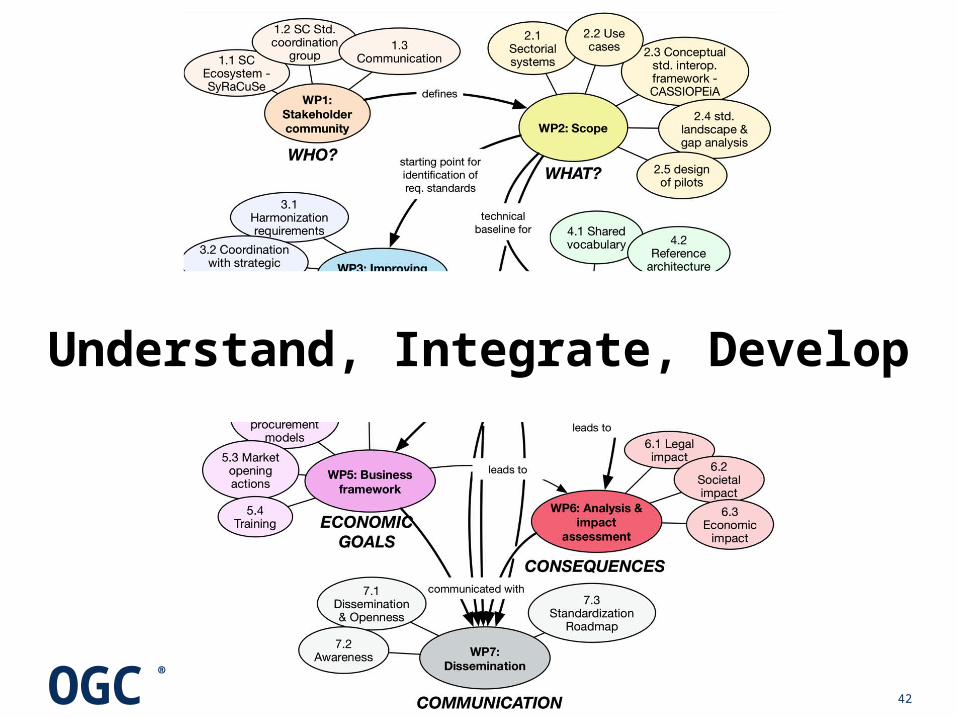
Understand, Integrate, Develop

OGC®
© 2015 Open Geospatial Consortium 43

OGC®
© 2015 Open Geospatial Consortium 45
Ingo Simonisisimonis @ opengeospatial.org