olksboukundige Vereniging van Suid Afrika Excursion … · 2013-11-05 · olksboukundige Vereniging...
10
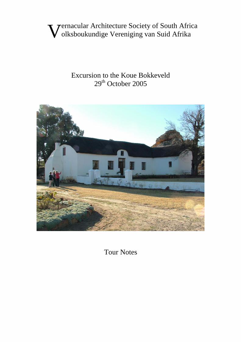
ernacular Architecture Society of South Africa olksboukundige Vereniging van Suid Afrika Excursion to the Koue Bokkeveld 29 th October 2005 Tour Notes V
Transcript of olksboukundige Vereniging van Suid Afrika Excursion … · 2013-11-05 · olksboukundige Vereniging...
ernacular Architecture Society of South Africa
olksboukundige Vereniging van Suid Afrika
Excursion to the Koue Bokkeveld
29th October 2005
Tour Notes
V
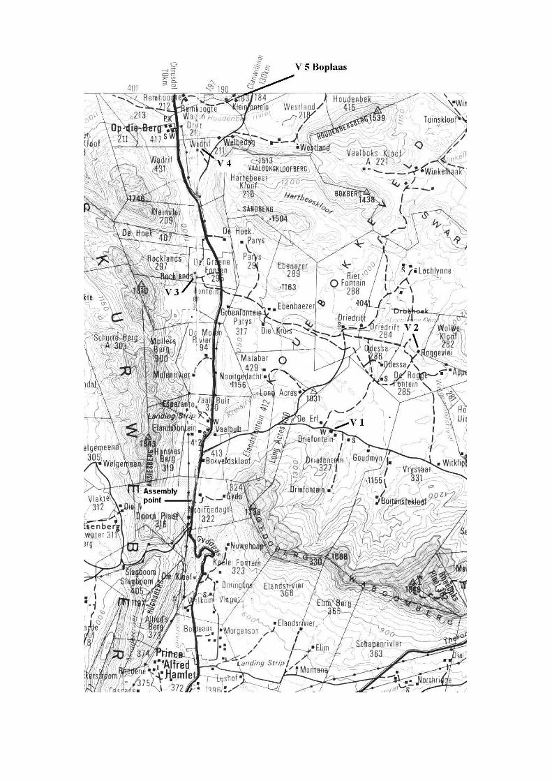
Directions
The two easiest ways to get to Ceres are:-
a] Along the N1 towards Worcester, just before the town turn left on the R43 and just
before Wolseley onto the R46 to Ceres.
b] Via Wellington up the R44 and on to the R46 through New Kloof Pass, by passing
Hermon and Tulbach and on to Ceres.
Once in Ceres, drive through the town, crossing the bridge over the river and then
turning left at the traffic lights onto the R303 towards Prince Alfred Hamlet and Op-
de-Berg. After Prince Alfred Hamlet you ascend the Gydo Pass up onto the Koue
Bokkeveld. At the top of the pass you can see on your left, down in the kloof the old
ox wagon track.
Just a few kilometres further on your right is Nooitgedacht, a farm belonging to Du
Toit Broedery. Opposite on the left is a gravel lay-by where we are going to meet.
Be there by 10.00. It will take at least 2 hours to get there from Cape Town.
To reach our first site carry on up the road towards Op-die-Berg and after about 5 km
take the tar road turning right. This road changes to gravel. At the fork keep right until
you reach Driefontein.
Brief History of the Koue Bokkeveld
The area known as the Bokkeveld, (from the vast herds of Springbok that migrated
through in early times) was first permanently by settled by VOC colonists around
1730. Most of the first farmers were from the ‘t land van Waveren that later became
known as the Tulbach Valley. The Bokkeveld was divided into two areas the Koue
and Warm. This latter area was the land surrounding the top of the Mostert’s Hoek
Pass, where Ceres now stands. The Koue or Cold Bokkeveld was the higher lying area
to the east and north.
The farms in the northern parts were mostly described as being agter de Witzenberg
(behind the Witzenberg) this being one of the mountain ranges that separates the
Koue Bokkeveld from the Tulbach Valley and was crossed by the Witzenberg Pass.
Sometimes however, the farms were described as being over the Oliphants River as
this was another route into the area via Kardouws Kloof (crossing into the Oliphants
Valley from just above Porterville) and the Elands Pad Pass (a road over the
Middleberg).
The area was fertile and excellent for growing grain, fruits and vegetables and
poultry, especially turkeys. The main activity was the rearing of mutton sheep. In
1805 it was calculated that there were 30 000 sheep in the district. The main
advantage was the cold climate, which prevented lamziekte, a prevalent disease at that
time. During the coldest periods the farmers took their flocks over the Swartruggens
and down into the Ceres Karoo to feed on the winter grass.
It was always sparsely settled and a good proportion of the white inhabitants were
members of the van der Merwe family.
As late as the 1820’s this area was considered a remote part of the Cape and at
Houdenbeck, in one corner, the last slave rebellion took place in 1823.
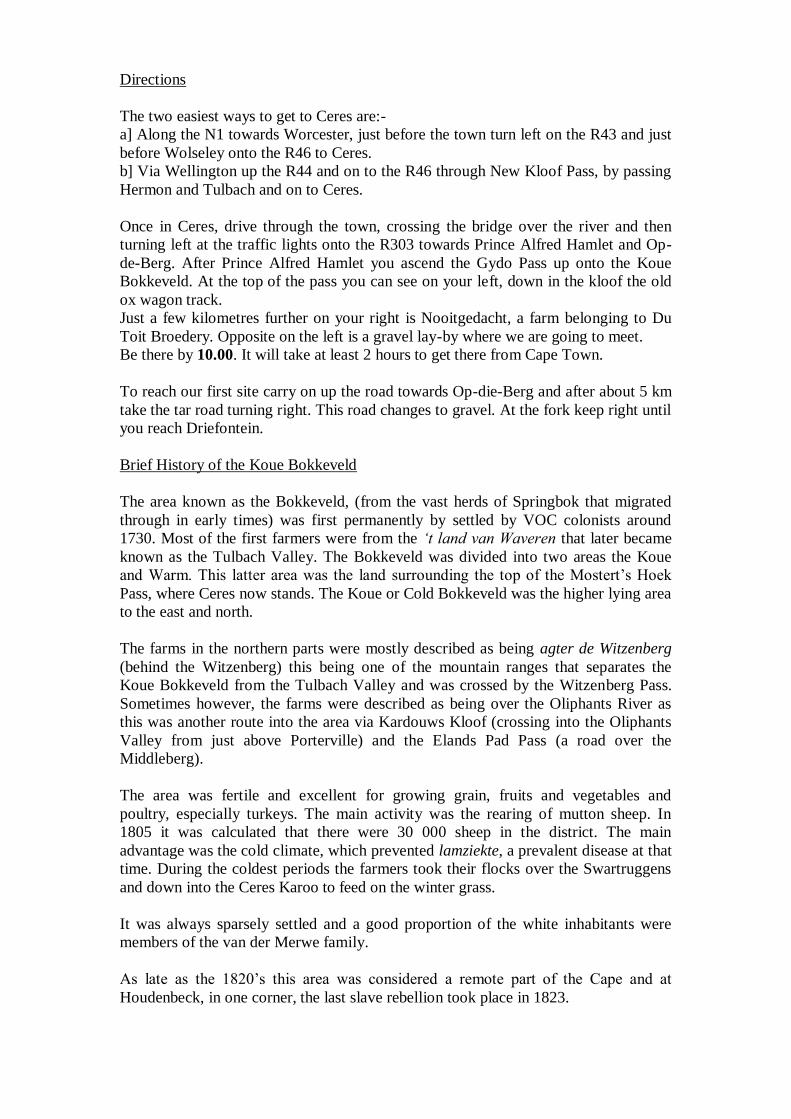
V1. Driefontein – Arrive 10:30 – Depart 11:00
1818 survey diagram of Driefontein
The first loan farm record found was the 1739 grant to Jacobus Pienaar, described as
Driefontein agter de Bokkeveld. Pienaar kept the farm until 1770 when it was taken
over by Carel Hendrik Buijtendag. Buijtendag had been expelled from the Tulbach
Valley in 1754 and was living at the adjoining farm Rietfontein. He still had a farm
near Tulbach (Rietvalley) and he swapped this with Jacobus Pienaar for Driefontein.
Buijtendag was a surly and vicious man who murdered at least one of his servants and
was eventually banished to the Netherlands.
In 1774 before he left he sold the farms to Johan Claste (Clarssen) for 10 000
guilders, the balance of which had to be paid within two years. Buijtendag made it so
difficult for Claste that he could not repay the money and ended broke. For a fuller
story of Carel Hendrik Buijtendag’s activities, see Nigel Penn’s book “Rogues,
Rebels and Runaways” where he describes Buijtendag as the “Beast of the
Bokkeveld”.
After Claste vacated Driefontein, the property was taken over by Frans Joosten in
1777.
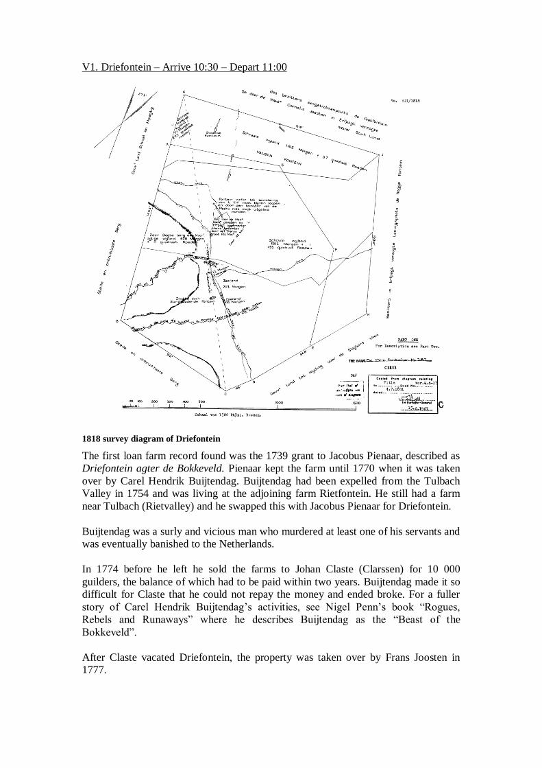
By the time VOC loan farms were converted to perpetual quit rent, it was in the hands
of Petrus Ludovic du Toit and it is thought that he built the present house. The house
has a date of 1819 on one of the gables but has been modernized perhaps late in the
1800”s. It has been conjectured that the style of the house, an H shape with an
extended tail was once a T shape.
Driefontein from the front
The Cohen Family
Lionel Cohen owns both Driefontein and the next farm we visit, Roggevlei. His main
farm is called Odessa, named after the town in the Ukraine where his family came
from. The first Cohen had the lease for the farm Karoopoort at the entrance to the
Ceres Karoo. This farm was put out to tender by the Government as it was ideally
positioned, on the then, main road to the Transvaal. Cohen had a trading store there
for some years. Later he decided to go into the business of breeding horses, an activity
carried on by his descendants to this day, and purchased his farm that was once part of
the farms Rietfontein and Roggevalley.
V2. Roggevlei – Arrive 11:20 – Depart 12:00
After Driefontein, head back towards the R 303 (but do not get that far) and, where
you turned right at the fork on the way in, turn right and follow the map. Drive
carefully on this gravel road.
Little is known of Roggevlei, it is suspected that this farm once formed part of the
much larger farm called Bokkenveld aan de Rogge Valley (now De Rogge Fontein).
The first loan farm grant found is for Louw Pretorius in 1743. It is not known when he
left but in 1787 the farm was vacated by Hendrik Johannes de Nicker in favour of
Frans Joosten who had earlier registered Driefontein,
The survey diagram for this farm has not been located but we know from the diagram
of an adjoining farm that a C.F. du Toit was a part owner in 1875.
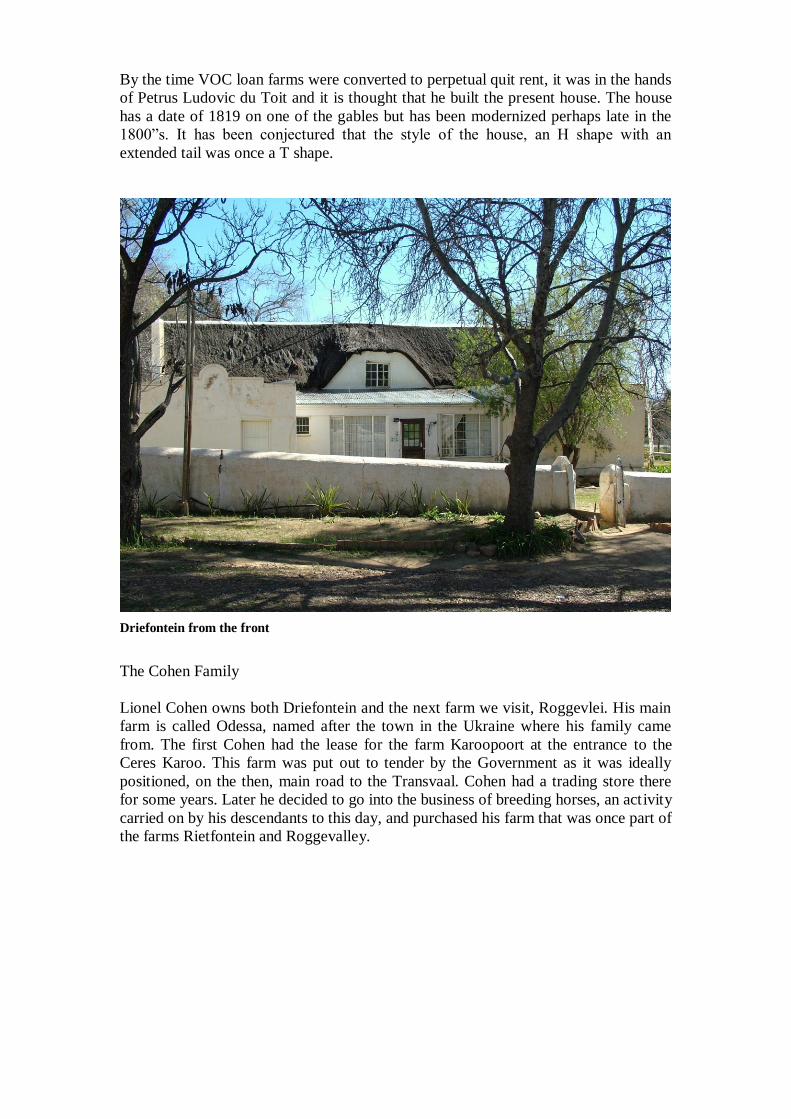
House at Roggevlei
As can be seen this is a typical Bokkeveld house with half-hipped ends and an
eyebrow gable over the door. There is a forward facing extension at the front right
hand side, turning the building into an L shape. The windows and door have been
replaced, but some time ago, as there is an old photograph dating from the first half of
the last century showing these. A tentative date would be 2nd
quarter of the 19th
century.
From Roggevlei back track to the R 303 and turn right and drive north to Rocklands
which will be on your left hand side.
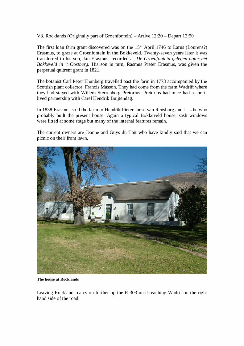
V3. Rocklands (Originally part of Groenfontein) – Arrive 12:20 – Depart 13:50
The first loan farm grant discovered was on the 15th April 1746 to Larus (Lourens?)
Erasmus, to graze at Groenfontein in the Bokkeveld. Twenty-seven years later it was
transferred to his son, Jan Erasmus, recorded as De Groenfontein gelegen agter het
Bokkeveld in 't Oostberg. His son in turn, Rasmus Pieter Erasmus, was given the
perpetual quitrent grant in 1821.
The botanist Carl Peter Thunberg travelled past the farm in 1773 accompanied by the
Scottish plant collector, Francis Masson. They had come from the farm Wadrift where
they had stayed with Willem Sterrenberg Pretorius. Pretorius had once had a short-
lived partnership with Carel Hendrik Buijtendag.
In 1838 Erasmus sold the farm to Hendrik Pieter Janse van Rensburg and it is he who
probably built the present house. Again a typical Bokkeveld house, sash windows
were fitted at some stage but many of the internal features remain.
The current owners are Jeanne and Guys du Toit who have kindly said that we can
picnic on their front lawn.
The house at Rocklands
Leaving Rocklands carry on further up the R 303 until reaching Wadrif on the right
hand side of the road.
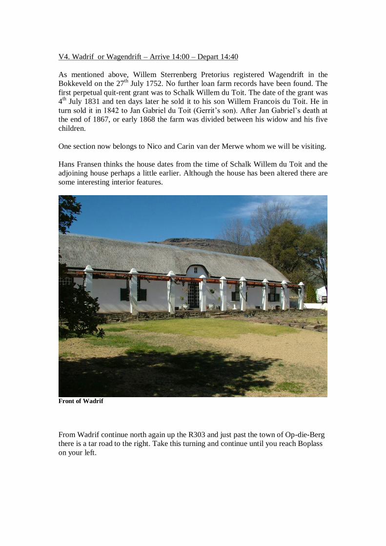
V4. Wadrif or Wagendrift – Arrive 14:00 – Depart 14:40
As mentioned above, Willem Sterrenberg Pretorius registered Wagendrift in the
Bokkeveld on the 27th
July 1752. No further loan farm records have been found. The
first perpetual quit-rent grant was to Schalk Willem du Toit. The date of the grant was
4th
July 1831 and ten days later he sold it to his son Willem Francois du Toit. He in
turn sold it in 1842 to Jan Gabriel du Toit (Gerrit’s son). After Jan Gabriel’s death at
the end of 1867, or early 1868 the farm was divided between his widow and his five
children.
One section now belongs to Nico and Carin van der Merwe whom we will be visiting.
Hans Fransen thinks the house dates from the time of Schalk Willem du Toit and the
adjoining house perhaps a little earlier. Although the house has been altered there are
some interesting interior features.
Front of Wadrif
From Wadrif continue north again up the R303 and just past the town of Op-die-Berg
there is a tar road to the right. Take this turning and continue until you reach Boplass
on your left.
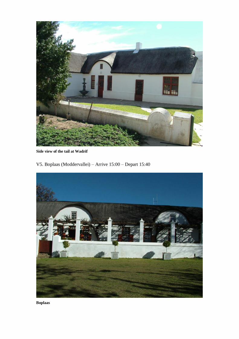
Side view of the tail at Wadrif
V5. Boplaas (Moddervallei) – Arrive 15:00 – Depart 15:40
Boplaas
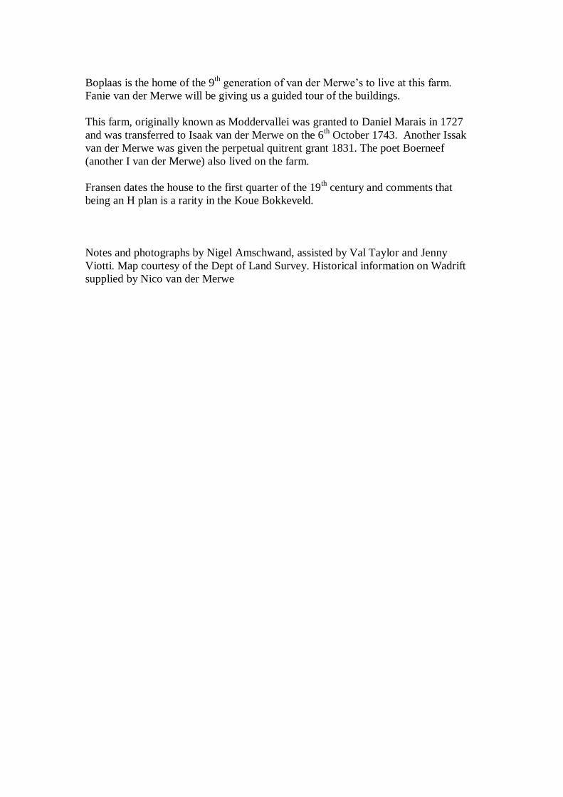
Boplaas is the home of the 9th generation of van der Merwe’s to live at this farm.
Fanie van der Merwe will be giving us a guided tour of the buildings.
This farm, originally known as Moddervallei was granted to Daniel Marais in 1727
and was transferred to Isaak van der Merwe on the 6th October 1743. Another Issak
van der Merwe was given the perpetual quitrent grant 1831. The poet Boerneef
(another I van der Merwe) also lived on the farm.
Fransen dates the house to the first quarter of the 19th century and comments that
being an H plan is a rarity in the Koue Bokkeveld.
Notes and photographs by Nigel Amschwand, assisted by Val Taylor and Jenny
Viotti. Map courtesy of the Dept of Land Survey. Historical information on Wadrift
supplied by Nico van der Merwe