NWC SAF/HIGH RESOLUTION WINDS AMV SOFTWARE VERSION...
8
Proceedings for the 13 th International Winds Workshop 27 June - 1 July 2016, Monterey, California, USA NWC SAF/HIGH RESOLUTION WINDS AMV SOFTWARE VERSION 2016 Javier García-Pereda NWC SAF/AEMET Leonardo Prieto Castro 8, E-28040 Madrid, Spain, [email protected] Abstract The “High Resolution Winds (HRW)” AMV software, developed inside the “Satellite Application Facility on support to Nowcasting and very short range forecasting (NWC SAF)” stand alone “Software package for geostationary satellites (NWC/GEO)”, provides a detailed calculation of Atmospheric Motion Vectors and Trajectories locally and in real time by its users. A new version of NWC/GEO software package is being released in 2016, with following main new elements for HRW product: the inclusion in “CCC height assignment method” of a pressure level correction physically based on the cloud depth, considering new parameters provided by NWC/GEO CMIC - Cloud Microphysics product, and its extension to the processing of images coming from GOES-N satellite series (GOES 13, GOES 14 and GOES 15). Common tools and libraries used by all NWC/GEO products have also been prepared to easily process later on additional geostationary satellite series, through the conversion of satellite input data to a common NetCDF format. A detailed documentation of all HRW code has also been included, with the support of Doxygen tool and through comments inside its C and Fortran code, which helps NWC SAF users to understand every single step of HRW algorithm. The validation of HRW version 2016 for MSG satellite AMVs, compared to previous version 2013, shows an increase in the amount of valid AMVs of about a 20%, and a reduction in all validation statistics, up to about a 20% in the case of the Normalized BIAS. The validation for GOES-N satellite AMVs shows equivalent validation statistics than for MSG satellite AMVs. Because of its characteristics and its ease to be obtained, understood and run locally, NWC SAF/HRW AMV software had been proposed as option for “Stand alone AMV calculation software”, available to all AMV researchers and users. The good validation results obtained by NWC SAF/HRW product, one of the two best AMVs algorithms in the 2014 AMV Intercomparison study, and the additional improvements in the validation shown by version 2016, should be enough to convince any AMV researchers about the use of NWC/GEO HRW AMV software. NWC SAF/GEO AND HIGH RESOLUTION WINDS v2016 Eumetsat’s “Satellite Application Facility on support to Nowcasting and Very short range forecasting (NWC SAF)” develops and distributes to Meteorological Services and Researchers “NWC SAF/GEO Software Package”. This software package allows for the calculation of different meteorological products locally and in near real time, including “High Resolution Winds (HRW)”: high density sets of Atmospheric Motion Vectors (AMVs) and Trajectories. The latest version of NWC/SAF GEO (v2016) is already running operationally at NWC SAF Helpdesk, and will be released to NWC SAF users in October 2016 after a final review/authorization by Eumetsat. The main changes of this NWC SAF/GEO v2016 software package are: 1. The official release of several new NWC SAF/GEO products (causing the largest extension of NWC SAF/GEO software since its start):
Transcript of NWC SAF/HIGH RESOLUTION WINDS AMV SOFTWARE VERSION...

Proceedings for the 13th International Winds Workshop 27 June - 1 July 2016, Monterey, California, USA
NWC SAF/HIGH RESOLUTION WINDS AMV SOFTWARE VERSION 2016
Javier García-Pereda
NWC SAF/AEMET Leonardo Prieto Castro 8, E-28040 Madrid, Spain, [email protected]
Abstract The “High Resolution Winds (HRW)” AMV software, developed inside the “Satellite Application Facility on support to Nowcasting and very short range forecasting (NWC SAF)” stand alone “Software package for geostationary satellites (NWC/GEO)”, provides a detailed calculation of Atmospheric Motion Vectors and Trajectories locally and in real time by its users. A new version of NWC/GEO software package is being released in 2016, with following main new elements for HRW product: the inclusion in “CCC height assignment method” of a pressure level correction physically based on the cloud depth, considering new parameters provided by NWC/GEO CMIC - Cloud Microphysics product, and its extension to the processing of images coming from GOES-N satellite series (GOES 13, GOES 14 and GOES 15). Common tools and libraries used by all NWC/GEO products have also been prepared to easily process later on additional geostationary satellite series, through the conversion of satellite input data to a common NetCDF format. A detailed documentation of all HRW code has also been included, with the support of Doxygen tool and through comments inside its C and Fortran code, which helps NWC SAF users to understand every single step of HRW algorithm. The validation of HRW version 2016 for MSG satellite AMVs, compared to previous version 2013, shows an increase in the amount of valid AMVs of about a 20%, and a reduction in all validation statistics, up to about a 20% in the case of the Normalized BIAS. The validation for GOES-N satellite AMVs shows equivalent validation statistics than for MSG satellite AMVs. Because of its characteristics and its ease to be obtained, understood and run locally, NWC SAF/HRW AMV software had been proposed as option for “Stand alone AMV calculation software”, available to all AMV researchers and users. The good validation results obtained by NWC SAF/HRW product, one of the two best AMVs algorithms in the 2014 AMV Intercomparison study, and the additional improvements in the validation shown by version 2016, should be enough to convince any AMV researchers about the use of NWC/GEO HRW AMV software. NWC SAF/GEO AND HIGH RESOLUTION WINDS v2016 Eumetsat’s “Satellite Application Facility on support to Nowcasting and Very short range forecasting (NWC SAF)” develops and distributes to Meteorological Services and Researchers “NWC SAF/GEO Software Package”. This software package allows for the calculation of different meteorological products locally and in near real time, including “High Resolution Winds (HRW)”: high density sets of Atmospheric Motion Vectors (AMVs) and Trajectories. The latest version of NWC/SAF GEO (v2016) is already running operationally at NWC SAF Helpdesk, and will be released to NWC SAF users in October 2016 after a final review/authorization by Eumetsat. The main changes of this NWC SAF/GEO v2016 software package are: 1. The official release of several new NWC SAF/GEO products (causing the largest extension of NWC SAF/GEO software since its start):

Proceedings for the 13th International Winds Workshop 27 June - 1 July 2016, Monterey, California, USA
- CMIC - Cloud Microphysics, which provides Cloud phase, Cloud optical thickness, Effective particle radius, Liquid water path and Ice water path new outputs for cloudy pixels during daytime.
- EXIM - Extrapolated Imagery, which extrapolates Satellite and NWC SAF product images up to one hour into the future.
- ASII-NG - Automatic Satellite Image Interpretation Next Generation, which identifies some specific meteorological phenomena.
- CI - Convection Initiation, which shows the probability of cloudy pixels to become a thunderstorm.
2. A major redefinition of: - The Auxiliary common data (topographies, emissivities,…) used by all NWC SAF/GEO products. - The general library used by all NWC SAF/GEO products for the reading and processing of input
and output data, and for the processing of mathematical and meteorological operations. As a consequence of this, there is a better homogenization of common processing tasks, and a simplification of the processing of any additional geostationary satellite series (processed through a common NetCDF satellite data format, with software support by Météo France). Considering “High Resolution Winds (HRW) v2016”, its main improvements are: 1. The recoding and verification of all HRW code considering the new NWC SAF/GEO common library (NWCLIB) and the new NWC SAF/GEO Cloud product outputs (CT – Cloud type, CTTH – Cloud Top Temperature and Height, CMIC – Cloud Microphysics).
2. The provision of a detailed documentation of all HRW code through an “html handbook” with the support of Doxygen tool, and through comments explaining every step of the C/Fortran code. This “Doxygen html handbook” permits to know simply with a web browser the tasks of all functions and variables inside HRW code, and to identify all processes included inside HRW code. This way, the algorithm is very easy for understanding and further development by any NWC SAF user.
Figure 1: Example of the “NWC SAF/HRW Doxygen html handbook” for a specific HRW algorithm function. All functions, variables and processes of HRW algorithm are specifically identified in this handbook. 3. The modification of the AMV and Trajectory height assignment with the Cloud Microphysics. Several studies have suggested to consider AMVs at a level lower than the cloud top (P.Lean et al., Á.Hernández-Carrascal & N.Bormann, K.Salonen & N.Bormann, 2014). A relationship has been found to exist between the “AMV best fit level” and the “Cloud depth”, considering next steps:
- First, the “AMV Cloud phase” (CPhAMV), the “AMV Liquid water path” for liquid AMVs, (LWPAMV), and the “AMV Ice water path” for ice AMVs (IWPAMV), are calculated considering pixel information provided by NWC SAF/CMIC - Cloud Microphysics (available during daytime only) and the formulas provided by “CCC height assignment method”.

Proceedings for the 13th International Winds Workshop 27 June - 1 July 2016, Monterey, California, USA
- Displaying for “Ice phase AMVs” and “Liquid phase AMVs” the “Normalized bias (NBIAS)”, the “Normalized root mean square vector difference (NRMSVD)”, and the “Pressure difference with the best fit level” against IWPAMV/LWPAMV values, it can be seen that the NBIAS is more negative for larger IWPAMV/LWPAMV values, the NRMSVD is larger for larger IWPAMV values, and an approximately linear relationship exists between the Pressure difference with the best fit level and the IWPAMV/LWPAMV values.
Figure 2: “Normalized bias” (NBIAS, in yellow), “Normalized r oot mean square vector difference” (NRMSVD, in blue) and “Pressure difference with the best fit level” (i n 105 Pa, in red) against “Ice water path values” (IWP AMV, in the upper row, in kg/m 2) and “Liquid water path values” (LWP AMV, in the lower row, in kg/m 2), for visible AMVs (in the left column), infrared AMVs (in the middle column) and water vapou r AMVs (in the right column). A negative value of th e “Pressure difference with the best fit level” mean that the “ best fit level” is nearer to the ground.
- Defining a linear “Microphysics correction of the AMV pressure level” with this relationship between the “Pressure difference with the best fit level” and the IWPAMV/LWPAMV values, and comparing the AMV statistics with those of HRW v2013 (previous version of HRW algorithm), all validation parameters improve such as shown by Figures 3 and 4, although some of them in a limited way. The method can imply a retuning of the “Microphysics correction” with the cloud type, with a separate treatment of opaque and semitransparent cloud types.
Figures 3 and 4: Validation statistics against Radiosonde winds for NWC SAF/HRW v2013 (up) and v2016 (below). Basic scale AMVs for MSG-2 in the European and Mediter ranean region, for the period July 2009-June 2010 f or all atmospheric layers together (100-1000 hPa) have been considered. (NC: Number of collocations; SPD: Mean Radiosonde wind speed in m/s; NBIAS: Normalized bias ; NMVD: Normalized mean vector difference; NRMSVD: Normalized root mean square vector difference).

Proceedings for the 13th International Winds Workshop 27 June - 1 July 2016, Monterey, California, USA
Figures 5 and 6: Example of NWC SAF/High Resolution Winds v2016 AMVs ( up) and 1 hour Trajectories (down) for MSG-3 satellite for 12th June 2016 at 12:00Z in the European and North Atlantic region. Colour coding ba sed on the AMV and Trajectory pressure level.
4. The adaptation of HRW algorithm to GOES-N satellite series (GOES 13, 14, 15). This is the first geostationary satellite series apart from MSG, with which High Resolution Winds algorithm can be used (initial step for the adaptation to other geostationary series later on). This process proves that NWC SAF/GEO software, and specifically the High Resolution Winds, can work very well with other geostationary satellites.
- AMVs and Trajectories are extracted from 0.6 µm visible channel (with a 1 km resolution), and 10.7 µm Infrared channel and 6.5 µm Water vapour channel (with a 4 km resolution).
- All processes are similar for MSG series and GOES-N series AMVs except the “Microphysics correction of the AMV pressure level”, because the smaller number of satellite channels of GOES-N series does not permit the calculation of NWC SAF/CMIC - Cloud microphysics product.
- Two default configurations are defined for the AMV and Trajectory calculation with GOES-N series: every 15 minutes in the United States region, and every 30 minutes in the North America region. Other options are also possible, after configuration by the user.
- Comparing AMV statistics for GOES-N series (in Figure 7) with those for MSG series (in Figure 4), it can be seen that the validation statistics are very similar.
Figure 7: Validation statistics against Radiosonde winds for NWC SAF/HRW v2016. Basic scale AMVs for GOES-13 in the United States region, for the period July 2010-J une 2011 for all atmospheric layers together (100-1 000 hPa) have been considered. (NC: Number of collocations; SPD: Me an Radiosonde wind speed in m/s; NBIAS: Normalized b ias; NMVD: Normalized mean vector difference; NRMSVD: Norma lized root mean square vector difference).

Proceedings for the 13th International Winds Workshop 27 June - 1 July 2016, Monterey, California, USA
Figures 8 and 9: Example of NWC SAF/High Resolution Winds v2016 AMVs ( up) and 1 hour Trajectories (down) for GOES-13 satellite for 1st July 2010 at 17:45Z in the United States region. Colour coding based on the AM V and Trajectory pressure level.
5. The option for an additional AMV/Trajectory output using NetCDF format. A discussion was started during the autumn 2014 in the International Winds Working Group (IWWG) mailing list, about a possible common NetCDF format for all AMV producers.
- Currently only NOAA seems to be providing it. - Eumetsat plans about this AMV NetCDF output are still not clear: Simon Elliott suggested that the
IWWG defines first the corresponding format. - NWC SAF/HRW will for the moment provide its specific NetCDF AMV outputs, until a common
NetCDF output format is decided. NWC SAF/GEO AND HIGH RESOLUTION WINDS IN NEXT PHASE : 2017-2022 NWC SAF proposal for next phase (CDOP3, 2017-2022) has been approved by the Eumetsat Council in June 2016. The evolution of High Resolution Winds algorithm during this phase will be based on: 1. The adaptation to additional geostationary series: Himawari 8/9 in v2018 (next release), GOES R/S (later on) and MTG-Imager (with a version for “day 1”, when it becomes operational, in 2020 or later).
- Due to the similarities in the “Next generation geostationary imagers”, once the adaptation to the first one of them is made (Himawari 8/9), the adaptation to the rest of them will be very straightforward (including other possible satellite series).
- The processing will be based on the conversion of all satellite data to a common NetCDF satellite input, able to process all satellites, with tools provided by Météo France.
2. The increase of the temporal and spatial density of AMVs, especially at low levels, in v2018.
- The process will imply a more detailed evaluation of smaller tracer sizes and shorter temporal gaps, including a mixed option which considers at the same time the Nominal scan and the Rapid scan (with AMVs calculated considering Nominal scan cycles, but with tracking verification considering Rapid scan cycles).

Proceedings for the 13th International Winds Workshop 27 June - 1 July 2016, Monterey, California, USA
3. The inclusion of additional techniques in the AMV calculation process, including as an option “NOAA/NESDIS Nested tracking technique”. 4. Research on additional AMV Quality estimates, including a “Mesoscale Quality indicator” and new “Speed and level error estimates”. NWC SAF/GEO-SOUNDER NEW SOFTWARE PACKAGE NWC SAF will also start to develop during CDOP-3 phase a specific NWC SAF/GEO-S software package, for the processing of “IRS – Infrared Sounder Instrument” on board MTG-Sounder satellite series (operational in 2022 or later). The work will be based on contributions by Miguel Ángel Martínez, Xavier Calbet and Javier García-Pereda. NWC SAF/GEO-S software package will include the retrieval of winds in a version for “day 2”, calculated from MTG-S/IRS Level 1 images and MTG-S/IRS Level 2 vertical profiles. The work on wind retrieval starts in the second half of 2016. Collocated MTG-I/FCI AMVs and MTG-S/IRS winds can be used together to overcome difficulties, due to the lower resolution of MTG-S/IRS images (4 km) and the problems of navigation of MTG-S/IRS data. Interaction with other institutions is suggested for operational needs from this product. 1. The wind retrieval considering MTG-S/IRS Level 1 images will be based on using parts of the MTG-S/IRS spectrum with progressively less absorption by water vapour or carbon dioxide. This implies a progressive scan of the atmosphere, detecting first high levels of clouds and humidity only, and lower levels later on (which is useful for the AMV height assignment). It is important in this process to define very well the working wavelengths, so that they strictly have less absorption by water vapour or carbon dioxide.
Figure 10: Distribution of the spectrum to be scanned by MTG- S/IRS instrument (left), and examples of images obtained with METOP/IASI instrument for some specific bands inside the MTG-S/IRS spectrum, with progressiv ely lower absorption by water vapour (up right) and car bon dioxide (down right). 2. For the retrieval of winds and wind profiles considering MTG-S/IRS Level 2 Vertical profiles, NWC SAF/GEO-S software package will be able to:
- Use the MTG-S/IRS Level 2 Vertical profiles calculated by Eumetsat (based on Physical retrieval and ECMWF model).
- Generate its own MTG-S/IRS Level 2 Vertical profiles (based on a statistical estimation and any model provided by the user, for all MTG-S/IRS regions, and with much less use of CPU). This

Proceedings for the 13th International Winds Workshop 27 June - 1 July 2016, Monterey, California, USA
process will possibly be based on linear regression using collocated NWP temperature and humidity and MTG-S/IRS Level 1 data.
- At this moment (initial step), the work is based on tuning the calculation of winds and wind profiles considering equivalent High Resolution NWP model profiles (using NWP resolution as near as possible to the 4 km and 30 minutes defined for MTG-S/IRS).
INTERACTIONS OF NWC SAF WITH OTHER INSTITUTIONS Some interactions are possible between NWC SAF and other AMV producers and institutions, for which specific financing can be found through NWC SAF Visiting Scientist Activities: 1. The extension of HRW algorithm to other options (other geostationary satellites, other methods developed by other AMV algorithms,...). 2. The collaboration to compare methods in NWC SAF/HRW algorithm with those of other AMV producers. 3. The option for an active implication in the next AMV Intercomparison study: NWC SAF can participate again in the coordination and financing of this study. Economic resources for this are available during CDOP-3 phase starting in March 2017. 4. The opportunity to take advantage of the displacement of Meteosat 8 to 41.5ºE in late 2016 for AMV studies, using for the first time all the capabilities of having two MSG satellites in two locations with high angular displacements. A study is proposed to compare the AMV levels calculated with the purely geometric stereo method, and with CCC method using NWC SAF/CTTH – Cloud Top Temperature and Height product outputs, against the best fit level respect to NWP model winds or Radiosonde winds, taking into account that all these levels can be very different. HIGH RESOLUTION WINDS AS “STAND ALONE AMV CALCULATI ON SOFTWARE” Due to its characteristics and its ease to be obtained, understood and run locally, NWC SAF/High Resolution Winds product was proposed in the 11th International Winds Workshop in 2012 as option for the “Stand alone AMV calculation software”, available to all AMV researchers and users. The good validation results for NWC SAF/HRW by independent studies (the MetOffice AMV monitoring or the 2014 AMV intercomparison study), and the additional improvements in the validation in NWC SAF/HRW v2016 should be enough to convince any researchers about its usefulness. In case of interest on using NWC SAF software package and its products, all National Meteorological Services within Eumetsat Member or Cooperating States are automatically considered as potential users. Any other organisation may also apply to become user of it. Up to now all applicants have become users of NWC SAF software without any restrictions: over 130 institutions from all around the world (Europe, Americas, Africa, Asia), including national meteorological services, universities, research institutions, public service providers, and public and private companies. To become a user of NWC SAF software package, and for any further questions or suggestions on NWC SAF/HRW algorithm, please contact the NWC SAF Helpdesk webpage (http://www.nwcsaf.org) or the NWC SAF/High Resolution Winds developer Javier García-Pereda ([email protected]).
Proceedings for the 13th International Winds Workshop 27 June - 1 July 2016, Monterey, California, USA
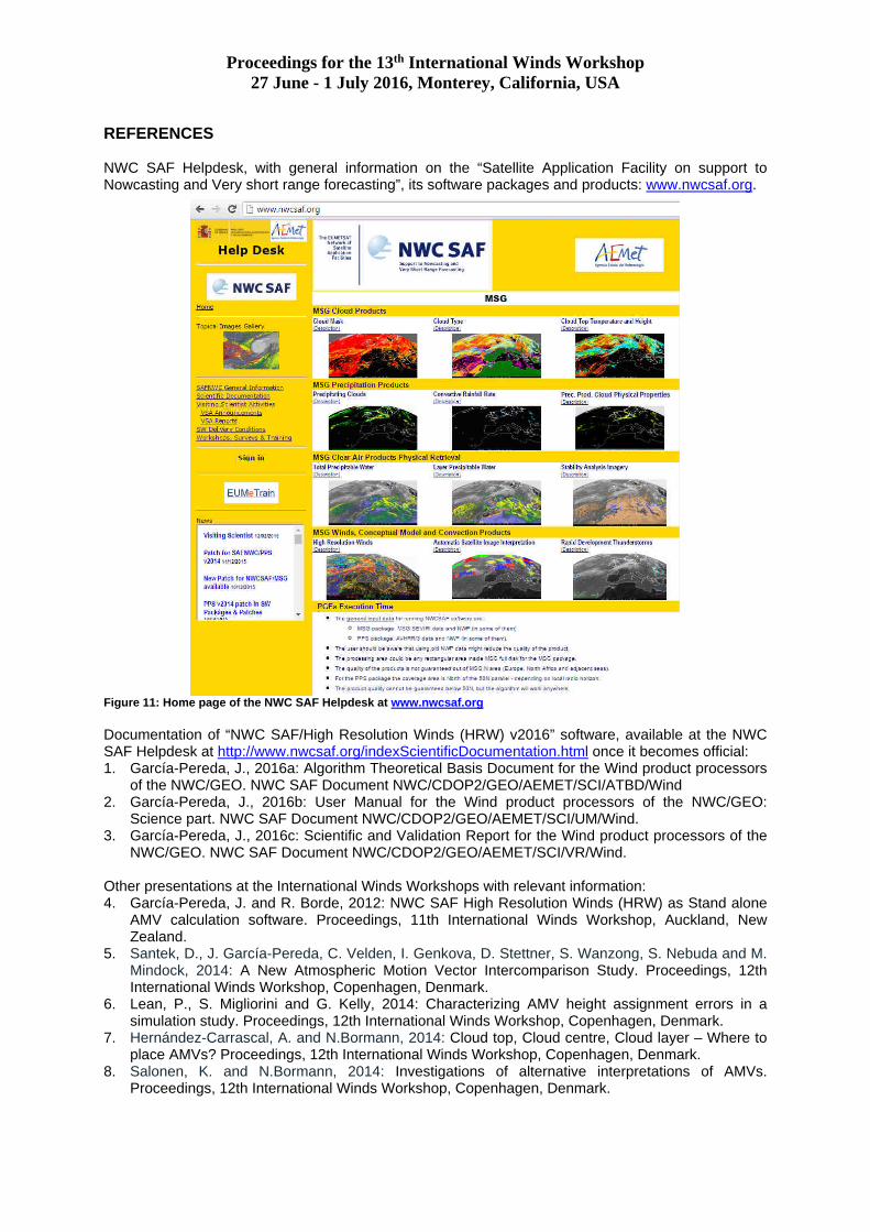
REFERENCES NWC SAF Helpdesk, with general information on the “Satellite Application Facility on support to Nowcasting and Very short range forecasting”, its software packages and products: www.nwcsaf.org.
Figure 11: Home page of the NWC SAF Helpdesk at www.nwcsaf.org Documentation of “NWC SAF/High Resolution Winds (HRW) v2016” software, available at the NWC SAF Helpdesk at http://www.nwcsaf.org/indexScientificDocumentation.html once it becomes official: 1. García-Pereda, J., 2016a: Algorithm Theoretical Basis Document for the Wind product processors
of the NWC/GEO. NWC SAF Document NWC/CDOP2/GEO/AEMET/SCI/ATBD/Wind 2. García-Pereda, J., 2016b: User Manual for the Wind product processors of the NWC/GEO:
Science part. NWC SAF Document NWC/CDOP2/GEO/AEMET/SCI/UM/Wind. 3. García-Pereda, J., 2016c: Scientific and Validation Report for the Wind product processors of the
NWC/GEO. NWC SAF Document NWC/CDOP2/GEO/AEMET/SCI/VR/Wind. Other presentations at the International Winds Workshops with relevant information: 4. García-Pereda, J. and R. Borde, 2012: NWC SAF High Resolution Winds (HRW) as Stand alone
AMV calculation software. Proceedings, 11th International Winds Workshop, Auckland, New Zealand.
5. Santek, D., J. García-Pereda, C. Velden, I. Genkova, D. Stettner, S. Wanzong, S. Nebuda and M. Mindock, 2014: A New Atmospheric Motion Vector Intercomparison Study. Proceedings, 12th International Winds Workshop, Copenhagen, Denmark.
6. Lean, P., S. Migliorini and G. Kelly, 2014: Characterizing AMV height assignment errors in a simulation study. Proceedings, 12th International Winds Workshop, Copenhagen, Denmark.
7. Hernández-Carrascal, A. and N.Bormann, 2014: Cloud top, Cloud centre, Cloud layer – Where to place AMVs? Proceedings, 12th International Winds Workshop, Copenhagen, Denmark.
8. Salonen, K. and N.Bormann, 2014: Investigations of alternative interpretations of AMVs. Proceedings, 12th International Winds Workshop, Copenhagen, Denmark.