November 2017 - hawaii.govfiles.hawaii.gov/dbedt/economic/library/facts/Facts_Figures_brow... ·...
12
November 2017
Transcript of November 2017 - hawaii.govfiles.hawaii.gov/dbedt/economic/library/facts/Facts_Figures_brow... ·...
November 2017
2
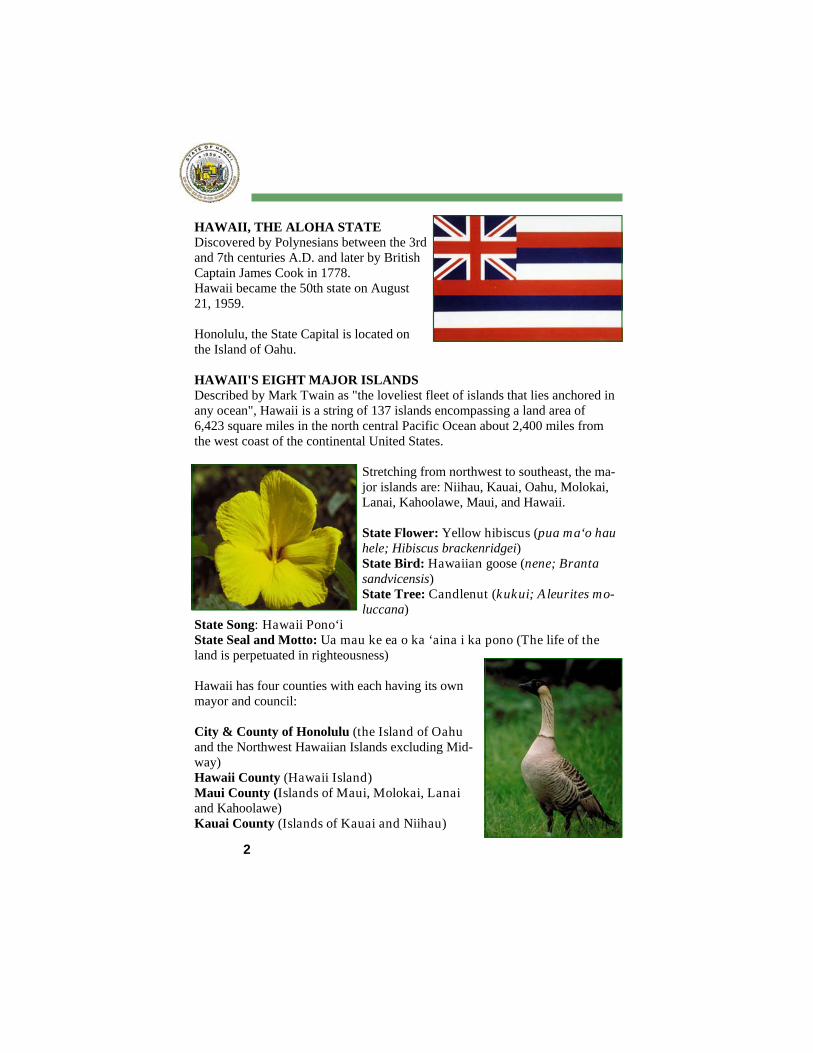
HAWAII, THE ALOHA STATE Discovered by Polynesians between the 3rd and 7th centuries A.D. and later by British Captain James Cook in 1778. Hawaii became the 50th state on August 21, 1959. Honolulu, the State Capital is located on the Island of Oahu. HAWAII'S EIGHT MAJOR ISLANDS Described by Mark Twain as "the loveliest fleet of islands that lies anchored in any ocean", Hawaii is a string of 137 islands encompassing a land area of 6,423 square miles in the north central Pacific Ocean about 2,400 miles from the west coast of the continental United States.
Stretching from northwest to southeast, the ma-jor islands are: Niihau, Kauai, Oahu, Molokai, Lanai, Kahoolawe, Maui, and Hawaii. State Flower: Yellow hibiscus (pua ma‘o hau hele; Hibiscus brackenridgei) State Bird: Hawaiian goose (nene; Branta sandvicensis) State Tree: Candlenut (kukui; A leurites mo-luccana)
State Song: Hawaii Pono‘i State Seal and Motto: Ua mau ke ea o ka ‘aina i ka pono (The life of the land is perpetuated in righteousness) Hawaii has four counties with each having its own mayor and council: City & County of Honolulu (the Island of Oahu and the Northwest Hawaiian Islands excluding Mid-way) Hawaii County (Hawaii Island) Maui County (Islands of Maui, Molokai, Lanai and Kahoolawe) Kauai County (Islands of Kauai and Niihau)
3
Population density (2016): 222 persons per square mile Number of households (2016): 455,868 Average persons per household (2016): 3.04 persons Median age (2016): 38.9 years
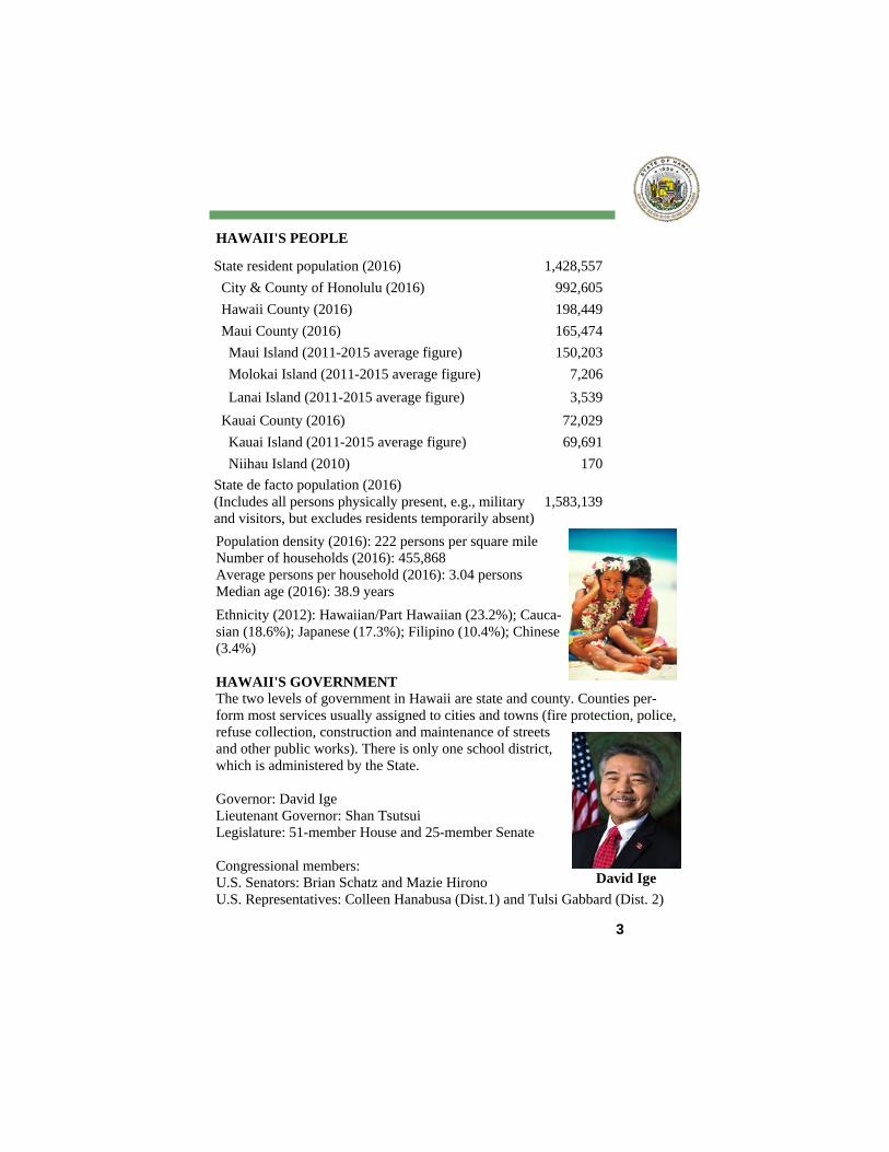
Ethnicity (2012): Hawaiian/Part Hawaiian (23.2%); Cauca-sian (18.6%); Japanese (17.3%); Filipino (10.4%); Chinese (3.4%) HAWAII'S GOVERNMENT The two levels of government in Hawaii are state and county. Counties per-form most services usually assigned to cities and towns (fire protection, police, refuse collection, construction and maintenance of streets and other public works). There is only one school district, which is administered by the State. Governor: David Ige Lieutenant Governor: Shan Tsutsui Legislature: 51-member House and 25-member Senate Congressional members: U.S. Senators: Brian Schatz and Mazie Hirono U.S. Representatives: Colleen Hanabusa (Dist.1) and Tulsi Gabbard (Dist. 2)
State resident population (2016) 1,428,557
City & County of Honolulu (2016) 992,605
Hawaii County (2016) 198,449
Maui County (2016) 165,474
Maui Island (2011-2015 average figure) 150,203
Molokai Island (2011-2015 average figure) 7,206
Lanai Island (2011-2015 average figure) 3,539
Kauai County (2016) 72,029
Kauai Island (2011-2015 average figure) 69,691
Niihau Island (2010) 170
State de facto population (2016) (Includes all persons physically present, e.g., military and visitors, but excludes residents temporarily absent)
1,583,139
HAWAII'S PEOPLE
David Ige
4
EDUCATION Hawaii is America's most multicultural state, located at the crossroads of East and West in a string of islands renowned for their natural beauty. For more than two centuries, the islands of Hawaii have welcomed interna-tional visitors with the spirit of ‘Aloha.’ Some have come as students to take advantage of our outstanding education and training opportunities. Many who have studied in Hawaii have returned to be leaders back home - they have en-tered government service, became doctors, teachers, business people, acted as positive change agents for their own countries. The University of Hawaii system had 53,418 students enrolled in 2016. It awarded 4,841 bachelor's degrees, 1,126 master's degrees and 204 doctoral degrees. Hawaii's statewide public school system had an enrollment in 2016 of 181,550 students in grades K-12. There were also 127 private schools as of the 2013-14 school year. Enrollment in private schools was 30,827 in 2013-14. Institutions with an international focus are the East-West Center, the Asia-Pacific Center for Security Studies, the Japan-America Institute of Manage-ment Science, Hawaii Pacific University, Chaminade University, and the Uni-versity of Hawaii.
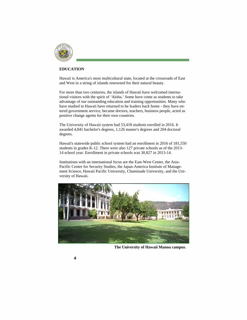
The University of Hawaii Manoa campus.
5
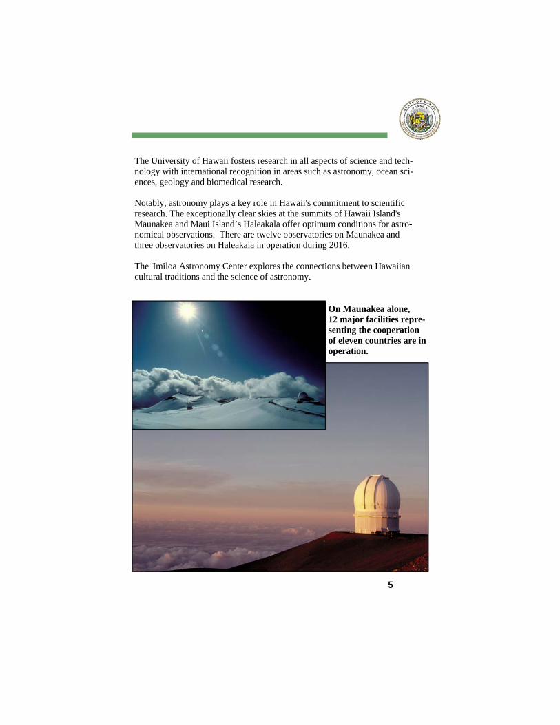
The University of Hawaii fosters research in all aspects of science and tech-nology with international recognition in areas such as astronomy, ocean sci-ences, geology and biomedical research. Notably, astronomy plays a key role in Hawaii's commitment to scientific research. The exceptionally clear skies at the summits of Hawaii Island's Maunakea and Maui Island’s Haleakala offer optimum conditions for astro-nomical observations. There are twelve observatories on Maunakea and three observatories on Haleakala in operation during 2016. The 'Imiloa Astronomy Center explores the connections between Hawaiian cultural traditions and the science of astronomy.
On Maunakea alone, 12 major facilities repre-senting the cooperation of eleven countries are in operation.
6
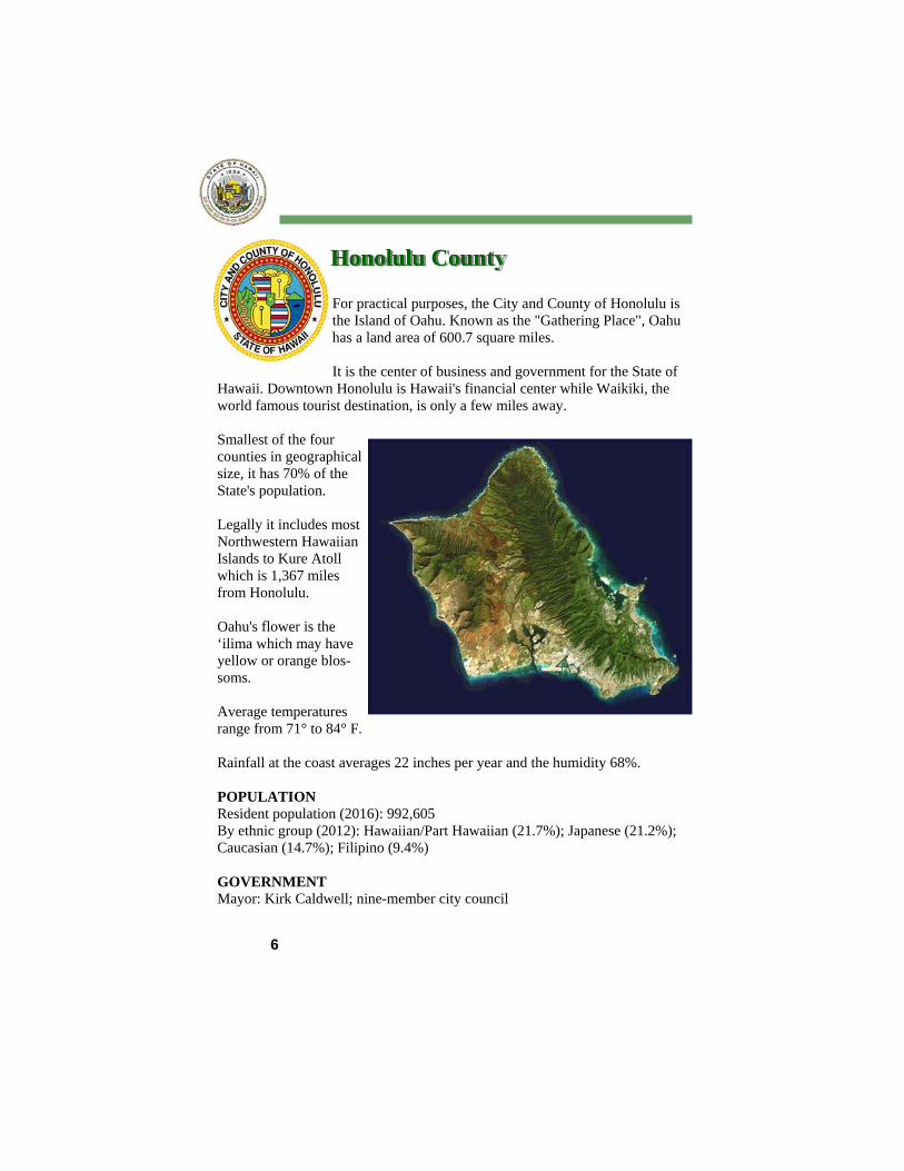
For practical purposes, the City and County of Honolulu is the Island of Oahu. Known as the "Gathering Place", Oahu has a land area of 600.7 square miles. It is the center of business and government for the State of
Hawaii. Downtown Honolulu is Hawaii's financial center while Waikiki, the world famous tourist destination, is only a few miles away. Smallest of the four counties in geographical size, it has 70% of the State's population. Legally it includes most Northwestern Hawaiian Islands to Kure Atoll which is 1,367 miles from Honolulu. Oahu's flower is the ‘ilima which may have yellow or orange blos-soms. Average temperatures range from 71° to 84° F. Rainfall at the coast averages 22 inches per year and the humidity 68%. POPULATION Resident population (2016): 992,605 By ethnic group (2012): Hawaiian/Part Hawaiian (21.7%); Japanese (21.2%); Caucasian (14.7%); Filipino (9.4%) GOVERNMENT Mayor: Kirk Caldwell; nine-member city council
Honolulu County
7
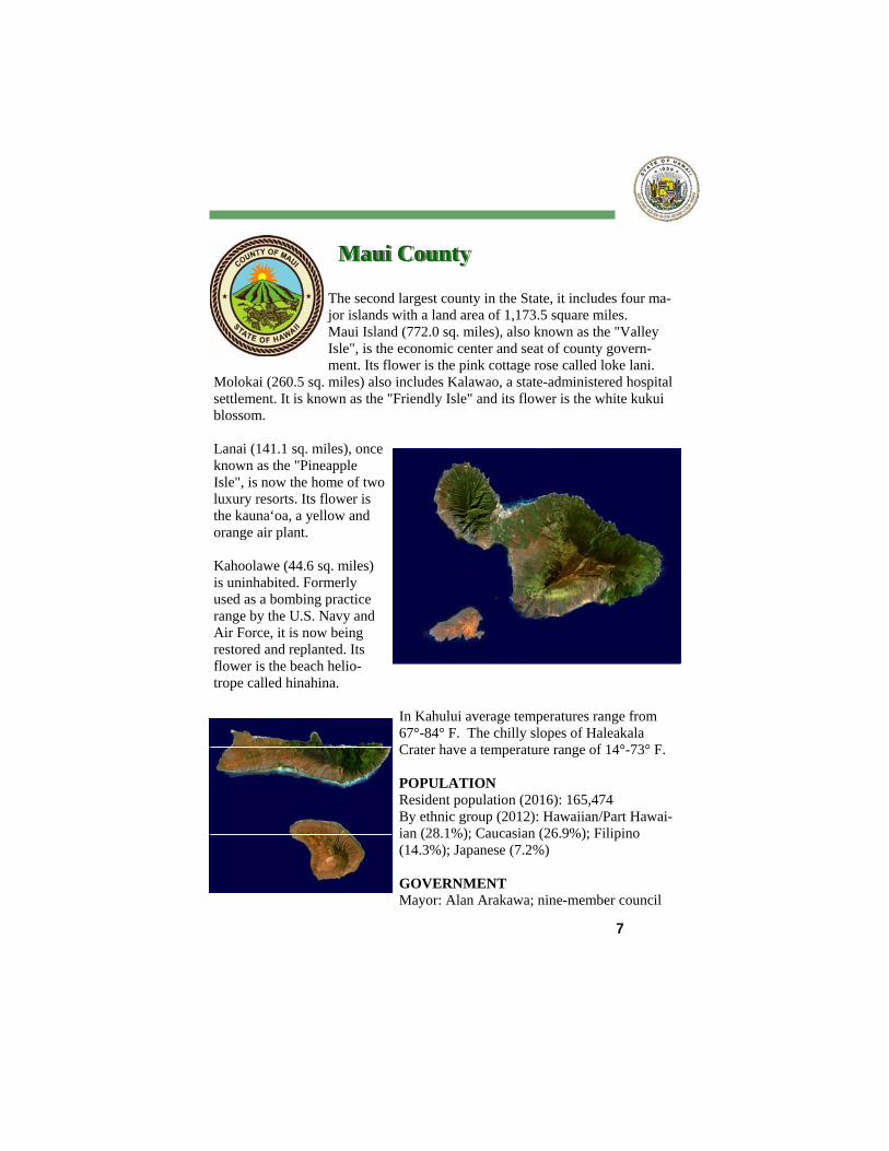
The second largest county in the State, it includes four ma-jor islands with a land area of 1,173.5 square miles. Maui Island (772.0 sq. miles), also known as the "Valley Isle", is the economic center and seat of county govern-ment. Its flower is the pink cottage rose called loke lani.
Molokai (260.5 sq. miles) also includes Kalawao, a state-administered hospital settlement. It is known as the "Friendly Isle" and its flower is the white kukui blossom. Lanai (141.1 sq. miles), once known as the "Pineapple Isle", is now the home of two luxury resorts. Its flower is the kauna‘oa, a yellow and orange air plant. Kahoolawe (44.6 sq. miles) is uninhabited. Formerly used as a bombing practice range by the U.S. Navy and Air Force, it is now being restored and replanted. Its flower is the beach helio-trope called hinahina.
In Kahului average temperatures range from 67°-84° F. The chilly slopes of Haleakala Crater have a temperature range of 14°-73° F. POPULATION Resident population (2016): 165,474 By ethnic group (2012): Hawaiian/Part Hawai-ian (28.1%); Caucasian (26.9%); Filipino (14.3%); Japanese (7.2%) GOVERNMENT Mayor: Alan Arakawa; nine-member council
Maui County
8
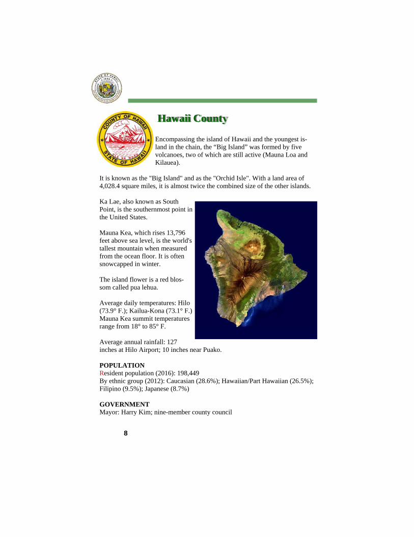
Encompassing the island of Hawaii and the youngest is-land in the chain, the “Big Island” was formed by five volcanoes, two of which are still active (Mauna Loa and Kilauea).
It is known as the "Big Island" and as the "Orchid Isle". With a land area of 4,028.4 square miles, it is almost twice the combined size of the other islands. Ka Lae, also known as South Point, is the southernmost point in the United States. Mauna Kea, which rises 13,796 feet above sea level, is the world's tallest mountain when measured from the ocean floor. It is often snowcapped in winter. The island flower is a red blos-som called pua lehua. Average daily temperatures: Hilo (73.9° F.); Kailua-Kona (73.1° F.) Mauna Kea summit temperatures range from 18° to 85° F. Average annual rainfall: 127 inches at Hilo Airport; 10 inches near Puako. POPULATION Resident population (2016): 198,449 By ethnic group (2012): Caucasian (28.6%); Hawaiian/Part Hawaiian (26.5%); Filipino (9.5%); Japanese (8.7%) GOVERNMENT Mayor: Harry Kim; nine-member county council
Hawaii County
9
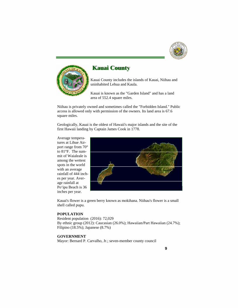
Kauai County includes the islands of Kauai, Niihau and uninhabited Lehua and Kaula. Kauai is known as the "Garden Island" and has a land area of 552.4 square miles.
Niihau is privately owned and sometimes called the "Forbidden Island." Public access is allowed only with permission of the owners. Its land area is 67.6 square miles. Geologically, Kauai is the oldest of Hawaii's major islands and the site of the first Hawaii landing by Captain James Cook in 1778. Average tempera-tures at Lihue Air-port range from 70° to 81°F. The sum-mit of Waialeale is among the wettest spots in the world with an average rainfall of 444 inch-es per year. Aver-age rainfall at Po‘ipu Beach is 36 inches per year. Kauai's flower is a green berry known as mokihana. Niihau's flower is a small shell called pupu. POPULATION Resident population (2016): 72,029 By ethnic group (2012): Caucasian (26.0%); Hawaiian/Part Hawaiian (24.7%); Filipino (18.5%); Japanese (8.7%) GOVERNMENT Mayor: Bernard P. Carvalho, Jr.; seven-member county council
Kauai County
10
Canonized in 2009, Saint Damien of Molokai was a Roman Catholic priest from Belgium who was recog-nized for his ministry to people with Hansen’s disease on Molokai.
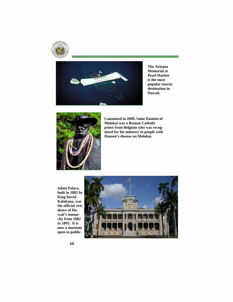
The Arizona Memorial at Pearl Harbor is the most popular tourist destination in Hawaii.
Iolani Palace, built in 1882 by King David Kalakaua, was the official resi-dence of Ha-waii’s monar-chy from 1882 to 1893. It is now a museum open to public.
11
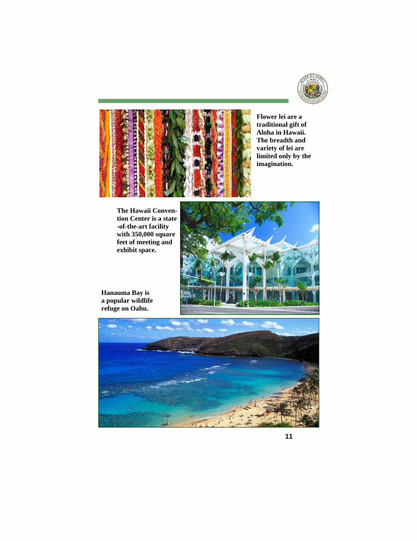
Flower lei are a traditional gift of Aloha in Hawaii. The breadth and variety of lei are limited only by the imagination.
Hanauma Bay is a popular wildlife refuge on Oahu.
The Hawaii Conven-tion Center is a state-of-the-art facility with 350,000 square feet of meeting and exhibit space.
www.Hawaii.gov
Follow us on Twitter: @HawaiiData

![[XLS]2007 Annual Report - hawaii.govfiles.hawaii.gov/dbedt/visitor/visitor-research/2015... · Web viewTABLE 108 TABLE 107 TABLE 106 TABLE 105 TABLE 104 TABLE 103 TABLE 102 TABLE](https://static.fdocuments.us/doc/165x107/5aafbcbe7f8b9a07498db390/xls2007-annual-report-viewtable-108-table-107-table-106-table-105-table-104.jpg)