Non-Residential Chromate Chemical Production Jersey City ... · Non-Residential Chromate Chemical...
41
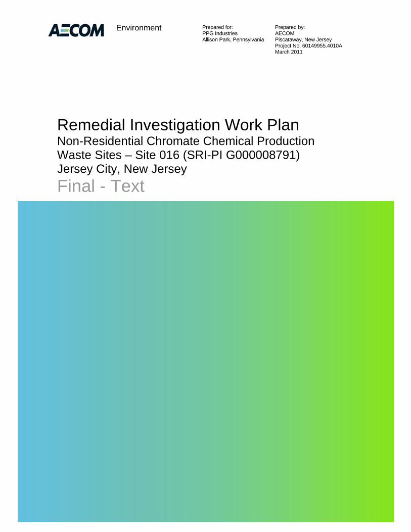
Prepared for: Prepared by: PPG Industries AECOM Allison Park, Pennsylvania Piscataway, New Jersey Project No. 60149955.4010A March 2011 Environment Remedial Investigation Work Plan Non-Residential Chromate Chemical Production Waste Sites – Site 016 (SRI-PI G000008791) Jersey City, New Jersey Final
Transcript of Non-Residential Chromate Chemical Production Jersey City ... · Non-Residential Chromate Chemical...
Prepared for: Prepared by: PPG Industries AECOM Allison Park, Pennsylvania Piscataway, New Jersey Project No. 60149955.4010A March 2011
Environment
Remedial Investigation Work Plan Non-Residential Chromate Chemical Production Waste Sites – Site 016 (SRI-PI G000008791) Jersey City, New Jersey
Final - Text
Prepared for: Prepared by: PPG Industries AECOM Allison Park, Pennsylvania Piscataway, New Jersey Project No. 60149955.4010A March 2011
Environment
Remedial Investigation Work Plan Non-Residential Chromate Chemical Production Waste Sites – Site 016 (SRI-PI G000008791) Jersey City, New Jersey
Final
Prepared for: Prepared by: PPG Industries AECOM Allison Park, Pennsylvania Piscataway, New Jersey Project No. 60149955.4010A March 2011
Environment
Remedial Investigation Work Plan Non-Residential Chromate Chemical Production Waste Sites – Site 016 (SRI-PI G000008791) Jersey City, New Jersey
Final
_________________________________ Prepared By William D. Spronz
_________________________________ Reviewed By Kathleen Whooley

AECOM FINAL RIWP Environment
2011-03-25_Site_016_Final_RIWP_F.docx FINAL RIWP March 25, 2011
i
Contents
1 Introduction ...................................................................................................................... 1-1
1.1 Remedial Investigation Status and Objectives ................................................................... 1-1
1.2 Remedial Investigation Requirements ................................................................................ 1-1
1.3 Report Organization ............................................................................................................. 1-3
1.4 Health and Safety Plan and Quality Assurance Project Plan ............................................. 1-3
2 Project Team .................................................................................................................... 2-1
2.1 JCO Project Team ............................................................................................................... 2-2
2.2 Management ........................................................................................................................ 2-2
2.3 Field Operations Leader ...................................................................................................... 2-2
2.4 Field Task Leader/Site Geologist ........................................................................................ 2-2
2.5 Site Safety Officer ................................................................................................................ 2-3
2.6 Sampling and Health and Safety Technicians .................................................................... 2-3
2.7 Subcontractors ..................................................................................................................... 2-3
3 Background Information ................................................................................................ 3-1
3.1 Historical Information ........................................................................................................... 3-1
3.2 Sanborn Maps ...................................................................................................................... 3-1
3.3 Interpretive Aerial History .................................................................................................... 3-2
3.4 Previous Environmental Investigation Results, Remedial Actions, and Enforcement Actions .................................................................................................................................. 3-2
3.4.1 Previous Environmental Investigation Results..................................................... 3-2
3.4.2 Remedial Actions .................................................................................................. 3-7
3.4.3 Enforcement Actions ............................................................................................. 3-7
3.5 Physical Description and Surrounding Land Use ............................................................... 3-8
3.5.1 Surrounding Land Use .......................................................................................... 3-8
3.6 Environmental Setting .......................................................................................................... 3-9
3.6.1 Topography ........................................................................................................... 3-9
3.6.2 Regional Geology ................................................................................................. 3-9
3.6.3 Project Area Geology .......................................................................................... 3-10
3.6.4 Hydrology ............................................................................................................ 3-11
3.6.5 Regional Hydrogeology ...................................................................................... 3-12
3.6.6 Project Area Hydrogeology................................................................................. 3-14
3.7 Areas of Concern ............................................................................................................... 3-15
AECOM FINAL RIWP Environment
2011-03-25_Site_016_Final_RIWP_F.docx FINAL RIWP March 25, 2011
ii
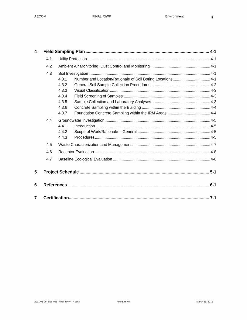
4 Field Sampling Plan ........................................................................................................ 4-1
4.1 Utility Protection ................................................................................................................... 4-1
4.2 Ambient Air Monitoring: Dust Control and Monitoring ........................................................ 4-1
4.3 Soil Investigation .................................................................................................................. 4-1
4.3.1 Number and Location/Rationale of Soil Boring Locations ................................... 4-1
4.3.2 General Soil Sample Collection Procedures ........................................................ 4-2
4.3.3 Visual Classification .............................................................................................. 4-3
4.3.4 Field Screening of Samples ................................................................................. 4-3
4.3.5 Sample Collection and Laboratory Analyses ....................................................... 4-3
4.3.6 Concrete Sampling within the Building ................................................................ 4-4
4.3.7 Foundation Concrete Sampling within the IRM Areas ........................................ 4-4
4.4 Groundwater Investigation ................................................................................................... 4-5
4.4.1 Introduction ........................................................................................................... 4-5
4.4.2 Scope of Work/Rationale – General .................................................................... 4-5
4.4.3 Procedures ............................................................................................................ 4-5
4.5 Waste Characterization and Management ......................................................................... 4-7
4.6 Receptor Evaluation ............................................................................................................ 4-8
4.7 Baseline Ecological Evaluation ........................................................................................... 4-8
5 Project Schedule ............................................................................................................. 5-1
6 References ....................................................................................................................... 6-1
7 Certification ...................................................................................................................... 7-1
AECOM FINAL RIWP Environment
2011-03-25_Site_016_Final_RIWP_F.docx FINAL RIWP March 25, 2011
iii
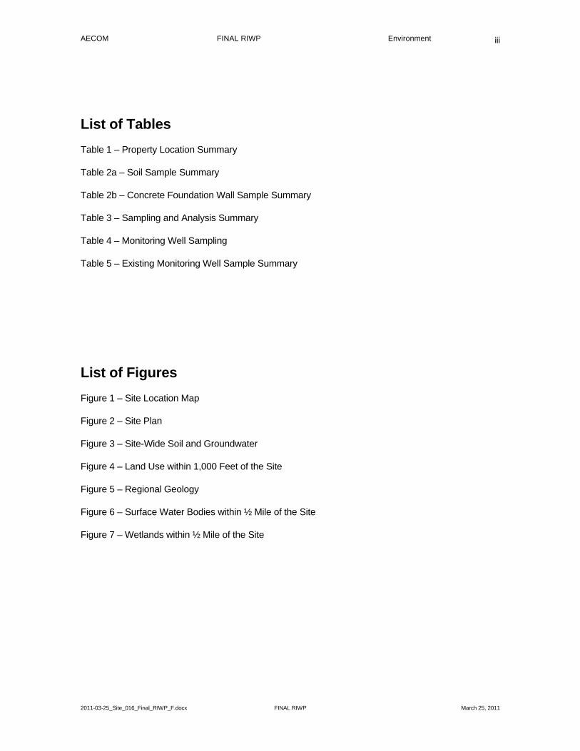
List of Tables
Table 1 – Property Location Summary
Table 2a – Soil Sample Summary
Table 2b – Concrete Foundation Wall Sample Summary
Table 3 – Sampling and Analysis Summary
Table 4 – Monitoring Well Sampling
Table 5 – Existing Monitoring Well Sample Summary
List of Figures
Figure 1 – Site Location Map
Figure 2 – Site Plan
Figure 3 – Site-Wide Soil and Groundwater
Figure 4 – Land Use within 1,000 Feet of the Site
Figure 5 – Regional Geology
Figure 6 – Surface Water Bodies within ½ Mile of the Site
Figure 7 – Wetlands within ½ Mile of the Site

AECOM FINAL RIWP Environment
2011-03-25_Site_016_Final_RIWP_F.docx FINAL RIWP March 25, 2011
iv
List of Appendices
Appendix A - Health and Safety Plan
Appendix B - Field Sampling – Quality Assurance Project Plan
Appendix C - Sanborn Maps
Appendix D - Historic Aerial Photographs
Appendix E - Selected Information from Previous Investigations
Appendix F - Utility Maps
Appendix G - Project Schedule
AECOM FINAL RIWP Environment
2011-03-25_Site_016_Final_RIWP_F.docx FINAL RIWP March 25, 2011
1-1
1 Introduction
1.1 Remedial Investigation Status and Objectives
This Remedial Investigation Work Plan (“RIWP”) was prepared by AECOM on behalf of PPG Industries, Inc. (“PPG”) to provide the proposed scope of work for conducting a Remedial Investigation (“RI”) at Hudson County Chromium (“HCC”) Site 016 (“the Site”) in Jersey City, Hudson County, New Jersey (Figure 1). Site 016 is located at 45 Linden Avenue East (Block 1507, Lot 4L) of Jersey City, New Jersey (Figure 2 and Table 1). The Site was identified as a Non-Residential HCC site by the New Jersey Department of Environmental Protection (“NJDEP”). The NJDEP Site Remediation Program (“SRP”) Program Identification Number (“SRP-PI”) for Site 016 is G000008791.
In 1990, PPG and the NJDEP entered into an Administrative Consent Order (“ACO”) to investigate and remediate locations where chromate chemical production waste (“CCPW”) or CCPW-impacted materials related to former PPG operations may be present. On June 26, 2009, NJDEP, PPG, and the City of Jersey City entered into a Judicial Consent Order (“JCO”) with the purpose of remediating the soils and sources of contamination at these HCC sites as expeditiously as possible. The goal of the JCO is to complete the investigation and remediation of the PPG sites within five years, in accordance with a judicially enforceable master schedule. Priority for the remedial activities will be given to residential locations where CCPW and CCPW-related contamination is present. The provisions of the original ACO remain in effect with the JCO taking precedence where conflicts exist between the two documents.
The objective of this RI is to delineate the horizontal and vertical extent of CCPW and CCPW-related impacts in soil and groundwater at the Site. Based on data from previous site investigations, the contaminants of concern (“COCs”) in the soil and groundwater at the Site include hexavalent chromium (“Cr+6”) and five of the United States Environmental Protection Agency (“USEPA”) Target Analyte List (“TAL”) metals: antimony (“Sb”), chromium (“Cr”), nickel (“Ni”), thallium (“Tl”), and vanadium (“V”).
This RIWP is considered a dynamic document that may be revised by addenda where necessary to complete the horizontal and vertical delineation of CCPW and CCPW-related impacts. Upon completion of the RI, a RI Report (“RIR”) will be prepared to present the results of the RI and will be submitted to the court-appointed JCO Site Administrator for review.
1.2 Remedial Investigation Requirements
This RIWP was prepared in accordance with the following requirements:
Technical Requirements for Site Remediation (“TRSR”), N.J.A.C. 7:26E-4.2 (NJDEP, 2009b);
Appendix B of the 1990 NJDEP ACO; and
June 26, 2009 JCO.
The RIWP addresses the following RI requirements in accordance with Appendix B of the ACO:
Characterize CCPW-related soil, surface water, and groundwater impacts at the Site;
Determine the nature, type and physical state of CCPW-related impacts on the Site, emanating from the Site, or which have emanated from the Site;
Determine the horizontal and vertical extent of CCPW-related impacts on the Site, emanating from the Site, or which have emanated from the Site;

AECOM FINAL RIWP Environment
2011-03-25_Site_016_Final_RIWP_F.docx FINAL RIWP March 25, 2011
1-2
Assess the surface and subsurface site characteristics including groundwater depth and flow direction;
Assess potential contaminant migration paths through air, soil, groundwater, surface water, and sediment;
Assess potential air, soil, surface water, and groundwater impacts upon on human health and the environment;
Assess potential containment and/or reduction measures to reduce or eliminate human health and environmental impacts related to CCPW or CCPW-related contamination; and,
Present the data needed for the development of a feasibility study (“FS”) and the selection of a remedial action (“RA”) alternative to mitigate CCPW and CCPW-related impacts on human health and the environment.
Soil analytical results will be compared to NJDEP Soil Remediation Standards (“SRS”) at N.J.A.C. 7:26D (NJDEP, 2009a), promulgated on June 2, 2008 and adopted on November 4, 2009, and last amended on April 19, 2010 for soil delineation purposes. Currently there are no SRS for Cr or Cr+6; however, NJDEP expects to develop SRS for these compounds at some point in the future. Therefore, Cr and Cr+6 will be compared to the NJDEP’s February 8, 2007 and September 2008 Chromium Soil Cleanup Criteria (“CrSCC”) (NJDEP, 2008a). The CrSCC of 20 milligrams per kilogram (“mg/kg”) for Cr+6 and 120,000 mg/kg for trivalent chromium (“Cr+3”) will be utilized for soil delineation purposes during this RI.
The other CCPW-related contaminants of concern will be delineated to the most stringent SRS, or to the default Impact to Groundwater (“IGW”) soil screening levels (“SSL”) in accordance with the NJDEP December 2008 Guidance Document for the Development of Site-Specific Impact to Ground Water Soil Remediation Standards Using the Soil-Water Partition Equation (NJDEP, 2008b). Comparison of contaminants to the IGW criteria will be conducted only in unsaturated soils in accordance with NJDEP guidance.
These CCPW contaminants of concern include:
Compound RDC SRS NRDC SRS IGW SSL Sb 31 mg/kg 450 mg/kg 6 mg/kg Ni 1,600 mg/kg 23,000 mg/kg 31 mg/kg Tl 5 mg/kg 79 mg/kg 3 mg/kg V 78 mg/kg 1,100 mg/kg NA NA – Standard not available RDC SRS – Residential Direct Contact Soil Remediation Standard NRDC SRS – Non-Residential Direct Contact Soil Remediation Standard
Groundwater results will be compared to the NJDEP Groundwater Quality Standards (“GWQS”) at N.J.A.C. 7:9C (NJDEP, 2009d). Total Cr results will be compared to the Total Cr GWQS of 70 micrograms per liter (“µg/L”). The remaining COCs will be compared to their existing GWQS:
Compound GWQS Sb 6 µg/L Ni 100 µg/L Tl 2 µg/L V 60 µg/L
AECOM FINAL RIWP Environment
2011-03-25_Site_016_Final_RIWP_F.docx FINAL RIWP March 25, 2011
1-3
A site-specific Cr+6 criterion for the allergic contact dermatitis endpoint is not required for this remedial action in accordance with NJDEP’s February 8, 2007 Chromium Cleanup Policy (NJDEP, 2007a).
1.3 Report Organization
Appendix B, Part II of the ACO, sets forth information to be included in the RIWP for non-residential CCPW sites. This RIWP is organized to address these items and the requirements set forth in the NJDEP TRSR as follows:
Section 1 provides the introduction and objectives of the proposed RI;
Section 2 identifies key RI personnel and describes their roles and qualifications;
Section 3 provides site background information, including environmental setting, history and a summary of previous investigation data;
Section 4 includes the Field Sampling Plan (“FSP”), describing the location, number, and frequency of soil and groundwater samples, sampling methodology, field procedures, analytical methods, and chain of custody protocols;
Section 5 presents the proposed RI implementation schedule;
Section 6 provides references for the reports and documents used to prepare the RIWP; and,
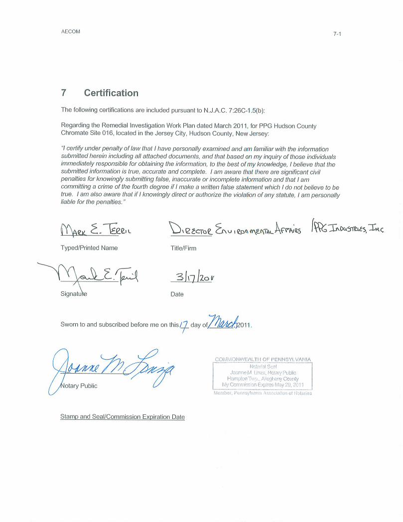
Section 7 includes the signed and notarized report certification in accordance with N.J.A.C. 7:26C-1.5.
Supplemental information is presented in the RIWP Appendices.
1.4 Health and Safety Plan and Quality Assurance Project Plan
A Health and Safety Plan (“HASP”) was developed for environmental site investigations that will be performed at the PPG Non-Residential Chromate Chemical Production Waste Sites and was submitted under separate cover (Appendix A). A Field Sampling Plan-Quality Assurance Project Plan (“FSP-QAPP”) was also submitted to NJDEP under separate cover (Appendix B). These two documents describe health and safety protocols and the quality assurance requirements applicable to non-residential CCPW sites for which PPG has responsibility.
The HASP referenced in Appendix A establishes general health and safety protocols to be followed by site personnel during implementation of the RIWP. The HASP describes training, medical surveillance, personnel hygiene practices, hazard exposure monitoring, and monitoring equipment maintenance requirements. It is a dynamic document, which will be updated as needed to address issues that may be encountered during the RI.
The FSP-QAPP referenced in Appendix B establishes the overall quality assurance (“QA”) objectives for the RI program and documents sampling and analytical procedures to be used for collecting and analyzing environmental samples. It describes procedures for equipment decontamination, sample handling, sample chain-of-custody protocols, and standard QA procedures for conducting the RI. The FSP-QAPP will be updated as conditions warrant. The FSP-QAPP was prepared to address the requirements presented within Appendix C of the 1990 ACO.

AECOM FINAL RIWP Environment
2011-03-25_Site_016_Final_RIWP_F.docx FINAL RIWP March 25, 2011
2-1
2 Project Team
The key RI project personnel are presented in the following table. Their roles and responsibilities are further described below.
Project Team Personnel Address Phone
PPG:
Project Director (Non-Garfield Ave. Sites)
David Claassen PPG Industries, Inc. 4325 Rosanna Drive, Bldg. C Allison Park, PA 15101-2009
O (412) 492-5629 C (412) 434-2887
Legal Contact Joseph F. Lagrotteria
LeClair-Ryan One Riverfront Plaza 1037 Raymond Boulevard, Sixteenth Floor Newark, NJ 07102
O (973) 491-3516
Facility Contact:
Site 016 Contact Rafael Etzion 4 Birchwood Ave. Port Washington, NY 11050
O (516) 528-4567
AECOM:
Program Manager Scott Mikaelian, P.E. 30 Knightsbridge Rd., Suite 520 Piscataway, NJ 08854
O (732) 564-3624 C (732) 757-9425
Project Manager (Non-Garfield Ave. Sites)
Alfred LoPilato, CHMM Rusten Corporate Park 100 Red Schoolhouse Rd. Suite B-1 Chestnut Ridge, NY 10977-6715
O (845) 425-4980 C (748) 772-8474
RI Lead William Spronz, P.G. 30 Knightsbridge Rd., Suite 520 Piscataway, NJ 08854
O (732) 564-3917 C (908) 377-7226
Field Operations Leader Richard Feinberg, P.G. 30 Knightsbridge Rd., Suite 520 Piscataway, NJ 08854
O (732) 564-3610 C (732) 233-4552
Field Task Leader/ Site Geologist
To be provided when selected
30 Knightsbridge Rd., Suite 520 Piscataway, NJ 08854
O (732) 564-3600
Regional Health & Safety Officer
Phil Platcow 2 Technology Park Drive Westford, MA 01886
C (617) 371-4461
Sampling Technicians To be provided when selected Health & Safety
Technicians
Subcontractors:
Drilling Surveying Laboratory Waste Hauler (IDW) Disposal Facility (IDW)
To be provided when selected
JCO Team:
Site Administrator Michael McCabe 4 Normandy Drive Chadds Ford, PA19317
O (201) 777-2099
Project Manager Brian McPeak 208 Winding Way South Little Silver, NJ 07739
O (732) 216-6364
AECOM FINAL RIWP Environment
2011-03-25_Site_016_Final_RIWP_F.docx FINAL RIWP March 25, 2011
2-2
Project Team Personnel Address Phone
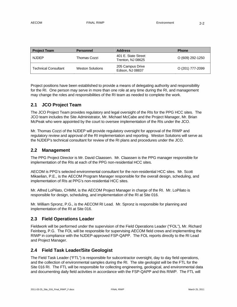
NJDEP Thomas Cozzi 401 E. State Street Trenton, NJ 08625
O (609) 292-1250
Technical Consultant Weston Solutions 205 Campus Drive Edison, NJ 08837
O (201) 777-2099
Project positions have been established to provide a means of delegating authority and responsibility for the RI. One person may serve in more than one role at any time during the RI, and management may change the roles and responsibilities of the RI team as needed to complete the work.
2.1 JCO Project Team
The JCO Project Team provides regulatory and legal oversight of the RIs for the PPG HCC sites. The JCO team includes the Site Administrator, Mr. Michael McCabe and the Project Manager, Mr. Brian McPeak who were appointed by the court to oversee implementation of the RIs under the JCO.
Mr. Thomas Cozzi of the NJDEP will provide regulatory oversight for approval of the RIWP and regulatory review and approval of the RI implementation and reporting. Weston Solutions will serve as the NJDEP’s technical consultant for review of the RI plans and procedures under the JCO.
2.2 Management
The PPG Project Director is Mr. David Claassen. Mr. Claassen is the PPG manager responsible for implementation of the RIs at each of the PPG non-residential HCC sites.
AECOM is PPG’s selected environmental consultant for the non-residential HCC sites. Mr. Scott Mikaelian, P.E., is the AECOM Program Manager responsible for the overall design, scheduling, and implementation of RIs at PPG’s non-residential HCC sites.
Mr. Alfred LoPilato, CHMM, is the AECOM Project Manager in charge of the RI. Mr. LoPilato is responsible for design, scheduling, and implementation of the RI at Site 016.
Mr. William Spronz, P.G., is the AECOM RI Lead. Mr. Spronz is responsible for planning and implementation of the RI at Site 016.
2.3 Field Operations Leader
Fieldwork will be performed under the supervision of the Field Operations Leader (“FOL”), Mr. Richard Feinberg, P.G. The FOL will be responsible for supervising AECOM field crews and implementing the RIWP in compliance with the NJDEP-approved FSP-QAPP. The FOL reports directly to the RI Lead and Project Manager.
2.4 Field Task Leader/Site Geologist
The Field Task Leader (“FTL”) is responsible for subcontractor oversight, day to day field operations, and the collection of environmental samples during the RI. The site geologist will be the FTL for the Site 016 RI. The FTL will be responsible for collecting engineering, geological, and environmental data and documenting daily field activities in accordance with the FSP-QAPP and this RIWP. The FTL will
AECOM FINAL RIWP Environment
2011-03-25_Site_016_Final_RIWP_F.docx FINAL RIWP March 25, 2011
2-3
be responsible for initiating and documenting changes to field procedures in accordance with the FSP-QAPP when field conditions indicate that revisions are warranted. The FTL reports directly to the FOL.
2.5 Site Safety Officer
The AECOM Site Safety Officer (“SSO”) will be responsible for monitoring and enforcing compliance with the site specific HASP. The SSO may delegate responsibility to on-site personnel as appropriate. The SSO authority will also have completed an 8-hour supervisor’s health and safety training course.
2.6 Sampling and Health and Safety Technicians
Sampling technicians are responsible for the collection and documentation of environmental samples as described in the FSP-QAPP and RIWP. Sampling technicians may also serve as Health and Safety Technicians (“HST”), and will report directly to the SSO. The SSO and/or the HST will set-up, calibrate, and monitor health and safety instrumentation for field activities in accordance with the HASP. The HST will record events/excursions pertaining to Health and Safety issues in the project field book and on appropriate field forms.
Site personnel will have at least six months of field experience or be supervised by an experienced FTL. Site personnel will have completed the OSHA required 40-hour training program and the requisite 8-hour refresher courses. At least one member of each field crew will have current certifications in first aid and cardiopulmonary resuscitation (“CPR”) training.
2.7 Subcontractors
Drilling, direct-push services, surveying, analytical laboratory, data validation, waste hauling, waste disposal, and other RI activities will be conducted by subcontractors selected and supervised by AECOM and PPG. Only subcontractors with the appropriate licenses, credentials, and safety record will work on this RI. The subcontractors for the RI have not yet been identified. AECOM and PPG will submit a list of selected subcontractors to the JCO Site Administrator prior to conducting the RI field work.
AECOM FINAL RIWP Environment
2011-03-25_Site_016_Final_RIWP_F.docx FINAL RIWP March 25, 2011
3-1
3 Background Information
The following subsections provide background information about HCC Site 016, located at 45 Linden Avenue East, Jersey City, Hudson County, New Jersey.
3.1 Historical Information
Pursuant to N.J.A.C. 7:26E-4.2(b) 3, a historical review for the Site and surrounding area was conducted that included the review of other consultants’ reports, and the review of historic air photos and Sanborn Maps provided by Environmental Data Resources (“EDR”). Seven aerial photographs from the period 1943 to 2006 and ten Sanborn Maps from 1991 to 2006 were reviewed to assess historic development for the Site. The Sanborn Maps and Aerial Decade Reports provided by EDR and used during this evaluation are included in Appendices C and D of this RIWP. Selected historical figures and documentation from other sources are provided in Appendix E.
This historical information was used to assist in selecting the proposed soil boring and groundwater monitoring well locations, with the objective of overall site coverage and filling in of data gaps.
As previously reported by ICF Kaiser (1993), the Site and the entire area east of the New Jersey Turnpike Hudson Extension and south of Caven Point Road, was originally part of the Upper New York Bay. The area was filled to the approximate present day dimensions by 1912 for industrial development. The Morris & Cummings Dredging Company operated along the former shoreline and most likely the filling was done with dredge spoils. Numerous railroad building structures were present including a transformer house. To the east was a Lehigh Valley Railroad (“LVRR”) Warehouse Pier with several storage tanks and to the west was a junkyard. The LVRR occupied the majority of the Site area and areas to the east of Site 016 (HCC Site 112A). Standard Oil occupied much of the land farther north of Sites 016 and 112A (HCC Site 112).
LVRR has owned the property defined as HCC Site 112A (Block 1507, Lot 10E) since 1928. LVRR has leased that property to Continental Oil, Pittston Petroleum, Inc., an affiliate of Tankport Terminals Inc., and Ultramar Petroleum, Inc., over the years.
The warehouse on Site 016 was built by Lawrence Construction and is currently owned by K.I.D.S. Realty Co., LLC. Presently, the warehouse on Site 016 is used as a storage facility. It is not known if other process raw materials and products or hazardous waste were ever generated or stored onsite by any previous occupants of the warehouse (ICF Kaiser, 1992a; ICF Kaiser, 1993).
3.2 Sanborn Maps
Sanborn Maps are provided in Appendix C for the following years of coverage: 1991, 1994, 1999, 2001, 2002, 2003, 2004, 2005, and 2006. ICF Kaiser referenced a 1912 Sanborn Map which was updated in 1956 to show that the area of the site, including the entire current land area east of the New Jersey Turnpike Hudson Extension and south of Caven Point, had been filled to its approximate present day dimensions by 1912 (ICF Kaiser, 1993). No site details were provided on the 1991 Sanborn Map. The Sanborn Maps from 1994 through 2006 show the building as noncombustible building (“NC”) construction in 1972 with concrete block wall. There were no changes in the building construction on the Site after that date. This building is shown to be divided into two spaces with the western portion being identified as “M+W” (manufacturing and warehouse) and the eastern portion identified just as “W” (warehouse) (Sanborn Map, 1994). A review of several years of subsequent Sanborn Maps following examination of the 1994 map (through 2006) indicated no significant changes

AECOM FINAL RIWP Environment
2011-03-25_Site_016_Final_RIWP_F.docx FINAL RIWP March 25, 2011
3-2
in the building footprint or property use since 1994. The information reviewed shows no evidence that the Site was ever used for chromate ore processing or the storage of CCPW.
3.3 Interpretive Aerial History
A series of seven aerial photographs from the years 1943 to 2006 were reviewed pursuant to N.J.A.C. 7:26E4.2 (b)3ii. The aerial photographs were reviewed to provide information about the Site history, land use, onsite structures, visible utilities, material storage, and other site characteristics. Copies of these photographs for the years 1943, 1953, 1966, 1976, 1985, 1995, and 2006 are included in Appendix D to this RIWP.
Aerials from 1943 and 1953 show Site 016 as vacant land. ICF Kaiser reported that six rectangular buildings were erected on the adjacent property south of the Site and the southwest portion of the Site was cleared for parking (ICF Kaiser, 1993). A road intersecting the Site led to a former U.S. Army base (Caven Point Army Terminal) to the northeast of the Site, and three small buildings connected by a dirt road to the main road, and a pier extending in to the bay are located offsite to the east (ICF Kaiser, 1993).
Between 1954 and 1960, the six rectangular buildings to the south of the Site were demolished and the southwest portion of the Site was cleared and leveled between 1961 and 1971 for construction of the warehouse (ICF Kaiser, 1993). Construction of the warehouse occurred sometime between 1972 and 1974 and is present on the 1976 aerial photograph included in Appendix D. Between 1976 and 1981, an extension to the warehouse was constructed and can be seen in the 1985 and 1995 aerial photographs, also included in Appendix D to this RIWP (ICF Kaiser, 1993).
The entire warehouse on Site 016 is visible in the 2006 aerial photograph (Appendix D), as are the athletic fields and recreational areas to the northeast, which were built between 1981 and 1989, (ICF Kaiser, 1993). Also visible on the 2006 aerial photograph is the Liberty National Golf Course, which opened July 4, 2006, part of which is located to the east of the Site. HCC Sites 112, 112A, and portions of Site 016 were remediated prior to construction of the golf course.
3.4 Previous Environmental Investigation Results, Remedial Actions, and Enforcement Actions
The following subsections provide information regarding previous environmental investigations, remedial actions, and enforcement actions for HCC Site 016. Select information from these reports is included in Appendix E to this RIWP.
3.4.1 Previous Environmental Investigation Results
Three previous investigations were conducted at the site by various firms retained by responsible parties and/or state agencies:
L. Robert Kimball and Associates (“Kimball”) were retained by the New Jersey Department of Transportation (“NJDOT”) to perform a soil investigation of the area within the Route 185 easement.
Environmental Science and Engineering, Inc. (“ES&E”) performed a remedial investigation/feasibility study (“RI/FS”) at Site 016 – Linden Avenue East for NJDEP.
AECOM FINAL RIWP Environment
2011-03-25_Site_016_Final_RIWP_F.docx FINAL RIWP March 25, 2011
3-3
ICF Kaiser Engineers, Inc. was retained by PPG to perform a RI on the HCC Group 4 sites, which include Site 016 – Linden Avenue East and Site 112A – Ultramar Petroleum.
The results of these three investigations are discussed below and select sampling locations from previous investigations are provided on Figure 3.
3.4.1.1 1987 NJDOT Investigation – L. Robert Kimball and Associates
In May 1987, a soil sampling program was initiated by NJDOT to determine the horizontal and vertical extent of Cr-impacted soils within the Route 185 easement area located within the boundaries of the HCC Group 4 sites. A surface water and sediment sampling program was also implemented to determine whether or not the drainage ditch along the northern property boundary had been impacted by CCPW where it crosses the Route 185 easement. This drainage ditch, sometimes referred to as “Claremont Creek” and/or “Claremont Ditch”, is not a naturally occurring stream but a drainage channel dredged into the fill material that was used to reclaim the marshland (ICF Kaiser, 1993). The ditch was later remediated and lined during a Remedial Action (“RA”). L. Robert Kimball and Associates submitted the results of this work in September 1988 and those results, as presented in the ICF Kaiser RI (ICF Kaiser, 1993), are summarized below.
3.4.1.1.1 Soil and Waste Investigation Data
The soil and waste investigation included a soil boring program as well as a test pit sampling program. Shallow soil samples and surface soil samples were collected on both sides of the drainage ditch at depths of 0 to 6 inches and in 6-inch intervals to 36 inches below ground surface (“bgs”). Nine test pits were located between previously sampled areas to provide additional data and information for depths greater than 36 inches bgs.
A total of 100 soil samples were analyzed for total Cr; however, only 11 of these were also analyzed for Cr+6 during this investigation. Total Cr concentrations ranged from 5 mg/kg to 6,790 mg/kg with the higher concentrations encountered near the eastern side of the easement along the drainage ditch. Hexavalent chromium concentrations ranged from 0.01 mg/kg to 0.20 mg/kg.
Three test pit soil samples were analyzed for the eight RCRA metals with no results reported above the method detection limits (“MDL”). Three soil samples collected 6 inches above the water table in areas beneath visually identified CCPW were analyzed for Priority Pollutant Metals. The reported analytical results indicated that no compounds were detected above the MDL in these samples.
3.4.1.1.2 Surface Water and Sediment Investigation Data
Investigation of the surface water and sediments along the banks of the drainage ditch were undertaken because of the potential for Cr to migrate to the ditch via groundwater and/or surface water run-off. One surface water sample was analyzed for total Cr. The concentration of total Cr reported from that sample was 2,029 mg/kg, however it appears there was a quality control problem during sampling and/or analysis of that sample. The Kimball report did not indicate whether the analytical results were fully validated.
Ten sediment samples were collected from seven locations along the drainage ditch bank. Five samples were analyzed for total Cr and one sample was analyzed for Cr+6. Total Cr concentrations ranged from 237.6 mg/kg to 1,386 mg/kg. Hexavalent chromium was not detected.
AECOM FINAL RIWP Environment
2011-03-25_Site_016_Final_RIWP_F.docx FINAL RIWP March 25, 2011
3-4
3.4.1.1.3 Groundwater Investigation Data
Groundwater data previously reported for Site 112A by Killam and Associates (1987) were presented for wells MW-10, MW-11, and MW-12. These wells were installed by Killam and Associates to delineate concentrations of petroleum hydrocarbons and total Cr at Site 112A and samples were submitted for total Cr and Cr+6 analyses (ICF Kaiser, 1993). These wells were also used to determine groundwater flow direction at the Site. Kimball reported that total Cr was detected in all three groundwater samples and concentrations ranged from 0.4 to 0.5 parts per million (“ppm”). Hexavalent chromium was only detected in one sample collected from MW-10 and was reported at a concentration of 0.18 ppm. Kimball did not report whether these results represented filtered or unfiltered samples. Killam reported that groundwater in the upper groundwater zone flowed in a northeasterly direction towards Claremont Ditch with a gradient of approximately 0.003 feet per foot (“ft/ft”) (ICF Kaiser, 1993).
3.4.1.2 1989 NJDEP Investigation – Environmental Science and Engineering, Inc.
The results of RI/FS activities conducted by ES&E on behalf of NJDEP were submitted in a report dated March 1989 for Site 016. The purpose of this investigation was to survey the extent of Cr present in soils and examine potential impacts to surface water and sediments. The results of ES&E’s work, as reported by ICF Kaiser (1993), are summarized below.
3.4.1.2.1 Soil Investigation Data
ES&E conducted a soil sampling program on behalf of NJDEP at Site 016 on January 19 and 20, 1987. Sixteen soil borings were advanced to a maximum depth of 6 feet bgs. The Hach screening methodology was used to analyze 47 soil samples for total Cr. Twenty-seven of these samples were also submitted for laboratory analysis for total Cr. Of the 47 samples analyzed by the Hach method, 13 had total Cr concentrations greater than 200 mg/kg, and of the 27 samples analyzed in the laboratory, 11 contained concentrations of total Cr greater than 500 mg/kg. Nine of these soil samples were submitted to the analytical laboratory for Cr+6 analysis. The concentration of Cr+6 in all but one of these samples was below 10 mg/kg. There was no indication in the ES&E report that this data had been formally validated.
Based on visual and analytical evidence, ES&E reported that CCPW and/or CCPW impacted material had been used as fill on portions of Site 016 and that Cr contamination extended to a depth of about 3 feet bgs.
3.4.1.2.2 Surface Water and Sediment Investigation Data
Two surface water samples were collected at mid-depth and mid-stream in the drainage ditch. Surface water samples were analyzed for total Cr, Cr+6, and total dissolved solids (“TDS”). Total Cr concentrations reported by the analytical laboratory for these samples were 48 µg/L and 55 µg/L. Hexavalent chromium concentrations were less than the 10 µg/L MDL.
One sediment sample was collected from the drainage ditch at the same location as the downstream surface water sample. A total Cr concentration of 1,200 mg/kg was reported by the analytical laboratory for this sediment sample. Hexavalent chromium was reported at 0.1 mg/kg.
3.4.1.3 1992-1993 PPG Investigation – ICF Kaiser Engineers, Inc.
In January 1992, ICF Kaiser initiated RI activities on behalf of PPG, at the HCC Group 4 Sites, which included Sites 016 and 112A, as well as the portions of those sites within the NJDOT Route 185 Easement. The main objectives of this sampling program were to verify the vertical and horizontal
AECOM FINAL RIWP Environment
2011-03-25_Site_016_Final_RIWP_F.docx FINAL RIWP March 25, 2011
3-5
extent of total Cr and Cr+6 in soils and sediments as well as provide data to characterize hydrogeologic properties and groundwater quality at the Group 4 sites. The boring, sampling, and groundwater monitoring well locations were surveyed following sampling activities. Results of this work are summarized below.
3.4.1.3.1 Soil Investigation Data
During this investigation, soil samples were collected from 98 shallow soil borings, 25 deep soil borings, 9 shallow lysimeter borings, and from most of the soil borings advanced for the installation of permanent groundwater monitoring wells. Included in these totals are one deep and eight shallow borings installed within the warehouse (Levy Warehouse) on Site 016. Deep soil borings were typically advanced to the peat layer or silt/clay confining layer (“meadow mat”) and the total depth varied between 16 and 26 feet bgs. Shallow borings were advanced 12 and 14 feet bgs at the Site. Several additional shallow borings were advanced 2 and 6 feet bgs within the Route 185 corridor for use in a Focused Feasibility Study. Shallow monitoring wells were completed to depths between 11 and 16 feet bgs and deep wells to depths between 35 and 42 feet bgs. Soil boring and well construction logs are provided in Appendix E.
In general, analytical samples were collected from split-spoon intervals 0-2, 4-6, 8-10, and 12-14 feet bgs, and at selected intervals for depths greater than 16 feet bgs. Additional soil samples were collected from the split spoon sampling intervals between these analytical sample intervals and preserved for future analysis of total Cr and/or physical properties.
ICF Kaiser (1993) reported that 582 soil samples were analyzed for total Cr with 462 of those samples also analyzed for Cr+6. Data from the 1993 report are available in Appendix E.
Selected maps from the 1993 ICF Kaiser report (as Drawings 4-4 through 4-12) illustrating the distribution of Cr for each 2-foot soil horizon, relative to elevation (AMSL) are included in Appendix E of this RIWP. The maps show delineation areas of 500 mg/kg for total Cr and 10 mg/kg for Cr+6. These areas primarily include the near-surface soils (fill) above the water table. CCPW and/or CCPW-related material was not encountered in any of the borings advanced within the Levy Warehouse. Only one soil sample beneath the warehouse floor exceeded the delineation criteria. A sample (0160BC2005) collected from 4.50 to 5.50 feet bgs from boring PPG4-BC2, located in the northeast corner of the Levy Warehouse had a total Cr concentration of 599 mg/kg, but Cr+6 was not detected above the MDL, as shown on Table 4-B of PPG’s Response to Comments letter from June 23, 1994.
3.4.1.3.2 Surface Water and Sediment Investigation Data
Surface water and sediment sampling was performed between May 5 and May 12, 1992 to evaluate the Cr concentrations in the drainage ditch. Sediment samples were collected at various depths beneath the stream bed. Eight unfiltered surface water samples, including a field duplicate, were collected and analyzed for total Cr and Cr+6 during this period (ICF Kaiser, 1993). In addition, 28 sediment samples were collected from nine locations. Each of these sediment samples was analyzed for total Cr, Cr+6, and total organic carbon (“TOC”).
Total Cr was not detected in surface water samples collected upstream of the Route 185 Easement Area. Total Cr was detected at a concentration of 12 µg/L in the surface water sample collected adjacent to and just downstream of the easement, and at a concentration of 39 µg/L in the farthest downstream location. Hexavalent chromium was not detected in any of the surface water samples, indicating that the drainage ditch was minimally impacted by CCPW and CCPW-related material within the Group 4 sites (ICF Kaiser, 1993).

AECOM FINAL RIWP Environment
2011-03-25_Site_016_Final_RIWP_F.docx FINAL RIWP March 25, 2011
3-6
Total Cr concentrations in sediment samples ranged from 21 mg/kg to 2,620 mg/kg, with the highest concentrations being encountered in samples collected mid-stream immediately adjacent to the former tank berm area on Site 112A. Hexavalent chromium was detected in three sediment samples with the maximum concentration being 8.2 mg/kg.
3.4.1.3.3 Groundwater Investigation Data
The overall objective of the groundwater investigation at the HCC Group 4 sites was to provide data to characterize hydrogeologic characteristics and groundwater quality near Sites 016 and 112A. A total of 19 groundwater monitoring wells were used to evaluate the site hydrogeology during the ICF Kaiser investigation. Three groundwater monitoring wells (MW-11, MW-12, and MW12A) had been installed during a previous investigation. During RI field activities, ICF Kaiser oversaw the installation of 16 groundwater monitoring wells, for a total of 19 groundwater monitoring wells installed to investigate the HCC Group 4 Sites.
Seventeen of these 19 wells (12 shallow and 5 deep) were installed to evaluate the site’s shallow and deep water-bearing zones. The remaining two wells were installed to monitor a “perched” groundwater zone to the north of the drainage ditch, located above the silt/clay layer.
Two rounds of groundwater sampling were completed during the 1992 RI. Total Cr was detected in all of the unfiltered samples collected from the wells in the shallow water-bearing zone south of the drainage ditch except for PPG4-MW7 and PPG4-MW13, as illustrated in Figures 4-4 and 4-5 of the 1993 ICF Kaiser Draft RI Report, provided in Appendix E of this RIWP. Total Cr concentrations in filtered samples from the shallow water bearing zone were generally low or below the MDL in all but two samples. Hexavalent chromium was detected at concentrations >100 µg/L in the unfiltered samples collected from PPG4-MW5 and PPG4-MW12 during the first round of sampling (February 1992) and from PPG4-MW11 and MW-12 during the second round of sampling (October 1992). Hexavalent chromium concentrations exceeded 100 µg/L in the filtered samples collected from PPG4-MW5 (February 1992) and PPG4-MW11 (October 1992). According to the 1993 ICF Kaiser RI Report, these results indicate that CCPW had impacted the shallow groundwater zone, specifically at adjacent Site 112A located east of Site 016. The decrease in concentrations of total and Cr+6 from the first round to the second was attributed to the removal of the CCPW-impacted tank berms from Site 112A.
Total Cr concentrations were either very low or below the MDL during both sampling rounds in the deep groundwater zone. Hexavalent chromium was detected at minimal concentrations in deep groundwater zone wells during the first sampling event but was not detected in any of the samples collected from the deep water-bearing zone during the second sampling event in 1992. ICF Kaiser concluded that there were no CCPW-related impacts in the deep groundwater zone (ICF Kaiser, 1993).
3.4.1.3.4 Tidal Study Investigation Data
A tidal study was conducted by measuring the water levels in 15 of the 19 Group 4 monitoring wells and in the Upper New York Bay over a 14-hour period in February 1992. Tabulated data is provided in the 1993 ICF Kaiser Draft RI Report. ICF Kaiser reported that tidally influenced water-level fluctuations were not observed in the majority of shallow groundwater zone monitoring wells. They concluded that shallow groundwater flow direction, hydraulic gradient, and groundwater flow velocity were not tidally influenced at Sites 016 and 112A. Minor small tidally influenced water level fluctuations (approximately 0.4 feet or less) were observed on the east side (bay side) of Sites 016 and 112A in the deep groundwater monitoring wells. No evidence of tidally influenced groundwater fluctuations were observed in the wells greater than 800 feet west of the zero mean sea level elevation at the bay.
AECOM FINAL RIWP Environment
2011-03-25_Site_016_Final_RIWP_F.docx FINAL RIWP March 25, 2011
3-7
3.4.2 Remedial Actions
Interim remedial measures (“IRMs”) implemented at Site 016 have included fencing and paving of the access road to the north of the Site, the details of which are provided in the September 11, 1992 IT Corporation (“IT”) IRM As-Built Report. This IRM was conducted by PPG to reduce potential exposure to CCPW-impacted soils.
PPG began implementing additional IRMs at Site 016 in 2008 to achieve clean closure in an area converted to loading docks by the current occupant. These areas are labeled “loading dock” and are directly adjacent to the eastern side of the Levy Warehouse building shown on Figure 3. Post-excavation sampling points are shown in orange on Figure 3 as well. CCPW-impacted soils were excavated in two areas along the east side of the warehouse building between December 19, 2008 and February 13, 2009. Approximately 3,140 cubic yards (“CY”) of material were removed and disposed or off-site. The two areas were then backfilled with certified clean dense graded aggregate (“DGA”) and/or clean crushed stone (AECOM, 2009). The tables, figures, and boring logs from the 2009 Interim Remedial Action Report (“IRAR”) are included in Appendix E.
None of the pre-excavation borings were advanced immediately adjacent to the building. The purpose of these borings was to screen and delineate soils for the development of the IRM excavation plan. Pre-excavation borings were completed to depths ranging from 12 to 14 ft bgs and CCPW was encountered in 9 borings ranging in depth from 0.5 to 5 ft bgs. CCPW was not continuous throughout this depth range. Pre-excavation boring logs are provided in Appendix E. Post-excavation samples were collected directly from sidewalls and the base of the excavations and do not have associated boring logs.
Limited post-excavation concrete foundation sampling was completed and two samples were collected from the exposed concrete building foundation on the west end of the excavation after design depths were met. These samples were collected to evaluate whether the concrete was impacted. Sample 016-K01-001, collected from 0 to 6 inches into and at the base of the exposed foundation wall of the building in Area A on January 21, 2009, near post-excavation sampling location PE9-001, had a Cr+6 concentration of 91.1 mg/kg. Sample 016-K01-001(0-1) was collected on February 2, 2009 from 0 to 1 inch into and at the base of the exposed foundation wall of the building, also near post-excavation sampling location PE9-001. This sample had a Cr+6 concentration of 101 mg/kg, indicating that the building foundation is impacted in these areas. As such, the liner was installed along the building foundation as described in Section 6.6.2 of the IRAR (AECOM, 2009).
Site 112A and the drainage ditch were both remediated prior to the construction of the Liberty National Golf Course and received NFA determinations from the NJDEP on August 3, 2004. Therefore, additional investigation is not proposed in these two areas. A copy of the NJDEP NFA letter dated August 3, 2004 is provided in Appendix E.
3.4.3 Enforcement Actions
According to the 1993 RIR, there were no known enforcement actions for the Site. However the Hudson Regional Health Commission suggested that NJDEP arrange for the paving of CCPW-impacted areas to limit exposure following their site visits on October 16 and 22, 1989. The Jersey City Health Division recommended the posting of warning signs in the areas where CCPW was observed at ground surface.

AECOM FINAL RIWP Environment
2011-03-25_Site_016_Final_RIWP_F.docx FINAL RIWP March 25, 2011
3-8
3.5 Physical Description and Surrounding Land Use
Site 016 is located at 45 Linden Avenue East, Jersey City, Hudson County, New Jersey and is designated as Block 1507, Lot 4L (Figure 2). The area immediately surrounding the site is primarily commercial, recreational, and industrial. Site 016 is approximately 12.9 acres in size. A warehouse covers approximately 7.5 acres, an asphalt parking lot covers approximately 2.0 acres, and unpaved areas cover approximately 3.4 acres. The warehouse is currently occupied by Lou Levy and Sons, owners of New Jersey Fashions.
The Site is bounded by a drainage ditch and athletic fields to the north, Caven Point Road and the New Jersey Turnpike Extension on the west, Site 112A and the Liberty National Golf Course on the east, and Linden Avenue to the south (Figure 2). The Site is located in a commercial and industrial area of Jersey City in Hudson County, New Jersey. The drainage ditch, sometimes referred to as “Claremont Creek” and/or “Claremont Ditch”, is not a naturally occurring stream but a drainage channel dredged into the fill material that was used to reclaim the marshland (Killam, 1988, as cited in ICF Kaiser, 1993). The ditch was remediated and lined during completion of the 2002 RA work conducted at Site 112A.
To the east of the Site is HCC Site 112A, which received a No Further Action (“NFA”) designation from NJDEP following remediation of CCPW impacts as part of the remedial action (“RA”) work conducted for the Liberty National Development Project (IT Corporation, 2001). HCC Site 112 which is, located further to the north and northeast, was also remediated and received a NFA designation.
3.5.1 Surrounding Land Use
Since the late 1800s, the land surrounding Site 016 has been used for industrial purposes, either directly or indirectly related to the nearby port facilities. HCC Site 112A is located adjacent to the eastern edge of Site 016. The LVRR is located southeast of Site 016 and east of Site 112A. The LVRR is used for freight transportation. Warehouses and a scrap yard are located on the LVRR property. Recreational fields and vacant land which is owned by the City of Jersey City and the New Jersey Department of Transportation (“NJDOT”) are located north of the Site and across the drainage ditch. The Caven Point Army Terminal, a former U.S. military reservation was located on the property northeast of Sites 016 and 112A.
The future land use for the area is designated as “part industrial” (City of Jersey City, 2001). The area north of the site is designated as mixed use, such as office and residential. Current land use within 1,000-foot radius of Site 016 is shown on Figure 4.
There are environmentally sensitive areas and/or sensitive receptors located adjacent to the Site, primarily associated with the golf course and athletic fields (Figure 4). While there are no residences located near the Site, the athletic fields and the golf course are located to the north and east and commercial buildings are located across Linden Avenue to the south. Potential human receptors include people employed at Sites 016 and the adjacent businesses or construction workers conducting excavations at the Site that may be exposed to dust impacted by Cr+6. Potential dust generation was mitigated during installation of two Interim Remedial Measures (“IRMs”) located adjacent to the warehouse on Site 016 to reduce potential human exposure to Cr impacted dust from construction operations. No chromium-related impacts have been observed in the building located on Site 016. Past remedial construction, demolition, and excavation activities at the site were limited to HAZWOPER trained workers.

AECOM FINAL RIWP Environment
2011-03-25_Site_016_Final_RIWP_F.docx FINAL RIWP March 25, 2011
3-9
3.6 Environmental Setting
Land use, soils, geology, topography, surface water, hydrogeology, and well search results for the RIWP Project Area and surrounding area of Jersey City are summarized in the subsections below.
3.6.1 Topography
The topography at Site 016 is generally flat, gradually sloping towards the drainage ditch along the northern edge of the Site (Figure 2). The facility buildings are at an approximate elevation of 10 feet above mean sea level (“AMSL”) with the lowest elevations at the Site nearing 5 feet AMSL near the drainage ditch. Surface runoff on the Site and surrounding area flows across the Site toward the drainage ditch. Surface water near the loading docks and the building is channeled into a storm sewer system which discharges into the drainage ditch. Figure 1 shows the regional topography near the Site on a USGS Topographic Map. Onsite topography is illustrated in Figure 2.
3.6.2 Regional Geology
The Site lies within the glaciated section of the Piedmont Physiographic Province of the Appalachian Highlands, along the eastern edge of the Newark Basin (Killam, 1988, as cited ICF Kaiser, 1993). The area is underlain by formations of Recent and Pleistocene sediments. The Triassic age bedrock throughout the region is comprised of non-marine sedimentary rocks, consisting mainly of sandstone, mudstone, and conglomerate. A diabase sill of regional extent is found west of the Site. The regional bedrock geology is illustrated in Figure 5.
3.6.2.1 Triassic Newark Supergroup
The Triassic Newark Supergroup consists of non-marine sedimentary rocks with diabase intrusives. Generally, the Triassic Newark Supergroup exhibits a slight dip to the northwest with local warping and occasional faulting (Herpers and Barksdale, 1951). The formations generally strike northeast to southwest and dip between 10 to 20 degrees northwest.
The Newark Supergroup is divided into three formations on the basis of lithology: (1) the lower unit - the Stockton Formation, (2) the middle unit – the Lockatong Formation, and (3) the upper unit - the Passaic Formation.
The Stockton Formation located beneath the Site is a gray to reddish brown sandstone, interbedded with conglomerate, siltstone, and shale. The siltstone may be gray, green, or purple and fossiliferrous. This formation is about 850 feet thick beneath the Project Area (Lyttle and Epstein, 1987).
The Lockatong Formation, located west of the Site, consists of fossil-rich thinly laminated to thickly bedded gray to black siltstone and shale. A diabase sill of Lower Jurassic Age intrudes the Lockatong Formation west of the Site within Jersey City.
The Passaic Formation (aka the Brunswick Formation) located west of the Site is the thickest unit (about 10,000 feet) of the Triassic Newark Supergroup and is found west of the Project Area. The Passaic consists of reddish-brown mudstones, shale, siltstone, and sandstone with interbedded conglomeritic sandstones along the basin margins (Michalski, 1990).

AECOM FINAL RIWP Environment
2011-03-25_Site_016_Final_RIWP_F.docx FINAL RIWP March 25, 2011
3-10
3.6.2.2 Overburden
The sediments overlying the Newark Supergroup include Pleistocene age glacial drift deposits consisting of stratified to unstratified sediments ranging from silty clay to sands and gravels, and Recent alluvial deposits consisting of unconsolidated mud and silt, with peat, other organic material and, occasional sand and gravel lenses.
Preglacial Lakes Hackensack and Hudson, which existed north of the Site, may have contributed outwash deposits to the Site area as drainage of these lakes occurred. The terminal moraine stretches to south of Jersey City, across Perth Amboy, New Jersey, to Staten Island, New York, and to western Long Island, New York.
The Recent alluvial deposits were deposited by streams either directly on top of the Stockton Formation or on top of the Pleistocene age glacial outwash sediments. These deposits resulted in the creation of the Meadowlands tidal marshes. A “meadow mat” or peat layer is frequently associated with these tidal marshes. In many areas of Jersey City, these marsh areas have been dewatered and backfilled, resulting in a surface layer of fill material overlying the meadow mat (ICF Kaiser, 1993).
3.6.3 Project Area Geology
Site 016 is located in an area formerly part of the Upper New York Bay where water depths in the bay ranged from about 1 to 4 feet. The former bay area currently occupied by the Site was filled to the present day configuration by 1912 and the fill material lying on top of the former bay bottom includes unconsolidated coarse to fine sand, silt, and clay (ICF Kaiser, 1993). A thick sequence of unconsolidated natural material underlies the fill. The major geologic units at the Site from top to bottom, as reported in the ICF Kaiser RI Report (1993) include:
a discontinuous layer of CCPW and/or CCPW-impacted soils;
a fill layer consisting of sand (ICF Kaiser’s “Upper Sand Unit”);
a series of organic, fine grained natural soils and peat (ICF Kaiser’s “Upper Confining Unit” or
“meadow mat”);
a natural sand layer with varying thickness and continuity (ICF Kaiser’s “Lower Sand Unit”);
and,
a silt unit of unknown total thickness (ICF Kaiser’s “Lower Confining Unit”).
The bedrock beneath the overburden at the Site is the Stockton Formation.
3.6.3.1 Project Area Overburden
Project area overburden is made up of four to five major geologic units with minor subunits, some of which may not be present throughout the Site (Appendix E, ICF Kaiser Figures 4-1 and 4-2).
The fill material at Site 016 includes the upper two geologic units: 1) CCPW and/or CCPW-related soils, and 2) the Upper Sand Unit. The CCPW and/or CCPW-impacted soils are typically found between 0 and 2 feet bgs at Site 016 and are not continuous across the Site. The CCPW fill is found above the groundwater table and consists of reddish brown, coarse to fine grained sand with some silt, traces of medium to fine grained gravel, with visible CCPW and occasional yellow staining.
AECOM FINAL RIWP Environment
2011-03-25_Site_016_Final_RIWP_F.docx FINAL RIWP March 25, 2011
3-11
The Upper Sand Unit fill is found between about 0 and 12 feet bgs beneath the Site and consists of grayish brown, coarse to fine grained sand, trace silt, trace fine gravel, and shell fragments. The groundwater table is typically encountered within this unit. ICF Kaiser deemed the groundwater found within this unit as the “Shallow Groundwater Zone.”
Naturally occurring geologic units are generally found at depths greater than 12 feet bgs beneath the Site. ICF Kaiser defined the Upper Confining Unit as 2 or 3 subunits: (1) organic silt and clay, (2) peat (“meadow mat”) which may or may not be present in all areas across the Site, and (3) silt. The organic silt and clay subunit was described as a dark gray organic, micaceous silt and clay with trace shell fragments and peat. Typically, this subunit was encountered between 12 and 19 feet bgs, above the meadow mat. The meadow mat was generally encountered from 19 to 21 feet bgs at the Site. A subunit of gray silt with trace shell fragments was encountered below the meadow mat from 21 to 25 feet bgs. This Upper Confining Unit separated the Shallow Groundwater Zone found in the Upper Sand Unit from the Deep Groundwater Zone, which was identified within in the Lower Sand Unit.
The Lower Sand Unit was typically encountered from 25 to 31 feet bgs at the Site, but may not be continuous across the Site (ICF Kaiser, 1993). This unit consists of reddish brown to gray medium to fine grained sand with trace silt and shell fragments and overlays the Silt unit that ICF Kaiser defined as the Lower Confining Unit.
The Lower Confining Unit was described as reddish brown to gray micaceous silt and was typically encountered below 31 feet bgs across the Site. It is not known how thick this unit is as none of the borings advanced during previous investigations fully penetrated this unit.
3.6.3.2 Project Area Bedrock
The Site is underlain by the Stockton Formation, although a gradational contact and/or interfingering with the Lockatong Formation may exist west of the Site. The Stockton Formation, dips gently to the west and is described as gray to reddish-brown sandstone inter-bedded with conglomerate, siltstone, and shale. The siltstone may be gray, green, or purple and fossiliferrous. This formation is found at depths of about 60 feet bgs on the west side of Site 016 to about 110 feet bgs on the east side of the Site and has a thickness of approximately 850 feet beneath the Site (i-Map NJ Geology, 2010; Lyttle and Epstein, 1987). No borings from previous investigations were advanced to the bedrock.
3.6.4 Hydrology
3.6.4.1 Surface Water
There is one natural surface water feature and several man-made surface water features within a half-mile radius of the Site (Figure 6). The Upper New York Bay is located approximately 700 feet to the east of the Site. A man-made drainage ditch (Claremont Ditch) borders the northern Site boundary. The drainage ditch was remediated and lined during the RA work completed by Liberty National Development Company in 2002. Several landscaped ponds and drainage features were constructed on the Liberty National Golf Course for aesthetic purposes and run-off control.
About 75% of the Site is paved or covered by the existing warehouse. Surface runoff on the Site and surrounding areas on paved (impervious) surfaces is generally channeled into a storm sewer system which discharges into the drainage ditch along the northern Site border.

AECOM FINAL RIWP Environment
2011-03-25_Site_016_Final_RIWP_F.docx FINAL RIWP March 25, 2011
3-12
3.6.4.2 Wetlands
No wetlands were identified on the Site. Wetland maps from the New Jersey Geographic Information System (“NJ GIS”) show the closest wetlands were constructed as part of the Liberty National Golf Course and are located about 300 feet east of the Site (Figure 7).
3.6.5 Regional Hydrogeology
Regionally, groundwater occurs in three overburden water-bearing zones and within bedrock fractures. The overburden water bearing zones include: (1) an unconfined water-bearing zone within the fill material, (2) an unconfined to semi-confined zone within the alluvial sediments beneath the fill, and (3) an unconfined to semi-confined zone within the glacial silt, sand, and gravel overlying the bedrock.
Salt water intrusion has been an on-going groundwater problem in the region since at least 1959 (Geraghty, 1959; ICF Kaiser, 1993). The salt water intrusion at the site has been attributed to past industrial use of the groundwater from both overburden and bedrock formations (Geraghty, 1959, as cited in ICF Kaiser, 1993). The source of the salinity has been attributed to the direct contact between the coarse sand and gravel of the glacial deposits and bedrock fractures with the saline waters of the nearby Hudson River and New York Bay (ICF Kaiser, 1993).
3.6.5.1 Groundwater in the Overburden
Groundwater is found in three water-bearing units within the overburden:
1) fill material; 2) alluvial deposits beneath the fill; and 3) glacial sediments and till beneath the alluvium.
The shallow water-bearing unit can range from moderate to high hydraulic conductivity depending upon the materials making up the fill. The water bearing zones beneath the fill are generally characterized as low to moderately conductive because of the silt and clay content of the sediments.
Groundwater flow within the shallow water-bearing unit is influenced by infiltration through unpaved surface areas and the hydraulic characteristics of the fill material. Groundwater in the fill is typically encountered within 5 to 10 feet bgs. In general, shallow groundwater flow patterns represent a subdued version of land surface topography but can vary due to precipitation intensity and duration. Variations can be attributed to heterogeneities in the fill, subsurface structures, and variable recharge due to the presence of impervious surfaces. Figures 4-1 through 4-3 from the 1993 ICF Kaiser Draft RI Report, provided in Appendix E of this RIWP, show groundwater flow direction and elevations from the 1992 RI fieldwork. Table 4-3, also from the 1993 ICF Kaiser Draft RI Report, provides mean water levels as well as tidal study water level data from February 5, 1992.
Groundwater flow in the intermediate and deep water bearing zones is expected to be southeastward toward New York Bay. The intermediate zone described regionally corresponds to the zone that ICF Kaiser identified as the “deep groundwater zone” during previous Site investigations. The deep water-bearing zoned identified regionally was not investigated during previous Site investigations.
Flow velocity within the intermediate and deep zones is generally low due to the silt and clay content of the sediments. However, highly conductive discontinuous gravel layers are sometimes found within the deep glacial sediments. Regionally, the glacial deposits can support water supply wells yielding up to 1,500 gallons per minute (“gpm”) (Geraghty, 1959, as cited in ICF Kaiser, 1993).
AECOM FINAL RIWP Environment
2011-03-25_Site_016_Final_RIWP_F.docx FINAL RIWP March 25, 2011
3-13
3.6.5.2 Groundwater in the Stockton and Lockatong Formations (Bedrock)
The Stockton and Lockatong Formations are part of a major regional aquifer serving most of the industrialized sections of northern New Jersey. However, groundwater beneath the Site is not considered potable and no public water supply wells draw water from either of these formations in the Jersey City area.
The hydrogeologic properties of the Stockton and Lockatong Formations in this area are not well-documented but are expected to be similar to the Passaic Formation, which was formerly referred to as the Brunswick Formation. Hydraulic conductivity within the rock matrix is virtually nonexistent. Hydraulic conductivity is due to secondary features such as fractures and joints. The thickness of water-bearing zones is limited to fractures or fracture sets ranging from a few inches up to approximately 20 feet (ICF Kaiser, 1993). Groundwater occurrence and flow is controlled by major bedding plane partings and/or intensely fractured seams (Michalski, 1990). Near-vertical fractures are also present but are considered minor flow paths. Groundwater flow within the bedrock is generally anisotropic, with preferential flow northeast or southwest along the strike of the beds. Well yields range from several gallons to several hundred gpm with yields generally decreasing with depth. Groundwater in these formations can occur under both confined and unconfined conditions (ICF Kaiser, 1993).
3.6.5.3 Well Search
There are no known potable water supply wells in Hudson County, New Jersey, however PPG conducted a well inventory search through NJDEP Division of Water Resources Office of Records for the area within a 1-mile radius of the Site. No drinking water supply wells were found within a one-mile radius of HCC Site 016 (ICF Kaiser, 1992).
One industrial water supply well was identified within a one-mile radius of the Site (ICF Kaiser, 1991). The 160-ft deep well is located east of the Site at the Prolerized Schiabo Neu facility at the foot of Linden Avenue and reports a capacity of about 70 gpm from the bedrock water-bearing zone. No further information was available for this well. An updated well search will be performed during the Site 016 RI and presented in the RI Report.
AECOM FINAL RIWP Environment
2011-03-25_Site_016_Final_RIWP_F.docx FINAL RIWP March 25, 2011
3-14
3.6.6 Project Area Hydrogeology
3.6.6.1 Project Area Overburden Hydrogeology
Groundwater is found in three water-bearing units within the overburden beneath the Site:
1) Shallow water-bearing zone: This zone is defined as saturated sections of the Upper Sand Unit (fill) encountered south of the drainage ditch, and the portion of the Upper Sand Unit underlying small perched groundwater zone located off-site and north of the drainage ditch. This zone extends to about 12 to 20 feet bgs throughout the Site area. The shallow water-bearing zone is separated from the underlying intermediate zone by a confining layer of fine-grained sediments including the organic silt, clay, and peat.
2) Intermediate water-bearing zone: This zone was identified as the “Deep Groundwater Zone” in previous investigation reports. It is found within the Lower Sand Unit reported in the ICF Kaiser RIR and was encountered at about 25 to 31 feet bgs, primarily east of Site 016 and beneath Site 112A. This zone ranges up to approximately 15 feet thick on Site 112A, but may either be missing or discontinuous beneath Site 016. The intermediate water-bearing zone is separated from the deep zone by a layer of low hydraulic conductivity silts and clays. Borings were not advanced through this layer during previous investigations.
3) Deep water-bearing zone: Previous site investigations did not extend into the deep water-bearing zone. Based upon regional information, the deep water-bearing zone is expected to be about 40 feet bgs, and extend to bedrock (approximately 60 to 110 feet bgs depending on the location within the Project Area). This zone appears to be made up of sand coarsening with depth and may include seams of gravel. A clay layer is usually found beneath the sand and gravel close to the bedrock surface.
Nineteen monitoring wells were used to evaluate the hydrogeology beneath Sites 016 and 112A during the 1992 RI activities. Seven of these wells are located on Site 016 property, including PPG4-MW1, PPG4-MW2, PPG4-MW13, PPG4-MW14, PPG4-MW15, and PPG4-MW16, which are screened in the shallow groundwater zone, and PPG4-MW1A, which is screened in the deep groundwater zone. In general, groundwater is encountered between 5 and 10 feet bgs across the Site, and groundwater flows northeasterly towards the Claremont Ditch. Subsequent excavation lead to the abandonment of monitoring wells PPG4-MW1 and PPG4-MW1A, leaving the remaining five wells (PPG4-MW2, PPG4-MW13, PPG4-MW14, PPG4-MW15, and PPG4-MW16) onsite for future groundwater monitoring.
A tidal study was conducted during the RI using 15 monitoring wells over a 14-hour period on February 5, 1992. The results of the tidal study indicate relatively small tidally influenced fluctuations in groundwater levels in three deep wells and one shallow well. No tidal influences were reported in any of the other wells (Table 4-3 from ICF Kaiser,1993).
3.6.6.2 Project Area Bedrock Hydrogeology
No borings or wells were advanced to bedrock during previous investigations at the Site. However, bedrock beneath the Site is expected to be similar to the regional bedrock description provided in Section 3.6.5.2. Hydraulic conductivity within the rock matrix is virtually nonexistent. Hydraulic conductivity is due to secondary features such as fractures and joints. The thickness of water-bearing zones within the bedrock is limited to fractures or fracture sets ranging from a few inches up to several feet. Groundwater occurrence and flow is controlled by major bedding plane partings and/or intensely

AECOM FINAL RIWP Environment
2011-03-25_Site_016_Final_RIWP_F.docx FINAL RIWP March 25, 2011
3-15
fractured seams (Michalski, 1990). Near-vertical fractures are also present but are considered minor flow paths.
Groundwater flow within the bedrock is generally anisotropic, with preferential flow northeast or southwest along the strike of the beds. Well yields range from several gallons to several hundred gpm, with yields generally decreasing with depth. Groundwater within the bedrock occurs under both unconfined and confined conditions.
3.7 Areas of Concern
Two Areas of Concern (“AOCs”) were identified at the Site for the investigation of CCPW and CCPW-related materials:
1) Site-wide soils and 2) Site-wide groundwater.
These two AOCs include Jersey City Tax Block 1507, Lot 4L and encompass an area of approximately 12.9 acres.
Visible CCPW was not encountered in any of the borings advanced inside of the Site 016 warehouse building; however, CCPW and CCPW-impacted materials were identified on the Site outside of the building. Although extensive investigation has been conducted at the Site, additional investigation will be conducted to fill data gaps and accurately determine the extent of CCPW and CCPW-impacted material at the Site. To the south and west of the building, hexavalent chromium concentrations have not exceeded an estimated concentration of 5.9 mg/kg (Figure 4-4 from PPG’s 1994 Response to Comments, provided in Appendix E of this RIWP).
Groundwater has been characterized across Site 016 through the installation of seven groundwater monitoring wells. Six of these wells were installed in the shallow water-bearing zone and one was installed the intermediate water–bearing zone (ICF Kaiser’s deep groundwater zone). Two rounds of groundwater samples were collected during the 1992 RI. During the October 1992 sampling event, filtered groundwater samples collected from the Site 016 groundwater monitoring wells reported total Cr concentrations ranging from less than the MDL to 7.09 µg/L. Hexavalent chromium was not reported above the MDL in any of these filtered samples (ICF Kaiser, 1993).

AECOM FINAL RIWP Environment
2011-03-25_Site_016_Final_RIWP_F.docx FINAL RIWP March 25, 2011
4-1
4 Field Sampling Plan
Pursuant to Appendix B, Section E of the ACO, the FSP is provided below. The FSP includes procedures for waste characterization, soil investigation, groundwater investigation, and air monitoring.
4.1 Utility Protection
Prior to conducting intrusive operations, existing drawings and other available documentation will be reviewed to evaluate whether potential conflicts with underground utilities exist. Available utility maps are included in Appendix F and PPG is working with local utilities to obtain additional information. New Jersey One Call will be notified by the drilling contractor at least 3 and not more than 10 business days prior to the start of drilling in each off-site area.
A professional utility locating service will be retained to conduct surveys at the Site to clear proposed drilling locations. A variety of techniques are available to locate utilities, including ground penetrating radar, electromagnetic conductivity, radio frequency, audio frequency, and passive electric. The efficacy of each technique is dependent upon a variety of factors including type of utility, the material (metal, cement, PVC, etc.), and nearby utilities. It is common practice to use more than one utility locating technique. A NJ-licensed surveyor will stake out the property borders, particularly the eastern property line, prior to the commencement of soil sampling activities.
Soil boring and monitoring well locations will be adjusted in the field to avoid underground and overhead utilities. As an added precaution, soft-dig services (air-knife or vacuum boring) will be utilized to a depth of about 4 feet or to the expected invert depth of the deepest utility at each soil boring or well location. The collection of shallow soil samples for laboratory analysis within soft-dig zones will be conducted using hand-augers or manual techniques to protect utilities while still addressing sampling needs.
4.2 Ambient Air Monitoring: Dust Control and Monitoring
The potential for dust generation during RI activities is considered low. The primary activity which may generate dust is breaking through surface concrete for soil boring advancement and/or monitoring well installation. A water spray will be utilized during these activities at the boring location as needed to reduce the potential for dust generation. Dust monitoring and control measures are described in the project HASP (Appendix A).
4.3 Soil Investigation
The objective of the soil sampling program presented in this RIWP is the horizontal and vertical delineation of CCPW and CCPW-impacted materials at the Site and emanating from the Site. A 60-foot by 60-foot grid was applied to the Site map to facilitate the location of soil borings and wells and to enable filling in of data gaps left by the 1992 RI activities (Figure 3). The soil boring locations are proposed based on an evaluation of the available background information and are intended to provide overall coverage of the Site. Boring locations may be adjusted in the field based upon utilities, difficult drilling, and/or accessibility.
4.3.1 Number and Location/Rationale of Soil Boring Locations
Seventy-one soil borings and eight permanent monitoring wells are proposed for the horizontal and vertical delineation of CCPW and CCPW-impacted material (Tables 2, 3, and 4 and Figure 3). A
AECOM FINAL RIWP Environment
2011-03-25_Site_016_Final_RIWP_F.docx FINAL RIWP March 25, 2011
4-2
summary of the proposed soil samples is provided in Table 2a. A table summarizing the number of analytical samples and proposed analytical methodology summary is provided in Table 3. The actual number of soil borings, samples, and sample depths may be adjusted based on the data collected and analyzed during implementation of the RI as well as on field conditions and accessibility.
Ten soil borings and three permanent groundwater monitoring wells are proposed for the Site outside of the warehouse building. It is expected that these borings will be completed to approximately 24 ft bgs or 12 ft below the fill/native soil interface. The goals of these borings and wells are to fill in data gaps and provide additional data across the site.
ICF Kaiser reported no visible evidence of CCPW beneath the floor of the Site 016 warehouse building. Total Cr was detected in all26 of the sub-slab soil samples, at concentrations ranging from 7.77 J to 599 mg/kg. Hexavalent chromium was encountered in only two soil samples collected from within the building at estimated concentrations (5.90J mg/kg and 8.80J mg/kg),, less than the then-current delineation guideline (10 mg/kg hexavalent chromium) (PPG, 1994).
Sixty-one soil borings and five permanent groundwater monitoring wells are proposed inside of the Site 016 building (Figure 3 and Table 2a). Additional soil borings may be advanced within the building if further delineation is required based upon field observations and/or analytical results.
Boring locations may be adjusted in the field based upon utilities and/or accessibility. A concrete coring machine will first be used to core through the floor slab at each interior boring location. If CCPW is identified below the floor, a sample of the concrete core will be submitted to the laboratory for Cr and Cr+6 analysis, including Eh and pH. Soil borings will be will be advanced using direct-push methodology (“Geoprobe”). Exhaust from the Geoprobe will be vented to an outside location where necessary. Dust monitoring will be conducted during the field activities, and dust control measures will be implemented as needed, in accordance with the HASP.
4.3.2 General Soil Sample Collection Procedures
Typically, drilling will be conducted using direct-push methods, although hollow stem auger methods may be used where permanent monitoring wells will be installed within a boring, or where difficult drilling is encountered. Split spoon samples or macro-cores will be collected continuously from the ground surface to the top of native material, then every four feet thereafter. In general, borings will be advanced to a depth of about 8 feet below the expected top of the meadow mat, approximately 12 feet below the fill/native material interface. Each split spoon or macro-core will be visually inspected for the presence of CCPW material and characterized by the field geologist. Soils will be field-screened for volatile organic compounds (“VOCs”) using a photoionization detector (“PID”). The results will be recorded in the field book and VOC detections will be provided to the NJDEP.
Analytical samples will be collected from selected depths, at a minimum frequency of one analytical sample every four feet. Analytical samples will be collected to a depth of 12 feet below the top of native soil but deeper analytical samples will be collected if field observation or analytical results indicate CCPW-impacts extend to a greater depth.
Soil samples will be collected within 6-inch discrete intervals for laboratory analysis. At a minimum, one analytical sample will be collected from each 4-foot depth interval of the boring. Analytical samples will be selected from each boring based upon the following sample rationale:
One surficial soil sample from 0-0.5 feet bgs (or from the first 6-inch soil/fill interval beneath pavement and sub-base);

AECOM FINAL RIWP Environment
2011-03-25_Site_016_Final_RIWP_F.docx FINAL RIWP March 25, 2011
4-3
One analytical sample within each 4-foot interval unless CCPW is visually identified.
Where CCPW material is visually identified:
o One sample directly above visible CCPW material unless the surficial sample is CCPW;
o One sample directly below the bottom of visible CCPW;
One sample directly above the first native soil;
One sample approximately 4 feet below the fill/native soil interface;
One sample approximately 8 feet below the fill/native soil interface (4 feet below the previous sample interval); and
One sample approximately 12 feet below the fill/native soil interface (4 feet below the previous sample interval).
CCPW, fill material, and first native material may not be encountered in the order listed above, and may not be observed in every boring. If evidence of CCPW or CCPW impact is observed in the deepest planned interval, additional, deeper sampling will be conducted to complete vertical delineation.
4.3.3 Visual Classification
Visual classification of soil samples will be performed using the Burmeister Soil Classification System (Project Operating Procedures) and the Unified Soil Classification System (“USCS”) symbols. Sample descriptions will include geologic description of the soil, and visual observations (e.g., staining, oily sheens, mottling, discoloration, etc.). Soil color will be classified using Munsell Color Charts to provide consistent descriptions.
Visual identification of CCPW is relatively accurate due to the distinctive color, texture, and consistency of the material. Field staff will be trained to identify CCPW. In some cases the color of CCPW residue may not appear on the Munsell Color Charts. Therefore, the field crews will be trained for consistent description of these colors.
4.3.4 Field Screening of Samples
Each soil core will be field-screened with a PID. Samples will be field-screened within the split-spoon sampler or the acetate macro-core liner immediately upon opening the soil core. Field screening for VOCs will be conducted solely for health and safety purposes because no VOC samples will be collected during this RI. However, field screening results will be recorded in the field book for future reference and elevated VOC readings will be provided to NJDEP in a timely manner.
4.3.5 Sample Collection and Laboratory Analyses
Sampling will be performed in accordance with the most current version of the project FSP-QAPP. Analytical samples will be placed in pre-cleaned containers provided by the laboratory. The containers will be clearly labeled with the sample identification, depth, date of collection, and analyses to be performed. Analytical samples will be collected, handled, and shipped in accordance with chain-of-custody protocol described in the FSP-QAPP.
AECOM FINAL RIWP Environment
2011-03-25_Site_016_Final_RIWP_F.docx FINAL RIWP March 25, 2011
4-4
Soil samples will be analyzed for CCPW-related metals (Cr, Cr+6, Sb, Ni, Tl, and V). Table 3 presents the number of samples, type of analysis, analytical methods, container (bottle) requirements, and holding times. In addition to the CCPW-related metals, the soil and groundwater samples will be analyzed for pH and Eh (laboratory-based oxygen-reduction potential). Data will be provided by the laboratory as full New Jersey Tier I data deliverables (CLP-I).
In cases where the Cr+6 analysis fails the analytical laboratory quality control criteria, those samples will be reanalyzed for Cr+6 and additional QA/QC parameters including ferrous iron (“Fe+2”), Total Organic Carbon (“TOC”), Chemical Oxygen Demand (“COD”), Sulfides, and oxidation-reduction potential (“ORP”), as required by standard operating procedures for the Cr+6 analytical methodology.
4.3.6 Concrete Sampling within the Building
When drilling within the building, the concrete floor will be cored in order to advance borings and characterize soil and groundwater beneath the building. Concrete core samples will be collected from the proposed borings within the building and retained either for analysis or disposal, pending completion of each soil boring. A concrete sample will be collected from the bottom two -inches of concrete core at boring locations where visual evidence of CCPW is observed during the advancement of the boring. If visual evidence of CCPW is not observed beneath the floor, the core will be discarded. Concrete cores will be submitted for total Cr, Cr+6, pH, and Eh analysis (Tables 2a and 3).
4.3.7 Foundation Concrete Sampling within the IRM Areas
Four concrete samples of the foundation wall are proposed for the loading dock IRM areas on the eastern side of the warehouse building. Samples will be collected from within newly constructed loading docks areas (Figure 3). Table 2b provides a summary of sample locations and rationale. Sample locations will be collected from the walls at a depth below the former ground surface corresponding to the CCPW identified during the IRM. Samples 016_I010FW and 016_I010aFW will be collected from approximately 5.0 ft bgs and samples 016_I011FW and 016_I012 will be collected from approximately 4.5 ft bgs. These depths are appropriate based on the previous samples collected during the IRA. If, based on field conditions and access to these sampling areas, foundation wall samples cannot be collected at these specific locations, new locations will be chosen and biased towards areas known to have been impacted with CCPW during IRA activities.
The concrete veneer is a 12-inch thick masonry wall installed at the bottom of the loading dock, approximately 5.4 ft bgs (R.W. Dill Architect and Planner, Sheet A2.2, provided in Appendix E). In order to ensure full penetration through the new masonry wall, a concrete coring machine with a 6 to 8 inch diameter will be used to core through this masonry wall. This section of new concrete will be removed and a smaller diameter concrete coring machine will take a core of the original foundation wall. The foundation wall core will be approximately 2 to 3 inches in diameter and approximately 5 inches long. Concrete samples will be collected using a concrete coring machine similar to that used to collect concrete floor samples inside the warehouse building. Cores will be marked to indicate where the sample should be collected from at the lab and submitted for Cr+6, total Cr, pH, and Eh analysis.
Following coring, both the foundation wall and masonry wall will be patched and returned to previous conditions.
AECOM FINAL RIWP Environment
2011-03-25_Site_016_Final_RIWP_F.docx FINAL RIWP March 25, 2011
4-5
4.4 Groundwater Investigation
4.4.1 Introduction
Previous groundwater investigations were conducted at the Site and on neighboring Site 112A. However, vertical and horizontal delineation of CCPW-related groundwater impacts were not completed. Therefore, additional groundwater characterization will be conducted during this RI. The objective of the RI groundwater investigation is to identify potential CCPW impact to groundwater, the vertical and horizontal extent of the impacts, and confirm groundwater flow direction at the Site.
The shallow water-bearing zone includes water present in the fill material, from the water table to the top of the native material. The intermediate water-bearing zone (ICF Kaiser’s “deep groundwater zone”) typically extends from 25 to 31 feet bgs. This zone was identified beneath Site 112A and the eastern edge of Site 016 but may be absent or very thin beneath Site 016. Permanent groundwater monitoring wells are proposed for the shallow water-bearing zone. If impacts are encountered, additional groundwater screening may be proposed to delineate vertical impacts at those well locations. Additionally, if groundwater impacts are encountered, utility mapping will be conducted to determine if there is potential for contaminant migration along utility bedding and/or infiltration into the utilities.
4.4.2 Scope of Work/Rationale – General
Eight permanent groundwater monitoring wells are proposed to evaluate groundwater quality during this RI (Figure 3). These eight wells will be installed in the shallow water-bearing zone. Groundwater samples will also be collected from five existing on-site monitoring wells if these wells are serviceable. If the existing permanent groundwater monitoring wells are not serviceable, a decision will be made in the field as to whether to co-locate additional permanent monitoring wells with the non-serviceable wells or install additional permanent wells elsewhere with a goal of overall site coverage.
The rationale for the permanent wells, screen intervals, and proposed laboratory analyses are included in Table 4. The existing monitoring well sampling summary is presented in Table 5 and well construction information is available in Appendix E (ICF Kaiser, 1993).
4.4.3 Procedures
4.4.3.1 Monitoring Well Drilling and Installation
Eight permanent groundwater monitoring wells are proposed during the RI. These wells will be completed as Category 3 Resource Evaluation Wells in the shallow water-bearing zone by a licensed New Jersey well driller, in accordance with N.J.A.C. 7:9D (NJDEP, 2007b). The permanent monitoring wells will include 5-feet of well screen placed immediately below the water table, or within visually impacted soils where appropriate. It is expected that the total depth of these wells will be approximately 24 ft bgs. If groundwater analytical results indicate CCPW-related impacts (i.e., hexavalent chromium concentrations greater than 70 µg/L), the need for the installation of temporary or permanent groundwater monitoring in the intermediate water-bearing zone for vertical screening purposes will be evaluated.
Prior to sampling, permanent groundwater monitoring wells will be developed by a licensed New Jersey well driller in accordance with N.J.A.C. 7:9D-2.11 so as not to damage the well structure or cause adverse subsurface conditions that may destroy the natural barriers which prevent the movement of poor quality water or contaminants. Wells will be allowed to recharge prior to sampling.
AECOM FINAL RIWP Environment
2011-03-25_Site_016_Final_RIWP_F.docx FINAL RIWP March 25, 2011
4-6
4.4.3.2 Groundwater Sample Collection Procedure
Pursuant to Section 6.9.2.2.3 of the August 2005 NJDEP Field Sampling Procedures Manual (“FSPM”), low-flow purging and sampling (“LFPS”) techniques will be used to purge and sample permanent groundwater monitoring wells (NJDEP, 2005). For wells with screened intervals greater than 5 feet (existing wells only, which have 7.5 to10-foot screens; see Table 5), LFPS is acceptable, provided multiple locations at 5-foot intervals along the screen are sampled (NJDEP, 2005). Therefore the intake of the pump will be set at multiple locations (one for every 5 feet of screen) within these wells and multiple samples will be collected.
A pump with dedicated tubing will be used to draw the purge water from the well and discharge into a 55-gallon drum. The wells will be purged until the appropriate indicator parameter readings stabilize. Samples will be collected directly from the tubing dedicated to each monitoring well. Pursuant to Section 6.9.2.2.4 of the NJDEP FSPM, water quality indicator parameters (“WQIPs”) will be collected by AECOM personnel under NJ Laboratory Certification Number 12995. The following WQIPs with their specified stability ranges shall be recorded:
pH + 0.1 unit Specific Conductance + 3% Temperature + 3% Dissolved Oxygen (“DO”) + 10% Turbidity + 10% for values greater than 1 NTU ORP/Eh + 10 millivolts Water Level Drawdown <0.3 ft
o (During pump start-up, drawdown may exceed the 0.3-ft target and then recover as flow-rate adjustments are made)
In addition to the standard WQIPs, observations of sheen and/or distinct odors shall be recorded on the appropriate field log.
The well purging information and the indicator groundwater parameters readings for pH, temperature, conductivity, ORP, DO, and turbidity will be recorded on the field sampling logs. Observations for sheen or distinctive odors will also be recorded, if encountered.
The detailed procedures for sample collection are presented in Section 7.3 of the FSP-QAPP. The procedures for the collection and recording of field measurements are provided in Section 7.3.1 of the FSP-QAPP.
4.4.3.3 Laboratory Analysis
Groundwater samples will be analyzed for CCPW-related metals (Cr, Cr+6, Sb, Ni, Tl, and V) by a NJDEP-certified laboratory. The number of samples, requested analysis, analytical method, bottle requirements, and holding times for the samples are presented in Table 3.
4.4.3.4 Surveying
The locations and elevations of new permanent monitoring wells will be measured by a NJ-licensed surveyor in accordance with N.J.A.C. 7:26E-4.4 (g) 7i and N.J.A.C. 7:1D, Appendix A. The survey procedure is found in Section 6.4 of the FSP-QAPP.
AECOM FINAL RIWP Environment
2011-03-25_Site_016_Final_RIWP_F.docx FINAL RIWP March 25, 2011
4-7
Monitoring well elevations will be surveyed to the nearest 0.01 foot North American Vertical Datum, 1988 (“NAVD 88”). Latitude and longitude will be measured to the nearest 1/10 of a second North American Datum, 1983 (“NAD 83”) and to the nearest foot in New Jersey State Plane Coordinates. A permanent reference mark will be made on the top of the riser casing for each well.
Temporary monitoring wells (if installed) and soil borings will be located via GPS and/or by measuring distances to the well from at least two permanent structures. Vertical control will not be provided for temporary monitoring wells.
4.4.3.5 Water Level Measurement
The depth to water will be measured in the five existing monitoring wells (PPG4-MW2, PPG4-MW13, PPG4-MW14, PPG4-MW15, and PPG4-MW16) and the new permanent monitoring wells. Synoptic water level measurements will be collected within a single day. These measurements will be used to evaluate groundwater flow direction at the Site. Water levels will also be measured prior to well purging and groundwater sample collection.
Each well will be screened with a PID prior immediately upon removal of the cap for health and safety purposes. Static water levels and total well depths will be measured to the nearest 0.01 foot using an electronic water level meter. If the presence of light non-aqueous phase liquid (“LNAPL”) or dense non-aqueous phase liquid (“DNAPL”) is suspected, water levels and free-phase product thickness will be measured using an oil/water interface probe. LNAPL and/or DNAPL will be reported to NJDEP if it is encountered.
Water level measurements will be collected according to the procedure given in Section 7.3.1 of the FSP-QAPP.
4.4.3.6 Groundwater Impacts to Surface Water
There are no surface water bodies near the Site (Figure 6). The drainage ditch (Claremont Ditch) along the northern Site border has been remediated, lined, and graded to 8 feet AMSL. Upper New York Bay is located more than 700 feet east of the Site. Therefore, no groundwater impacts to surface water are expected.
4.5 Waste Characterization and Management
Investigation-derived wastes (“IDW”) generated during the field operations will be handled as detailed in Section 9.0 of the FSP-QAPP. IDW may include drill cuttings, concrete coring cuttings, contaminated personal protective equipment (“PPE”), decontamination fluids, well purge water, and trash. Solids such as drill cuttings and decontamination solids will be placed into United States Department of Transportation (“USDOT”) approved 55-gallon drums. The drums will be staged on site at temporary waste storage areas pending waste characterization and off-site disposal. Drums will be shipped from the site to a licensed facility within 90 days of generation by PPG.
Well development, well purge, and equipment decontamination water will be placed into 55-gallon drums and staged on site in a temporary drum storage area. Drums will be shipped from the site to a licensed facility within 90 days of generation by PPG.

AECOM FINAL RIWP Environment
2011-03-25_Site_016_Final_RIWP_F.docx FINAL RIWP March 25, 2011
4-8
4.6 Receptor Evaluation
An Initial Receptor Evaluation (“RE”) will be conducted for Site 016 in accordance with N.J.A.C. 7:26E-1.15(d)1. The results of this initial RE will be submitted to NJDEP within 6 months of the February 18, 2011 conference call conducted by the JCO Project Manager and NJDEP’s Technical Consultant, Weston Solutions, Inc., regarding receptor evaluations at the PPG Chrome sites (Amin et al., 2011). An updated version of this RE will be submitted with the RI Report.
4.7 Baseline Ecological Evaluation
A Baseline Ecological Evaluation (“BEE”) will be conducted in accordance with the N.J.A.C. 7:26E-3.11 and submitted with the RI report.
AECOM DRAFT RIWP Environment
2011-03-25_Site_016_Final_RIWP_F.docx FINAL RIWP March 25, 2011
5-1
5 Project Schedule
The proposed schedule for RI activities at each of the PPG chromate waste sites are under development by PPG and the JCO Administration Team. Key target dates for Site 016 include the following:
Field Work: Field work will be initiated in May 2011 beginning with utility clearance for the soil boring program and is expected to be completed in June 2011 (N.J.A.C. 7:26E-4.2(b)1i).
Analytical Results: Receipt of analytical results is expected in July 2011 (N.J.A.C. 7:26E-4.2(b)1ii).
RI Report: Submittal of the final RI Report is scheduled for November 2011 (N.J.A.C. 7:26E-4.2(b)1iii).
A more detailed schedule will be provided as part of the JCO Master Schedule upon approval by the JCO Administrative Team (Appendix G).

AECOM FINAL RIWP Environment
2011-03-25_Site_016_Final_RIWP_F.docx FINAL RIWP March 25, 2011
6-1
6 References
AECOM, 2010a, “Field Sampling Plan-Quality Assurance Field Sampling Plan / Quality Assurance Project Plan Non-Residential Chromium Sites, Hudson County, New Jersey,” February 2010.
AECOM, 2010b, “Health & Safety Plan, Environmental Site Investigations, PPG Sites, Jersey City, New Jersey,” September 2010.
AECOM, 2009, “Interim Remedial Action Report for PPG Hudson County Chromate Non-Residential Site 016,” August, 2009.
Amin, P., Costa, R., and McPeak, B., 2011. February 18, 2011 conference call regarding receptor evaluations at PPG chrome sites. Participants included Prabal Amin and Ralph Costa (Weston Solutions, NJDEP’s Technical Consultant), Brian McPeak (JCO Project Manager), William Spronz, Scott Mikaelian, Chris Martell, Al LoPilato, Julia Shackford, and Robert Cataldo (AECOM).
City of Jersey City, 2001. “Master Plan Land Use Map”, Division of City Planning, March 9, 2001.
Environmental Data Resources, Inc., 2009a. Certified Sanborn® Map Report, Site 016, 45 Linden Avenue East, Jersey City, New Jersey 07305, Inquiry Number 2643727.33. November 23, 2009.
Environmental Data Resources, Inc., 2009b. EDR Aerial Photo Decade Package, Site 016, 45 Linden Avenue East, Jersey City, New Jersey 07305, Inquiry Number 2643727.35. November 23, 2009.
Environmental Data Resources, Inc., 2009c. EDR Historical Topographic Map Report, Site 016, 45 Linden Avenue East, Jersey City, New Jersey 07305, Inquiry Number 2643727.34, November 23, 2009.
Geraghty, J., 1959. ”Ground-Water Problems in the New York City Area, New York Academy of Sciences,” Volume 80: 1049-1059.
Herpers, H. and Barksdale, H.C. 1951. “Preliminary Report on the Geology and Ground Water Supply of Newark, New Jersey Area”: New Jersey Division of Water Resources Special Report SR-10, 52p.
Hudson County Chromium Sites Status Report, October 2007.
ICF Kaiser Engineers, 1991. Draft Remedial Investigation Work Plan – Group 10, Site 107 – Fashionland and Site 108 – Albanil Dyestuff. Prepared for PPG Industries. September.
ICF Kaiser Engineers, Inc., 1992a. “Final Remedial Investigation Work Plan, Group 4, Site 016 – Linden East and Site 112A – Ultramar Petroleum #2 (South Ultramar Terminal).” June, 1992.
ICF Kaiser Engineers, Inc., 1992b. “Draft Remedial Investigation Report, Group 4, Route 185 Easement.” July 10, 1992.
ICF Kaiser Engineers, Inc., 1993. “Draft Remedial Investigation Report, Group 4, Sites 016 and 112A.” August 31, 1993.
AECOM FINAL RIWP Environment
2011-03-25_Site_016_Final_RIWP_F.docx FINAL RIWP March 25, 2011
6-2
ICF Kaiser Engineers, Inc., 1997a. “Draft Addendum 2 to the Remedial Investigation Work Plan, Group 4 Sites, Sites 016 and 112A.” May 27, 1997.
ICF Kaiser Engineers, Inc., 1997b. “Draft Addendum 3 to the Remedial Investigation Work Plan, Group 4 Sites, Sites 016 and 112A.” June 20, 1997.
Killam Associates, 1988. “Site Investigation Results for Ultramar Petroleum Inc. As referenced in ICF Kaiser, 1993.
IT Corporation, 2001. [Remedial Action Work conducted on Site 112A for Liberty National Group – this document is cited but I don’t have a full title.]
Lyttle, P.T., and Epstein, J.B., 1987. “Geologic Map of the Newark 1 x2 Quadrangle, New Jersey, Pennsylvania, and New York.” U.S. Geological Survey Miscellaneous Investigations Map 1715, 2 sheets, Scale 1:250,000.
Michalski, A. 1990. “Hydrogeology of the Brunswick (Passaic) Formation and Implications for Ground Water Monitoring Practice.” Groundwater Monitoring Review 10:4 137-143.
NJDEP, 2009a. “New Jersey Administrative Code Chapter 26D, Remediation Standards,” N.J.A.C. 7:26D.
NJDEP, 2009b. “New Jersey Administrative Code Chapter 26E, Technical Requirements for Site Remediation,” N.J.A.C. 7:26E.
NJDEP, 2009c. “New Jersey Administrative Code Chapter 9B, Surface Water Quality Standards,” N.J.A.C. 7:9B.
NJDEP, 2009d. “New Jersey Administrative Code Chapter 9C, Groundwater Quality Standards,” N.J.A.C. 7:9C.
NJDEP, 2009e. “New Jersey Administrative Code Chapter 26C, Administrative Requirements for the Remediation of Contaminated Sites,” N.J.A.C. 7:26C.
NJDEP, September 2008a. Chromium Soil Cleanup Criteria.
NJDEP, 2008b. “Guidance Document for the Development of Site-Specific Impact to Ground Water Soil Remediation Standards Using the Soil-Water Partition Equation,” revised December 2008.
NJDEP, 2007a. NJDEP Commissioner Jackson’s February 8, 2007 Memorandum Regarding Chromium Moratorium.
NJDEP, 2007b. “New Jersey Administrative Code Chapter 7:9D, Well Construction and Maintenance; Sealing of Abandoned Wells.” N.J.A.C. 7:9D
NJDEP, August 2005. Field Sampling Procedures Manual.
NJDEP, August 2004. Entire Site, Soils Only, Limited Restricted Use, No Further Action Letter and Covenant Not to Sue/NRD Settlement, Tankport/Caven Point Road Facility Remediation Project, August 3, 2004.
AECOM FINAL RIWP Environment
2011-03-25_Site_016_Final_RIWP_F.docx FINAL RIWP March 25, 2011
6-3
NJDEP, 1999. Bedrock Geology for New Jersey, NJDEP, Office of Geographic Information Systems (OGIS), Trenton, New Jersey, 1999.
NJDEP, 1986. Wetlands of Hudson County, New Jersey, NJDEP, Trenton, New Jersey, 1986.
New Jersey GIS, 2007. 2002 Land Use/Landcover of New Jersey Web Map Service, Trenton, New Jersey, 2007.
New Jersey Office of Information Technology (NJOIT), 2009. New Jersey 2007-2008 High Resolution Orthophotography, NJOIT, Office of Geographic Information Systems, Trenton, New Jersey, 2007.
PPG Industries, Inc., 1994. “Responses to NJDEPE Comments Dated May 10, 1994, Group 4 Sites – Sites 016 and 112A, PPG Non-Residential Sites Chromium Remediation Project.” June 23, 1994.
R.W.Dill Architect and Planner, 2007. “Sheet A2.2 – Loading Dock Plans.” September 21, 2007.
T&M Associates, 2009. “Jersey City Master Plan Circulation Element,” Amended July 14, 2009.
USGS, 1967. “Jersey City-NJ-NY Jersey City Topographic Quadrangle”, 7.5 Minute Series, Photo revised 1981.
USGS, 1898, “Staten Island-New Jersey Topographic Quadrangle”, 15 Minute Series.