Nicholas Sanson: Amerique Septentrionale, La Nouveau
13
Nicholas Sanson: Amerique Septentrionale, La Nouveau Mexique et La Florida 1650 1: Fray Alonso de Benavides 1626-1629 Fray Alonso de Benavides came to New Mexico as the custos, or Father Superior, of the custody of the Conversion of St. Paul, as the Franciscan order had designated New Mexico during that time. During his three-year tenure, he enthusiastically claimed to have built 50 beautiful churches, and established missionary relationships with the Jumano, the Navajo, and the Apache. De Benavides' Relacion paints a picture of a fertile and lovely land, harmoniously populated by newly-converted Christians. The good news was welcomed in Europe, and an additional 30 friars were authorized for the New Mexico missions. [de Benavides, Alonso] Links: New Mexico State Historian: Alonso de Benavides -- http://newmexicohistory.org/filedetails.php? fileID=483 2: Santa Barbara 1630 Santa Barbara was the next nearest populated area to New Mexico. The prosperous mines in this region drove demand for food (livestock) and captives from New Mexico. Overview: Santa Barbara The boomtown around the mines of Santa Barbara, discovered in 1564 by Rodrigo del Río y Loza, was the last outpost for many Spaniards departing for New Mexico in the 16th and 17th centuries. The Chamuscado expedition, which revived interest in settling New Mexico, was launched because Fray Agustin Rodriguez was sent to minister to the miners. 8 5 6 4 3 7 9 10 1 2 Library of Congress Geography and Map Division - Terms of Use
Transcript of Nicholas Sanson: Amerique Septentrionale, La Nouveau

Nicholas Sanson: Amerique Septentrionale, La NouveauMexique et La Florida1650
1: Fray Alonso de Benavides
1626-1629
Fray Alonso de Benavides came to New Mexico as the custos, or Father Superior, of the custody of theConversion of St. Paul, as the Franciscan order had designated New Mexico during that time.
During his three-year tenure, he enthusiastically claimed to have built 50 beautiful churches, and establishedmissionary relationships with the Jumano, the Navajo, and the Apache. De Benavides' Relacion paints a pictureof a fertile and lovely land, harmoniously populated by newly-converted Christians. The good news waswelcomed in Europe, and an additional 30 friars were authorized for the New Mexico missions. [de Benavides,Alonso]
Links: New Mexico State Historian: Alonso de Benavides -- http://newmexicohistory.org/filedetails.php?fileID=483
2: Santa Barbara
1630
Santa Barbara was the next nearest populated area to New Mexico. The prosperous mines in this region drovedemand for food (livestock) and captives from New Mexico.
Overview: Santa Barbara
The boomtown around the mines of Santa Barbara, discovered in 1564 by Rodrigo del Río y Loza, was the lastoutpost for many Spaniards departing for New Mexico in the 16th and 17th centuries. The Chamuscadoexpedition, which revived interest in settling New Mexico, was launched because Fray Agustin Rodriguez wassent to minister to the miners.
8
5
64
37
9
10
1
2
Library of Congress Geography and Map Division - Terms of Use

Quote: Nevertheless, during that time the frontier of settlement was pushed rapidly northward, and a new lineof approach to New Mexico was opened by way of the great central plateau. In the forward moving columnwere explorers, missionaries, miners, and cattlemen. Zacatecas was founded in 1548, Durango in 1563, andwith the opening of the mines of Santa Barbara, Parral, San Bartolomé, and other places in their vicinity,before 1580, the frontier of settlement reached the head of the Conchos River. It was this stream whichfurnished the new avenue of approach to New Mexico.
The military frontier had proceeded even further, for, in pursuit of marauding Indians, as well as in search ofmines and slaves, the frontier garrisons had made many forays to the interior beyond Santa Barbara. In thisway they had heard new reports of the Pueblo region, which had never been forgotten.
About 1579 an Indian captured during one of these raids told at Santa Barbara of a country to the north wherethere were large settlements of people who raised cotton for clothing, and had a plentiful food supply. Uponhearing this report, Fray Agustin Rodriguez, a Franciscan lay brother, stationed at San Bartolomé, began toplan with some of the soldiers to make an expedition to the region thus described. Fray Agustin went toMexico to get permission from the viceroy, and the outcome was the expedition... [Bolton, Herbert Eugene]
Images:
Statue of a Miner in Santa Barbara, Mexico
3: Peicj
1630
Quote: Some four leagues onward in the same northerly direction, you will come to the pueblo of Pecos, whichhas over two thousand souls. Here there is an elegant rectory and temple, of particularly fine and distinctarchitecture and construction, into which a priest put extraordinary work and care.
And although these Indians are part of the Hemes nation, they are considered to be a people apart due totheir isolation and the fact that they are cut off from the Hemes territory proper, even though they speak thesame language.
This is an incredibly cold land and not very fertile, although with a great deal of seeding they do produce thecorn their people need. These Indians are very well taught in all the trades, and they have schools of reading,writing, singing, and the playing of musical instruments, as in other pueblos. [de Benavides, Alonso]
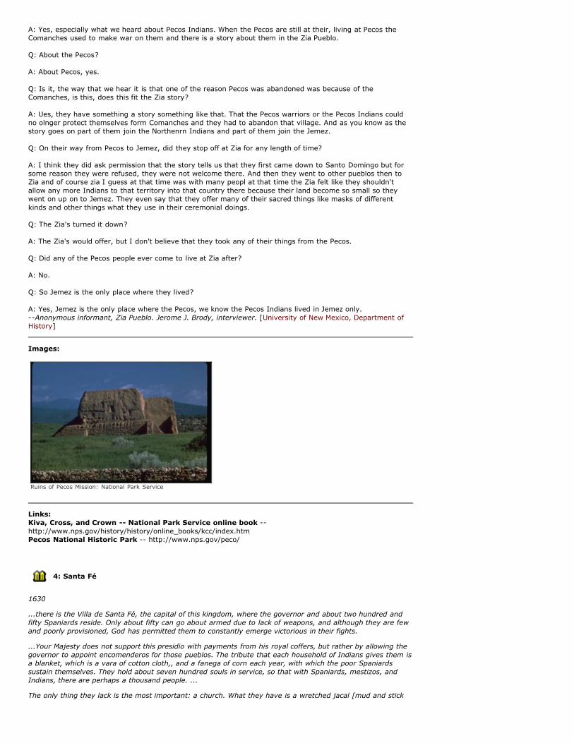
Overview: Pecos Pueblo
Thanks to its propitious location at the nexus between the Rio Grande pueblos and the buffalo-rich plainstribes, for centuries the Towa-speaking Pecos controlled trade, and became one of the richest and mostpowerful pueblos. Early Spanish explorers quickly ran into conflicts with the pueblo's powerful leaders. Disease,particularly smallpox, ultimately decimated the population- mostly adults, as many children had beenvaccinated- in the early 19th century. A few survivors resettled with the Jemez (possibly in 1838), bringingtheir important fetishes, societies, and patron saints.
Today, the National Park Service manages the mission and the Pueblo ruins as a national historic site. Visitorscan tour the ruins and learn more about Pueblo and mission life in the visitor center.
The ruins of Cicúique are still to be seen at the site where Alvarado visited it, close by the modern town ofPecos. This is one of the most historic spots in the Southwest, for in every era since it was first seen byAlvarado as the guest of Bigotes, it has occupied a distinctive position in all the major developments of theregion. It was the gateway for Pueblo Indians when they went buffalo hunting on the Plains; a two-way passfor barter and war between Pueblos and Plains tribes; a portal through the mountains for Spanish explorers,traders, and buffalo hunters; for the St. Louis caravan traders with Santa Fe; for pioneer Anglo-Americansettlers; for Spanish and Saxon Indian fighters; for Civil War armies; and for a transcontinental railroadpassing through the Southwest.[bimsplit] Herbert E. Bolton, Coronado, Knight of Pueblos and Plains,1949 [Bolton, Herbert Eugene]
27 April 1968:
Quote: A: ... I do not have any story about Comanches attacking the Zia Pueblo.
Q: But all three of the other [Apache, Navajo and Ute] did?
A: Yes, especially what we heard about Pecos Indians. When the Pecos are still at their, living at Pecos theComanches used to make war on them and there is a story about them in the Zia Pueblo.
Q: About the Pecos?
A: About Pecos, yes.
Q: Is it, the way that we hear it is that one of the reason Pecos was abandoned was because of theComanches, is this, does this fit the Zia story?
A: Ues, they have something a story something like that. That the Pecos warriors or the Pecos Indians couldno olnger protect themselves form Comanches and they had to abandon that village. And as you know as thestory goes on part of them join the Northenrn Indians and part of them join the Jemez.
Q: On their way from Pecos to Jemez, did they stop off at Zia for any length of time?
A: I think they did ask permission that the story tells us that they first came down to Santo Domingo but forsome reason they were refused, they were not welcome there. And then they went to other pueblos then toZia and of course zia I guess at that time was with many peopl at that time the Zia felt like they shouldn'tallow any more Indians to that territory into that country there because their land become so small so theywent on up on to Jemez. They even say that they offer many of their sacred things like masks of differentkinds and other things what they use in their ceremonial doings.
Q: The Zia's turned it down?
A: The Zia's would offer, but I don't believe that they took any of their things from the Pecos.
Q: Did any of the Pecos people ever come to live at Zia after?
A: No.
Q: So Jemez is the only place where they lived?
A: Yes, Jemez is the only place where the Pecos, we know the Pecos Indians lived in Jemez only.--Anonymous informant, Zia Pueblo. Jerome J. Brody, interviewer. [University of New Mexico, Department ofHistory]
Images:
Ruins of Pecos Mission: National Park Service
Links: Kiva, Cross, and Crown -- National Park Service online book --http://www.nps.gov/history/history/online_books/kcc/index.htmPecos National Historic Park -- http://www.nps.gov/peco/
4: Santa Fé
1630
...there is the Villa de Santa Fé, the capital of this kingdom, where the governor and about two hundred andfifty Spaniards reside. Only about fifty can go about armed due to lack of weapons, and although they are fewand poorly provisioned, God has permitted them to constantly emerge victorious in their fights.
...Your Majesty does not support this presidio with payments from his royal coffers, but rather by allowing thegovernor to appoint encomenderos for those pueblos. The tribute that each household of Indians gives them isa blanket, which is a vara of cotton cloth,, and a fanega of corn each year, with which the poor Spaniardssustain themselves. They hold about seven hundred souls in service, so that with Spaniards, mestizos, andIndians, there are perhaps a thousand people. ...
The only thing they lack is the most important: a church. What they have is a wretched jacal [mud and stick

building]. This is because the priests have concentrated on establishing churches for the Indians they havebeen converting. They constantly tend to and live among these people.
And so when I came into the areas as its custodian, I began the construction of a church and rectory [SanMiguel Mission] to the honor and glory of Our Lord God that would be outstanding anywhere. Our clerics nowteach Spaniards and Indians there to read, write, play instruments, and sing, as well as all the arts of politesociety.
This place, although cold, is the most fertile in all of New Mexico. [de Benavides, Alonso]
Overview: Santa Fé
Santa Fe was for centuries the end of the Camino Real, and has almost always been the seat of government inNew Mexico. Most of the original town was built between 1610-1612, and centered around the plaza. Thebarrio of Analco, across the Río de Santa Fé from the plaza, was one of the main genízaro settlements of NewMexico from its founding at least until the late eighteenth century
The Casas Reales, or the Palace of the Governors, was built in 1610 when Santa Fé was established. Peopletook refuge in it during the Indian siege of August 1680. Subsequently, this seat of government was occupiedby the Pueblo rebels, again by the Spanish, by the Mexican Provincial governors, by U.S. General Kearny, theConfederate Army, and a string of American Territorial governors. [Long Distance Trails Group--Santa Fe,National Park Service, New Mexico State Office, Bureau of Land Management]
Quote: Every calculation based on experience elsewhere fails in New Mexico...--Lew Wallace, Governor of Territorial New Mexico, 1878-1881
Images:
House in Santa Fe San Miguel church, the oldest in America
Links: Santa Fe- Official Visitor Site -- http://santafe.org/Palace of the Governors: Museum of New Mexico -- http://www.palaceofthegovernors.org/
5: Taosy
1630
Quote: There are two thousand five hundred baptized souls, with a friary and church that have beenestablished with great care by the two friars in charge of its conversion.
These Indians are well taught in church doctrine. And in the year just past of 1627, Our Lord confirmed HisHoly Word with a miracle among them. As it happened, it was difficult for them [the Taos men] to stop havingso many women, as was their custom before they were baptized. Each day, the friar preached to them theholy sacrament of matrimony, and the person who contradicted him most strongly was an old Indiansorceress. Under the pretext of going to the countryside for firewood, she took along four good Christianwomen, and married at that, all conforming to the good order of Our Holy Mother Church. And coming andgoing in their wood gathering, she was trying to persuade them not to continue with the kind of marriage ourpadre was teaching, saying how much better off a person was practicing her old heathenism.
These good Christians resisted this kind of talk. They were getting close to the pueblo again, and the sorceresswas carrying on with her sermon. The sky was clear and serene, but a bolt from the blue struck that infernalinstrument of the devil right in the middle of those good Christian women who had been resisting her evilcreed. They were spared form the bolt, and quite confirmed in the truth of the holy sacrament of matrimony.
The entire pueblo ran to the spot. Seeing the results of the thunderclap from heaven, everyone who had beensecretly living in sin got married and began to believe mightily in everything the padre taught them. ...
It is an incredibly cold country with a great abundance of provisions and livestock. [de Benavides, Alonso]
Overview: Taos Pueblo
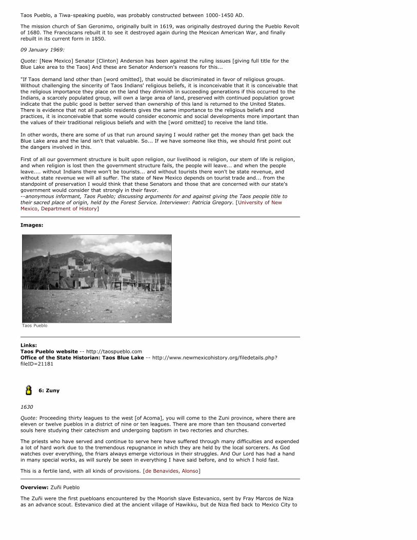
Taos Pueblo, a Tiwa-speaking pueblo, was probably constructed between 1000-1450 AD.
The mission church of San Geronimo, originally built in 1619, was originally destroyed during the Pueblo Revoltof 1680. The Franciscans rebuilt it to see it destroyed again during the Mexican American War, and finallyrebuilt in its current form in 1850.
09 January 1969:
Quote: [New Mexico] Senator [Clinton] Anderson has been against the ruling issues [giving full title for theBlue Lake area to the Taos] And these are Senator Anderson's reasons for this...
"If Taos demand land other than [word omitted], that would be discriminated in favor of religious groups.Without challenging the sincerity of Taos Indians' religious beliefs, it is inconceivable that it is conceivable thatthe religious importance they place on the land they diminish in succeeding generations if this occurred to theIndians, a scarcely populated group, will own a large area of land, preserved with continued population growtindicate that the public good is better served than ownership of this land is returned to the United States.There is evidence that not all pueblo residents gives the same importance to the religious beliefs andpractices, it is inconceivable that some would consider economic and social developments more important thanthe values of their traditional religious beliefs and with the [word omitted] to receive the land title.
In other words, there are some of us that run around saying I would rather get the money than get back theBlue Lake area and the land isn't that valuable. So... If we have someone like this, we should first point outthe dangers involved in this.
First of all our government structure is built upon religion, our livelihood is religion, our stem of life is religion,and when religion is lost then the government structure fails, the people will leave... and when the peopleleave.... without Indians there won't be tourists... and without tourists there won't be state revenue, andwithout state revenue we will all suffer. The state of New Mexico depends on tourist trade and... from thestandpoint of preservation I would think that these Senators and those that are concerned with our state'sgovernment would consider that strongly in their favor.--anonymous informant, Taos Pueblo; discussing arguments for and against giving the Taos people title totheir sacred place of origin, held by the Forest Service. Interviewer: Patricia Gregory. [University of NewMexico, Department of History]
Images:
Taos Pueblo
Links: Taos Pueblo website -- http://taospueblo.comOffice of the State Historian: Taos Blue Lake -- http://www.newmexicohistory.org/filedetails.php?fileID=21181
6: Zuny
1630
Quote: Proceeding thirty leagues to the west [of Acoma], you will come to the Zuni province, where there areeleven or twelve pueblos in a district of nine or ten leagues. There are more than ten thousand convertedsouls here studying their catechism and undergoing baptism in two rectories and churches.
The priests who have served and continue to serve here have suffered through many difficulties and expendeda lot of hard work due to the tremendous repugnance in which they are held by the local sorcerers. As Godwatches over everything, the friars always emerge victorious in their struggles. And Our Lord has had a handin many special works, as will surely be seen in everything I have said before, and to which I hold fast.
This is a fertile land, with all kinds of provisions. [de Benavides, Alonso]
Overview: Zuñi Pueblo
The Zuñi were the first puebloans encountered by the Moorish slave Estevanico, sent by Fray Marcos de Nizaas an advance scout. Estevanico died at the ancient village of Hawikku, but de Niza fled back to Mexico City to

spread the astounding word about the glorious city he had seen.
Espejo describes the "Zuñi province" as Mazaque, Quaquma, Aguico, Alona, Quaquina, and Cana." Hodgeidentifies the indiginous names as "Mátsaki, K'iákima, Hálona, Kwákina, Háwikuh, and K'iánawa."
Because of its isolation, the Zuñi were able to maintain their traditions during the Spanish and Mexicanperiods, but after New Mexico became American territory, they lost much of their traditional land base. Visitorsto Zuni can learn more about the A:shiwi at the historic mission, or the A:shiwi A:wan Museum and HeritageCenter..
24 January 1970:
Quote: A: Well this is Tom Idaque, and I want to tell you my life story this morning, while this friend of mine isvisiting me, and how I was surprised to see him. I though that if we don't see each other on this earth, wewould see each other up yonder, but he is come this morning, and I was glad to see him. I didn't look foranyone to come this morning. So, I was glad to see him and talk with him and now I am going to tell aboutmy life, what I done in my young days. In 1900 I went to school in Albuquerque, New Mexico and I went toschool for three years and I come back home and I didn't know, I don't talk very good English. I don't talkvery good English yet, but I can understand more than that time. Only think that I learn how to talk wasworking among the white folks around here and some other places, and so only, think I done in my youngdays was breaking horses, riding wild horses and things like that and I been out in the country most of thetime, I never live much in Zuni.....
Oh, there is a lot of things what they used to tell us around here, they grown in the herbs and things like that,they use it for some good purposes but now, young people use everything today and they have forgotten all ofthose things, they pick them up and nothing grows up there, clean, we put them in a sack and send themaway to dry up and I never put them in a sack yet and I usually put them in something where the dirt won'tget in and keep it clean.
Q: Is there some of the Zuni plants that have made their way into the commercial market that you know of?
A: Oh, they do, they raise a lot of in summer time, they raise water melons and cantaloupe and things likethat, they took them out and when somebody, they only raise it for their own use, but sometimes they raisemore than they can use and sometimes they go out and take it to market.
Q: They grow squash, several varieties of squash?
A: Quite a bit, they raise them too, and...
Q: They had that before the coming of the Spaniards though, didn't they?
A: Oh yeah, yeah, and all colors of corn, yellow and blue and white and kind of a black looking corn and thenone was a speckled just like a different colors and it....
Q: Yeah, the grain is never the same and it is speckled and spotted.
A: Yeah, and they are still raising them and then of course, they still use them corn and stuff like that for theirown old time way about somethings that they do in the way back they are still using them and different colorsof corn and in the winter time when they have doing the ceremonies then they use, they make the cornbreadout of it. They use white corn and blue corn, to make it on a hot rock and they just some paper bread likethat.
Q: You use a hot rock and that fat rock is above on the ground a ways....
A: And there is a fire under it and heat up and they... they take the... some like to make it like stir up for hotcakes and they dip their fingers in there and they run it up and make it quite a bit and then when it cooksthen they just turn it over and lay it in a pan and keep it up like that until you get a big pot, and then roll itup and in different so that....
Q: The corn was ground first wasn't it?
A: Fine, into flour, and then make it that way.
Q: Make it into a mush, into a kind of a soup...
A: Yeah, a kind of a soup like and then they spread that on a rock and...
Q: Put that right over the heated rock, that rock is usually sandstone?
A: Yeah, and then they smooth it on the top so that this paper bread won't stick on the rock. They... after theyfinish it then they polish it with different kind of stuff, and it gets slick just like a glass and then when it getshot, then you just put that on there and it don't stick on there, it just cooks up and dries up on a rock, and rollit up and ready to eat, and that is they way that they do that with all their ceremonies that they do, theydon't eat the bread like an other time, but they do that once a year, and now once a year, but years ago, theyused to do it every year, and they make it that way, the corn the main, and bread like, in place of bread, butthe Zunis are a little bit different than the other Indian out east, you take round San Felipe and SantoDomingo, Jemez, they still eat stuff like that...
Q: The outsiders seem to think that the Indians have kept the old corn and developing it like he once did, heis still developing it, isn't he?
A: Oh yeah, it is still that way and the Zunis took care of them, and even if it doesn't rain, they go out thereand work on it and keep the dirt stirred up so that the moisture, will anything that you plant it out in the, the
and work on it and keep the dirt stirred up so that the moisture, will anything that you plant it out in the, thedifferent soil, well if the moisture is not there well it is not going to grow and the dirt is stirred up on the topand loose enough good so that the moisture will hold better, in there and if the big ground baked down hard,then there won't grow anything there....It don't hold out good, like if it was stirred up. Anything that is looseright around the roots, it would hold the moisture better, maybe quarter of an inch, or one inch, is dry but it isdown below, loose dirt, it helps hold in moisture. That is what helps.
Q: And they plant that, how many grains in a hill?
A: Oh, about they plant about four corn in there and sometime you put three and if some other look likesomething there and dig it out, then they plant it over again....When they are fixing up, after everything isgrowed up, some new corn, they either took the shucks off and, or shell it and dry the grain, or they took itthat way, just the way they roast it or sometimes they just throw sweet corn together and put a big hole andput them in there and cook it that way for their winter. The only things.... different tribes, and Zunis andLagunas do that, and just to watch the corn and just when it starts to get real old and not too hard, but justenough, you like to roast them, maybe about a truck load or so come up to the place and you dug a hole andyou build a fire for all day after they heat all of them it is dig like a well and so many feat around and whenthey get the heat up good, then all of that truck load or wagon load of corn in there and they covered themup, cover them right tight and the steam will cook them.
Q: They left the husks on them didn't they?
A: Yeah, either till after they cook, they shell it or leave it like that, just dry it and after they tie them togetherin bunches and hanged them up and after they dried up then they put them away for winter use and it doesn'tmake, when it takes those, after, maybe put up, after being put up for four or five months and you cook itthere is nothing different than picking them off the stalks fresh and taste good just like in the summer time....and that is just the way that they fix it for you.... Yeah, I have seen that, but they don't do too much of thatnowadays hardly...and only those...Indians that I was telling you about, Jemez, San Felipe and Santo Domingoand all of those, they are still doing it and the Zunis don't, the trouble with the Zunis are they are all outsomewhere working, working for the railroad, and some of them employed by the National Forest and theforest service and many other workers and none of them Zunis they stay home to do anything, only the realold people they are still raising their corn and pumpkins and things like this and squash all kinds of somethinglike that, they still plant them and took care of them and raise them, the young people don't do that anymorehardly.--Tom Idaque, Zuni Pueblo. Folsom C. Scrivner, interviewer. [University of New Mexico, Department ofHistory]
Images:
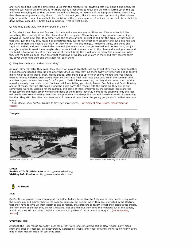
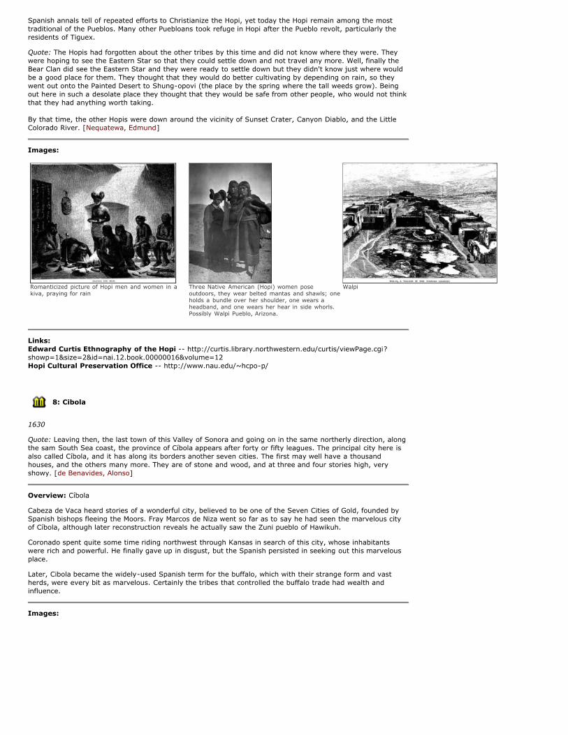
Across the roofs of Zuni Zuni Pueblo man weaving on a loom
Links: Pueblo of Zuñi official site -- http://www.ashiwi.org/Visiting Zuñi Pueblo -- http://www.zunitourism.com
7: Moqui
1630
Quote: It is a general custom among all the infidel Indians to receive the Religious in their pueblos very well inthe beginning, and submit themselves soon to Baptism; but seeing, when they are instructed in the Doctrine,that they have to give up their idolatries and sorceries, the sorcerers so resent it that they disquiet the others,and turn them aside that they be not Christians. Not only this but they drive the Religious out of the pueblo,and if not, they kill him. Thus it befell in the principal pueblo of this Province of Moqui.... [de Benavides,Alonso]
Overview: Hopi
Although the Hopi mesas are today in Arizona, they were long considered part of New Mexico. Early mapsshow the cities of Totoneac, as discovered by Coronado's troops, and Moqui Province shows up on nearly everymap of New Mexico made for centuries after.
Spanish annals tell of repeated efforts to Christianize the Hopi, yet today the Hopi remain among the most
Spanish annals tell of repeated efforts to Christianize the Hopi, yet today the Hopi remain among the mosttraditional of the Pueblos. Many other Puebloans took refuge in Hopi after the Pueblo revolt, particularly theresidents of Tiguex.
Quote: The Hopis had forgotten about the other tribes by this time and did not know where they were. Theywere hoping to see the Eastern Star so that they could settle down and not travel any more. Well, finally theBear Clan did see the Eastern Star and they were ready to settle down but they didn't know just where wouldbe a good place for them. They thought that they would do better cultivating by depending on rain, so theywent out onto the Painted Desert to Shung-opovi (the place by the spring where the tall weeds grow). Beingout here in such a desolate place they thought that they would be safe from other people, who would not thinkthat they had anything worth taking.
By that time, the other Hopis were down around the vicinity of Sunset Crater, Canyon Diablo, and the LittleColorado River. [Nequatewa, Edmund]
Images:
Romanticized picture of Hopi men and women in akiva, praying for rain
Three Native American (Hopi) women poseoutdoors, they wear belted mantas and shawls; oneholds a bundle over her shoulder, one wears aheadband, and one wears her hear in side whorls.Possibly Walpi Pueblo, Arizona.
Walpi
Links: Edward Curtis Ethnography of the Hopi -- http://curtis.library.northwestern.edu/curtis/viewPage.cgi?showp=1&size=2&id=nai.12.book.00000016&volume=12Hopi Cultural Preservation Office -- http://www.nau.edu/~hcpo-p/
8: Cibola
1630
Quote: Leaving then, the last town of this Valley of Sonora and going on in the same northerly direction, alongthe sam South Sea coast, the province of Cíbola appears after forty or fifty leagues. The principal city here isalso called Cíbola, and it has along its borders another seven cities. The first may well have a thousandhouses, and the others many more. They are of stone and wood, and at three and four stories high, veryshowy. [de Benavides, Alonso]
Overview: Cíbola
Cabeza de Vaca heard stories of a wonderful city, believed to be one of the Seven Cities of Gold, founded bySpanish bishops fleeing the Moors. Fray Marcos de Niza went so far as to say he had seen the marvelous cityof Cíbola, although later reconstruction reveals he actually saw the Zuni pueblo of Hawikuh.
Coronado spent quite some time riding northwest through Kansas in search of this city, whose inhabitantswere rich and powerful. He finally gave up in disgust, but the Spanish persisted in seeking out this marvelousplace.
Later, Cibola became the widely-used Spanish term for the buffalo, which with their strange form and vastherds, were every bit as marvelous. Certainly the tribes that controlled the buffalo trade had wealth andinfluence.
Images:
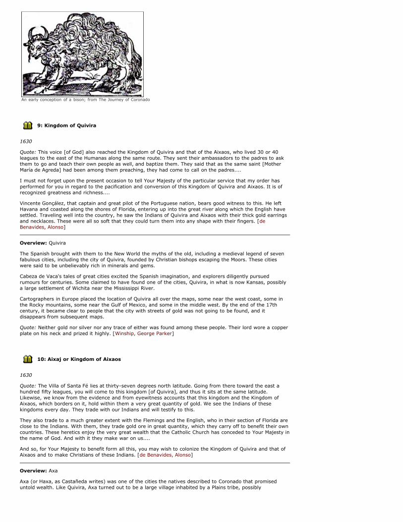
An early conception of a bison; from The Journey of Coronado
9: Kingdom of Quivira
1630
Quote: This voice [of God] also reached the Kingdom of Quivira and that of the Aixaos, who lived 30 or 40leagues to the east of the Humanas along the same route. They sent their ambassadors to the padres to askthem to go and teach their own people as well, and baptize them. They said that as the same saint [MotherMaría de Agreda] had been among them preaching, they had come to call on the padres....
I must not forget upon the present occasion to tell Your Majesty of the particular service that my order hasperformed for you in regard to the pacification and conversion of this Kingdom of Quivira and Aixaos. It is ofrecognized greatness and richness....
Vincente Gonçález, that captain and great pilot of the Portuguese nation, bears good witness to this. He leftHavana and coasted along the shores of Florida, entering up into the great river along which the English havesettled. Traveling well into the country, he saw the Indians of Quivira and Aixaos with their thick gold earringsand necklaces. These were all so soft that they could turn them into any shape with their fingers. [deBenavides, Alonso]
Overview: Quivira
The Spanish brought with them to the New World the myths of the old, including a medieval legend of sevenfabulous cities, including the city of Quivira, founded by Christian bishops escaping the Moors. These citieswere said to be unbelievably rich in minerals and gems.
Cabeza de Vaca's tales of great cities excited the Spanish imagination, and explorers diligently pursuedrumours for centuries. Some claimed to have found one of the cities, Quivira, in what is now Kansas, possiblya large settlement of Wichita near the Mississippi River.
Cartographers in Europe placed the location of Quivira all over the maps, some near the west coast, some inthe Rocky mountains, some near the Gulf of Mexico, and some in the middle west. By the end of the 17thcentury, it became clear to people that the city with streets of gold was not going to be found, and itdisappears from subsequent maps.
Quote: Neither gold nor silver nor any trace of either was found among these people. Their lord wore a copperplate on his neck and prized it highly. [Winship, George Parker]
10: Aixaj or Kingdom of Aixaos
1630
Quote: The Villa of Santa Fé lies at thirty-seven degrees north latitude. Going from there toward the east ahundred fifty leagues, you will come to this kingdom [of Quivira], and thus it sits at the same latitude.Likewise, we know from the evidence and from eyewitness accounts that this kingdom and the Kingdom ofAixaos, which borders on it, hold within them a very great quantity of gold. We see the Indians of thesekingdoms every day. They trade with our Indians and will testify to this.
They also trade to a much greater extent with the Flemings and the English, who in their section of Florida areclose to the Indians. With them, they trade gold ore in great quantity, which they carry off to benefit their owncountries. These heretics enjoy the very great wealth that the Catholic Church has conceded to Your Majesty inthe name of God. And with it they make war on us....
And so, for Your Majesty to benefit form all this, you may wish to colonize the Kingdom of Quivira and that ofAixaos and to make Christians of these Indians. [de Benavides, Alonso]
Overview: Axa
Axa (or Haxa, as Castañeda writes) was one of the cities the natives described to Coronado that promiseduntold wealth. Like Quivira, Axa turned out to be a large village inhabited by a Plains tribe, possibly
Pawnee. [Twitchell, Ralph Emerson]
About this Map
Nicholas Sanson: Amerique Septentrionale, La Nouveau Mexique et La Florida : 1650
Nicholas Sanson from Abbeville, France founded one of the most influential dynasties of cartography inFranche, continued by his sons Nicholas, Guillaume, and Adrian. He trained as an historian and apparentlypursued cartography to illustrate his historical interests. His maps came to the attention of King Louis XIII ofFranche who appointed Sanson as Geographe Ordinaire du Roi about 1640. Sanson rejected the excessiveornamentation of the Dutch and insisted his maps be based on accurate, verifiable information. Ironically,Sanson's maps encouraged the errors of California as an island and a Rio Grande River originating in a largelake north of Taos which then flowed southwestward into the gulf of California, the Mar Vermejo.
Despite these geographic errors, Sanson was the first to include local place names, especially Santa Fe, andtribal identities in a published map of the Southwest. In 1656, he expanded these identifications in his LaNouveau Mexique et La Florida, the first large regional map of the Spanish territory from Florida to California.He was the first to identify and generally locate the Apache tribes-- the Apaches de Navajo, Apaches de Xila,Apaches de Peryllos, and Apaches Vaqueros.
The strong similarity between Sanson's New Mexico tribal and place names and those described at length byFray Alonso de Benavides in his Memorial of 1630 suggest that Sanson had access to one of the translationspublished shortly after its printing by the Spanish Royal Printery that same year. French and Dutch translationsappeared in 1631; Latin and German in 1634.
Atlas Citation: [Eidenbach, Peter]
Map Credits: Library of Congress Geography and Map Division
TIMELINE: TERRA INCOGNITA
circa 1150
Quivira and Cíbola are two of the fantastic Seven Cities of Gold, that springs from the Moorish invasions.According to legend, seven bishops fled the invasion, to save their own lives and to prevent the Muslims fromobtaining sacred religious relics. A rumor grew that the seven bishops had founded the cities of Cíbola andQuivira. The legend says that these cities grew very rich, mainly from gold and precious stones. This ideafueled many expeditions in search of the mythical cities during the following centuries. Eventually, the legendbehind these cities grew to such an extent that no one spoke solely of Quivira and Cíbola, but instead of sevenmagnificent cities made of gold.
1492
Cristobal Colón, an Italian on a Spanish-financed expedition, discovers the New World. He travels with twoSpanish captains as the captains of the Niña and the Pinta. Martin Alonzo Pinzon sailed as captain of the Pinta,but he was also the co-owner of the Niña and the Pinta. His brother, Vincente Yáñez Pinzon, sailed as captainof the Niña. Vincente Pinzon made additional explorations in South and Central America.
1493
Papal Bull dividing all land in the new world between Portugal and Spain.
1499 Vicente Yáñez Pinzón, Alonso de Ojeda, Americo Vespucci, Juan de la Cosa, Alonso Niño and CristóbalGuerra were sent by King Ferdinand and Queen Isabella to explore new territories. They went along the coastof Brazil to the Gulf of Mexico and the Florida coast. They also reached the Chesapeake Bay.
1500
Juan de la Cosa drew the first map of America's coastline.
1513
Juan Ponce de Leon, in search of the fountain of youth and other fabulous riches, instead became the firstEuropean to land in Florida. At the time, he was also the first governor of Puerto Rico. On a later expedition,he discovered the Gulf Stream. This current became very important for Spanish trips from Europe to theAmericas.
1519
Captain Alonso Alvarez de Pineda explored and charted the Gulf Coast from Florida to Mexico. De Pineda andhis crew were the first Europeans in Texas, and claimed it for Spain.
1528
Panfilo de Narvaez led a disastrous expedition to settle Florida, when almost all of his men, and de Narvaezhimself, died after being abandoned onshore. Four men survived, and spent the next eight years crossingTexas, New Mexico, and Arizona, looking for a Spanish settlement. Cabeza de Vaca and his three companions
were the first Europeans to explore the Southwest, enter New Mexico, and contact many Southwestern tribes.
1528-1536
Alvar Cabeza de Vaca explores Texas, Arizona and New Mexico. De Vaca published an account of his journeyupon his return to New Spain. He receives a copper bell on the Rio Grande & is told that inhabitants farthernorth on the river "there were many plates of this same metal buried in the ground in the place where it hadcome and that it was a thing which they esteemed highly and that there were fixed habitations where it camefrom." Buckingham Smith's translation of Cabeza de Vaca's relacion.
1539
Fray Marcos de Niza, a Franciscan priest, claimed to have traveled to the fabled "Seven Golden Cities ofCibola" during the summer of 1539. The Viceroy of New Spain sent Fray Marcos to accompany Estevan, aMoorish slave who had traveled with Cabeza de Vaca, to find the great cities in the north the desert tribes haddescribed. Estevan was killed at Zuni Pueblo, but Fray Marcos returned to Mexico to report that indeed, greatcities lay to the north.
1540-1542
Francisco Vasquez de Coronado searched for the Seven Golden Cities of Cibola for nearly three years, coveringhuge areas of Arizona, New Mexico, the Grand Canyon, the Texas panhandle, Kansas, and Colorado. In Tiguex,and then at Cicuye, he came into conflict with the pueblos, and subsequent expeditions have to contend withthe negative results of Coronado's decisions.
1540
Alernando de Alarcon takes boats from Aculpulco to the Colorado River, and ascends the river twice todetermine if California is an island. Far upriver (before the canyons begin) he meets a man familiar with thepueblos and with the plains tribes. Their informant tells them of Coronado's doings.
1542
Juan Rodriguez Cabrillo sailed from Acapulco to southern California, claiming California for King Charles I ofSpain. Cabrillo named San Diego Bay and Santa Barbara.
1548
Zacatecas founded.
1562
Diego Gutiérrez published a map where California appeared for the first time.
1563
Durango founded.
1563-1565
Francisco de Ibarra explored New Mexico.
1565
Captain Pedro Menendez de Aviles established a settlement at St. Augustine, Florida, making it the oldestEuropean city in the U.S.. De Aviles also explored the coastline of North America as far north as St. HelenaIsland, South Carolina, and had forts built along the coast for protection.
1565-1580
Mines open in Santa Barbara, San Bartolome, Parral. The rich mines of northern Mexico drove demand for bothworkers and food, both of which New Mexico supplied for centuries.
1573
Council of the Indies Code is established for regulating new domains. New laws require:
- discoveries were to be made with "Peace and Mercy"
- no injuring native peoples
- only the King or his representative can authorize expeditions
- Spanish governments can't aid one tribe over another
1581
Francisco Sanchez Chamuscado and Fray Agustin Rodriguez enter the pueblo province, which they call SanFelipe, leading 9 spanish men and 16 indian servants. They leave 2 priests behind: Juan de Santa Maria getskilled by the Maguas Indians; Fray Francisco López is killed in Puaray (near Bernalillo).
1582-1583
Don Antonio Espejo launches an expedition to rescue the priests, and upon finding that there were no priestsleft alive to rescue, traveled around New Mexico, from the Galisteo Basin to Jemez, claiming New Mexico forthe King.
1589
Luis de Carabajal governor of Nuevo León, gets arrested by the Inquisition, and his Lieutenant Governor,Castaño de Sosa, takes his seat.
1590-1591
Governor de Sosa takes the entire colony on an unauthorized expedition of New Mexico. Troops are sent fromSaltillo to arrest de Sosa, who is exiled to the Philippines.
1594-1596
Antonio Gutiérrez de Humaña and Francisco Leyva de Bonilla explore New Mexico and Colorado as far as thePurgatoire River in an unauthorized expedition. While in present-day Kansas, Humaña murdered Bonilla, thenall men were killed before they could leave the plans.
1596
Juan de Zaldivar explored the San Luis Valley of Colorado.
1598-1608
Don Juan de Oñate brought the first colony to New Mexico, and explored vast areas of New Mexico, Colorado,and Kansas. He reached the South Sea in 1605, and signed his name at on Inscription Rock, now El MorroNational Monument. Farfán explores Arizona on behalf of Oñate and reports the discovery of large pearls andlodes of rich ore.
1598
Juan de Archuleta explored Colorado as far as Kiowa County.
1602
Sebastián Vizcaíno sailed up the coast of California, and named Monterey Bay, San Diego, San Clemente,Catalina, Santa Barbara, Point Concepcion, Carmel, Monterey, La Paz, and Ano Nuevo. Vizcaíno also triedunsuccessfully to colonize southern California.
1607
First permanent British colony founded by Capt. John Smith at Jamestown, VA.
1610
In Santa Fe, New Mexico, the Spanish built the block long adobe Palace of the Governors.
1630, 1640
Fray Alonso Benavides makes an inspection of the New Mexico missions and the progress in converting thepueblos. He reports several wonders, including the conversion of the Xumanas through the miraculousapparition of Mother Luisa de Carrion.
1641-late 1650s
Smallpox epidemic devastates New Mexico.
1653
Captain Alonso de Leon followed Rio de Palmas (Rio Grande) a few hundred miles to the mouth and reportedprospering Indian farmers.
1660-1662
Drought in New Mexico; war parties of nomadic tribes strike Cerralvo, Saltillo, Monterey, Casas Grandes, andChihuahua.
1661- 1662
Don Diego Peñalosa becomes governor of New Mexico. Don Diego Peñalosa, accused of seditious andscandalous behavior by the Inquisition, gets exiled from Spain and her dominions. Twenty years later, hemanages to get the ear of the French monarch, arguing for an attack from Louisiana and seize northernMexico. This plan may have encouraged Sieur La Salle to make an expedition to the mouth of the Rio Bravo in"Florida" with an eye to founding a French colony. Their plans come to nothing, but Coronelli's 1688 map wasinspired in large part by this saga.
1668
Widespread hunger in New Mexico.
1671
Disease, Apache raids.
1675
Senecu destroyed by Apache attack, never resettled .
1673
Fray Juan Larios recruits a reconnaissance team to meet and convert tribes along the Rio Grande, south to LaJunta del Rios, where the Pecos and the Rio Grande meet. Lieutenant Fernando del Bosque led the expedition,made notes of the country and its products, and recommended three settlements along the river, arecommendation which Spain would continue to ignore for a long time.
1680
Tired of harsh treatment and religious intolerance, the Pueblo people band together under the leadership of aman named Popé and drive the Spanish from the New Mexico colonies. The rebels destroy and deface most ofthe Spanish churches. The Spanish retreat to the south side of the Rio Grande, and found the city El Pasowhile waiting eleven years for reinforcements.
1682
Robert Cavalier, Sieur de la Salle commissioned to conquer Spain's northern American colonies in 1682,France claims Louisiana from Rio de las Palmas (modern-day Rio Grande) up the Gulf Coast.
1683
Governor Otermin's replacement is General Domingo Jironza Petriz de Cruzate. Cruzate extends the reach of ElPaso south and east along the Rio Grande, and responds to requests for missionaries from tribes from the areaof Junta de los Rios.
1691-1695
Francisco de Vargas reconquered New Mexico and entered the San Luis Valley.
1687-1711
Father Eusebio Francisco Kino, a Jesuit priest, founded many missions and explored areas the Pimería Altaregion of New Spain, including what are now northern Mexico, California, and Arizona. He founded his firstmission in what is now Sonora, Mexico, then spent 25 years exploring and mapping the lands along the RioGrande, the Colorado River, and the Gila River, traveling as far as the headwaters for the Rio Grande and theGila.
1706
Juan de Ulibarri crossed Colorado as far as the Arkansas Valley into Kiowa County.
Visit Atlas of Historic NM Maps online at atlas.nmhum.org.
Website and Contents Copyright ©2008 - 2009 New Mexico Humanities Council. All rights reserved.