Newsletter 2017 Volume 1 - AtlantOS · PDF fileNewsletter 2017 This project has ......
24
2017 Newsletter This project has received funding from the European Union’s Horizon 2020 research and innovation programme under grant agreement No 633211 Atlant S Email: [email protected] | Website: www.atlantos-h2020.eu | Twitter: @atlantos_h2020 Volume 1 Issue 2 1
-
Upload
nguyendung -
Category
Documents
-
view
216 -
download
1
Transcript of Newsletter 2017 Volume 1 - AtlantOS · PDF fileNewsletter 2017 This project has ......
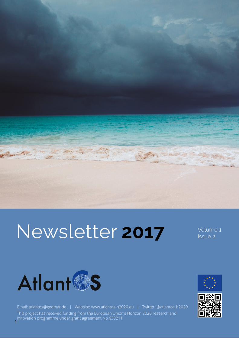
2017Newsletter
This project has received funding from the European Union’s Horizon 2020 research and innovation programme under grant agreement No 633211
Atlant SEmail: [email protected] | Website: www.atlantos-h2020.eu | Twitter: @atlantos_h2020
Volume 1Issue 2
1
Contents
Focus Area - Societal Benefit Areas / User Needs
News from the Work Packages
Opinion Page
News from the private sector
Kids corner
Capacity building
News from the community
Upcoming events
3
10
15
16
17
21
23
23
CreditsEditor: Anja Reitz and Sandra Ketelhake (GEOMAR Helmholtz Centre for Ocean Research Kiel)Graphics: Simon Keeble (Blue Lobster IT Limited)
Cover photo: Beach - Credit: Pixabay
The second AtlantOS newsletter is focussing on the contribution of ocean observing to societal benefits. On the one hand, the
diverse needs of societies for ocean information has been guiding the objectives of AtlantOS and in general, the essential ocean variables for societal benefits. On the other hand, available information is assembled to provide information products to address very specific societal benefit areas. Our aim is to enhance and optimise the system and networks to a more fit-for-purpose system and deliver key information and decision support tools for a variety of marine actors including the economic sectors.
What is the H2020 project AtlantOS
The AtlantOS H2020 EU research and innovation project pools the effort of 57 European and 5 non-European partners
from 18 countries to collaborate on optimising and enhancing Atlantic Ocean observing. The project has a budget of about € 21 Million for 4 years (April 2015 – June 2019) and is coordinated by GEOMAR Helmholtz Centre for Ocean Research Kiel, Germany (Prof. Dr. Martin Visbeck).
We have selected contributions that demonstrate a specific success story within the AtlantOS community that show cases how ocean observations can help to address a specific user need. These examples will provide motivation to maintain a growing investment in Atlantic Observing. AtlantOS will continue to make recommendations and support actions to improve and innovate Atlantic Ocean observing to obtain a more internationally shared, more sustainable resourced, more efficient, more integrated, and collectively a fit-for-purpose system.
The overarching target of the AtlantOS initiative is to deliver an advanced framework for the development of an integrated Atlantic Ocean Observing System that goes beyond the state-of–the-art, and leaves a legacy of sustainability after the life of the project.
EditorialAnja Reitz and Sandra Ketelhake (GEOMAR Helmholtz Centre for Ocean Research Kiel)
Ocean Observing for Society - AtlantOS products and servicesNadia Pinardi (University of Bologna, Italy)
Caroline Cusack (Marine Institute, Ireland)
AtlantOS has the ambition of delivering a suite of end-user products/services targeted at marine issues of societal concern for Atlantic
maritime nations. These products/services will enhance the safety of coastal communities and promote economic development in key emerging marine and maritime sectors through better decision support tools and integrated products/services, using ocean observations, modelling and information on human related activities.
AtlantOS products/services will contribute substantially to the GEO Blue Planet initiative and the UN Sustainable Development Goals 13 “Climate Action” and 14 “Life below water”.
The main products/services developed by AtlantOS cover the following themes: disaster risk reduction (coastal flooding risk mapping, maritime transport efficient ship routing, harmful algal blooms, oil spill hazard mapping), resource assessment
FOCUS AREA
Societal Benefit Areas / User Needs
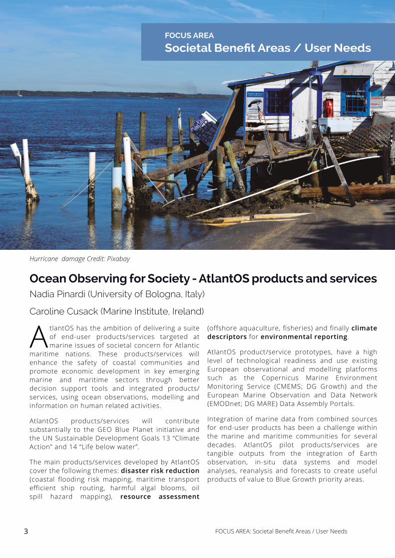
Hurricane damage Credit: Pixabay
(offshore aquaculture, fisheries) and finally climate descriptors for environmental reporting.
AtlantOS product/service prototypes, have a high level of technological readiness and use existing European observational and modelling platforms such as the Copernicus Marine Environment Monitoring Service (CMEMS; DG Growth) and the European Marine Observation and Data Network (EMODnet; DG MARE) Data Assembly Portals.
Integration of marine data from combined sources for end-user products has been a challenge within the marine and maritime communities for several decades. AtlantOS pilot products/services are tangible outputs from the integration of Earth observation, in-situ data systems and model analyses, reanalysis and forecasts to create useful products of value to Blue Growth priority areas.
3 FOCUS AREA: Societal Benefit Areas / User Needs
Increasing safety along the Atlantic Ocean coasts – Developing a comprehensive world map of storm surgesKevin Horsburgh (National Oceanography Centre, United Kingdom)
Coastal flooding represents one of the major challenges of global climate change for humanity. Storm surges and oceanic waves
are the major cause of extreme sea levels, causing devastating coastal impacts around the world. Storm surges caused by mid-Atlantic weather systems can increase sea levels by 4 m and hurricane surges can be as high as 10 m. In the US in 2012, Hurricane Sandy caused 106 deaths and damages exceeding $60 Billion.
Within the AtlantOS project we are improving methods for estimating extreme sea levels around the Atlantic and more widely. We will develop a comprehensive world picture of storm surge distribution for both tropical and extra-tropical cyclones. We have already published new understanding about how storm surges and high tides interact, providing proof that any storm surge can occur on any tide. This is a big step forward for estimating the statistics for extreme water levels. Our work also provides the systematic best practice to identifying storm surges from a tide gauge record – and long-term high-quality sea level observations
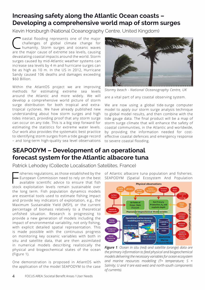
Stormy beach - National Oceanography Centre, UK
are a vital part of any coastal observing system.
We are now using a global tide-surge computer model to apply our storm surge analysis technique to global model results, and then combine with the tide gauge data. The final product will be a map of storm surge climate that will enhance the safety of coastal communities, in the Atlantic and worldwide, by providing the information needed for cost-effective coastal defences and emergency response to severe coastal flooding.
Figure 1: Ocean in situ (red) and satellite (orange) data are the primary information to feed physical and biogeochemical models delivering the necessary variables for ocean ecosystem and marine resources modelling (T= temperature; S = Salinity; U and V are east-west and north-south components of currents).
SEAPODYM – Development of an operational forecast system for the Atlantic albacore tuna Patrick Lehodey (Collecte Localisation Satellites, France)
Fisheries regulations, as those established by the European Commission need to rely on the best available scientific advice to ensure that fish
stock exploitation levels remain sustainable over the long term. Fish population dynamics models are essential tools used to estimate fishing impact and provide key indicators of exploitation, e.g., the Maximum Sustainable Yield (MSY), or the current percentage of biomass relatively to a theoretical unfished situation. Research is progressing to provide a new generation of models including the impact of environmental variability, not only fishing, with explicit detailed spatial representation. This is made possible with the continuous progress on monitoring key oceanic variables with both in situ and satellite data, that are then assimilated in numerical models describing realistically the physical and biogeochemical states of the ocean (Figure 1).
One demonstration is proposed in AtlantOS with the application of the model SEAPODYM to the case
of Atlantic albacore tuna population and fisheries. SEAPODYM (Spatial Ecosystem And Population
4 FOCUS AREA: Societal Benefit Areas / User Needs
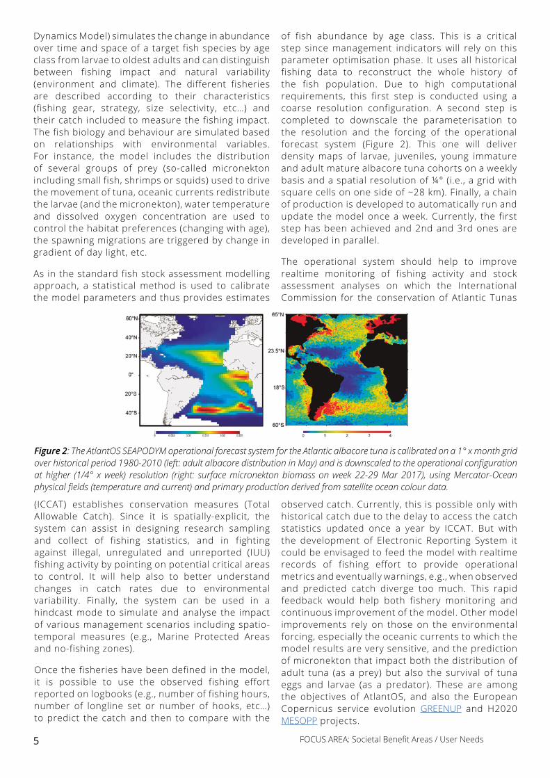
Figure 2: The AtlantOS SEAPODYM operational forecast system for the Atlantic albacore tuna is calibrated on a 1° x month grid over historical period 1980-2010 (left: adult albacore distribution in May) and is downscaled to the operational configuration at higher (1/4° x week) resolution (right: surface micronekton biomass on week 22-29 Mar 2017), using Mercator-Ocean physical fields (temperature and current) and primary production derived from satellite ocean colour data.
Dynamics Model) simulates the change in abundance over time and space of a target fish species by age class from larvae to oldest adults and can distinguish between fishing impact and natural variability (environment and climate). The different fisheries are described according to their characteristics (fishing gear, strategy, size selectivity, etc…) and their catch included to measure the fishing impact. The fish biology and behaviour are simulated based on relationships with environmental variables. For instance, the model includes the distribution of several groups of prey (so-called micronekton including small fish, shrimps or squids) used to drive the movement of tuna, oceanic currents redistribute the larvae (and the micronekton), water temperature and dissolved oxygen concentration are used to control the habitat preferences (changing with age), the spawning migrations are triggered by change in gradient of day light, etc.
As in the standard fish stock assessment modelling approach, a statistical method is used to calibrate the model parameters and thus provides estimates
of fish abundance by age class. This is a critical step since management indicators will rely on this parameter optimisation phase. It uses all historical fishing data to reconstruct the whole history of the fish population. Due to high computational requirements, this first step is conducted using a coarse resolution configuration. A second step is completed to downscale the parameterisation to the resolution and the forcing of the operational forecast system (Figure 2). This one will deliver density maps of larvae, juveniles, young immature and adult mature albacore tuna cohorts on a weekly basis and a spatial resolution of ¼° (i.e., a grid with square cells on one side of ~28 km). Finally, a chain of production is developed to automatically run and update the model once a week. Currently, the first step has been achieved and 2nd and 3rd ones are developed in parallel.
The operational system should help to improve realtime monitoring of fishing activity and stock assessment analyses on which the International Commission for the conservation of Atlantic Tunas
(ICCAT) establishes conservation measures (Total Allowable Catch). Since it is spatially-explicit, the system can assist in designing research sampling and collect of fishing statistics, and in fighting against illegal, unregulated and unreported (IUU) fishing activity by pointing on potential critical areas to control. It will help also to better understand changes in catch rates due to environmental variability. Finally, the system can be used in a hindcast mode to simulate and analyse the impact of various management scenarios including spatio-temporal measures (e.g., Marine Protected Areas and no-fishing zones).
Once the fisheries have been defined in the model, it is possible to use the observed fishing effort reported on logbooks (e.g., number of fishing hours, number of longline set or number of hooks, etc…) to predict the catch and then to compare with the
observed catch. Currently, this is possible only with historical catch due to the delay to access the catch statistics updated once a year by ICCAT. But with the development of Electronic Reporting System it could be envisaged to feed the model with realtime records of fishing effort to provide operational metrics and eventually warnings, e.g., when observed and predicted catch diverge too much. This rapid feedback would help both fishery monitoring and continuous improvement of the model. Other model improvements rely on those on the environmental forcing, especially the oceanic currents to which the model results are very sensitive, and the prediction of micronekton that impact both the distribution of adult tuna (as a prey) but also the survival of tuna eggs and larvae (as a predator). These are among the objectives of AtlantOS, and also the European Copernicus service evolution GREENUP and H2020 MESOPP projects.
5 FOCUS AREA: Societal Benefit Areas / User Needs
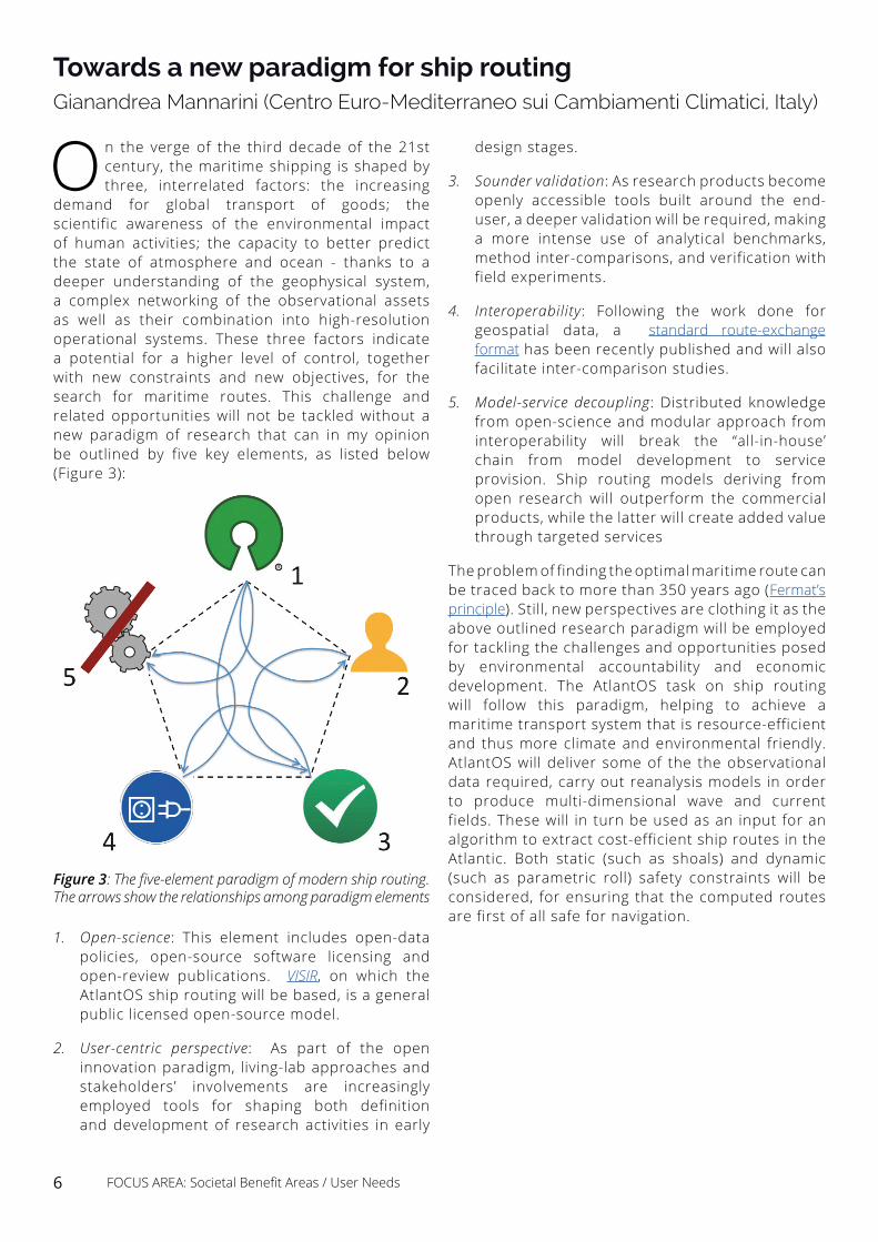
Figure 3: The five-element paradigm of modern ship routing. The arrows show the relationships among paradigm elements
Towards a new paradigm for ship routingGianandrea Mannarini (Centro Euro-Mediterraneo sui Cambiamenti Climatici, Italy)
On the verge of the third decade of the 21st century, the maritime shipping is shaped by three, interrelated factors: the increasing
demand for global transport of goods; the scientific awareness of the environmental impact of human activities; the capacity to better predict the state of atmosphere and ocean - thanks to a deeper understanding of the geophysical system, a complex networking of the observational assets as well as their combination into high-resolution operational systems. These three factors indicate a potential for a higher level of control, together with new constraints and new objectives, for the search for maritime routes. This challenge and related opportunities will not be tackled without a new paradigm of research that can in my opinion be outlined by five key elements, as listed below (Figure 3):
1. Open-science: This element includes open-data policies, open-source software licensing and open-review publications. VISIR, on which the AtlantOS ship routing will be based, is a general public licensed open-source model.
2. User-centric perspective: As part of the open innovation paradigm, living-lab approaches and stakeholders’ involvements are increasingly employed tools for shaping both definition and development of research activities in early
design stages.
3. Sounder validation: As research products become openly accessible tools built around the end-user, a deeper validation will be required, making a more intense use of analytical benchmarks, method inter-comparisons, and verification with field experiments.
4. Interoperability: Following the work done for geospatial data, a standard route-exchange format has been recently published and will also facilitate inter-comparison studies.
5. Model-service decoupling: Distributed knowledge from open-science and modular approach from interoperability will break the “all-in-house’ chain from model development to service provision. Ship routing models deriving from open research will outperform the commercial products, while the latter will create added value through targeted services
The problem of finding the optimal maritime route can be traced back to more than 350 years ago (Fermat’s principle). Still, new perspectives are clothing it as the above outlined research paradigm will be employed for tackling the challenges and opportunities posed by environmental accountability and economic development. The AtlantOS task on ship routing will follow this paradigm, helping to achieve a maritime transport system that is resource-efficient and thus more climate and environmental friendly. AtlantOS will deliver some of the the observational data required, carry out reanalysis models in order to produce multi-dimensional wave and current fields. These will in turn be used as an input for an algorithm to extract cost-efficient ship routes in the Atlantic. Both static (such as shoals) and dynamic (such as parametric roll) safety constraints will be considered, for ensuring that the computed routes are first of all safe for navigation.
6 FOCUS AREA: Societal Benefit Areas / User Needs
Globally, harmful and potentially toxic phytoplankton (high and low biomass forming HAB species) negatively affect fisheries and
shellfisheries at a cost of billions of Euros per annum (Bernard et al. 2015). In Europe, harmful algal events are a well-known hazard to aquaculture activities and can also disrupt the health of marine ecosystems. For example, HABs can result in aquaculture production closures in shellfish growing areas for extended periods causing economic hardship in rural coastal communities. Other impacts include the loss of farmed fish and the widespread mortalities of wild fish and benthic organisms when “red tides” (caused by bloom forming HAB species) persist.
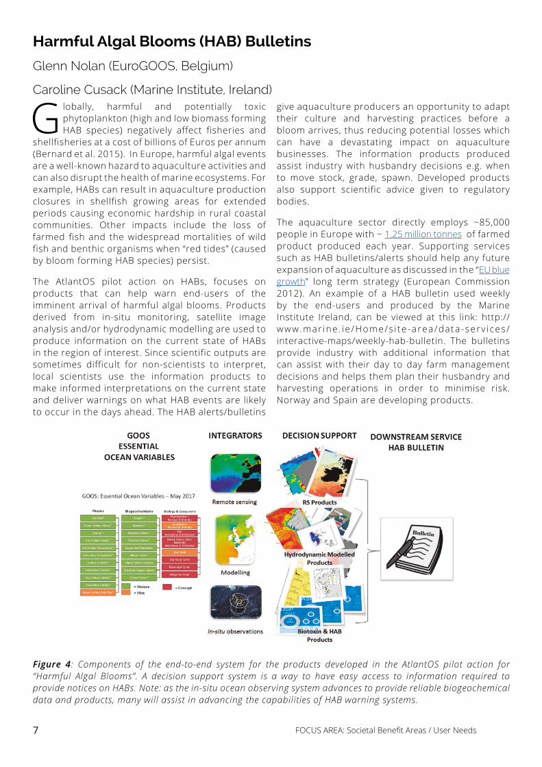
The AtlantOS pilot action on HABs, focuses on products that can help warn end-users of the imminent arrival of harmful algal blooms. Products derived from in-situ monitoring, satellite image analysis and/or hydrodynamic modelling are used to produce information on the current state of HABs in the region of interest. Since scientific outputs are sometimes difficult for non-scientists to interpret, local scientists use the information products to make informed interpretations on the current state and deliver warnings on what HAB events are likely to occur in the days ahead. The HAB alerts/bulletins
Figure 4: Components of the end-to-end system for the products developed in the AtlantOS pilot action for “Harmful Algal Blooms”. A decision support system is a way to have easy access to information required to provide notices on HABs. Note: as the in-situ ocean observing system advances to provide reliable biogeochemical data and products, many will assist in advancing the capabilities of HAB warning systems.
give aquaculture producers an opportunity to adapt their culture and harvesting practices before a bloom arrives, thus reducing potential losses which can have a devastating impact on aquaculture businesses. The information products produced assist industry with husbandry decisions e.g. when to move stock, grade, spawn. Developed products also support scientific advice given to regulatory bodies.
The aquaculture sector directly employs ~85,000 people in Europe with ~ 1.25 million tonnes of farmed product produced each year. Supporting services such as HAB bulletins/alerts should help any future expansion of aquaculture as discussed in the “EU blue growth” long term strategy (European Commission 2012). An example of a HAB bulletin used weekly by the end-users and produced by the Marine Institute Ireland, can be viewed at this link: http://www.mar ine . ie /Home/s i te -area/data -serv ices/interactive-maps/weekly-hab-bulletin. The bulletins provide industry with additional information that can assist with their day to day farm management decisions and helps them plan their husbandry and harvesting operations in order to minimise risk. Norway and Spain are developing products.
Harmful Algal Blooms (HAB) Bulletins
Glenn Nolan (EuroGOOS, Belgium)
Caroline Cusack (Marine Institute, Ireland)
7 FOCUS AREA: Societal Benefit Areas / User Needs
Estimates suggest that, every year, over 370,000 tonnes of oil are spilled into the marine environments by maritime transportation
activities (US National Research Council, 2009). Interestingly, 72% of the total volume is not related to large accidents such as Prestige or Erika but to small and frequent events, many times intentional, so-called operational spills. In spite of the impressive numbers depicted by the U.S. National Academy of Sciences, the scientific community still ignores the coastal impacts due to oil spill pollution from the maritime transportation on a global scale. In AtlantOS we propose to estimate the hazard that maritime transportation represents to coastal resources in the Atlantic basin, demonstrating how international efforts to collect and mainly generate
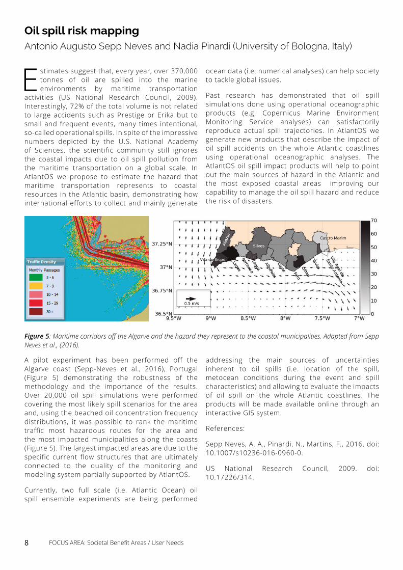
Figure 5: Maritime corridors off the Algarve and the hazard they represent to the coastal municipalities. Adapted from Sepp Neves et al., (2016).
A pilot experiment has been performed off the Algarve coast (Sepp-Neves et al., 2016), Portugal (Figure 5) demonstrating the robustness of the methodology and the importance of the results. Over 20,000 oil spill simulations were performed covering the most likely spill scenarios for the area and, using the beached oil concentration frequency distributions, it was possible to rank the maritime traffic most hazardous routes for the area and the most impacted municipalities along the coasts (Figure 5). The largest impacted areas are due to the specific current flow structures that are ultimately connected to the quality of the monitoring and modeling system partially supported by AtlantOS.
Currently, two full scale (i.e. Atlantic Ocean) oil spill ensemble experiments are being performed
ocean data (i.e. numerical analyses) can help society to tackle global issues.
Past research has demonstrated that oil spill simulations done using operational oceanographic products (e.g. Copernicus Marine Environment Monitoring Service analyses) can satisfactorily reproduce actual spill trajectories. In AtlantOS we generate new products that describe the impact of oil spill accidents on the whole Atlantic coastlines using operational oceanographic analyses. The AtlantOS oil spill impact products will help to point out the main sources of hazard in the Atlantic and the most exposed coastal areas improving our capability to manage the oil spill hazard and reduce the risk of disasters.
addressing the main sources of uncertainties inherent to oil spills (i.e. location of the spill, metocean conditions during the event and spill characteristics) and allowing to evaluate the impacts of oil spill on the whole Atlantic coastlines. The products will be made available online through an interactive GIS system.
References:
Sepp Neves, A. A., Pinardi, N., Martins, F., 2016. doi: 10.1007/s10236-016-0960-0.
US National Research Council, 2009. doi: 10.17226/314.
Oil spill risk mapping Antonio Augusto Sepp Neves and Nadia Pinardi (University of Bologna, Italy)
8 FOCUS AREA: Societal Benefit Areas / User Needs
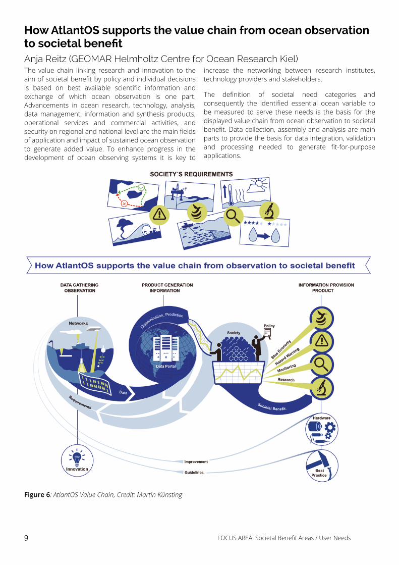
How AtlantOS supports the value chain from ocean observation to societal benefitAnja Reitz (GEOMAR Helmholtz Centre for Ocean Research Kiel)The value chain linking research and innovation to the aim of societal benefit by policy and individual decisions is based on best available scientific information and exchange of which ocean observation is one part. Advancements in ocean research, technology, analysis, data management, information and synthesis products, operational services and commercial activities, and security on regional and national level are the main fields of application and impact of sustained ocean observation to generate added value. To enhance progress in the development of ocean observing systems it is key to
increase the networking between research institutes, technology providers and stakeholders.
The definition of societal need categories and consequently the identified essential ocean variable to be measured to serve these needs is the basis for the displayed value chain from ocean observation to societal benefit. Data collection, assembly and analysis are main parts to provide the basis for data integration, validation and processing needed to generate fit-for-purpose applications.
Figure 6: AtlantOS Value Chain, Credit: Martin Künsting
9 FOCUS AREA: Societal Benefit Areas / User Needs
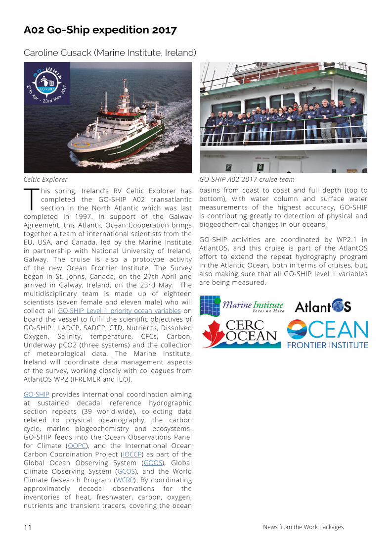
PIRATA maintains 18 buoys in the Tropical Atlantic; this induces yearly dedicated cruises ensured by Brazil, US and French partners.
France is in charge of 6 meteo-oceanographic moorings (at 23°W-0°N, 10°W-0°N, 0°E-0°N, 10°W-6°S, 10°W-10°S, 8°E-6°S) and 3 currentmeter (ADCP) moorings (at 23°W-0°N, 10°W-0°N and 0°E-0°N; this last one added in 2016 in the frame of the PREFACE EU programme). The last French PIRATA cruise (PIRATA FR27) has been carried out from February 25th to April 3rd, 2017, from Mindelo (Cabo-Verde), onboard the R/V THALASSA. This year, 2017, is the 20th anniversary of the PIRATA program; as US and French cruises were almost simultaneous, the meeting between the French R/V THALASSA and the US R/V RON BROWN on March 3rd at 23°W-0°40S was a nice gift! In addition to usual tasks (buoys and one ADCP mooring servicing, CTD-O2/LADCP casts, et.), this PIRATA FR27 ensured the following operations, of particular interest in the context of AtlantOS: i) at 6°S-8°E, off Congo, the ATLAS system has been replaced by a new PIRATA T-Flex system, and a new CO2 parameters sensor has been added, as contribution to the AtlantOS WP3.5; ii) the deployment of 21 surface drifting buoys (SVP-B), as contribution to the AtlantOS WP3.6; iii) the deployment of 7 ARGO profilers, five of them with Iridium transmission and double programming (so allowing some profiles every two days during three months from the surface down to
PIRATA Fr 27 Cruise - short summaryBernard Bourlès (Institut de Recherche pour le Développement, France)
News from the Work Packages
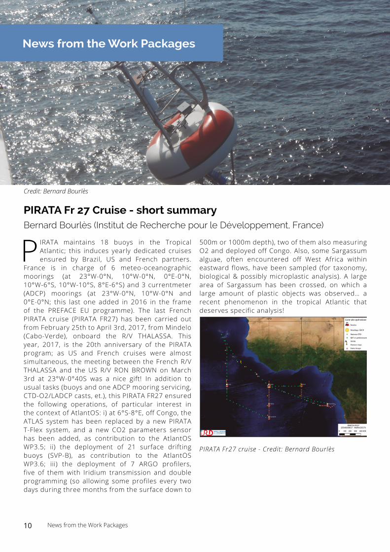
Credit: Bernard Bourlès
500m or 1000m depth), two of them also measuring O2 and deployed off Congo. Also, some Sargassum alguae, often encountered off West Africa within eastward flows, have been sampled (for taxonomy, biological & possibly microplastic analysis). A large area of Sargassum has been crossed, on which a large amount of plastic objects was observed… a recent phenomenon in the tropical Atlantic that deserves specific analysis!
PIRATA Fr27 cruise - Credit: Bernard Bourlès
10 News from the Work Packages
A02 Go-Ship expedition 2017
Caroline Cusack (Marine Institute, Ireland)
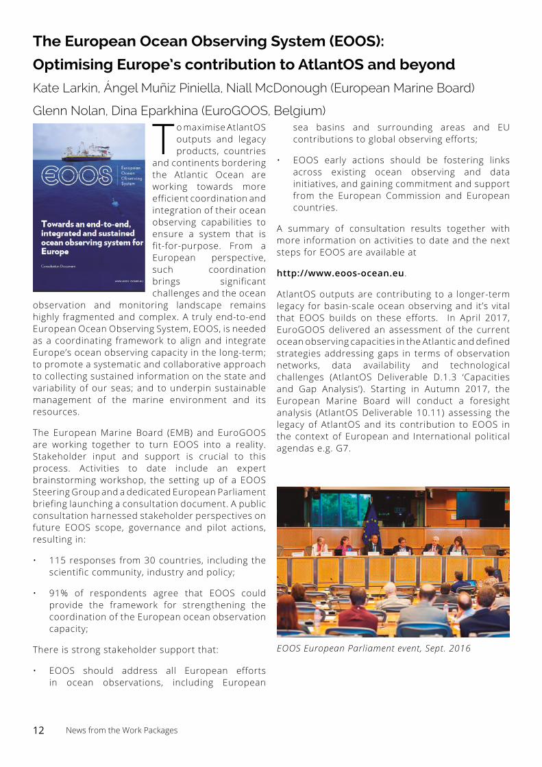
This spring, Ireland’s RV Celtic Explorer has completed the GO-SHIP A02 transatlantic section in the North Atlantic which was last
completed in 1997. In support of the Galway Agreement, this Atlantic Ocean Cooperation brings together a team of international scientists from the EU, USA, and Canada, led by the Marine Institute in partnership with National University of Ireland, Galway. The cruise is also a prototype activity of the new Ocean Frontier Institute. The Survey began in St. Johns, Canada, on the 27th April and arrived in Galway, Ireland, on the 23rd May. The multidisciplinary team is made up of eighteen scientists (seven female and eleven male) who will collect all GO-SHIP Level 1 priority ocean variables on board the vessel to fulfil the scientific objectives of GO-SHIP: LADCP, SADCP, CTD, Nutrients, Dissolved Oxygen, Salinity, temperature, CFCs, Carbon, Underway pCO2 (three systems) and the collection of meteorological data. The Marine Institute, Ireland will coordinate data management aspects of the survey, working closely with colleagues from AtlantOS WP2 (IFREMER and IEO).
GO-SHIP provides international coordination aiming at sustained decadal reference hydrographic section repeats (39 world-wide), collecting data related to physical oceanography, the carbon cycle, marine biogeochemistry and ecosystems. GO-SHIP feeds into the Ocean Observations Panel for Climate (OOPC), and the International Ocean Carbon Coordination Project (IOCCP) as part of the Global Ocean Observing System (GOOS), Global Climate Observing System (GCOS), and the World Climate Research Program (WCRP). By coordinating approximately decadal observations for the inventories of heat, freshwater, carbon, oxygen, nutrients and transient tracers, covering the ocean
basins from coast to coast and full depth (top to bottom), with water column and surface water measurements of the highest accuracy, GO-SHIP is contributing greatly to detection of physical and biogeochemical changes in our oceans.
GO-SHIP activities are coordinated by WP2.1 in AtlantOS, and this cruise is part of the AtlantOS effort to extend the repeat hydrography program in the Atlantic Ocean, both in terms of cruises, but, also making sure that all GO-SHIP level 1 variables are being measured.
Atlant S
Celtic Explorer GO-SHIP A02 2017 cruise team
11 News from the Work Packages
The European Ocean Observing System (EOOS):
Optimising Europe’s contribution to AtlantOS and beyond
Kate Larkin, Ángel Muñiz Piniella, Niall McDonough (European Marine Board)
Glenn Nolan, Dina Eparkhina (EuroGOOS, Belgium)
To maximise AtlantOS outputs and legacy products, countries
and continents bordering the Atlantic Ocean are working towards more efficient coordination and integration of their ocean observing capabilities to ensure a system that is fit-for-purpose. From a European perspective, such coordination brings significant challenges and the ocean
observation and monitoring landscape remains highly fragmented and complex. A truly end-to-end European Ocean Observing System, EOOS, is needed as a coordinating framework to align and integrate Europe’s ocean observing capacity in the long-term; to promote a systematic and collaborative approach to collecting sustained information on the state and variability of our seas; and to underpin sustainable management of the marine environment and its resources.
The European Marine Board (EMB) and EuroGOOS are working together to turn EOOS into a reality. Stakeholder input and support is crucial to this process. Activities to date include an expert brainstorming workshop, the setting up of a EOOS Steering Group and a dedicated European Parliament briefing launching a consultation document. A public consultation harnessed stakeholder perspectives on future EOOS scope, governance and pilot actions, resulting in:
• 115 responses from 30 countries, including the scientific community, industry and policy;
• 91% of respondents agree that EOOS could provide the framework for strengthening the coordination of the European ocean observation capacity;
There is strong stakeholder support that:
• EOOS should address all European efforts in ocean observations, including European
sea basins and surrounding areas and EU contributions to global observing efforts;
• EOOS early actions should be fostering links across existing ocean observing and data initiatives, and gaining commitment and support from the European Commission and European countries.
A summary of consultation results together with more information on activities to date and the next steps for EOOS are available at
http://www.eoos-ocean.eu.
AtlantOS outputs are contributing to a longer-term legacy for basin-scale ocean observing and it’s vital that EOOS builds on these efforts. In April 2017, EuroGOOS delivered an assessment of the current ocean observing capacities in the Atlantic and defined strategies addressing gaps in terms of observation networks, data availability and technological challenges (AtlantOS Deliverable D.1.3 ‘Capacities and Gap Analysis’). Starting in Autumn 2017, the European Marine Board will conduct a foresight analysis (AtlantOS Deliverable 10.11) assessing the legacy of AtlantOS and its contribution to EOOS in the context of European and International political agendas e.g. G7.
EOOS European Parliament event, Sept. 2016
12 News from the Work Packages
Capacities and Gaps in Atlantic Ocean Observing System Erik Buch (EuroGOOS, Belgium) and Task 1.2 team (Work Package 1 AtlantOS)
In a recently delivered report on “Capacities and Gap Analysis”, partners of AtlantOS Task 1.2 took up the challenge of analysing the current capacities
and gaps of all three disciplinary components of the Atlantic Ocean Observing System (OOS) - a task in itself unprecedented due to the very different levels of “maturity” in setting societal requirements for designing and carrying out sustained measurements of physical, biogeochemical and biological phenomena and Essential Ocean Variables needed to observe key ocean processes. To this end, expert meetings and an intense dialog within the group and in consultation with leading international expert groups under IOC, such as the GOOS Panels, had to be conducted. Following up on an earlier integrated look at the societal requirements across the three disciplines, the report outlines a strategy towards a comprehensive capacity and gap analysis of the OOS.
The design of an optimal OOS – in this case for the Atlantic Ocean - includes several logical steps, which follow the approach of the Framework for Ocean Observing:
i) Define the requirements – societal drivers for information to address specific questions, ii)identify the scientific approaches associated with the requirements, iii) Identify the phenomena and Essential Ocean Variables (EOVs) to be captured, based on the scientific approach, iv) Use the existing observing infrastructure for data acquisition of the respective set of phenomena and EOVs, v) Use accessible data to derive information products that address the Observing Objective (point 1), thus providing a measure of the current capacity of the OOS, vi)If information cannot be derived perform a Gap analysis (data acquisition, product generation) Ensure a “Fit for Purpose”, enhanced and optimised OOS.
Constant monitoring of our ocean observing capacity and gaps in the system is a core activity to ensure an optimised, and thus cost efficient, sustainable OOS. In this respect, sustained ocean observing is different from ocean observing for fundamental research performed for a defined period only. However, both, the sustained OOS and the observing efforts in the context of fundamental research, shall benefit from each other. The most obvious link is via data exchange - while observing in the sustained system must provide open-access data, the fundamental researchers should make sure that their data is also open-access to ensure
this data is integrated into the ocean observing value chain
Analysing the existing observing capacity for several EOVs in the Atlantic Ocean cannot be done without considering the respective observing objective. However, “baseline” information is first required before an optimisation can be performed. In respect to baseline information we conclude that:
Basic physical parameters such as temperature and salinity are relatively well observed in most parts of the Atlantic Ocean although areas of low density of observations can be identified (e.g. Figure 7).
For other EOVs – physical, biogeochemical and biological – geographical gaps are much more evident (e.g. Figure 7).
It should be stressed that the examples of observing capacity provided in the report reflect data which is publicly available in databases such as CMEMS INSTAC, EMODnet, SeaDataNet, ICES and through community-based data synthesis such as the Surface Ocean CO2 Atlas (SOCAT; www.socat.info) and the Global Ocean Data Analysis Project (GLODAP); which unfortunately do not include all data available for the Atlantic Ocean.
Additionally, it is well-known that a substantial amount of data is not, for various reasons, made publicly available by the data owners, and can be seen as lost data in the framework of a sustained Atlantic OOS.
The report provides examples of “generic” gaps identified in the system (e.g. missing baseline data). However, it has been suggested to concentrate a future gap analysis around four subjects:
• Gaps in the observing networks
• Gaps in data availability
• Gaps in sustainability
• Gaps in technology
A detailed gap analysis would furthermore rely on detailed requirements and scientific approaches for an Atlantic OOS to be established. The adequacy in spatial and temporal resolution of sampling, the parameter suite, the measurement quality and other sampling requirements etc., and this is not possible before some of the “maturity” issues mentioned above are addressed properly. In fact, the ocean
13 News from the Work Packages
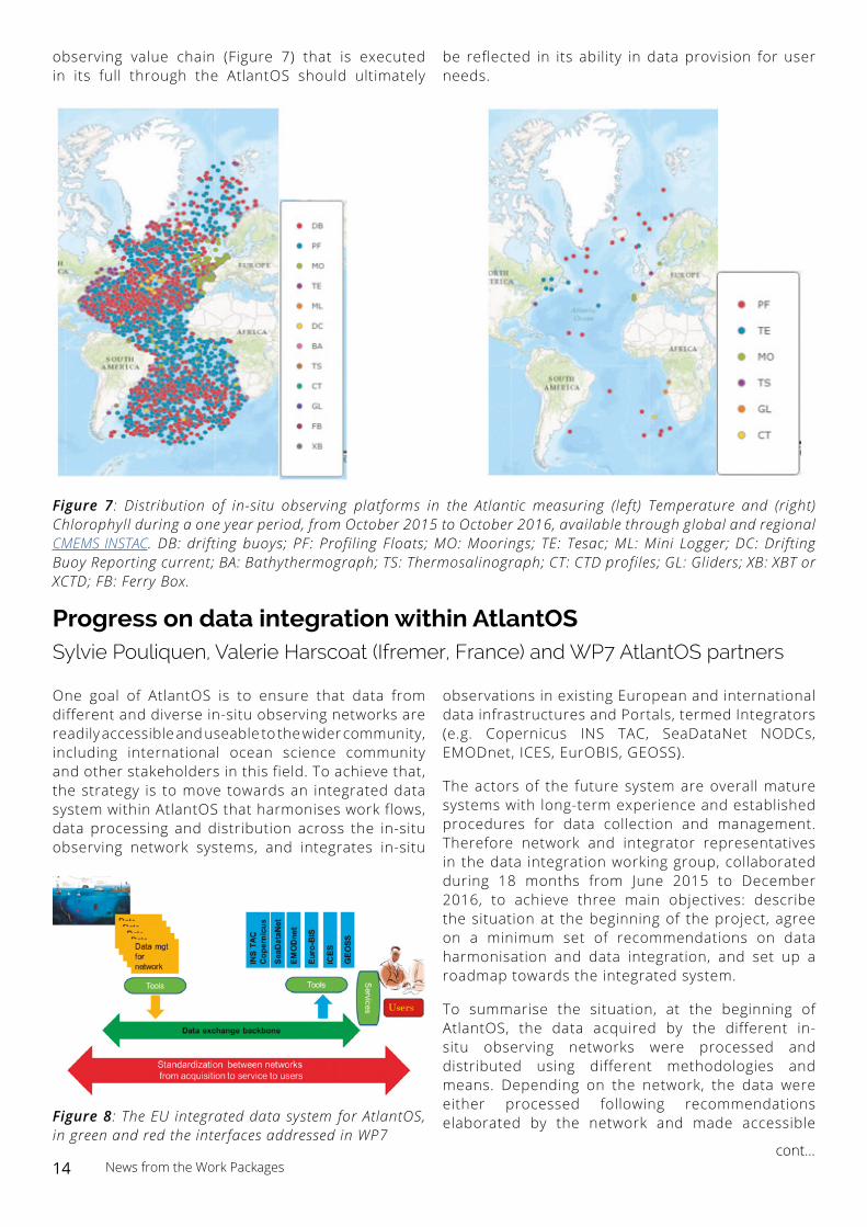
observing value chain (Figure 7) that is executed in its full through the AtlantOS should ultimately
be reflected in its ability in data provision for user needs.
Figure 7: Distribution of in-situ observing platforms in the Atlantic measuring (left) Temperature and (right) Chlorophyll during a one year period, from October 2015 to October 2016, available through global and regional CMEMS INSTAC. DB: drifting buoys; PF: Profiling Floats; MO: Moorings; TE: Tesac; ML: Mini Logger; DC: Drifting Buoy Reporting current; BA: Bathythermograph; TS: Thermosalinograph; CT: CTD profiles; GL: Gliders; XB: XBT or XCTD; FB: Ferry Box.
Progress on data integration within AtlantOS Sylvie Pouliquen, Valerie Harscoat (Ifremer, France) and WP7 AtlantOS partners
One goal of AtlantOS is to ensure that data from different and diverse in-situ observing networks are readily accessible and useable to the wider community, including international ocean science community and other stakeholders in this field. To achieve that, the strategy is to move towards an integrated data system within AtlantOS that harmonises work flows, data processing and distribution across the in-situ observing network systems, and integrates in-situ
Figure 8: The EU integrated data system for AtlantOS, in green and red the interfaces addressed in WP7
observations in existing European and international data infrastructures and Portals, termed Integrators (e.g. Copernicus INS TAC, SeaDataNet NODCs, EMODnet, ICES, EurOBIS, GEOSS).
The actors of the future system are overall mature systems with long-term experience and established procedures for data collection and management. Therefore network and integrator representatives in the data integration working group, collaborated during 18 months from June 2015 to December 2016, to achieve three main objectives: describe the situation at the beginning of the project, agree on a minimum set of recommendations on data harmonisation and data integration, and set up a roadmap towards the integrated system.
To summarise the situation, at the beginning of AtlantOS, the data acquired by the different in-situ observing networks were processed and distributed using different methodologies and means. Depending on the network, the data were either processed following recommendations elaborated by the network and made accessible
cont...14 News from the Work Packages
Opinion PageOpportunities to increase the societal benefit by ocean observation
Moacyr Araujo (Federal University of Pernambuco, Brazil)
Science has always been challenged to propose solutions
to prevent or solve societal problems. The consequent proposal may be somehow controversial to creativity and aspects of freedom of the scientific research itself. The natural link between the generation of new knowledge and societal needs has proved to be
more than ever necessary, and one may consider this as an interesting collateral effect of climate change. In this context, Ocean Sciences became an exciting and privileged niche to test new practices and to develop bold innovative cooperation-based programs. AtlantOS was conceived under this scenario and since its early phase it has been conducted through a clear science-for-society track, in turn based on three essential pillars: innovation, integration and cooperation. Innovation for facing the challenge of bringing Atlantic Ocean observation
systems closer to real societal needs; integration for considering for the first time the large spectra of different initiatives and programs all over the Atlantic basin, aiming to connect them into a more efficient and complementary way. High latitude observation programs, such as RAPID, OSNAP, SAMOC, MOVAR, etc., are today more connected to tropical initiatives like PREFACE, PIRATA, and others, forcing the identification of a main set of scientific questions that should be jointly addressed. Issues such as prevention and reduction of marine pollution, sustainable management and protection of marine systems, regulation of harvesting and terminating overfishing are no longer regional and/or specific concerns but can be strongly beneficiated by internationally integrated ecosystem-based observing systems. Finally, all these efforts have been achieved by fostering cooperation among all countries bordering the basin, the third AtlantOS insight. In that sense, important scientific gaps in Atlantic Ocean observation have been considered as priority for joint observation/cooperation efforts, providing support, for example, to historical needs of observing key and less investigated regions of the South Atlantic.
through a unique portal (FTP or Web), or were processed by individual scientific researchers and made available through National Data Centres or at the Institution level. Some datasets were available through Integrators by ad-hoc links that were developed in past years within projects such as Copernicus, EMODNet, SeaDataNet, etc. By exploring the data landscape, the partners in our working group identified the needs for improvements to facilitate the access to the broad array of Atlantic observations and avoid “mixing apples and oranges”, which will be to the benefit of all the actors and the users. Therefore, relying on existing European and international standards and protocols, the partners first agreed on common standards for metadata and data description, and recommendations for near-real time Quality Control (NRT QC) of selected Essential Variables (detailed in deliverables D7.1 Data Harmonisation and D7.2 QC Report). Then a data exchange backbone was designed to facilitate discovery, viewing and downloading by the users, along with tools that can be set up to at network level to plug the data on the backbone, and to facilitate integration into the Integrators. And finally
it was identified that services to the users shall be enhanced to ease access to existing observations. All the guidelines for both networks and integrators are available in the deliverable D7.4 Data management handbook.
Time has come for the actors of the integrated system to begin the Implementation phase that aims to feed operational models and facilitate enhanced products from AtlantOS data. The networks are going to implement the recommendations for standardisation across networks, plan NRT QC procedures enhancement if needed and facilitate access to network data. The integrators are going to enhance their tools for data integration (network data ingestion, viewing and downloading services on network data, cross network assessments and feedback to networks, traceability and monitoring facilities for providers and users) and to enhance the services to users (facilitate discovery through catalogues, provide OGC services, provide enhanced download facilities, facilitate visibility of existing data and provide gap identification).
15 News from the Work Packages / Opinion Page
Major advancements in autonomous measurements for the essential ocean variable “Carbonate System” Reliable long-term Measurements of Total Alkalinity in Seawater
Steffen Aßmann, PeerFietzek (Kongsberg Maritime Contros GmbH, Germany)
News from the Private sector
Total alkalinity (TA) describes the capacity of seawater to buffer acidic perturbations.
Practically, it is an important sum parameter for many scientific applications including ocean acidification and carbonate chemistry research, monitoring of biogeochemical processes, aqua culture and fish farming as well as pore water analysis. Like salinity, TA is a conservative parameter and a valuable supplement for oceanographic data records.
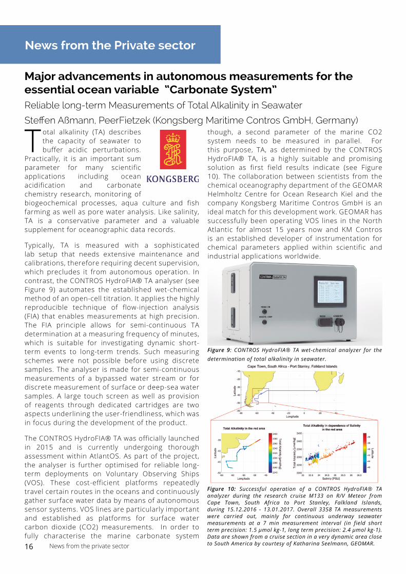
Typically, TA is measured with a sophisticated lab setup that needs extensive maintenance and calibrations, therefore requiring decent supervision, which precludes it from autonomous operation. In contrast, the CONTROS HydroFIA® TA analyser (see Figure 9) automates the established wet-chemical method of an open-cell titration. It applies the highly reproducible technique of flow-injection analysis (FIA) that enables measurements at high precision. The FIA principle allows for semi-continuous TA determination at a measuring frequency of minutes, which is suitable for investigating dynamic short-term events to long-term trends. Such measuring schemes were not possible before using discrete samples. The analyser is made for semi-continuous measurements of a bypassed water stream or for discrete measurement of surface or deep-sea water samples. A large touch screen as well as provision of reagents through dedicated cartridges are two aspects underlining the user-friendliness, which was in focus during the development of the product.
The CONTROS HydroFIA® TA was officially launched in 2015 and is currently undergoing thorough assessment within AtlantOS. As part of the project, the analyser is further optimised for reliable long-term deployments on Voluntary Observing Ships (VOS). These cost-efficient platforms repeatedly travel certain routes in the oceans and continuously gather surface water data by means of autonomous sensor systems. VOS lines are particularly important and established as platforms for surface water carbon dioxide (CO2) measurements. In order to fully characterise the marine carbonate system
though, a second parameter of the marine CO2 system needs to be measured in parallel. For this purpose, TA, as determined by the CONTROS HydroFIA® TA, is a highly suitable and promising solution as first field results indicate (see Figure 10). The collaboration between scientists from the chemical oceanography department of the GEOMAR Helmholtz Centre for Ocean Research Kiel and the company Kongsberg Maritime Contros GmbH is an ideal match for this development work. GEOMAR has successfully been operating VOS lines in the North Atlantic for almost 15 years now and KM Contros is an established developer of instrumentation for chemical parameters applied within scientific and industrial applications worldwide.
Figure 9: CONTROS HydroFIA® TA wet-chemical analyzer for the determination of total alkalinity in seawater.
Figure 10: Successful operation of a CONTROS HydroFIA® TA analyzer during the research cruise M133 on R/V Meteor from Cape Town, South Africa to Port Stanley, Falkland Islands, during 15.12.2016 - 13.01.2017. Overall 3358 TA measurements were carried out, mainly for continuous underway seawater measurements at a 7 min measurement interval (in field short term precision: 1.5 µmol kg-1, long term precision: 2.4 µmol kg-1). Data are shown from a cruise section in a very dynamic area close to South America by courtesy of Katharina Seelmann, GEOMAR. 16 News from the private sector
Kids Corner
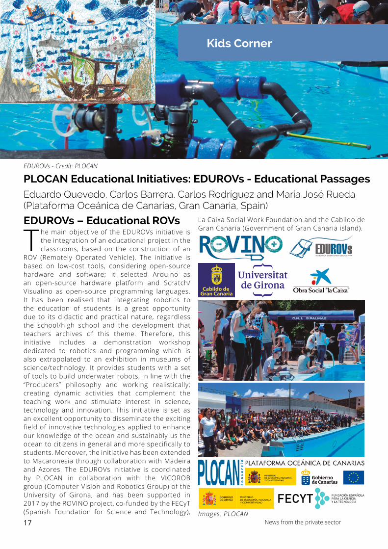
The main objective of the EDUROVs initiative is the integration of an educational project in the classrooms, based on the construction of an
ROV (Remotely Operated Vehicle). The initiative is based on low-cost tools, considering open-source hardware and software; it selected Arduino as an open-source hardware platform and Scratch/Visualino as open-source programming languages. It has been realised that integrating robotics to the education of students is a great opportunity due to its didactic and practical nature, regardless the school/high school and the development that teachers archives of this theme. Therefore, this initiative includes a demonstration workshop dedicated to robotics and programming which is also extrapolated to an exhibition in museums of science/technology. It provides students with a set of tools to build underwater robots, in line with the “Producers” philosophy and working realistically; creating dynamic activities that complement the teaching work and stimulate interest in science, technology and innovation. This initiative is set as an excellent opportunity to disseminate the exciting field of innovative technologies applied to enhance our knowledge of the ocean and sustainably us the ocean to citizens in general and more specifically to students. Moreover, the initiative has been extended to Macaronesia through collaboration with Madeira and Azores. The EDUROVs initiative is coordinated by PLOCAN in collaboration with the VICOROB group (Computer Vision and Robotics Group) of the University of Girona, and has been supported in 2017 by the ROVINO project, co-funded by the FECyT (Spanish Foundation for Science and Technology),
PLOCAN Educational Initiatives: EDUROVs - Educational PassagesEduardo Quevedo, Carlos Barrera, Carlos Rodríguez and María José Rueda (Plataforma Oceánica de Canarias, Gran Canaria, Spain)
EDUROVs - Credit: PLOCAN
La Caixa Social Work Foundation and the Cabildo de Gran Canaria (Government of Gran Canaria island).
Images: PLOCAN
EDUROVs – Educational ROVs
17 News from the private sector
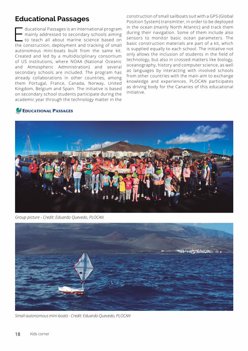
Educational Passages
Educational Passages is an international program mainly addressed to secondary schools aiming to teach all about marine science based on
the construction, deployment and tracking of small autonomous mini-boats built from the same kit. Created and led by a multidisciplinary consortium of US institutions, where NOAA (National Oceanic and Atmospheric Administration) and several secondary schools are included. The program has already collaborations in other countries, among them Portugal, France, Canada, Norway, United Kingdom, Belgium and Spain. The initiative is based on secondary school students participate during the academic year through the technology matter in the
construction of small sailboats suit with a GPS (Global Position System) transmitter, in order to be deployed in the ocean (mainly North Atlantic) and track them during their navigation. Some of them include also sensors to monitor basic ocean parameters. The basic construction materials are part of a kit, which is supplied equally to each school. The initiative not only allows the inclusion of students in the field of technology, but also in crossed-matters like biology, oceanography, history and computer science, as well as languages by interacting with involved schools from other countries with the main aim to exchange knowledge and experiences. PLOCAN participates as driving body for the Canaries of this educational initiative.
Small autonomous mini-boats - Credit: Eduardo Quevedo, PLOCAN
Group picture - Credit: Eduardo Quevedo, PLOCAN
18 Kids corner
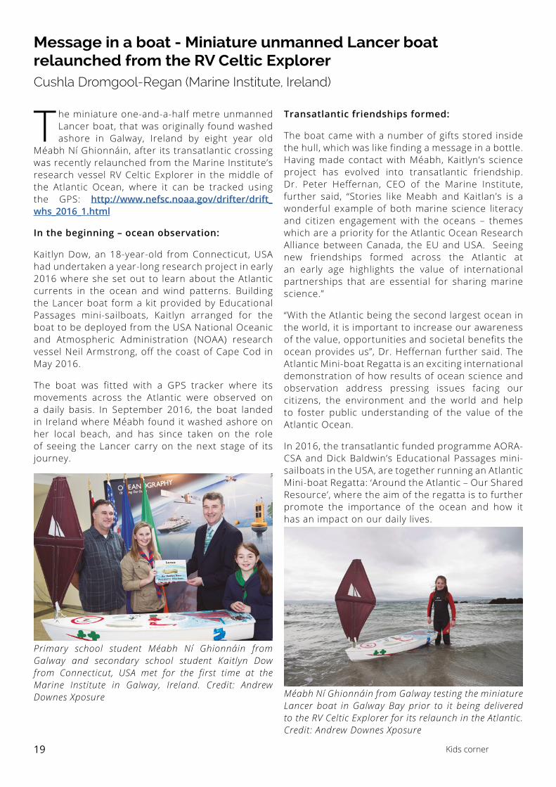
Message in a boat - Miniature unmanned Lancer boat relaunched from the RV Celtic Explorer Cushla Dromgool-Regan (Marine Institute, Ireland)
The miniature one-and-a-half metre unmanned Lancer boat, that was originally found washed ashore in Galway, Ireland by eight year old
Méabh Ní Ghionnáin, after its transatlantic crossing was recently relaunched from the Marine Institute’s research vessel RV Celtic Explorer in the middle of the Atlantic Ocean, where it can be tracked using the GPS: http://www.nefsc.noaa.gov/drifter/drift_whs_2016_1.html
In the beginning – ocean observation:
Kaitlyn Dow, an 18-year-old from Connecticut, USA had undertaken a year-long research project in early 2016 where she set out to learn about the Atlantic currents in the ocean and wind patterns. Building the Lancer boat form a kit provided by Educational Passages mini-sailboats, Kaitlyn arranged for the boat to be deployed from the USA National Oceanic and Atmospheric Administration (NOAA) research vessel Neil Armstrong, off the coast of Cape Cod in May 2016.
The boat was fitted with a GPS tracker where its movements across the Atlantic were observed on a daily basis. In September 2016, the boat landed in Ireland where Méabh found it washed ashore on her local beach, and has since taken on the role of seeing the Lancer carry on the next stage of its journey.
Transatlantic friendships formed:
The boat came with a number of gifts stored inside the hull, which was like finding a message in a bottle. Having made contact with Méabh, Kaitlyn’s science project has evolved into transatlantic friendship. Dr. Peter Heffernan, CEO of the Marine Institute, further said, “Stories like Meabh and Kaitlan’s is a wonderful example of both marine science literacy and citizen engagement with the oceans – themes which are a priority for the Atlantic Ocean Research Alliance between Canada, the EU and USA. Seeing new friendships formed across the Atlantic at an early age highlights the value of international partnerships that are essential for sharing marine science.”
“With the Atlantic being the second largest ocean in the world, it is important to increase our awareness of the value, opportunities and societal benefits the ocean provides us”, Dr. Heffernan further said. The Atlantic Mini-boat Regatta is an exciting international demonstration of how results of ocean science and observation address pressing issues facing our citizens, the environment and the world and help to foster public understanding of the value of the Atlantic Ocean.
In 2016, the transatlantic funded programme AORA-CSA and Dick Baldwin’s Educational Passages mini-sailboats in the USA, are together running an Atlantic Mini-boat Regatta: ‘Around the Atlantic – Our Shared Resource’, where the aim of the regatta is to further promote the importance of the ocean and how it has an impact on our daily lives.
Primary school student Méabh Ní Ghionnáin from Galway and secondary school student Kaitlyn Dow from Connecticut, USA met for the first time at the Marine Institute in Galway, Ireland. Credit: Andrew Downes Xposure Méabh Ní Ghionnáin from Galway testing the miniature
Lancer boat in Galway Bay prior to it being delivered to the RV Celtic Explorer for its relaunch in the Atlantic. Credit: Andrew Downes Xposure
19 Kids corner
Reducing the gap with science in teaching young people, a real challengeCarolyn Scheurle, Martina Ferraris and Hervé Claustre (Observatoire Océanologique de Villefranche-sur-Mer, France)
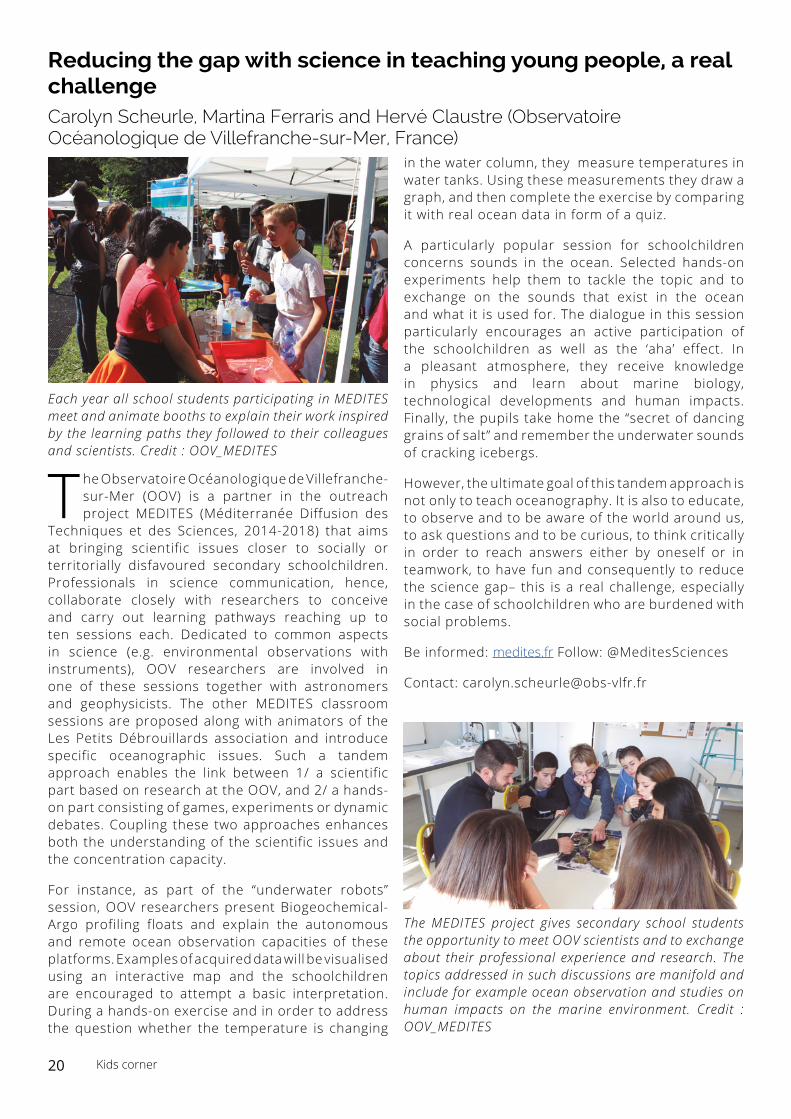
The Observatoire Océanologique de Villefranche-sur-Mer (OOV) is a partner in the outreach project MEDITES (Méditerranée Diffusion des
Techniques et des Sciences, 2014-2018) that aims at bringing scientific issues closer to socially or territorially disfavoured secondary schoolchildren. Professionals in science communication, hence, collaborate closely with researchers to conceive and carry out learning pathways reaching up to ten sessions each. Dedicated to common aspects in science (e.g. environmental observations with instruments), OOV researchers are involved in one of these sessions together with astronomers and geophysicists. The other MEDITES classroom sessions are proposed along with animators of the Les Petits Débrouillards association and introduce specific oceanographic issues. Such a tandem approach enables the link between 1/ a scientific part based on research at the OOV, and 2/ a hands-on part consisting of games, experiments or dynamic debates. Coupling these two approaches enhances both the understanding of the scientific issues and the concentration capacity.
For instance, as part of the “underwater robots” session, OOV researchers present Biogeochemical-Argo profiling floats and explain the autonomous and remote ocean observation capacities of these platforms. Examples of acquired data will be visualised using an interactive map and the schoolchildren are encouraged to attempt a basic interpretation. During a hands-on exercise and in order to address the question whether the temperature is changing
in the water column, they measure temperatures in water tanks. Using these measurements they draw a graph, and then complete the exercise by comparing it with real ocean data in form of a quiz.
A particularly popular session for schoolchildren concerns sounds in the ocean. Selected hands-on experiments help them to tackle the topic and to exchange on the sounds that exist in the ocean and what it is used for. The dialogue in this session particularly encourages an active participation of the schoolchildren as well as the ‘aha’ effect. In a pleasant atmosphere, they receive knowledge in physics and learn about marine biology, technological developments and human impacts. Finally, the pupils take home the “secret of dancing grains of salt” and remember the underwater sounds of cracking icebergs.
However, the ultimate goal of this tandem approach is not only to teach oceanography. It is also to educate, to observe and to be aware of the world around us, to ask questions and to be curious, to think critically in order to reach answers either by oneself or in teamwork, to have fun and consequently to reduce the science gap– this is a real challenge, especially in the case of schoolchildren who are burdened with social problems.
Be informed: medites.fr Follow: @MeditesSciences
Contact: [email protected]
Each year all school students participating in MEDITES meet and animate booths to explain their work inspired by the learning paths they followed to their colleagues and scientists. Credit : OOV_MEDITES
The MEDITES project gives secondary school students the opportunity to meet OOV scientists and to exchange about their professional experience and research. The topics addressed in such discussions are manifold and include for example ocean observation and studies on human impacts on the marine environment. Credit : OOV_MEDITES
20 Kids corner
Capacity Building
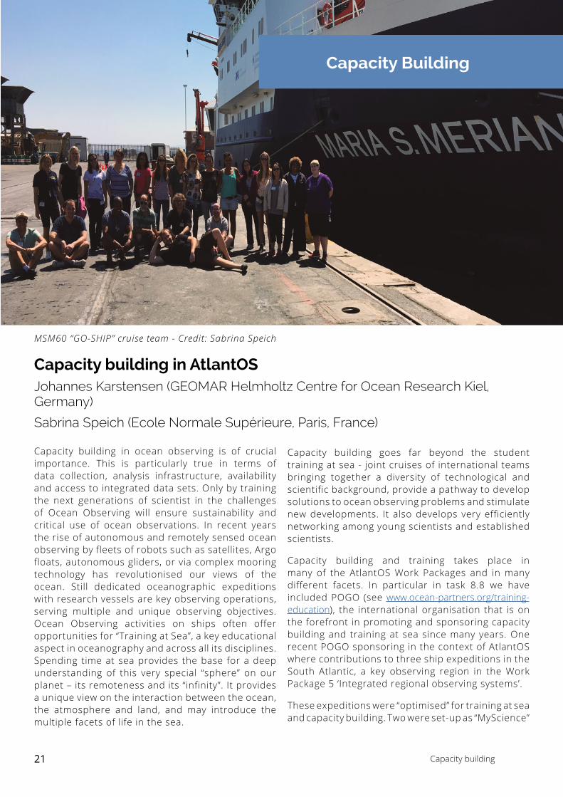
MSM60 “GO-SHIP” cruise team - Credit: Sabrina Speich
Capacity building in AtlantOSJohannes Karstensen (GEOMAR Helmholtz Centre for Ocean Research Kiel, Germany)
Sabrina Speich (Ecole Normale Supérieure, Paris, France)
Capacity building in ocean observing is of crucial importance. This is particularly true in terms of data collection, analysis infrastructure, availability and access to integrated data sets. Only by training the next generations of scientist in the challenges of Ocean Observing will ensure sustainability and critical use of ocean observations. In recent years the rise of autonomous and remotely sensed ocean observing by fleets of robots such as satellites, Argo floats, autonomous gliders, or via complex mooring technology has revolutionised our views of the ocean. Still dedicated oceanographic expeditions with research vessels are key observing operations, serving multiple and unique observing objectives. Ocean Observing activities on ships often offer opportunities for “Training at Sea”, a key educational aspect in oceanography and across all its disciplines. Spending time at sea provides the base for a deep understanding of this very special “sphere” on our planet – its remoteness and its “infinity”. It provides a unique view on the interaction between the ocean, the atmosphere and land, and may introduce the multiple facets of life in the sea.
Capacity building goes far beyond the student training at sea - joint cruises of international teams bringing together a diversity of technological and scientific background, provide a pathway to develop solutions to ocean observing problems and stimulate new developments. It also develops very efficiently networking among young scientists and established scientists.
Capacity building and training takes place in many of the AtlantOS Work Packages and in many different facets. In particular in task 8.8 we have included POGO (see www.ocean-partners.org/training-education), the international organisation that is on the forefront in promoting and sponsoring capacity building and training at sea since many years. One recent POGO sponsoring in the context of AtlantOS where contributions to three ship expeditions in the South Atlantic, a key observing region in the Work Package 5 ‘Integrated regional observing systems’.
These expeditions were “optimised” for training at sea and capacity building. Two were set-up as “MyScience”
21 Capacity building
cruises (portal.geomar.de/web/mysciencecruise) specifically promoting undergraduate and graduate students to design and execute own science projects during the cruise. A third one, the RV Maria S Merian MSM60 “GO-SHIP” cruise (contribution to task 2.1), was a special contribution to the “women in science day” (11. February 2017) with a large international representation of women scientists:
15 out of the 22 science crew members originating from 8 different countries that collected 7 000 km underway observations over the upper 1 000 m of the ocean, undertaken 129 full-depth hydrographic stations, unwound 500 km of wire and deployed a number of autonomous Argo profiling floats on a line running from the southern tip of Africa to South America along 34° 30’ S.
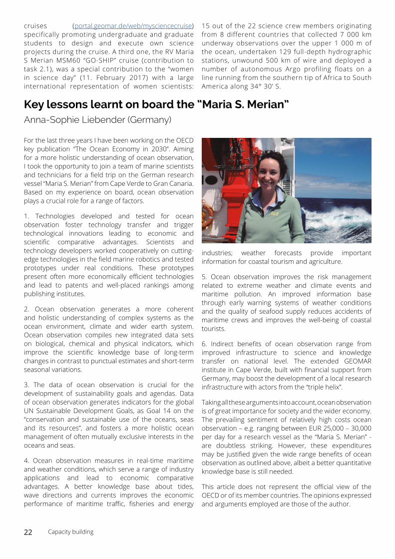
Key lessons learnt on board the “Maria S. Merian” Anna-Sophie Liebender (Germany)
For the last three years I have been working on the OECD key publication “The Ocean Economy in 2030”. Aiming for a more holistic understanding of ocean observation, I took the opportunity to join a team of marine scientists and technicians for a field trip on the German research vessel “Maria S. Merian” from Cape Verde to Gran Canaria. Based on my experience on board, ocean observation plays a crucial role for a range of factors.
1. Technologies developed and tested for ocean observation foster technology transfer and trigger technological innovations leading to economic and scientific comparative advantages. Scientists and technology developers worked cooperatively on cutting-edge technologies in the field marine robotics and tested prototypes under real conditions. These prototypes present often more economically efficient technologies and lead to patents and well-placed rankings among publishing institutes.
2. Ocean observation generates a more coherent and holistic understanding of complex systems as the ocean environment, climate and wider earth system. Ocean observation compiles new integrated data sets on biological, chemical and physical indicators, which improve the scientific knowledge base of long-term changes in contrast to punctual estimates and short-term seasonal variations.
3. The data of ocean observation is crucial for the development of sustainability goals and agendas. Data of ocean observation generates indicators for the global UN Sustainable Development Goals, as Goal 14 on the “conservation and sustainable use of the oceans, seas and its resources”, and fosters a more holistic ocean management of often mutually exclusive interests in the oceans and seas.
4. Ocean observation measures in real-time maritime and weather conditions, which serve a range of industry applications and lead to economic comparative advantages. A better knowledge base about tides, wave directions and currents improves the economic performance of maritime traffic, fisheries and energy
industries; weather forecasts provide important information for coastal tourism and agriculture.
5. Ocean observation improves the risk management related to extreme weather and climate events and maritime pollution. An improved information base through early warning systems of weather conditions and the quality of seafood supply reduces accidents of maritime crews and improves the well-being of coastal tourists.
6. Indirect benefits of ocean observation range from improved infrastructure to science and knowledge transfer on national level. The extended GEOMAR institute in Cape Verde, built with financial support from Germany, may boost the development of a local research infrastructure with actors from the “triple helix”.
Taking all these arguments into account, ocean observation is of great importance for society and the wider economy. The prevailing sentiment of relatively high costs ocean observation – e.g. ranging between EUR 25,000 – 30,000 per day for a research vessel as the “Maria S. Merian” - are doubtless striking. However, these expenditures may be justified given the wide range benefits of ocean observation as outlined above, albeit a better quantitative knowledge base is still needed.
This article does not represent the official view of the OECD or of its member countries. The opinions expressed and arguments employed are those of the author.
22 Capacity building
News from the Community
• AtlantOS was partner in a successful side event entitled ‘Building partnerships for Integrated Ocean Observing and Information in support of the implementation of SDG 14’ during the ‘The Ocean Conference Preparatory Meeting’ (15 - 16 February in New York, US) on 14 February 2017.
• AtlantOS will conduct a side event on 8 June 2017 (9:00-10:30 AM, conference room no 6 at UNHQ) entitled ‘Alliances for Integrated Ocean Observing and Information Services Supporting the Implementation of Sustainable Development Goal 14’ during the ‘The Ocean Conference’ that will take from 5 to 9 June in New York, US.
• AtlantOS initiated the process of developing an Atlantic Ocean Observation System BluePrint. The BluePrint will present best practice to integrate
existing ocean observing activities into a more sustainable, more efficient, and more fit-for-purpose Integrated Atlantic Ocean Observing System, with the ambition to be integrative, user-responsive, multi-national, multi-sectoral and purposeful. The team started its work in February 2017. By now, a draft outline is developed. The overall goal is to present the BluePrint at the OceanObs 2019.
• The first of a series of meetings to exchange ideas concerning long-term sustainability issues related to development of a comprehensive observing system in the Atlantic Ocean region between the US, Canada and Europe took place in April.
Upcoming Events
June
• The Ocean Conference - UN SDG 14 (5 – 9 June, New York)
• Data Harmonization workshop (7-8 June, Brussels)
• 11th GEO European Project Workshop (19-21 June, Helsinki)
• The Oceans’17 MTS/IEEE conference (19 – 22 June, Aberdeen)
• Summer School – From multidisciplinary data to integrated information for coastal areas (19 – 23 June, The Hague)
July
• 6th Euro-Argo Users meeting (4 – 5 July, Paris)
• International WCRP/IOC Conference 2017 – Regional Sea Level Changes and Coastal Impacts (10 – 14 July, New York)
• A New Era of Blue Enlightenment - EU-SA Agreement Meeting (12 – 14 July, Lisbon)
October
• A GODAE Ocean View International School - “New Frontiers in Operational Oceanography” (2 – 13 October, Mallorca)
• Our Ocean Conference (5 – 6 October, Malta)
November
• 8th PLOCAN Glider School (6 – 11 November, Gran Canary)
• 3rd AtlantOS GA meeting (21-23 Nov, Gran Canary)
23 News from the community & Events
Email: [email protected] | Website: www.atlantos-h2020.eu | Twitter: @atlantos_h2020
Atlant SAtlantOS Project Coordination Unit (PCU)
Coordinator: Prof Dr Martin Visbeck
Deputy: Dr Johannes Karstensen
Manager: Dr Anja Reitz