New Opportunities To Improve Water Quality in the...
42
PLANNING AND ZONING TO PROTECT WATER QUALITY IN THE SAGINAW BAY WATERSHED A Great Lakes Restoration Initiative (GLRI) Cass River Sub-Watershed First Local Government Workshop May 12, 2011
Transcript of New Opportunities To Improve Water Quality in the...

PLANNING AND ZONING TO PROTECT WATER QUALITY IN THE SAGINAW BAY WATERSHED
A Great Lakes Restoration Initiative (GLRI)
Cass River Sub-Watershed First Local Government Workshop May 12, 2011

Funding • Great Lakes Restoration Initiative (GLRI) by U.S.
Environmental Protection Agency (EPA) Project Team
• Planning & Zoning Center (PZC) at Michigan State University (MSU)
• East Michigan Council of Governments (EMCOG) • Saginaw Basin Land Conservancy (SBLC) Advisory Assistance • Michigan Department of Environmental Quality
(DEQ)
Introduction

• Background • Other GLRI Projects • Saginaw River/Bay AOC • Soils Map of Michigan • Land Cover Map of Michigan • Cass River Watershed Maps • Local Watershed Plans • Why are We Doing This? • Roles of Major Players • Roles of Local Governments • Project Purpose • Planning & Zoning Assessment Tool • Best Management Practices Guidebook • Outcomes • Expectations • How you can participate? • Conference Survey • Contact Information
Agenda of Meeting
Farmers
Water Quality Orgs
Local Governments
Businesses
Citizens

Saginaw Basin
• Michigan’s largest watershed (8,709 square miles)
• Including a part of 22 counties • Contains America’s largest
freshwater coastal wetland system • Drains approximately 15% of
Michigan’s total land area • One of Michigan’s most diverse
areas • Agriculture • Manufacturing • Tourism • Outdoor recreation • Vast variety of fish and wildlife

Great Lakes Restoration Initiative (GLRI) • The program identifies goals, objectives, measurable
ecological targets, and specific actions for each of the following five focus areas: 1. Cleaning up toxics and areas of concern; 2. Combating invasive species; 3. Promoting nearshore health by protecting watersheds
from polluted run-off; 4. Restoring wetlands and other habitats; and 5. Tracking progress and working with strategic partners.
• Largest federal investment in the Great Lakes in two decades.
• GLRI projects target Areas of Concern (AOCs).
Background

• Goal is delisting • Objective is removing
impairments and preventing future pollution
• Saginaw Bay AOC
Background
Michigan’s Great Lakes Areas of Concern (AOCs)

Pigeon River Corridor Sediment Reduction Project • Pigeon River Inter-county Drain Drainage Board • $1,723,235
Shiawassee Flats Wildlife and Fish Habitat Restoration • Dept. of Interior – US Fish and Wildlife • $785,492
Van Hove Coastal Wetland Restoration • Ducks Unlimited Inc. • $129,249
Upper Great Lakes Stream Connectivity and Habitat Initiative
• Dept. of Interior – US Fish and Wildlife • $876,786
Fish Passage at the Frankenmuth Dam • City of Frankenmuth • $400,000
Rifle River Watershed Nonpoint Implementation Project • Huron Pines • $495,000
Western Lake Huron, MI • The United States Army Corps of Engineers (USACE) • $600,000
Source: http://greatlakesrestoration.us/
Other GLRI Projects

• Includes all 22 miles of the Saginaw River/Bay • Designated an AOC since 1988 • Of the 14 Impairments criteria, Saginaw River/Bay includes10:
1. Restriction on fish and wildlife consumption 2. Eutrophication or undesirable algae 3. Degradation of fish and wildlife populations 4. Beach closings 5. Degradation of aesthetics 6. Bird or animal deformities or reproduction problems 7. Degradation of benthos 8. Degradation of phytoplankton and zooplankton
populations 9. Restriction of dredging activities 10. Loss of fish and wildlife habitat
Saginaw River/Bay AOC

Soils
• Wet loamy soils (green) predominant; purple soils have more sand in them; all are well suited for agriculture if drained.
• Crops commonly grown: corn, sugar beets, field beans.

Land Cover
• Agriculture • Wooded wetlands • Forested

Cass River Watershed: 2006 Land Use/Land Cover

Land Use/Land Cover Change 1800-2000

Cass River Watershed: Water Features

Cass River Watershed: Water Control Structures

Cass River Watershed: Open Space and Recreation Facilities

• Developed in 2008 by the Cass River Rapid Watershed Assessment Technical Committee (members consisting of various federal, state, and local agencies and organizations)
• “The RWA provides a brief assessment of the Cass River watershed’s natural resources, resource concerns and conservation needs.”
Local Watershed Plan The Cass River Rapid Watershed Assessment (RWA)
“Nonpoint source pollution is the primary pollution threat facing the water resources of the Cass River Watershed. Nonpoint source pollution is any pollutant carried off the land by water or wind and deposited into surface water.” Can include sediment, fertilizer, pesticides, herbicides, fungicides, vehicle lubricants, etc.

Issues • Eroding stream banks • Poor road / stream crossings • Storm runoff • Cropland erosion • Loss of riparian & wildlife
corridors • Loss of wetlands • Channelization • Septic effluent • Crop fertilizers • Livestock waste • Thermal pollution • Lack of proper zoning • Invasive species
Local Watershed Plan The Cass River Rapid Watershed Assessment (RWA)

Goals for Improvement • Institute responsible land use protection and
public policy to protect parcels within the watershed that provide groundwater recharge, key wildlife habitats, headwater stream protection, important wetland functions, coastal areas, etc.
• Identify sites contributing to water quality problems and work with producers to implement Best Management Practices (BMPs).
• Identify sites that are unnaturally adding sediment to the river system and implement a system of Best Management Practices where possible.
• Increase and develop citizen involvement/public awareness and responsible use of the watershed through stewardship and education.
Local Watershed Plan
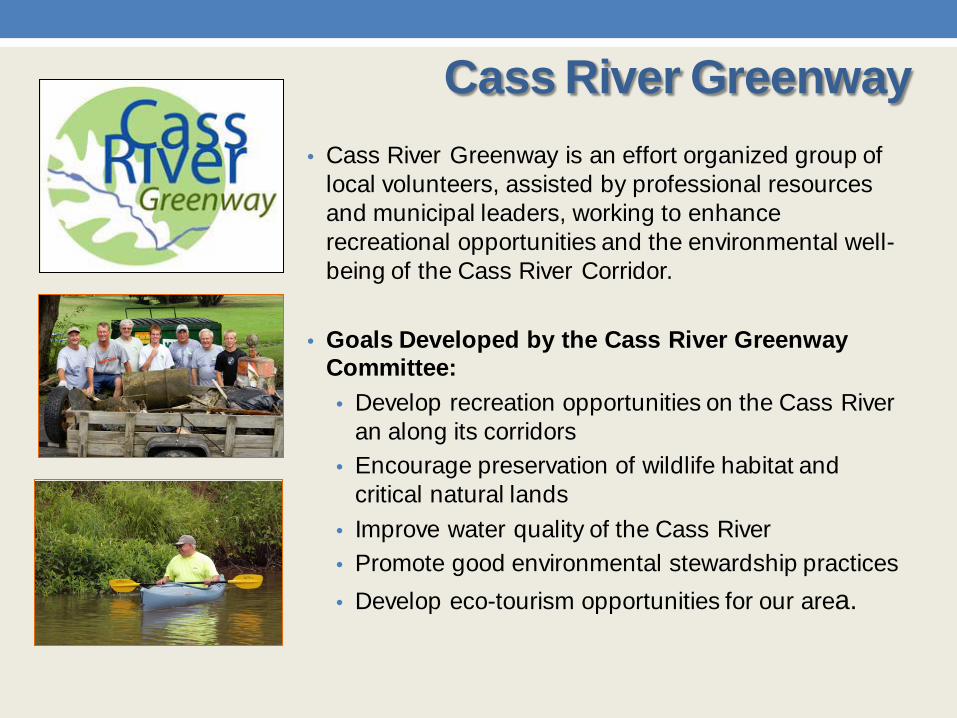
• Cass River Greenway is an effort organized group of local volunteers, assisted by professional resources and municipal leaders, working to enhance recreational opportunities and the environmental well-being of the Cass River Corridor.
• Goals Developed by the Cass River Greenway Committee: • Develop recreation opportunities on the Cass River
an along its corridors • Encourage preservation of wildlife habitat and
critical natural lands • Improve water quality of the Cass River • Promote good environmental stewardship practices • Develop eco-tourism opportunities for our area.
Cass River Greenway

• The Saginaw Bay Resource Conservation & Development Council (RC&D) received funding from the Michigan DEQ.
• Primary Objectives:
1. Organize committees comprised of key stakeholders to identify and prioritize water quality issues;
2. Evaluate and summarize watershed information to identify and prioritize specific areas for water quality improvements.
3. Submit a Watershed Management Plan for the Cass River Watershed that meets Federal and State criteria to receive future project funding to improve water quality.
Cass River Watershed Project

Outcomes • Clean water that is fishable and
swimmable, with less sediment, fertilizers and pesticides.
• Happy users. • Happy taxpayers.
Roles All major players have a role to play, including: • Conservation and
watershed organizations • Local governments • Landowners • County agencies • State agencies • Federal agencies
GLRI The federal government has a major initiative to restore and delist the Bay as an AOC through the Great Lakes Restoration Initiative (GLRI).
Action Plan The watershed plans detail restoration and protection efforts for each sub-watershed, which when implemented, helps reduce pollution and restore damaged parts of the watershed and Bay.
AOC Major Watershed Pollution led to the USEPA designating the Saginaw Bay as a Area of Concern (AOC). This means that water quality is severely degraded and a large number of beneficial uses are impaired.
Watershed Plans Watershed management plans for each of the rivers flowing into the Bay were prepared by local watershed groups such as the Cass River Rapid Watershed Assessment Technical Committee, Huron Pines, Ducks Unlimited, Inc., and MDEQ.
RAP Saginaw Bay watershed Remedial Action Plan (RAP) describes methods for correcting impairments to beneficial uses, in the degraded areas.
Why are we doing this?

Roles of Major Players
Federal Agencies EPA o Funded GLRI and
other enhancement activities
o Role in wetland permits
o Education
Army Corps o Dredging permits o Wetland permits
USDA o Fund
conservation organizations and landowners
o Education of farmers and other landowners
State Agencies DEQ o Support cleanup
and delisting o Provide technical
assistance o Apply regulations o Education o Link stakeholder
groups
DNR o Manage State
land o Education o Support cleanup
partnerships
County Agencies Drain Commissioners o Reviews Site Plans
for new developments
o Proposals for BMP implementation
o Stormwater management
Health Department o Septic tank and
other environmental codes
Road Commission o Manages negative
impacts from road crossings and use of de-icers
Landowners o BMP
implementation o Consider long
term preservation of sensitive habitats
Local Governments o Education on
BMPs and Low Impact Development practices
o Local Master Plans
o Local Zoning Ordinances
o Enforce adopted regulations
o Facilitate coordination and cooperation with public, private and non-profit groups
Conservation and Watershed Organizations o Education on Best
Management Practices (BMPs)
o Planning o Permanent land
protection o Wetland and their
sensitive land preservation and restoration
o Technical assistance
Improving Water Quality of Saginaw Bay Watershed

Role of Local Governments
Project Team will help your community accomplish these actions through this project!
Actions • Educate: o Best Management Practices
(BMPs) o Low Impact Development
Practices • Update:
o Local Master Plans o Local Zoning Ordinances
• Enforce: o Adopted regulations
• Facilitate: o Coordination and cooperation
with public, private and non-profit groups

Project Purpose
Prevention of future pollution through:
1. Education 2. Collaboration 3. Coordination 4. Technical assistance 5. Action by local
governments 6. Action by landowners 7. Action by water quality
advocacy organizations and other local organizations

Conduct Planning and Zoning
Assessments
Feb – July 2011
April 2011
December 2011
June 2012
Public Meetings (one in each sub-
watershed)
Workshops for Local
Governments (one in each sub-
watershed)
May 2011
September 2011
March 2012
Technical Assistance Plans &
Work with Local Governments
January 2012
Conference
Work with Land Owners and
Farmers
Project Timeline
September June 2011 2012
May Sept 2011 2012
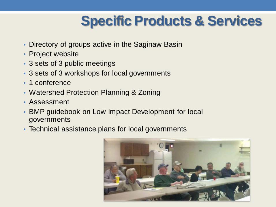
• Directory of groups active in the Saginaw Basin • Project website • 3 sets of 3 public meetings • 3 sets of 3 workshops for local governments • 1 conference • Watershed Protection Planning & Zoning • Assessment • BMP guidebook on Low Impact Development for local
governments • Technical assistance plans for local governments
Specific Products & Services

• Directory of Groups Serving the Saginaw Bay Watershed
• Project Website http://www.landpolicy.msu.edu • Great Place Network http://www.greatplacenetwork.org/
Collaborative Efforts

Watershed Protection Planning & Zoning Assessment Tool
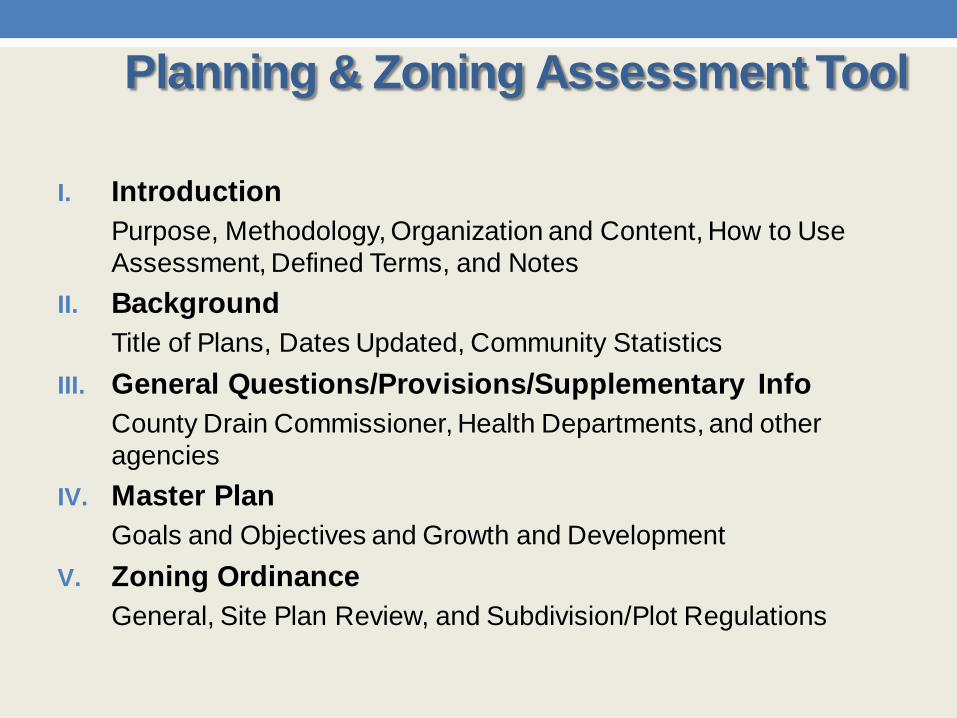
I. Introduction Purpose, Methodology, Organization and Content, How to Use Assessment, Defined Terms, and Notes
II. Background Title of Plans, Dates Updated, Community Statistics
III. General Questions/Provisions/Supplementary Info County Drain Commissioner, Health Departments, and other agencies
IV. Master Plan Goals and Objectives and Growth and Development
V. Zoning Ordinance General, Site Plan Review, and Subdivision/Plot Regulations
Planning & Zoning Assessment Tool

Planning & Zoning Assessment Tool

Edwards Township Population: 1,390 (2000) Master Plan Example
Planning & Zoning Assessment Tool

Planning & Zoning Assessment Tool
Edwards Township Population: 1,390 (2000) Zoning Ordinance Example

1. Introduction • Purpose, How to use the guidebook
2. Understanding the watershed • How a watershed functions, how it is unique and valuable, what needs
fixing 3. The umbrella of protection for the watershed
• The role of township, city and village planning & zoning • The role of community organizations, foundations and education
institutions • The role of individual property owners, businesses and corporations • The roles of county, state, and federal government
4. Best Management Practices (see next slide) 5. How to implement the ideas in this guidebook
• Planning process, education, incentives, volunteerism, evaluating progress
6. Where to go for more information 7. References
Best Management Practices (BMPs) Draft Outline of Low Impact Development
Guidebook

Water Pollution Filtering • Vegetated Filter Strips/Buffer Strips Sediment & Erosion Control • Protect Riparian Buffer Areas • Riparian Corridor Ordinance • Streamside Management Pollution Prevention • Comprehensive Nutrient Management Plan • Non-point Source Pollution Control Ordinance Policy BMPs • Conservation Easement • Public Involvement and Education • Riparian Waterfront Lot Use Regulations/Keyhole
Regulations Reduce Impervious Surfaces • Subdivision ordinance Improving Groundwater Recharge • Protecting areas of high recharge
Best Management Practices (BMPs)

• Evaluation of existing master plan and zoning ordinance language
• Sample language options for master plan and zoning • Assistance with adoption of regulations • Follow-up
Technical Assistance by PZC at MSU
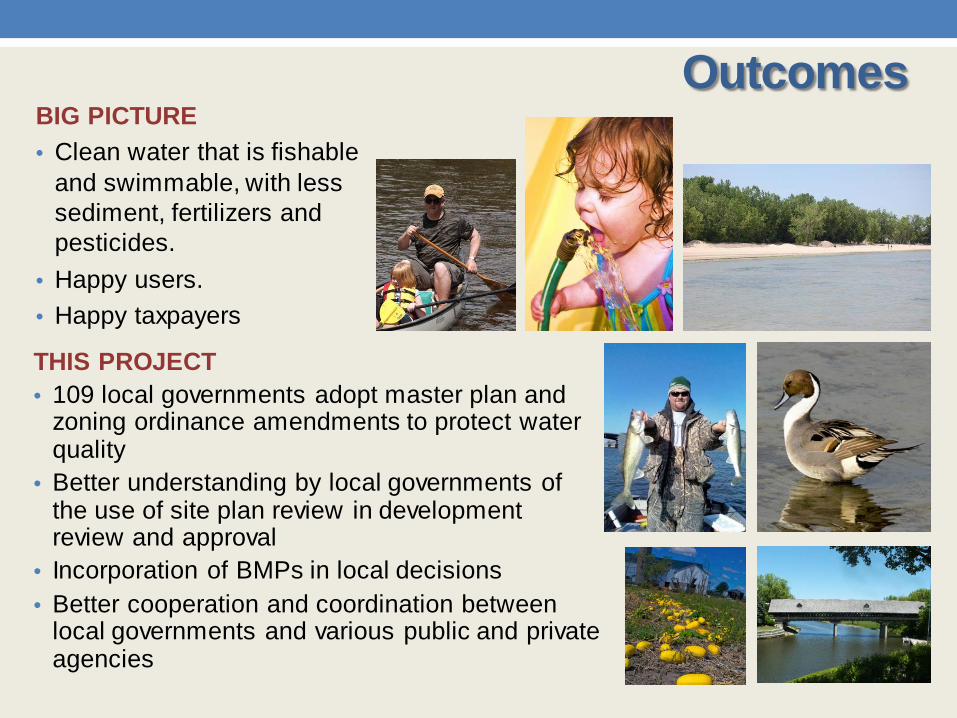
THIS PROJECT • 109 local governments adopt master plan and
zoning ordinance amendments to protect water quality
• Better understanding by local governments of the use of site plan review in development review and approval
• Incorporation of BMPs in local decisions • Better cooperation and coordination between
local governments and various public and private agencies
BIG PICTURE • Clean water that is fishable
and swimmable, with less sediment, fertilizers and pesticides.
• Happy users. • Happy taxpayers
Outcomes

Schedule for PZC Assistance to Local Governments
May – Sept 2011 Complete Planning & Zoning Assessment
and BMPs Low Impact Development Guidebook
Oct – Dec 2011 Provide Technical Assistance to each
jurisdiction with specific amendments to Master Plan & Zoning Ordinance
Jan – June 2012 Provide Technical Assistance with any
questions as community’s adopt amendments in the Master Plan & Zoning Ordinance

Expectations
Local Governments • Engagement (especially
during summer months) • Contact person • Participation • Cooperation • Collaboration
Project Team • Advocacy • Cooperation • Collaboration • Outreach • Education

Smelly Debris is Spoiling Huron County Beaches
Bay City Times, 2006
2007
Experts say avoid Saginaw Bay muck

• Contact us with your questions • Get the word out! • Networking • Providing support to project team • Support for implementation of local sub-watershed plan • Working with landowners and farmers • Individual action to protect water quality
How you can participate in the MSU project?

Conference Survey
Mark A. Wyckoff, FAICP Professor and Director Planning & Zoning Center at MSU Senior Associate Director, Land Policy Institute
Jacqueline Spry Visiting Academic Specialist-Outreach at MSU
Michigan State University Land Policy Institute
Planning & Zoning Center 310 Manly Miles Building
1405 South Harrison Road East Lansing, MI 48823 517.432.2222 ext. 123
Contact Information