New Construction and Land Acquisition Mastodon Trail · Mastodon Trail will implement these plan...
118
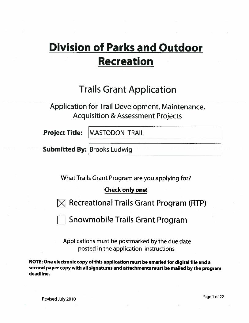
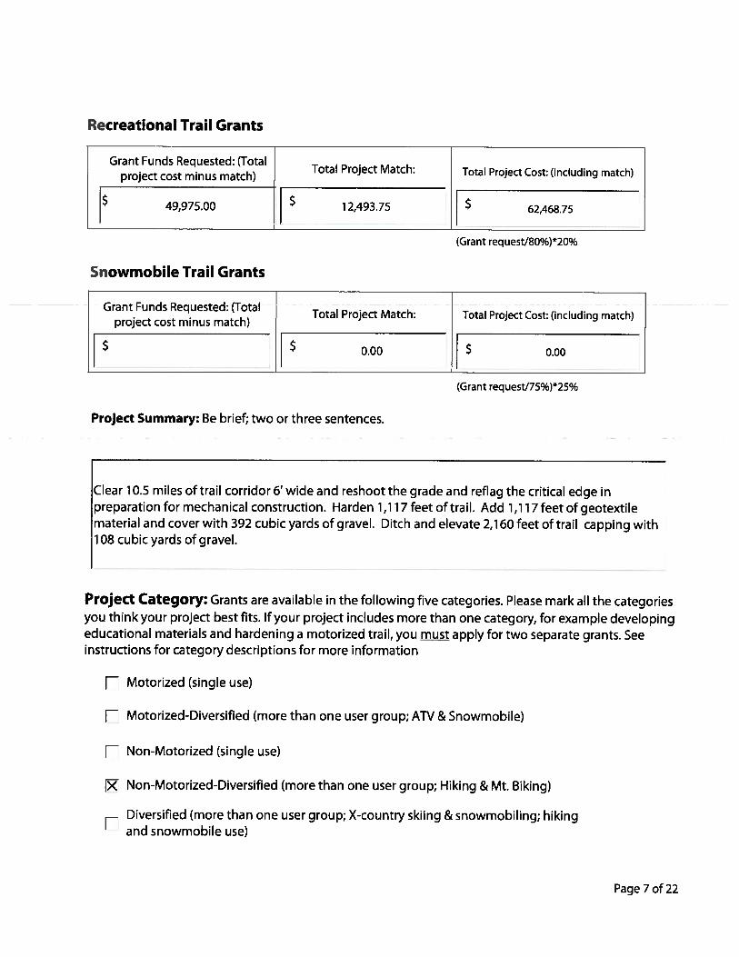
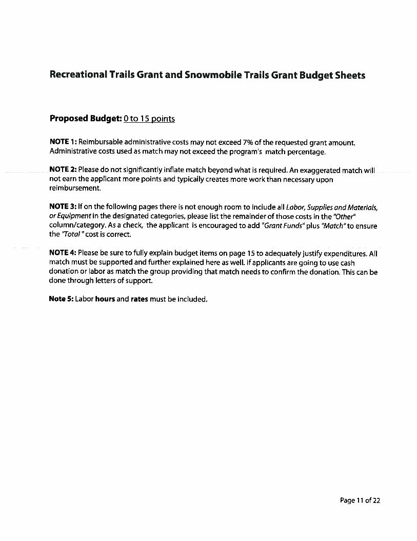
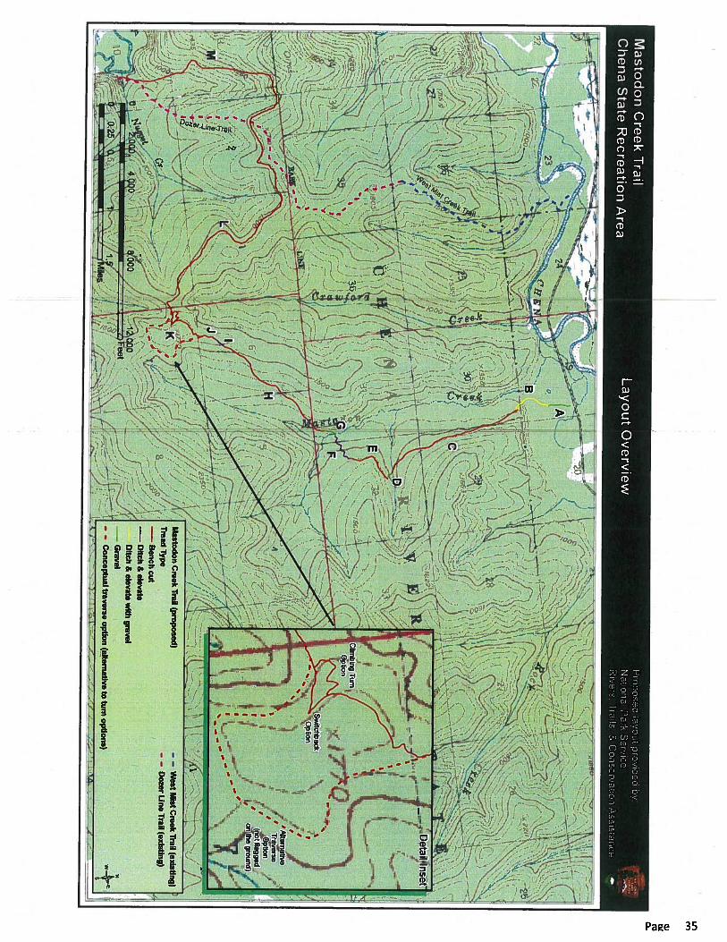
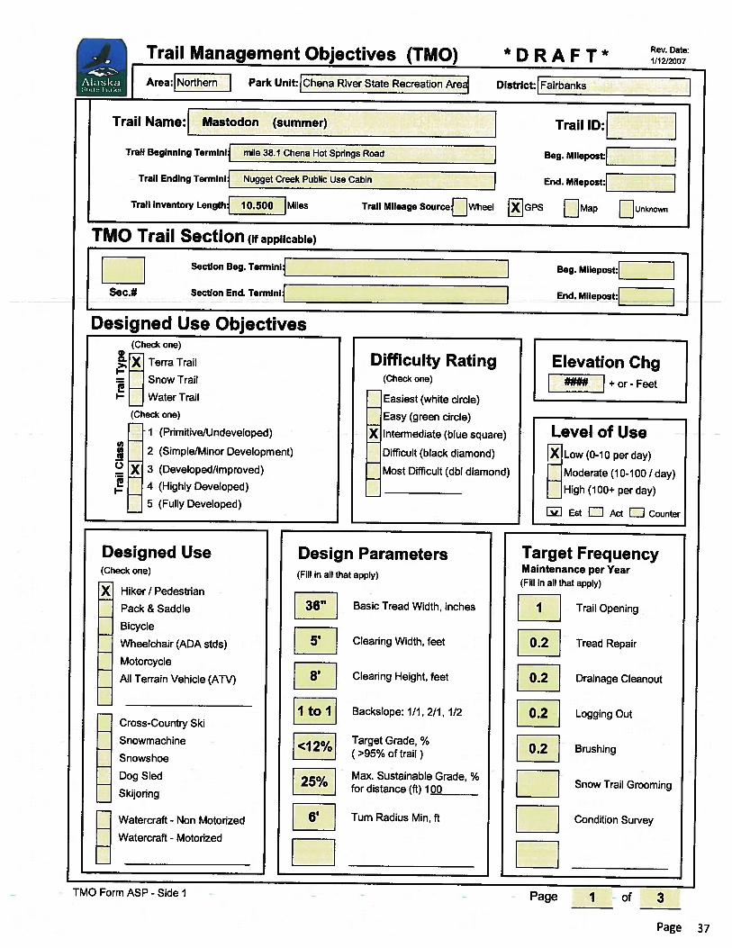
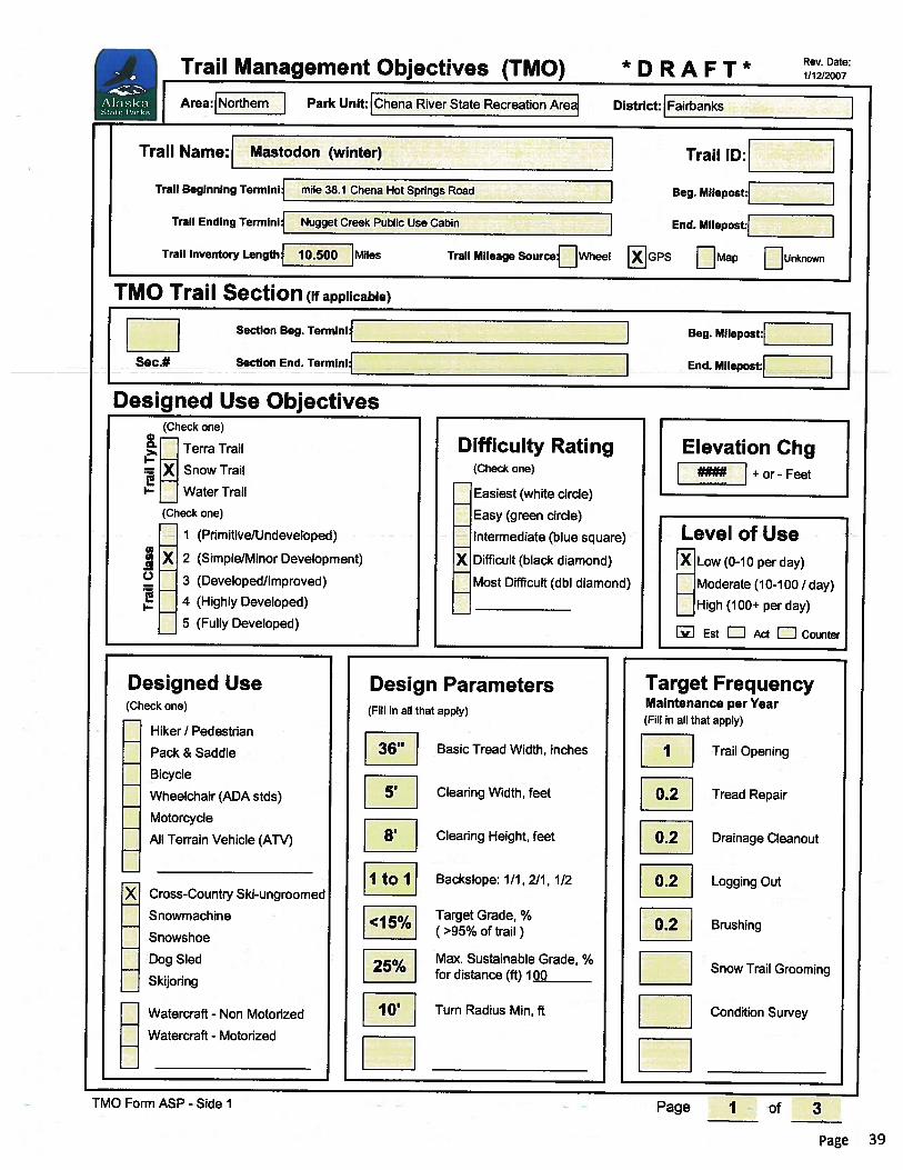
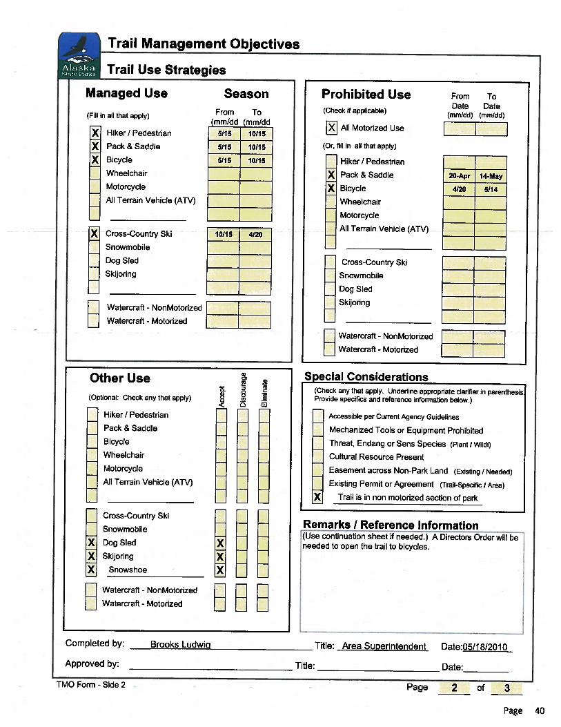
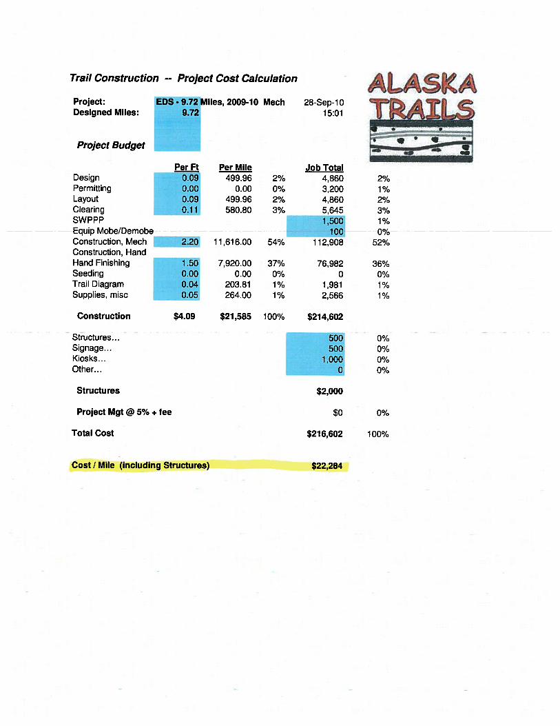
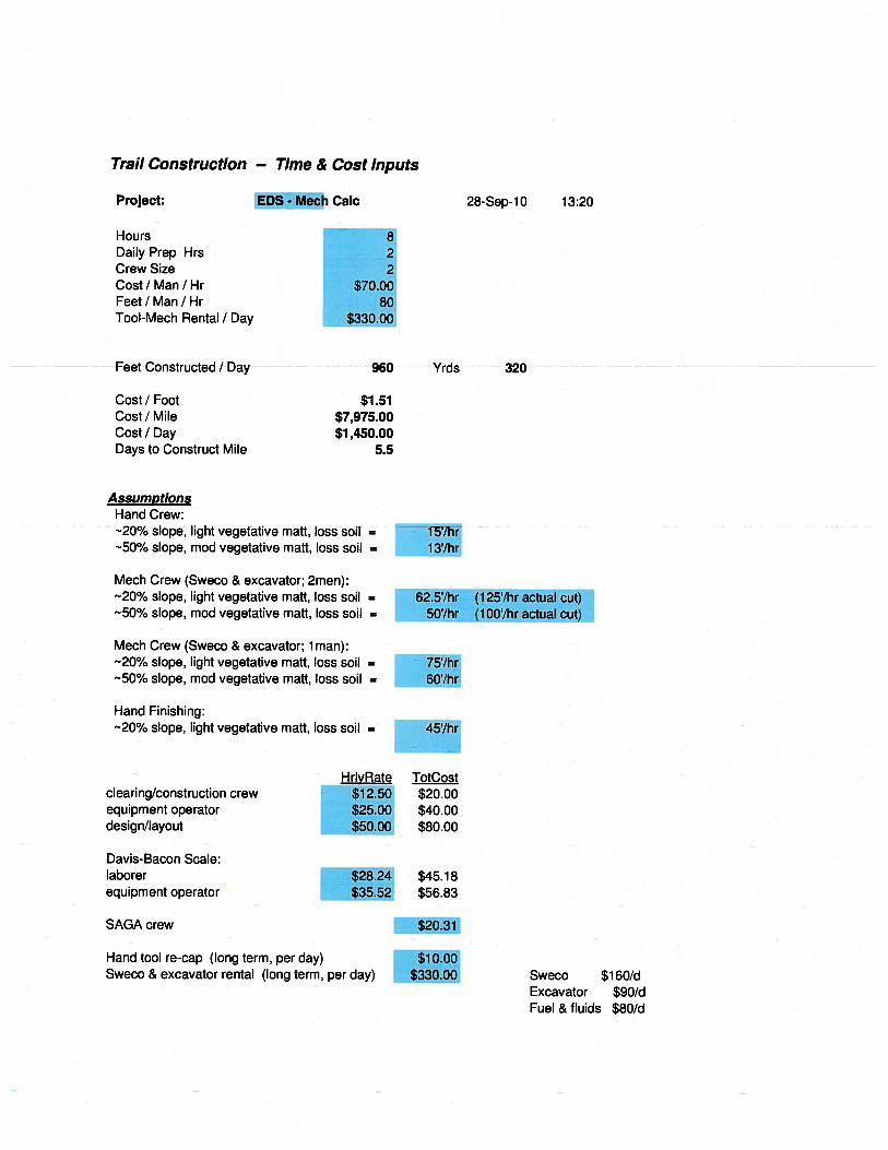
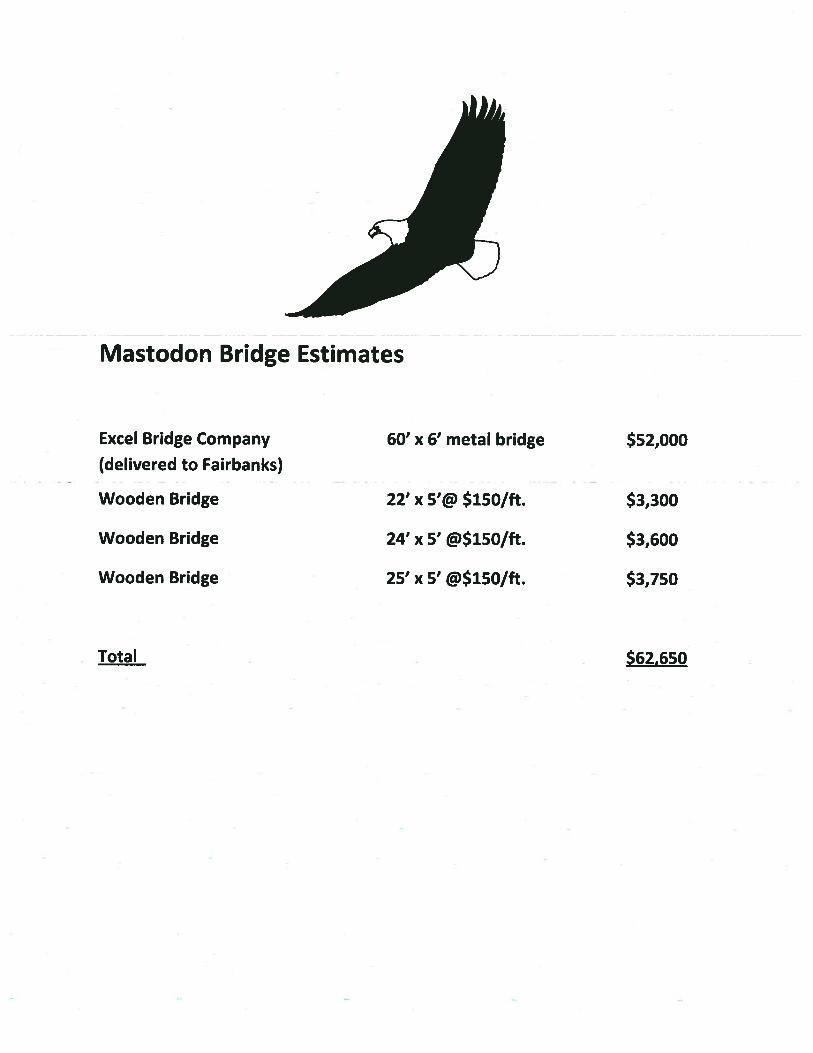
Total Project Snapshot Report 2011 Legislature TPS Report 55263v1 $85,000 Approved Agency: Department of Natural Resources Project Title: Project Type: New Construction and Land Acquisition Mastodon Trail State Funding Requested: $246,657 House District: Fairbanks Areawide (7-11) One-Time Need Brief Project Description: Construct a 10.5 mile trail to Nugget Creek Public Use Cabin in Chena River State Recreation Area. This will provide an overland/year-round trail to the cabin and eventually link with the Granite Tors Trail to the east forming a 40 mile network of non-motorized trails to three public cabins / trail shelters. Funding Plan: Total Project Cost: $340,632 Funding Already Secured: ($93,975) FY2012 State Funding Request: ($246,657) Project Deficit: $0 Funding Details: 2009/2010, National Park Service Grant: RTCA Program. Conceptual Trail Corridor Identification $44,000 2011, State Trails Office: RTG Program PhaseI: trail corridor clearing $49,975 A Capital Appropriation from the legislature will be leveraged (50% match) for additional funding from the Land & Water Conservation Fund to build the trailhead. Detailed Project Description and Justification: The Northern Area of Alaska State Parks seeks funding to construct 10.5 miles of new trail in Chena River State Recreation Area, 26 miles east of Fairbanks, Alaska. This new trail (Mastodon) will provide safe, year-round access to Nugget Creek public use cabin. The existing access to the cabin crosses the Chena River which can be hazardous due to thin ice or open water, even in late winter. The new alignment will also provide an overland connection to Mist Creek Trail and eventually link the very popular Tors Trail to the east forming a 40 mile network with three public use cabins / trail shelters. The trail will provide a new opportunity for mountain bikers, skiers,and horseback riders to access a public use cabin on a non-motorized trail. BACKGROUND: From 2003 through 2006 the Chena River State Recreation Area Management Plan went through a substantial public review process. The following recommendations came from that process. On page 24, the plan states that several routes are possible and should be considered for the future, such as trails connecting the Mist Creek Trail with the Granite Tors Trail. Future new trails should link to existing trails to create more loop trail opportunities or to extend into new areas." Elsewhere, on page 54, the plan directs Northern Area State Parks to disign the Mist Creek Trail for winter and summer non-motorized use and to work with user groups and individuals to expand winter trails and a cabin system for non-motorized users. Finally, on page 47, the plan recommends that trail access to the existing Nugget Creek cabin be improved. For use by Co-chair Staff Only: Page 1 Contact Name: Jacob Miller Contact Number: 465-4976 10:25 AM 5/27/2011
Transcript of New Construction and Land Acquisition Mastodon Trail · Mastodon Trail will implement these plan...
Total Project Snapshot Report2011 Legislature TPS Report 55263v1
$85,000
Approved
Agency: Department of Natural Resources
Project Title: Project Type: New Construction and Land Acquisition
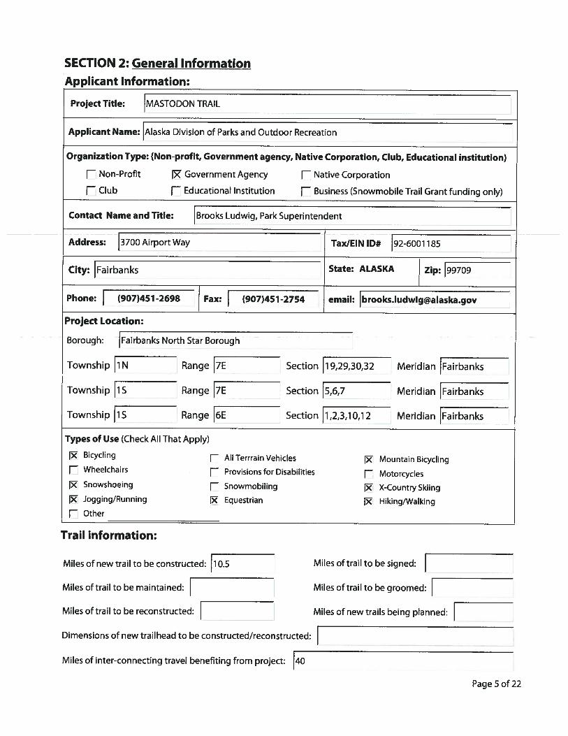
Mastodon Trail
State Funding Requested: $246,657 House District: Fairbanks Areawide (7-11)One-Time Need
Brief Project Description:Construct a 10.5 mile trail to Nugget Creek Public Use Cabin in Chena River State Recreation Area.This will provide an overland/year-round trail to the cabin and eventually link with the Granite Tors Trailto the east forming a 40 mile network of non-motorized trails to three public cabins / trail shelters.
Funding Plan: Total Project Cost: $340,632 Funding Already Secured: ($93,975)FY2012 State Funding Request: ($246,657)Project Deficit: $0 Funding Details:
2009/2010, National Park Service Grant: RTCA Program. Conceptual Trail Corridor Identification $44,000
2011, State Trails Office: RTG Program PhaseI: trail corridor clearing $49,975
A Capital Appropriation from the legislature will be leveraged (50% match) for additional funding from the Land & Water Conservation
Fund to build the trailhead.
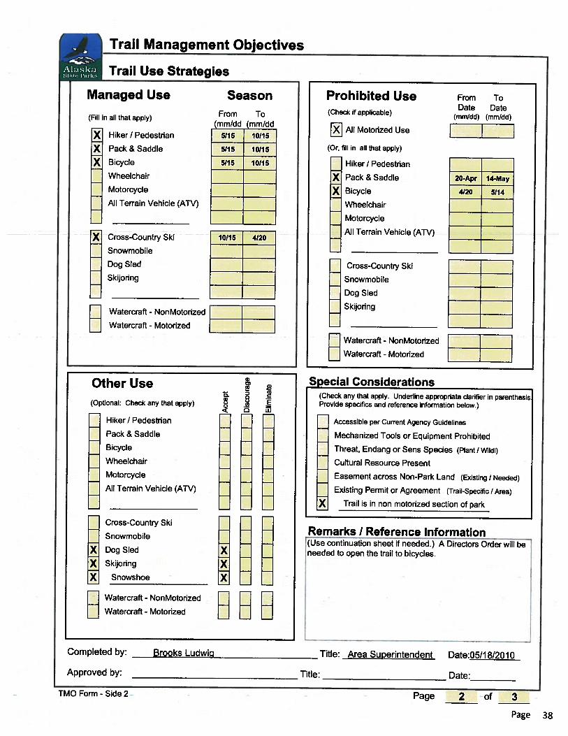
Detailed Project Description and Justification:The Northern Area of Alaska State Parks seeks funding to construct 10.5 miles of new trail in Chena River State RecreationArea, 26 miles east of Fairbanks, Alaska. This new trail (Mastodon) will provide safe, year-round access to Nugget Creekpublic use cabin. The existing access to the cabin crosses the Chena River which can be hazardous due to thin ice or openwater, even in late winter. The new alignment will also provide an overland connection to Mist Creek Trail and eventuallylink the very popular Tors Trail to the east forming a 40 mile network with three public use cabins / trail shelters. The trailwill provide a new opportunity for mountain bikers, skiers,and horseback riders to access a public use cabin on anon-motorized trail.
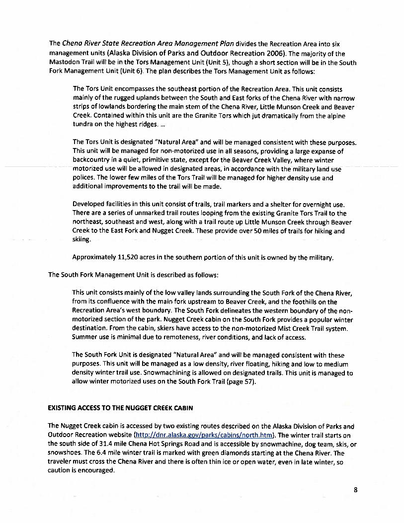
BACKGROUND: From 2003 through 2006 the Chena River State Recreation Area Management Plan went through asubstantial public review process. The following recommendations came from that process. On page 24, the plan statesthat several routes are possible and should be considered for the future, such as trails connecting the Mist Creek Trail withthe Granite Tors Trail. Future new trails should link to existing trails to create more loop trail opportunities or to extend intonew areas." Elsewhere, on page 54, the plan directs Northern Area State Parks to disign the Mist Creek Trail for winter andsummer non-motorized use and to work with user groups and individuals to expand winter trails and a cabin system fornon-motorized users. Finally, on page 47, the plan recommends that trail access to the existing Nugget Creek cabin beimproved.
For use by Co-chair Staff Only:
Page 1
Contact Name: Jacob MillerContact Number: 465-4976
10:25 AM 5/27/2011
Total Project Snapshot Report2011 Legislature TPS Report 55263v1
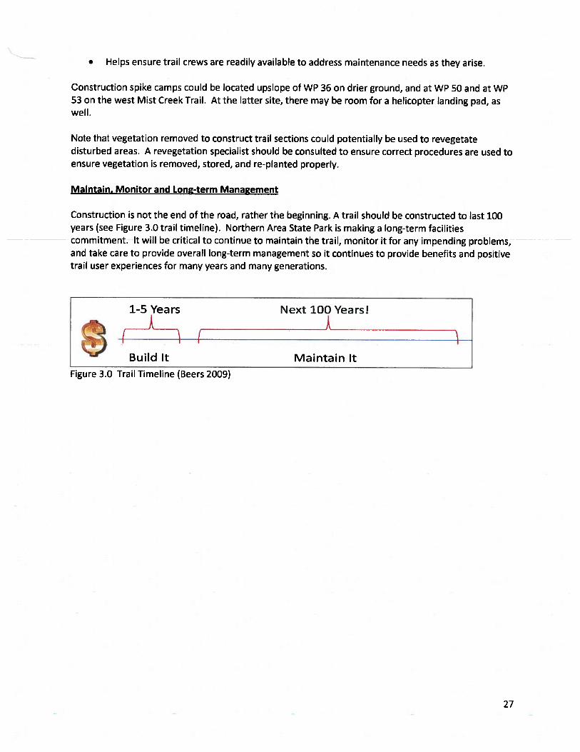
These recommendations served as a catalyst for the Northern Area State Park proposal for the Mastodon Trail. TheMastodon Trail will implement these plan recommendations, providing a sustainably designed and constructed year-roundtrail that will substantially improve access for people of all ages and skill levels.
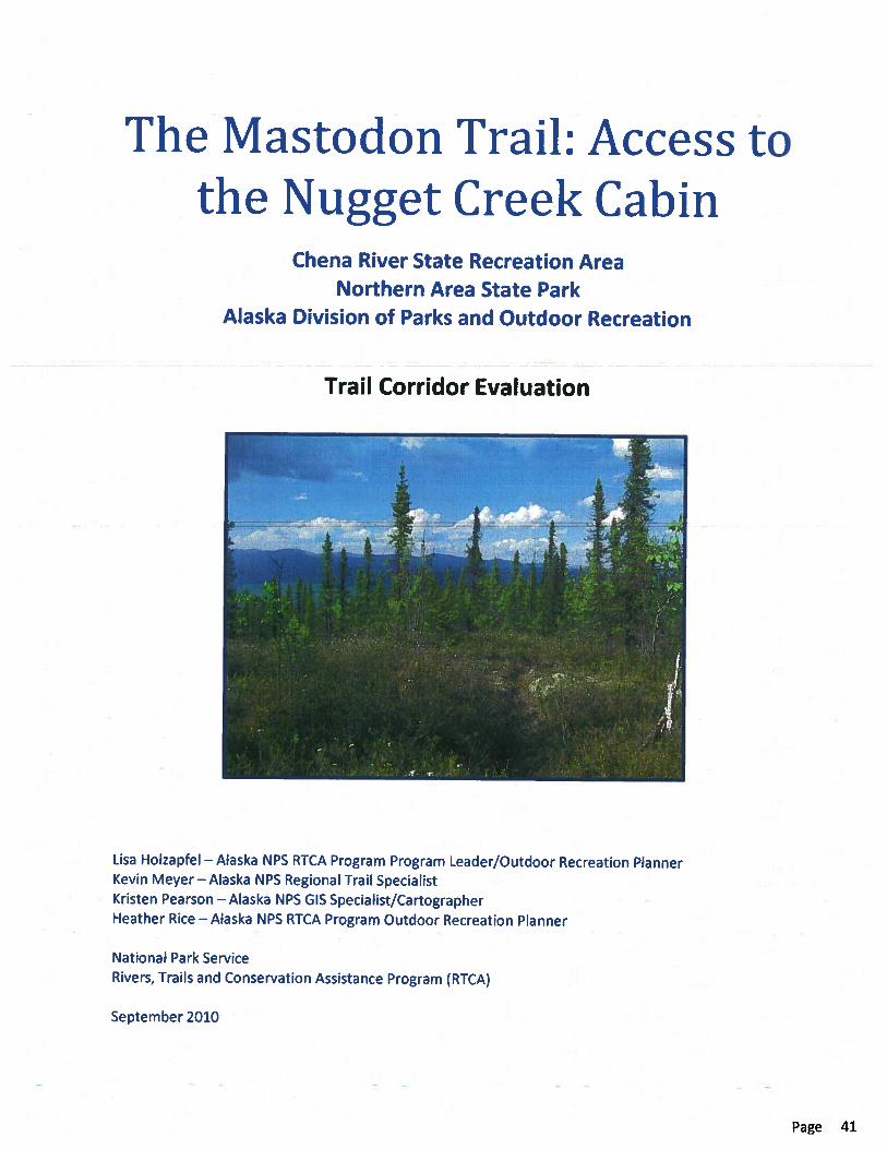
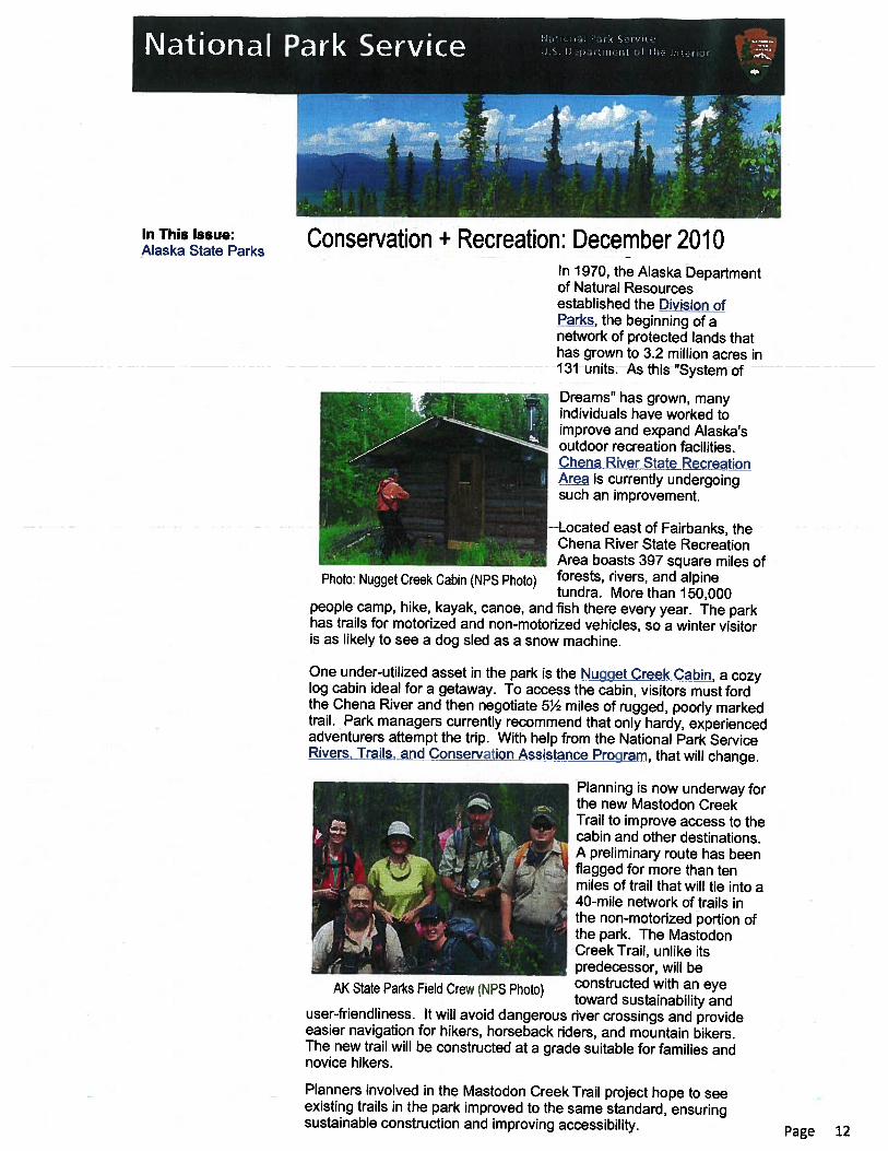
In October 2009, the Northern Area of Alaska State Parks was awarded a grant for technical assistance from the NationalPark Service, Alaska Region Rivers, Trails, and Conservation Assistance program (RTCA) to assess the Mist Creek trailalignment and identify a sustainable non-motorized trail to Nugget Creek Cabin in Chena River State Recrteation Area. RTCA technical assistance was provided from October 2009 through September 2010. NPS and park staff spent six days inthe field, hiked 55 miles, and laid out and flagged 10.5 miles of trail. 10 8-hour days were spent on post-field analysis, mapcreation, and report writing.
Public Outreach and Support
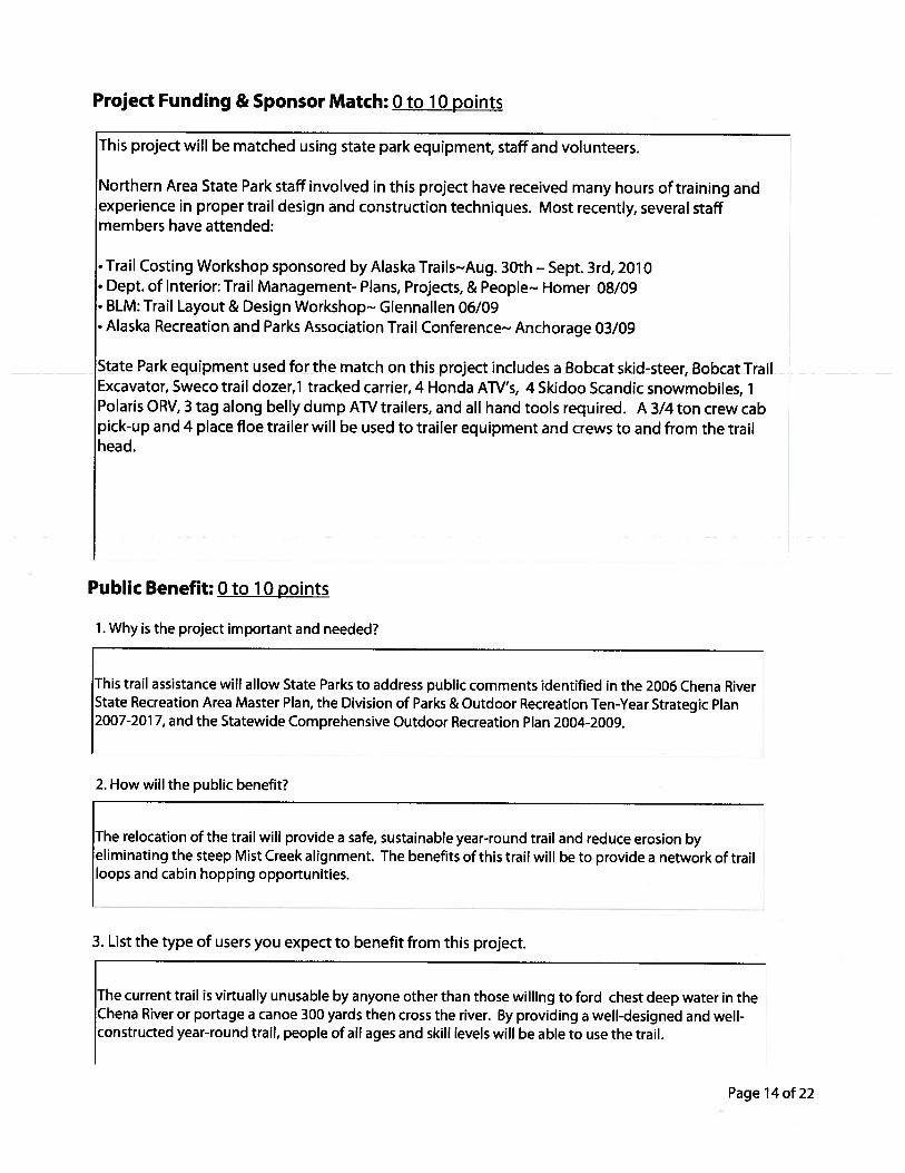
The 2006 update of the Chena River State Recreation Area Management Plan involved several rounds of public review andmany meetings and workshops that gave the public an opportunity to comment on plan proposals, including thoserecommendations highlighted above. Since that time, improvements made on other trails in the area have increased publicsupport for trail development and the public has been kept abreast of recreation area trail projects through regular mediareleases. The Northern Area State Park Citizen Advisory Board (Northern Area CAB), a diverse group of trail users whoassist recreation area staff with management and development issues, has been an important conduit for publicparticipation and opinion, conveying ideas and concerns to and from park staff.
The proposed Mastodon Trail has the full support of the Northern Area CAB. In recent years, Northern Area CAB members,Tom Paragi and Dave Payer, have been instrumental in carrying forward the proposal. Both have researched a number ofroutes for the Mastodon Trail that would link the Tors Trail to the Mist Creek Trail and improve access to the Nugget Creekcabin. They conducted reconnaissance for these routes during the winter of 2007 and spring of 2008 and drew up a mapreflecting their findings, including a potential shelter location. For the past several years additional volunteers have scoutedand flagged alternative trails to the Nugget Creek cabin.
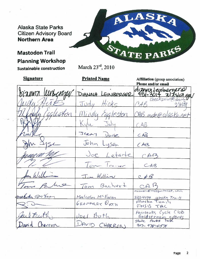
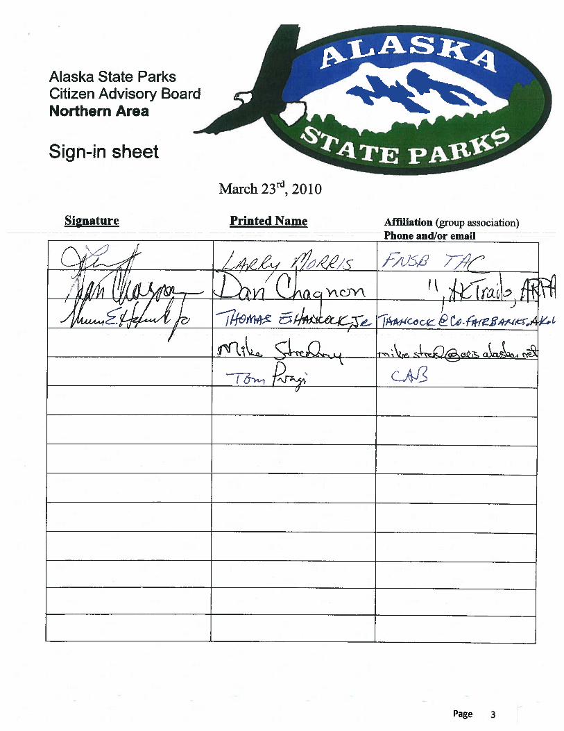
In 2010, Northern Area State Parks began a formal public involvement process to solicit input on the trail proposal. Avideo-conference was hosted on March 11 in Fairbanks by the Northern Area CAB and RTCA. Key stakeholders wereinvited to discuss the Mastodon Trail and receive training on sustainable trail design and construction and trail managementobjectives. Two Northern Area CAB members and three Northern Area State Park staff attended. Due to technicaldifficulties with the video-conferencing, however, the training component was rescheduled to March 23 when Kevin Meyer,Alaska NPS Regional Trails Specialist, could present the materials in person. At that later meeting, ten Northern Area CABmembers, three Northern Area State Park staff, and seven visitors attended.
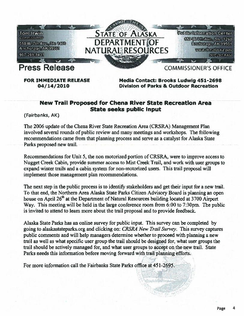
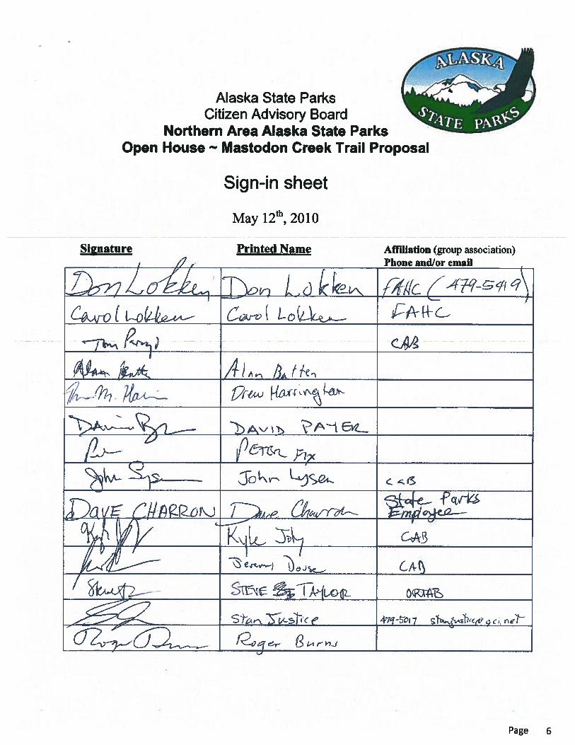
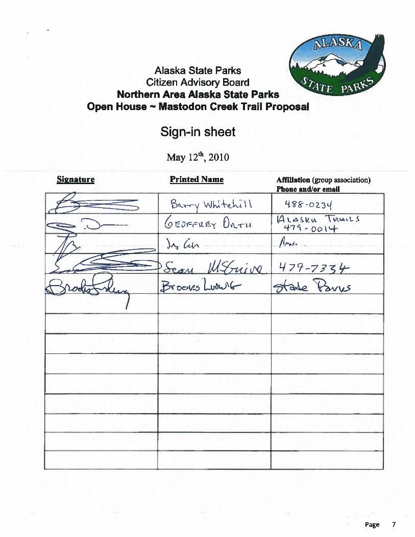
On May 6, the Fairbanks Daily News Miner published an article about the trail proposal and upcoming public open househosted by the Northern Area CAB. The open house, held on May 12 in Fairbanks, gave the wider public an opportunity tolearn more about the trail proposal and provide feedback. Nineteen people signed in at this open house.
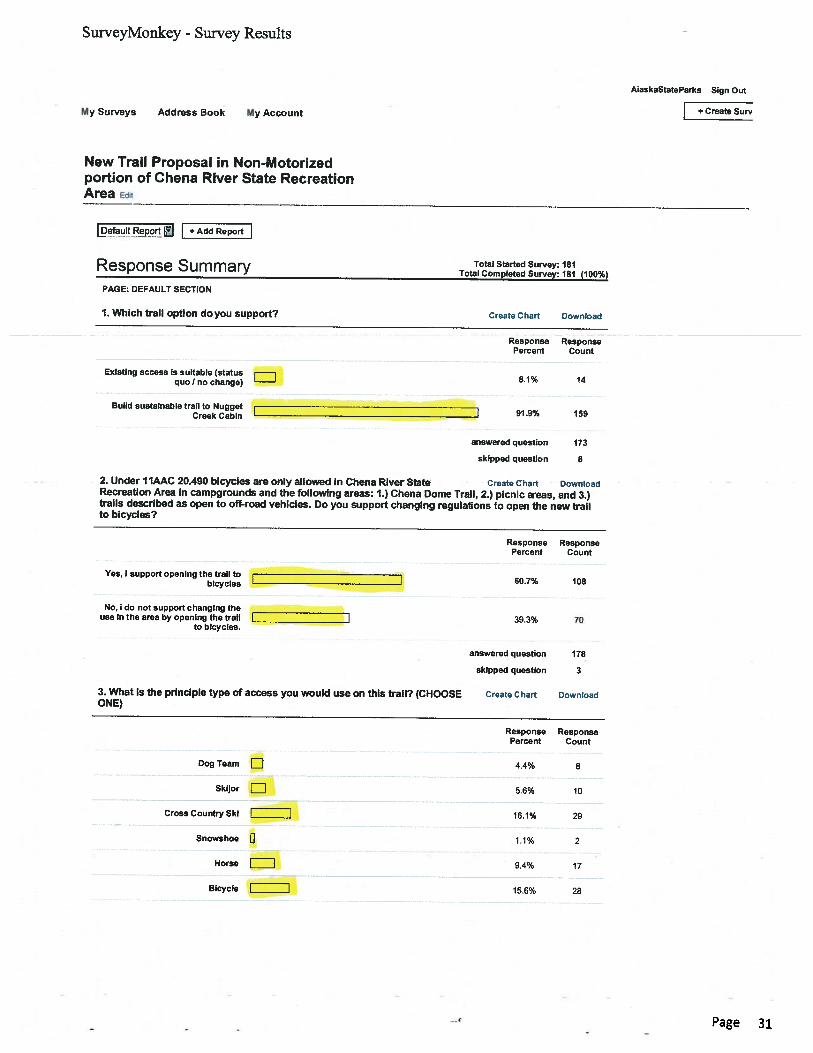
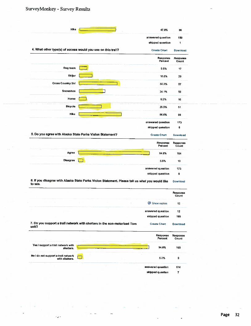
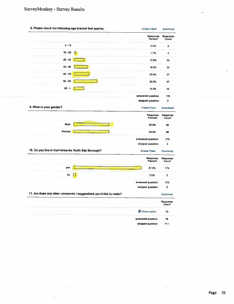
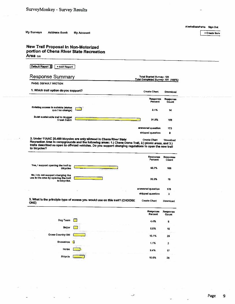
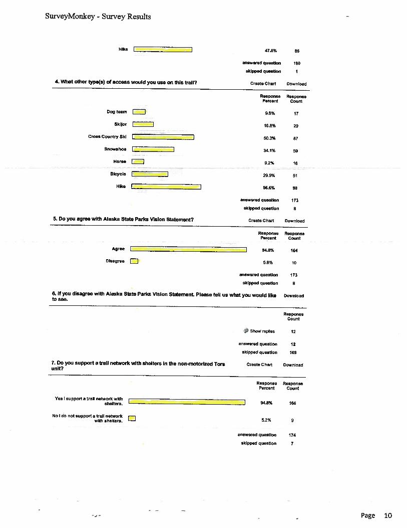
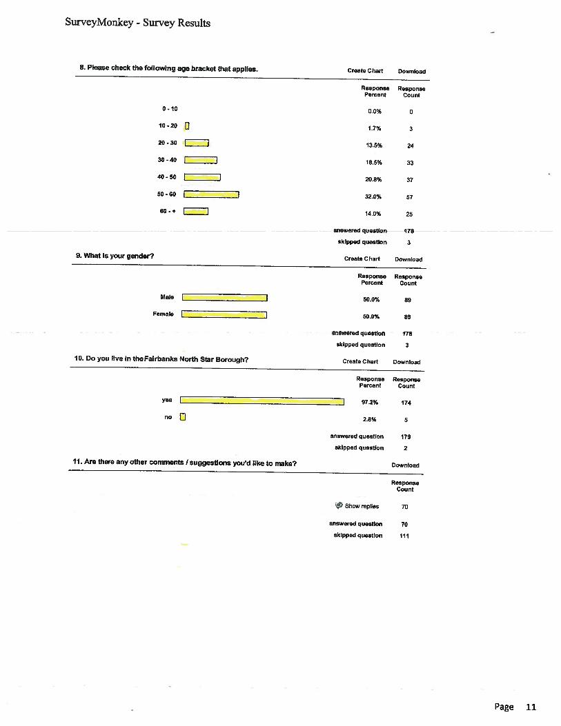
As part of its public outreach, Northern Area State Park also set up an on-line survey for public input, with questions aboutthe Mastodon Trail. The trail received broad public support in the on-line survey. Of the 181 people completing the survey ,more than 91% support building a sustainable trail to Nugget Creek cabin. Most survey takers (48%) selected hiking as theprincipal type of access they’d use the trail for, with skiing and bicycling selected by the next highest percentage of survey
For use by Co-chair Staff Only:
Page 2
Contact Name: Jacob MillerContact Number: 465-4976
10:25 AM 5/27/2011
Total Project Snapshot Report2011 Legislature TPS Report 55263v1
takers (16% each). Sixty-one percent of those surveyed supported opening the trail to bicycles. Ninety-five percent of thosesurveyed support a trail network with shelters in the Tors Management Unit.
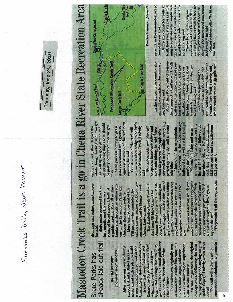
On June 24, 2010, the Fairbanks Daily News Miner published an article noting that “after receiving overwhelming support,Alaska State Parks is going ahead with a plan to build a new non-motorized trail in the Chena River State Recreation Area.” The article described the work done in June by RTCA trail specialists and Chena River State Recreation Area trail crews tolayout and flag a conceptual trail corridor.
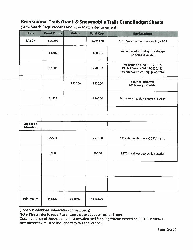
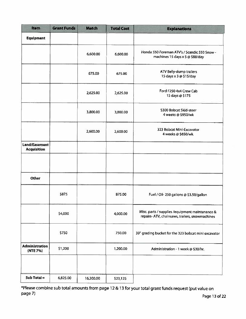
In December of 2010 the Northern Area of Alaska State Parks applied for a Recreational Trail Grant to clear 10.5 miles oftrail corridor 6' wide and reshoot the grade and reflag the critical edge in preparation for mechanical construction. The granthardens the first 1,117' of trail. The next section of trail (2,160')will be ditched and elevated and capped with 108 yards ofgravel. This grant request was the second highest scoring grant in the diversified catagory.
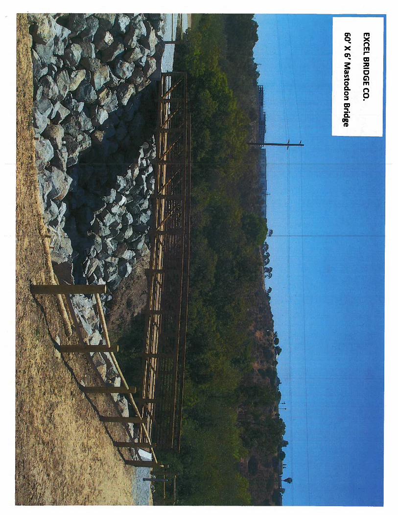
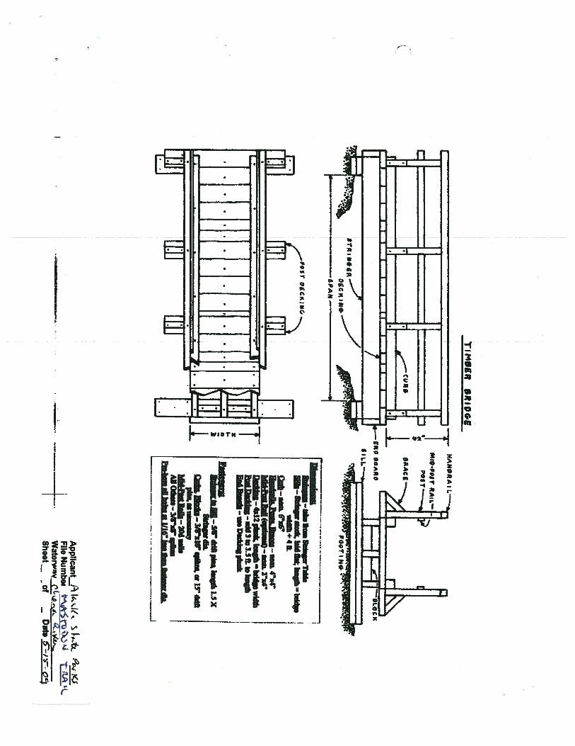
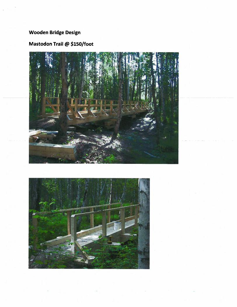
This capital project will finish the Mastodon Trail and includes purchasing and installation of four trail bridges.
Project Timeline:Permitting: April / June 2011Trail Hardening Phase I: July / Aug. 2011Trail Clearing Sept.2011 / May 2012Contracting Jan. / April 2012Final Grading / Flagging June 2012Contract for final phase construction July 2012Finish work / clean-up July / Sept. 2013
Entity Responsible for the Ongoing Operation and Maintenance of this Project:State of Alaska, Division of Park and Outdoor Recreation
Grant Recipient Contact Information:Name: Brooks LudwigTitle: Park SuperintendentAddress: 3700 Airport Way
Fairbanks, Alaska 99709Phone Number: (907)451-2698Email: [email protected]
Has this project been through a public review process at the local level and is it a community priority? X Yes No
For use by Co-chair Staff Only:
Page 3
Contact Name: Jacob MillerContact Number: 465-4976
10:25 AM 5/27/2011


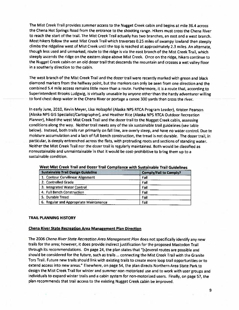
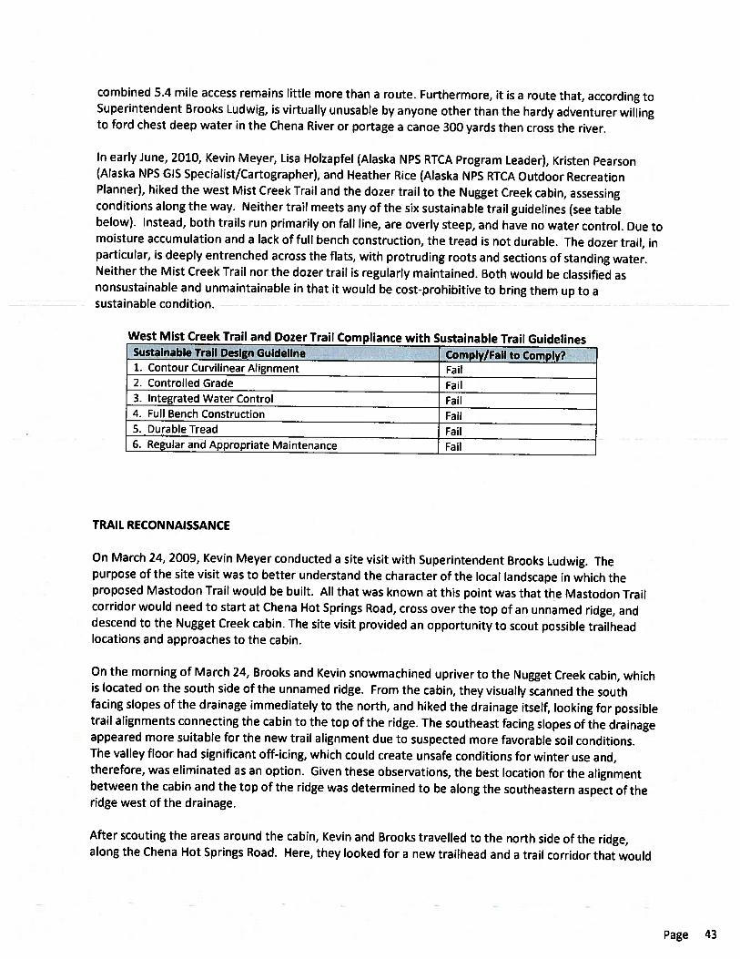
0 0.5 1 1.50.25 Miles
0 4,000 8,000 12,0002,000 Feet
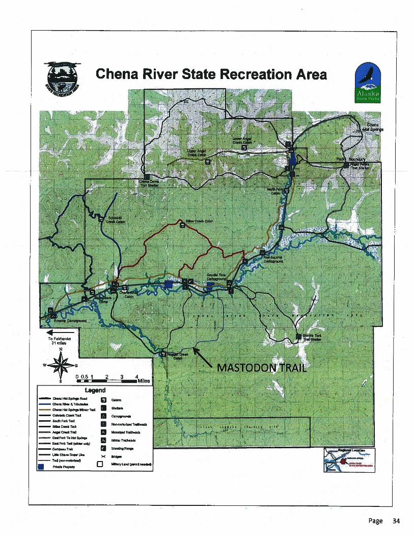
Mastodon Creek TrailChena State Recreation Area
Proposed layout provided by:National Park ServiceRivers, Trails, & Conservation Assistance
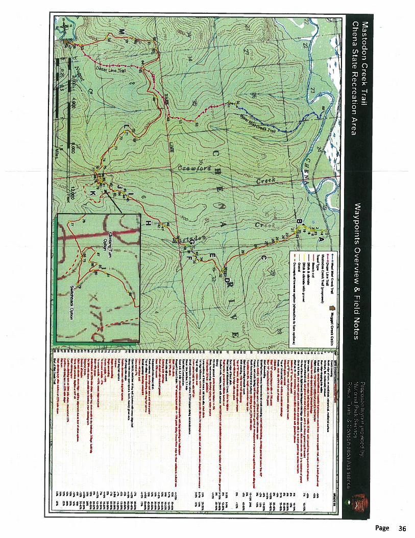
Waypoints Overview & Field Notes
88
878685
82
81
80
7978
77
76
Switchback Option
Climbing TurnOption
A
M L
K
JI
H
G F
ED
C
B
West Mist
Cree
k Trai
l
Doze
r Line
Trail
13
19
32
16
417
1518
14
2120 22
29
28
2726
2524
23
3032
34
31
33
38
3710
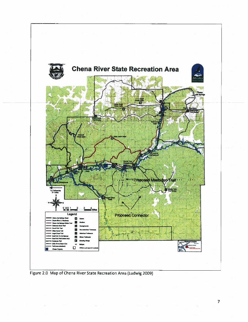
3635
43
4241
40
39
4584
44
8283
81
777980
7886
7685
8788
7273
74 75
7170 69
68
53
66
6564
636261
60
59
58
5756
5554
52
51
50
89
West Mist Creek TrailDozer Line Trail
Mastodon Creek Trail (proposed)Tread Type
Bench cutDitch & elevateDitch & elevate with gravelGravelConceptual traverse option (alternative to turn options)
Nugget Creek CabinWP SITE CONDITIONS/PRESCRIPTION GRADE SS2 Creek crossing3 North edge of burn, on small knob; mineral soil, mottled at surface4 Hot burn, flat, moderately drained10 Burn ridge dropping into valley13 Road edge; develop trailhead; meander trail between aspen trees; remove organic mat; add 1- to 2-inch gravel cap <5%14 Slight swale; may require additional gravel to trail harden <5%15 Develop ford with approximately 24-foot bridge 16 Wet swale; cross to burn edge; trail harden to cross swale; 25 feet; extra gravel may be required to trail harden <5%17 On burn-mineral soil; end gravel and start full bench; add 2- to 4-inch gravel cap if needed 7% 10-15%18 On top of low rib; light burned; flat-topped mini ridge with tussocks; ditch and elevate with 2- to 4-inches of gravel 19 On to hot burn; pack veg mat; gravel; start ditch and elevate with 2- to 4-inch gravel cap across hot burn20 Start up rib; start benching; may need ditch and elevate with gravel in places 8% 10-15%21 Bottom of "S" turns; drain point 8% 15%22 Top of "S" turns; start bench cut across slope to south 8% 30-35%23 Midpoint grade reversal 8% 35-40%24 Top of 1st ascent; stay +8-9% to avoid wet drainage 8+% 35-40%25 Swale; drain dip (-5% in & out of drain) -5%26 Climb 8% 8% 35-40%27 Start "W" shaped layout with +/- 5% grade +/-5% 35-40%28 Start "W" shaped layout with +/- 3% grade +/-3%29 Start descending -8% 15-20%30 Entering heavy mossy hummocks at creek crossing; start trail hardening, develop gravel pit before this WP -3% 10%31 Creek; install a ~22-foot bridge and a ~25-foot bridge with center span 3% 10%
Frozen, wet north facing; trail harden with gravel from gravel pit development or bench cut spoil from further along trail 32 North face but gravel at surface; climbing turn on 20% side slope 10-12% 20%
Transition into 8%; tough construction near turn 8%33 Start descending towards creek -8% 40-50%34 Wet crossing; may need trail hardening35 Top of "S" turns; ditch and elevate option begins 8% <15%36 Install ~56-foot bridge with two piers
East edge of flood plain37 West bank of Mastodon Creek; drive for hillside 0-3% 0-3%
Trail harden; gravel from hillside bench cut 8% 12-25%38 Excellent soils; tundra, birch with spruce; start full bench cut; potential camp/cabin site upslope of WP 38 on drier ground 8-10% 25-40%39 Mossy 9% 30-40%40 On drier ground; grade break for hikers +/- 3% +/-3%41 Seep, wet crossing; develop spring as water source
Trail harden 25 feet - geoblock 42 Long sections of thick moss, old burn site; start climb 10% 20-30%43 1st ridge influence; work to cross over; provide ditches for drainage or ditch and elevate across ridgetop as necessary 5-7% 10%44 Top of ridge; cross over 3-5% 10%45 Cross game trail; tie in with WP 8450 Small campsite on ridge where RTCA stayed during reconnaissance51 Dozer Line junction; 3.1 mile52 East Mist Creek junction53 Good soil, 4.2 mile; possible construction campsite with big clearing for helicopter54 Nugget Creek Cabin; "W" shaped layout with +/- 10% grade along Chena River edge to clear wetland & cultural site +/-10%55 Start 15% climb 15% 30-40%56 End 15% climb 5-7% 12-15%57 Start side hill ascent 10% 15-20%58 Entering side drainage 10% 30-40%59 Rest stretch with reduced grades +/-5% 30-40%60 Start 10% ascent 10% 30-40%61 Steepened side slope; birch 10% 40-50%62 Rock outcrop; develop rest area and view point 10% 40-50%63 Top of valley; heavy clearing with dog hair spruce +/-5% 50-60%64 Small opening; develop viewpoint +/-5% 15%65 Cross old dozer trail66 Descend at 7% -7% 30-50%68 Open birch; stretches of dog hair; junction with cross ridge trail +/-5% 30-40%69 Steep side slope; open spruce, birch, mossy; great vista +/-5% 50-60%70 Off steep side slope -5% 40-50%
Grades decrease with dog hair spruce -5% 15-20%71 End dog hair spruce -7% 15-20%72 Contour 3-5% 20-30%73 Begin descending -7% 20-30%74 Begin ascending 5% 20-30%75 Across saddle, +/-5% +/-5% 15-20%76 To access saddle, +7% 7% 15-20%77 To cross saddle, +/-5%; cross ridge foot trail +/-5% 12-15%78 Start +8% grade 8% 20-32%79 Switchback on 50% side slope; upper leg; drain south to dry drainage; 3 flags; build big 10% 40-50%80 On 26% side slope; possible turn location; start climbing turn 10% 26%81 Traverse knobs +/-5% 20-30%82 Decend off knobs -10% 30-40%83 Ditch and elevate; down ridge - fall line alignment due to lack of other options -5% 10%84 Tie-in with previous flagline at WP 45 -10% 10%80 Start climbing turn 10% 30%85 Cut-thru climbing turn on 26% side slope; descend at 10% 10% 26%86 Cut-thru climbing turn on 22% side slope 10% 22%87 Flat turn 10%88 Start climbing turn after cut-thru on 22% side slope 10% 22%89 Start of Mist Creek Trail