
nearmap for construction and engineering brochure
3
Transform the way you plan, manage and monitor projects by seeing what’s on the ground now and over time in spectacular detail NEARMAP FOR CONSTRUCTION AND ENGINEERING High Resolution Imagery Frequently Updated Our unique technology allows us to frequently capture over 85% of Australia’s population in both metro and regional urban areas - and deliver high resolution geo-referenced imagery and data straight to your browser.
-
Upload
kieran-ella -
Category
Documents
-
view
90 -
download
1
Transcript of nearmap for construction and engineering brochure

Transform the way you plan, manage and monitor projects by seeing what’son the ground now and over time in spectacular detail
NEARMAP FOR CONSTRUCTION AND ENGINEERING
High Resolution Imagery Frequently Updated
Our unique technology allows us to frequently capture over 85% of Australia’s population in both metro and regional urban areas - and deliver high resolution geo-referenced imagery and data straight to your browser.
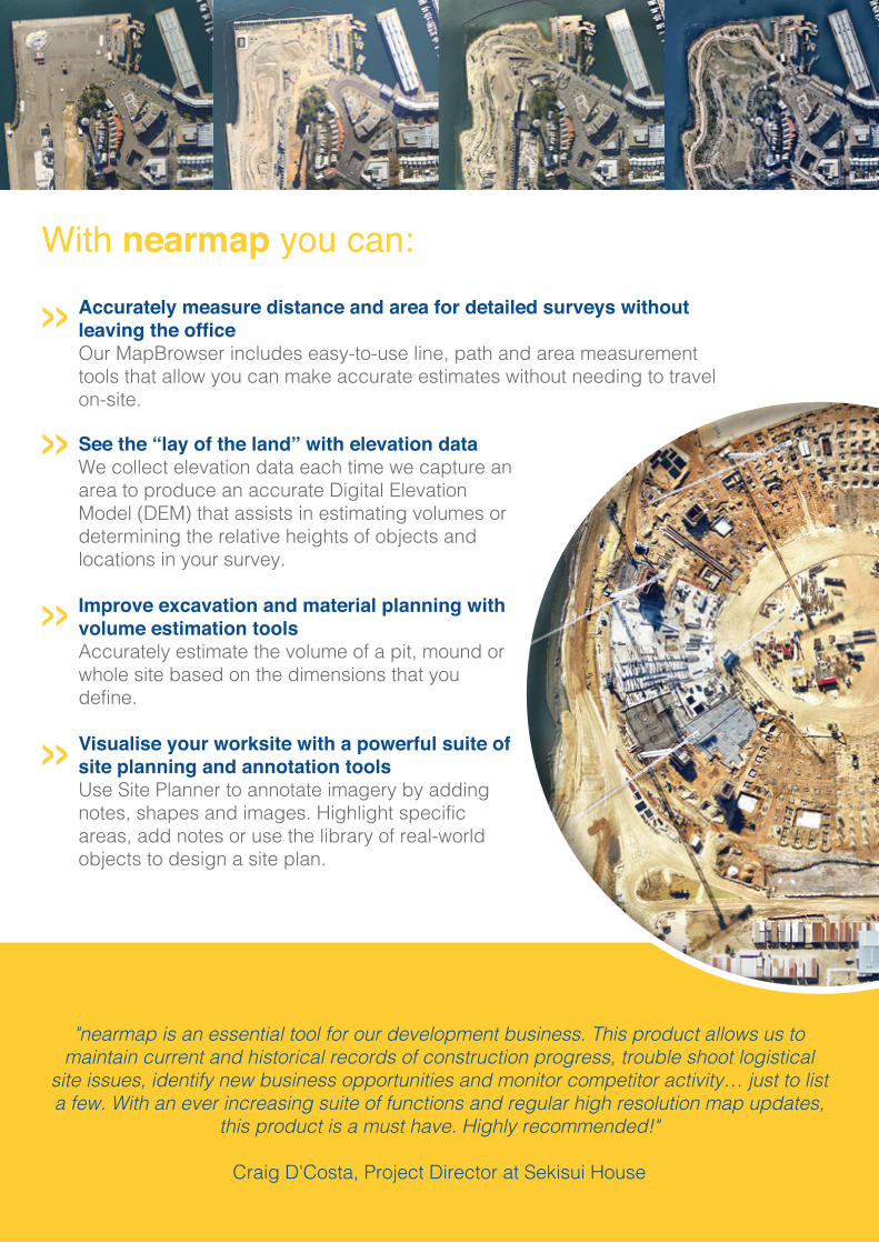
"nearmap is an essential tool for our development business. This product allows us to maintain current and historical records of construction progress, trouble shoot logistical
site issues, identify new business opportunities and monitor competitor activity… just to list a few. With an ever increasing suite of functions and regular high resolution map updates,
this product is a must have. Highly recommended!"
Craig D'Costa, Project Director at Sekisui House
With nearmap you can:Accurately measure distance and area for detailed surveys without leaving the officeOur MapBrowser includes easy-to-use line, path and area measurement tools that allow you can make accurate estimates without needing to travel on-site.
See the “lay of the land” with elevation dataWe collect elevation data each time we capture an area to produce an accurate Digital Elevation Model (DEM) that assists in estimating volumes or determining the relative heights of objects and locations in your survey.
Improve excavation and material planning with volume estimation toolsAccurately estimate the volume of a pit, mound or whole site based on the dimensions that you define.
Visualise your worksite with a powerful suite of site planning and annotation toolsUse Site Planner to annotate imagery by adding notes, shapes and images. Highlight specific areas, add notes or use the library of real-world objects to design a site plan.
»»
»
»

Integrate with your CAD or GIS applications for improved workflowUtilise nearmap imagery within your own applications through support for standard protocols WMS, TMS, WMTS and KML as well as our Web Services API. Static and dynamic imagery can also be consumed by CAD & GIS applications including ARCGIS, AutoCAD & BricsCAD.
Enhance your insights with your own spatial dataOverlay your own data onto nearmap imagery with simple KML or KMZ file uploads.
Utilise nearmap’s property and demographic data to understand the wider impact of your projectsFind areas of interest then drill down to detailed, property-specific information including sales and listing history. Integrated demographic data from the Australian Bureau of Statistics provides insights into the population of the location you are viewing.
Model the impact of shadowing and floodingThe accuracy of our elevation data means you can simulate the effects of shadows at any time of the year and create flood scenarios based on any water depth above sea level.
“we love nearmap, it is a fantastic tool for us to check out sites anywhere in metro areas
Australia wide – a typical project maybe 4 to 5 hours’ drive away
and nearmap saves us having to travel there to measure the site
square metre area for calculating rain intensity or
distance to the nearest stormwater discharge point –
our clients also love it when we come back so quickly, rather
than waiting days or weeks for us to travel to site.”
John Lovett, Operations Manager
at Spel Environmental - Integrated Water Solutions
Contact us to find out more on how nearmap can give you that extra edge!
1800 632 762au.nearmap.com/construction
»
»»
»


