'Ne-saw-je-won' as the Ottawas say : a tale of the waters...
90
cop.<^ NE-SAW-IE-WON A TALE OF .R'f^ATERS THAT RUN DOWN FROM LAKE SUPERIOR TO THE SEA HELEN M. MARTIN
-
Upload
trinhnguyet -
Category
Documents
-
view
213 -
download
0
Transcript of 'Ne-saw-je-won' as the Ottawas say : a tale of the waters...
cop.<^
NE-SAW-IE-WON
A TALE OF
.R'f^ATERS THAT RUN DOWNFROM LAKE SUPERIOR TO THE SEA
HELEN M. MARTIN

it

GREAT LAKESREGION

LIBRARY OF THEUNIVERSITY OF ILLINOIS
AT URBANA-CHAMPAIGNIN MEMORY OF
STEWART S. HOWEJOURNALISM CLASS OF 1928
STEWART S. HOWE FOUNDATION
551.31M364ncop. ?.
I .H.S.

NE-SAW-JE-WON

SPECIAL EDITION
For Private Distribution
Copyright, 1939, by
M. D. Harbaugh
Printed in the United States of America by
The William Feather Company
Cleveland, Ohio

as the Ottawas say
A Tale of
THE WATERS THAT RUN DOWNFROM LAKE SUPERIOR TO THE SEA
by
HELEN M. MARTIN

To Dr. Frank Leverett and to the NLemory of
Mr. Frank B. Taylor:
Through nearly half a century Dr. Leverett and Mr. Taylor
explored and deciphered the records made by the continental
glaciers during the Ice Age. Front their studies was revealed
the fascinating history of the Great Lakes. They travelled,
mainly on foot, thousands of miles along the glacial moraines
and over the beaches, shores and beds of the ancient lakes,
measuring, recording and mapping as they went. They em-
bodied their observations and conclusions in many scientific
publications. Their ivork and their lives have been an inspira-
tion to other geologists who have folloived their footsteps and
to many students ivho absorbed, in their lecture halls, the
interesting story of glaciation. Much of this tale—NE-SAW-JE-WON, of ^^the waters that run down from Lake Superior
to the sea''—is draivn from their classic volume, ''The
Pleistocene of Michigan and Indiana and the History of the
Great Lakes'' and from Dr. Leverett's ''Moraines and Shore
Lines of the Lake Superior Region"—publications of the
United States Geological Survey.

^ //n. rOREWORD^ <P
THE Story of the Great Lakes, familiar to geologists the world
over, is so romantic that it should be known to all who find
pleasure in understanding natural environment and the man-
ner of its development. The story should have a strong appeal to
all who know and love the broad waters of the Great Lakes and the
picturesque beauty of their shores.
Several years ago a group of business men, accustomed to a mid-
summer trip together on a lake freighter, each day afloat gathered to
discuss subjects of mutual interest. One of them, a geologist, con-
tributed a series of informal talks on the Geology of the Great
Lakes Region and the History of the Lakes, drawing illustrations
from the rocks and shore features that could be observed from the
ship. So much interest was aroused by these discussions that eventu-
ally it was planned to have the story written in brief, popular form,
with the necessary maps and illustrations, so that it could be read at
leisure and retained as a memento of such voyages.
Years passed without any action being taken on this idea, until
in the fall of 193 8, Miss Helen M. Martin, geologist, associated with
the Michigan Geological Survey, was engaged to prepare the manu-script. As she is intimately familiar with the geology of the lakes
region and is a former student of Dr. Frank Leverett (who, with
the late Frank B. Taylor, is mainly responsible for what is knownof the origin and development of the Great Lakes), Miss Martin is
especially qualified for this undertaking. In the spring of 1939,
her manuscript, sketch maps and photographs were turned over to
Mr. M. D. Harbaugh, who has done the editorial work, prepared
final drawings, and designed and directed the publication.
For this little volume, the reader is indebted to Pickands, Mather
and Company, The M. A. Hanna Company, The Cleveland-Cliffs
Iron Company, and Oglcbay, Norton & Company. They join with
others who have had a part in giving form to the idea that initiated
this booklet, in hoping that NE-SAW-JE-WON will be found
interesting and instructive.
M. D. llavbangh
Hanna Building
Cleveland, Ohio
July, 19)9


NE-SAW-JE-WON
CONTENTSPage
Sketch of the Story 9
Setting for the Ice-Age Drama—The Rock Formations andPre-Glacial History of the Great Lakes Region 11
The Glacial Period and its Records 20
The Records Made by Rivers and Lakes 28
Lake Maumee—the First of the Glacial Lakes 33
Early Lake Chicago; Lake Jean Nicolet 34
The Second Stage of Lake Maumee 37
The Third Stage of Lake Maumee 38
Lake Saginaw 39
Lake Chicago 41
Lake Arkona 41
Expanding Lake Chicago 43
Restored Lake Saginaw; Lake Newberry 43
Lake Whittlesey 44
Lake Wayne 45
Early Lakes of the Superior Basin 46
Lake Warren 47
Lake Duluth 47
Lake Elkton 49
Early Lake Algonquin; Lake Tonawanda 53
Niagara River and the Birth of the Falls; Beginning ofIndependent Lake Erie 5 5
The Second Stage of Lake Algonquin; Lake Iroquois;
Lake Erie 57
Crustal Movements of the Earth 59
More Work of Niagara River 62
The Records of Algonquin Time 63
The Nipissing Great Lakes 69
The Modern Great Lakes 78
The Story Unfinished 81

CONTENTS
Figure
Figure
Figure
Figure
Figure
Figure
Figure
Figure
Figure
Figure
Figure
Figure
Figure
Figure
Figure
Figure
PlatePlatePlate
PlatePlatePlatePlatePlatePlatePlatePlate
PlatePlatePlatePlate
MapsPage
Regional Map of the Great Lakes
1.
—
Geological Map of the Great Lakes Region 12
2.
—
Glacial Map of North America 20
3.
—
Glacial Map of the Great Lakes Region 22
4.
—
First of the Glacial Lakes—Maumee and Chicago 32
5.
—
Glacial Lakes Maumee, Saginaw, Chicago, andJean Nicolet 36
6.
—
Diagram Showing Water Levels of the VariousStages of Lakes in the Erie Basin 38
7.
—
Glacial Lakes Arkona and Chicago 40
8.
—
Glacial Lakes Whittlesey, Saginaw, Chicago,AND Newberry 42
9.
—
Glacial Lakes Warren, Chicago, and Duluth 48
10.
—
Glacial Lakes Elkton (formerly Lundy),SiMcoE, Chicago, and Duluth 50
11.
—
Glacial Lakes Duluth, Chicago and earlyAlgonquin; Independent Lake Erie 52
12.
—
Diagram of Niagara River Gorge 54
13.
—
Glacial Lakes Algonquin and Iroquois; Lake Erie 56
14.
—
Glacial Lakes Algonquin and Iroquois; Lake Erie 60
15.
—
Final Stage of Glacial Lake Algonquin; LakeErie and Lake Iroquois 68
16.
—
Nipissing Great Lakes, Lake Erie and Lake Ontario 70
Photographs
1.
—
"Pictured Rocks" Rampart of Cambrian Sandstone 15
2.
—
Falls of Tahquamenon River 16
3.
—
Beach on Mackinac Island 30
4.
—
Arch Rock, Mackinac Island 64
5.
—
Sugar Loaf Rock, Mackinac Island 65
6.
—
Pointe Aux Barques, Sea Caves and Arches 66
7.—Castle Rock, St. Ignace, Michigan 71
8.
—
The "Fortress" of the Pictured Rocks 72
9.
—
Cliff and Sea Cave 72
10.
—
Stacks and Sea Caves 73
11.
—
Chapel Rock 74
12.—Wave-Cut Cliffs 74
13.
—
Miner's Castle 75
14.
—
Grand Marais Dunes 76
15.
—
Nla-Gara Falls 80

NE-SAW-JE-WON
Sketch of the Story
A BOUT a million years ago, when in far-off Java Pithe-
/-\ canthropus Erectus, the Ape-man, was fumbling his
-^ -*- way to the man species, a river system occupied the
Great Lakes region, flowing from the highlands of eastern
Canada probably to the Gulf of Mexico. But about that time
glaciers, which developed far north in the Hudson Bay region,
started to move southward and eventually erased or buried
much of the record of that river. Half a million years later
the Peiping man, Sinanthropus, was buried in the limestone
caves of China, and in North America the continental ice
sheet reached as far south as Kansas. Then during a time of
genial climates the ice front retreated, and perhaps the ice
melted almost entirely from the region which is now the
United States. Vegetation followed the northward movementof the ice front, and a rich soil was developed over the glaciat-
ed region of North America. In Europe the Heidelburg and
Piltdown men made their appearance, but we have no evi-
dence as yet that man had arrived on this continent. Thensome 150,000 to 200,000 years ago, when the Neanderthal
man was living before the ice front in Europe, the ice re-
advanced in North America. It covered the Great Lakes
region and moved as far south as southern Illinois near Cairo,
to a point ten miles south of the Ohio River near Cincinnati,
and to Beaver Falls in western Pennsylvania. North Americabecame the most icebound of continents. In the centers of
accumulation about the Hudson Bay region the ice is esti-
mated to have been from three to six miles in thickness.
Thirty-five thousand years ago, when the Cro-Magnon—the first of modern men—were hunting the mastodon in
southern Europe and drawing rude pictures of their kill on

NE-SAW-JE-WON
the walls of their cave homes in southern France, the North
American ice sheet again had melted back some hundreds of
miles ; in northwestern Ohio pools of water gathered along its
front, and the Great Lakes had their beginning.
When the Folsum-Yuma men were hunting bison on our
western plains, twenty thousand years ago, the glacier melted
away from the ledge of limestone at Lewiston, New York,
on the Niagara River, and Niagara Falls was born. Ten thou-
sand years later, when our present civilization was dawning in
the Near East, the ice had melted entirely from the Great
Lakes basins; only a small lake in the Erie basin spilled
over Niagara Falls, and the three upper lakes poured their
waters in a wide torrent through the Ottawa River valley,
in Canada, into the Atlantic Ocean which by then had entered
and drowned the Gulf of St. Lawrence as far west as the
vicinity of Ottawa, Ontario. Some three thousand years
ago—perhaps about the time the camel caravans of King
Solomon were bringing copper ores to the smelters of the
great king at Exion-Geber and his argosies were sailing the
Red Sea, when the glamorous Queen of Sheba brought gold
and spices to the ruler of Judeah, when the people of Central
and South America were building great pyramid temples to
the Sun-God—a sluggish river crossing the flat lands nowcovered by Lake St. Clair was quickened by flooding waters,
as the three upper great lakes deserted their eastern outlet
through Ontario and poured their waters southward through
the St. Clair and Detroit rivers, and the present Great Lakes
system was established.
This is no fantastic tale of idle dreaming; it is a sketch of
events in the Story of the Great Lakes—a romance of Nature's
slow, gradual change of the face of the continent, an Auto-
graph of Time which the lakes themselves in main part have
written—the Story of "NE-SAW-JE-WON," as the Ottawas
say, meaning The Waters That Run Down From Lake
Superior To The Sea.
10

SETTING FOR lliL ICE-AGE DRAMA
THE SroRY oi THE GrlA I Laki£S is largely a story of the
Ice Age in North America, a period geologically recent,
which began only about a million years ago. But the
events of the preceding eons of geologic time—hundreds of
millions of years—when the forces of Nature were warring
over the tasks of building, tearing down and rebuilding the
rock formations of the continent, all played parts in prepar-
ing the stage for the drama of the ice invasion.
The Rock Formations and Pre-Glacial History
OF THE Great Lakes Region
In the days when the Earth was young and turbulent, the
Great Lakes region was the basin-shaped floor of the sea
bordering a shield-shaped mass of igneous rock lying to the
north—the initial North American continent. Several times
in the eons that passed, as the Earth settled down and the
continents became stable, the borders of this land were up-
lifted to mountain height, only to be worn down almost to sea
level during long periods of quiescence. Finally a great con-
vulsive, though slow, earth movement lifted to Alpine heights
a mountain range extending from Minnesota and Wisconsin,
in a northward-bearing arc, to the Laurentian Highland in
Canada and the Adirondacks in New York. The several
uplifts, whether slow or violent, changed the rocks so that the
borders of the continent came to be a region of igneous and
metamorphic rocks—granites, gneisses, schists, lavas, slates,
and bedded rocks which were crumpled and folded. In the
west these mountains have long since been worn away almost
to their roots, leaving only rugged uplands in the highlands
surrounding Lake Superior.
When earth forces brought uplifts of this vast area, they
were accompanied by local downwarps or flutings of the sur-
11

oouiOo
cS S Q (/) O O ol
HH '^
M '^
12

ROCK FORMATIONS AND PRE-GLACIAL HISTORY
face. One of these depressions, produced late in this early
history, in time became the elongated curved basin of Lake
Superior. Another much older depression, centering in the
Southern Peninsula of Michigan and there more or less circu-
lar in shape, extended eastward in a rising scoop-like trough
to east-central New York. This depression became the basin
in which later invading seas deposited a great series of layered
formations, one above another, made of the sediments weath-
ered and eroded from the ancient rocks of the adjacent
uplands. Slow earth movements caused sea after sea to enter
and withdraw or be spilled from this basin, each sea being
smaller than and within the boundaries of its predecessor, and
each leaving layers of accumulated sedimentary material to be
buried—in the central area of the basin—by the deposits of its
successor. These sediments were compressed and hardened into
rock—sandstones, limestones, shales, rock salt and gypsum.Coal beds, formed from the abundant vegetation which grewin the marshes associated with the later seas, were inter-bedded
with the upper rock formations.
With the withdrawal of the last sea the land was elevated,
and a long period of weathering and erosion followed. Thehighest portions of the bedded rocks around the rim of the
scoop-like basin wore away first, bevelling the edges of the
basinward-sloping rocks but not disturbing the lower portions
in the interior of the depression. Thus developed a series of
gigantic "rock bowls"—one within another—occupying the
basin. They are like a great nest of mixing bowls with lips to
the east. Some of the rock layers are hard and resistant to
weathering, others are soft and easily eroded; hence in time
the once-beveled edges of the resistant sandstones, limestones
and dolomites came to have the general appearance of a series
of parallel, concentric, stone "ramparts" with steep outward-facing exposures and gentle inner slopes toward the basin.
These are separated by the depressions worn in the softer,
less resistant layers—the shales, salt and gypsum beds. Where
13

NE-SAW-JE-WON
these soft beds are deeply carved and gouged out along their
exposures they may be likened to "moats" between the ram-
parts of harder rock.
Without going into detailed descriptions of each set of rock
bowls, let us rather consider their relation to the development
of the basins of the Great Lakes. As flowers, trees and people
have distinctive family names, so names have developed to
designate the rock formations. English geologists first studied
the sedimentary rocks in England and Wales, and the names
given the formations there have now been applied all over the
world to rocks which have the same relative positions and are
similar in character and in the life records or fossils contained
in them. The lowest and oldest of the sedimentary rocks
known to the early geologists were named Cambrian, from
Cambria in Wales where they were first studied. For con-
venience, all the older igneous and metamorphic rocks are
grouped as pre-Cambrian. Above the Cambrian, in parts of
North America but not in Europe, is the Ozarkian, namedfrom the Ozark Mountains; the next set of higher and younger
rocks is the Ordovician, named from an ancient tribe of
Wales; over the Ordovician rocks are the Silurian, also named
from an ancient tribe of Britons that lived in Wales; then
come the Devonian, commemorating Devon in England; and
above these are the Carboniferous rocks—the Mississippian
and the overlying Pennsylvanian. (Figure 1.)
Insofar as the Great Lakes are concerned, the important
facts about the rocks are their arrangement and position and
their different degrees of hardness. The pre-Cambrian rocks,
which are hard and resistant to weathering, are downwarped
to form the basin of Lake Superior. The Cambrian is a very
resistant, coarse sandstone underlying the Ozarkian sandy
dolomite, dolomitic sandstone, and dolomite. The thin edge
of the Cambrian or Lake Superior sandstone, which once
rested upon the pre-Cambrian rocks, has been weathered away
until now its northern edge stands as the outer rampart of red,
14

ROCK FORMATIONS AND PRE-GLACIAL HISTORY
Photo by Michigan Deparlmcnt of Comervation
PLATE 1.—"PICTURED ROCKS" RAMPART OF CAMBRIANSANDSTONE
SOUTH SHORE OF LAKE SUPERIOR; NIPISSING AND MODERN LAKES.
gray and white sandstone, rising majestically two hundred
feet above Lake Superior, facing the moat of the Superior
basin. It is the most battlcmented of all the ramparts, and on
it Nature has painted her "Pictured Rocks" and carved archi-
tectural designs that delight and awe the beholder. We can
follow this Cambrian rampart from Sault Stc. Marie to the
eastern half of the Keweenaw Peninsula,''" and from east of
Marquette we can trace it southward into south-central
"Wisconsin, where it swings westward around the old, igneous
land-mass of central Wisconsin. Short streams entering Lake
Superior from the south leap over the edges of the sandstone
*The sandstone in the basin of Keweenaw Bay, which forms tlie rampart alonj; its shore
and east nearly to Marquette, may be of pre-Cambrian age. (Editor.)
H

NE-SAW-JE-WON
photo by Michigan Department of Conservation
PLATE 2.—FALLS OF TAHQUAMENON RIVERLARGEST FALLS WEST OF NIAGARA 300 FEET WIDE, FALLING OVER A
LEDGE OF CAMBRIAN SANDSTONE.
into Lake Superior or reach the lake in cascading beauty of
misty falls over the fortressed cliffs. The tranquil 300-feet-
wide Tahquamenon River falls in majestic grandeur over
ledges of red-brown sandstone at the Upper Falls, rushes
through a gorge it has cut in the rock to the ledges of the
Lower Falls, and then winds again tranquilly on to the lake.
Other streams have cut short gorges in the sandstone, but the
positions of their falls near the lake are maintained and de-
struction of the falls is prevented by the layer of resistant
Hermansville (Ozarkian) limestone, which is the rim of the
next inner rock bowl.
Above and within the white, sandy Ozarkian dolomites and
limestones were deposited the lime muds which became the
hard, resistant limestones of the early Ordovician—the Black
16

ROCK FORMATIONS AND PRL-GLACIAL HISTORY
River and Trenton limestones. The Menominee and White-
fish rivers cascade over the nortliern edges of these southward-
sloping rocks to reach Green Bay and Lake Michigan. Whenthe limestone-making sea became shallower, fine muds were
deposited, and through countless ages these also hardened to
rock—a soft shale. When exposed at the surface the shale did
not resist weathering but gradually was worn away to form
the moat behind the Cambrian-Ozarkian-early Ordovician
sandstone and limestone rampart. Today we find parts of that
moat occupied by Green Bay of Lake Michigan, by North
Channel and Georgian Bay of Lake Huron, and by the Lake
Ontario basin in the eastward extension of the Ordovician
rocks.
Following the time when the muddy seas of the late
Ordovician deposited muds that became the soft shales under-
lying the Green Bay-Georgian Bay-Ontario moat, came the
Silurian time of genial climates when in the warm clear seas
life was abundant. Shelled creatures of many kinds swam the
seas or crawled upon their floors, and corals and bryozoans
built great reefs. The shelled creatures and corals died, shells
and reefs w^ere broken and buried in lime mud, and through
long ages the muds hardened to limestone filled with the petri-
fied remains of a life long past. So hard and resistant to
weathering is this rock that it formed the next great encircling
rampart. This limestone is named Niagaran, because of its ex-
posure along Niagara River—particularly at the brink of Ni-
agara Falls. From western New York south of Lake Ontario,
the Niagaran limestone rampart extends northwesterly across
Ontario in a broad arc separating Georgian Bay from Lake
Huron, rises to the surface as Manitoulin and Drummondislands, continues across the eastern half and forms the south
shore of the Northern Peninsula of Michigan (excepting St.
Ignace Peninsula) , then circles southward between Green Bay
and Lake Michigan along the Lake Michigan shore of Wiscon-
sin to the southern end of Lake Michigan, where it forms the
17

NE-SAW-JE-WON
sill holding the waters of the lake in the basin. Where the
shales which underlie it are cut away, the Niagaran rampart
stands in places like a cornice, rather than with the fortress-
like character of the Cambrian sandstones ; but it is sufficiently
impregnable to have played a most important part in the
development of the lakes. The close of Silurian time was
marked by dry climates and by a shrinking sea from which
life almost departed and which left enormously thick beds of
salt and thinner beds of gypsum.
Then came a return of more genial climates, and a warmsea—the Devonian—entered the lake region and left thick
sediments in the deep basin of the Michigan area. A part of
the Devonian record is in the limestone which makes the
rampart along the northern rim of the Southern Peninsula
of Michigan from the Traverse Bay area to Alpena, which is
submerged under Lake Huron, crosses Ontario and swings
back again into southeastern Michigan, northern Ohio and
Indiana, and which forms the western bowl in which the
thick soft shales of the late Devonian and early Mississippian
were deposited. These soft shales, together with the shales and
salt beds of the late Silurian, in time were carved out to formthe moat back of the Niagaran rampart, and in them the
channels of great rivers were cut—rivers which carved valleys
now filled by Lakes Michigan, Huron and Erie.
Above the thick shales of the lower Mississippian is a hard
sandstone overlain by limestone and gypsum beds. Parts of
the sandstone and limestone rims come to the surface near
Holland, Michigan, and also along the shore of Lake Huron—around the "Thumb" of Michigan and along the opposite
shore of Saginaw Bay. The southern rims of these Mississip-
pian sandstone and limestone bowls are near the surface along
an arc extending from the Thumb through south-central
Michigan to Holland, and although inland, they played their
parts in the lake history.
Within the Mississippian bowl in Michigan is the set of

ROCK FORMATIONS AND PRE-GLACIAL HISTORY
Pennsylvanian sandstones, shales and coal beds. These had
little to do with the story of the Great Lakes, except that a bit
of their eastern rim was cut into to form the southwestern end
of Saginaw Bay.
After Pennsylvanian time no seas entered the immediate
area of the Great Lakes, and for many millions of years Na-ture was busy cutting, carving and wearing away the rocks
laid down in the region. The soft shales and salt beds were
eroded to form the wide moats, or trenches, between the more
resistant formations which made the escarpments, evidences
of the channels by which the seas had entered the region were
obliterated, and a thick soil cover was developed. However,
Nature was very busy building up the rest of the continent
of North America—folding the Appalachians to mountain
height, wearing them down to almost a plain, then lifting
them again in a wide plateau which since has been carved to
the Appalachian Mountains as we know them now. The Great
Plains were built up, the Sierras and then the Rockies uplifted,
and the mountains of the ancient pre-Cambrian area about
Lake Superior were worn down. In the entire lake region wehave no rock records of this time—known as the Mesozoic
and Cenozoic eras, yet we know that with the general uplift
of the continent this region was lifted much higher above
sea level than it now stands.
The force that lowered the northern part of the continent
and changed the ancient river valleys to lake basins started
its work about a million years ago when a climatic change
took place. The winters became not so much colder, but
longer—so long that the snows of one winter were not melted
by the summer sun before another winter set in. This time
period we know as the Pleistocene, the age of the great con-
tinental glaciers which build the final rock record in the Great
Lakes region. It ended when the ice had melted to the small
remnants of the Greenland ice cap. Geological formations
now in the making arc known as Recent.
19

NE-SAW-JE-WON
FIGURE 2.—GLACIAL MAP OF NORTH AMERICASHOWING THE MAXIMUM EXTENT OF THE ICE SHEETS AND THE SEVERAL
CENTERS OF ICE ACCUMULATION.From U. S. Geological Survey.
The Glacial Period and Its Records
During early Pleistocene time, in the highlands about Hud-son Bay snow accumulated throughout hundreds of years
and became packed to ice so thick that it pushed outward by
20

THE GLACIAL, IMRIOD AND ITS RKCORDS
its own weight, just as a mass of clay or dough piled on a
board spreads outward from its thick central mass. Once
started to move, tiie mass of snow-ice became a glacier, which
is estimated to have been from two to six miles thick and
which reached a maximum extent of approximately 1600
miles from its center to the Ohio Valley. Lour times during
that million years the ice advanced over and retreated from the
continent. Each advance had some effect upon the lake re-
gion, but it is only with the last advance—the so-called Wis-
consin glaciation—that we are particularly interested. This
last advance obliterated or buried much of the record of the
earlier invasions, although it did not quite reach to the Ohio
valley, as the preceding Illinoian invasion had done.
Once started, the ice moved slowly, relentlessly southward
from the Hudson Bay area. Its freezing grip clutched the
loosened rock ledges and plucked them away; it crushed and
scooped up the surface debris, absorbing boulders, sand and
clay into its mass, and slowly carried forward its load of rock
materials to deposit them far from their source. -It used peb-
bles, cobbles and boulders frozen in its base as great files, rasps
and plough points to scratch and groove the surfaces of the
bed rock over which it passed; or with fine rock and clay it
scoured and polished these surfaces and rounded and polished
the boulders and pebbles within its mass. By the scratches,
grooves and polishings on rock ledges, we know in what di-
rections the ice moved. At times this last great glacier, like
the others before it, melted faster than it pushed forward, so
that the southward movement was somewhat pulsating; but in
the main, for thousands of years it moved steadily southward,
carting along within its mass unmeasured quantities of rock
debris which it had taken from the lands to the north. Whenit reached the area of the Great Lakes, tongues of ice entered
the river valleys in the ancient rocky moats and there became
thicker and moved more rapidly. These river valleys were in
the soft shales, hence the ice gouged and furrowed them; it
21

NE-SAW-JE-WON
FIGURE 3.—GLACIAL MAP OF THE GREAT LAKES REGIONSHOWING THE DIRECTIONS OF MOVEMENT OF THE SEVERAL GLACIAL LOBES
AND THE POSITIONS OF THE ICE BORDER AT SUCCESSIVE STAGES IN THERETREAT.
From Frank Leverett and F. B. Taylor.
deepened and widened, but did not carve them to the U-shaped valleys which distinguish the action of glaciers in high
mountains. These tongues or lobes of ice in the valleys that
now are the basins of the Great Lakes acted almost as inde-
22

THH GLACIAL PERIOD AND ITS RECORDS
pendent glaciers, the ice advancing outward from their ownaxes or centers. Thus the ice in the Lake Michigan basin
moved not only southward with the general movement of
the glacier but also radially from the central axis, southwest-
ward and southeastward, toward the edges of the basin. Theice lobes in other basins had similar movements, which are
revealed in the rather complicated directions of the scratches,
also by curious features carved in the bedrock and by under-
lying deposits of earlier glaciations.
Once past the old river valleys the ice fronts again united,
and the glacier—shaped somewhat like a huge cauliflower
with its stem to the north—moved southward almost to the
Ohio River. Its extent is marked by the line of hills, knownas terminal moraine, extending irregularly eastward fromShelbyville, Illinois, to southern Ohio, thence into north-
western Pennsylvania, and from there southeastward to and
across Long Island. The advance was stopped by a slow
climatic change which caused the ice to begin a lingering,
halting retreat, marked by occasional readvances of the ice
front, but nevertheless a continuous withdrawal northward.
When the retreating ice front reached the ancient river valleys
the glacier once again assumed the tongue or lobate character
—thicker in the valleys and thinner on the uplands—each lobe
again with the characteristics of an essentially independent
glacier.
The records of the retreat are similar to the records of re-
treat of living glaciers, easily studied in the Alps and in the
high Sierras, which furnish the clues to the work of the con-
tinental ice sheet. The records are mainly in long lines of
hummocky hills—moraines—of rock debris which the ice de-
posited as it melted. When the rate of forward push of the
ice was equalled by the rate of melting at its border, the ice
front remained stationary for many—probably hundreds
—
of years, and the rock waste brought from the north settled
out of the melting ice at its edges, accumulating there like
23

NE-SAW-JE-WON
debris on a city dump. Obviously, this material is a collection
of all sorts of unrelated odds and ends of rock material fromthe varied surfaces over which the ice had passed. The melt
water sorted out some of the debris and carried it away fromthe ice front, building up deposits called outwash plains or
aprons, the coarser gravel being left near the moraines and
the finer gravel, sand and silt being carried farther away.
The moraines may be likened to entrenchments thrown upfor protection by the retreating ice in the warfare between
heat and cold. They mark the lines of halt and reinforcement,
followed by giving-way and further retreat, as the warmingclimate slowly forced the glaciers from the continent. A rapid
retreat, when the forces of heat were great and when melting
was more powerful than the forward push, caused the rock
debris to be deposited in gently undulating plains of com-mingled sand, clay and stones called till. These deposits, knownas ground moraine or till plains, are similar on a large scale to
the dusty, clayey deposit left on the surface after a persistent
winter snowbank has melted. Formation of the till plain was
stopped at each halt, as the ice built another backstep moraine.
Long roughly parallel lines of morainal hills, stretching fromPennsylvania to Illinois, mark the retreat of the Wisconsin
glaciation in the Ohio valley region. But when the ice had
retreated to the Great Lakes area the valleys of the ancient
river systems again determined the shape of its front; again
the ice assumed lobate form, the lobes acting as independent
glaciers in the Lake Michigan, the Huron-Erie and the
Superior basins. The moraines which mark the halts of
these glacial lobes are festooned about the basins in lines of
hummocky hills which roughly parallel the borders of the
present lakes. In time, as melting progressed, the lobes cameto be more completely separated, so that distinct glaciers
occupied the basins of Lake Michigan, Green Bay, Lake Erie,
Lake Huron, Saginaw Bay, and finally the Ontario basin. In
the Lake Superior region the ice probably divided into lobes
24

THE GLACIAL PLKIOD AND ITS RLCORDS
on either side of Keweenaw Peninsula. In places the moraines
of adjacent lobes were pushed together, making a jumble of
high hills such as the scenic Irish Hills of southeastern Michi-
gan and the high hills of the northern part of the Southern
Peninsula. These morainic hills, with their beautiful lakes
of ponded waters and with clear streams rushing down their
slopes, give to the glaciated region its varied and picturesque
beauty. Other parts of the country have hills carved from
the bed rock of the region, but the glaciated district, particu-
larly in Michigan, has also hills built by a plastering of rock
waste scraped off Canada, transported and dumped by the ice.
The ice in the Saginaw Bay lobe melted faster than the ice of
the Michigan and Huron-Erie lobes, because it was thin over
the rim of the Marshall (Mississippian) sandstone—one of our
old "rock bowls." Its retreat was rapid and marked by brief
halts, with the result that the moraines of that lobe are
grouped in a necklace arrangement of pendant festoons about
the bay—narrow belts of low rolling hills with broad flat
valleys (outwash plains) between, in contrast to the high
sharply-hilled moraines of the other glacial lobes. In other
states of the glaciated area and in the Northern Peninsula of
Michigan much of the bed-rock is exposed at the surface or
the drift is thin, but in the Southern Peninsula the burial
cover of glacial drift is so thick that bed-rock appears at the
surface in but few places. Hence secrets of mineral wealth in
the underlying rocks have been preserved until mechanical
ingenuity made it possible to drill through the thick cover
of drift.
High conical gravelly hills mark the sites of water falls
where streams flowing in channels or tunnels high in the ice
fell over its edge and piled their rock debris in dumps at the
foot of the falls. Such hills, known as kames, standing alone
or in groups of several on the till plain or in the terminal
moraine, may be easily recognized by their form and by their
water-sorted contents where these are exposed in excavations.
2J

NE-SAW-JE-WON
In the early-inhabited parts of the glaciated district they were
used for burial places, as generally the soil cover was thin and
their gravel content provided good drainage. In many places
they furnish gravel and sand for road building and other con-
struction. Long narrow hills that look like abandoned rail-
way embankments mark the sites of walled or tunnelled chan-
nels of streams which flowed upon, within, or under the ice.
These stream channels became choked with rock debris, and
when the ice melted the water-sorted material settled to the
land surface, its sides assuming characteristic steep angles of
repose. These sinuous hogback ridges, known as eskers, maybe from a few feet to more than a hundred feet high and
from a fraction of a mile to many miles long. They are onthe till plains and in the moraines.
Other strange products of glacial building are drumlins,
curious hills shaped like inverted canoes, found on the till
plains, aligned in the direction of the ice movement. Somedrumlins, such as those on the limestone Cheneaux Islands,
and the lenticular hills in the drumlin area of Grand Traverse,
Michigan (found on excavation to have cores of shale covered
with a plastering of pebble-set clay), evidently were "shaped
into drumlinoid form by the ice passing over them"; some are
sculptured till; and others are a special form of ground mor-aine—mounds of glacial till with elliptical bases. Drumlins
may be from fifty to three hundred feet high and from one-
fourth mile to one and one-half miles long; many of them are
steepest on the end facing the direction from which the ice
came. The exact manner of origin of these remarkable hills is a
matter of much speculation. They are usually arranged in
fan-shaped groups; and it is believed that in some way they
were carved from old till by readvance of local ice lobes, or
were accretions of till beneath the ice along margins of broad
lobes—perhaps in long crevasses, or are hills carved in the
bed-rock by the advancing glacier and coated over with stony
clay left by melting ice. Excellent examples of drumlins may
26

THE GLACIAL PLRIOD AND ITS RLCORDS
be seen near the southern end of Green Bay, in Wisconsin; in
Dickinson, Marquette, Deha and Menominee counties, the
Les Cheneaux Lsland area, and in tlie Grand Traverse region,
in Michigan; as well as in western and central New York.
All this plaster of rock waste quite foreign to the forma-
tions on which it lies—these moraines, kames, eskers, drum-lins, outwash plains, till plains, mixed accumulations of all
sorts, sizes and shapes of rock fragments—limestone, sand-
stone, jasper, granite, gneiss, chunks of copper, iron ore, rare
flakes of gold, even a few diamonds, beds of clay, sand, gravel
—spread over the glaciated region, is collectively known as
drift, because early geologists believed it to have been spread
by drifting currents and icebergs in an ancient sea. Its thick-
ness varies widely; in some places it is very thin or entirely
lacking and in others it is from 800 to 1,200 feet thick.
A large area in southwestern Wisconsin was never covered
by the ice. Not because it was too high, but for some other
reason, the ice deployed around it, leaving the famous Drift-
less Area in which the beautiful and interesting Dells of the
Wisconsin River have been cut by that stream in the red-
brown Cambrian sandstones. A small peak of rock standing
like an island above a glacier is known by the Eskimo name"nunatak." Around such a nunatak in Ontario the ice de-
ployed in its forward march and formed the Huron and Erie
lobes, and in the retreat the nunatak separated these lobes.
Highlands in the Northern Peninsula once covered by the ice
became nunataks for a time during the retreat.
As the glacier retreated northward, the melt water from
the ice escaped in broad channels leading southward to the
Ohio River and thence to the Mississippi. These channels,
now the wide flat valleys of too-small rivers, furnisjied the
routes for man-made canals in the heyday of canal building
in Ohio. The great volume of glacial water reached the Ohio
and vastly increased the size and activity of that river. Ad-vance of the ice had pushed the river southward in the vicinity
17

NE-SAW-JE-WON
of Cincinnati, but with removal of the ice barrier the river
returned to its former course.
The Records Made by Rivers and Lakes
Nature today continues to make the same sort of records
she has always made on the face of the earth. As the workof living glaciers supplies the key to knowledge of the ancient
ice invasions, so does the work of modern streams and lakes
furnish the key to the records made by rivers and lakes of
the past. Each river and lake writes its own life-story. Start-
ing as small rills or brooks, rivers increase in size as they ac-
quire tributaries. At the same time they use tools found in
their paths or supplied by tributaries—cobbles, pebbles,
gravels, and even huge boulders in flood times—to cut and
carve their channels deeper. Having deepened their channels
to the limit of their power, they wear away their banks. Thenet result is the production of a valley, narrow near the
source of the stream and widening into a broad flaring "V"toward the outlet. The cross-section of the valley is also
V-shaped, being a sharp V near the headwaters and almost
flat near the mouth. Tributary streams enter with their cur-
rents directed downstream, so that in time the river system
has the familiar "tree," or dendritic, pattern. The streams in-
crease in length by headward cutting (even when the source
is in a lake, the lake is drained eventually) and by building
deltas at the mouth and then cutting across them. As the
river grows old, it will have drained the lakes in its course andbuilt a wide flat on which it swings lazily and muddily frombank to bank, like the Mississippi. By contrast, in the areas
which have been glaciated the drainage is poor and hap-hazard, for pre-glacial stream courses have been more or less
filled with drift, the streams diverted, and waters ponded to
form lakes and swamps. Tributaries may enter the mainstream at any angle, valleys may be wider near the headwatersthan near the mouth, small streams may occupy much-too-
28

RECORDS MADL BY RIVHRS AND LAKES
wide valleys; or valleys which have all the appearance of river
vallcvs may have no streams in them at all. In places beds of
rounded gravel are lett to mark the channels of departed
streams; in other places rocky ledges show that they have
been scoured by tools carried by rushing river waters. In a
word, major streams in a glaciated region do not conform to
any pattern; their courses are determined by the manner of
deposition of the drift-cover rather than primarily by the
slope of the land and the character of the bed-rock surface.
Actually, many of the streams once flowed in directions op-
posite to the courses they now take, as, for example, MaumeeRiver which now enters Lake Erie at Toledo: its drainage
pattern is more like a double anchor than like a tree; its val-
ley widens toward the headwaters which once flowed south-
westward down the channel of the Wabash. A dry river
channel now separates the Wabash and the Maumee near
Fort Wayne, Indiana—a channel which has its place in the
history of the Great Lakes, as well as in the history of the
migrating Indians who used it as a trail and of the white menwho there built a fort to guard the way to the west. The life
story of most of the streams entering the Great Lakes is as
varied as is the tale of the lakes.
Present-day lakes are making shore lines, beaches, strands
and ridges; waves and currents wash sediments onto and along
their shores; deltas are being built at the mouths of streams,
or the mouths are being filled by wave and current action
which curves the lake beaches into them; sands along the
shores are rounded and etched to grains of distinctive charac-
ter and are sorted and piled by the wind into heaps called
dunes; pebbles shifted along the shores by currents and waves
become flattened, showing their beach origin in contrast to
the rounded pebbles shaped by rolling along in streams. (Such
flattened pebbles on a beach are known as shingle.) The
29

NE-SAW-JE-WON
Photo by Michigan Department of Conservation
PLATE 3.—BEACH ON MACKINAC ISLANDLOOKING SOUTH FROM BRITISH LANDING. SHOWS CHARACTERISTICS OF AMODERN BEACH. STEP NOTCHES IN BACKGROUND ARE SHORES OF THE
NIPISSING AND ALGONQUIN LAKES.
shore lines of lakes are being straightened to smooth curves,
as waves and currents build bars, hooks and spits across the
coastal indentations, making lagoons which in time becomeswamps and then flat muck-lands. Sand and gravel are left
along the lake beaches, but the finer sediments are carried
farther from shore, and the very finest muds are deposited in
deep water. The manner of settling of these most-finely-
ground muds supplies an interesting geological clock by whichto actually measure in years the rate of accumulation of these
sediments; and from their thickness can be derived an ap-
proximate age for the lake in which they were deposited. In
the summer time when sediments are being washed into the
lake, the coarser of the fine muds settle to the bottom rather
30

RECORDS MA PL BY R1\'LRS AND LAKLS
rapidly and build a layer of light-colored sediments. Then in
the winter time when ice covers the lake or the land is so
frozen that little or no sediment is washed from it, the very
fine particles of silt and minute organic matter, which re-
mained in suspension in the water all summer, gradually
settle to the bottom in the cold quiet water and build a thinner
layer of dark-colored sediments on top of the thicker summerlayer. Such seasonal layers of alternating fine dark -colored
and coarser light-colored clays are known as varves. It is
evident that if a section cut through layers of varved clays
to the original bed of a lake can be examined, the number of
seasons the lake lived can be determined, just as the age of a
tree is determined by the seasonal rings of wood that it ac-
quires. If a lake exists long enough all depressions of its bot-
tom will be filled to a common flat surface. At times the
level of a lake may be raised, its area become larger, and its
storm waves more powerful. The waves bite into the beaches,
notching them on the lakeward side, cut into high lands along
its shores, and make water-worn cliffs. If the higher stage
exists long enough the lake may completely destroy the shore
forms made at a lower level. If the borders of the lake are
resistant rocky cliffs, the waves cut grottos and sea caves in
them and pound the loosened debris on the shore into a narrow
rocky beach. Outlets of lakes also have their distinctive
characteristics. The lake beaches curve into the outlet and
disappear in the channel, as the outlet assumes the character
of a river and slopes away from the beach lines; thus old
abandoned outlets can be identified.
If the lake dries up or is drained away all these records
—
beaches, strands, dunes, shore cliffs, sea caves, grottos, varved
clays, flat lake-beds of sand and clay—are left high and dry,
showing where the lake once was and revealing its history.
The strength of these features indicates the length of time
the lake endured. Obviously a short-lived lake would makeweak, ill-defined shore features, whereas a long-lived lake
31

oo<uXuQZ<
w
W
<
<
<ow
HPh
O
32

THi: GLACIAL LAKES
would cut and build strong and pronounced beaches, shore
cHflPs and terraces. It is possible that many lakes once existed
of which we shall never have knowledge, for they left records
so weak and faint as to be now illegible. At any given level
of a lake the features of its shores and beaches must have been
horizontal and all related to that elevation. If the lake be-
comes smaller and remains long enough at a lower level, new
shore features will be made at that elevation; if it becomes
larger the rising waters wash over the older shore lines but do
not always destroy them. In fact, if the waters rise rapidly
and the lake becomes deep, old shore features of a lower level
may be well preserved; and if the new higher lake persists
long enough, these features may be buried by its varved clays.
Changes of lake level make all sorts of complications in the
records, but because shores are horizontal when made, most
of the records can be deciphered.
It is from such records of glaciers, rivers and lakes, some
simple, others complicated, that we have been able to read
and learn of the development of the Great Lakes.
Lake Maumee—The First of the Glacial Lakes
When the ice had melted so far north that its front stood
north of the drainage divide and the land sloped toward the
ice, streams of melt water could no longer flow freely south-
ward, hence the water collected in front of the ice in long
narrow pools back of the bordering moraine. From the rec-
ords such as those described, we know that the earliest glacial
pools which formed along the edge of the ice lobe in the Erie
basin were in northwestern Ohio. When the ice had melted
far enough, several pools united to form a narrow crescent-
shaped lake around the front of the Erie ice lobe. Thus was
born the first of the great lakes—the ancestor of Lake Erie.
Faint beaches were made by these early pools of melt-water,
but the waters rose steadily and finally formed a strong beach
at the highest level the lake reached, about 230 feet above tlie
33

NE-SAW-JE-WON
present level of Lake Erie. At this stage the over-flow waters
escaped over a "col" (low place between hills) in the im-
pounding moraine and flowed from the lake-basin south-
westward, past the site of Fort Wayne, to the Wabash River
which had been one of the escape channels for the melt-water
before the lake was formed. Thus the first outlet of the Great
Lakes was via the Wabash and Ohio rivers to the Mississippi
and the Gulf of Mexico. The Maumee River now flows into
Lake Erie over the bed of this ancient lake, hence its name
—
Lake Maumee. (Figure 4.)
Early Lake Chicago; Lake Jean Nicolet
Shortly after the formation of the first Lake Maumee,another long narrow lake began forming at the foot of the
ice lobe in the Lake Michigan basin, between the retreating
ice and the morainic barrier. This was the beginning of
glacial Lake Chicago, the ancestor of Lake Michigan. Its out-
let was through the lower channel of the present Des Plaines
River, into the Illinois, and thence to the Mississippi and the
Gulf of Mexico. Probably only a little later two small lakes
formed at the southern end of the ice lobe in the Green Baybasin. The outlet of one of these was southward to RockRiver and of the other southwestward to Wisconsin
River, thence to the Mississippi and the Gulf. These lakes
later united, forming glacial Lake Jean Nicolet which is of
interest but of relative unimportance. It did not last long
enough to make strong shores as an independent lake, for it
soon merged with Lake Chicago, when the retreating ice
opened passage to that lake.
Very much later a similar crescent-shaped lake was formedaround the western end of the Superior ice lobe. It was knownas glacial Lake Duluth, the ancestor of Lake Superior, and
discharged southward through St. Croix River to the
Mississippi.
From these four small crescent-shaped glacial lakes, ini-
34

THE GLACIAL LAKES
tially all outside the basins of the present lakes and all dis-
charging southward to the Mississippi and the Gulf of Mexico,
grew a series of lakes "which for size and complicated history
is not known in any other part of the world." The total area
which at some time has been covered by waters of these
glacial lakes is considerably greater than the area of the pres-
ent Great Lakes (now about 95,000 square miles), although
the entire area submerged was not covered at any one time.
Only one glacial lake was larger—Lake Agassiz, of which
Lake W'innepeg is a remnant. Although it once covered 1 10,-
000 square miles, its history is very simple. It also was formedin front of an ice barrier during the retreat of the last glacier
—the Keewatin ice sheet which late in the retreat of Wisconsin
glaciation had pushed southward from a center west of Hud-son Bay and had reached south as far as Des Moines, Iowa,
over-riding the deposits of its earlier neighbor—the Patrician
lobe of the Labrador ice. (Figure 2.) The Keewatin
glacier persisted for some time after the formation of the in-
cipient Great Lakes, thus Lake Agassiz came into existence
long after the Great Lakes were well established. Its outlet
was to the Mississippi before establishment of the present
drainage. The bed of Lake Agassiz now makes the wheat
lands of the northwest, in Minnesota, North Dakota, Mani-toba and Saskatchewan.
The accompanying maps show the manner of development
and the changes in the lakes more graphically than words can
describe. Figure 1 shows the distribution of the rock forma-
tions which determined the location of the lake basins. Figure
2 shows the areal extent of and the centers of accumulation
of the ice sheets which covered the northern part of NorthAmerica during Pleistocene time. Figure 3 shows the direc-
tions of movement of the ice in the glacial lobes which oc-
cupied the several lake basins and the positions of the ice
border at successive stages in the retreat. The other maps, in
order, show the various strand lines and outlet streams of the
3J


THE GLACIAL LAKES
lakes, and also the probable positions of the ice front as
marked by the terminal moraines made by the several lobes.
Glacial Lake Maumee (Figure 4) was curiously shaped,
with long narrow arms extending around the edge of the Erie
ice lobe and a funnel-Hke outlet southwestward to the Wabash
River. Along tiie bordering moraine are the lake beaches,
sloping eastward into the flat bottom of the old lake. The ice
front of that time is marked by the line of hills known as the
Defiance moraine (named from Defiance, Ohio), which
swings around the position marking the edge of the Erie lobe
from Ohio into Michigan. Where the lake bordered the ice
the moraine was deposited in the waters of the lake.
The Second Stage of Lake Maumee
When the ice retreated from the Defiance moraine, it
opened a northern outlet near Imlay City, Michigan, thirty-
five feet lower than the Fort Wayne outlet. The waters of
Lake Maumee then abandoned the Fort Wayne outlet and
flowed in an arc across the Thumb of Michigan, past Flint and
Durand, along the edge of the Saginaw ice lobe and into
Grand River. (Figure 5.) Before that time Grand River
probably had been only a trickling stream in a crease in the
moraine. The change in outlet started the second and lowest
stage of Lake Maumee, which lasted long enough for the lake
to build typical beaches and shore formations, as it had done
at the higher level. But from this time on the story of the
lakes becomes very complex. Retreats of the ice front opened
lower outlets and changed the direction of drainage discharge
from the lakes; re-advances of the ice raised the level of the
waters, closed older outlets and opened new ones. Almost
every oscillation of the ice front was of a duration long
enough for the lakes to produce their characteristic records.
By patient search many of the old strand lines have been lo-
cated, even though rising waters destroyed much of the
37

NE-SAW-JE-WON
evidence during the glacial time, and wind, weather and manhave obliterated much of the record since.
The Third Stage of Lake Maumee
From this second or lowest stage of Lake Maumee, the
lake level was raised about twenty-five feet—almost to the
level of the Fort Wayne outlet—by a re-advance of the
GrassmereI
635-640 I Lake Elkton
Elkf-on ((formerly Lundy)
3ei5-620 I
Highest 5f Clair and RougeLowest St Clair and
Lake Erie
Lake Erie.SdO-ssot^KS) 560i during
Low level dunng K(rkfield '-^^^ N, pissing
stage of Lake Algonquin
FIGURE 6.—DIAGRAM SHOWING WATER LEVELS OF THEVARIOUS STAGES OF LAKES IN THE ERIE BASIN
FROM THE FIRST LAKE MAUMEE TO THE PRESENT LAKE ERIE. (OLDEST AT
LEFT. BEACHES SUBMERGED BY LATER EXPANSION OF THE PONDED WATERS
INDICATED BY CROSS-HATCHED PATTERN.)
After Leverett and Taylor.
glacier, which moved westward up the slope of the highlands
of the Thumb. The ice front finally rested along the east side
of the Imlay outlet channel and there built a moraine which

T H li GLACIAL LAKES
crowded the channel westward. In this stage the lake reached
its greatest extent. (ligure 5.) Curiously, it was lower than
the hrst Lake Maumee but higher than the second, and
stretched from Fort Wayne, Indiana, northward to Imlay
City, Michigan, and eastward to Girard, Pennsylvania. Theoutlet continued through Grand River to the small Lake
Chicago in the Michigan basin, and thence to the Mississippi.
The ice front extended from the vicinity of Detroit across the
basin of Lake Erie, at a distance of forty or fifty miles east of
Toledo, so that along the ice the lake was 1 50 to 200 feet deep.
As the ice formed the eastern and northern shores, the lake
made no beach lines in Ontario.
Figure 6 shows diagrammatically the stages of Lake Mau-mee and of the later lakes which occupied the Erie basin in
its step-like descent to its present level. From the highest to
the lowest is over 270 feet.
Lake Saginaw
During the final stages of Lake Maumee the ice in the
Saginaw Bay depression had retreated far enough so that a
small shallow crescent-shaped lake was formed along its
margin. This lake, known as Saginaw (Figure 5), became
larger when it received the overflow drainage from the Imlay
outlet river, and the waters of Lake Maumee and Lake Sagi-
naw flowed past the site of Maple Rapids into Grand River,
thence to Lake Chicago through a series of small lakes back
of the lake-border moraine near Paw Paw and Dowagiac,
Michigan. Lake Chicago also slowly expanded as the ice in
the Lake Michigan lobe melted northward. At first the chan-
nel of Grand River was narrow, but gradually, as the flow
from the lakes entered and scoured it, this became one of the
mightiest streams of the North American continent—a mile
to one and one-fourth miles wide and, near Grand Rapids, a
hundred and twent\' feet deep.
39

40

THE GLACIAL. LAKES
Lake Chicago
As Lake Maumcc increased In size Lake Chicago also in-
creased and was building its liigliest beach, the Glenwood, a
few miles south of Chicago. Lake Chicago never had tiie
varied history of the other lakes. Its several beaches are paral-
lel to the present beach and are so near Lake Michigan that
in places they actually have been undercut and destroyed by
the present lake. The outlet was through Des Plaines River
to the Illinois and the Mississippi—the "Chicago Outlet," nowutilized by the Chicago Ship and Drainage Canal.
Lake Arkona
The next important step in the development of the lakes
in the Erie basin was the rather sudden withdrawal of the ice
from the Thumb region of Michigan. All the lake waters to
the eastward fell to the level of Lake Saginaw, which had ex-
panded northeastward in a broad strait around the northern
end of the Thumb, and merged with it to form the larger lake
known as Arkona—the first lake to fill a part of the Lake
Huron basin. (Figure 7.) Lake Arkona endured for a long
time, as is shown by the height and strength of its beaches and
the size of the river deltas which were built into it and were
not wholly destroyed by powerful later events. That the lake
was large and deep and that the ice front stood far to the
north and east, is also shown by the strong gravelly beaches
which must have been made by waves that had a long
"fetch" on shore. The beaches show that Arkona, the largest
lake to occupy the Erie basin, was nearly three times as large
as Lake Erie. It extended northward as far as Gladwin, Michi-
gan, and eastward forty to fifty miles east of Buffalo, NewYork, and received from the east the waters of the long nar-
row ice border drainage covering the Finger Lakes region. It
was the first lake to make definite beaches in Ontario, along
the southern edge of the Ontario nunatak around which
the ice had separated into two independent lobes—one in the
41
^ bS
42

THE GLACIAL LAKES
Eric and the other in the Huron basin. As the ice retreated
Lake Arkona tell to lower levels, building beaches at each halt
in the lowering process, and the outlet continued through
Grand River to Lake Chicago.
Expanding Lake Chicago
As Lake Chicago continued to receive the discharge through
Grand River from Lake Saginaw and Lake Arkona, the lake
increased in size, particularly to the eastward, so that the
river entered it near Grand Rapids, rather than near the
Indiana line as at the earlier stage. During the retreat of the
Lake Michigan ice lobe the crescent-shaped lake had developed
several large bays along its eastern border, near the present
mouth of St. Joseph River, along the lower course of Kalama-
zoo River, and in the region west of Grand Rapids. The St.
Joseph, Kalamazoo, and Grand rivers abandoned their former
united course to the Kankakee, past South Bend, Indiana, and
each, in the order named, became an independent stream en-
tering a bay of Lake Chicago.
Restored Lake Saginaw; Lake NewberryThen the ice made a powerful and rapid re-advance south-
ward. It cut off the waters in the Saginaw area and restored
Lake Saginaw to independence, but did not change its level
or its outlet to Grand River. It cut off the waters in the
Finger Lakes region of New York, to form independent Lake
Newberry, and caused them to find an outlet through Lake
Seneca and Susquehanna River. (Figure 8.) We know that
it was a re-advance of the ice which caused these changes, be-
cause the high Port Huron moraine—built when the glacier
halted—covers part of the Arkona beaches. As we trace the
Arkona beaches we find them suddenly disappearing under
the Port Huron moraine, south of Cass City, Michigan, but
they re-appear at the same level farther north in the Thumbarea and thus very evidently are buried under the mor.iine in
the intervening miles,
4)

NE-SAW-JE-WON
Lake Whittlesey
Advance of the ice raised the level of the Arkona waters
about forty-four feet and ushered in a new lake which is
named Lake Whittlesey, for an early Ohio geologist. (Figure
8.) That Lake Whittlesey lasted for a long time is shown by
the fact that it had time to fill in the bays and to build one of
the strongest, straightest beaches in the lake region. The beach
was used as a highway by Indians, and later by white men,
from the time of the earliest Indian travel. In a direct line
like a railway embankment, it crosses the valleys of creeks
that formerly entered Lake Arkona, and in places it stands
twenty to twenty-five feet above the old valley floors to the
south. Such a strong beach must have been made by rapidly
rising water moved by powerful waves. The material for it
was torn from the earlier-built Arkona beaches, but when the
Whittlesey waters were so deep that bottom water was below
the level of wave action the Arkona beaches were protected
from wave cutting and thus preserved. Rivers flowing into
lakes Maumee and Arkona built deltas into the lakes, but
deltas and stream valleys were drowned by the rising Lake
Whittlesey. Thus, at first the shore had many wide estuaries
into the heads of which the rivers then built new deltas, as
streams are now filling the headwater levels of the drowned
bays and estuaries of the Atlantic coast from Maine to Vir-
ginia. But the new deltas above and back of the old did not
bulge into the lake beyond the beach, hence the peculiar con-
dition of deltas of Whittlesey time fitting into the beach like
insets in a mosaic. Gravel operators who procure gravel from
this old beach often find the gravel cut out by the fine
material of the inset deltas. However, near Alden, New York,
a small delta made by a stream flowing into Lake Whittlesey
buried the eastern end of the Arkona beaches ; and in Canada
glacial rivers developed such strength that they built deltas
along the northern shore. The location of the ice barrier
which retained this lake has been traced more precisely than
44

T H t GLACIAL LAKES
that of any of the other glacial lakes, so that the position of
the ice front is known from Lake Michigan near Muskegon,
Michigan, to the Genesee valley in western New York. Parts
of the moraine which the ice built along its front were laid
in the deep water of lakes Saginaw and Whittlesey. These
sections were washed over and are not so pronounced a feature
of the landscape as the high morainic jumble of hills made
elsewhere by the ice in this, its most powerful advance and
longest stand in the area of the Great Lakes.
Although the advancing ice closed the broad strait tiiat had
made Lake Saginaw a part of Lake Arkona, and separated these
lakes, an outlet for Lake Whittlesey was developed past the
site of Ubly in Huron County, Michigan, which carried the
waters of Lake Whittlesey into the lower Lake Saginaw and
thence to Grand River, Lake Chicago and the Mississippi.
Lake Wayne
Again the ice retreated, and in the climax of this retreat
the waters fell abruptly eighty to eighty-five feet and col-
lected in a lake known as Wayne, causing the reunion of Lake
Saginaw with the larger lake to the east. The boundaries of
Lake Wayne have not been continuously traced, but it is so
named because of the strength of the beaches at this elevation
near W^ayne, Michigan. Inasmuch as an outlet lower than the
Grand River outlet has been found near Syracuse, New York,
it is probable that for the first time the glacial lakes had an
eastern outlet to the Hudson River valley. This outlet shows
that the waters fell over cliffs in the hills south of Syracuse,
making falls as high as Niagara. It is also possible that the
outlet may have been to the north, past the ice front to the
region of Little Traverse Bay in Michigan, and thence to
Lake Chicago; but evidence supporting this theory is not as
conclusive as that for an eastern outlet. Also, Lake Saginaw
may have had a northern outlet and Lake Wayne an eastern
outlet. (This is just one of tlie many interesting perplexities
4J

NE-SAW-JE-WON
in the lake history.) It is apparent that a lake corresponding
to Lake Arkona may have existed again for a short time whenthe Whittlesey waters reached the former Arkona level on
the way down to the level of Lake Wayne.
Early Lakes of the Superior Basin
About this time the ice lobe in the Superior basin had re-
treated north of the drainage divide, and five small lakes had
formed along its borders. The largest of these, glacial Lake St.
Louis (formerly called Lake Upham), was held between the
Superior ice lobe on the east and the Keewatin ice on the west
and covered the central drainage basin of St. Louis River,
south of the Mesabi Range in Minnesota. Its outlet was downSt. Louis River to the ice border, thence along the border to
Kettle River, a tributary of St. Croix River. A second small
lake formed in southeastern Carlton County, Minnesota, in
the extreme western end of the Lake Superior basin. It has
been named Lake Nemadji, as Nemadji River flows across its
bed. Its outlet was westward to Moose Lake and Kettle River
and to the St. Croix. In northern Douglas and Bayfield
counties, Wisconsin, glacial Lake Brule covered about twenty
square miles of the drainage valley of Bois Brule River. Its
outlet was southward through St. Croix River to the Mis-
sissippi. At first it received drainage along the ice border
from as far east as Baraga County, Michigan, but later the
border drainage expanded into two other lakes, Ashland and
Ontonagon. Lake Ashland covered several townships in
northeastern Ashland County, Wisconsin, and extended to
the eastern slope of Bayfield Peninsula. It was separated from
Lake Brule by the highlands of the Copper Range but had an
outlet across Bayfield Peninsula into Lake Brule. Farther
east, glacial Lake Ontonagon occupied much of the drainage
basin of Ontonagon River, south of the Copper Range in the
Northern Peninsula of Michigan. Its outlet was the peculiar
narrow channel, one-eighth to one-fourth of a mile wide and
46

1111. GLACIAL LAKES
twenty to forty feet deep, leading from the present Lake
Gogebic to Presque Isle River, thence in a northward loop
almost to Lake Superior, thence westward again past Bes-
semer, Michigan, and Saxon, Wisconsin, into glacial Lake
Ashland in the norihwcsiern corner of Iron County, Wiscon-
sin, The ice border drainage from Baraga County eastward
drained southward into glacial Lake Chicago. The old beds of
glacial lakes Brule, Ashland and Ontonagon are the fertile
agricultural lands in an otherwise rocky infertile region.
Lakl Warrln'
At length came another oscillation of the ice, and the east-
ern outlet for the lakes in the Huron-Erie basin was closed.
The lake waters again were raised above the level of Lake
Wayne and created the lake known as glacial Lake \\'\irren.
(Figure 9.) It was at the level of Lake Saginaw and once
more deprived that lake of its independence. But despite the
southward oscillation of the ice front which closed the east-
ern outlet, the ice had melted far enough north so that nowthe lakes entered the Ontario basin. The outlet returned to
Grand River, and the waters from all the lakes, including the
waters of the Finger Lakes region of New York and of Lake
Simcoe in Ontario, drained to the enlarged Lake Chicago and
thence to the Des Plaines-Illinois, or Chicago, outlet to the
Mississippi. Lake Warren repeated the history of Lake Whit-
tlesey : it was the result of an ice advance, its waters were raised
above the level of its immediate predecessor lake, and its
violent storm waves tore into the material of the Lake Waynebeaches to build its own strong, sandy and gravelly beaches,
which also have been used by men for travel routes.
Laki: Dulu ih
In the Superior basin the ice retreated step by step until the
western end of the basin was uncovered. Lakes St. Louis and
Nemadji drained into Lake Brule, and all became a part of
Lake Duluth—the ancestral Lake Superior. This was a cres-
47

^^^V48

THK GLACIAL LAKES
cent-shaped lake around the end of the Superior lohe, which
drained throui;h the old Lake Brule outlet to St. Croix River
and the Mississippi. Lake Ontonagon was lowered about 200
feet, and its bed became land, but narrow bays of Lake Duluth
extended a few miles up each of the tributaries of Ontonagon
River south of the Copper Range.
Lake Elkton
Powerful as were Lakes Warren, Chicago and Duluth, they
also gave way to lower lakes, as the ice once again retreated
and drew the lake waters down. Lowering was slow and halt-
ing, and at each halt the lake had time to make a beach. At
two such halts prominent beaches, the Grassmere and Elkton,
were built. During that period the waters of the Huron and
Erie basins were connected by a broad shallow strait across
the site of the St. Clair and Detroit rivers and Lake St. Clair.
As the lake level fell parts of the strait became so narrow that
the waters flowed through it with a river-like current across
the submerged Port Huron moraine, eleven miles south of
Port Huron, Michigan. This stream may be considered the
ancestral St. Clair River. Through it the waters of Lake
Saginaw were brought to the level of the next lake in the
Erie basin—glacial Lake Elkton (formerly named Lake
Lundy.)"" (Figure 10.)
When the lakes settled to the Elkton level the Grand River
outlet was abandoned, because a lower outlet was uncovered
eastward through the Marcellus-Cedarvale channel which
crosses the hills southwest of Syracuse, New York. This out-
let passed over the Niagaran escarpment and was shifted west-
ward over it from place to place as the water level lowered.
The outlet stream falling over the escarpment made falls as
high and imposing as Niagara, and although little or no water
now descends (ner these "fossil" cataracts, they add to the
•Dr. Frank Lcvcrctt chnriKcd the name of this lake fr<ini l.undy tn I'lkton in 19^9.
49

50

THE GLACIAL LAKES
grandeur of the scenic beauty in western New York, particu-
larly near Jonesville and in the Blue I lills.
At the close of Lake Elkton time the ice had retreated
northward tar t'ni)ui;h so tii.u the Cjrcat Lakes began to shrink
into the Hniiis ot the ancient river basins and to assume some-
what their present appearance. In the Superior basin Lake
Duluth extended eastward to the highlands of KeweenawPeninsuhi and the Huron Mountains, and westward and
northward beyond Dulutii, Minnesota, and lort W'ilham
Ontario, but its outlet was still through the Bois Brule-St.
Croix River to the Mississippi.
Lake Chicago had enlarged northward until it occupied
Green and Traverse bays. It received considerable drainage
from the ice fronts in the Northern and Southern peninsulas
of Michigan and continued to drain to the Mississippi. Lake
Saginaw had merged with Lake Likton; a large lake in the
Simcoe basin of Ontario was connected with Lake Elkton by
a stream flowing along the ice front; the western end of the
Ontario basin was occupied by the eastern part of Lake Elk-
ton, extending in long narrow bays around the Ontario ice
lobe. Overflow discharged eastward over high cataracts and
drained along the ice border past Syracuse and down the
Mohawk valley to the Hudson. This drainage channel is
known as the Syracuse outlet.
The effect of lowering the outlet through the Syracuse
channel \vas to increase the power of the currents flowing
over the old submerged moraines which marked the former
positions of the ice front south of Port Huron and which
had acted as barriers holding up the waters in the Saginaw and
Huron basins. These moraines are south of Port Huron, at
Detroit, and near Trenton—soutliwest of Detroit. Themorainic material was easily cut tiirough by several streams,
51
UBRARY
UNFVERsmr OF iiumxsKf URBANA -CHAMPAIGN

52

THE BIRTH OF NIAGARA FALLS
as for a time two St. Clair rivers flowed in parallel courses, and
Detroit River resembled a wide loosened braid of manystrands. But in time the currents chose the eastern channels
and took almost their present courses. When these rivers
developed, the lakes in the Huron and Hrie basins were finally
separated, and a fairly stable condition was established. This
initiated perhaps the most interesting episode in the long lake
history—the beginning of glacial Lake Algonquin, the largest
of the glacial lakes and the last to be controlled by the ice
sheet. Up to this time the important lakes were in the Erie
and connecting basins; from now on the northern lakes be-
come important.
Early Lake Algonquin; Lake Tonawanda
The early Lake Algonquin (Figure 11) occupied only the
southern part of the Huron basin. The outlet at Port Hurondischarged its waters southward into Lake Erie, thence along
the ice front in the Ontario basin, past Syracuse and down the
Mohawk valley to the Hudson. Correlative with it were
lakes Chicago and Duluth in the west and Lake Tonawandain New York. When the ice front withdrew back of the
Niagaran escarpment and the waters in the Ontario basin be-
gan to lower, a broad shallow lake was left for some time,
stretching for fifty miles east of Buffalo, New York, and eight
or ten miles west of the present location of Niagara Falls.
Tonawanda Creek now flows on the bed of this short-lived
lake which wc know as glacial Lake Tonawanda.
The waters of Lake Duluth reached Lake Chicago by flow-
ing southward from near Marquette, Michigan, through the
rocky channel now used by the short northward-flowing AuTrain River and the longer southward-flowing Whitefish
River, having abandoned the higher western outlet to St.
Croix River. Lake Chicago still used the Chicago outlet, via
the Des Plaines-Illinois-Mississippi rivers. The ice later with-
drew from the high lands west of Alpena, Michigan, and
J}
GLACSAL LAKE IROQUOffS
Dufferiri Ids.
FIGURE 12.—DIAGRAM OF NIAGARA RIVER GORGESHOWING RELATIONSHIPS TO THE LAKES.
Modified frovi Gilbert—U. S. Geological Siirvey, Niagara Folio.
54

CUTTING NIAGARAS GORGE
ended the independence of Lake Chicago, uniting; it across
northern Miclii^an witli the early Lake Algonquin. Llowever,
as the two lakes were at the same level, it is probable that for
a time both the Chicago and the Syracuse outlets were used.
Niagara River and i hi Birth of the Falls; Beginning
oi Independent Lake Erie
At this period in the Lake drama Niagara River comes on
the stage to play an important part. When the ice of the
Ontario lobe withdrew far enough north so that the melt
waters fell below the level of the Niagaran escarpment, the
overflow from lakes Erie and Tonawanda fell over the rocky
ledge near Lewiston, New York; then Niagara Falls was born,
and Lake Erie became independent. No longer fed by glacial
streams, Erie waters became warm and gradually became
populated with fresh-water fish. At first the water descended
in a great cascade, but in a short time a pool. Cataract Basin
(Figure 12), was scoured at the base of the cascade, and un-
dercutting of the limestone ledge followed. Four other spill-
ways northward from Lake Tonawanda were in use, but the
spillway at Lewiston was the largest, and as it also received
the overflow from Lake Erie it could cut faster. In time it
drained Lake Tonawanda westward and caused the abandon-
ment of the spillways at Holly, Medina, Gasport and Lock-
port, New York, leaving them as short gorges in the escarp-
ment carrying small streams with cascades. Lake Tonawandawas drained, until now all that is left of it is the broad part
of Niagara River above Goat Island.
During the life of early Lake Algonquin, about 2,000
feet of the Niagara gorge was cut back from the escarpment.
This section is known as the Lewiston Branch Gorge. Or-dinarily a stream flowing from a lake has no cutting tools
with which to deepen its channel, for rock debris carried into
the lake is left on the bottom, and the outlet stream flows
clear. Niagara River has always carried clear water, but it
55

56

THE GLACIAL. LAKES AND LAKE li R 1 1
flows northward over a i^ently southward -sloping bed of
thick hmcstonc. When tlie water of the river lalls over the
escarpment it drops with such force that it breaks up the
rocks below and thus gives the stream below the falls powerful
cutting tools. Under the limestone are thick beds of soft
shales—the same shales in which Green and Georgian bays
are carved. Below the shales is a thin hard limestone which
furnishes heavy tools when its fragments fall into the river;
under this is another layer of soft shales, and then a resistant
sandstone about at the water level below the falls. The water
dashing against the rocks at the base of the falls hurls the
fragments upward against the soft shales, smashing, biting,
breaking into them, and so undermining the sandstones and
limestones. The thick heavy upper limestone is thus under-
cut until it resembles an overhanging cornice; it becomes top-
heavy and then huge masses of it break loose and fall into the
maelstrom below, adding to the tools already there. This
process of undercutting the shales and breaking off the un-
supported limestone cornice has been going on ever since the
first water dashed against the shales in the escarpment cliff at
Lewiston, eighteen to twenty thousand years ago, and has been
the most important factor in cutting the Niagara gorge. Thegorge has been deepened by the river with rock-fragment
tools supplied from the fallen sandstone and limestone blocks,
but the varying widths and other characteristics of the gorge
are a part of the story of the lakes.
The Second Stage of Lake Algonquin; Lake Iroquois;
Lake Erie
The early stage of Lake Algonquin passed when the ice
retreated far enough to open an outlet lower than the out-
lets at Port Huron and Chicago. When the level of the lakes
became stationary at the level of this new outlet the second
stage of Lake Algonquin was established, and it endured for
a long time. (Figure 13.) As early Lake Algonquin was
S7

NE-SAW-JE-WON
passing into the second stage, the ice in the Ontario basin had
melted so far to the northeast that the long narrow body of
water between the ice and the Niagaran escarpment increased
to a lake overflowing the basin. This body of water has been
named Lake Iroquois and is the ancestor of Lake Ontario. Re-
treating from the vicinity of Syracuse, the ice uncovered a still
lower outlet near Rome, New York, through which the waters
of Lake Iroquois spilled down the Mohawk valley to the Hud-son and deepened the channel which centuries later was to
serve as a part of the Erie Canal. Lake Iroquois was fed not
only by the waters of the melting Ontario ice lobe but also by
the overflow from the vast second Lake Algonquin, which dis-
charged through a lower outlet than the Port Huron-Lake
Erie-Niagara River route. All the waters of the upper lake
basins—Superior, Michigan, Huron, Saginaw and Georgian
Bay—were connected in a broad expanse of lake. Its shores
extended well beyond the borders of the present waters oc-
cupying those basins, and it covered the eastern part of the
Northern Peninsula of Michigan, except for a few small
islands. The entire overflow passed eastward through the low
col in the vicinity of Kirkfield, Ontario, down Trent River
to the Ontario-Lake Iroquois basin—a channel known as the
Kirkfield-Trent River outlet. Thus, when Lake Algonquin
fell to the level of the Kirkfield outlet its waters reached the
Atlantic Ocean at New York through Lake Iroquois, MohawkRiver and the Hudson valley. The Hudson valley was then a
marine estuary, drowned when it was flooded by the rising
Atlantic Ocean. Lake Erie was a small independent lake in the
eastern part of the Erie basin, no longer fed by the waters of
melting ice, and was somewhat below the level of the lake
today. It had as tributary a stream which flowed from the
swampy region which is now Lake St. Clair, through the
channel (perhaps a swampy slough) of Detroit River, and
across the western floor of the old lake. During this period
Niagara River, receiving only the overflow from this small
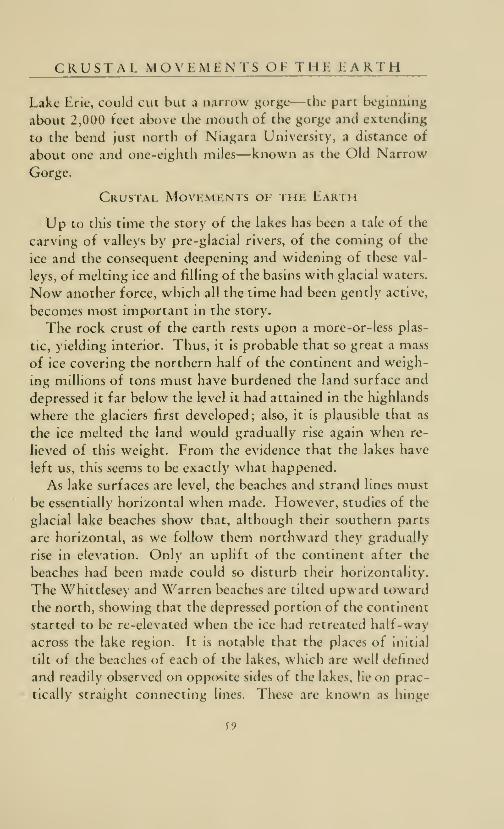
CKUSTAL MO\ LMLNTS Ol THL LARTH
Lake Erie, could cut but a narrow gorge—the part beginning
about 2,000 feet above the mouth of the gorge and extending
to the bend just norili of Niagara University, a distance of
about one and one-eighth miles—known as the Old Narrow
Gorge.
Crustal Movements of the Earth
Up to this time the story of the lakes has been a tale of the
carving of valleys by pre-glacial rivers, of the coming of the
ice and the consequent deepening and widening of these val-
leys, of melting ice and filling of the basins with glacial waters.
Now another force, which all the time had been gently active,
becomes most important in the story.
The rock crust of the earth rests upon a more-or-less plas-
tic, yielding interior. Thus, it is probable that so great a mass
of ice covering the northern half of the continent and weigh-
ing millions of tons must have burdened the land surface and
depressed it far below the level it had attained in the highlands
where the glaciers first developed; also, it is plausible that as
the ice melted the land would gradually rise again when re-
lieved of this weight. From the evidence that the lakes have
left us, this seems to be exactly what happened.
As lake surfaces are level, the beaches and strand lines must
be essentially horizontal when made. However, studies of the
glacial lake beaches show that, although their southern parts
are horizontal, as we follow them northward they gradually
rise in elevation. Only an uplift of the continent after the
beaches had been made could so disturb their horizontality.
The Whittlesey and Warren beaches are tilted upward toward
the north, showing that the depressed portion of the continent
started to be re-elevated when the ice had retreated half-way
across the lake region. It is notable that the places of initial
tilt of the beaches of each of the lakes, which are well defined
and readily observed on opposite sides of the lakes, lie on prac-
tically straight connecting linos. These arc known as hinge
J9

60

M O R L WORK Oh NIAGARA RIVER
lines, north of which the beaches arc upcanted somewhat
as a partly-opened trap door. The hinge Hne north of wliich
the continent first uphfted extends from Aslitabula, Oliio,
northwestward across Lake St. Clair, and bends to Lake Michi-
gan west of Grand Rapids. South of that line the Lake
Whittlesey beaches are horizontal; north of it they are up-
tilted. That the uplift was somewhat spasmodic is shown
by the fact that the Lake Warren beaches are uptilted north
of another hinge line about fifteen miles north of and parallel
to the Whittlesey hinge.
By these deformed beaches we know that the forces of
continental uplift were active even before the time of Lake
Algonquin, but they had played no very important part as
yet in the development of the lakes. By the time the Kirk-
field outlet of Lake Algonquin was well established, and a river
wider than the St. Clair had scoured a broad channel downthe Trent River valley, and the lake had made well-defined
beaches and other shore formations, the continent began to
rise more rapidly; then the waters of the lakes were spilled
southward out of their basins and again found their old out-
lets past Port Huron and Chicago; and for a time Lake
Algonquin had three outlets: to Lake Iroquois, to Lake Erie,
and to Mississippi River through the old Chicago outlet.
(Figure 14.) Spilling the waters on the south shores destroyed
the beaches of the Kirkheld stage in Michigan, but they are
preserved around Duluth and in the Ontario areas. The down-
cutting, and therefore lowering, of the outlet past Port Hurondiverted the overflow from the Chicago outlet, so that in the
latter part of this stage Lake Algonquin was drained through
lakes St. Clair, Rouge and Erie. Lakes St. Clair and Rouge
were small transitional lakes in depressions of the former
strait connecting the Huron and Erie basins during Lake
Elkton time, and now held the Algonquin overflow. Theywere large enough and lived long enough to make faint but
well-defined beaches. The uplift raised the level of the Rome,
61

NE-SAW-JE-WON
New York, outlet of Lake Iroquois and caused the water to
be ponded back on the southern shores, but it was not high
enough to cause a reversal of flow back into Lake Erie. At
this stage Lake Iroquois made its strongest beach.
More Work of Niagara River
The early increase in volume in the rejuvenated Lake Erie
increased the activity of Niagara River: a greater volume of
water flowed over the falls, and a wider gorge was cut—that
part of the gorge extending from the bend north of Niagara
University up-stream as far as the head of Foster Rapids.
When the Chicago outlet was abandoned and all the water
of the upper lakes poured over Niagara, the wide gorge from
the head of Foster Rapids to the upper edge of the Eddy
Basin above the Whirlpool was made. Together these parts
of the gorge are known as the Lower Great Gorge. (Figure
12.) Curiously, the Whirlpool is not a part of the gorge
proper. Its story is actually older than that of the gorge in
which it now lies. At some time before the last ice invasion,
a river flowing from southeast to northwest had plunged over
the Niagaran escarpment at the site of the little Canadian
town of St. David. Like the Niagara, this river, which has
been named St. David, cut a gorge back from the escarpment
as far as the Eddy Basin just above the Whirlpool. The on-
coming glacier destroyed the river and filled its gorge with
rock debris (drift) , which then became considerably cement-
ed together although not as solid as rock. Later, when the
Niagara had cut back to the old buried gorge, the northeast
wall of the gorge supporting the falls became thin and
crumbled, giving the waters access to the less-resistant ma-
terial filling the old channel. The waters of Niagara, plunging
with great force and volume, soon scoured away the glacial
debris, swirled and hurled its heavy tools northwest into the
buried gorge until it had made the Whirlpool. The depth of
the Whirlpool is due in part to the depth of the buried gorge
61

THE RECORDS OF ALGONQUIN TIME
which the Nlaj^ara resurrected. The Lower Reef, at tlie out-
let of tlie pool, is the remnant of the breached wall of tiie old
gorge; the Upper Reef marks the site of the ancient St.
David's Falls. At present tlu- current, dashing along the right
side of the gorge, swirls around to the left in the pit of the
Whirlpool, swings back upstream into the Lddy Basin and
then downstream over the Lower Reef, cutting deeper and
deeper into the soft shale bed of the pool and also cutting
against the drift fill of the ancient St. David's Gorge. A small
stream, Bowman Creek, enters the \\'hirlpcK)l from the old
gorge and carries its contribution of rock waste as cutting
tools for the Niagara. This section of the gorge, made during
the two-outlet stage of Lake Algonquin, is two miles long,
showing the long time that the second stage of this lake
existed.
The Records of Algonquin Time
The rising deepening waters of Lake Algonquin, whose
powerful waves beat with force against the shores, built
strong beaches which are marked by well-defined cliffs and
beach ridges in the landscape about the present three upper
lakes—Michigan, Superior and Fiuron. As one drives toward
the shores of these lakes, the highway leads from rolling mo-rainic uplands, down over cliff to terrace, and across the sev-
eral beaches of Lake Algonquin. In places later lakes have cut
away the Algonquin beaches, but in the main these beaches are
the high cliffs set some distance back from the present lake
shores. Tracing of the beaches shows that the Chicago outlet
is choked by the Algonquin beach; that the tip of the
Southern Peninsula of Michigan, north of Indian River and
Petoskey, was an archipelago; and that only the highest points
of Keweenaw Peninsula were above water as islands. \ he
great inland lakes of Michigan—Torchlight, Charlevoix, Wal-
loon, Mullet, Douglas, Burt and others—with their high-
cliffcd terraces, are remnants of lake Algonquin. The "in-
63

NE-SAW-JE-WON
photo by Michigan Department of Conservation
PLATE 4.—ARCH ROCK, MACKINAC ISLANDA SEA ARCH CUT IN LIMESTONE OF THE ALGONQUIN SHORE. THENIPISSING BEACH BELOW HAS BEEN DESTROYED BY MODERN WAVE ACTION.
land route" of lakes and low portages between Cheboygan
and Petoskey is a channel of the Algonquin archipelago. Theinteresting cliffed scenic beauty of Mackinac Island was pro-
duced by the work of the ancient lakes. During Algonquin
time Mackinac Island was triangular in shape and only about
three-fourths of a mile long, rising eighty feet above the lake
level. On its shores the beating waves of Lake Algonquin
carved Sugar Loaf and Arch Rock. From this small ancient
island Mackinac slopes by cliff and terrace to the present
lake level. Each terrace and its backing cliff represents a level
of the ancient lakes as well as a step in the slow uplift of the
continent. In places the waters of later lakes have cut into
64

THl Rl C ORDS c)l ALGONQUIN T I M Iv
photo by Michigan Depdrtmcnl of CoHtervtliom
PLATE J.—SUGAR LOAF ROCK, MACKINAC ISLAND
A LIMESTONE REMNANT OI THE ANCIENT ALGONQUIN SHORE, NOW FAR
INLAND AND ABOVE LAKE LEVEL.
the beaches, so that the chffs now rise sheer from the Huronto the old Algonquin shore, but the general view of the island
is of land rising by great steps from Lake Huron.
Interesting and arresting are these raised beaches, with
their arched rocks, wave-cut cliffs, sea caves and grottos, and
shingle beaches high above lake level; they tell a story not only
of rising and falling water but of a rising land. If we sail
along the lakes we see the interesting rocks, like little ships,
cut from the mainland and jutting into the lake at the tip of
the Thumb of Michigan—at Pointe Aux Barques. They are
cut in the rocky shore cliff of Lake Algonquin, which at the
Pointe is only ten feet above the level of Lake Huron; but
when we reach Mackinac we find the same shore—which we
65

NE-SAW-JE-WON
m
photo by Michigan Deportment of Conservation
PLATE 6.—POINTE AUX BARQUES, SEA CAVES AND ARCHESCUT IN THE MARSHALL (MISSISSIPPIAN ) SANDSTONE OF THE ALGONQUIN
shore; HURON COUNTY, THUMB OF MICHIGAN.
could have followed all the way on the mainland—to be 194
feet higher. The elevation of this beach at Port Huron is
607 feet above sea level, at Mackinac 801 feet, near Munising
in the Northern Peninsula 948 feet—341 feet higher than at
Port Huron; and on Keweenaw Peninsula west of Calumet
it is at 1,080 feet, rising to 1,100 feet near Mohawk and to
1,110 feet near CHff. If we follow the beach eastward from
Port Huron to the Kirkfield outlet, we find ourselves gradu-
ally mounting higher, until at Kirkfield, Ontario, the beach
is 883 feet above sea level—276 feet above its Port Huronelevation. North of Georgian Bay evidence of the beaches
shows that the country has been lifted 600 to 700 feet. The
Algonquin beaches near Grand Bend, Ontario, on the eastern
66

THE LAST Ol THIL GLACIAL LAKES
shore of Lake Huron, at Riclimondville on the western shore,
at Standisli near Sai;inaw Bay, and near Manistee on the east-
ern Lake Michigan shore, are at the same elevation, thus
estabhshing the position of the Algonquin hinge line north of
which the land has uptilted. At times uplift was slow and
steady so that the beaches were actually split while forming,
and several beaches of the lowering lake actually come to-
gether at a common point—just to add to the complexities.
The records made along the eastern boundary of the glacier
during Lake Algonquin time have not been fully worked out;
but when the ice sheet in the St. Lawrence valley had re-
treated to the northern edge of the Adirondack Mountains,
a new outlet for Lake Iroquois somewhat lower than that at
Rome, New York, was found, and a channel was scoured
along the northern mountain slope toward Lake Champlain.
Continental uplift shortened the life of this stage, which is
known as Lake Frontenac.
When the ice barrier withdrew farther north the land was
so low that the sea, which had gradually risen with the return
to it of vast quantities of glacial waters, entered the valley of
the St. Lawrence (as earlier it had entered the valley of the
Hudson), filling the Ontario basin with ocean water,
as is shown by the remains of marine or salt-water animals left
in the deposits. This marine embayment has been namedGilbert Gulf.
As it must come to everything, an end came to Lake Al-
gonquin. The barrier holding it to the highest level finally
gave way when the ice retreated north of North Bay, On-tario, and opened an outlet even lower than the Kirkfield
outlet. Then through a short river bordering the ice front the
waters of the upper lakes poured into the marine gulf which
had flooded the valleys of the St. Lawrence and Ottawa rivers,
of Lake Champlain and Hudson River. This great marine
estuary is known as the Champlain Sea. Evidence is lacking to
determine the time duration of this, the Ottawa, stage of the
67

68

THE N 1 IM S S 1 N C. C, R 1 A 1 I. A K l- S
lake, but it marks the end of Ali;onquin, the last of the glacial
lakes (Iii;ure 15), and was a transition to a new lake, tor the
waters tell to a lower level when the ice had completely with-
drawn from the basin of the Cireat I akes.
Thi: Nipissing Great Lakes
When the ice was no longer a barrier the lakes were drawndown almost to their present levels in the five separate basins.
The three upper lakes which occupied the Superior, Michigan,
and Huron-Georgian Bay basins are known as the Nipissing
Great Lakes. (Figure 16.) The beaches are strongest near
the present Lake Nipissing, in Ontario near the North Bay
outlet, hence the name. The col at North Bay was the low-
est along the Nipissing shore, so the outlet was developed
through it down the Mattawa River into the Ottawa—from
which the sea had withdrawn. By the time the Mattawa-
Ottawa River outlet was well established the land had risen
so that the sea retreated eastward to the limits of a narrow
estuary reaching up the St. Lawrence and Ottawa valleys to
a short distance west of Ottawa. The Champlain-Hudsonvalley remained filled with marine waters. The old North
Bay outlet at the present time is marked by lakes and swamps,
with ct)nnecting dry valleys which show the marks of scour
of a great river. It is the route by which Marquette, Allouez,
Mesnard and other early Jesuit missionary explorers reached
Georgian Bay and Lake Superior.
In the early stages the Nipissing lakes built beaches which
have been nearh' obliterated except in a small area near the
northeast corner of Lake Superior. The strong beach weknow as the Nipissing beach was made when the lake was
rising, its waters being spilled on its southern shores as the
continent continued to uptilt to the north. That the tilting
was rather rapid is shown b\ the "greedine«>s" with which this
lake bit into the old Algonquin beaches where they had been
cut as cliffs. In the area where the beaches are horizontal the
69

70

THE NIPISSING GREAT LAKES
?holo by Michigan Deptrlment of Conieritliom
PLATE 7.—CASTLE ROCK, ST. IGNACE, MICHIGANA REMNANT OF THE NIPISSING SHORE.
Nipissing beach is ten to twelve feet below the Algonquin,
but northward from the hinge line—extending from Great
Bend, Ontario, to Manistee, Michigan—they become widely
separated, until at Mackinac Island they are more than 175
feet apart, and over 360 feet separates them at Sault Ste. Marie.
In the Huron and Michigan basins the Nipissing beaches have
been lifted from the horizontal position along the same hinge
line as the Algonquin, but in the Superior basin they seem to
have a hinge of their own. Like the Algonquin beaches, the
Nipissing have also been destroyed in many places by the
work of the modern lakes—notably along the east side of the
Thumb north of Port Huron, along the east coast of Lake
Huron, and on both sides of Lake Michigan. Elsewhere they
are very pronounced, paralleling the present shore at no great
71

NE-SAW-JE-WON
Photo by Michigan Department of Conservation
PLATE 8.—THE "FORTRESS" OF THE PICTURED ROCKSNEAR MUNISING, MICHIGAN, ON LAKE SUPERIOR; NIPISSING AND MODERN
KM. ililliMBft. i*!' -»iM« i j m i ' i<m iii li«»'» ' i
Photo by Michigan Department of Conservation
PLATE 9.—CLIFF AND SEA CAVEIN CAMBRIAN SANDSTONE, LAKE SUPERIOR; NIPISSING AND MODERN
72

THE NIPISSING GREAT LAKES
photo by Michigan Drparlmrnl of Conirridtion
PLATE 10.—STACKS AND SEA CAVESSTACKS ON NIIMSSING SHORES; CAVES ON MODERN SHORES OF LAKE
SUPERIOR; CLIFFS OF CAMBRIAN LAKE SUPERIOR SANDSTONE.
distance back of it, and in some places—as on the rampart-
bastioned shore east of Marquette—being directly above the
present shore. Nipissing beaches are somewhat more sandy
than the Algonquin and in places—as at Grand Marais on the
Superior shore—are buried under great dunes.
Where rock clitfs formed tiie shore tiie powerful Nipissing
waves carved caves and grottos, cut pinnacles—called stacks
—
from the mainland, and carved deep bays or fjords in the
islands—particularly in Isle Royale which became an island
when the waters of the lakes were drawn down to the Nipis-
sing level. Pulpit Rock and Scotts Cave, of Mackinac Island,
and the isolated pinnacles of rock near St. Tgnace, are relics oi
the Nipissing shore. Sea caves and stacks around Lake Supe-
73

NE-SAW-JE-WON
photo by Michigan Department of Comeriation
PLATE 11.—CHAPEL ROCKNIPISSING AND MODERN SHORES OF LAKE SUPERIOR; CAMBRIAN LAKE
SUPERIOR SANDSTONE.
Photo by Michigan Department of Conservation
PLATE 12.—WAVE-CUT CLIFFSNEPISSING AND MODERN SHORES OF LAKE SUPERIOR; CAMBRIAN LAKE
SUPERIOR SANDSTONE.
74

THE NIPISSING GREAT LAKES
Photo by Michigan Dcpdrtment of CoHurviliou
PLATE 13.—MINER'S CASTLEREMNANT OF NIPISSING SHORE OF LAKE SUPERIOR; CAMBRIAN LAKE
SUPERIOR SANDSTONE.
rior, the carvings in the upper levels of the Lake Superior sand-
stone facing Lake Superior from the Pictured Rocks east-
ward, the muraled cliffs of Grand Island, the skerries of Isle
Royale, Monument Rock, towering seventy feet above the
plain between Tobin Harbour and Duncan Bay on Isle Royale
—all these shore formations now high and dry were cut by
the powerful waves of Lake Nipissing. But at the western
end of Lake Superior the Nipissing beach seems to pass under
the present beach; and that belongs to the story of the pres-
ent Great Lakes and of the deformation of their shores by the
tilting of the continent. The movement which withdrew
the lakes from their eastern shores and spilled the waters over
the southern shores, in one area lifted the Nipissing beach
75

NE-SAW-JE-WON
Photo by Michigan Department of Conservation
PLATE 14.—GRAND MARAIS DUNESON THE NIPISSING BEACH OVERLOOKING LAKE SUPERIOR.
high above, and in the other depressed it below the present
water level. At Port Huron the Nipissing beach is 595 feet
above sea level; it rises to 631 feet on Mackinac Island, to
651 feet at Sault St. Marie, and to 710 feet at Peninsula
Harbour on the North Shore of Lake Superior. In early
Nipissing time the northern part of Keweenaw Peninsula was
an island, but Lake Nipissing built a bar across the mouth of
the separating strait, connecting the island to the mainland
and ponding the waters back into Torch and Portage lakes.
Man has cut a canal through the bar and reproduced the old
strait.
During the existence of the Nipissing lakes the water in
the St. Clair basin was at so low a stage that perhaps even the
swamps were drained by the sluggish river that flowed past
76

THE NIPISSING GREAT LAKES
the site of Detroit to the small Lake Erie, which was then ten
to twelve feet below its present level. Submerged old river
channels can be traced in the western part of the Erie basin,
indicatini; the land conditions of Nipissing time. The bays
along the southern shore of Lake Erie are the drowned river
channels of this time. The caves at Put-in-Bay were all above
water during the Nipissing stage of Lake Erie, although nowparts of them are submerged.
During this time only the waters of the greatly-reduced
Lake Erie poured over Niagara halls and cut the narrow gorge
between the upper part of the Eddy Basin and the railroad
bridges—the three-fourths-of-a-mile-Iong gorge of the
Whirlpool Rapids. (Eigure 12.) Above the bridge the gorge
is wider, marking the beginning of the present Great Lakes
stage.
When uplift of the continent had changed the shore lines
and outlets of the lakes and the entire discharge of the Nipis-
sing lakes passed through the col at North Bay, the stage en-
dured for a long time. But the end came for the Nipissing
lakes as once again uplift in the north spilled the waters south-
ward. The old Chicago outlet was put in operation again but
for only a short time, for the lake level soon fell three or four
feet so that entire discharge was finally poured through the
outlet past Port Huron, reviving St. Clair River and spreading
the overflow into the St. Clair basin to form Lake St. Clair;
then the current quickened in the newl\ -formed Detroit
River. The waters of the broad shallow strait connecting the
Superior and Huron basins across the eastern end of the St.
Mary's peninsula were withdrawn into St. Mary's River, and
the two lakes become independent; Lake Superior was held
back in its higher basin b>' the rim of the old Cambrian sand-
stone "bowl," which crosses the river at the falls mu\ rapids
of the St. Mary's. So recently did this separation take place
77

NE-SAW-JE-WON
that the river has accompHshed little gorge-cutting and little
destruction of the rapids.
The Modern Great Lakes
When all the waters had ceased to flow through the NorthBay outlet and all finally poured southward to Lake
Erie, the present stage of the Great Lakes was begun. These
lakes, like their glacial ancestors, are building beaches, mak-ing shore cliffs, cutting caves and arches in rocky headlands,
and deepening fjords—as along Isle Royale and Les Cheneaux.
In other places they are straightening shores by building bars
and spits across the bays, creating—as did Lake Nipissing
along the Lake Michigan coast—small lakes barred from the
large lake by dune-capped sand bars. Sands from their shores
are being piled by the wind high in dunes. Dunes along Lake
Michigan are as high as, if not the highest dunes in the world.
In places like the Sleeping Bear—on the Point of that nameon the northwestern coast of the Southern Peninsula of Michi-
gan—the dunes are perched atop the bordering moraine; in
other places they bury the Algonquin and Nipissing shores.
Down-cutting of the outlets continues, so that beaches lower
than the Nipissing have been made by the modern lakes. Oneof these beaches, which is fairly strong and can be traced
around the lakes, is called the Algoma beach, from the place
where it was first noticed on North Channel of Lake Huron.
The connecting rivers of the Great Lakes also have had an
interesting and complicated history, as they developed with
the changing lakes. In order of age (in the present arrange-
ment of the lake-river system) these rivers are St. Clair, De-troit, Niagara, Nipigon, St. Lawrence and St. Mary's. Nipi-
gon River is the largest tributary of Lake Superior and in its
lower course flows across the dry bed of old Lake Nipigon,
once the most northerly bay of Lake Algonquin. So many
78

THE MODERN GREAT LAKES
features of the Great Lakes are unique, it is not surprising; to
lind that the delta of St. Clair River is most unusual, for it
is built by a stream flowing from one lake into another.
Earlier in the story we found that this river had to cut across
the Port Huron moraine, south of Port Huron, in order to
carry the waters of the glacial lakes. Thus the present river
acquired some tools which had been left in the channel when
the former stream became sluggish or disappeared. These, in
small amount, the present river has ground up, carried into
Lake St. Clair, and dropped when the current was slackened
in the quiet waters of the lake. The delta has been increased
in size—principally after all the morainic materials were car-
ried away—by sediments which have been washed by storm
waves from the Lake Huron shores. In the narrow southern
part of Lake Huron waves are cutting material from the
Canadian shore; the coarse material is deposited on the Cana-
dian side at Point Edward, but the finer is being carried by the
river to the American side, building the delta—the famous
St. Clair flats—farther out into Lake St. Clair.
The narrow part of Detroit River, between Belle Island
and Delray, is the part of its channel cut across the moraine
which separated the Erie and the Huron ice lobes and which
for a time held the waters of Lake St. Clair at a higher level.
At first the river flowed across the moraine in several chan-
nels, but eventually it deepened the present channel opposite
Detroit and drew all the overflow from Lake St. Clair through
one channel. Then for a time the river widened, as far
south as Crosse Isle, into small Lake Rouge which existed long
enough to build a distinct beach. Many of the older cottages
on Grosse Isle are built on the Rouge beach. South of Wyan-dotte the river once entered Lake Erie through many chan-
nels or distributaries, and probably built a delta of the ma-
terials it washed from the broad flat moraine which it crosses
at Trenton. But lifting of the lake level has submerged the
delta front, and deepening of the river has drawn the water
79

C/3
<:
<Pi
<
<
H-l
80

R i: V 1 1: w AN I) iM<i: VI t w
from all the western distributaries into twtj—the channels
around Grosse Isle—leaving the abandoned channels as curi-
ous depressions occupied by small creeks or as the natural
canals across Grosse Isle.
Since the establishment of the present lake s\su'ni, i\iai;ara
River, with the force of overflow waters from the lour upper
lakes, has cut the gorge over two and one-quarter miles—from
the railroad bridges to the Horseshoe Falls.
The Story Unfinished
Thus reads the story of the Great Lakes—descendants of
much smaller, higher, independent lakes which were outside
the present lake basins and discharged to the sea through
outlets leading to the Mississippi River, thence to the Gulf
of Mexico; which grew in size to lakes larger than the present
and found eastern outlets to the Atlantic, first by the Mohawkand Hudson rivers and finally by the St. Lawrence—
a
history and record of which there is no counterpart on the
globe. Through all the time man has been on the continent,
the lakes have exerted an influence on his life. The old outlets
served as highways and portages from one part of the country
to another; they were chosen as the sites of forts to guard
the frontier; they became the passes for railway, canal, and
concrete highway. The ancient beaches served as lines of
travel for red man and white, for trails and highways, for
roads of rail and concrete; they are the sites of all the forts
which commanded the Great Lakes. The lakes lured the early
explorers westward as they sought a route to India, served
as routes for trapper and fur trader and for the seeker of
precious metals, and finally, as the highways of a vast water-
borne commerce when the riches of their waters and their
borders became known. The old spillwa> s and lake beds be-
came the fertile gardens of agriculture. And not the least of
their significance, the shores of these lakes offer some of the
most magnificent scener>' in the world.
81

NE-SAW-JE-WON
What of the future? Lakes are but ephemeral features of
any landscape. The Great Lakes, like all others, are doomed
to extinction. Slowly they are filling, slowly their outlets are
being lowered, and eventually they will be drained; but as
long as the rock sill at Buffalo holds—or until Niagara River
cuts back to Lake Erie—the upper lakes will remain as lakes.
Measurements of Niagara Falls since 1827 show that the
Horseshoe Falls are cutting back at the average rate of four
to five feet each year and no longer have the smooth horseshoe
curve at their crest which gave them their name. Until St.
Mary's River cuts through the Cambrian sandstone sill at the
rapids, Lake Superior will be held in its basin twenty feet above
Lake Huron. But when these rock barriers have been cut away,
the lakes will shrink in their basins and once again will become
a great river system. Then the records of these lakes also will
be shown by the beaches and shores they have made.
For a long time the land has been fairly stable; but occa-
sional slight earthquakes, the deepening of the waters on the
southern shores of the lakes, the withdrawal of water from the
northern shores—exposing the lake bottoms, and other evi-
dences, all show that uphft has not ceased. Measurements indi-
cate that the North American continent is rising at the rate of
about one inch every ten years for each 100 miles north of the
Whittlesey hinge line. Will it rise high enough to spill the
lakes over the limestone sill at Chicago, which is only eight
feet above Lake Michigan, and return the flow to the Gulf of
Mexico ? Has the glacial period passed or are we in an inter-
glacial stage? Will the ice return and destroy all the evidences
by which this story is told? If this happens it will be so far in
the future—so many thousand of years—that another civili-
zation will write the story.
82

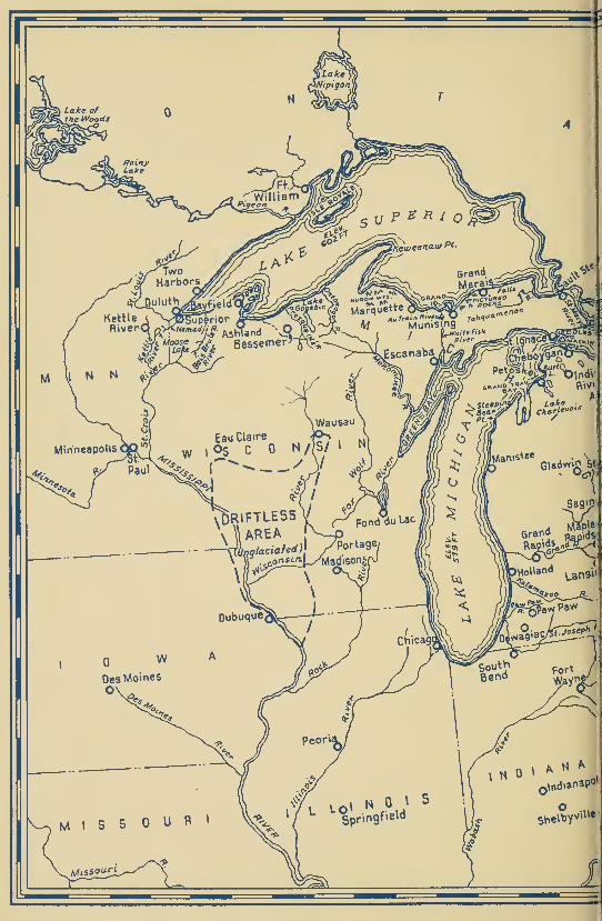


![Text - University Library at University of Illinois at Urbana ...libsysdigi.library.illinois.edu/oca/Books2008-09/monthly...Armed Forces ln.signla [colored poster]. 1969. 37 x 2(5](https://static.fdocuments.us/doc/165x107/5ade6c047f8b9a595f8e2551/text-university-library-at-university-of-illinois-at-urbana-forces-lnsignla.jpg)