NAU Parking Lot 46 Drainage Design Final Presentation
17
NAU Parking Lot 46 Drainage Design Final Presentation Surf and Turf Engineering Sophia Fox Mariam Alqabandi Donovan Stewart Saud Alazmi 1 CENE 476 April 15th, 2021
Transcript of NAU Parking Lot 46 Drainage Design Final Presentation
NAU Parking Lot 46 Drainage Design
Final Presentation
Surf and Turf Engineering
Sophia Fox
Mariam Alqabandi
Donovan Stewart
Saud Alazmi
1
CENE 476
April 15th, 2021
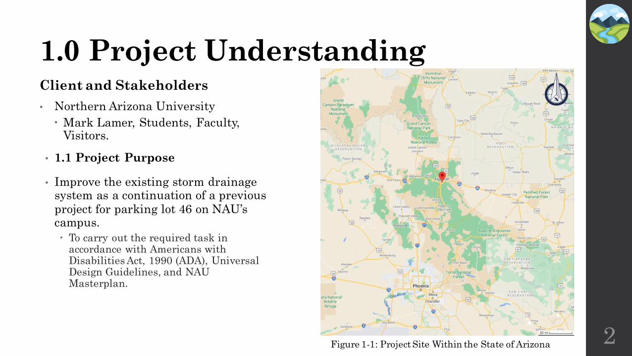
1.0 Project Understanding
2
• 1.1 Project Purpose
• Improve the existing storm drainage system as a continuation of a previous project for parking lot 46 on NAU’s campus.
To carry out the required task in accordance with Americans with Disabilities Act, 1990 (ADA), Universal Design Guidelines, and NAU Masterplan.
Client and Stakeholders
• Northern Arizona University
Mark Lamer, Students, Faculty, Visitors.
Figure 1-1: Project Site Within the State of Arizona
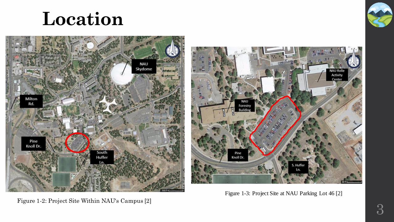
Figure 1-2: Project Site Within NAU's Campus [2]
3
Location
Figure 1-3: Project Site at NAU Parking Lot 46 [2]
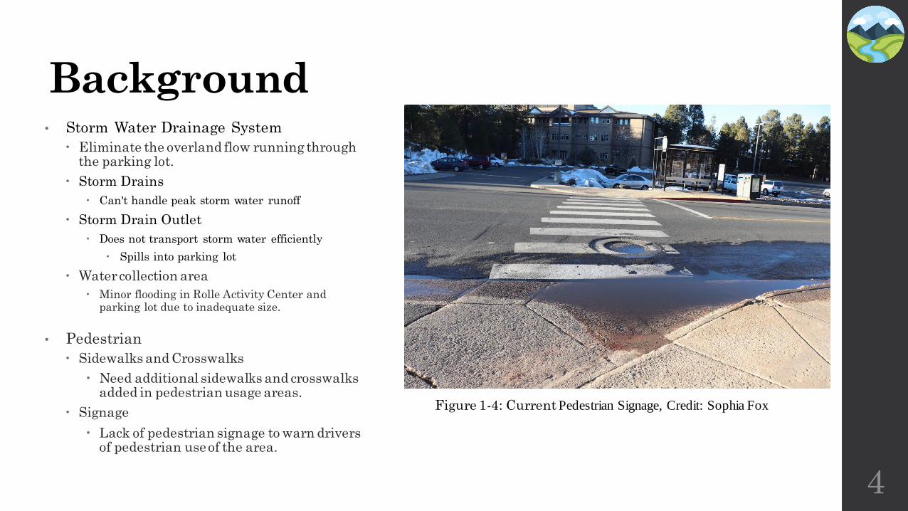
Background• Storm Water Drainage System
Eliminate the overland flow running through the parking lot.
Storm Drains
Can't handle peak storm water runoff
Storm Drain Outlet
Does not transport storm water efficiently
Spills into parking lot
Water collection area
Minor flooding in Rolle Activity Center and parking lot due to inadequate size.
• Pedestrian
Sidewalks and Crosswalks
Need additional sidewalks and crosswalks added in pedestrian usage areas.
Signage
Lack of pedestrian signage to warn drivers of pedestrian use of the area.
4
Figure 1-4: Current Pedestrian Signage, Credit: Sophia Fox
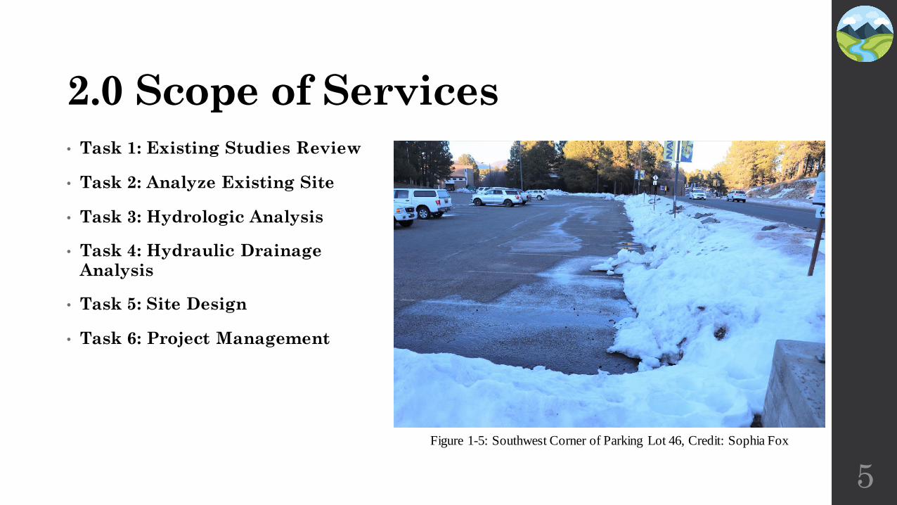
2.0 Scope of Services
• Task 1: Existing Studies Review
• Task 2: Analyze Existing Site
• Task 3: Hydrologic Analysis
• Task 4: Hydraulic Drainage Analysis
• Task 5: Site Design
• Task 6: Project Management
5
Figure 1-5: Southwest Corner of Parking Lot 46, Credit: Sophia Fox
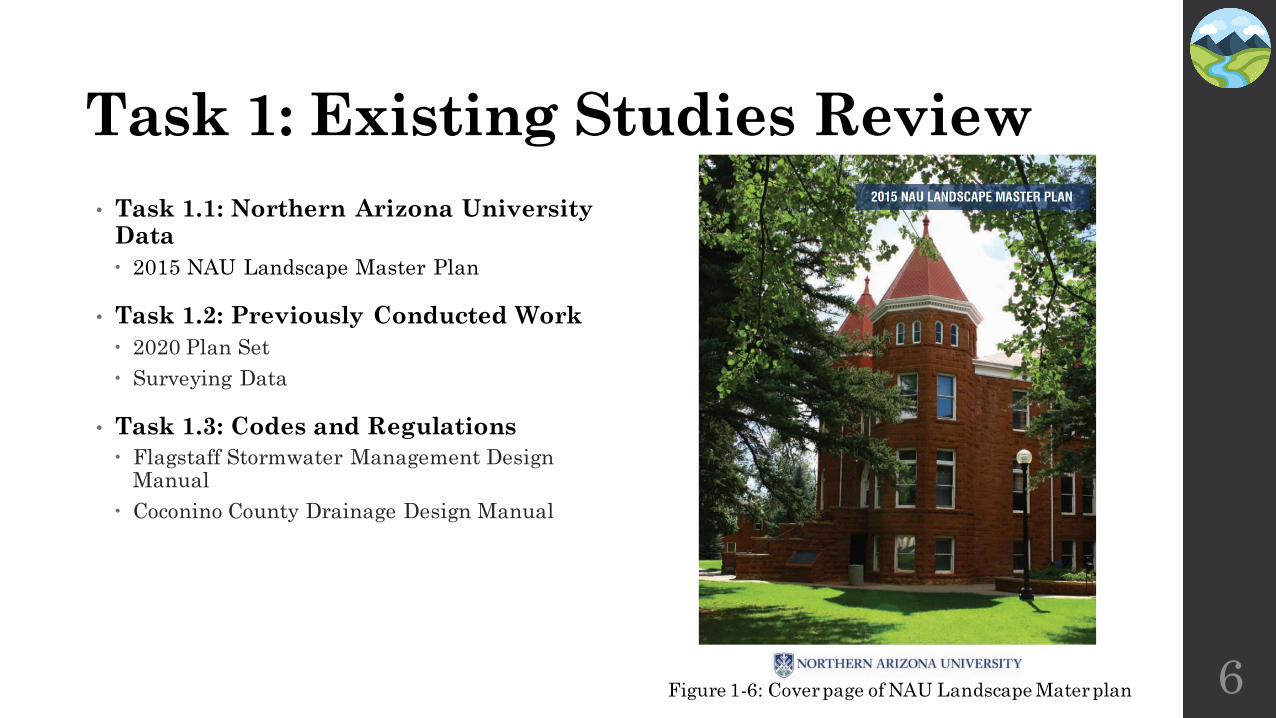
Task 1: Existing Studies Review
• Task 1.1: Northern Arizona University Data
2015 NAU Landscape Master Plan
• Task 1.2: Previously Conducted Work
2020 Plan Set
Surveying Data
• Task 1.3: Codes and Regulations
Flagstaff Stormwater Management Design Manual
Coconino County Drainage Design Manual
6Figure 1-6: Cover page of NAU Landscape Mater plan
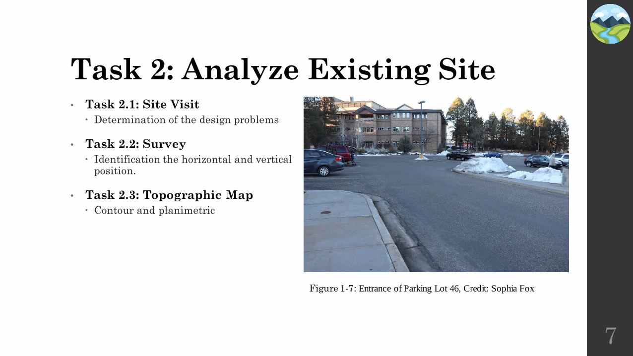
Task 2: Analyze Existing Site
7
• Task 2.1: Site Visit
Determination of the design problems
• Task 2.2: Survey
Identification the horizontal and vertical position.
• Task 2.3: Topographic Map
Contour and planimetric
Figure 1-7: Entrance of Parking Lot 46, Credit: Sophia Fox
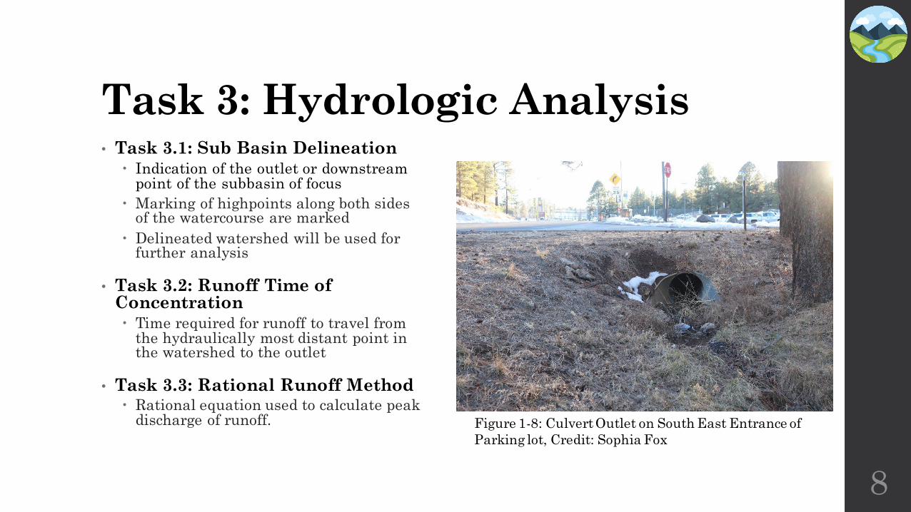
Task 3: Hydrologic Analysis• Task 3.1: Sub Basin Delineation
Indication of the outlet or downstream point of the subbasin of focus
Marking of highpoints along both sides of the watercourse are marked
Delineated watershed will be used for further analysis
• Task 3.2: Runoff Time of Concentration Time required for runoff to travel from
the hydraulically most distant point in the watershed to the outlet
• Task 3.3: Rational Runoff Method Rational equation used to calculate peak
discharge of runoff.
8
Figure 1-8: Culvert Outlet on South East Entrance of
Parking lot, Credit: Sophia Fox
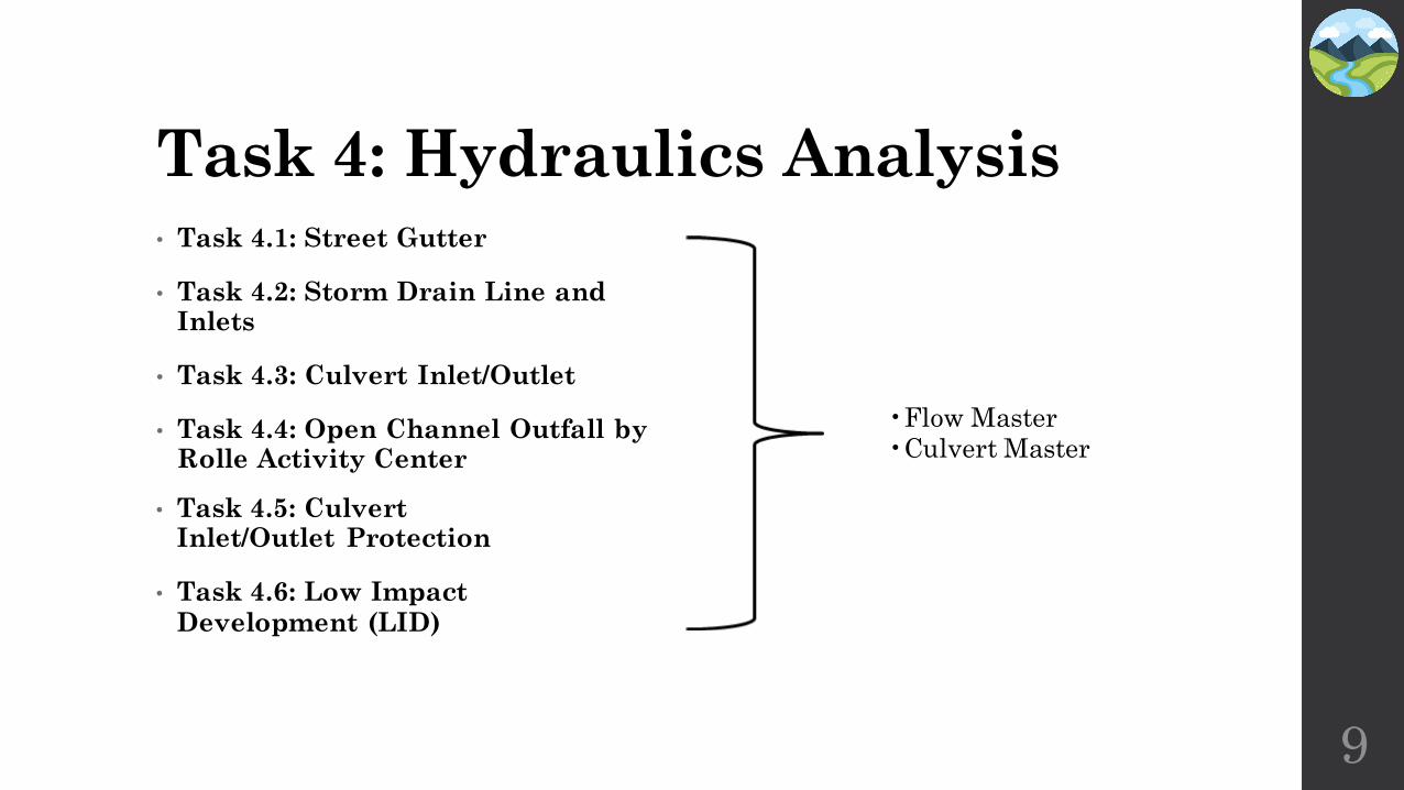
Task 4: Hydraulics Analysis• Task 4.1: Street Gutter
• Task 4.2: Storm Drain Line and Inlets
• Task 4.3: Culvert Inlet/Outlet
• Task 4.4: Open Channel Outfall by Rolle Activity Center
9
• Task 4.5: Culvert Inlet/Outlet Protection
• Task 4.6: Low Impact Development (LID)
•Flow Master•Culvert Master
Task 5: Site Design
10
• Task 5.4: Plan Set Development
5.4.1 Cover Sheet
5.4.2 Project Notes
5.4.3 Results of Survey Sheet
5.4.4 Drainage Details
• Task 5.5: Engineers Opinion Of Probable Cost to Construct
• Task 5.1: Overall Site Layout
• Task 5.2: Stormwater
5.2.1 Storm Drain Plan and Profile
5.2.3 LID Basin
5.2.4 Culverts
• Task 5.3: Pedestrian Pathway
5.3.1 ADA/Universal Design Compliance
5.3.2 Path Plan View
5.3.3 Signage and Striping
Task 6: Project Deliverables• Task 6.1: Project Impacts
6.1.1 Environmental Impacts
6.1.2 Economic Impacts
6.1.3 Social Impacts
• Task 6.2: Project Deliverables
6.2.1 30% Submittals
6.2.2 60% Submittals
6.2.3 90% Submittals
6.2.4 Final Submittal
6.2.5 Meeting Memo Binder
6.2.6 Website
11

Task 7: Project Management• Task 7.1: Meetings
7.3.1 Client Meetings
7.3.2 Technical Advisor (TA) Meetings
7.3.3 Grading Instructor (GI) Meetings
7.3.4 Team Meetings
• Task 7.2: Resource Management
7.4.1 Schedule Management
7.4.2 Budget Management
7.4.3 Staff Management
12
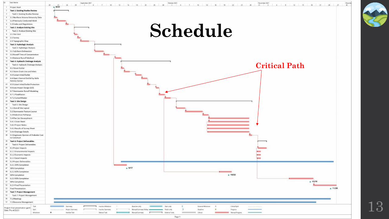
13
Schedule
Critical Path

Staffing Personnel
14
Table 1: Staff Personnel Summary
Task
Hours Per Position
SR. ENG PM JR. ENG EIT I. ENG Total
1.0 Existing Studies Review 5 0 15 10 10 40
2.0 Analyze Existing Site 2 0 16 12 12 42
3.0 Hydrologic Analysis 0 0 26 16 14 56
4.0 Hydraulic Analysis 3 1 38 38 24 104
5.0 Site Design 36 1 55 39 25 156
6.0 Project Deliverables 24 10 49 49 43 175
7.0 Project Management 14 29 14 14 14 85
Total 84 41 213 178 141 657
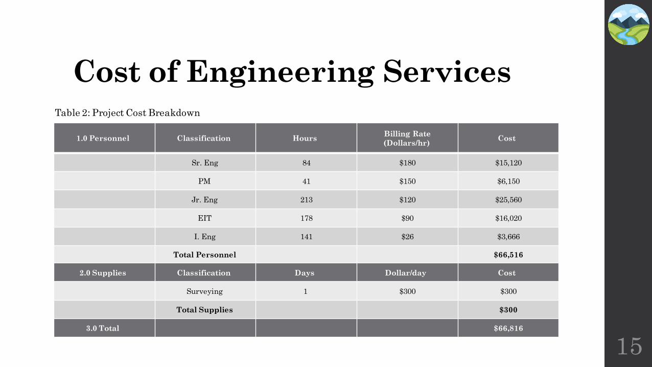
Cost of Engineering Services
1.0 Personnel Classification HoursBilling Rate
(Dollars/hr)Cost
Sr. Eng 84 $180 $15,120
PM 41 $150 $6,150
Jr. Eng 213 $120 $25,560
EIT 178 $90 $16,020
I. Eng 141 $26 $3,666
Total Personnel $66,516
2.0 Supplies Classification Days Dollar/day Cost
Surveying 1 $300 $300
Total Supplies $300
3.0 Total $66,816
15
Table 2: Project Cost Breakdown

References[1] "Arizona color county maps cities towns", Countymapsofarizona.com, 2021. [Online]. Available: http://www.countymapsofarizona.com/. [Accessed: 06- Feb- 2021].
[2] "Google Maps", Google Maps, 2021. [Online]. Available: https://www.google.com/maps. [Accessed: 06- Feb- 2021].
[3] "US Topo: Maps for America", Usgs.gov, 2021. [Online]. Available: https://www.usgs.gov/core-science-systems/national-geospatial-program/us-topo-maps-america?qt-science_support_page_related_con=0#qt-science_support_page_related_con. [Accessed: 06- Feb- 2021].
[4] Resources, "Most Common Business Uses of Photogrammetry - GIS Resources", GIS Resources, 2021. [Online]. Available: https://www.gisresources.com/common-business-uses-photogrammetry/. [Accessed: 06- Feb- 2021].
[5] "What is GIS? | Geographic Information System Mapping Technology", Esri.com, 2021. [Online]. Available: https://www.esri.com/en-us/what-is-gis/overview. [Accessed: 06- Feb- 2021].
[6] "Surveying Basics: Reading a Contour Map | Onsite Installer", Onsite Installer, 2021. [Online]. Available: https://www.onsiteinstaller.com/online_exclusives/2019/04/surveying-basics-reading-a-contour-map. [Accessed: 10- Feb- 2021].
[7] "6. Digital Line Graph (DLG) | The Nature of Geographic Information", E-education.psu.edu, 2021. [Online]. Available: https://www.e-education.psu.edu/natureofgeoinfo/c7_p7.html. [Accessed: 06- Feb- 2021].
[8] "How to Read Construction Plans - A Beginner's Guide - Construct-ed.com", Construct-Ed, 2021. [Online]. Available: https://www.construct-ed.com/beginners-guide-how-to-read-construction-plans/. [Accessed: 08- Feb- 2021].
[9] P. Bernie Roseke, "Guide to Project Resource Management", ProjectEngineer, 2021. [Online]. Available: https://www.projectengineer.net/guide-to-project-resource-management/. [Accessed: 08- Feb- 2021].
16
Questions?
Surf and Turf Engineering
Mariam Alqabandi
Sophia Fox
Donovan Stewart
Saud Alazmi 17