National Weather Service CAP v1.2 Documentation · NWS CAP messages are in XML format and based on...
55
National Weather Service CAP v1.2 Documentation Revision History Date Revision Descirption 11/30/2016 Initial document 3/7/2017 Added CMAMText parameter which had been omitted from previous version of document. Added new severe weather related parameters coming around April 2017: - eventMotionDescription - windGust - hailSize - tornadoDetection - tornadoDamageThreat - waterspoutDetection Removed erroneous mention of parameters called alertName and segmentAction. 5/16/2017 Added NWSheadline parameter. Removed notes that several of the severe weather related parameters are coming April 2017, since they’ve been deployed. NWS CAP messages are in XML format and based on NWS weather and hydrologic watches, warnings, advisories, and special statements. NWS CAP messages are designed to be compliant with the [OASIS CAP v1.2] standard and [CAP v1.2 USA Integrated Public Alert and Warning System (IPAWS) Profile Version 1.0]. The documentation contained here supplements the OASIS CAP standard and IPAWS CAP profile by identifying the formats of NWS information contained within our CAP v1.2 IPAWS compliant messages. Thus, users should familiarize themselves with the OASIS CAP standard and IPAWS CAP profile prior to using NWS CAP messages. NWS CAP Blocks and Elements alert • identifier • sender • sent • status • msgType • scope • code • note
Transcript of National Weather Service CAP v1.2 Documentation · NWS CAP messages are in XML format and based on...

National Weather Service CAP v1.2 Documentation
Revision History Date Revision Descirption 11/30/2016 Initial document 3/7/2017 Added CMAMText parameter which had been omitted from previous version
of document. Added new severe weather related parameters coming around April 2017: - eventMotionDescription - windGust - hailSize - tornadoDetection - tornadoDamageThreat - waterspoutDetection Removed erroneous mention of parameters called alertName and segmentAction.
5/16/2017 Added NWSheadline parameter. Removed notes that several of the severe weather related parameters are coming April 2017, since they’ve been deployed.
NWS CAP messages are in XML format and based on NWS weather and hydrologic watches, warnings, advisories, and special statements. NWS CAP messages are designed to be compliant with the [OASIS CAP v1.2] standard and [CAP v1.2 USA Integrated Public Alert and Warning System (IPAWS) Profile Version 1.0].
The documentation contained here supplements the OASIS CAP standard and IPAWS CAP profile by identifying the formats of NWS information contained within our CAP v1.2 IPAWS compliant messages. Thus, users should familiarize themselves with the OASIS CAP standard and IPAWS CAP profile prior to using NWS CAP messages.
NWS CAP Blocks and Elements
alert
• identifier • sender • sent • status • msgType • scope • code • note

• references
info
• category • event • responseType • urgency • severity • certainty • eventCode • effective • onset • expires • senderName • headline • description • instruction • web • contact • parameter
o NWSheadline o EAS-ORG o VTEC o eventEndingTime o stormMotionDescription o windGust o hailSize o tornadoDectection o tornadoDamageThreat o waterspoutDetection o BLOCKCHANNEL o CMAMText
area
• areaDesc • polygon • geocode

“alert” Element and Sub-elements
Element Name alert
Description The container for all component parts of the alert message.
Format <alert xmlns = “urn:oasis:names:tc:emergency:cap:1.2”>
alert elements
<info> info elements
<area> area elements
</area>
</info>
</alert>
Where xmlns:cap = “urn:oasis:names:tc:emergency:cap:1.2” is the xmlns attribute referencing the CAP URN as the namespace.
Example <alert xmlns = “urn:oasis:names:tc:emergency:cap:1.2”> . . . </alert>
Inclusion Included in every CAP message that originates from the NWS.

Element Name
identifier
Description A string which uniquely identifies the CAP message.
Format <identifier>id</identifer>
Where id is a string not to exceed 30 characters. May contain letters, numbers, and “-“.
Example <identifier>NWS-IDP-PROD-2146365-2004781</identifier>
Inclusion Included in every CAP message that originates from the NWS.

Element Name sender
Description Email address of the NWS webmaster.
Format <sender>[email protected]</sender>
Example <sender>[email protected]</sender>
Inclusion Included in every CAP message that originates from the NWS.

Element Name sent
Description The origination time and date of the alert message.
Format <sent>YYYY-MM-DDThh:mm:ssXzh:zm</sent> Where:
• YYYY = Year
• MM = Month (00-12)
• DD = Day, 2 digits with leading zeros (01-31)
• T marks the start of the time section
• hh = 24-hour format of an hour with leading zeros (00-23)
• mm = Minutes with leading zeros (00-59)
• ss = Seconds, with leading zeros(00-59)
• X = "+" if the preceding date and time are in a time zone ahead of UTC, or the symbol "-" if the preceding date and time are in a time zone behind UTC
• zh = Hours of offset from the preceding date and time to UTC
• zm = Minutes of offset from the preceding date and time to UTC
Example <sent>2011-05-24T16:49:00-07:00</sent>
refers to May 24, 2011 at 4:49:00 PM Pacific Daylight Time.
Inclusion Included in every CAP message that originates from the NWS.

Element Name status
Description The code denoting the appropriate handling of the alert message.
Format <status>status</status> Where status is one of the following:
• "Actual" - Actionable by all targeted recipients
• "Exercise" - Actionable only by designated exercise participants; exercise identifier SHOULD appear in <note>
• "System" - For messages that support alert network internal functions
• "Test" - Technical testing only, all recipients disregard; test identifier SHOULD appear in <note>
• "Draft" – A preliminary template or draft, not actionable in its current form. Not currently used by NWS.
Example <status>Actual</status>
Inclusion Included in every CAP message that originates from the NWS. Only in rare cases would a value other than “Actual” be used.

Element Name msgType
Description The code denoting the nature of the alert message.
Format <msgType>msgType</msgType> Where msgType is one of the following according to the CAP v1.2 standard:
• "Alert" - Initial information requiring attention by targeted recipients
• "Update" - Updates and supercedes the earlier message(s) identified in <references>
• "Cancel" - Cancels the earlier message(s) identified in <references>.
• "Ack" - Acknowledges receipt and acceptance of the message(s) identified in <references>. Not currently used by NWS.
• "Error" – Indicates rejection of the message(s) identified in <references>; explanation SHOULD appear in <note>. Not currently used by NWS.
Example <msgType>Alert</msgType>
Inclusion Included in every CAP message that originates from the NWS. A msgType of “Cancel” is only used to cancel an alert which was sent in error (not intended to be sent).

Element Name scope
Description The code denoting the appropriate handling of the alert message.
Format <scope>scope</scope> Where scope is one of the following according to the CAP v1.2 standard:
• "Public" - For general dissemination to unrestricted audiences
• "Restricted" - For dissemination only to users with a known operational requirement. Not used by the NWS.
• "Private" - For dissemination only to specified addresses. Not used by the NWS.
Example <scope>Public</scope>
Inclusion Included in every CAP message that originates from the NWS. NWS does not currently use “Restricted” or “Private”.

Element Name code
Description Version of the CAP IPAWS profile as adopted by FEMA to which the subject CAP message conforms.
Format <code>IPAWSvn.n</code>
Where n.n is the version of the CAP IPAWS profile as adopted FEMA.
Example <code>IPAWSv1.0</code>
Inclusion Included in every CAP message that originates from the NWS.

Element Name note
Description The text describing the purpose or significance of the alert message.
Format <note>note<note>
Example <note>This is a only a test. A national exercise is being conducted. This is only a test.</note>
Inclusion Included in NWS CAP messages when the <status> is "Exercise" or "Test".

Element Name references
Description References the most recent message to which the current message refers or replaces.
Format <references>sender,identifier,sent</references>
Where sender,identifier, and sent are the sender, identifier, and sent elements from the earlier CAP message or messages that this one replaces. When multiple messages are referenced, they are separated by whitespace.
Example <references>[email protected], NWS-130404-301701-246008 ,2010-12-29T09:36:23-07:00</references>
Inclusion Included whenever the NWS updates or cancels an alert for which a CAP message has been produced. NWS references all active messages (ones with at least one active <info> block) impacted by the new message. An “active” <info> block is one that has not yet reached its <expires> time. Referencing all alert messages with <info> blocks that still have an <expires> time in the future ensures that any messages that may still be playing incorrectly are properly superseded by the most recent Update or Cancel. This resolves issues caused by transmission delays and/or lost messages that may result in message chains being broken. If only a single reference were used, a missed message could result in an alert playing beyond its intended time.

“info” Element and Sub-elements
Element Name info
Description The container for all component parts of the info element.
Format <info> info elements
<area> area elements
</area> </info>
Example <alert xmlns = “urn:oasis:names:tc:emergency:cap:1.2”>
alert elements
<info> info elements
<area> area elements
</area>
</info>
<info> info elements
<area> area elements
</area>

</info>
</alert>
Inclusion One or more <info> blocks are included in every CAP message that originates from the NWS.

Element Name
category
Description The code denoting the category of the subject event in the alert message. Multiple instances may occur within an <info> block.
Format <category>category</category> Where category is one of the following according to the CAP v1.2 standard:
• "Geo" - Geophysical (inc. landslide)
• "Met" - Meteorological (inc. flood)
• "Safety" - General emergency and public safety
• "Security" - Law enforcement, military, homeland and local/private security
• "Rescue" - Rescue and recovery
• "Fire" – Fire suppression and rescue
• "Health" - Medical and public health
• "Env" - Pollution and other environmental
• "Transport" - Public and private transportation
• "Infra" - Utility, telecommunication, other non-transport infrastructure
• "CBRNE" – Chemical, Biological, Radiological, Nuclear or High-Yield Explosive threat or attack
• "Other" – Other events
Example <category>Met</category> <category>Health</category>

Inclusion Included in every <info> block.

Element Name event
Description The text denoting the type of the subject event in the alert message.
Format <event>event</event>
Example <event>Tornado Warning</event>
Inclusion Included in every CAP message that originates from the NWS.

Element Name responseType
Description The code denoting the type of action recommended for the target audience. Multiple instances may occur within an <info> block.
Format <responseType>responseType</responseType> Where responseType is one of the following values as defined in the CAP v1.2 standard.
• "Shelter" - Take shelter in place or per <instruction>
• "Evacuate" - Relocate as instructed in the <instruction>
• "Prepare" - Make preparations per the <instruction>
• "Execute" - Execute a pre-planned activity identified in <instruction>
• "Avoid" - Avoid the subject event as per the <instruction>
• "Monitor" - Attend to information sources as described in <instruction>
• "Assess" – Evaluate the information in this message. Not used by NWS.
• "AllClear" - The subject event no longer poses a threat or concern and any follow on action is described in <instruction>
• "None" - No action recommended
Example <responseType>Shelter</responseType>
Inclusion Included in every <info> block.

Element Name urgency
Description Urgency of the subject event of the alert message.
Format <urgency>urgency</urgency>
Where urgency is one of the following values for the given alert type.
• “Immediate” - Responsive action SHOULD be taken immediately
• “Expected” - Responsive action SHOULD be taken soon (within next hour)
• “Future” - Responsive action SHOULD be taken in the near future
• “Past” - Responsive action is no longer required
• “Unknown” - Urgency not known
Example <urgency>Immediate</urgency>
Inclusion Included in every <info> block. An <urgency> value of “Past” is used by NWS to convey that the alert is ended for area covered by the respective <info> block.

Element Name severity
Description Severity of the subject event of the alert message
Format <severity>severity</severity>
Where severity is one of the following values for the given alert type.
• “Extreme” - Extraordinary threat to life or property
• “Severe” - Significant threat to life or property
• “Moderate” - Possible threat to life or property
• “Minor” – Minimal to no known threat to life or property
• “Unknown” - Severity unknown
Example <severity>Extreme</severity>
Inclusion Included in every <info> block.

Element Name certainty
Description Certainty of the subject event of the alert message.
Format <certainty>certainty</certainty>
Where certainty is one of the following values for the given alert type.
• “Observed” – Determined to have occurred or to be ongoing
• “Likely” - Likely (p > ~50%)
• “Possible” - Possible but not likely (p <= ~50%)
• “Unlikely” - Not expected to occur (p ~ 0)
• “Unknown” - Certainty unknown
Example <certainty>Expected</certainty>
Inclusion Included in every <info> block.

Element Name eventCode
Description A system-specific code identifying the event type of the alert message.
Format <eventCode> <valueName>SAME</valueName> <value>XXX</value> </eventCode>
<eventCode> <valueName>NationalWeatherService/valueName> <value>PPS</value> </eventCode>
Where:
• XXX is a three character event code from FCC Part 11.31 or the value “NWS”.
• PPS is the NWS phenomena and significance string for the alert type. The PPS is a concatenation of the two character Phenomena (PP) and one character Significance (S) code from the NWS Valid Time Event Code (VTEC) string for the alert type. If the NWS has no VTEC string for the alert type (e.g., Special Weather Statement), then an alternative three-character code will be used (e.g., SPS). See http://www.nws.noaa.gov/os/vtec for more information about VTEC.
The NWS produces many types of alerts. The most critical alert types are listed in FCC Part 11.31 (Title 47, Part 11, EAS Rules and Regulations). A SAME value (XXX) of “NWS” means the alert is not for a type listed in FCC Part 11.31. The NWS has a special agreement with FEMA’s Integrated Public Alert and Warning System (IPAWS) so that alerts with an XXX of “NWS” pass through to the IPAWS public alerts feed. This way, third party redistributors of official alert information have access to all NWS CAP messages through the IPAWS public feed.
Example For an alert type listed in FCC Part 11.31: <eventCode> <valueName>SAME</valueName>

<value>SVR</value> </eventCode> <eventCode> <valueName>NationalWeatherService</valueName> <value>SVW</value> </eventCode> For an alert type NOT listed in FCC Part 11.31: <eventCode> <valueName>SAME</valueName> <value>NWS</value> </eventCode> <eventCode> <valueName>NationalWeatherService</valueName> <value>MSY</value> </eventCode>
Inclusion Included in every <info> block.

Element Name effective
Description The effective date and time of the information in the alert message. In other words, the CAP message itself (i.e., the alert) is effective at the time it is sent. Identical to <sent>. <effective> should not be confused with any use of “effect” and/or “effective” terminology in the plain language text of the alert because they may not have the same meaning. The <effective> date and time may also not be the same as the <onset> date and time which reflects the beginning of the subject event in the alert message.
Format <effective>YYYY-MM-DDThh:mm:ssXzh:zm</effective> Where:
• YYYY = Year
• MM = Month (00-12)
• DD = Day, 2 digits with leading zeros (01-31)
• T marks the start of the time section
• hh = 24-hour format of an hour with leading zeros (00-23)
• mm = Minutes with leading zeros (00-59)
• ss = Seconds, with leading zeros(00-59)
• X = "+" if the preceding date and time are in a time zone ahead of UTC, or the symbol "-" if the preceding date and time are in a time zone behind UTC
• zh = Hours of offset from the preceding date and time to UTC
• zm = Minutes of offset from the preceding date and time to UTC
Example <effective>2011-05-24T16:49:00-07:00</effective>

refers to May 24, 2011 at 4:49:00 PM Pacific Daylight Time.
Inclusion Included in every <info> block.

Element Name onset
Description Expected time of the beginning of the subject event in the alert message. The value for <onset> may be the same as that for <effective> when the event is already occurring or imminent.
Format <onset>YYYY-MM-DDThh:mm:ssXzh:zm</onset> Where:
• YYYY = Year
• MM = Month (00-12)
• DD = Day, 2 digits with leading zeros (01-31)
• T marks the start of the time section
• hh = 24-hour format of an hour with leading zeros (00-23)
• mm = Minutes with leading zeros (00-59)
• ss = Seconds, with leading zeros(00-59)
• X = "+" if the preceding date and time are in a time zone ahead of UTC, or the symbol "-" if the preceding date and time are in a time zone behind UTC
• zh = Hours of offset from the preceding date and time to UTC
• zm = Minutes of offset from the preceding date and time to UTC
Example <onset>2011-07-04T17:12:00-05:00</onset>
refers to July 4, 2011 at 5:12:00 PM Central Daylight Time.

Inclusion Included in every <info> block, except when the <urgency> is “Past”.

Element Name expires
Description The expiry date and time of the information in the alert message. This is the time at which the information in the message should be considered stale and no longer used. The NWS forecaster will update or cancel the alert by the <expires> time. <expires> should not be confused with any use of “expire” and/or “expiration” terminology in the plain language text of the alert because they may not have the same meaning. The <expires> date and time may also not be the same as the <eventEndingTime> parameter which reflects the expected end time of the event in the alert message.
Format <expires>YYYY-MM-DDThh:mm:ssXzh:zm</expires> Where:
• YYYY = Year
• MM = Month (00-12)
• DD = Day, 2 digits with leading zeros (01-31)
• T marks the start of the time section
• hh = 24-hour format of an hour with leading zeros (00-23)
• mm = Minutes with leading zeros (00-59)
• ss = Seconds, with leading zeros(00-59)
• X = "+" if the preceding date and time are in a time zone ahead of UTC, or the symbol "-" if the preceding date and time are in a time zone behind UTC
• zh = Hours of offset from the preceding date and time to UTC
• zm = Minutes of offset from the preceding date and time to UTC
Example <expires>2012-05-30T09:30:00-04:00</expires>

refers to May 30, 2012 at 9:30 AM Eastern Daylight Time.
Inclusion Included in every <info> block.

Element Name senderName
Description Name of the issuing NWS Office.
Format <senderName>senderName</senderName>
Where senderName is the name of the NWS office which issued the alert.
Example <senderName>NWS Miami (Southern Florida)</senderName>
Inclusion Included in every <info> block.

Element Name headline
Description A brief human-readable headline containing the alert type and valid time of the alert.
Format <headline>WWA issued Month DD at hh:mmAM/PM LST/LDT until Month DD at hh:mmAM/PM LST/LDT by NWS Office</headline> Where:
• WWA = Watch, Warning, Advisory, or special statement
• MONTH = Month spelled out
• DD = Day (1-31)
• hh = Hour (1-12)
• mm = Minutes (00-59)
• LST/LDT = Local Standard Time or Local Daylight Time as appropriate
• Office = Name of the NWS office which issued the alert
For very long duration or open-ended alerts (e.g., long duration floods, hurricanes, tsunamis, etc.) which are in effect until further notice, the format for <headline> is as follows.
<headline>WWA issued Month DD at hh:mmAM/PM LST/LDT until further notice by NWS Office</headline>
Example <headline>Winter Storm Warning issued March 18 at 12:17PM PDT expiring March 18 at 6:00PM PDT by NWS Medford</headline> For very long duration events: <headline>Flood Warning issued April 29 at 10:23AM CDT until further notice by NWS Eastern ND and Grand Forks</headline>

Inclusion Included in every CAP message that originates from the NWS.

Element Name
description
Description The text describing the subject event of the alert message.
Format <description>description</description>
Example <description>...RED FLAG WARNING IN EFFECT UNTIL 8 PM EDT THIS EVENING FOR HUMIDITY VALUES BELOW 35 PERCENT AND WINDS ABOVE 15 MPH FOR METRO AND INLAND SECTIONS OF BROWARD AND MIAMI-DADE COUNTIES... A VERY DRY AIRMASS WILL CONTINUE TO MIX DOWN TO THE SURFACE THROUGH THIS AFTERNOON. IN ADDITION TO THIS VERY DRY AIRMASS WHERE SOME LOCATIONS WILL EXPERIENCE RELATIVE HUMIDITY VALUES OF AROUND 20 PERCENT AND POSSIBLY LOWER, WIND SPEEDS WILL ALSO BE AROUND 15 MPH WITH GUSTS OVER 20 MPH. ALSO IN ADDITION, THE ENERGY RELEASE COMPONENT FOR BROWARD COUNTY IS FORECAST TO BE AROUND 35, BUT A SLIGHTLY LOWER VALUE OF NEAR 30 IS EXPECTED IN MIAMI-DADE COUNTY. ALL OF THESE CONDITIONS COMBINED WARRANT A RED FLAG WARNING THIS AFTERNOON FOR THE METROPOLITAN AND INLAND SECTIONS OF THE AFOREMENTIONED COUNTIES INTO EARLY EVENING. CONDITIONS WILL GRADUALLY BECOME MORE MOIST THROUGH THE LATE AFTERNOON AS ATLANTIC MOISTURE MOVES IN THE THE NORTHEAST WINDS.</description>
Inclusion Included in every <info> block. For alerts which are ended, the <description> may only state that the subject event is no longer expected in the area.
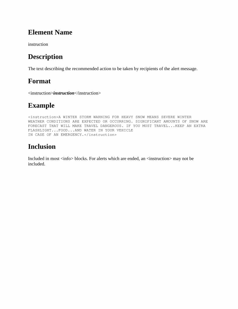
Element Name instruction
Description The text describing the recommended action to be taken by recipients of the alert message.
Format <instruction>instruction</instruction>
Example <instruction>A WINTER STORM WARNING FOR HEAVY SNOW MEANS SEVERE WINTER WEATHER CONDITIONS ARE EXPECTED OR OCCURRING. SIGNIFICANT AMOUNTS OF SNOW ARE FORECAST THAT WILL MAKE TRAVEL DANGEROUS. IF YOU MUST TRAVEL...KEEP AN EXTRA FLASHLIGHT...FOOD...AND WATER IN YOUR VEHICLE IN CASE OF AN EMERGENCY.</instruction>
Inclusion Included in most <info> blocks. For alerts which are ended, an <instruction> may not be included.

Element Name web
Description A hyperlink where additional information about the alert can be found.
Format <web>URL</web>
Example <web>http://www.weather.gov</web>
Inclusion Included in every <info> block.

Element Name parameter
Description Denotes additional information associated with the alert message.
Format <parameter> <valueName>valueName</valueName> <value>value</value> </parameter>
Example <parameter> <valueName>VTEC</valueName> <value>/O.CON.KDMX.SV.W.0004.000000T0000Z-110321T1845Z/</value> </parameter>
Inclusion The NWS often uses parameters in each <info> block to convey additional information.

Parameter Name NWSheadline
Description A general statement that summarizes the alert.
Format <parameter> <valueName>NWSheadline</valueName> <value>text</value> </parameter>
Where text is the headline in the traditional NWS alert segment from which the CAP message is derived. Multiple headlines from the traditional NWS alert segment will generally appear together as one text value often with "... ..." inserted between each headline. Occasionally when a headline(s) is malformed in the traditional NWS alert segment, the headline (or second or subsequent headlines) will appear at the beginning of the text in the <description> element.
Example of Single Headline <parameter> <valueName>NWSheadline</valueName> <value>RED FLAG WARNING IN EFFECT FROM 11 AM THIS MORNING TO 9 PM PDT THIS EVENING FOR FAR SOUTHERN NEVADA BELOW 5000 FEET</value> </parameter>
Example of Multiple Headlines <parameter> <valueName>NWSheadline</valueName> <value> WINTER STORM WARNING REMAINS IN EFFECT FROM 8 PM THIS EVENING TO 11 AM PDT THURSDAY ABOVE 6000 FEET... ...WINTER WEATHER ADVISORY REMAINS IN EFFECT FROM 8 PM THIS EVENING TO 11 AM PDT THURSDAY BELOW 6000 FEET</value> </parameter>
Inclusion Included in many, but not all, NWS alerts. .

Parameter Name EAS-ORG
Description EAS Originator code of the NWS as required by the IPAWS CAP profile.
Format <parameter> <valueName>EAS-ORG</valueName> <value>WXR</value> </parameter>
Where WXR is the EAS-ORG (originator code) of the NWS.
Example <parameter> <valueName>EAS-ORG</valueName> <value>WXR</value> </parameter>
Inclusion Included in every <info> block even when the message is not intended for EAS dissemination.

Parameter Name VTEC
Description Valid Time Event Code (VTEC) of the subject alert message.
Format <parameter> <valueName>VTEC</valueName> <value>VTEC</value> </parameter>
Where VTEC is the Valid Time Event Code (VTEC). When multiple VTEC string(s) occur, each string may be separated by a new line or cr/lf (carriage return/line feed). See http://www.nws.noaa.gov/os/vtec for more information about VTEC.
Example <parameter> <valueName>VTEC</valueName> <value>/O.CON.KDMX.SV.W.0004.000000T0000Z-110321T1845Z/</value> </parameter>
Inclusion Included in many, but not all NWS CAP messages.

Parameter Name eventEndingTime
Description The expected end time, in UTC, of the subject event in the alert message. This is the time at which the hazard conditions of the subject event are no longer expected.
Format <parameter> <valueName>eventEndingTime</valueName> <value>YYYY-MM-DDThh:mm:ssXzh:zm</value> </parameter>
Where:
• YYYY = Year
• MM = Month (00-12)
• DD = Day, 2 digits with leading zeros (01-31)
• T marks the start of the time section
• hh = 24-hour format of an hour with leading zeros (00-23)
• mm = Minutes with leading zeros (00-59)
• ss = Seconds, with leading zeros(00-59)
• X = "+" if the preceding date and time are in a time zone ahead of UTC, or the symbol "-" if the preceding date and time are in a time zone behind UTC
• zh = Hours of offset from the preceding date and time to UTC
• zm = Minutes of offset from the preceding date and time to UTC
Example <parameter> <valueName>eventEndingTime</valueName> <value>2012-05-30T13:30:00-04:00</value>

</parameter>
Means the hazard conditions of the subject event are no longer expected after 1:30 pm Eastern Daylight Time on May 23, 2012.
Inclusion Included in most <info> blocks. The <eventEndingTime> parameter will not be included for very long duration or open-ended alerts (e.g., hurricanes, tsunamis, some long duration floods, etc.) which are in effect until further notice.

Parameter Name eventMotionDescription
Description The position and motion of a hazardous event given in local time.
Format <parameter> <valueName>eventMotionDescription</valueName> <value>YYYY-MM-DDThh:mm:ssXzh:zm...event…dirDEG...spKT...lat,lon [, lat,lon…] </value> </parameter>
Where:
• YYYY = Year
• MM = Month (00-12)
• DD = Day, 2 digits with leading zeros (01-31)
• T marks the start of the time section
• hh = 24-hour format of an hour with leading zeros (00-23)
• mm = Minutes with leading zeros (00-59)
• ss = Seconds, with leading zeros(00-59)
• X = "+" if the preceding date and time are in a time zone ahead of UTC, or the symbol "-" if the preceding date and time are in a time zone behind UTC
• zh = Hours of offset from the preceding date and time to UTC
• zm = Minutes of offset from the preceding date and time to UTC
• event = storm

• dirDeg = three-digit direction from which the storm is moving, in degrees from 000 to 359 nonzero direction
• sp = speed of movement of the storm, in knots from 0 to 99 without a leading zero
• lat,lon = coded pair(s) identifying the latitude and longitude of the storm center expressed as a single point (in the case of one pair) or a line (if more than one pair is used) using WGS 84 (see Implementation Notes section of the OASIS CAP Profile document)
Example <parameter> <valueName>eventMotionDescription</valueName> <value>2010-08-05T08:46:00-05:00...storm...062DEG...16KT...30.62,-90.82 30.40,-90.91 30.25,-90.79</value> </parameter>
Means that on August 8, 2010 at 8:46:00 AM Central Daylight Time, the storm was moving from the northeast (to the southwest) at 16 knots. The storm center was located along the line connected by latitude 30.62 longitude -90.82, latitude 30.40 longitude -90.91, and latitude 30.25 longitude -90.79.
Inclusion Included in NWS CAP messages with the following <eventCode>:
• TOR (Tornado Warning) • SVR (Severe Thunderstorm Warning) • SVS (Severe Weather Statement) • SMW (Special Marine Warning) • MWS (Marine Weather Statement) • EWW (Extreme Wind Warning)

Parameter Name windGust
Description Maximum predicted non-tornadic thunderstorm wind speed.
Format <parameter> <valueName>windGust</valueName> <value>speed</value> </parameter>
Where speed is the maximum predicted non-tornadic thunderstorm wind gust in miles per hour.
Example <parameter> <valueName>windGust</valueName> <value>70</value> </parameter>
Inclusion Included with Severe Thunderstorm Warnings, some Special Marine Warnings, some Severe Weather Statements, and some Marine Weather Statements.
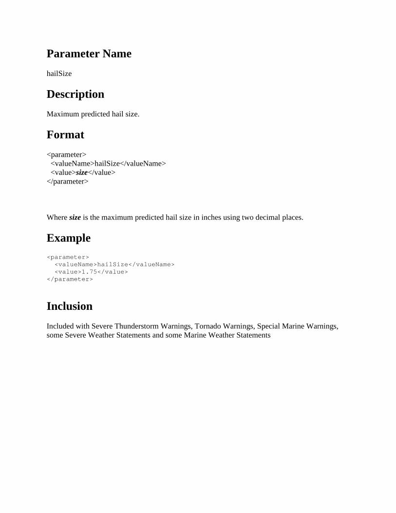
Parameter Name hailSize
Description Maximum predicted hail size.
Format <parameter> <valueName>hailSize</valueName> <value>size</value> </parameter>
Where size is the maximum predicted hail size in inches using two decimal places.
Example <parameter> <valueName>hailSize</valueName> <value>1.75</value> </parameter>
Inclusion Included with Severe Thunderstorm Warnings, Tornado Warnings, Special Marine Warnings, some Severe Weather Statements and some Marine Weather Statements

Parameter Name tornadoDetection
Description Describes whether the tornado is indicated by radar or observed. This is an implied statement of confidence in the evidence that a tornado is occurring.
Format <parameter> <valueName>tornadoDetection</valueName> <value>detection</value> </parameter>
For Tornado Warnings, detection is “RADAR INDICATED” or “OBSERVED”.
For Severe Thunderstorm Warnings, the only value for detection is “POSSIBLE”.
Example <parameter> <valueName>tornadoDetection</valueName> <value>RADAR INDICATED</value> </parameter>
Inclusion Included with all Tornado Warnings and some Severe Thunderstorm Warnings.

Parameter Name tornadoDamageThreat
Description Impact in terms of damage expected from a tornado.
Format <parameter> <valueName>tornadoDamageThreat</valueName> <value>damage</value> </parameter>
Where damage is “CONSIDERABLE” or “CATASTROPHIC”.
Example <parameter> <valueName>tornadoDamageThreat</valueName> <value>CATASTROPHIC</value> </parameter>
Inclusion Only included in Tornado Warnings when there is credible evidence that the tornado is producing considerable or greater damage.

Parameter Name waterspoutDetection
Description Describes whether the waterspout is observed or possible. This is an implied statement of confidence in the evidence that a waterspout is occurring.
Format <parameter> <valueName>waterspoutDetection</valueName> <value>detection</value> </parameter>
Where detection is “OBSERVED” or “POSSIBLE”.
Example <parameter> <valueName>waterspoutDetection</valueName> <value>POSSIBLE</value> </parameter>
Inclusion Included in some Special Marine Warnings and Marine Weather Statements.

Parameter Name BLOCKCHANNEL
Description Blocks transmission of the alert across an IPAWS dissemination channel. One or more channels may be blocked.
Format <parameter> <valueName>BLOCKCHANNEL</valueName> <value>channel</value> </parameter>
Where channel is one of the following values.
• “CMAS” – Refers to Wireless Emergency Alerts (WEA)
• “EAS” – Refers to Emergency Alert System
• “NWEM” – Refers to Non-Weather Emergency Message
• “PUBLIC” – Refers to IPAWS public alert dissemination channel
Example <parameter> <valueName>BLOCKCHANNEL</valueName> <value>CMAS</value> </parameter> <parameter> <valueName>BLOCKCHANNEL</valueName> <value>EAS</value> </parameter>
Inclusion NWS blocks often blocks CMAS, since WEA is intended only for the most critical alerts. NWS blocks EAS for alerts which are not intended for EAS. NWS always blocks messages to NWEM, since NWEMs push CAP messages back the NWS which would cause an undesirable dissemination loop. NWS never blocks PUBLIC.

Parameter Name CMAMText
Description A brief emergency message passed through FEMA IPAWS and on to wireless carriers for display on mobile devices as a Wireless Emergency Alert (WEA).
Format <parameter> <valueName>CMAMText</valueName> <value>text</value> </parameter>
Where text is an emergency message no longer than 90 characters.
Example <parameter> <valueName>CMAMText</valueName> <value> Tornado Warning in this area til 3:45 AM CST. Take shelter now. Check local media. -NWS</value> </parameter>
Inclusion Included mostly in CAP messages for new alerts which warn of an imminent threat to life and/or property, such as Tornado and Flash Flood Warnings.

Element Name area
Description The container for all sub-elements of the area element.
Format <area> area elements </area>
Example <area> <areaDesc>Honolulu</areaDesc> <polygon>21.49,-157.94 21.62,-157.99 21.67,-157.88 21.41,-157.77 21.36,-157.81 21.49,-157.94</polygon> <geocode> <valueName>UGC</valueName> <value>HIC003</value> </geocode> <geocode> <valueName>SAME</valueName> <value>015003</value> </geocode> </area>
Inclusion Included in every <info> block.

Element Name areaDesc
Description The text describing the affected area of the alert message.
Format <areaDesc>Location[; Location…]</areaDesc>
Where Location is a county, parish, borough, or independent city.
Example <areaDesc>Mahaska; Poweshiek</areaDesc>
Inclusion Included in every <info> block.

Element Name polygon
Description The paired values of points defining a polygon that delineates the affected area of the alert message.
Format <polygon>Lat,Lon Lat,Lon Lat,Lon Lat,Lon [; Lat,Lon…]</polygon>
Where Lat,Lon is a latitude and longitude coordinate pair. A minimum of 4 coordinate pairs is present. The first and last pair will always be the same.
Example <polygon>41.50,-92.30 41.50,-92.40 41.48,-92.41 41.51,-92.76 41.63,-92.76 41.66,-92.30 41.50,-92.30</polygon>
Inclusion Included in NWS <info> blocks with the following <eventCode>.
• TOR (Tornado Warning) • SVR (Severe Thunderstorm Warning) • SVS (Severe Weather Statement) • SMW (Special Marine Warning) • MWS (Marine Weather Statement) • FFW (Convective Flash Flood Warning) • FLW (Areal Flood Warning) • FFS (Convective Flash Flood Statement) • FLS (Areal Flood Advisory or Areal Flood Statement) • EWW (Extreme Wind Warning)

Element Name geocode
Description The geographic code delineating the affected area of the alert message. Multiple instances MAY occur within an <Area> block.
Format <geocode> <valueName>SAME</valueName> <value>SAME</value> </geocode> <geocode> <valueName>UGC</valueName> <value>SSFNNN</value> </geocode> Where
• SAME is the 6-digit [Specific Area Message Encoding code].
• SS = Two-letter standard Post Office state (or marine area) identifier
• F = C or Z where o C means the NNN represents a [3-digit FIPS county], parish, or independent city
number. NNN may also be ALL representing all of the counties in a state, or the numbers 000 representing all, or an unspecified part, of a state.
o Z means the NNN represents a 3-digit [NWS zone number]. NNN may also be ALL representing all of the zones in a state, or the numbers 000 representing all, or an unspecified part, of a state.
Many NWS alerts contain the (C) form of the UGC. Alerts using the zone (Z) form of the UGC include non-precipitation watch/warning/advisories and winter storm watch/warning/advisories. There are three listings of NWS zones: public zones, coastal and offshore marine zones, fire weather zones each found on the NWS GIS web page at http://www.nws.noaa.gov/geodata/ under NWSM libraries. Public zones and coastal and offshore marine zones are the zones in primary use in most NWS products and the geographic areas and zone numbering complement one another. Fire weather zones are used only in specialized products and use zone numbering that overlaps public zone numbers (i.e., fire weather and public zone numbers must not be mixed or used together). Fire weather alerts include Red Flag Warnings, Fire Weather Watches,

Rangeland/Grassland Fire Danger and their corresponding NWSevent <eventCode> values FWW, FWA, and RFD.
Example <geocode> <valueName>SAME</valueName> <value>012009</value> </geocode> <geocode> <valueName>SAME</valueName> <value>012095</value> </geocode> <geocode> <valueName>SAME</valueName> <value>012097</value> </geocode> <geocode> <valueName>SAME</valueName> <value>012117</value> </geocode> <geocode> <valueName>SAME</valueName> <value>012127</value> </geocode> <geocode> <valueName>UGC</valueName> <value>FLC009</value> </geocode> <geocode> <valueName>UGC</valueName> <value>FLC095</value> </geocode> <geocode> <valueName>UGC</valueName> <value>FLC097</value> </geocode> <geocode> <valueName>UGC</valueName> <value>FLC117</value> </geocode> <geocode> <valueName>UGC</valueName> <value>FLC127</value> </geocode>
Inclusion Included in every CAP message that originates from the NWS.