National Science Foundation - Natural Reserve System
20
Special Research Projects National Centers & Other Landscape-scale Projects that Utilize NRS Reserves University of California Natural Reserve System
Transcript of National Science Foundation - Natural Reserve System
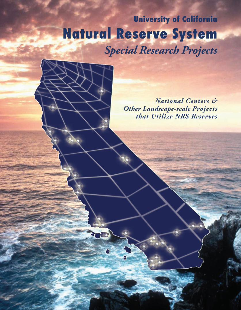
Special Research Projects
National Centers & Other Landscape-scale Projects
that Utilize NRS Reserves
University of California
Natural Reserve System

�
The UC Natural Reserve System plays an enabling role in major research projects that are of nationwide significance. By providing protected, landscape-scale locales, as well as support facilities, dedicated to research, these sites attract specialists in a wide diversity of fields ranging from ecology, engineering, and marine biology to computer science, geology, and forestry.
The UC Natural Reserve System provides unmatched research opportunities. Over two thousand researchers from the University of California, as well as from many other institutions across the country and around the world, cur-rently work on hundreds of research projects on NRS reserves.
This compendium highlights fifteen large-scale investigations that involve collaborative efforts of interdisciplinary teams of scientists from multiple institutions in research that is part of a larger national or international effort. These projects all aim at gaining more complete understanding of the basic physical and ecological processes that govern the functioning of the biosphere. Such understanding is critically important to the sustainable wise management of natural resources, whether they be terrestrial or marine. The list includes national centers funded by the National Science Foundation, as well as landscape-scale projects funded by both federal agencies and private foundations.
Addressing today’s global environmental problems requires that scientists work together in new ways, employing new tools, and on a scale that was unimaginable just a few years ago. The availability of a network of protected reserves reflecting California’s diverse ecosystems and dedicated to research and teaching is an invaluable resource for both scientists and educators.
Interdisciplinary teams of researchers working
at NRS reserves are developing systems
and techniques that will lead to the next
generation of scientific breakthroughs.

3
National Centers and Other Landscape-scaleProjects that Utilize NRS Reserves
page
18
1514
7
8
9
10
1112
13
16
17
19
6
5 National Center for Airborne Laser Mapping (NCALM)
Science and Technology Center (STC):Center for Embedded Networked Sensing (CENS)
Tagging of Pacific Pelagics (TOPP)
Partnership for Interdisciplinary Studies of Coastal Oceans (PISCO)
Santa Barbara Coastal Long Term Ecological Research (LTER)
Keck HydroWatch Center
Fuel Management National Pilot Project
Sagehen Experimental Forest
Science and Technology Center (STC):National Center for Earth-surface Dynamics (NCED)
Controls on the Response of California’s Ecosystems to Environmental Change
North American Carbon Program / Determining California’s Carbon Budget
Optical Fiber Infrasound Sensor (OFIS)
San Dieguito Wetlands Restoration
Parasites in Natural Ecosystems
Quail Ridge Wireless Mesh Network

�
Natural Reserve System 2008Angelo Coast Range Reserve* 1Año Nuevo Island Reserve* 1�Blue Oak Ranch Reserve (BORR)* 1�Bodega Marine Reserve 9Box Springs Reserve �7Boyd Deep Canyon Desert Research Center �9Burns Piñon Ridge Reserve �6Carpinteria Salt Marsh Reserve ��Chickering American River Reserve 6Coal Oil Point Natural Reserve �1Dawson Los Monos Canyon Reserve ��Eagle Lake Field Station �Elliott Chaparral Reserve �5
Emerson Oaks Reserve* ��Fort Ord Natural Reserve 16Hastings Natural History Reservation 17James San Jacinto Mountains Reserve* �8Jenny Pygmy Forest Reserve* �Jepson Prairie Reserve* 10Kendall-Frost Mission Bay Marsh Reserve �6Landels-Hill Big Creek Reserve* 18McLaughlin Natural Reserve �Motte Rimrock Reserve �1Kenneth S. Norris Rancho Marino Reserve 19Quail Ridge Reserve 7Sagehen Creek Field Station 5
San Joaquin Freshwater Marsh Reserve �0Santa Cruz Island Reserve* ��Scripps Coastal Reserve ��Sedgwick Reserve �0Sierra Nevada Aquatic Research Laboratory (SNARL) / Valentine Eastern Sierra Reserve 1�Stebbins Cold Canyon Reserve 8Stunt Ranch Santa Monica Mountains Reserve ��Sweeney Granite Mountains Desert Research Center �5Valentine Camp / Valentine Eastern Sierra Reserve 11Younger Lagoon Reserve 15
*Santa Cruz Island Reserve is protected, owned, and managed by The Nature Conservancy (TNC). Angelo Coast Range, Jen-ny Pygmy Forest, Jepson Prairie, and Emerson Oaks Reserves are protected by TNC, as is Oasis de los Osos, a satellite site of James San Jacinto Mountains Reserve. TNC is involved in the protection of Blue Oak Ranch Reserve and Landels-Hill Big Creek Reserve. Año Nuevo Island Reserve is a 25-acre portion of the 4,000-acre Año Nuevo State Reserve, which is owned and operated by California State Parks.
5
Funded by
• National Science Foundation
NRS Reserve Supporting �is Research
• Angelo Coast Range Reserve
Participating Institutions
• Civil & Coastal Engineering, College of EngineeringUniversity of Florida
• Earth & Planetary Science,University of California, Berkeley
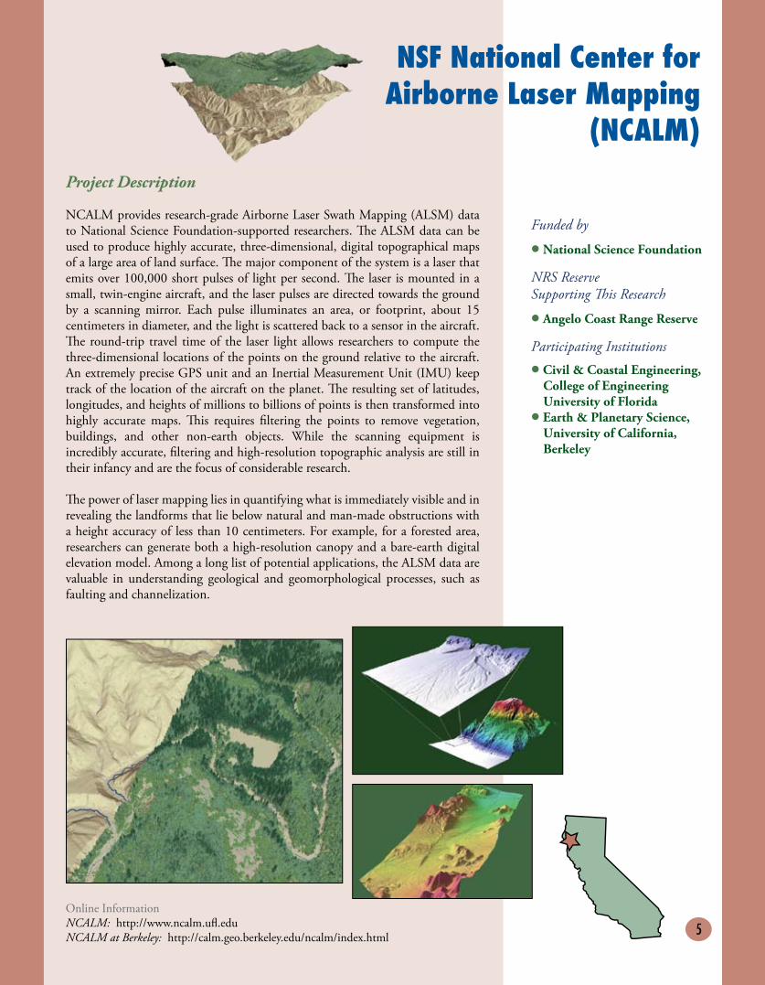
NSF National Center for Airborne Laser Mapping
(NCALM)Project Description
NCALM provides research-grade Airborne Laser Swath Mapping (ALSM) data to National Science Foundation-supported researchers. �e ALSM data can be used to produce highly accurate, three-dimensional, digital topographical maps of a large area of land surface. �e major component of the system is a laser that emits over 100,000 short pulses of light per second. �e laser is mounted in a small, twin-engine aircraft, and the laser pulses are directed towards the ground by a scanning mirror. Each pulse illuminates an area, or footprint, about 15 centimeters in diameter, and the light is scattered back to a sensor in the aircraft. �e round-trip travel time of the laser light allows researchers to compute the three-dimensional locations of the points on the ground relative to the aircraft. An extremely precise GPS unit and an Inertial Measurement Unit (IMU) keep track of the location of the aircraft on the planet. �e resulting set of latitudes, longitudes, and heights of millions to billions of points is then transformed into highly accurate maps. �is requires filtering the points to remove vegetation, buildings, and other non-earth objects. While the scanning equipment is incredibly accurate, filtering and high-resolution topographic analysis are still in their infancy and are the focus of considerable research.
�e power of laser mapping lies in quantifying what is immediately visible and in revealing the landforms that lie below natural and man-made obstructions with a height accuracy of less than 10 centimeters. For example, for a forested area, researchers can generate both a high-resolution canopy and a bare-earth digital elevation model. Among a long list of potential applications, the ALSM data are valuable in understanding geological and geomorphological processes, such as faulting and channelization.
Online InformationNCALM: http://www.ncalm.ufl.eduNCALM at Berkeley: http://calm.geo.berkeley.edu/ncalm/index.html
6
Project Description
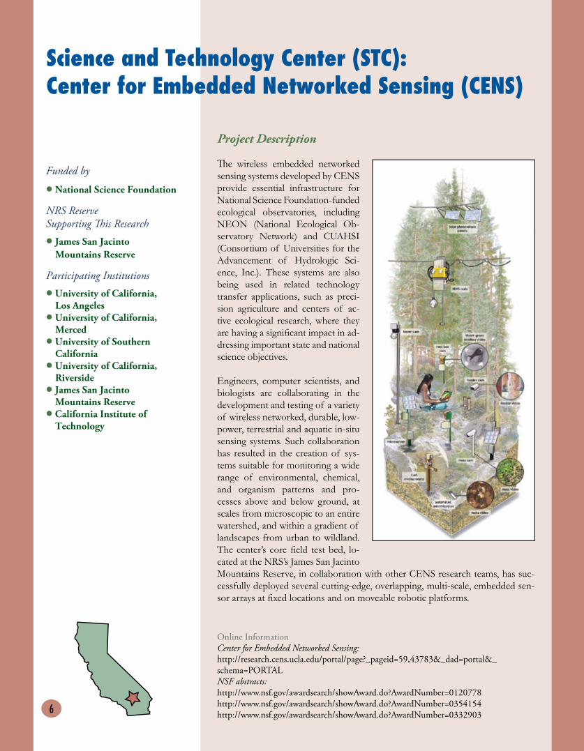
�e wireless embedded networked sensing systems developed by CENS provide essential infrastructure for National Science Foundation-funded ecological observatories, including NEON (National Ecological Ob-servatory Network) and CUAHSI (Consortium of Universities for the Advancement of Hydrologic Sci-ence, Inc.). These systems are also being used in related technology transfer applications, such as preci-sion agriculture and centers of ac-tive ecological research, where they are having a significant impact in ad-dressing important state and national science objectives.
Engineers, computer scientists, and biologists are collaborating in the development and testing of a variety of wireless networked, durable, low-power, terrestrial and aquatic in-situ sensing systems. Such collaboration has resulted in the creation of sys-tems suitable for monitoring a wide range of environmental, chemical, and organism patterns and pro-cesses above and below ground, at scales from microscopic to an entire watershed, and within a gradient of landscapes from urban to wildland. The center’s core field test bed, lo-cated at the NRS’s James San Jacinto Mountains Reserve, in collaboration with other CENS research teams, has suc-cessfully deployed several cutting-edge, overlapping, multi-scale, embedded sen-sor arrays at fixed locations and on moveable robotic platforms.
Funded by
• National Science Foundation
NRS Reserve Supporting �is Research
• James San JacintoMountains Reserve
Participating Institutions
• University of California, Los Angeles
• University of California,Merced
• University of SouthernCalifornia
• University of California,Riverside
• James San Jacinto Mountains Reserve
• California Institute of Technology
Online InformationCenter for Embedded Networked Sensing:http://research.cens.ucla.edu/portal/page?_pageid=59,43783&_dad=portal&_schema=PORTALNSF abstracts:http://www.nsf.gov/awardsearch/showAward.do?AwardNumber=0120778http://www.nsf.gov/awardsearch/showAward.do?AwardNumber=0354154http://www.nsf.gov/awardsearch/showAward.do?AwardNumber=0332903
Science and Technology Center (STC):Center for Embedded Networked Sensing (CENS)

7
Project Description
Various atmospheric and anthropogenic phenomena create infrasonic soundwaves (0 to 20 Hertz) that can travel thousands of kilometers through the atmosphere. Example sources include meteors, tornadoes, wave swells, earthquakes, rocket and spacecraft launches/re-entries, and atmospheric nuclear tests. After the approval of the Comprehensive Test Ban Treaty (CTBT) in 1996, the United Nations International Monitoring System established a network of more than 300 sites to conduct seismological, hydroacoustic, radionuclide, and infrasound monitoring. �is advanced sensor array is part of that network.
Where other infrasound sensors consist of microbarometers or microphones that measure atmospheric pressure changes, the new optical fiber infrasound sensor (OFIS) consists of a compliant tube wrapped helically with optical fibers. Pressure fluctuations produced by infrasonic soundwaves cause strain in the tubular diaphragm, which induces changes in the optical path length, thereby creating an interferometer whose change in path length measures time-dependent fluctuations in atmospheric pressure.
�e OFIS averages pressure over the length of the tube (approximately 89 meters) rather than as a point sensor. Integrating over the OFIS’s length reduces small-scale atmospheric noise due to air turbulence. Current results indicate that the OFIS records pressure fluctuations with less noise than mechanically filtered sensors and sets a new low-noise limit in the band from 1 to 10 Hertz, depending on local wind conditions.
�ree OFIS arrays are currently in operation at this site, with more to be added. A number of instrumental issues are currently under study, including variation in the instrument calibration with time and its dependence on temperature, stability of the interferometer, and methods to mitigate environmental problems. �e ultimate goal is to create an array of OFIS sensors that can detect directional signals and transmit data in real time for analysis.
Optical Fiber Infrasound Sensor (OFIS)
Funded by
• United Nations International Monitoring System
NRS Reserve Supporting �is Research
• Boyd Deep Canyon DesertResearch Center
Principal Investigators
• Mark ZumbergeUniversity of California, San Diego
• Jon BergerUniversity of California, San Diego
Participating Institutions
• Scripps Institution ofOceanography
• Laboratory for Atmospheric Acoustics
Online InformationInternational Monitoring System: http://www.seismo.ethz.ch/bsv/ctbto/ims.htmlLaboratory for Atmospheric Acoustics: http://l2a.ucsd.edu/about.html
8
North American Carbon ProgramDetermining California’s Carbon Budget
Project Description
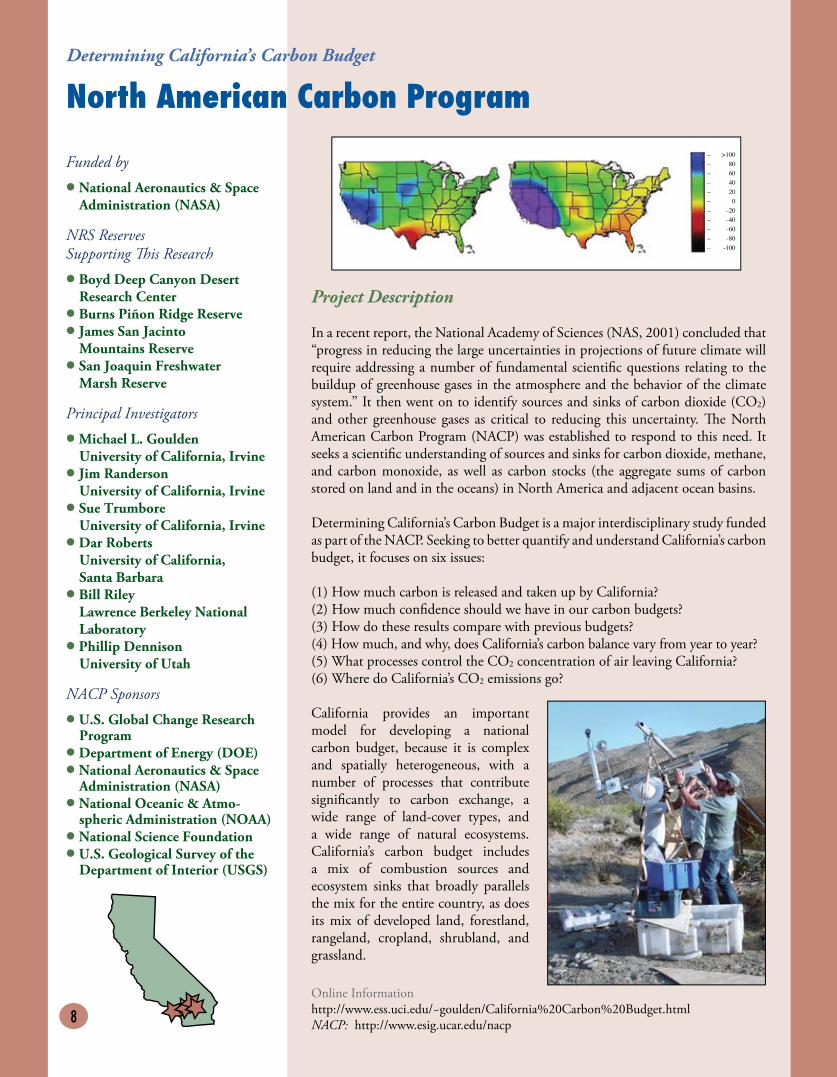
In a recent report, the National Academy of Sciences (NAS, 2001) concluded that “progress in reducing the large uncertainties in projections of future climate will require addressing a number of fundamental scientific questions relating to the buildup of greenhouse gases in the atmosphere and the behavior of the climate system.” It then went on to identify sources and sinks of carbon dioxide (CO2)and other greenhouse gases as critical to reducing this uncertainty. �e North American Carbon Program (NACP) was established to respond to this need. It seeks a scientific understanding of sources and sinks for carbon dioxide, methane, and carbon monoxide, as well as carbon stocks (the aggregate sums of carbon stored on land and in the oceans) in North America and adjacent ocean basins.
Determining California’s Carbon Budget is a major interdisciplinary study funded as part of the NACP. Seeking to better quantify and understand California’s carbon budget, it focuses on six issues:
(1) How much carbon is released and taken up by California? (2) How much confidence should we have in our carbon budgets? (3) How do these results compare with previous budgets? (4) How much, and why, does California’s carbon balance vary from year to year? (5) What processes control the CO2 concentration of air leaving California? (6) Where do California’s CO2 emissions go?
California provides an important model for developing a national carbon budget, because it is complex and spatially heterogeneous, with a number of processes that contribute significantly to carbon exchange, a wide range of land-cover types, and a wide range of natural ecosystems. California’s carbon budget includes a mix of combustion sources and ecosystem sinks that broadly parallels the mix for the entire country, as does its mix of developed land, forestland, rangeland, cropland, shrubland, and grassland.
Online Informationhttp://www.ess.uci.edu/~goulden/California%20Carbon%20Budget.htmlNACP: http://www.esig.ucar.edu/nacp
Funded by
• National Aeronautics & SpaceAdministration (NASA)
NRS Reserves Supporting �is Research
• Boyd Deep Canyon DesertResearch Center
• Burns Piñon Ridge Reserve• James San Jacinto
Mountains Reserve• San Joaquin Freshwater
Marsh Reserve
Principal Investigators
• Michael L. GouldenUniversity of California, Irvine
• Jim RandersonUniversity of California, Irvine
• Sue TrumboreUniversity of California, Irvine
• Dar RobertsUniversity of California, Santa Barbara
• Bill RileyLawrence Berkeley NationalLaboratory
• Phillip DennisonUniversity of Utah
NACP Sponsors
• U.S. Global Change ResearchProgram
• Department of Energy (DOE)• National Aeronautics & Space
Administration (NASA)• National Oceanic & Atmo-
spheric Administration (NOAA)• National Science Foundation• U.S. Geological Survey of the
Department of Interior (USGS)
– >100– 80– 60– 40– 20– 0– -20– -40– -60– -80– -100

9
Controls on the Response of CaliforniaʼsEcosystems to Environmental Change
Project Description
�e goal of this project is to understand better the impact of environmental change on south-ern California’s ecosystems. An ecosystem’s re-sponse to environmental change is determined by several mechanisms, including shifts in plant physiology, plant demography, plant competi-tion and community composition, and biogeo-chemistry and nutrient cycling. �e goal here is to understand how each of these mechanisms contributes to an ecosystem’s overall response to environmental change. Researchers have used various approaches to investigate the eco-logical effects of environmental change, includ-ing manipulations, interannual observations, and gradient studies. Each of these approaches provides a key piece of the puzzle, but no single
approach provides a complete picture of ecosystem response. We are using a hy-brid experimental design that simultaneously incorporates manipulations, as well as interannual and gradient observations to improve the understanding of the effects of changing water balance on California’s ecosystems.
Our research focuses on high-value ecosystems in a region where climate change is expected to have a major impact. Four considerations underscore the impor-tance and relevance of this research:
(1) Southern California provides an excellent natural laboratory for understanding how cli-mate controls ecosystem function. (2) Southern California’s location at the edge of the mean winter storm track and expo-sure to climate variability associated with the ENSO (El Niño/Southern Oscillation) and PDO (Pacific Decadal Oscillation) increase the likelihood of pronounced future climate change.(3) Southern California’s semiarid climate and steep climate and vegetation gradients increase the likelihood that a change in cli-mate will have a major impact on California’s ecosystems.(4) �e tight link between climate, ecosys-tem function, and natural disasters in southern California increases the likeli-hood that climate change will result in large socioeconomic impacts.
Funded by
• Department of Energy (DOE)
NRS Reserves Supporting �is Research
• Boyd Deep Canyon DesertResearch Center
• Burns Piñon Ridge Reserve• James San Jacinto
Mountains Reserve• Motte Rimrock Reserve
Principal Investigators
• Michael L. GouldenEarth System Science University of California, Irvine
• Katharine N. Suding Ecology & Evolutionary BiologyUniversity of California, Irvine
Physiological, Demographic, Competitive, and Biogeochemical
Smoke from Southern CA fires, 10/26/03. Extreme fires co-vary with unusual atmospheric circulation (Santa Ana winds from the east), sweeping the combusted CO2 away from North America. (Terra MODIS image from Goddard Space Flight Center Scientific Visualization Studio.)
California vegetation type and recent fire his-tory. Areas that have burned since 1966 are shown in red. Brown area is desert; yellow is grassland; green shades are shrub, woodland, and forest; gray is urban; pink is agriculture.
Online Informationhttp://www.ess.uci.edu/~goulden/California%20Climate%20Impacts.html

10
Science and Technology Center (STC): National Center for Earth-surface Dynamics (NCED)
Project Description
�e National Center for Earth-surface Dynamics (NCED) is focused on understanding the processes that shape the earth’s surface. �e earth’s surface is the dynamic interface among the lithosphere, hydrosphere, biosphere, and atmosphere. It is interwoven intimately with the life that inhabits it. Surface processes span environments that range from high mountains to ocean depths and time scales that range from fractions of a second to millions of years. Because of these wide ranges in form, process, and scale, the study of surface dynamics has involved many disciplines and approaches. A major goal of NCED is to foster the development of a unified, quantitative science of earth-surface dynamics that combines efforts in geomorphology, civil engineering, biology, sedimentary geology, oceanography, and geophysics. �e NCED research program is focused on channel systems. Major projects include:
(1) Development of desktop watersheds that use high-resolution topographic, hydrologic, and ecological data for environmental forecasting;(2) Restoration geomorphology, providing science and policy tools for stream and landscape restoration; and (3) Subsurface prediction, coupling our understanding of surface and tectonic
processes with our understanding of the geo-metry of channelized conduits and reservoirs in sedimentary basins.
Goals of NCED include both short-term prediction of surface response to natural and anthropogenic change and long-term interpretation of how past conditions are recorded in landscapes and sedimentary strata. Progress towards these goals would contribute to solutions of such pressing societal problems as the estimation and mitigation of landscape-related risk; responsible management of landscape resources, including forests, agricultural, and recreational areas; forecasting landscape response to possible climatic and other changes; and wise development of resources, such as groundwater and hydrocarbons, that are hosted in buried sediments.
Online InformationNational Center for Earth-surface Dynamics: http://www.nced.umn.eduUC Berkeley Geomorphology Group: http://socrates.berkeley.edu/~geomorphPower Lab for Food Web Research at UC Berkeley: http://ib.berkeley.edu/labs/power
Funded by
• National Science Foundation
NRS Reserve Supporting �is Research
• Angelo Coast Range Reserve
Participating Institutions
• University of Minnesota (lead)• University of California,
Berkeley• Fond du Lac Tribal &
Community College • Science Museum of Minnesota• Massachusetts Institute of
Technology• Princeton University • University of Wyoming
11
Sagehen Experimental Forest
Project Description
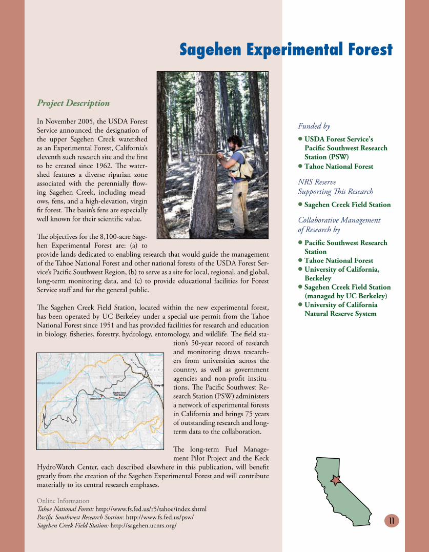
In November 2005, the USDA Forest Service announced the designation of the upper Sagehen Creek watershed as an Experimental Forest, California’s eleventh such research site and the first to be created since 1962. �e water-shed features a diverse riparian zone associated with the perennially flow-ing Sagehen Creek, including mead-ows, fens, and a high-elevation, virgin fir forest. �e basin’s fens are especially well known for their scientific value.
�e objectives for the 8,100-acre Sage-hen Experimental Forest are: (a) to provide lands dedicated to enabling research that would guide the management of the Tahoe National Forest and other national forests of the USDA Forest Ser-vice’s Pacific Southwest Region, (b) to serve as a site for local, regional, and global, long-term monitoring data, and (c) to provide educational facilities for Forest Service staff and for the general public.
�e Sagehen Creek Field Station, located within the new experimental forest, has been operated by UC Berkeley under a special use-permit from the Tahoe National Forest since 1951 and has provided facilities for research and education in biology, fisheries, forestry, hydrology, entomology, and wildlife. �e field sta-
tion’s 50-year record of research and monitoring draws research-ers from universities across the country, as well as government agencies and non-profit institu-tions. �e Pacific Southwest Re-search Station (PSW) administers a network of experimental forests in California and brings 75 years of outstanding research and long-term data to the collaboration.
�e long-term Fuel Manage-ment Pilot Project and the Keck
HydroWatch Center, each described elsewhere in this publication, will benefit greatly from the creation of the Sagehen Experimental Forest and will contribute materially to its central research emphases.
Funded by
• USDA Forest Service’sPacific Southwest ResearchStation (PSW)
• Tahoe National Forest
NRS Reserve Supporting �is Research
• Sagehen Creek Field Station
Collaborative Management of Research by
• Pacific Southwest ResearchStation
• Tahoe National Forest• University of California,
Berkeley• Sagehen Creek Field Station
(managed by UC Berkeley)• University of California
Natural Reserve System
Online InformationTahoe National Forest: http://www.fs.fed.us/r5/tahoe/index.shtmlPacific Southwest Research Station: http://www.fs.fed.us/psw/Sagehen Creek Field Station: http://sagehen.ucnrs.org/

12
Fuel Management National Pilot Project
Project Description
Nearly a century of fire suppression in the Sierra Nevada has had the unintend-ed consequence of placing millions of hectares of forest at risk of catastrophic fire. Modifying wildland fire behavior across landscapes in the Sierran Na-tional Forests has been identified as a management priority. �e preferred response is to apply strategic fuel treat-ments at the landscape level, yet there is little guidance for the implementation of this strategy. Sagehen Creek Basin in the Tahoe National Forest provides a representative landscape, where the ac-cumulation of forest fuels has created a severe risk of catastrophic wildfire. �e primary goal of this study is: to evaluate the effectiveness of strategically placed area treatments (SPLAT) in reducing fire hazard at Sagehen Creek Basin. We will first build a field-parameterized version of the fire-behavior model, FARSITE, and simulate alternative fuel-management de-
signs. �e performances of these de-signs would be evaluated in terms of slowing fire spread and reducing fire intensity. �e data needed to develop the map layers for FARSITE will be obtained from a network of geo-referenced field plots where we will measure the fire-relevant attributes of the vegetation and the surface fuels. Since these attributes are not only heterogeneous, but also resistant to measurement via remote sensing, we will explore innovative, efficient field methods for assessing fuel loads. We will capitalize on the long-term mon-
itoring record at Sagehen to quantify the recent trends in forest change and use the results to inform fuel-management strategies. Our hope is that the specific lessons learned during this intensive study of one landscape will help guide plan-ning for other management units throughout the forests in the Sierra Nevada. �e Sagehen Creek Field Station provides vital infrastructure support to extend these results to both professional managers and the interested public.
Translating SPLATs from a theoretical to a real-world landscape: �e implications of fuel-management strategies for Sagehen Creek Basin, Tahoe National Forest
Funded by
• USDA Forest Service
NRS Reserve Supporting �is Research
• Sagehen Creek Field Station
Principal Investigators
• John J. BattlesEnvironmental Science, Policy& ManagementUniversity of California,Berkeley
• Scott StephensEnvironmental Science, Policy& ManagementUniversity of California,Berkeley
Online InformationJoint Fire Science Program: http://jfsp.nifc.gov/JFSP_Project_Info_5.htm
13
Keck HydroWatch Center
Funded by
• W. M. Keck Foundation
NRS Reserves Supporting �is Research
• Angelo Coast Range Reserve• Sagehen Creek Field Station
Principal Investigators atUniversity of California, Berkeley
• Inez FungEarth & Planetary Science;Environmental Science, Policy& Management; Co-Director,Berkeley Institute of theEnvironment
• Ronald CohenChemistry; Director, BerkeleyAtmospheric Sciences Center
• David CullerElectrical Engineering & Computer Science
• Todd DawsonIntegrative Biology; Director,Center for Stable IsotopeBiogeochemistry
• Donald DePaolo Earth & Planetary Science;Director, Center for IsotopeGeochemistry
• William Dietrich Earth & Planetary Science;
Co-Leader, National Center forEarth-surface Dynamics &National Center for AirborneLaser Mapping
• James KirchnerEarth & Planetary Science;Director, UC Berkeley CentralSierra Field Research Stations
Project Description
Administered by the Berkeley Institute of the Environment, the Keck HydroWatch Center will dramatically expand the obser-vations of all aspects of the water cycle by developing cost-effective, rapid-response, and accurate sensors and techniques to
monitor water quality, quantity, and pathways. �e center is initiating a proto-type deployment of intensive environmental monitoring networks, resulting in the acquisition, synthesis, and analysis of new, large volumes of data. �e first deployments will take place at two small (~10-102 km2), hydrologically different sites within the UC Natural Reserve System: Angelo Coast Range Reserve and Sagehen Creek Field Station.
One goal of the HydroWatch project is to create a model of the entire hydrologic system that integrates the atmospheric, surface, and below-ground variations of water. �is model will allow researchers to address a number of long-standing questions about how the water cycle functions and how it may change:
(1) How is freshwater resupplied and recycled?
(2) What is the distribution of water vapor in the lowest kilometer of the at-mosphere and of soil moisture across the landscape? How do atmospheric and land-surface processes alter these distributions?
(3) How long do watersheds store water in the subsurface, and by what combi-nation of flowpaths does this water reach the stream?
Once the prototype network has been demonstrated, scientists expect that this model can be readily scaled-up and deployed at continental-scale watersheds (>104-105 km2), creating a national and international standard for water-moni-toring programs.
Online InformationBerkeley Institute of the Environment: http://bie.berkeley.edu
14
Project Description
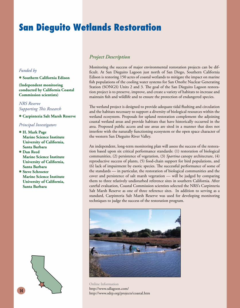
Monitoring the success of major environmental restoration projects can be dif-ficult. At San Dieguito Lagoon just north of San Diego, Southern California Edison is restoring 150 acres of coastal wetlands to mitigate the impact on marine fish populations of the cooling water systems for San Onofre Nuclear Generating Station (SONGS) Units 2 and 3. �e goal of the San Dieguito Lagoon restora-tion project is to preserve, improve, and create a variety of habitats to increase and maintain fish and wildlife and to ensure the protection of endangered species.
�e wetland project is designed to provide adequate tidal flushing and circulation and the habitats necessary to support a diversity of biological resources within the wetland ecosystem. Proposals for upland restoration complement the adjoining coastal wetland areas and provide habitats that have historically occurred in the area. Proposed public access and use areas are sited in a manner that does not interfere with the naturally functioning ecosystem or the open space character of the western San Dieguito River Valley.
An independent, long-term monitoring plan will assess the success of the restora-tion based upon six critical performance standards: (1) restoration of biological communities, (2) persistence of vegetation, (3) Spartina canopy architecture, (4) reproductive success of plants, (5) food-chain support for bird populations, and (6) lack of impairment by exotic species. �e successful performance of some of the standards — in particular, the restoration of biological communities and the cover and persistence of salt marsh vegetation — will be judged by comparing them to three relatively undisturbed reference sites in southern California. After careful evaluation, Coastal Commission scientists selected the NRS’s Carpinteria Salt Marsh Reserve as one of three reference sites. In addition to serving as a standard, Carpinteria Salt Marsh Reserve was used for developing monitoring techniques to judge the success of the restoration program.
Funded by
• Southern California Edison
(Independent monitoring conducted by California Coastal Commission scientists)
NRS Reserve Supporting �is Research
• Carpinteria Salt Marsh Reserve
Principal Investigators
• H. Mark PageMarine Science InstituteUniversity of California, Santa Barbara
• Dan ReedMarine Science InstituteUniversity of California, Santa Barbara
• Steve SchroeterMarine Science InstituteUniversity of California, Santa Barbara
San Dieguito Wetlands Restoration
Online Informationhttp://www.sdlagoon.com/http://www.sdrp.org/projects/coastal.htm
15
Project Description
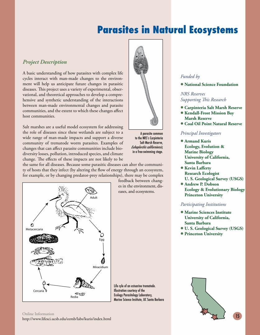
A basic understanding of how parasites with complex life cycles interact with man-made changes to the environ-ment will help us anticipate future changes in parasitic diseases. �is project uses a variety of experimental, obser-vational, and theoretical approaches to develop a compre-hensive and synthetic understanding of the interactions between man-made environmental changes and parasite communities, and the extent to which these changes affect host communities.
Salt marshes are a useful model ecosystem for addressing the role of diseases since these wetlands are subject to a wide range of man-made impacts and support a diverse community of trematode worm parasites. Examples of changes that can affect parasite communities include bio-diversity losses, pollution, introduced species, and climate change. �e effects of these impacts are not likely to be the same for all diseases. Because some parasitic diseases can alter the communi-ty of hosts that they infect (by altering the flow of energy through an ecosystem, for example, or by changing predator-prey relationships), there may be complex
feedback between chang-es in the environment, dis-eases, and ecosystems.
Funded by
• National Science Foundation
NRS Reserves Supporting �is Research
• Carpinteria Salt Marsh Reserve• Kendall-Frost Mission Bay
Marsh Reserve• Coal Oil Point Natural Reserve
Principal Investigators
• Armand KurisEcology, Evolution & Marine BiologyUniversity of California, Santa Barbara
• Kevin LaffertyResearch EcologistU. S. Geological Survey (USGS)
• Andrew P. DobsonEcology & Evolutionary BiologyPrinceton University
Participating Institutions
• Marine Sciences InstituteUniversity of California, Santa Barbara
• U. S. Geological Survey (USGS)• Princeton University
Parasites in Natural Ecosystems
Online Informationhttp://www.lifesci.ucsb.edu/eemb/labs/kuris/index.html
A parasite common to the NRSʼs Carpinteria
Salt Marsh Reserve, Euhaplorchis californiensis,in a free-swimming stage.
Life cyle of an estuarine trematode. Illustration courtesy of theEcology Parasitology Laboratory, Marine Science Institute, UC Santa Barbara
Adult
Metacercaria
Cercaria
Egg
Miracidium
Redia
16
Santa Barbara Coastal Long Term Ecological Research (LTER)
Online InformationSanta Barbara Coastal LTER-SBC: http://www.lternet.edu/sites/sbc
Funded by
• National Science Foundation
NRS Reserves Supporting �is Research
• Carpinteria Salt Marsh Reserve• Santa Cruz Island Reserve
Participating Institution
• University of California, Santa Barbara
Project Description
�e Santa Barbara Coastal LTER–SBC (Santa Barbara Channel) is part of the National Science Foundation’s Long Term Ecological Research (LTER) Network. It is located in the coastal zone of southern California near Santa Barbara. It is bounded by the steep, east/west-trending Santa Ynez Mountains and coastal plain to the north and the unique North-ern Channel Islands archipelago to the south. Point Conception, where the coast of California returns to a north-to-south orientation, lies at the western boundary, and the Santa Clara Riv-er marks its eastern edge. �e site lies on the active boundary of the Pacific Oce-
anic Plate and the North American Continental Plate. High levels of tectonic activity have created dra-matic elevation gradients in both the terrestrial and the underwater landscapes of the site. �e Santa Barbara Channel includes some of the deepest ocean basins known on the continental shelf, along with remarkable submarine canyons and escarpments.
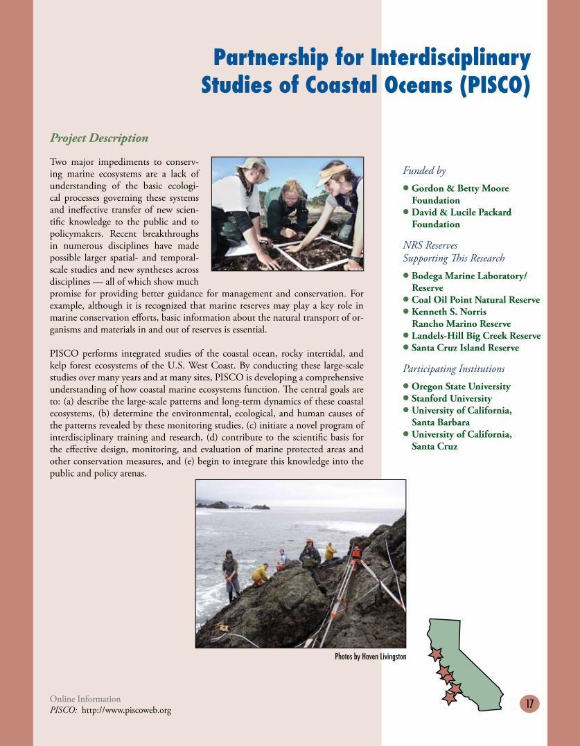
Giant kelp (Macrocystis pyrifera) is the world’s largest and fastest grow-ing submarine plant. Giant kelp forests occur in the northern and southern hemispheres and are one of the most productive ecosystems in the world. �ey provide food and shelter for a wide diversity of organisms, many of which have high economic value. �e primary research objective of the Santa Bar-
bara Coastal LTER is to investigate the relative importance of land versus ocean processes in structuring giant kelp forest ecosystems for different conditions of land use, climate, and ocean influences.
Giant kelp forest off the coast of Santa Barbara. Photo by Ron McPeak
Land/Ocean Interactions and the Dynamics of Kelp Forest Ecosystems
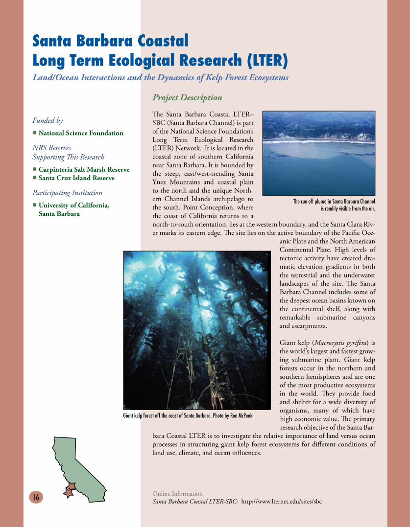
The run-off plume in Santa Barbara Channel is readily visible from the air.
17
Partnership for Interdisciplinary Studies of Coastal Oceans (PISCO)
Funded by
• Gordon & Betty MooreFoundation
• David & Lucile PackardFoundation
NRS Reserves Supporting �is Research
• Bodega Marine Laboratory/Reserve
• Coal Oil Point Natural Reserve• Kenneth S. Norris
Rancho Marino Reserve• Landels-Hill Big Creek Reserve• Santa Cruz Island Reserve
Participating Institutions
• Oregon State University• Stanford University• University of California,
Santa Barbara • University of California,
Santa Cruz
Project Description
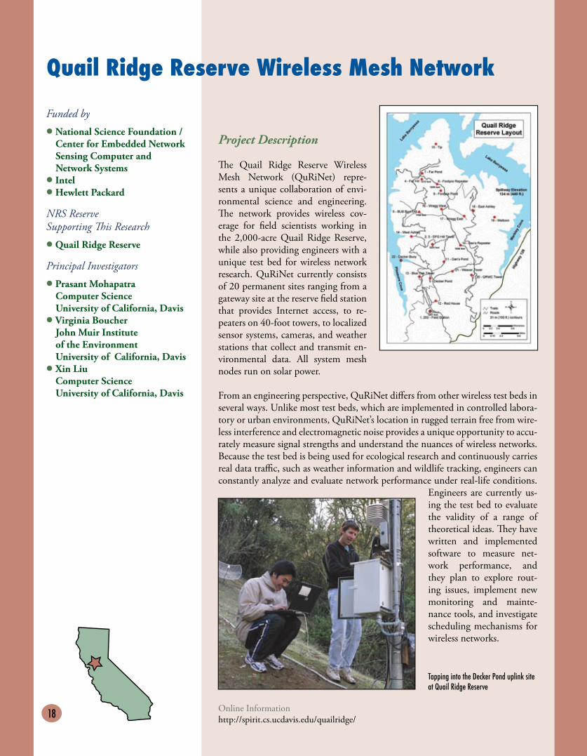
Two major impediments to conserv-ing marine ecosystems are a lack of understanding of the basic ecologi-cal processes governing these systems and ineffective transfer of new scien-tific knowledge to the public and to policymakers. Recent breakthroughs in numerous disciplines have made possible larger spatial- and temporal-scale studies and new syntheses across disciplines — all of which show much promise for providing better guidance for management and conservation. For example, although it is recognized that marine reserves may play a key role in marine conservation efforts, basic information about the natural transport of or-ganisms and materials in and out of reserves is essential.
PISCO performs integrated studies of the coastal ocean, rocky intertidal, and kelp forest ecosystems of the U.S. West Coast. By conducting these large-scale studies over many years and at many sites, PISCO is developing a comprehensive understanding of how coastal marine ecosystems function. �e central goals are to: (a) describe the large-scale patterns and long-term dynamics of these coastal ecosystems, (b) determine the environmental, ecological, and human causes of the patterns revealed by these monitoring studies, (c) initiate a novel program of interdisciplinary training and research, (d) contribute to the scientific basis for the effective design, monitoring, and evaluation of marine protected areas and other conservation measures, and (e) begin to integrate this knowledge into the public and policy arenas.
Online InformationPISCO: http://www.piscoweb.org
Photos by Haven Livingston
18
Quail Ridge Reserve Wireless Mesh Network
Funded by
• National Science Foundation /Center for Embedded NetworkSensing Computer and Network Systems
• Intel• Hewlett Packard
NRS Reserve Supporting �is Research
• Quail Ridge Reserve
Principal Investigators
• Prasant MohapatraComputer ScienceUniversity of California, Davis
• Virginia BoucherJohn Muir Institute of the EnvironmentUniversity of California, Davis
• Xin LiuComputer ScienceUniversity of California, Davis
Project Description
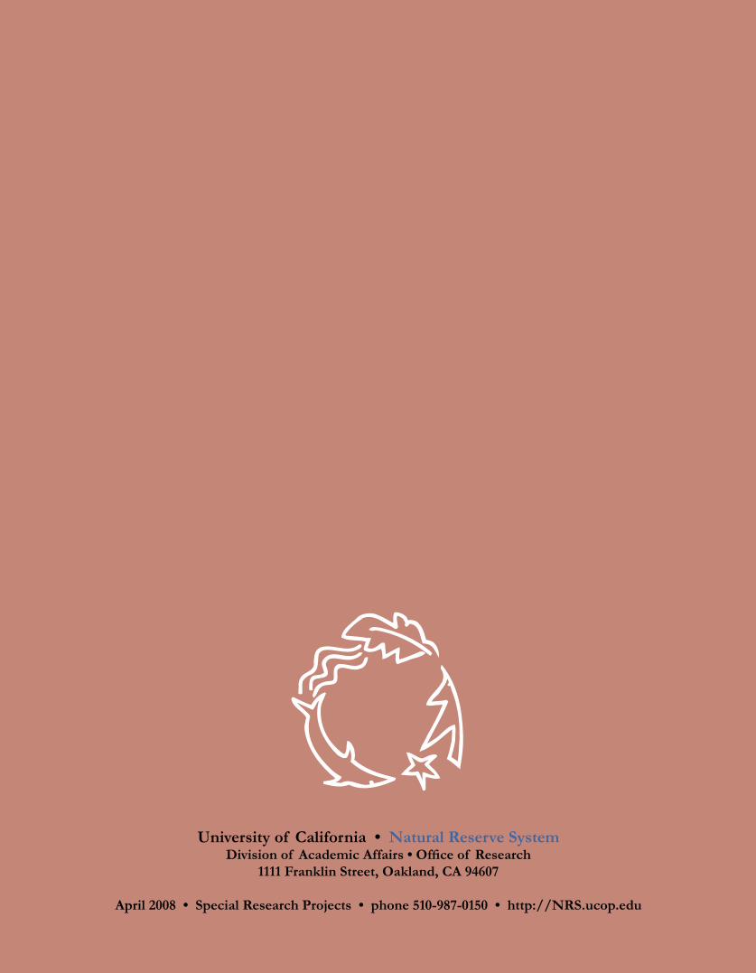
�e Quail Ridge Reserve Wireless Mesh Network (QuRiNet) repre-sents a unique collaboration of envi-ronmental science and engineering. �e network provides wireless cov-erage for field scientists working in the 2,000-acre Quail Ridge Reserve, while also providing engineers with a unique test bed for wireless network research. QuRiNet currently consists of 20 permanent sites ranging from a gateway site at the reserve field station that provides Internet access, to re-peaters on 40-foot towers, to localized sensor systems, cameras, and weather stations that collect and transmit en-vironmental data. All system mesh nodes run on solar power.
From an engineering perspective, QuRiNet differs from other wireless test beds in several ways. Unlike most test beds, which are implemented in controlled labora-tory or urban environments, QuRiNet’s location in rugged terrain free from wire-less interference and electromagnetic noise provides a unique opportunity to accu-rately measure signal strengths and understand the nuances of wireless networks. Because the test bed is being used for ecological research and continuously carries real data traffic, such as weather information and wildlife tracking, engineers can constantly analyze and evaluate network performance under real-life conditions.
Engineers are currently us-ing the test bed to evaluate the validity of a range of theoretical ideas. �ey have written and implemented software to measure net-work performance, and they plan to explore rout-ing issues, implement new monitoring and mainte-nance tools, and investigate scheduling mechanisms for wireless networks.
Online Informationhttp://spirit.cs.ucdavis.edu/quailridge/
Tapping into the Decker Pond uplink site at Quail Ridge Reserve

19
Tagging of Pacific Pelagics (TOPP)
Funded by
• U.S. Office of Naval Research • Gordon & Betty Moore
Foundation• David & Lucile Packard
Foundation• Alfred P. Sloan Foundation
NRS Reserve Supporting �is Research
• Año Nuevo Island Reserve
TOPP Partners
• Sea Mammal Research Unit, University of St. Andrews
• Tuna Research andConservation Center,Hopkins Marine Station
• Monterey Bay Aquarium• Oregon State University• Cascadia Research Collective• Moss Landing Marine Lab• Southwest Fisheries Science
Center, NOAA
Principal Investigators
• Barbara A. BlockStanford University
• Daniel CostaUniversity of California, Santa Cruz
• Steve BogradNational Oceanic & Atmospheric Administration (NOAA)
• Randy Kochevar Monterey Bay Aquarium
Project Description
�e Tagging of Pacific Pelag-ics (TOPP) research program is an international scientific collaboration applying new technologies to enhance our understanding of the environmental basis for movements and behaviors of highly migratory pelagic animals in the North Pacific. Because these animals spend most of their lives in the open ocean, their movements can only be tracked with microprocessor-based archival tags that record their location and a number of other parameters, such as water pressure, ambient light, internal body temperature, external water tem-perature, and, in some cases, ocean salinity. Some of these tags must be retrieved to be downloaded, while others transmit the recorded data to ARGOS satellites from the ocean’s surface. TOPP scientists use this information to follow the mi-grations of tunas, sharks, pinnipeds (California sea lions and elephant seals), mola mola (ocean sunfish), cetaceans, albatross, squid, and sea turtles as they crisscross the Pacific basin. �e results answer basic questions about the animals’ biology, including where they feed and breed, and what migration corridors they use.
In addition to providing information about the animals themselves, the data gath-ered by the project provide oceanographers with a new way to sample conditions at different depths in the water column as they study the conjunction between the ocean, atmosphere, and climate. Understanding this conjuction is a critical com-ponent of models that predict changes in the global climate. �e TOPP program is increasing our understanding about how large open-ocean animals utilize the North Pacific ecosystem, as well as about the North Pacific itself. We are now be-ginning to see which areas are most critical for feeding, reproduction, and migration, and to better understand the environmental mechanisms that shape these behaviors. �is information will add to our current knowledge about these magnificent creatures and be invaluable in establishing ecosystem-based management strategies to ensure the long-term health of populations.
Online Informationhttp://toppcensus.org
Diving patterns for California sea lions
University of California • Natural Reserve SystemDivision of Academic Affairs • Office of Research
1111 Franklin Street, Oakland, CA 94607
April 2008 • Special Research Projects • phone 510-987-0150 • http://NRS.ucop.edu