National Report of Finland
8
___________________________________________________________________________________ BSHC26_National Report of Finland Page: 1 of 8 18 August 2021 Baltic Sea Hydrographic Commission Agenda Item B.3.3 26 th Meeting, 21-23 September 2021 National Report VTC Finland National Report of Finland 1. Finnish Hydrographic Office The Finnish Transport and Communications Agency Traficom organisation was reviewed during 1 st half of 2021 and the new management structure has been in force since 15 June 2021. Fig.1. Hydrographic and Fairways unit with underlying teams. The staff working for hydrography consist 51 specialists and the annual budget for hydrographic activities is about 9 million euros. The FHO has been performing according to the Quality Management System based on the ISO 9001 standard since 2011. Executive Summary This Report highlights the main activities and achievements of the Finnish Hydrographic Office since BSHC Virtual Meeting in September 2020. - The hydrographic surveys continues on shallow, nearshore areas with LiDAR and multibeam technologies. - Production of nautical charts was limited due to the ongoing system development projects. - Bathymetric Data Management System (MERTA) and Nautical Chart Production System (AHTI) have been taken in operational use. - The implementation of the "New vertical chart reference FIN N2000" (~BSCD2000) is ongoing.
Transcript of National Report of Finland
___________________________________________________________________________________
BSHC26_National Report of Finland Page: 1 of 8 18 August 2021
Baltic Sea Hydrographic Commission Agenda Item B.3.3 26th Meeting, 21-23 September 2021 National Report VTC Finland
National Report of Finland
1. Finnish Hydrographic Office
The Finnish Transport and Communications Agency Traficom organisation was
reviewed during 1st half of 2021 and the new management structure has been in
force since 15 June 2021.
Fig.1. Hydrographic and Fairways unit with underlying teams.
The staff working for hydrography consist 51 specialists and the annual budget for
hydrographic activities is about 9 million euros.
The FHO has been performing according to the Quality Management System based on
the ISO 9001 standard since 2011.
Executive Summary
This Report highlights the main activities and achievements of the Finnish Hydrographic
Office since BSHC Virtual Meeting in September 2020.
- The hydrographic surveys continues on shallow, nearshore areas with LiDAR and
multibeam technologies.
- Production of nautical charts was limited due to the ongoing system development
projects.
- Bathymetric Data Management System (MERTA) and Nautical Chart Production
System (AHTI) have been taken in operational use.
- The implementation of the "New vertical chart reference FIN N2000" (~BSCD2000)
is ongoing.

___________________________________________________________________________________
BSHC26_National Report of Finland Page: 2 of 8 18 August 2021
Baltic Sea Hydrographic Commission Agenda Item B.3.3 26th Meeting, 21-23 September 2021 National Report VTC Finland
2. Hydrographic surveys
During 2020, hydrographic surveys projects took place in Vaasa area on the Bothnia Sea
area. LiDAR surveys continued in the Archipelago Sea targeting full coverage from coastline
down to 6 m of water depth. The contract HAKO2018, on the Lake Saimaa was terminated
and canceled caused by COVID-19 pandemic. Due to the COVID-19 pandemic data deliveries
from areal surveys (~570 km2) in the Gulf of Finland were delivered late.
Table 1: Survey statistics for 2020.
Task Surveyed by Multibeam
[km2]
Line
sounding
[km2] Vaasa (BSVA2020) Meritaito Oy 550
Archipelago Sea areal surveys
Meritaito Oy LiDAR total area 3700 of which data acquired
~500,
Fig.2. Hydrographic re-survey coverage in 2020 surveyed according to IHO S-44 and FSIS-44 standards.

___________________________________________________________________________________
BSHC26_National Report of Finland Page: 3 of 8 18 August 2021
Baltic Sea Hydrographic Commission Agenda Item B.3.3 26th Meeting, 21-23 September 2021 National Report VTC Finland
The Finnish part of the HELCOM-BSHC Revised Harmonised Hydrographic Re-Survey Scheme
has been enhanced. The HELCOM survey plan was the driving force to perform the
hydrographic surveys in Finnish waters until 2017. The focus of hydrographic surveys has
now moved towards the inadequately surveyed coastal nearshore areas. As a total Baltic
Sea re-survey scheme, the requirements of the HELCOM Copenhagen 2013 Ministerial
Declaration are in progress in all Baltic Sea countries. The Finnish shallow nearshore
HELCOM Cat III areas have been included into the new version of the Re-Survey Scheme.
3. New Charts and updates
Printed charts
Due to the ongoing Ahti Development Project and ongoing N2000 fairway and nautical chart
reform -project, no new editions of printed charts or ENCs was published in 2020. The chart
correction service for both printed and ENC charts has been provided without interruption,
though.
Published printed charts
2013 2014 2015 2016 2017 2018 2019 2020
General charts 2 4 3 3 1 2 1 -
Approach charts 18 13 11 7 9 6 3 -
Harbour charts 10 8 2 4 9 1 1 -
Chart series 3 4 2 2 1 2 - -
Other charts - 1
Table 2. Statistics of published New Editions of Finnish nautical charts in 2013 – 2020.
Fig.3. New Chart catalogue 2021

___________________________________________________________________________________
BSHC26_National Report of Finland Page: 4 of 8 18 August 2021
Baltic Sea Hydrographic Commission Agenda Item B.3.3 26th Meeting, 21-23 September 2021 National Report VTC Finland
More information about Finnish nautical charts are available in The Chart Catalogue 2021
Link
The statistics of sold printed charts are presented in the Table 3. The overall sales of the
nautical chart series increased in 2020. Probably due to the increased domestic tourism and
boating. The new revision of the Water Traffic Act most likely had an impact on sales as
well.
Table 3. Statistics of sold printed charts 2013-2020.
In addition, there are many adopted printed charts from Finnish area of responsibility sold
by UKHO.
ENC production and distribution
The number of sold ENCs increased about 10 % and number of ships using ENCs increased
about 20 % during 2020. The ENC Statistics are visible in the Table 4 and Table 5.
Released ENCs 2013 2014 2015 2016 2017 2018 2019 2020
New ENCs 4 3 25 17 5 1 - -
New editions 33 43 48 38 50 47 13 71
Table 4. Statistics of produced Finnish ENC 2013-2020s.
Table 5. Statistics for the use of Finnish ENCs 2013-2020
Quality control of ENCs has been further improved with the new chart production
process. Some software tools for hydrographic data quality control and operation
guidance have been enhanced.
4. New publications and updates
Notices to Mariners are distributed via website including a download service (PDF) and NtM
Online web-service. Clients can filter the Notices by time of publication, area of interests or
charts in hand.
Printed paper
charts 2013 2014 2015 2016 2017 2018 2019 2020
AO-size 9186 10225 7330 5761 4656 5155 4136 3579
Chart series 14892 16634 19738 9642 9899 9747 7592 11855
Total sold
copies 24078 26 859 27088 15043 14555 14902 11728 15434
Use of ENC 2013 2014 2015 2016 2017 2018 2019 2020
ENCs sold annually (excluded trial,
training and demo usage)
61022 69982 77533 89927 95193 107101 115462 141973
No of ships (annually)
1908 2270 2713 3212 3659 4492 4698 4841
No of customers (annually) 669 793 898 1054 1232 1467 1439 1401

___________________________________________________________________________________
BSHC26_National Report of Finland Page: 5 of 8 18 August 2021
Baltic Sea Hydrographic Commission Agenda Item B.3.3 26th Meeting, 21-23 September 2021 National Report VTC Finland
The Lists of Lights are published for coastal areas and inland waterways. The Lake Saimaa
area is now included as a part of the publication for inland waterways. The List of Lights are
available as downloadable PDFs and in addition, information of lights can be search based
on ID, area of interest or related chart product.
Table 6. Annual statistics for nautical publications
5. MSI
Finnish Transport and Communications Agency is responsible for safety radio
communications in Finnish territorial waters and for distress radio communications in the
deep channels of the Saimaa waterways system. Fintraffic (government owned company) is
operating the national navigational warnings service.
In total 244 navigational warnings were published during 2020.
Publication /
Service
2013 2014 2015 2016 2017 2018 2019 2020
Navigational Warnings
431 234 236 237 239 200 84 244
Table 7. Annual statistics for navigational warnings
6. C-55
Status of hydrographic Surveys
Status of Nautical Charting
Publication /service 2013 2014 2015 2016 2017 2018 2019 2020
Notices to Mariners, vol of publications
33 34 34 35 35 35 35 35
Number of NtM notices 422 397 391 366 388 366 306 296
Number of ER updates 431 534 605 504 668 776 562 595

___________________________________________________________________________________
BSHC26_National Report of Finland Page: 6 of 8 18 August 2021
Baltic Sea Hydrographic Commission Agenda Item B.3.3 26th Meeting, 21-23 September 2021 National Report VTC Finland
7. Capacity building
Nothing to report.
8. Oceanographic activities
The implementation project for "New vertical chart reference N2000" (Baltic Sea Chart
datum 2000) is ongoing with data conversation and preparations for chart publication. BSCD
2000 will be introduced on the nautical charts, starting 2021 with a new hydrographic chart
data management and production system AHTI.
Fig.4. New vertical system N2000 (Baltic Sea Chart Datum 2000)
___________________________________________________________________________________
BSHC26_National Report of Finland Page: 7 of 8 18 August 2021
Baltic Sea Hydrographic Commission Agenda Item B.3.3 26th Meeting, 21-23 September 2021 National Report VTC Finland
9. Spatial data infratructure
National Geodata Portal
The non-navigational use of hydrographic data has increased exceedingly. A viewing
service is in use via the interface of National Geodata Portal providing Inspire specific
national spatial data sets, for example. The FHO is actively supporting hydrographic data
to the National Geodata Portal. The metadata of FHO is also available at the National
Geodata Portal.
Open data view and download services
File download service for viewing and downloading datasets
- Web Map Service
- Web Feature Service
- Tiled map service (WMTS) for viewing FHO nautical chart data in
raster format
The data available from these services is not suitable for navigation
and does not meet the requirements for an official nautical chart.
Links:
Finnish Transport and Communications Agency (The new data viewing
and download service)
https://julkinen.traficom.fi/oskari/?lang=en
National Geodata Portal Paikkatietoikkuna:
http://www.paikkatietoikkuna.fi/?lang=en
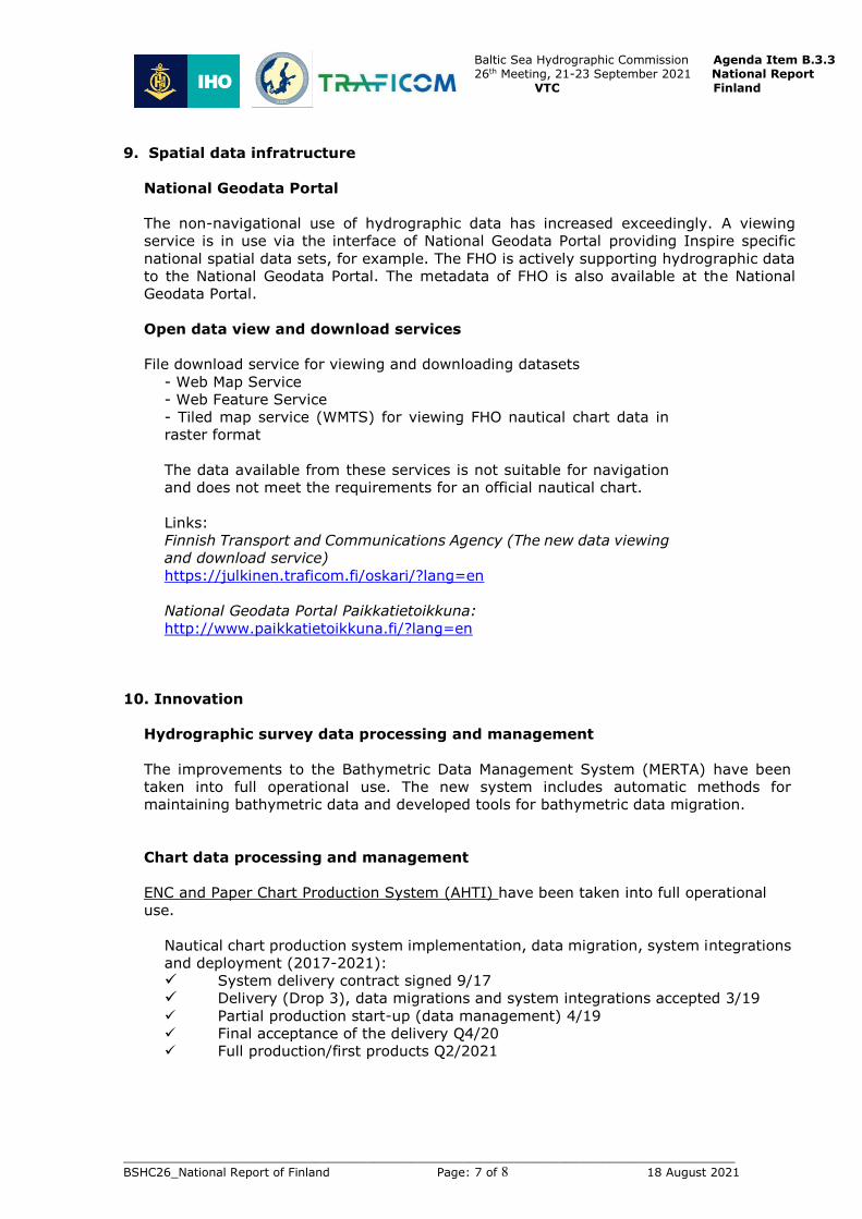
10. Innovation
Hydrographic survey data processing and management
The improvements to the Bathymetric Data Management System (MERTA) have been
taken into full operational use. The new system includes automatic methods for
maintaining bathymetric data and developed tools for bathymetric data migration.
Chart data processing and management
ENC and Paper Chart Production System (AHTI) have been taken into full operational
use.
Nautical chart production system implementation, data migration, system integrations
and deployment (2017-2021):
System delivery contract signed 9/17 Delivery (Drop 3), data migrations and system integrations accepted 3/19 Partial production start-up (data management) 4/19
Final acceptance of the delivery Q4/20
Full production/first products Q2/2021

___________________________________________________________________________________
BSHC26_National Report of Finland Page: 8 of 8 18 August 2021
Baltic Sea Hydrographic Commission Agenda Item B.3.3 26th Meeting, 21-23 September 2021 National Report VTC Finland
11. Other activities
FHO has Bilateral Arrangements with UKHO (adoptions of printed Charts), Norway
(ENC RENC services), Sweden, Estonia and Germany.
Finland is member of the IHO Council and take part of the HSSC and IRCC meetings.
Finnish experts are actively working in;
- HSSC/NCWG (as Chair)
- HSSC/ENCWG
- HSSC/S-100WG and HSSC/S-101PT
- HSSC/DQWG
- HSSC/NIPWG (as Vice Chair)
- HSSC/TWCWG
- IRCC/WEND-WG (representing BSHC)
- IRCC/MSDIWG
- Baltic Sea Hydrographic Commission including BSHC/BSICCWG (Chair), BSHC-
HELCOM/MWG (Chair), BSHC/BSDIWG, BSHC/BS-NSMSDIWG, BSHC/CDWG
- Nordic Hydrographic Commission including NHC/NCPEG, NHC/NSEG
- Arctic Region Hydrographic Commission (as Associate Member) including
ARHC/OTWG and ARHC/ARMSDIWG.
Finland is member of the PRIMAR and contribute actively the work of PRIMAR PAC and
WGs.
11. Conclusions
This report highlights the main activities of the Finnish Hydrographic Office since BSHC
Virtual Meeting in September 2020.