NATIONAL HISTORIC LANDMARK NOMINATION - U.S. Department of
14
NFS Form 10-900 OPANA RADAR SITE United States Department of the Interior, National Park Service NATIONAL HISTORIC LANDMARK NOMINATION USDI/NPS NRHP Registration Form (Rev. 8-86) OMB No. 1024-0018 Page 1 National Register of Historic Places Registration Form 1. NAME OF PROPERTY Historic Name: OPANA RADAR SITE Other Name/Site Number: 2. LOCATION Street & Number: Kamehameha Highway City/Town: Kawela State: HI County: Honolulu Code: Not for publication: 003 Vicinity: X Zip Code: 96731 3. CLASSIFICATION Ownership of Property Private:_ Public-Local:__ Public-State:__ Public-Federal: X Number of Resources within Property Contributing Category of Property: Site Building(s):__ District:__ Site; X Structure:__ Object:__ Noncontr ibut ing ____ buildings ____ sites ____ structures ____ objects Total Number of Contributing Resources Previously Listed in the National Register: 1 Name of Related Multiple Property Listing: N/A
Transcript of NATIONAL HISTORIC LANDMARK NOMINATION - U.S. Department of
NFS Form 10-900
OPANA RADAR SITEUnited States Department of the Interior, National Park Service
NATIONAL HISTORIC LANDMARK NOMINATIONUSDI/NPS NRHP Registration Form (Rev. 8-86) OMB No. 1024-0018
Page 1National Register of Historic Places Registration Form
1. NAME OF PROPERTY
Historic Name: OPANA RADAR SITE
Other Name/Site Number:
2. LOCATION
Street & Number: Kamehameha Highway
City/Town: Kawela
State: HI County: Honolulu Code:
Not for publication:
003
Vicinity: X
Zip Code: 96731
3. CLASSIFICATION
Ownership of PropertyPrivate:_
Public-Local:__ Public-State:__
Public-Federal: X
Number of Resources within Property Contributing
Category of Property: Site Building(s):__
District:__Site; X
Structure:__ Object:__
Noncontr ibut ing____ buildings ____ sites ____ structures ____ objects
Total
Number of Contributing Resources Previously Listed in the National Register: 1
Name of Related Multiple Property Listing: N/A

NFS Form 10-900 USDI/NPS NRHP Registration Form (Rev. 8-86) OMB No. 1024-0018
OPANA RADAR SITE Page 2United States Department of the Interior, National Park Service National Register of Historic Places Registration Form
4. STATE/FEDERAL AGENCY CERTIFICATION
As the designated authority under the National Historic Preservation Act of 1966, as amended, I hereby certify that this ___ nomination ___ request for determination of eligibility meets the documentation standards for registering properties in the National Register of Historic Places and meets the procedural and professional requirements set forth in 36 CFR Part 60. In my opinion, the property ___ meets ___ does not meet the National Register Criteria.
Signature of Certifying Official Date
State or Federal Agency and Bureau
In my opinion, the property ___ meets ___ does not meet the National Register criteria.
Signature of Commenting or Other Official Date
State or Federal Agency and Bureau
5. NATIONAL PARK SERVICE CERTIFICATION
I hereby certify that this property is:
___ Entered in the National Register ___________ ___ Determined eligible for the _______________
National Register ___ Determined not eligible for the ____________
National Register___ Removed from the National Register _________ ___ Other (explain): ________________________
Signature of Keeper Date of Action

NFS Form 10-900 USDI/NPS NRHP Registration Form (Rev. 8-86) OMB No. 1024-0018
OPANA RADAR SITE Page 3United States Department of the Interior, National Park Service National Register of Historic Places Registration Form
6. FUNCTION OR USE
Historic: Defense Sub: Military Facility
Current: Defense Sub: Military Facility
7. DESCRIPTION
ARCHITECTURAL CLASSIFICATION: N/A
MATERIALS: Foundation: Walls: Roof: Other:

NFS Form 10-900 USDI/NPS NRHP Registration Form (Rev. 8-86) OMB No. 1024-0018
OPANA RADAR SITE Page 4United States Department of the Interior, National Park Service National Register of Historic Places Registration Form
Describe Present and Historic Physical Appearance.
The Opana Radar Site is situated on a knoll overlooking the Pacific Ocean. Located 532 feet above sea level, it is the highest point on the Opana ahupua'a (traditional Hawaiian land division), and provides an unobstructed view out to sea.
Today a modern Navy telecommunications station occupies the top of the Opana Hill adjacent to the Opana Radar Site. The area is fenced and a roadway leads up from Kamehameha Highway to the site. The original area of the historic Opana Radar Site comprises only a small portion of the modern station. The area is a grassy lawn adjacent to and within the confines of the station. 1
On December 7, 1941, two trucks and a trailer, which held the portable SCR 270 radar unit, were situated on the Opana site, parked several feet west of the high point of the hill. Parked parallel to each other, the trucks contained the transmitter, modulator, water cooler, receiver, oscilloscope, operator, and the generator, respectively, while the trailer served as a base for the antenna.
Since the Opana radar was a mobile unit there is no physical evidence of the original radar installation today. The unit was never permanently anchored to the site. No monument or marker can be found on the site to identify its historic role in the Pearl Harbor attack. With the exception of the fence, which runs close to the site of the generator truck, and a manicured lawn area, the Opana site is devoid of improvements.
The Opana Radar Site was listed on the National Register of Historic Places on September 19, 1991. 2
1 The original location of the Opana radar station was established by Col. Wilfred H. Tetley USAF (Ret.) and Merle Stouffer during a site visit to the area in 1987. During this visit Colonel Tetley prepared a site map outlining the original location of the radar equipment. Colonel Tetley commanded the Opana radar station at the time of the attack on the morning of December 7, 1941. Mr. Stouffer was a non-commissioned officer serving under Colonel Tetley at the time. Colonel Tetley re confirmed this information to the author in a personal phone conversation on March 2, 1993.
2 The material for this section of this nomination was taken from the following source:
Merle Stouffer, "National Register of Historic Places Inventory Nomination Form" (Honolulu, Hawaii: Hawaii State Historic Preservation Division, 1991), p. 2.
NPS Form 10-900 USDI/NPS NRHP Registration Form (Rev. 8-86) OMB No. 1024-0018
OPANA RADAR SITE Page 5United States Department of the Interior, National Park Service National Register of Historic Places Registration Form
8. STATEMENT OF SIGNIFICANCE
Certifying official has considered the significance of this property in relation to other properties: Nationally; X Statewide:__ Locally:
Applicable NationalRegister Criteria: A X B
Criteria Considerations(Exceptions) : A__ B__ C__ D__ E__ F__
NHL Criteria: 1 NHL Exception: 3
NHL Theme(s): VIII. World War IIB. War in the Pacific, 1941-1945
Areas of Significance: Military
Period(s) of Significance: 1941
Significant Dates: December 7, 1941
Significant Person(s): N/A
Cultural Affiliation: N/A
Architect/Builder: N/A

NPS Form 10-900 USDI/NPS NRHP Registration Form (Rev. 8-86) OMB No. 1024-0018
OPANA RADAR SITE Page 6United States Department of the Interior, National Park Service National Register of Historic Places Registration Form
State Significance of Property, and Justify Criteria, Criteria Considerations, and Areas and Periods of Significance Noted Above.
INTRODUCTION
The story of the Opana radar and the men who operated the site is world famous and has entered the mythology of World War II history. For most observers, the immediate lesson of this history is the story of the first operational use of radar by the United States in wartime. An even more significant aspect of the Opana radar story was the fact that the potential military implications of radar were now obvious for all to see. After the lessons of Pearl Harbor were assimilated, the United States embraced the concept of large scale government-funded research to develop the weapons needed to win a modern war. The large sums of monies invested in this research and development by the United States would forever change the modern world and the role of government in the direction of the nation's scientific and educated elite. In the years after 1941, this union would evolve into what President Eisenhower called the "Military Industrial Complex. Ml
SIGNIFICANCE
The events leading to the Japanese attack on Pearl Harbor on the morning of December 7, 1941, have been examined and reexamined by legions of scholars. Questions relating to why and how the attack took place have tended to obscure other facets of the Pearl Harbor story including the significant roles played by the ordinary servicemen and women, and the new technologies of war in the circumstances leading up to, and issuing from, the events of December 7, 194I. 2
1 Walter A. McDougall, ...the H&avens and the Earth-A Political History of the Space Age (New York: Basic Books, Inc., 1985), pp. 6-8, 78-81.
2 The literature leading up to and including the attack on Pearl Harbor is both large and controversial. For further information concerning the varied opinions regarding the attack and the roles of the people involved the reader is directed to the following sources:
RECOMMENDED PRIMARY SOURCE: Pearl Harbor Attack: Hearings before the Joint Committee on the Investigation of the Pearl Harbor Attack, 79th Cong. 1st sess. (1946).
RECOMMENDED SECONDARY SOURCES: Walter Lord, Day of Infamy, (New York: Holt, Reinhardt & Co., 1957)
Gordon W. Prange, At Dawn We Slept (New York: McGraw Hill, 1984)

NFS Form 10-900 USDI/NPS NRHP Registration Form (Rev. 8-86) OMB No. 1024-0018
OPAKA RADAR SITE Page 7United States Department of the Interior, National Park Service National Register of Historic Places Registration Form
Even before the Japanese attack on Pearl Harbor, the gravity of the situation in the Pacific was not lost on the American public. Japan's attack on Manchuria in 1931, her assault on Shanghai in 1932, and her invasion of China in 1937, turned the United States from a traditional friend of Japan into a potential enemy. Japanese actions during the 1930s posed an intolerable threat to American holdings in the Eastern Pacific and to the security of the United States. As the United States government began to clarify its policy in Asia and the Pacific, and to oppose Japanese expansion, relations between the two powers deteriorated.
While the diplomats argued, scientists in the laboratory were experimenting with a new technology that would change the face of warfare. This was radar (radio detecting and ranging), a system that had the ability to detect long-range objects. Radar could determine the positions of distant objects through the measurement of the time taken for the radio waves to travel to an object, be deflected, and return. Starting in 1935, Britain installed a series of radar stations on the southern coast of England. These stations proved to be a major factor in the winning the Battle of Britain. Beginning in 1940, England and the United States collaborated in the further development and refinement of this new technology of war.
The United States Army closely examined the potential use of radar during these years. As early as December 1939, the Army, under the direction of the Secretary of War, established an Aircraft Warning Service (AWS), using radar for the defense of American territory including the Hawaiian Islands. Col. Wilfred H. Tetley, USAF (Ret.), at the time a captain, was given command of the newly created AWS. Under Colonel Tetley's direction, mobile radar detector sets were installed at Kawaiola, Wainae, Kaawa, Kokohead, Schofield Barracks, and Fort Shafter on Oahu. SCR-270 radar equipment, the latest in the Army inventory, and newly developed by the U.S. Army Signal Corps at Fort Monmouth, New Jersey, was installed. 3 These newly installed radars
3 The information concerning the establishment of the Aircraft Warning Service in Hawaii and the subsequent events that occurred at the Opana radar station on the morning of December 7, 1941, was provided to the author in personal interviews during the Summer and Fall of 1991. All of the participants in the events of that day, Colonel Tetley, Colonel Tyler, George Elliot, Jr., and Joseph L. Lockard were interviewed. (Note: Colonel Tetley, the commanding officer of the Aircraft Warning Service in Hawaii, was not at the Opana radar station on the morning of December 7, 1941.) Their written statements concerning the events of that morning and background information concerning the establishment of the radar network in Hawaii prior to the Japanese attack, can be found in the Opana Radar Site file in the History Division, National Park Service, Washington, DC. The author also interviewed Merle Stouffer, the author of the original National Register nomination for the Opana Radar Site, for his recollections of that day. Mr. Stouffer was a non-

NFS Form 10-900 USDI/NPS NRHP Registration Form (Rev. 8-86) OMB No. 1024-0018
OPANA RADAR SITE Page 8United States Department of the Interior, National Park Service National Register of Historic Places Registration Form
appeared to hold great promise when, in September 1941, the radars at Waianae and Koko Head, detected planes at a range of 85 miles. On Thanksgiving day in 1941, the same day the Japanese fleet sailed on the Pearl Harbor mission, the Schofield Barracks training set was relocated to the Opana site, a knoll in the foothills of the Koolau Range near Kahuku Point on the Island of Oahu. By early December 1941, there were six operating radars on the Island of Oahu, including Opana.
The radar sets on Oahu were intended to be but one component of an integrated air defense system. The AWS, with its six mobile long-range radar installations, the Aircraft Warning Communications net, and the Aircraft Information Center were all to be tied together as one operating unit. The Army Air Corps was changing its pursuit squadrons into interceptor squadrons for a planned Interceptor Command. The Army Anti-Aircraft Artillery batteries were undergoing modernization to employ their new SCR-268 radar. The integration of these commands and missions into one smoothly functioning unit was planned to occur automatically at the onset of hostilities. By December 1941, although the pieces were in place, the integration had not yet occurred.
The SR-270B mobile radar set operating at the Opana site was a complicated and heavy affair. Each unit consisted of four trucks. One truck contained a van with a motor-generator set and a rectifier. Another truck housed a van containing the transmitter and receiving equipment. The antenna was a folded frame that was towed behind another truck and the last truck contained equipment to be mounted on the antenna. The men who manned the radar installations were mostly volunteers with a technical background in electronics. At the Opana site, Private Joseph L. Lockard from Harrisburg, Pennsylvania, and Private George Elliot from Chicago, Illinois, were typical volunteers.
commissioned officer in the Aircraft Warning Service in Hawaii, and served under Colonel Tetley's command.
On December 5, 1991, the author visited the Opana radar site with Colonel Tetley, Colonel Tyler, Mr. Elliot, Mr. Lockard and park historian Daniel Martinez from the USS Arizona Memorial to establish the exact location of the radar installation. This was the first time that all of the participants in the events at the Opana radar station were assembled together. On December 10, 1991, Colonel Tetley, Colonel Tyler, Mr. Elliot, Mr. Lockard and the author presented papers at Session 7, entitled "Early Warning: The Mystery of Radar in Hawaii," of the December 7, 1991, symposium "The Storm Unleashed" held in Hawaii. A tape of this session is in the files of the USS Arizona Memorial in Hawaii. Finally, the author participated in oral interviews with all of the above participants during the week of December 7, 1991, in Hawaii. These tapes can be found in the files of the USS Arizona Memorial .

NFS Form 10-900 USDI/NPS NRHP Registration Form (Rev. 8-86) OMB No. 1024-0018
OPANA RADAR SITE Page 9United States Department of the Interior, National Park Service National Register of Historic Places Registration Form
In the early hours of the morning of December 7, 1941, the roles of the ordinary servicemen stationed at Pearl Harbor and the use of this new technology came together when, at 7:02 a.m., George Elliot, who was practicing with the radar set, detected the approaching aircraft. Elliot and Lockard reported their findings to the temporary information center at Fort Shafter. Since this report came in after the designated watch time (4-7 a.m.), the information center staff had already gone to breakfast. On duty that morning was Lt. Kermit Tyler, a pilot with the 78th Pursuit Squadron, stationed at Wheeler Field, Hawaii and a telephone operator. Lt. Tyler had been on duty since 4 a.m. and this was only his second time at the Information Center. After receiving Private Lockard's report, Lt. Tyler reasoned that the radar blip was a flight of Army B-17 bombers due in that morning. Lt. Tyler instructed the Opana Radar operations to disregard the information and not to worry about it.
Elliot and Lockard continued to plot the incoming Japanese planes until 7:40 a.m when the contact was lost in the background interference as the planes approached Oahu. Both men then secured the Opana radar shortly before 8 a.m. and headed down to Kawailoa for breakfast. On the way down the road they passed a truck speeding back the other way to Opana. It was only after they arrived at Kawailoa that they realized Pearl Harbor was under attack. Elliot and Lockard immediately returned to Opana and helped to operate the radar around the clock. More soldiers arrived armed and ready to repel the expected Japanese invasion that never occurred.
The story of the Opana radar and the men who operated the site is world famous and has entered the mythology of World War II history. The most immediate lesson was the first operational use of radar by the United States in wartime. In spite of this milestone, the Japanese were still able to carry out their attack. The failure to warn the Army command in Hawaii on the morning of December 7, 1941, was not a failure of the technology as much as it was a failure of organization. The use of radar was not fully combined into an integrated air defense system. While the technology of radar functioned, as intended, and detected the incoming planes, there was no way to accurately assess the information and communicate this knowledge to those in command. The army planes remained on the ground, and Army high command did not learn about the Opana radar sightings until after the attack.
In spite of this, the significance of the sighting and the important role of radar in wartime was immediately recognized by both the Army and Navy. Privates Elliot and Lockard had detected the incoming flight of Japanese planes and had reported this fact to their superiors. Ordinary men, placed in extraordinary circumstances, they performed their duty as expected.
An even more significant aspect of the Opana radar story was the fact that the potential military implications of radar were now obvious for all to see. The use of radar gave the United States the important technological edge that was needed to redress the
NFS Form 10-900 USDI/NPS NRHP Registration Form (Rev. 8-86) OMB No. 1024-0018
OPANA RADAR SITE Page 10United States Department of the Interior, National Park Service National Register of Historic Places Registration Form
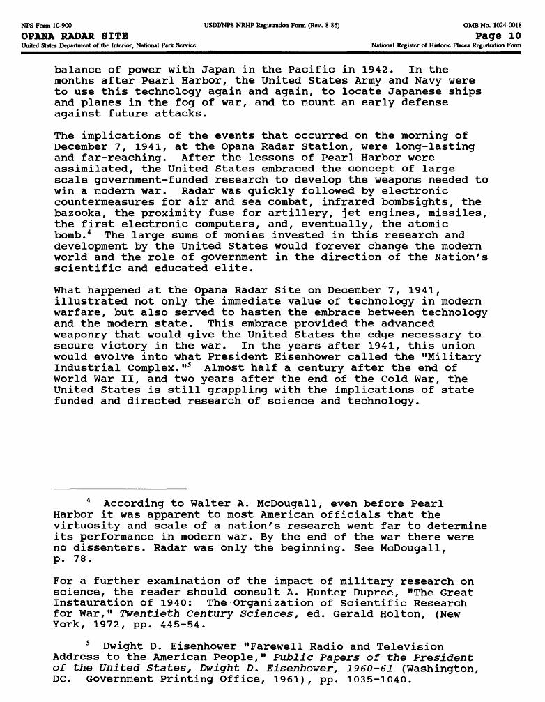
balance of power with Japan in the Pacific in 1942. In the months after Pearl Harbor, the United States Army and Navy were to use this technology again and again, to locate Japanese ships and planes in the fog of war, and to mount an early defense against future attacks.
The implications of the events that occurred on the morning of December 7, 1941, at the Opana Radar Station, were long-lasting and far-reaching. After the lessons of Pearl Harbor were assimilated, the United States embraced the concept of large scale government-funded research to develop the weapons needed to win a modern war. Radar was quickly followed by electronic countermeasures for air and sea combat, infrared bombsights, the bazooka, the proximity fuse for artillery, jet engines, missiles, the first electronic computers, and, eventually, the atomic bomb. 4 The large sums of monies invested in this research and development by the United States would forever change the modern world and the role of government in the direction of the Nation's scientific and educated elite.
What happened at the Opana Radar Site on December 7, 1941, illustrated not only the immediate value of technology in modern warfare, but also served to hasten the embrace between technology and the modern state. This embrace provided the advanced weaponry that would give the United States the edge necessary to secure victory in the war. In the years after 1941, this union would evolve into what President Eisenhower called the "Military Industrial Complex."5 Almost half a century after the end of World War II, and two years after the end of the Cold War, the United States is still grappling with the implications of state funded and directed research of science and technology.
4 According to Walter A. McDougall, even before Pearl Harbor it was apparent to most American officials that the virtuosity and scale of a nation's research went far to determine its performance in modern war. By the end of the war there were no dissenters. Radar was only the beginning. See McDougall, p. 78.
For a further examination of the impact of military research on science, the reader should consult A. Hunter Dupree, "The Great Instauration of 1940: The Organization of Scientific Research for War," Twentieth Century Sciences, ed. Gerald Holton, (New York, 1972, pp. 445-54.
5 Dwight D. Eisenhower "Farewell Radio and Television Address to the American People," Public Papers of the President of the United States, Dvright D. Eisenhower, 1960-61 (Washington, DC. Government Printing Office, 1961), pp. 1035-1040.
NFS Form 10-900 USDI/NPS NRHP Registration Form (Rev. 8-86) OMB No. 1024-0018
OPANA RADAR SITE Page 11United States Department of the Interior, National Park Service National Register of Historic Places Registration Form
9. MAJOR BIBLIOGRAPHICAL REFERENCES
PRIMARY SOURCES:
All of these letters and statements can be found in the Opana Radar Site file in the offices of the History Division of the National Park Service in Washington, DC.
Personal Letter, William H. Tetley to Harry Butowsky, September 28, 1991.
Personal Letter, William H. Tetley to Harry Butowsky, November 4, 1991.
Personal Letter, George E. Elliot, Jr. to Harry Butowsky, November 13, 1991.
Statement from William H. Tetley concerning the Opana Radar Station, November 27, 1991.
Recollections of Kermit Tyler regarding Pearl Harbor Day, No date.
Recollections of Joseph L. Lockard: "Early Warnings: The Mystery of Radar in Hawaii," No date.
Dwight D. Eisenhower. Public Papers of the President of the United States, Dwight D. Eisenhower, 1960-61. Washington, D.C.: Government Printing Office, 1961, pp. 1035-1040.
SECONDARY SOURCES:
Farago, Ladislas. The Broken Seal: Operation Magic and the Pearl Harbor Disaster. New York: Random House, 1967.
Lord, Walter. Day of Infamy. New York: Holt, Reinhart & Co., 1957.
McDougall, Walter A. ...the Heavens and the Earth A Political History of the Space Age. New York: Basic Books, Inc, 1985.
Morison, Samuel Eliot. The Rising Sun in the Pacific. Boston: Little Brown, 1948.
Prange, Gordon W. At Dawn We Slept. New York: McGraw Hill, 1981.
Spector, Ronald H. The Eagle Against the Sun: The American War with Japan. New York, The Free Press, 1985.
Stouffer, Merle E. "National Register of Historic Places Inventory Nomination Form Opana Radar Site" Honolulu, Hawaii: Hawaii State Historic Preservation Division, 1991.
NFS Form 10-900 USDI/NPS NRHP Registration Form (Rev. 8-86) OMB No. 1024-0018
OPANA RADAR SITE Page 12United States Department of the Interior, National Park Service National Register of Historic Places Registration Form
Previous documentation on file (NPS):
__ Preliminary Determination of Individual Listing (36 CFR 67) has beenrequested.
X Previously Listed in the National Register.__ Previously Determined Eligible by the National Register.__ Designated a National Historic Landmark.__ Recorded by Historic American Buildings Survey: #__________ Recorded by Historic American Engineering Record: #________
Primary Location of Additional Data:
X State Historic Preservation Office __ Other State AgencyX Federal Agency: DEPARTMENT OF DEFENSE, NAVY DEPARTMENT_ Local Government
UniversityX Other (Specify Repository): Opana Radar Site File, NPS,
History Division, Washington, DC. 20013-7127
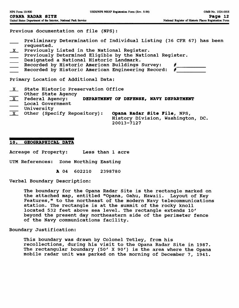
10. GEOGRAPHICAL DATA
Acreage of Property: Less than 1 acre
UTM References: Zone Northing Easting
A 04 602210 2398780
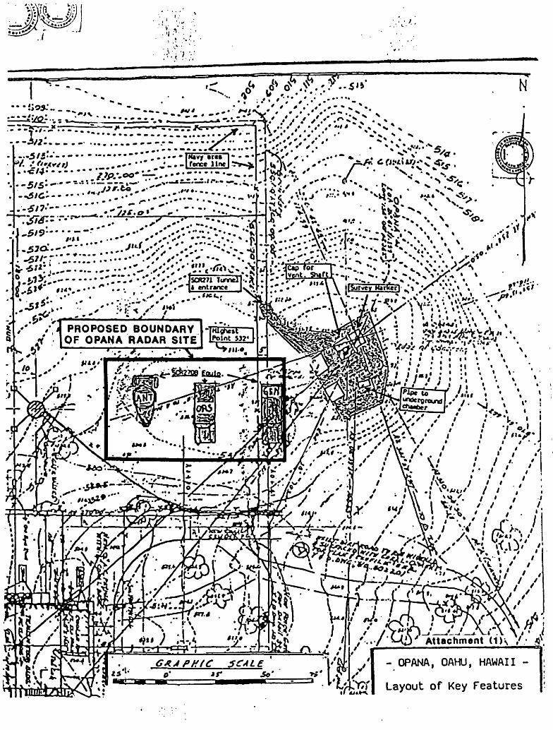
Verbal Boundary Description:
The boundary for the Opana Radar Site is the rectangle marked on the attached map, entitled "Opana, Oahu, Hawaii. Layout of Key Features," to the northeast of the modern Navy telecommunications station. The rectangle is at the summit of the rocky knoll located 532 feet above sea level. The rectangle extends 10' beyond the present day northeastern side of the perimeter fence of the Navy communications facility.
Boundary Justification:
This boundary was drawn by Colonel Tetley, from his recollections, during his visit to the Opana Radar Site in 1987. The rectangular boundary (50 ' X 90') is the area where the Opana mobile radar unit was parked on the morning of December 7, 1941.

NFS Fonn 10-900 USDI/NPS NRHP Registration Fonn (Rev. 8-86) OMB No. 1024-0018
OPANA RADAR SITE Page 13United States Department of die Interior, National Park Service National Register of Historic Places Registration Form
11. FORM PREPARED BY
Name: Dr. Harry A. Butowsky, HistorianNational Park Service, History Division 800 North Capitol Street Washington, DC 20002
Phone: 202/343-8155
Date: March 10, 1993
National Park Service/WASO/History Division (418): April 5, 1993
N
*•*• * <51»
[^?^r:::::::^-:^;::^..?^-«, ^ */*;;...-....... .•••^^-;-''^!Vf5iCv.->^°..^*:.-- - ••••-*::v/--v;<v--W7ii-miidf:{.-£*** «<;.-•••" •••• , ". •.'*.•" lLSS£22££-J>A':
C*** . ^*«* t*«« ^ i i^t " * • ' * * 2l_ ryr^ k* " * ^ *# 1* ^ ^ **wl • X:; .0?.^-*^—Li^_j£——,_.., "'-iJ/' / J PROPOSED BOUNDARY -TMtf^n—I
V OF OPANA RADAR SITE tfiPlot »»' r '. -^ • — - - - V.w... - «
lo
.x-
r»*»
'. • *.5'4ji im;/ //:^A''x'-i'' /% v /. // /.
7•«
\\>'
/ /
PHfC SCAL£
~rrrtt.4-.i'/ i . I A.
Attachment (1)\ /
- OPANA, OAHU, HAWAII -
^.!Wj Layout of Key Features