
Naming the World - East Asian Lib
31
Naming the World: Toward A Digital Historical Gazetteer for Asia and the Globe Ruth Mostern UC Merced & University of Pittsburgh For Presentation at the Council on East Asian Libraries Annual Meeting Faculty Lecture March 15, 2017
Transcript of Naming the World - East Asian Lib

Naming the World: Toward A Digital Historical Gazetteer for Asia and
the Globe
Ruth MosternUC Merced & University of Pittsburgh
For Presentation at the Council on East Asian Libraries Annual MeetingFaculty LectureMarch 15, 2017

I:“Istanbul Not Constantinople”Place Names Change Over Time
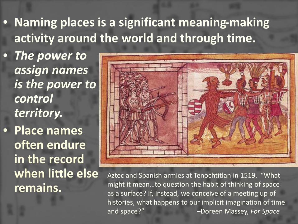
• The power to assign names is the power to control territory.
• Place names often endure in the record when little else remains.
• Naming places is a significant meaning-making activity around the world and through time.
Aztec and Spanish armies at Tenochtitlan in 1519. “What might it mean…to question the habit of thinking of space as a surface? If, instead, we conceive of a meeting up of histories, what happens to our implicit imagination of time and space?” –Doreen Massey, For Space

Weilu Prefecture 威虜軍(“awe the caitiffs”) became Guangxin 廣信軍 Prefecture (“extensive trust”) in 981 in the course of diplomatic efforts between Northern Song and Liao.

A 1584 map of China by Abraham Ortelius based on a manuscript map by Luiz Jorge de Barbuda with Beijing marked as C[ivitas] Paquin
The long history of political power is made manifest through a sequence of names.

Hagia Sophia (Ἁγία Σοφία, Sancta Sophia, آیا .(Ayasofya ,صوفیا
– 537-1453: Greek Orthodox cathedral (except for a short Catholic stretch)
– 1453-1931: Muslim mosque– 1935-present: Museum
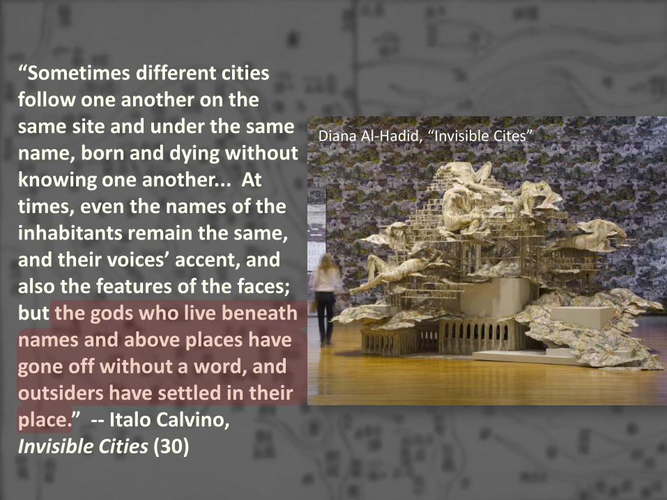
“Sometimes different cities follow one another on the same site and under the same name, born and dying without knowing one another... At times, even the names of the inhabitants remain the same, and their voices’ accent, and also the features of the faces; but the gods who live beneath names and above places have gone off without a word, and outsiders have settled in their place.” -- Italo Calvino, Invisible Cities (30)
Diana Al-Hadid, “Invisible Cites”

A gazetteer database reveals:• A few places changed
names.• The density of the state
presence varied by region, era, and policy objective.
Spatial information in difangzhi 地方志 was relational and textual.
“Dividing the Realm in Order to Govern”The Spatial Organization of the Song State, 960-176 CE
The court abolished dozens of county governments during an eleventh century fiscal reform movement.


II: Toward a Geography of a World Without Maps
From Ptolemy to Postal Codes Michael Curry (2005)
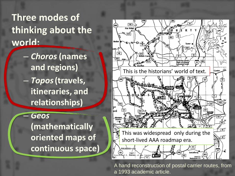
Three modes of thinking about the world:
– Choros (names and regions)
– Topos (travels, itineraries, and relationships)
– Geos (mathematically oriented maps of continuous space)
A hand reconstruction of postal carrier routes, from a 1993 academic article.
This is the historians’ world of text.
This was widespread only during the short-lived AAA roadmap era.

Choros: A Geography of Place
Yi-fu Tuan: Experience constructs place at different scales. The fireplace and the home are both places. Neighborhood, town, and city are places; a distinctive region is a place, and so is a nation….As centers of meaning the number of places in the world is enormous and cannot be contained in the largest gazetteer.
Tim Ingold: The landscape is constituted as an enduring record of –and testimony to –the lives and works of past generations who have dwelt within it, and in so doing, have left there something of themselves.

Each of these texts is a series of attestations about a name or status that a place has held at some point.

Topos: A Geography of Itinerary
Catherine Delano-Smith: Early modern European wayfinding generally used texts, not maps. A traveler’s itinerary from England to Rome around 1400, set out according to political divisions. One note marks the halfway point of the journey, another indicates the spot where horses must be paid for. The last heading describes an alternative route to be used if there is war in Lombardy.

《渡海方程》,《海道經書》,《海道針經》and other rutters were navigation itineraries. Navigation maps were made from texts, not made from scratch.

Ben Schmidt: tracks from nineteenth century ships logs, all voyages from the ICOADS US Maury collection

III: Placing Names


Core-periphery modeling in China and Japan using gazetteer data (Henderson and Ryavec, Mizoguchi)

Place name etymology and language change (Pai and Fan)

IV: Toward a World-Historical GazetteerModeling Places and Creating Infrastructure

Modeling and Linking PlacesKarl Grossner et al. in Placing Names

An increasing number of digital humanities projects focusing on historical texts, maps, and data are backed by gazetteers, but most are local or regional in scope, and/or focused on a very particular topic.

Dataset repositories like the Collaborative for Historical Information and Analysis at the Pitt World History Center need gazetteers as thesauri and to support visualization.

Place modeling supports analysis and interoperable infrastructure and is also an exercise for thinking about discourse and semantics. But specialist gazetteers need to be linked together. La Perouse, Cartes de decouvertes au Nord du Japon,
1797. Studying this expedition inspired Bruno Latour’swork about the power of centralizing and standardizing geographical knowledge.


“ “


Guinea coast of Africa from Sierra Leon to Elmina (Ghana). Cantino Map of 1502, Biblioteca estense, Modena
Detail of Southeast Asia from the Selden Map of c. 1619, Bodleian Library
Collaborators with specialist gazetteers can link them to the “spine.”


Gazetteer development is a crucial endeavor because linked gazetteers are critical infrastructure for interoperability in the digital realm, and because place names are the residue of the “meeting up of histories in space.”