My Digital Watershed GIS Geographic Information System Google Earth.
9
My Digital Watershed GIS Geographic Information System Google Earth
-
Upload
antony-maxwell -
Category
Documents
-
view
222 -
download
3
Transcript of My Digital Watershed GIS Geographic Information System Google Earth.
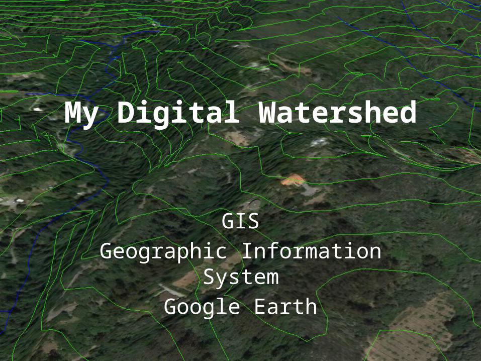
My Digital Watershed
GISGeographic Information System
Google Earth

Adding Layers (review)
• Go to http://scwibles.ucsc.edu/Products/ProductsDocuments/Norris_ContourWhat_supporting/
• Download (right click) watsonville.kmz and choose “save link as” from the menu, navigate to the desktop and click ‘OK’
• From the file menu in Google earth open “watsonvill.kmz” from the Desktop
• It will appear in the “Temporary Places” on the left

Which way does the water go?(review)
Which direction does the river flow?
• Where is the river?• Which direction does
the river flow?http://www.cibolasar.org/minilessons/nav_lesson/USMC_mapfigs.jpg
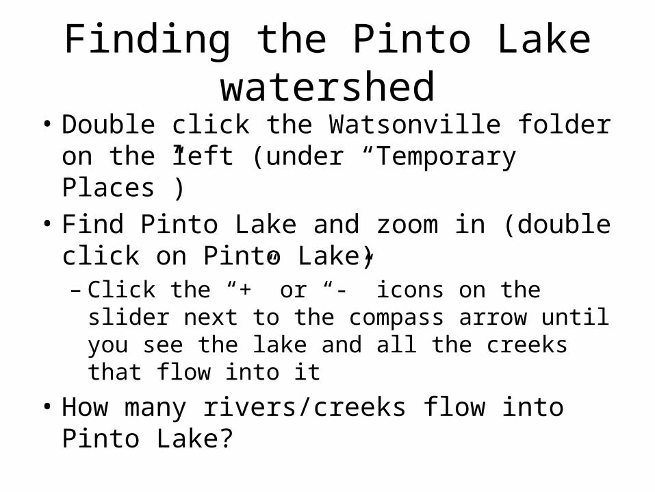
Finding the Pinto Lake watershed• Double click the Watsonville folder on the left
(under “Temporary Places”)• Find Pinto Lake and zoom in (double click on
Pinto Lake)– Click the “+” or “-” icons on the slider next to the
compass arrow until you see the lake and all the creeks that flow into it
• How many rivers/creeks flow into Pinto Lake?
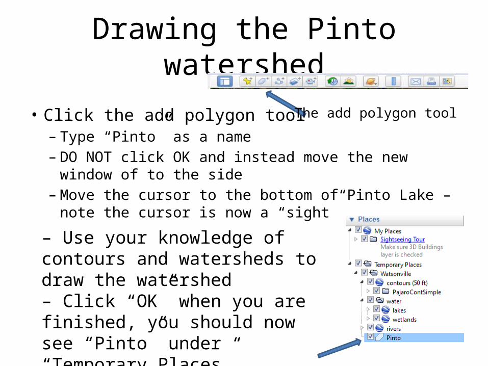
Drawing the Pinto watershed
• Click the add polygon tool– Type “Pinto” as a name– DO NOT click OK and instead move the new window of to the
side– Move the cursor to the bottom of Pinto Lake – note the cursor
is now a “sight”– Use your knowledge of contours and watersheds to draw the watershed– Click “OK” when you are finished, you should now see “Pinto” under “Temporary Places”
The add polygon tool
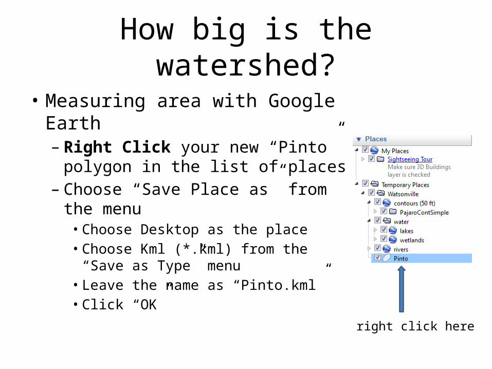
How big is the watershed?
• Measuring area with Google Earth– Right Click your new “Pinto”
polygon in the list of places– Choose “Save Place as” from the
menu• Choose Desktop as the place• Choose Kml (*.kml) from the “Save as
Type” menu• Leave the name as “Pinto.kml”• Click “OK”
right click here
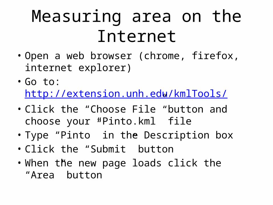
Measuring area on the Internet
• Open a web browser (chrome, firefox, internet explorer)
• Go to: http://extension.unh.edu/kmlTools/• Click the “Choose File” button and choose your
“Pinto.kml” file• Type “Pinto” in the Description box• Click the “Submit” button• When the new page loads click the “Area”
button

Flight Simulator
• Do you want to learn how to fly??• Turn of “Temporary Places” (click the
checkbox)• Go to “Tools” menu and choose “Enter Flight
Simulator”– Click “SR22” (easier)– Click “Current View”– Click Start Flight (Good Luck!!!)
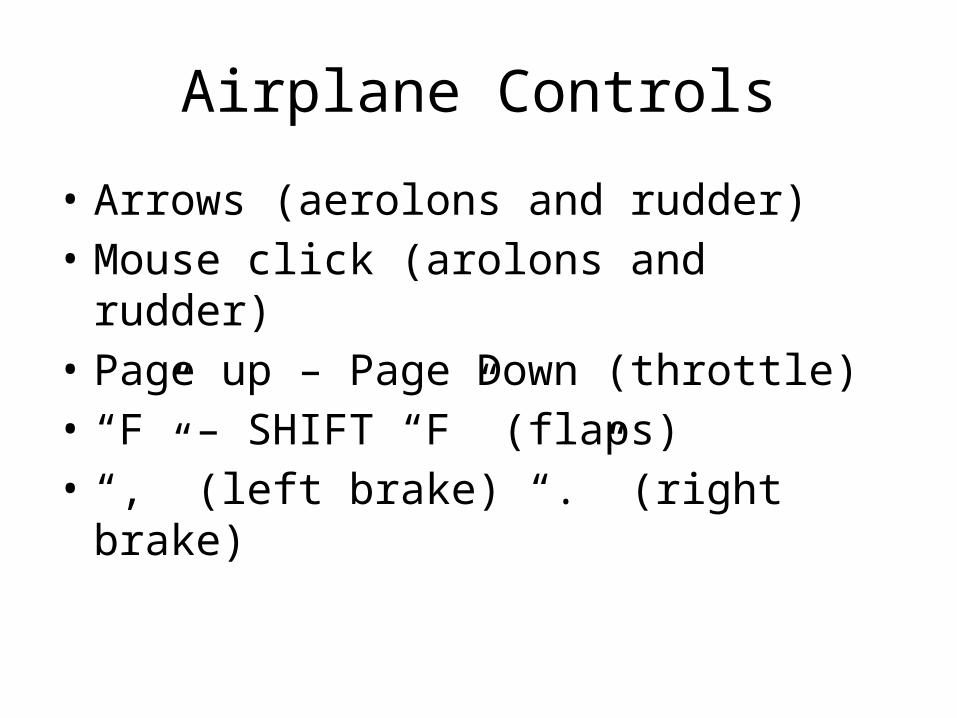
Airplane Controls
• Arrows (aerolons and rudder)• Mouse click (arolons and rudder)• Page up – Page Down (throttle)• “F” – SHIFT “F” (flaps)• “,” (left brake) “.” (right brake)