MRI 2313 : MARITIME GEOGRAPHY CHAPTER 1: THE CHARACTERISTICS OF CLIMATIC AND WEATHER SYSTEM.
49
MRI 2313 : MARITIME GEOGRAPHY CHAPTER 1: THE CHARACTERISTICS OF CLIMATIC AND WEATHER SYSTEM
-
Upload
garey-gordon -
Category
Documents
-
view
218 -
download
1
Transcript of MRI 2313 : MARITIME GEOGRAPHY CHAPTER 1: THE CHARACTERISTICS OF CLIMATIC AND WEATHER SYSTEM.

MRI 2313 : MARITIME GEOGRAPHY
CHAPTER 1: THE CHARACTERISTICS OF CLIMATIC AND WEATHER SYSTEM

LEARNING OUTCOME• Definition of weather and climate.• To explain the weather and climate system. • To explain the world climate and weather.• To describe the factors that influence climate and weather. • To explain the changes of climate and weather and their
effect to maritime transportation. • To describe the effect of global warming to maritime
transportation.

Definition• Weather :
• The physical state of the atmosphere at a particular place and time as regards heat, cloudiness, dryness, sunshine, wind, rain, etc.
E.g: on a particular day in Trinidad, the weather is warm in the afternoon. But later in the day, when there are clouds blocking sun’s rays, the weather could become colder.
• Climate : • The weather conditions prevailing in an area in general or over a long
period. • Generalized statement of the prevailing weather conditions at a given
place, based on statistics of a long period of record and including the mean values, departures from those means and the probabilities associated with those departures.
• E. g: Although the weather in Pakistan may be cool and dry today, Pakistan’s climate is the hot most of the time.

What is climate?• It is the average weather of a region.• Including the measurement of weather information, that
are:• Net radiation • Barometric pressure • Cloud cover and type• Presence of fog• Precipitation type and intensity• Incidence of cyclones and anticyclones • Frequency of frontal passages
• Two simple measurements normally given by weather station – temperature and precipitation.
The difference between weather and climate
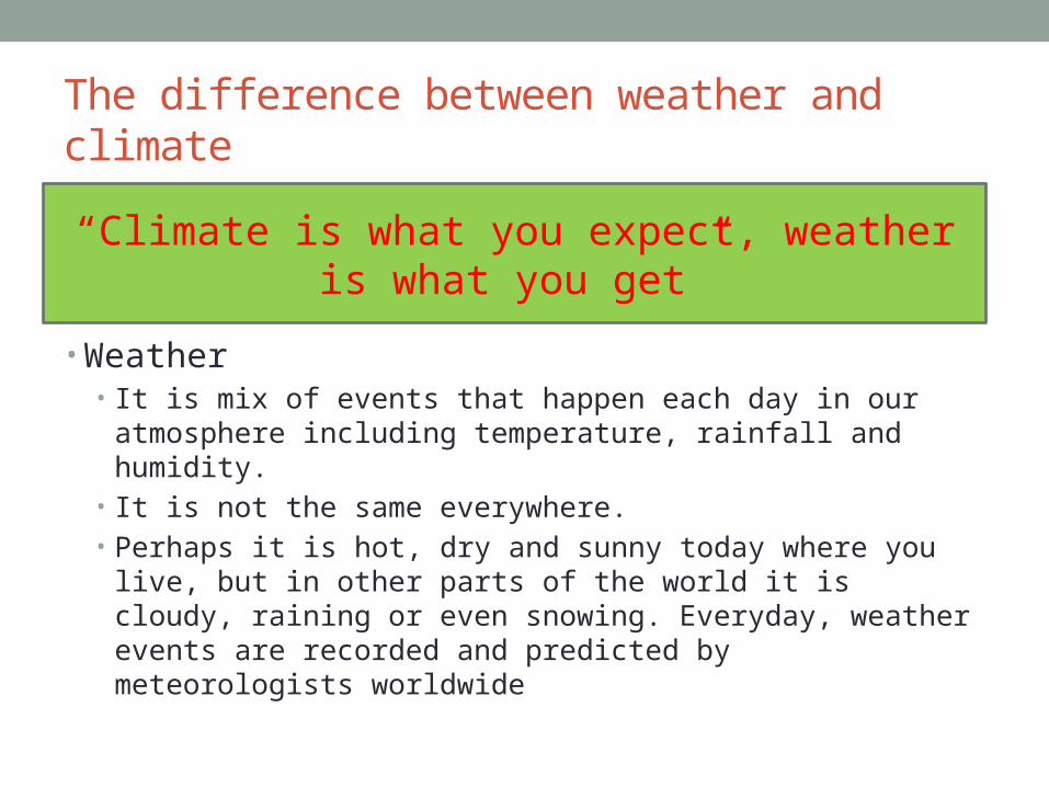
• Weather• It is mix of events that happen each day in our atmosphere
including temperature, rainfall and humidity. • It is not the same everywhere. • Perhaps it is hot, dry and sunny today where you live, but in other
parts of the world it is cloudy, raining or even snowing. Everyday, weather events are recorded and predicted by meteorologists worldwide
“Climate is what you expect, weather is what you get”

Fundamental of weather • Sun is driving force of weather on earth. • Earth is heated by sun unevenly (tropic warmer than
polar). • Water and land response differently to sun’s rays.
• Oceans warm slower than land (day) • Oceans cools slower than land (night)
• Different temperature of air above ocean & land, cause different of pressure.
• The difference of pressure cause winds.

• Elements of weather • Temperature • Wind • Stability of the atmosphere • Relative humidity • Precipitation • Cloud development

• Climate:• Climate in your place on the globe controls the weather where you
live. Climate is the average weather pattern in a place over many years. So, the climate of Antarctica is quite different than the climate of a tropical island. Hot summer days are quite typical of climates in many regions of the world, even without the effects of global warming

Why climates are changing?• Climates are changing because our Earth is warming,
according to the research of scientists. Does this contribute to a warm summer day? It may, however global climate change is actually much more complicated than that because a change in the temperature can cause changes in other weather elements such as clouds or precipitation.

Figure 1: schematic view of the components of the climate system, their processes and interactions.


• Task. • Explain how the climate changing effect to human health.

Weather and climate system• WEATHER SYSTEM- recurring pattern of atmospheric circulation
associated with characteristic weather, such as a cyclone or anticyclone.
• The oceans and the atmosphere are constantly in motion, and without these motions life as we know it would be impossible. Atmospheric motions shape the globe’s patterns of weather and climate, also arouse the surface of the sea. In return, the oceans provide the atmosphere with heat and moisture. The spectrums of atmospheric and oceanic motion range widely through time and space, from tiny turbulent eddies which survive for about a few seconds to the variations in ice-cover and the global climatic fluctuations which extend over centuries. Monsoons, tropical cyclones, wind-waves, storm surges, tides, tsunamis, the great currents in the upper ocean; these and indeed all motion systems in the atmosphere and the sea effect maritime activities.


The Beaufort scale • Estimation of wind speed • Divided into series of speed, from 0 (calm) to 12 and
above (hurricane)


Weather and climate system
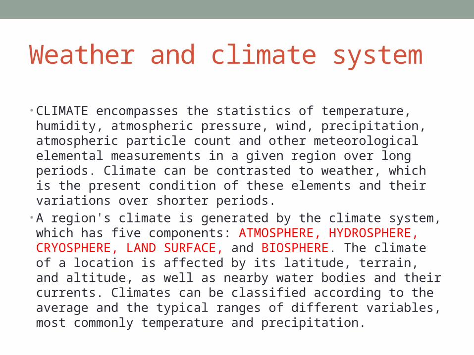
• CLIMATE encompasses the statistics of temperature, humidity, atmospheric pressure, wind, precipitation, atmospheric particle count and other meteorological elemental measurements in a given region over long periods. Climate can be contrasted to weather, which is the present condition of these elements and their variations over shorter periods.
• A region's climate is generated by the climate system, which has five components: ATMOSPHERE, HYDROSPHERE, CRYOSPHERE, LAND SURFACE, and BIOSPHERE. The climate of a location is affected by its latitude, terrain, and altitude, as well as nearby water bodies and their currents. Climates can be classified according to the average and the typical ranges of different variables, most commonly temperature and precipitation.

Elements of climate system
Land surface Hydrosphere

World climate and weather • Global warming potential (GWP) and ozone depletion potential
(ODP)- greenhouse effect accumulation of heat in the lower atmosphere through the absorption of long-wave radiation from the Earth’s surface.
• The occurrence of El Nino – La Nina, at intervals of about 3 to 8 years, a remarkable disturbance of ocean and atmosphere occurs. It begins in the eastern Pacific Ocean and spreads its effects widely over the globe. The disturbance last for more than a year, bringing in droughts, heavy rainfalls, severe spells of heat and cold, or a high incidence of cyclonic storms to various parts of the Pacific and its eastern coasts. The effects cause depletion of fishes off Peruvian coast and was informed by local fishermen.
• The major change in sea-surface temperatures that accompanies on El-Nino can also shift weather pattern across large regions of the globe.
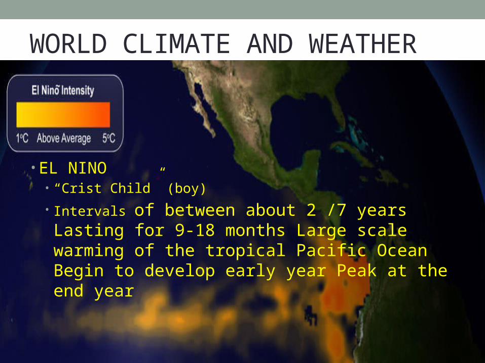
WORLD CLIMATE AND WEATHER
• EL NINO• “Crist Child” (boy)
• Intervals of between about 2 /7 years Lasting for 9-18 months Large scale warming of the tropical Pacific Ocean Begin to develop early year Peak at the end year

WORLD CLIMATE AND WEATHER
• LA NINA • “Infant girl” (girl)
• Intervals of between about 2/7 years Lasting for 9-18 months Large scale cooling of the tropical Pacific Ocean
• ENSO - acronym for El Niño/Southern Oscillation. ENSO used to describe both warm (El Nino) and cool (La Nina)
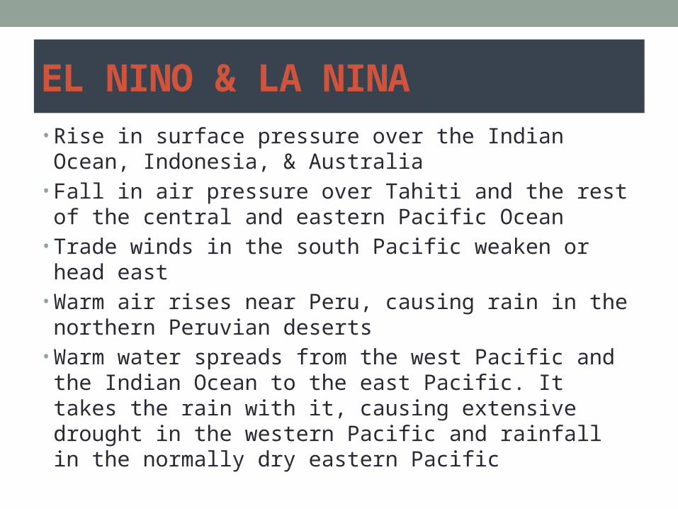
EL NINO & LA NINA • Rise in surface pressure over the Indian Ocean,
Indonesia, & Australia • Fall in air pressure over Tahiti and the rest of the central
and eastern Pacific Ocean • Trade winds in the south Pacific weaken or head east • Warm air rises near Peru, causing rain in the northern
Peruvian deserts • Warm water spreads from the west Pacific and the Indian
Ocean to the east Pacific. It takes the rain with it, causing extensive drought in the western Pacific and rainfall in the normally dry eastern Pacific
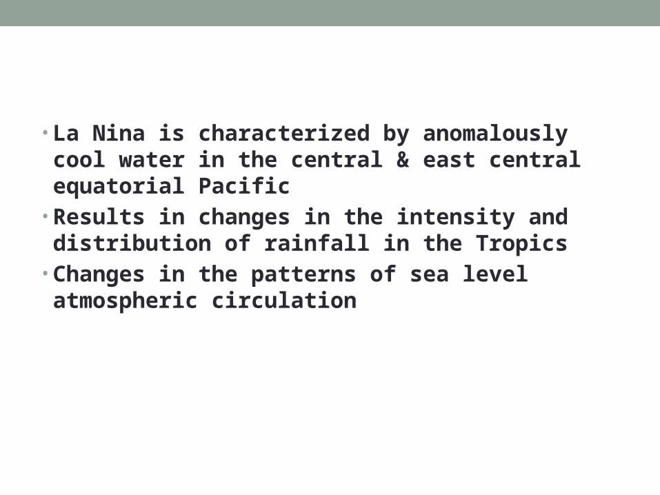
• La Nina is characterized by anomalously cool water in the central & east central equatorial Pacific
• Results in changes in the intensity and distribution of rainfall in the Tropics
• Changes in the patterns of sea level atmospheric circulation


Effect of La Nina & El Nino in the future


Factors that influence climate and weather
1. ELEVATION OR ALTITUDE EFFECT CLIMATE
2. PREVAILING GLOBAL WIND PATTERNS
3. TOPOGRAPHY
4. EFFECT OF GEOGRAPHY
5. SURFACE OF THE EARTH
6. CLIMATE CHANGE OVER TIME

Weather and climate change and their effect to maritime transportation Impact on ships and sea lanes • Increasing temperature
• Reduce the amount of sea ice in many important shipping lanes, extending the shipping season.
• Warmer winters • Lead to less snow and ice accumulation on vessels, decks, and
rigging in marine transportation. • In Arctic, warmer temperature could also open up the possibility of
a Northway Passage, which could reduce shipping times and distance. However, this passage may also provide a pathway for invasive species transport and survival.
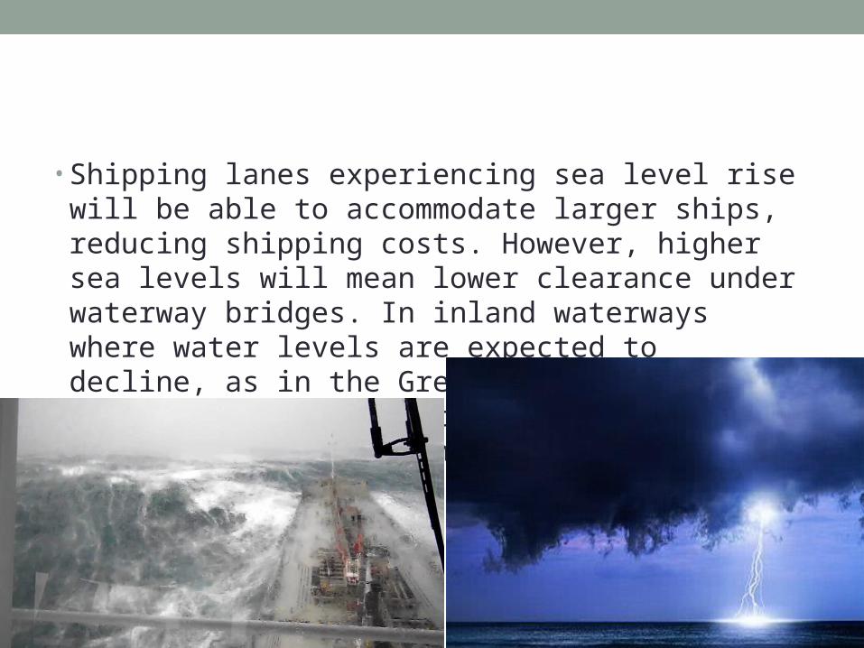
• Shipping lanes experiencing sea level rise will be able to accommodate larger ships, reducing shipping costs. However, higher sea levels will mean lower clearance under waterway bridges. In inland waterways where water levels are expected to decline, as in the Great Lakes, ships could face weight restrictions, as channels become too shallow.

• Changes in precipitation can affect shipping in many ways. Flooding could close shipping channels, and increased runoff from extreme precipitation events could cause silt and debris to build up, leading to shallower channels.
• Changes in precipitation patterns could also affect the rate at which sediments accumulate, which may also make existing channels shallower and less accessible. In areas experiencing increasing drought, water levels could periodically decrease, limiting inland shipping on rivers. More severe storms could increase disruptions in marine travel and shipping.
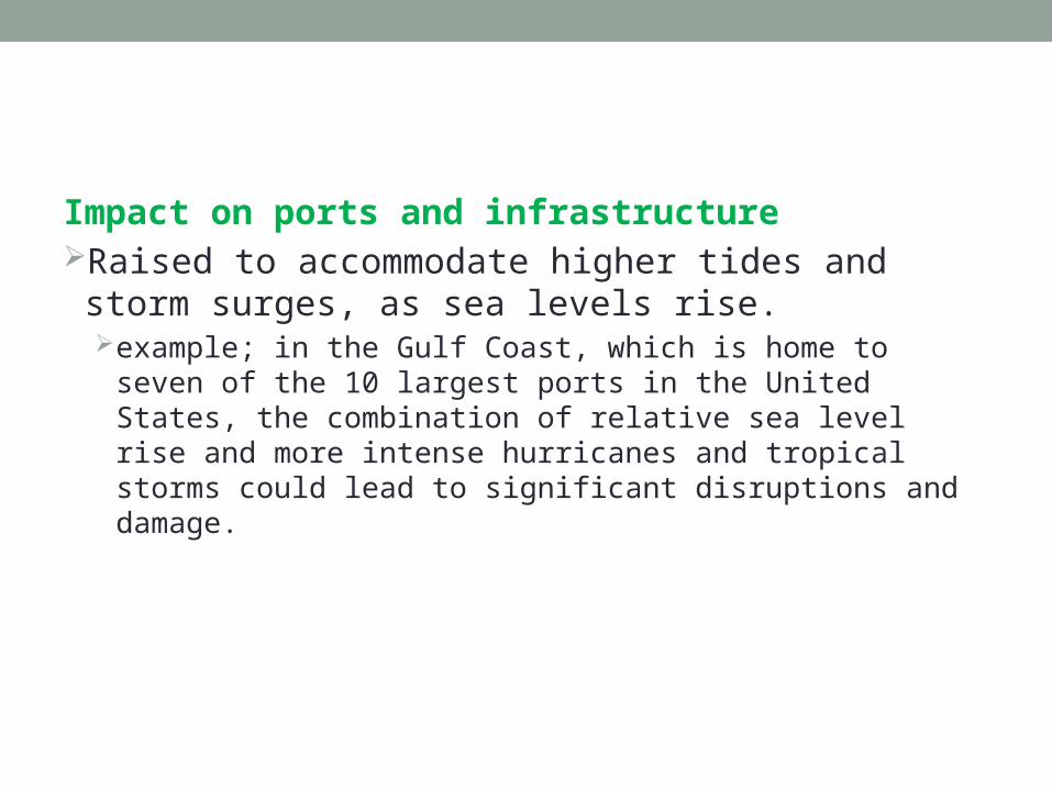
Impact on ports and infrastructureRaised to accommodate higher tides and storm surges,
as sea levels rise.example; in the Gulf Coast, which is home to seven of the 10
largest ports in the United States, the combination of relative sea level rise and more intense hurricanes and tropical storms could lead to significant disruptions and damage.

• Changes in precipitation and sea-level rise affect the water balance of coastal ecosystem.
• The increases in precipitation and run-off may cause the risk of coastal flooding.
• Climate change affect the structure (e.g; plant and animal production, nutrient cycling) of estuarine and marine system.
Climate change affect on maritime transport
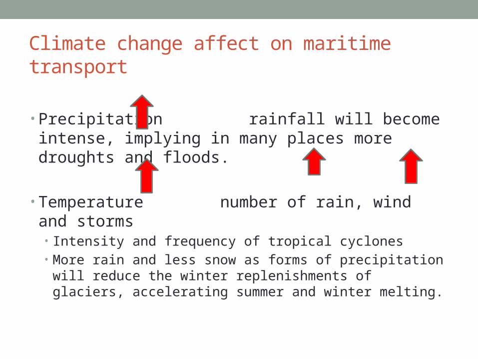
• Precipitation rainfall will become intense, implying in many places more droughts and floods.
• Temperature number of rain, wind and storms • Intensity and frequency of tropical cyclones • More rain and less snow as forms of precipitation will reduce the
winter replenishments of glaciers, accelerating summer and winter melting.
Climate change affect on maritime transport
• The rise in sea level • Glacier melt & thermal expansion of the oceans • Exacerbate by extreme weather ; e.g storm surges• Inundate & contaminate groundwater in coastal area • Lead to mass migration from coastal areas (major impacts on port
& shipping)

Climate change affect on maritime transport
• Global warming • In North Atlantic and in the Arctic, where the area and the thickness
of Arctic summer sea ice has dropped drastically (22% in two years), triggering a number of systemic effects, including the opening up of new Arctic routes for maritime transport.

Climate change affect on maritime transport
• Pollution, warming and acidification • Rising ocean temperatures, pollution and plastic debris• Acidification from rising levels of CO2 and overfishing. • Increased dead zones and pollutions • Degrading coral reefs

• Waterborne transport will be affected by:• Changed water levels• Extreme precipitation • Storms • Higher temperatures

Belts of pressure

•Lower water levels will harm many inland waterways,
requiring stricter cargo weight limits and redesigned vessels as well as costly and environmentally damaging dredging.
•Higher sea levels will reduce clearances under bridges
near coasts and directly threaten port infrastructure and the road and rail hinterland connections. • It combined with more frequent and more intense storms are directly
damaging to bridges, piers, terminal buildings, ships and cargoes.


THANK YOU