Mozambique, Niassa Reserve and Malawi – Aug - Overland Forum
49
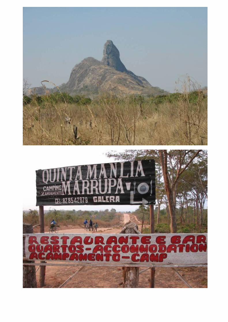
Mozambique, Niassa Reserve and Malawi – Aug/Sept 2010 - Pierre and Christi de Wet General: An article, on the very remote Niassa Reserve in Northern Mozambique, was published in the December 2007 edition of the SA 4x4 magazine. Since reading it, we wanted to visit the reserve to experience it first hand. Our chance came this year. The trip would be a solo trip with only Christi and myself. We are quite familiar with the southern part of Mozambique, from Ponta do Ouro, the Maputo Elephant Reserve and further north to Pomene which we have visited a couple of times. We have entered Mozambique via all the border posts over the years and decided to use the Pafuri border post and to cross the Limpopo River close by instead of at the more regular used crossing at Mapai. After crossing to drive the lesser used track on the eastern bank of the Limpopo towards Mapai where we will join the main track east to Vilanculos. From Vilanculos we would drive north all the way to Pemba and then turn west and visit the Niassa Reserve. After that our route would take us to Lake Niassa (Malawi) where we would visit both sides of the lake, Mozambique and Malawi and visit a few places in Malawi before returning home via Mozambique or perhaps Zimbabwe. Information on Mozambique and Malawi is freely available in articles and books. On some of the forums, on the Internet, you find valuable information of web sites of resorts etc. I compiled a basic plan for the trip which was changed numerous times as more information became available. We were not sure about the condition of the road between Montepeuz and Marrupa in the north of Mozambique and did not really know what to expect in the Niassa Reserve. I used paper maps from Info Map and on my PC, I had Map Source with Waypoint Manager and T4A (Tracks for Africa). I worked out routes, with alternatives in some places, viewed them on Google Earth and after being satisfied, downloaded 45 routes to my Garmin GPS 276C. To enter Mozambique and Malawi as a SA citizen, you only require a valid passport. For your vehicle, registration papers, permission from the bank to take the vehicle out of SA (if the vehicle is still financed by them), a 3 rd . party insurance, normally available at the border, a reflective jacket and warning triangles are required. Your SA drivers licence is valid. Take preventative measures against Malaria. The US dollar is widely accepted and in many places in Mozambique the SA Rand is also accepted. We took both and changed dollars for local currency at banks as required. It is easier to pay for fuel and the day to day items using the local currency. ATM’s are also an option and is available in most of the larger towns. The exchange rate in SA was R7.49 to the dollar inclusive of all bank costs. In Mozambique we got 37 Metical for one US$ which gave us a Rand/Metical exchange rate of almost 1 to 5. In Malawi we got 147 Malawian Kwacha for a US $ which worked out to a Rand to Kwacha rate of almost 1 to 20. Our vehicle is 2007 diesel Toyota Land Cruiser Pickup with an ALU Cab Canopy and Hannibal IMPI rooftop tent. We took 200L of diesel fuel, 120L of drinking water, two National Luna 52L fridges/freezers (containing our meat for a month) and running off 2 deep cycle batteries. The battery capacity was 215ah in total, excluding the vehicle battery. Cold drinks, beer, vegetables etc. was also included, but we replenished our stock as was required. We also had all the normal camping gear and clothing required for such a trip as well as a variety of tools. Spares like fan belts, fuel filter, fuses and bulbs were also added. We had four 10L containers of drink water, which when used up, we replaced with water that we used for general washing and cleaning. Adding all of the above made for one hefty load. I used the original 7.50x16 8PR tyres on split rims. This proved to be the right decision as the tyres are very tough and we experienced no tyre problems on the entire trip. As a precaution I took two spare wheels. There were many highlights on the trip, the crossing of the Limpopo River at Pafuri, the bush drive to Vilanculos, nice camping sites at Vilanculos, Gorongoza, Nacala, Pangane, Pemba, Nkopola Lodge and Steps. To drive in Gorongoza early in the morning and see the animals in the mist was great. To cross the 3.2km bridge to the island, Ilha da Mozambique was something to be experienced. Camping almost on the beach at Pangane with a view very few hotels can match. The excellent Barracuda and King fish on a bed of Coconut rice served by Hashim, the owner of the campsite at Pangane. To ride the rough road between Montepeuz and Maruppa, and the remoteness and solitude of our bush camp on the bank of the Rovuma River in the north of Niassa Park. To see the beauty of Lake Malawi with Baobab Trees going right to the shores, and the lazy couple of days in the familiar Kruger before returning to the busy city life. We met like minded travellers at most of the sites we stayed over and enjoyed sharing travelling experiences. Some days we did some hard driving with long distances but overall very relaxing with plenty of rest days in between We never experienced any problem with the vehicle, our equipment or at any border crossings or roadblock. Low points were few of which a shortage of diesel in Malawi was the only one worth mentioning. This prevented us visiting the Liwonde National Park and Mt. Mulange but at the end gave us time for 3 relaxed days in the Kruger Park. We were shocked to see a truck on fire and be reduced to melted steel in front of our very eyes. This was a wake up call of how easy a disaster can happen. Both countries are well geared for tourists with camping sites all over. In Mozambique ablutions at some places are not up to standard but in Malawi we found it to be very good. Fuel stations are found almost everywhere and was it not for a countrywide shortage of diesel in Malawi, fuel would not have been a problem. Diesel in Mozambique cost app. R6.50 per litre and in Malawi R11.20. Roads varied between tar, gravel, sand and 2 spoor tracks as well as some tracks where low range was needed. In my mind good gravel is gravel where you can travel 60 km/h for most of the time, fair where you need to slow down often but mostly allows for 50-60 km/h and bad when you average between 10-20 km/h. After that you start getting to low range donga type terrain or heavy bumpy sand tracks.
Transcript of Mozambique, Niassa Reserve and Malawi – Aug - Overland Forum

Mozambique, Niassa Reserve and Malawi – Aug/Sept 2010 - Pierre and Christi de Wet General: An article, on the very remote Niassa Reserve in Northern Mozambique, was published in the December 2007 edition of the SA 4x4 magazine. Since reading it, we wanted to visit the reserve to experience it first hand. Our chance came this year. The trip would be a solo trip with only Christi and myself. We are quite familiar with the southern part of Mozambique, from Ponta do Ouro, the Maputo Elephant Reserve and further north to Pomene which we have visited a couple of times. We have entered Mozambique via all the border posts over the years and decided to use the Pafuri border post and to cross the Limpopo River close by instead of at the more regular used crossing at Mapai. After crossing to drive the lesser used track on the eastern bank of the Limpopo towards Mapai where we will join the main track east to Vilanculos. From Vilanculos we would drive north all the way to Pemba and then turn west and visit the Niassa Reserve. After that our route would take us to Lake Niassa (Malawi) where we would visit both sides of the lake, Mozambique and Malawi and visit a few places in Malawi before returning home via Mozambique or perhaps Zimbabwe. Information on Mozambique and Malawi is freely available in articles and books. On some of the forums, on the Internet, you find valuable information of web sites of resorts etc. I compiled a basic plan for the trip which was changed numerous times as more information became available. We were not sure about the condition of the road between Montepeuz and Marrupa in the north of Mozambique and did not really know what to expect in the Niassa Reserve. I used paper maps from Info Map and on my PC, I had Map Source with Waypoint Manager and T4A (Tracks for Africa). I worked out routes, with alternatives in some places, viewed them on Google Earth and after being satisfied, downloaded 45 routes to my Garmin GPS 276C. To enter Mozambique and Malawi as a SA citizen, you only require a valid passport. For your vehicle, registration papers, permission from the bank to take the vehicle out of SA (if the vehicle is still financed by them), a 3
rd. party insurance, normally
available at the border, a reflective jacket and warning triangles are required. Your SA drivers licence is valid. Take preventative measures against Malaria. The US dollar is widely accepted and in many places in Mozambique the SA Rand is also accepted. We took both and changed dollars for local currency at banks as required. It is easier to pay for fuel and the day to day items using the local currency. ATM’s are also an option and is available in most of the larger towns. The exchange rate in SA was R7.49 to the dollar inclusive of all bank costs. In Mozambique we got 37 Metical for one US$ which gave us a Rand/Metical exchange rate of almost 1 to 5. In Malawi we got 147 Malawian Kwacha for a US $ which worked out to a Rand to Kwacha rate of almost 1 to 20. Our vehicle is 2007 diesel Toyota Land Cruiser Pickup with an ALU Cab Canopy and Hannibal IMPI rooftop tent. We took 200L of diesel fuel, 120L of drinking water, two National Luna 52L fridges/freezers (containing our meat for a month) and running off 2 deep cycle batteries. The battery capacity was 215ah in total, excluding the vehicle battery. Cold drinks, beer, vegetables etc. was also included, but we replenished our stock as was required. We also had all the normal camping gear and clothing required for such a trip as well as a variety of tools. Spares like fan belts, fuel filter, fuses and bulbs were also added. We had four 10L containers of drink water, which when used up, we replaced with water that we used for general washing and cleaning. Adding all of the above made for one hefty load. I used the original 7.50x16 8PR tyres on split rims. This proved to be the right decision as the tyres are very tough and we experienced no tyre problems on the entire trip. As a precaution I took two spare wheels. There were many highlights on the trip, the crossing of the Limpopo River at Pafuri, the bush drive to Vilanculos, nice camping sites at Vilanculos, Gorongoza, Nacala, Pangane, Pemba, Nkopola Lodge and Steps. To drive in Gorongoza early in the morning and see the animals in the mist was great. To cross the 3.2km bridge to the island, Ilha da Mozambique was something to be experienced. Camping almost on the beach at Pangane with a view very few hotels can match. The excellent Barracuda and King fish on a bed of Coconut rice served by Hashim, the owner of the campsite at Pangane. To ride the rough road between Montepeuz and Maruppa, and the remoteness and solitude of our bush camp on the bank of the Rovuma River in the north of Niassa Park. To see the beauty of Lake Malawi with Baobab Trees going right to the shores, and the lazy couple of days in the familiar Kruger before returning to the busy city life. We met like minded travellers at most of the sites we stayed over and enjoyed sharing travelling experiences. Some days we did some hard driving with long distances but overall very relaxing with plenty of rest days in between We never experienced any problem with the vehicle, our equipment or at any border crossings or roadblock. Low points were few of which a shortage of diesel in Malawi was the only one worth mentioning. This prevented us visiting the Liwonde National Park and Mt. Mulange but at the end gave us time for 3 relaxed days in the Kruger Park. We were shocked to see a truck on fire and be reduced to melted steel in front of our very eyes. This was a wake up call of how easy a disaster can happen. Both countries are well geared for tourists with camping sites all over. In Mozambique ablutions at some places are not up to standard but in Malawi we found it to be very good. Fuel stations are found almost everywhere and was it not for a countrywide shortage of diesel in Malawi, fuel would not have been a problem. Diesel in Mozambique cost app. R6.50 per litre and in Malawi R11.20. Roads varied between tar, gravel, sand and 2 spoor tracks as well as some tracks where low range was needed. In my mind good gravel is gravel where you can travel 60 km/h for most of the time, fair where you need to slow down often but mostly allows for 50-60 km/h and bad when you average between 10-20 km/h. After that you start getting to low range donga type terrain or heavy bumpy sand tracks.
Our day to day progress, activities and route was as follows: 20/08 Departed from home at 14h30 in Pretoria and drove via the N1 toll road north to Louis Trichardt. Filled up with diesel and drove to the Tshipise Holiday Resort 35 km south of Messina where we arrived at 19h30 – 475 km on a good tar road. 21/08 Spend the day of leisure at Tshipise, again filled the Cruiser with diesel and bought wood. Met a group of 6 Cruisers, all Prado’s except for one 100 Series VX. One Prado towed a trailer. They were on their way to the Gonarezhou Reserve in Zimbabwe and were also planning to cross the Limpopo at Pafuri the next day. 22/08 Left Tshipise at 05h00 and arrived at the Pafuri gate at 06h15. Entered Kruger Park and took a leisurely drive to the Pafuri Border Post with a stop at the Pafuri Picnic spot for coffee. Saw lots of game and thought of the old days when we used to spend many happy holidays in Kruger. The border crossing was a breeze but there was no 3
rd party insurance for Mozambique
on sale there, perhaps because it was a Sunday. It left us with no choice but to buy it in Vilanculos. The group of Cruisers also arrived just before we left for the crossing. I walked through the river which was around 400 to 500 meters wide at this point but with firm sand and only 70cm deep at the deepest point. Deflating the tyres we drove through without a problem. Christi sat on the roof rack and captured the process on video. As I was busy inflating the tyres, the Cruiser group arrived at the crossing. They also surveyed the river. I showed them where I crossed but they decided to look around on their own. We had coffee and waited for almost an hour but as they were still on the other side we moved on. The track to Mapai is rough on this side of the Limpopo and overgrown. I found an error on T4A indicating an old unused track which led us into thorn bushes. Turned around after leaving the Cruiser full of scratches we found the correct route. When wet, one or two of the crossings may not be possible on this track. Arriving at Mapai around 15h00, we took photos of the more popular crossing and then drove east for 12km where we called it a day. We found a nice spot in the bush and set up camp for a well deserved rest after 270 km on tar, gravel and a rough track. 23/08 We knew we had a long drive ahead of us so we left early as we wanted to get to Vilanculos before it got dark. The road is a mix between gravel, 2 spoor tracks in Mopani bush and eventually tar on the last stretch. The going was quite easy and besides a few slower patches we made good progress. We enjoyed the drive through the bush and arrived late afternoon at Vilanculos. We booked in at Blue Water Beach Resort for 3 nights – 430 km. 24/08 In Vilanculos we had to exchange dollars for metical, buy bread, fill the vehicle with diesel and buy 3
rd. party insurance. This
proved to be a real mission to accomplish. The insurance company give you a bank deposit form, you then queue in BIM Bank for an hour and a half, pay in the money, goes back to the insurance people who would then walk 3 blocks away to the nearest fax machine to fax your application to their head-office in Inhambane. You then drive around town for 2 hours, do your shopping, enjoy excellent PAO (bread), do some sight seeing. You now go back, find that the insurance is not available yet and after some complaining, a call is made to Inhambane via a cell phone. A runner is dispatched to collect the fax and at long last you are you insured for a month. In future I will buy it in SA prior to leaving. We were under the impression that it was available at Pafuri but now we are wiser. Spend the rest of the day at leisure at the resort – 30 km travelled 25/08 Blue Water Beach Resort is like an oasis with palms, green lawns, restaurant, clean ablutions and a sparkling pool right next to the beach. We spend the day chilling and doing what one does best, relaxing, bought a fish (Rock Cod) from local fishermen and had a fish braai that evening. 26/08 I am always on the lookout for interesting alternative roads and saw a sand track on T4A maps going from Vilanculos to Inhassoro. After leaving Blue Water resort, this proved to be a very enjoyable track and gave the Cruiser a chance to do some 4x4 work in fairly deep sand. I was very impressed with the narrow 7.50 x 16 tyres in the sand, deflated to 2 bars in front from 3 and to 3 at the rear from 4.5. The road became gravel about halfway to Inhassoro. We had a look at the camping in town at Hotel Seta as well as at Goody Villas south of town. Goody Villas would have been our choice but it was still early and we decided to drive on to the Gorongosa Reserve. It is quite a distance on a good tar road with the final 27 km gravel. We arrived late afternoon and paid for 2 nights camping. We also had to pay an entrance fee, pay for the vehicle and 2 adults – 515 km on sand, tar and gravel. 27/08 Up bright and early and we were the first visitors through the gate into the reserve. The whole place was covered in a thick mist and it was very special to see the animals and birds in such a cosy damp atmosphere. We saw lots of animals and covered most of the roads on the outskirts of the reserve except the south eastern part which was closed. Later the mist cleared and we could see more of this beautiful park. We stopped for coffee at a viewpoint and a young man and an elderly lady arrived. We offered them coffee and found out that the young man is a Frenchmen who rented a vehicle in Maputo. The lady, Teresa, was from Lissabon and a retired schoolteacher who taught French and Portuguese. She was a backpacker, travelling with public transport with only a rucksack and was picked up at a crossing by the guy the previous day. He was returning to Maputo and she was on her way to Ilha da Mozambique up north. We invited them for a braai the evening which Teresa accepted. Christi suggested that we could give her a lift but I was a bit sceptical as 3 people in a single cab with two bucket seats could

prove to be a problem. Christi said they would take turns to sit in the middle on pillows and blankets so we offered Teresa a lift which she gladly accepted. Gorongosa is a real gem, the reserve is a must visit for visitors to the area. They have a fine restaurant, a pool and a shady campsite. The ablution facilities are not 5 star but acceptable and even had warm water. Next time we visit we will stay longer - 103 km in the reserve on gravel and 2 spoor tracks. 28/08 We left Gorongosa at 06h30. First it was misty but it cleared before Mt. Gorongosa and we could admire the scenery. At Caia we paid the cheap toll fee and crossed the fantastic new bridge over the Zambesi. Thinking of reports from travellers who spend days there to cross by ferry, I was feeling a bit guilty on how easy it has become. After Caia the road became gravel for app. 50km which was in a fair to bad condition allowing a speed of 50-60 km/h. With no specific place in mind for the overnight stop and the two ladies suffering in the single cab, we decided not drive into the night and opted to go to Zalala Beach, 25 km east of Quelimane. We first drove through Quelimane where Teresa draw money at an ATM and took the tar road to Zalala Beach. This 25 km was bad, very narrow, the side of the road crumbling and potholes to spare. There were many locals, bicycles and small motorbikes all over the place so it took us the best part of 45 minutes to get to Zalala Beach. We went to the camping site indicated on T4A and found it to be merely a sandy place next to a noisy restaurant. Local children then directed us to camping, which we missed, adjacent to the previous one. This is a new development with a shower and toilets but no running water yet. They provided buckets of water which was acceptable. We could find no accommodation for Teresa so the only option for her was to sleep in the cab of the Cruiser. Christi made her a bed as comfortable as possible but I don’t think she had a very good night although she said it was fine – 550 km on gravel and tar/bad tar. 29/08 It was still a long drive to Ilha so we started early. This time the 25 km to Quelimane was far easier. We were well rested and there was almost no traffic. The road surface to Ilha is tar and we made good progress. The vehicle was re-fuelled at Nampula and we enjoyed the scenery of this part of Mozambique which as it is quite different to that of the southern parts. We arrived around 15h00 at the Casuarina Bridge Camp which is located on the beach next to the bridge that leads to the island. The setting of the camp is beautiful with palm trees but the ablutions were filthy and no running water. Some dirty water was provided in a bucket but we opted to wash next to the vehicle with our own water. A towel was used for cover and to provide some privacy. This time Teresa got a bed in a bungalow so at least she would enjoy a comfortable nights rest. We got ourselves cleaned up, made a fire and enjoyed a braai. This was the last night with Teresa as she would stay behind on Ilha the next day – 757 km on tar 30/08 We started driving over the bridge just after 08h00. The bridge is a single, narrow, lane with a few double sections where vehicles can pass each other. Road works were in progress making the going slow but it gave us time to admire the scenery, take photographs and get video footage. The island is old, run down and over populated but still very interesting to visit. Passing by you could not really see into the buildings to judge what the interior looked like so when we arrived at the Casa do Gabriel guesthouse, we were pleasantly surprised. It is clean, restored and looked like a real nice place to stay. Next time we will definitely make an effort to stay there and to see more of the historical buildings on the island. After sightseeing around the island, the ladies spend time at the local market and then it was time to say good bye to Teresa. Continuing our journey, we took a gravel road north to Nacala, over Mossuril, Cabaceira Penquena, Chokas, Matibane and Murrupela. We arrived at Libelula Dive Centre which has a small campsite that was rather full. We were disappointed and not wanting to be crowded we looked for another camp. Finding nothing we went back to Libelula. The owners were in town at the time but the other campers told us that they are very easy going and advised us to camp between two empty bungalows. Three of the other vehicles would be leaving the following morning after which we could relocate to a better site – 213 km mainly on sand and gravel. 31/08, 01/09, 02/09 Libelula is a place where you can relax, snorkel or just enjoy the beautiful beach. We managed to get the Cruiser under a tree and decided to stay for four nights in. The Cruiser rested two days. With electricity on the premises we had no issues keeping the batteries charged and fridges running. On the third day we drove into town to purchase bread and supplies - 45 km 03/09, 04/09 We would have loved to linger longer but it was time to move on. In the near future we hope to be able to spend as much time as we desire at beautiful places like this. Today our destination is Pangane, situated on the coast, 200 km north of Pemba. This will be the most northern point on our trip. The road is tarred all the way to Macomia. The road to the coast becomes gravel with the last 15 km being sand. The setting at Pangane is one of the most beautiful I have seen so far. Camping is virtually on the beach under palm trees. The ablutions are clean but very basic with the sea temperature at 30 degrees. The place belongs to Hashim, a friendly person that can actually communicate in English. He prepared the best fresh fish, served with what he called coconut rice at a measly R28 per serving. I would liked to stay here for two weeks but our time was limited and with no electricity to charge the batteries we were forced to move on after 2 days Alternatively we had to take the vehicle for a drive to charge the batteries. Solar panels are now very high on our wish list – 530 km on tar, gravel and sand 05/09, 06/09, 07/09, 08/09 We departed from Pangane around 08h30, destination Pemba. This was our last stop at the coast before moving inland. To avoid travelling the same road again, we took the gravel road towards Mahate where we turned south to Pemba over Pawpaw. Later on I regretted this decision. The road was in a fair condition but there must be hundreds of ditches preventing you from using into any gear higher than third. Upon arrival I turned off to Pemba Dive and Bush Centre and immediately decided to stay. This is a lovely place, clean ablutions with a beautiful beach. Archery, trampoline, kayaking, mud bath and nature walks
were all included in the price. We enjoyed our stay and relaxed, did some kayaking, reading, visited Pemba for sightseeing and shopping and had a look at Russel’s Place, the alternative for camping in the area. Not a bad place to stay with a nice bar but not on the beach so we were glad we chose the other option – 244 km on sand, tar and gravel plus 75 km around Pemba the following days. 09/09 Sad but true, it was time to move on towards out main goal for this trip, the Niassa Reserve. We left Pemba early on an excellent tar road towards Montepeuz where we arrived at 08h00. Not knowing if there will be diesel at Marrupa, we filled the vehicle and continued the drive on a rough road towards Marrupa. Road construction was in progress and the first 25 km was not too bad. After this portion the going got very slow. It was not serious 4x4stuf but you need a vehicle with good clearance and 4x4 to get you through certain sections. There were numerous pole bridges which looked very flimsy but they all held. The last 15 km of the road got better and we reached Marrupa at 15h15. It took 7 hours to cover the 205 km. Camping sites in this part of the world is a rarity but we heard of a new site at Marrupa which we found quite easily. An ambitious local man started a new development with a restaurant, bar and campsite. The ablutions and bungalows were not completed yet but we had a secure place to sleep which was all we needed as we were totally self sufficient. We found that here is now a new filling station at Marrupa where we once again filled with diesel prior to entering Niassa Reserve. Previously no diesel was available here, necessitating one to take enough fuel to cover 1200km. This makes a visit to the Niassa Reserve more accessible for many people – 427 km on tar, gravel and bad gravel roads. 10/09, 11/09 The entrance gate of the Niassa Reserve is 100 km from Marrupa on a fairly good gravel road. The scenery in this part of the country is beautiful with many Inselbergs (loose standing mountains). We enjoyed the drive towards the gate which one reach after the crossing of the Lugenda River. At the gate you need to sign a register and on towards the camp headquarters, 46 km inside the reserve. We paid for a stay of 3 days, a total of R160. The road in the reserve was still in a fair condition. What we saw however was quite a large population of local people living in the reserve and it seems that they, in spite of living in a reserve, still deforest the area to make charcoal like in almost every Africa country we visited. So far we saw no game and we decided to get off the main track and followed a 2 spoor track north towards the Rovuma River. It is overgrown in places and slow going but you are really in the bush and almost no sign of local people. The Mopani bush limiting your view and we saw no animals at all. While having a brunch a local man on a bicycle and his wife on her own bicycle stopped next to us. He transported two small boys on the frame bar, and a suitcase on the carrier. The children sat on the bare steel with nothing to cushion their backsides. His wife was also transporting a suitcase. With the language barrier communication was a bit difficult but we made out that they were on their way to Marrupa, 160 km away. This made us aware of how fortunate we are. What they had with them was probably their total earthly belongings. Despite this they were all smiles and very friendly. We gave them cold drinks and sweets for the children before they moved on. We reached the end of the track on T4A, where a bush camp was shown but it was next to the house of a local. This was 800 meters from the Rovuma River, the border of Mozambique and Tanzania. There was no chance that we would camp here. Luckily we saw a faint 2 spoor track leaving the area and decided to see where it would lead us to. This was 4x4 low range terrain with steep dongas and low bushes. After 14 km we found a spot right on the bank of the Rovuma River with a view of the Tanzanian side and decided to camp there - 231 km The next day we continued west next to the Rovuma River hoping that we would find a way south where we could join with one of the roads. The going was rough but we had splendid views around the Rovuma River. We moved at a slow pace and passed a camp called Masese River Camp. The Cruiser got stuck in a mud pool but thanks to the winch and a tree we easily got out and eventually ended up in a village, Mbunjo. After the village it was very difficult to continue, the track was only used by pedestrians and bicycles, we followed it for 3.5 km but decided to turn around. Ten km east of the village another track turned south west which we took. At times it disappeared but there were markings on the trees where bark was chopped off with a panga making it possible to keep direction. After 15 km we went through a dry riverbed with a very steep exit, only with both front and rear lockers locked and some wheel spin did we manage to get out. The track ended here, we can only guess that because of the difficult crossing it was decided not to carry on with the making of the track. It was now clear that the only way back to the main road was via the one we came in with. We turned around and drove back to our previous camp – 130 km. I was feeling very good at the 65 km of new tracks recorded for T4A. 12/09 After a quiet night we left early. We saw almost no game in the park, a few baboons, kudu, 3 Sable, 1 Elephant. All the animals were very wild and ran away. There are many hunting concessions in and around the park which I believe makes the animals very skittish. We saw some Lion spoor in the riverbed but at night it was very quiet. Large areas in the park were also burnt. If you visit this park you do it for the remoteness and solitude and not to see animals. After driving to Marrupa, we topped up the diesel and then followed a good tar road to Lichinga where we arrived late afternoon. We clocked in at the Quinta Camp on the outskirts of Lichinga which we found to be pretty rundown – 527 km tracks, gravel and tar 13/09 We drove up and down through Lichinga to get a view of the town, filled up with diesel, bought PAO and then took the tar road to Metangula. Lichinga is at an elevation of almost 2000 meter above sea level and then the road descends to 490 meter at Metangula. This provided a scenic drive. There is a new filling station just before entering Metangula which are located on the shores of Lake Niassa. A campsite is shown at Chuanga on the T4A maps, 7 km north of Metangula. We booked in at the

camp which is in a beautiful setting right on the Lake. Unfortunately there are no ablutions and only a filthy toilet next to the restaurant. We washed in the lake and enjoyed the sunset over the lake – 132 km on tar and good gravel. 14/09, 15/09, 16/09 Time does not stop and we had to keep to our schedule. On to Malawi, the road took us back to Lichinga. At Lichinga the tanks were filled (a very good decision). The drive to Mandimba was on a corrugated gravel road. At Mandimba no diesel was to be found and entered Malawi. The border crossing was quick and we changed some US $ for Malawian Kwatcha. This time we could buy vehicle insurance at the border after which we moved on. Not really in need for diesel we moved on to Palm Beach Resort on the lake side. They have a nice setup but, as they were busy renovating the ablutions, we moved to the next resort, Nkopola Lodge. Here we chilled for the next 2 days, taking photographs, and enjoyed the surroundings. We really had a desire to stay on for longer, it was pure luxury to have an ablution facility with warm water and toilets that could be flushed. The last day a German couple on motorcycles arrived and told us of a countrywide shortage of diesel – 358 km on gravel and tar. 17/09 Visiting Monkey Bay, we checked out the campsites at Chembe in Cape Mc Clear where Eagles Nest would have been our choice but moved on to Nkhotakota. We stopped at every filling station but no diesel was to be found. The cruiser had a range of 1400 km with the fuel on board but being on the cautious side I drove slowly. Christi bought some pottery at Dedza Pottery, south of Nkotakota, after which we drove back to Senga Bay. We looked at the camping at Cool Runnings but preferred the setup at Steps and settled there for the night – 483 km 18/09, 19/09 The Steps campsite is a beautiful place where the entire beach is swept every morning. The shortage of diesel however worried us as we had a tight schedule and could not afford to stay in Malawi for more than a few days. We made the decision to move on and left at 09h30 for Lilongwe hoping that we would find diesel in the capital city but with no luck. People complain about Zimbabwe but I feel Malawi is not much better off. We stopped at every filling station on the way to the border at Mwanza with no luck and to top it off getting a R250 speed fine for travelling at 69 km/h in a 50 zone close to Dedza. Needless to say, at this stage we had enough of Malawi and even after getting diesel 3 km before the border at Mwanza, we decided to get out of the country and back into Mozambique where we felt more at ease. Diesel was available everywhere and it was a relief to get rid of people who want money for nothing and swamp you the moment you stop. We crossed into Mozambique at 19h00, reaching Tete at 20h30. We had to wait 1h30 to cross the bridge over the Zambesi, due to road works. Christi counted 350 trucks waiting to cross on the northern side with about the same amount south after we crossed. Luckily light traffic got preference. One lane is open, 30 min for southern bound traffic and than 30 min to the north. The bridge was closed from 23h00 to 06h00. We drove until 23h30. By then we were both very tired so we stopped next to the road and slept for 4 hours in the Cruiser after which we carried on to Vilanculos. On the way we saw a truck burning and reduced to melted steel. Eventually we reached Vilanculos at 15h00 on the 19
th of September after 29.5 hours on our butts in the Cruiser. Again we
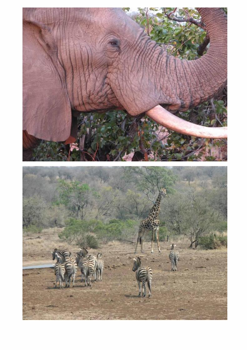
clocked in at Blue Water Beach and camped on the same site we had almost 4 weeks before for a well deserved rest – 1417 km. 20/09 By now we were driving fit. The decision was made to visit the Kruger Park and left Vilanculos a bit late. We enjoyed the drive through the last stretch through Mozambique on excellent tarred roads (besides for some road works south of Vilanculos and a bad stretch north of Xai-Xai) and reached Maputo at peak hour. This caused us to be too late to get into the park. No problem. After filling the Cruiser with diesel in Komatipoort, we booked in at the local caravan park and retired for the night – 805 km. 21/09, 22/09, 23/09 At 06h00 we entered Kruger Park at the Crocodile Bridge gate, and saw a lot of game all the way up. By 11h00 we had seen 4 of the big 5 and by 15h00 we sighted lions which completed seeing the big 5 in one day. At Lower Sabie we visited the park offices where they were very friendly and efficient and we got booking for one night at each of Satara, Letaba and Maroela. This was exactly what we wanted. The 3 days in Kruger were relaxing. Game was plentiful, the campsites excellent and the ablutions spotless. All this at much cheaper than any other game reserve we experienced so far in Africa. SA citizens are very quick to complain about our parks but after visiting many parks on the continent we can only say that none of them come close to what we have on our doorstep – 507 km. 24/09 – Leaving the Kruger Park at the Orpen gate at 08h30 we arrived home in Pretoria at 14h30, exactly 5 weeks after we left – 503 km.
Scroll down for a Cost Breakdown
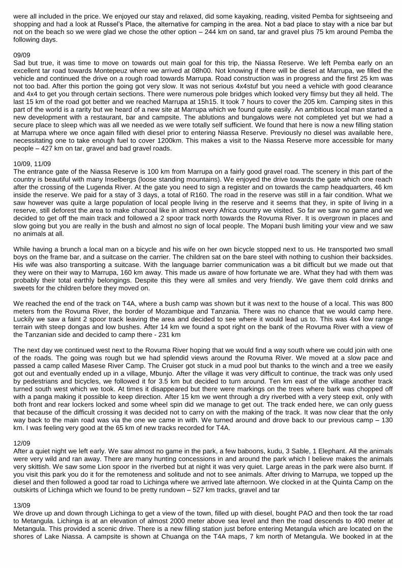
Cost Breakdown: - Prices converted to SA Rand, Vat incl: Accommodation and entrance fees into Parks: Tshipise R400 (2 nights) Kruger Park (Day fee to drive through) R80 Blue Water Beach Vilanculos R675 (3 nights) Gorongoza (Camping + entrance into reserve) R737 (2 nights) Zalala Beach east of Quelimane R80 (1 night) Casuarina Bridge Camp at Ilha R70 (1 night) Libelula north of Nacala R480 (4 nights) Hashim’s Place, Pangane R200 (2 nights) Pemba dive & Bush Camp R750 (4 nights) Marrupa R40 Niassa Reserve (entrance and bush camping) R160 (3 nights) Lichinga R70 Chuanga R70 Nkopola Lodge R225 (3 nights) Steps in Senga Bay R100 Vilanculos R225 Komatipoort R150 Kruger Park (Camping + day fees) R705 (3 nights) R5217 Border Costs+3
rd. party
Mozambique (Pafuri) R58 Vilanculos (3
rd Party) R150
Malawi R370 R578 Toll Fees SA Roads and Bridges in Mozambique R200 Food & Beverages Beer, Cool drinks, Wood, Charcoal, Vegetables, Groceries, Ice Cream
Fish, etc. R910 Restaurants Hashim, Gorongoza, Kruger R316 Fuel South Africa R2492
Mozambique R6918 Malawi R1120 R10530 Service of Cruiser Done by myself R750 Communication Extra cost on Cell account for roaming R700
Savings Fuel for commuting at home, to work and back (R1550) Water and Electricity usage at home (R500) (R2050) Grand Total for Trip R17151 Total fuel used 1379 litres Total Distance as per GPS Log 9757 Km Average Fuel Consumption 7.08km/L Food taken with us would also been consumed while at home, other extras are already added to the above costs. The wear and tear on the vehicle and tyres are not included as well as extra costs when doing a major service on the vehicle.
Scroll down for Photo’s
Pierre en Christi, photos 20 August to 24 September 2010
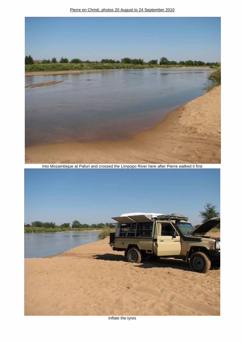
Into Mozambique at Pafuri and crossed the Limpopo River here after Pierre walked it first
Inflate the tyres

After action, satisfaction
Bushcamp 12 km east of Mapai enroute to Vilanculos

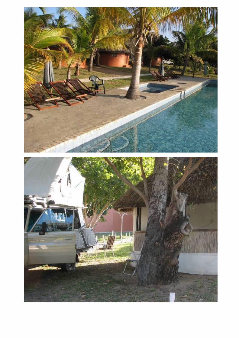
Stayed at Blue Water Beach in Vilanculos, friendly and helpfull Philipe manage the resort

Visited the Gorongosa National Park. Large areas in the park is a wetland of which some tracks will be impassible in the rainy season. There we met a 61 year old Portugese lady, Tersesa, a retired teacher who travelled Mozambique with a backpack
and public transport. We gave her a lift to Ilha da Mozambique, a 2 day drive which was difficult in the single cab vehicle. Between her and Christi they took turns to sit on blankets and pillows in the middle.

Arrived at Ilha da Mozambique, previously the capital of Mozambique and camped at Casuarina Bridge Camping on the land side of the bridge to the Island. The bridge is app. 3.2km long, the Island is 3km long and 550m wide and thousands of people
are living there. Teresa had to sleep in the vehicle the previous night but this time she has a bed in one of the chalets. The next day we drove to the Island, narrow streets and things look run down so you have no idea how the houses look on the
inside. Casa do Gabriel was a pleasant surprise and is a guesthouse we can recommend, they even has safe parking for the vehicle. Christi en Teresa visited the local market after which we left Teresa at Casa do Gabriel

Streets of Ilha


Fort San Sabastian

Church: Santo Antonio and colourfull market

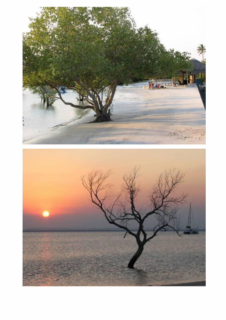
Arrived at Nacala and camped at Libelula, what a beautifull place. Stayed 4 nights, snorkeled and saw beautifull fish.


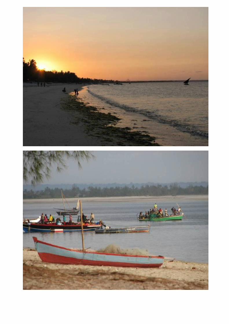
Moved on to Pangane, 200km north of Pemba. Very beautifull setting with basic facilities, washing water in a bucket and a toilet. Hashim, the owner, prepares fish and coconut rice and serves it at your campsite at a low price. Look at the scenery
from the rooftop tent, called the Honymoon Suite! Shelves are large and plenty and Christi enjoyed picking them up.


Arrived at Pemba and camped at Pemba Dive & Bush Centre where we rowed with a kajak and unsuccessfully tried some
fishing


Enroute to Niassa Park one cross bridges like this. Christi just closed her eyes on some of them.


Never seen before, white Guinea Fowl close to Niassa Park


Our campsite on the bank of the Rovuma River in the very remote Niassa Park, on the other side is Tanzania


This one looked real bad

Lake Niassa (aka Lake Malawi) on the Mozambique side, here we decended 1500 meter


Our campsite at Chuanga on the lake


Arrived in Malawi and camped next to the lake at Nkopola Lodge. Fantastic and a warm shower, we stayed 3 nights


Steps in Senga Bay next to the Livingstonia Hotel where they sweep the entire beach every morning. Malawi ran out of diesel
so we had to cut it short and missed out on a visit to Liwonde Reserve. Decided to go back via Mozambique and to visit Kruger Park for 3 days before going home.

Enroute to SA in Mozambique, not nice to see!
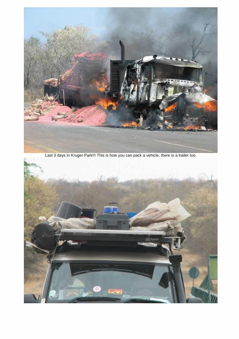
Last 3 days in Kruger Park!!! This is how you can pack a vehicle, there is a trailer too.


![IOSIÌ{A ]ï|AO]|EL - Mozambique History Net...task of organising political education in a women's unit in Niassa Province. This task she undertook successfullv for 6 months. In 1967,](https://static.fdocuments.us/doc/165x107/607dd607fc897c79a7735986/iosioea-aoel-mozambique-history-task-of-organising-political-education.jpg)