LESSONS LEARNED FROM PAST NOTABLE DISASTERS EGYPT PART 3: EARTHQUAKES
Upload
meghan-thorntonCategory
view
217download
3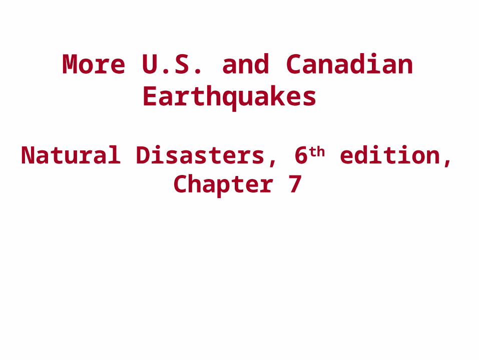
More U.S. and Canadian Earthquakes
Natural Disasters, 6th edition, Chapter 7
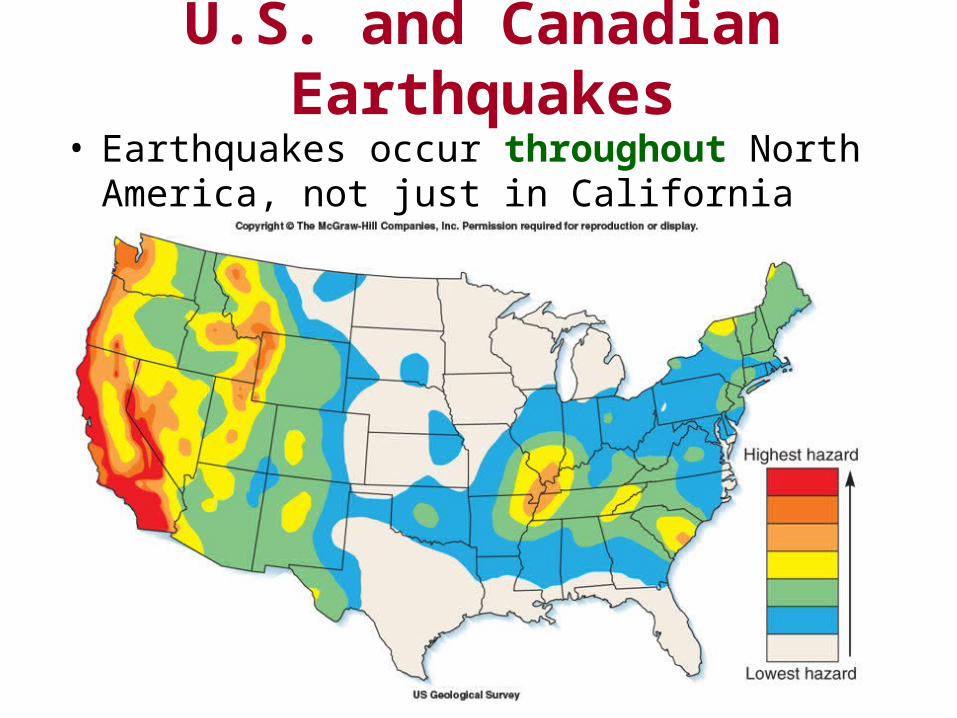
U.S. and Canadian Earthquakes• Earthquakes occur throughout North America, not
just in California
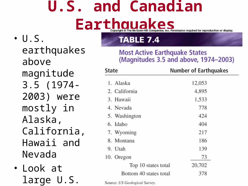
U.S. and Canadian Earthquakes• U.S. earthquakes
above magnitude 3.5 (1974-2003) were mostly in Alaska, California, Hawaii and Nevada
• Look at large U.S. and Canada earthquakes not on tectonic boundary
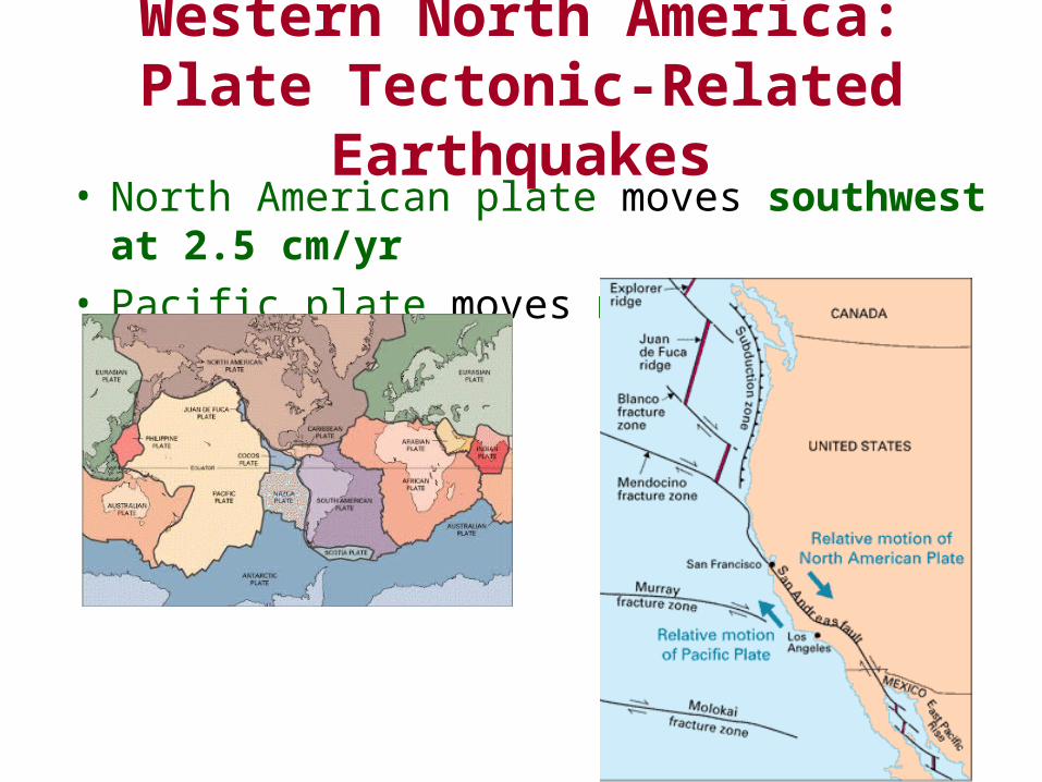
Western North America: Plate Tectonic-Related Earthquakes
• North American plate moves southwest at 2.5 cm/yr• Pacific plate moves northwest 8 cm/yr
Western North America: Plate Tectonic-Related Earthquakes
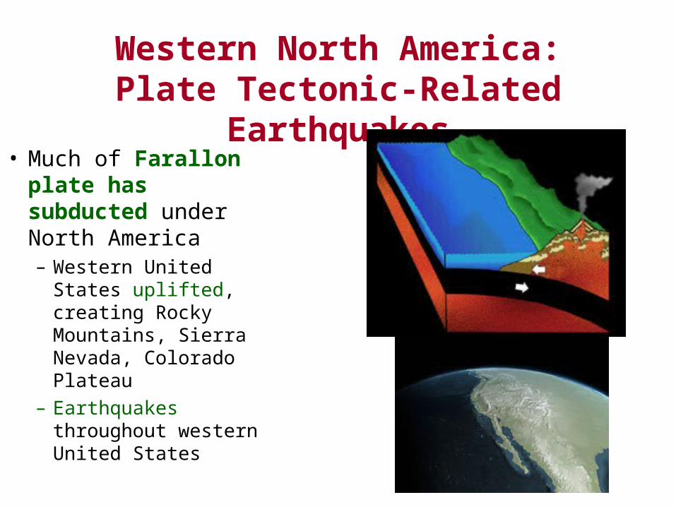
• Much of Farallon plate has subducted under North America– Western United States
uplifted, creating Rocky Mountains, Sierra Nevada, Colorado Plateau
– Earthquakes throughout western United States
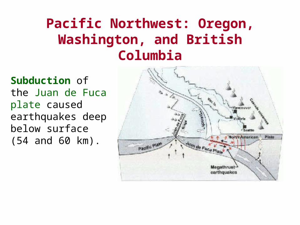
Pacific Northwest: Oregon, Washington, and British Columbia
Subduction of the Juan de Fuca plate caused earthquakes deep below surface (54 and 60 km).
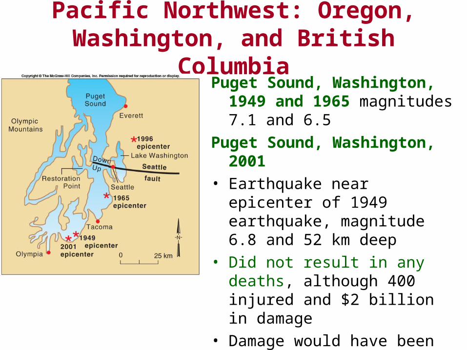
Pacific Northwest: Oregon, Washington, and British Columbia
Puget Sound, Washington, 1949 and 1965 magnitudes 7.1 and 6.5
Puget Sound, Washington, 2001
• Earthquake near epicenter of 1949 earthquake, magnitude 6.8 and 52 km deep
• Did not result in any deaths, although 400 injured and $2 billion in damage
• Damage would have been far worse but for improved building codes after 1965 earthquake
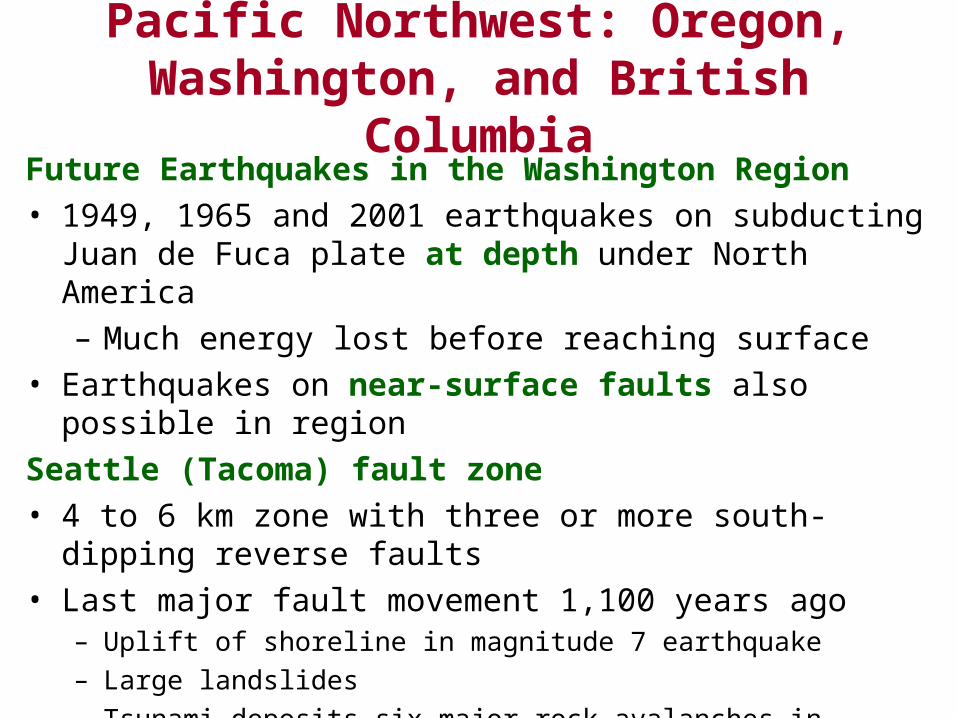
Pacific Northwest: Oregon, Washington, and British Columbia
Future Earthquakes in the Washington Region
• 1949, 1965 and 2001 earthquakes on subducting Juan de Fuca plate at depth under North America
– Much energy lost before reaching surface
• Earthquakes on near-surface faults also possible in region
Seattle (Tacoma) fault zone
• 4 to 6 km zone with three or more south-dipping reverse faults
• Last major fault movement 1,100 years ago– Uplift of shoreline in magnitude 7 earthquake
– Large landslides
– Tsunami deposits six major rock avalanches in Olympic Mountains
– Coarse sediment layers at bottom of Lake Washington
• Seattle sits on basin of soft sediments that amplify shaking
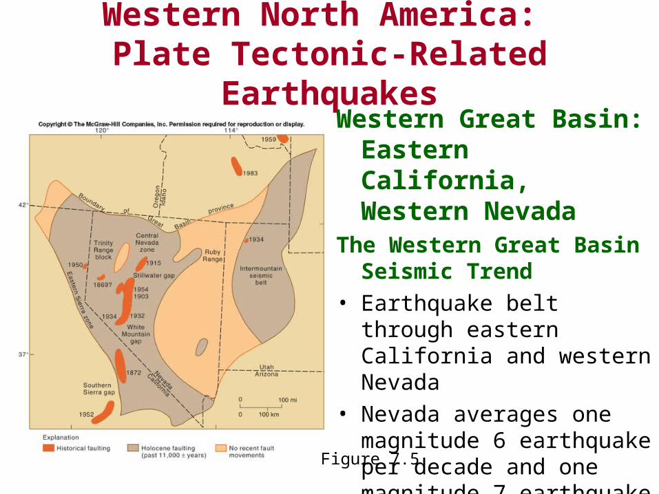
Western Great Basin: Eastern California, Western Nevada
Western North America: Plate Tectonic-Related Earthquakes
Figure 7.4
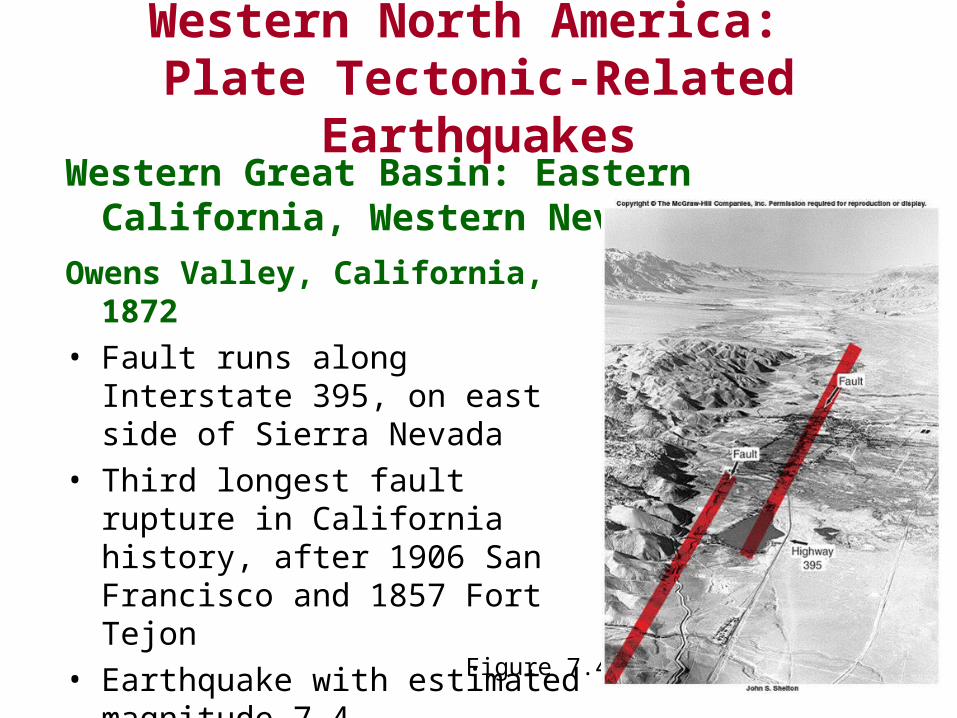
Owens Valley, California, 1872
• Fault runs along Interstate 395, on east side of Sierra Nevada
• Third longest fault rupture in California history, after 1906 San Francisco and 1857 Fort Tejon
• Earthquake with estimated magnitude 7.4
Western North America: Plate Tectonic-Related Earthquakes
Western Great Basin: Eastern California, Western Nevada
The Western Great Basin Seismic Trend
• Earthquake belt through eastern California and western Nevada
• Nevada averages one magnitude 6 earthquake per decade and one magnitude 7 earthquake per 27 years
Figure 7.5
Western North America: Plate Tectonic-Related Earthquakes
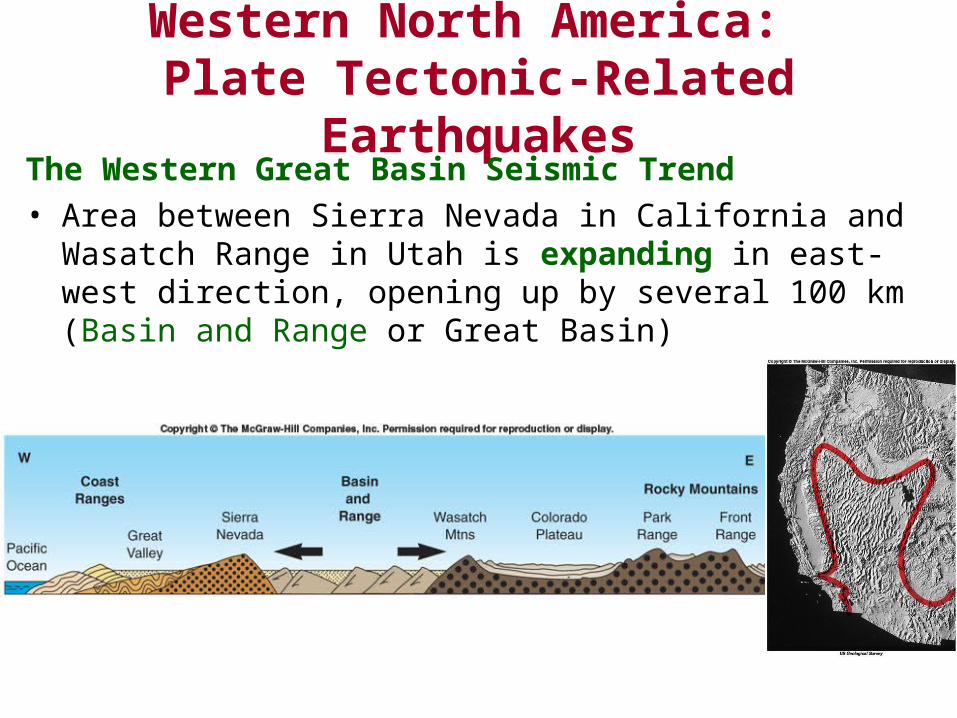
The Western Great Basin Seismic Trend
• Area between Sierra Nevada in California and Wasatch Range in Utah is expanding in east-west direction, opening up by several 100 km (Basin and Range or Great Basin)
Western North America: Plate Tectonic-Related Earthquakes
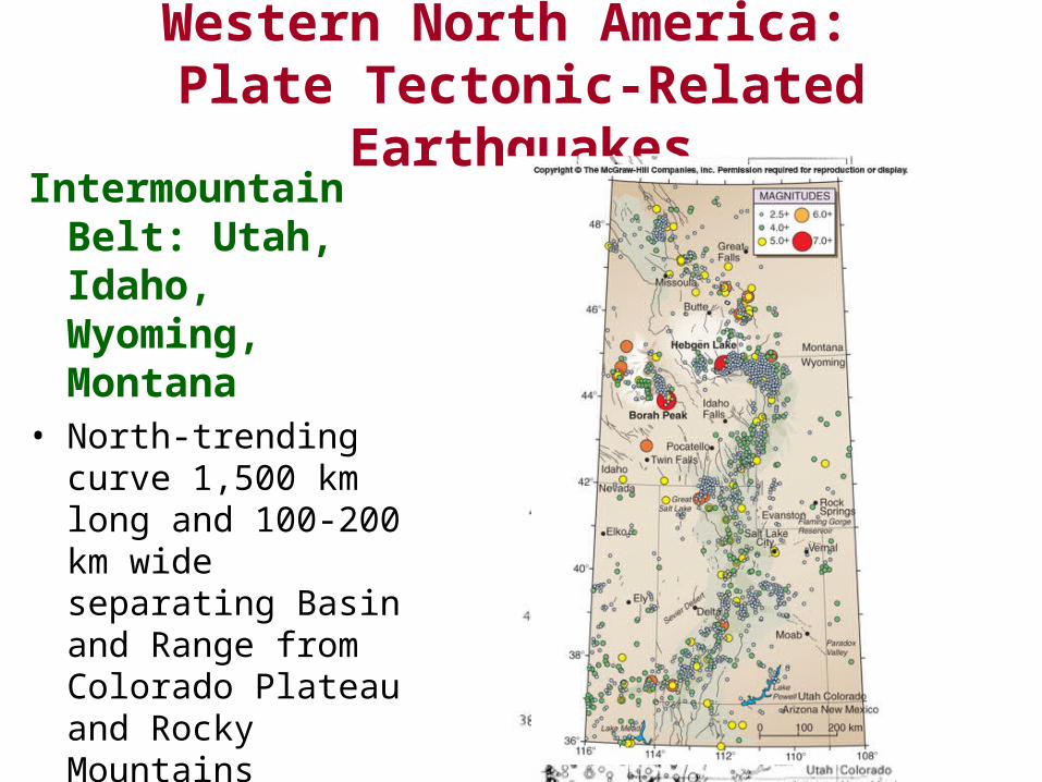
Intermountain Belt: Utah, Idaho, Wyoming, Montana
• North-trending curve 1,500 km long and 100-200 km wide separating Basin and Range from Colorado Plateau and Rocky Mountains
• Faults on east side are down-to-the-west and on the west side are down-to-the east: center is down-dropped
Intermountain Belt: Utah, Idaho, Wyoming, Montana
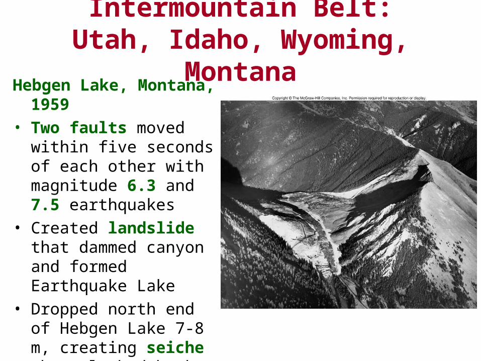
Hebgen Lake, Montana, 1959
• Two faults moved within five seconds of each other with magnitude 6.3 and 7.5 earthquakes
• Created landslide that dammed canyon and formed Earthquake Lake
• Dropped north end of Hebgen Lake 7-8 m, creating seiche that sloshed back and forth for almost 12 hours
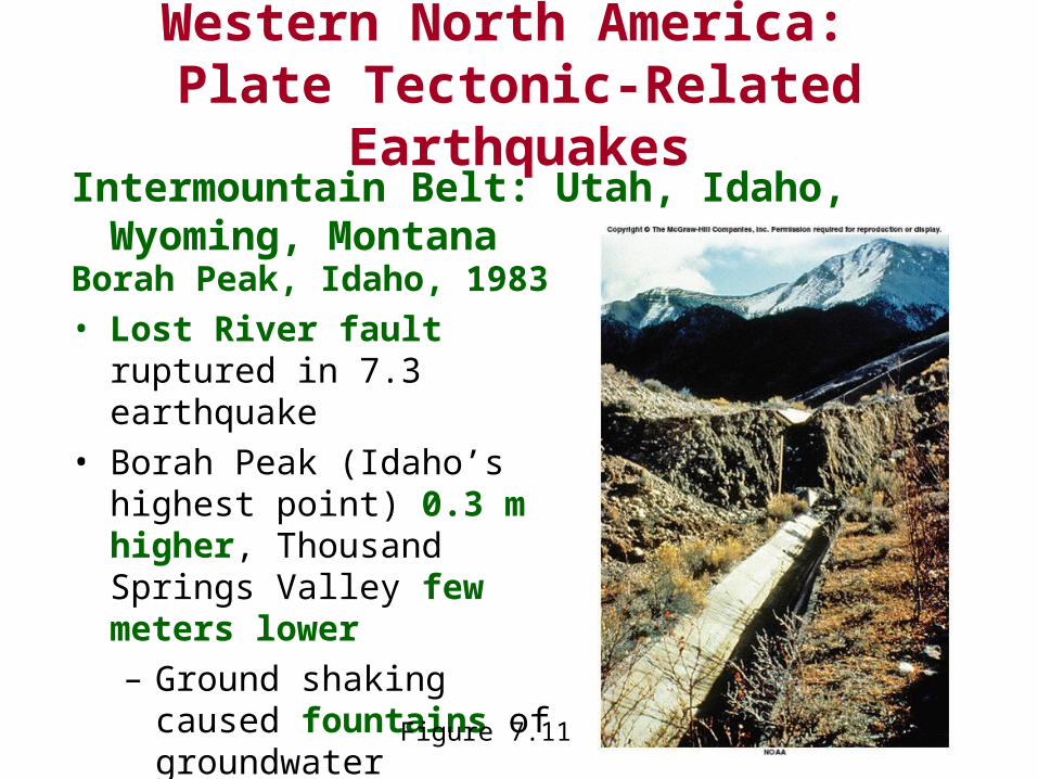
Borah Peak, Idaho, 1983
• Lost River fault ruptured in 7.3 earthquake
• Borah Peak (Idaho’s highest point) 0.3 m higher, Thousand Springs Valley few meters lower
– Ground shaking caused fountains of groundwater
Intermountain Belt: Utah, Idaho, Wyoming, Montana
Western North America: Plate Tectonic-Related Earthquakes
Figure 7.11
Intermountain Belt: Utah, Idaho, Wyoming, Montana
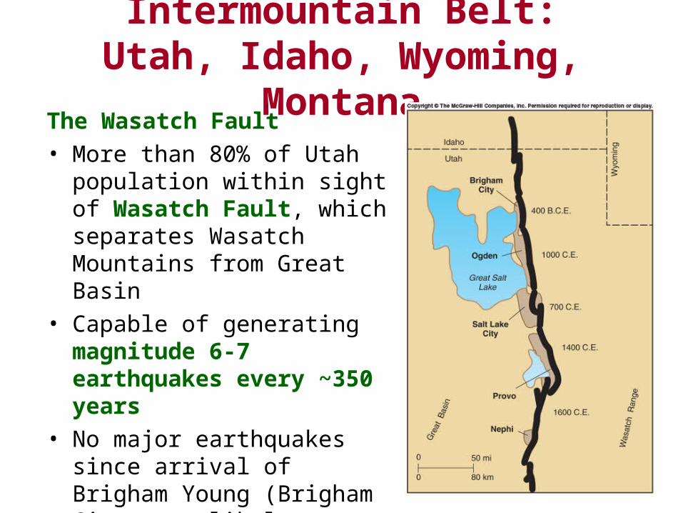
The Wasatch Fault
• More than 80% of Utah population within sight of Wasatch Fault, which separates Wasatch Mountains from Great Basin
• Capable of generating magnitude 6-7 earthquakes every ~350 years
• No major earthquakes since arrival of Brigham Young (Brigham City next likely candidate)
Western North America: Plate Tectonic-Related Earthquakes
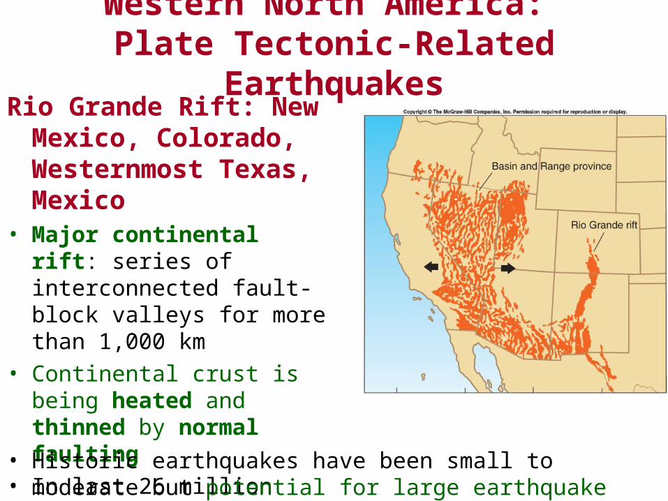
Rio Grande Rift: New Mexico, Colorado, Westernmost Texas, Mexico
• Major continental rift: series of interconnected fault-block valleys for more than 1,000 km
• Continental crust is being heated and thinned by normal faulting
• In last 26 million years, 8 km of extension
• Historic earthquakes have been small to moderate but potential for large earthquake exists
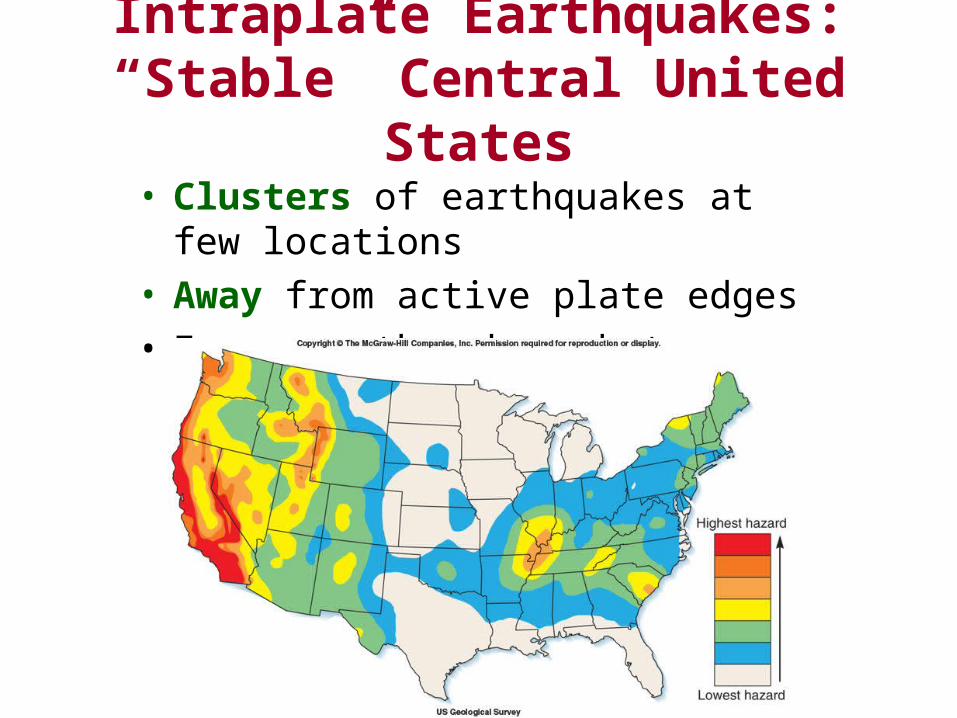
Intraplate Earthquakes: “Stable” Central United States
• Clusters of earthquakes at few locations• Away from active plate edges• Fewer earthquakes, but can be just as large
Intraplate Earthquakes: “Stable” Central United States
New Madrid, Missouri, 1811-1812• Series of earthquakes, with four very large events
– Eight considered violent, ten very severe
– Total of 1,874 events
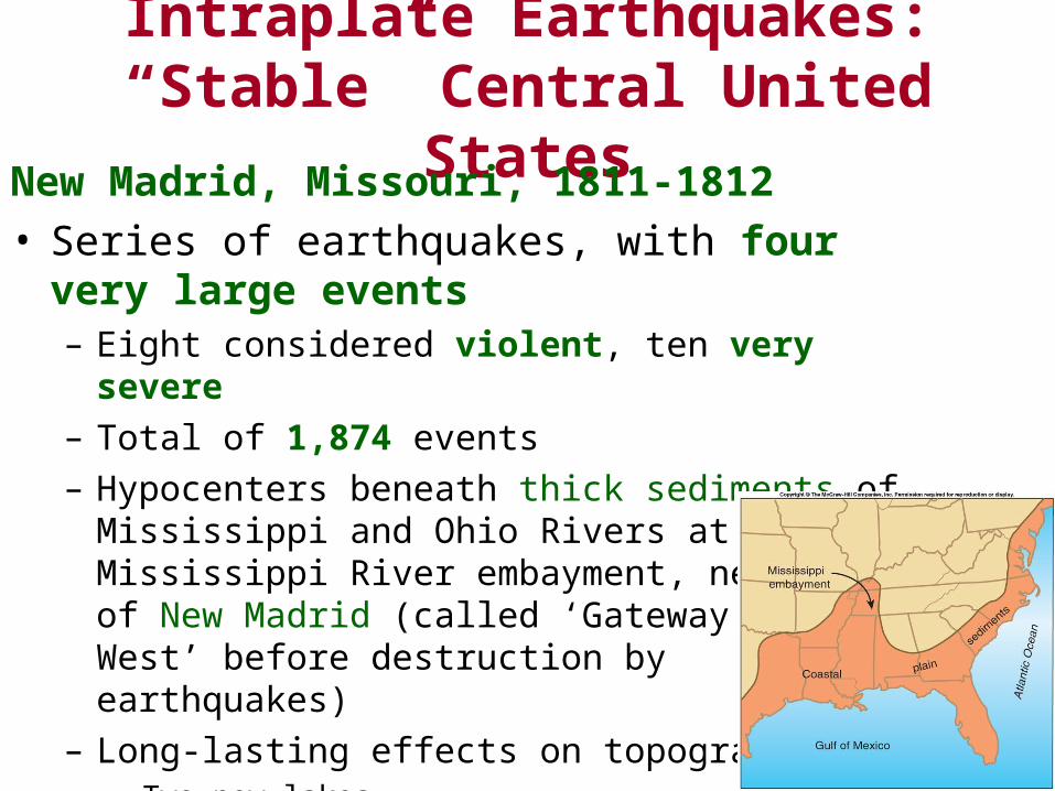
– Hypocenters beneath thick sediments of Mississippi and Ohio Rivers at Mississippi River embayment, near town of New Madrid (called ‘Gateway to the West’ before destruction by earthquakes)
– Long-lasting effects on topography• Two new lakes
• Low cliffs and domes formed
• Waterfalls in streams
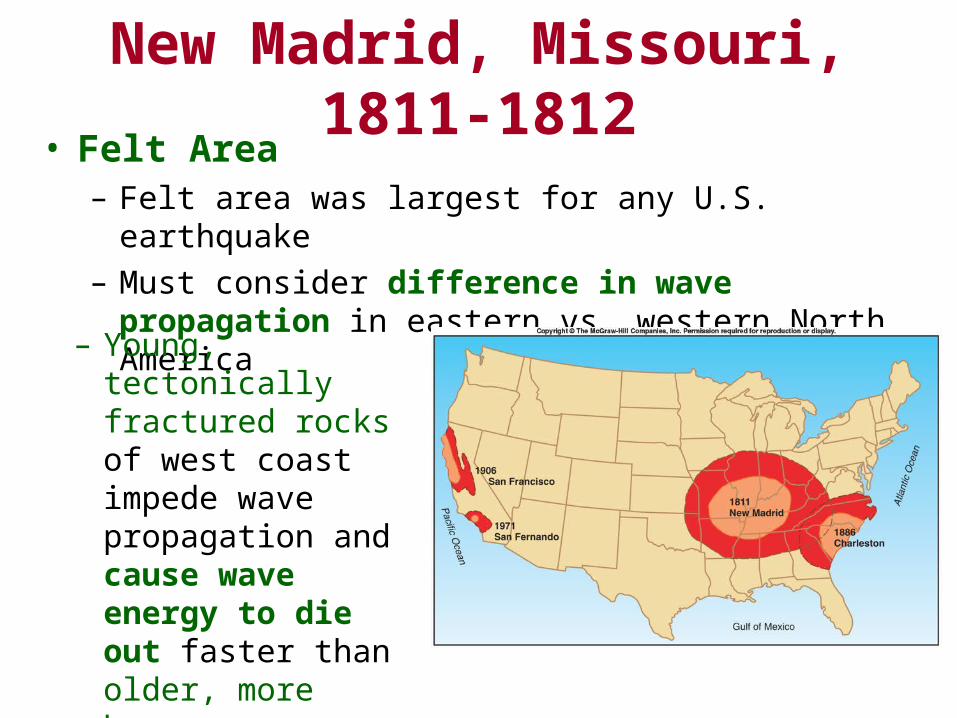
New Madrid, Missouri, 1811-1812• Felt Area
– Felt area was largest for any U.S. earthquake
– Must consider difference in wave propagation in eastern vs. western North America
– Young, tectonically fractured rocks of west coast impede wave propagation and cause wave energy to die out faster than older, more homogeneous rocks of central U.S.
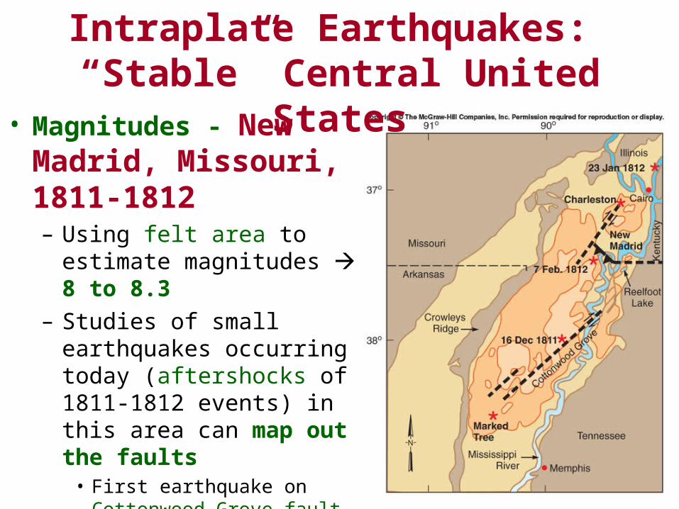
• Magnitudes - New Madrid, Missouri, 1811-1812– Using felt area to estimate
magnitudes 8 to 8.3
– Studies of small earthquakes occurring today (aftershocks of 1811-1812 events) in this area can map out the faults
• First earthquake on Cottonwood Grove fault, triggered two of following earthquakes on Reelfoot blind thrust
• Remaining earthquake difficult to locate
Intraplate Earthquakes: “Stable” Central United States
New Madrid, Missouri, 1811-1812
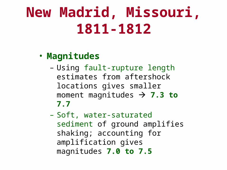
• Magnitudes– Using fault-rupture length estimates from
aftershock locations gives smaller moment magnitudes 7.3 to 7.7
– Soft, water-saturated sediment of ground amplifies shaking; accounting for amplification gives magnitudes 7.0 to 7.5
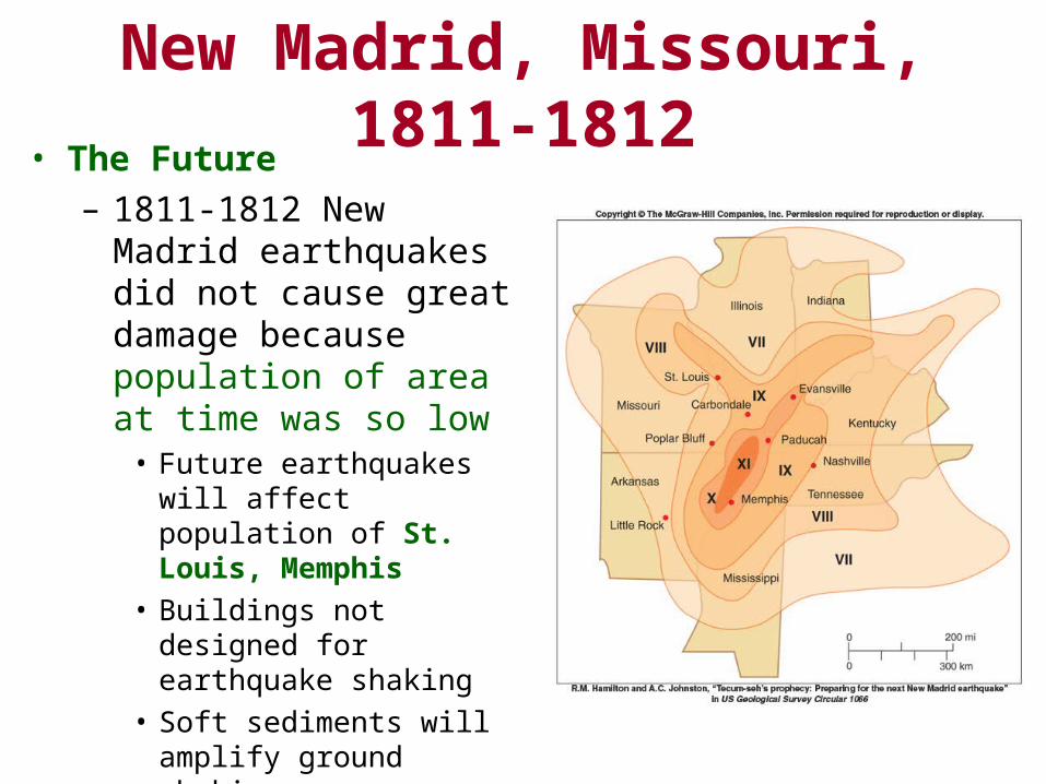
New Madrid, Missouri, 1811-1812• The Future
– 1811-1812 New Madrid earthquakes did not cause great damage because population of area at time was so low
• Future earthquakes will affect population of St. Louis, Memphis
• Buildings not designed for earthquake shaking
• Soft sediments will amplify ground shaking
• Very large area will be affected
New Madrid, Missouri, 1811-1812
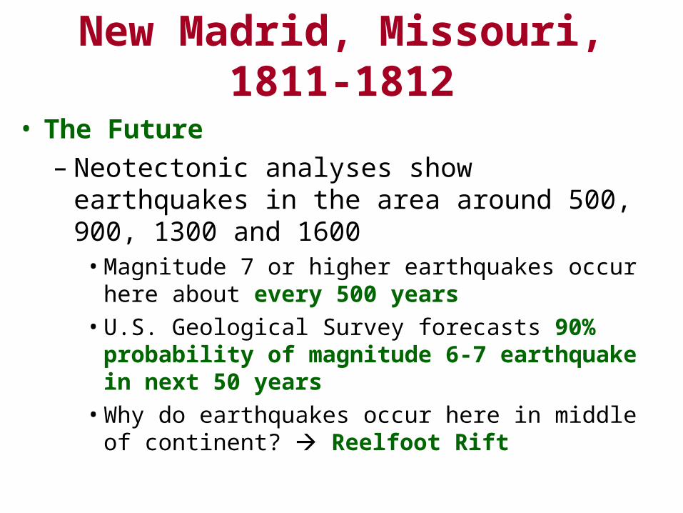
• The Future– Neotectonic analyses show earthquakes in the area
around 500, 900, 1300 and 1600• Magnitude 7 or higher earthquakes occur here about every
500 years
• U.S. Geological Survey forecasts 90% probability of magnitude 6-7 earthquake in next 50 years
• Why do earthquakes occur here in middle of continent? Reelfoot Rift
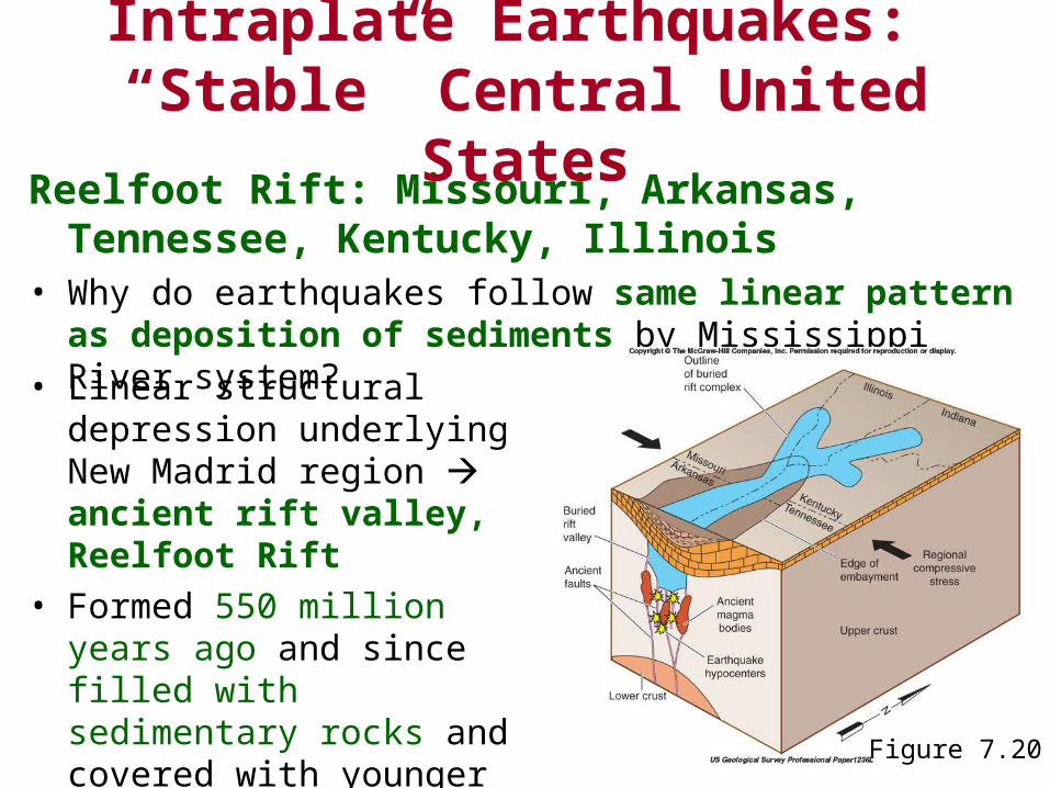
Reelfoot Rift: Missouri, Arkansas, Tennessee, Kentucky, Illinois
• Why do earthquakes follow same linear pattern as deposition of sediments by Mississippi River system?
Intraplate Earthquakes: “Stable” Central United States
• Linear structural depression underlying New Madrid region ancient rift valley, Reelfoot Rift
• Formed 550 million years ago and since filled with sedimentary rocks and covered with younger sediments
Figure 7.20
Intraplate Earthquakes: “Stable” Central United States
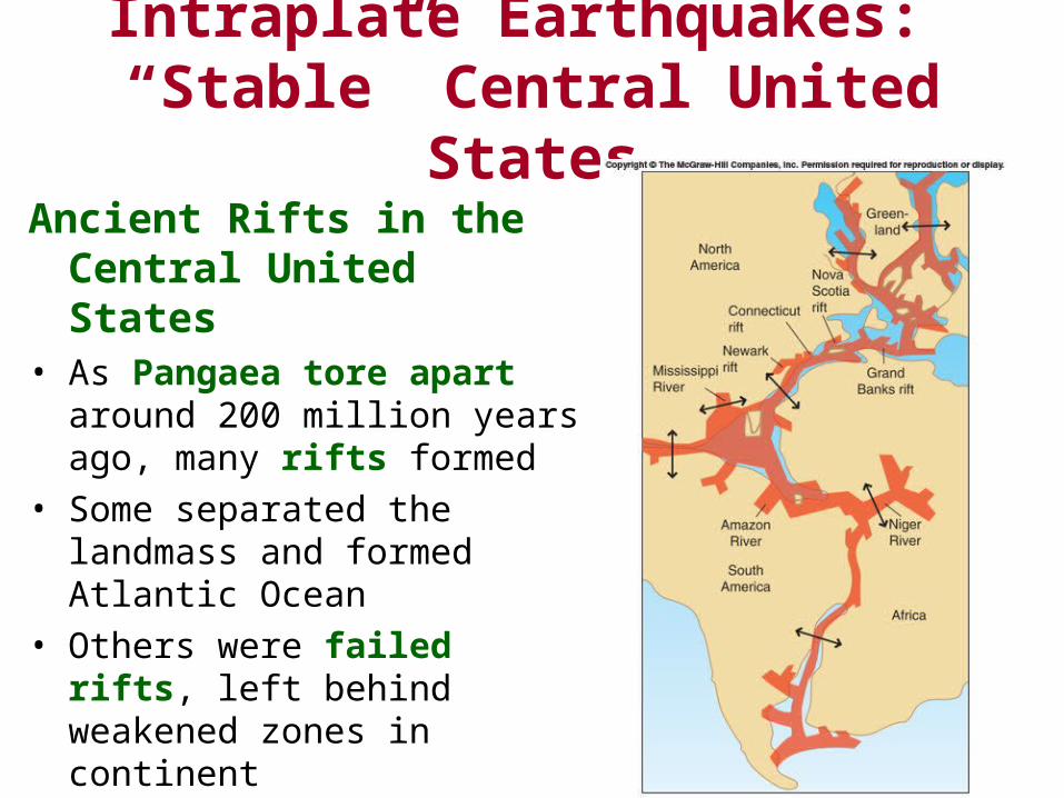
Ancient Rifts in the Central United States
• As Pangaea tore apart around 200 million years ago, many rifts formed
• Some separated the landmass and formed Atlantic Ocean
• Others were failed rifts, left behind weakened zones in continent
• Can be reactivated by plate-tectonic stresses

Ancient Rifts in the Central United States
• Failed rifts correlate to active faults at the surface– St. Louis arm St. Genevieve
fault zone
– Rough Creek rift Rough Creek fault zone
– Southern Oklahoma rift Wichita Mountains frontal-fault system, Meers fault across Oklahoma
– Southern Indiana arm Wabash Valley fault zone
Intraplate Earthquakes: “Stable” Central United States
Figure 7.22
Intraplate Earthquakes: Eastern United States
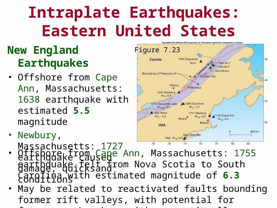
New England Earthquakes• Offshore from Cape Ann,
Massachusetts: 1638 earthquake with estimated 5.5 magnitude
• Newbury, Massachusetts: 1727 earthquake caused damage, quicksand conditions
• Offshore from Cape Ann, Massachusetts: 1755 earthquake felt from Nova Scotia to South Carolina with estimated magnitude of 6.3
• May be related to reactivated faults bounding former rift valleys, with potential for future earthquakes, with proportionally more damage across densely populated East Coast
Figure 7.23
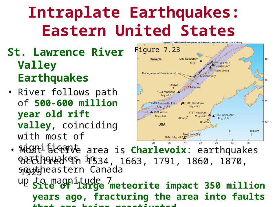
St. Lawrence River Valley Earthquakes
• River follows path of 500-600 million year old rift valley, coinciding with most of significant earthquakes in southeastern Canada up to magnitude 7
Intraplate Earthquakes: Eastern United States
• Most active area is Charlevoix: earthquakes occurred in 1534, 1663, 1791, 1860, 1870, 1925
– Site of large meteorite impact 350 million years ago, fracturing the area into faults that are being reactivated
Figure 7.23
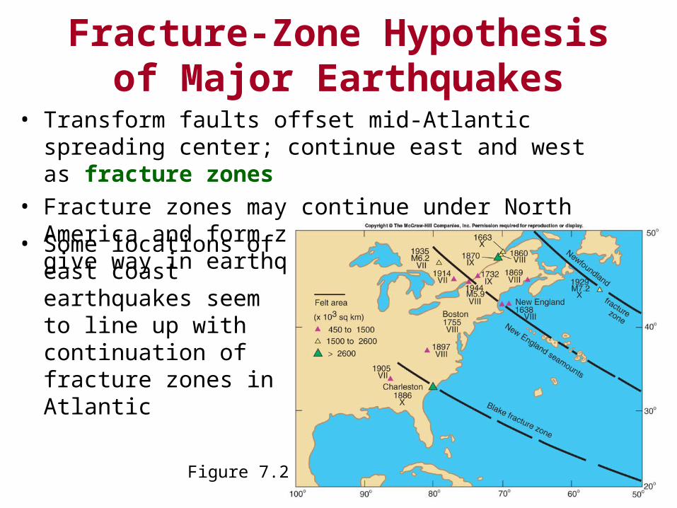
Fracture-Zone Hypothesis of Major Earthquakes
• Transform faults offset mid-Atlantic spreading center; continue east and west as fracture zones
• Fracture zones may continue under North America and form zones of weakness that give way in earthquakes
Figure 7.24
• Some locations of east coast earthquakes seem to line up with continuation of fracture zones in Atlantic
Fracture-Zone Hypothesis of Major Earthquakes
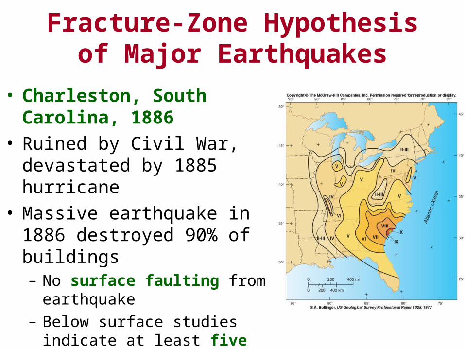
• Charleston, South Carolina, 1886
• Ruined by Civil War, devastated by 1885 hurricane
• Massive earthquake in 1886 destroyed 90% of buildings– No surface faulting from earthquake
– Below surface studies indicate at least five similar earthquakes in last 3,000 years – recurrence interval of about 600 years
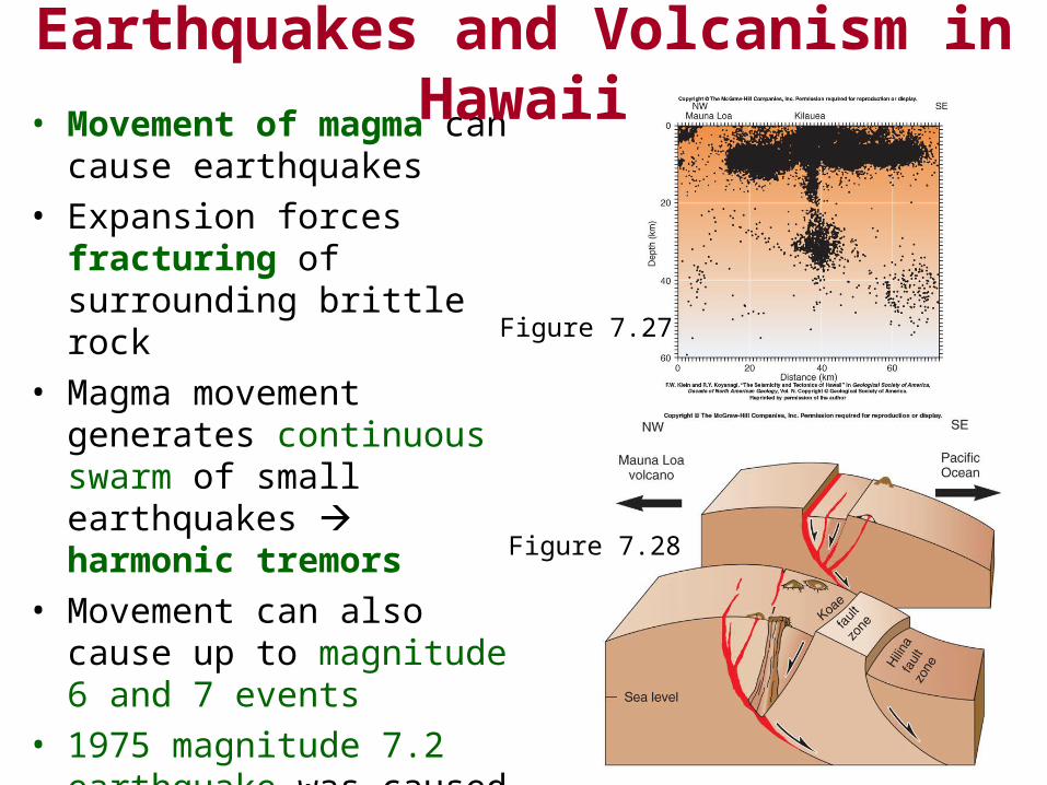
• Movement of magma can cause earthquakes
• Expansion forces fracturing of surrounding brittle rock
• Magma movement generates continuous swarm of small earthquakes harmonic tremors
• Movement can also cause up to magnitude 6 and 7 events
• 1975 magnitude 7.2 earthquake was caused by movement on normal fault of block into sea – caused tsunami up to 12 m high
Earthquakes and Volcanism in Hawaii
Figure 7.28
Figure 7.27

End of Chapter 6