Mobile GIS - techadvantage.org · Mobile GIS Put your operations and asset infrastructure on your...
14
Mobile GIS Put your operations and asset infrastructure on your workers’ maps so they perform safely, accurately, and efficiently
Transcript of Mobile GIS - techadvantage.org · Mobile GIS Put your operations and asset infrastructure on your...

Mobile GISPut your operations and asset infrastructure on your workers’ maps
so they perform safely, accurately, and efficiently

Software connecting the mobile workforce
GIS: Current State for Co-ops
• Geospatial Information Systems (GIS) have been around a long time
• Cooperatives have spent over a decade building and improving GIS systems
• Getting more integrated, advanced, real time, and mobile
• How do you get more value out of your GIS investments?
• Put your operations and assetinfrastructure in the palm of your field workers’ hands
Software connecting the mobile workforce
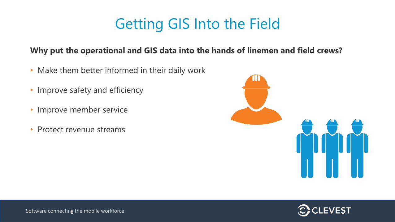
Getting GIS Into the Field
Why put the operational and GIS data into the hands of linemen and field crews?
• Make them better informed in their daily work
• Improve safety and efficiency
• Improve member service
• Protect revenue streams

Software connecting the mobile workforce
What should be in the field?
Visualize operations in the same context as
infrastructure – creating true operation intelligence
• Eliminate duplicate work and blind spots
• See assignments on any device
• Turn-by-turn directions to work/asset locations
• Easily locate GIS assets
• Maintain and install GIS assets
• Improve data quality
• Collect data which feeds into operations center for
real-time updates and asset information for
GIS/OMS/ADMS
• e.g. Update estimated time of restoration (ETR) from the field
for communication to customer on utility’s outage map

Software connecting the mobile workforce
Principles for Effective Use of GIS
1. Provide visibility to your field workers
2. Make their work as efficient as possible
3. Provide integrated systems for
maintaining your asset infrastructure
Software connecting the mobile workforce
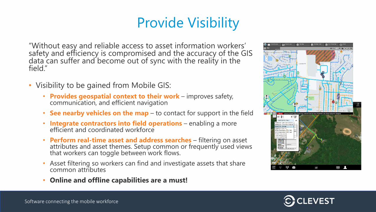
Provide Visibility
“Without easy and reliable access to asset information workers’ safety and efficiency is compromised and the accuracy of the GIS data can suffer and become out of sync with the reality in the field.”
• Visibility to be gained from Mobile GIS:
• Provides geospatial context to their work – improves safety, communication, and efficient navigation
• See nearby vehicles on the map – to contact for support in the field
• Integrate contractors into field operations – enabling a more efficient and coordinated workforce
• Perform real-time asset and address searches – filtering on asset attributes and asset themes. Setup common or frequently used views that workers can toggle between work flows.
• Asset filtering so workers can find and investigate assets that share common attributes
• Online and offline capabilities are a must!

Software connecting the mobile workforce
Provide Efficiency
“Inaccurate and changing asset information (e.g., latitude and longitudes) are updates that need to be made as time progresses.”
• Separate systems for all of this information!
• Efficiencies to be gained with Mobile GIS:
• Geometric/connectivity network tracing enables the workers to investigate outages or the impact of infrastructure changes quickly
• Enabling asset edits in the field for updating and maintaining the asset infrastructure provides more accurate and up-to-date information
• Passing edits back to systems of record to reduce data reentry, inefficiency, and inaccuracy is a must
Software connecting the mobile workforce
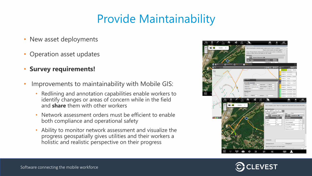
Provide Maintainability
• New asset deployments
• Operation asset updates
• Survey requirements!
• Improvements to maintainability with Mobile GIS:
• Redlining and annotation capabilities enable workers to identify changes or areas of concern while in the field and share them with other workers
• Network assessment orders must be efficient to enable both compliance and operational safety
• Ability to monitor network assessment and visualize the progress geospatially gives utilities and their workers a holistic and realistic perspective on their progress
Software connecting the mobile workforce
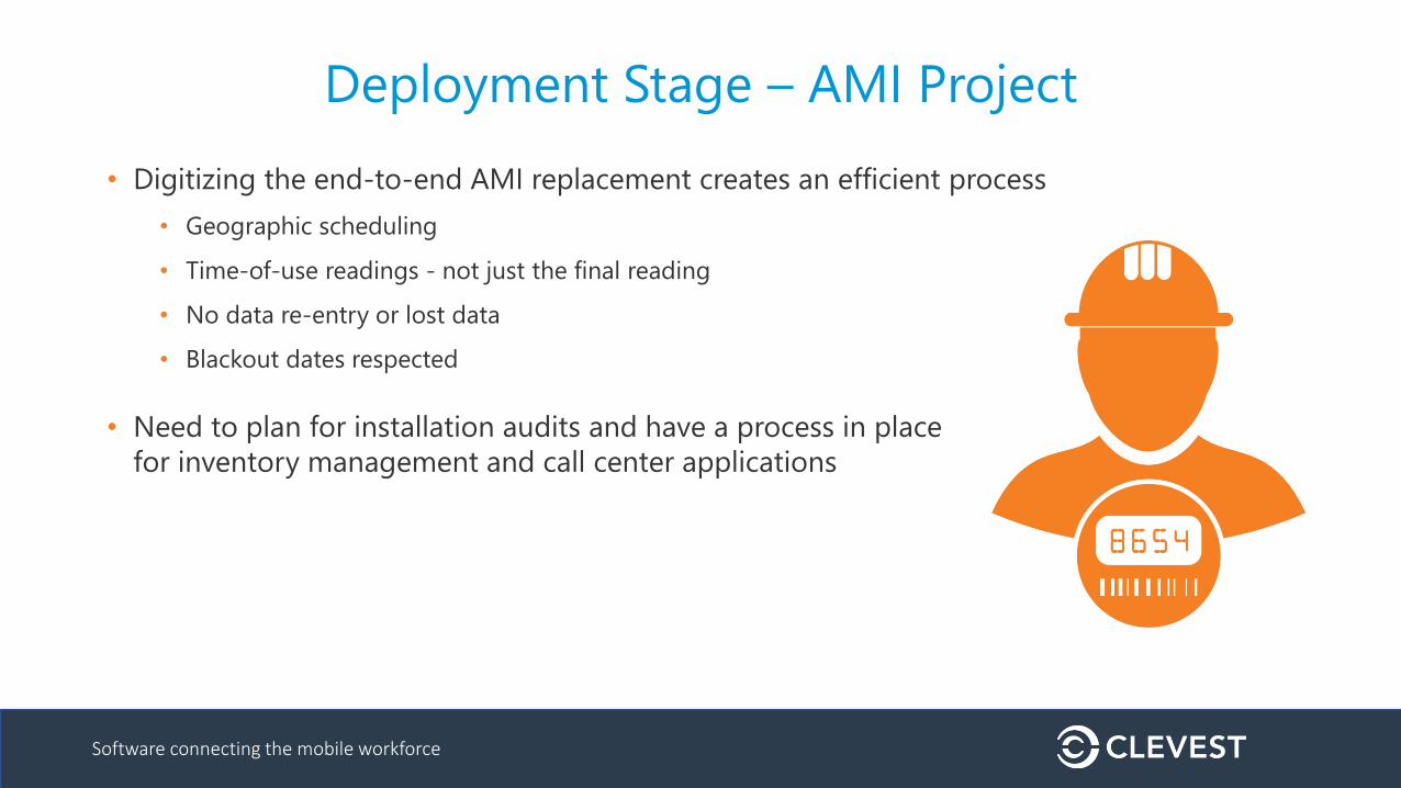
Deployment Stage – AMI Project
• Digitizing the end-to-end AMI replacement creates an efficient process
• Geographic scheduling
• Time-of-use readings - not just the final reading
• No data re-entry or lost data
• Blackout dates respected
• Need to plan for installation audits and have a process in place
for inventory management and call center applications
Software connecting the mobile workforce
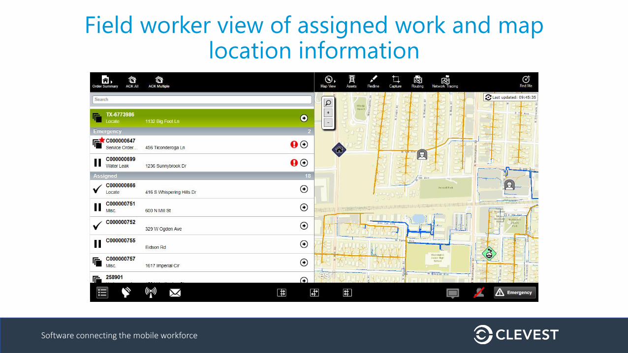
Field worker view of assigned work and map location information

Software connecting the mobile workforce
Dispatcher/supervisor view of work in progress
Software connecting the mobile workforce
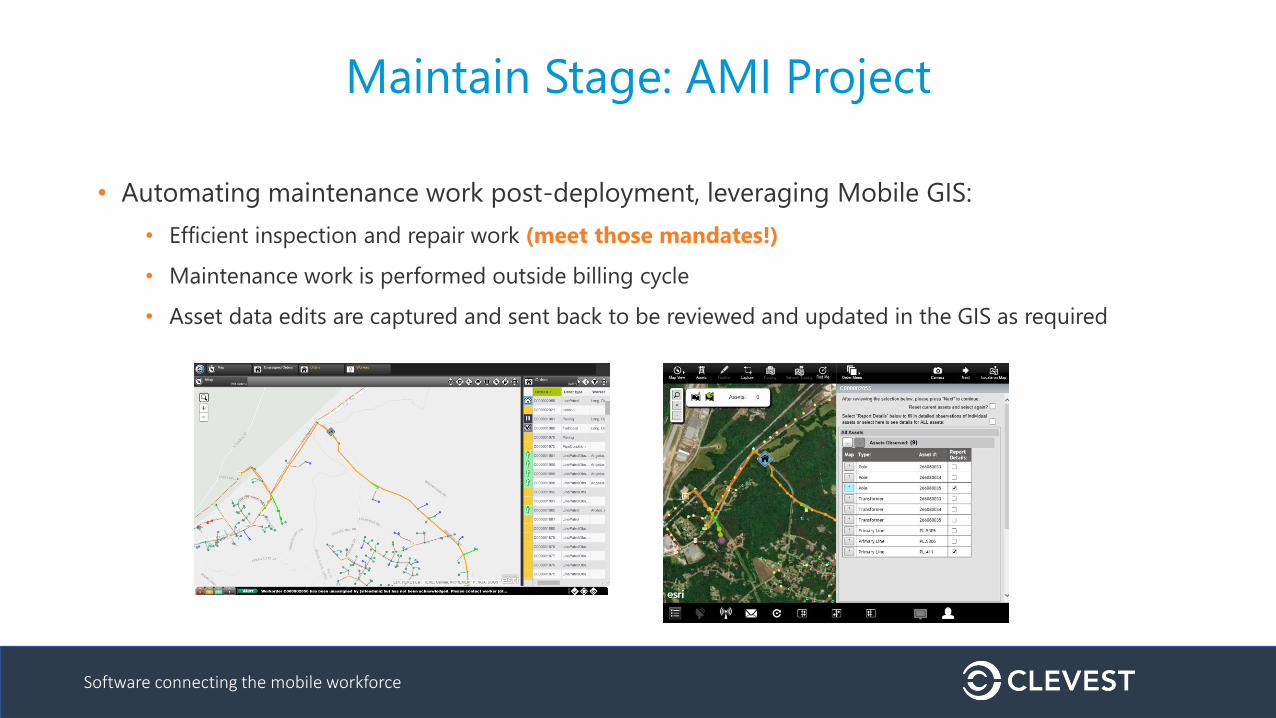
Maintain Stage: AMI Project
• Automating maintenance work post-deployment, leveraging Mobile GIS:
• Efficient inspection and repair work (meet those mandates!)
• Maintenance work is performed outside billing cycle
• Asset data edits are captured and sent back to be reviewed and updated in the GIS as required
Software connecting the mobile workforce
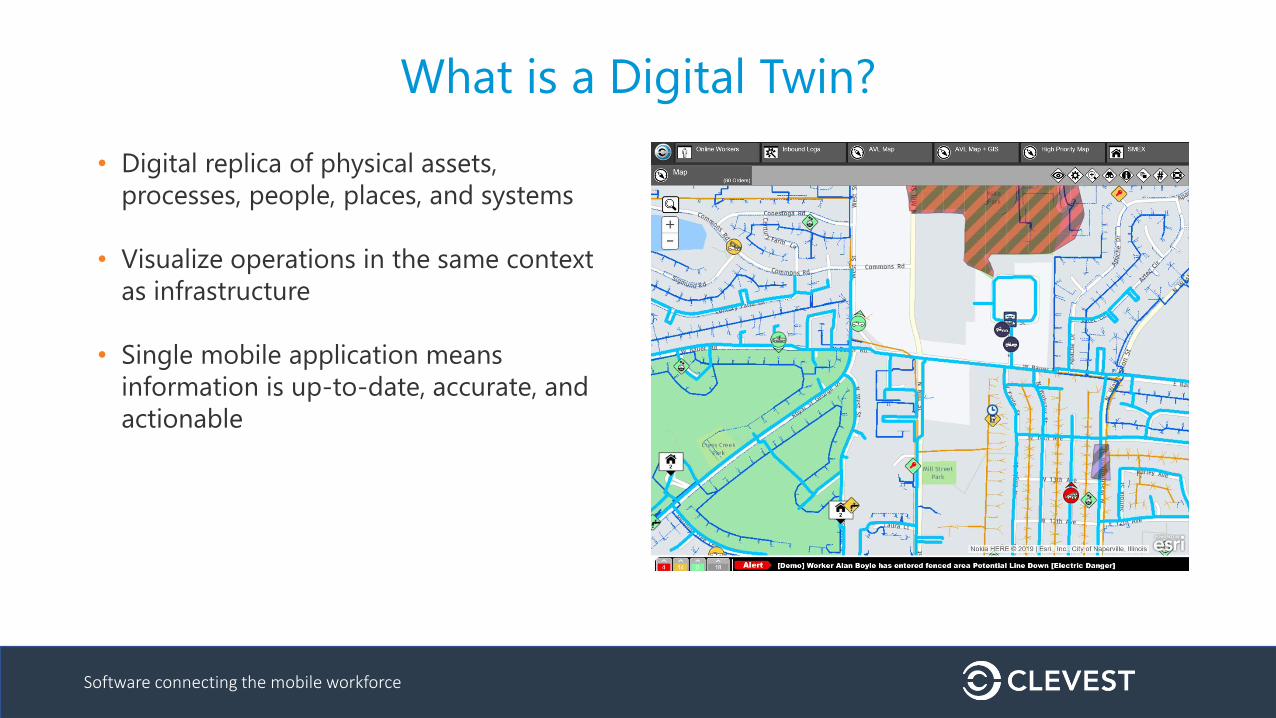
What is a Digital Twin?
• Digital replica of physical assets,
processes, people, places, and systems
• Visualize operations in the same context
as infrastructure
• Single mobile application means
information is up-to-date, accurate, and
actionable

Software connecting the mobile workforce
Questions
Andrew Paul
604-218-0712
www.clevest.com
Visit Clevest during TechAdvantage in booth #547