
Mistaken for - iiNet
176
1
Transcript of Mistaken for - iiNet

1

2
Mistaken for Granite:
earth science for rock watchers
e-book version, sample
(This is a curtailed and abbreviated version, slightly more than half of the original text, so only some of the navigation will work. You can see what is missing by looking at the chapter comtents. It is saved as a low-res PDF, which is shared for free. Get the whole book in high res from Kindle, either as an e-book or as a paperback.)
Peter Macinnis

3
Publication data
Author: Macinnis P. (Peter) (1944 – ).
Title: Mistaken for Granite.
ASIN (e-book edition): B085BGM95Z
ASIN (paperback edition): B0858W4YSK
ISBN for print version: 979-8620093632
Notes: Written originally as an e-book with internal navigation. Contains
illustrations. This is a condensed sample, with bits missing.
Target audience: curious minds from mid-teens to mid-90s.
Subjects: Rocks, geology, environment, climate change earth science.
Copyright: text and photographs copyright © Peter Macinnis 2020, line art
either by the author or public domain.
Cover illustration: Granite hills, Freycinet Peneinsula. Tasmania. [Peter
Macinnis].

4
Chapters Contents
A preamble about a scramble.
Background to earth science.
1: How the earth was made.
2: Deep rocks.
3: How rocks wear away
4: Spicks and specks.
5: Rocks in beds.
6: Changing rocks.
7: Things going wrong.
8: Rocks that ignore the rules.
9: Water and geology.
10: Rocks that were once alive.
11. Making money from rocks.
12: Thinking about rocks.
13. Why dropping rocks on toes hurts.
14. Oh dear, is that the time?
15. End-of-the-earth science.
16. The end.
17. Glossary.
Note: in the text, words in bold underlined orange are explained in the glossary at the end. Without this safety net, the first fifty pages would bloat horribly as I tried to explain all those bits. Use the glossary when you must, but avoid it when you can. If it isn’t in the glossary, look it up on the web, and then you will realise why I left all of those long technical terms in the text.
Dedication:
For Christine, who helped me bother many rocks.

5
6
Peter Macinnis is an award-winning Australian writer for both adults and children. His awards come from the Children's Book Council of Australia, the West Australian Premier, the Wilderness Society, The Educational Publishing Awards Australia (EPAA) and the Royal Zoological Society of New South Wales, among others. There is a full list of his awards at http://members.ozemail.com.au/~macinnis/writing/awards.htm.
Trained as a biologist, he cares about natural history, social history and the stories behind things, and so he has become well-regarded as an historian. He also talks on ABC Radio national from time to time, sometimes teaches adults how to do extreme research and data handling, and thoroughly enjoys being the visiting scientist at his local K-6 school.
A short foreword You cannot hope to bribe or twist, thank God! the British journalist. But, seeing what the man will do unbribed, there's no occasion to. —Humbert Wolfe (1885 – 1940).
This book is written with the intelligent reader in mind, somebody living in an age when the British disease has smitten too many of the world’s scriveners, an age when, unless we care about the earth sciences, our grandchildren have no future.
Wolfe’s epigram, written in the year he died, reminds us that the tricks we see in Fake News and Alternative Facts have been around longer than we realise. The techniques used by the gutter-press and the gutter-politicos have deep roots.
That person who looks you in the eye while picking your pocket and stabbing you in the back is just the latest to follow an old tradition.
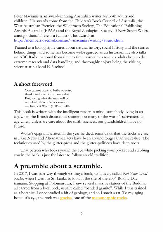
A preamble about a scramble. In 2017, I was part-way through writing a book, tentatively called Not Your Usual Rocks, when I went to Sri Lanka to look at the site of the 2004 Boxing Day tsunami. Stopping at Polonnaruwa, I saw several massive statues of the Buddha, all carved from a local rock, usually called “banded granite”. While I was trained as a botanist, I once studied a bit of geology, and so I smelt a rat. To my aging botanist’s eye, the rock was gneiss, one of the metamorphic rocks.

7
Reclining Buddha carved from local rock, Polonnaruwa, Sri Lanka.
Some 60 km away by winding road, there is a large rock called Sigiriya, a name derived from the Sanskrit Sīnhāgiri, meaning Lion Rock, rather like Sinhapura, the Sanskrit for Lion City, which is now Singapore.
About 1500 years ago, when blue body paint was the height of fashion among my ancestors, an advanced Hindu culture established a fortress on top of Sigiriya. As tourists do, we climbed to the top, and I saw the stone, close up.
Sigiriya Rock, Sri Lanka. What sort of rock is it?
Sigiriya is built on a lump of gneiss, but many web sites say the stone is granite, and a few assert that it is a volcanic plug—which would make it basalt! I had looked this up before going there, and found that the many contributors to Wikipedia dodge the issue, simply calling Sigiriya “a massive column of rock nearly 200 metres high”. I knew in advance that I needed a closer look.
Clearly, ‘granite’, technically an igneous rock, forged in the planet’s fiery depths, means different things to different people, especially those with little in the way of geological training. It really isn’t rock(et) science, though.
On the left, granite from Norway, right, two Australian basalt cobbles about 19 cm long.

8
To a poet, any hard rock is granite, while a stone mason calls any rock with visible crystals granite, but geologists divide those big-crystal rocks up into granite, granodiorite, diorite, gabbro and more. The poet’s granite and the mason’s granite may not be granite at all, and a friend (not a geologist) says he once read that most Australian “granites” are really a relation, granitic porphyry.
On top of Sigiriya rock, I recalled writing a story about the Rosetta Stone while wearing my science journalist hat, some fifteen years before my climb. The tale began with an Australian quiz show causing a bit of fuss and bother after somebody found an apparent error, made a year earlier.
A contestant had said the Rosetta Stone was made of obsidian, but the quizmaster ruled that it was in fact basalt. The producers later conceded that it was “really granite”, and that the contestant should have another chance to win the big money. The three named rocks are quite different, so what was going on?
The Rosetta Stone was carved in 196 BCE, and it carries three inscriptions, saying the same thing in Greek, in Egyptian demotic script, and in hieroglyphics. The content is fairly boring, a list of taxes repealed by Ptolemy V, but the use of three languages made the stone very exciting when it was found in 1799 by French forces fighting in the Napoleonic Wars in Egypt. When the French lost a major battle, the stone became a prize of war, handed over to the victors, and placed on display in the British Museum in 1802, where it remains.
The Rosetta Stone, the key to decoding hieroglyphics, was described by its original French finders as ‘une pierre de granite noir’ (‘a stone of black granite’), but these were not geologists speaking. When Egyptologists called it “black granite”, they just meant a dark, fine-grained granodiorite from Aswan.
A geologist’s granite has large and very obvious crystals of quartz, orthoclase and other minerals like mica. Forming at a great depth, it cools very slowly, leaving enough time for large crystals to develop. Granite is typically 40% quartz (silicon dioxide), and that means it is generally pale in appearance.
Basalt, on the other hand, is black to medium grey, and while it may contain a few larger bits of the minerals olivine and plagioclase, it is typically aphanitic, a term geologists use to indicate igneous rocks in which the grain size is small (less than 0.5 mm), so any grains or crystals cannot be seen with the naked eye.
That leaves us no further forward: why was a piece of granodiorite labelled basalt? Granodiorite is similar to granite, because it has quartz and plagioclase (with no orthoclase), but it also contains biotite and hornblende. It is typically darker than granite, but still a long way from basalt.

9
British scientists always called the Rosetta Stone basalt, and probably nobody gave the rock much thought, because it was the text cut into the stone that mattered, not the rock itself. When the stone was cleaned in 1998, it was found to be covered with black wax, printer’s ink, used to obtain contact-prints of the inscriptions, finger grease and dirt, with white paint in the incised lettering to make it stand out. Calling the blackened stone basalt made some sort of sense.
Andrew Middleton and Dietrich Klemm saw that the cleaned stone was not basalt at all, and they published their findings in 2003. In chemical terms, they said, the stone is more like tonalite (that lost me as well, so don’t worry!). If you want to be precise, the Rosetta Stone is made of granodiorite that has probably been exposed to some extra heating. It isn’t basalt, but it should neither be taken for granite, nor mistaken for granite, either.
Now you know where the title came from for this book written for people who enjoy curiously searching around simple marvels. If that describes you, then you are in good company, because not long before he died, Isaac Newton (1642–1727) may (or may not) have said:
I don’t know what I may seem to the world, but as to myself, I seem to have been only like a boy playing on the sea-shore and diverting myself in now and then finding a smoother pebble or a prettier shell than ordinary, whilst the great ocean of truth lay all undiscovered before me.
People usually trust this quote, but Newton’s interest (or lack of it) in rocks matters little: plenty of other people enjoy wandering along, looking at the rocks and bothering them, especially the ones laymen might call unusual, and that was implied in my original title, Not Your Usual Rocks.
So what makes a rock ‘unusual’, and why are rocks as they are? The ‘why’ question is the key one, because when you look closer, there are no unusual rocks, just interesting rocks, along with some uncommon rocks, and they all tell a consistent story about the past.
So if you like, this book is about interesting and uncommon rocks and the science behind them. Here’s a quick look at some of the most interesting rocks to
poke and bother.
Seven curious rock types 1. Rocks that push in between other rocks (and sometimes disappear leaving a gap). These are igneous dykes, basaltic rocks that have pushed into a joint (a crevice) as melted rock. See chapter 1.

10
A dyke at 1080 Beach, NSW, and a weathered-out dyke between Gerringong and Kiama, NSW.
2. Then related to the dykes, there are the hot rocks that flow like honey. My fondness for rocks extends to wandering out 6 kilometres over fresh (but solid) lava to see shiny, glowing melted rock. This sort of thing is also covered in chapter 1.
The author near a lava flow, Kilauea, Hawaii, in 2005. It was hot and running downhill!
3. Rocks with curious shapes or colours, usually as the result of something that geologists call weathering: these are discussed in chapter 3.

11
Granite boulder, Freycinet Peninsula, Tasmania, Liesegang weathering, Swansea Heads, NSW.
4. Rocks that give way to natural effects, rather like the granite above. This sort of thing is also weathering, and it is also explored in chapter 3.
This picture shows sandstone with honeycomb weathering higher up, and cross-bedding below, Sydney area.
5. Rocks that bend, or break and slide, something discussed in chapter 5.

12
Folded metamorphic rock at Mystery Bay, NSW and folded, faulted rock at Aragunnu Beach, NSW.
6. Rocks that do not lie flat and level, like this case of cross bedding in Hickson Road in the city of Sydney. Cross bedding is explained in chapter 5.
This is Triassic sandstone in the middle of Sydney.
7. Rocks that float. This is what really triggered me to write the first version of this book, so I could draw attention to, and explain, the many novel rocks that people miss noticing. The seeds were sown in late 2013, when pumice washed up on the east coast beaches of Australia, delighting curious minds.

13
Small pumice fragments floating in water.
That arrival, and in due course, this book, were both triggered indirectly by a series of distant and unseen events involving a seamount in the Kermadec Islands, in the middle of July, 2012. Except for a small station on Raoul Island, some 250 km NNE of the seamount, this particular bit of New Zealand’s territory is uninhabited, and nobody knew there had been a minor volcanic eruption there. It was a bit like that alleged winner of a British contest in 1929 to find the world’s dullest headline: “Small Earthquake in Chile: Not Many Killed”.
The relevance (or not) of distance in seismic events depends on where you are standing, because an earthquake can have a long reach. A Chilean earthquake in 1960 killed 5000 Chileans, and through a tsunami, 61 more people in Hilo (Hawaii), 140 in Japan and another 32 in the Philippines. The Kermadec tremors in 2012 were truly small and harmless, except to fish. It wasn’t a small eruption, but it caused no tsunamis.
A previously unknown submarine volcano on L’Havre Seamount pumped out pumice, a bubble-filled rock that floats, making a raft that covered an area of 19,000 to 26,000 km2, a piece of temporary real estate larger than Israel, lying east of the International Date Line at 30º South.
Nobody noticed the eruption while it was happening. Later, a search through seismological records identified the raft’s birth date as around July 18 to 19, when there were a number of tremors in the 3.0–4.8 range. Satellite imagery showed an ash plume that went on for several days after July 18.
So why did nobody notice these quakes? The US Geological Service says there are about 13,000 earthquakes each year in the 4 to 4.9 range, and 130,000 in the 3 to 3.9 range, and who feels those? Unless the ash plume was visible, the Raoul station would remain unaware of the eruption.
During the 2010 eruption of Eyjafjallajökull on Iceland, the only airport in Europe that was never closed by the volcano’s ash was Iceland’s Reykjavik airport, because the ash cloud never blew in that direction. In Viking times, the

14
citizens of Reykjavik might have remained unaware of the volcano erupting until travellers came west to tell them of it. At times, volcanoes can be surprisingly hard to notice.
Pumice is formed when gas-rich molten rock cools too quickly for the gas to bubble out and escape. Under lower pressure as magma bursts forth into the ocean, the gas expands to form vesicles (bubbles), giving a rocky froth. That sort of rock floats, and the raft that formed was up to 60 cm above the surface.
Just as most of an iceberg is under water, so is much of each lump of pumice. The actual above/below ratio can be worked out from the specific gravity (or density, if you like) of the pumice. The specific gravity (or s.g.) of pumice is around 0.64, so each piece, and the whole raft, is 64% under water. Let’s call it two thirds.
In places where the pumice was 60 cm out of the water, it would have projected below the water another 1.2 metres. That said, the raft would be thinner around the edges, but we can do some rough sums.
If we assume a low value for the average thickness of the raft, just 60 cm, and take the smaller estimate of area, the volume was (19,000 x 1000 x 1000 x 0.6) cubic metres. Multiplying that by the s.g., the mass of rock would have been something like 7.3 billion tonnes. The world’s annual coal production is about 7.5 billion tonnes, so that’s quite a lot of rock, and we never even heard it arrive!
In the summer of 2013–14, the east coast of Australia saw large amounts of pumice stranded on beaches, and six years later, as I write this, there are still small pieces of pumice on our beaches, usually well above the tide mark. As a biologist by original training, I looked at these and found all sorts of life, including goose-neck barnacles, bryozoans and tube-worms (probably Galeolaria) on them, and I started collecting some of the larger pieces to photograph.
Pumice and its coating of marine life. For scale, the tube diameter is about 2 mm.

15
I am of a jovial grandfatherly demeanour, so when assorted grandchildren, grand-nieces and grand-nephews saw me gathering up stray rocks they wanted to know what I was doing. So did a number of other children, though in these days of stranger-danger awareness, they brought guardian adults with them, and I got the adults involved as well. As an old educator, that was fine by me.
That was how I noticed that the idea of rocks that float was an attention-grabber, and every person I talked to just had to throw a piece of pumice into the water. That got me thinking about some of the other rocks which “break the rules”, meaning they fail to behave as accepted wisdom predicts.
Clearly, what rocks do always lies within the “rules”. If we think the rules are broken, it is our understanding of those rules that is at fault. Still, to the lay person, a lot of rocks do unexpected things, and the seeds of this book were sown when the pumice came ashore. Still, the seeds lay dormant for a while, as I collected examples and photographs. *
——————————————
* As I entered the final run on this book in late 2019, I learned that there was another mass of pumice heading towards our shores. In early 2020, I am still waiting…
I started a new notebook on October 1, 2015, and started writing on January 1, 2016. The places mentioned here reflect my travel choices, more than anything else, but the centre of my interest always comes back to the Australian continent. I actually stopped work on this book in March 2016 to do a couple of other books first, and then to race around Scandinavia, Sri Lanka, Iberia and Morocco, spotting even more rocks. Other books jumped the queue, and more travels…
The first and main interruption came when I was side-tracked by the National Library of Australia, who offered me a commission to write a book for younger readers on related matters. Australian Backyard Earth Scientist is now published, but there was a lot of more detailed stuff I wanted to share as well. I realised there was more to my story than rocks, so I consulted my friends. Losang Zopa, Anne Smith, Anne Graham and Peter Chubb repeatedly and iteratively played with themes, and so my new title emerged. They are all to blame…
The careful reader may see patches of similar text in the two books, because I occasionally pillaged an early draft of this work when I was writing ABES. That said, both books are suited to agile minds of all ages, but while pre-teens may struggle with the science in this book occasionally, it shouldn’t be that hard.
Back to the Contents

16
Background to earth science.
South Head, Sydney, Triassic Hawkesbury sandstone.
What geologists agree on. Agreement 1: We can see where the world has changed. Agreement 2: We can tell the ages of rocks. Agreement 3: We can see that rocks break down. Agreement 4: Geology involves reusing old material. Agreement 5: Rocks come in three main types. Agreement 6: All geological effects can be explained. Agreement 7: There are standard rules of geology. Agreement 8: The principles of science apply to rocks. Caveats.
How this book works. A planetary data sheet.
Back to the Contents
What is earth science about?
Earth science is the only way to understand how the world works, so we can protect ourselves from things going wrong.
Once upon a time, all our knowledge came from accepted wisdom, which was bad news for real wisdom. Accepted wisdom means ancient ideas conceived

17
by unscientific minds: there was no science back then, so the ideas just had to be unscientific. People were smart enough to want to work out what made things tick, but they relied on their own experience across short life spans.
According to the accepted wisdom of humanity’s main religions, the world never changes. Nothing on our planet alters, we are told, over and over again. In Psalm 104:5, we read:
He established the earth upon its foundations, So that it will not totter forever and ever.
Again, in Ecclesiastes 1:4, the King James Bible tells us:
One generation passeth away, and another generation cometh: but the earth abideth for ever.
Even poets (people with strange notions about granite) get into the same same-old act, and Alfred, Lord Tennyson, in The Brook, has a stream speak like this:
For men may come and men may go, But I go on for ever.
Now back to the Biblical bit, around 1640, Bishop James Ussher, using traditional ages and dates found in the Old Testament, worked out that the world began in October, 4004 BCE, .
We will return to this estimate in chapter 14, but in calculating that date, Ussher was merely repeating a view, an accepted wisdom which was widely held before his time, though he did so with rather greater precision. William Shakespeare, who died in 1616, reflected the same view when he wrote in As You Like It, the line: “The poor world is almost six thousand years old…”
The rocks tell us a rather different story, if and when we look at them the right way. This book is about reading the rocks’ story and making sense of it. Exploring the scenery, and understanding the whys and hows of the scenery is a far more interesting notion than the idea that everything stays the same.
In my spare time, I am a volunteer in a sanctuary on a headland in Sydney, on the east coast of Australia. I help to control the weeds, heal the land, and plant new habitat for bandicoots. Any soil derived from Sydney’s characteristic Hawkesbury sandstone is a poor and challenging place for life, but this is doubly so on a headland facing the Pacific Ocean. It features an impoverished sandy soil, where salt-spray-laden winds blow up and over it in every storm.
All over the continent, much of Australia’s soil is old and deficient, bad news for plants seeking a home. When novelist Anthony Trollope visited Australia in the early 1870s, he looked over the sandhills around Perth and wrote:

18
An ingenious but sarcastic Yankee, when asked what he thought of Western Australia, declared that it was the best country he had ever seen to run through an hour-glass. He meant to insinuate that the parts of the colony which he had visited were somewhat sandy. —Anthony Trollope, Australia and New Zealand, 557 (1873).
Trollope, by the way, was given to recycling jokes he found in old books, and it seems the original maker of this joke was probably no Yankee at all:
Fremantle, of which it was wittily said by the quartermaster of one of His Majesty’s ships who visited the place, “You might run it through an hourglass in a day,” is but a collection of low white houses scattered over the scarce whiter sand. —John Lort Stokes, Discoveries in Australia, Volume 1, chapter 1.3. (1846)
You mightn’t expect it, but poor and unfriendly places like the white sandhills of Western Australia and the thin, washed-out sand on Sydney’s headlands offer challenges that force plants to find micro-niches they can cling to.
Poor soil like this generates an amazing biodiversity, because each niche varies in some subtle way that marginally favours one plant over all others because that one has broader leaves, deeper roots or thicker cuticle—or the niche may subtly favour some animal with larger lungs, a different colour or longer legs.
These specialisations place that animal or plant at a disadvantage if it moves, compared with its neighbour, because the second plant or animal has its own special attributes. Each thrives in its own favoured and favouring spot, so similar but different species emerge, side by side, and the biodiversity index goes up.
We are still finding new species up on my play space, Sydney’s North Head. These aren’t species new to science, just new to our records, but it is a fascinating and rewarding place to work, and I learned, soon after starting there, that the headland was covered with deposits of white sand, blown there in the last ice age.
I also learned that one academic believes that a tsunami dumped all the sand on top of the headland, though he seems not to have explained how the sand was dropped with precision accuracy, and then persuaded to remain in place as the waters cascaded off the headland. Trust me, the sand is aeolian: it blew in. All one needs is some common-sense logic.
The sanctuary has gathered in an remarkable set of talents and minds, making it an interesting place to work. What I bring to the party is a training in biology and a lifetime of work as a communicator of science. I also bring curiosity and an understanding of rocks and soil.
In my day job, I write about science because I have a curious mind. I am a cross between Kipling’s mongoose Rikki-Tikki-Tavi, who always had to run and

19
find out, and his Elephant’s Child who had “‘satiable curtiosity”. Kipling used this verse to end his fable about why elephants have trunks:
I Keep six honest serving-men: (They taught me all I knew) Their names are What and Where and When And How and Why and Who. —Rudyard Kipling, ‘How the Elephant Got Its Trunk’, Just So Stories, 1902.
For me, it isn’t enough to know that animals eat plants (or that they eat animals which eat plants), or that plants grow in soil. I want to know where the soil came from, how it formed, why it is there and more. That means I care about rocks, and I know there is more to rocks than just being a solid foundation to build on.
The day I set out to write my first rough outline of this book, I mentioned my plans to a colleague. Our chat expanded into a few of the areas I hoped to look at, and as often happens, I began talking about the sandy soil. Jenny said, idly, “And of course, all this sand was once sandstone.”
I agreed, but added “…and not only that: all this sandstone was once sand, and before that, I’m told it was a different sort of stone, somewhere near Broken Hill”. She thought about it and supposed it must be so, now I mentioned it. She simply had found no reason, before our discussion, to ask where the rocks came from. Unless you think about it, the rocks are just there, and usual…
We went off on different tasks, but as I set to work blocking further erosion in a developing gully on a track, I thought more about this discussion, because simple physical work allows one time to think, and I realised we don’t think enough about the rocks that shape our scenery. That night, riding to Sydney on the ferry for a concert, I started to jot down some headings about explaining geology.
As we approached Circular Quay, it struck me that when he first went on board HMS Beagle, Charles Darwin was more of a geologist than anything else. All his evolution stuff came later—but without the rocks, there would have been no life to evolve. Rocks, and the curious rocks, the not-your-usual rocks were indeed a worthy topic for further enquiry.
As we left the concert hall, several hours later, I quoted Paul Ehrlich (1854–1915), a chemist who once said to his wife after a symphony concert:
Those really were two unforgettable hours. It’s been a long time since I’ve been able to concentrate so well on my problems with arsenophenylglycine. We’ll have to make a small substitution the first thing tomorrow.
I refused flatly to explain why that seemed apposite, but like me, she’s a science-trained person, so she worked it out. A major strand in this book deals with how

20
scientists work things out. The science will be gentle, and explained, but be aware that science lurks under every rock. Mind you, if you look carefully, some of the science will also be sitting on the rocks, sunning itself. Science is like that.
In the 2020s, climate is the part of earth science we simply must understand, but earth science began with the rocks and geology, and so shall we.
What geologists agree on. It is the customary fate of new truths to begin as heresies and to end as superstitions. —Thomas Henry Huxley, (1825–1895), The coming of age of The Origin of Species in Science and Culture xii.
Almost every city in the world is shaped and defined by its geology, in all sorts of unexpected ways. Some of the effects are easy to see, like the large volcanic remnants which feature in central Edinburgh, the soft clay of London which allows tunnels to be drilled for underground railway lines, or the chalk of Paris which allows the Métro lines to be put in place.
Around my home in Sydney, sitting on top of a 200-metre-deep bed of sandstone, the area is shaped by the geology. The hard sandstone and drowned river valleys of Sydney, produced by a rise in sea levels at the end of the last ice age, guarantee a sprawling city with many bridges.
A sandstone cliff near Fairy Bower, Sydney with joints (planes of weakness that we will visit later).
The fern-leaf pattern of Sydney harbour comes from the mostly north-south and east-west joints in the sandstone. When the sea level was much lower, during past ice ages, Australia wasn’t frozen, and water seeped in and ran along the joints, carving gullies and valleys that were later filled in (“drowned”) by the rising seas.
Some cities like Budapest were shaped by the rivers they lay on, rivers that were in turn shaped by geology. Then again, the Maltese people survived prolonged bombing in World War II, and their island provided an important strategic base for the Allies against the Germans, because the population could

21
shelter in limestone caves. Liverpool in England only became an important port after silting of the River Dee ruined Chester as an ocean port.
Every cliff and rock face, even most pebbles, will carry a tale on and in it. The rules of thumb we use to explain rocks are the rules of scientific geology, but science is variable in its quality and in its actions.
Beach pebbles, Gerringong New South Wales.
The more general a scientific rule-of-thumb is, the more scientists agree about it. But no rule is sacred: if somebody finds just one contradiction, people need to think, and toss out a part, or even all, of the old rule. Sometimes, two scientific models can rest happily, side by side. The 333-year-old (in 2020) physics of Isaac Newton is good enough to send rockets to the moon or the outer planets, but to explain the universe, we need the more modern ideas of Albert Einstein.
These days, adjustments to science seem to happen less often, but it’s always possible that one of the foundations, one of the basic assumptions of geology needs to be altered or discarded. How much story can you see in the picture below? I see lots of past history, but then I was trained by clever observers and I’ve been looking curiously at rocks for six decades—and I know what geologists agree about. Let’s go there.
Hawkesbury sandstone cliff, North Head, Sydney.
Agreement 1: We can see where the world has changed.
The world does not abide forever, even if, in our short life spans, the world really is fairly permanent, because the occasional volcanic eruption or a massive earthquake can make a difference to what we see. Floods can move huge amounts of sediment as mud, and the occasional collapse of a delicate eroded

22
arch or cliff may be seen, and rivers may alter their courses in a flood, but that’s about it for changes in any single human lifetime.
Most, but not all, geological changes are very slow and hard to spot. An example of a rapid change was in November 2016, when an earthquake near Kaikoura, north of Christchurch in New Zealand, suddenly lifted a long strip of seabed above the high tide mark.
By 2020, all you could see was a strip of rocks, whitened by the dead marine life on them.
On a larger time scale, continents shift around, pushing and jostling. As they do, they shove the Swiss Alps, the Himalayas, the Andes and all the other mountainous parts of the world up into the sky. At the same time, weathering destroys rocks, and erosion carries the remnants down to lower reaches. Without new rocks being pushed up, there would be no mountains left.
Sometimes, land sinks deep beneath the sea, and new material gets washed in and laid down on top, compressing the sediment to rock. Later, some of those new underwater rocks may be shoved back up into the air. All geological-scale events are slow, and we know this because we can work out the dates of rocks.
The secret lies in noting the slow processes and imagining how massive their effects might be over a large enough period of time. Once they did that, people needed to reconsider how old our planet was, and how old the rocks might be.
Back to Contents
Agreement 2: We can tell the ages of rocks.
Our various dating methods often give slightly different results, because geochronology, the dating of rocks involves inexact measures. Sometimes the assigned date relies on inference or assumptions, like the cases where we find
23
fossils that come from a species that only lasted a short while. We say that when similar layers in two cliffs carry the same index fossil, they are the same age.
There can be traps. We may have misidentified one of the fossils, or we may be wrong about how long that species survived. The good news is that we keep finding new methods and new data, so over time, the picture becomes clearer. The better news is that the adjustments are generally small, because the different methods all give a consistent picture.
At times, we may use the half-lives of radioactive minerals, or other measures: once again all of the methods give consistent results. The order of formation given by different dating methods is the same, and over time, we have got much better at putting precise year-counts, on things. Our planet formed around 4.6 billion years ago, though the sandstone I walk on most days is Triassic in age, and roughly 200 million years old, but the sandstone won’t last forever.
Back to Contents
Agreement 3: We can see that rocks break down.
Rocks don’t abide forever: they are less than everlasting. Their minerals break down, under the combined effects of water and air, and the rocks come apart under the mechanical effects caused by heat, cold, grinding rocks carried by rivers and glaciers, and even from sand-blasting in deserts when strong winds blow.
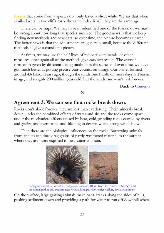
Then there are the biological influences on the rocks. Burrowing animals from ants to echidnas drag grains of partly-weathered material to the surface where they are more exposed to sun, water and rain.
A digging animal, an echidna, Tachyglossus aculeatus, 10 km from the centre of Sydney, and an animal pad in arid country near Oodnadatta provides easier walking for later animals.
On the surface, large grazing animals make pads, tracks along the sides of hills, pushing sediment down and providing a path for water to run off downhill when

24
it rains, carrying surface sediment away. On a personal note, I don’t exclude my own walking on sandstone from this.
Tree roots grow into cracks in rocks and expand, splitting the rocks, while at the other end of the scale, some mosses can drill neat holes in quartz, one of the toughest of minerals. In bulk, the Earth abideth well, and nothing is ever lost—it just bobs up in a new hat.
Back to Contents
Agreement 4: Geology involves reusing old material.
None of the material coming from rocks is ever wasted. Calcium from basalt will eventually be dissolved and carried to the sea, where corals, snails or other marine life will extract it and use it to make skeletons, shells or something else. Later, these dead animals may fall down and over time, become limestone.
North of the Hawkesbury River’s mouth, NSW: muddy water is carried northward by currents, before it settles.
On land, the calcium may pause to form cell walls in plants, the shells of birds or the bones of vertebrate animals. Sometimes, the shells just dissolve once more, but over time, all the calcium is washed down to the sea. Sand becomes sandstone, mud becomes shale, shells make limestone, and so on.
If rocks get buried deeply enough, they may be changed by heat and pressure, so sandstone becomes quartzite, limestone becomes marble, and shale becomes slate. If the rock is heated enough, it may end up as molten lava that spews out onto the surface of the earth again. Rocks aren’t all “just rocks”, because the world’s rocks have many different origins.
Back to Contents

25
Agreement 5: Rocks come in three main types.
If you blinked and missed it, I referred in the last section to three different sorts of rock: the ones made from sediments, the ones shaped by heat and pressure, and the ones that were melted before they became rocks.
Sedimentary rock forms when sediment particles (bits and pieces of almost any sort) fall to the bottom of a lake or sea (or sometimes the bottom of a vast sand dune). Later, the particles are buried and a complex mix of pressure, water washing through and maybe some heat, turns it into a rock. Sedimentary rocks are the ones that sometimes contain fossils, though a few deformed fossils may also be seen in slate or marble.
Igneous rock is any sort of material that was once a hot liquid, because at high temperatures, all rocks will melt. Granite forms far below the earth’s surface, and only appears when a whole load of surface rock erodes and weathers away. Granite cools slowly enough for big mineral crystals to form. Basalt, on the other hand, is oozy stuff that flows and spreads. Some basalt comes out of volcanoes as lava, some oozes out and flows across the land, making a flat sheet that cools fast, so the crystals are very tiny.
Some of the magma pushes through the cracks that geologists call joints, but joints will come later, and so will the dykes, formed by the cooled magma.
Metamorphic rock (the name comes from Greek, and means changed shape) forms when another kind of rock is subjected to heat and/or pressure. Large metamorphic areas are usually formed by extreme heat and pressure, and this is called regional metamorphism. When melted lava flows over other rocks, or when a volcano pushes through other rocks, the heat may travel a few metres or tens of metres, causing contact metamorphism.
In short, there are very few inexplicables when it comes to looking at the rocks, because in the end, the old rocks are broken down and wiped out. You can tell when an inexplicable shows up, because the scientists start formicating.
No, read that again, carefully. Scientists know that formication means running around like ants in a panic. Spelling is important in science, and many other things: consider the famous and possibly apocryphal one-letter typographical error when a newspaper was supposed to report that Queen Victoria “…passed over the bridge to the accompaniment of thunderous applause”. We all agree that was funny, and we can even explain why, because humour, like geology, is explicable, if you know the right things.
Back to Contents

26
Agreement 6: All geological effects can be explained.
Basically, all the things we see in the shape of the world can be explained by the forces we see operating today. Geologists call this the principle of uniformitarianism, which just says the natural laws and processes we see shaping the earth today are the same ones that shaped the past.
In other words, we don’t work on the idea that there used to be wizards and witches who moved the rocks around, that there were fire-breathing dragons which made the lava melt. We don’t need to assume the existence of pixies driving Stealth Bulldozers or poltergeists with geological habits. Yesterday’s causes of change are today’s causes of change.
The rocks, even the not-your-usual rocks like these, keep on following the rules.
Continents move, floating on the surface of the planet; earthquakes happen; rocks form, then they weather and are carved by erosion; rocks get pushed up; others are pushed down and buried, and so on. On a smaller scale, sediments get washed away by water, blown around by winds, or forced along by glaciers. They always have done, and for some considerable time, they always will.
When weight is applied to the existing surface, in the form of glaciers or any other way, the earth’s crust behaves like a small raft that an elephant has boarded. Like the raft, the rocks sink. On the other hand, when glaciers melt, the earth springs back up again, and this is currently happening in Scandinavia which was relieved of a lot of glacial weight, about 10,000 years ago. Geology never rushes…
Back to Contents
Agreement 7: There are standard rules of geology.
Sometimes, what you see may seem contrary to the rules below, but if you think that, it usually means you simply haven’t thought hard enough. The apparent

27
contradictions emerge only because you are unaware of the other rules that apply in a particular place. With enough thinking, you can explain what you see.
Rocks are usually laid down in flat layers.
It is a fairly safe rule that sedimentary rocks form flat, parallel beds, because the sediments are washed or blown into some sort of basin, and the first material fills in the gaps and crevices, leaving a flat surface. The effects of currents (or winds) and gravity keep the top fairly flat after that.
Even when one layer is humped up, the layers that follow even the surface out.
Against that, some beds can be laid down on a slope. This effect is called cross bedding, and we will look at it in more detail in chapter 5. Cross bedding can be distinguished from beds that have been tilted later by looking for the horizontal beds above and below.
Cross bedding in Hawkesbury sandstone, Old Man’s Hat, North Head, Sydney, Australia.
There can be traps for the unwary when it comes to igneous rocks. If the rock arrives as lava, streaming down the flank of a volcano, some of the lava cools and becomes solid, leaving a sloping skin of rock.

28
Eroded remnants of an old volcano near Cape Palliser, North Island, New Zealand.
Younger rocks usually lie on top of older ones.
Rocks are always laid down that way, but there are a couple of notable exceptions. Magma sometimes pushes up through sedimentary (or other) rocks to form a dyke. If the dyke reaches the surface, it flows out over the landscape (when it is called a flow). A flow is always younger than the rocks it lies on top of, and older than any rocks which are found above it.
Sometimes the magma pushes between two layers of rock, forming a sill, but the igneous rock remains younger than the rocks that lie on top of it. How do we know what happened? We look for contact metamorphism, above and below the layer.
The other exception to youngest-on-top comes when rocks bend, and fold, and sometimes (very rarely), overfold, so that the usual age order is reversed locally. In less extreme cases, horizontal beds may just be tilted up and eroded away, leaving sloping beds behind. If the land sinks at this point, new sediments wash in to start a new age of rock building. We will come back to this shortly.
In an area where there are active volcanoes, lava may pour out and flow across the countryside, laying fairly flat layers—except, as mentioned above, on the flanks of the volcanoes, where sloping beds form.
The Columbia River forms the border between Washington and Oregon in the USA.
It flows through a valley carved through a massive series of basalt flows.
There can be gaps in the geological record in any place.

29
On my home territory, near Sydney on Australia’s east coast, the rocks are Triassic in age. If you drill straight down you will come eventually to Permian rocks, the coal measures that are exposed around the margins of what we call the Sydney Basin. Because the beds form a basin, you find coal near the surface at Newcastle, Wollongong, Lithgow and other places. Coal also used to be mined on the very shores of Sydney harbour, but the miners had to drill quite a long way down, all the way to the Permian rocks.
In theory, if we keep drilling, we should next find Carboniferous rocks, but in the Budawang Ranges, my favourite wandering place, these layers are missing, and instead we encounter tilted Devonian metamorphic rocks. It looks as though we are missing 100 million years (or more) of geological history.
Any rock-hound will tell you this gap is an unconformity, and they will hazard a guess that the Devonian rocks may have been deeply buried and covered with Carboniferous rocks, but that the earth and its rocks moved hugely, and any Carboniferous rock was eroded, leaving ribs of tough tilted Devonian stone across the land in the early Permian era. We can’t be sure there were ever any Carboniferous rocks, but it is likely they came and went, leaving no trace.
Later, the land all sank deep into a sea in some sort of cataclysm. In the Budawang ranges, west of Nowra, south of Sydney, the lowest layer of the Permian rocks is a conglomerate containing very large boulders, telling us that the first deposits in that part of the basin were laid down in a huge flood.
At Myrtle Beach, on the south coast of NSW, this conglomerate layer is missing, suggesting that the oldest Permian sediments there were laid down at a different time. It may have been a few years, more probably it was a few millennia—or even quite a few millennia. The estimated age gap either side of the unconformity here is ~200 million years, with Ordovician rocks below and Permian above.
Myrtle Beach, south coast of NSW. The sloping beds below are pointing to 1 o’clock, and the hand (top left) spans a gap of about 200 million years in the geological record.
There is also a simpler sort of time gap, much harder to identify, called a disconformity. This happens when sediment stops being delivered for a while,

30
but we can largely ignore disconformities for the moment. We now have the basic background to understand a bit of slightly more detailed geological history.
The laws and principles of geology.
Nicolaus Steno started it. Here is a modern version that conveys his thinking in language we use today.
* Steno’s Law of Superposition says that in a sequence of strata, any stratum is younger than any strata on which it rests, and older than any strata above it.
An illustration from Charles Lyell’s The Student’s Elements of Geology (1871), page 17, showing
how irregularities in an underlying surface are filled in, slightly contradicting Steno.
* Steno’s Law of Original Horizontality says strata are deposited horizontally and then deformed to various attitudes later. That is, undisturbed true bedding planes are nearly horizontal, though we need to note here that cross-bedding is possible where sandhills or sandbanks are being formed.
* Steno’s Principle of Lateral Continuity: strata initially extend sideways in all directions. That is, every outcrop in which the edges of strata are exposed demands an explanation, and similar strata on two sides of a valley represent erosion of the rock between.
* Steno’s Principle of Cross-cutting Relationships: anything that cuts across layers post-dates them. This applies particularly to igneous intrusions such as dykes. Aside from Steno’s principles, geologists accept the following notions:
(1) An intruding rock is younger than the rock it intrudes into;
(2) A fault is younger than the rock which is faulted;
(3) William Smith’s principle of fossil succession; and
(4) Any pieces of ‘foreign’ rock included within a rock must be older than the rock they are found in.

31
Xenoliths (foreign rocks) in sandstone, Kangaroo Island, South Australia.
We will come to Smith’s fossil succession soon, but geology was only possible because of James Hutton. He had made enough money from his ammonium chloride factory to be able to retire from work and study geology.
Hutton was an old friend of Joseph Black, the first scientist to distinguish heat from temperature, and also a friend of James Watt (of steam engine fame), so it is no surprise that Hutton assumed that all earth activity was due to what he called the earth’s ‘heat engine’. Most importantly, he said “…The past history of our globe must be explained by what can be seen to be happening now”.
He emphasised the igneous origins of rocks (unsurprisingly, given that he came from Edinburgh, where igneous rocks are common). The French Revolution was happening, so the public of Britain were unenthusiastic about Hutton’s revolutionary notions. They were unprepared for his ideas, and unwilling to accept them, but soon, still in the early 1800s, they were ready.
John Playfair was trained in mathematics at a time when geology had not been invented, so he was necessarily largely self-taught. Like James Hutton, Playfair was exposed to the stimulating geology of Edinburgh, which would have assisted him in his thinking.
He invented geomorphology, giving us ‘Playfair’s Law’, which says rivers cut their own valleys. He also said the angle of slope of each river shows an adjustment towards a balance between the velocity and discharge of water on one hand, and the amount of material carried on the other.
Playfair made the work of Hutton more accessible with his ‘Illustrations of the Huttonian Theory of the Earth’ in 1802. Playfair also explained the rock cycle of repeated weathering, erosion, deposition and solidification in simple terms:
The series of changes which fossil bodies are destined to undergo, does not cease with their elevation above the level of the sea; it assumes, however, a new direction, and from the moment that they are raised to the surface, is constantly exerted in reducing them again under the dominion of the ocean. The solidity is now destroyed which was once acquired in the bowels of the earth… —John Playfair, Illustrations of the Huttonian Theory of the Earth, 1802, 109.

32
His ideas gained wider acceptance after Charles Lyell added Playfair’s thoughts into his Principles of Geology, but we have ignored William Smith long enough. An orphan, he was set to work early as a surveyor for the new canals that were crossing the British countryside, so industrialists could haul goods around.
These canals needed digging into the ground, and even tunnels through hillsides, and this gave Smith first-hand chances to observe and classify the many rock types as they are seen in fresh unweathered exposures. Most importantly, he saw how strata were typified by fossils, and he pointed out that the same stratum could be identified over a considerable distance by the fossils it contained.
In 1816, Smith published his ideas, accompanied by a coloured geological map, and made the point that, given the law of superposition, the fossils in the strata gave us a view of the history of life on earth. Now the way was open, and Charles Lyell’s Principles of Geology could be released in the early 1830s, just in time for Charles Darwin to take a copy with him on the voyage of HMS Beagle, so he would be prepared to unravel in full detail the reasons why life actually possessed a history on earth.
That is how science weaves itself into a web, but science also involves cycles.
Rock material gets recycled.
Modern geology is all about the rock cycle, with material being raised to the surface by volcanoes to be weathered, eroded, washed and deposited to maybe later become sedimentary rock, or heated and compressed to metamorphic rock, or melted to form igneous rock, which may later return to the surface again. Until subduction zones were observed in plate tectonics, where one plate slides beneath another, the burial of rocks in the rock cycle was something of a mystery, but this is now much clearer.
The rock cycle.

33
Long before Twitter, I wrote a set of simple scientific principles that were limited to 160 characters. Each proposition had to stand on its own, in 160 characters or less. The aim was to see if there was a simple way to define science and all its curiosities. They are still on the web as “Science SPLATS”, a name I gave them before I worked out what SPLATS meant, and I never got beyond “Science Principles, Laws, Assumptions, Theories and Something-or-other”.
It doesn’t matter how the name was reached, but here are some of my SPLATS that relate to rock cycles:
The material that we call rock goes through cycles, being melted, weathered, eroded, buried and eventually heated and compressed until it melts again.
Rocks are mostly made of minerals or their weathering products, which were, at one stage of their existence, crystalline, and may still be crystalline.
Rocks erode and re-form in the rock cycle. The process involves chemical and mechanical weathering, erosion, transport, deposition and compaction
Rocks and soil erode, water transports sediments downstream, and the sediment particle size in a stream depends on the speed of the water flow.
Sedimentary rocks buried under a sufficient load of more recent sediment may be compressed and heated so that over time they form metamorphic rocks.
Most minerals in rocks are present as crystals: the size of the crystals in igneous rocks shows how quickly they cooled, with slow cooling giving big crystals.
Back to Contents
Agreement 8: The principles of science apply to rocks. Atoms and molecules.
The laws of thermodynamics.
Conservation of mass and energy.
Equilibrium.
The law of large numbers.
Evolution.
Falsifiability.
Ockham’s Razor.
Back to the Contents
These principles are what all scientists just naturally assume, but they are rarely stated explicitly for the public. There is enough information here to tell you what the idea is about, and enough terms to look the idea up, if you think you need to. There are lots of ins and outs, and working scientists spend their lives mastering them. Such people will, I hope, recognise that this is Science Lite.

34
Atoms and molecules. To begin with, all matter is made up of atoms, and the properties of matter will depend on what atoms are present, as well as how they are arranged and connected. Many atoms join up in regular frameworks that we call crystals.
Back to Agreement 8: The principles of science apply to rocks.
The laws of thermodynamics. Putting it simply, heat flows from hot to cold, and perpetual motion is impossible. By the way, if you want to drive a politician or an arts administrator to distraction, ask him or her to explain (or even just to state) the second law of thermodynamics. Trust me: it matters!
A good many times I have been present at gatherings of people who, by the standards of the traditional culture, are thought highly educated and who have with considerable gusto been expressing their incredulity at the illiteracy of scientists. Once or twice I have been provoked and have asked the company how many of them could describe the Second Law of Thermodynamics. The response was cold: it was also negative. Yet I was asking something which is the scientific equivalent of: Have you read a work of Shakespeare’s? —C. P. Snow, Rede Lecture The Two Cultures and the Scientific Revolution (1959).
Back to Agreement 8: The principles of science apply to rocks. Entropy.
This is harder. We begin with the simplest available version first: entropy is a thermodynamic function that measures randomness or disorder. Or if you like, entropy is a measure of untidiness. Most of the principles of science are what scientists call counter-intuitive. In lay terms, they seem to go against our gut reaction: the earth as we experience it looks flat, and our intuition tells us the sun and moon circle around us once a day, but all scientists agree that the world is a globe, we orbit around the sun once a year, and the moon orbits around us once a month.
Entropy is slippery, rather than counter-intuitive, and you have to note the qualifications which limit entropy to events inside a closed system. Under those restrictions, entropy, or disorder, increases, which is how scientists say that over time, everything in a system gets more random, more dispersed.
There can be no exceptions to the rule that the disorder always increases, but life, at a local level, can be an anti-entropy agent, making things more ordered at that level, even as entropy is increasing on a larger scale. In simple terms, animals and plants gather up and concentrate certain elements in our bodies. In hot magma, crystals may concentrate rare elements.

35
Across the universe, every change leads to an overall increase in the total entropy, but the delight lies in the details, and a lot of geological science comes down to explaining how, on a local level, the process of concentration in elements or minerals is driven.
If [your pet theory of the universe] is found to be contradicted by observation—well, these experimentalists do bungle things sometimes. But if your theory is found to be against the second law of thermodynamics I can give you no hope; there is nothing for it but to collapse in deepest humiliation. —Sir Arthur Stanley Eddington, The Nature of the Physical World (1928), chapter 4.
Back to Agreement 8: The principles of science apply to rocks.
Conservation of mass and energy. In simple terms, matter and energy can neither be created nor destroyed. There is No Such Thing As A Free Lunch, anywhere in science. Not ever!
Back to Agreement 8: The principles of science apply to rocks.
Equilibrium. As a rule, things are in balance, but that doesn’t mean they are unchanging. The number of oxygen molecules in an open jar on my desk may vary slightly over time, as molecules whizz in and out, but at any practical level, the entries and exits cancel each other out. We say the molecules are in dynamic equilibrium.
Back to Agreement 8: The principles of science apply to rocks.
The law of large numbers. There is no such law, but it is convenient to pretend it exists. Given time, every atom of a sample of radioactive carbon-14 will break down. We cannot say when a given atom will decay, but with large numbers of atoms, we can say that half of all of the carbon-14 atoms that we start with will have decayed if we come back in 5730 years. Scientists say carbon-14 has a half-life of 5730 years. Start with a large number of 14C atoms, and after 5730 years, half of them will have decayed.
Back to Agreement 8: The principles of science apply to rocks.
Evolution. Evolution also hangs on large numbers. You won’t evolve, I won’t evolve, but our species, like every other species, does evolve, if there are enough of them.
Back to Agreement 8: The principles of science apply to rocks.
Falsifiability. Every part of science is able to be falsified by evidence, and if some idea can’t be tested and potentially falsified, it just isn’t science. That doesn’t mean science is

36
all false, it just means every assumption is always considered open to testing and being found wrong
If we found dinosaur fossil bones and human fossil bones in the same rock, this would mean we had to revise large parts of what we think we know about geology and biology. Scientists are always on the alert for contradictions like that, even though they don’t really expect to find any. One way to become a famous scientist is by finding a red-hot contradiction to what everybody believes.
Back to Agreement 8: The principles of science apply to rocks.
Ockham’s Razor. Then again, maybe we wouldn’t need to revise anything except our viewing position. William of Ockham made it a lot more complicated, but his basic notion was that if there are two possibilities, you should take the simpler one. If we found human and dinosaur fossils in a single rock, a simpler explanation would be fraud. We would at least look for evidence of fraud first, but if there was truly no evidence of fraud, then it would be time to start a rethink.
Back to Agreement 8: The principles of science apply to rocks.
Caveats.
I am neither an earth scientist nor a geologist, but I know how to think, where to look, and what questions to ask. My undergraduate studies were mainly in the areas of botany and zoology, so I may, from time to time, be in error. As a professional science writer, I am used to checking my facts, but even when I get the latest opinions, there is still one gotcha remaining.
Geological science does change, and I saw it happen. When I was an undergraduate, I picked up a year of formal geology training, and in 1962, one of our geology lecturers alerted us to certain sessions of ANZAAS, the Australian and New Zealand Association for the Advancement of Science. “Listen to Sam Carey,” he told us. “He’s quite mad: he thinks the continents are moving.”
I did indeed hear Sam Carey talking about his wild ideas. He seemed to make a reasonable case, except that we all knew the idea was crazy. Yet just three years later, plate tectonics was all the go. In fairness, Sam Carey was only partly right, because his notion was based on some false assumptions, but the key thing to note is this: in 1962, believing in moving continents was madness, by 1965, it was pretty much the orthodox model.
Here, I have tried to stay with the best and safest bits of orthodoxy, but at any time, that which was orthodox can be defeated or overturned by a simple

37
paradox. One new discovery is all it takes to change things, as T. H. Huxley said while discussing work on the spontaneous generation of life:
But the great tragedy of science—the slaying of a beautiful hypothesis by an ugly fact—which is so constantly being enacted under the eyes of philosophers, was played almost immediately, for the benefit of Buffon and Needham. —T. H. Huxley, Presidential address to the British Association in September, 1870.
This book is about the facts—though in chapter 15, I will discuss a maverick theory about the origins of oil. I don’t believe that theory, but it is both entertaining, and instructive to consider, as a way of seeing how science works.
Back to Agreement 8: The principles of science apply to rocks.
How this book works.
Curved columnar basalt on the Snake River.
Rock melts when it gets hot, it flows downhill, it gets hard as it slows and cools off, and thick beds often form columns. When I first saw the structure above in northwest USA in 2015, I declared that I would be writing to President Obama, demanding that he send in the Corps of Engineers to blow it up, on the ground that it was contrary to the laws of physics. For the unwary, I spoke in jest.
I have since given the matter a lot of thought, because columnar jointing, with straight up-and-down “pipes” is very common in basalt flows all over the world. The Giants’ Causeway in Ireland may be the most famous example, but there are plenty of others. The curving, by the way, was both known and explained by Charles Lyell, who saw similar formations in the 1820s, but I will come back to that later, in chapters 1 and 2.
Bryce Canyon, Utah, showing pinnacles called hoodoos, formed in part by the flaking action of winter ice.

38
Over time, rocks break down and wear away. Sometimes, this can lead to amazing forms, like the pinnacles above, from Bryce Canyon in Utah. In chapter 3, we will look at the chemical and physical changes geologists call weathering, and more, because weathering is responsible for the shape of the world we live in.
When rocks weather, the bits and pieces fall down as far as they can, and then they are carried by wind and water (and sometimes by ice in the form of glaciers) to some other place, and sometimes form new rocks that reveal their origins. Chapter 4 looks at the ways of moving sediments, how they become rocks and how the sandstone at Zion National Park in Utah must have formed by desert winds pushing sand around. Chapter 5 is about sedimentary rocks.
Deeper down, things get even hotter, and the pressure is even greater. Chapter 6 will skip lightly over how we know what is down there, and how rock changes in places far too dangerous for us to ever go. We will look at where we think the heat comes from, and how that ties into the age of the planet.
In chapter 7, we look at things going wrong, mainly earthquakes and volcanoes, and that brings us to igneous rocks, then we look at larger-scale movements, plate tectonics and how that affects us in chapter 8.
London’s Broad Street pump was destroyed in World War II. This replica is near the John Snow pub in Soho.
There’s more than rock underground, and chapter 9 is about groundwater, water tables and wells, including a very clever Iranian invention, a well that goes sideways, uphill. We will look at the pump above: the original caused a small epidemic in the 19th century, because people did not understand groundwater.
Trilobite, frontispiece from Lyell’s The Student’s Elements of Geology (1871).
Some of the things we find in rocks were once alive, and we call the remains fossils. Curiously, as you will learn in chapter 10, without water in the rocks, few fossils would form.

39
Chapter 11 looks at minerals and economic geology, before we turn to the many ways humans use and have used rocks for engineering, for art, and in other ways, some of them quite unexpected.
Inca wall at Machu Picchu, Peru, made without any metal tools.
When you come down to it, most of the rocks around us are unusual—and most of them can leave us puzzled, if we don’t know about the ways rocks behave. We need to change that, which means readers need to understand how geologists and earth scientists think, and that comes in chapter 12.
Gravity is involved in every part of rock work, and that comes in chapter 13, before we turn to finding the ages of rocks in chapter 14, and then look at how the world may end, thanks to the political clowns and greedy idiots who are ignoring geology, physics and climate science. Chapter 15 is about why these fools should be left on a small desert island, and chapter 16 is about endings.
Chapter 17 is a short glossary of some of the technical terms, the words that appear in underlined bold orange letters throughout the book.
Back to the Contents

40
1: How the earth was made.
Yasur, Vanuatu.
The start of the universe in 200 words. Forming the solar system. Backgrounder: stable isotopes. The emergence of oxygen. From Fireball Earth to a volcanic planet. Classifying volcanoes. Geysers and vents. Volcanic chemistry and physics. Parasitic cones. Visiting a volcano. Going inside a volcano Lava tubes. Life on a volcano. Basalt flows. Columnar basalt. Dykes.
Back to the Contents
The start of the universe in 200 words.
Let’s begin with the Big Picture, known grandly as cosmology, but really more like “this is our best guess for now about what happened”. Any cosmology is a bunch of theories about the origin, nature, structure, and evolution of the universe.

41
A cosmology is any model representing the observed universe. Western cosmology is entirely scientific in its approach, and has produced two famous models in modern times: the ‘Big Bang’ and the ‘steady state’ hypotheses.
We accept the big bang for the moment, because it predicts that there would have been five light-element nuclei formed at the big bang: hydrogen-1 and hydrogen-2, helium-3 and helium-4, and lithium-7.
The big bang theory says hydrogen-1 would be about 76% of the universe, helium-4 would be around 24%, and the other elements would be present only as traces. This is the result we get, and that offers support for a big bang, and more importantly, for a hot big bang.
We may one day see a return of the steady-state theory in a new guise, or the complete replacement of the big bang theory by something entirely unthought-of, but whatever comes next, it will still have to fit in with the laws of physics.
The most incomprehensible thing about the world is that it is comprehensible. —Albert Einstein (1879–1955)
My own suspicion is that the universe is not only queerer than we suppose, but queerer than we can suppose. —J. B. S. Haldane (1892–1964)
Geysers and vents.
Volcanic areas often have geysers, where groundwater is heated under pressure until it boils, pushing out overlying water, which then boils explosively.
It wasn’t a geologist who showed that volcanic rocks are pretty much the same everywhere. It was a chemist, and he wasn’t just any chemist, either, but Robert Bunsen (1811–1899), who made many other inventions and discoveries.
These inventions do not include the Bunsen burner, which was actually invented by Peter Desaga and popularised by Bunsen, but the list does include the Bunsen grease-spot photometer, and a model of a geyser which can often be seen in superior science museums. This is made up of a flask full of water, a long tube coming up out of the flask, with a shallow pan at the top.

42
Bunsen’s model geyser in its modern form, but with real-life dimensions and values.
In the 1840s, Bunsen visited Iceland to study the active volcano Hekla, but he also visited Geysir and wondered how these ‘fountains’ of water and steam operated. What made the fountains keep on spouting, usually at regular intervals? At Yellowstone, ‘Old Faithful’ was so accurate that even its name celebrated its impressive time keeping. We will begin with the simple version:
Two views of Old Faithful, Yellowstone USA.
Bunsen knew two things—that the boiling point of water depended on the pressure acting on it (extra pressure means a higher boiling point), and that the geysers were supplied with a great deal of heat, coming from deep below. From that, he designed a simple model to show how they work.
Bunsen assumed a large, deep open chamber, with a narrow shaft connecting it to the surface. The model needs one extra thing: a source of heat like a Bunsen burner and, while the diagram shows a 200-metre tube, even the two-metre-high model works. (The short model is safer and a Bunsen burner can drive it!)
We start with the open chamber full of water, just after an ‘eruption’ of the fountain. The water, now cooled below 100ºC, has trickled down from a surface pool into the empty chamber. Water fills the chamber and the whole tube, so the

43
water in the chamber is under a pressure of 2100 kilopascals (21 atmospheres), and at that pressure water only boils when it gets to 204ºC.
The hot rocks heat the water up and when the temperature reaches 204ºC, some of the water at the bottom changes to steam, some water is pushed out of the top, and with less water in the tube, the pressure drops.
Now the superheated water boils furiously, pushing more water up the tube, lowering the pressure, and making the boiling even more furious. The result is an ‘eruption’ of hot water. The water spreads out across the surface in a large pool, the hot steam rushes out, and then water in the pool flows back down, filling the chamber with cooler water and the process starts again.
This is not a perfect theory, but the experts say it will do until a better one comes along. Now let’s take a more detailed look at the geyser effect.
To understand geysers, we need to look at the physics of boiling, because water doesn’t always boil at 100ºC. Even cold water and ice give off water vapour, but when you heat water, it gives off more and more vapour, and the pressure of the water vapour increases. Once the vapour pressure of the hot water is greater than the air pressure outside, bubbles form, and we say the water is boiling.
When the air pressure is “one standard atmosphere”, or 101.3 kilopascals, the water boils at 100ºC. If the pressure is reduced to 50 kPa, the boiling point is just 78ºC, and at 6.3 kPa, the boiling point is just 37ºC, or body temperature. At that atmospheric pressure (which occurs about 18 km above sea level), you not only can’t breathe: you will begin to boil!
The average atmospheric pressure at the top of Mount Everest, the atmospheric pressure is about 34 kPa, so the boiling point of water is 71ºC. As my old physics teacher told us, you can’t get a decent cup of tea when you go up a mountain. On Mars, the pressure is about 0.6 kPa, and tea of any sort is impossible to get, but that’s the least of your worries.
Thermal pools, Orakei Korako, New Zealand.

44
In the Bunsen model, cooler water from the pan trickles down into the flask, and the whole thing starts again, just like Old Faithful. A real geyser is the same, but on a larger scale. There are differences though, because the model is made of metal, and a real geyser is made of rocks, which slowly dissolve.
Thermal pools, Yellowstone area, USA.
Thermal pools, Fountain Paint Pots, USA.
Mineral deposits, Mammoth Springs, USA.

45
Boiling mud spring, Yellowstone.
Back to 1: How the earth was made.
Volcanic chemistry and physics.
Nobody much knows Bunsen invented the model geyser, and only a few specialist historians now recall that he was also the founder of geochemistry.
It cannot therefore be doubted that the extensive volcanic elevations constituting the high table-land of Armenia and the island Iceland have flowed from sources which were chemically identical. —Robert Bunsen, Poggendorff’s Annalen, 1851.
Bunsen’s careful chemical analysis showed that his sample rocks, collected in both Armenia and Iceland, were identical, and so he invented geochemistry. He was lucky, because different sorts of eruption can be very different in chemical terms, and he must have chosen two volcanoes of the same kind.
Some volcanoes make pumice like the Kermadec islands one that made my beach visitors; some make viscous and gloopy lava like Kilauea; and those like Mt Yasur (at the start of this chapter and again, below) have explosive eruptions, throwing lumps of molten rock high in the air, where they turn solid and fall as “volcanic bombs”.
Volcanic bombs are defined as solid lumps of more than 64 mm diameter that are ejected during a volcanic eruption. Some of them can be up to several metres in size. (Geologists in America who have these in their carry-on luggage call them “volcanic rocks” because TSA agents are not very bright.)
Those that are highly liquid when they are launched can be deformed in flight or when they hit the ground. Experts recognise a number of curious classes including breadcrust bombs with surface cracks, cored bombs, ‘cow-pie’ bombs which flattened on impact and others.

46
Volcanic bombs on Mount Vesuvius. The right-hand one was about 800 mm diameter.
Staying around when the bombs start to fall is a no-brainer (in several senses).
Back to 1: How the earth was made.
Going inside a volcano
Thrihnukagigur (Þríhnúkagígur in Icelandic, meaning ‘three peaks crater’) has been dormant for 4000 years, and it has been open to tourists since 2012. Going there is definitely a summer activity, because to visit it, we had to walk 3 km over a lava field in mist, while biting winds drove chilly rain into our faces. This was summer in Iceland, so it could have been worse, and at least it was warmer in the magma chamber, at 6ºC. At the time, that felt warm!
Access is now by an open cable lift, which you can see below. It lowers eight people at a time, down through a small surface vent, onto the floor of the magma chamber 120 metres below. The chamber’s first explorer, Dr Árni B Stefánsson, was lowered down on a rope in 1974, in far less comfort.
This cable lift brings visitors down into the magma chamber, Thrihnukagigur, Iceland. (Courtesy Benjamin Hardman, Inside the Volcano)
When Thrihnukagigur went quiet, lava stopped pouring out, and the top of the magma sank, leaving a gap, 120 metres deep, below the tiny vent on the surface. Then the magma ‘froze’, and the floor formed on top of it. The rocks on the side of the chamber, and also on the floor, are large, angular and jagged.

47
The walls of the magma chamber, Thrihnukagigur volcano, Iceland.
This trip is suitable for moderately fit people between 12 and 75 who can walk a fairly level (but chilly) path for 3 km. It ought to be on any rock hound’s bucket list. Bookings can be made online, and buses leave from Reykjavik.
Back to 1: How the earth was made.
Columnar basalt.
I mentioned columnar basalt at the end of my introduction, when I described how I joked about demanding that the US government destroy certain deposits on the Snake River. I said the deposits were contrary to the laws of physics. To see why I reacted this way, we need to consider just how columnar jointing arises, and then I will explain why I was wrong to be surprised.
Curved columnar basalt on the Snake River.
Typically, we see columnar jointing in lava flows, though it can also be encountered in basaltic sills and dykes—and as I will show later, it can arise from contact metamorphism when sandstone changes to quartzite. For now, we will stay with the lava flows.

48
Straight columnar basalt in Fingal’s Cave, Staffa, Scotland; Svartifoss Iceland.
When a lava flow cools, it shrinks, and especially in the middle section of the flow, straight-sided cracks that geologists call joints, begin to form. The process is a little like the way mud will crack as it dries, but that can be a misleading analogy.
The joints are somewhat regular, and they shape the rock into columns that are, on average, hexagonal, but the number of faces can be 5–7 in Fingal’s Cave in Scotland, or 4 to 8, or even 3 to 12.
As a rule, the columns are vertical, but this is subject to an important condition: the column is typically perpendicular to the contact, which means the direction of cooling. Charles Lyell wrote this:
[Assuming] that columnar trap has consolidated from a fluid state, the prisms are said to be always at right angles to the cooling surfaces… —Charles Lyell, Elements of Geology, 183, 1838.
Having explained that curved columns can happen easily enough, two pages on, he offered another example from a valley north of Vicenza in Italy, and this time he illustrated it as well.
Curved columnar basalt in Italy, from Charles Lyell’s Elements of Geology (1838), 105.
So before you call in the army engineers to right a scientific wrong, think carefully: science just is, and when the evidence goes against what you believe, don’t attack the evidence: attack your beliefs, and work out where you went wrong! Now here are some other images of columnar basalt:

49
Curved and straight columnar basalt on the Snake River.
Two views of straight columnar basalt in Fingal’s Cave, Staffa, Scotland.
Back to 1: How the earth was made.
Dykes.
There are many famous dykes in Britain that have nothing to do with geology. They are earthworks that date back to the Dark Ages, and the most famous one is Offa’s Dyke (Clawdd Offa in Welsh), which runs roughly along the border between England and Wales. This is often explained as a defensive wall like Hadrian’s Wall, but historians say it was really just a clear boundary.
Credit for building it is given to a Saxon king of Mercia, but at least some parts of it have been shown by carbon dating to be older, and there is no record of garrisons ever being stationed on the dyke. A dubious tradition has it that the English cut the ears off any Welshman found east of it, while the Welsh would hang any Englishman found to the west.
The point about earthworks is that they are both a ditch and a mound, formed from the earth that was dug out of the ditch. In the English language a dyke (or dike) can be the sort of sea-wall that the little Dutch boy stuck his finger in, or a drainage ditch. It is in my nature to diverge, but this linguistic divergence is an essential one, so please bear with me for a moment.
The first reference I can find to a dyke in the geological sense comes from a review of a Scotsman’s book in The Edinburgh Review, Or Critical Journal, in 1818.

50
Basil Hall was a captain in the Royal Navy, and he undertook a voyage to “…the west coast of Corea and the great Loo-Choo island”. If we take Corea to be Korea, and the Loo-Choo islands are the Ryukyus, then the great island is probably Okinawa. That is background: while there, he saw “…a whin dyke, four feet wide, the planes of whose sides lie N.E. and S. W…” off the coast of Korea, but he drew something far better at Madeira.
Dyke near Madeira, from Charles Lyell’s Elements of Geology (1838), 105.
This was a classic example of a wall-type geological dyke, and Charles Lyell used it in his Elements of Geology, but he had an even better one that he had already used in the third volume of his Principles of Geology, a generation earlier.
The engraving, seen below) showed dykes at the base of Mount Etna on Sicily, and like the Madeira example, the stone of the dyke is longer-lasting than the layers of volcanic ash that it pushed into.
Dyke near Mt Etna, from Charles Lyell’s Principles of Geology (1834), volume 3.
There are other dykes that weather out quickly, leaving an empty ditch, but we will come to those in a moment. In 1824, Alexander von Humboldt wrote (in translation) in the Edinburgh Philosophical Journal: “At Skeen in Norway, a basaltic and porous syenite…is a bed, not a dike…”

51
Clearly, Humboldt meant to draw a contrast between horizontal and vertical layers of rock, but we are looking at a translation written by educated members of the Scottish Enlightenment, who knew all about dykes, but at that point, most of the geologists were Scots, and they knew what Scottish dykes were.
Dyke on the flank of Mt Vesuvius.
When Lyell and Roderick Murchison, later to be two of Britain’s most famous geologists, wrote about a lava flow in the area of Puy de la Vache in France, they referred to it being “…in the shape of a long dike or mound, rising in the middle between 100 and 200 feet high…” We would not call that a dyke now.
Yellowstone River, USA: from the appearance as seen from a distance, there are probably dykes in the valley that intruded into volcanic ash.
The word “dyke” came to mean a fairly narrow seepage of molten rock through a crack or a crevice in ash or rock. The picture above shows the Yellowstone River valley, and it appears to be a valley through volcanic ash, with several dykes exposed near the bottom. The dark band at the top looks like a later basalt flow.
Where the stone that makes the dyke breaks down quickly, instead of a wall, we have a ditch left behind. The picture below shows a weathered-out dyke on the Australian coast between Gerringong and Kiama.

52
Weathered dyke between Gerringong and Kiama, NSW, Australia.
In this case, the effect is exaggerated, because the dyke magma came up through a joint in sandstone. The magma was hot enough to cause what we call contact metamorphism, which we will look at in chapter 6, but for now, think of it as a way of toughening the rock.
Here are two more examples of dykes, both from the south coast of New South Wales.
Dykes showing variable weathering, south coast of NSW.
Back to 1: How the earth was made.
2: deleted from sample.

53
3: How rocks wear away.
Weathered rocks in Australia.
From rocks to soil Chemical weathering. Physical weathering. Joints and weathering. How granite tors form. Wave Rock, Uluru and geological reasoning. Falling rocks. Honeycomb weathering. Hoodoos and pinnacles. Liesegang weathering. Glaciers and weathering. Glacial landforms. Icebergs. Anatomy of an ice age.
Back to the Contents
Chemical weathering.
Most chemical weathering involves water, and chemical reactions go faster at higher temperatures, so the fastest breakdowns happen in warm and humid tropical climates. The simplest water weathering happens in those rare cases

54
when there is a soluble salt in a rock, and this is dissolved out and carried away, as when halite, salt crystals are dissolved.
A pool in sandstone, Umina, north of Sydney. Water makes the damp sandstone weather faster.
Usually any soluble salts have long since gone, but if a piece of sandstone has its grains bound by calcium carbonate or limestone, the limestone “dissolves” quite fast. Note that this does not involve the rock dissolving in the way that salt or sugar will dissolve in water: it is a chemical change, and for those with some old-fashioned school chemistry, it can be written out like this:
CaCO3 + H2CO3 → Ca2+ + 2HCO3-
As a general rule, whenever you see a chemical group with a charge tacked on at the end, this means we are talking about charged atoms (or groups of atoms) called ions, which can slosh around in solution.
In chemical terns, ordinary limestone is fairly insoluble calcium carbonate, but even a dilute solution of carbon dioxide in water can react with limestone, turning the insoluble carbonate grouping into what used to be called the bicarbonate ion, though now we call it the hydrogen carbonate ion.
This ion (HCO3-) is less strongly bound to the calcium ion, and the two of
them spread out into the water. If the water they are in evaporates, then calcium carbonate forms again, and we call the products stalactites and stalagmites—but we will come to those later.
Most chemical weathering results from hydrolysis, which means “splitting by water”. A typical example of this is the breakdown of orthoclase or alkali feldspar (KAlSi3O8, which is found in igneous rocks) into a clay mineral, kaolinite (H4Al2Si2O9).
Oxygen is also important in some sorts of chemical weathering. When olivine, a common rock which is iron silicate Fe2SiO4 breaks down to limonite, Fe2O3.H2O, oxidation has taken place. That leads us back to another water-

55
involved chemical weathering, when limonite undergoes dehydration and forms brick-red hematite, which is just Fe2O3.
Because most chemical weathering involves oxygen or water getting into the rock, physical weathering opens entry points and so is very important.
Now we are done with the technical jargon for a while.
Back to 3: How rocks wear away.
Physical weathering.
When desert sand is blown against a cliff and slowly knocks fragments off, that is physical weathering, but so is the action of water that soaks into the surface of a rock, high on a mountain, before the water freezes, expands, and wedges a few grains or pieces away.
As a rough guide, physical weathering involves one or more of heat, force, water or ice. The distinction between chemical and physical weathering isn’t all that important, because all the different sorts of weathering go on at the same time. To be precise, chemical weathering involves rocks either losing existing minerals or acquiring new minerals, while physical weathering just involves the rocks being broken into smaller bits.
In summer, rock may be exposed to strong sunlight that makes the rock surface expand and chip away as well. Rocks are not very good conductors of heat, so under the surface, the rock is cool and keeps its former size, even as the surface expands in the sun. Stresses are set up, and once again, grains and fragments may fall off. Then there are stronger forces in play.
Heat can also come from lightning strikes, and around the world, there are about 100 lightning strikes, somewhere, each second. That adds up to a lot of energy hitting things. When lightning fails to hit a building, a tree, a foolish kite flyer or an unwise golfer, it usually hits rock.
Lightning often comes with rain, and when water has already soaked into a rock, the instant heat of a lightning strike turns that water to steam, flaking off a surface layer. With the rock in small pieces, other weathering effects take over.

56
Two lightning blasts, Triassic sandstone, Kuring-gai Chase NSW, Australia.
Two more lightning blasts, Permian sandstone, Budawang Ranges, Australia.
Back to 3: How rocks wear away.
Wave Rock, Uluru and geological reasoning.
Even on a large scale, similar effects can be seen, but granite has more surprises to offer. Near Wave Rock in Western Australia, you can see spheroidal granite—and a truly amazing shape in the rocks.
Two views of the Wave Rock area, Western Australia.
These sights are some 350 km south-east of Perth, near the town of Hyden, and once you see Wave Rock, you will understand its name. Standing 11 to 12 metres high, the flared slope looks just like a giant wave, about to break. Most of Australia first discovered this rock in the 1960s, just after a bitumen road reached Hyden from Perth, making Wave Rock a feasible tourist attraction.
It was featured on 28 April 1965 in Women’s Weekly, and the magazine said it was a result of wind erosion, though adding the suggestion that the shape might also be due to the ‘action of glaciers’. Later popular stories said the cause was the action of an ancient sea, lapping the foot of the cliff.

57
Geologists pointed out that if the sea had been there, then there ought to be marine deposits around the place. These same spoilsports went on to explain that one feature of bare rock surfaces like Hyden Rock or Uluru was that a lot of water ran off them, when rare rains came by.
The soil around the rock got wet and supported more vegetation. So even if desert winds came rushing in, the plants would absorb the force of the wind, and stop the sand grains that were supposed to have shaped the ‘wave’. Flared slopes are also found around other large bodies of rock, like the cave seen below, one of the ones around the base of Uluru that visitors are allowed to enter. Similar shapes can also be found on the Eyre Peninsula in South Australia.
A weathering pattern at Uluru, Northern Territory, Australia, which reminds us of Wave Rock.
The simple answer is that the same water run-off that knocked out the sand-blasting theory was in fact a central part of the true cause of these concave forms. Australia is an old land, with old soils that have been exposed to dry winds over many years. Features like Wave Rock and Uluru that now rear up out of the flat plains were once hidden underground, within the plains. Over time, the winds uncovered them, but once the stone was exposed, rainfall ran straight off it.
The cleverest early white explorers quickly got the idea of asking the people who lived there, the Indigenous Australians, where to look for water. Some of them followed “native roads”, knowing the tracks made by countless feet had to lead to water. Invariably, the “native wells”, the soaks, lay at the foot of a rocky slope, and this steady supply of water explains how the wave shape developed.
Water weathers some of the minerals in rocks, whether the rock is the granite of Wave Rock, or the arkose sandstone of Uluru. The minerals break down, and in a sense, the rock just rots away under the influence of the damp soil. The minerals that had been rock became dust, and as the wind blew, or a rare flash flood gurgled across the plain, those minerals were carried away.

58
Other parts of Uluru (Northern Territory, Australia) show interesting weathering patterns.
Back to 3: How rocks wear away.
Falling rocks.
One way of breaking up rocks is to drop other rocks on them. From time to time, rocks will fall from a cliff, or roll down a hill. This can happen after an earth tremor, or simply because the rock lying under it gave way, under the ravages of weathering. When this happens, some of the downhill rocks are about to take a pounding.
Fallen rock, Kata Tjuta area.
Philosophers like to argue about trees falling in a forest where nobody hears them fall. After a Wednesday in August 2016, they had a new conundrum, this one involving rocks falling and nobody hearing it. The location was my favourite playground, Sydney’s North Head, a lump of Triassic sandstone with significant jointing. Joints will be explained in more detail in chapter 5, but for now, just think of them as vertical cracks.

59
Looking west, a view of the rock fall on the day of the fall.
At some point, some rock came down off the cliff, between the Hole in the Wall track and Fairfax Lookout. Perhaps somebody heard a bang, or two bangs, but that was it. Nobody seems to be sure about anything, and I don't report rumours, even though I react to them.
I picked up a rumour on the web, and hurried off to gather photographs. I was just in time, because the panic-merchants were already reacting wildly, fearing that Armageddon was upon us, we were all doomed, all of those things that make flailing mis-managers shout “don’t panic!” to ensure that everybody else goes into a panic. (This is a cunning ploy to hide the fact that they started the panic!)
Temporary barriers were swiftly (well, three of four days later) put in place.
Several years on, the best access points are still blocked off. The shots above came from those two points, because I beat the authorities to it, assessed the safety, and went in to record an unusual event.

60
Closer views of the fallen rock.
The panic was based on the fear that “the whole cliff might come down”. It will, one day, but not right now, and they blocked off unrelated bits of coast in any case. I gave up a flourishing career as a management consultant in 1990 to avoid dealing with mindless knee-jerk “managers” like these. To manage risks, you need to understand the facts and the principles. Here’s what a typical cliff looks like:
At the bottom, wave action, and half-way up, differential weathering have undercut blocks of stone.
All rocks have joints in them, they are there, and rock can fall off when a joint is sufficiently undermined. Hawkesbury sandstone usually has two sets of joints, more or less at right angles to each other. Some of the sandstone beds are less resistant to weathering, and some of the beds in the sandstone are more like shale, eroding out even faster, undercutting the beds above. The joints shape Sydney’s cliffs, keeping them vertical.
Inner North Head has two clear undercuts, as you can see in the composite shot above. When the undercutting goes right under a joint, the situation is ripe for a block to fall, and that is what happened.

61
I considered that it wasn’t the whole cliff, just a block weighing perhaps 600 tons, a wildly inaccurate guesstimate, as it turned out, but this would still not have been nice to have land on you. My neighbour Geoff Lambert suspected that it was bigger. He did the research, using aerial photos, and came up with this:
It was much bigger than I imagined. The surface area of the rock that fell was about 950m2 and the height (if no overhang), was an average of 33m. Thus a volume of 31000m3 and, at an assumed specific gravity of 2.5, a mass of about 75,000 tonnes.
That estimate was impressive, but still not a record. The last time Australia saw a fall of this sort was in January 1931, and it was called a landslide. The process was slower and better observed, beginning with a fissure or cleft near Dog Face Rock in the Blue Mountains, west of Sydney.
This opening went from 2 metres to 4.5 metres over a couple of days, and already, “hundreds of tons” had fallen by 27 January. Within 24 hours, an alleged 100,000 tonnes had fallen.
Sir Edgeworth David knew what was what: this process had shaped the valleys of the Blue Mountains, and it had been going on for millions of years, he told the Sydney Morning Herald on 4 May 1931. (See page 9 for the full story.
These events are rare, but inevitable, and for the past few years, I have been photographing likely future fall areas, in the hope of getting a before-and-after. In geological time scales, they are frequent, but on our scale, such falls are rare. The sky is not falling, Chicken Little!
At North Head, churning waves grind up the smaller sandstone fragments: note the colour in the water.

62
More commonly, rock falls in smaller fragments, tumbling down onto a slope that is called a talus slope in America, and a scree slope in nations where English is spoken. Under either name, these are usually not good places to walk, because the slopes are unstable. Some slopes are stabilised by the vegetation growing on them, but they are still dangerous.
Scree slopes near Sun Peaks, British Columbia and southern Croatia.
Another good place not to be is under a meteorite, and as they fall, meteorites also break rocks. Kaali järv (‘Lake Kaali’) on the Estonian island of Saaremaa shows what a meteorite can do.
Kaali järv, Saaremaa, Estonia.
Kaali is the largest of nine craters, and it is a circular pit, 110 metres across and some 22 metres deep: the other craters are all within a kilometre of this lake. Dating the impact is a challenge: the pit was probably created some 6000 ± 1000 years ago, though some people think it is only a little over 2000 years old.
What we know for certain is that a large lump came in at 10 to 20 km/second and broke up 5 or 10 kilometres up. The estimated mass is somewhere between 20 and 80 tonnes, delivering a punch close to that of the atomic bomb exploded over Hiroshima.

63
Two views of the Henbury meteorite craters, Northern Territory, Australia.
The Henbury craters are in a conservation area some 150 km south of Alice Springs, and the age estimates are all something more than 4000 years, but the event lives on in Indigenous oral tradition, and like the Estonian meteorite, the Henbury item broke up to form a dozen or so pieces of nickel-iron. About the only scientific information is that the temperature at the site went up to 850ºC.
Back to 3: How rocks wear away.
Honeycomb weathering.
Geology sculpts the rocks around us, and one of the delights of my home area is honeycomb weathering, sometimes called alveolar weathering, while others call it fretting, stone lattice, or most poetically, stone lace.
Honeycomb weathering in Hawkesbury sandstone,
some of it cross-bedded, near Box Head, north of Sydney.
Much of the best-exposed sandstone near Sydney is close to the coast, and around the world, it is common to blame salt spray for honeycomb weathering. The idea is that salt spray lands on and soaks into the stone, then when the water evaporates, salt crystals are supposed to wedge sand grains off.

64
Honeycomb weathering on a coastal boulder, Maroubra, Sydney, Australia.
There is definitely more to the picture than that. While salt spray may play a part, as a young man, I saw honeycomb weathering in the Budawang Ranges, 40 km from the nearest sea coast. I have no surviving photographs from that time, but I do have something rather similar from the flanks of Uluru.
A curious but entirely natural weathering effect on the side of Uluru.
Honeycomb weathering, far from the sea: Cyprus (left) and Zion National Park, Utah (right).
Other theories put forward involve wind-scouring, or salts from the soil getting into the stone. In colder climates, frost wedging is sometimes invoked, with a tell-

65
tale waving of the hands. My take on it: this stone is beautiful: why not sit back and enjoy it? Away from the coast, the best honeycomb weathering is often found in overhanging cliffs and caves.
Coastal honeycomb weathering, Wobby Beach (left) and North Head (right).
If you are photographing honeycomb weathering, don’t neglect to fiddle with the exposure, as reflected in the next two shots:
Two views of the same piece of rock, Malabar, south of Sydney.
Honeycomb weathering, Cuttagee Lagoon, NSW (left) and Kuring-gai Chase National Park, Sydney (right).
Hoodoos and pinnacles.
Differential weathering produces some true wonders, but before I turn to the best examples, I want to start with a small-scale example that is commonly seen on bush tracks where there is an exposure of clay soil that contains pebbles, at the side of the track. For scale in the picture below, the leaves in the foreground are about finger-sized.

66
Mini-pinnacles in clay soil. Each tiny pillar of soil is protected by a small pebble.
When it rains heavily, clay is splashed around, but when the wash-away level gets down to a pebble, the clay beneath is protected, even while the clay to either side is being washed away. The result is that tiny, fragile clay pinnacles begin to develop. In the state of Utah, one of the great tourist attractions is Bryce Canyon, which has truly amazing pinnacles.
Pinnacles (“hoodoos”), Bryce Canyon, Utah.
More hoodoos, Bryce Canyon, Utah.
Why are these pinnacles known locally as “hoodoos”? I don’t know: they just are, but isn’t it marvellous what a bit of weathering can do? I was told that most of the shaping was brought about by ice-wedging, as the area is cold enough for frost during a lot of the year.

67
Hoodoos in Red Canyon, Utah, and along a river bank in British Columbia.
Back to 3: How rocks wear away.
Liesegang weathering.
Over the millennia, water seeps in through joints, and soaks into the rock. Given the right conditions, it may produce patterns like the ones below, which are called Liesegang patterns or rings, after the first scientist to study them, R. E. Liesegang, though his rings were generated by adding a crystal of silver nitrate (or a strong solution of silver nitrate) to a gel containing dilute potassium dichromate, which yielded periodic patterns of silver chromate as a precipitate.
Liesegang patterns, Swansea Heads, NSW.
This is another of those hand waving things, but my preferred explanation involves organic matter in sandstone that reduces fairly insoluble iron (Fe3+) to soluble iron (Fe2+), which then diffuses through the stone under the influence of water in the rock. At some point the Fe2+ is oxidised back to Fe3+.
Well, just because I prefer it has no real bearing on the truth of that assertion, because it doesn’t really explain the formation of the rings. The majority of the shots provided below were taken at the back of the rock platform near Reid’s reserve in part of the Reid’s Mistake Formation near Swansea Heads.

68
Liesegang patterns, Swansea Heads, NSW.
This is a tuffaceous sandstone with pronounced jointing, and as I will describe in chapter 10, there are petrified trees there as well: in fact I was there looking for the trees when I chanced upon this small portion of the rocks. I have no more information to add: just enjoy the patterns!
Liesegang patterns, Swansea Heads, NSW.
Now here are a few from another site:
Liesegang patterns, Malabar, NSW.
Back to 3: How rocks wear away.
4: Spicks and specks. While sediments aren’t rocks, you can’t do much geology without the bits and pieces that come from rocks, and go back to rocks. Sediments drive the rock cycle, the basic process that underlies all of geology. Besides, sand is fun, if you have a hand lens or microscope.

69
Assorted beach sand samples, under the microscope.
Erosion. The particles that make rocks. The shapes of beaches.
Back to the Contents
The particles that make rocks.
Sediments come in different sizes that have names, if you talk to geologists:
Boulders are greater than 256 mm diameter, bigger than your head;
Cobbles are particles between 64 mm and 256 mm in diameter, fist size to head size;
Pebbles are between 4 and 64 mm in diameter, the ones people like to throw into the water;
Granules are particles between 2 mm and 4 mm in diameter that will probably crunch under foot;

70
Beach sand can often be largely shell grit.
Sand has particles 0.0625–2.0 mm in diameter, big enough to see minerals;
Silt particles are between 0.0625 and 0.004 mm in diameter, too small to identify and tasting gritty;
Clay particles between 0.004 mm and 0.002 mm in diameter, and they stay in suspension;
Colloids are very fine sediment particles less than 0.002 mm in diameter, and they stay in suspension;
Mud particles also have a diameter of less than 0.002 mm, too small to see, and it tastes smooth, geologists say;
Gravel and stones are tricky: gravel is a mixture of particles between 256 mm and 2 mm in diameter, and stones are particles larger than 20 mm in diameter.
Pebbles, Aragunnu Beach, NSW south coast.
The particle size in a sedimentary rock depends on the speed of the wind or water flow, and coarser sediment settles as the speed drops away, producing graded deposits. Anything down to pebbles forms a rock called conglomerate, sand forms sandstone, and smaller particles form shale, mudstone or siltstone. If particles come from a volcano as ‘ash’, that’s a tuff, or perhaps a breccia.

71
Now it is time to look at what happens to the sediment, once it is moved, starting with beaches.
Back to 4: Spicks and specks.
5: Rocks in beds.
Ziz valley, Morocco.
Sandstone. Cross bedding. Conglomerate. Limestone. Laying down beds. Mudstone, siltstone, claystone and shale. Faults. Jointing. Folding rocks. Tilting rocks. Bouncing rocks. Is this a leg-pull?
Back to the Contents
Speaking formally, sedimentary rocks form when particles are transported and dropped by wind, water or glacial ice, or by precipitation from solution in water under normal surface temperatures and pressures, or by the aggregation of

72
inorganic material from skeletal remains. Less formally, stuff is carried in, dropped, covered and buried. The stuff becomes sedimentary rock.
Sediments, compressed and heated gently, form sedimentary rocks, which can be weathered and eroded to form yet more sediments. Examples include shale, limestone and sandstone, and telling them apart sometimes calls for a bit of geochemistry, or a good look at a freshly broken surface.
The formal definition in the first paragraph rules coal out as a sedimentary rock, but it is often treated as sedimentary as well. That approach makes sense when you have coal beds lying between beds of undoubted sedimentary rock.
(Keep in mind that the handy labels we use are a bit artificial. When volcanic ash settles to make a layer that later becomes rock, is it sedimentary or igneous? Most of my geological friends say it is sedimenteous or ignentary. In short, the classification of coal is the least of your worries.)
In the 1700s, when rocks were first grouped together, they were looked at in terms of what ores they contained, or what they might be used for. Sandstone might be simply referred to as ‘freestone’, because it was usually free of the close laminar beds found in shales and some limestones, but you need to be careful:
A freestone is a uniform thick-bedded sandstone with few divisional planes. It can be cut or worked easily in any direction, and consequently forms a good building stone. The term freestone is also applied to some limestones of similar character. —G. W. Tyrrell, The Principles of Petrology, Methuen, 1929, 210.
Stonemasons, of course, still distinguish one stone from another by their working qualities, but until rocks were classified as being of certain types, there was no chance of their origins being determined or scientifically studied.
When lime and sand are mixed, you may have a calcareous sandstone or an arenaceous limestone. The moral: nature does not work by pure categories, and it is unwise to get too hung up on the names, because the outline above is only the tip of the iceberg, and there might be a polar bear behind you on the berg…
Curiously shaped iceberg, Tracy Arm, Alaska. Look closely!
Now before we move on to the truly unusual structures, a quick word about some strata of the Grand Canyon in the USA, and some apparently normal rock from northern Australia, rock which conceals a secret.

73
Strata, Grand Canyon, USA (left) and the Bungle Bungles Australia (right).
These may look like two rather similar formations, but the Bungle Bungles in the north-east of Western Australia, have unusual orange and dark grey stripes. The rocks are late Devonian, and the dark layers have a higher clay content which holds on to moisture better, providing a good base for cyanobacteria, the simple ancient organisms that used to be called blue-green algae.
The surface layer of cyanobacteria is shallow, but enough to protect the rock and stop it eroding. The lighter coloured layers have a lower clay content, meaning they are more porous, so they dry out faster and provide a poor habitat for the cyanobacteria. The surface is more exposed, so iron in the rock oxidises and gives the rock its rusty-orange colour.
At the times when tourists go there, the land is often hot, dry and parched, but over the summer, the monsoon rains (called ‘the wet season’, or more colloquially, ‘the wet’) come roaring through, cascading down the rocks and washing out the chasms.
The beehive shapes of the Bungle Bungles have formed over the past 20 million years or so, by a combination of uplift, weathering and erosion, and the process is still going on today.
Back to 5: Rocks in beds.
Cross bedding.
Sandstone often shows this form of bedding (sometimes called current bedding), with sloping beds sandwiched in between horizontal beds.

74
Triassic Hawkesbury sandstone, Old man’s Hat, North Head, Sydney, Australia.
In 1669 Nikolas Steno, in his Prodromus, suggested that tilted strata in geology were originally laid down horizontally, and later lifted up by some force, but it needn’t be so. When sediment is carried to the front of an advancing bank of sediment and pushed over the edge, it forms a characteristic slope at the angle of rest or repose.
Sandstone often shows what I prefer to call cross bedding, even though it is formed when sediment is pushed into place by air or water currents. It is seen where the horizontal layer that was a sand bank has internal beds laid down at the angle of rest, of around 30º. Look for horizontal beds, above and below.
Hawkesbury sandstone with cross bedding, Hickson Road, Sydney, Australia.
In the picture above, a water current moving from right to left once pushed new sand along until it tumbles down the front edge of the sand bank, making a sloping layer. The individual beds often have horizontal layers above and below, and each bed is usually about 50 to 60 cm thick.
Aeolian sandstones, rocks which are formed in wind-blown desert sand, can show the same sloping effect, but the beds may be 20 metres or more deep.

75
Cross-bedded aeolian sandstone, a fossil sand dune, Zion National Park, Utah, USA. Using the trees for scale,
notice how deep this bed is.
Sand dunes and sand banks all show this characteristic angle of rest (or angle of repose). This is the steepest angle that loose dry particles can form, and it depends on local gravity, the attractive forces between the particles, the shape and size of the particles, and partly on the friction between the particles. These variables determine the angle of rest in a particular case.
Mojave desert dunes at dusk.
A slope at the angle of rest is unstable. If you dig a small hole at the base of a dune, or tread on it, a whole load of sand comes sliding down at you. People travelling in inland Australia on foot know that when you step onto a dune, the sand collapses beneath you, so climbing a 20-metre dune feels like climbing a hill three times as high, and it’s the same all over the world.
Most undisturbed sand dunes lie at this angle, because sand is blown over the top of the dune. If the slope is less than the angle of rest, the sand grain stays at the top, if not, it rolls down the slope until it comes to rest. Wheat, gravel or sugar, all sorts of matter will develop their own unique maximum slope, and even scree slopes do the same. (This is what makes scree slopes dangerous.)
On the edge of the Sahara in Morocco, advancing sand lies at the angle of rest.

76
You can also see the angle of rest in ant lion pits, which can be found all over Australia: the pits are about the size of a 20-cent coin. You can explore the angle of rest in sand, rice, sugar grains or anything else with a simple cylindrical jar: the one in the picture has dry sand in it.
(Left) an ant lion pit: the sides are at the angle of rest; (right) my angle of rest measurer.
Now let’s turn back to the aeolian sandstones of Utah. About a dozen years ago, a study of the zircons in these desert sandstones revealed that the sand in the stone came from the Appalachian Mountains in eastern North America.
The sand must have been carried in an ancient westward-flowing river system that transported sediment across the continent of North America. This was during the Jurassic era, approximately 190 million years ago, but the river was similar to the Amazon in modern day South America, which carries material the other way, east, across that continent from the Andes.
During the Jurassic, a huge sandy plain, similar to today’s Sahara, covered much of the western United States. If the beds below look suspiciously as though they might have been laid down in water, they weren’t. These beds below are aeolian (or eolian, if you are American).
Cross-bedded Navajo sandstone, Zion National Park.
In southern Utah, these desert sands are exposed at Zion National Park in the Navajo Sandstone, a rock unit famous for its large fossil sand dunes visible in steep cliff exposures.

77
As Charles Lyell showed, tilted strata, whether they were originally horizontal or laid down as cross-beds, can be deceptive. From some angles, they may even appear horizontal. If you take a book and sit it on a table with the top end on a block of wood, obviously all the pages are sloping, but if you move around so you are looking into the top edge of the book, the page edges will appear horizontal. Lyell demonstrated the effect like this:
How Charles Lyell drew the world’s attention to the role of point-of-view in geology.
I managed to capture this effect in real life, not far from my home, at a point where cross-bedded sandstone had been artificially cut at some point in the past. Notice the two contrasting dips on the two edges:
Two sections through a cross-bedded stratum in one shot, Sydney Road, Fairlight, Sydney, Australia. The
shaded edge (to the left of the corner) appears to have almost horizontal beds.
Cross bedding is something of a major temporary obsession with me, so here are a few more examples:
Cross-bedded Hawkesbury sandstone, Malabar, Sydney (left) and on the right, another view of the Fairlight
Sydney exposure, seen above.

78
Left, honeycomb weathering in cross-bedded sandstone, Broken Bay, Australia. Right, Muogamarra sanctuary.
An eroded volcanic flank, Bartolomé, Galapagos Islands, beds that really were laid down on a slope.
Faults. FAULT, in the language of miners, is the sudden interruption of the continuity of strata in the same plane, accompanied by a crack or fissure varying in width from a mere line to several feet, which is generally filled with broken stone, clay, &c., and such a displacement that the separated portions of the once continuous strata occupy different levels. —Charles Lyell, Principles of Geology, volume 3, p. 68
Normal fault in varved shale (seen earlier), Sandy Hollow, Hunter Valley, Australia.
Everybody has their faults, and I keep mine in a small block of varved shale that sits on my desk. I removed the things that sit on it for a photograph (left), but to get a clearer shot, I then put the other side down on a scanner (right image).
In the left-hand picture above, you can see the main fault, slanting to the left down the face of the rock, and the strata on the left have slumped down, which makes this a normal fault, said to be due to tension. If the left side had moved up

79
under compression, it would be a reverse fault. Careful examination suggests that this fault arose from localised slumping: there are several other faults in the block, and there is folding at the bottom.
From Lyell’s Students Geology, published before normal and reverse faults were identified.
In a normal fault, material to the left of the / symbol (or to the right of a fault sloping like this: \) moves down. In a reverse fault, the rock to the left of / or to the right of \ moves up instead.
When there are two nearby faults like / \ under compression, the rock in the middle slips down, in what is called a graben, while under tension, the block moves up to form a horst. When there are two nearby faults like \ / under tension, a graben forms, while when they are under compression, a horst forms.
Handy mnemonic: a horst looks like a vaulting horse, the graben is a horst of a different colour
Larger-scale faults occur as a result of major force, but pictures of these are generally hard to come by and unconvincing.
Reverse fault, Camel Rock, NSW, Australia and normal fault, Waitemata sandstone, New Zealand.

80
Reverse fault, eroded volcano, Bartolomé, Galápagos Islands (close-up view on right).
Back to 5: Rocks in beds.
Jointing.
Joints are, as explained earlier, fracture planes in rocks, and they are blamed on stresses that occurred, usually assumed to be the result of decompression when the erosion removes a rock’s overburden, reducing the pressure below.
Against that, joints seem to go an awfully long way down, but for want of a better explanation, we probably have to stick with that for now. These planes of weakness are important for a number of reasons, one being that water can pass up, down and along joints, sometimes depositing solid material in the joint, making the joint more resistant to weathering and erosion.
Jointed Waitemata sandstone, Auckland New Zealand (left), jointed sandstone, Wangi Wangi, north of Sydney,
Australia (right), each with iron deposits.
At other times, igneous dykes can intrude along joints, but one of the major geological effects is that weathering intrudes into solid rock along the joint lines, and these deposits can sometimes be combined with Liesegang rings, which were described in chapter 3.

81
As you can see in the next few pictures, and also in the Wangi Wangi rock platform above, iron concretions are important in shaping the surface of sandstone.
In the left-hand picture below, we see Liesegang effects sculpted into 3D, but the long, skinny concretion on the right is more amusing. It was, at one point, claimed by young-Earth creationists to be “incontrovertible evidence” of Noah’s flood, because they mistook the concretion for a tree trunk.
Two effects of iron salts, carried into sandstone by water, Box Head, north of Sydney, Australia. The climber
has his back to the ‘tree’.
The Elvina gang, of which I am a part, examined the “tree” and showed it to be concretions passing through beds which have left their marks (like the cross-bedding near the top). The creationists quickly dropped their claim and ran off to find something else to misrepresent.
The bottom line is that joints are breaks in rocks or minerals, generating two free surfaces where none existed before. They offer planes of weakness that housing, road, bridge, tunnel and dam builders need to take into account.
Joints, Hawkesbury sandstone, Sydney Harbour.
Joints often come in regular sets, all trending in the same direction, and these are usually seen as a set, and two sets in the same rock form a system. In the photo

82
above, the main set is trending north-south, out to sea, but the careful observers will see a second family of joints, running at right-angles to the first set.
Inner North Head, Sydney, Australia, showing joints in the sandstone. Blocks undercut by weathering plummet
down, leaving a vertical rock face.
Road cuttings can reveal a lot about joints, showing the horizontal joints that are usually hidden. The horizontal planes show up clearly in the next photograph, and so do the two intersecting sets of vertical joints. This cutting was probably made in the 1920s.
Hawkesbury sandstone with three sets of joints (one horizontal), Fairlight, Sydney, Australia.
The photograph above reminds us that textbook diagrams are often deficient. Just above the base bed, there is an area of rock that masons would not use. This thin lens of shale probably represents a break in the sequence of deposition.

83
Joints are most easily seen where rock is exposed to the sea.
Back to 5: Rocks in beds.
Folding rocks.
Like a teenager’s bedroom (or the study, wherein I write), folded rocks are severely offensive to the ordered mind. This is why no ordered mind should ever be allowed to step up to the position of World Dominator (a term taken to encompass World Dominatrix, this being an equal opportunity work), because an ordered mind, given the power, would wipe out all the wiggly bits, and that would be a shame.
Folds visible on Cascade Mountain, near Banff, British Columbia.
Under very high pressure, many solids such as rock and ice become viscous fluids that flow. Folded strata appear, at first glance, unnatural and definitely not right in any way, but when you start to look around, they turn out to be common.
This boulder from the kink zone at Mystery Bay, NSW appeared at the start of this book.

84
In the 19th century, a standard “strong man” act always involved bending an iron bar. It requires a great deal more force to bend rocks than bars of iron, and this power usually comes as compressional or shearing forces when plates of rock come in contact with each other. The rocks at Mystery Bay are Ordovician, almost 500 million years old, but the mystery of the bay’s name relates to an apparent murder of four men in 1880, and the geology is quite straightforward.
The kink zone is 400 metres wide, and in technical language, shows up in coastal outcrops of Ordovician turbidites (chert, black mudstone and slate). At some stage in the past, this area was the target of huge forces from a massive collision between plates, during which time the rocks squished like toothpaste.
Charles Lyell explained folding by relating it to a number of layers of cloth being squeezed between books, but the real forces are far greater than just being squeezed by a couple of slim volumes.
Lyell’s model to explain “curved strata” in The Student’s Elements of Geology, 1871, 54.
Not too far south of Mystery Bay, and still among the Ordovician rocks, is the Aragunnu campground in the Mimosa Rocks National Park. This is accessed from a dirt road mainly used by people who assume nobody else is there, so drive slowly.
The formation in the next picture doesn’t seem to be mentioned in the tourist literature, even though they mention other things about the geology, so you will need to go down onto the beach and look around for yourself, if you want to find this amazing collection of folds and faults, but as to the nature of this rock, the deponent knoweth not. Here is what you are seeking:
Faults and folds in Ordovician rock, Aragunnu Beach, NSW.

85
In Switzerland, Mt Pilatus looks down on Luzern, and tourists like it for the views. Those who know their geology know that this is one of the rare places in the world where older rocks are on top of younger rocks. This is because tectonic forces became involved, as Africa pushed north into Europe. These forces left their biggest mark in the Alps, where the rocks are piled higher and deeper.
Folded limestone, top of Mt Pilatus, Switzerland.
Sometimes, something just has to give, and that usually means some rocks being folded. In this case, there was a thrust fault, and that has produced overfolding and a reversal of the usual age order. Steno’s rules have not been broken, just run over. We do need to adjust the rules a bit, sometimes.
A few geological terms are best learned by knowing some entomology, rather than etymology. For example, stalagmites and stalactites may be recalled by “ants in the pants: the mites go up, and the tights go down”. In a similar way, an anticline in cross section, looks a bit like a cartoon ant hill, while a syncline in cross section resembles a sink.
An anticline, partly exposed in a sheep paddock, NSW Australia.
Between Yass and Wee Jasper in New South Wales, some paddocks of a sheep station lie close to the road. In those paddocks, there is an anticline. It shows up faintly, at points where the rock at a given level is more resistant to weathering, so it pokes through the grass, tracing the shape of the geology below.
In western Maryland in the USA, there is a syncline mountain called Sideling Hill. At first glance, a “syncline mountain” seems odd: you would expect a valley, but a mountain is what you get. My thanks to an old friend, Laura Hicks of Kentucky, for these shots, taken on the fly:

86
Sideling Hill, Maryland. [Laura Hicks].
And here is a chance shot, taken from a coach window, while whizzing through the countryside in Ecuador. This same glacial till features at the end of chapter 3.
Folding in glacial till near Quito, Ecuador.
Sometimes, you may see a fold which is nothing of the sort, and any gully or ridge in flat and tilted rocks can give a false impression, as Charles Lyell knew:
Lyell’s model to explain false folds in The Student’s Elements of Geology, 1871, 61.
Several years ago, I spotted the apparent double fold seen in the left-hand picture below, but I went along Lake Como by boat until I got the perfect alignment, showing that the light-coloured bed was entirely flat: the folding was an illusion.
Looking from Bellagio, across Lake Como, Italy, four different angles.
Back to 5: Rocks in beds.

87
Bouncing rocks.
Various evidence tells us about the earth’s inner structure, although the best evidence comes from the way earthquake waves are transmitted through the planet. The Earth has a crust on the surface, a mantle below the crust, and a core at the very centre. The crust is less dense than the mantle, and floats on it.
As we saw in chapter 2, the Earth’s crust and the mantle are separated by a division called the Mohorovičić discontinuity, the point where the density of the planet changes. At continental fringes, the continental shelf joins the continental slope that ends in the continental rise near the abyssal plain, and the Mohorovičić discontinuity is closer to the planet’s surface. This is why the Mohole (look it up!) was drilled in deep ocean waters.
Isostasy is the name given to the theory that the Earth’s crust can be considered as less dense blocks floating on the denser semi-molten mantle. High mountains in this model must be regions where the crust is thickest, with deep roots extending down into the mantle, and this is borne out by measurements.
Follow the arrow and notice how the level rises when the weight of froth is taken off this pint of Guinness.
Following on from this, continents rise by isostatic uplift or elastic rebound when material is removed by erosion or an overburden of ice is melted away, as at the end of an ice age. This movement due to isostasy is quite slow, and much of Scandinavia is still rising up out of the earth as it rebounds from the pressure of huge glaciers during the last ice age.
Isostatic effects in the earth include ice loading in ice ages and the later rebound, as the previously loaded rocks are able to rise back up from the mantle. Mountains are a part of the less dense crust that floats on the more dense mantle. Mountain ‘roots’ sink deeper into the mantle.

88
Glacial rebound operates when glaciers start retreating, losing ice from the top. Scandinavia has fewer worries than most parts of the world from rising sea levels, because the land there is still rising out of the sea. Imagine an elephant sitting on a surfboard: the surfboard sinks, but bounces back when the elephant gets off. This is what is happening with Scandinavia, but more slowly. Maybe we should imagine a surfboard in honey?
Just south of Stockholm an island called Djurgården was separated from the mainland by a narrow channel along the north side of the island, but as the land rose, the channel got shallower and shallower. Then between 1825 and 1834, the channel was dug out and deepened, to counter the effects of glacial rebound.
The land continues to rise by about one centimetre each year, so sooner or later, the canal will need to be excavated again. Still, if glacial rebound causes problems for engineers, it is wonderful for archaeologists and historians. In 2016, I examined some amazing petroglyphs—rock engravings—at Alta in Norway. These are on bare rock, close to the sea.
Petroglyphs, Alta, Norway, showing an early stage in the culture of reindeer herding or hunting.
Other scenes show fishing, and possibly hunting.
These engravings were probably all done close to the water’s edge, meaning the highest are the oldest. When something like a railway line appears (second photo) this probably shows a time when the local people started making fences around their reindeer.
In November 2016, it was estimated that 90 per cent of the rise in the Swiss Alps since the last ice age was caused by rebound, as the Alpine glaciers melted.

89
If a new ice age comes, the glaciers will slowly advance once more, and the land will be pushed down again. Right now, a new ice age seems unlikely, but we have a less than complete understanding of climate, so who can tell?
And now, a small puzzle:
Back to 5: Rocks in beds.
7: Things going wrong.
Multiple faults in a roadside cutting near Quito (Ecuador).
Volcanoes.
Earthquakes.
Tsunamis. Back to the Contents
It is the hardest thing in the world to frighten a mongoose, because he is eaten up from nose to tail with curiosity. The motto of all the mongoose family is, “Run and find out”; and Rikki-Tikki was a true mongoose. —Rudyard Kipling, Rikki-Tikki-Tavi, 1893.
[Pliny] died a victim to his curiosity…He was in command of the Roman fleet at the time of the great eruption of Vesuvius, which destroyed Pompeii and Herculaneum. He landed in order to watch the upheaval, ventured too far, and was overwhelmed by the storm of falling ashes. —William Dampier, A History of Science (1942) page 61.
Despite what my publishers often assume, I am not really an historian. I do, however, write about historical matters, because like any good scientist, I am kin to the mongoose. I want to know why things happened, and what made them happen as they did, and not differently. That is why I can argue that without the

90
steam engine and the telegraph, Einstein may not have started the line of thought that led to special relativity.
It all began with a need to synchronise clocks, but nobody needed to do that until railways came in, and timetables were needed to make sure that up and down trains did not collide on the single tracks that were normal. (The single tracks between towns worked because train drivers would pull into sidings to let other trains pass. That is why they needed synchronised clocks and watches.)
So Einstein’s thinking arose from the needs of steam train drivers, but until the telegraph was available, synchronisation was hard. Without telegraphy, Einstein may not have pursued the deep problems of time and space.
Probably he would have got there, because trains and telegraphs were helpful precursors, rather than what scholars back then designated as sine qua non, a Latin tag meaning without which, nothing. There were many essential precursors like the invention of calculus, and probably a few enabling technologies.
Most sciences depend on glass, for example. We use or used glass for windows for houses and lanterns, to make light bulbs and tubes, lenses for spectacles, telescopes, microscopes and surveyors’ theodolites, laboratory glassware from test tube to reagent bottle to Petri dish, thermometers, barometers, cathode ray tubes, optic fibres and much more.
Most modern science could not exist without glass, but tourism also played a role. The idea of the Grand Tour began in the late 1600s, but as late as 1843, travelling from London to Rome took 21 weary days, though in 1860, steam ships and trains got you there in just two and a half days. In those earlier and slower days, when people went on the Grand Tour, they tried to tick as many boxes as possible, and after Pompeii was rediscovered in 1748, it went on the list of marvels to see. Seeing things like that helped educate people more widely.
Back to 7: Things going wrong.
Earthquakes. What earthquakes do. Earthquakes: a personal note. Earthquake waves. Deep earthquakes. Earthquakes away from the edges of plates. A short history of seismology.
Back to 7: Things going wrong.

91
…and the mount of Olives shall cleave in the midst thereof toward the east and toward the west, and there shall be a very great valley; and half of the mountain shall remove toward the north, and half of it toward the south. —Zechariah 14:4
To those with even a little bit of geological knowledge, the prophet must have been writing about an earthquake. In fact, the very next verse refers to a previous earthquake, almost as if to reassure us.
This appears to be the earliest reference anywhere to movement along a fault line during an earthquake, although there had been earlier quakes in the same area. Quite a few people explain the collapse of the walls of Jericho by assuming an earthquake, and even the parting of the Red Sea for Moses and the Israelites is seen by some as the result of an earthquake.
An earthquake happens when local tension is released between two large blocks of rock pushing past each other, along a line of weakness. We will consider shortly just how and why the rocks move. For now, our interest lies in the lines of weakness, or, if you think in three dimensions, we are interested in the planes of weakness which are called faults.
Back to Earthquakes.
Earthquakes: a personal note.
Our daughter, Associate Professor Cate Macinnis-Ng, is a plant scientist in New Zealand. She was in Christchurch on a fateful day in 2011. With two scientist parents, she knows how to observe, and here is how she described it for me.
We heard it first as a low rumbling like the sound of a big truck approaching. “It’s just an aftershock,” my colleague reassured me as his office began to shake.
I was in Christchurch for some meetings and was discussing a possible new collaboration with another plant scientist. Matt’s office was on the third floor at the University of Canterbury and he had experienced plenty of aftershocks since the first earthquake a few months ago. But this was different.
As noise got louder and the room shook from side to side more and more, Matt realised this was more than he expected. “Get on the floor!” he shouted above the roar as his books started falling out of the shelves and his filing cabinets started to open.
By this time, our desk chairs were rolling around and as the computer fell off the desk, I had the horrible feeling that the whole building would collapse. The sensation of jerking from side to side was no better huddling on the floor as more books and papers landed around us.

92
There was nowhere safe as the whole building was shaken about. When the noise and movement finally subsided, the rumbling was replaced with alarms sounding. Leaving Matt’s trashed office, he noted sadly that he’d only just finished cleaning up after the last big shake.
Students and staff streamed down fire stairs and out to evacuation areas but I noticed all of the buildings were still standing and I felt a bit silly for thinking our building would go down.
As we walked across an outdoor parking area to leave the university, an aftershock hit and the cars started bobbing up and down as the earthquake caused ripples across the concreted area.
I sent a quick text to my husband and parents before the mobile phones cut off to let them know I was fine. With the university closed, we evacuated to the nearby home of another colleague while everyone else tried to get through the jammed roads to family.
With each aftershock, we could hear it coming, and we weren’t sure if it was going to build into something big or dwindle before the shaking really started. The constant tension of aftershocks coming was immensely stressful. It wasn’t until later when the power came back on and we were able to watch the television that I realised the devastation the quake had caused in the centre of town.
Our building was never going to collapse, but I was in the best part of town because the buildings at the university had been built well above the required standard. It was distressing to be within kilometres of so much destruction and heart ache.
I was grateful to be able to return to the safety of Auckland the next day. I wasn’t the only one keen to get out of Christchurch, and the airport was packed with people trying to get on a plane. Passengers erupted into a round of applause as we took off from the runway.
It took several weeks for me to trust that the ground was solid again and the sound of trucks approaching will always have a different feeling for me now. I’ve been back to Christchurch several times since, and the city is coming back stronger than ever but the February 2011 earthquakes will forever be a big part of the history of New Zealand’s third largest city.
In early 2020, I visited Christchurch to assess the social effects, nine years on, and learned there were many other aspects to consider. The water table (chapter 9) was close to the surface, and the vibrations caused a lot of liquefaction: anybody visiting the city is advised to visit Quake City, a museum which explains the science behind liquefaction. Quake City also looks at what keeps buildings up, what knocks them down, and what causes landslides and avalanches.

93
The Anglican cathedral, Christchurch, New Zealand, early 2020, when restoration was about to begin.
One of the other Christchurch buildings, still awaiting restoration.
Earthquakes away from the edges of plates.
John Bradbury, a Fellow of the Linnean Society, published his Travels in the Interior of America in 1817, and I came across him while researching a history of gold rushes, because I wanted the origin of two words, ‘diggers’ and ‘diggings’. That led me to Bradbury’s account of the lead mines of St. Genevieve, where the diggers did their digging with wooden shovels.
Bradbury was on the Mississippi on December 15, 1811 when the first of seven earthquakes that shook the USA along the New Madrid fault during 1811 and 1812:

94
…I was awakened by the most tremendous noise, accompanied by an agitation of the boat so violent, that it appeared in danger of upsetting…I could distinctly see the river as if agitated by a storm; and although the noise was inconceivably loud and terrific, I could distinctly hear the crash of falling trees, and the screaming of the wild fowl on the river, but found that the boat was still safe at her moorings.…At day-light we had counted twenty-seven shocks. —John Bradbury, Travels in the Interior of America, 1817, 199–200.
This event was part of a series of earthquakes, one of them so massive that it rang church bells in Boston, 1700 km away, and caused part of the Mississippi River to run backwards for a short while.
There has since been little movement in the New Madrid Fault, especially compared with the San Andreas Fault, which has moved over 200 kilometres in the past five million years, so the chance of another earthquake around the New Madrid fault is unlikely, but how many other unknown rifts might there be like this under other continents?
The tremors lasted so long and were so large that many of the frontier folk felt it was the end of the world, giving it not only a geological importance, but a theological importance as well. Across 1811 to 1812, membership in the Methodist church increased by 50% in the earthquake zone, compared with 1% for the rest of the nation.
The likely explanation is that during the last ice age, a huge ice sheet invaded North America, weighing down the crust of the continent. When the glaciers melted, freed from the heavy pressure of the ice sheet, North America slowly rose up. This glacial rebound continues even today and triggers tremors in Missouri, Kentucky, Arkansas and Tennessee.
So what lies beneath the earthquakes, and could they happen again? The question of a repeat performance is an important one, for what was mere backwoods in 1812 is now the world’s most industrialized nation, and a quake strong enough to ring church bells in Boston, more than 1700 kilometres away would do huge damage now.
The 19th century quakes were felt in 27 of the states of the US, but about all they did back then was to topple trees, upturn flatboats and make the Mississippi River run backwards for a bit. The USA will not get off that lightly next time.
The rebound after glaciation is well-documented, and the crust is still lifting in Norway, Sweden and Canada’s Hudson Bay. The bad news is that big earthquakes may continue along the New Madrid fault for the next 10,000 years, long enough for North America to bounce back fully from the glaciers. And the

95
really bad news is that these events seem to happen every 200 to 900 years—and the 200 years is now up.
Australia has had very few serious earthquakes because the Australian continental plate is just too old and too thick. As a result, when Australia moves north, the island of Papua New Guinea acts like the crumple section at the front of a car, grinding, breaking and doing all of the suffering, while the passengers behind get off without so much as a scrape.
But that need not always be the case, for sometimes continents can split apart, forming a rift valley. America’s New Madrid fault lies in the centre of a large continental plate, and contradicts the usual pattern of earthquakes happening where plates collide. Is North America coming apart? Probably not…
Back to Earthquakes.
Tsunamis.
The name tsunami comes from the Japanese language, and means “harbour wave”, because boats out to sea will generally feel and see no wave at all, but close to the shore and in harbours, all the energy of an 800 km/h wave is used to form a much higher but rather slower wave. Sometimes, a harbour focuses the power of a tsunami.
But why use a Japanese word? Japan is largely volcanic, sitting on a subduction zone, and has long been a literate society. The Japanese people were, and are, aware of tsunamis, all too painfully aware. It’s a good word, while “tidal wave” is misleading, so tsunami it is!
A tsunami is a water wave generated by sudden earth movements. Tsunamis may travel thousands of kilometres as barely visible waves before hitting a coast. In shallow waters, a tsunami builds up to a considerable height, and may flood a large coastal area, without any warning, far from any seismic activity.
Tsunamis are sometimes as high as a five-storey building when they reach shallow water. They travel at about 1000 km/h in the open ocean and at around 150 km/h closer to the shore, so if they are identified near their sources, which may be on the other side of the Pacific ocean, people could get to safe places before the tsunami arrives, saving many lives.
People called tsunamis ‘tidal waves’ until 1994, when a disastrous quake on December 26 killed more than 300,000 people in those parts of Asia facing the Indian Ocean. It was the first major tsunami of the Media Age, and by the time its carnage had become old news, the world had acquired a new word.

96
In hindsight, the risk of a tsunami was obvious. A huge earthquake had happened, south of Australia. This indicated a major shift in the crust of the Earth, which caused scarcely a ripple because the plates moved sideways, but that movement transferred tension from way south of Australia to the north, where the north-pushing Australian plate would be more likely to cause a vertical movement and trigger chaos.
Sooner or later, the Indian Plate, pushed by the Australian plate, had to slide under the Burma micro-plate, bumping it upwards, like this:
With the southern (red) plate (the Indian plate) moving north-west, relative to the northern (blue) plate (the Burma micro-plate), a block (light blue) broke away, and it was pushed to the west and upwards.
In the 2004 event, a 1200 km rupture opened lengthwise to the north-northwest at 2.5 km/s in the first 10 minutes of the earthquake. More than 30 cubic kilometres of water were displaced by the shifting sea floor, and this generated the waves that did the damage. At sea, they were about 1-metre high, but up to 15 metres high as they came ashore. With no warning, people died in 14 different countries.
Looking back, the risk was obvious, but giant tsunamis are rare enough for people not to think about them. They are caused when something large like an asteroid or a cliff falls into the sea, when a major slide of material happens under the sea, or when the ocean floor heaves after the crust breaks.
The Atlantic coasts of Europe, Africa and the Americas are at risk from the Canary Islands, where a future eruption of the Cumbre Vieja volcano could trigger an undersea collapse, with a block of rock “…twice the size of the Isle of Man…” falling at up to 350 km/h. The energy released would be equal to the electricity used in the USA in six months, and it would mostly go into the water.
The first result would be a dome of water, 900 metres high and tens of kilometres wide, generating a series of crests and troughs, surging out at 800 km/h. The waves would spread, losing energy with distance, so the 100 metre waves on the western Sahara shore, would be 50 metre waves to Florida and the Caribbean, 8 to 9 hours later. The waves hitting Brazil could reach 40 metres, but in some places, the waves could be funnelled, as they were at Hilo in Hawaii in 1960. The only real certainty is the speed of transmission.

97
Sooner or later, an asteroid will plunge into an ocean. Asteroid 1950 DA is one kilometre across, and there is a slight chance of it hitting us in 2880, but there are probably other threats, still to be spotted. An asteroid that size would blast a cavity about 18 km across, all the way down to the sea floor. As the ocean rushes in, waves will radiate out at 800 km/h, and rather than the one big wave that movie-makers like to show, there will be a number of them, starting small and getting larger, one every three or four minutes.
This variation is important if you are ever caught in a tsunami zone: in Sri Lanka in 2004, the biggest crest was the third or fourth, which gave a British geologist a chance to warn staff and tourists to clear the beach. In the ocean, those waves were a metre high, but their tremendous speed converted to extra height in shallow waters. The wave system can also lead first to a ‘drawing-down’, where the sea appears to go out: if you see this happening, run!
When in doubt, hurry up the nearest hill!
In 1998, a landslide caused by a magnitude 7.0 earthquake triggered a tsunami on the north coast of New Guinea, sending water surging in at 10 to 20 m/s, about 30 to 60 km/h. A wind at the top end of that scale can buffet you, but the force of a water wave is about a thousand times as high as wind at the same speed.
Back to 7: Things going wrong.

98
8: Rocks that ignore the rules.
Tilted, folded beds near Todra Gorge, Morocco.
Floating pumice. Floating plates. How plate tectonics works. A plate tectonics timeline.
Back to the Contents
Floating pumice.
Throw a rock into water, and it splashes and sinks, unless it’s pumice. Think of pumice as a frothy glass, a gas-filled rock full of bubbles and tubes, a rock produced when gas fizzes out of extruding magma. The bubbles give it a low density, so the pumice usually floats in water.
Volcanic glass forms naturally when magma cools so fast that the atoms don’t have time to connect in regular lattice structures and crystals. The magma involved is silica-rich, making a sticky, thick lava that froths up, a bit like the head on beer. It cools fast when it is extruded into water, locking the bubbly structure in place.

99
Marine life on pumice from the 2012 L’Havre Seamount eruption: bryozoan on the left,
tubeworms on the right. The scale is an Australian $2 coin, 20 mm across.
Until recently, people thought pumice only came from volcanic eruptions in shallow water. The 2012 L’Havre Seamount eruption (mentioned in the preamble) showed that was wrong, because this source was a deep submarine volcano. That eruption produced the two inhabited pumice pieces shown above, the fragments that inspired this book.
“Lava Soap” contains crushed pumice, and when you wash yourself with it, the effect is the same as wiping crushed glass over your skin: you cut off the outermost layer of skin, and any dirt engrained into it. (A quick safety note: you can make pumice dust by rubbing two pieces together, but this is very dangerous!)
Back to 8: Rocks that ignore the rules.
Floating plates.
When I was a beginning science teacher, I used to like stirring young minds by exposing them to paradoxes. One of my toys was a large measuring cylinder with a layer of mercury, under a layer of water, under a layer of oil.
Into this, I had inserted a small rock, a small block of hardwood and a small cork. The rock floated on the mercury, the wood was supported by the water, and the cork lay on the top of the oil. There was no explanation: it just sat in a glass case in a public passageway.
Students either worked it out for themselves, or they found out which teacher changed the items in the display case (me) and asked questions, or they asked other students who knew the answer. My early answers were more of the nature of hints like “Why did Archimedes run naked down the street, shouting ‘Eureka’?”, though I made it easier later.
No, I won’t explain it better than that right now, but think of yourself floating in a bath: you sink down into the water until the amount of water you

100
displace has the same mass as you. If a gangster has fitted you with concrete-filled boots, the amount of water you displace may be less than your mass, so you will sink to the bottom.
Of course, if you have a suitable flotation device attached, you may float, even with the concrete boots. This holds in every case where something floats in a fluid, if it is partly submerged, whether it is you, an ocean liner, an iceberg or a mountain range. All floating things displace their own mass of fluid, so given the right conditions, even rocks can float on something.
This effect was first noticed when 19th century surveyors were mapping parts of India, about 100 km from the Himalayas. Surveyors used to depend mainly on the simple principle that the angles of a triangle add up to 180º plus the firm belief that a plumb line points directly at the Earth’s centre.
That opinion rests on an understanding of gravity (chapter 13): all mass exerts a gravitational pull, and the closer that mass is, the stronger the force is. So the Himalayan mountain range ought to pull the surveyor’s plumb line ever so slightly sideways. But how would you know that this was so?
The answer is simple: you can determine where true vertical is, by taking sightings on the stars. When surveyors did this, they found that the difference between the plumb line and the true vertical was 5.236 seconds of arc. There was just one problem: careful calculation showed that the discrepancy ought to have been 15.886 seconds, just over three times as great. When the numbers are checked and found to be right, that means some of the assumptions behind the calculations have to be wrong.
The surface rocks, the crust, have a specific gravity of between 2.75 and 2.90. The underlying rock must be more dense, because the total mass of the Earth is 5.97219 x 1024 kg which gives us an average specific gravity for the planet of 5.513. Those are numbers, and they cannot be argued with. We can, however, question the assumption that the Himalayas are a lump of less dense rock, sitting on top of more dense rock, like a cork on water.
Even a cork sinks into the water a bit, and the planet’s mountain ranges float on the more dense rocks of the crust, which have s.g. values in the range 2.90 to 4.75, so the mountains sink into the denser rocks. We cannot easily dig or drill down to examine the roots of a mountain, but cunning observation of seismic waves allows us to ‘see’ what is down there.
Back to 8: Rocks that ignore the rules.

101
A plate tectonics timeline.
In 1595, Abraham Ortelius suggested the Americas were “torn away from Europe and Africa by earthquakes and floods”, an early version of continental drift.
In 1620 Francis Bacon pointed out the jigsaw fit of the opposite shores of the Atlantic Ocean, a faltering step to drifting continents and plate tectonics.
In 1910, Alfred Wegener noticed the same close ‘fit’ between the west coast of Africa and the east coast of South America and started thinking about continental drift.
In 1912, Wegener elaborated his theory of continental drift based on fossil and glacial evidence, and first spoke of continental drift.
In 1926, geologist Arthur Holmes said the Earth’s internal heat had to go somewhere, and argued that there may be convection currents in the Earth.
In 1960, Harry Hess proposed that new sea floor might be created at mid-ocean rifts and destroyed at deep sea trenches, a key to plate tectonics.
In 1963, Vine and Matthews explained the ‘stripes’ of magnetized rocks as due to sea floor spreading and the periodic geomagnetic field reversals.
Note: this page was written while listening to The Alfred Wegener Song by The Amoeba People, on Youtube. The rest of the book ran on Sibelius.
Back to 8: Rocks that ignore the rules.

102
9: Water and geology.
Iguazu Falls, Brazil.
A consciousness of streams. Iran’s sideways wells, or qanats. Salination. John Snow’s cholera map. Water wars and poison wells.
Back to the Contents
There are two useful kinds of water in the ground. Artesian water is trapped between two layers of rock that are waterproof, so the water pressure is enough to make water gush out of a well. Sub-artesian water is similar, but the water needs to be pumped to the surface. The second sort is groundwater.
An artesian well diagram based on one in a 19th century issue of Scientific American. The well taps the grey aquifer, which is between the black impermeable bed above and the yellow impermeable bed below.
In the early 1860s, there was a race on in Australia, with different colonial capitals desperately seeking a route that would bring the telegraph line from Asia (and so from Europe) to their city first, because having knowledge first was power.

103
Famously, several members of the ill-fated ‘Burke and Wills expedition’ (including both Burke and Wills) died of starvation, scurvy, thirst and stress. Far to the west, a canny Scot, John McDouall Stuart, made repeated assaults through central Australia and eventually succeeded in finding a route. More importantly, it was a route which had water, in the heart of a brutally dry land.
By a combination of good luck and good management, Stuart worked his way along the edge of the Great Artesian Basin, a monster underground lake that lies beneath 22% of Australia. It draws water in, way off in the lush tropics of coastal Queensland, so the water can seep through porous rocks that are protected from the drying sun by a massive overburden of rocks, sand and dust.
At the end of its journey, the water emerges, carrying dissolved salts that crystallise out to form characteristic piles called mound springs. It was these springs which made Stuart’s telegraph route work, because they gave water to the operators in the repeater stations, dotted through central Australia.
The water in a good aquifer may flow 125 metres a day under the best conditions, 15 metres a day under average conditions. Because the flows occur in such a broad ‘pipe’ in the Great Artesian Basin, there is little need to worry about how fast the water flows: the big worry is how fast it is being lost. Only in recent years have people realised that the losses are happening too fast.
The early Australian settlers came from a land where water was often drawn up from wells. They knew, without understanding why, that there was water beneath the ground, and when there was no surface water, they sank wells, looking for what we now call groundwater.
Rain soaks into the soil, although in heavy rain, water also runs into creeks and rivers. The part of the water in the soil that isn’t captured by plants keeps sinking slowly, pulled by gravity, until it reaches a zone where it can go no deeper, and then it fills in all the gaps in the soil, and begins flowing sideways across the bedrock.
Under every dry creek and river, there is saturated soil, and there are slow-flowing underground creeks and rivers, as the original Australians knew and showed the settlers, but this is water that was rain not long before.
Groundwater occurs wherever the geology allows it to exist, provided there are surface supplies available to top it up as it seeps down to the sea, or is taken out. The right geology means having rocks and sediments that are either porous or permeable, and in geology, these two words have different meanings.

104
A porous rock is one with spaces where water can fit, a permeable rock is one where the spaces are linked together, so water can pass along through the rock. To hold water, a rock or a sediment layer needs pores that can hold the water, but being porous is not enough: pumice is full of pores, but the pores are not connected, and so the rock is not permeable.
Gravels and sandstones are usually very permeable, letting water pass freely through them. Water falling as rain may either be absorbed by plant roots, or sink down until it can sink no further, either because the rock below is impermeable, or because it is saturated with water.
A simplified groundwater diagram.
The water spreads out, forming a layer known as the water table, but despite its name, the water table is rarely flat and level. The ground below the water table is saturated with groundwater which flows slowly to the sea or lakes. Wells fill to the level of the water table. Groundwater moves sideways through an aquifer with a rate of flow that depends on the aquifer’s permeability and the slope it is flowing down.
The water table is lower near a well.
When water is drawn from a well, this lowers the water table in the immediate area, and more water flows in. Over time, with continued pumping, the local water table takes up a conical shape. The slope of the cone gets steeper when water is drawn from a well faster than it is replaced by inflow or local recharging.
We humans have three main stores of fresh water. The first is on the surface in rivers, lakes and dams. The second is water locked up in the ice of glaciers, and the third is water in the ground. Depending on the nature of the ground and its rocks, some parts of the world have more of their water flow under the ground than on the surface.

105
At a soak or a spring, the water table reaches the surface; at a river or a lake, the water table also reaches the surface, instead of being somewhere below it.
Wet sand dunes and rocks behind a beach near The Entrance, NSW, with emerging groundwater.
The water table eventually feeds into either a river or the sea, lowering the local level, but more water flows in. The key points to understanding groundwater: it flows beneath the ground in a permeable aquifer, but it flows more slowly than water above the ground.
In Standley Chasm in arid central Australia, water comes to the surface, close to rock.
Occasionally, the water is trapped beneath an impermeable layer, so the pressure builds up, and the potentiometric surface, the level to which it could rise is higher than the ground. When this happens, a well drilled into the aquifer lets water flow out under pressure, forming an artesian well.
One of the most wasteful uses of artesian water happened at Thargomindah in 1898. This tiny town, about 300 km east of where Burke and Wills died, lies in dry country, and water had to be hauled there from the Darling River at Bourke in old ship's water tanks.
Then a bore found water at a depth of 800 metres. Around 1894, a Thargomindah sawmill owner set up a steam-powered generator, and the local council bought this in 1898. Two tenders were submitted to operate the generator, the cheaper quote coming from a local blacksmith, who made a water wheel, mounting this in a casing made from an old water tank.
A water wheel may seem unlikely in flat dry country, but Thargomindah's bore delivered hot water under such high pressure that uncontrolled, the water spouted more than 20 metres high, and this pressure was enough to spin the wheel and generate electricity!

106
The best estimate of the earth’s groundwater is about 50 million cubic kilometres, but we could only reasonably hope to extract about 4 million cubic kilometres. This leaves out the deep groundwater that we can probably never use, and some very salty water that is also found below the surface.
Back to 9: Water and geology.
Iran’s sideways wells, or qanats. Almost 3,000 years ago (nobody is sure exactly when), a clever hydrologist in modern Iran invented the qanat, an upward-sloping tunnel that creeps in, just under the top of a sloping water table, to let water flow out under gravity alone.
How a qanat burrows in under the water table.
As you move across a plain towards a mountain range, the ground rises, so too does the water table, producing a sloping surface which can be used. A qanat usually starts as a series of wells which allow the qanat makers to work out where the water table is, and whether it is worth while cutting a qanat at that point.
In the end, the qanat was made by digging shafts down to the water table, and then linking them by a sideways tunnel to let the water run down to the shaft below, always getting closer to the surface of the ground. At the end, the water flowed out into a basin or pond, where people could collect it.
The idea spread and, by 550 BCE, there was a qanat on the Greek island of Samos. With the spread of Islam in the 8th and 9th centuries, a single culture covered a far larger area, and the idea reached northern Africa, gaining new names as it went, so the Iranian qanat is known in Morocco as a khettara. These clever water sources can be seen today in most Muslim countries, and also in Japan, Italy and Luxembourg.
A khettara, the Moroccan name for a qanat.

107
Back to 9: Water and geology.
John Snow’s cholera map.
This last portion of this book was written just after “the Wuhan coronavirus” became Covid19, but in early 2003, a coronavirus disease called Severe Acute Respiratory Syndrome (SARS) emerged in China. At first, the Chinese authorities ignored it, and soon SARS spread in a major way to Vietnam, Hong Kong and Canada, carried by air passengers who reached their destinations before any symptoms showed up. In those countries, it killed about 14–15% of those who were given good treatment.
Within a few weeks, virologists knew what caused the disease, and epidemiologists knew a lot about where it had come from, though even today, we are unsure what the original source animal was. The disease was stopped because epidemiologists knew enough about the cause.
Epidemiologists are medically trained but to use knowledge, statistics and logic. If children living on a river get bad diarrhoea, if all the cases are in towns near the river, and the outbreaks spread down the river, this would give you a hint that there might be something lurking in the river water. Investigation might prove this suspicion wrong. It might be a disease-bearing mosquito that was being spread down the river, or something else. At least you could start testing some hypotheses.
There is a pub in Broadwick Street in London’s Soho, just along from Carnaby Street. Called the John Snow, it does well serving ales to epidemiologists, anaesthetists (Snow gave chloroform to Queen Victoria during her last two confinements), statisticians and curious scientists. Just a little further along the street, there is a replica of a pump, shown earlier in this book.
The original pump provided local people with water when Broad Street was there. German bombs destroyed the area in World War II, so it is now Broadwick Street, and local shopkeepers hush you if you say there was once an epidemic of cholera there. One must not alarm the tourists!
Tourists need not be alarmed. The outbreak was a long while ago, 1853, to be exact, and in ten days, 500 people died of cholera in an area just 250 metres across. All the cases seemed to be in one small part of London, and they seemed to centre on Broad Street. Snow targeted that street—and he had previously suspected that cholera was spread in drinking water.
The Broad Street pump took water from a well, but some houses near the pump were free of cholera and some cases were located quite a long way from

108
the pump. By careful questioning, Snow found that some people from further off preferred to get water from the Broad Street pump because it “tasted better” than other pumps. These were the only distant people to get cholera. Then he found that the nearby people who used the pump but were cholera-free were tea drinkers, who never actually drank unboiled water from the pump.
‘Infection’ meant something different then. An infectious disease was one caused by infecting poisons, and on that model, boiling could work by destroying the poisons. It would be some years yet before people knew about bacteria causing disease, but the match between pump and cholera was a convincing one, so he called for the removal of the pump handle, stopping people from using the water. Within days, the link was broken and the epidemic was a thing of the past.
Snow’s map of Soho: the available pumps are yellow dots, the blue circle includes almost all the cholera cases (black dots), and it is centred on the Broad Street pump.
We are told he drew and published a map showing the pattern of cholera cases near Broad Street. Each black dot was a house where somebody got cholera, and the pumps were shown as well, but the map was almost certainly drawn later.
The outbreak started on August 31, three days after a baby at 40 Broad Street developed cholera. This was the house nearest to the well, and the toilet for this house was a cess-pit, just like most of the other toilets in London. All human waste from the house went into this hole, right beside the well.
Cholera gives people the “runs” (or diarrhoea, to give it its proper name). Cholera germs breed in victims’ stomachs, and are flushed out with the “runs”.

109
This puts them into the cess-pit, and then into the well beside the cess-pit. Groundwater moves in when water is pumped out, so leakage was inevitable.
Epidemiology needs subtle and creative minds and the clever use of science and even more so, of statistics. The only visible difference between malaria-carrying mosquitoes and some related mosquitoes which don’t carry malaria is seen in the hairs on their legs. Only careful and systematic microscopy can reveal details like that. Graphs, spreadsheets, maps and tests can reveal more. Truth and honesty are essential or statistical analysis is a waste of time.
The World Health Organisation figures on the SARS outbreak show that in every other country with a major SARS outbreak, the mortality was 14 to 15%. The Chinese admitted to just 6.4%, and that stinks of manipulation. In Hong Kong, the mortality rate lifted at the end, as old cases died and no new cases arose, but in China, the death rate did not show this final upward flick.
Somebody in China was still lying. Without absolute honesty, epidemiologists stand little chance in any future outbreak of disease. SARS was stopped in 2003, but only just, and it may not happen this time—or next time.
Back to 9: Water and geology.
10: Rocks that were once alive. The object in last shot on this page was never alive, but it’s still a fossil.

110
A quick primer on fossils. Finding fossils. The Cambrian explosion. Preparing a fossil. Devonian billabong: a case study. Interpreting a fossil. The disappearing petrified trees. Fake fossils from Morocco. Wayfaring with fossils. A practical scientist.
Back to the Contents
A quick primer on fossils.
Fossils are traces of old life forms which need to be interpreted, allowing for changes in death, and the warping caused by the compression of sediments. The best fossils are formed from living things when the material of a live organism is replaced by other material that is fine-grained and slow to deposit.
There are many fossil types: some are formed when something rots away, leaving a mould that can be filled by minerals in groundwater, seeping slowly in. Chemical replacement happens when bones are buried, and over time, the mineral material of the bones is replaced by other chemicals, even opal, which is dissolved silica.
Frontispiece from The Student’s Elements of Geology, 1871.
Decayed plants may leave phytoliths as traces, and these can be recovered from deposits and used by archaeologists as hints on past climates and crops.

111
Later, we will look at fake fossils. Here are some real fossils, to get us started.
When shell grit and sand become stone, this is what we get. On the left, Fossil Bluff, northern Tasmania, on the
right, Mandurah, Western Australia.
Unidentified shellfish fossils, Ulladulla, NSW.
Fossil lamp shell and unidentified bivalve, Ulladulla, NSW.
When sediments are laid down, we don’t assume that the same bed will stretch over the whole of a depositional basin, but we do expect that where the bed occurs, it will have similar properties, so we should recognize the same bed if we come upon it somewhere else. And because we accept the Law of Superposition, we know (as well as a scientist can ever “know” anything) that the beds will always turn up in the same order.
By relating different beds to each other in different places, geologists can build up a very reliable “stratigraphic column”, which shows how all of the beds would have appeared if they had all been formed in the same place.

112
This has two main uses: we can find the continuation of a particular bed that carries useful minerals in it, and we can build up a plan which shows the total sedimentary deposition that we might have got in one place, if that place had stood still and collected all of the sediments that have fallen all over the world since the Precambrian era. This was to have important implications for geologists in the 19th century as they tried to use the stratigraphic column method to get an age for the earth. We will come back to that method later.
When people ask me what my hobbies are, I say I have just one: lighting fires. No, not bushfires, though I used to light bushfires for research, under very tightly controlled conditions. (I was a research assistant with senior scientists, we had tankers, up to 30 crew, knapsack sprays and tools, and the work we did gave rise to the present six-point bushfire danger scale.)
The later editing of this book took place in New Zealand, and thereby lies a tale of lighting a fire in the hearts of three anonymous children. One February Saturday, my wife and I decided to take in the Auckland Art Gallery, a superbly designed building with delightful Jura Grey limestone floors and stairs from Bavaria, all highly polished.
Now as the people who travelled with me in 2019 in Spain, Portugal and Morocco can attest, I keep my head down when walking on marble or limestone, watching out for fossils like the ones seen here. When I photograph fossils, I usually lay down an Australian 50 cent coin for scale: these coins are 32 mm across. People often only see me picking up the coin after getting my shot, and if they question me, I have been known to claim that I am a one-trick (and not very profitable) wizard.

113
Five ammonites from the floors of the Auckland Art Gallery, and a single belemnite.
This is fun, but real joy is discovering that the floors and stairs of a building are all fossil-stuffed limestone. True joy is having a father and three children ask what I was photographing. Sheer blissful joy is walking out the front door of the Auckland Art Gallery, an hour later to hear the oldest one, a girl of 8 or 9, giggling with glee at finding yet another fossil in the outdoor paving.
I think I won that one. So yes, my hobby is lighting fires, and that’s why fossils matter.
On April 29 1962, President John Fitzgerald Kennedy addressed a gathering of 49 Nobel laureates at the White House with these words:
I think this is the most extraordinary collection of talent, of human knowledge, that has ever been gathered together at the White House, with the possible exception of when Thomas Jefferson dined alone.
It isn’t the sort of comment we might reasonably expect to hear from (or about) the most recent incumbent of the Oval Office, but Jefferson (1743–1826) really was an amazing intellect. At a time when religious leaders mainly denied that fossils were traces of ancient life, and kept pushing the Biblical ‘truth’ of a 6000-year-old planet, Jefferson analysed the science, and proved that Noah’s flood could never have happened.
The proof is in Jefferson’s Notes on Virginia, which also reveals his lively interest in fossils, making him an early starter, but not the first to realise what fossils were. Around the same time, that eminent French scientist we know as Buffon, was on the same track, saying that “marbles, limestones, chalks, marls, clays, sand, and almost all terrestrial substances” came from oceanic sources.
Buffon wasn’t the first, either: the beginnings of fossil awareness lie in the year 1666, when two fishermen caught a large shark off Livorno (Leghorn) in Italy. The Grand Duke of Tuscany, Ferdinand II, had the shark’s head sent to Nicolaus Steno (1638–1686).

114
Steno dissected and drew it, publishing his findings the next year. It was a straightforward anatomical drawing, but if it was a Great White Shark (as some people think), then the drawing was rather less than accurate. In fairness to Steno, the fish was probably in poor condition by the time he received it.
Steno noted that the shark’s teeth resembled unusual stones called glossopetrae which came from the island of Malta. Pliny the Elder had said these curious stones had fallen from the sky during lunar eclipses.
Others called these the tongues of serpents which had been turned to stone by Saint Paul when shipwrecked on Malta in CE 59. This legend was the origin of their name, which literally means tongue stone. It was a pretty legend, and there was a thriving trade in tongue stones, which were sold as antidotes for poison.
Steno’s shark, and its teeth.
Dip one in a glass of poisoned wine, buyers were told, and the poison will be detoxified. Gullible rich buyers swallowed this and paid well for a tongue stone amulet that could be dunked in any suspect glass of wine (which they also swallowed), but Steno’s scientific comments rather damaged that trade.
He said the tongue stones were shark teeth, which was a reasonable thing for an anatomist to say, but his next step was to wonder how the tongue stones got to where they were found, deep inside rocks, especially if the world was only a few thousand years old, as most people then believed.
We will look at the age of the Earth in chapter 14, but perhaps Steno saw he was on dangerous ground here, a Protestant in a Catholic country, soon after the religion-based Thirty Years War. The shark teeth had been enclosed in rock that showed an impression of the teeth. Clearly, he said, the rock had formed around the teeth, and they had not, somehow, been inserted into the rock.
He also concluded that if marine fossils like shark teeth are found high on mountains, those mountains must once have been under the sea. For some reason, perhaps safety, Steno converted to Catholicism in 1667 and two years later, he published what is usually called “his Prodromus”. A prodromus is an introduction, a prologue, but he never went any further with it.

115
In 1675, Steno was ordained as a priest, and in 1677, he was appointed a bishop, and left geology behind. In England, Robert Hooke and botanist John Ray had also said fossils were the remnants of organisms, but as a bishop, Steno could make this challenging science more acceptable in a changing church.
Still, his major contribution came before he joined the church, when he spelled out his basic principles of geology which spread fast: by 1671, there was an English translation available. That translation was less than helpful, because it was entangled in old thinking which was valid at the time, but which is far from valid today, so here is a modern version that conveys the two laws and the two principles that Steno left for us. We met these earlier, here they are again, briefly.
The Law of Superposition: any stratum is younger than the strata on which it rests, and it is older than the strata that rest upon it.
The Law of Original Horizontality: strata are deposited horizontally and then deformed to various attitudes later.
The Principle of Lateral Continuity: strata initially extend sideways in all directions.
The Principle of Cross-cutting Relationships: anything that cuts across layers must post-date them.
Steno also noted that there are two major rock types in the Apennine Ranges near Florence. The lower rocks have no fossils, while the upper layer is rich in fossils. In keeping with the thinking of his day, he took the lower layer to be rock laid down before the creation of life, while explaining the fossils in the upper layer as relics of Noah’s flood. He was wrong, of course, but for the first time, somebody had tried to point to geological evidence of different periods of the Earth’s history.
There the matter stayed, with a few minor attempts until Baron Georges Léopold Chrétien Frédéric Dagobert Cuvier (1769–1832) made a major contribution to science by explaining how the whole of an animal might be reconstructed from just a few small fossilised parts:
Every organism forms a whole … if, for instance, the intestines of an animal are so organised as only to digest fresh meat, it follows that its jaws must be constructed to devour a prey, its claws to seize and tear it, its teeth to cut and divide it, the whole structure of its locomotory organs such as to pursue and catch it; its sensory organs to perceive it at a distance…
This more than made up for Cuvier’s earlier mistake of interpreting extinct animals as clear evidence of a series of catastrophes. He fell into this trap because

116
he accepted Buffon’s estimate for the age of the Earth, no doubt augmented by the story of Noah’s flood.
Cuvier specialised in the reconstruction of vertebrates from fossils, and he knew each layer of rock beneath Paris was identified by its fossil contents, wherever that rock outcropped on the surface. For the first time, Cuvier and his assistant, Alexandre Brongniart were able to draw up an idealised stratigraphic column where every stratum was assigned a fixed position. All of a sudden, people realised that fossils were important, and rushed to apply Cuvier and Brongniart’s methods to the geology of other areas.
Cuvier wanted to change natural history from an anecdotal hobby into a rigorous science, just as firmly founded as chemistry and physics. To do this, he needed a range of specimens to study, and he collected all that he could for his museum. In 1812, Cuvier broke, once and for all, the idea that there was a ‘chain of being’, a line of animals from lowest to highest (with humans on the top of the heap). Instead, he saw four equal assemblages of animals: the vertebrates, the molluscs, the segmented invertebrates (worms, insects, crustaceans etc., called the articulates) and the radially symmetrical animals such as sea urchins, which he called the radiates.
These, said Cuvier, were different and equally successful body plans, with no suggestion that the vertebrates should go ‘on top’, as in the old idea of a chain of being. Cuvier’s four groups are still the basis of the modern phyla, although the articulates and the radiates have been further subdivided since his time.
Others, however, tried to link these separate branches together, and hoped desperately to find ‘missing links’ to join the branches. The platypus was seen in this light, linking the separated mammalian and reptilian lines, but with none of the evolutionary notions we give to a ‘missing link’ today.
To explain some of the facts of animal and plant distribution, Cuvier suggested there must have been land bridges which later disappeared. Further, when species were split into the New and Old Worlds, they were separated, and degenerated in different ways, giving rise to modern ‘species’.
Fossils come in many varieties, ranging from the body impressions of fish in a dried-out Devonian period billabong (we will come to that story later) to flat carbon prints of outlines, opalised skeletons, footprints and tracks, fossilised droppings (coprolites), and rarely, even the original material, like the bones in California’s La Brea Tar pits, or the insects trapped in amber which were so important to the plot of the movie Jurassic Park.

117
Most fossils are chemical replacements, atom by atom, so the fossil bone you see in a museum is really a piece of stone, where each atom has been washed away, over long periods of time, with rock atoms left in their place.
Glendonite trace and mould, Ulladulla, NSW. These are replacement fossils.
Glendonite is an interesting form of calcium carbonate that only forms below 5°C, in a cold ocean. So when we find forms like the specimens below on a rock platform, we know that the rock was laid down in a cold sea, because the hole on the left is where a glendonite crystal was later dissolved away.
In the right-hand shot, we see a piece of iron oxide that has formed when the crystal dissolved away, and later, iron oxide was carried in and laid down, filling the mould that was left behind. That explains some odd cobbles on the same rock platform, which is at Ulladulla, south of Sydney. There must have been a glacier somewhere nearby, calving icebergs that floated off, melting slowly and as they did, dropping big round pebbles that plunged down into the soft mud.
Dropstone, Ulladulla, NSW (left) and sandstone with “worm” burrows, Sydney (right).
In a sense, those dropstones are fossils of the past, but they are still the original atoms, near enough. Above, you can see a dropstone and also some sandstone that appears to have been thoroughly burrowed. One geologist friend used to think these holes were traces of fossil tree roots, but I tend to think they were burrowing animals of the wormy kind.
One other fossil type occurs as original material; the fossil placoderms of the Late Devonian reefs of the Gogo Formation in the Kimberleys of Western Australia. These fish fell off their reefs into deep quiet waters when they died, and were rapidly buried in a lime-rich mud which encased them and then set hard

118
as limestone, holding the entire fish skeleton together, or the whole fish piece, for some were scavenged, either as they sank, or after they reached the sea floor.
The main point is that the actual bones are original, not a chemical copy of them, and more importantly, the bones were protected, just as a broken arm is, when it is put into a cast. Where most fossils are flattened and distorted, these were preserved, ready for removal. Preparation is easy: repeated washing in 10% acetic acid, air drying, followed by a plastic impregnation, more acid, and so on.
The secret of becoming a fossil is to die in the right place. Most dead bodies are eaten by scavengers, the bones are picked at by birds and small mammals, and bits are often dragged large distances. If you want to be a complete fossil, you need to avoid all that. You need to be buried in oxygen free conditions, in fine sediment, deep enough so you are protected from animals that may eat you.
This rarely happens, and this is why the story of human evolution is mainly built on partial skeletons that have been gnawed at by hungry animals, keen to get at the rich and nutritious brain tissue, with the main bones crunched to expose the marrow in the long bones, and some of the rest trampled by passing animals.
Back to 10: Rocks that were once alive.
Finding fossils.
Collecting fossils became a popular obsession among the middle classes in the 19th century, exposing more people to evidence of ancient life. Mary Anning (1799–1847) was a self-trained professional by the time she died, far too young.
Living near Lyme Regis on the southern coast of England, she found and prepared fossils for rich collectors and museums. She is even commemorated in a verse that was once an assertion about the reality of fossils, though most of us only know it today as a tongue-twister:
She sells seashells, by the seashore And the shells that she sells, are seashells I’m sure.
Anning’s story has been picked over, romanticised and fictionalised, but there can be no doubt that she was respected. When she died of breast cancer, her obituary was published in the Quarterly Journal of the Geological Society, an organisation that would not admit women as members until 1904.
Anning’s father worked as a carpenter and cabinet maker but he was also an enthusiastic fossil collector, and she made her living from fossils after he died in

119
1810, selling them to rich middle-class enthusiasts who were beginning to take an interest in at least the more genteel aspects of science.
In 1811, she found an ichthyosaur, now in the Natural History Museum in London. Later, she discovered the first plesiosaur, and in 1828, the first British pterodactyl, and rich people flocked to learn from her how she did it. One visitor, Lady Harriet Silvester, wrote in her diary that Anning had reached the peak of her profession at 25 “by reading and application”.
…she has arrived to that greater degree of knowledge as to be in the habit of writing and talking with professors and other clever men on the subject, and they all acknowledge that she understands more of the science than anyone else in this kingdom.
To the educated middle classes of Britain, Anning needed no explanation:
The violence of the weather lately washed down…and exposed a mass, which, on digging out, proved to be the vertebrae of some animal, whose size must have been enormous. It is in excellent preservation, every process and part being perfect…Many are the conjectures with respect to the animal; some imagine it to be the gigantic buffalo or the rhinoceros, and others the elephant. That intelligent osteologist, Miss Anning, of Lyme, surmises it to belong to either the behemoth or the hippopotamus, yet admits that it far exceeds their acknowledged dimensions. —The Gentleman’s Magazine, December 1824, p. 548.
The cliffs of Lyme Regis were then, as they are now, unstable, and the art of the fossil collector involved walking along the base of the cliffs at low tide, seeking out fallen rocks while inspecting fresh exposures.
Her best finds are probably still not credited to her. She sold many fossils to collectors, who often later donated the specimens to museums, though the records show only the donor’s name, not that of the person who did the hard work. She learned on the job, but without her efforts, scientists like Richard Owen would have lacked access to the fossils which showed them clearly that the Earth was far older than anybody had thought.
Owen graduated in medicine, but took a post at the museum of the College of Surgeons, and met Georges Cuvier in 1830. After studying in Paris, he became superintendent of natural history at the British Museum in 1856, where he was at first supervised by the principal librarian in an organisation that cared more about art works and books than about biological specimens.
Owen is generally considered to be Cuvier’s successor, but he found certain advantages in being British. There was a long-running and major disagreement about the status of the Australian platypus, a fur-covered, milk-producing, egg-laying animal with an apparently reptilian skeleton. Owen cultivated the curators

120
at the Australian Museum in Sydney, and remained the only European scholar with easy access to a good supply of platypus specimens.
The principle of homology: these are all pentadactyl (five-fingered) limbs.
Owen was the first to recognise and use the idea of homology. A bat’s wing and a seal’s flipper are called homologous because they have the same underlying pattern. (We need to distinguish this from analogy: the wing of an insect is analogous to the wing of a bird, but these have different origins, and so they are not homologous.)
From the 1820s, dinosaur fossils were found in England, and by 1841, Owen had used the term ‘Dinosauria’ to describe these animals. Sadly, he behaved in a scurrilous and underhanded way to try to undermine the explanation of evolution put forward by Charles Darwin. He was not a nice person.
At the same time, Owen’s recognition of a moa from a small fragment of bone, like his statement that Archaeopteryx was “unequivocally a bird” were just two of his contributions which consolidated the Darwinian model of evolution. In time, everybody was fossil-aware, and even novelist Charles Dickens joined in:
… implacable November weather. As much mud in the streets as if the waters had but newly retired from the face of the earth, and it would not be wonderful to meet a Megalosaurus, forty feet long or so, waddling like an elephantine lizard up Holborn Hill. —Charles Dickens, Bleak House, London, 1852, 1.
Back to 10: Rocks that were once alive.
Devonian billabong: a case study.
First came the billabong, then the fish, and last of all, the people. Other nations call billabongs ‘oxbow lakes’, but Australians call them billabongs. Nobody uses oxbows any more, and a billabong is an unlake-like, silent, murky backwater, abandoned by its river, deserted, left to its own devices.

121
The forces that shaped Australia in the past are the forces shaping the land today. Devonian period Australian billabongs formed then, just as they do now, all over the world, wherever rivers wander across flat plains. You can even see billabongs in Siberia when you fly over them in spring, their dark shapes marked by late snowdrifts along their banks, you can see them in north America, and, of course, in Australia. Only the name varies.
How a billabong forms. The river flows from top to bottom.
A billabong starts when a river twists in ever-larger meanders. One day, two nearby loops come so close that rising waters break through, finding the river a shorter path. Later, when the waters fall away, the new opening is fixed, and the cut-off winding arc of river bed remains as a long sluggish pond.
After a billabong forms, the river banks block both ends, and the billabong is cut off. It is still below the local water table, so even in dry weather, it is full of seeping water and it fills to the brim when flood waters pour over the plain.
Close to the river, billabongs carry many of the same species of plant and animal. The billabong resembles the river, but develops its own special ecology, disrupted each time the river floods, reduced in each drought when the billabong shrinks, and re-established each time the rains return.
The Devonian climate was probably much like today’s climate. Droughts in Devonian Australia must have happened as they do today: only the plants and the animals were different, 360 million years ago. Since then, there have been 360 once-in-a-million-years droughts. In those searing droughts, the water remnants feel dry to the touch, and the rivers become chains of warm mud puddles.
Devonian droughts would have seemed even worse than today’s, for most of the animals were fish, creatures of the water. There were no reptiles, no birds, and no mammals to walk or fly away, for these creatures had not yet evolved, and the fish were trapped.

122
Devonian waters teemed with many kinds of fish, but mainly with placoderms, strange armoured fish who protected their front halves with plates of bony armour, while leaving their tails exposed. On the land, a few insects had followed the first adventurous plants ashore. Then there were the lobefish, the crossopterygians which not only breathed through gills but also gulped air into a sort of primitive lung.
In the warm oxygen-starved mud, those primitive lungs could be a real advantage. So could the lobed fins that these fish may have used to drag themselves slowly through the mud, heave and flop, heave and flop, after insects. Maybe they could also escape to some other body of water, but in a drought, that would be a slim chance.
These were the animals of hope for our human future, because their descendants would eventually give us the amphibians, and through them, the reptiles, the birds and the mammals of today. Those lobed fins tell it all, for they have bone structures just like our own arms and legs.
But that lay well ahead, and was no future for the animals of Canowindra’s Devonian drought, where nothing escapes and all life is forced, gasping, closer and closer to the centre of a shrinking tepid mudbath, pushing and shoving for a share of the dwindling, soothing cover of water.
Inevitably and suddenly, the end came for the stick-in-the-muds. The last muddy water drained away or evaporated, and the remaining fish, pushed into a smaller and smaller area, choked to death by the thousands. Finally uncovered, their skins scorched and burnt by the sun as they flapped their last, they were trapped, unable to heave and flop their way to the river nearby.
Soon after, the rains came. A small, soothing flood trickled over the ground and into their billabong, covering their bodies in a gentle shroud of sand. The weight of the covering sediment pressed the fishy remains down into the mud below. More floods followed, sea levels changed, continents rose and fell.
In time, the billabong was covered with perhaps two kilometres of sediment which hardened into rock. Time passed, modern fish, reptiles, birds and mammals evolved far above, and slowly, the oppressive burden of the rocks was eroded away from the fish, still lying deep within the rock.
In the last two hundred thousand years, the fish have been close enough to the surface of the land for the effects of weather and groundwater to reach them. Slowly during that time, in the spaces where the fishes’ bones had been buried, the enveloping rock turned into a clay-like paste.

123
More time passed, more rock was worn away. Humans came to the land. In 1956, a ratepayer complained about a dangerous bump on a bend in a local road. His shire council sent out a bulldozer to rip several large slabs of rock from the bend to ease the way. Some of the fish were free of their burden at last.
The bulldozer driver was a shrewd observer. He saw strange patterns on one of the slabs, and carefully turned it over, meaning to do something about it later. Time passed, rain washed away some of the clay. A local beekeeper saw the slab, and what looked like reptiles in the rock. He wrote to the Australian Museum in Sydney, saying the slab was to be found near Canowindra, a small rural town, about 300 km from Sydney.
It was some time before a palaeontologist could visit the area. When he got there, he was so excited, he wanted to camp beside the slab to protect it from theft. Eventually, he was persuaded that nobody would steal six hundred kilograms of rock that had already lain there for many months, but he slept restlessly in town that night.
The slab was carefully cleaned and prepared, and by 1966, it was on display at the Australian Museum in Sydney. Then in 1993, a curious alliance of a local dentist, a museum palaeontologist, and sympathetic local councillors, arranged for a 20 tonne excavator, complete with driver, to see what else the site held. They had a dream.
The result was a huge array of slabs, carrying the prints of several thousand Devonian armoured fish. Each slab, prised up and turned over, bears the impressions of the tops of a swarm of fish, while the rock that remains behind carries the impressions of their undersides.
The lower surface was covered until it was ready to be unveiled later as part of their dream, a new ‘Age of Fishes’ museum. The top slabs were carried ceremoniously in proud council trucks to a shed at the Canowindra showground, to be cleaned by eager volunteers, and I was one of them.
Cleaning a fossil slab takes time and care. You start with a tiny chisel, hammering on the slab, picking at the embedded remains of a fish. Soon, the rock begins to crumble at the edges, and you move on. You brush away the fragments with a dry brush, scrub at the growing hole with a wet brush, and mop it dry. For finer work, you attack the slab with a toothbrush or a large needle, the sort once used to sew up wheat bags.

124
Two views of one of the Canowindra slabs.
All the while, you scan urgently for signs of the ‘ornamentation’, the pattern on the outside surface of the bony armour of the placoderm fish. Beside you, a set of drawings reminds you of the sorts of shapes you can expect to meet. Each blow, each gouge is a puzzle, a tiny gamble that you’ve read the picture correctly.
One way or another, the work was done, the fossils escaped from their rock, and went from the dusty showground to the Museum of the Age of Fishes in Canowindra, celebrating the Devonian billabong, and that tragic day, 360 million years ago.
Back to 10: Rocks that were once alive.
Fake fossils from Morocco.
Morocco is, if you will pardon the geographically inaccurate cliché, a Mecca for fossils, and you will often see them exposed for sale like the left-hand shot below, where the cat is walking mainly on old ammonites. The sawn-open ammonites that youths will offer to sell to you are too hard to fake, and too easy to find. Many of the others are fakes.
Genuine fossils, on sale on the left in Casablanca, purchased on the right.

125
The problem is that many of the fakes are offered for sale outside Morocco, and it is possible that the shops where I have seen them in the USA and Australia really knew no better, but all it takes is a careful look, and a tap of a finger-nail. Stone goes ‘ching!’ but resin makes a dull thud, by comparison. So when you try tapping on a moulded resin “fossil”, the feel and sound is quite different.
A fake fossil ‘swarm’, made in a factory in Morocco, with real fossils glued onto a stone base.
The main fakes are trilobites, and the copies are getting better and better. Experts I have talked to describe it as an “arms race” between the detectors of spurious fossils and the fakers, who hang out on the internet forums where the secrets of detection are revealed. One good rule: if it looks too good, it’s probably a fake. The next two pictures, below, show things that are most definitely fakes, though they are made with real fossils. Here, the show is just too good to be true.
How genuine fossils are attached to a stone base, using a thick layer of epoxy glue.

126
The fossils are glued to a heavy stone slab. Look for the thick layer of epoxy glue that attaches them (if they don’t fall off). Watch out also for alert shopkeepers who hate chortling photographers.
Trilobites are the most common fakes, and you will almost certainly end up with a resin cast unless you keep your wits about you. Start by buying a cheap ammonite pair, sawn in half, from a teenager on a street in a small town.
These are too cheap to be worth faking, but they are hugely over-priced in shops. Then spend some time, tapping your genuine ammonite with a finger nail until you know the feel and sound.
Back to 10: Rocks that were once alive.
Wayfaring with fossils.
Fossils were once anything that was found buried, including archaeological material, and this confusion lives on in some quarters, as this true tale will reveal.
In 1993, I was working for the Australian Museum as an educator, but I had been seconded to an aid project in the Pacific (training science teachers), and I brought home a pickled Giant African Land Snail.
Knowing these snails ought to be a dubious import into Oz, I declared it, outlined the preservation methods used, explained that it was destined to reside in the Australian Museum, and I was told “You know more about this than I do. Take it.”
Clearly, I had pre-empted the argument phase, but equally clearly, I act honestly. That had to change in late April that same year, when I was forced to get an export safely out of Britain.
A colleague at the museum, knowing I would be in Edinburgh, had asked me to courier home a type specimen of a Devonian fish that he had lodged with the Royal Museums of Scotland in Edinburgh some years earlier.
I agreed, took the right letters to effect the loan, collected the fossil in bubble wrap and cardboard and set off, with the appropriate documents saying what it was, and that it was a proper and legitimate loan.
All was well until I arrived at Heathrow on my way out. As I had all the papers, and worried that there might be questions if I did not show what I had, I declared the fish. The customs officer spoke impeccable English but let us just say that he was clearly of non-British parentage and culture. “You can’t take that,” he said.
I asked why not. “You don’t have the appropriate EU documentation, and you are stealing our heritage.” Now I might have said, “Mate, this is a Scottish fish, I’m a genetic Scot, and it’s being loaned by a Scottish museum to a Scot in Australia—and he found it in the first place. So just whose heritage are we talking about?”
I didn’t, because that is not my way. I could see the surreal aspect, but I was diplomatic. It availed me nothing. He still demanded that I surrender the object as yet uninspected, which lay in my carry-on bag. I argued, and explained that it was

127
one of a kind. It was a type specimen, and special to science. He produced an alphabetical list of sciences on a sheet of paper. “Is this archaeology or zoology?”
“Neither,” I said. “It comes under palaeontology.”
He bristled, sensing that I was being smart or worse, and scrutinised his sheet of paper. Because I’m good at reading upside-down, I pointed to the word he was seeking. “It means ‘study of fossils’,” I said.
I had, however, recognised that this gentleman, for all that he was polite, well-informed on paperwork and probably well-meaning, was either untrained or as thick as two bricks—or both. I concluded that this was not somebody who could be trusted to look after a type specimen and treat it with due care.
A type specimen is very special to scientists: it is the original specimen from which a name was given. My colleague had found this fossil, described it and named it, but now it needed some further study, which is why he was borrowing it.
I had, in the same bag, a piece of partly metamorphosed shale from Wales, wrapped in newspaper, so I brought that to the top of the bag. It was, after all, of no real value to me. Let me emphasise that I did not, at any time, imply that this was the fossil because I am, after all, a totally honest man. I spoke no lie.
His hand darted out, seized the package, and tipped the stone out of the protective wrapping so it landed with a bang onto the counter (confirming my assessment of him), turned it over, dug at it with a grubby thumbnail (further confirmation), then handed it back. “I suppose you can take it,” he told me, somewhat reluctantly.
I thanked him nicely, wrapped the Welsh shale again, placed it protectively over the fossil fish in its bubble wrap, and walked off.
I said nothing until I was home, when I told an edited version of this story in a British weekly, New Scientist, as part of a discussion on rare fossils being sent through the mail, the risks they were put under, and the need to have customs officers examine them. The officers needed to be educated first, I said.
My colleague examined the fossil fish as necessary, and it was later couriered safely back to Edinburgh, though not by me. I was lying low, and having outed myself, I have avoided Heathrow ever since, because they may still be waiting for me.
Back to 10: Rocks that were once alive.

128
11. Making money from rocks.
Worn stone and sawn stone, Fairy Bower, Sydney
Using the rocks. Rocks as notepads. How geology can shape a battle.
Back to the Contents
When people seek riches from the planet, all bets are off, especially when it comes to getting rich without hard work. The people who used ‘hydraulicking’ in California, Australia and New Zealand probably thought they were clever, but the Romans did similar things in Spain, almost two millennia back.
Malakoff Diggins, California (left) and Las Medulas, Spain (right). Ruins from gold mining.
Any good history of the rise of technology must deal with several phases. To get past a stone-based culture, technology needs a place to work, and that generally means a village with places to store stuff. Then there is the need for materials, most of them drawn from the ground.

129
The next stage is finding methods: smelting, writing, agriculture, measurement, engineering, but to build a civilisation based on technology, humans need concepts like force, energy and interdependence, all tied together by the art of communication. Mainly, though, our ancestors needed the right materials.
There were seven metals known in ancient times: gold, mercury, tin, lead, silver, copper, and iron. Iron, on rare occasions, found as the metal in meteorites, but mostly, people who wanted to get some metal had to treat an ore in some way, to smelt it, to get the metal.
So the future technologists needed to know where to dig, and that was the start of economic geology, but sometimes what they needed was a bit of cunning. A Pole named Seweryn Korzelinski reached the Victorian goldfields in the 1850s, where he noticed four Irishmen living in two tattered tents. He saw that these men spent two days a week digging and the rest of the time drinking and fighting. A three-pint bottle of brandy cost £1, so he guessed they were getting gold. He sank a shaft close to their claim and it paid off.
Later on, shafts went far deeper, but the first arrivals in a gold rush took the easy gold that lay in the gravel in the creeks. After that, there was more gold hidden in the soft clay beneath the gravel. This sort of mining was called “surfacing”, but as the surface gold ran out, the diggers had to change their methods.
They dug down into the top layers of a light but variably coloured soft shale called the pipeclay, but what made them start going down past the pipeclay and digging really deep holes? Most of the gold seekers were practical people, operating on a limited budget, and once their money ran out, they would have to sell up and go home. They were unlikely to risk their money in sinking a shaft, just on chance. So what sort of hopes, what knowledge did they have?
During the 1850s, many of the shafts went 60 metres straight down. These were driven down through sediment—sand, soil, small rocks and clay, not through solid rock, though later on, shafts would also be cut through rock.
Soil was easier to dig than rock, but it was still hard work. When miners dug through sediment, their shafts needed “timbering” or “slabbing”. That meant cutting and adding timber frames to stop the sides collapsing, and there was also 200 tons of earth, or more, to be removed from the hole.
If gold turned up at the bottom, everybody was happy at their good fortune, but if the hole missed running into gold, the diggers had wasted a small fortune in sinking and reinforcing the long shaft.

130
After a while, people noticed that some patches were richer than others. No rule could ever be established as to the occasional large nuggets, but then somebody must have noticed that where gravel came in contact with the shale, there were pockets that were full of gold.
In the 1850s, there were people who called themselves geologists, and ordinary folk could buy books on ‘geology’, but nobody had too much of an idea about what lay beneath the scenery. Geology was still an infant science. Fossils were rare wonders, volcanoes were poorly understood and earthquakes were hard to explain. There was no real idea of such a thing as geological history and that made the rocks hard to understand.
Coal miners would dig out flat beds of coal sandwiched between layers of sedimentary rock. They would follow the coal seam until a geological fault ended it, or the bed thinned out. Then they looked around for a logical place to continue, but the geology of gold was much more complicated, and a good vein might be anywhere. It was a mystery, and it was a secret.
Ordinary diggers had no idea that far below the ground they walked around on, there were old land surfaces and old creek beds, ancient country, buried beneath deep layers of sediment.
When the shaft-sinkers began to find gold-bearing “drift beds”; they learned to trace “leads” through the drift bed until they struck a “gutter”—an old creek bed. By that good luck, a pattern was set. Looking back with modern knowledge, we can see that the first lucky diggers must have dug blindly into an old and buried creek bed, still with the load of gold it held when it was first covered over.
Victoria’s 19th century rush yielded 2500 tonnes of gold, but that was less than 2% of all the gold ever mined in human history. Geologists say this may be less than half of what is still there in Victoria. Another 5000 tonnes of gold may lie in old valleys and gullies, buried far below beneath the flat and featureless plains.
Preparations were made in the late 1990s to combine seismology and drill cores to see what is down there, but no useful results seem to have flowed from this. Many of the gold deposits could be hundreds of metres down, and out of reach but as a science writer who was once a botanist, I knew there was another way of tackling the issue.
Some of the shallower deposits might be found with a bit of cunning, using the science of geobotany. This idea is by no means new, and the best reference is more than 50 years old, though the practice is much older even than that.

131
The first use of plants as indicators of economic ore deposits happened in 1828, the method was revived in 1837 in Germany, and immediately after World War II in the USSR, as it then was. One plant, the blue-flowered Ocimum homblei only grows in soil containing 100 parts per million of copper or more.
Observing the distribution of O. homblei has led in the past to the discovery of several ore deposits. The only plant growing in high-gold areas known so far is the horse-tail of British Columbia. Still, prospecting with plants may be worth studying—though not worth investing in, at this stage.
There was a better and related solution hinted at in a 1986 editorial in Science, when Philip Abelson discussed the way plants extract gold with their roots. This gold can be detected by neutron activation analysis, when levels as low as 1 part per billion can be found in 10 grams of wood ash.
This approach was being used in Canada in areas where most of the solid rock is covered by a layer of glacial till. Some trees have roots that reach down to the bedrock and take up gold, if it is present. The ash produced by incinerating tree samples taken over gold deposits gives readings of around 100 ppb, while trees away from a deposit will have about one third of that reading.
The snag has always been that sampling in the cold Canadian winter is challenging, and in summer the flies eat you. The answer is aerial sampling. These days, with GPS, it would be easy to hover over the trees, taking samples with a grab dangling from a helicopter or a drone, tagging each sample with an exact location that could later be used to generate a map of places where gold levels were high. This would show where to drill cores.
Now think for a moment of another place where potential gold deposits are covered by a layer of sediment. What if a similar plan could be applied to the Murray valley? Our daughter, like her parents, is trained in botany, and she mentioned that Australia’s Eucalyptus trees can be quite efficient at accumulating gold from the soil. So economic geology can still be expected to head off in some odd directions.
Back to 11. Making money from rocks.
Using the rocks. Who built the seven towers of Thebes? The books are filled with the names of kings. Was it kings who hauled the craggy blocks of stone? And Babylon, so many times destroyed. Who built the city up each time? In which of Lima’s houses,

132
That city glittering with gold, lived those who built it? In the evening when the Chinese wall was finished Where did the masons go? —Berthold Brecht, ‘A Worker Reads History’, Selected Poems, 1947.
The first stone tools were made during or soon after the brief lifetime of the Taung child. Raymond Dart may have been right about people using bones, teeth and horns first (or not: it remains an interesting suspicion). Still, a couple of million years back, give or take a bit, somebody noticed that certain rocks broke to make sharp edges when they were banged together.
Before long, somebody found that the shiny rocks like flint and obsidian worked best. Somebody else saw that glancing blows gave longer, thinner, sharper flakes, and technology began. Science, the art of explaining events and predicting effects, may have taken a little longer, but the first hints were there, way back then.
Modern humans (us) are inventive and inquisitive. For more than 30 millennia, they have shared ideas and techniques. Those new notions spread from valley to valley, as people visited their neighbours, or when traders came and carried new methods away. War parties might take prisoners, captives who may have ingratiated themselves (or saved their lives) by demonstrating a new skill. Ideas spread, one way or another.
Whatever tools they used, communication was one of the earliest things humans did. Early communication may not have involved speech as we understand it, but the tool-makers of Olduvai Gorge, Homo habilis, must have taught—or shown—each other how to make tools, two million years ago.
Many people working on human evolution think it was the tool-making which made Homo habilis into the first humans. Yet working stone is an art, and if the making of tools was to be more than a flash in the pan, the art of tool making had to be passed on, from parent to child. Communication must have gone hand in hand with tool-making.
About the same time in many places, humans started to produce art. Cave paintings at Lascaux and Altamira, rock art in Australia, carvings in Czechoslovakia, decorated pottery, and more, and it started a new trend.

133
The ‘Venus of Willendorf’ or ‘Willendorf Woman’ is held in the Naturhistorisches Museum Wien, or Natural
History Museum in Vienna. It is carved from oolitic limestone, and is typical of other ‘Venus’ figures.
In Australia, people may have been keeping records on rocks even earlier, using both rock engravings and painting on rock surfaces. These should be thought of as teaching aids, intended to illustrate parts of the rich cultures that held communities together. The rock art was more library than art gallery. Myths, legends and teaching stories of many sorts are held in those grooves on flat sandstone.
As the left-hand illustration below shows, the grooves actually started out as pecked holes that were joined up by rubbing with hard stone. The white invaders in 1788 brought deadly diseases, some violence, and a great deal of cultural disruption: that engraving was probably started before or soon after 1788.
Australian Indigenous rock engravings near Sydney.
Notice how, in the right-hand shot above, some foolish person has scratched over the outline. This should never happen, any more than people should walk on the engravings. (That happens as well.) Paintings in an art gallery should never be touched. The same applies to art engraved or painted on stone surfaces!

134
Australian Indigenous rock engravings near Sydney.
There are two safe and good ways to make engravings show up well. The first is to go out in winter or early or late in the day, when the sun is low in the sky. The other is to carry extra water and pour it on the engraving. If you don’t have a scale like the one on the right-hand shot, get somebody’s foot in (not on) the picture.
Australian Indigenous rock paintings. Kimberleys, W.A.
Australian Indigenous rock paintings, Mitchell Plateau and Malka’s Cave, W. A.
Much of Australia’s prehistory relates to Indigenous art painted with mineral pigments in rock overhangs. There are also engravings on rock surfaces in some places, and occasional stone tools that can tell a story. The paintings are information-laden, but how do you date them? After all, mineral pigments offer little material for carbon dating.
From fossil records, we know that Australia’s megafauna died out, about 45,000 years ago, and the ‘Tasmanian tiger’ or thylacine lived on the Australian mainland until about 4000 years ago, when the dingo was introduced, and

135
probably out-competed the thylacine. A painting showing megafauna is unlikely, but there are certainly sites where thylacines can be seen in paintings in northern Australia.
In 2001, Richard Roberts of the University of Melbourne reported on his attempts to date 28 ‘young’ megafauna sites (to sample only the later part of the lifetime of the species) where megafauna remains had been found across Australia. As the sites were older than the 40,000 year limit for radiocarbon dating, he needed to rely instead on uranium-thorium and optical methods to date the sites.
The uranium-thorium method is used to date calcite bands in caves that lie above and below animal remains, while the optical dating method relies on the effects of stray radiation on quartz grains. These radiation effects promote electrons in the quartz to higher levels, but while the quartz is on the surface and exposed to sunlight, the electrons are continually released. Once the quartz grain is buried, the energized electrons can accumulate and provide a ‘clock’ indicating how long the grain has been buried.
Using these measures, the sites returned dates in the range 51,200 years down to 39,800 years, but while there is still no ‘smoking gun’, people definitely appear to have been involved. The effect may, however, have been indirect, with Indigenous people using fire as a tool to clear and manage the landscape, and in the process, depriving the megafauna of the cover and food they needed.
We know that about 30,000 or 40,000 years ago, humans started to produce art in Europe, and by 31,000 years ago, they were painting the Vallon-Pont-d’Arc caves in France, and producing beads, figurines, and more. The human remains that we find with this art show us the makers were not Neandertals, but the really astounding thing is the range of the art.
The Cro-Magnon people often lived in ‘caves’—meaning under rock overhangs on the sides of valleys, places probably better described as rock shelters. Many of these shelters were well above the valley floor, and would have needed some sort of a ladder to get people up to them.
The Cro-Magnons got their name from one such rock shelter near Les Eyzies in the Dordogne of France, where five skeletons were found in the Cro-Magnon shelter in 1868 during railroad construction work.
We know the Cro-Magnon people used the rock shelters, because they left signs of their occupation behind them. They left rubbish, bone scraps, bones with engraved sketches on them, remnants and scraps left over from the making of stone tools. One shelter at Les Eyzies, Abri Pataud, was completely “dug”, and yielded more than 50,000 worked pieces of flint.
These were our people, the ancestors of the scientists who would come later, but in other parts of the world, people used rock in other ways.

136
The Egyptians used stone to write hieroglyphics, to make statues like the Sphinx and tombs (The Great Pyramid
at Giza). [Christine Macinnis].
Like cultures all over the world, they used stone to make homes for the dead, long before they made homes for the living. In Asia, stone was carved into art:
Stone carvings, Angkor Wat.
Stone carvings, Angkor Wat.
A Roman bridge in Spain (left), and (right) a convict-built bridge in Tasmania.
Temple of Concordia, Agrigento, Sicily, 5th century BCE, and a nearby wall.

137
Deserted toilet, Kanyaka, South Australia (19th century), Kamares aqueduct near Larnaka, Cyprus.
The aqueduct was an early means of transporting water with no energy cost, but it required complex masonry and the ability to make waterproof channels. We think of aqueducts as a Roman invention, but there were earlier ones in Assyria, and they probably derive from the qanats of Persia (chapter 9). The Aqua Appia, the first Roman aqueduct, was built in 312 BCE.
A surviving (but not operating) aqueduct, Segovia, Spain.
The aqueduct would work by gravity if builders could survey a suitable route, build supports and construct a waterproof channel to carry water without leaks. While the most spectacular part of an aqueduct consists of the arched bridges over valleys, these were massive challenges, and avoided whenever possible. For the most part, the aqueduct was a water-proof channel that was laid in a ditch, winding around the hills.
Whether the channel was a spectacular bridge or a simple ditch: the channel had a smooth concrete base and side walls of stone slabs or masonry, covered with a layer of maltha cement, a mixture of lime, pork fat, and the rubbery milk of unripe figs. This surface was totally impervious to water.
Finally, the top was covered over with vaulting, a semicircular stone arch. The standard form was a channel 1.2 metres wide, and the height of the channel was 1.8 metres. If you ever visit a surviving relic like Pont du Gard, look for the tunnel which disappears into the hill on the Nîmes side of the aqueduct.
Pont du Gard was a huge structure, but it had to be built because the valley it crossed was filled with a raging torrent each spring. When this sort of expense

138
was not demanded by regular floods in the valley, the Romans took their aqueduct down there in a lead pipe called a siphon, which was able to carry the water under pressure, and deliver it to the same height on the other side of the valley. This proved a great deal cheaper than bridging the valley.
Back to 11. Making money from rocks.
12: Thinking about rocks. There were no men on board the fleet who had any knowledge of useful sciences, such as botany, geology, mineralogy, and natural history; and consequently there was no means of ascertaining the resources of the country, and applying the knowledge to the wants of the settlement. — G. B. Barton, History of New South Wales from the Records, Charles Potter, Government Printer, 1889, 36.
… a geologist should be well-versed in chemistry, natural philosophy, mineralogy, zoology, comparative anatomy, botany; in short, in every science relating to organic and inorganic nature. — Sir Charles Lyell (1797 – 1875), quoted in A Thousand and One Gems of English Prose, selected by Charles Mackay, 1872.
In short, everything that is now known concerning the configuration of the floors of the oceans proves conclusively that Wegener's hypothesis of continental drift is wholly untenable. — Walter H. Bucher, 'The Crust of the Earth', Scientific American Reader (1953), page 67.
As compared with their present-day representatives, the Tertiary vertebrates were characterised by their larger size; not that small species did not exist, but that many which then lived were larger than any existing today. — C. A. Sussmilch, An Introduction to the Geology of New South Wales, Angus and Robertson, 1922, 205.
To explain the observed phenomena, we may dispense with sudden, violent and general catastrophes, and regard the ancient and present fluctuations … as belonging to one continuous and uniform series of events. — Sir Charles Lyell (1797 – 1875), Principles of Geology, 1840.
Speak to the earth and it shall teach thee. —Old Testament, Book of Job, 12:8.
Speak to a geologist, and it shall confuse thee—unless thou knowest how they think. — Peter Macinnis.
Defining the shape of the Earth. Geophysics. Unconformities and breaks in time. The pendulum and the real shape of the earth. Inconstant gravity.

139
The centre of gravity. Back to the Contents
Geologists spend most of their time trying to work out what lies underneath the surface of the Earth, or what history lies behind the formations which are seen on the surface.
They look for things which are happening today, and try to relate these effects to what must have happened in the past. They look for trends like the direction taken by a vein of minerals, and then try to work out where the vein will turn up again. This sort of reasoning is particularly important when a mine is located in faulted rocks, where a vein may appear to end abruptly, but continue on, on the other side of the fault, a few metres up or down from where it ends.
More importantly, a clear understanding of how and when a geological deposit formed will tell us where to look for other similar deposits. An understanding of the traces which may be detected from the Earth’s surface will save miners a great deal of unnecessary digging.
And most importantly, with ‘Big ones’, major earthquakes, due any year now in two of the world’s seven largest economies, California and Japan, geologists are very keen to predict when earthquakes may happen, so they can reduce the economic disruption and the loss of life that will follow.
Geology even determines the economies of whole nations. The soils of Australia are old and poor, because the continental plate is too tough to buckle, so it won’t raise mountains or start volcanoes, and the land is dry because there are no serious mountains to trap passing clouds and wring moisture from them.
So while Australia has some seasonal weather patterns, it has very little truly seasonal weather, and has much of the continent’s weather controlled more by El Niño in the Pacific Ocean and the Indian Ocean Dipole to Australia’s west. With a different geology, these climatic cycles might have a much smaller effect on the island continent of Australia.
The main assumptions of geology are Steno’s law of superposition, with younger rocks lying on older rocks, together with the expectation that an intruding rock is older than the rock it intrudes into, that faults are younger than the rocks they divide, that included rock pieces are older than the rocks they are found in, and that more modern fossils are found in more recent beds, together with the belief that rocks containing similar fossils must have been laid down at about the same time.
Secondary assumptions include the view that there is a rock cycle, with material being raised to the surface by volcanoes, being weathered, eroded,

140
washed and deposited in sediments which may later become sedimentary rock, or heated and compressed to metamorphic rock, or even melted to form igneous rock, which may later return to the surface again.
Until subduction zones were observed in plate tectonics, where one plate slides beneath another, the burial of rocks in the rock cycle was something of a mystery, but this is now much clearer.
Sydney’s Triassic Hawkesbury sandstone turns up well to the south at Drawing Room Rocks.
Back to 12: Thinking about rocks.
Unconformities and breaks in time.
An unconformity is the result of a gap in the geological record, where rocks have been eroded away, and later, new material has been added above. If the beds below the break are tilted, it may be referred to as an angular unconformity. Charles Lyell argued that some of the best geological evidence came from the unconformability of strata of different ages:
Thus, for example, on the borders of Wales and Shropshire, we find the slaty beds of the ancient Silurian system curved and vertical, while the beds of the overlying carboniferous shale and sandstone are horizontal. All are agreed that in such a case the older set of strata had suffered great dislocation before the deposition of the newer or carboniferous beds, and that these last have never since been convulsed by any movements of excessive violence. —Charles Lyell, The Principles of Geology, 1853, 187.
It was a single unconformity that kick-started the whole science of geology, when James Hutton found an angular unconformity at Siccar Point in Scotland in 1788, a place where one set of horizontal sediments had been uplifted, folded and eroded, before other sediments were laid down over them. And here is Hutton’s unconformity: the upper layer is the famous Devonian Old Red Sandstone, sitting unconformably on Silurian greywacke.

141
Hutton’s Siccar Point Unconformity, Siccar Point, Berwickshire, Scotland. [Wikimedia Commons].
This led Hutton to believe that the earth was very old, but on theological grounds, he could not accept the idea that a divine Creator would make an earth which would wear out, so there had to be some mechanism of renewal. In his view, the earth was some sort of perpetual motion machine.
And so we got the uniformitarian principle, the idea that the forces now operating to change the earth’s surface have always operated in the same way. There were no catastrophes, said Hutton, just slow and steady change.
The result, therefore, of this physical inquiry is, that we find no vestige of beginning, no prospect of an end. —James Hutton, Theory of the Earth, 200.
So what does an unconformity look like? Here is another example, caught from a coach in Ecuador: at the top of the hill, the strata are horizontal, but half-way down, the beds are sloping down to the left at an angle of about 30º.
An unconformity, outside Quito, Ecuador.
As part of the work for this book, I set myself the task of locating points where the bottom of the Sydney Basin (Triassic and Permian rocks) sat unconformably on the underlying older rocks. I know three places where the boundary can be

142
seen. The first is at Myrtle Beach, south of Sydney, if you can see the tilted metamorphic rocks below, and more or less horizontal rocks above.
One hand spanning something over 100 million years, Myrtle Beach, NSW.
So how big is the gap? The Devonian era, according to the geological time scale, was 416 to 359 mya, while the Permian was 299 to 251 mya. So if the Devonian rocks beneath were laid down at the close of business on the last day of the Devonian, and the Permian rocks were laid down on the first morning of the Permian, the gap is 60 million years.
If we take the other extremes, the gap might be 165 million years: on average, it was probably a gap of somewhere between 80 and 140 million years. The other two places I know where you can reach the base of the Sydney basin are the subject of a tale with a moral.
First up, the Sydney Basin is the lump of geology that I live on top of, so I know it well. Centred on the coast at Sydney, the Sydney Basin reaches out west over the Blue Mountains, south past Ulladulla and north past Newcastle.
It is made up of Permian and Triassic rocks, lying unconformably on top of other rocks. There are scattered dykes, the occasional flow. and at least three volcanic necks that I can recall—and I think there are others I never knew about.
Once upon a time, just after the Carboniferous, rocks from the Devonian era which had been cooked out of recognition and squished way down, had become what we call metamorphic rocks. They were also folded or tilted, but by then, any Carboniferous rocks were eroded away and the Devonian rocks surfaced.
From either folding or tilting, the old rocks were all at an angle, and they got eroded back to a jagged landscape that sank down in the Permian, far beneath the sea. This happens in geology, so just live with it. At Myrtle Beach, the sediments

143
that covered the old rocks were fairly fine, but in what is now the Budawang Ranges, inland from the Nowra-Ulladulla coast, a big flood must have pushed a huge supply of cobbles, mud and sand out over the newly submerged old rocks.
Remember that the original surface of the eroded Devonian rocks was a jagged one. I forgot that, and that was the seed of the surprise ending that came only after a lot of slogging. First, I made a one-day trip with my sons, about 15 or 16 km each way, but we had to stop, short of our target.
As a family, we have been going into the area for 40 years, but if you do the sums, I am necessarily slowing down. Unable to make it in and out in one day, we retreated in good order, getting out before it got dark. A few months on, we made a two-day trip, equipped to camp and walk out the next day.
On the way in, the track is familiar enough that we greet favourite trees, and favourite stopping-and-resting points, one of which is Tinderry Lookout. We were walking on Devonian metamorphics going uphill to the lookout, which is the first bit of serious Permian conglomerate that you see when walking in, but I still didn’t wake up: perhaps you can see what we must have passed.
As I sat at the lookout, it struck me that somewhere on the way up to Tinderry Lookout, we must have crossed over the boundary, and by leaving our gear and walking slowly back down the hill, we just about located it, but it was buried, and I would never get a satisfactory photo of the sort people get at Siccar Point.
So we went on in, and made it to the camping cave, where I was very happy with the results: perhaps it wasn’t Siccar Point, but it worked fairly well.
The top part is Permian conglomerate, the rest is Devonian metamorphics, tilting about 20º to the left.
And the stinger? On the way out, we stopped again at Tinderry Lookout. We had lunch, played with a skink that came begging, and then I saw It. We were standing right on top of the unconformity!

144
If you look very closely (or if you take this with you when you go there), you can see ribs of lichen-covered
metamorphic rock on the ground.
So we had reached our goal, no sweat, no slog, no trouble! When the floods came, back in the Permian, the rubble and junk that later became conglomerate flowed into the deepest parts, levelling the surface and then filling in upwards, and I had NEVER noticed it! To be a good geologist, you have to know how to observe! Apparently, I’m still working on that skill…
Just over that drop, lies the unconformity I was seeking. I will get to it, one day…
Back to 12: Thinking about rocks.
Inconstant gravity.
The gravitational pull of the Earth varies from place to place. In general, it is smallest at the equator, and it is greater at sea level than at a higher altitude. Another factor which plays a part is the mean density of the rocks closest to the point where the acceleration due to gravity is being measured.

145
How g varies with latitude and altitude.
In the list of g values above, the only one I could find, the American locations are all at nearly the same latitude, while varying in altitude, the other locations have values given for sea level, to allow easier and more interesting comparisons. All are actual measurements, with the exception of the North Pole value, which has been calculated from known data.
The total pull is the sum of all of the small pulls, and close to a large mountain range, the principle of isostasy ensures that the rock beneath the surface is less dense. In addition, the mass of rock above the Earth’s surface in the nearby mountain actually produces a measurable upward component in the force due to gravity.
The effects of gravity had been well understood, ever since the time of the ancient Greeks, even if the nature and implications of gravity were less obvious. Until the 19th century, everybody ‘knew’ that everything fell to the centre of the Earth, that the plumb bob pointed straight down to the planet’s centre.
It is one thing to know what gravity does, but it was altogether another thing to know why gravity does what it does, and a great deal more challenging to calculate gravity’s effects. When Dan Brown asserted in Angels and Demons that at 60,000 feet, about 18.3 km, gravity is down to 70% of what it is at sea level, I had just enough background to know he was wrong. I had done a similar sum before.
I went out at Woomera a year or two before I read Brown’s worthless scribble. I was there to cover a scramjet launch, a test engine that was carried to 320 km before dropping back to Earth. As I drove north from Port Augusta, it was a long haul on a road with giant road trains, kangaroos and emus, and I needed something to keep me alert. I did some back-of-the-mental-envelope calculations to see what the gravitational force would be at the top of its flight.

146
Over about 55 km of dead-straight road, I came up with the value 90.7% of ground-normal for gravity at 320 km, and I double-checked it. So I feel your pain, dear reader, in confronting such abstruse matters, but this is an area we must be on top of. That and not ending a sentence with a preposition, but talking of pain, would you believe that scientists call the pull of gravity a weak force?
If you had just stepped off a high bridge, you might feel the pain and say “those scientists are nuts!”, but it takes an extremely heavy planet to deliver that much pull. The same bridge you have just stepped off is also heavy, but you don’t even feel the pull that it is applying to you, because its mass is too small: gravity is indeed a weak force. Now here are the values you need to evaluate Dan Brown’s claim: his value for 18 km, 70% of ground-normal, is only reached at 1250 km!
Km from surface
Acceleration due to gravity (ms-2)
Percentage of earth surface g
0 9.8 100 %
18 9.74510669 99.44%
100 9.500781065 96.95%
200 9.215059688 94.03%
320 8.888888889 90.70%
1250 6.859037122 70%
2500 5.067642974 51.71%
5000 3.088704217 31.52%
6400 2.45 25%
385000 (moon) 0.00262026 0.026%
150 million (sun) 0.000000178 0.00000018%
The measure of acceleration is metres per second per second (usually written as ms-2), and an acceleration of 9.8 ms-2 just means that if you are falling at 100 metres per second, for each second after that, you add 9.8 metres per second to your velocity. That is, you accelerate by (9.8 metres per second) each second.
Physicists say the acceleration due to gravity varies in accordance with the inverse square law. While this sounds complicated, it’s a shorthand way of saying that when you are twice as far from the centre of gravity as before, the gravitational pull will be just a quarter of what it was originally.
So that’s clear, but what’s the centre of gravity? That’s hard to define in words, so the next section will look at this strange idea and how to use it.

147
Back to 12: Thinking about rocks.
The centre of gravity.
This is the single point in any body with mass which may be regarded as having the entire mass concentrated there. When a body is hanging up, a plumb line from the point of suspension always passes through the centre of gravity, so the intersection of two or three such lines can be used to locate the centre of gravity.
A force along a line which passes through the centre of gravity will move the body without making it rotate (or change its rotation), but it should be noted that some bodies, like horseshoe shapes and hollow spheres, may have a centre of gravity which does not lie within the material of the body itself.
For a sphere, the centre of gravity is just the centre, the middle. When heavy bodies orbit each other, they move around the shared centre of gravity, and this is how we find exoplanets, the planets that don’t orbit our Sun.
Imagine two skaters with their hands clasped, swinging around on the ice. You don’t see one circling the other, you see them circling a central point, where their hands meet: they both orbit around their common centre of gravity.
If you replace one skater with a Sumo wrestler and the other with a small child, the rotation point moves. The wrestler would still wobble a bit, but it would look as though the child was almost in orbit around him. With a heavier second skater, the wobble effect would be reduced.
When a planet orbits a star, they both rotate around the centre of gravity, and the star seems to wobble like the Sumo wrestler. When the planet is moving away from us, the star is coming our way, and vice versa. That means we can look for Doppler shifts that indicate the presence of a planet, and even learn its orbital period and distance.
Just 15 light years away, a rocky world, 7.5 Earth masses and about twice the Earth’s diameter, whizzes around Gliese 876 (or GJ 876), a star just like our Sun. It does so about 3 million km away from the star, which means it is rather hotter than our planet, to say the least of it. You could bake a roast on it (even though GJ 876 is in the constellation Aquarius!).
Our sort of life would be impossible there. The years take just 1.94 of our Earth days, but maybe life in the fast (p)lane(t) is different! Then again, there may be other smaller and slower planets still to be found around GJ 876, but it is the physics of the centre of gravity that tell us what is what.

148
It was a silly geographical error which drew Christopher Columbus to discover the Americas, and it was an equally silly error which was one reason for James Cook to visit Australia and New Zealand, in search of a Great South Land, at least partly because of the ‘counterpoise argument’, which said that there had to be a large antipodean land mass to balance the weight of the northern continents.
Alexander Dalrymple believed there needed to be a large mass of land. It was, he said, “…wanting on the South of the Equator to counterpoise the land to the North, and to maintain the equilibrium necessary for the Earth’s motion”. Perhaps, if anybody had stopped to think what the earth weighed, Cook might not have searched the South Pacific and found Australia.
Unlike an unbalanced fly wheel, the distribution of the mass of surface land is not a serious issue in the balance of the globe, which merely rotates around its centre of gravity, without being in any way influenced by ‘imbalances’. Only mechanical devices that are spinning on axles will wobble. Any irregular body, rotating freely in space, can turn freely.
Leaving out hurdling and diving, there are four main forms of competitive jumping: the high jump, the long (or broad) jump, the hop-step-and-jump (which gained dignity by becoming the triple jump), and the pole vault.
The high jump involves raising your centre of gravity as high as possible while, at the same time, getting all of your body parts over a bar that hangs precariously on two uprights. Success comes from running as hard as you can at the jump area, and then converting your forward energy into a vertical leap.
Your centre of gravity is a little over halfway up your height, somewhere not far from your navel. If you are two metres tall, and clear the bar at two metres, you have succeeded in raising your centre of gravity by about 90 cm. Now by a neat bit of physics that we will come to in the next chapter, your upward speed must be the same as an object falling to the ground from 90 cm, so your upward speed as you took off was 4.2 metres/sec, just over 15 km/h, a third of the maximum speed that a sprinter can achieve. The current world record of 2.45 metres is equal to about 5.2 metres/sec of vertical speed at take-off.
A top pole vaulter can clear 6 metres, which is equivalent to almost 10 metres/sec, or 36 km/h, close to the world record for sprinters. The catch is that part of the energy comes from the run-up, but there is more as the runner pushes forward when the pole digs in, and more energy from the jumper’s arms and shoulders gaining leverage on the pole.

149
For male long jumpers, the approximate velocity v for a jump of s metres is (s + 2.23)/0.95 m/s, while for females, it is (s + 2.81)/0.99 m/s. Jesse Owens’ 1935 record of 8.13 metres implies an improbable 11 metres/sec, so use this formula with care!
Most people know that gravity on the Moon is about 1/6th of that on Earth, so they assume that Javier Sotomayor, who cleared the high jump bar at 2.45 metres would be able to clear 14.7 metres on the Moon, assuming he was in an enclosure and did not need a space suit.
If we leave out air friction which would have to be there if the humans were breathing, the athletes who threw things would probably get close to doing six times better than on earth, but there is a catch in non-throwing events: running fast needs gravity, and this might even affect some of the throwing events.
There is no easy way to do the analysis, but a sprinter who takes off out of the blocks needs to get a grip on the ground, and under low gravity, the runner would probably lose contact with the ground, and be unable to keep those legs pushing forward. On top of that, some part of the movement of the arms and legs relies on a pendulum effect, and the period of any pendulum depends on the gravitational forces acting on it.
In other words, there are good reasons to expect that running on the Moon would be harder than it is on earth. Let us set that aside for a moment. Sotomayor’s 2.45 metres implies a vertical speed of 5.2 metres/sec. If we take the acceleration due to gravity on the lunar surface as 1.62 ms-2, we find that Sotomayor would raise his centre of gravity 8.35 metres, which would see him just clear around 9.5 metres, more than 5 metres short of the predicted height.
That would be fairly spectacular, but keep in mind that we made the dubious assumption that Sotomayor could run as fast on the Moon as on Earth. It might be safer not to bet on the high jump at any future Lunar Olympics!
Blue whales can leap completely out of the water, which probably involves raising their centre of gravity by 8 to 10 metres. Using the principle that speed-up = speed-down, it is easy to show that their speed when they fall back is equal to their speed as they started to emerge, and a 9 metre fall means a speed of 50 km/h, near enough, but we are leaving earth science behind.
Back to 12: Thinking about rocks.

150
13. Why dropping rocks on toes hurts. What doth gravity out of his bed at midnight? — William Shakespeare (1564 – 1616), Henry IV Part 1, II, iv
Yet out of pumps grew the discussions about Nature's abhorrence of a vacuum, and then it was discovered that Nature does not abhor a vacuum, but that air has weight; and that notion paved the way for the doctrine that all matter has weight, and that the force which produces weight is co-extensive with the universe — in short, to the theory of universal gravitation and endless force. — Thomas Henry Huxley (1825 – 1895), On the Advisableness of Improving Natural Knowledge, 1866.
The airplane stays up because it doesn't have time to fall. —Orville Wright (1871 – 1948), explaining flight (in a way which better explains the orbit of the moon).
But I, Simplicio, who have made the test can assure you that a cannon ball weighing one or two hundred pounds, or even more, will not reach the ground by as much as a span ahead of a musket ball weighing half a pound, provided both are dropped from a height of 200 cubits. — Galileo Galilei (1564 – 1642), Dialogues Concerning Two New Sciences, First Day, Dover, 1954, 62.
You can drop a mouse down a thousand-foot mine shaft; and, on arriving at the bottom, it gets a slight shock and walks away, provided that the ground is fairly soft. A rat is killed, a man is broken, a horse splashes. — J.B.S. Haldane (1892 – 1964), 'On Being the Right Size', from Possible Worlds.
If you fall from a high tower, you fall quicker and quicker; a judicious selection of a tower will ensure any rate of speed. — Stephen Leacock (1869 – 1944), Storybook Lapses (1910)
Gravity and gravitation. The Universal Gravitational Constant. Gravity and golf in space. An asteroid named Eros. Flying away forever.
Back to the Contents
Gravity and gravitation.
Most people would say ‘gravity’ was discovered by Sir Isaac Newton, but gravity was known long before his time. Getting a bit technical, Newton was considering the orbit of the moon, and he showed that the force of gravity must diminish in accordance with the inverse square law.
Under that law, doubling the distance from any heavy body reduces the attractive force to a quarter, but note that the gravitational pull of a sphere has to be treated as a point-mass at the centre of the sphere.

151
In practical terms, we stand on the surface of the earth, some 6400 km from the centre: if we are raised to a height of 6400 km above the surface, the pull of gravity on us would be reduced to a quarter of what it is now. The attraction of gravity on the surface of the moon is about one-sixth of what it is on the surface of the earth, simply because the moon has a smaller mass than the earth.
Interestingly, most people will say wrongly that a pencil, released by an astronaut on the lunar surface, will either float where it is or drift away. In fact, the pencil will obey the laws of gravitation, and fall towards the moon. If you ask people to explain their answers, they will usually say that there is no gravity in space, or that the vacuum on the moon, the gravitational pull of the earth, or some other cause has neutralised the moon’s gravity. If you ask why astronauts don’t float away, people often say this is because astronauts wear heavy boots!
As we have seen, a high jumper on the moon cannot leap six times as high as the same athlete on earth. Let’s stay with physics of falling, then. When I was a schoolboy, we physics people asked: “if you jumped from the Empire State Building, would you penetrate the roadway or splatter?
Lacking sufficient data, my friends and I concluded that you would splatter as you went through (well, we were schoolboys and physics students! Think of us as engineers with a charisma bypass…)
We can use the simple equation v2 = 2as here, because the initial velocity is zero. Young readers, please note that this is one of those considerations that physicists call a thought experiment or Gedankenexperiment if you are German. Whatever your origins, do not try this at home!
As you can see from the table below, it takes 2.5 seconds to fall the first ten floors, but just over a tenth of that time to cover the last ten. For an elegant ending, you should shout “so far, so good,” as you pass the third floor. You will need to speak fast, but sadly, you will never know if your listeners got the joke.

152
Falling off a building (not recommended).
The idea of acceleration came through Newton, who got it from Galileo Galilei, and then passed it on. Galileo was probably the first to realise that it would be easier to time objects sliding gently down a slope than it was to time objects in free fall. This, together with the primitive timing devices which he and his colleagues made, allowed Galileo to see clearly, for the first time, what acceleration really was.
Galileo used slow sliders because he had no accurate timing device. If the shortest unit of time that you can estimate is a second, this makes it very hard to observe and measure any acceleration.
He recognised that the final speed at the bottom would be the same, whether it was achieved directly through a simple drop, or indirectly after running down a long ramp, the sort of ramp that physicists call an inclined plane.
Of course, every discovery has to have a use in war, if you want funding. We hear inspiring tales of scientists, asked by rulers what use their discovery is, who reply bravely, “what use is a baby?” or “one day, you may be able to tax it”, but more often, they were ready with a proposed military use. This is why Galileo suggested that his telescope would be useful in identifying enemy ships while they were still a long way off the port that they were coming to attack.

153
So in the Renaissance, when physicists were able to explain the flight of a cannon-ball, the way was set to produce tables which would tell ignorant soldiers the angle and gunpowder load needed to hit a target, and they were on a winner, funding-wise. ‘Gunnery tables’ were one of the needs which drove the development of computers during World War II.
Newton had another equation that described the gravitational force between two masses, M1 and M2, when the distance between their centres of gravity was r, and it went like this:
F (M1 x M2)/r2
Here, the sideways 8 means “is proportional to”, which means the two values are in a standard proportion. So by choosing the right value for G (“the Universal Gravitational Constant”), we can write:
F = (G x M1 x M2)/r2 But what was the value of G? That’s coming next!
Back to 13. Why dropping rocks on toes hurts.
Gravity and golf in space.
In 1971, astronaut Alan Shepard played the first-ever golf stroke in space when he struck a ball out across the lunar surface. He played with an improvised club: a Wilson six-iron head attached to a lunar sample scoop handle. He claimed later that the second of two balls went “miles and miles”.
In 2006, cosmonaut Mikhail Tyurin played a shot of sorts from the International Space Station. He did it one-handed, something that would hardly be approved of on most courses. Worse, US astronaut Michael Lopez-Alegria held onto Tyurin’s feet while he made the stroke. This stopped him accidentally flying off into space, but it would never be accepted at the Royal and Ancient!
The ball weighed far less than a standard ball, just 3 grams, and Tyurin hit it with a gold-plated six-iron, as part of a stunt to promote a Canadian golfing equipment company. He shanked the shot, but the ball was still expected to burn up in the atmosphere after several days. With that sort of time frame, even a gentle tap would result in what the company claimed was “the longest drive”.
There are many who have claimed this title, though quite a few of the alleged records were achieved far from the golf course: strokes have been played along airstrips, from hills overlooking frozen rivers, and in other conditions that would artificially enhance the “carry” of the ball.

154
The flight of a ball on the moon or from a space station would differ remarkably from a ball hit on a golf course. The stroke itself uses muscle power to accelerate the club head towards the ball, but the force of gravity also plays a small part. The lower gravity on the moon and the “lack of gravity” in space (there is gravity in space, you just can’t notice it) play a bigger part.
Then there is the influence of the air. From the space station, the ball would have followed a complex curve, shaped first by the Earth’s gravity and then by drag from the wisps of atmosphere that it ran into. On the moon, the ball would describe a parabola, moving forward as fast when it touches down as it moved when it left the tee.
On Earth, the ball climbs steadily, and sometimes even begins to climb more steeply, before it slows, and drops more or less straight down to the fairway. This strange path is predictable from the way the ball starts out. With a perfect on-centre hit, the ball climbs at a shallow angle, with a backspin of as much as 3000 rpm and travelling at around 70 metres/second.
By the time it falls to the grass, the ball’s forward motion will be less than a third of that. Not all of it has been wasted, though, because some of the energy carried by the ball was used to keep it aloft so it could move further forward.
The secret is an aerodynamic effect called Magnus lift, and this is why there are dimples on a golf ball. They help form a turbulent layer underneath the ball, and that keeps it floating along. This was not something the physicists thought up: it all began when canny golfers noticed that their older and more battered balls went further. Speed was a key factor, but a dimpled ball was better!
Still, for most aspects of golf, speed is all-important, but when it comes to putting on the green, there is a severe speed limit. On Earth, if your ball is travelling faster than 4.6 km/h, and it hits the hole squarely, it will cross the cup before it drops far enough to be stopped by the opposite lip. If you want your ball to go in, rather than hopping up and going over, that is one speed you must not exceed. On the moon, the limit would be a great deal lower.
Back to 13. Why dropping rocks on toes hurts.
14. Oh dear, is that the time? All of recorded human history is much less than 4.5 billion minutes. Yet, geologists claim that Earth formed half-a-million times longer ago than that. No one can easily fathom the meaning of “deep time.” So how can we be sure such age estimates are correct? The answer lies in the testimony of the rocks. —Robert M. Hazen, ‘How Old is Earth, and How Do We Know?’, Evolution: Education and Outreach (2010) 3:198 – 205.

155
We must remember that measures were made for man and not man for measures. — Isaac Asimov (1920 – 1992), Of Time and Space and Other Things, 1965.
The world and time had both one beginning. The world was made, not in time, but simultaneously with time. — St. Augustine of Hippo (354 – 430), The City of God.
Come what come may, Time and the hour runs through the roughest day. — William Shakespeare (1564 – 1616) Macbeth, I, iii, 146-7.
The first grand discovery was time, the landscape of experience. Only by marking off months, weeks, and years, days and hours, minutes and seconds, would mankind be liberated from the cyclical monotony of nature. — Daniel J Boorstin, The Discoverers, page 1
We can be certain that the radiation did not change appreciably during the last 500 million years; because during all this time life existed on earth, which means that the temperature of the earth during the whole period must have been very nearly what it is today. This temperature is determined by the sun's radiation. — Hans Albrecht Bethe (1906 – 2005), The Sky, December 1940.
Compared with what we think of as long periods in our everyday calculations, there must have been enormous time and considerable variations in circumstances for nature to lead the organisation of animals to the degree of complexity and development that we see today. — Chevalier de Lamarck (1744 – 1829), Philosophie Zoologique.
DUCHESS OF BERWICK: …dear Agatha and I are so much interested in Australia. It must be so pretty with all the dear little kangaroos flying about. Agatha has found it on the map. What a curious shape it is! Just like a large packing case. However, it is a very young country, isn't it? HOPPER: Wasn't it made at the same time as the others, Duchess? — Oscar Fingall O'Flahertie Wills Wilde (1854 – 1900), Lady Windermere's Fan.
A Geological time scale The 6000-year Earth and the geologists. The age of the earth. Dating things: technicalities.
Back to the Contents
The 6000-year Earth and the geologists.
At the start of this book, in Background to earth science, we looked back to a time when the source of all knowledge was the Bible, and the ways in which it could be interpreted. From that, many ‘scholars’ said the planet was created 6000 years ago, but the study of geology called that dating into question. It didn’t add up.
Hugh Miller, geologist and stern Scottish churchman, died in 1856. In 1857, his widow referred in a new edition of his The Old Red Sandstone to “infidels” among the geologists, so clearly the lines were being drawn on the Biblical age of the Earth, well before Darwin published The Origin of Species in 1859.

156
A few geologists joined Mrs Miller in her fundamentalist approach to the age of the Earth, but the professional geologists and the vast majority of trained scientists already accepted that life had been on Earth far longer than the literal 6000 years that could be read into a literal reading of the Old Testament.
Reading the rocks requires a far cleverer type of literacy. Fossils are curious things, and fossil experts are adept at detecting slight variations that reveal hidden secrets. Most fossils carry subtle clues in their shape, their form, where they lie, or what lies around them, but perceiving this only comes after looking at large numbers of fossils with a clever eye.
That sort of insight does not necessarily help explain how a fossil came to be where it was, but it is a start. After that, you are left with a choice between logical reasoning and inference, or supposition and wild fantasy. Many people, finding a conclusion they don’t like, will denounce another’s logical reasoning as crazy fantasy, or hail a colleague’s wild surmise as pure gold. Those who do this can sometimes be anti-scientists of the worst sort, but they can also be scientists.
The mainstream geologists were annoyed by catastrophists, people who wanted all geology to have been produced in several major disasters like Noah’s flood. The normal geologist’s view is uniformitarian, meaning that conditions have been the same, uniform, over the eons, with geology caused by processes we can see today, with weathering, erosion, volcanoes and other ordinary events shaping the Earth.
Some of the modern opposition to asteroid theories that account for the “end of the dinosaurs” stems from this same visceral reaction to any suggestion that catastrophes shaped the Earth.
Rational geologists now tend to assume a sort of geological punctuated equilibrium, where normal conditions apply most of the time, with the occasional surprise. All the same, geological mavericks who stress tsunamis, asteroids and other catastrophes tend to be looked down on, even today.
Boucher de Perthes had been an extreme catastrophist, and he was an amateur at a time when geologists were becoming professional. It took the mainstream scientists a while to trust him, but he just kept on, digging interesting human-made tools from deep chalk deposits in France.
In the end, the scientists came around to his ideas (or his results, anyhow), thanks mainly to Charles Lyell, who visited Boucher de Perthes’ excavations in 1859 and came away convinced that the tools were not only real, but offered strong evidence that humans were older than supposed.

157
Lyell presented a paper on the topic at the September meeting of the British Association and published The Antiquity of Man in 1863. After his visit, Lyell wrote “That the human race goes back to the time of the mammoth and rhinoceros (Siberian) and not a few other extinct mammals is perfectly clear…”
The dispute over flint tools in The Times in November was all about age. The tools lay far deeper than tombs which contained coins 2000 years old. The Biblical 6000 years was too short for the depths at which the flints occurred, unless you assume a change in conditions.
A massive flood like Noah’s might explain the deep burial, but the geologists knew that chalk beds are formed slowly by tiny organisms, not by floods. “The discovery of these relics of a race which seems to have been of far greater antiquity than any that has been hitherto supposed to have inhabited our planet, involves many interesting and difficult questions,” wrote T. W. Flower in The Times on 18 November.
A correspondent from Notting Hill mentioned London’s new sewers in The Times, noting that “a half-mile cut at Shepherd’s Bush, 35 feet deep, part of the new London sewers”, was to be extended all over London. The writer wondered if the Geological Society could appoint competent people to visit these cuttings and take note of the strata revealed.
The debate showed the opponents, the nay-sayers, as anti-Micawbers. Dickens’ Micawber spent his life hoping for something to turn up, these people spent their lives scrutinising the works of science, hoping for something to turn down. ‘Senex’ was quick to propose a wild fantasy to account for the flints, and just like today’s creationists, he based it on a garbled and cherry-picked version of the works of the enemy. He wrote in The Times on December 5.
Mr Darwin tells us of cliffs in Patagonia full of fossils. Suppose such a cliff face fallen down over an Indian burying ground, and a river afterwards diverging from its bed depositing a variety of detritus, or drift, including minerals from the Andes.
The debate was not straightforward, because physicists also questioned the geological view on the planet’s age from their own scientific perspectives. The planet was warm below ground, they said, and must be cooling, which meant it used to be hotter, because there was no apparent source of continuing warmth.
If you went back far enough, they said, the planet would have been too hot for life, and that set a limit to the time life had existed. The answer to this paradox was that internal radioactivity has kept the planet warm for billions of years, but in 1859, radioactivity was unknown, and it is the decay of radioactive nuclei that keeps the planet’s interior hot.

158
The flint tools argument might have been good training for the debate that would descend, like Noah’s deluge, once Darwin’s book came out—and it was released on 24 November. People just needed to read it first. Today, it remains good training for those trying to convince palaeo-conservatives that their love of coal will kill our grandchildren.
Remember, we are talking science here, and science never offers proof, just evidence, although Thomas Jefferson managed to prove from scientific data that Noah’s flood could not have happened. All the same, when so many different classes of evidence point in the same direction, perhaps we should forgive those scientists claim to have “proof that evolution happened”.
There remains an important question: which piece of evidence is more important? The general story we get is always the same, but sometimes the competing “stories” point in slightly different ways, and in the end, we may have to choose between looking at the shapes of bones, the blood chemistry, or the shape and numbers of the teeth. Personally, the blood chemistry and DNA evidence win my allegiance, every time.
Evolution is well demonstrated over geological time by the sequence of organisms preserved in the fossil record. But while all scientists agree that evolution happens, there are two competing schools of thought regarding the pattern and speed of evolution.
The gradualist school sees species changing in small steps through time by slow directional change within a lineage, producing a long graded series of differing forms.
The punctuated equilibria school is based on a model in which species are relatively stable and long-lived in geological time, and that new species appear during outbursts of rapid speciation, followed by the differential success of certain of the newly formed species.
Most practising biologists see no problem in assuming that evolution is probably a mixture of these two forms.
Back to 14. Oh dear, is that the time?

159
15. End-of-the-earth science.
Two views of climate change: a widespread (and regrettably anonymous) skewering of denialists; and Jens Galschiot's installation 'Unbearable' in Copenhagen. The curve shows the rise in CO2 levels.
King tide, January 2018, next to Sydney Opera House, invading the Royal Botanic Gardens. King tide, January 2018, over-topping an extended sea wall, North Harbour, Sydney.
Why climate matters How climate is changed. A history of climate change. How cracking continents made snowball Earth. A theory about oil.
Back to the Contents
A history of climate change.
We have known about what we used to call ‘global warming’ for quite a while. What is different now is that most reputable atmospheric scientists believe human activity is driving the modern warming of our climate. All the same, now we know that global warming is a bad description, we call it ‘climate change’. Under any name, it’s the same beast, and the same looming disaster.
Nor is the suspicion that humans are to blame as recent as the critics and denialists would have you believe. The problem used to be that there was not a lot of hard science in the arguments, which come down to logic, reason, careful modelling—and interpretation that is likely to be biased by a generous serving of self-interest among the nay-sayers.

160
That has changed in the last ten years, as we saw how the climate spin-doctors were using the same crooked tactics that were used to hide the harm that tobacco does. Nowadays, nobody denies that the Earth is getting warmer, because the evidence is there.
In December 2019, Australia recorded its six hottest days ever, but the trend was apparent in 1950, when George Kimble reported in Scientific American that the northern limit of wheat-growing in Canada had moved northward some 200 or 300 miles (call it 400 kilometres), adding that farmers in southern Ontario were experimenting with growing cotton.
While the Canadian cotton industry seems not to have taken off, he reported another trend that continues to this day, the northward retreat of the permafrost:
In parts of Siberia the southern boundary of permanently frozen ground is receding poleward several dozen yards per annum.
The matter open to question back then was the cause. Kimble noted that the Domesday Book listed 38 vineyards in England in 1086, in addition to those of the Crown. He pointed also to the Greenland colony which was frozen out, back around the mid-1400s and other evidence that climates change.
He also looked at Biblical evidence on the distribution of date palms to suggest that conditions in 1950 were much like those of Biblical times, providing a picture of a climate that fluctuates around a mean.
Now about the ‘greenhouse effect’: in cold climates, a greenhouse is a glass shed which allows sunlight to shine in, where much of the energy is absorbed and changed to heat. Glass is less transparent to heat than it is to light, but a greenhouse does not just trap warmth that way: it also holds a body of warm air around the plants, and protects them from wind-driven evaporation. So while we still speak of ‘greenhouse gases’, it is rare to hear anybody mention the greenhouse effect these days.
Way back in the 1820s, Joseph Fourier realised that heat-trapping might occur. Then in 1856, an American scientist, Eunice Newton Foote, identified carbon dioxide as the most likely threat, before John Tyndall said much the same thing in 1861. (Tyndall usually gets the credit, but Eunice Foote was first!)
Then Svante Arrhenius reminded us in 1896 that both water vapour and carbon dioxide were ‘greenhouse gases’ (escaping that bad analogy is hard) and so water and carbon dioxide would play a role in making the planet get warmer.
He also considered changes that might be happening, and consulted Arvid Högbom, who just happened to know all about carbon dioxide sources and sinks.

161
Carbon dioxide was coming from animals when they breathed, from volcanoes, and from humans burning fossil and other fuels.
Arrhenius thought the human additions were a very small part of the total in the air already, perhaps one part in a thousand was added by the burning of coal, and there were probably checks and balances. He estimated that it would take 3000 years to double the atmospheric levels of carbon dioxide, but that such a doubling would raise world average temperatures by 5 to 6°C.
In 1896, the CO2 level was around 290 parts per million: in 2016, the value was estimated at 396 parts per million: we had travelled one third of the distance in 120 years. In 2018, it was 407.4 ppm, and in May 2019, it reached a seasonal peak of 414.7 ppm. My back-of-the-envelope scribblings suggest we will double the 1896 value by 2090, in just under 200 years, rather than 3000 years.
To Europeans back in the 1890s, the warming effect seemed nothing to worry about, because nobody had stopped to consider the cascades, the flow-ons that might be driven by that rise in temperature. A thermodynamics expert, Walter Nernst, even wondered if it would be feasible to set fire to uneconomical and low-grade coal seams, so as to release enough carbon dioxide to warm the Earth’s climate deliberately!
Scientists are slow to move to a new model, a new way of understanding, something called a paradigm, and as mentioned earlier, I lived through the plate tectonics paradigm shift. There was fuss and bother along the way, but in the end, the good science was recognised and accepted.
In the 1990s, global warming was in much the same position, with scientists arguing furiously, even when they agreed on the main principles, and as in the puzzle of the wandering continents, the key evidence is all there. The problem is that once again we are stuck with a bad analogy, just as the early 1960s saw us hung up on “continental drift”.
That aside, the cost of disagreement and bickering is remarkably different. It mattered not at all if people disagreed about plate tectonics (except, perhaps, that it makes tsunamis like the 2004 Indian Ocean tsunami easier to understand), but global warming will be a major disaster for humanity, and any delay has the potential to cost lives. To understand this, we have to accept some puzzling propositions.
To take one example, the formation of cold salty water in the Norwegian Sea is probably what stops Dublin and New York being iced-in each winter. This is because of the cold brine that drives a current known as the Conveyor, which in turn drives the Gulf Stream. The Gulf Stream takes warm water from the

162
Caribbean and swirls it up around the North Atlantic, contributing to fogs and breaking icebergs loose, but keeping many ports warm and open, even in winter.
Just as the prion proteins of mad cow disease have more than one stable form, so do weather patterns, and if the weather once drops into a new pattern, we may not be able to bounce it back to where it started.
A golf ball in a wok lies at the bottom, and if you move it and let it go, it will roll back down. That is a stable system. A golf ball, sitting on a long cardboard tube doesn’t fall, so we might say it is stable, but if you knocked it over, it wouldn’t come back to this position. We say it is metastable.
The golf ball on the tube is stable to small nudges, but only within limits. Humpty Dumpty had two positions, one on the wall and one off it, and according to the nursery rhyme, the second was a position of no return. On the wall, Humpty Dumpty was metastable, but beside the wall, he was stable, and broken.
Climate patterns are either stable or metastable. If they are pushed too hard, they may ‘flip’ into a new metastable pattern (or even break), and only then, too late, do we discover that they were metastable (or even breakable). The best example of a probably metastable pattern is the monsoon system that waters much of Asia and the north of Australia, but El Niño and Indian Ocean Dipole are other possibles.
Climate scientists worry that severe changes may deliver a push that will take a metastable pattern away from what we know, and there might be no way of returning to the original pattern. The good news is that as northern Europe freezes over, the glaciers which are now melting away fast will be replenished, lowering sea levels. The increased snow cover will also increase the reflectivity of the northern hemisphere, and that may cool the planet down a little. We just have to hope it does not trigger a new stable pattern that happens to be an ice age.
The actual changes that might follow any breaking point are hard to predict. They are unlikely to be spectacular and major, and probably they will do their harm stealthily, when roads, bridges, port facilities and cities are flooded, or when agricultural land is lost, either by being covered by the sea or as a result of drastically changed rainfall patterns.
If rock is exposed in Antarctica, this could lead to a low pressure zone over the icy continent that could change weather patterns around the world. It hasn’t happened yet, but we need to learn from history. Ten years ago, no politician would take a long-term view and force the changes needed in the next thirty to

163
forty years, when most of them are elected for a mere three to four years, before they face the voters again.
It is easier to bleat plaintively that there is no real agreement among the scientists yet (there is, actually), or that some eminent scientists (they aren’t eminent: just look at where their funding comes from) believe there are other explanations. That saves the politicians from having to act—and the honesty of scientists in saying that they cannot be sure just how things will go wrong allows devious short-term opportunists to prattle that “the scientists aren’t sure…”.
Politics is a marvellous human discovery. It is a pity that politicians still have to discover humanity and consider its prospects. It is likely that politics, dithering, duck-shoving and shilly-shallying will make this disaster happen, and many of the effects will seem to be unrelated to the climate.
Take dengue (pronounced den-GAY) fever, which is caused by the dengue fever virus, which is transmitted by the Aedes aegypti mosquito. The geographic range of Aedes aegypti is limited by freezing temperatures that kill overwintering larvae and eggs, so dengue virus transmission is limited to tropical and subtropical regions.
Aedes albopictus is also capable of spreading dengue fever. As a rule, the Aedes mosquitoes are recognizable by their striped legs (which give Aedes albopictus its nickname of ‘tiger mosquito’), and the fact that they bite by day.
Dengue fever involves an internal haemorrhage that sometimes leads to shock—a drop in blood pressure and failure of blood cells to meet the metabolic demands of the body. It is a leading cause of death among children in Southeast Asia, killing about 1% of all cases. It includes four distinct viruses or serotypes, dengue 1 through dengue 4. As in the case of malaria, mosquitoes become infected with dengue after taking a blood meal from a dengue-infected person.
People infected with dengue virus develop dengue fever or dengue haemorrhagic fever. Dengue fever is also known as ‘breakbone disease’ because of severe headache and joint pain associated with it. Dengue haemorrhagic fever is far more serious than the rarely fatal dengue fever.
After a short incubation period of 1 or 2 weeks, the mosquito can transmit the infection to a susceptible person. An infection with any of the four serotypes confers protective lifelong immunity, but only to that serotype. The risk of developing haemorrhagic dengue appears to be increased among people later infected with a different serotype. In recent years, haemorrhagic dengue has become increasingly common in tropical America.

164
Climate change is expected not only to increase the range of the mosquito but would also reduce the size of the mosquito’s larval size and, ultimately, its adult size. Since smaller adults must feed more frequently to develop their eggs, warmer temperatures would boost the frequency of double feeding and increase the chance of transmission, which will happen when the first person bitten is carrying the virus.
Warmer temperatures reduce the incubation time for the virus. The incubation period of the dengue type-2 virus is 12 days at 30°C, but seven days at 32 to 35°C. Half the world’s population is currently at risk from the disease, and it has recently become a serious problem in Latin America. Brazil alone had a quarter of a million cases in 1997.
Dengue is hard to eradicate once it is established. In Australia, it reappeared in north Queensland in 1981 after being absent for some 25 years, and spreads each year through the areas of northern Australia where the Aedes aegypti mosquito is found, though cases are reported from across Australia each year, as a result of people being infected in either the north of the continent or overseas.
There have been suggestions in the past that global warming could lead to a spread of the Aedes aegypti mosquito, and thus the disease, but at the moment, Australian cases seem to be limited to about 200 a year. There is, however, a massive increase in cases across the whole of the western Pacific.
Back to 15. End-of-the-earth science.
A theory about oil.
Some fuels, like peat, coal, and perhaps oil may be derived from the fossilised remains of plants and animals. Standard wisdom says all the oil and coal that we find is organic, and so must have originated with organisms.
This is testable in some cases: we can certainly find plenty of fossils in coal, confirming that coal was formed when dead plant and occasional animal matter was buried in a swamp under the right conditions. We can see peat, brown coal, black coal and anthracite, and we can show that these are always found in sedimentary rock. We call these energy sources fossil fuels because we regard them as a form of buried solar energy, fossilised sunshine.
Every so often, a scientist comes up with what sounds like a totally crackpot idea. That is, in terms of what other scientists believe, it is a crackpot idea. Alfred Wegener wanted people to accept the idea of continents moving, and people dismissed him as an eccentric or a fool. Louis de Broglie made the crazy

165
suggestion that electrons might really be waves, and almost failed to get his doctor’s degree because of it.
Wegener died without recognition, though his theory of continental drift (which we now know in an amended form as plate tectonics) is standard stuff in your textbooks. Louis de Broglie was luckier, because Albert Einstein heard about his strange idea, and suggested gently that de Broglie might in fact be correct, and de Broglie lived to see the electron microscope (which treats electrons as waves) become a standard laboratory tool.
Wegener’s case is a bit more typical, for few ‘crackpots’ get an easy time of it. More than that, most of the crackpot ideas turn out to be wrong. Yet without those strange ideas, science would never grow. Thomas Gold had to comfort himself with that thought, each time a geologist sneered at his ideas about where oil comes from. That, and the knowledge that scientists can change their minds.
Scientists usually work with a particular paradigm until evidence arises to make the old paradigm unacceptable. There have been many failed paradigm shifts, because scientists are only swayed by the evidence. When the scientists proposing a change are as astute and capable as the late Thomas Gold was, people need to ask themselves what evidence they should look for, either to support or refute the paradigm shift that Gold offered.
Gold was a famous physicist, one of three astronomers who worked out the steady-state theory of the universe, which has now been replaced by the Big Bang theory of the origin of the universe. He lived to see that theory overthrown, and now he was attacking an older, and more deeply accepted theory. He could not accept that our world’s hydrocarbons are biogenic, made by living things.
When we first discovered petroleum, said Gold, it was close to the planet’s surface, and chemists then thought that the only place you found carbon chemicals was in living things. They even named carbon chemistry organic chemistry, because it was the chemistry of organisms. Oil was made of organic chemicals, so obviously it had to come from organisms.
Now we know that comets contain ‘organic’ chemicals, and so does Jupiter. Nobody argues that the methane on Jupiter came from giant Jovians breaking wind, and nobody assumes there are little green people all over the comets, producing the organic stuff there. If we were to discover oil today, said Gold, we would never be so silly as to claim that it came from plants and animals, not with the knowledge we have now of other bodies in the solar system.
The geologists sneered at this. How much oil has been found in igneous rock? they asked. Gold accepted this question cheerfully. Not a lot, he said,

166
because geologists are set in their ways, and they only drill for oil in sedimentary rock, where the oil sometimes gets trapped as it rises to the surface. He had, he claimed, extracted 12 tonnes of hydrocarbons from granite in Sweden, most of it coming from dolerite veins that have intruded into the granite from below. The veins either weakened the granite, or carried the hydrocarbon with them, he said.
The Arabian Gulf oil fields, according to Gold, have no common features at any depth, except that they are over an area of great seismic activity. This area contains 60% of the world’s recoverable hydrocarbons. From the mountains of south-eastern Turkey down to the Persian Gulf, the plains of Saudi Arabia and the mountains of Iran, there is a continuous band of oil-fields, but nobody can find an adequate supply of source rocks to account for the oil that is there.
There is simply no ‘coherent geology’ beneath the surface to explain why the oil is found there, he said. The rocks are of all types and all ages, with nothing in common. But they are all rich in oils, and the oils are chemically identifiable, right through the area. They must have a common origin, said Gold, but some of the rocks are fifty million years younger, and were formed when the climate, the biology, everything in the area had changed. According to Gold, there is just no way the oil could have come from the rocks that have formed since life evolved.
In other places as well, we find oil provinces that stretch much further than any surface geological features. The only thing that is common is the deep seismic activity.
Then we come to Gold’s other problem: where did the living things that supposedly formed the oil get their carbon? If they got it from carbon dioxide in the air, through photosynthesis, there could not have been enough for life to keep going. So, said Gold, there must have been a continuous supply of carbon compounds for life to keep going. On his calculations, the earth’s atmospheric CO2 must have been replaced 2,000 times in the past 500 million years.
The source of our hydrocarbons, he suggested, is about 150 km below the surface, seeping upwards when it can. Look at Indonesia, he said, where the movement of the Australian plate is causing activity below the surface, and there are huge oilfields. Look at California, where two plates are separating. Look at the match-up between seismic activity and oilfields in the rest of the world, he said.
It was true, he said that we often find petroleum in sedimentary rocks, but that, he said, was merely because we have a paradigm that says that we should look in sedimentary rocks, and so we only drill oil wells in sedimentary structures.
We were trapped in a 19th century paradigm, he said, one that held, until well after Friedrich Wöhler synthesised urea and William Perkin synthesised the first

167
organic dyes in 1856, a paradigm that is reflected in the very name of the science that Perkin initiated, organic chemistry.
Back in the 19th century, as people began to drill for oil and use it, they naturally assumed the carbon compounds were organic, formed from living things. Even Pluto has hydrocarbons, but where did Pluto’s methane come from? There are no swamps or cows on Pluto, yet there is methane there. These organic chemicals come from a distinctly non-organic background.
Just for now, the oil companies have not been rushing to take up exploration leases on the world’s granite belts. In the future, we might just see a paradigm shift that leads them to do so, but even then, the oil would still be fossilised sunshine in a sense, for all of the solar system’s other hydrocarbons must have had their origin inside the sun, or some other earlier star, and the stored energy in them is derived from a star’s nuclear furnaces.
That leaves me wondering about the Yarrabubba asteroid: might it have smashed into a large deposit of inorganic oil? The best answer: more research is needed. Science often says that.
The author was fortunate enough to interview Thomas Gold when he was in Sydney in the 1990s, to attend a public debate that he took part in, and then to dine with him and a number of Sydney physicists in a dinner that was unforgettably punctuated by the delivery of a fatogram to somebody at the next table.
No, ‘fatogram’ is not explained in the glossary. Look it up.
Back to 15. End-of-the-earth science.
16. The end. Science is a great many things…but in the end they all return to this: science is the acceptance of what works and the rejection of what does not. That needs more courage than we might think. It needs more courage than we have ever found when we have faced our worldly problems. — Jacob Bronowski, The Common Sense of Science, 148.
It is better to debate a question without settling it than to settle a question without debating it. — Joseph Joubert (1754 - 1824)
Do you hear the children weeping, O my brothers, Ere the sorrow comes with years? — Elizabeth Barrett Browning (1806 - 1861), The Cry of the Children.
We are wealthy and wasteful but this can't go on. If we don't eat dog biscuits, we could end up eating our dog instead. — Magnus Pyke (1908–1992)
Entropy is Time's arrow — Sir Arthur Eddington

168
From ghoulies and ghosties and long-leggety beasties, And things that go bump in the night, Good Lord, deliver us! — Anonymous, Cornish prayer.
Death and Famine and War and Pollution continued biking towards Tadfield. And Grievous Bodily Harm, Cruelty To Animals, Things Not Working Properly Even After You've Given Them A Good Thumping but secretly No Alcohol Lager, and Really Cool People travelled with them. — Neil Gaiman, Good Omens: The Nice and Accurate Prophecies of Agnes Nutter, Witch.
This is the way the world ends This is the way the world ends This is the way the world ends Not with a bang but a whimper. —T. S. Eliot, The Hollow Men.
There may be a choice. Disaster theories. Asteroids. The dinosaur event was nothing…
Back to the Contents
Disaster theories.
Popular fictional science is full of disaster scenarios, because those tales sell well. Sometimes, though, the scenarios are popular, but not science. Let us consider the view that asteroid strikes make volcanoes erupt.
The world’s flood basalt provinces came from the largest eruptions of lava on Earth, with known volumes of individual lava flows exceeding 2000 cubic kilometres. By comparison, the ongoing eruption of Kilauea volcano on Hawaii produced just 1.5 cubic kilometres from 1968 to 2016, and a 2018 eruption of 0.25 cubic kilometres was regarded as “huge”.
The very largest flood basalts are the Deccan Traps and the Siberian Traps (as we saw in chapter 1, ‘trap’ comes from a Sanskrit word meaning ‘step’). The name is used because of the way the layers of basalt weather and erode later to produce stepped hillsides). The Columbia River flows shown below are rather smaller than the Deccan traps, but the same stepped pattern is visible there.

169
Stepped flood basalt flows, Columbia River, USA.
A number of the flood basalts seem to have formed at times close to the occurrence of certain extinction events, in particular the Newark outpouring of a million cubic kilometres, some 201 million years ago; the Deccan outpouring of about 2 million cubic kilometres, around 66 million years ago; and the Siberian one, also of some 2 million cubic kilometres, around 249 million years ago.
The Deccan outpour lies close to the Cretaceous-Tertiary boundary, formed at the time when the dinosaurs all died, and the Siberian event matches closely the Permian-Triassic boundary, while the Newark event matches the end of the Triassic.
The probability of having three major volcanic events that would each typically last about a million years should occur within 1 million years of major extinction events during the last 250 Myr (of which there are about 12) is estimated at about one in ten thousand.
This has tempted many in the past to assume that these volcanic outbursts were responsible for the extinction events, and when an asteroid in Mexico was associated with the Cretaceous-Tertiary extinctions, some vulcanologists wondered if the impact of the asteroid might have triggered basaltic flows.
How serious would such an event be? The only flood basalt eruption since written history began was the 1783-84 eruption of Laki in Iceland. This produced a basaltic lava flow of 565 cubic kilometres, which represents only 1% of the volume of a typical large igneous province (or LIP) flow, but the eruption’s environmental impact resulted in the deaths of 75% of Iceland’s livestock and 25% of its human population died from starvation. If such a relatively small eruption happened today, all air traffic over the North Atlantic would probably be halted for three to six months.

170
So it seems possible that an eruption bigger than that would possibly be enough to trigger an extinction event, but all the same, the idea that volcanoes can erupt when the Earth is smacked by a large comet or meteorite has become a popular idea among disaster enthusiasts. That may be so, but it seems there is no proof to back the claim up, and science is not a popularity contest.
Not only is there no firm evidence that an impact started a volcanic eruption on Earth or on any other planet, there is no known mechanism by which this can occur. It seems that the idea was helped along by some bad science.
In the pre-Apollo days of space exploration, astronomers noted the common occurrence of dark material, usually assumed to be lava in impact basins on the Earth side of the moon. They thought that impacts caused lava to upwell in the biggest craters after they had formed, eventually filling them.
Good photos of the lunar far side, taken by the Russian probe Zond 3 in 1965 showed that the far side basins were not filled with basalt. Later samples returned from the moon by the Apollo missions showed that the mare basalts are considerably younger (up to about 1 Gyr) than the basins in which they lie.
That aside, there seems to be no way that the impact of an asteroid could punch a deep enough hole to let all that basalt out. Even the 100-km diameter Chicxulub crater barely disturbed the Moho beneath it, with less than a few km uplift beneath the centre. Under these circumstances pressure relief melting seems very unlikely, even in the largest known terrestrial craters.
So, exciting as the scenario may be to movie makers, it seems to be an idea without legs, and that isn’t all the bad news for those who enjoy a bit of doom and gloom. Other precious theories fail to stand up, as well.
We will, of course be polite and not mention the possible benefits we may have got from the Yarrabubba event, if it got us out of a Snowball Earth.
Asteroids.
People used to believe that asteroids were all the remains of a broken-up planet, but now they are more likely to be considered as parts of a planet that never formed. In 1980, Luis Alvarez, his son Walter, with Frank Asaro, and Helen Michel, argued that the dinosaurs had been wiped out by the impact of some sort of asteroid or comet, landing on the Yucatan peninsula in Mexico.
This happened 65 million years ago, and enriched the iridium in the K-T layer, which is geologist-speak for the boundary between Cretaceous deposits and Tertiary ones. Iridium has also been found at the Permian-Triassic boundary,

171
though not at the concentration found in sediments from the time of the dinosaur extinction
Asteroids are irregularly shaped rocky bodies, lying between the orbits of Mars and Jupiter, or those same bodies if they have been deflected from that region. If or when a huge asteroid hits the Earth, the catastrophic destruction it causes and even the impact winter that follows might be only a prelude to a different, but very deadly, phase that starts later on: an ultraviolet spring.
First would come the enormous devastation, huge tidal waves, and a global dust cloud that would block the sun and choke the planet in icy, winter-like conditions for months, as spelt out in certain recent popular movies. The asteroid impact would be of a magnitude similar to the one that occurred around the Cretaceous-Tertiary boundary, when there was a massive extinction of many animals, including the dinosaurs.
That one is believed to have hit, just off the Yucatan Peninsula, with a force of almost one trillion megatons. After the immediate effects already listed, the atmosphere would become loaded with nitric oxide, causing massive amounts of acid rain. As a result of the acid, lakes and rivers would have reduced amounts of dissolved organic molecules, which would allow a much greater penetration of ultraviolet light.
At first, dust clouds would keep the ultraviolet out, but this just sets the stage for a greater disaster later on, since many animals depend on some exposure to ultraviolet light to keep up their biological protective mechanisms against it. In the absence of any UV, these protective systems would cease to operate, so the animals would be unprotected when the ultraviolet spring came.
It is likely the dust cloud would shield the Earth from ultraviolet light for just over a year, by which time UV levels would be as they are now, as the dust settled. Then UV levels would continue rising until they were at least double current levels, about 600 days after impact.
The levels of ultraviolet-related DNA damage would be about 1000 times higher than normal, while general ultraviolet damage to plants would be about 500 times higher than normal. The Yucatan asteroid hit a portion of the Earth’s crust that was rich in anhydrite rocks, raising a 12-year sulfate haze that blocked much of the ultraviolet radiation.
Anhydrite rocks cover less than 1% of the planet’s surface, so we may not be so lucky next time. The collision will be devastating, and the impact winter deadly, but the ultraviolet spring will finish off the survivors.

172
The threat will probably come from an Apollo asteroid, one of a group of asteroids whose orbits cross that of the Earth. They are named after the first of their kind, Apollo, which was discovered in 1932 and then lost until 1973. They are so small and faint that they are difficult to see except when they are close to Earth, and they can come close from time to time.
In January 1991 the Apollo asteroid 1991 BA passed 170,000 km from the Earth, the closest observed approach of any asteroid, and the Yucatan impact may have involved another Apollo asteroid.
Sooner or later, an asteroid will splash down in an ocean. Asteroid 1950 DA is 1 kilometre across, and there is a slight chance of it hitting Earth in 2880, but there are probably others, still to be spotted. An asteroid that size would blast a cavity about 18 km across, all the way down to the sea floor. As the ocean rushes in, waves will radiate out at 800 km/h, and rather than the one big wave that movie-makers like to show, there will be a number of them, starting small and getting larger, one every three or four minutes.
This variation is important if you are ever caught in a tsunami zone. The wave system also leads to a ‘drawing-down’, where the sea appears to go out: if you see this, run uphill, but it will probably only put off the inevitable!
Back to the start of 16. The end.
17. Glossary. The difference between a piece of stone and an atom is that an atom is highly organised, whereas the stone is not. The atom is a pattern, and the molecule is a pattern, and the crystal is a pattern; but the stone, although it is made up of these patterns, is just a mere confusion. It’s only when life appears that you begin to get organisation on a larger scale. Life takes the atoms and molecules and crystals; but, instead of making a mess of them like the stone, it combines them into new and more elaborate patterns of its own. —Aldous Huxley (1894 – 1963), Time Must Have a Stop. 1945, chapter 14.
* * *
schist: One of the metamorphic rocks derived from basalt, andesite, gabbro, tuff, shale or rhyolite. Schists are divided into chlorite schists with chlorite, epidote and plagioclase.
seamount: An elevated area of limited extent rising 1000 m or more from the surrounding ocean floor. It is also called a guyot.
sediment: Material that settles out at the bottom of a liquid when it is still. The term is used mainly in earth sciences, but turns up also in chemistry: a precipitate

173
is one form of sediment. In the earth sciences, though, sediment is usually regarded as particulate matter that has been transported by wind, water or ice and subsequently deposited, or that has been precipitated from water; sedimentation. See chapter 4.
sedimentary rocks: Rock formed by deposition of particulate matter transported by wind, water or ice, or by precipitation from solution in water under normal surface temperatures and pressures, or by the aggregation of inorganic material from skeletal remains. Examples include shale, limestone and sandstone. See chapter 5.
shale: A sedimentary rock composed of very fine sediment, mud clay and silt, typically less than 1/16 mm in diameter. See chapter 5.
soil: The surface weathered layers of the Earth’s crust and any intermixed organic material, often including living invertebrates and microbes.
specific gravity: In chemistry, specific gravity or relative density is the ratio of the weight of a given volume of a substance to the weight of an equal volume of water.
stratum: Strata (the plural form) are layers of rock set down at some past time, on the earth’s surface, later to be covered by newer strata. Because of the way in which they are laid down, geologists can be confident that the age of the lowest rocks is greater than that of rocks further up in the succession, as defined in the Law of Superposition.
unconformity: The result of a gap in the geological record, where rocks have been eroded away, and later, new material has been added above. If the beds below the break are tilted, it may be referred to as an angular unconformity. If the rocks below the break are eroded plutonic or metamorphic rocks, it may be referred to as a nonconformity. If the beds above and below are parallel to each other (that is, they appear conformable), it is generally referred to as a disconformity. See chapter 12.
uniformitarianism: The doctrine that natural geological processes affecting the Earth are still operating at essentially the same rate and intensity as they have throughout geological time. It replaced the earlier theory of catastrophism. It is wrong, though, to assume that the uniformitarians said there were no catastrophes at all. This is a common misinterpretation: in fact, they argued only that there had been no giant catastrophes along the lines of Noah’s flood, and that what we see could be explained by forces no greater than those to be seen operating on a daily basis. They key to their argument is that they believed the

174
world was much older, giving slow processes the time to effect many of the changes that show up in the geological record. See chapter 14.
vesicles: A more or less spherical space in igneous rocks, formed by gas as it expands when pressure is released. Such vesicles commonly fill with mineral crystals. (The vesicles found in animals and plants are unrelated.)
weathering: Physical, chemical and biological changes in a rock, resulting from exposure to the atmosphere, that accompany soil formation from parent rock. See chapter 3.
Back to Contents

175
By the same author: About 15 of my print works are still available, either in hard copy or as e-books, issued by several of the print publishers I have used in the past. You can keep up on the latest news from this link: http://members.ozemail.com.au/~macinnis/writing/index.htm
In recent times, I have written a series of quirky books, mainly about specialist areas of history, niche books for small specialist markets, and these have (mostly) been self-published under the series title Not Your Usual…
There is, however, one title that is, even for me, distinctly unusual. Sheep May Safely Craze, is a comedy/fantasy/mystery, published both as a Kindle e-book, and also as an Amazon paperback. You can learn more about it here: https://www.amazon.com/dp/B077R7FC45, where you can find, among others, this review:
If you’re a fan of word-play, sly humor, obscure literary references, and whimsy, this book is for you. It should be on the shelf next to Douglas Adams’ works. And it helps if you’re a collector of trivia and miscellany.
If you enjoyed my willingness to amuse, as seen here, give it a look: you will never be the same again, because you will have looked upon the Dark Side of Pea Soup.
Back to the Contents

176
Blurb
This is a book for people who wonder why rocks are as they are. Here, among other everyday things, you will find tales of wells that go (slightly) uphill; rivers that flow underground; ancient recycling; rotten rocks; pretty rocks; how and when rocks were made; waves and beaches; rocks that float, fall, bounce, bend and tip over; asteroids; hoodoos; Liesegang rings; falling things and weighing the planet; plate tectonics; crystals; lightning as a destroyer of rocks; glaciers; mud; sand dunes; caves; tombs; soil; and where to find a fortune in gold.
Those are the stories the rocks can tell, if you know how to read them. The rocks won’t tell you (but this book does) about poets, playwrights and plagiarists; mad (maybe) and devious (certainly) scientists; altitude sickness; ringing bells in Boston; walking on and inside volcanoes; elephants in stiletto heels; golf in space; rocks in exotic locations; a tourist authority conspiracy; a quiz show that got it wrong; the art of making aqueducts; finding water in a desert; poison wells; fat strippers and oil wells; hot spots; fake fossils; pretending to be a wizard in Coimbra in Portugal (where the undergraduates wear Harry Potter cloaks); how (and why) the author smuggled a fossil; stone fortifications, monuments, bridges and buildings; rock inscriptions and art, and what they tell us; behaving oddly in art galleries; mapping the planet’s surface and interior; gravity and finding exoplanets; telling the truth about cholera and lies about SARS; why climate matters and how we (and the world) will probably end, possibly sooner than we think. There are also brief references to dragons and pixies, but only in a soundly geological context.
Back to the Contents