MISSION VALLEY HEIGHTS SPECIFIC PLAN - San … preparation of The Mission Valley Heights Specific...
67
MISSION VALLEY HEIGHTS SPECIFIC PLAN Prepared for H.G. FENTON MATERIAL CO. Prepared by SQP..SG AND ARCHITECTURE. SAN DIEGO . SAN FRANCISCO APPROVED BY PLANNING COMMISSION: FEBRUARY 5, 1987 ADOPTED BY CITY COUNCIL: MAY 5, 1987 RESOLUTION NO. R-268286
Transcript of MISSION VALLEY HEIGHTS SPECIFIC PLAN - San … preparation of The Mission Valley Heights Specific...

MISSION VALLEY HEIGHTS
SPECIFIC PLAN
Prepared for
H.G. FENTON MATERIAL CO.
Prepared by
SQP..SG AND ARCHITECTURE. SAN DIEGO . SAN FRANCISCO
APPROVED BY PLANNING COMMISSION: FEBRUARY 5, 1987
ADOPTED BY CITY COUNCIL: MAY 5, 1987
RESOLUTION NO. R-268286

CITY OF SAN DIEGO
COUNCIL
Maureen O'Connor, Mayor
Ed Struiksma Abbe Wolfsheimer Gloria McColl Celia Ballesteros
Bill Cleator William Jones Mike Gotch Judy McCarty
PLANNING COMMISSION
Ronald Roberts, Chairperson Paula Oquita, Vice-Chairperson
Daniel Guevara Yvonne Larsen
PLANNING DEPARTMENT
Jack Van Cleave, Director
Michael J. Stepner, Assistant Planning Director
Allen M. Jones, Deputy Director
Diana Dugan, Deputy Director, Environmental Quality Division
Linda Murray Johnson, Senior Planner
Ellen Mosely Environmental Analyst
CITY MANAGER
John Lockwood, City Manager
John P. Fowler, Assistant City Manager
Henry Empeno, Jr. Ralph Pesqueira
AI Kercheval
ENGINEERING DEPARTMENT
James P. Casey, Director and City Engineer
George Simpson, Assistant Director
Allen Holden, Jr., Deputy Director, Transportation and Traffic Engineering
Tom Elder, Associate Traffic Engineer
CITY ATTORNEY
John W. Witt, City Attorney
Frederick C. Conrad, Chief Deputy - Civil Division

PREFACE
A precise plan for the Mission Valley Heights Planning area was reviewe·d and published in October of 1980. Since that time, the plan area has been removed from the Serra Mesa Community Plan and incorporated into the· Mission Valley Community Plan. In addition, modifications to the land use designations for three specific parcels have been proposed.
As a result of these changes, the City has requested the preparation of an updated planning document in a specific plan format. This document, The Mission Valley Heights Specific Plan, responds to this request.
LOCATION
LINDA VISTA
MISSION HILLS
ii
MAP
SERRA MESA
NORMAL HEIGHTS
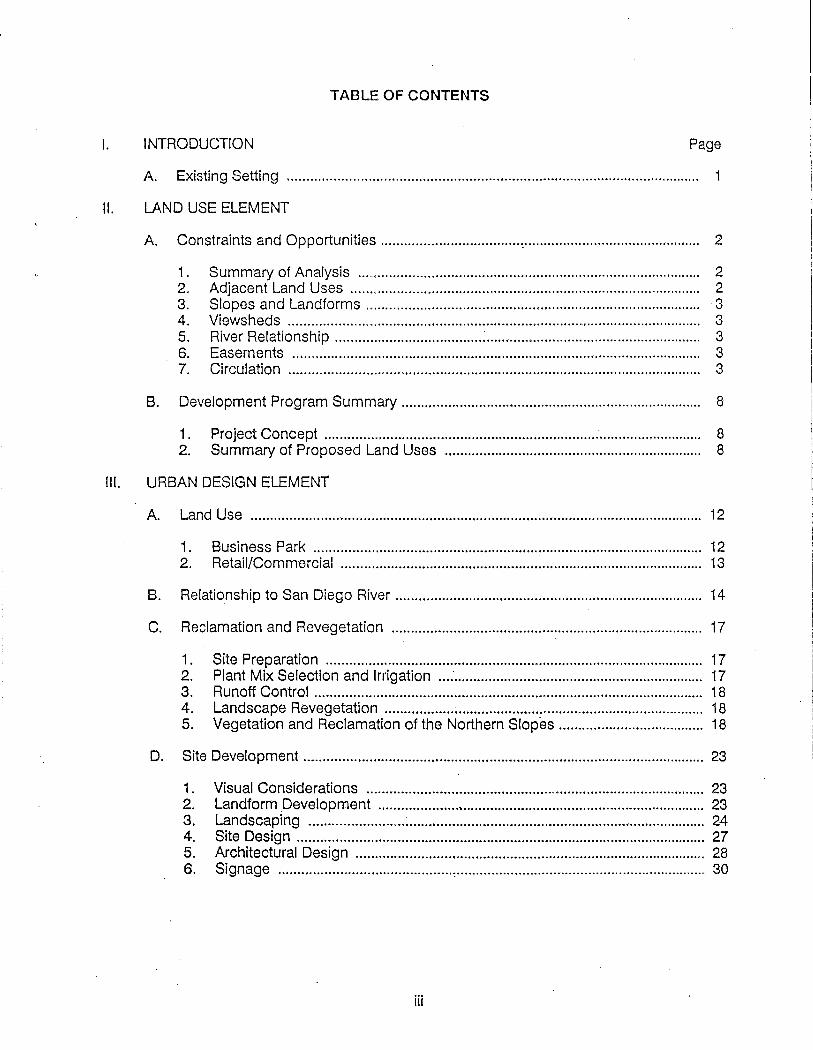
TABLE OF CONTENTS
I. INTRODUCTION Page
A. Existing Setting . ....... .. . . ....... .. ..... ... . ........ ............ .............. ............ ........ ...... .. . .. . .. .. ....... 1
II. LAND USE ELEMENT
A Constraints and Opportunities ····································~·············································· 2
1. Summary of Analysis ......................................................................................... 2 2. Adjacent Land Uses ........................................................................................... 2 3. Slopes and Landforms ....................................................................................... -3 4. Viewsheds . .. ... . . .... . .... . . .... .... ........ ........... ......... ...................... ... .. ... .... . . .... .... .... .... 3 5. River Relationship ...................................... ~........................................................ 3 6. Easements .......................................................................................................... 3 7. Circulation ........................................................................................................... 3
B. Development Program Summary .............................................................................. 8
1. Project Concept .................................................................................................. 8 2. Summary of Proposed Land Uses ................................................................... 8
Ill. URBAN DESIGN ELEMENT
A. Land Use ..................................................................................................................... 12
1. Business Park ........... ,.......................................................................................... 12 2. Retail/Commercial .............................................................................................. 13
B. Relationship to San Diego River ................................................................................ 14
C. Reclamation and Revegetation ................................................................................. 17
1. Site Preparation .................................................................................................. 17 2. Plant Mix Selection and Irrigation ... :................................................................. 17 3. Runoff Control ..................................................................................................... 18 4. Landscape Revegetation ............................................................. ...................... 18 5. Vegetation and Reclamation of the Northern Slopes ...................................... 18
D. Site Development ........................................................................................................ 23
1. Visual Considerations ........................................................... ............................. 23 2. Landform Development ..................................................................................... 23 3. Landscaping ......................... ~......... .................................................. .................. 24 4. Site Design ............... ......................................................................... .................. 27 5. Architectural Design ............................................................... ............. ............... 28 6. Signage ............................................. , ................................................................. 30
iii

Table of Contents (Continued)
IV. TRANSPORTATION/CIRCULATION ELEMENT Page
A. Summary of Transportation Issues ........................................................................... 32
1. Traffic Impacts .................................................................................................... 32 2. Stadium Way/Murray Ridge Extension ............................................................. 32 3. Frazee Road Improvements .............................................................................. 32 4. Pedestrian Linkage ............................................................................................. 33
B. Circulation
1. Bus Routes and Transit ...................................................................................... 33 2. Vehicular .............................................................................................................. 34 3. Service ................................................................................................................. 35 4. Bicycle ............................................................... :................................................. 35 5. Pedestrian ........................................................................................................... 35
V. PUBLIC SERVICE ELEMENT
A. Sanitary Sewer Service ............................................................................................... 39
B. Water Service .............................................................................................................. 39
C. Storm Drainage ........................................................................................................... 39
D. Solid Waste Management ............................................... : .......................................... 39
E. Gas and Electric Service ............................................................................................ 39
F. Police and Fire Protection .......................................................................................... 40
VI. CONFORMANCE WITH COMMUNITY PLANS
A. Progress Guide and General Plan ............................................................................. 41
B. Mission Valley Community Plan ................................................................................ 42
C. Serra Mesa Community Plan ................. · .................................................................... 44
I . I
VII. IMPLEMENTATION
A. Processing and Review ....... ....................................... ........... ......... .................. .......... 46
B. Transportation Improvements ................................................................................... 47
C. Public Improvements .................................................................................................. 49
D. Public Facilities ............................................................................................................ 50
E. Development Phasing .... .. . . ... ............ ........ ........... ...... .... ... ........ ... ...... .... ... ......... ... . .... 50
iv

VIII. APPENDIX
A Mission Valley Heights Improvement Plans: Street Sections
Figure Number
LIST OF FIGURES
Title Page
1. Existing Zoning and Land Use .................................... .. ......... ........................... 4
2. Surrounding Ownership Map ............................................................................ 5
3. Easement/UtilitX Map .................................................. ........ ............ ................... 6
4. Site Opportunity Map ......................................................................................... 7
5. Specific Plan Map ............................................................................................... 11
6. View Corridors Map ............................................................................................ i 5
7. Site Sections ....................................................................................................... 16
8. Bus/Pedestrian/Bike Circulation ........................................................................ 37
9. Vehicular Circulation .......................................................................................... 38
v

I INTRODUCTION

I. INTRODUCTION
The H.G. Fenton Materials Company phased out its Murray Canyon rock extraction and processing facility and asphaltic concrete batch plant in Mission Valley during the latter part of 1985. This operation has been transferred to a new location on 600 acres in Carroll Canyon which will serve the company's needs for many years to come. The new site in Carroll Canyon commenced full operations in 1985.
As a result of the above actions, the existing Murray Canyon site in Mission Valley is no longer used for sand and gravel extraction. Therefore, this report, The· Mission Valley Heights Specific Plan, has been prepared to serve as the continuing basis for evaluating the consistency of future proposals for the property requiring discretionary action from the City.
A. EXISTING SETIING
The Specific Plan area is within Mission Valley, and is bounded on the east by Mission Center Road, south by Friars Road, west by State Highway 163, and to the north by existing residential development at the top of the mesa. For the most part, the undeveloped portion of the planning area stretches above Mission Valley, offering excellent vistas of the valley below. It is located in the center of the San Diego Metropolitan area.
To assure overall coordination on a more complete planning area basis, the following proposed development plans and existing city-approved plans have been included within this Specific Plan:
1. The Mission Valley Heights subdivision, which consists of:
a) City approved Planned Industrial Development (no. 40-018-0) consisting of 71.2 net acres, with 27 light industrial and office use parcels and 1 1.0 acres of public streets and dedications.
b) Lots 1 and 3, Proposed Planned Commercial Development Amendment (no. 84-0128) consisting of 10.2 acres with commercial office and restaurant uses fronting on Mission Center Road.
2. The proposed Friars-Mission Center, (PCD no. 83-0393), 14.6 acre community commercial shopping center fronting on Friars Road between Frazee Road and Mission Center Road. ·
1

IT LAND USE. ELEMENT . ·

II. LAND USE ELEMENT
A CONSTRAINTS AND OPPORTUNITIES
Introduction
The preparation of The Mission Valley Heights Specific Plan included research and analysis of surrounding plans and land use, zoning, ownership, and transportation routes, both existing and proposed within the Mission Valley Community Plan. On-site research included analysis of on-site easements and utilities, viewsheds, slopes, and other environmental factors.
1. Summary of Analysis
The following statements represent a generalized overview of the area:
a. Related land uses in the valley are business-oriented commercial.
b. Future plans for development emphasize a variety in land use, including residential, and the creation of an "urban center" concept· incorporating retail, commercial, industrial and office uses.
c. Land use for the proposed development is in conformance with the Mission Valley Community Plan.
d. Single family development predominates the mesa area. There is a clear physical separation of the mesa from the valley.
e. Ownership patterns of the undeveloped land, available for development in large units, reinforce the potential for organized future development within the valley.
f. The existing transportation patterns are limited, however, the potential exists for developing a strong interior transportation network on the larger undeveloped parcels.
2. 6Qjacent Land Uses
Adjacent developments include the following:
a. The Sunroad Project, including an existing seven story office building, a recently completed ten story office building and a third office building considered for future development.
b. The Griffith Industrial Tract, including 'the Mini storage warehousing and the SCA Construction Supply Company.
c. The Denny's Restaurant and Chevron service station, fronting on Friars Road.
2

3. Slopes and Landforms
The gravel extraction process has, by its nature, resulted in significant alteration of the original topography. High slopes separate the extraction area from the adjacent properties. These slopes are fairly steep and represent potential for erosion.
The remaining majority of the site has been rough graded in accordance with previously approved development plans, thereby establishing overall building pad and drainage slopes.
4. Viewsheds
As a result of the grading and natural topography, off-site vistas to the south are possible, affording views of the valley floor, the San Diego River Corridor, and the hillside on the south side of the Valley. ·
5. River Relationship
The Specific Plan area is located within certain Design Protection Areas, as defined in the Mission Valley Community Plan, for hillsides and transportation corridors. Opportunities exist to orient views within the upper areas of the Specific Plan site to the San Diego River Corridor. In addition, provisions for nonvehicular circulation linkages are possible.
6. Easements
As existing 100 foot SDG&E utility easement extends north to south along the eastern portion of the property. In addition, maintenance of existing sewer line easements as well as provision for storm drainage system extensions are required. Finally, miscellaneous utility easements exist at various portions of the site.
Slope easements exist along the freeway right-of-way lines on the westerly edge of the site.
7. Circulation
The planning area is bounded by major vehicular circulation routes on three sides. State highway 163 extends along the western edge of the site, with an interchange at Friars Road. Friars Road defines the southerly edge of the project, with access to existing development provided by Frazee and Murray Canyon Road. Mission Center Road establishes the eastern boundary of the site, and will provide access to the planning area.
There are currently no pedestrian or other non-vehicular circulation linkages or routes across the planning area. Bus service is currently provided to the site by San Diego Transit, with four routes along Friars Road and one route on Mission Center Road.
3

• I
·,\ -c..-\i . ·.co ,, . .,., .
Amended BY SGPA Planning and Architecture 1565 Hotel Circle South San Dtego. CA 92108 (619> 297-0UI
4
-FRIARS MISSION CENTER . project. site
· · (R·t·s)' · · ·
4/88
...
-.. --.... -.... ·-
MISSION VALLEY
HEIGHTS
~~li$~~~ ~ n~ \!11~
H.G. f'E!'t1"()ft MATERIAL COMJiliUfY 7U ........... ,..... Mrcct p..o.IMJK 14 ..... cUeF. ·eaJltomk nuz 41JO)H8-~
PRC TOUPS
figure 1

SGPA Planning ond Architecture 1565 Hotel· Circle South Son Diego, CA 92108 (619) .297-0131 ................... ., .... --
5
·.,- < -
4/88
" ~:;.-~ ~
.... ,·i -1
I I
-.-F£1.
MISSION VALLEY
HEIGHTS
~ Mlflf(Q)Ulll!t<dllillil~ ~e1r~ii1P
mfi\~jp
1 GRA~1 18 TOWNSE~D 2 CONROCK 17 UNITED ARTIST 3 FOWLER 18 AETNA LIFE INS'. ·4 MISSION VALLEY PART ~ 9 FORD LEASING CO. 5 FEDERATED 20 MURRAY PROP.INC.
DEPARTMENT STORES 21 HAZARD 6 STATE WIDE STATIONS 22 CARLYLE R!.CO •. 1 NATIONAL BANK OF 23 AARDEMA
SAN DIEGO 24 V~RESCO 8 PARKER INVESTMENT 25 MOBIL OIL 9 PLAYA DEL RIO ASSOC. 2 8 JMB REALTY TRU
10 MAY 'PROPERTIES INC. 27 PARKER INV.ST. 11· MILLER BOND & CO. 23 MISSION CENTER 12 MBM ASSOC. TWO LTD 13 MURDOCK SAN DIEGO 2e FRAZEE CO. 14 CLAIRMONT VALLEY 30 CHEVRON U.S.A.
PROPERTIES 31 SELCO REALTY' 15 GREAT WESTERN··. INCOME FUND
SAV.INGS . & · LOAN 32 GRIFFITH 3 3 HOME FEDERAL
SAVINGS a LOAN
34 MISSION VALLEY
~ ... ~ .. M.G. Jl'£M'I'OI'( MATERIAL COMPANY PRC TOOPS
----~.a-t au Malkl& • 1a pia)'& p.o.bozM I& Jolla, ealdonlla NOR 8&a ...., c:&lllonll& nt~ (G'KI IN-AU ~4&1-etU

i
/ ~ ... (" ....r-·
~ ... ..: \.
:· ..• .., \ /'
( .. \ .... I' _..• • I
;
\ '.·: \ .. :
6
,-. ~:s \.\.-· .. \ ..
-. ~;·.>. ~~>id •'
'. · .. -·~ \
_,
us. l_i'O
.. ~ - _... .. /
· ..
MISSION VAil,EY
HEIGHTS
~~i1m'1-n1mkw mA1D "' 4' HEC. DISTRIBUT1011 ESTMS. IH FAV~~~toN ~~NY j F I t E 1 56795
2 10' DRAINAGE BA~T. IN FAVOR OF CITY OF SAN DIEGO, DOC. 2568/8 BK. 8042/P.G. l31 OR RtG. 12/ll/83.
:) SLOPE ESMT. IH FAVOR OF STATE OF CALIFORNIA RECORDED 12/26169 AS F/P NUMBER 233845.
A 20' PRIVATE RD. E9H. DOC. 540% BK. 255/PG 91 RBC. 12/2011933 111 FAVOR -t OF MAX f-tCKLEF., [TAL .
f5 30' S.D.G. & E. GAS l:!Nf. ESJ'IT. REL. 10/22/74 FILE HO. 74-2814S4.
#\ !OO'S.O.G.& E. £ASE~EMT FILE~. 79151619 STORM DRAIN ESJ'IT. TO CITY OF ~GENERAL PRACTICAL ACCESS_ EASEMENT INCLUDED
20' SE'.>'f:R ES/'11. 114 FAVOR OF c'!TY OF SAN DIEGO REC. 10/16/51 DOC. 12f>531 1 BK. 426!!/PG. 142 AHO REL. 2/75/73 FILE NO. 73-048375 NOTE: THIS ESI'IT. PLOTTED FROM 6RAPHICAL DATA SHOWN ON CITY ENGINEER DRAWING 14871-40 ONLY .
~ S.D.G.& E. EASE"EHT DEC. 11/28/56 DOC. 166172 BK. 6353 P.G. 568 HO W WIDTH GIVEN.
11 10' S.D.G.&E. GAS LINE ESl'IT. REC. 9/26/57 BK. 6765/P.G. 106 DOC. 146%3.
10 10' S.D.G. & f. GAS LINE ESTM. REC. 3/31155 BK. 7015/PG, 1(56 DOC. 50548.
11 8' PACIFIC TELEPHON£ E~T. REC. 1/31/67 FILE NO. 13499.
1 ~ 70' ROAD E~T. IN FAVOR Of CITY OF S~ DIEGO REC. 9110/65 FILE NO. 6 1611265
1"' 10' S.O.G.&E. GI\S LINE E$1'11, R(C. Jl/8/65 BK. 6334/PG. 106 DOC . .. 14fi%3.
1...a STORI1 ORAII't ES11TS. IN FAVOR Of CITY OF SM DIEGO REC. 10/20/71 .., f.l LE 1'10. 2423~4
1 iJ SAN DIEGO REC. 9/10/65 FJL[ 164283
149 12' S.D.G.&E. ESMT. REL. 11/15/66 FILE HO. 180495
~- ~-K.G. PUn'Otf MATERIAL CGMMlrt 718 wat W"Ph;atca .a..t p.&iaoar M .. , ..... caJIIar.al,a 18112 «'S19---HU
PRC TOOPS nsa ., w· • a.-,... Ia )oU&. ~ IIIII
figure 3

7
MISSION VALLEY
HEIGHTS
~b-
H.G.RICTON MATERIAL COMPANY 701 wat wuhln•toft etr«t p..o.box 84 MA cbedo, c:allfom1a Htll ts1Q)--8U4
PRC TOUPS au aftftJda de a.. ~ Ia jolla, eallfcwak ....
($1. 444-•t••

B. DEVELOPMENT PROGRAM SUMMARY
1. Project Concept
Mission Valley is the major retail core of San Diego, with the nearby Mission Valley and Fashion Valley shopping centers providing 2.5 million square feet of regionally oriented retail space. The Valley also represents a significant commercial office activity, providing more than 1.6 million square feet of office space. Housing is also rapidly increasing within the Valley, providing the opportunity for residences close to work.
Given the relatively large size of the Specific Plan area, the opportunity exists to establish a mix of many uses in a unified development concept with a thematic approach.
These land uses will consist of industrial, office, and community commercial/retail facilities. The upper areas of the plan are designated for a wide variety of industrial and office uses including research and development operations, light manufacturing and assembly, and computer/data processing. The portions of the project fronting on the circulation routes are planned for office and commercial/retail complexes. This mix of development is linked by a looped circulation system, providing coordinated and integrated access for vehicular and pedestrian systems. As a result, there are opportunities to provide visual and circulation relationships that are appropriate and responsive to approved and proposed iand uses.
2. Summary of Proposed Land Uses
The Mission Valley Heights Specific Plan will create an "urban center", by providing a mix of land uses, including commercial, retail, office and light industrial. The following table defines the approved and proposed land uses that comprise the specific plan.
8

MISSION VALLEY HEIGHTS SPECIFIC PLAN LAND USE TABULATION
PROJECT NAME Net Floor Remarks Land Area Area
Lot No. Use (A C) (SF)
MISSION VALLEY HEIGHTS
Lot 1: 8.0 296,500 Proposed PCD Amendment Comm. Office No. 84-0128
Lots 2, 4-29: 71.2 1 '160,000 Approved PID No. 40-018-0 Business Park
Lot 3: Restaurant 2.2 8,800 Proposed PCD Amendment No. 84-0128
Circulation (Streets) 11.0
Sub-to!al 92.4 1,465,300 I r
FRIARS-MISSION CENTER I I
Commercial/Retail 14.6 150!000 Proposed PCD No. 83-0393 I lr
I Total Proposed 107.0 1,615,300 I Development Acres SF I
I
~ II !1
9

As a means of further defining the project land uses and site specific develop- ment criteria, the following table establishes the proposed project components on a parcel by parcel basis.
MINIMUM MAX BLDG. MAX LOT LANDSCAPE
F.A.R. ACRES AREA COVERAGE AREA
MISSION VALLEY HEIGHTS: P.I.D. Approved
Commercial Office 1.50 12.36 380,000 SF 50% min. 10% of (Lots 4-7) site area, Corporate Office .80 10.06 150,000 SF 50% including 10% (Lot 2) of vehicular Corporate Center .80 9.49 200,000 SF 50% use area. (Lot 24) (avg. 1 tree Industrial Business .23 14.93 150,000 SF 25% per 5 parking (Lots 17-23) spaces) Ught Industrial .27 24.41 280,000 SF '27% (Lots 8-16, 25-29)
MISSION VALLEY HEIGHTS: P.C.D. Amendment-Proposed
Commercial Office .90 7.98 296,500 SF 25% same as above (Lot 1) Restaurant .20 2.22 8,800 SF 10% (Lot 3)
FRIARS-MISSION CENTER: P.C.D. Proposed
Retail/Commercial .24 14.60 150,000 SF 25% same as above (Includes 40,000 SF Market)
10

11
--1....1-..-1:.....1----+
I· -····· . I . I ~-•
.• .·· ....
' '
-.,...-----------~--1---- ; . • . / ~ I
. . ) \ . - . / /~ ~ .. ;.; L.s.'IJ'O ~
........... -·. . -· , ,-/· ./ ; ·. \ r. ··-··-. ~--- _ .. !· _," /..- / rJ: ---·, i ..
~-.. -----~- - (' ,../ f : .. • •• -, ~ .. ·:- I
I __ .. :
MISSION VALLEY
HEIGHTS
~JP.)~~li~ii<e
D MISSION VALLEY HEIGHTS PID: ~ting· (~0·018~0) MISSION VALLEY HEIGHTS PCD: amenQment ( .. 84·0128) FRIARS-MISSION CENTER PCD: proposed (*83·0393)
CDDCDODI SPECIFIC PLAN BOUNDARY
Note: land use tabulation on page· 9
~fw
H.G. FE.NTON . MAT£RIAL COMPANY 1M wqt wu!UnCtoa atreet p.o.box 64 &&1\ dlealo. C&11fomla mut
. . (810) H&-8814
PRC TOUPS au avaUda. de Ia plap. 1a Jolla, caUfQmia noaa
fe1. 4&4-1161

• h:
11
MISSION VALLEY
HEIGHTS
JP>ll~ffi\ 111Th<&,JP>
.MISSION VALLEY HEIGHTS PID: ~t~· (4140·018·0) .M-ISSION VALLEY HEIGHTS PCD: amendment ( .. 84·0121)) FRIARS-MISSION CENTER PCD: proposed (*83·0393)
CDCODOOI SPECIFIC PLAN BOUNDARY
Note: land use tabulation on page 9
~b
H.G.F£NTOH MAT£RIAL COMPANY
1M weat wu!UnCton atreet p.o.box 84 &&1\ diq&o, ca.Ufoml& mut
. . (81Q) n&-8814
PRC TOUPS uu avenld& c1e 1a p~ap 1a Jolla, e&Uiwni& noaa
(111~ 4&4-1161
I!'! ~-- --- //!!!!

ill URBAN
DESIGN ELEMENT

Ill. URBAN DESIGN ELEMENT
A. LAND USE
As the summary of land use indicates, the Mission Valley HBights Specific Plan contains a range of integrated industrial, office and commercial/retail uses. The following identifies in detail the specific uses, the general phasing of each use and the anticipated tenant composition of each element.
1. Business Park: Office and Industrial
The largest land use element for development in the Mission Valley Heights Specific Plan is the business park, Mission Valley Heights Lots 1 thru 29, consisting of approximately 1 ,465,300 square feet and covering 92.4 acres. Tenant types are anticipated to be a wide range of office and light industrial uses.
The Specific Plan recommends that development take place in annual increments of approximately 100,000 square feet. However, based on changing market conditions and project acceptance, this incremental phasing may be exceeded. For example, it is possible that corporate headquarters operations, including administrative, research, and development, assembly, warehousing, and showcasing will represent an area of business park demand which has not been anticipated. Also, light industrial operations, many of which now exist in Kearny Mesa to the north, may fihd Mission Valley Heights an advantageous location for their operations.
Those lots designated as offices will initially range in size from approximately 200,000 to 140,000 square feet of building area, and in varying heights of one to seven story structures. They will be sited in a series of clustered office parks.
It is anticipated that these office components will include users engaged in financial, service and information processing fields, characteristic of many office uses now located in Mission Valley. Also, corporate headquarters tenants are expected, due to its proximity to hotels, retailing, restaurants, and its central relationship to both airport and surface transportation.
On sites adjacent to Mission Center Road to the east and Murray Canyon Road to the south, the business park consists exclusively of office clusters. This results in higher intensity uses near the project entrances. Those areas on the west (for example, lots 8-16) are planned for light industrial/office uses, including manufacturing or research and development activities.
12

2. Retail/Commercial: Friars-Mission Center
The Specific Plan proposes development of approximately 150,000 square feet of retail space. This will be developed as a community commercial center, anchored by a large supermarket tenant, and supported with a mixture of smaller retail and service tenants. In addition, the commercial/retail center will include free-standing restaurants and financial institutions. This commercial center will be built on the 14.6 acre lot fronting on Friars Road and will serve the Mission Valley market area. It should be noted that Mission Valley currently dqes not provide a supermarket or significant mix of convenience goods ~etailers in the vicinity.
Although the commercial center has been conceived as a community commercial element, it will also service the retail needs of nearby office employees at Mission Valley Heights, as well as the residential population throughout Mission Valley. As a result, part of the tenant mix will include retailers who service the specific retail needs of office tenants, such as office supply stores, stationery stores, florist, etc.
The commercial center will be constructed on the most visible site adjacent to Mission Valley Heights, affording tenant visibility and exposure to the Friars Road traffic. Development is planned to occur as a single on-going phase, extending over a number of years.
13

B. RELATIONSHIP TO SAN DIEGO RIVER
The San Diego River through Mission Valley represents a significant aesthetic and economic community asset. In particular, it provides visual and physical relief from the intensifying urbanization in the Valley. As a linear green space, the river corridor unifies th·e community, accentuating the natural setting of the Valley. As the Valley continues to develop as a major urban center, the need for accessible open space will increase.
While the Friars Mission Center project is separated from the river corridor to the South by Friars Road, the amenity afforded by the river should be addressed by means of enhanced pedestrian/bicycle access and view opportunities. In addition, the ongoing development of the corridor itself into a regional and community recreational resource provides the opportunity for future linkages from the project to the river in conjunction with installation of the proposed LRT system.
Development guidelines for the specific plan are:
1. Off-site views from the upper building sites shall be oriented towards the river corridor, particularly lots 17 through 23.
2. Tree species used in landscaping of lower lots should be selected so as to avoid visual blockage of the river, consistent with the Mission Valley Community Plan (Appendix F).
3. Pedestrian and bikeway linkage nodes shall be provided at the Friars Road and Mission Center intersection for access to the river corridor to the south. This can be accomplished by means of enhanced paving and landscaping at the Friars Road undercrossing in conjunction with intersection and ramp improvements.
4. Additional linkage shall be provided during development and installation of the proposed LRT system, by means of a pedestrian overcrossing in the vicinity of the Friars Road/Frazee Road intersection. Refer to Section IV, A: Summary of Transportation Issues.
14

/ ;
~·
15
HEIG
PRIMARY YU!\V OF VALL!Y fLOO~ I& 51PI!~· CO~~IDO~ (VtiW:S iF~O~ LOWE111 l!.LliY.:\TION$ !!LOCKED ~y !XJSTING ST~UCTU~ES:;.-r VI!W$ OF HU ... LSI:Oi iJEYOND POIII:Jl!!.)
GAT:EW.AY v;:e;w i~TO VALLEY
VIEW OfF FUV:!~ AMiD C.AHOiiD"f TRI!:J ·
VI!W OF S3TI FROM HWY. 1 S:J (~OATHBOUND) . . ,.,
VtiW ACiU~~~J TME SJTi TO VALl.!¥ (GATEWAY Vn~~M) .
'Xe~wa<+~~ p.&~M
--~~~ «511~-ea4
A AND AAU4T!K. TI.PO£
SAN 0"'!<\0 · SAH .. AAHClSCO

KEY PLA"
. . I RESIDENTW.I
I
I
SECTION A
FRIARS MISSION CENTER
SECTION B
4/88
FRIARS ftO AD
RESIDENTIAL BEYOND
MISSION VALLEY
HEIGHTS
LANDSCAPE
LIGHTING
FRIARS ROAD OVERPAH
MISSION CENTER RD. PEDESTRIAN UNDERCROSSING
SECTION C. r •"'it.
RESIDENTIAL
1------- SI'ECFIC PLAN AREA --------1
.............. H.G. RfC"'''ft MATERIAL COMMifY ,. ........... -cto- .lltl'eet p.o.a.-M ........ calllanla ..... ( ...........
figure 7

C. RECLAMATION AND REVEGETATION
The Mission Valley Heights Business Park has received City approval of construction documents pertaining to the rough grading, street and utility improvements, and the irrigation and landscaping of all slope and undeveloped pad areas. The landscape standards within the approved drawings (permit file No. 21345-D) provide for permanent revegetation of all rough graded slopes within the business park. Timely installation of this revegetation is required to avoid erosion and eliminate the unsightly condition (see paragraph 5).
To assure a comprehensive revegetation program, the following criteria. outline similar procedures that will be used to provide temporary and permanent planting on slope areas of the Friars-Mission Center commercial site:
1 . Site Preparation
a. All site areas with less than 5:1 slopes will be ripped to a depth of 12 inches, parallel to the contours at a maximum spacing of three feet on center. An alternate grading method is to disc areas to a depth of 6 inches, parallel to the contours.
b. All fill slopes will be "punched" or "tacked" with ·straw.
c. All newly cut slopes over 15 feet in height shall be graded using serrations.
d. Grading of landforms shall avoid hard-edged, "engineered" appearance.
e. All soils shall be analyzed by a recognized soils testing laboratory and/or landscape architect to determine soil characteristics, soil amendments required, and adjustments to the coverage or seed mix type.
f. Final development of the Friars-Mission Center commercial area should not begin until the reclamation and revegetation of the barren slopes on site has begun and an irrigation system is in place.
2. Plant Mix Selection and Irrigation
a. All species selected for revegetation planting will be native or naturalized, drought and fire resistant plantings as indicated in table, page 21 .. The mix will include at least one rapid growth species to provide immediate coverage while the remaining planting is established.
b. All planting is to be performed on freshly prepared soil, with non-compacted surfaces.
c. Low precipitation temporary and permanent irrigation systems shall be installed to provide uniform watering of all slope areas. Slopes with permanent planting (i.e., lower portions, where future construction is not likely) shall be provided with permanent below-grade irrigation.
17

d. All revegetated project areas shall receive contractor maintenance of irrigation and plant materials for a period of at least 90 days.
3. Runoff Control
Positive runoff control methods shall be provided at all slope areas until vegetation is established. Methods shall include siltation basins, dikes and swales with straw or rock energy dissipaters to avoid eroded gullies at areas of concentrated runoff.
4. Landscape Revegetation
Zone A: Areas of less than 5:1 slope:
All areas of less than 5:1 slope, including all future building pads, will be seeded with hydroseed mix no. 2, a mix of low growing native grasses and flowering herbacious perennials.
Zone B: Temporary Plantings on Slopes:
Slopes created by rough grading will likely be modified when the pads are actually developed, including regrading and landscaping w1th conventional plantings and irrigation. As a temporary erosion control planting, provide mulch of straw, either "tacked" or "punched" over seed mix no. 1.
a. All mixtures shall include seed, fertilizer, and other necessary amendments to promote growth.
b. All areas receiving planting will be maintained during the plant establishment period.
Zone C: Permanent Plantings on Slopes:
Upper slope areas and lower portions of graded slopes not likely to be modified by future development will include species suitable for permanent plantings. Lower slope areas will be planted with a seed mix which contains flowering ground covers, shrubs and trees.
5. Revegetation and Reclamation of the Northern Slopes
Revegetation and reclamation of the northern slopes (as outlined on the approved landscape plan for PID No. 40-018-0) within· the Mission Valley Heights Specific Plan boundary shall occur prior to the rainy season immediately following approval of this Specific Plan (i.e., by October, 1987). Revegetation shall occur regardless of whether initial grading for the installation of public improvements has occurred.
In addition, a three-year landscape maintenance program shall be provided by the applicant to ensure the successful long-term reclamation and revegetation of the slope area. The program shall include the following criteria:
18

a. Irrigation. Temporary irrigation shall be provided for both container stock plantings and hydroseeded areas for a minimum of two years. During this two-year period, the need for irrigation will vary according to climatic conditions. Irrigation shall be carried out in a manner that does not promote localized erosion of the hillside. The applicant will be responsible for the maintenance and repair of the irrigation system throughout the initial establishment period and removal of any temporary system after its use has been discontinued.
b. Plant Replacement. Any container stock plants that die within the three-year period shall be replaced immediately with plants comparable to the original size and quality of the original plantings. In reference to hydroseeded areas, the bare spots shall be replanted or rehydroseeded prior to the rainy season in order to avoid adverse erosion or visual impacts. The materials and methods to be used in the rehydroseeding process shall be similar to those required in the initial plantings.
c. Fertilization. Plant species have been chosen for their compatibility with the areas, soils, and climate conditions. Therefore, a long-term fertilization program will not be required. However, a short term program (one-year) shall be instituted to promote rapid establishment of initial plantings.
d. Enforcement. The Planning Department will be informed in writing of the date in which the initial revegetation has been completed. The project will be reviewed on an annual basis throughout the three-year period. Upon review, the Planning Department and Park and Recreation Department will make recommendations, if necessary, in order to ensure the proper revegetation of the slope areas within the three- year period. After three years, if the Planning Director determines the initial plantings have not been adequately established, this agreement will remain in effect for another three years.
19

Suggested Hydroseed Mixes
HYDROSEED MIX #1
Artemesia calfornica Atriplex canescens Encelia californica Erigonum fasciculatum Eriphyllum confertifolium Eschscholzia californica Lupin us succulentus Mimulus puniceus Plantago indica Salvia me/litera Trifolium hirtum "hykon"
HYDROSEED MIX #2
Bromus mol/is Bromus rubens Eschscholzia californica Lupinus succulentus Plantago indica
This mix will be used on "temporary" areas that are steeper than 5:1. The plants are largely herbacious so as to facilitate removal if necessary.
This mix will be used on temporary "flat" areas not exceeding a 5:1 slope. Fast growing grass and grass-like material as well as some wild flowers will be used to provide coverage until finish grading occurs. No woody material is included in the mix to facilitate removal.
20

MISSION VALLEY HEIGHTS IMPROVEMENT PLANS
REVEGETATION PLANT MATERIAL
1. TREES (1 gallon, typ.)
Acacia Baileyana Acacia Melanoxylon Brachychiton Populneum* Eucalyptus Cladocalyx Gleditsia Tricanthos Jacaranda Acutifolia* Olea Europaea Pinus Torreyana Pinus Canariensis Pinus Roxburghi* Tipuana Tipu
* = street frontage trees
2. SHRUBS (1 gallon, typ.)
Bouganvillea 'Don Mario' Bouganvillea 'Mrs. Palmers Enchantment' Bouganvillea 'Orange King' Ceanothus 'Concha' Ceanothus 'Joyce Coulter' Ceanothus Griseus 'Louis Edmunds' Ceanothus Griseus Horizontalis 'Yankee Point' Cistus Vellosus Cotomeaster Lacteus Eleagnus Punggens Eucalyptus Lehmanii Garrya Elliptica 'James Roof' Heteromeles Arbutifolia Leptospermum Scoparum 'Ruby Glow' Prunus llicifolia Rhus lntegrifolia Rhus lancea Schinus Molle
3. GROUNDCOVER
File No. 21345-D
Installed in row plantings three feet on center with plants staggered along parallel rows.
a) Acacia 'Pecoffverde', to be hydroseeded with Mix No.2
b) Jasminum Polyanthemum, to be hydroseeded with Mix No. 1
. c) Cissus Antarctica, to be hydroseeded with Mix No. 1
21

4. HYDROSEED
a) Hydroseed Mix No" 1 (Permanent Irrigated)
Seed Lb/Acre
Trifolium Fragiferum 'O'Conners' 25# Ganzania Hydrid 4# Color Mix No. One (see item b) 22#
Total Seed 51#
Fertilizer
'Milorganite' or 'Growpower' or equal 1000# 16.6.8 (inorganic) 600# Urea Formaldehyde or IBDU 300# Fiber 2000# Binder 160# Humectant (CPA 4000) 100#
b) Color Mix No. One
Seed Lb/Acre
Alyssum 'Royal Carpet' 3# Alyssum 'Violet Queen' 3# Eschschjolzia Californica 2# Lasthenia Chrysostoma 4# Umonium Perezii 4# Lupinus Densiflorus 2# Lupinus Succulenetus 2# Tagetes Patula 'Extra Dwari Doubles' 2#
Total Seed 22#
c) Hydroseed Mix No. 2 (Permanent Irrigated)
Pure Uve Seed Lbs./Acre Seed/Acre
Acroclinium Rosea 3# 2# Atriplex Semibaccata 'Corto' 31# 20# Lobularia Maritima 'Carpet of Snow' 6# 4# Lobularia Maritima 'Royal Carpet' 6# 4# Gazania Hybrida 9# 6# Lotus Kalo 8# 6# Plantago Sempervirens 14# 10#
Total Seed 77# 52#
22

D. SITE DEVELOPMENT
The scale of the planning area and the goal of establishing an urban center involves consideration of a wide variety of site development, architectural, and signage issues. The following guidelines provide the criteria for developing an overall visual concept and context.
1. Visual Considerations
a. Viewsheds from the planning area towards the South should be maintained. In particular, pedestrian view corridors from the upper lots towards the river corridor and hillsides should. be established. Placement of ·tall buildings shall respect the view shed of the residential area to the north.
b. Given the high degree of visibility that the planning area represents from surrounding roadways, site development should respond to view relationships onto the site. For example, visual corridors into the project areas from Mission Center Road and Route 163 should be established where possible.
c. In order to reflect existing building form and to establish orientation within the project, visual focal points shouldbe established at Lots 17/21/29 and at Lot 7/Friars Mission Center entrance area.
d. The slope of the planning area and its visibility from surrounding circulation routes requires that careful screening techniques be developed for storage and service areas, process equipment, and roof surfaces.
2. Landform Development
a. The existing rough graded areas shall be further developed within the concept of terracing the project tots up the slopes.
b. Site development of individual projects should incorporate stepping of building forms and floor elevations to accommodate graded slopes, rather than mass excavation/filling.
c. Buildings shall be sited so as to provide graded slope transitions between lots, rather than retaining wall conditions.
d. Buildings should be blended into t~e site through grading techniques such as earth berming.
e. Landscaped slopes at building and parking areas shall not exceed 1 verticalto 2 horizontal.
f. Vehicular circulation slopes shall not exceed 10% except at loading areas and parking areas shall not exceed 6% slope. The majority of the pedestrian circulation system should not exceed 5%, with a maximum of 8% in limited areas.
23

3. Landscaping
To assure a cohesive landscape theme, plant materials shall be selected in accordance with Appendix F of the Mission Valley Community Plan and the following list of plant material. The list of species and sizes is followed by general landscape development guidelines.
CONVENTIONAL PLANTINGS
VINES & GROUNDCOVERS (Flats)
Arctotheca Calendula Baccharis Pilularis Delosperma Alba Hibbertia Scandens Bougainvillea
Hymenoculus Purpurea Croceus Hypercum Calycinum Lipia Repens Hedera Helix Trachelospermum Jasminiodes
SHRUBS (1 & 5 Gallon, Typical)
Abelia Grandiflora Acacia Redolens Ceanothus Griseus Harizontalis Cotoneaster Horizontalis Echium Fastuosum Heteromeles Arbutifolia Juniperus Chinensis Carrisa Grandiflora Moraea Bicolor Raphiolepis Indica
Lantana Montevidensis Melaleuca Nesophilla Myoporum Laetum Plumbago Capensis Prunus Lyonii Rhus lntregrifolia Tecomaria Capensis Xylosma Congestum Pittosporum Tobira Photinia Fraseri Nerium Oleander
TREES (5, 15 Gal. & 24" Box)
Acacia Baileyana Ceratonia Siliqua Erythrina Caffra Eucalyptus Lehmanii Eucalyptus Rudis Eucalyptus Cladocalyx Pinus Halepensis Olea Europaea
24
Gleditsia Triacanthos Pinus Torreyana Rhus Lancea Schinus Molle
· Tipuana Tipu Ficus Rubigimosa Cedrus Deodora II ex Altaclarensis Platanus Acerifolia

REQUIRED STREET TREES
(24" Box, Typical)
Platanus Occidentalis Fraxinus Velutina Jacaranda Acutifolia Koelreuteria Bipinnata Koelreuteria Paniculata Liquidambar Styraciflua Cupaniopsis Anacardioides
Tristania Conferta Eucalyptus Ficifolia Quercus llex Ulmus Parvifolia Pinus Canadensis
TRANSITION PLANTINGS
(Native and Naturalized Container Stock, 1 Gallon, Typical)
Rhus Ovata Rhus lntegrifolia Rhus Laurina Adenostoma Fasciculatum Xylococcus Bicolor Salvia Mellifera Heteromeles Arbutifolia Quercus Dumosa
Artemisia Californica Encelia Californica Baccharis Sarothroides Ceaonothus Verrucosus Ceaonothus Tomentosus Acacia Redolens Eucalyptus Species Atriplex Lentiformis
a. The integrity of the development will be insured through the implementation of a total landscape design concept which includes the following landscaping elements:
• Landscaping shall enhance major architectural design elements through the careful use of flower and leaf color and texture, plant forms, plant masses, landscape lighting, benches, and other outdoor furnishings which relate to the architectural design theme.
• Landscape design will avoid visual confusion due to the use of many unrelated plant varieties through implementation of a select palette of plant material to maintain the theme of the landscape design.
• Landscaping will reinforce the sequence of events and experiences which relate to the inherent qualities of the site and the movement patterns by which people will experience and relate to the landscape (pedestrian, bicycle and vehicular).
b. Plant types for the various planting areas shall be coordinated for color, texture, and scale. In general, drought tolerant plantings shall be used at all project landscaping. The use of color and contrasting texture should be used as a means of directing attention to entrances and pedestrian areas.
25

A unified planting theme shall be used at all frontages and at planting areas between adjacent project areas to avoid juxtaposition of conflicting landscaping color, scale, and texture. Turf area should be limitecj to appropriate use areas.
c. All project areas shall be · irrigated with automatic, below-grade sprinkler systems, designed for water conservation. · Irrigation systems will be permanent automated systems, adequate for the establishment of all plant material and will be installed as soon as practical after grading and prior to plant material installation.
d. Planting coverage rates shall be sufficient to assure rapid fill- in for the selected species. In particular, slope areas shall be amended, planted, and provided with jute matting or similar materials to avoid erosion during permanent plant material establishment.
Planted areas shall receive contractor maintenance of irrigation and plant material for a period of at le.ast 90 days.
e. Earth berms will be rounded and natural in character, designed to obscure undesirable views (i.e., automobiles, storage and utility areas, etc.) and add character and interest to the site. All outdoor storage, loading, refuse and utility areas will be visually screened on all sides except at access points.
f. Landscape finish grading will insure that the entire site will surface drain and that there are no drainage problems created.
g. Planting materials shall be selected for resource conservation benefits. For example, decidous trees should be planted on the southerly side of plazas to afford summer shade and winter solar gain. Dense tree plantings should be concentrated on western exposures of buildings to reduce heat gain.
h. Landscaping materials and placement shall provide for screening of service and parking areas where possible. In general, loading areas, outside storage yards, and parking areas adjacent to the primary circulation corridor shall be screened with a combination of berms, fencing and landscape planting.
i. Trees and plantings adjacent to pedestrian paths and within parking areas shall be selected to enhance the human scale. High canopy trees shall be used adjacent to vehicular circulation, set back from entrances to buildings, parkhg lots and street intersections for visibility and safety. Low scale plantings shall be located adjacent to driveway entrances and street corners and shall not obscure driver visibility in accordance with City Engineering Department standards.
26

j. All soils will be fertilized, amended, and tilled to conform to recommendations made by a soil testing laboratory and/or landscape architect in order to promote healthy and vigorous plant growth. All plant material selected for use should be of a type known to be successful in the area or in similar climatic and soil conditions.
k. Undeveloped site areas designed for future use and expansion will be maintained in a weed and debris free condition. Maintenance of landscaped common areas will be provided for by the establishment of a tenant's association.
4. Site Design
a. Site planning and building design of individual projects shall inco.rporate shared or combined parking and pedestrian entrances where possible. Common access between lots for loading/service areas should be considered. Building setbacks shall be coordinated between· adjacent lots so as to avoid unusable site area between buildings.
b. Individual projects shall relate exterior on-site plaza areas with those of other projects, both visually and in terms of continuous paths of travel.
c. Storage and loading areas shall be located so that vehicular travel path conflicts are minimized. In addition, these areas are to be planned to facilitate screening, either as part of the building design or as an integral component of the landscape scheme.
d. Bikeways and pedestrian paths shall have different textures to clearly define travel areas. Pedestrian paths across drives and intersections shall be in a contrasting material and texture. Pedestrian node areas, such as bus stops, also should be paved with contrasting materials to provide identity.
Sidewalks at major street frontages will be designed within final Community Plan standards. Pedestrian paths along major streets shall have an 8' clear width. Paths within individual lots shall be a minimum of 6' clear width. Approved PID areas have 5' paved sidewalks at all street frontages.
e. Streetscape utility items, such as hydrants and transformers, shall be located so as to avoid visual and travel conflicts with pedestrian paths. Where possible, transformers and related ·utility components should be placed in vaults or screened with retaining walls/plantings.
f. Site and street lighting shall be coordinated to provide a consistent lighting character. Street lamps on public streets shall be low pressure sodium, while lighting on individual lots may be selected from other types in accordance with approved City guidelines. Location of lighting standards along th'e primary
27

corridor should be coordinated with the tree pattern. Increased lighting intensity should be provided at parking entrances and street intersections.
Outdoor lighting within the project site areas will be designed to minimize light pollution, enhance natural color rendition, and provide the required illumination for safety in the use of walkways, roadways, parking areas and public open spaces. Lighting design shall be coordinated between adjacent buildings and parking lot areas.
Lighting of buildings should focus on entrances and design elements, as well as landscape features.
5. Architectural Design
a. Existing adjacent development has effectively set the overall architectural image of the area to be contemporary in nature. Consequently, design of new structures shall respond to this theme, while at the same time expressing the individual character appropriate to each facility.
b. Building forms, materials and colors shall complement adjacent topography, landscape and existing buildings to the South and enhance views from adjacent residential areas. Architectural harmony with the surrounding community shall be achieved so far as practicable.
c. In concept, the selection of materials and forms shall recognize the urban, nonresidential nature of the project. Structures shall stress contrast primarily between adjacent materials and forms, with variation in texture and color secondary.
The materials used shall convey a sense of timelessness and permanence. Materials that convey this sense include, but are not limited to concrete, stucco and masonry of many forms, including stone, tile, brick and block. Wood and metal should be used sparingly and as trim only. Sloped roofs should be tile or metal.
d. Building forms shall be scaled to step up and away from the primary corridor and from each other; parallel and continuous surfaces shall be avoided. Sloped wall/roof forms should be used as a scale transition device between parking areas, and buildings, with slopes selected for compatibility with the surrounding landforms. ·
e. Since the site is visible from higher elevations, pitched and flat roof forms shall be considered integral design elements, with consideration given to glare reduction, color and pattern of roofing materials, and adequate screening of roof-mounted mechanical equipment.
28
Vertical and horizontal screening of rooftop mechanical equipment shall be designed to reduce visual impact while allowing adequate equipment ventilation (i.e., open trellis above equipment, within a screen wall).
f. Parking structures shall be designed as integral components of the overall design of specific projects, with related materials and forms incorporated in both the parking structure and the facility served. Parking structures shall be screened from street views where possible.
g. The color choice for building materials and signage shall be selected from a coordinated palette that offers the variety desired in the architectural expression for the overall project. In general, colors for the primary building forms should be integral with the material used. Colors should be coordinated with landscaping materials. Earthtones and pastels are preferred for large areas, with intense colors being limited to accent points and trim.
h. Entrances to lobby/reception areas, parking structures, and service areas should be clearly defined. Contrasting materials, open glass, and lighting accents should be considered as possible options. In all cases, entrances should be de$igned to provide safety and security, without concealed areas or blind spots. Service areas shall •be separated from principal building entries.
i. Design of project areas shall respond to viewshed opportunities, particularly from lobby areas and exterior plazas. Development of each lot should capitalize on opportunities for high activity "people SP,aces" with views toward the river corridor.
j. Permanent open space and plaza areas shaJI be integrated into topographic and natural features of the site. These areas should capitalize ·on view corridors, solar exposure and orientation to adjacent buildings.
k. Temporary enclosures shall be limited to construction-related structures.
I. Building placement on individual lots shall respect the solar access of adjacent structures and shall not cast extraordinary shadows on neighboring building sites.
m. Minimum building setbacks: front yards: 25 feet, side and rear yards: 10 feet.
n. Building designs should incorporate opportunities for detailed elements of design, i.e., signage, canopies/awnings, special lighting, unique forms and features. ·
o. Conditions, covenants and restrictions (CC&R's) shall control architectural design, and will include controls on building forms, materials, colors, signage and landscaping.
29

6. Signage:
Project signage is intended to identify rather than advertise activities and to insure a high level of graphic quality throughout the project area. A planned sign program shall be prepared by the developer and submitted with development plans for the business park and commercial project areas, consisting of guideline specifications and examples for the foll.owing signage types:
Identification and entry signs. Building or monument signs. Individual tenant signs. Street signs and traffic control signs. Building address and suite numbers. Information and directory signs. Plaque, bracket and artwork signs.
The sign program will be designed to promote variety and individual expression for each use, while maintaining a cohesive, high quality overall effect.
a. Friars-Mission Center:
Size of permitted signage will be governed by the tenants lease space size, location and orientation. As a general rule:
1. Retail tenants in the Friars-Mission Center Project will be permitted one. identification sign for each primary street frontage.
2. Commercial pad buildings and major retail tenants will be permitted two identification signs.
3. Retail shop tenants will each be permitted one building- mounted sign plus under-canopy signs.
4. Ground mounted project and tenant identification signs will be permitted in five locations: Three entry drives and at the corners of Friars/Frazee and Friars/Mission Center.
b. Mission Valley Heights, Lots 1 and 3:
The buildings in this project will each be permitted one primary sign and one secondary sign. Primary signs shall be oriented toward the adjacent street and secondary signs may be oriented toward other street frontage or parking areas.
Additional building or ground mounted signs may be permitted for the tenant occupying the majority of space in their respective office building.
30

All signs erected in the project areas will conform to the sign program and will be submitted to the City for approval. Ground signs adjacent to public rights-of-way will be subject to review by the City Engineering Department.
31
Til TRANSPORTATION/
CIRCULATION
ELEMENT

IV. TRANSPORTATION/CIRCULATION ELEMENT
A transportation analysis has been conducted for the area by Urban Systems Associates, Inc. in conjunction with the Friars-Mission Center and Mission Valley Heights, Lot 1 & 3 projects. This analysis was conducted based upon the mosr intensive development, utilizing data for the overall Mission Valley transportation network as approved by the City of San Diego Transportation Division.
A SUMMARY OF TRANSPORTATION ISSUES
1. Traffic Impacts
On July 8, 1985 the City Council adopted an ordinance for Mission Valley limiting the issuance of building permits until a financing plan for public improvements has been adopted (Ordinance No. 0-16460). This ordinance provides that no building permits shall be issued if the trip generation of the proposed uses of the premises exceeds the average daily trip allocation for the premises as set forth in that ordinance. The Mission Valley Heights Specific Plan falls within District E of that ordinance and is allocated a trip generation per net acre of 353 ADT (gross acres exclusive of areas within the Hillside Review (HR) Overlay District). The application of this ordinance would allow 35,547 ADT for the entire Specific Plan area.
Although the proposed development projects vary individually from the allowable ADT, the overall traffic generation for the Specific Plan area will be 35,544 ADT. This figure is within the allowable ADT for the Specific Plan area. The Specific Plan therefore conforms to the intent of the ordinance; amendments to the Specific Plan shall not cause the traffic generation to exceed the total site allocation of 35,547 ADT.
The baseline forecast was revised to reflect the cumulative volumes for the total Mission Valley Community Plan area. There are no significant changes of impacts on the street system which would require reclassification of proposed circulation system facilities.
2. Stadium Way/Murray Ridge Extension
The transportation analysis indicated that the Stadium Way/Murray Ridge extension to 1-805 is highly beneficial to the future level of service on Friars Road adjacent to the specific plan area. The recently adopted Mission Valley Community Plan indicates that these streets will be needed when urban development occurs north of Friars Road (between Mission Center Road and Interstate 805).
3. Frazee Road Improvements
Procurement of a 98-foot right-of-way and full street improvements between Friars Road and Murray Canyon Road are important to maintaining an acceptable level of service on this high-volume four-lane collector street.
32

4. Pedestrian Linkag~
Provision for a pedestrian crossing of Friars Road is important to encourage walking between employment centers and commercial activities proposed along both sides of this street. From a traffic engineering standpoint, it is essential that no at-grade pedestrian crossings be allowed to interfere with traffic flow on this prime arterial street. A grade separated crossing shall be developed at the existing Mission Center Road underpass. This pedestrian link shall be enhanced to provide a safe and pleasant environment to encourage its use.
The Mission Valley Community Plan identifies a pedestrian overcrossing of Friars Road at Frazee Road. Upon completion of the LRT system serving the valley, an overcrossing at this location would encourage commuting to the employment centers north of Friars Road as well as increased pedestrian interaction between proposed developments .on both sides of Friars Road. Adequate property reservation should be assured at the southwest corner of Friars ·Mission Center to accommodate a landing for the pedestrian overcrossing should this location be selected.
Transportation improvements. required of proposed projects for mitigation of traffic impacts are outlined in Section VII: Implementation.
B. CIRCULATION
Given the large planning area available, the opportunity exists for establishing a comprehensive circulation scheme that addresses primary movement modes, both within the project planning area and off site. Concepts and guidelines for bus, automobile (including service, emergency, and parking), bicycle and pedestrian systems are described below.
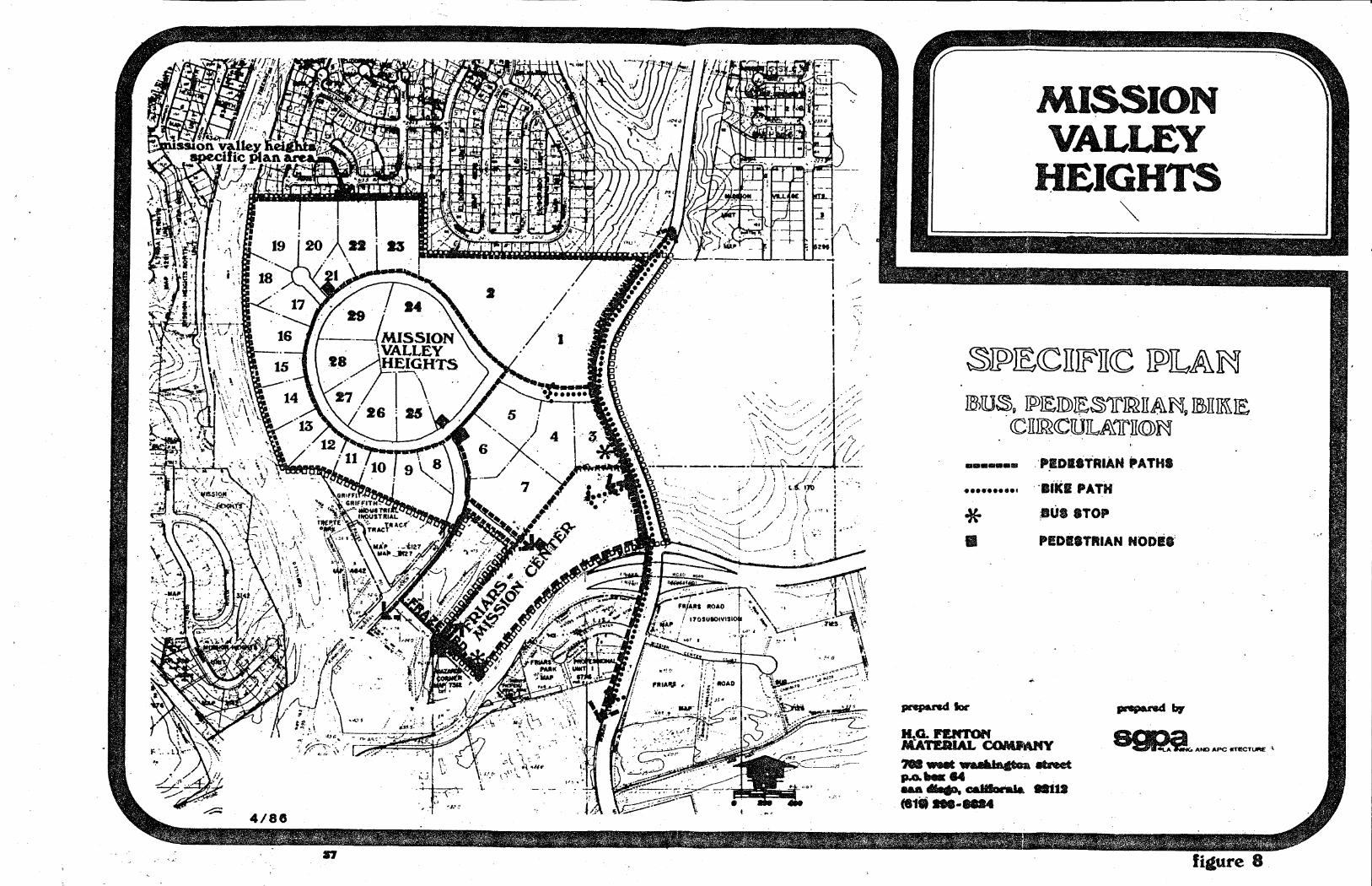
1. Bus Route and Transit
a. Friars Road and Mission Center Road have established bus transportation routes, serving the Specific Plan Area.
b. Bus stops shall be located on Friars Road and Mission Center Road as determined by MTDB and the City Engineer. This will provide easy pedestrian access from bus stops to destinations generating the greater number of users.
c. Bus stops shall be designed to provide secure and inviting shelter, provide for proper signage and directional graphics and be integrated into the overall design theme.
d. Proposals for the alignment of a future Light Rail Transit system through Mission Valley are being reviewed by City staff and MTDB. Current plans call for a station in the vicinity of Mission Center Road and Hazard Center, enhancing the opportunities for future transit alternatives for employees and shoppers in this area of the valley.
33

2. Vehicular
The following guidelines reflect consideration of three types of automobile circulation systems: public (including parking areas); service; and emergency/police. These improvements will be provided in compliance with appropriate standards and the following concepts and guidelines.
a. Provide complete access for Emergency (police, fire, and ambulance) services to structures as required by City of San Diego safety codes. Plaza, concourse and mall areas shall allow for emergency access.
b. Minimize the number of driveway entrances into parking areas in order to avoid breaking the continuity of the pedestrian sidewalk areas. When driveways occur, the driveway width shall be a maximum of 30 feet, with a patterned surface to visually accent the pedestrian right-of-way. Textured paving materials used within the public rights-of-way are subjE?Ct to approval by the City Engineer.
c. Large parking areas of any one project shalt be served by an internal circulation loop; multiple access to· the public streets shall be minimized.
d. Mixed use projects within the same parcel of land may be considered for lower parking ratios than single use parcels, based on an evaluation of peak use (similar to the U.L.I. Shared Parking Studies), as well as specific review of the parking areas, their access and relationship to buildings.
e. Surface parking areas on an individual lot shall be interconnected when possible, thereby expanding the options for those looking for a parking place. In addition, this permits a more efficient use of the overall parking stock, accommodating peak loads in areas that are not being used at capacity.
f. Large parking areas shall be visually screened wherever feasible. Exposed vehicular use areas shall include a minimum of 10% of the total area in landscaping. Where possible, depress or raise large exposed parking areas from the level of the public street as a way to mitigate potential.view blockage and exposure to large expanses of parking.
g. Where appropriate, anticipate future demand in the design of parking facilities, by utilizing land reservation or provision for potential addition of future abovegrade structures.
34

3. Service
a. Use of public right of way for service loading/unloading. shall be avoided. Adequate on-site service and delivery areas, including provision for circulation, shall be provided. ·
b. Service areas shall be separated from entrances and public access areas where possible.
4. Bicycle
. a. Since· both Friars Road and Mission Center Road are integral components of the Bikeway System, opportunities exist to relate the Specific Plan to this alternative transportation mode.
b. Bicycle access shall be provided throughout the Business Park and Retail components of the Specific Plan, sharing the proposed project streets with vehicular circulation and connecting to the existing community wide bike path system.
c. Provide safe surface treatments for drainage inlet grates, manhole covers, etc., on bikeway paths.
d. Project developments shall provide secure bike racks and other facilities to foster bicycle use. In addition, major employment centers should provide locker, shower and changing facilities in order to encourage the use of bicycles and bikeways.
5. Pedestrian
The mixed use "urban center" concept will foster pedestrian movement from one portion of the project to another. The plan should encourage and facilitate this circulation, by incorporating the following guidelines:
a. Separation of pedestrian and bikeway/automotive traffic throughout the project shall be provided where feasible. Definition of pedestrian paths shall be developed through the use of differing paving materials. Major crossings shall be designated by a change in material and texture.
b. A grade-separated crossing of Friars Road at the Mission Center Road underpass shall be provided. This crossing is to be developed and enhanced as a safe, secure, and inviting circulation component.
c. Entry plazas and pedestrian focal points shall be developed to enhance project entrances.
35
...

d. Given the grade differential of the planning area, and the intent to establish an inviting path of travel, sidewalks and pedestrian ways should be designed to provide landings and rest areas where appropriate.
e. Safe and secure circulation to, from and within parking areas should be provided, including provision of adequate signage, lighting and open pathways, without unsafe concealed spaces.
g. On-site pedestrian paths shall be integrated with locations of bus shelters. All pedestrian paths shall comply with state handicapped accessibility regulations.
36
I .· ./ l
MISSION VALLEY
HEIGHTS ~
~]p)JE<CITIFITCC ]p)ILAM JBlU~g ~JEJD)~S)JrJJ&llA\Ng ffi>TIIK\JE
CC·ll~<CUJIL.A\lrllCC»~
···-·· •••••••••••
* II
~-
:P~DISTRIAH PATHS
··aiKI PATH
8UI8TOP
P!DiiTRIAN NODil'
H,.G. Jl'ltllfTC)ft COMMMY MATERIAL . ,. ............. llt:Net ft-'"l_ ... ...
;;; ....,. caJ8oral& .. u (818--1884

hnended By
SGPA Planning ond Architecture 1565 Hotel Clr1ce South Son Diego, CA 92108 · (619) 297-0131 ,...._....._.,_.~,.._......,._.._..... ....
i : _,....,.. - .. -...
4/88
MISSION VALLEY
HEIGHTS
w~l&li<CMll~Ir <ClllfCCMJlc&1cli~
(:::;::,}.:;:!.:::;] I .. TERST ATE R.O. W.
~ e-LANE EXPRESSWAY
+ • • 8 •LANE PRIMARY ARTERIAL
------111111111111
000000
*
~loc'
6 •LAN I: MAJOR
4-LANE MAJOR
4-I.,ANE COLLI:CTOR
3-LANE COLLECTOR
2-LANE COLLECTOR
PUBUC STREETS OF ADEQUATE CAPACITY TO CONNECT STADIUM WAY AND MISSION CENTER PIOAD WITH INTERSTATE 805 AT PHYWS PLACE WILL BE NEEDED WHEJf · URBAN DEVELOPMENT OCCURS HO~TH OF FRIARS .ROAD (BETWEEN MISSIOt..' ·::ENTER. ROAD AND INTERSTATE 8015)
SEE PAGE (fl,e.
H.G. FENTON PRC TOUPS MATERIAL COMPANY
'lW2 west wa.ahiftgtoo. etreet Jl.Oobox 64 l[.aJ\ diqo, caJiforn.1a. nt12 (619J 298-8824
figure 9

Y. PUBLIC SERVICES
ELEMENT

V. PUBLIC SERVICE ELEMENT
A SANITARY SEWER SERVICE
Sanitary sewer service will tie into the existing 30 inch V.C. sewer trunk line which traverses the property immediately west of Mission Center Road. All lots within the project can be served by a gravity flow system. Sanitary sewer laterals to each lot will be provided, sized as required by demand.
B. WATER SERVICE
Water service is available at two points from the existing 16-inch main in Friars Road. It is proposed that the first connection be near the intersection of Friars and Mission Center Roads, consisting of a 16-inch main, extending up Mission Center Road to the entrance between lots 1 and 3. Lines would then reduce to 12" and be extended throughout the project. Ultimately a complete looped water system would be established by connection of the 12" main system Into the Murray Canyon roadline provided by the Murray-Frazee Subdivision.
C. STORM DRAINAGE
A complete project storm drainage system will be provided within the streets and carried to a new box culvert traversing the site. Improvements to the existing drainage channel have recently been completed to adequately accommodate storm flows entering the project at the northerly parcel line adjacent to Mission Center Road. Continuation of storm drainage flows originating off-site will be accommodated within an engineered system.
D. SOLID WASTE MANAGEMENT
Sold waste collection and disposal will be provided to the project by private collection companies, with all material disposed of off site at approved sanitary landfills.
E. GAS AND ELECTRIC SERVICE
Both gas and electric facilities from San Diego Gas & Electric Company (SDG&E) exist on the property with capacity necessary to service the project.
Gas line easements exist in the southeasterly portions of the site, as well as various services located within right of ways. An existing SDG&E easement which traverses the easterly side of the site contains overhead electric transmission lines in a 100 foot corridor. The corridor must remain protected, although site work is proposed within its boundaries in order to create developable pads. Future consolidation and/or relocation shall be accomplished in conformance to San Diego Gas and Electric rules and regulations.
According to SDG&E planning staff, adequate electric and gas service exist to service the level of development contemplated in this specific plan. Local gas and electric distribution lines will be installed underground.
39

F. POLICE AND FIRE PROTECTION I
Police protection and service will be provided by the City of San Diego, operating out of the Eastern Division Station.
Fire protection will be provided by the City of San Diego, with initial response provided by Station 28, located at 3880 Kearny Villa Road. In addition, all on-site fire service and protection systems required as a part of the development review process will be provided.
40

1ZI CON.FORMANCE WITH
COMMUNITY PLANS

VI. CONFORMANCE WITH COMMUNITY PLANS
The Mission Valley Heights Specific Plan has been developed to provide a framework for analysis of Tentative Map, Rezoning, PCD, and PID applications covering the property. In order for the Plan to serve this function, consistency between the Specific Plan and previously adopted city plans must be established. The following sections establish this relationship.
A. PROGRESS GUIDE AND GENERAL PLAN
The Progress Guide and General Plan for the City of San Diego designates a portion of the Planning area for sand and gravel extraction with the remaining area designated for general industrial purposes. Speciffcally stated on page 6 and page 203 of the General. Plan are the following statements related to land use development:
"The General Plan reflects the major proposal contained within community or sub-area plans adopted by the City Council. However, the General Plan should in no way be considered as a replacement for previously adopted and future community plans. Such plans must remain as official guidelines for the development of communities and sub areas and act as supplements to the General Plan with regard to the more specific proposals and programs normally associated with community plans."
"The General Plan Map is the Land Use Element of the Progress Guide and General Plan. It illustrates the location of residential area, commercial activity, industrial development, public facilities, the alignment of the transportation netvvork and the open~ space/park system. It is intended to indicate only those land uses of regional or Citywide significance and its locational designations should be considered advisory only. The fine detail so often seen on planning maps is included not on the General Plan, but on the many community plans which have been developed throughout the San Diego area. Reference must be made to these plans and the maps and descriptions of any particular property."
The General Plan also designates the Mission Valley Heights property as "urbanized." This portion of the urbanized area is conceptualized as an area expected to become more diverse in land use, particularly employment opportunities. Access and future public transportation systems are expected to emphasize nodes of activity in older communities.
The overall thrust of these two major general plan policies related to land use covering the Mission Valley Heights planning area is to I) refer detailed land use recommendations for the property to the adopted Mission Valley Community .Plan and 2) recommend that development occur and be more diverse in land use, particularly employment opportunities.
In this respect the Mission Valley Heights Specific Plan conforms. The land use proposal for an "urban center" being developed on the site is in conformance with the General Plan concept of this area of the City. The consistency between the Community Plan is established in the following sections.
41
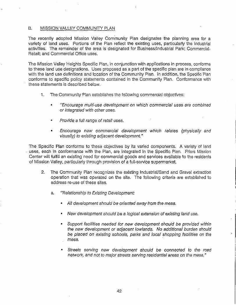
B. MISSION VALLEY COMMUNITY PLAN
The recently adopted Mission Valley Community Plan designates the planning area for a variety of land uses. Portions of the Plan reflect the existing uses, particularly the industrial activities. The remainder of the area is designated for Business/Industrial Park; CommercialRetail; and Commercial Office uses.
The Mission Valley Heights Specific Plan, in conjunction with applications in process, conforms to these land use designations. Uses proposed as a part of the specific plan are in compliance with the land use definitions and location of the Community Plan. In addition, the Specific Plan conforms to specific policy statements contained in the Community Plan. Conformance with these statements is described below.
1. The Community Plan establishes the following commercial objectives:
• "Encourage multi-use development on which commercial uses are combined or integrated with other uses.
• Provide a full range of retail uses.
• Encourage new commercial development which relates (physically and visually) to existing adjacent development."
The Specific Plan conforms to these objectives by its varied components. A variety of land uses, each in conformance with the Plan, are integrated in the $pecific Plan. Friars Mission Center will fulfill an existing need for commercial goods and services available to the residents of Mission Valley, particularly through provision of a full-service supermarket.
2. The Community Plan recognizes the existing Industrial/Sand and Gravel extraction operation that was operated on the site. The following criteria are established to address re-use of these sites.
a. "Relationship to Existing Development:
• All development should be oriented away from the mesa.
• New development should be a logical extension of existing land use.
• Support facilities needed for new development should be provided within the new development or adjacent lowlands. No additional burden should be placed on existing schools, parks and local shopping facilities on the mesa.
• Streets serving new development should be connected to the road network, and not to major streets serving residential areas on the mesa."
42

b. "Environmentallssues:
• Environmental sensitivities should be incorporated into each precise development plan.. .. These should include, but not be limited to, the following: air quality; flood hazards; high quality habitats and adjacent open space systems; hillside preservation and conservation; carrying capacity of the local street system; impact of San Diego Stadium.
• Ideally, depletion or termination of mining operations should be reached in any given extraction area before re-use begins. If this proves infeasible, new development should be sufficiently buffered from continued mining operations to meet existing noise and air pollution standards;. present no· danger to public health, safety and welfare; and minimize environmental conflicts.
• The use of Planned Developments and Specific Plans should be encouraged to assure the highest quality of development and sensitive treatment of the environment. II
c. "Land .Use Guidelines
• When land within existing sand and gravel extraction areas is proposed for urban development, multiple land uses should be considered and processed consistent with the land use and development guidelines of the Multiple Use Development Option of this Community Plan."
d. "Implementation Guidelines:
• New development should be logical and cohesive, not piecemeal or fragmented.
• If two or more entities are operating in a given extraction area, they should coordinate their activities to assure logical, cohesive development and minimize environmental conflicts.
• In recognition of the large areas involved, changing economic conditions, and the extensive time frames necessary for complete re-use, Specific Plans for parcels of ten or more acres and Planned Developments for parcels of less than ten acres should be utilized to process development plans. Development plans should include specific land use allocations, development intensities (floor area square footage for office and retail uses, number of guest rooms for hotels, and number of dwef!ing units for residential development), complete street networks, and, if applicable, phasing programs. II
43
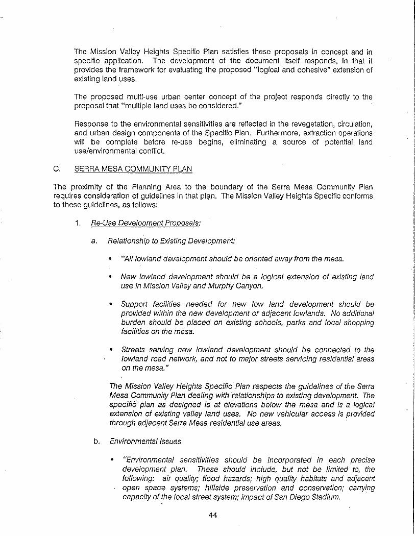
The Mission Valley Heights Specific Plan satisfies these proposals in concept and in specific app!ication. The development of the document itself responds, in that it provides the framework for evaluating the proposed "logical and cohesive" extension of existing land uses.
The proposed multi-use urban center concept of the project responds directly to the proposal that "multiple land uses be considered." ·
Response to the envi~onmental sensitivities are reflected in the revegetation, circulation, and urban design components of the Specific Plan. Furthermore, extraction operations will be complete before re-use begins, eliminating a source of potential land use/environmental conflict.
C. SERRA MESA COMMUNITY PLAN
The proximity of the Planning Area to the boundary of the Serra Mesa Community Plan requires consideration of guidelines in that plan. The Mission Valley Heights Specific conforms to these guidelines, as follows:
1. Re-!Jse Development Proposals:
a. Relationship to Existing Development:
• "All lowland development should be oriented away from the mesa.
• New lowland development should be a logical extension of existing land use in Mission Valley and Murphy Canyon.
• Support facilities needed for new low land development should be provided within the new development or adjacent lowlands. No additional burden should be placed on existing schools, parks and local shopping facilities on the mesa.
• Streets serving new lowland development should be connected to the lowland road network, and not to major streets servicing residential areas on the mesa."
The Mission Valley Heights Specific Plan respects the guidelines of the Serra Mesa Community Plan dealing with relationships to existing development. The
. specific plan as designed is at elevations below the mesa and is a logical extension of existing valley land uses. No new vehicular access is provided through adjacent Serra Mesa residential use areas.
b. Environmentallssues
• "Environmental sensitivities should be incorporated in each precise development plan. These should include, but not be limited to, the following: air quality; flood hazards; high quality habitats and adjacent open space systems; hillside preservation and conservation; carrying capacity of the local street system; impact of San Diego Stadium.
44
• I

• The use of Planned Residential Developments, Planned Commercial development and Manufacturing-Industrial permits should be encouraged to assure the highest quality of development and sensitive treatment of the environment."
The project areas within the boundaries of the Mission Valley Heights Specific Plan have been analyzed for impacts on area-wide traffic and air quality. Mitigation measures addressing these impacts have been identified and incorporated into the improvements associated with the proposed projects.
Additionally, the Planned Industrial Development and Planned Commercial Development permit process has been utilized for the development proposals.
In summary, the Mission Valley Heights Specific Plan provides a comprehensive framework for the overall development of the Planning Area. It represents the general guidelines and criteria for land use siting, circulation system redevelopment, and urban design that are necessary for the successful re-use of a major planning area. The proposals contained within the Specific Plan are in conformance with the intent and specifics of the Mission Valley Community Plan.
45
VII IMPLEMENTATION

VII. IMPLEMENTATION
Implementation of the Mission Valley Heights Specific Plan will be done according to city policies governing development within the "urbanized" area of the city, as defined by the Progress Guide and General Plan for the City of San Diego. The proposed methods of processing and review, as well as development phasing of the project~ are described below.
A. PROCESSING AND REVIEW
The Mission Valley Heights project was processed through city approvals for Tentative Map, Rezone, PCD and PID in April, 1982; the final map recorded in September, 1984. The Rezoning, Tentative Maps, and PCD for Friars-Mission Center are currently in process with the City. The PCD Amendment for Lots 1 and 3 of Mission Valley Heights is currently in process with the city.
The following implementation provisions apply to the proposed project sites.
1. Subdivision Map Act and Local Subdivision Ordinance
These laws, enforced by city staff, Planning Commission, and City Council provide for on-site improvements, enforcement of items dealing with public health, safety, and welfare, and provision of off-site public facilities directly related for the needs of the subdivision.
2. Rezoning Procedures
The rezone of Friars-Mission Center from R-1-5 to CA is currently in process with the City, (Application 83-0393). Additional rezoning is not anticipated.
3. Environmental Review
Under the terms of the California Environmental Quality Act (CEQA) and the City Code, all rezoning, subdivision, use permits, hillside permits and other discretionary acts required for implementation of this plan are subject to environmental review. Such review includes city staff analy- sis of the project and related impacts and a public review period cui- minating in public hearings.
4. Planned Commercial Development
Projects approved under a Planned Commercial Development (PCD) Permit may use the flexible but thorough implementation process outlined in the ordinance to achieve design flexibility while meeting the goals of this plan. This process shall be utilized for the commercial areas of Mission Valley Heights Specific Plan (FriarsMission Center PCD and Mission Valley Heights Lots 1 and 3 PCD Amendment).
46

5. Planned Industrial Development
The review process associated with Planned lnd!Jstrial Development processing provides the same opportunities as does the PCD procedure. The PID Process has been utilized for office and industrial projects within the planning area.
B. TRANSPORTATION IMPROVEMENTS
Transportation improvements will be required by Subdivision Review Board approval through the Subdivision Map and PCD approvals process. The following transportation related improvements will be required of the proposed projects.
This· specific plan does not in any way approve the engineering design details for the grade and alignment of the public streets or easements. The precise design parameters for public rights-of-way will be established with the approval of the tentative and/or final map(s) for this development. Any changes from those shown in this specific plan may require an amendment to the plan, either administrative or formal, depending upon the impacts on the plan, as determined by the Planning Director. The design parameters will be subject to the approval of the City Engineer and shall be in conformance with Council Policy 600-4.
i. Improvements to be provided by Friars-Mission Center Project:
a. Friars Road between SR-i63 and Mission Center Road:
Widening of Friars Road to provide a right turn lane to Frazee Road and four lanes of through traffic in both directions between the northbound on-ramp to SR-i 63 and the westbound on-ramp from Mission Center Road. Dual left-turn lanes will be provided from both directions on Friars to Frazee Road. The traffic signal at the intersection of Friars Road and Frazee will be modified. Pedestrian barriers will be provided to prohibit surface pedestrian crossing. The Friars Road west bound on-ramp from Mission Center Road will be signalized, and widened as determined by the City Engineer. An enhanced pedestrian under-crossing of Friars Road will be provided at Mission Center Road.
A median barrier will be constructed in Friars Road, with design subject to approval of the City Engineer.
With reference to the above improvements, the Friars Mission Center developers shall be responsible for all re-configuration and improvement north of the centerline of Friars Road.
b. Frazee Road Adjacent to Friars-Mission Center:
Developer will improve Frazee Road adjacent to the project to high volume collector design, with a 98' R.O.W., including dual left-turn lanes for southbound traffic.
47

c. Mission Center Road:
Developer will improve the west half of Mission Center Road to a six lane major road design standard, adjacent to the property and will provide a traffic signal at the Friars Mission Center driveway access. The minimum interim roadway width will be 72 feet.
d. Street Connection from Murray Canyon Road:
Developer will provide a street connection from Murray Canyon Road directly into the Friars Mission Center project; width will meet with City Engineering Department approval.
e·. In addition to the above, the developers of Friars Mission Center will conduct a post-development study of the project. The purpose of this study is to determine the ratio qf single destina- tion trips to multiple destination (linked) trips for this type of shopping center.
2. Improvements to be Provided by Lot 1 and 3 Projects
The developers of Mission Valley Heights Planned Industrial Develop- ment (PID) were required to provide improvements for the west one- half of Mission Center Road adjacent to that project including a signal at Mission Valley Road. The improvements adjacent to Lot 3 will be upgraded to a six lane major street design stangard with a minimum interim roadway width of 72 feet.
3. Related Off-Site Improvements Being Provided by Others
a. The following improvements will be provided by First San Diego River Improvement Project (FSDRIP):
Reconfiguration and improvements south of the centerline of Friars Road, as described in 1.a. above, including improving the Friars Road/SR-163 interchange by narrowing the median on Friars Road over SR-163, and providing dual left-turns for the eastbound to northbound movement. In addition, the northbound offramp will be widened and signalized at its terminys with Friars Aoad.
Widening of three ramps at Friars Road and Mission Center Road to accept discharge of dual left turn and right turn lanes.
4. Related Off-Site Community Wide Improvements
In order to mitigate traffic. impacts, the following measures shall be required of developers for Friars-Mission Center and Mission Valley Heights lots 1 and 3.
48

a. Stadium Way/Murray Ridge Extension.
The Stadium Way/Murray ridge extension to 1-805 will run pre- dominantly through land where a sand and gravel operation cur- rently exists. As stated in the Mission Valley Community Plan: "Provision of these streets will not be required until the sand and gravel operations have ceased and resource depletion has occurred. Additionally, the exact alignment will be determined by detailed engineering studies and by agreement between the city and the property owner at the time urban development takes place on these parcels." Developers will be required to sign an agree- ment to support an assess·ment district for these improvements at such time as these improvements are required.
b. Public Transit Assessment District Improvements:
Developers will be required to sign an agreement to support the formation of an_ assessment district to provide proposed public transit improvements, including Light. Rail Transit, as identified in the Mission Valley Community Plan.
c. Developers will be required to sign an agreement to support an assessment district for a pedestrian overcrossing of Friars Road at Frazee Road. This improvement may be considered as part of the p·ublic transit district improvements and will be included in the Mission Valley Financing Plan, with costs to be assessed to benefitting property owners through an assessment district. -~
Friars Mission Center developers shall be required to prepare a conceptual design study for a pedestrian overcrossing of Friars Road east of Frazee Road. Based upon this study, the developer shall be required to execute an offer of dedication for an ease- ment to accommodate the landing. This offer shall be revocable after 15 years and shall become null and void if, within that period, the City approves an alternate location for the over- crossing.
d. Hazard Center Road Under SR-163:
Developers will be required to sign an agreement to support an area-wide assessment district to widen Hazard Center Road under SR-163 to four lanes.
C. PUBLIC IMPROVEMENTS
Implementation of the required public utility improvements will be accom- plished through the tentative and final subdivision map review and approval process. These will include:
1. All public improvements associated with the Mission Valley Heights P.I.D. have been provided for through the approved final subdivision map and will be installed prior to issuance of occupancy permits. Refer to improvement plans, file no. 21345-D.
49

2. The following public improvements will be required through the tentative and final map process for Friars-Mission Center. 'These improvements will be guaranteed prior to issuance of building permits:
a. New 1 0" sewer will be constructed in Frazee Road along the project frontage, servicing the Friars-Mission Center project.
b. Public 12" water main will be constructed on-site from existing 12" water line in Frazee Road to the new 16" water line in Mission Center Road, previously guaranteed by Mission Valley Heights Subdivision.
c. Frontage improvements along all streets within the Specific Plan Area, including fire hydrants, street lights and related curb, gutter and sidew·alk will be constructed in conjunction with related street improvements.
The following parkway/sidewalk configurations will be provided:
Street
Friars Road Mission Center Road Frazee Road (Adjacent to
Shopping Center) All Other Streets (Mission
Valley Road, Metropolitan Road, Murray Canyon Road, Mission Valley Court)
D. PUBLIC FACILITIES
Landscaped Width
Sidewalk Adjacent to Width Curb
8' 5' 8' 4' 8' 4'
5' 0'
The developers of Mission Valley Heights Lots 1 and 3 and Friars-Mission Center shall agree to support area-wide assessment districts for public facilities, in accordance with the Mission Valley Community Plan.
E. DEVELOPMENT PHASING
Phasing for the Mission Valley Heights projects will be accomplished in accordance with the approved Mission Valley Heights PID & PCD permits, subdivision map, and market absorption conditions. Estimated time span of development is 1987 to 1997.
Friars-Mission Center will be accomplished substantially in one continuous phase in response to market absorption conditions. Development is anticipated between 1987 to 1990.
50

PLANNING TEAM
Planning Consultant:
Environmental Consultant:
Landscape Consultant:
Civil Consultant:
Traffic Consultant:
SGPA Planning and Architecture
RBR Associates
Kawasaki - Theilacker and Associates
George S. Nolte and Associates
Urban Systems Analysts

VIII APPENDIX .
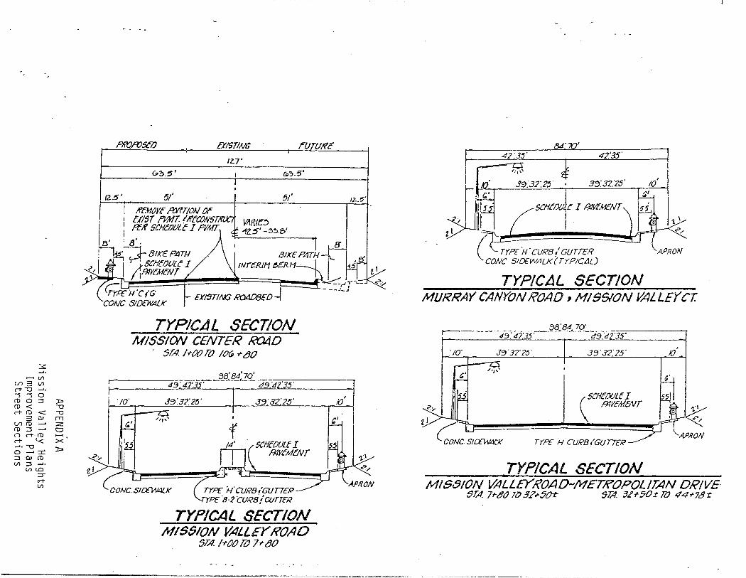
3:
...... Vl U1""Vl rt -o --'• '' 0 ro o ~ ::x;:. ro < -o rt-ro < -o
3 OJ rr1 u; ro __, z ro~_, o n rt-· ro ,...... M- '< >< ...... -o 0 __, :r:: ~OJ(D Vl ~ ......
Vl tO ::r rt Vl
)::;>
Pli'QA'JSCO EXI5T/.NG ~UTU!fc
IZ.7'
cP~.5' c..~-5·
/2.5' 51' 51'
KfJ1JYf A:Y?T!ON Or I C/IST ?YMT (lftC/JN5TtrU..I YARJE:;
1.· ; ':tf SCHCDlJLC I PJIAITA 42.5' -~~.e>' 8' . 8.
~·-=-:1_ BIKE PATH
II Tj SC'IfCOlJLC I /IR!Y!'M!'AIT
<,;,ce ii'CIG ~ EX~T!t\G ..m40BED~ CONC SIDEWALK
TYPICAL SECTION MISSION CENTER xt14D
STA. /rOO!{) lOG + 80
43."42' --·
TYPICAL SECTION M/55/0N VALLEY ROAD
STA. !rOO!{) 7--rtJO
1~.'5'
10'
&J.'iV' 42.'35"
39."32:?5' 0 3:Y32:zs·
SC!if'/){)Jc I !JiYEMENT
I
TYPICAL SECTION MURRAY CANYON ROAD, MIGSION VALLEY CT.
·;o·
&'
43.' 42·--·
3'3"3?'?~·
/,,, ...
3'3"32'25'
SCHE()(JLf I H1YcldENT
TYPE fi CURB /GU77ER
TYPICAL SECTION
JO.
MIS8!0N VALLEYROAD-METROPOL/J:4N DRIVE STA 7~"80 7lJ 3Z.-5()r SlA 3Z-t-50~ llJ 44+78~