Metadata Understanding the Value and Importance of Proper Data Documentation James Wilson James...
23
Metadata Understanding the Value and Importance of Proper Data Documentation James Wilson James Madison University John McGee, Ph.D. Adapted from: The Virginia Metadata Creators Workshop Funded through the FGDC Dan Widner & Lyle Hornbaker Virginia Geographic Information Netwo
-
Upload
barry-atkins -
Category
Documents
-
view
219 -
download
0
Transcript of Metadata Understanding the Value and Importance of Proper Data Documentation James Wilson James...

MetadataUnderstanding the Value and Importance of
Proper Data Documentation
James WilsonJames Madison University
John McGee, Ph.D.
Adapted from:The Virginia Metadata Creators Workshop
Funded through the FGDC
Dan Widner & Lyle HornbakerVirginia Geographic Information Network

Acknowledgements
This material from the Virginia Metadata Workshop was funded through a Federal Geographic Data Committee (FGDC) 2006 CAP grant.
We shamelessly borrowed, modified, and incorporated existing metadata training material from the FGDC, the USGS, and the NOAA Coastal Services Center.

Help me to educate YOU!
Remember, this is an INTERACTIVE workshop…PLEASE feel free to ask questions, provide comments, give suggestions, and offer real world experiences along the way (don’t wait until the end!!!)

Metadata Presentation Overview
• This presentation is just the first presentation in a day long workshop. The idea is to provide you with a “taste” of metadata.
• This overall metadata workshop is designed for individuals who are new to metadata.
• Developing metadata is a task that employers associated with entry level GIS technicians
• We’ll spend more time on Metadata next summer!

Workshop Topics
• Section 1: What is Metadata (this is what this presentation is about...)
• Section 2: The Value of Metadata and Tips for Institutionalizing Metadata
• Section 3: Metadata Standards• Section 4: Metadata Clearinghouses• Section 5: Writing Metadata
What is Metadata?
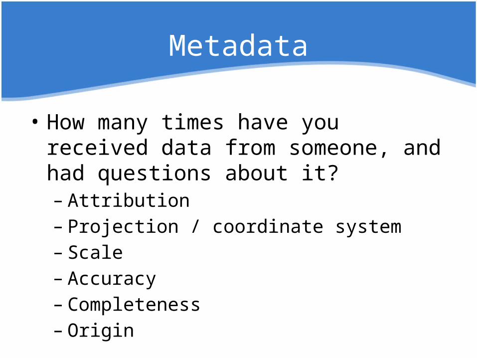
Metadata
• How many times have you received data from someone, and had questions about it?– Attribution– Projection / coordinate system– Scale– Accuracy– Completeness– Origin

Setting the Stage
GeospatialRefers to any data set tied
to a location on the Earth’s surface. The term “geospatial” refers to GIS, GPS, and remote sensing
products and services.
MetadataWhen referring to metadata, we assume the metadata is
well-written and fully developed.

Simply put, metadata is information
about your data.
What is Metadata?
Note: Metadata is not your actual spatial data…however, it serves as a reference for
your spatial data
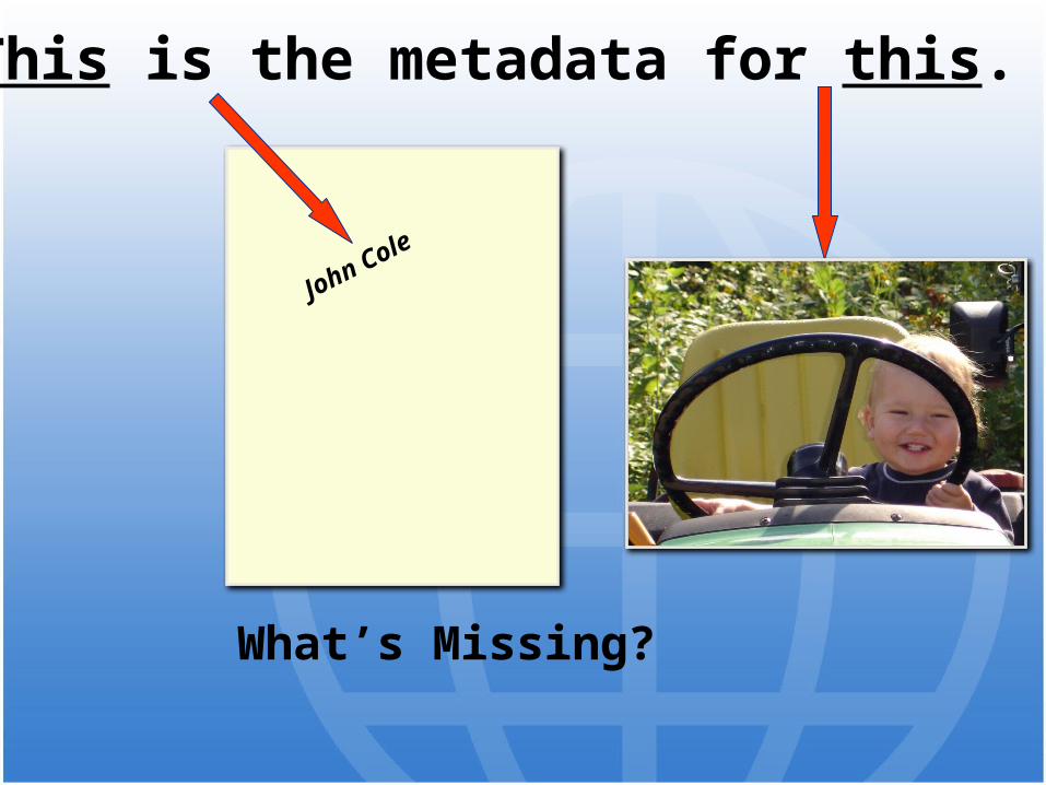
This is the metadata for this.
What’s Missing?
John Cole

This is the metadata for this.
What’s missing?
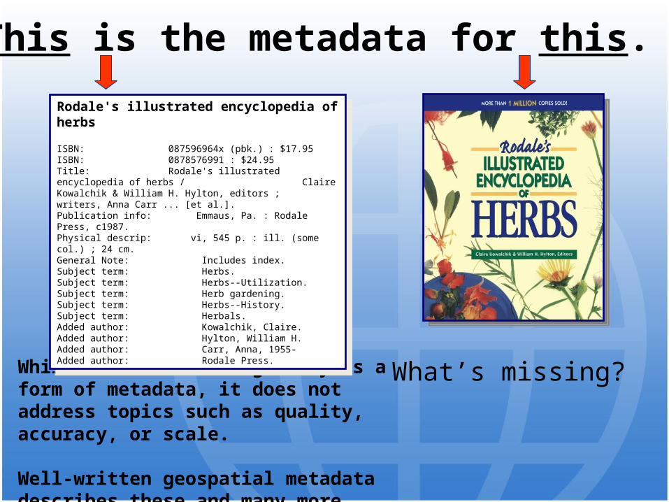
This is the metadata for this.
While the card-catalog entry is a form of metadata, it does not address topics such as quality, accuracy, or scale.
Well-written geospatial metadata describes these and many more aspects of the data.
Rodale's illustrated encyclopedia of herbs ISBN: 087596964x (pbk.) : $17.95ISBN: 0878576991 : $24.95Title: Rodale's illustrated encyclopedia of herbs /
Claire Kowalchik & William H. Hylton, editors ; writers, Anna Carr ... [et al.].
Publication info: Emmaus, Pa. : Rodale Press, c1987.Physical descrip: vi, 545 p. : ill. (some col.) ; 24 cm.General Note: Includes index.Subject term: Herbs.Subject term: Herbs--Utilization.Subject term: Herb gardening.Subject term: Herbs--History.Subject term: Herbals.Added author: Kowalchik, Claire.Added author: Hylton, William H.Added author: Carr, Anna, 1955-Added author: Rodale Press.
What’s missing?
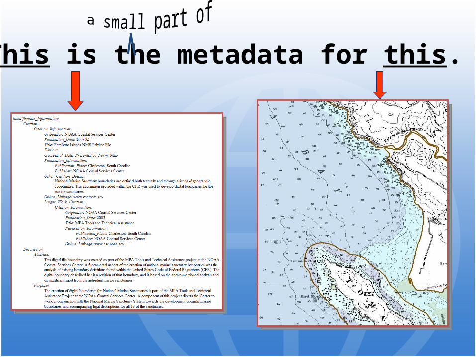
This is the metadata for this.

Metadata is not “the spatial data”, but it is
a vital component
of the spatial data…
What is NOT metadata…

What is NOT metadata…
• Metadata is not “sexy”
• But remember that there are many critical things in life that are not “sexy” (i.e. seat belts, life jackets, fire escapes, parachutes, archived data, etc.)

Metadata is not “BIG data”
(that would be megadata…!)
What is NOT metadata…

Properly documented
data provides vital information
to interested parties.
A Component of Data
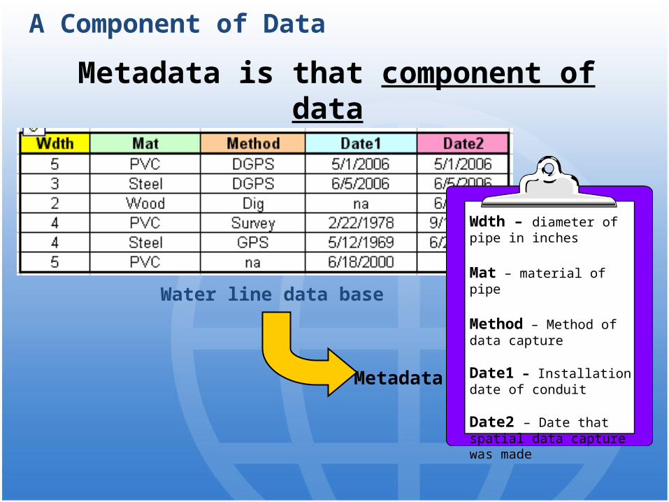
Metadata is that component of data which describes it.
Water line data base
A Component of Data
Metadata
Wdth – diameter of pipe in inches
Mat – material of pipe
Method – Method of data capture
Date1 – Installation date of conduit
Date2 – Date that spatial data capture was made

Metadata describes…
CONTENT
CONDITION
QUALITY
Characteristics of the data
Characteristics of the data
A Component of Data
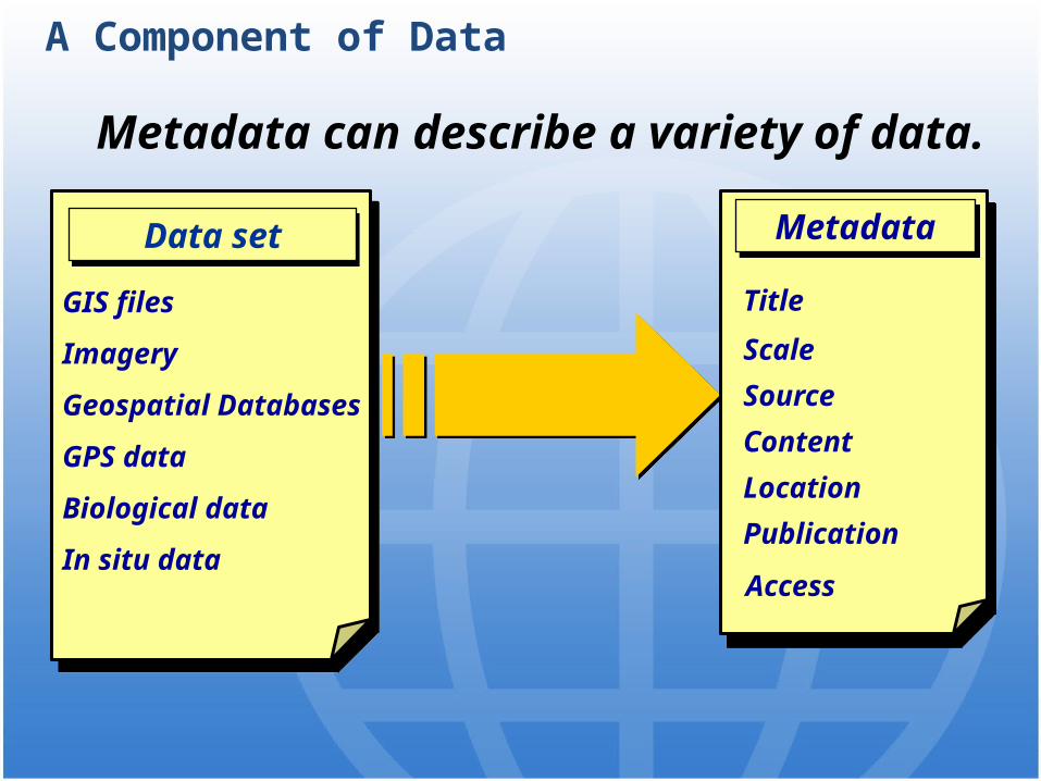
Metadata can describe a variety of data.
Title
Scale
Source
Content
Location
Publication
Access
Title
Scale
Source
Content
Location
Publication
Access
MetadataMetadata
A Component of Data
GIS files
Imagery
Geospatial Databases
GPS data
Biological data
In situ data
GIS files
Imagery
Geospatial Databases
GPS data
Biological data
In situ data
Data setData set

A Component of Data
Because metadata provides vital information about a dataset, it
should never be viewed or treated as a separate entity.
Metadata
Non-spatial orattributes
SpatialTake Home Message
Metadata is a critical and
integral component of any complete
data set.
Metadata is a critical and
integral component of any complete
data set.
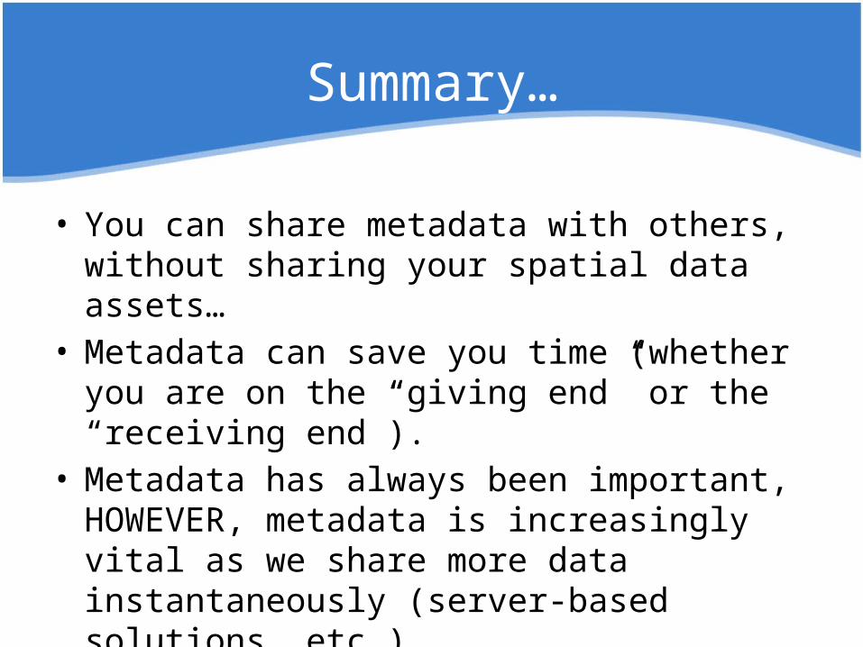
Summary…
• You can share metadata with others, without sharing your spatial data assets…
• Metadata can save you time (whether you are on the “giving end” or the “receiving end”).
• Metadata has always been important, HOWEVER, metadata is increasingly vital as we share more data instantaneously (server-based solutions, etc.)

Exercise
Getting to Know MetadataCheck your notebook!
Choose a metadata file...
Review the file and answer some basic (but important) questions!
Gain some initial familiarity with a real metadata file…