MARYLAND Safe Routes to School · Maryland Safe Routes to School Guidebook ... More parents driving...
57
Safe Routes to School A GUIDE FOR PARENTS AND COMMUNITIES Maryland Bicycle and Pedestrian Advisory Committee Maryland Department of Transportation MARYLAND Safe Routes to School GUIDEBOOK
Transcript of MARYLAND Safe Routes to School · Maryland Safe Routes to School Guidebook ... More parents driving...
Safe Routes to SchoolA G U I D E F O R P A R E N T S A N D C O M M U N I T I E S
Maryland Bicycle and Pedestrian Advisory Committee Maryland Department of Transportation
M A R Y L A N D
Safe Routes to SchoolG U I D E B O O K
Acknowledgments
Thanks to the Maryland Bicycle and Pedestrian
Advisory Committee and to the parents, grandpar-
ents and administration at Montebello Elementary
School in the City of Baltimore and Rolling Terrace
Elementary School in Montgomery County. The hard
work and enthusiasm of these groups helped make
the SR2S pilot project and guidebook a success.
Maryland Safe Routes to School Guidebook ———————————————————————— i

ii ———————————————————————— Maryland Safe Routes to School Guidebook

Letter from the Governor
Maryland Safe Routes to School Guidebook ———————————————————————— iii
Dear Parent or Community Member,
Thank you for taking the initiative to provide students
in your community with a safe journey to school! By leading
a Safe Routes to School effort, you will join others across
Maryland who are working to improve the health and safety
of our children. Maryland’s Safe Routes to School Guidebook
was developed to help you identify resources and build
community support for your project.
This Guidebook is the result of the hard work and dedication
of an outstanding group of citizens—the Maryland Bicycle
and Pedestrian Advisory Committee. These individuals have
spent many hours working to craft this guidance, and their efforts are greatly appreciated.
Inside this guide you will find all the tools you need to launch a Safe Routes to School project
in your community. It contains important facts about child traffic safety issues, and the growing
health problems associated with childhood inactivity. It includes ideas for making the journey
to school safer, such as pedestrian and bicycle safety education lessons, sidewalk and crossing
improvements, and ways to reduce traffic speeds in your neighborhood. The guide will walk
you through the process of forming a Safe Routes to School Team, setting up a kick-off meeting,
assessing existing conditions around your school, gathering input from the community, and
getting your Safe Routes Plan implemented.
So go ahead and get started. And find other community members who can help with your Safe
Routes project. Your efforts will help to make all kids in your neighborhood safer and healthier!
Sincerely,
Robert L. Ehrlich, Jr.
Governor

iv ———————————————————————— Maryland Safe Routes to School Guidebook

Table of Contents
1: INTRODUCTION . . . . . . . . . . . . . . . . . . . . . . . . . . . . . . . . . . . . . . . . . . . . . . . . . . . . . . . . . . . . . . . . . . . . . . . . . . . . . . . . . 1
Welcome to the Maryland Safe Routes to School Program . . . . . . . . . . . . . . . . . . . . . . . . . . . . . . . . . . . . . . . . . . . 1
The Problem . . . . . . . . . . . . . . . . . . . . . . . . . . . . . . . . . . . . . . . . . . . . . . . . . . . . . . . . . . . . . . . . . . . . . . . . . . . . . . . . . . . . . 1
What is the Safe Routes Program? . . . . . . . . . . . . . . . . . . . . . . . . . . . . . . . . . . . . . . . . . . . . . . . . . . . . . . . . . . . . . . . . . 2
Why Have a Safe Routes Program? . . . . . . . . . . . . . . . . . . . . . . . . . . . . . . . . . . . . . . . . . . . . . . . . . . . . . . . . . . . . . . . . . 2
Who Prepares the Safe Routes Plan? . . . . . . . . . . . . . . . . . . . . . . . . . . . . . . . . . . . . . . . . . . . . . . . . . . . . . . . . . . . . . . . . 4
Contents of this Guide . . . . . . . . . . . . . . . . . . . . . . . . . . . . . . . . . . . . . . . . . . . . . . . . . . . . . . . . . . . . . . . . . . . . . . . . . . . . 4
2: GETTING STARTED—SETTING UP THE PROJECT . . . . . . . . . . . . . . . . . . . . . . . . . . . . . . . . . . . . . . . . . . . . . . . . . . 5
Step 1: Form a Safe Routes to School Team . . . . . . . . . . . . . . . . . . . . . . . . . . . . . . . . . . . . . . . . . . . . . . . . . . . . . . . . 5
Step 2: Hold a Kick-Off Meeting . . . . . . . . . . . . . . . . . . . . . . . . . . . . . . . . . . . . . . . . . . . . . . . . . . . . . . . . . . . . . . . . . . . 7
3: MAPPING EXISTING CONDITIONS . . . . . . . . . . . . . . . . . . . . . . . . . . . . . . . . . . . . . . . . . . . . . . . . . . . . . . . . . . . . . . . . 9
Step 1: Prepare the Base Maps . . . . . . . . . . . . . . . . . . . . . . . . . . . . . . . . . . . . . . . . . . . . . . . . . . . . . . . . . . . . . . . . . . . . 9
Step 2: Research Planned Roadway Improvements . . . . . . . . . . . . . . . . . . . . . . . . . . . . . . . . . . . . . . . . . . . . . . . . . 10
Step 3: Conduct a Walking/Biking Audit . . . . . . . . . . . . . . . . . . . . . . . . . . . . . . . . . . . . . . . . . . . . . . . . . . . . . . . . . . 12
School Site Assessment Form . . . . . . . . . . . . . . . . . . . . . . . . . . . . . . . . . . . . . . . . . . . . . . . . . . . . . . . . . . . . . . . . . . . . . 12
Neighborhood Assessment Form . . . . . . . . . . . . . . . . . . . . . . . . . . . . . . . . . . . . . . . . . . . . . . . . . . . . . . . . . . . . . . . . . 13
4: GETTING INPUT FROM PARENTS, TEACHERS, ADMINISTRATORS, AND STUDENTS . . . . . . . . . . . . . . . . 15
Step 1: Discuss the Project with Teachers . . . . . . . . . . . . . . . . . . . . . . . . . . . . . . . . . . . . . . . . . . . . . . . . . . . . . . . . . 15
Step 2: Survey the Students . . . . . . . . . . . . . . . . . . . . . . . . . . . . . . . . . . . . . . . . . . . . . . . . . . . . . . . . . . . . . . . . . . . . . . 15
Step 3: Survey the Parents . . . . . . . . . . . . . . . . . . . . . . . . . . . . . . . . . . . . . . . . . . . . . . . . . . . . . . . . . . . . . . . . . . . . . . . 17
Survey Data Reduction Spreadsheet (diskette) . . . . . . . . . . . . . . . . . . . . . . . . . . . . . . . . . . . . . . . . . . . . . . . . . . . . . 00
5: PULLING IT ALL TOGETHER—THE SAFE ROUTES PLAN . . . . . . . . . . . . . . . . . . . . . . . . . . . . . . . . . . . . . . . . . . . 19
6: FINDING THE FUNDING! . . . . . . . . . . . . . . . . . . . . . . . . . . . . . . . . . . . . . . . . . . . . . . . . . . . . . . . . . . . . . . . . . . . . . . . . 25
7: SOME FINAL TIPS FOR SUCCESS . . . . . . . . . . . . . . . . . . . . . . . . . . . . . . . . . . . . . . . . . . . . . . . . . . . . . . . . . . . . . . . . . 27
Example Documents
Example SR2S Team Invitation . . . . . . . . . . . . . . . . . . . . . . . . . . . . . . . . . . . . . . . . . . . . . . . . . . . . . . . . . . . . . . . . . 28
School Site Audit Form . . . . . . . . . . . . . . . . . . . . . . . . . . . . . . . . . . . . . . . . . . . . . . . . . . . . . . . . . . . . . . . . . . . . . . . 29
Neighborhood Site Audit Form . . . . . . . . . . . . . . . . . . . . . . . . . . . . . . . . . . . . . . . . . . . . . . . . . . . . . . . . . . . . . . . . 33
SR2S Parent Survey . . . . . . . . . . . . . . . . . . . . . . . . . . . . . . . . . . . . . . . . . . . . . . . . . . . . . . . . . . . . . . . . . . . . . . . . . . . 34
SR2S Travel Survey . . . . . . . . . . . . . . . . . . . . . . . . . . . . . . . . . . . . . . . . . . . . . . . . . . . . . . . . . . . . . . . . . . . . . . . . . . . 38
Maryland Safe Routes to School Guidebook ———————————————————————— v
Appendices . . . . . . . . . . . . . . . . . . . . . . . . . . . . . . . . . . . . . . . . . . . . . . . . . . . . . . . . . . . . . . . . . . . . . . . . . . . . . . . . . . . . . . . . . . . . 39
Contacts by County . . . . . . . . . . . . . . . . . . . . . . . . . . . . . . . . . . . . . . . . . . . . . . . . . . . . . . . . . . . . . . . . . . . . . . . . . . 39
State Contacts . . . . . . . . . . . . . . . . . . . . . . . . . . . . . . . . . . . . . . . . . . . . . . . . . . . . . . . . . . . . . . . . . . . . . . . . . . . . . . . 43
Physical Solutions—Gallery of Solutions . . . . . . . . . . . . . . . . . . . . . . . . . . . . . . . . . . . . . . . . . . . . . . . . . . . . . . . . 43
Cost Estimates . . . . . . . . . . . . . . . . . . . . . . . . . . . . . . . . . . . . . . . . . . . . . . . . . . . . . . . . . . . . . . . . . . . . . . . . . . . . . . . 45
Education and Encouragement Resources . . . . . . . . . . . . . . . . . . . . . . . . . . . . . . . . . . . . . . . . . . . . . . . . . . . . . . 46
Funding Sources . . . . . . . . . . . . . . . . . . . . . . . . . . . . . . . . . . . . . . . . . . . . . . . . . . . . . . . . . . . . . . . . . . . . . . . . . . . . . . 27
vi ———————————————————————— Maryland Safe Routes to School Guidebook
SECTION 1
Introduction
Maryland Safe Routes to School Guidebook ———————————————————————— 1
WELCOME TO THE MARYLAND SAFE ROUTES TO SCHOOL PROGRAM!Welcome and congratulations! You have joined a growing
number of citizens who are concerned about the safety of
children who walk or bicycle to school, and who have decid-
ed to work together to improve conditions. The materials in
this guide will enable you to establish a successful and ongo-
ing Safe Routes to School Program at your school—and to
ultimately enhance the safety and health of your community
for years to come.
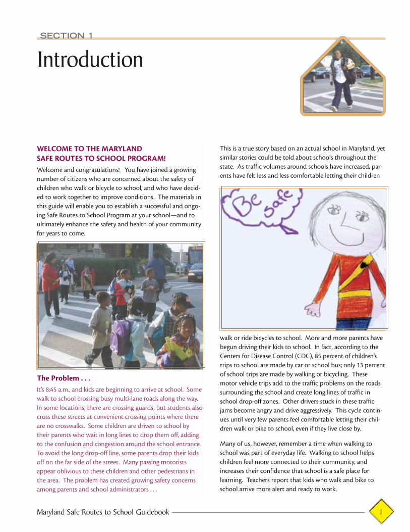
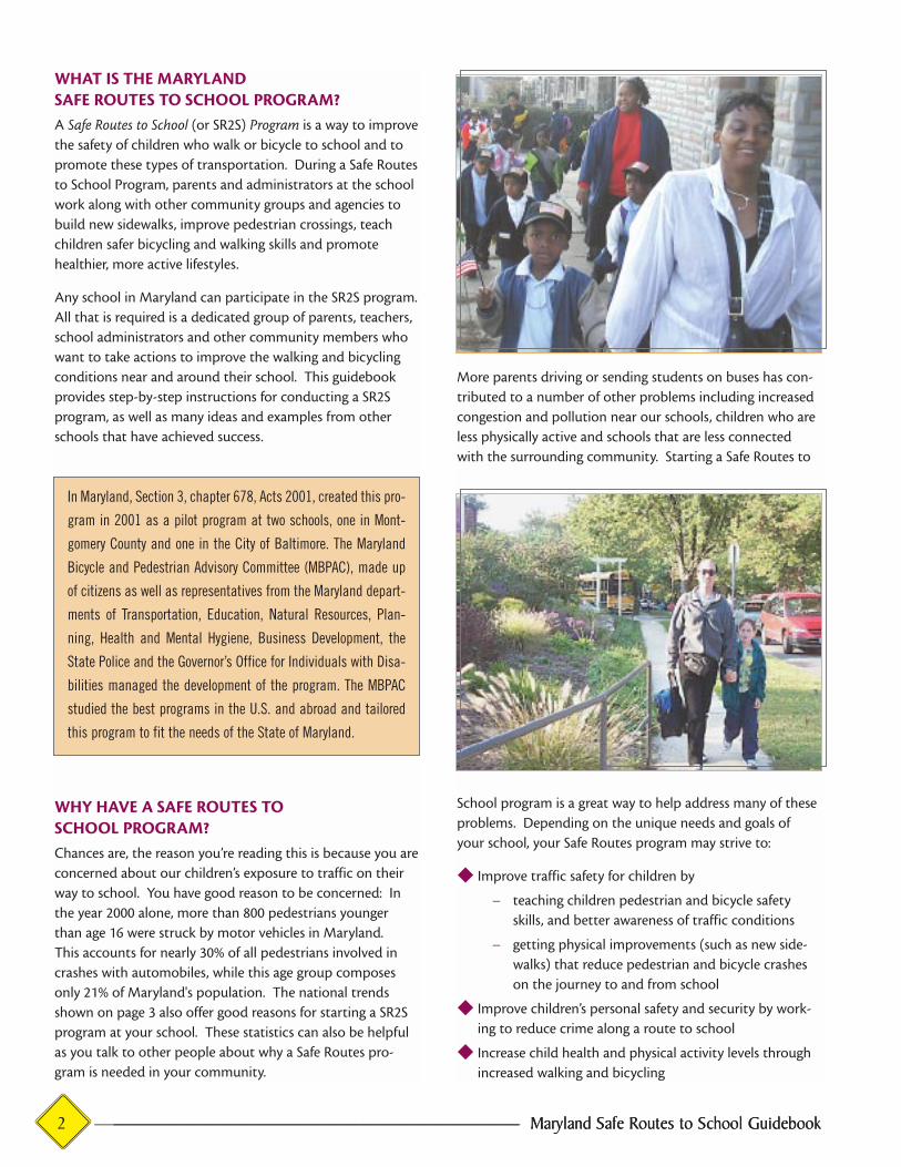
The Problem . . . It’s 8:45 a.m., and kids are beginning to arrive at school. Some
walk to school crossing busy multi-lane roads along the way.
In some locations, there are crossing guards, but students also
cross these streets at convenient crossing points where there
are no crosswalks. Some children are driven to school by
their parents who wait in long lines to drop them off, adding
to the confusion and congestion around the school entrance.
To avoid the long drop-off line, some parents drop their kids
off on the far side of the street. Many passing motorists
appear oblivious to these children and other pedestrians in
the area. The problem has created growing safety concerns
among parents and school administrators . . .
This is a true story based on an actual school in Maryland, yet
similar stories could be told about schools throughout the
state. As traffic volumes around schools have increased, par-
ents have felt less and less comfortable letting their children
walk or ride bicycles to school. More and more parents have
begun driving their kids to school. In fact, according to the
Centers for Disease Control (CDC), 85 percent of children’s
trips to school are made by car or school bus; only 13 percent
of school trips are made by walking or bicycling. These
motor vehicle trips add to the traffic problems on the roads
surrounding the school and create long lines of traffic in
school drop-off zones. Other drivers stuck in these traffic
jams become angry and drive aggressively. This cycle contin-
ues until very few parents feel comfortable letting their chil-
dren walk or bike to school, even if they live close by.
Many of us, however, remember a time when walking to
school was part of everyday life. Walking to school helps
children feel more connected to their community, and
increases their confidence that school is a safe place for
learning. Teachers report that kids who walk and bike to
school arrive more alert and ready to work.
2 ——————————————————————— Maryland Safe Routes to School Guidebook2 ———————————————————————— Maryland Safe Routes to School Guidebook
WHAT IS THE MARYLAND SAFE ROUTES TO SCHOOL PROGRAM?A Safe Routes to School (or SR2S) Program is a way to improve
the safety of children who walk or bicycle to school and to
promote these types of transportation. During a Safe Routes
to School Program, parents and administrators at the school
work along with other community groups and agencies to
build new sidewalks, improve pedestrian crossings, teach
children safer bicycling and walking skills and promote
healthier, more active lifestyles.
Any school in Maryland can participate in the SR2S program.
All that is required is a dedicated group of parents, teachers,
school administrators and other community members who
want to take actions to improve the walking and bicycling
conditions near and around their school. This guidebook
provides step-by-step instructions for conducting a SR2S
program, as well as many ideas and examples from other
schools that have achieved success.
WHY HAVE A SAFE ROUTES TO SCHOOL PROGRAM?Chances are, the reason you’re reading this is because you are
concerned about our children’s exposure to traffic on their
way to school. You have good reason to be concerned: In
the year 2000 alone, more than 800 pedestrians younger
than age 16 were struck by motor vehicles in Maryland.
This accounts for nearly 30% of all pedestrians involved in
crashes with automobiles, while this age group composes
only 21% of Maryland's population. The national trends
shown on page 3 also offer good reasons for starting a SR2S
program at your school. These statistics can also be helpful
as you talk to other people about why a Safe Routes pro-
gram is needed in your community.
More parents driving or sending students on buses has con-
tributed to a number of other problems including increased
congestion and pollution near our schools, children who are
less physically active and schools that are less connected
with the surrounding community. Starting a Safe Routes to
School program is a great way to help address many of these
problems. Depending on the unique needs and goals of
your school, your Safe Routes program may strive to:
◆ Improve traffic safety for children by
— teaching children pedestrian and bicycle safety
skills, and better awareness of traffic conditions
— getting physical improvements (such as new side-
walks) that reduce pedestrian and bicycle crashes
on the journey to and from school
◆ Improve children’s personal safety and security by work-
ing to reduce crime along a route to school
◆ Increase child health and physical activity levels through
increased walking and bicycling
In Maryland, Section 3, chapter 678, Acts 2001, created this pro-
gram in 2001 as a pilot program at two schools, one in Mont-
gomery County and one in the City of Baltimore. The Maryland
Bicycle and Pedestrian Advisory Committee (MBPAC), made up
of citizens as well as representatives from the Maryland depart-
ments of Transportation, Education, Natural Resources, Plan-
ning, Health and Mental Hygiene, Business Development, the
State Police and the Governor’s Office for Individuals with Disa-
bilities managed the development of the program. The MBPAC
studied the best programs in the U.S. and abroad and tailored
this program to fit the needs of the State of Maryland.

Maryland Safe Routes to School Guidebook ———————————————————————— 3Maryland Safe Routes to School Guidebook ——————————————————————— 3
Child Crash Facts
◆ In the United States, 484 children under age 16 were
killed as pedestrians in traffic crashes in 2001.
◆ In Maryland, more than 800 children younger than age 16
were hit by motor vehicles in 2000.
School Trip Facts
◆ An estimated 20 to 25 percent of rush hour traffic on
local roadways is school traffic.
◆ Nationally, 85 percent of children’s trips to school are
made by car or school bus; only 13 percent of school trips
are made by walking or bicycling.
Child Health and Fitness Facts
◆ Approximately 13 percent of children and adolescents in
the United States are now seriously overweight—more
that twice the number of children considered obese in the
early 1980s. Overweight children are more likely to devel-
op cardiovascular disease (Maryland’s number one killer),
diabetes and other health related problems.
◆ At least half of all youth do not participate in physical
activity that promotes long-term health.
◆ Asthma is on the rise among children. Nationally, age-
specific death rates from the disease increased 67 percent
between 1979 and 1998. Vehicle emissions, especially
diesel exhaust, are a known contributor to this disease.
A Safe Routes Program Can Help
◆ In Marin County, California where a Safe Routes program
has been in place for two years, participating schools
have seen great results:
— Children walking to school went from 14% to 23%
— Children biking to school doubled from 7% to 15%
— Children carpooling increased from 11% to 21%
— Children arriving alone in a car shrank from 62% to 38%
SOURCES: NATIONAL HIGHWAY TRAFFIC SAFETY ADMINISTRATION; MARYLAND CRASH OUTCOME DATA EVALUATION SYSTEM;SURFACE TRANSPORTATION POLICY PROJECT; U.S. DEPARTMENT OF HEALTH AND HUMAN SERVICES; CENTERS FOR DISEASE CONTROL AND PREVENTION; AMERICAN HEART ASSOCIATION; AMERICAN LUNG ASSOCIATION; AMERICAN JOURNAL OF PUBLICHEALTH, SEPTEMBER 2003.
SO
UR
CE
: S
UR
FAC
E T
RA
NS
PO
RTA
TIO
N P
OLI
CY
PR
OJE
CT
SO
UR
CE
: A
ME
RIC
AN
LU
NG
AS
SO
CIA
TIO
N

4 ———————————————————————— Maryland Safe Routes to School Guidebook4 ——————————————————————— Maryland Safe Routes to School Guidebook
◆ Contribute to a reduction in traffic congestion and
improved air quality
◆ Develop a stronger relationship between children and
their neighborhood community, or all of the above.
◆ Teaching children to become more independent and self-
reliant
◆ Enabling parents to become involved in making their
communities safer.
WHO PREPARES THE SAFE ROUTES PLAN?You do. Although this guide was developed by the state, the
Safe Routes to School Program is usually a local, school- and
community-based initiative. This guidebook explains how to
get your project underway, and gives practical advice based on
successful programs in Maryland and other parts of the U.S.
Anyone can develop the Safe Routes Plan, but to be success-
ful, you’ll want to involve a range of people along the way
including parents, neighborhood organizations, the local
PTA, a group of teachers, a Community Traffic Safety
Program (CTSP) representative, local police, transportation
planners and other interested businesses or organizations.
The Safe Routes Plan is usually developed by a mix of people
from various groups working together as a committee.
There is no set formula. The key is to attract and retain ded-
icated, motivated individuals who will work together to
improve the safety of the school journey.
CONTENTS OF THIS GUIDEThis guide explains how to establish a Safe Routes to School
Program. It also provides the tools and resources necessary
for the successful implementation of that Program. The
guide is fairly comprehensive. The process it describes may
be short, or it may be long depending on the goals you
establish and how much work is needed to achieve them.
The tools contained in this guide include:
◆ surveys,
◆ a diskette containing a program to evaluate the surveys,
◆ ideas for ways to educate and encourage safer walking
and bicycling,
◆ descriptions of different types of physical improvements
that may help solve the problems at your school,
◆ enforcement ideas,
◆ resources and potential funding sources for the improve-
ments and programs you plan to make as part of your
SR2S program.
What Does “Safe” Mean To Your Community?
There are different ways to define the word safe. In some
communities, it means keeping kids safe from being hit by a
car on the way to school. In others, it might mean keeping
kids safe from crime such as drugs and violence. Or it might
mean both. By starting a Safe Routes Program, you can find
out what the most pressing safety problems are in your
school and begin working as a community to address them.
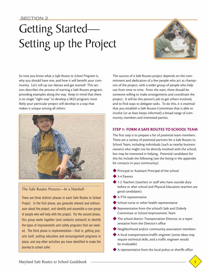
SECTION 2
Getting Started—Setting up the Project
So now you know what a Safe Routes to School Program is,
why you should have one, and how it will benefit your com-
munity. Let’s roll up our sleeves and get started! This sec-
tion describes the process of starting a Safe Routes program,
providing examples along the way. Keep in mind that there
is no single “right way” to develop a SR2S program; most
likely your particular project will develop in a way that
makes it unique among all others.
The success of a Safe Routes project depends on the com-
mitment and dedication of a few people who act as champi-
ons of the project, with a wider group of people who help
out from time to time. From the start, there should be
someone willing to make arrangements and coordinate the
project. It will be this person’s job to get others involved,
and to find ways to delegate tasks. To do this, it is essential
that you establish a Safe Routes Committee that is able to
involve (or at least keeps informed) a broad range of com-
munity members and interested parties.
STEP 1: FORM A SAFE ROUTES TO SCHOOL TEAMThe first step is to prepare a list of potential team members.
There are a variety of potential partners for a Safe Routes to
School Team, including individuals (such as nearby business
owners) who might not be directly involved with the school,
but may be interested in helping. Potential candidates for
this list include the following (see the listing in the appendix
for contacts in your community):
◆ Principal or Assistant Principal of the school
◆ 3-4 Parents
◆ 1-2 Teachers (teachers or staff who have outside duty
before or after school and Physical Education teachers are
good candidates)
◆ A PTA representative
◆ School nurse or other health representative
◆ Representative from the school’s Safe and Orderly
Committee or School Improvement Team
◆ The school district Transportation Director, or a repre-
sentative from the Director’s office
◆ Neighborhood and/or community association members
◆ A local transportation/traffic engineer (some ideas may
require technical skills, and a traffic engineer would
be invaluable)
◆ A representative from the local police or sheriffs office
Maryland Safe Routes to School Guidebook ——————————————————————— 5
The Safe Routes Process—In a Nutshell
There are three distinct phases in each Safe Routes to School
Project. In the first phase, you generate interest and enthusi-
asm about the project, and identify and assemble a core group
of people who will help with the project. For the second phase,
this group works together (and conducts outreach) to identify
the types of improvements and safety programs that are need-
ed. The third phase is implementation—that is, getting proj-
ects built, putting education and encouragement programs in
place, and any other activities you have identified to make the
journey to school safer.
◆ A school crossing guard
◆ Representatives from the regional and/or local roadway
departments, for example:
— Local or State bicycle and/or pedestrian
transportation planner
— County or City Transportation Department staff,
or Public Works Department representative
◆ Community Traffic Safety Program (CTSP) representative
◆ Bicycle/Pedestrian Advisory Committee representatives
◆ Local walking or bike club representatives
◆ A representative from your local governments planning
agency’s Technical Advisory Committee (TAC) and/or
Citizen Advisory Committee (CAC)
◆ Children from your school—children who are already
walking to school often have very good reasons for taking
a particular route to school. By listening carefully to their
ideas and opinions, the Safe Routes Team can gain
valuable insights.
This is just a sample list. There may be other individuals or
organizations that you’d like to invite to serve on your SR2S
Team. Chances are, you’ve already been in contact with one
or more people about this idea, and they should be the first
people on your list. Once you’ve put the list together
(names, phone numbers, mailing and e-mail addresses),
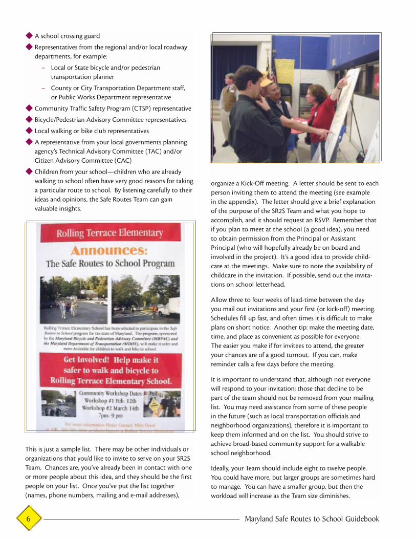
organize a Kick-Off meeting. A letter should be sent to each
person inviting them to attend the meeting (see example
in the appendix). The letter should give a brief explanation
of the purpose of the SR2S Team and what you hope to
accomplish, and it should request an RSVP. Remember that
if you plan to meet at the school (a good idea), you need
to obtain permission from the Principal or Assistant
Principal (who will hopefully already be on board and
involved in the project). It’s a good idea to provide child-
care at the meetings. Make sure to note the availability of
childcare in the invitation. If possible, send out the invita-
tions on school letterhead.
Allow three to four weeks of lead-time between the day
you mail out invitations and your first (or kick-off) meeting.
Schedules fill up fast, and often times it is difficult to make
plans on short notice. Another tip: make the meeting date,
time, and place as convenient as possible for everyone.
The easier you make if for invitees to attend, the greater
your chances are of a good turnout. If you can, make
reminder calls a few days before the meeting.
It is important to understand that, although not everyone
will respond to your invitation; those that decline to be
part of the team should not be removed from your mailing
list. You may need assistance from some of these people
in the future (such as local transportation officials and
neighborhood organizations), therefore it is important to
keep them informed and on the list. You should strive to
achieve broad-based community support for a walkable
school neighborhood.
Ideally, your Team should include eight to twelve people.
You could have more, but larger groups are sometimes hard
to manage. You can have a smaller group, but then the
workload will increase as the Team size diminishes.
6 ———————————————————————— Maryland Safe Routes to School Guidebook
STEP 2: MANAGING THE KICK-OFF MEETINGThe kick-off meeting is a very important event—it will set
the tone, pace and level of enthusiasm for the project. You
will want to be well prepared for this meeting. At the meet-
ing you should:
◆ Set the scene—talk about the school’s traffic problems
and the difficulties children face in making the school
journey. Explain the purpose of this project.
◆ Mention national trends (see statistics in Section 1). Talk
about the growth in traffic, the decline in walking and
bicycling among youth, and the increasing concern for
children’s health.
◆ Explain how the Safe Routes Project will work and
describe the likely benefits for children, parents, staff and
the community. You may want to share some items from
this Guidebook as handouts—or to provide entire copies
of the guide.
◆ Give participants an opportunity to talk about their safe-
ty concerns—keep a running list of problems and ideas
for solutions.
◆ Summarize the discussion by making a list of the goals for
the project. Goal statements can be simple and straight-
forward, for example: increase traffic safety for students
walking to school; alter unsafe pedestrian behavior
among students; educate parents who drop off kids;
increase security near the school; etc.
◆ Develop a project timetable.
◆ Explain what the next steps will be. Assign responsibili-
ties (or ask for volunteers!) If you have a large group, you
may decide to set up subcommittees. Regardless, there
are certain tasks that will need to be done. Examples of
these tasks are provided below (greater details are given
in the following chapters):
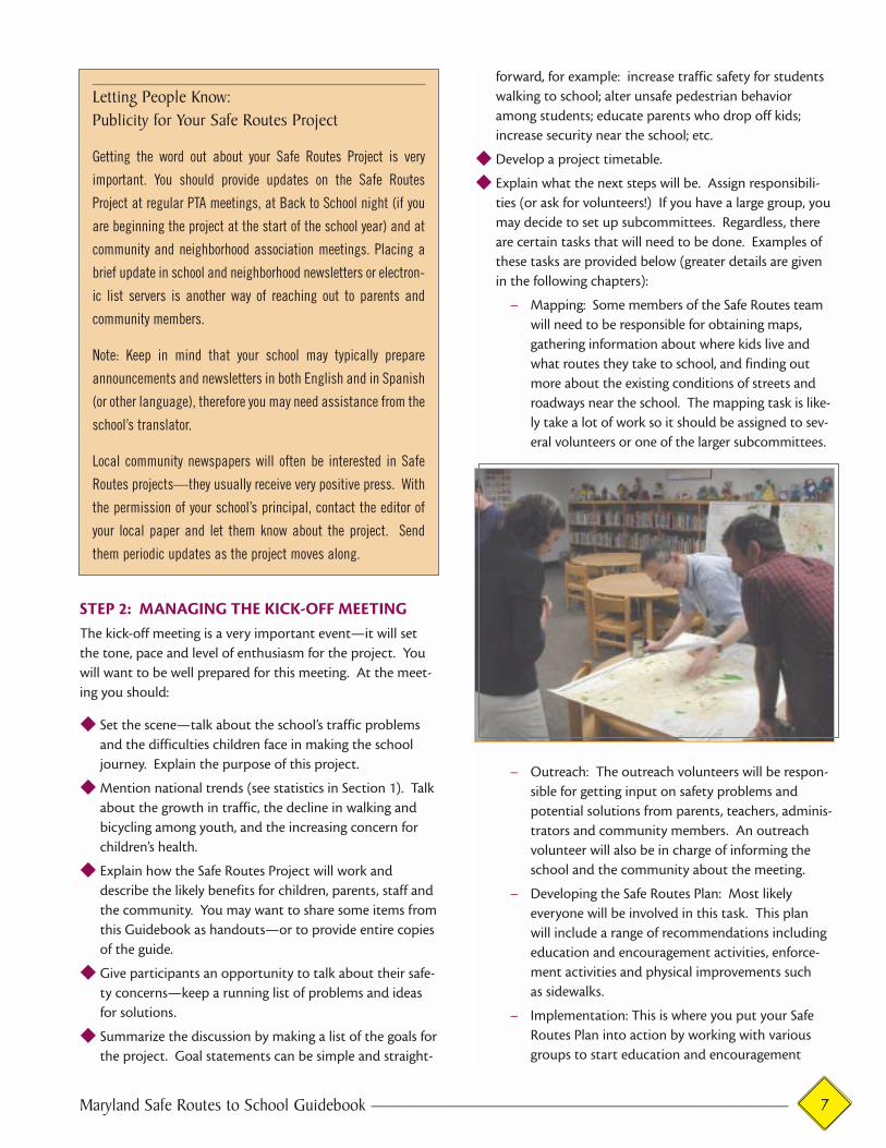
— Mapping: Some members of the Safe Routes team
will need to be responsible for obtaining maps,
gathering information about where kids live and
what routes they take to school, and finding out
more about the existing conditions of streets and
roadways near the school. The mapping task is like-
ly take a lot of work so it should be assigned to sev-
eral volunteers or one of the larger subcommittees.
— Outreach: The outreach volunteers will be respon-
sible for getting input on safety problems and
potential solutions from parents, teachers, adminis-
trators and community members. An outreach
volunteer will also be in charge of informing the
school and the community about the meeting.
— Developing the Safe Routes Plan: Most likely
everyone will be involved in this task. This plan
will include a range of recommendations including
education and encouragement activities, enforce-
ment activities and physical improvements such
as sidewalks.
— Implementation: This is where you put your Safe
Routes Plan into action by working with various
groups to start education and encouragement
Maryland Safe Routes to School Guidebook ———————————————————————— 7
Letting People Know:Publicity for Your Safe Routes Project
Getting the word out about your Safe Routes Project is very
important. You should provide updates on the Safe Routes
Project at regular PTA meetings, at Back to School night (if you
are beginning the project at the start of the school year) and at
community and neighborhood association meetings. Placing a
brief update in school and neighborhood newsletters or electron-
ic list servers is another way of reaching out to parents and
community members.
Note: Keep in mind that your school may typically prepare
announcements and newsletters in both English and in Spanish
(or other language), therefore you may need assistance from the
school’s translator.
Local community newspapers will often be interested in Safe
Routes projects—they usually receive very positive press. With
the permission of your school’s principal, contact the editor of
your local paper and let them know about the project. Send
them periodic updates as the project moves along.
activities, get additional enforcement in place and
get physical improvements scheduled for construc-
tion. This is another task that will require the help
of everyone on the Safe Routes team.
◆ Ask for support and involvement from everyone, assign
some responsibilities to be completed prior to the
next meeting.
◆ Set the dates for future meetings.
Budget about two hours for this first meeting, and make
sure everyone signs the attendance list. Subsequent meetings
should be shorter, but the kick-off meeting usually takes
longer. Remember that meetings should be made enjoyable
and easy to attend. Have childcare available and provide
refreshments if possible and keep the discussion lively.
8 ———————————————————————— Maryland Safe Routes to School Guidebook
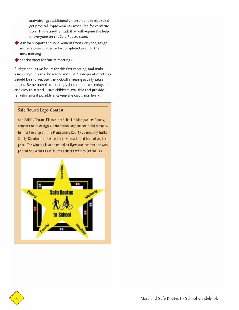
Safe Routes Logo Contest
At a Rolling Terrace Elementary School in Montgomery County, a
competition to design a Safe Routes logo helped build momen-
tum for the project. The Montgomery County Community Traffic
Safety Coordinator provided a new bicycle and helmet as first
prize. The winning logo appeared on flyers and posters and was
printed on t-shirts used for the school’s Walk to School Day.

SECTION 3
Mapping and Observing Existing Conditions
The first task for the Safe Routes to School Team will be to
find out more about conditions on the streets and roadways
near the school site. This section describes how to develop
maps and evaluate student walking and bicycling route con-
ditions. These maps can be simple, hand drawn creations, or
they can be more elaborate, computer-generated maps.
STEP 1: PREPARE THE BASE MAPSYou’ll want to obtain / and or prepare two maps for the Safe
Routes to School Team: a School Neighborhood Map and a
School Site Map.
The School Neighborhood Map should include:
◆ The location of the school
◆ The school district
◆ The surrounding road and path network (that is, the
location and names of roads and sidepaths within a 1-2
mile radius of the school)
◆ The school’s “walk-zone” or “non-transport” limits (areas
near the school where busing is not provided). This
information should be available from the school’s trans-
portation director, and
◆ The location of student residences (homes, apartments,
subdivisions) and how many students are walking from
those locations. This is very important because it will
give the Team a sense of where the mass of student walk-
ing trips originate, and what potential routes they take to
school. You may be able to get information about stu-
dents’ residences from the school principal, however
sometimes this information is kept confidential. See the
sidebar for other creative ways to identify on your map
where students live.
Quick solutions for developing base maps:There are a number of ways that these maps can be prepared,
from low-tech to high-tech. A commercially-available road
map (such as an ADC map) pinned to a board can serve as a
base map, with the other information added via markers, high-
lighters, etc. Often these maps are the most user-friendly
because people are familiar with them. For some areas how-
ever, these maps may not show enough detail, so you may need
to look elsewhere for a map that will work for your purposes.
Be sure the map includes the entire area where students could
walk or ride to school. School district maps are available from
your local library. Other potential sources for maps include:
Maryland Safe Routes to School Guidebook ———————————————————————— 9
© A
DC
TH
E M
AP
PE
OP
LE,
PU
N #
20
20
21
13
◆ City Planning Department
◆ County Planning Department
◆ USGS (Quad Maps available through
http://mapping.usgs.gov/)
◆ School Master Plan (a map which may have been created
when the school was built)
Note: More and more, good maps are available on-line at local,
county and state websites (see the appendix for resources). If
you don’t have computer access or need help finding maps on-
line, ask a librarian at your local library for help.
The School Neighborhood Map should cover at 1-2 miles in
every direction from the school or the entire school district.
One way to figure distance is to measure out a piece of
string on your map scale, and use a pin to mark circular
zones for a 2 mile distance, 1 mile distance and .5 mile dis-
tance, with the school being the center point.
If you can enlist the help of the school board or local/region-
al government planning agency, you can gather the informa-
tion and have them prepare a computerized map for you.
The School Site Map should be a large map of the school
property (ask the school to provide a copy of their school
site map, if available). This map should depict:
◆ Parent and school bus drop-off and pick-up zones
◆ Sidewalks
◆ Immediately adjoining roads, with their configurations
(e.g., two lane, four lane with a median, etc.), and
◆ Intersections with traffic signals
◆ Intersections with marked crosswalk
◆ Intersections staffed with crossing guards
STEP 2: RESEARCHING PLANNED ROADWAYIMPROVEMENTS
The volunteers responsible for mapping (or the Mapping
Subcommittee) will also be responsible for researching (and
creating a list of) roadway improvements for the area. This will
be important later, since road projects and intersection
improvements can have a tremendous impact on pedestrian
10 ———————————————————————— Maryland Safe Routes to School Guidebook

safety, and also represent an opportunity to incorporate your
project proposals onto roadway improvements that are
already planned for the near future.
In order to complete this list, it will be necessary to contact all
of the agencies with responsibility over the roads surrounding
the school, for at least a two-mile radius. This Team should
find out what improvements are funded for construction
within the next five years. Only funded improvements should
go on this list. Proposed unfunded improvements could be
“scheduled” as far out as 20 years. The master list can be
prepared in a table format, like the example shown below:
A Few Tips About Road Ownership and Management in Maryland:Often, in Maryland, the roads or streets on which you would
like to see improvements may be owned and maintained by
several different jurisdictions. Roadways with a State Road
number (with the exception of those in the City of Baltimore
and several in Annapolis) are owned and managed by the
Maryland State Highway Administration. Information about
future improvements to these roadways can be obtained
from the local District office of the Maryland State Highway
Administration (see list of contacts in the appendix).
All roads in the City of Baltimore are owned and managed by
the City’s Office of Transportation. The City of Annapolis
Department of Transportation, owns many of the roadways
within the city limits. There are a few exceptions.
All other roads in Maryland are owned and maintained by
either the county government or other local jurisdictions
(Takoma Park, City of Rockville, etc.). The best way to deter-
mine who is responsible for a road in question is to ask a
local county planner or transportation department official.
Contact information is provided in the appendix.
Mapping Tips
◆ Make sure your school neighborhood map includes road
names, names of major destinations (such as parks, malls,
shopping centers, etc), and other helpful information.
◆ Make sure that there is a north arrow and scale on the map.
◆ Make sure that there is a master copy so you can make
duplicates in the future. This will enable you to write on
the copied maps without altering the original.
◆ If the map is small in size, you might want to consider
getting it photocopied at a larger scale at a local copy
center. Bigger is better for mapping existing conditions.
◆ Create a legend as you go, so your mapping can be easily
understood by others.
Involving Kids In The Process
Involve students in the Safe Routes process by asking them to
create a map showing where they live in relationship to the
school and the route they take to get to school. Ask the students
to show locations that need safety improvements along their
route to school and why. For those that ride the bus or arrive in
cars, have them concentrate on traffic safety issues at the
school site.
Master List Example
Road Name Improvements Improvements Sidewalks Planned? Bikelanes Planned? ConstructionStart Point Finish Point (Yes/No) (Yes/No) Start Date
Maple Avenue 1st Street 4th Street Yes No October, 2002Oak Boulevard 32nd Avenue 38th Avenue Yes Yes March, 2003
Maryland Safe Routes to School Guidebook ———————————————————————— 11

Roadway ownership may seem to be a trivial detail, however
it can become a very important issue when it comes to seek-
ing funding for improvements to the roads. For example,
one road may be a State road and therefore subject to
MDOT design and review/approval procedures, and another
may be a County road with different procedures. You may
have several agencies reviewing your recommended
improvements, each with somewhat different procedures for
funding new projects.
The school board has responsibility for school grounds and
school driveways. Often maintenance of these is handled by
the School Facilities and Pupil Transportation Divisions of
the county or city public schools department. Talk to your
school principal to determine who is responsible for these
facilities at your school.
STEP 3: DETERMINING SCHOOL/WALKINGROUTES CONDITIONS
Now that you’ve created your base maps and determined
if any roadway improvements are planned near your school,
it’s time to get out and take a look at existing conditions
at your school and on the streets you identified earlier as
routes that many students currently walk or live along.
The main goal of this exercise is to list SPECIFIC locations
on the school site and the surrounding streets that need
improvements.
Take time to watch what happens at the school during the
morning drop-off and afternoon pick-up periods. It’s very
important to watch the traffic patterns and observe stu-
dents movements. Do this on several different days and
make sure you talk to parents, teachers (especially those
with outside duty in the morning and afternoon), kids and
crossing guards about the problems. Keep a list of the prob-
lems you see or people tell you about. In many cases, you
may already know the major “hot spots” such as intersec-
tions that are difficult to cross, streets that need sidewalks,
but during your “walk-through,” you may notice areas where
sidewalks are missing or are in poor repair, corners that are in
need of curb ramps (wheelchair ramps), intersections that
are too wide and dangerous, streets where traffic is going
too fast, and other things. These are the types of problems
that you need to write down on your list.
At some schools, you may find you can get all the informa-
tion about existing conditions you need from watching what
happens and talking to people as described in the following
section on outreach. At other schools, you may want to do
a more detailed study. If so, there are two types of “site sur-
veys” or “audits” provided in the appendix of this guide to
assist you in evaluating conditions: the School Site Audit
and the Neighborhood Site Audit. Directions for using these
audits are provided below.
How to Use the School Site AuditThe school site audit will help determine walking and bicy-
cling conditions on or adjacent to school property. By look-
ing closely at such things as the student drop-off, bus load-
ing zones, sidewalks, crossing guard locations, signage and
adjacent intersections, it will help you discover potential
areas for design improvements and increased safety.
Members of the Safe Routes Team and the Principal should
fill out the audit during the prime school hours in order to
see how the children get to and from school. It will be useful
to have a map of school grounds on hand for note taking. If
a map is unavailable you can construct a map as you go. (See
appendix for a sample school site audit.)
12 ———————————————————————— Maryland Safe Routes to School Guidebook
How to Use the Neighborhood Site AuditSimilar to the school site audit, the neighborhood audit is
designed to help you evaluate the walking and bicycling condi-
tions by inventorying neighborhood intersections, streets and
sidewalks used by the students. There are separate forms for
evaluating intersections or mid-block crosswalks and roadway
segments (see appendix). You’ll want to use your base maps
and some of the information you’ve already collected such as
traffic counts and the rough locations of where students live.
At the conclusion of the site audits, gather participants
together to summarize the findings and create a list of
problems and improvements that are needed (see Chapter 5:
Pulling it All Together). If a local transportation planner hasn’t
been involved yet, this would be a good time to speak to him
or her about the problems you have identified.
As you begin to identify where students live and the routes
along which they walk or bike, you’ll begin to learn a lot about
where you’ll want to prioritize improvements. In dense city
neighborhoods, kids may come from pretty much every street
around the school. However in more suburban communities,
there might be a major street that carries a lot of the student
foot/bike traffic. You will find that there are several logical,
“main routes” to school.
Some communities have designated these main routes as
“Safe Routes” and focused the improvement efforts along
them. You may want to do this depending on what you find
in your community. This might be particularly helpful in
neighborhoods that deal with violence. In these neighbor-
hoods, a designated route could be focused on in order to
create a safe space for children using a walking school bus
and for advocating for physical improvements to make it
safe and more secure.
Things to Do if Speeding is a Problem
◆ Talk to your neighbors and community leaders, and find
out if they agree that speeding is a problem. If others
support your concerns, you are more likely to be “heard”
when you ask for help in solving the problem.
◆ Ask your local police department to monitor speeds in the
area. In addition to ticketing speeders, many police
departments own “speed display trailers” which indicate
when motorists are speeding. Ask if the police can place
the speed display trailer along the street(s) you have
identified as having a speeding problem.
◆ Let people in your community know that speeding is not
acceptable. Include messages in community and school
newsletters, and on signs throughout the neighborhood
(in some cases, school and church signs have been used
to display messages about speeding).
◆ Ask your county or city to re-design your street to slow
motorists through construction of traffic calming devices.
Motorists commonly speed on streets that are too straight
and wide open. Traffic calming devices can slow the
speeds of motorists on such streets, through the con-
struction of road treatments which include raised devices
(such as speed humps and raised crosswalks), roadway
narrowing, curves in the roadway, or planting trees along
the street.
Maryland Safe Routes to School Guidebook ———————————————————————— 13

14 ———————————————————————— Maryland Safe Routes to School Guidebook

SECTION 4
The most effective Safe Routes to School programs take full
advantage of the first-hand experience of students, parents
and teachers at the school. These are the people who wit-
ness safety problems on a daily basis, and their opinions are
important. It is also essential that input be gathered from
the broader neighborhood community. They will want a say
in anything that happens in their neighborhood. A number
of techniques are recommended to get input from these
people. These tasks should be assigned to several people on
your Safe Routes Team or to an Outreach Subcommittee.
STEP 1: DISCUSS THE PROJECT WITH TEACHERS AND STAFF
Find an appropriate time, such as a school staff meeting, to
make a presentation to teachers and other staff about the
project. Solicit their input about student attitudes, unsafe
behaviors, and other concerns. Ask the teachers if they typi-
cally teach pedestrian and bicycle safety skills, and to what
extent these lessons are taught (i.e. how many hours in a typi-
cal year). This will be a good time to find out if they are
interested in teaching more lessons on bicycle and pedestrian
safety (see Sidebar for more information on safety curricula). STEP 2: CONDUCT STUDENT AND PARENT SURVEYS
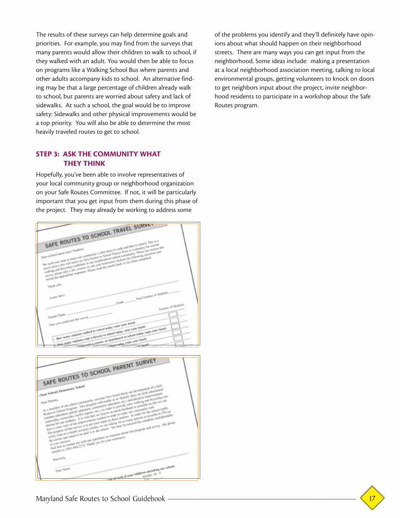
There are two surveys in the appendix of this Guide that can
be used for your Safe Routes project—one is for students
and the other is for parents. These are provided in hard
copy, and also on CD so that you can “personalize” them
with the name of your school. These surveys are an impor-
tant part of the Safe Routes process. The information gath-
ered in these surveys will enable you to evaluate progress
and the success of your program. They will also give your
Safe Routes Committee a better understanding of the cur-
rent situation, so you can plan more effectively for future
improvements and safety features.
Getting in contact with parents and compiling student data
can be tedious. However, by following the instructions in this
Maryland Pedestrian and Bicycle Safety and Education Program
Public schools in Maryland have not traditionally taught com-
prehensive pedestrian and bicycle safety skills. There are sev-
eral new educational programs, however, that can be used for
this purpose. The Maryland Highway Safety Office, in partner-
ship with the City of Rockville, has prepared a Maryland
Pedestrian and Bicycle Safety and Education program for use in
local schools throughout the state. Other educational resources
include Risk Watch (available through the Safe Kids Coalition of
Maryland) and the 4-H Bicycle and Pedestrian Safety
Curriculum (available through Maryland’s 4-H clubs). Also
check with your local police or fire department or local American
Automobile Association (AAA) office to see what traffic safety
educational materials they can provide. See the Contacts by
County listings on page 39–43.
Getting Input
Maryland Safe Routes to School Guidebook ———————————————————————— 15
Guide, these surveys should be relatively easy to accomplish,
and should provide you with accurate information.
The Student Travel Survey will generate information on what
types of transportation are used at the school—i.e. how
many children walk, ride the bus, are driven by their parents,
or use some other mode of transportation. This survey will
complement the parent survey and provide travel behavior
data for the entire school. This survey should be conducted
at school under the supervision of homeroom teachers.
The Parent Survey will collect vital information on parents’
perceptions and opinions of conditions near the school, as
well as what types of improvements would be needed in
order for them to feel comfortable enough to let their child
walk to school. This survey is specifically targeted to families
who live within a 2-mile radius of the school. The survey can
be sent home with the students or distributed by direct mail
(more expensive, but preferred, since parents are usually del-
uged with papers brought home by their children and may
ignore the survey if it arrives that way). Parents should be
given two weeks to return their completed surveys to the
school. Some schools have found success in getting surveys
returned by providing small incentives such as erasers or
candy to student when they bring in a completed survey. In
order to make it easier to tabulate the survey results, a
spreadsheet file has been provided on the enclosed disc to
enable you to quickly enter the data and generate the results.
The following topics are covered by the Parent Survey:
◆ Gender, age and grade of their child (or children) who
attend the school
◆ Distance between their residence and the school
◆ Opinions on walking and biking conditions
◆ Factors that influence the decision to walk or bike
◆ Routes used to reach school
◆ Education programs
The Outreach volunteer(s) or subcommittee should be
responsible for distribution and collection of the survey
packet data. Consult the school’s principal for appropriate
procedures before distributing the surveys. A CD is included
with this guidebook that contains a Microsoft Excel spread-
sheet. The spreadsheet is pre-programmed to provide you
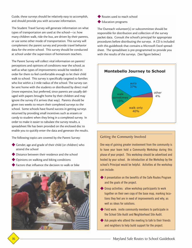
with the results of the surveys. (See figure below.)
Getting the Community Involved
One way of gaining greater involvement from the community is
to have your team hold a Community Workshop during this
phase of your project. This workshop should be advertised and
hosted by your school. An introduction at the Workshop by the
school’s Principal would be helpful. Activities at the workshop
can include:
◆ A presentation on the benefits of the Safe Routes Program
and the goals of the project.
◆ Group activities: allow workshop participants to work
together on their own copy of the base map, marking loca-
tions they feel are in need of improvements and why, as
well as ideas for solutions.
◆ Field work: invite community members to participate in
the School Site Audit and Neighborhood Site Audit.
◆ Ask people who attend the meeting to talk to their friends
and neighbors to help build support for the project.
16 ———————————————————————— Maryland Safe Routes to School Guidebook
The results of these surveys can help determine goals and
priorities. For example, you may find from the surveys that
many parents would allow their children to walk to school, if
they walked with an adult. You would then be able to focus
on programs like a Walking School Bus where parents and
other adults accompany kids to school. An alternative find-
ing may be that a large percentage of children already walk
to school, but parents are worried about safety and lack of
sidewalks. At such a school, the goal would be to improve
safety: Sidewalks and other physical improvements would be
a top priority. You will also be able to determine the most
heavily traveled routes to get to school.
STEP 3: ASK THE COMMUNITY WHAT THEY THINK
Hopefully, you’ve been able to involve representatives of
your local community group or neighborhood organization
on your Safe Routes Committee. If not, it will be particularly
important that you get input from them during this phase of
the project. They may already be working to address some
of the problems you identify and they’ll definitely have opin-
ions about what should happen on their neighborhood
streets. There are many ways you can get input from the
neighborhood. Some ideas include: making a presentation
at a local neighborhood association meeting, talking to local
environmental groups, getting volunteers to knock on doors
to get neighbors input about the project, invite neighbor-
hood residents to participate in a workshop about the Safe
Routes program.
Maryland Safe Routes to School Guidebook ———————————————————————— 17

18 ———————————————————————— Maryland Safe Routes to School Guidebook
SECTION 5
The Safe Routes Plan
Now that you’ve thoroughly evaluated site conditions, and
have asked parents, teachers, students, and the community
for their input—it’s time to pull it all together into a plan of
action to make your school a safe, walkable, bikeable desti-
nation! This section of the Guide explains how to develop
goals and actions for your Safe Routes Plan, and also provides
some successful techniques other schools have used to pro-
mote safe walking routes.
STEP 1: PREPARE A LIST OF PHYSICALIMPROVEMENTS AND NEW PROGRAMS
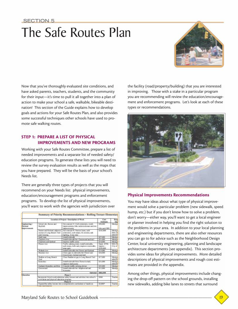
Working with your Safe Routes Committee, prepare a list of
needed improvements and a separate list of needed safety/
education programs. To generate these lists you will need to
review the survey evaluation results as well as the maps that
you have prepared. They will be the basis of your school’s
Needs list.
There are generally three types of projects that you will
recommend on your Needs list: physical improvements,
education/encouragement programs and enforcement
programs. To develop the list of physical improvements,
you’ll want to work with the agencies with jurisdiction over
the facility (road/property/building) that you are interested
in improving. Those with a stake in a particular program
you are recommending will review the education/encourage-
ment and enforcement programs. Let’s look at each of these
types or recommendations.
Physical Improvements RecommendationsYou may have ideas about what type of physical improve-
ment would solve a particular problem (new sidewalk, speed
hump, etc.) but if you don’t know how to solve a problem,
don’t worry—either way, you’ll want to get a local engineer
or planner involved in helping you find the right solution to
the problems in your area. In addition to your local planning
and engineering departments, there are also other resources
you can go to for advice such as the Neighborhood Design
Center, local university engineering, planning and landscape
architecture departments (see appendix). This section pro-
vides some ideas for physical improvements. More detailed
descriptions of physical improvements and rough cost esti-
mates are provided in the appendix.
Among other things, physical improvements include chang-
ing the drop-off pattern on the school grounds, installing
new sidewalks, adding bike lanes to streets that surround
Maryland Safe Routes to School Guidebook ———————————————————————— 19
the school, providing bike racks for the school, providing
curb ramps (wheelchair ramps), and improving the visibility
of pedestrian crossings both at midblock and inter-
section locations.
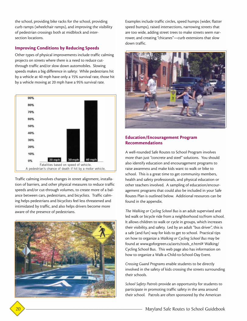
Improving Conditions by Reducing SpeedsOther types of physical improvements include traffic calming
projects on streets where there is a need to reduce cut-
through traffic and/or slow down automobiles. Slowing
speeds makes a big difference in safety: While pedestrians hit
by a vehicle at 40 mph have only a 15% survival rate, those hit
by a vehicle moving at 20 mph have a 95% survival rate.
Traffic calming involves changes in street alignment, installa-
tion of barriers, and other physical measures to reduce traffic
speeds and/or cut-through volumes, to create more of a bal-
ance between cars, pedestrians, and bicyclists. Traffic calm-
ing helps pedestrians and bicyclists feel less threatened and
intimidated by traffic, and also helps drivers become more
aware of the presence of pedestrians.
Examples include traffic circles, speed humps (wider, flatter
speed bumps), raised intersections, narrowing streets that
are too wide, adding street trees to make streets seem nar-
rower, and creating “chicanes”—curb extensions that slow
down traffic.
Education/Encouragement ProgramRecommendations
A well-rounded Safe Routes to School Program involves
more than just “concrete and steel” solutions. You should
also identify education and encouragement programs to
raise awareness and make kids want to walk or bike to
school. This is a great time to get community members,
health and safety professionals, and physical education or
other teachers involved. A sampling of education/encour-
agement programs that could also be included in your Safe
Routes Plan is outlined below. Additional resources can be
found in the appendix.
The Walking or Cycling School Bus is an adult supervised and
led walk or bicycle ride from a neighborhood to/from school.
It allows children to walk or cycle in groups, which increases
their visibility, and safety. Led by an adult “bus driver”, this is
a safe (and fun) way for kids to get to school. Practical tips
on how to organize a Walking or Cycling School Bus may be
found at www.goforgreen.ca/asrts/tools_e.html# Walking/
Cycling School Bus. This web page also has information on
how to organize a Walk-a-Child-to-School-Day Event.
Crossing Guard Programs enable students to be directly
involved in the safety of kids crossing the streets surrounding
their schools.
School Safety Patrols provide an opportunity for students to
participate in promoting traffic safety in the area around
their school. Patrols are often sponsored by the American
Fatalities based on speed of vehicle.A pedestrian’s chance of death if hit by a motor vehicle.
20 ———————————————————————— Maryland Safe Routes to School Guidebook

Automobile Association and undergo training from local
police. More information on starting a School Safety Patrol
can be found at http://www.aaamidatlantic.com/
Walk a Child to School Day is typically held in early October
each year, and is an excellent way to raise awareness of
pedestrian conditions surrounding the school. Each year
more and more schools in Maryland participate in this event.
The Maryland Highway Safety Office is very supportive of
this event. If you are interested in holding this event at your
school, work with your Community Traffic Safety
Coordinator to organize the activity (see contacts list on
pages 39–43 in the appendices). Prizes can be given for the
longest distance walked/biked, the most kids walking/cycling
from one neighborhood, etc. Check out the tips and regis-
tration for your event at http://www.walktoschool-usa.org/
A Monthly Walk to School Contest is another way of provid-
ing incentives to children to walk to school. Rewards in the
form of extra credit, awards, etc. could be given out as part
of this contest.
Walk or Bike Across America Students in Marin County,
California keep track of the miles they spend walking and
biking to school by calculating how far they live from school
and multiplying that by the number of times they walk and
bike. Each week at a designated time, the students add up
the distance the whole class has traveled and plot it on a
map. Then they "travel" to a destination chosen by the class
within those miles. Students become aware that they can
travel great distances on foot or bike. Each new destination
can be researched by the class to find out more about other
parts of the country. At the end of a designated time, the
class that has traveled the farthest gets a special reward like a
video or pizza party. For more information, see
http://www.saferoutestoschools.org/events.html
Classroom Activities are a great way to raise awareness,
encourage kids to walk to school and teach safe walking and
bicycling behaviors. The Maryland Highway Safety Office, in
partnership with the City of Rockville, has prepared a
Maryland Pedestrian and Bicycle Safety and Education
program for use in local schools throughout the state. In
addition, many organizations such as AAA and local police
and fire departments have curricula designed for use in ele-
mentary and middle school classrooms. In addition to safety
lessons, classroom involvement can also include activities
such as mapping routes to school as part of a geography
lesson and writing letters to local transportation and elected
officials about safety concerns in the school neighborhood.
Enforcement RecommendationsAs you looked at existing conditions and gathered input
from the school and local community, you may have found
that you need increased law enforcement to reduce speed-
ing, illegal turns, and increase patrols for crime suppression.
Hopefully you’ve kept your local police or sheriff ’s office
involved, or at least informed, of your Safe Routes program.
Maryland Safe Routes to School Guidebook ———————————————————————— 21
Spot Enforcement Occasional or “spot” enforcement can be
helpful in reinforcing traffic safety laws and new rules such as
a new drop-off pattern at a school. Talk to your local law
enforcement about providing such enforcement on an occa-
sional basis.
STEP 2: SET PRIORITIES AND SHORT- ANDLONG-TERM GOALS
At this point in the process, there is likely to be some con-
sensus on your Committee about which projects are needed
most. The next step is to prioritize your needs lists, that is,
decide which projects are needed the most and should be
pursued first.
Keep in mind that some projects will take longer to put in
place than others. It is therefore important at this stage to
set short-term and long-term goals. Your list of short-term
goals is likely to include such things as increasing community
awareness about the importance of walking and biking and
getting some of the education/encouragement and enforce-
ment activities started.
There may also be opportunities to make “quick fix” type
improvements that are not as costly as major physical
improvements, but that would yield great benefit for a rela-
tively low cost (examples: reducing pedestrian/vehicle con-
flicts at the school entrance by changing drop-off patterns,
adding painted crosswalks and warning signs at midblock
crossings, minor traffic calming projects). These “quick-fix”
opportunities should be given a high priority, and placed on
the list of short-term (or intermediate) goals since they will
enable the community to see some immediate results and
will help build support for larger, long-term projects.
The list of long-term goals is likely to include some high-priori-
ty physical improvements that will require time to gather polit-
ical support and funding such as redesigning an intersection,
constructing new sidewalks or major neighborhood traffic
calming projects. These projects will take longer to put in
place since they usually have to wait “in line” behind other sim-
ilar projects that communities have asked for. Even though
they belong on the list of long-term goals, it will be important
to start building community support and looking for funding.
For these larger projects, it may also be useful to contact your
local council member or state legislator to make sure he or she
is informed of the need and support for the project.
Talk to them about the possibility of doing some “spot”
enforcement or a “pedestrian sting” operation to help
enforce some of the traffic laws that help protect pedestri-
ans. (See sidebar.) Keeping in mind that the police too often
have limited resources for enforcement, here are some addi-
tional ways to help improve adherence to traffic laws and
reduce crime along the school route.
Corner Captains are parents or citizens who merely set up a
chair on the corner of a school route. Their presence alone
will increase the safety and security of children walking to
school. This can be enhanced with a “uniform” that can be
as simple as a pre-arranged high visibility shirt and hat color
(like orange), or may involve pre-printed t-shirts with logos
and the like.
Cops on Bikes programs render high visibility enforcement
and provide additional safety and security for children walk-
ing or cycling to/from school.
Paperwork Patrol. Police often spend time in their vehicles
completing paperwork. Several communities have started
programs where police will park in front of local schools to
complete this paperwork. Even though they may not actively
ticket, their presence often helps reduce speeding. Request
that your school be one of these locations.
Speed Trailers Many communities use speed trailers as an
educational device that also helps slow speeds. Speed trail-
ers can be parked near a school to show passing motorists
their current speed in comparison to the posted speed limit.
This encourages motorists to drive the speed limit, however,
it usually only has a temporary effect. Ask your local police
about locating a speed trailer near your school.
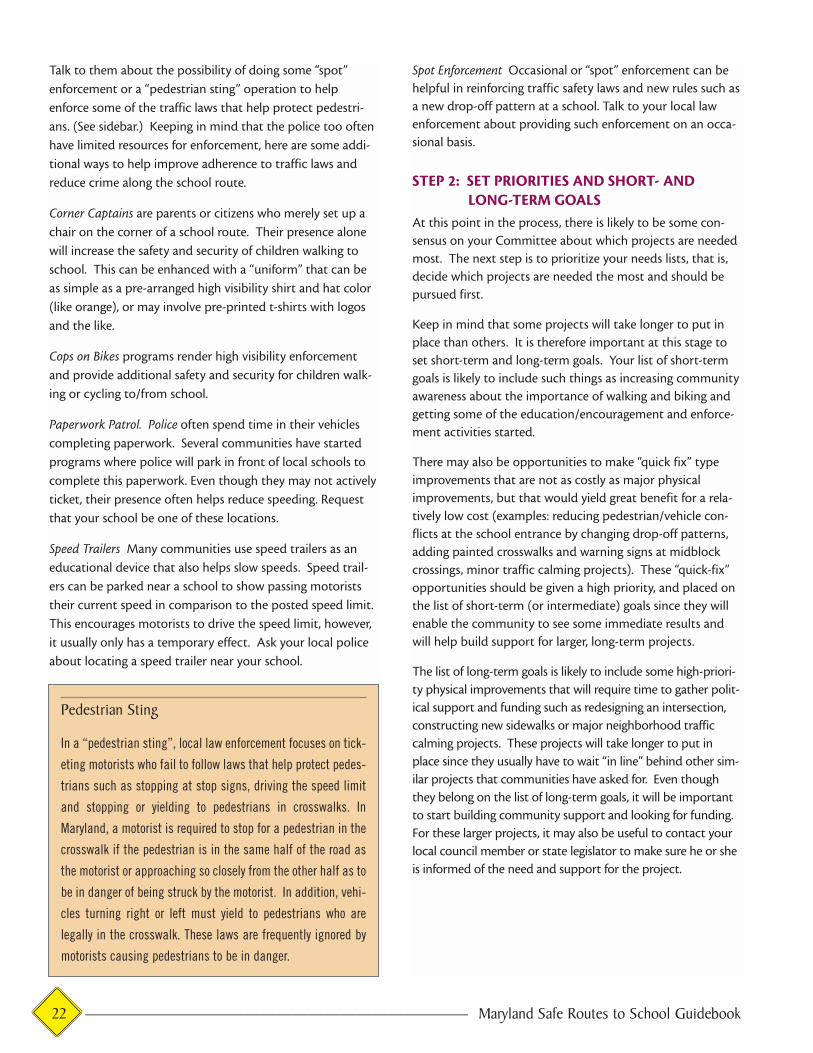
Pedestrian Sting
In a “pedestrian sting”, local law enforcement focuses on tick-
eting motorists who fail to follow laws that help protect pedes-
trians such as stopping at stop signs, driving the speed limit
and stopping or yielding to pedestrians in crosswalks. In
Maryland, a motorist is required to stop for a pedestrian in the
crosswalk if the pedestrian is in the same half of the road as
the motorist or approaching so closely from the other half as to
be in danger of being struck by the motorist. In addition, vehi-
cles turning right or left must yield to pedestrians who are
legally in the crosswalk. These laws are frequently ignored by
motorists causing pedestrians to be in danger.
22 ———————————————————————— Maryland Safe Routes to School Guidebook

A Word of Caution About Pedestrian Overpassesand Tunnels
When faced with a busy road crossing, one solution people often
turn to is a pedestrian overpass or tunnel. While there are times
when this type of solution is warranted, the majority of these
structures (particularly overpasses) are rarely used because
they require pedestrians to walk a considerably longer distance.
Tunnels can create serious security problems and can be
uncomfortable places to walk. Considering that the costs of
overpasses and tunnels regularly run into the millions of dol-
lars, the decision to pursue this type of solution should be made
VERY carefully, in full consideration of whether the structure is
likely to be used. Alternatives would include enhanced at-grade
pedestrian crossing measures such as red crosswalks, curbs
that extend out into the street to narrow the crossing, median
refuge islands, pedestrian activated signals (at midblock and
intersection locations), and other innovative pedestrian cross-
ing treatments.
Quick-Fixes
At Montebello Elementary School in Baltimore, parents were
dropping off kids directly in front of the school on a very busy
street. This drop-off pattern created congestion and confusion
and often resulted in children crossing in the middle of the
block and darting between parked and moving cars. To solve
this problem, the Safe Routes Team at the school worked with
the school administrators, the City’s Office of Transportation,
the Baltimore City Public Schools Pupil Transportation, and
School Facilities Department to create a “quick fix” solution. A
parking lot behind the school was striped to become a new
drop-off area, signs indicating the change were installed
around the school, the administration sent home flyers to
inform parents, police helped with initial enforcement and
directing traffic and volunteers from the Safe Routes Team
formed the Montebello Parents on Patrol to help guide parents
to the new drop-off and assist the crossing guards in directing
walking children to crosswalks and safe crossing points. The
result: the change reduced traffic and congestion in front of the
school and helped build enthusiasm among parents and
administrators for the Safe Routes program.
Maryland Safe Routes to School Guidebook ———————————————————————— 23

24 ———————————————————————— Maryland Safe Routes to School Guidebook
SECTION 6
Putting the Program in Place and Finding the Funding!
During the Implementation phase, you will put into full
effect the programs that you have identified in your Safe
Routes Plan. To do this you’ll work closely with the other
members of your Safe Routes Team.
Implementation of your Safe Routes to School Program will
likely occur on several levels, with the Safe Routes Team tak-
ing the lead in organizing a variety of partners to get the
work done. You may ultimately work with the State (i.e.
Maryland State Highway Administration, Maryland
Department of Planning, Maryland Office of Highway Safety,
etc.), with your local county government, with your munici-
pal government (if your school lies within an incorporated
town), with your local community group or neighborhood
association, the local business community, with a local law
enforcement agency, or with a variety of other organizations
throughout Maryland that support safety-based programs.
There are MANY potential partners for Safe Routes projects
—which is a particular strength of this program.
STEP 1: APPROACH POTENTIAL PARTNERSIt’s a good idea at this stage in the process to make some
phone calls to those people who you’ve been keeping
informed about the Safe Routes program, but may not have
been actively involved. Now that you have a list of programs
and improvements and short- and long-term goals, you’ll
want to make sure that everyone knows what they are.
Many of the educational and encouragement activities will
require little or no funding, but lots of volunteer time from
parents, teachers, and community members. Talk to local
businesses about the program and solicit their help in provid-
ing incentives such as small prizes, bumper stickers or pizza
parties. Be sure to contact organizations such as bike shops,
AAA, fire/police and health departments. They often have
incentives they can provide to you at little or no cost. As dis-
cussed in Section 5, talk to local law enforcement about pro-
viding additional enforcement around the school if needed.
STEP 2: DETERMINE IF YOUR PROJECT IDEAS CANBE INCORPORATED INTO THE CAPITAL IMPROVEMENTS PROGRAM (CIP) OF YOURSTATE, COUNTY OR LOCAL JURISDICTION
As described in Chapter 3, a variety of different government
agencies at the state, county and local level have jurisdiction
over our streets and highways. During the early phases, you
Maryland Safe Routes to School Guidebook ———————————————————————— 25
will have identified who owns and manages the roads near
your school, as well as whether any improvements are sched-
uled in the near future. As you begin the implementation
process, you will want to go back to those sources to request
assistance in getting your projects built—either independ-
ently or in conjunction with other road improvement proj-
ects that have already been planned.
Some of these improvements the agencies may commit to
doing in the near future, others will be longer term, and still
others they will respond to as “infeasible” for various reasons.
Don’t despair. A little creative thinking will be necessary
here. Just because a particular roadway needs sidewalks (or
a bike lane), and the roadway department doesn’t plan on
adding them, or have the money to do so at your request,
does not mean that you should walk away from that particu-
lar project. There are other avenues open to you. For exam-
ple, there are safety funds available from a variety of govern-
ment agencies, as well as grants to address just these types of
needs. A list of these funding sources is provided on pages
48–49 in the appendix, beginning on page 44. Also, the
regional and state Bicycle and Pedestrian Coordinators will
likely be able to further guide you toward available funding
sources, as these often change. The School Board may have
funds available. If these alternative funding sources are not
sufficient to cover the anticipated costs for a particular proj-
ect, they may be available for use as matching funds to the
agency with jurisdiction over the roadway, thereby making
the project possible.
STEP 3: FOLLOW-UP ON LONG TERM GOALS
For some of your long-term physical improvement goals, it
will be important to maintain momentum sometimes over a
period of several years. The best way to do this is to work on
building a broad base of community support (the more peo-
ple who support the project, the more energy your project
will have) and to focus on small successes along the way.
Work closely with the neighborhood and community groups
and regularly follow-up with the local engineers and planners
involved in the physical improvement project.
Getting Community Buy-in for Sidewalks
If your Safe Routes Plan includes installing new sidewalks on res-
idential streets, it will be important to build support among the
affected landowners. This is sometimes difficult—for a variety of
reasons, people may be opposed to a new sidewalk in their front
yard. They may be ambivalent about the need for sidewalks.
Residents sometimes resist installing sidewalks because they
think it will change the rural appearance of their neighborhood.
As the champion for your Safe Routes project, part of your job is
to win these people over. If possible, meet with affected
landowners face to face—especially those that you think might
be opposed to sidewalks. Clearly explain your purpose, and
bring along supporting evidence—photographs of children
walking in the street, pictures of attractive sidewalks, child
safety statistics, and information about likely sources of fund-
ing. Be an earnest spokesperson for your project!
26 ———————————————————————— Maryland Safe Routes to School Guidebook
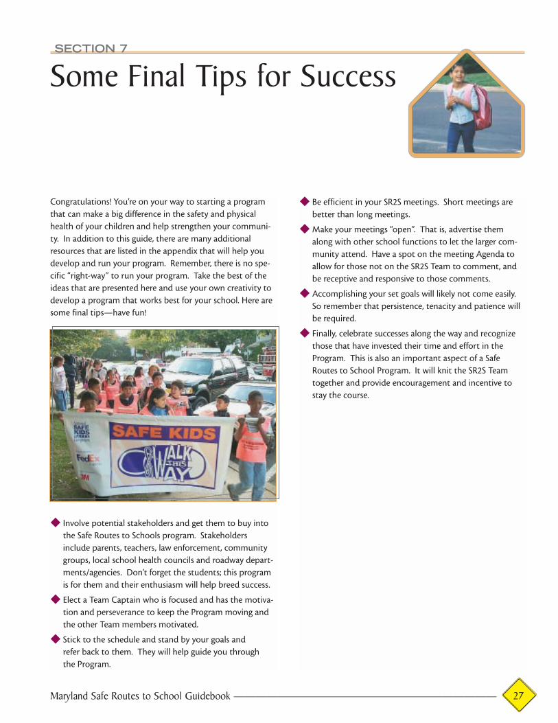
SECTION 7
Some Final Tips for Success
Congratulations! You’re on your way to starting a program
that can make a big difference in the safety and physical
health of your children and help strengthen your communi-
ty. In addition to this guide, there are many additional
resources that are listed in the appendix that will help you
develop and run your program. Remember, there is no spe-
cific “right-way” to run your program. Take the best of the
ideas that are presented here and use your own creativity to
develop a program that works best for your school. Here are
some final tips—have fun!
◆ Involve potential stakeholders and get them to buy into
the Safe Routes to Schools program. Stakeholders
include parents, teachers, law enforcement, community
groups, local school health councils and roadway depart-
ments/agencies. Don’t forget the students; this program
is for them and their enthusiasm will help breed success.
◆ Elect a Team Captain who is focused and has the motiva-
tion and perseverance to keep the Program moving and
the other Team members motivated.
◆ Stick to the schedule and stand by your goals and
refer back to them. They will help guide you through
the Program.
◆ Be efficient in your SR2S meetings. Short meetings are
better than long meetings.
◆ Make your meetings “open”. That is, advertise them
along with other school functions to let the larger com-
munity attend. Have a spot on the meeting Agenda to
allow for those not on the SR2S Team to comment, and
be receptive and responsive to those comments.
◆ Accomplishing your set goals will likely not come easily.
So remember that persistence, tenacity and patience will
be required.
◆ Finally, celebrate successes along the way and recognize
those that have invested their time and effort in the
Program. This is also an important aspect of a Safe
Routes to School Program. It will knit the SR2S Team
together and provide encouragement and incentive to
stay the course.
Maryland Safe Routes to School Guidebook ———————————————————————— 27

28 ———————————————————————— Maryland Safe Routes to School Guidebook
Example SR2S Team Invitation(On School Letterhead)
DATE
TO
Re: Northwest Elementary School’s Safe Routes to School Program
Program Team Formation
Dear ____________:
You are invited to join a small Team in an exciting new Program here at Northwest Elementary – the
Safe Routes to School Program. The purpose of the Safe Routes to School (or SR2S) Team is to
ensure that safer walking and cycling routes to school are provided for our children, as well as to
provide safety and educational training to them about walking and cycling. Through this Program,
it is our desire to, 1) have sidewalks and bike lanes built to improve our children’s safety, and 2)
expand the school’s curriculum to include safety and education programs that will teach our children
proper pedestrian and bicycling behavior and safety techniques.
We have scheduled a SR2S Team kick-off meeting on (DATE), at (TIME). The meeting will be held
at (PLACE). Refreshments and childcare will be available, and we look forward to seeing you there!
Please RSVP to me at (PHONE #), so I can plan accordingly. Thank you in advance for your help
with this important program.
Sincerely,
NAME & ADDRESS
cc: Principal
School Board
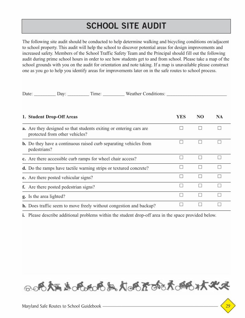
Maryland Safe Routes to School Guidebook ———————————————————————— 29
The following site audit should be conducted to help determine walking and bicycling conditions on/adjacentto school property. This audit will help the school to discover potential areas for design improvements andincreased safety. Members of the School Traffic Safety Team and the Principal should fill out the followingaudit during prime school hours in order to see how students get to and from school. Please take a map of theschool grounds with you on the audit for orientation and note taking. If a map is unavailable please constructone as you go to help you identify areas for improvements later on in the safe routes to school process.
Date: _________ Day: _________ Time: _________ Weather Conditions: _________________________
1. Student Drop-Off Areas YES NO NA
a. Are they designed so that students exiting or entering cars areprotected from other vehicles?
b. Do they have a continuous raised curb separating vehicles frompedestrians?
c. Are there accessible curb ramps for wheel chair access?
d. Do the ramps have tactile warning strips or textured concrete?
e. Are there posted vehicular signs?
f. Are there posted pedestrian signs?
g. Is the area lighted?
h. Does traffic seem to move freely without congestion and backup?
i. Please describe additional problems within the student drop-off area in the space provided below.
SCHOOL SITE AUDIT
� � �
� � �
� � �
� � �
� � �
� � �
� � �
� � �

30 ———————————————————————— Maryland Safe Routes to School Guidebook
2. Bus Loading Zones YES NO NA
a. Are bus driveways physically separated from pedestrian and bicyclingroutes by raised curbs or bollards?
b. Are bus driveways physically separated from parent pick-up/drop-off areas?
c. If the buses are "double-stacked" for drop-off/loading areas, are measurestaken for safety of students needing to cross in front or behind the bus?
d. Is traffic in the bus loading zone one-way?
e. Does the bus zone meet the minimum width of 24’ for drop-off/pull-out lanes?
f. Is there a continuous curb and sidewalk adjacent to the drop-off/loading area leading into the school site?
g. Is the bus loading/unloading zone lighted?
h. Please describe additional problem areas regarding the bus loading zone in the space provided below.
3. Sidewalks and Bicycle Routes YES NO NA
a. Are current pedestrian and bicycle routes separated frommotor vehicles by the use of sidewalks or separated pathways?
b. Are the bicycle routes designated by signage?
c. Are marked bicycle lanes present?
d. Are sidewalks and bicycle paths regularly maintained(free of debris, cracks and holes)?
e. Are there accessible ramps for wheel chair access?
f. Are the sidewalks continuous and without gaps?
g. Do the ramps have tactile warning strips or textured concrete?
h. Are the sidewalks lighted?
i. Are the sidewalks used regularly?
j. Please describe additional problem areas regarding the school’s sidewalk system and existing bicycleroutes in the space provided below.
� � �
� � �
� � �
� � �
� � �
� � �
� � �
� � �
� � �
� � �
� � �
� � �
� � �
� � �
� � �
� � �
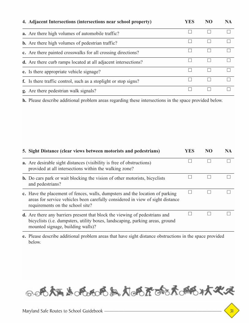
4. Adjacent Intersections (intersections near school property) YES NO NA
a. Are there high volumes of automobile traffic?
b. Are there high volumes of pedestrian traffic?
c. Are there painted crosswalks for all crossing directions?
d. Are there curb ramps located at all adjacent intersections?
e. Is there appropriate vehicle signage?
f. Is there traffic control, such as a stoplight or stop signs?
g. Are there pedestrian walk signals?
h. Please describe additional problem areas regarding these intersections in the space provided below.
5. Sight Distance (clear views between motorists and pedestrians) YES NO NA
a. Are desirable sight distances (visibility is free of obstructions) provided at all intersections within the walking zone?
b. Do cars park or wait blocking the vision of other motorists, bicyclistsand pedestrians?
c. Have the placement of fences, walls, dumpsters and the location of parking areas for service vehicles been carefully considered in view of sight distance requirements on the school site?
d. Are there any barriers present that block the viewing of pedestrians and bicyclists (i.e. dumpsters, utility boxes, landscaping, parking areas, groundmounted signage, building walls)?
e. Please describe additional problem areas that have sight distance obstructions in the space providedbelow.
Maryland Safe Routes to School Guidebook ———————————————————————— 31
� � �
� � �
� � �
� � �
� � �
� � �
� � �
� � �
� � �
� � �
� � �
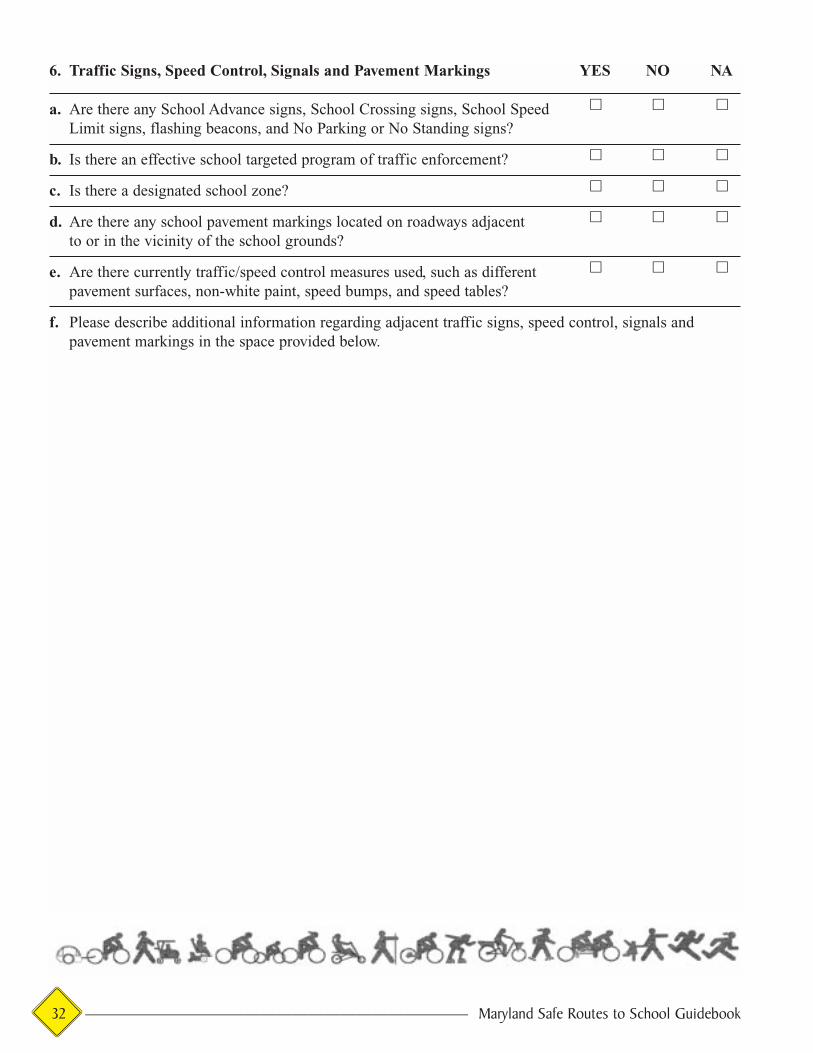
32 ———————————————————————— Maryland Safe Routes to School Guidebook
6. Traffic Signs, Speed Control, Signals and Pavement Markings YES NO NA
a. Are there any School Advance signs, School Crossing signs, School Speed Limit signs, flashing beacons, and No Parking or No Standing signs?
b. Is there an effective school targeted program of traffic enforcement?
c. Is there a designated school zone?
d. Are there any school pavement markings located on roadways adjacentto or in the vicinity of the school grounds?
e. Are there currently traffic/speed control measures used, such as different pavement surfaces, non-white paint, speed bumps, and speed tables?
f. Please describe additional information regarding adjacent traffic signs, speed control, signals andpavement markings in the space provided below.
� � �
� � �
� � �
� � �
� � �

Maryland Safe Routes to School Guidebook ———————————————————————— 33
The following neighborhood audit is designed to help you evaluate walking and bicycling conditions in yourschool’s neighborhood by taking an inventory of intersections, streets and sidewalks. There are separateforms for evaluating intersections and mid-block crosswalks versus roadway segments. Please use only oneform for each intersection or roadway segment. Make additional copies of the audit sheets to evaluate all ofthe neighborhood streets. Some information will need to be collected beforehand, such as average dailytraffic counts provided by the local municipality and a base map of neighborhood streets.
Instructions:
Step 1: Establish a boundary for assessment:
On your base map, identify the school location and outline an area (or perimeter) from which children couldwalk or bicycle to school. A good rule of thumb is 1 mile in all directions from the school.
Step 2: Identify where students live:
On your base map, identify where students live. This could be done by having students mark their homelocations on a large map with push pins, by using a GIS database (if available), or by using best estimates ofparents and school staff.
Step 3: Identify projected walkable routes to the school:
Draw on the map and identify possible routes that children may follow to walk or ride their bikes to school.Try to identify a major route in each direction (north, south, east, west).
Step 4: Inventory of existing facilities:
Locate and inventory all major features within the one-mile radius. Locate streets, intersections, sidewalks,problem areas, and other security and safety items. Identify all of these items on the map with either text orsymbols.
Step 5: Fieldwork:
Now, that you have completed the base mapping and initial analysis, it is time to go in the field. Using yourinitial analysis you can map an efficient course to evaluate all of the streets and major routes that youidentified. Use the attached audit sheets to begin collecting information.
Step 6: Compile, prioritize and rank findings:
When your fieldwork is complete, organize your audits by highlighting the most important aspects noted bythe audit team. List and rank these potential improvements in order of importance via safety and immediateneed. Report the findings to the School Traffic Safety Team.
NEIGHBORHOOD SITE AUDIT

34 ———————————————————————— Maryland Safe Routes to School Guidebook
(Your School) Elementary School
Dear Parents,
As a member of our school community, you may have heard about our development of a SafeRoutes to School Program. This program will enable us to identify ideas for both educational(student education, parent education, community education, etc.) and physical improvements(sidewalks, crosswalks, traffic signals, etc.), in order to provide safer walking and bicycling con-ditions for our students. It is vital that we receive as much feedback as possible so that we canhave a clear view of the improvements needed in order to make our community safe. The purpose of this survey is to get your input on these matters. In order for the school trafficsafety team to compile accurate results, we are asking for as many parents as possible to fill outthe survey and return it or mail it to the school. You may be assured the complete confidentialityof your answers. Feel free to contact me with any questions or concerns about this program and survey. My phonenumber is (301) 444-2222. Thank you for your assistance,
Sincerely,
Your Name
1. Please provide the gender, age and grade of each of your children attending our school.Gender M F Gender M F Gender M FAge ______ Age ______ Age ______Grade ______ Grade ______ Grade ______
2. In your opinion, do you live within walking distance to the school? (circle one)a. Yesb. No
3. About how far do you live from the school? (circle closest answer)a. 1/2 mile or lessb. 1/2 mile to a milec. between 1 and 1-1/2 milesd. over 1-1/2 miles
SAFE ROUTES TO SCHOOL PARENT SURVEY
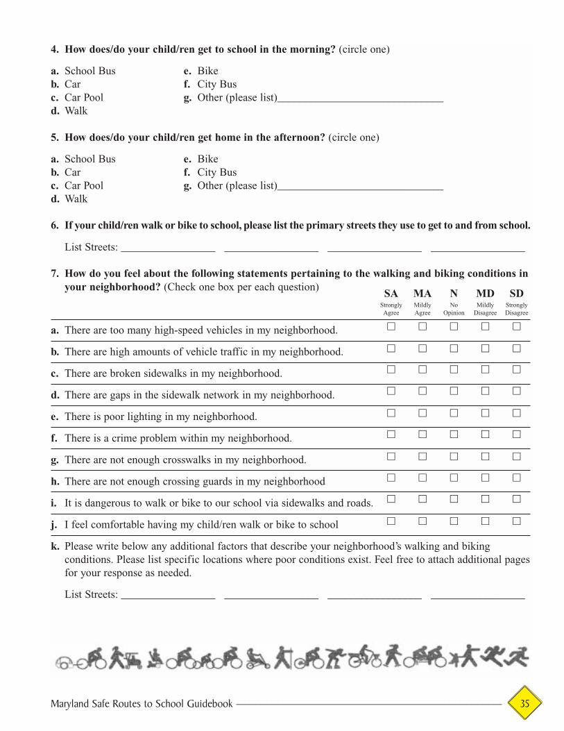
Maryland Safe Routes to School Guidebook ———————————————————————— 35
4. How does/do your child/ren get to school in the morning? (circle one)
a. School Bus e. Bikeb. Car f. City Busc. Car Pool g. Other (please list)______________________________d. Walk
5. How does/do your child/ren get home in the afternoon? (circle one)
a. School Bus e. Bikeb. Car f. City Busc. Car Pool g. Other (please list)______________________________d. Walk
6. If your child/ren walk or bike to school, please list the primary streets they use to get to and from school.
List Streets: _________________ _________________ _________________ _________________
7. How do you feel about the following statements pertaining to the walking and biking conditions inyour neighborhood? (Check one box per each question)
a. There are too many high-speed vehicles in my neighborhood.
b. There are high amounts of vehicle traffic in my neighborhood.
c. There are broken sidewalks in my neighborhood.
d. There are gaps in the sidewalk network in my neighborhood.
e. There is poor lighting in my neighborhood.
f. There is a crime problem within my neighborhood.
g. There are not enough crosswalks in my neighborhood.
h. There are not enough crossing guards in my neighborhood
i. It is dangerous to walk or bike to our school via sidewalks and roads.
j. I feel comfortable having my child/ren walk or bike to school
k. Please write below any additional factors that describe your neighborhood’s walking and bikingconditions. Please list specific locations where poor conditions exist. Feel free to attach additional pagesfor your response as needed.
List Streets: _________________ _________________ _________________ _________________
SA MA N MD SDStrongly Mildly No Mildly StronglyAgree Agree Opinion Disagree Disagree
� � � � �
� � � � �
� � � � �
� � � � �
� � � � �
� � � � �
� � � � �
� � � � �
� � � � �
� � � � �

36 ———————————————————————— Maryland Safe Routes to School Guidebook
8. Which of the following statements would influence your decision to consider letting your oldestchild walk or bicycle to school? (Check one box per each question)
I would let my oldest child walk or bike to school: Yes No Maybe
a. If they were accompanied by an adult.
b. If they were accompanied by other children the same age.
c. If they were accompanied by an older child.
d. If new sidewalks and crossings were installed.
e. If Police patrols and crossing guards were along school routes.
f. If they received walking/bicycle safety education from the school.
g. If we lived closer to the school.
9. How important are the following factors in influencing your decision to allow your child to walkor bicycle to school? (Check one box per each question)
Very Somewhat NotImportant Important Important
a. Crossing guards at all busy intersections.
b. Continuous sidewalks from your house to the school.
c. Clearly marked walking and bicycling routes (with signs).
d. Separated trail connecting your neighborhood to the school.
e. Slower traffic in the neighborhood.
f. Better lighting.
g. Emergency call boxes and designated safe houses (safer community).
h. Increased Police presence in the neighborhood.
i. Secure places to park bicycles (bike racks).
j. School education programs on walking and biking safety.
k. Please write below any additional factors that influence your decision to allow your child to walk orbicycle to school. Feel free to attach additional pages for your response as needed.
� � �
� � �
� � �
� � �
� � �
� � �
� � �
� � �
� � �
� � �
� � �
� � �
� � �
� � �
� � �
� � �
� � �

Maryland Safe Routes to School Guidebook ———————————————————————— 37
10. Traffic safety education programs are a primary component of the safe routes program. Below isa list of potential programs that could be developed at your school. Please check ones that youwould like to learn more about.
a. � The Walking School Bus (walking to /from school with an adult supervising a group of children).
b. � Contacting parents and updating them on the Safe Routes Program.
c. � Becoming an adult member of the School Traffic Safety Team.
d. � “Safety Post” program, where parents or other adult volunteers remain present at various locationsduring AM and PM travel times.
e. � Providing a “safe house” for children who may need assistance.
f. � Help organize the “Walk Our Children to School” event.
g. � Not interested in helping at this time, but would like updates.
h. � Other, please list ideas below. Attach additional pages for your response as needed.
11. Please list below the nearest street intersection next to your home.
Please provide your name and telephone or email address if you would like to be contacted about the vol-unteer opportunity you checked above. Hopefully you will be able to participate. To remain anonymousplease leave this section blank.
Name ___________________________________ Telephone _______________ E-mail _______________
Please return this survey to:
Thank you for your help and support!If you have any questions about this survey please call 301.444.2222

38 ———————————————————————— Maryland Safe Routes to School Guidebook
Dear (school name here) Teachers,
We need your help to make our community a safer place to walk and bike to school. This is atravel survey that will assist our Safe Routes to School Project Team in evaluating the currentwalking and bicycling conditions in our neighborhood school community. When you receive thissurvey, please take a few minutes to ask your homeroom students the following questions andrecord the appropriate responses. Please send the results back to me when completed.
Thank you,
(name here)
Teacher Name ________________________________ Grade _______ Total Number of Students _______
Date you conducted this survey _______________
Number of Students
1. How many students walked to school today, raise your hand:
2. How many students rode a bicycle to school today, raise your hand:
3. How many students rode a scooter or skateboard to school today, raise your hand:
4. How many students roller bladed to school today, raise your hand:
5. How many students came in a car to school today, raise your hand:
6. How many students came on a school bus today, raise your hand:
7. How many students came on a city bus today, raise your hand:
Please return the completed survey to the principal’s office today. This information will help us determinehow the students are currently getting to school in the morning to enable us to plan for safer routes.
Thank you for your help!
SAFE ROUTES TO SCHOOL TRAVEL SURVEY
�������
Appendices
CONTACTS BY COUNTY1
Allegany County
◆ State Highway Administration District 6 Office in LaVale,
District Engineer, 301-729-8400
◆ Allegany County Health Department, Community Traffic
Safety Coordinator, 301-777-5680
◆ Allegany County Department of Public Works,
Transportation Division, 301-777-5933
◆ Allegany County Board of Education, Supervisor of
Transportation, 301-759-2053
◆ Allegany County Sheriff ’s Office, Main Number,
301-777-5959
◆ Allegany County Health Department, Cardiovascular
Disease Grant Coordinator, 30l-777-5801, P.O. Box 1745
Willowbrook Road, Cumberland MD 2l502
Anne Arundel County
◆ State Highway Administration District 5 Office in
Annapolis, District Engineer, 410-841-5450
◆ Anne Arundel County Police, Traffic Safety Section,
Community Traffic Safety Coordinator, 410-222-8578
◆ Anne Arundel County Department of Public Works,
Traffic Engineering Division, 410-222-7331
◆ Anne Arundel County Public Schools, Division of
Transportation, 410-222-5111
◆ Anne Arundel County Health Department, Program
Manager, 410-222-70103, Harry S. Truman Parkway,
Annapolis MD 21401
Baltimore City
◆ Baltimore City Office of Transportation, Engineering
Supervisor, 410-396-6905
◆ Baltimore City Office of Transportation, Pedestrian Safety
Manager, 410-545-6854
◆ Baltimore City Health Department, Community Traffic
Safety Coordinator, 410-361-9130
◆ Baltimore City Public Schools, Director of Pupil
Transportation, 410-396-8777 or 410-396-8754
◆ University of Maryland-Baltimore/Community Health
Awareness Monitoring Program, Park Circle Business
Center, 2901 Druid Park Drive A204, Baltimore, MD 21215;
Department of Family Medicine, University of Maryland
Medical School, 29 South Paca Street, Baltimore, MD
21201; CHAMP Director, 410-383-4415; Assistant Director,
410-669-6570; Health Educator, 410-669-7053
Baltimore County
◆ State Highway Administration District 4 Office in
Brooklandville, District Engineer, 410-321-2800
◆ Baltimore County Police Department, Community Traffic
Safety Coordinator, Officer, 410-887-5916
◆ Baltimore County Division of Traffic Engineering,
410-887-3554
◆ Baltimore County Public Schools, Manager of
Transportation, 410-887-1111
◆ Baltimore County Police, General Information,
410-887-2214
◆ Baltimore County Health Department, Program
Coordinator, 410-887-3727, One Investment Place,
Towson, MD 21204
Calvert County
◆ State Highway Administration District 5 Office in
Annapolis, District Engineer, 410-841-5450
Maryland Safe Routes to School Guidebook ———————————————————————— 39
1Most of the resources listed were excerpted from Traffic Safety Recommenda-tions for School Zones: Guidelines and Resources. Maryland State HighwayAdministration School Safety Zone Traffic Safety Task Force. September 2000;and the Maryland State Highway Administration’s web site athttp://www.sha.state.md.us/oots/mctsp.htm
◆ Maryland State Police, Calvert County Community Traffic
Safety Coordinator, 410-535-1400
◆ Calvert County Public Works, Transportation Bureau,
410-535-9235
◆ Calvert County, Supervisor of Transportation,
410-535-7227
◆ Calvert County Sheriff ’s Department, 410-535-1600 or
301-855-1243, ext. 361
◆ Calvert County Health Department, 410-535-5400,
P.O. Box 980, Prince Frederick 20678
Caroline County
◆ State Highway Administration District 2 Office in
Chestertown, District Engineer, 410-778-3061
◆ Caroline County Health Department, Community Traffic
Safety Coordinator, 410-479-1882
◆ Caroline County Public Works, 410-479-0520
◆ Caroline County, Board of Education, Supervisor of
Transportation, 410-479-3260
◆ Caroline County Sheriff ’s Office, 410-479-2515
◆ Caroline County Health Department, Community Health
Nurse, 410-479-8080 ext 8630, 403 South 7th St., P.O. Box
10, Denton, MD 21629
Carroll County
◆ State Highway Administration District 7 Office in
Frederick, District Engineer, 301-624-8100
◆ Carroll County Health Department, Community Traffic
Safety Coordinator, 410-876-4448
◆ Carroll County Bureau of Roads, Operations and Traffic
Control, 410-848-6717
◆ Carroll County Public Schools, Supervisor of
Transportation, 410-751-3229
◆ Carroll County Sheriff's Office, 410-386-2900 or
1-888-302-8294
◆ Carroll County Health Department. Nutrition Services
Director, 410-876-4984; Program Coordinator,
410-876-4981; 290 Center Street, P.O. Box 845,
Westminster, MD 21158-0845
Cecil County
◆ State Highway Administration District 2 Office in
Chestertown, District Engineer, 410-778-3061
◆ Cecil County Health Department, Community Traffic
Safety Coordinator, 410-996-5168
◆ Cecil County Public Works, 410-996-5265
◆ Cecil County Public Schools, Supervisor of
Transportation, 410-996-5414
◆ Cecil County Health Department, 410-996-5168, John M.
Byers Health Center, 401 Bow Street, Elkton, MD 21921
Charles County
◆ State Highway Administration District 5 Office in
Annapolis, District Engineer, 410-841-5450
◆ Charles County Health Department, Community Traffic
Safety Coordinator, 301-934-9577
◆ Charles County Department of Public Facilities, Roads
Division, 301-932-3450 (in DC Metro Area 301-870-2778)
◆ Charles County Board of Education, Supervisor of
Transportation, 301-870-3814
◆ Charles County Sheriff ’s Office, Main Number,
301-609-6400
◆ Charles County Health Department, Cardiovascular
Disease Coordinator, 301-609-6930, Box 1050, White
Plains, MD 20695-1050
Dorchester County
◆ State Highway Administration District 1 Office in
Salisbury, District Engineer, 410-543-6715
◆ Dorchester County Sheriff's Office, Community Traffic
Safety Coordinator, 410-228-4142
◆ Dorchester County Highway Department, 410-228-2920
◆ Dorchester County Board of Education, Transportation
Supervisor, 410-228-4747
◆ Dorchester County Health Department, Cardiovascular
Disease Coordinator, 410-228-3223, 3 Cedar Street,
Cambridge MD 21613
Frederick County
◆ State Highway Administration District 7 Office in
Frederick, District Engineer, 301-624-8100
◆ State Highway Administration, Frederick County
Community Traffic Safety Coordinator, 301-624-8152
◆ Frederick County Division of Transportation Engineering,
Traffic and Transportation Planning, 301-696-2930
◆ Fredrick County Board of Education, Supervisor of
Transportation, 301-694-1500
◆ Frederick County Sheriff ’s Office, Main Number,
301-694-2168
40 ———————————————————————— Maryland Safe Routes to School Guidebook
◆ Frederick County Health Department, Director of
Nutrition Services, 301-631-3113, 350 Montevue Lane,
Frederick, MD 21702
Garrett County
◆ State Highway Administration District 6 Office in LaVale,
District Engineer, 301-729-8400
◆ Garrett County Health Department, Community Traffic
Safety Coordinator, 301-334-8122
◆ Garrett County Public Works, Traffic Safety Coordinator,
301-334-3988
◆ Garrett County Board of Education, Supervisor of
Transportation, 301-334-8908
◆ Garrett County Sheriff's Office, Main Number,
301-334-1911
◆ Garrett County Health Department. Community
Outreach Director, 301-334-8122; Nutritionist,
301-334-8111; 2008 Maryland Highway Mountain Lake
Park, MD 21550
Harford County
◆ State Highway Administration District 4 Office in
Brooklandville, District Engineer, 410-321-2800
◆ Harford County Community Traffic Safety Coordinator,
410-638-4924
◆ Harford County Division of Traffic and Transportation,
410-879-8379
◆ Harford County Public Schools, Supervisor of
Transportation, 410-638-4092
◆ Harford County Sheriff ’s Office, 410-836-5400
◆ Harford County Health Department, 410-838-3047
or 410-879-2404, 119 S. Hays Street, Box 797, Bel Air
21014-0797
Howard County
◆ State Highway Administration District 7 Office in
Frederick, District Engineer, 301-624-8100
◆ Howard County Department of Administration,
Community Traffic Safety Coordinator, 410-313-7237
◆ Howard County Department of Public Works, Traffic
Engineering Division, 410-313-2430
◆ Howard County Public Schools, Supervisor of
Transportation, 410-313-6732
◆ Howard County Police, Headquarters, 410-313-3200 or
301-621-4300; Northern District 410-313-3200; Southern
District, 410-313-3700
◆ Columbia Health Center, Cardiovascular Disease
Coordinator, 410-313-6204, 10630 Little Patuxent Pkwy,
Suite 400, Columbia MD 21044
Kent County
◆ State Highway Administration District 2 Office in
Chestertown, District Engineer, 410-778-3061
◆ Kent County Health Department, Community Traffic
Safety Coordinator, 410-778-2616
◆ Kent County Public Works, Roads Division, 410-778-4252
◆ Kent County Board of Education, Supervisor of
Transportation, 401-778-7127
◆ Kent County Sheriff's Office, 410-778-2279
◆ Kent County Health Department, Director of Health
Promotion & Wellness, 410-778-1350 or 410-778-7104;
Community Outreach, 410-778-7031; P.O. Box 359,
124 S. Lynchburg Street Chestertown, MD 21620
Montgomery County
◆ State Highway Administration District 3 Office in
Greenbelt, District Engineer, 301-513-7311
◆ Montgomery County Community Traffic Safety
Coordinator, 301-217-7250
◆ Montgomery County Division of Traffic and Parking
Services, 240-777-2190
◆ Montgomery County Engineering Services, Sidewalk
Program, 240-777-7272
◆ Montgomery County Police, School Safety Unit,
301-840-2715
◆ Montgomery County Public Schools, Division of
Transportation, 301-840-8130
◆ Montgomery County Public Schools, Safety and
Environment Health Unit, 301-279-3478
◆ Montgomery County Health Department Public Health
Services, Department of Health and Human Services,
Nutritionist, 240-777-1701, 2424 Reedie Drive, 2nd Floor,
Wheaton, MD 20902
Prince George’s County
◆ State Highway Administration District 3 Office in
Greenbelt, District Engineer, 301-513-7311
◆ Prince George’s County Police Department, Community
Traffic Safety Coordinators, 301-306-5609
◆ Prince George’s County Department of Public Works
and Transportation, 301-883-5650
Maryland Safe Routes to School Guidebook ———————————————————————— 41
◆ Prince George’s County Public Schools, Supervisor of
Transportation, 301-952-6570
◆ Prince George’s County Police, Crossing Guard Section,
301-731-4510
◆ Prince George's County Health Department, Program
Chief, Adult Health, 301-856-9480; Community Health
Nurse and Nutritionist, 301-856-9480; D. Leonard Dyer
Regional Health Center, 9314 Piscataway Road, Clinton
MD 20735-3630
Queen Anne’s County
◆ State Highway Administration District 2 Office in
Chestertown, District Engineer, 410-778-3061
◆ Queen Anne’s County. Sheriff ’s Office, Community Traffic
Safety Coordinator, 410-758-0770
◆ Queen Anne’s County Department of Public Works,
Road Engineer, 410-758-0920
◆ Queen Anne’s County Board of Education, Supervisor of
Transportation, 410-758-2403 (ext. 141 or 1-800-336-
7775, ext. 141)
◆ Queen Anne’s County Health Department, Program
Director, 410-758-0720 x354, 206 N. Commerce St.,
Centreville, MD 21617
St. Mary’s County
◆ State Highway Administration District 5 Office in
Annapolis, District Engineer, 410-841-5450
◆ St. Mary’s County Community Traffic Safety Coordinator,
301-475-4241
◆ St. Mary’s County Department of Public Works, County
Highway Division, 301-863-8401
◆ St. Mary’s County Public Schools, Supervisor of
Transportation, 301-475-5511
◆ St. Mary's County Sheriff's Office, 301-475-4040
◆ St. Mary’s County Health Department, Health Educator,
301-475-4318, P.O. Box 316, Peabody Street,
Leonardtown, MD 20650-0316
Somerset County
◆ State Highway Administration District 1 Office in
Salisbury, District Engineer, 410-543-6715
◆ Somerset County Community Traffic Safety Coordinator,
410-651-3882
◆ Somerset County Department of Public Works, Road
Department, 410-651-1930
◆ Somerset County Public Schools, Supervisor of
Transportation, 410-651-1485
◆ Somerset County Sheriff ’s Office, 410-651-9225
◆ Somerset County Health Department, Cardiovascular
Disease Coordinator and Program Supervisor, 410-651-
5665 ext. 217, 7920 Crisfield Highway, Westover, MD 21871
Talbot County
◆ State Highway Administration District 2 Office in
Chestertown, District Engineer, 410-778-3061
◆ Talbot County Community Traffic Safety Coordinator,
410-819-8067
◆ Talbot County Department of Public Works, Roads
Superintendent, 410-822-5446
◆ Talbot County Public Schools, Supervisor of
Transportation, 410-822-937
◆ Talbot County Sheriff ’s Office, 410-822-1020
◆ Talbot County Health Department, Coordinator and
Outreach Worker, 410-819-5629, 100 South Hanson
Street, Box 480, Easton MD 21601
Washington County
◆ State Highway Administration District 6 Office in LaVale,
District Engineer, 301-729-8400
◆ Washington County Health Department, Community
Traffic Safety Coordinator, 301-791-3054
◆ Washington County Department of Public Works, Traffic
Engineer, 301-791-3140
◆ Washington County Board of Education, Transportation
Supervisor, 301-791-4250
◆ Washington County Sheriff ’s Office, 301-791-3300
◆ Washington County Health Department, Partners in
Prevention (PIP) Program Coordinator, 301-791-3039; PIP
Program Secretary, 301-791-3030; 1302 Pennsylvania Ave.,
Hagerstown, MD 21742
Wicomico County
◆ State Highway Administration District 1 Office in
Salisbury, District Engineer, 410-543-6715
◆ Wicomico County Sheriff's Office, Community Traffic
Safety Coordinator, 410-548-4891
◆ Wicomico County Department of Public Works, Roads
Engineer, 410-548-4874
◆ Wicomico County Board of Education, Supervisor of
Transportation, 410-543-4266
42 ———————————————————————— Maryland Safe Routes to School Guidebook
◆ Wicomico County Sheriff ’s Department, 410-548-4891
◆ Wicomico County Health Department Hurdle Building,
Program Supervisor, 410-546-5311, 108 E. Main Street,
Salisbury, MD 21801
Worcester County
◆ State Highway Administration District 1 Office in
Salisbury, District Engineer, 410-543-6715
◆ Worcester County Health Department, Community
Traffic Safety Coordinator, 410-632-0056
◆ Worcester County Roads Department, County Roads
Engineer, 410-632-2244
◆ Worcester County Board of Education, Supervisor of
Transportation, 410-632-2582
◆ Worcester County Sheriff ’s Office, 410-632-1111
◆ Worcester County Health Department, Program Director,
Cardiovascular Disease Coordinator and Nutritionist,
410-632-0056, P.O. Box 249, Snow Hill, MD 21863
ADDITIONAL CONTACTS
◆ For links to listings of local elected officials and to look
up state and congressional representatives by zip code,
go to http://mdelect.net/lookup.asp
◆ For more information on contacts for individual counties
and municipalities, go to: http://www.mdmanual.net
◆ American Automobile Association
www.aaamidatlantic.com
Myra Wieman, Manager, Safety Services
Maryland (excluding PG, Mont and Charles counties)
100 West Road, Ste. 304, Towson, MD 21204
(410) 821-3904, [email protected]
Joe Beddick, Manager, Safety Services
Metro DC (including PG, Mont and Charles counties)
14280 Park Meadow Drive, Chantilly, VA 20151
(703) 222-4126, [email protected]
STATE CONTACTS
◆ Maryland Department of Transportation
Director of Bicycle and Pedestrian Access
7201 Corporate Center Drive, Mail Stop 200
Hanover, MD 21076
410-865-1237 or toll free 1-888-713-1414
◆ Maryland Highway Safety Office/State Highway
Administration
Pedestrian and Special Programs Coordinator
7491 Connelley Drive, Hanover, MD 21076
410-582-5578, [email protected]
◆ Maryland Department of Health and Mental Hygiene
(DHMH)
www.dhmh.state.md.us/
◆ Maryland State Department of Education
www.msde.state.md.us/
◆ Maryland Department of Planning (MDP)
www.mdp.state.md.us/
◆ Maryland Department of Natural Resources
www.dnr.state.md.us
EDUCATION AND ENCOURAGEMENT RESOURCES
www.walktoschool-usa.org
A resource guide for communities and organizations wanting
to plan a walk-to-school event “aimed at bringing forth per-
manent change to encourage a more walkable America.” A
nationwide walk to school day is planned for early October
each year.
www.iwalktoschool.org
The official website of International Walk to School Day.
www.dot.ca.gov/hq/LocalPrograms/
The California Department of Transportation (Caltrans) Safe
Routes program. The Division of Local Assistance provides
information for organizations wanting to apply for funding.
www.waytogo.icbc.bc.ca
Way to Go! is a school program that offers tools to help par-
ents make safer alternative travel arrangements for students
going to and from school. It fosters safer, healthier travel
alternatives for elementary and middle school students.
www.greenestcity.org
Greenest City is a non-profit, community-based environ-
mental organization committed to reducing pollution,
regenerating urban life, and promoting social equity. They
have developed an Active & Safe Routes to School program
and a Walk to School Day, to broaden participation of fami-
lies and children in active modes of transportation.
www.goforgreen.ca/home_e.html
Go for Green is a national non-profit, charitable organiza-
tion encouraging Canadians to pursue healthy, outdoor
Maryland Safe Routes to School Guidebook ———————————————————————— 43
physical activities while being good environmental citizens.
The organization promoted the Active & Safe Routes to
School program and the International Walk to School Day
in October.
www.ccc.govt.nz/saferoutes/
The Christchurch, New Zealand City Council funds a ‘Safe
Routes To School’ (SR2S) program. Originating with school
road safety investigations, SR2S has developed to include a
strong behavioural and promotional emphasis of encourag-
ing safe and active travel to school. These include Walk to
School Days, the Walking School Bus Project, and Resources
to help schools.
www.schoolbusfle et.com
Schoolbusfleet.com is an information service of SCHOOL
BUS FLEET magazine, a trade publication serving more than
22,000 school transportation professionals in the United
States and Canada. The site provides information on the
management and maintenance of school bus fleets operated
by public school districts, private schools, Head Start agen-
cies and childcare centers.
www.sustrans.org
Sustrans—the sustainable transport charity—works on
practical projects to encourage people to walk, cycle and use
public transport in order to reduce motor traffic and its
adverse effects. Sustrans is working on Safe Routes to Schools,
Safe Routes to Stations, home zones and other practical
responses to the transport and environmental challenges.
www.dpi.wa.gov.au/metro/gettingthere/cycling/bikewest.html
The Cycle Instead Program aims to increase the proportion
of trips made by bicycle in regional centers of Western
Australia by promoting cycling as an enjoyable and viable
form of sustainable transport for short journeys. The pro-
gram aims to contribute to meeting the Metropolitan
Transport Strategy’s target of increasing the proportion of
trips made by bicycle in Perth, Western Australia to 8% by
2010. The program includes cycling education, a sponsorship
program, and promotional events.
www.cdc.gov/nccdphp/dnpa/kidswalk/
To support the national goal of better health through physi-
cal activity, the Center for Disease Control’s Nutrition and
Physical Activity Program has developed KidsWalk-to-
School. This is a community-based program that aims to
increase opportunities for daily physical activity by encour-
aging children to walk to and from school in groups accom-
panied by adults.
www.baypeds.org/saferoutes.html
Describes the Safe Routes to School Bill of 1999 and the
opportunities for California.
www.saferoutestoschool.org/
Transportation Alternatives are advocates for bicyclists,
pedestrians and sensible transportation in New York City.
They have helped win numerous improvements for cyclists
and pedestrians and have been the leading voice for reduc-
ing car use in the city. Their Safe Routes to School program
endeavors to reduce the number of children and other
pedestrians and motorists who are injured or killed in traffic
and to keep the number of children walking to school at
80% by making the walking routes safer.
www.civfed.org/schosafe.htm
Arlington County, Virginia has embarked on a Safe Routes
to School program. The site includes three files that explain
background, describe the program and list the projects to
implement it.
FUNDING SOURCES
The following summary provides a brief overview of the pri-
mary funding sources available for pedestrian and bicycle
facilities, safety and education activities. Federal, State and
non-governmental sources are included. It is important to
note that, aside from these core programs, bicycle and
pedestrian improvements are also often made through the
inclusion of bicycle and/or pedestrian facilities in routine
highway improvement projects and streetscape projects.
It’s a good idea to begin with your local transportation
agency (city or county), in the case of Federal and State
funding, it may be necessary to go through them to access
these funds. Also, keep in mind that in addition to Federal
and State programs, city and county governments will often
have funding programs that support bicycle and pedestrian
improvements as well.
State and Federal Programs2
Transportation Enhancement ProgramTransportation Enhancement Program funds are available
for a broad array of projects including pedestrian and
bicycle facilities and pedestrian and bicycle safety and
education activities.
44 ———————————————————————— Maryland Safe Routes to School Guidebook
2This information is largely excerpted from MDOT’s website available athttp://www.sha.state.md.us/oppe/tep.htm

Proposals are accepted at anytime during the year and funds
are awarded to new projects in the summer and in the fall.
A State agency, a county or municipal government, a private
non-profit organization, a community group, or an individ-
ual may identify potential projects. Projects proposed by
non-governmental agencies must secure an appropriate
government agency as a co-sponsor. Maryland’s State
Highway Administration offers information and technical
assistance to applicants. For more information, contact
Dennis N. Simpson, Enhancement Program Manager,
Maryland State Highway Administration, Regional and
Intermodal, Planning Division, Mail Stop C502, P.O. Box 717,
Baltimore MD 21203-0717, 410-545-5675 or 1-888-204-4828.
Section 402 Funds and Community Traffic Safety Coordinators3
Section 402 funds, established by the Highway Safety Act of
1966, can be used to develop non-construction measures to
address a wide array of highway safety problems related to
human factors and the roadway environment. In Maryland,
these funds are administered by the Maryland Highway
Safety Office.
This office also oversees the Community Traffic Safety
Coordinators designated for each of Maryland’s 23 counties
and Baltimore City. (These coordinators are identified in the
Contacts by County listings on pages 39–43 in the appen-
dix.) The Coordinators work with local Task Forces to identi-
fy traffic safety issues/problems, develop appropriate coun-
termeasures, and implement or advocate solutions. Some
funds for safety education and encouragement programs
may be available through these coordinators.
National Recreational Trails4
The National Recreational Trails program funds the develop-
ment of community-based, motorized and non-motorized
recreational trail projects. The program provides funds for all
kinds of recreational trail uses, such as pedestrian uses (hik-
ing, running, wheelchair use), bicycling, in-line skating,
equestrian use, cross-country skiing, off-road motorcycling,
all-terrain vehicle riding, four-wheel driving.
Administered by the State Highway Administration (SHA),
this program matches federal funds with local funds or in-
kind contributions to implement trail projects. Projects can
be sponsored by a county or municipal government, a pri-
vate non-profit agency, a community group or an individual
(non-governmental agencies must secure an appropriate
government agency as a co-sponsor).
Federal funds administered by the State Highway
Administration are available for up to 50% of the project
cost, matched by at least 50% funding from the project
sponsor. Matching funds must be committed and docu-
mented in the local jurisdiction’s budget.
Activities eligible for funding within this program include:
◆ maintenance and restoration of existing recreational trail
◆ development and rehabilitation of trailside facilities and
trail linkages
◆ purchase and lease of trail construction equipment
◆ construction of new trails
◆ acquisition of easements or property for recreational
trails or recreational trail corridors
◆ operation of educational programs to promote safety
and environmental protection relating to the use of
recreational trails
Preference will be given to projects which:
◆ have broad-based community support
◆ provide linkages to or complete existing trails
◆ provide improvements to a trail in order to benefit or
mitigate impacts to the natural environment
◆ will be accomplished with youth conservation or service
groups to perform construction and maintenance
For further information contact: Recreational Trails
Coordinator, Maryland State Highway Administration, Office
of Environmental Design, Mail Stop C-303, P.O. Box 717,
Baltimore, MD 21203-0717, 410-545-8640 or 1-800-446-5962.
Partnership Planting ProgramThis program focuses on roadside beautification within the
state owned right-of-way, however, SHA programs that
address landscaping and beautification contribute signifi-
cantly to the pedestrian and bicycling environment and are
important to aspects of promoting more bicycling and walk-
ing. For more information, contact Leroy Jonas, Maryland
State Highway Administration, Landscape Operations
Division, C-304, 707 N. Calvert St. Baltimore MD 21202,
e-mail at [email protected].
Grants5
Healthy People 2010 Community ImplementationGrants ProgramThe Federal Department of Health and Human Services
plans to award hundreds of ‘micro-grants’ to community
Maryland Safe Routes to School Guidebook ———————————————————————— 45
3This information is largely excerpted from MDOT’s website available athttp://www.sha.state.md.us/oots/mctsp.htm
4http://www.sha.state.md.us/oed/trails.htm5This information is largely excerpted from www.trailsandgreenways.org

organizations for activities that support the goals of Healthy
People 2010, the nation’s public health agenda for the next
decade. Worth up to $2,010 each, the micro-grants represent
a new, low-cost approach to foster effective prevention
efforts at the community level. Each grant will support
efforts by local groups to promote health education, quality
care, access to care and other projects that support the far-
reaching national health goals of Healthy People 2010. Faith-
based organizations will be among those eligible to apply for
funding. For more information, contact: Sally Jones,
Administrative Officer, Office of Disease Prevention and
Health Promotion, Hubert H. Humphrey Building, Room
738-G, 200 Independence Avenue, SW., Washington, DC
20201, 202-260-7654.
www.health.gov/healthypeople/Implementation
Urban Park and Recreation Recovery Program
Funding is available for rehabilitation projects under the
UPARR program. Rehabilitation grants awarded will focus on
neighborhood park and recreation sites and facilities that
have ‘deteriorated to the point where health and safety are
endangered or the community’s range of quality recreation
service is impaired.’ Grant funds may be used to remodel,
rebuild or develop existing recreation areas and facilities.
UPARR grants are awarded on a 70/30 (Federal/local) match-
ing basis. Applications and additional requirements can be
found in the ‘UPARR Preapplication Handbook’ available
from the NPS field office or online at
www.ncrc.nps.gov/uparr. For more information, contact:
Stewardship and Partnerships Team, Philadelphia Support
Office, National Park Service, 200 Chestnut Street, 3rd Floor,
Philadelphia, PA 19106. Telephone 215-597-9195. Web site:
www.ncrc.nps.gov/uparr
PHYSICAL IMPROVEMENTS:GALLERY OF SOLUTIONSThis section provides an overview of typical solutions to
improve physical conditions. These solutions will comple-
ment the educational and promotional programs and, in
many cases, they will help reinforce existing speed limits and
pedestrian rights-of-way. Brief descriptions of various traffic
calming techniques and good crossing treatments are provid-
ed along with photos to illustrate their use. These descrip-
tions are followed with a table of rough cost estimates.
It is important to consult with a local traffic engineer and/or
public works agency in developing design solutions (i.e.
speed humps, bulb outs, etc.) or operational solutions (i.e.
signal timing changes or the use of crossing guards). In some
cases, a location may need to meet certain criteria to qualify
Curb bulbout. Photo by Dan Burden.
Diagonal diverter.
46 ———————————————————————— Maryland Safe Routes to School Guidebook
Median island with raised crossing.

for a specific treatment such as a traffic signal or stop sign.
A planning professional can help you understand these types
of guidelines as well as propose alternative solutions.
Traffic Calming MeasuresTraffic calming is a combination of mainly physical changes
to a street that reduce the negative effects of speeding
and improve conditions for pedestrians and bicyclists.
Traffic calming includes both speed reduction and volume
control measures.
Speed Reduction6
◆ Speed Humps. Speed humps are raised, rounded sec-
tions of pavement designed to slow vehicles on a road-
way. They are most appropriate for use on residential
streets rather than major streets or state roads. Many
communities have found speed humps to be contro-
versial. They should be implemented only when a large
degree of public support exists.
◆ Speed Tables. Speed tables are similar to speed humps,
however they have flat tops rather than rounded ones.
They often have colored or textured pavement on the
flat top and are generally longer than speed humps.
◆ Center Islands Neckdowns, Bulbouts, and Chokers.
Center islands, neckdowns, bulbouts and chokers are
various methods for slowing traffic by narrowing the curb-
to-curb width of the roadway. These measures are often
combined with crosswalks to increase pedestrian visibility
and create more comfortable pedestrian crossings.
◆ Narrowing by Restriping and Landscaping. In addition to
the measures above, striping and landscaping can be
used to visually narrow the roadway and help reduce
vehicle speeds.
◆ Modern Roundabouts. Modern roundabouts are an
intersection control device, like a traffic signal or stop
sign, however they function quite differently. At a round-
about, vehicles move counterclockwise around a circular
center island that is designed to slow traffic. Entering
vehicles yield to circulating vehicles. Splitter islands at
each entry point serve as pedestrian refuges where pedes-
trians only have to cross one direction of traffic at a time.
Recent studies of modern roundabouts have shown that
they reduce automobile and pedestrian crash rates.
◆ Neighborhood Traffic Circle. Traffic circles are small
raised circles placed in intersections that drivers must
maneuver around by driving slowly. Unlike modern
roundabouts that can be used at intersections on major
roadways, traffic circles are most appropriate for local
neighborhood streets.
Volume ControlVolume control measures are physical design measures that
prevent vehicles from entering certain streets. While these
measures can be very effective in reducing traffic volumes,
they often result in diverting traffic to parallel streets with
less restrictive volume control measures. For this reason,
their use should be considered very carefully.
◆ Full Closures. Full street closures use physical barriers
or landscaping to block vehicular traffic from entering
a particular roadway while maintaining access for
pedestrians, bicyclists, and emergency vehicles. This
method of volume control is highly restrictive method
of controlling high volumes. It should be used only on
roadways where a large number of short-cuts and
Neckdown.
Speed table with stamped asphalt.
6Ewing, Reid. Traffic Calming: State of the Practice. US Department ofTransportation. Federal Highway Administration. Washington, DC: 1999.
Maryland Safe Routes to School Guidebook ———————————————————————— 47
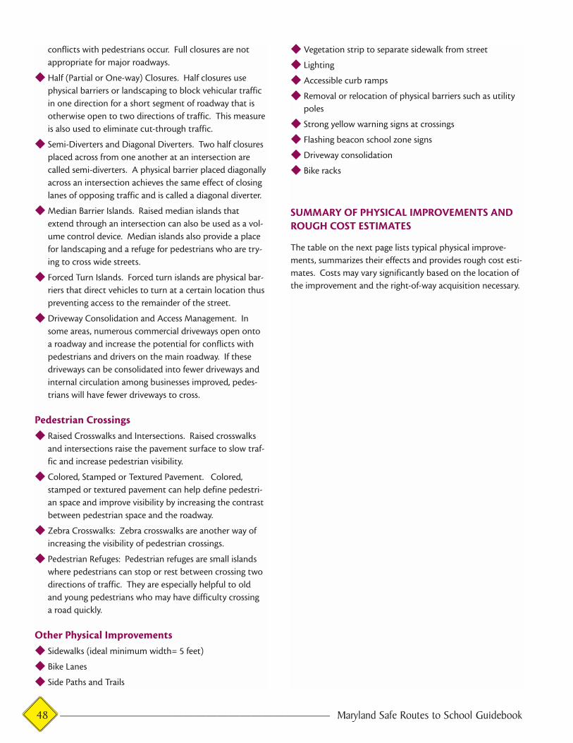
conflicts with pedestrians occur. Full closures are not
appropriate for major roadways.
◆ Half (Partial or One-way) Closures. Half closures use
physical barriers or landscaping to block vehicular traffic
in one direction for a short segment of roadway that is
otherwise open to two directions of traffic. This measure
is also used to eliminate cut-through traffic.
◆ Semi-Diverters and Diagonal Diverters. Two half closures
placed across from one another at an intersection are
called semi-diverters. A physical barrier placed diagonally
across an intersection achieves the same effect of closing
lanes of opposing traffic and is called a diagonal diverter.
◆ Median Barrier Islands. Raised median islands that
extend through an intersection can also be used as a vol-
ume control device. Median islands also provide a place
for landscaping and a refuge for pedestrians who are try-
ing to cross wide streets.
◆ Forced Turn Islands. Forced turn islands are physical bar-
riers that direct vehicles to turn at a certain location thus
preventing access to the remainder of the street.
◆ Driveway Consolidation and Access Management. In
some areas, numerous commercial driveways open onto
a roadway and increase the potential for conflicts with
pedestrians and drivers on the main roadway. If these
driveways can be consolidated into fewer driveways and
internal circulation among businesses improved, pedes-
trians will have fewer driveways to cross.
Pedestrian Crossings◆ Raised Crosswalks and Intersections. Raised crosswalks
and intersections raise the pavement surface to slow traf-
fic and increase pedestrian visibility.
◆ Colored, Stamped or Textured Pavement. Colored,
stamped or textured pavement can help define pedestri-
an space and improve visibility by increasing the contrast
between pedestrian space and the roadway.
◆ Zebra Crosswalks: Zebra crosswalks are another way of
increasing the visibility of pedestrian crossings.
◆ Pedestrian Refuges: Pedestrian refuges are small islands
where pedestrians can stop or rest between crossing two
directions of traffic. They are especially helpful to old
and young pedestrians who may have difficulty crossing
a road quickly.
Other Physical Improvements◆ Sidewalks (ideal minimum width= 5 feet)
◆ Bike Lanes
◆ Side Paths and Trails
◆ Vegetation strip to separate sidewalk from street
◆ Lighting
◆ Accessible curb ramps
◆ Removal or relocation of physical barriers such as utility
poles
◆ Strong yellow warning signs at crossings
◆ Flashing beacon school zone signs
◆ Driveway consolidation
◆ Bike racks
SUMMARY OF PHYSICAL IMPROVEMENTS ANDROUGH COST ESTIMATES
The table on the next page lists typical physical improve-
ments, summarizes their effects and provides rough cost esti-
mates. Costs may vary significantly based on the location of
the improvement and the right-of-way acquisition necessary.
48 ———————————————————————— Maryland Safe Routes to School Guidebook
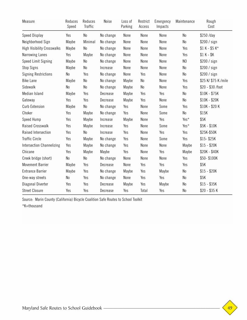
Maryland Safe Routes to School Guidebook ———————————————————————— 49
Measure Reduces Reduces Noise Loss of Restrict Emergency Maintenance RoughSpeed Traffic Parking Access Impacts Cost
Speed Display Yes No No change None None None No $250 /day
Neighborhood Sign Maybe Minimal No change None None None No $200 / sign
High Visibility Crosswalks Maybe No No change None None None Yes $1 K - $5 K*
Narrowing Lanes Yes Maybe No change None None None Yes $1 K - $K
Speed Limit Signing Maybe No No change None None None NO $200 / sign
Stop Signs Maybe No Increase None None None No $200 / sign
Signing Restrictions No Yes No change None Yes None No $200 / sign
Bike Lane Maybe No No change Maybe No None Yes $25 K/ $75 K /mile
Sidewalk No No No change Maybe No None Yes $20 - $30 /foot
Median Island Maybe Yes Decrease Maybe Yes Yes No $10K - $75K
Gateway Yes Yes Decrease Maybe Yes None No $10K - $20K
Curb Extension Maybe No No change Yes None Some Yes $10K - $20 K
Choker Yes Maybe No change Yes None Some No $15K
Speed Hump Yes Maybe Increase Maybe None Yes Yes* $5K
Raised Crosswalk Yes Maybe Increase Yes None Some Yes* $5K - $10K
Raised Intersection Yes No Increase Yes None Yes Yes $25K-$50K
Traffic Circle Yes Maybe No change Yes None Some Yes $15- $25K
Intersection Channelizing Yes Maybe No change Yes None None Maybe $15 - $20K
Chicane Yes Maybe Maybe Yes None Yes Maybe $20K - $40K
Creek bridge (short) No No No change None None None Yes $50- $100K
Movement Barrier Maybe Yes Decrease None Yes Yes Yes $5K
Entrance Barrier Maybe Yes No change Maybe Yes Maybe No $15 - $20K
One-way streets No Yes No change None Yes Yes No $5K
Diagonal Diverter Yes Yes Decrease Maybe Yes Maybe No $15 - $35K
Street Closure Yes Yes Decrease Yes Total Yes No $20 - $35 K
Source: Marin County (California) Bicycle Coalition Safe Routes to School Toolkit
*K=thousand