Marston Conservation Area Appraisal · salt mines had closed due to flooding. • It w as found...
26
Vale Royal Borough Council MARSTON (LION SALT WORKS) REVISED CONSERVATION AREA APPRAISAL
Transcript of Marston Conservation Area Appraisal · salt mines had closed due to flooding. • It w as found...

Vale Royal Borough Council
MARSTON(LION SALT WORKS)
REVISED CONSERVATION AREA
APPRAISAL

Conservation Areas were introduced by the Civic Amenities Act of 1967, and are now an accepted part of Town and Country Planning legislation and practice. Local Authorities are required to identify “areas of special architectural or historic interest, the character of which it is desirable to preserve or enhance”. They are also under a duty to review existing designations from time to time.
It has been recognised that if the special interest, character and appearance of a conservation area is to be retained, it must be managed. The first task in this process is to define and analyse the special characteristics that justify the designation of the conservation area. This is achieved by carrying out a Conservation Area Appraisal.
The character of an area depends upon its historic background, the architectural quality and interest of its buildings, their materials and detailing, the way they relate to each other, the line of the highway, the quality of the landscape, trees and open spaces and a variety of unique features.
A Conservation Area Appraisal provides a description of those elements that contribute to and define the character of the conservation area. It also provides the basis for development plan policies and development control decisions, both within and adjacent to the Conservation Area boundary. Subsequently the appraisal will provide the background for proposals to preserve or enhance the area. It may also identify development opportunities. Therefore the Government has stated that appraisals are considered to be essential for all existing and proposed conservation areas.
Vale Royal Borough Council understands the importance of involving the local community in the appraisal process. It has recognised that these studies are only valid if those people who are most closely affected by the designation of the conservation area accept the content of the appraisal. As a result, a public consultation exercise has been undertaken, the considered responses from which have been incorporated into this final version of the appraisal.
The Borough Council’s methodology for conducting Conservation Area Appraisals has been accepted as an example of Good Practice In Conservation by the Royal Town Planning Institute. However the Council has resolved to continue to revise and improve its methodology for conducting conservation area appraisals whilst striving to maintain a degree of consistency between the various completed studies.
The principal effects of this designation are as follows: 1. The Council is under a duty to prepare proposals to ensure the preservation or enhancement of the area 2. In carrying out its functions under the Planning Acts, and in particular when determining applications for planning permission and conservation area or listed building consent, the Council and the Secretary of State are required to take into account the desirability of preserving or enhancing the character or appearance of the area 3. Permitted development rights are more restricted within the designated area 4. Consent must be obtained from the Council for the demolition of any building in the area (subject to certain exceptions) 5. Special publicity must be given to planning applications for development in the area 6. Six weeks’ notice must be given to the local planning authority before any works are carried out to trees within the designated area. It becomes an offence, subject to certain exceptions, to cut down, top, lop, uproot, wilfully damage or destroy any tree in the area without the prior written consent of the local planning authority

HISTORY
1.0 Historic evolution of the area
1.1 Origins and development of the settlement
• The Northwich area of Cheshire is well known for its connections with the salt industry.
• The deposits of rock salt are deep below the surface and therefore can only be obtained by mining or brine pumping.
• Romans exploited brine streams where they came to the surface as brine springs, and extracted salt by evaporation.
• The first rock salt was discovered near Northwich in 1670, at a depth of approximately 45m and was extracted using simple mining techniques.
• Many of the mines were short lived due to the ever-present threat of flooding.
• The River Weaver was made navigable in 1732, which allowed salt to be transported out of the local area on a large scale for the first time, leading to an increase in demand.
• The Trent and Mersey canal, which ran through many of the salt working areas, was opened in 1776. • Cargoes of salt were then transhipped
to boats waiting on the river Weaver at Anderton, from where they made their way to the port of Liverpool.
• Initially this was done via a series of basins and ‘salt chutes’ until the construction of the Anderton Boat Lift in 1875, which lifted the narrow canal boats up and down the large drop that separated canal from river.
• Later the area was served by railway. • In 1779 a second lower bed of superior
rock salt was discovered and from then on all new mining operations were transferred to this lower level.
• New mines were sunk as close as possible to the canals to facilitate bulk transport, and in Marston the lower bed deposit was struck in 1781.
• A Red Lion Inn existed in Marston in 1846 on a site just south of the canal bridge.
• It is useful to give a visual description of a mine at the surface, now that standing structures no longer exist: • Typically a shaft for access, winding
and ventilation served each mine, with exposed winding gear covered by a timber roof structure. Adjacent would have been the horse gin circle for winding, although steam engines were increasingly used for winding rock salt and pumping water out of the mines.
• Steam power would have been denoted by brick engine house, boiler house and chimney.
• Associated surface buildings would have included salt stores, crushing mills, offices, stables, smithy, and workshop, and also accommodation for mine owner or foreman. Sometimes housing for workers was included. These often remained the only visible structures left after a mine closed.
• At its peak there were 29 bottom bed rock salt mines in the Northwich area, but naturally occurring brine was also extracted throughout the period. • As pumps increased in efficiency and
steam power was introduced, the rate of brine extraction escalated, and by the mid 19th century many of the rock salt mines had closed due to flooding.
• It was found that the water in the flooded mines dissolved the rock salt and could itself be pumped out as brine – this process of flooding and pumping out the mines could also be repeated.
• The cost of making white salt from brine was significantly cheaper than obtaining rock salt by mining.
• Salt was manufactured using the open pan method, as practiced at the Lion Salt Works, opened in 1894 on the site of the original Red Lion Inn, and run by the Thompson family.
• Brine would be heated in large pans over a coal fire in the pan house, and once evaporated the salt would be dried in the stove house.
• Associated structures were the brine storage tank, warehouses, and a packinghouse.
1

• Intense rivalry between salt works led to the formation of the Salt Union Ltd. in 1888 to unite firms and stabilise prices.
• Smaller firms were squeezed out and the last rock salt mine closed after a major flood in 1928.
• Subsidence was becoming a major problem as supporting rock piers left during rock salt mining gradually dissolved away – as a consequence brine pumping was gradually reduced.
• The Lion Salt Works closed in 1986 due to the loss of its main markets in West Africa during the civil war in Nigeria. • It was the last working open pan salt
works in the country.
1.2 Topographical elements that have influenced the settlement form
• The existence of valuable salt deposits underground led to the origin and development of Marston.
• Situated in a flat low-lying area, prone to subsidence and flooding as a consequence of the salt industry.
• The adjacent Trent and Mersey Canal is a contour canal – there are no locks locally – its water surface is therefore a constant element against which the rate of subsidence in the surrounding area can be measured.
1.3 Influence of current or previous land uses on the area
• The salt industry is responsible for the form and many of the features of the area as seen today. • Layout of the village core is a result of
the growth of the salt industry. • Mining subsidence shaped the area. • Large gaps in the streetscape where
houses have had to be demolished. • Collapse of Adelaide and Ollershaw
Works due to over mining has created flash pools now used for fishing.
• The Lion Salt Works remains as the most dominant collection of built structures in the area.
2.0 Archaeological significance and potential of the area
• The salt working industry in this area of Cheshire in the 18th and 19th century was on a much greater scale than anywhere else in Britain, and the archaeological remains are therefore of national interest and importance.
• The Lion Salt Works site is a Scheduled Monument which includes: • The upstanding remains of all
structures associated with the manufacture of salt including the Coronation Salt Store on the opposite side of Ollershaw Lane.
• The buried remains of part of the earlier Alliance Salt Works (1856-1910) - this was also built by the Thompson’s and extended to the east of the Lion Salt Works site beyond the current Scheduled Monument boundary.
• The Adelaide Salt Works was situated to the north of the canal and west of Ollershaw Lane, and is now partly covered by the flash pool.
Extract from 1st Edition OS map showing Adelaide Works (1877)
• It closed in 1928 when a shaft collapsed and the mine flooded, and was the last rock salt mine to be worked in mid-Cheshire.
2
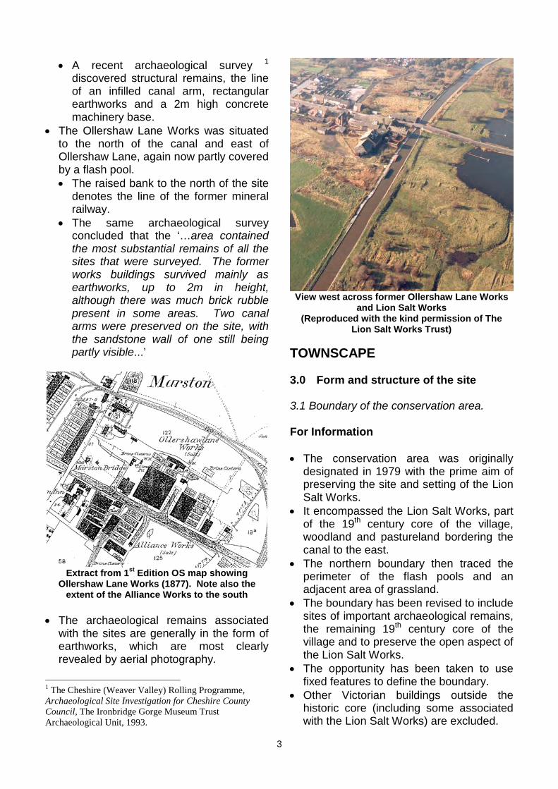
• A recent archaeological survey 1
discovered structural remains, the line of an infilled canal arm, rectangular earthworks and a 2m high concrete machinery base.
• The Ollershaw Lane Works was situated to the north of the canal and east of Ollershaw Lane, again now partly covered by a flash pool. • The raised bank to the north of the site
denotes the line of the former mineral railway.
• The same archaeological survey concluded that the ‘…area contained the most substantial remains of all the sites that were surveyed. The former works buildings survived mainly as earthworks, up to 2m in height, although there was much brick rubble present in some areas. Two canal arms were preserved on the site, with the sandstone wall of one still being partly visible...’
Extract from 1st Edition OS map showing Ollershaw Lane Works (1877). Note also the
extent of the Alliance Works to the south
• The archaeological remains associated with the sites are generally in the form of earthworks, which are most clearly revealed by aerial photography.
1 The Cheshire (Weaver Valley) Rolling Programme, Archaeological Site Investigation for Cheshire County Council, The Ironbridge Gorge Museum Trust Archaeological Unit, 1993.
View west across former Ollershaw Lane Works and Lion Salt Works
(Reproduced with the kind permission of TheLion Salt Works Trust)
TOWNSCAPE
3.0 Form and structure of the site
3.1 Boundary of the conservation area.
For Information
• The conservation area was originally designated in 1979 with the prime aim of preserving the site and setting of the Lion Salt Works.
• It encompassed the Lion Salt Works, part of the 19th century core of the village, woodland and pastureland bordering the canal to the east.
• The northern boundary then traced the perimeter of the flash pools and an adjacent area of grassland.
• The boundary has been revised to include sites of important archaeological remains, the remaining 19th century core of the village and to preserve the open aspect of the Lion Salt Works.
• The opportunity has been taken to use fixed features to define the boundary.
• Other Victorian buildings outside the historic core (including some associated with the Lion Salt Works) are excluded.
3
The revised boundary is as follows to enclose the woodland area to the south of the canal towpath.
For simplicity, references to orientation • When in line with the post and wire assume that Ollershaw Lane runs on a livestock fence to the north of the canal it North–South axis through Marston. turns and runs in a northerly direction in a
straight line over the canal to meet this • Commencing in the north of the area on fence, then continues to follow it in a
Ollershaw Lane at the point where the generally northern direction to enclose the footpath intersects the road (approx 160m collapsed shaft, pastureland and flash north of the canal bridge) and running pool. clockwise – • The boundary then turns through a right
• The boundary runs in an easterly angle and running in an easterly direction, direction along the post and wire fence to follows a post and wire fence, alongside a the left of the agricultural track until in line farm building and along another post and with the concrete post and wire mesh wire fence until it reaches the steel perimeter fence of the adjacent industrial perimeter boundary fence of the gas building, where it turns and runs south to bottle depot, which it follows back to the canal to encompass the flash pool Ollershaw Lane. and rough grassland area. • It then runs south down the centre of
• It turns easterly along the centre-line of Ollershaw Lane until in line with the the canal until in line with the rear footpath. boundaries of the housing in Wincham, where it turns south and follows the rear 3.2 Views within, into and out of the area garden fence line to a steel kissing gate.
• Here it turns to run in a westerly direction • Views within the conservation area – across the field to Cross Street spanning • The top of the canal bridge gives an a straight line between the two kissing elevated vantage point – gates to enclose the open space to the • Panoramic rural view to north across south- east of the Lion Salt Works. flash pools and adjacent open pasture.
• From the centreline of Cross Street the boundary turns to run in a southerly direction along the boundary fence of No. 20, turning at the rear of the property to run westerly along the rear boundary line of the houses on the south side of Cross Street and of No.8 Ollershaw Lane to the centre-line of Ollershaw Lane.
• Here it turns north until in line with the southern boundary of No.29 where turning west, it follows that boundary before turning south along the western boundary of Alexandria to the centre-line of The Avenue where it again turns west and continues to meet the southern View northwest across Adelaide flash curtilage boundary of No.10 The Avenue, which it follows west, then round to the • View to northwest across Adelaide north, and straight along the rear curtilage flash pool to copse of trees. of the Salt Barge site to the access track. • Linear views available along the canal -
• It then runs in a westerly direction beside • To the east a dialogue is set up the galvanised fencing along the left hand between old and new – the verge of the rough vehicular access track foreground is dominated by the
4

characterful small-scale canal-side structures of the Lion Salt Works in traditional materials; this contrasts with the bland bulky modern factories finished in blue cladding, beyond the conservation area.
View east from canal bridge - Lion Salt Works with the modern salt works in the distance
• View to the west – a more enclosed rural feel – the canal disappears out of sight bordered by shrubs and thicket.
• Open view of Crystal Cottage from the canal bridge.
View west from canal bridge - Crystal Cottage to the left
• Looking towards the centre from the perimeter of the area, the view is dominated by the distinctive timber structures and brick chimneys of the Lion Salt Works – slightly elevated above their
surroundings their outline appears in dark silhouette against a bright sky.
View across Ollershaw flash to Lion Salt Works
• Views into the conservation area – • Approaching by road from the south – the
main view of the village incorporates The Lion Salt Works, The Salt Barge public house and early residential development, creating a corridor along Ollershaw Lane, terminating at the hump-backed canal bridge.
View from south along Ollershaw Lane, showing the main area of the village
• Approached by road from the north the canal embankment on the horizon gives an elevated linear edge to the village, along which canal boats can often be seen moored. • The small hump-backed canal bridge is
central and terminates the view ahead; on the skyline off-centre is the Lion Salt Works.
5
View along Ollershaw Lane to Lion Salt Works
• Views out of the area – • View to east over the flash pool to the
dominant mass of a modern salt producing factory.
View of modern salt factory - dominating the landscape to the east
• From the top of the canal bridge – view to north extends beyond the flash pools to open pasture rising gently to the horizon; modern farm buildings in the distance.
• From towpath heading east – view of the bland housing over open fields and blank elevations of the modern factory buildings contrasts sharply with the diversity of building type within the conservation area.
• From towpath heading west – the scrap metal yard is visible through the trees in wintertime.
• View to northwest from both northern part of Ollershaw Lane and canal towpath at western end of conservation area of tower of Great Budworth Parish Church.
• Rural view of chapel and clump of trees surrounding graveyard from northern boundary of conservation area.
View north of chapel, and surrounding rural area
3.3 The importance of spaces within the conservation area
• The flash-pools and adjacent grassland on the site of former salt works create an important and distinct soft open space which contrasts with the urban nature of the village and industrial nature of the Lion Salt Works. • Peace and tranquillity associated with
the water, and evidence of wildlife in abundance.
• No public access – flash-pools are used by a private angling club.
• Ollershaw Lane – hard linear highway space that dissects the soft landscape to the north but ties together the urban landscape of the village to the south.
• The canal corridor – • Creates a defined linear space, which
can be enjoyed by all. • Provides a setting for The Lion Salt
Works. • Defines a boundary between built and
open parts of the conservation area. • Green open space to the southeast of the
Lion Salt Works protects its immediate setting and maintains its open aspect.
• Untidy and unmanaged open foreground from the informal lay-by adjacent to the Coronation salt store maintains an open aspect and setting to Crystal Cottage.
6

3.4 Enclosure within the settlement • Hedge and line of trees alongside the line of the former mineral railway provides a
• Property boundaries on Ollershaw Lane sense of enclosure to the Ollershaw are mainly defined by low red brick walls. Works flash pool and grassland. • In summer time vegetation that spills
over the red brick walls, softens andenhances the character of the area.
• In most cases the frontage boundary has been punched through to allow off road parking.
• There are some less appropriatetimber and concrete panel fences.
A sense of enclosure from the hedge and tree line
• Recent timber post and rail fencing mark the boundary around Crystal cottage.
• Tall spiked galvanised fencing has been used in recent years to protect open mine shafts and enclose part of the Lion Salt Works – this is appropriate to the area’s
Front boundary treatment of gardens of terraces industrial character. • The canal edges are strongly defined with
• Along Cross Street boundaries appear wide concrete reinforcement walls, which more loosely defined – some gardens are indicates previous subsidence problems. open to the road, which interrupts the The recently installed standard safety • uniformity of the street. railings on the side of Ollershaw Lane
• Beyond the village centre, poor quality detract from the area’s character. post and wire fencing predominates, often in a poor state of repair – detracts from the quality of the area.
7
Collapsed post and wire fencing
Safety railings approaching village from north
• Vehicular approach to the canal bridge from the north is bordered to the right by

a red brick wall topped mainly with blue brick on edge coping (more recent section closest to the bridge is all red). • Recently repaired sections, probably
following vehicle impact damage. • Early remnants of this wall may have
formed the Adelaide Works perimeter.
3.5 Urban form
• The conservation area is roughly centred about a cruciform, created by the intersection of Ollershaw Lane and the Trent and Mersey canal.
• The canal splits the conservation area into two distinct parts – one of green open space and water, and one predominately of the built structures, forming the village.
• The village has its own cruciform pattern formed by ribbon development along Ollershaw Lane and two off-set culs-de-sac transepts. • Cross Street is a Victorian narrow
lateral – The Avenue (opposite) is wider, unadopted, and for the most part it lies outside the conservation area. (Only Nos.6, 8 and 10 (dated 1857) are included).
• Comparison of the Marston Parish Plan (1846) and 3rd Edition Ordnance Survey (1910) shows that the village grew in direct response to the expansion in salt production in the area in a relatively short space of time.
Extract from Marston Parish Plan (1846), showing the layout of the village at that time
8
• The Lion Salt Works stands on the site of the original Red Lion Inn shown close to the canal bridge on the 1846 plan.
Extract from 3rd Edition Ordnance Survey (1910)
• Today the 19th century grain of the village core is still identifiable, although its once continuous uniform nature is now punctuated by ‘gap’ sites and pockets of new development that indicate where severe subsidence has led to demolition of part of a terrace - this should be seen as a characteristic of the village directly attributable to its salt making origins.
• New development has generally respected the original building line but not the terraced nature of the original housing.
East side of Ollershaw Lane

• The original urban form is more intact beyond. It also gives access to the pub on the south side of Cross Street. car park, Crystal Cottage and the canal.
South side of Cross Street
• The irregular form of the collection of structures forming the Lion Salt Works is derived from the functional requirements of the salt making process, involving brine pumping, evaporation pans, drying area, handling/packing and support facilities.
3.6 Road pattern
• Ollershaw Lane has a south-southwest to north-northeast orientation through the centre of the conservation area.
• In the south of the conservation area, Cross Street is a cul-de-sac running to the southeast. Another cul-de-sac, The Avenue, lies opposite and for the most part is outside the conservation area.
• The former access road into the Lion Salt Works and former Alliance Works (known as the ‘accommodation road’) can still be seen between the former Red Lion Inn and the adjacent pan house.
• New site access located to the right of the former Red Lion Inn – installed in 1990 by VRBC to provide safer access/egress.
• The canal towpath and line of former mineral railway to the north of the area are public footpaths.
• The road adjacent to The Salt Barge public house on Ollershaw Lane, was originally formed to give access to Crystal Mine; it has been extended in modern times to give access to the scrap metal yard (outside this conservation area) and
Access road behind The Salt Barge
4.0 Buildings
4.1 Age Profile
• The houses within the conservation area of the village are mostly of late 19th
century origin, with a number of later replacement dwellings.
• The Lion Salt Works complex contains a set of structures constructed and operated by different generations of the Thompson family, dating from 1894 (remains of Pan house No1) to 1958 (Pan House No.5).
• The present Red Lion Inn building was developed circa 1894 by substantially altering, partially demolishing and also extending, a terraced row of four dwellings, originally constructed in 1877.
4.2 Dominant architectural styles and types
• The Lion Salt Works is a collection of single and two-storey industrial buildings of similar ‘feel’ and materials, in a dilapidated state, with a makeshift and functional appearance.
• Original houses within the village are typical 19th century brick two-storey terraced, although most have been substantially altered. • Includes changes to fenestration
patterns, addition of cement render and
9

porches or canopies, concealing the original arched doorways – generally these changes detract from the original unified character of the area.
• One recently renovated dwelling serves as good evidence of how attractive the original design of the terrace could be.
Dwelling on west side of Ollershaw Lane – original design features retained
• Due to subsidence, the facades and/or gables of several have had to be rebuilt. • In some cases this has been carried
out in the original style and brick but often with a loss of original architectural details.
Facade of dwelling to right has PVCu windows added – with rebuilt gable
• In others, this has been carried out in new brickwork to a modern style, contemporary with the rebuilding date.
• Probably the original 19th century structure remains behind these new facades, with original internal features.
Facade of terrace rebuilt in modern form
• Although the combined affect of the alterations due to subsidence has been a loss of the unity that would originally have existed in the streetscape, the variety of changes and intrigue generated should be regarded as characteristic of Marston.
4.3 Building materials – textures and colours
Marston and The Lion Salt Works (Reproduced with the kind permission of The
Lion Salt Works Trust)
• The Lion Salt Works buildings are characterised by: • Timber-frame structures.
10
• Horizontally and vertically timber- • Chimneystacks are red brick with clay boarded walls. pots of varying designs – some buildings,
• Deep orange/red brick bases. including the former Red Lion Inn, have • Cement fibre corrugated sheet roofs. lost their stacks. • Roof hatches with louvered vents to • Rainwater goods are generally of
allow steam to escape. replacement PVCu. • Cement fibre rainwater goods. • Original window frames are portrait format
with sliding timber sashes – few survive. • Most replacement window frames are
timber in random designs to landscape format – some are of PVCu.
• Original heads and sills are stone – most dwellings no longer posses them. • Many rebuilt facades have a brick
soldier course above windows. • The Salt Barge has leaded lights set in
stone mullioned window surrounds.
The Lion Salt Works - a variety of materialschosen for their flexibility and ready availability
• Materials were chosen for economy and performance. • Brick bases were required to support
the heavy saltpans and form fire andflue spaces underneath.
• The lightweight timber structure aboveallowed good ventilation, and • Was able to accommodate the
degree of movement likely due tosubsidence.
• Was resistant to salt. • Was easy to repair.
• Majority of the buildings within the village are constructed of red Cheshire brick in Flemish Bond. • Some alternative modern red brick has
been used in the rebuild of somefacades, including brown/red sandfaced bricks in Stretcher Bond.
• Some houses have painted cementrender finish.
• Roofs are of Welsh slate with some later replacement concrete tile in a variety of colours and types – these detract from the character of the area. • Original ridge tiles are blue clay, but
concrete replacements are increasing.
These houses have both original and modern replacement features
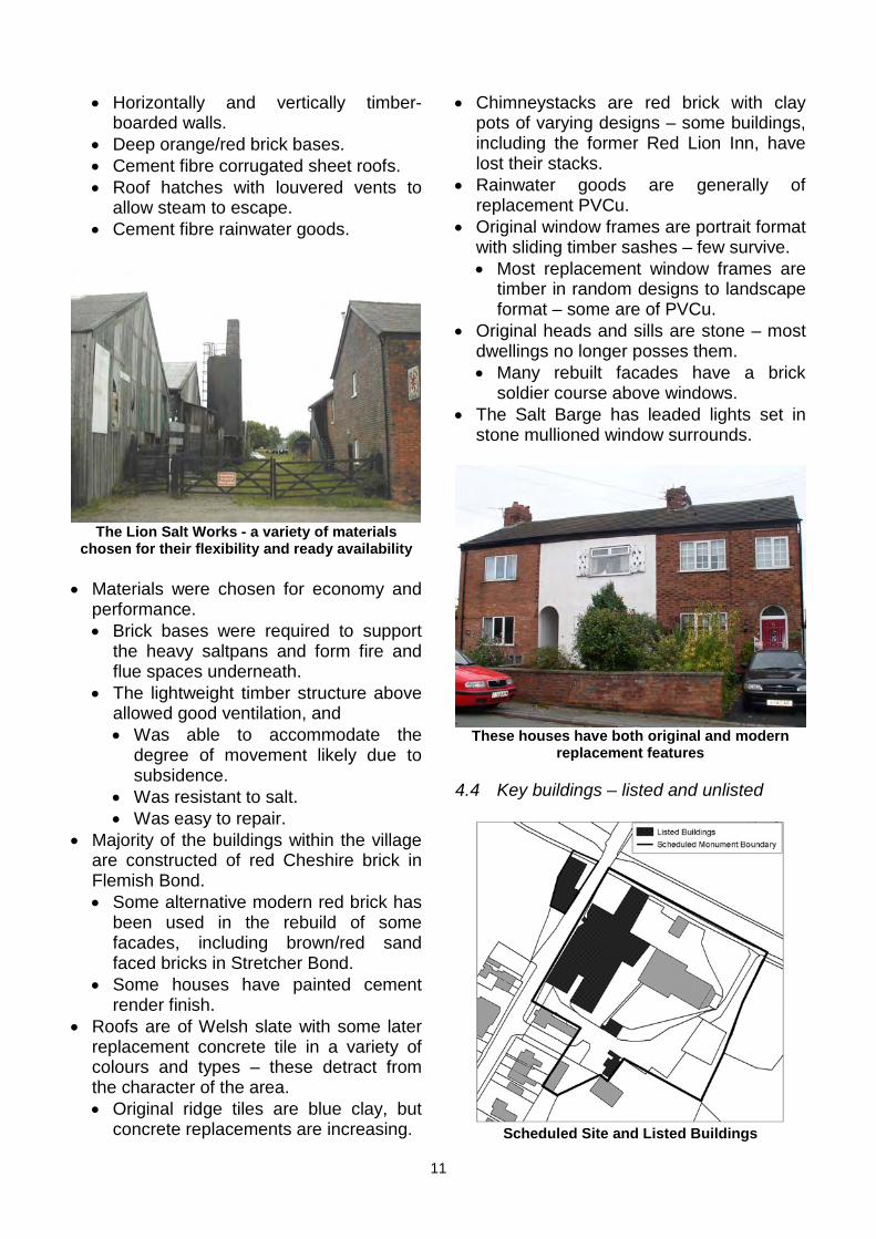
4.4 Key buildings – listed and unlisted
Scheduled Site and Listed Buildings
11

• The Lion Salt Works site is a Scheduled Monument – the designation includes all the upstanding structures on the sites to either side of Ollershaw Lane.
• The Grade II Listed Buildings are: • Pan house sheds Nos. 3 and 4 and the
stoves and store sheds or warehousesbehind.
• Engine shed and pump house. • Manager’s office (and attached boiler-
house although not in list description).• Coronation salt store on the west side
of Ollershaw Lane. • The Lion Salt Works is unique in being
the last surviving inland natural brine pumping open pan salt works in England – the existing structures contain evidenceof all the various processes involved inthe production of salt from natural brine atan open pan works and as such they are all key buildings.
Managers Office
• The structures have been deteriorating since the closure of the Lion Salt Works, and are now in varying states of collapse and disrepair. • The site is in the care of The Lion Salt
Works Trust who are actively seeking funding for the construction of a new
Loading Bay Interior
Pan House No. 3
Engine Shed and Pump House with Chimney
Warehouse Interior
12
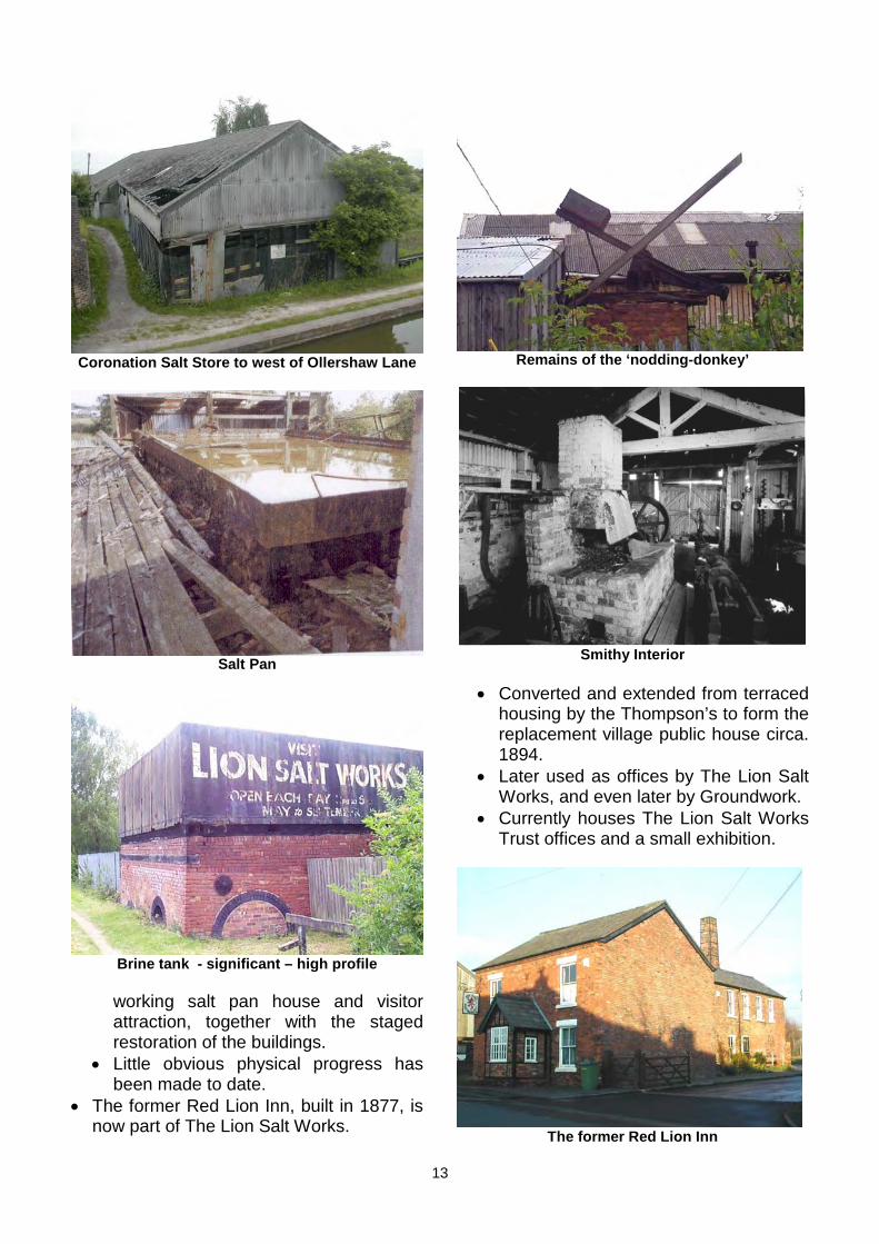
Coronation Salt Store to west of Ollershaw Lane
Salt Pan
Brine tank - significant – high profile
working salt pan house and visitor attraction, together with the staged restoration of the buildings.
• Little obvious physical progress has been made to date.
• The former Red Lion Inn, built in 1877, is now part of The Lion Salt Works.
Remains of the ‘nodding-donkey’
Smithy Interior
• Converted and extended from terraced housing by the Thompson’s to form the replacement village public house circa. 1894.
• Later used as offices by The Lion Salt Works, and even later by Groundwork.
• Currently houses The Lion Salt Works Trust offices and a small exhibition.
The former Red Lion Inn
13
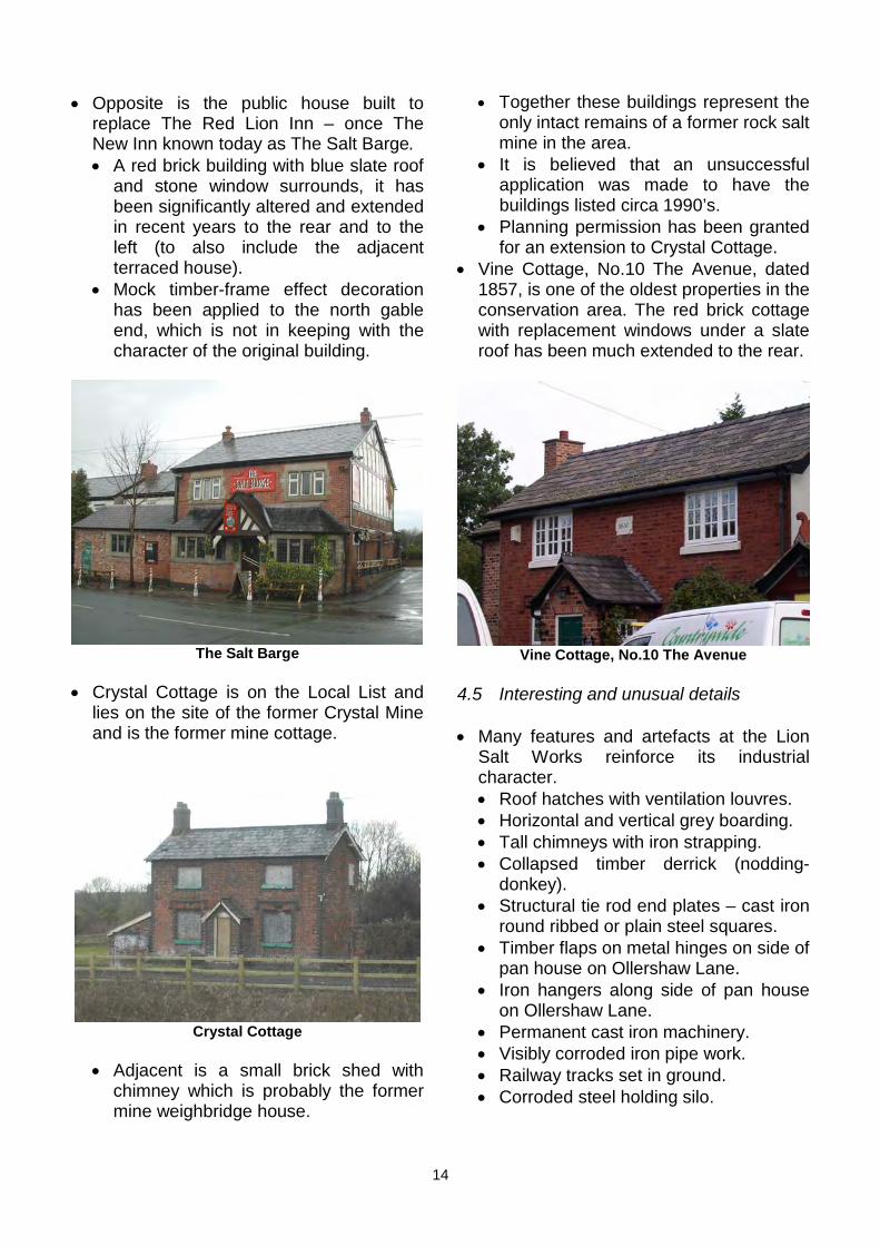
• Opposite is the public house built to replace The Red Lion Inn – once The New Inn known today as The Salt Barge. • A red brick building with blue slate roof
and stone window surrounds, it has been significantly altered and extended in recent years to the rear and to the left (to also include the adjacent terraced house).
• Mock timber-frame effect decoration has been applied to the north gable end, which is not in keeping with the character of the original building.
The Salt Barge
• Crystal Cottage is on the Local List and lies on the site of the former Crystal Mine and is the former mine cottage.
Crystal Cottage
• Adjacent is a small brick shed with chimney which is probably the former mine weighbridge house.
• Together these buildings represent the only intact remains of a former rock salt mine in the area.
• It is believed that an unsuccessful application was made to have the buildings listed circa 1990’s.
• Planning permission has been granted for an extension to Crystal Cottage.
• Vine Cottage, No.10 The Avenue, dated 1857, is one of the oldest properties in the conservation area. The red brick cottage with replacement windows under a slate roof has been much extended to the rear.
Vine Cottage, No.10 The Avenue
4.5 Interesting and unusual details
• Many features and artefacts at the Lion Salt Works reinforce its industrial character. • Roof hatches with ventilation louvres. • Horizontal and vertical grey boarding. • Tall chimneys with iron strapping. • Collapsed timber derrick (nodding-
donkey). • Structural tie rod end plates – cast iron
round ribbed or plain steel squares. • Timber flaps on metal hinges on side of
pan house on Ollershaw Lane. • Iron hangers along side of pan house
on Ollershaw Lane. • Permanent cast iron machinery. • Visibly corroded iron pipe work. • Railway tracks set in ground. • Corroded steel holding silo.
14

Roof hatches with ventilation louvers Timber flap with metal hinges and square wall tie plate
Tall Pump House chimney with iron strapping Iron hangers
Ribbed cast iron structural tie plate Permanent cast iron machinery
15
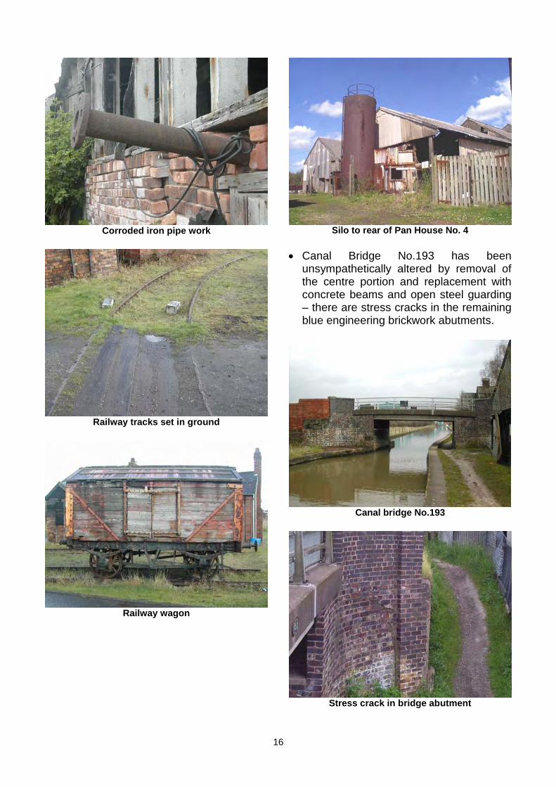
Railway tracks set in ground
Corroded iron pipe work Silo to rear of Pan House No. 4
• Canal Bridge No.193 has been unsympathetically altered by removal of the centre portion and replacement with concrete beams and open steel guarding – there are stress cracks in the remaining blue engineering brickwork abutments.
16
Railway wagon
Canal bridge No.193
Stress crack in bridge abutment
• Derelict canal stop-plank housing toppled down into field adjacent to Coronation Salt Stove – stop-plank slots no longer exist below bridge 193 due to raised concrete edges.
• Eaves bracket detail on Nos. 35-39 Ollershaw Lane.
35-39 Ollershaw Lane, showings the eaves detail
• Oval ribbed, cast iron structural tie rod end plates on houses.
• Crystal College – blue engineering brick labels over windows, jambs and quoins.
• Date stone ‘1857’ on No.10 The Avenue and stone plaque reading ‘Ebenezer House 1875’ on a terrace in Cross Street are amongst the few visible original details on the housing in the area.
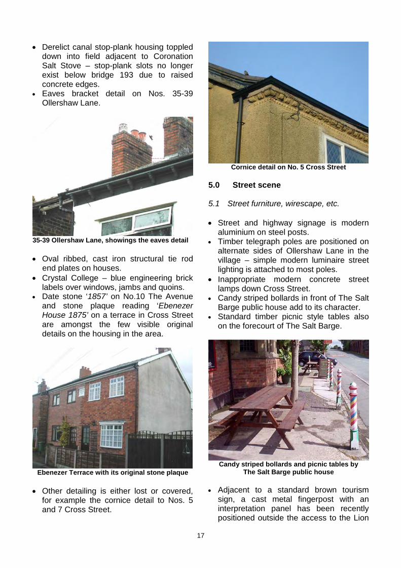
Cornice detail on No. 5 Cross Street
5.0 Street scene
5.1 Street furniture, wirescape, etc.
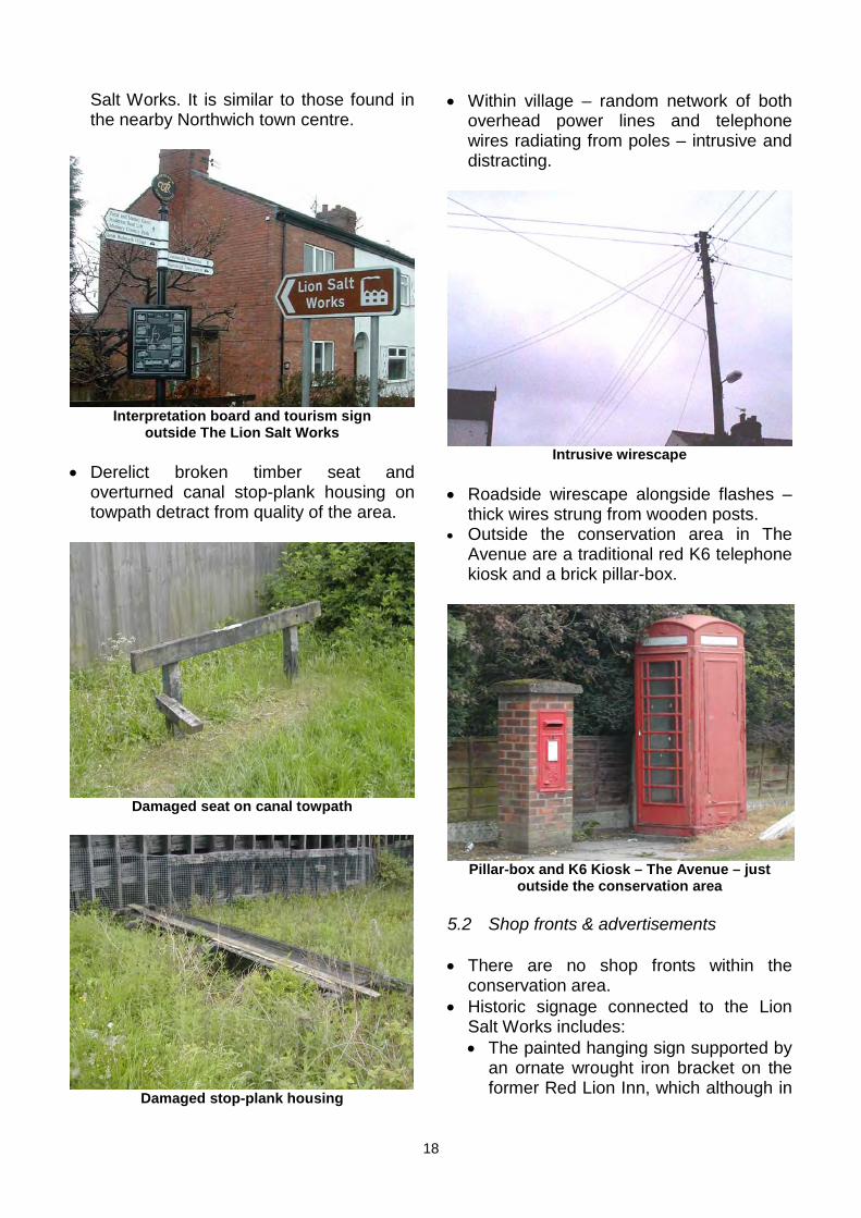
• Street and highway signage is modern aluminium on steel posts.
• Timber telegraph poles are positioned on alternate sides of Ollershaw Lane in the village – simple modern luminaire street lighting is attached to most poles.
• Inappropriate modern concrete street lamps down Cross Street.
• Candy striped bollards in front of The Salt Barge public house add to its character.
• Standard timber picnic style tables also on the forecourt of The Salt Barge.
Ebenezer Terrace with its original stone plaque
• Other detailing is either lost or covered, for example the cornice detail to Nos. 5 and 7 Cross Street.
Candy striped bollards and picnic tables by The Salt Barge public house
• Adjacent to a standard brown tourism sign, a cast metal fingerpost with an interpretation panel has been recently positioned outside the access to the Lion
17
Interpretation board and tourism sign outside The Lion Salt Works
• Derelict broken timber seat and overturned canal stop-plank housing on towpath detract from quality of the area.
Salt Works. It is similar to those found in • Within village – random network of both the nearby Northwich town centre. overhead power lines and telephone
wires radiating from poles – intrusive and distracting.
Pillar-box and K6 Kiosk – The Avenue – just outside the conservation area
5.2 Shop fronts & advertisements
• There are no shop fronts within the conservation area.
• Historic signage connected to the Lion Salt Works includes: • The painted hanging sign supported by
an ornate wrought iron bracket on the former Red Lion Inn, which although in
Intrusive wirescape
• Roadside wirescape alongside flashes – thick wires strung from wooden posts.
• Outside the conservation area in The Avenue are a traditional red K6 telephone kiosk and a brick pillar-box.
Damaged seat on canal towpath
Damaged stop-plank housing
18

need of refurbishment, enhances the building’s character.
Lion Salt Works Office hanging sign
• The distinctive painted white lettering on the black brine tank and the faded large white on black lettering on the gable end of the salt store.
Brine tank, with painted signage
Signage on Coronation Salt Store
• The Salt Barge has hand painted signage in a traditional style, including a simple hanging sign. • A portable ‘A’ board is often placed on
the forecourt. • There are also some traditionally painted
advertisements relating to the Salt Barge public house positioned along the canal.
5.3 Landmarks and focal points with historic connection or visual interest
• Primary landmarks are the two standing chimneys of the Lion Salt Works and distinctive collection of industrial buildings below.
• The canal bridge also acts as a distinctive landmark given the flat nature of the surrounding landscape.
5.4 Floorscape – materials, colour and texture
• The public roads are green surfaced dressed tarmacadam – the footpaths are heavily patched tarmacadam and the kerbs modern pre-cast concrete.
• New blue diamond chequered clay brick pavers to front and side of The Red Lion office match sunken and partially soil covered originals found along its frontage.
Original and new diamond pattern pavers
• Similar original pavers are also found in the forecourt of the Salt Barge.
• The towpath is a limestone gravel track bordered by encroaching grass verge.
19
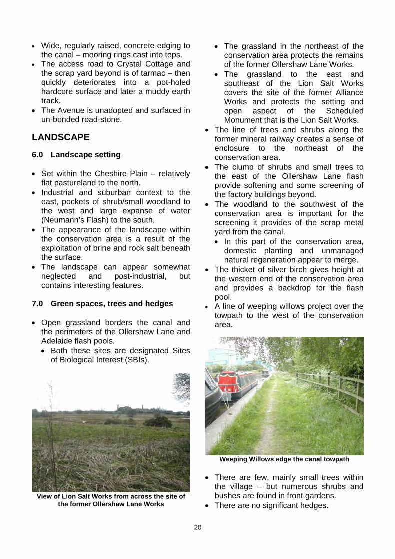
• Wide, regularly raised, concrete edging to the canal – mooring rings cast into tops.
• The access road to Crystal Cottage and the scrap yard beyond is of tarmac – then quickly deteriorates into a pot-holed hardcore surface and later a muddy earth track.
• The Avenue is unadopted and surfaced in un-bonded road-stone.
LANDSCAPE
6.0 Landscape setting
• Set within the Cheshire Plain – relatively flat pastureland to the north.
• Industrial and suburban context to the east, pockets of shrub/small woodland to the west and large expanse of water (Neumann’s Flash) to the south.
• The appearance of the landscape within the conservation area is a result of the exploitation of brine and rock salt beneath the surface.
• The landscape can appear somewhat neglected and post-industrial, but contains interesting features.
7.0 Green spaces, trees and hedges
• Open grassland borders the canal and the perimeters of the Ollershaw Lane and Adelaide flash pools. • Both these sites are designated Sites
of Biological Interest (SBIs).
View of Lion Salt Works from across the site of the former Ollershaw Lane Works
• The grassland in the northeast of the conservation area protects the remains of the former Ollershaw Lane Works.
• The grassland to the east and southeast of the Lion Salt Works covers the site of the former Alliance Works and protects the setting and open aspect of the Scheduled Monument that is the Lion Salt Works.
• The line of trees and shrubs along the former mineral railway creates a sense of enclosure to the northeast of the conservation area.
• The clump of shrubs and small trees to the east of the Ollershaw Lane flash provide softening and some screening of the factory buildings beyond.
• The woodland to the southwest of the conservation area is important for the screening it provides of the scrap metal yard from the canal. • In this part of the conservation area,
domestic planting and unmanaged natural regeneration appear to merge.
• The thicket of silver birch gives height at the western end of the conservation area and provides a backdrop for the flash pool.
• A line of weeping willows project over the towpath to the west of the conservation area.
Weeping Willows edge the canal towpath
• There are few, mainly small trees within the village – but numerous shrubs and bushes are found in front gardens.
• There are no significant hedges.
20
• Site of pan house No. 1 was hard • The brightly coloured narrow boats on landscaped in the 1982 – now reclaimed the canal are characteristic of the area by nature due to lack of maintenance. during summer months.
• The water features are important historic elements because of their strong association with the salt industry, as well as being attractive features in the conservation area.
• A pond lies in the fields to the southeast of the Lion Salt Works.
OTHERS
9.0 Negative factors
• The principle negative factors affecting Site of pan house No.1, now overgrown the conservation area are:
• The volume, weight and speed of traffic 8.0 Water features through the conservation area and in
particular over the canal bridge. • The flash pools, caused by the collapse of • The views of the dominant industrial
the old salt mines, dominate the buildings to the east. landscape to the north of the canal. • Views of, and noise from, the scrap • Swans, heron and other birds inhabit metal yard to the west – which appears
and frequent the flashes. to have been recently extended up to the boundary of the conservation area.
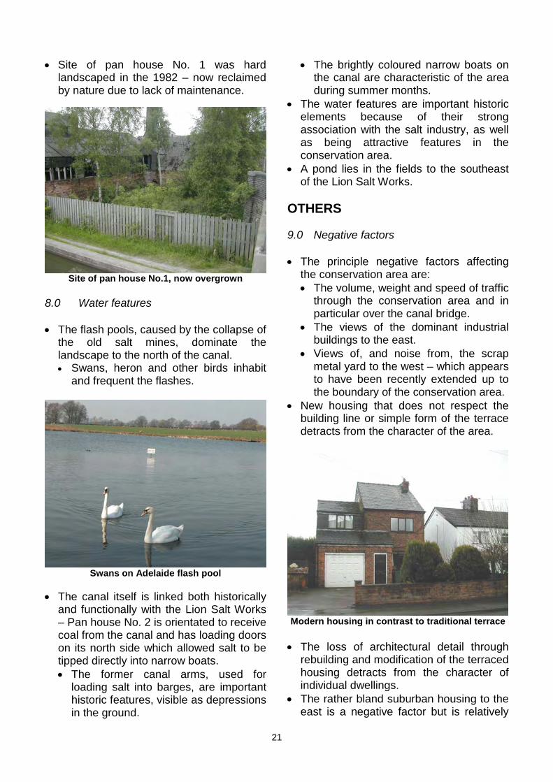
• New housing that does not respect the building line or simple form of the terrace detracts from the character of the area.
Swans on Adelaide flash pool
• The canal itself is linked both historically and functionally with the Lion Salt Works – Pan house No. 2 is orientated to receive Modern housing in contrast to traditional terrace coal from the canal and has loading doors on its north side which allowed salt to be • The loss of architectural detail through tipped directly into narrow boats. rebuilding and modification of the terraced • The former canal arms, used for housing detracts from the character of
loading salt into barges, are important individual dwellings. historic features, visible as depressions • The rather bland suburban housing to the in the ground. east is a negative factor but is relatively
21

well screened and sufficiently removed treatment, and a utilitarian steel gate at from the village centre not to be overly the entrance – waste items are often intrusive. dumped beside it.
• Lack of public access to the open spaces • Rubbish dumped in the woodland adjacent to the flash pools limits between the track and canal can be seen enjoyment of these areas. from the canal.
• Poor quality fencing and galvanized tubular steel gates beyond the village centre give an untidy appearance.
• The current dilapidated condition of The Lion Salt Works makes the buildings dangerous and attracts vandalism.
Fly tipping to the southwest of the canal
• Modern, bungalow development on The Avenue acts as a visual barrier between the historic village core and other older Victorian properties at the western end of The Avenue.
10.0 Neutral areas
10.1 Areas that neither enhance nor detract from the character or appearance of the conservation area
• Gap sites and the variety of alterations to the early housing due to subsidence are a defining characteristic of the area.
10.2 Areas and opportunities for development and or enhancement
• Future plans for the Lion Salt Works involve restoration of the existing buildings and formation of a new working demonstration salt works visitor attraction complete with visitor facilities. • This would reverse the impact of
current dereliction and make a positive contribution to the area.
• New development should respect the scale, variety and industrial character of the existing structures.
The Lion Salt Works from canal bridge approach
• The parking lay-by opposite The Lion Salt Works, and the lay-by opposite The Salt Barge public house car park are poorly surfaced and have poor boundary treatment.
The lay-by opposite the Lion Salt Works is poorly surfaced, and detracts from its surroundings
• The road leading to the scrap metal yard has poor surface and poor boundary
22
• The flash pools and adjacent green open space would make an attractive recreational area. • These spaces also have a high
amenity value from an educational point of view.
• Public access to these areas and links with the Lion Salt Works would enable their association with the salt industry to be interpreted and understood.
• The current grass/pasture land use is appropriate for the long-term protection of the shallow remains of the demolished salt works.
• More interpretation boards within the area, particularly along the towpath, could enhance people’s understanding and appreciation of the area. • From the towpath the flash pools could
be explained and viewed if no public access was possible.
• There is opportunity for new development within the voids in the streetscape. • This should be residential, respecting
the existing building line and be of simple form – the aim being to restore unity to the streetscape where possible.
• Alterations to key buildings should respect their character and form.
• Improvements in the quality and appearance of boundary fencing and gates outside the village would visually enhance the area.
• Tree planting and careful landscaping to the southwest of Crystal Cottage would help screen the scrap metal yard.
• Crystal Cottage should be sympathetically repaired and brought into occupation.
• There is potential for improvement of the visible stretch of the access road to the scrap metal yard - further expansion of the scrap metal yard should be discouraged and ideally it should be relocated in the long term.
• The surface of the canal towpath should be improved and maintained to a higher standard, to accommodate the potential for increased visitors. • Additional and improved seating should
also be provided.
11.0 Ambience/uniqueness
11.1 Sounds and smells
• Noise from the car breakers yard situated just outside of the conservation area often disrupts the peace of the village.
• Cars and lorries arriving and departing from the scrap metal yard, together with through-traffic noise along Ollershaw Lane, interrupt the otherwise quiet nature of the area.
• In the areas to the north of the canal and along the towpath, the sounds of bird life and waterfowl are more attractive.
• The former brine vapour smells would have been a characteristic of the area.
• The echoing regular thud of diesel narrow boat engines can be heard on the canal during the summer.
11.2 Vitality and vibrancy of the area
• Peace and tranquility characterise the area today, which is at odds with its former industrial nature.
• Evidence of busy human activity would have been an everyday spectacle at the Lion Salt Works before closure, together with steam rising from the pan houses and smoke from chimneys. • In this respect some of the essential
character of the area has been lost. • The proposals to establish a working
visitor attraction at the Lion Salt Works would restore some of the vibrance and vitality to the area.
• The Salt Barge public house is busy at certain times and provides a focus for people enjoying the canal.
• Canal traffic is essentially seasonal. • Ollershaw Lane is busy with traffic –
some of which is heavy goods. • Fishing is a popular leisure activity due to
the flashes.
11.3 Historical associations with unusual crafts, famous people and events
• The Lion Salt Works and archaeology in the area, remain as historical evidence of
23
important former extractive, mining and manufacturing methods, and are also a testament to the work of a local (Northwich) entrepreneurial family, the Thompsons. • They first occupied the site in 1856
when John Thompson erected the Alliance Works.
• The family developed a new salt pan on the site in the late 19th century which became known as the Lion Salt Works.
• In 1899 John Thompson died and his son, Henry Ingram Thompson took over the Lion Salt Works.
• Other sons took over the family’s local brick making interests.
• The site was developed by successive generations of the family for most of the 20th century.
• Last major development was the construction of Pan House No.5 around 1960 by Henry Lloyd Thompson.
• In 2004, the site featured in the BBC TV Restoration series.
11.4 Other characteristics which make the area unique
• Along the length of the canal, the Marston (Lion Salt Works) Revised conservation area overlaps with part of the Trent and Mersey Canal conservation area.
NOTE • Other properties associated with the
former management of the Lion Salt Works, that are situated in Chapel Street, in the adjacent village of Wincham, are not recognised by any form of protection.
Marston (Lion Salt Works) Revised Conservation Area Appraisal
(one of a series to be produced)
Revised after public consultation VRBC Cons 23/X Oct 2004
Whilst an appraisal aims to identify the essential elements that give an area its
character, it can only be a ‘snapshot’ in time. Elements and details of an area may be important even if they are not specifically
referred to in the document.
This document should be read in conjunction with “Conservation Area Appraisals”, produced by Vale Royal
Borough Council in July 1997.
Based on an initial survey and evaluation by Donald Insall Associates, Bridgegate House,
5 Bridge Place, Chester, CH1 1SA
Marston (Lion Salt Works) Conservation Area was designated by Vale Royal District Council on 5 April 1979. It was reviewed in 2004, when the boundary was revised and extended.
This appraisal relates to the extended Marston (Lion Salt Works) Revised Conservation Area that was designated by Vale Royal Borough Council on 25 November 2004 when the appraisal was adopted.
David M Hayes Conservation and Design Manager Environmental Policy Vale Royal Borough Council Wyvern House, The Drumber, Winsford, Cheshire, CW7 1AH Tele: 01606 867721 Email: [email protected]
24