Mapster international project providing historical maps ... · PDF fileMapster –...
15
Mapster – international project providing historical maps for researchers and students" Szymon Biały Cartographic Collection, Pedagogical University of Cracow, Poland Marek Zieliński Map Archive of Polish Military Geographical Institute (1919-1939), London, UK
Transcript of Mapster international project providing historical maps ... · PDF fileMapster –...

Mapster – international project providing historical maps for
researchers and students"
Szymon Biały Cartographic Collection, Pedagogical University of Cracow, Poland
Marek Zieliński
Map Archive of Polish Military Geographical Institute (1919-1939), London, UK

sdf
• 2004 – groving number of maps began to appear in the Internet
• Copyright protection – 70 years after first publication
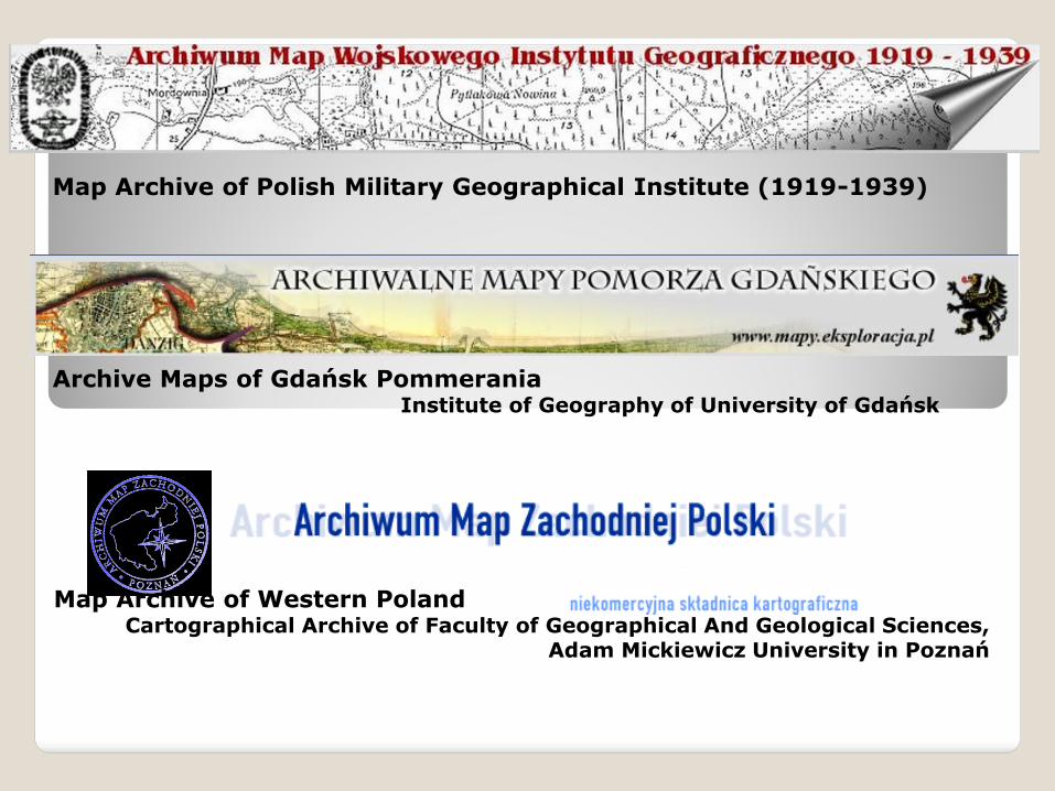
Map Archive of Polish Military Geographical Institute (1919-1939)
Archive Maps of Gdańsk Pommerania Institute of Geography of University of Gdańsk
Map Archive of Western Poland Cartographical Archive of Faculty of Geographical And Geological Sciences,
Adam Mickiewicz University in Poznań
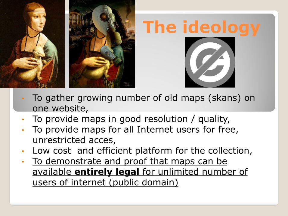
The ideology
• To gather growing number of old maps (skans) on one website,
• To provide maps in good resolution / quality, • To provide maps for all Internet users for free,
unrestricted acces, • Low cost and efficient platform for the collection, • To demonstrate and proof that maps can be
available entirely legal for unlimited number of users of internet (public domain)
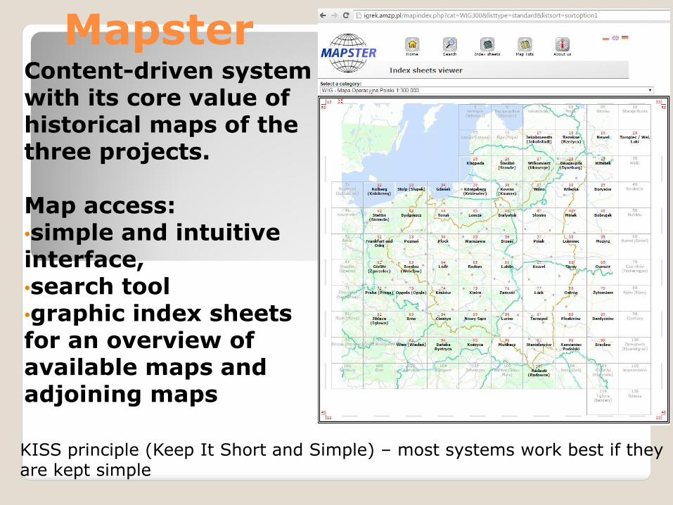
Content-driven system with its core value of historical maps of the three projects. Map access: •simple and intuitive interface, •search tool •graphic index sheets for an overview of available maps and adjoining maps
Mapster
KISS principle (Keep It Short and Simple) – most systems work best if they are kept simple
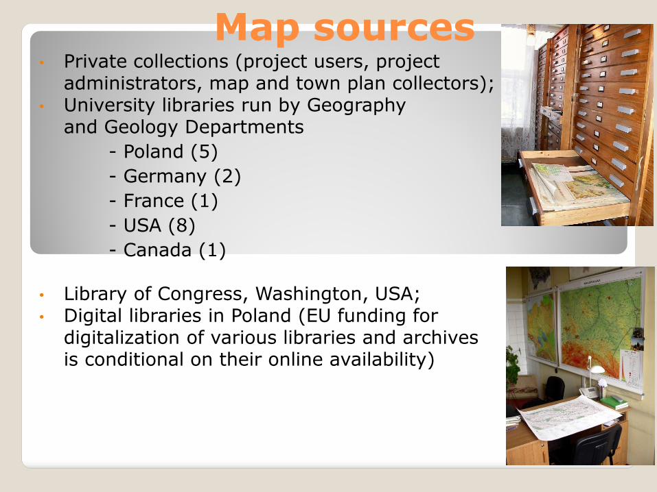
Map sources • Private collections (project users, project
administrators, map and town plan collectors); • University libraries run by Geography
and Geology Departments
- Poland (5)
- Germany (2)
- France (1)
- USA (8)
- Canada (1)
• Library of Congress, Washington, USA; • Digital libraries in Poland (EU funding for
digitalization of various libraries and archives is conditional on their online availability)
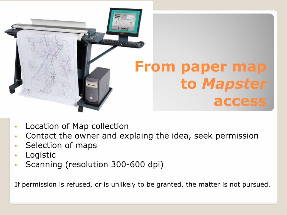
From paper map to Mapster
access
• Location of Map collection • Contact the owner and explaing the idea, seek permission • Selection of maps • Logistic • Scanning (resolution 300-600 dpi)
If permission is refused, or is unlikely to be granted, the matter is not pursued.
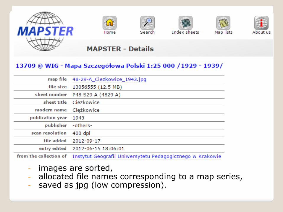
- images are sorted, - allocated file names corresponding to a map series, - saved as jpg (low compression).
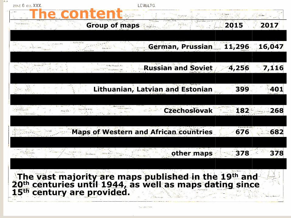
The content Group of maps 2015 2017
Polish 5,649 7,459
German, Prussian 11,296 16,047
Austrian and Hungarian 1,575 3,496
Russian and Soviet 4,256 7,116
Allied British-American 4,537 7,665
Lithuanian, Latvian and Estonian 399 401
Balkan 86 3,977
Czechoslovak 182 268
Ukrainian, Byelorussian and Caucasian states 2 2
Maps of Western and African countries 676 682
City maps 1,229 1,488
other maps 378 378
Total 30,265 48,979 The vast majority are maps published in the 19th and 20th centuries until 1944, as well as maps dating since 15th century are provided.
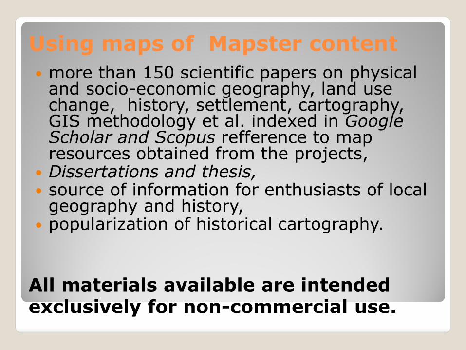
Using maps of Mapster content
more than 150 scientific papers on physical and socio-economic geography, land use change, history, settlement, cartography, GIS methodology et al. indexed in Google Scholar and Scopus refference to map resources obtained from the projects,
Dissertations and thesis, source of information for enthusiasts of local
geography and history, popularization of historical cartography.
All materials available are intended exclusively for non-commercial use.
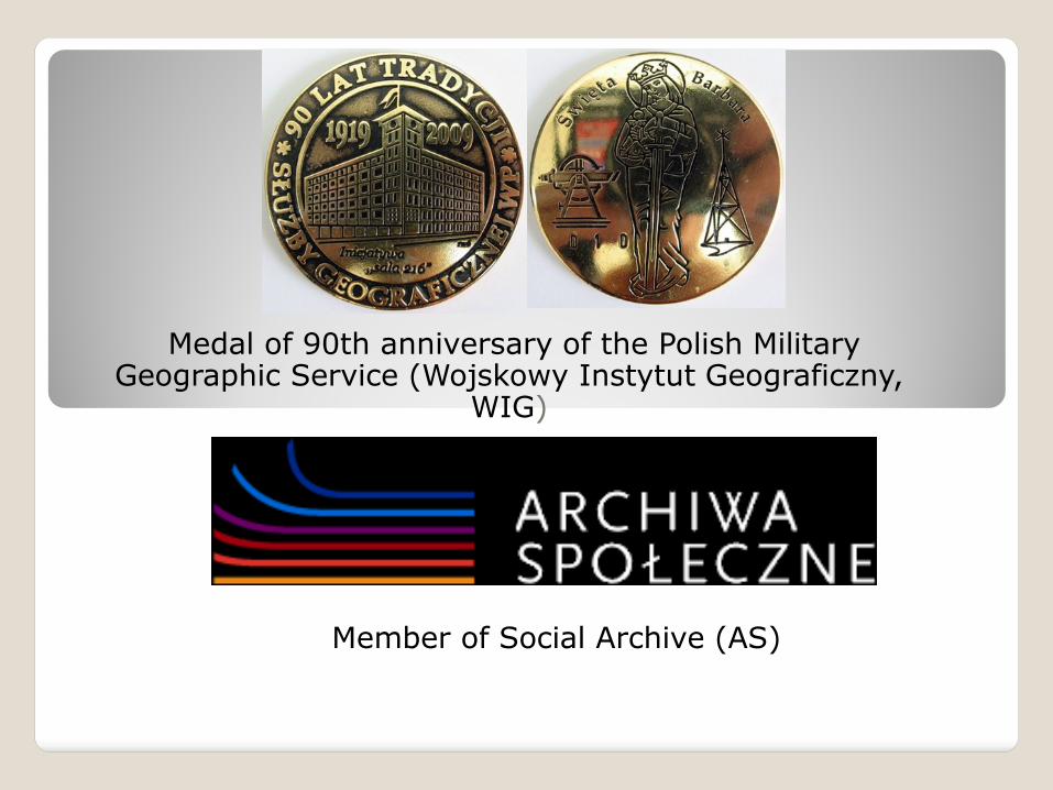
Medal of 90th anniversary of the Polish Military Geographic Service (Wojskowy Instytut Geograficzny,
WIG)
Member of Social Archive (AS)
The coordinators are not specialist (geogrphers or cartographers),
The coordinators are not paid for their work,
Private collectors, institutions, archives, libraries are invited to contribute the project through sending scans of their maps or making their maps available.
www.igrek.amzp.pl – Mapster, Old maps of Poland and Central Europe / Mapy archiwalne Polski i Europy Środkowej
www.mapywig.org –Map Archive of Polish Military Geographical Institute (1919-1939) / Archiwum Map Wojskowego Instytutu Geograficznego (1919-1939)
www.mapy.amzp.pl – Map Archive of Western Poland / Archiwum Map Zachodniej Polski
www.mapy.eksploracja.pl - Archive Maps of Gdańsk Pommerania / Archiwalne Mapy Pomorza Gdańskiego

Thank you for your attention Σας ευχαριστώ για την προσοχή σας