NJ-GeoWeb: Supporting Transparency and Decision-making Through
Upload
the-watershed-instituteCategory
view
324download
1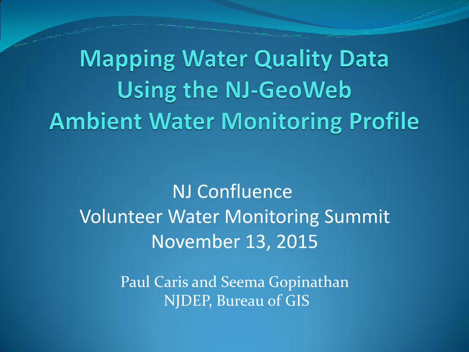
NJ Confluence Volunteer Water Monitoring Summit
November 13, 2015
Paul Caris and Seema Gopinathan NJDEP, Bureau of GIS
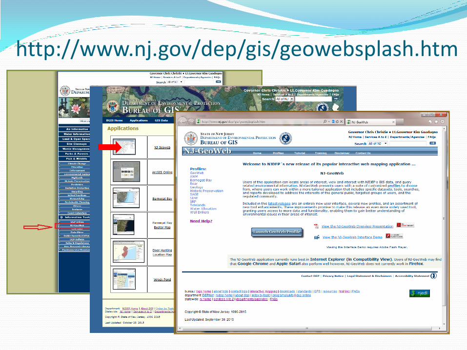
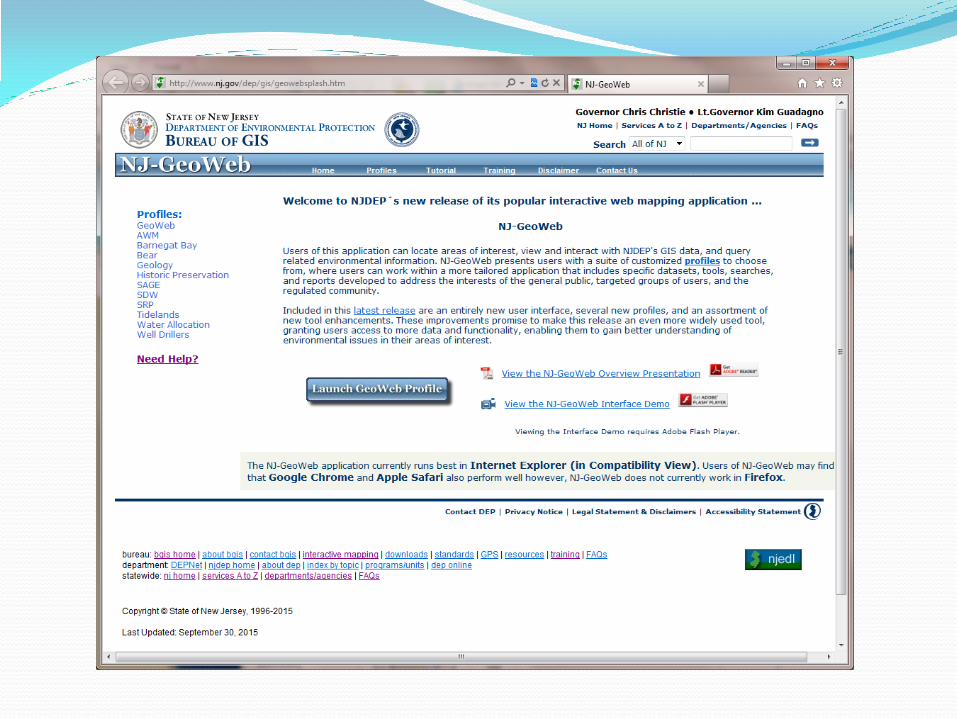
http://www.nj.gov/dep/gis/geowebsplash.htm
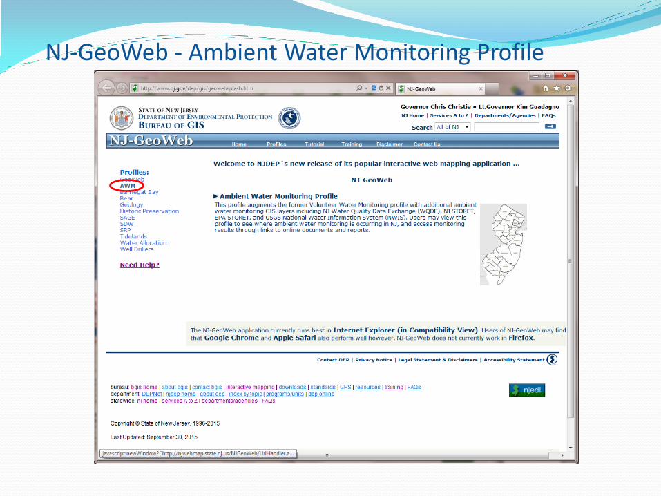
NJ-GeoWeb - Ambient Water Monitoring Profile
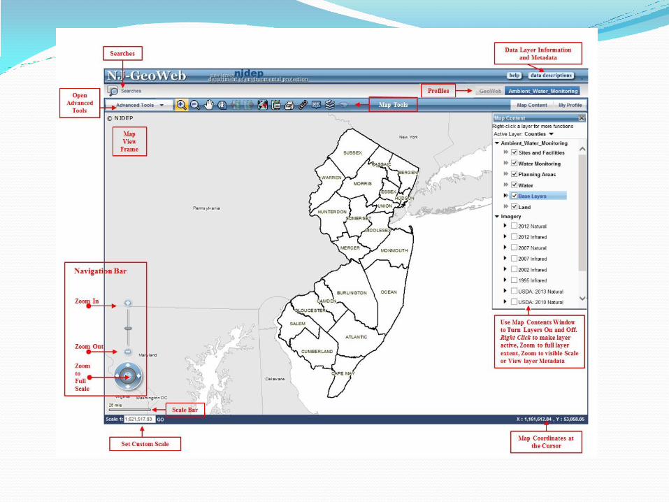

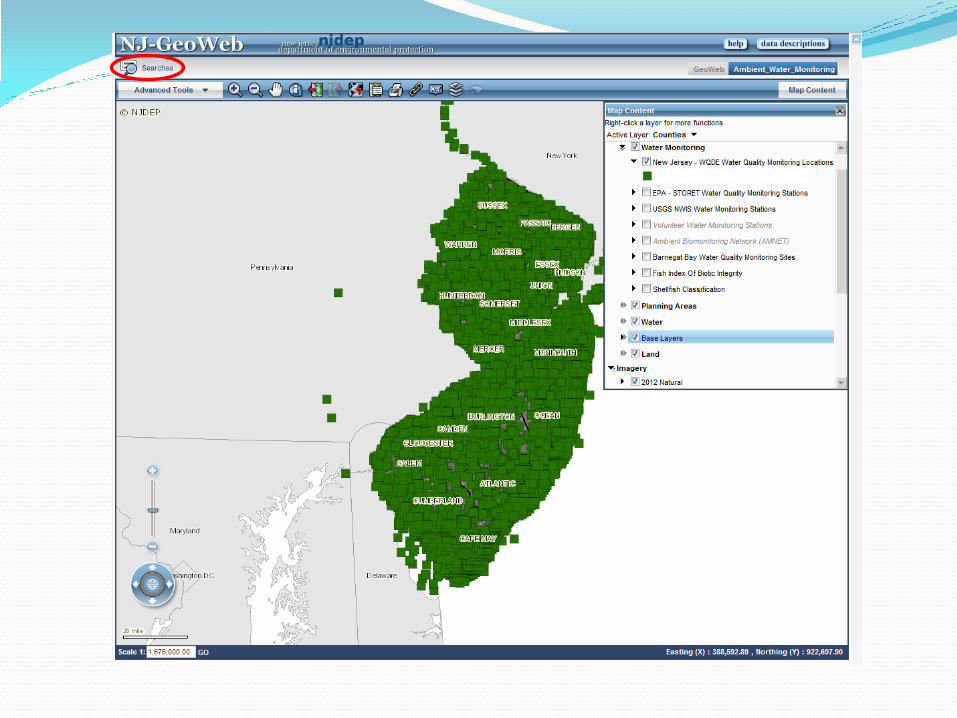
Grouped Layers
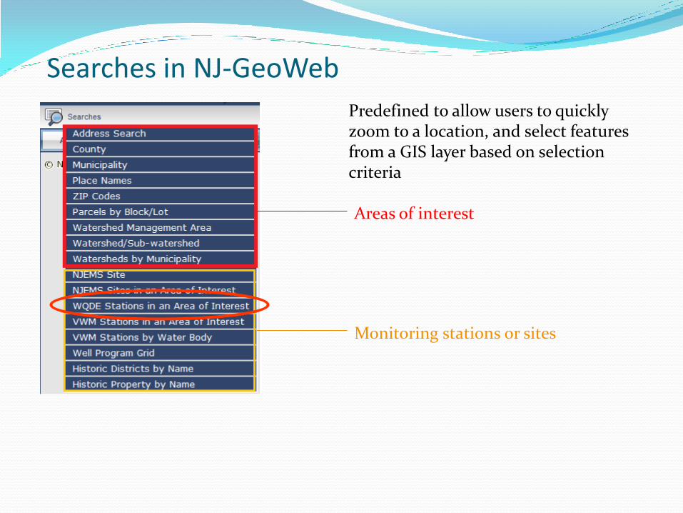
Searches in NJ-GeoWeb
Predefined to allow users to quickly zoom to a location, and select features from a GIS layer based on selection criteria
Areas of interest
Monitoring stations or sites
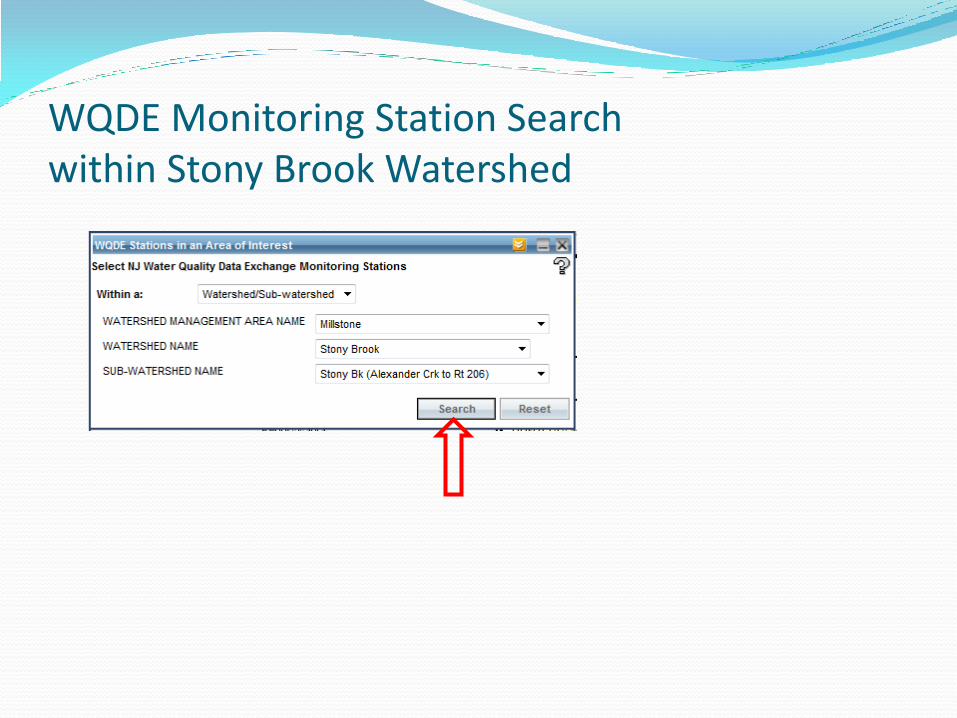
WQDE Monitoring Station Search within Stony Brook Watershed
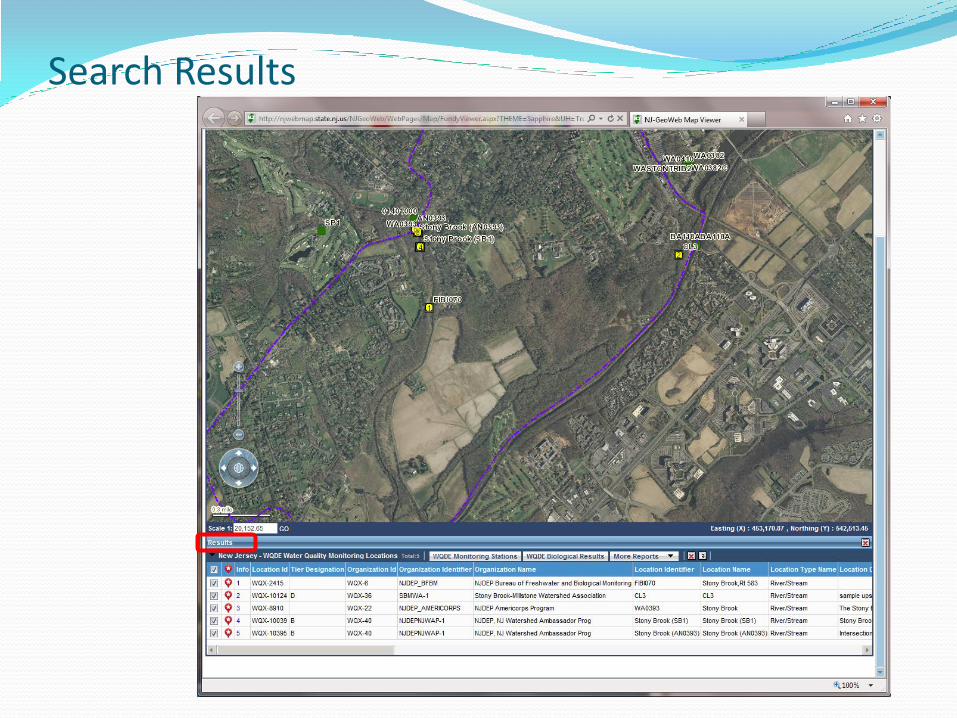
Search Results
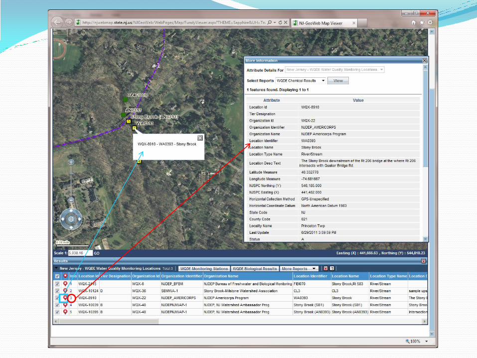
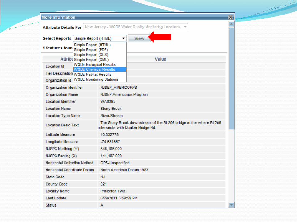
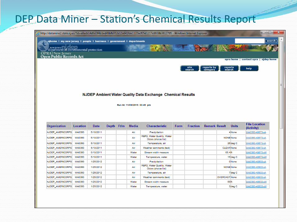
DEP Data Miner – Station’s Chemical Results Report
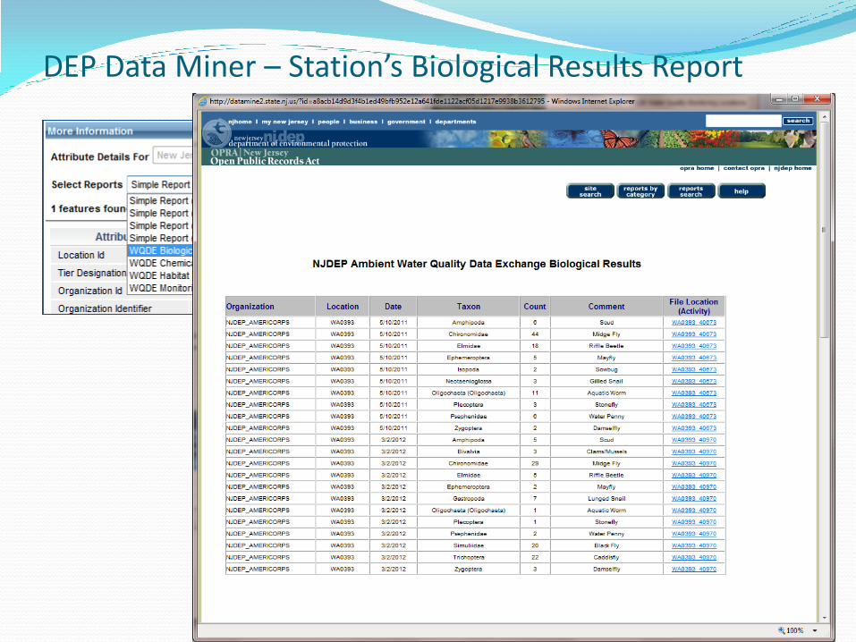
DEP Data Miner – Station’s Biological Results Report
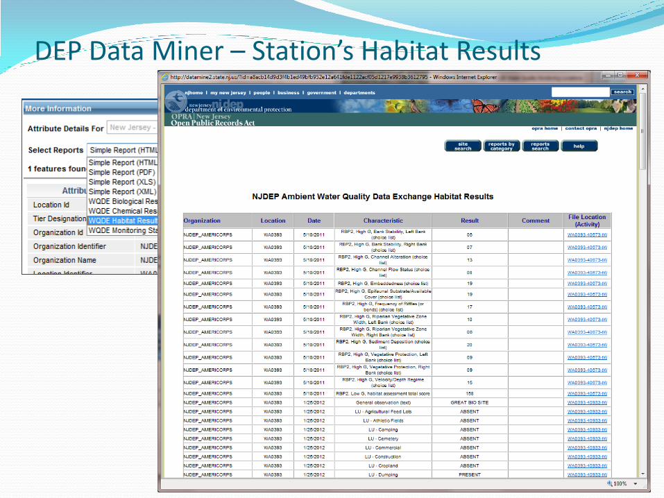
DEP Data Miner – Station’s Habitat Results

DEP Data Miner - Results from Multiple Stations
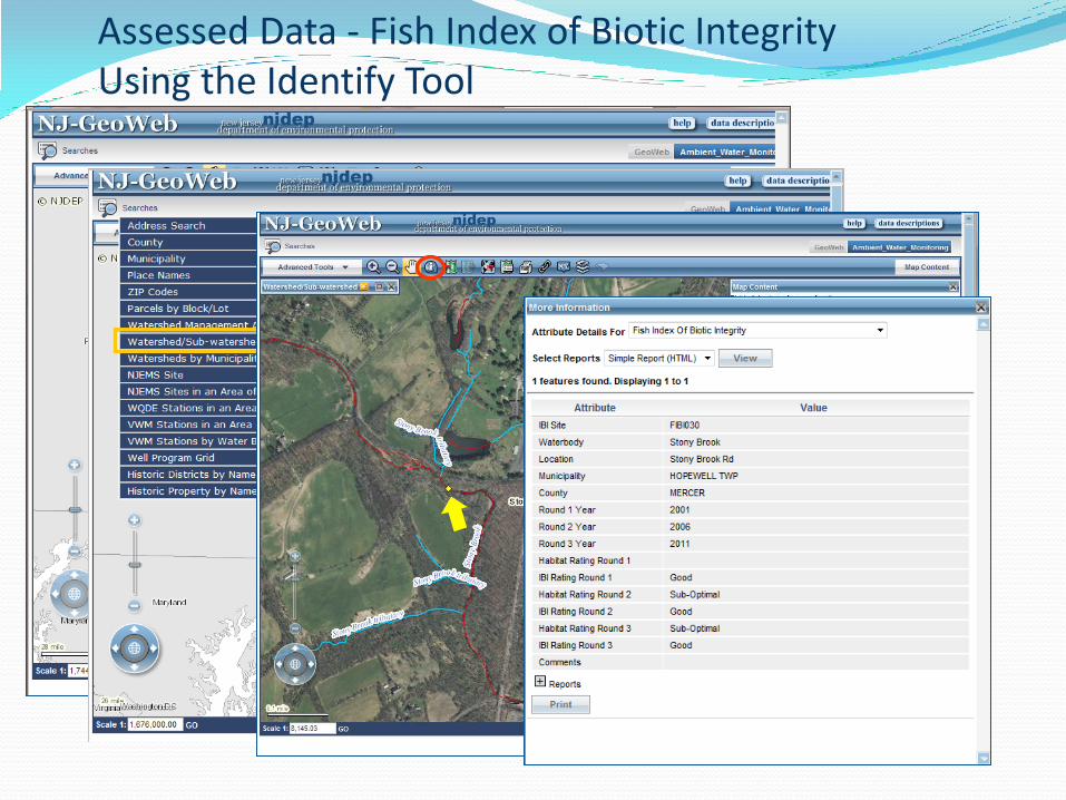
Assessed Data - Fish Index of Biotic Integrity Using the Identify Tool

New Jersey Ambient Biomonitoring Network (AMNET)
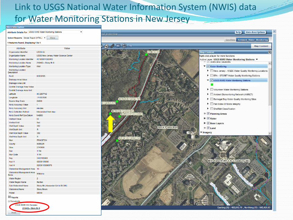
Link to USGS National Water Information System (NWIS) data for Water Monitoring Stations in New Jersey

USGS NWIS Data Site
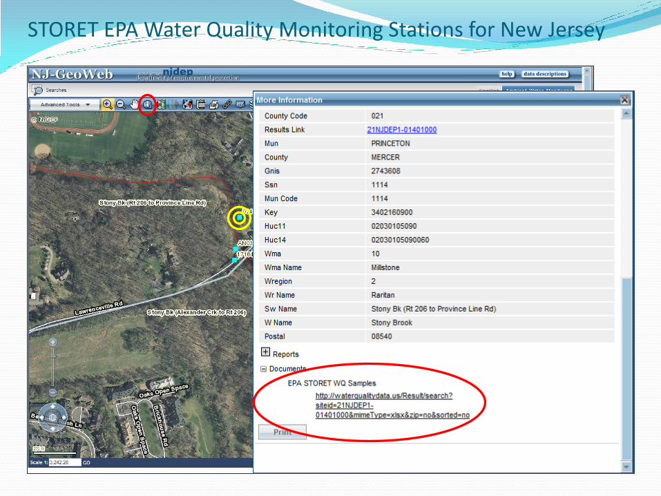
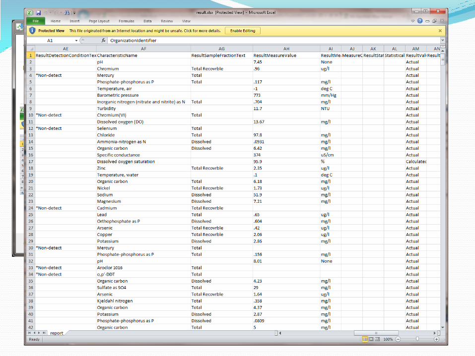
STORET EPA Water Quality Monitoring Stations for New Jersey
Contact Info
• NJDEP GIS Helpdesk: (609) 777-0672 • email: [email protected] Website:
http://www.nj.gov/dep/gis/geowebsplash.htm Training:
http://www.nj.gov/dep/gis/training.html