Mapping Mapping Mapping. Arctic and Antarctic Circle The Arctic Circle –66 degrees 33 mins –One...
16
Mapping Mapping Mapping
-
Upload
brian-powers -
Category
Documents
-
view
225 -
download
0
Transcript of Mapping Mapping Mapping. Arctic and Antarctic Circle The Arctic Circle –66 degrees 33 mins –One...
Mapping Mapping Mapping

Arctic and Antarctic Circle• The Arctic Circle
– 66 degrees 33 mins– One of five major circles of
latitude– Everything north is known as
the artic– Marks the southern extremity
of the Polar Day and Polar Night
– Within the Artic Circle• Polar day (mid-night sun) /
sun all day– Summer solstice / June 22
• Polar nights / no sun during day
– Winter solstice / Dec 22
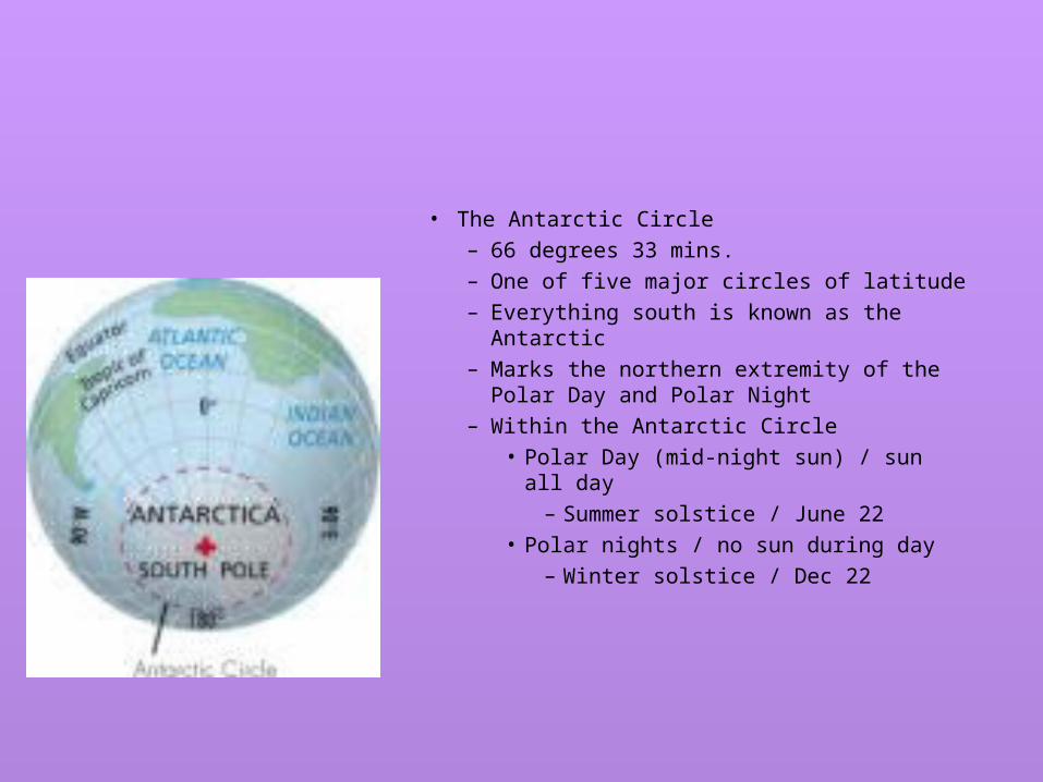
• The Antarctic Circle– 66 degrees 33 mins.– One of five major circles of latitude– Everything south is known as the Antarctic– Marks the northern extremity of the Polar
Day and Polar Night – Within the Antarctic Circle
• Polar Day (mid-night sun) / sun all day– Summer solstice / June 22
• Polar nights / no sun during day– Winter solstice / Dec 22

Continents
• Great land area of the earth• The Seven continents
– North America– South America– Africa– Europe– Asia– Australia– Antarctica

Oceans
• A subdivision of the whole body of salt water which covers ¾ of the earth
• The Four Major Oceans– Atlantic– Pacific– Indian– Artic

Equator and Prime Meridian
• Divides the earth into two halves
• Hemispheres• Equator =
North and South• Prime Meridian = East
and West

Equator
• Imaginary line half way between the north an south pole

Prime Meridian
• Passes though Greenwich, England
• Zero degree longitude
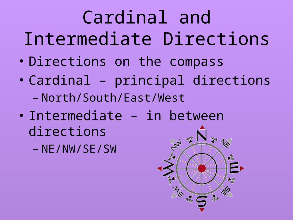
Cardinal and Intermediate Directions
• Directions on the compass
• Cardinal – principal directions– North/South/East/West
• Intermediate – in between directions– NE/NW/SE/SW
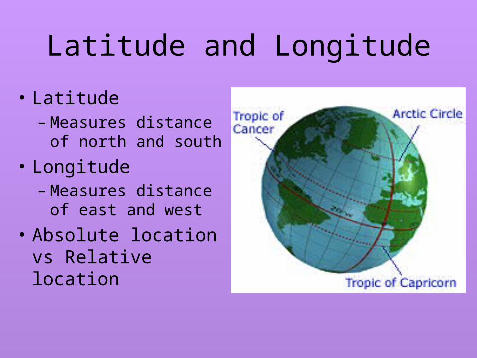
Latitude and Longitude
• Latitude– Measures distance
of north and south
• Longitude– Measures distance
of east and west
• Absolute location vs Relative location
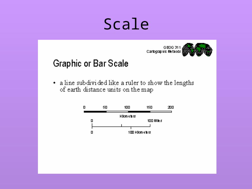
Scale

Natural features
• Distinctive characteristic of the earth
• Four main natural features– Mountains– Hills– Plains– Plateaus

Climate Zone
• average weather a place has over a 20-30 yr period
• We are Humid Continental

Political Map
– Show borders that divide nations from each other

Physical Map
– Shows features which divide places from each other