Mapping and GIS for the Internet Ruilan Shi Department of Geography McGill University Presented on...
41
Mapping and GIS Mapping and GIS for the Internet for the Internet Ruilan Shi Department of Geography McGill University Presented on June 1, 2001 on Carto2001
-
Upload
josephine-anthony -
Category
Documents
-
view
215 -
download
2
Transcript of Mapping and GIS for the Internet Ruilan Shi Department of Geography McGill University Presented on...

Mapping and GIS Mapping and GIS for the Internet for the Internet
Ruilan Shi
Department of Geography
McGill University
Presented on June 1, 2001 on Carto2001

ContentsContents
ArcIMS FeaturesArcIMS ArchitectureTech SpecsQuick demo using ArcIMS Manager
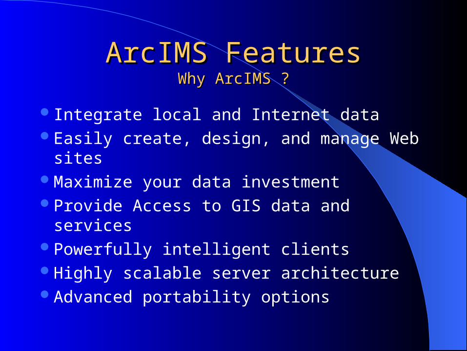
ArcIMS FeaturesArcIMS FeaturesWhy ArcIMS ?Why ArcIMS ?
Integrate local and Internet dataEasily create, design, and manage Web sitesMaximize your data investment Provide Access to GIS data and services
Powerfully intelligent clientsHighly scalable server architectureAdvanced portability options
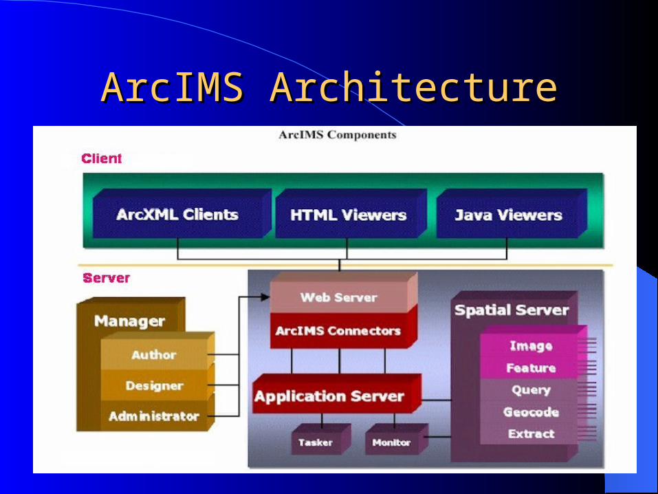
ArcIMS ArchitectureArcIMS Architecture

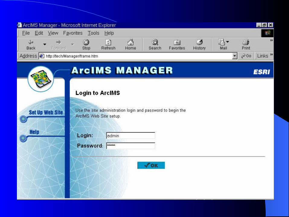
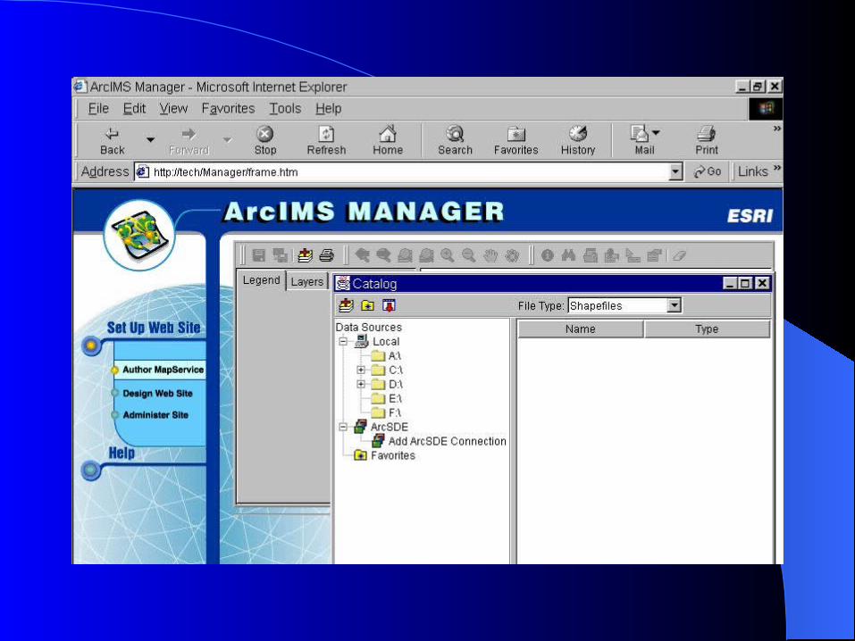
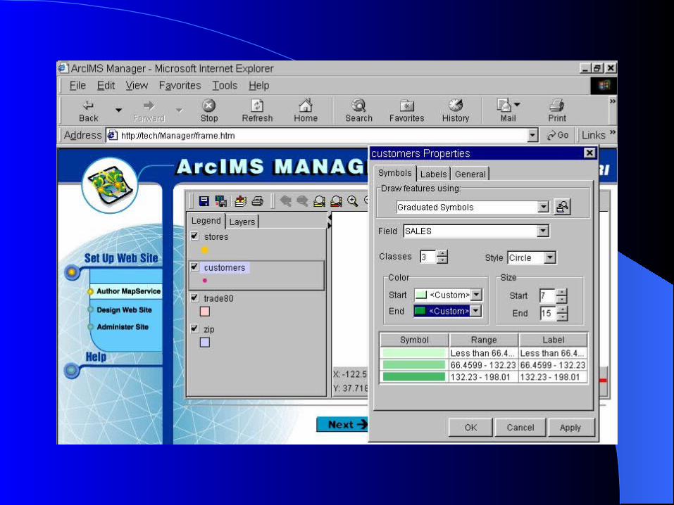
ArcIMS ManagerArcIMS Manager
Author MapServise files
Design web pages
Publish MapServises and administer ArcIMS Spatial servers

Application Server & ConnectorApplication Server & Connector
ArcIMS Components
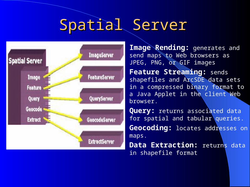
Spatial ServerSpatial Server Image Rending: generates and send
maps to Web browsers as JPEG, PNG, or GIF images
Feature Streaming: sends shapefiles and ArcSDE data sets in a compressed binary format to a Java Applet in the client Web browser.
Query: returns associated data for spatial and tabular queries.
Geocoding: locates addresses on maps.
Data Extraction: returns data in shapefile format

How ArcIMS Communicates ?How ArcIMS Communicates ?

Tech SpecsTech Specs
Supported Platforms • Windows NT 4.0 Intel with SP4, 5, 6A • Solaris 2.6 • Solaris 7 • Solaris 8
Supported web browsers• Internet Explorer 4.0• Internet Explorer 5.0• Netscape 4.5, 4.61 and 4.7
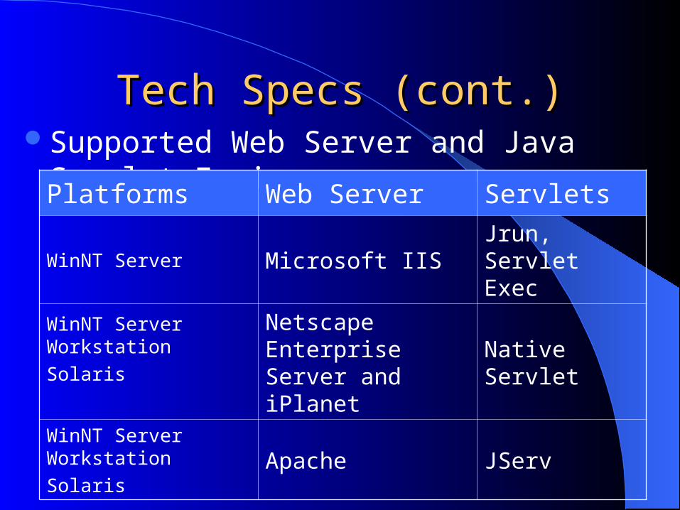
Tech Specs (cont.)Tech Specs (cont.)Supported Web Server and Java Servlet Engines
Platforms Web Server Servlets
WinNT Server Microsoft IISJrun, Servlet Exec
WinNT Server Workstation
SolarisNetscape Enterprise Server and iPlanet
Native Servlet
WinNT Server Workstation
SolarisApache JServ

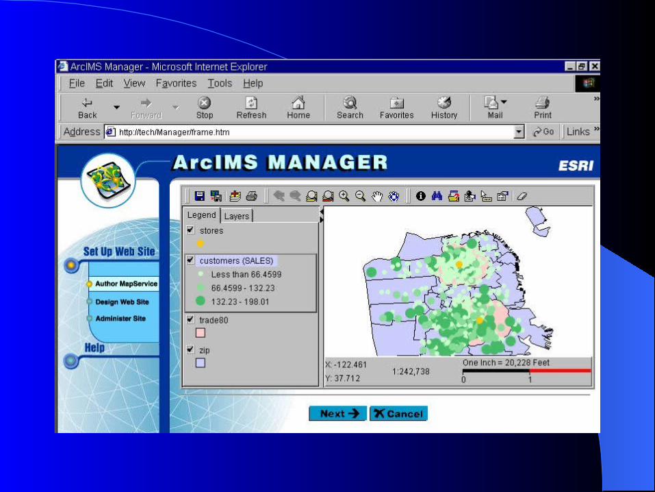
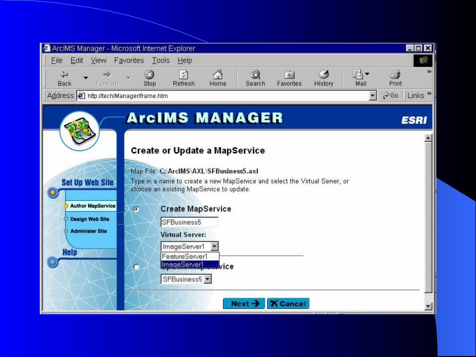
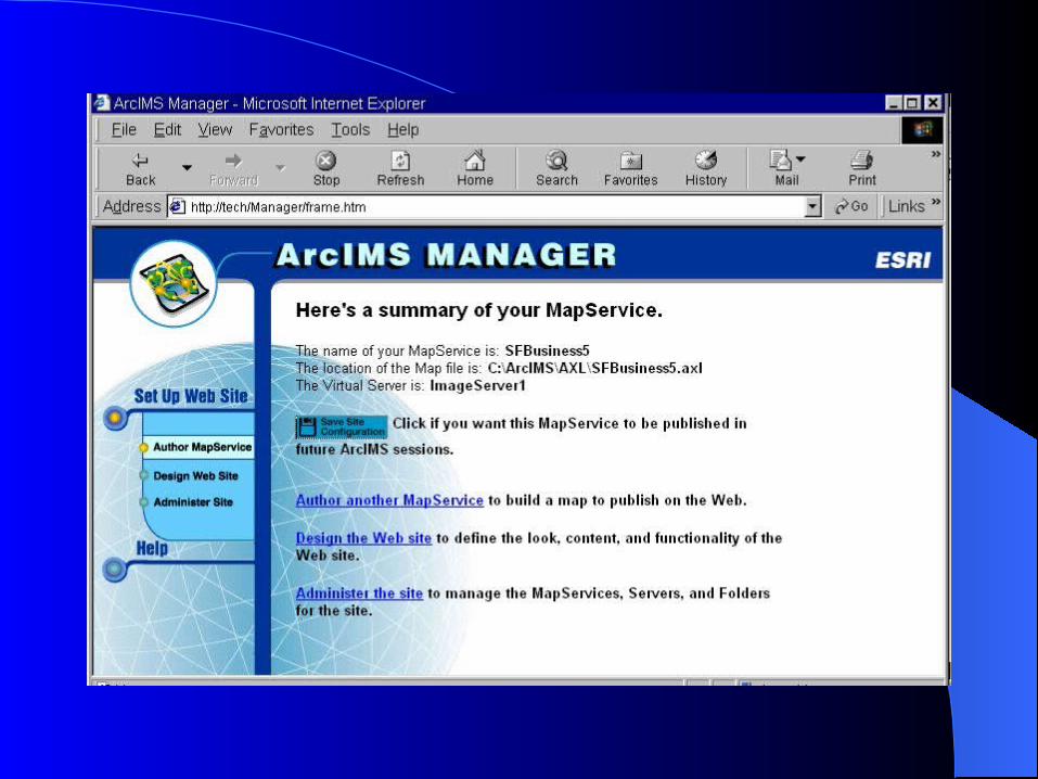
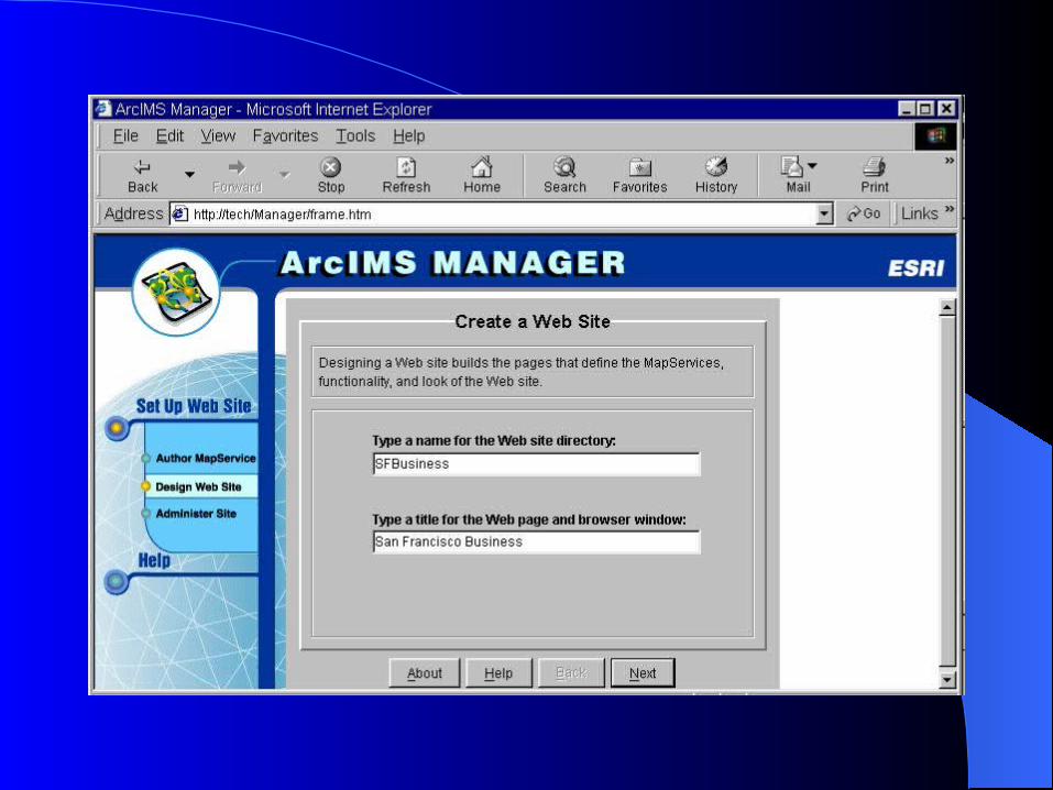
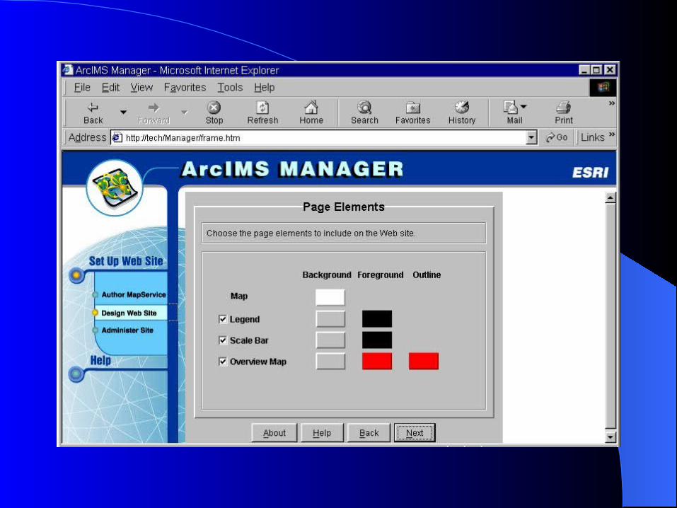
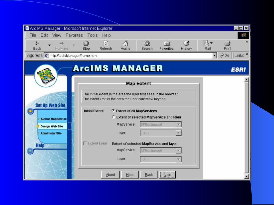
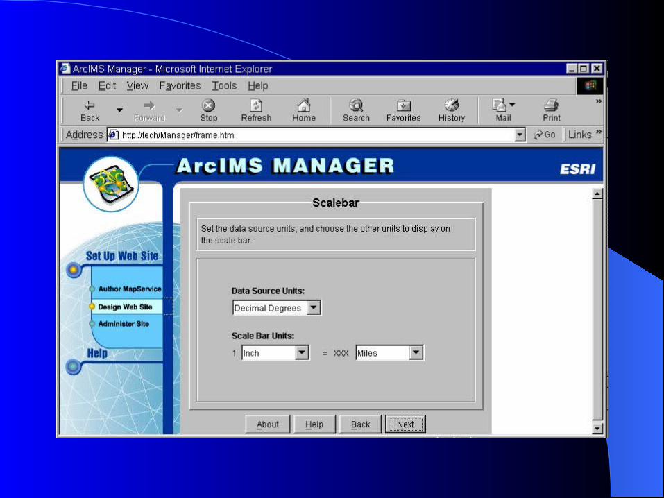
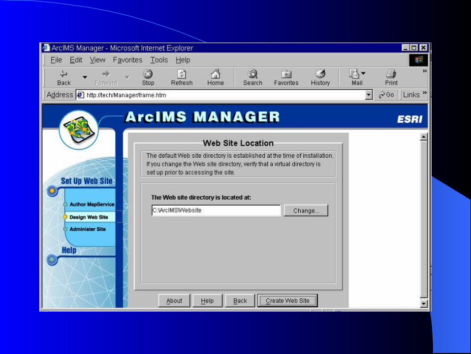
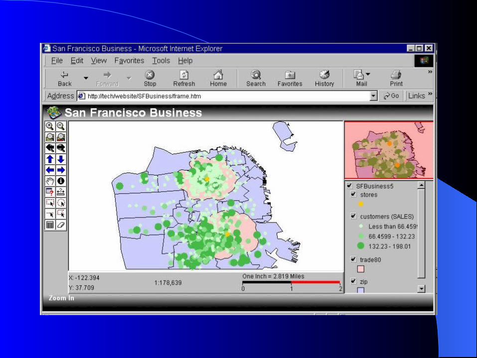
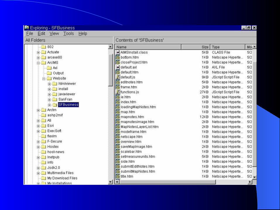
Quick demo using ArcIMS ManagerQuick demo using ArcIMS Manager


AcknowledgmentsAcknowledgments http://www.esri.com/software/arcims/index.html
overview of ArcIMS
http://www.esri.com/library/whitepapers/arcims_lit.html architecture
Security Features & functions ArcIMS vs. ArcView IMS, MapObject IMS
Thank You ! [email protected]