Map Projections - Hunter College, Department of Geography€¦ · Choosing Map Projections...
66
Map Projections 1
Transcript of Map Projections - Hunter College, Department of Geography€¦ · Choosing Map Projections...

Map Projections
1

Developable Projection Surfaces
2

Developable Projection Surfaces, Secant Case
3

Developable Projection Surfaces
4

The Secant Surface
5
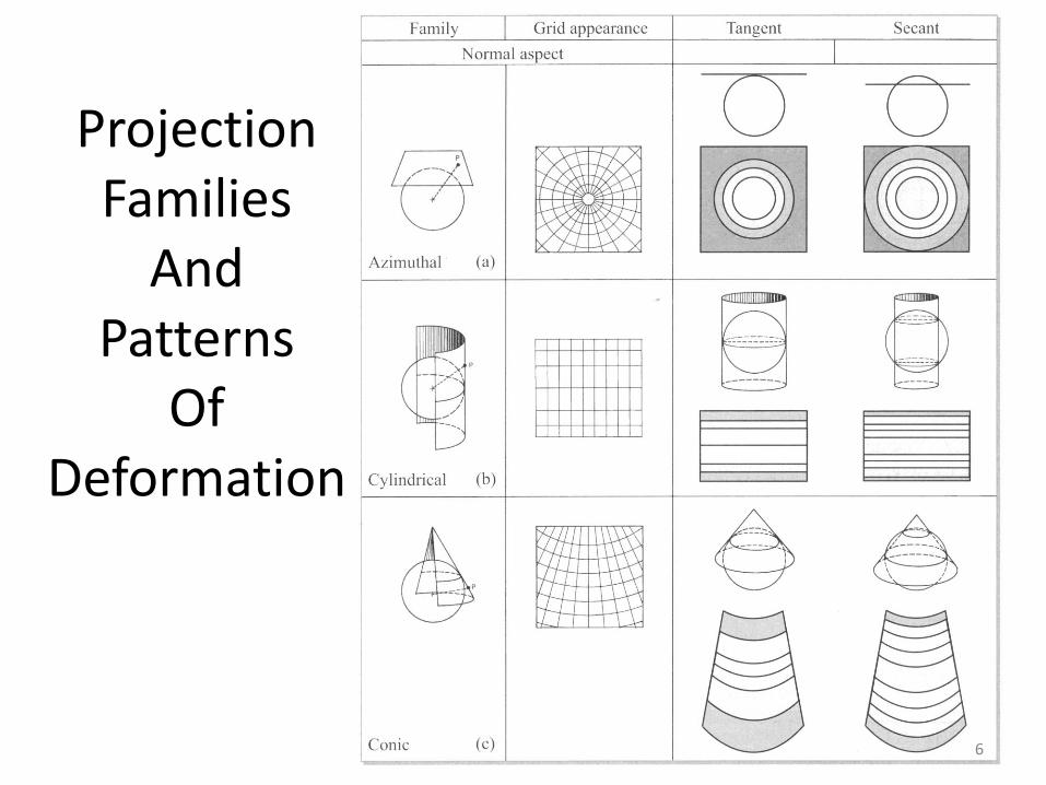
ProjectionFamilies
AndPatterns
OfDeformation
6

Common Projection Aspects For Azimuthal Mapping
7

Source of Illumination Variations of Azimuthal Mapping
8

ProjectionFamilies
AndPatterns
OfDeformation
9
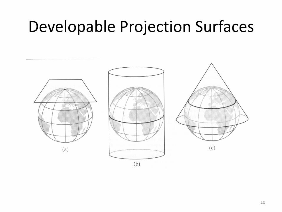
Developable Projection Surfaces
10

ProjectionFamilies
AndPatterns
OfDeformation
11

Common Alternative Projection Aspects for Cylindrical Mapping
12

Developable Projection SurfacesNote Cone Projection – Normal Aspect (c)
13

ProjectionFamilies
AndPatterns
OfDeformation
Note conic Projection (c)
14

Developable Projection SurfacesNote Cone Projection – Normal Aspect (c)
15

Developable Projection Surfaces, Secant Case – note conic projection, secant case (c)
16

ProjectionFamilies
AndPatterns
OfDeformation
Note conic Projection (c)
17
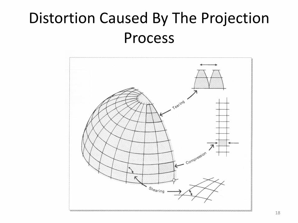
Distortion Caused By The Projection Process
18

Classic Examples of a Conformal, Equal
Area and a Compromise
Projection
19

Combinations of Projection Properties That Can Occur In One Projection
20
Determining Deformation and its Distribution Over the Projection
• two chief methods are available for determining projection distortion and its distribution over a map
• Slide #22: see Figure 3.11, Shape Distortion on an Equal Area Projection
• Show a geometrical figure
• Tissot’s Indicatrix
21

Shape Distortion on an Equal Area Projection
22

(C) Robinson Projection
23

Shape Distortion on Different Projections
24

Choosing Map Projections
Essential Questions
• Projection properties:
– are the properties of a particular projection suited to the design problem at hand?
– Are the following needed:
• Equivalency
• Conformality
• Equidistance
• Azimuthality
25

Choosing Map Projections
• Deformational patterns
• Projection center
• Software support
• Part of an existing map series or online digital map collection?
26

World Projections
• Many different world projections can be selected for mapping
• Mathematical, Equivalent Projections
• Mollweide Projection
27

Mollweide Projection
28

Mollweide Projection
• Has standard parallels (line of tangency or intersection) at 40o 44’ N and S
• The central meridian is half the length of the equator and drawn perpendicular to it
• Parallels are straight lines drawn parallel to the equator but are not drawn with lengths true to scale, except for the standard parallels
29

Hammer Projection
• Sometimes called the Hammer-Aitoffprojection
• The principal difference between this projection and the Mollweide is the Hammer has curved parallels
• This curvature results in less obliqueintersections (acute angles closer to 90o
compared to the Mollweide) of meridians and parallel at the extremities
30

Hammer Projection
31
Interrupted Projections
• One solution to minimize distortion is to make an interrupted projection of the world
• The most well known of the interrupted projections is the Goode’s Homolosineprojection
32

Goode’s Homolosine projection
33

Minimum Error Projections
• The Robinson projection was developed by Arthur Robinson for Rand McNally’s world maps in 1961
34
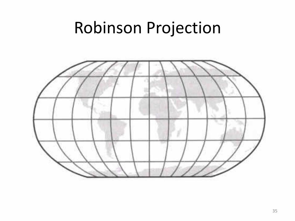
Robinson Projection
35

Winkel Tripel Projection
• The Winkel Tripel projection was developed in 1921 by Oswald Winkel
• Physicists Goldberg and Gott have shown quantitatively that the Winkel Tripel projection may be the best (lowest distortion) compromise projection yet
36

Winkel Tripel Projection
37

Cylindrical Projections
• Most famous cylindrical projection is the Mercator projection
• All lines of constant compass bearings, called loxodromes or rhumb lines) are shown as straight lines
• The problem with this use is that landmass areas such as Greenland and Russia are extremely distorted at the higher latitudes
38

Gall-Peters Cylindrical Projection
39

Gall-Peters Cylindrical Projection
• The purpose behind the invention was to counter the Mercator projection’s areal exaggeration of the high latitudes and its pervasive use as a general purpose map
• The Gall-Peters projection emphasizes many portions of the tropics dominated by less developed countries
40
Gall-Peters Cylindrical Projection
• Because of the prevalence of the Mercator projection, Peters stressed that his projection be used exclusively
• He also claimed that his projection portrays distances accurately, which is false
41

Gall-Peters Cylindrical Projection
• Nonetheless, the Gall-Peters projection has been adopted by:
– UNESCO
– UNDP
– UNICEF
– The National Council of Churches
42

American Cartographic Association Ban of Rectangular Maps
• http://geography.about.com/library/weekly/aa030201b.htm
43

Projections for Mapping Continents
Lambert Azimuthal (planar) Equal Area Projection
• Is a versatile projection
• In its equatorial aspect, this may be one of the best choices for mapping a hemisphere and certainly a continent
44

Lambert Azimuthal (planar) Equal Area Projection
45
Bonne Projection
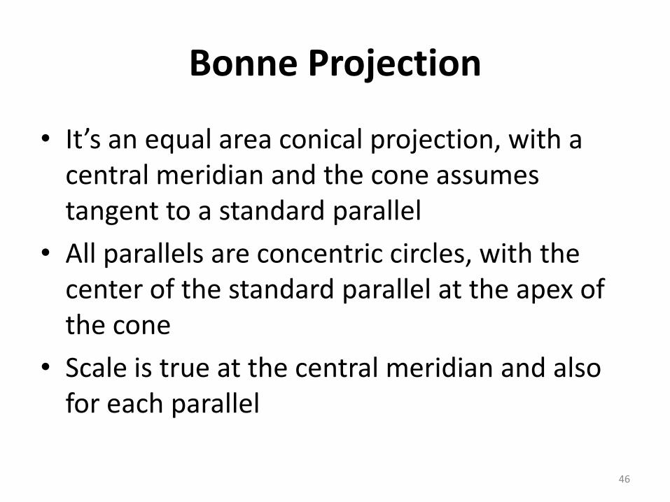
• It’s an equal area conical projection, with a central meridian and the cone assumes tangent to a standard parallel
• All parallels are concentric circles, with the center of the standard parallel at the apex of the cone
• Scale is true at the central meridian and also for each parallel
46

Bonne Projection
47

Bonne Projection
It is commonly used to map:– Asia
– North America
– South America
– Australia and other large areas
• although equivalency (equal area) is maintained throughout, shape distortion is particularly evident at the northeast and northwest corners
48

Bonne Projection
• because shape is best along the central meridian, the distortion becoming objectionable at greater distances from it, the selection of the central meridian relative to the important mapped area (and zooming to that area) is critical
49

Continental Appropriate Projections
– Sinusoidal
– Mollweide
– Goode’s Homolosine
– Compromise projections
50

Mapping Multiple Size Countries at Mid-Latitudes
• The Lambert Azimuthal (planar) Equal Area or the Albers Equal Area Conic projection may be used
• If conformality (angles are preserved around points and shapes of small areas are preserved) is desired, the Lambert Conformal Conic projection can be used
51

Mapping Multiple Size Countries at Mid-Latitudes
• While the Mercator projection is not recommended for world thematic mapping, the Transverse Mercator projection is often used for countries and other political entities that have a pronounced north-south orientation
52
Mapping Multiple Size Countries at Mid-Latitudes
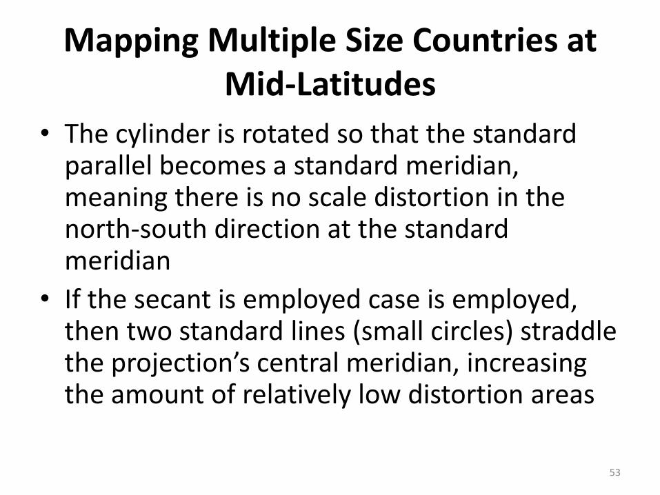
• The cylinder is rotated so that the standard parallel becomes a standard meridian, meaning there is no scale distortion in the north-south direction at the standard meridian
• If the secant is employed case is employed, then two standard lines (small circles) straddle the projection’s central meridian, increasing the amount of relatively low distortion areas
53

Mapping Smaller Areas
• It is important to note that as mapped areas become smaller in extent, the selection of the projection becomes less critical, potential scale errors begin to drop off considerably
54

Projected Coordinate Systems
• All projections involve coordinate systems such as latitude and longitude
• Combines the projection process with the parameters of a particular grid
55

State Plane Coordinate (SPC) System
• It was devised so local engineers, surveyors and others could tie their work into the reference then used, the Clarke ellipsoid of 1866, which was used in the NAD of 1927 but has since migrated to NAD 1983
• They desired a simple rectangular coordinate system on which easy plane geometry and trigonometry could be applied for surveying because working with spherical coordinated was cumbersome
56

State Plane Coordinate
System
57
State Plane Coordinate System
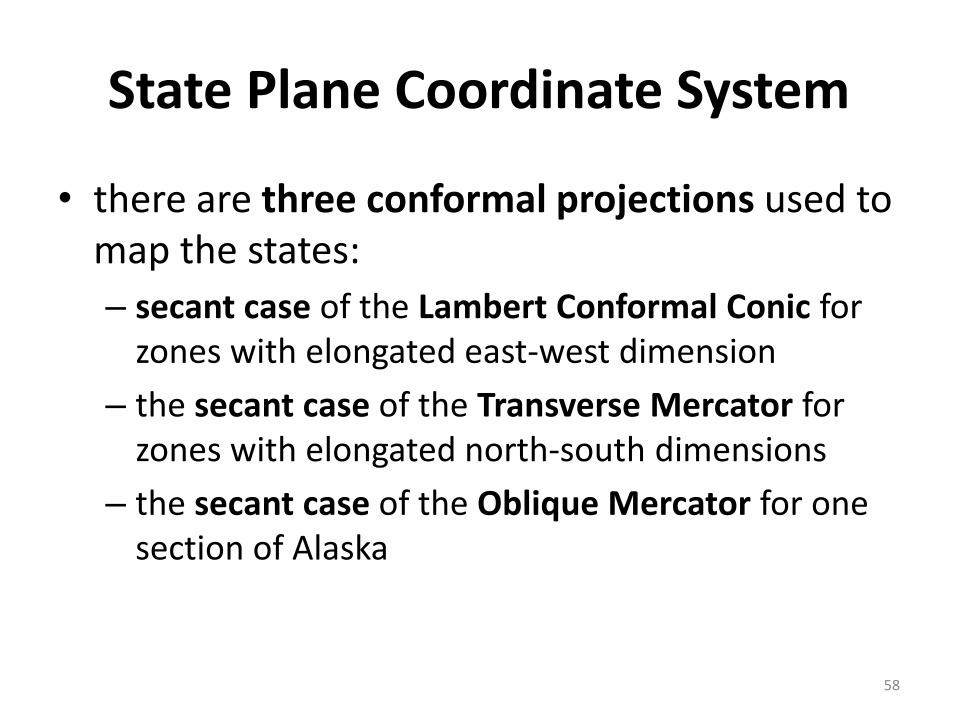
• there are three conformal projections used to map the states:
– secant case of the Lambert Conformal Conic for zones with elongated east-west dimension
– the secant case of the Transverse Mercator for zones with elongated north-south dimensions
– the secant case of the Oblique Mercator for one section of Alaska
58
Universal Transverse Mercator (UTM) System
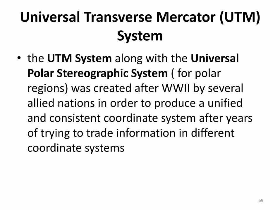
• the UTM System along with the Universal Polar Stereographic System ( for polar regions) was created after WWII by several allied nations in order to produce a unified and consistent coordinate system after years of trying to trade information in different coordinate systems
59
Universal Transverse Mercator (UTM) System
• the UTM system is not as accurate as the State Plane Coordinate system, with accuracies of one part in 2500.
• Many US states distribute much of their public domain spatial data in UTM format which can easily loaded into GIS and mapping software
60

Universal Transverse Mercator (UTM) System
61

The continental US has 10 zones (zones 10-
19) that extend from 126oW to 66oW
62

Universal Transverse Mercator (UTM) System
• The projection for this system is the secant case of the Transverse Mercator
• The transverse cylinder is positioned such that the central meridian runs north-south through the zone’s center
63

Universal Transverse Mercator (UTM) System
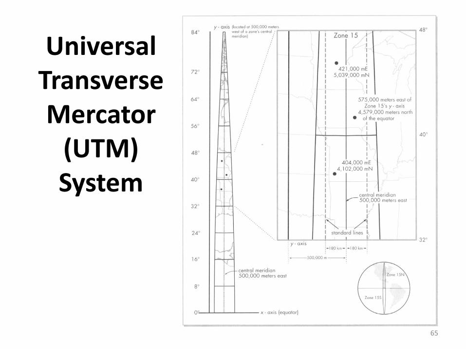
• Coordinates are based on the equator, which serves as the x-axis
• The y-axis is positioned at 500,000 meters west of a particular zone’s central meridian
• By generating this false origin, all coordinates are positive
• In the northern hemisphere, a point is measured as so many meters east (of the y-axis that intersects the false origin) and so many meters north of the equator
64
Universal Transverse Mercator
(UTM) System
65
Universal Transverse Mercator (UTM) System
• In the southern hemisphere, the origin is moved south by 10,000,000 meters, which is not too far from the South Pole
• Again, this keeps coordinates positive
66


![Understanding Map Projections - gis.icao.intgis.icao.int/icaoetod/map_projections[1].pdf · Projection parameters .....20 CHAPTER 3: GEOGRAPHIC TRANSFORMATIONS .....23 Geographic](https://static.fdocuments.us/doc/165x107/5b09bbed7f8b9a93738e51f6/understanding-map-projections-gisicao-1pdfprojection-parameters-20-chapter.jpg)