MAIRS and its Role in Regional Climate Change … and its Role in Regional Climate Change...
25
MAIRS and its Role in Regional Climate Change Initiatives Michael Manton Chair, MAIRS SSC CORDEX SEA Workshop, Bangkok, 9-10 June 2014
Transcript of MAIRS and its Role in Regional Climate Change … and its Role in Regional Climate Change...
MAIRS and its Role in Regional Climate Change Initiatives
Michael MantonChair, MAIRS SSC
CORDEX SEA Workshop, Bangkok, 9-10 June 2014

Objectives of MAIRS
MAIRS aims to promote integrated regional studies across monsoon Asia, in order To answer science questions on
The resilience of the monsoon system to human activities The vulnerability of human societies to environmental change
To promote collaboration across disciplines and regions
To enhance scientific capacity across the region.
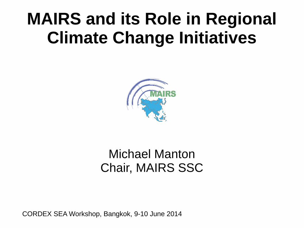
Rationale for MAIRS is Uniqueness of Monsoon Asia
World's highest mountains Heat source of Tibetan Plateau Seasonal monsoon affects water and food
resources Range of natural hazards (TC to GLOF) 3.6 billion people Anthropogenic aerosols Vulnerable coastal development Rapid urbanisation and economic growth
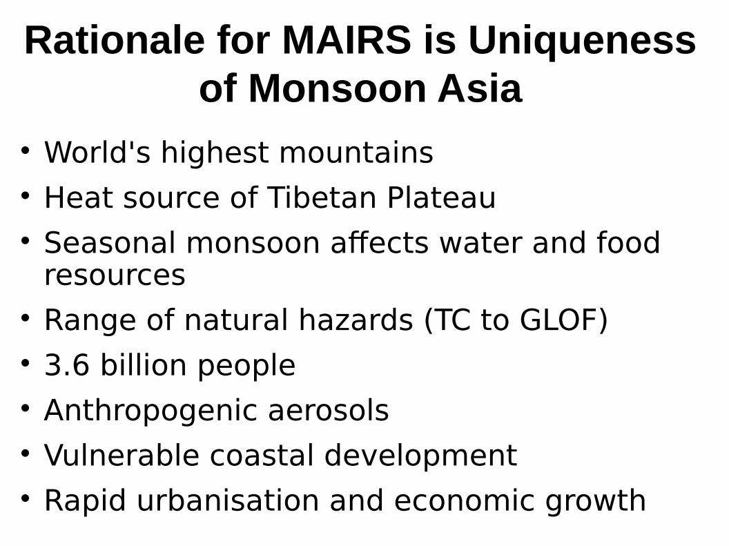
History of MAIRS Planning from 2005 under auspices of
START
Chair SSC
Congbin FU (2006-2010) (Phase I) Michael Manton (2011-2014) (Phase II)
IPO supported by CAS at IAP, Beijing
Link to Earth System Partnership (ESSP)
Review in Nov. 2010
Commence Phase II in 2011
Link to Future Earth in 2013

Conceptual Framework

Coastal Zone
Urban Zone
Mountain Zone
Integration across Vulnerable Zones
Dryland Zone
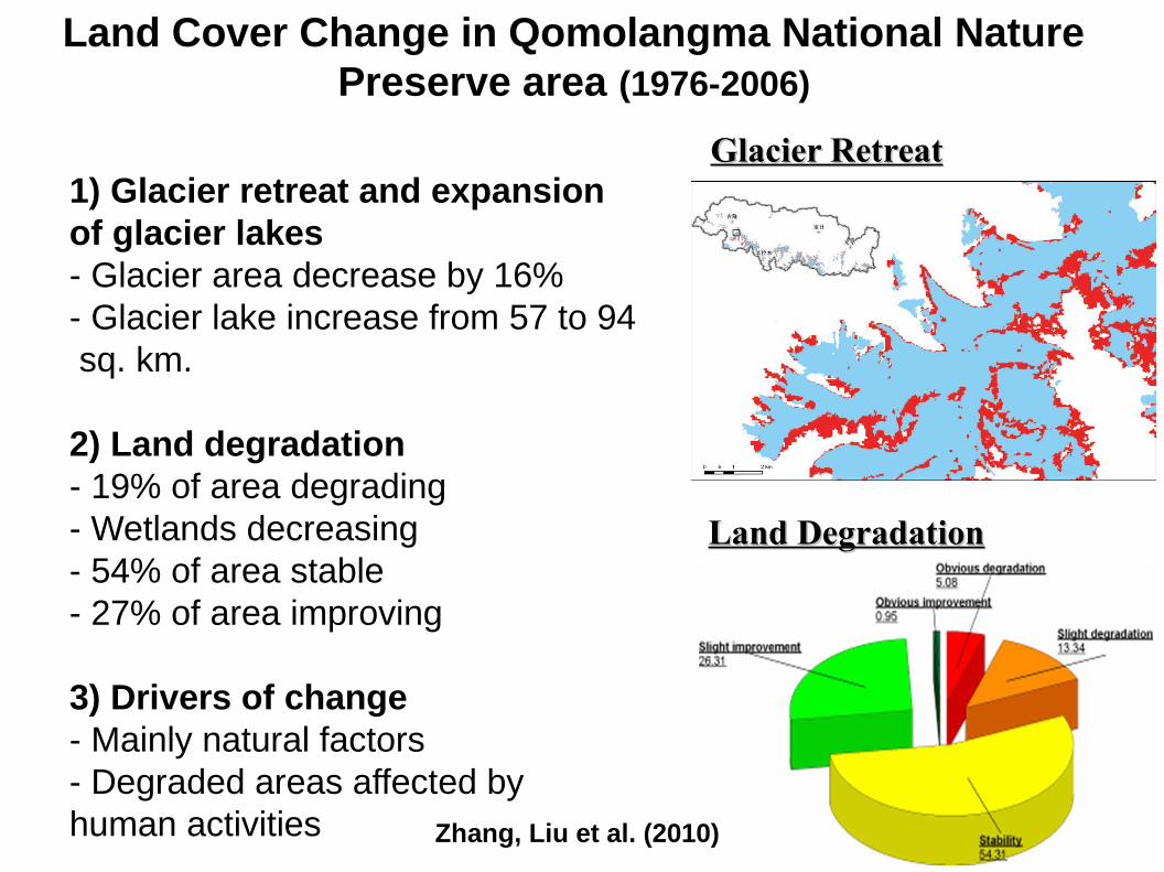
Land Cover Change in Qomolangma National Nature Preserve area (1976-2006)
Glacier RetreatGlacier Retreat
Land DegradationLand Degradation
Zhang, Liu et al. (2010)
1) Glacier retreat and expansion of glacier lakes- Glacier area decrease by 16%- Glacier lake increase from 57 to 94 sq. km.
2) Land degradation- 19% of area degrading- Wetlands decreasing- 54% of area stable- 27% of area improving
3) Drivers of change- Mainly natural factors- Degraded areas affected by human activities
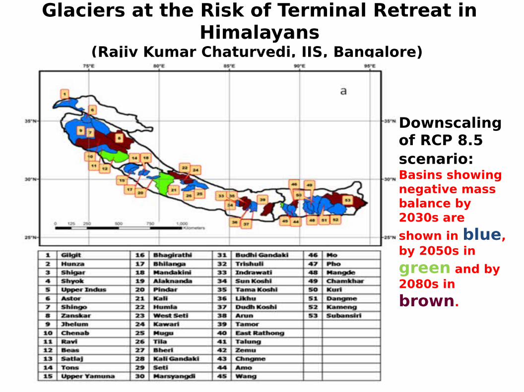
Glaciers at the Risk of Terminal Retreat in Himalayans
(Rajiv Kumar Chaturvedi, IIS, Bangalore)
Downscaling of RCP 8.5 scenario: Basins showing negative mass balance by 2030s are
shown in blue, by 2050s in
green and by 2080s in
brown.
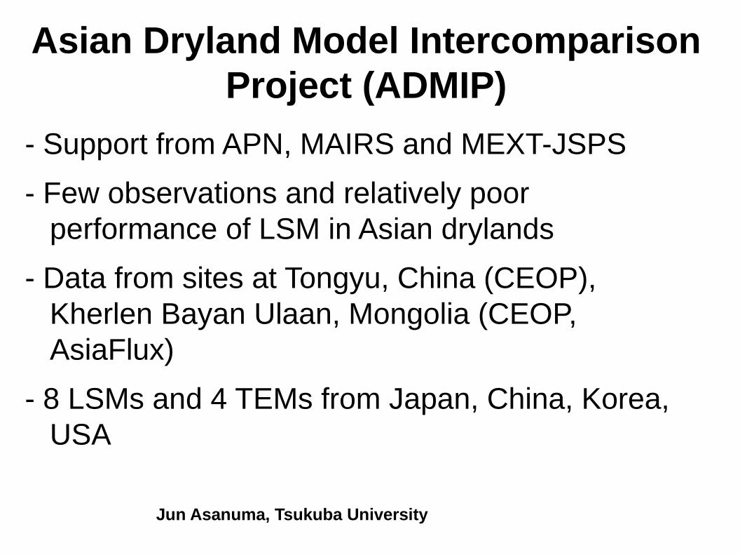
Asian Dryland Model Intercomparison Project (ADMIP)
- Support from APN, MAIRS and MEXT-JSPS
- Few observations and relatively poor performance of LSM in Asian drylands
- Data from sites at Tongyu, China (CEOP), Kherlen Bayan Ulaan, Mongolia (CEOP, AsiaFlux)
- 8 LSMs and 4 TEMs from Japan, China, Korea, USA
Jun Asanuma, Tsukuba University
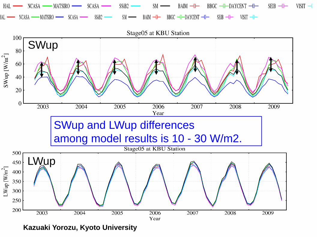
SWup
LWup
SWup and LWup differences among model results is 10 - 30 W/m2.
Kazuaki Yorozu, Kyoto University

Mega-City Clusters Drive Economic Development
3 city clusters with 26% of national population create 47% of national GDP
City cluster in Pearl River Delta (PRD)
City cluster in Yangtze River Delta (YRD)
City cluster in Beijing-Tianjin-Hebei region (BTH)
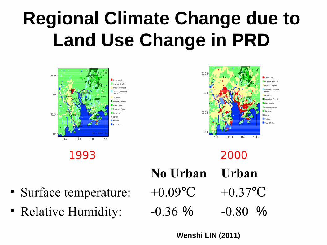
Regional Climate Change due to Land Use Change in PRD
1993 2000
No Urban Urban
• Surface temperature: +0.09 ℃ +0.37℃• Relative Humidity: -0.36 % -0.80 %
Wenshi LIN (2011)

Urban Heat Island impact on Sea Breeze in YRD
Tang JP (2011)


Joint Activity with WCRP CORDEX
Activity funded by APN “Coordinated Regional Climate Downscaling Experiment (CORDEX) in Monsoon Asia” (2013-2016)
Main Collaborators: KMA, NJU, CMA, IITM, ICIMOD, CSIRO, BMKG, MNU
CORDEX South Asia workshop, 27-30 Aug 2013, Kathmandu, Nepal
SEACLID – CORDEX South East Asia workshop, 18-19 November 2013, Jakarta, Indonesia
SEACLID – CORDEX South East Asia workshop, 9-10 June 2013, Bangkok, Thailand
CORDEX South East Asia workshop, Nov 2014, Citeko, West Java, Indonesia
CORDEX East Asia workshop, Nov 2015, Korea or China

CORDEX Issues
Modelling and evaluation GCMs, RCMs
Statistical downscaling and evaluation Value-adding to modelling Relate large-scale model output to local climate
Applications and uncertainties Match method to application Recognise cumulative uncertainties
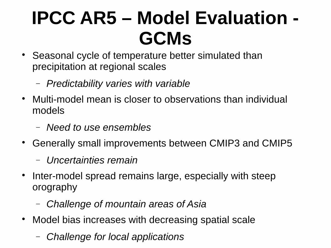
IPCC AR5 – Model Evaluation - GCMs
Seasonal cycle of temperature better simulated than precipitation at regional scales
Predictability varies with variable Multi-model mean is closer to observations than individual
models
Need to use ensembles Generally small improvements between CMIP3 and CMIP5
Uncertainties remain Inter-model spread remains large, especially with steep
orography
Challenge of mountain areas of Asia Model bias increases with decreasing spatial scale
Challenge for local applications
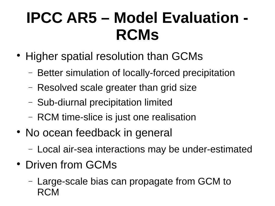
IPCC AR5 – Model Evaluation - RCMs
Higher spatial resolution than GCMs Better simulation of locally-forced precipitation Resolved scale greater than grid size
Sub-diurnal precipitation limited RCM time-slice is just one realisation
No ocean feedback in general Local air-sea interactions may be under-estimated
Driven from GCMs Large-scale bias can propagate from GCM to
RCM
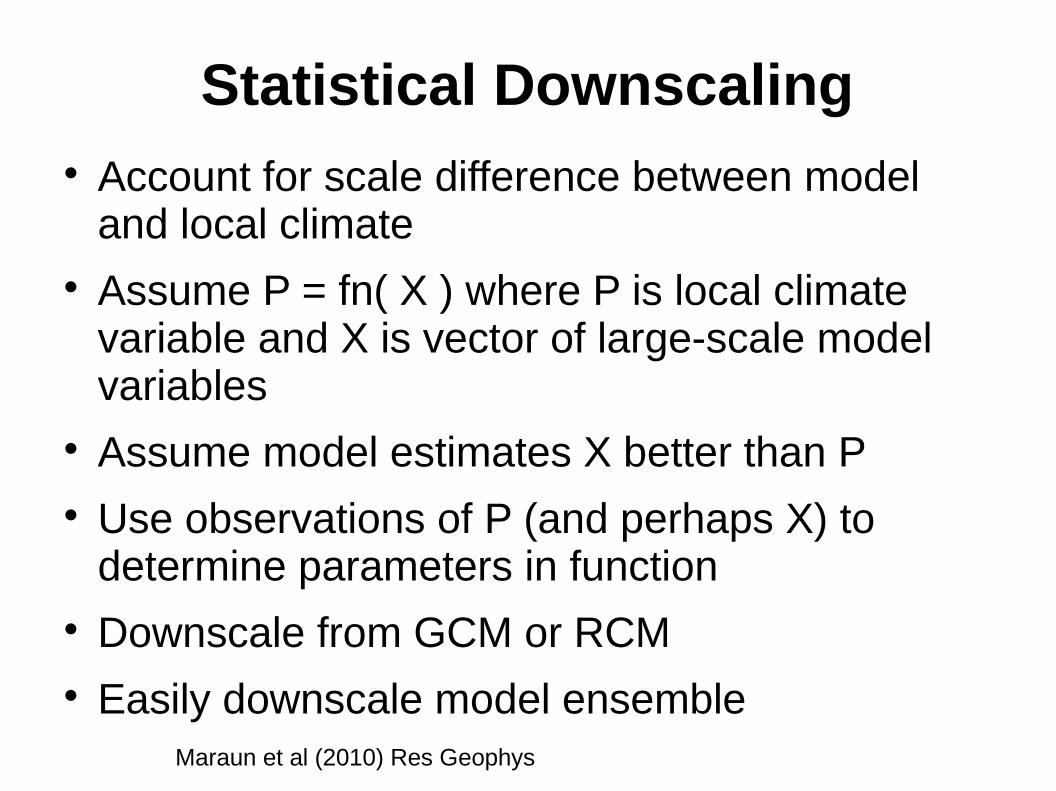
Statistical Downscaling Account for scale difference between model
and local climate Assume P = fn( X ) where P is local climate
variable and X is vector of large-scale model variables
Assume model estimates X better than P Use observations of P (and perhaps X) to
determine parameters in function Downscale from GCM or RCM Easily downscale model ensemble
Maraun et al (2010) Res Geophys

Comparison of SD and RCM
HJ Fowler et al (2007) Int J Climatol

Impact of SD on Model Differences
SEACI Synthesis Report (2012)
- Variation between estimates reduced by statistical downscaling
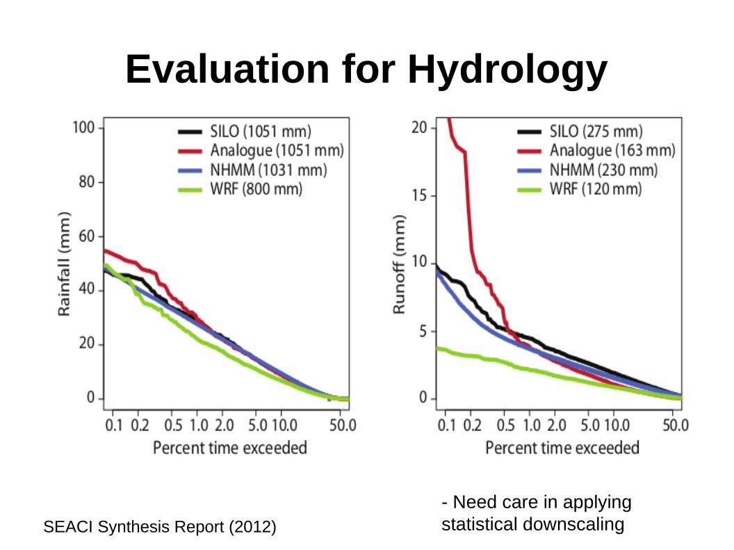
Evaluation for Hydrology
SEACI Synthesis Report (2012)
- Need care in applying statistical downscaling
Impact and Vulnerability Studies
Local climate variables are input to impact model; e.g. crop or hydrological models Evaluate climate model variables from
observations Evaluate impact model from observations
Recognise cascade of uncertainties Ensemble of future climates Consider sensitivity studies rather than forecasts
Downscaling linked to user needs Daily, monthly or seasonal frequency
Examples of RCM for Climate Change Studies in Asia
Yinling Xu, CAAS, Beijing Adaptation planning in Ningxia Projections from PRECIS drive crop models Linked to social and economic analysis
Motaleb Hossain Sarker, CEGIS, Bangladesh Impact assessment for rice crops across
Bangladesh Projections from PRECIS for water availability Hydrological and crop modelling Develop adaptation strategies
Conclusions MAIRS promotes links between research groups
across Asia MAIRS promoting CORDEX across Asia Modelling is important capability to support climate
research and applications CORDEX involves evaluation and application of
RCM and SD to support impact and vulnerability studies
Need to recognise Value-adding of SD to modelling Cascade of uncertainties Essential role of local observations