Local & Indigenous Spatial Knowledge, Culture and PGISdrm.cenn.org/Trainings/PGIS/Lectures_ENG/LSK,...
64
INTERNATIONAL INSTITUTE FOR GEO-INFORMATION SCIENCE AND EARTH OBSERVATION Local & Indigenous Spatial Knowledge, Culture and PGIS What is Special about PGIS? Understanding Mental Maps Respect for Indigenous /Local Spatial Knowledge Michael McCall ITC, Twente june 2010
Transcript of Local & Indigenous Spatial Knowledge, Culture and PGISdrm.cenn.org/Trainings/PGIS/Lectures_ENG/LSK,...

INTERNATIONAL INSTITUTE FOR GEO-INFORMATION SCIENCE AND EARTH OBSERVATION
Local & Indigenous Spatial Knowledge,
Culture and PGIS
What is Special about PGIS?
Understanding Mental Maps
Respect for Indigenous /Local Spatial Knowledge
Michael McCall
ITC, Twente
june 2010

Which is P-GIS?
P-GIS as form of PSP which makes use of maps and GI
output, especially GIS.
• Core is „degree of participation‟ in planning,
• essential issues are: processes, activities, instruments,
and procedures that involve participation
P-GIS is „doing (technical) GIS with some degree of
people‟s participation –
• Participation could be simply data collection, or choice
of data inputs, data layers, analysis, data queries.
• Core activity is the GI outputs (maps, etc.)
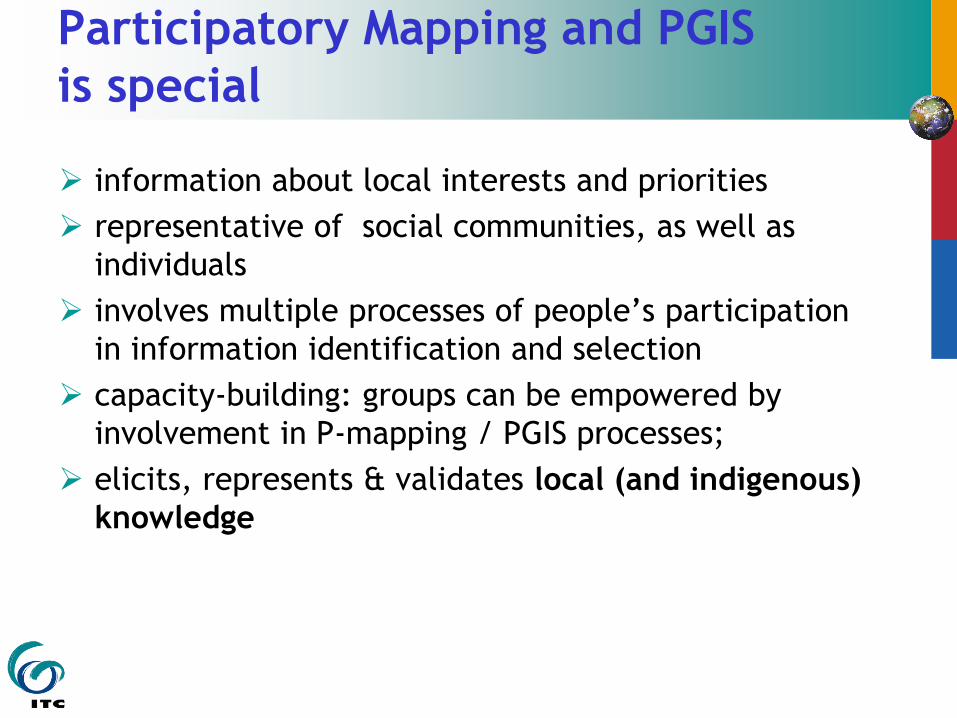
Participatory Mapping and PGIS
is special
information about local interests and priorities
representative of social communities, as well as
individuals
involves multiple processes of people‟s participation
in information identification and selection
capacity-building: groups can be empowered by
involvement in P-mapping / PGIS processes;
elicits, represents & validates local (and indigenous)
knowledge

“IK / LK” -- names
Local Knowledge (Internal Knowledge)
Indigenous (Technical) Knowledge, ITK
Local Spatial Knowledge, LSK
(Rural) Popular Knowledge
Traditional Knowledge

Local / Indigenous Knowledge
“Indigenous knowledge is the sum
total of the knowledge and skills
which people in a particular
geographic area possess, and which
enables them to get the most out of
their natural environment.
IKDM Editorial (July 1998)

Local / Indigenous Knowledge
{Most of} this knowledge and these skills have been passed down from earlier generations, but {individual} men and women in each generation adapt and add to this body of knowledge in a constant adjustment to changing circumstance and environmental conditions.
They in turn pass on the body of knowledge {intact} to the next generation, {in an effort} to provide them with survival strategies.”
IKDM Editorial (July 1998)

Local / Indigenous Knowledge
Flavier et al (1995) p. 479.
“IK is …. the information base for a
society, which facilitates communication
and decision-making. Indigenous
information systems are dynamic, and
are continually influenced by internal
creativity and experimentation as well
as by contact with external systems.”

Questions:
Strengths and Opportunities of using LSK.
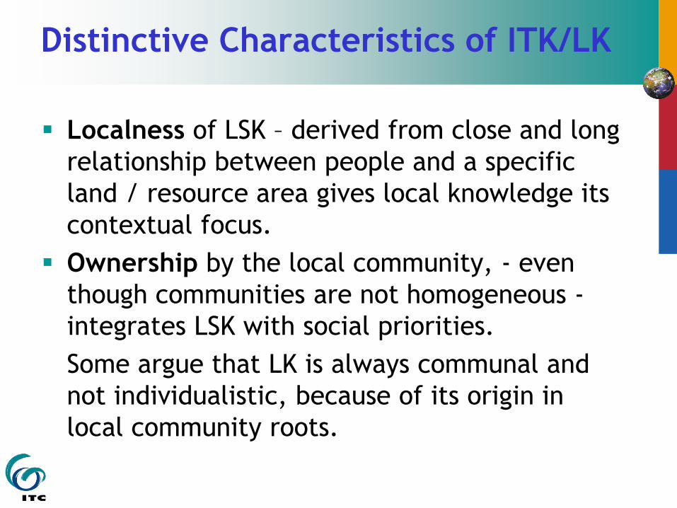
Distinctive Characteristics of ITK/LK
Localness of LSK – derived from close and long
relationship between people and a specific
land / resource area gives local knowledge its
contextual focus.
Ownership by the local community, - even
though communities are not homogeneous -
integrates LSK with social priorities.
Some argue that LK is always communal and
not individualistic, because of its origin in
local community roots.

Distinctive Characteristics of LK
Taxonomies and classification in LSK & ITK
are usually assumed to be more based on
functionality / purposiveness than in modern
scientific knowledge. (There is some evidence
countering this.)
LSK/ITK is more holistic because of the
purposiveness -
thus an emphasis on holistic, combinatorial
qualities of products or events.
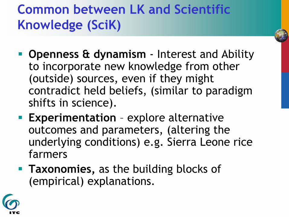
Common between LK and Scientific
Knowledge (SciK)
Openness & dynamism - Interest and Ability to incorporate new knowledge from other (outside) sources, even if they might contradict held beliefs, (similar to paradigm shifts in science).
Experimentation – explore alternative outcomes and parameters, (altering the underlying conditions) e.g. Sierra Leone rice farmers
Taxonomies, as the building blocks of (empirical) explanations.

Common between LK and SciK
Identification of specific conditions under
which more general „laws‟ or
explanations will hold, -
i.e. this is the basis of deductive science,
and it is the mechanism in eliciting
expert knowledge.

Knowledge as a Social process –
factors common between LK and SciK
Distribution of knowledge amongst experts within community – e.g. the „control‟ of key LSK/ITK is arrogated by male elders/ castes.
Similar dominations by closed scientific „academies‟.
Relation to culture – ITK is often devalued as “culturally-embedded, mixing the sacred and profane, encoded in ritual, etc.”,
But there is a parallel with growth-driven, individualistic, materialistic cultures being the context for applied modern SciK.
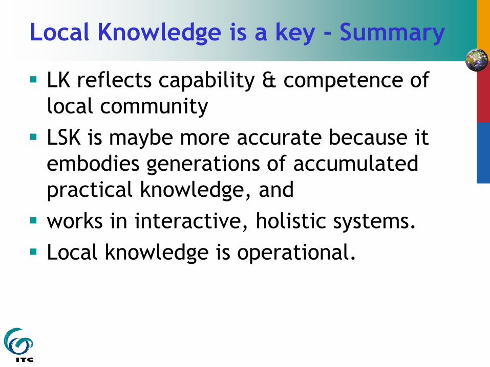
Local Knowledge is a key - Summary
LK reflects capability & competence of
local community
LSK is maybe more accurate because it
embodies generations of accumulated
practical knowledge, and
works in interactive, holistic systems.
Local knowledge is operational.

Local Knowledge is a key - Sumary
LK is resource that disadvantaged &
marginalised groups possess – even if their
land, property, resources, labour are
appropriated
LK is a resource needing little capital for
realisation.
LK can place community on equivalence with
outside forces
LK is often unique and threatened knowledge

Question :
Weaknesses & threats for LSK / ITK

ITK / LK HAS LIMITATIONS
Uneven distribution, generation, transmission of Indigenous / Local Knowledge
Slow rates of knowledge generation (slow experimentation & measurement techniques)
Unrecorded knowledge; limits of storage
Knowledge is lost when it is not utilised
Technical limitations "what farmers don't know cannot help them"

ITK / LK HAS LIMITATIONS
Knowledge is Controlled within rural society, thus unequal access: age, gender, economic & social class, religion, institutions, ...
e.g. weather forecasting = rain-making.
Focusing on just Local Knowledge factor diverts attention from structural issues –
such as, lack of access to land, markets, capital, technology, etc, & lack of power vis-a-vis globalisation, prices, tenure, trade, ..
PGIS represents many types of (Local)
Spatial Knowledge:
I. ADD to CONVENTIONAL INFORMATION on resources etc
ADD NEW & UNKNOWN INFORMATION e.g. new resources.
II. LOCAL ALTERNATIVE KNOWLEDGES i.e. needs, priorities, „counter maps‟
III. CULTURAL/ HISTORICAL (SACRED) Knowledge
IV. SPIRITUAL, MYSTICAL SPATIAL KNOWLEDGE in MENTAL MAPS of people’s culture mythologies; Indigenous spatial concepts – culture space, sacred spaces, cosmovisions

ISK / ITK - Indigenous (Spatial) Technical
Knowledge
IK and scientific knowledge are not always so
different.
ITK/ISK maybe more accurate because it
embodies generations of practical knowledge
and work in interactive, holistic systems.
Examples:
Interpret satellite images of land capability with Bedu
shepherds in Jordan (Patrick 2002);
ITK of grazing lands in Burkina Faso (Sedogo 2002);
Australia: mapping ITK of valuable vegetation types
Senegal River valley: compare farmers‟ & scientific soil
classifications (Tabor & Hutchinson 1994);

LSK / ITK – Local / Indigenous
(Spatial) Technical Knowledge
Examples:
Interpret satellite images of land capability with Bedu
shepherds Jordan (Patrick 2002);
ITK of grazing lands in Burkina Faso (Sedogo 2002);
Australia: mapping ITK of valuable vegetation types
Senegal River valley: comparison farmers‟ & scientific
soil classifications (Tabor & Hutchinson 1994);

II. ALTERNATIVE COMPETING GeoSpatial INFORMATION
– Counter Maps
Knowledge representing different viewpoints, priorities, interests, problems of different local actors, (different from dominant „official‟ view, & from other local actors).
The knowledge of local actors‟ needs, priorities values includes local configurations of land & resource ownership with complexities of multiple user rights, communal property regimes, etc.
Different viewpoints can be reflected in „counter maps’.

III. CULTURAL/ HISTORICAL (SACRED) K.
Cultural-Historical Identity > Building the Community
- Cultural knowledge & local history
o Places of historic, cultural and religious significance, ancestral grounds and sacred areas
o Indigenous names; cosmovisions, creation and origin myths, etc.
- Sacred Lands
- Land for the Ancestors
- Promote Community awareness e.g. Community development of GIS strengthened Ifugao historical cultural consciousness and prepared for negotiations.

Cultural Historical Identity

Cultural heritage, physical preservation,
and prevention of material theft LSK of secret sites, historical sites, cultural
artefacts, treasures, holy locations which local people do not want to become universal knowledge:
Native Americans in the USA fear vandalism of burial and sacred sites by souvenir-hunters.
New Zealand: for example in the Auckland region, over 50% of significant pā (fortified village) sites have been destroyed, < 2.5% of stone field wāhi tapu (sacred sites) remain.

IV. SPIRITUAL, MYSTICAL SPATIAL KNOWLEDGE
Specialised and restricted to particular peoples, is
the spiritual or mystical spatial knowledge
associated with cultural spaces, particularly
with specific landscapes.
This indigenous knowledge is qualitatively
different from scientific knowledge. This IK is
symbolic, metaphoric, and visionary, (mystical
in „scientific‟ terms), and especially related to
land & land features.
Knowledge of landscape is the embodiment of
the people‟s identity.

spiritual and material
But, there may often be functional connections with „scientific‟ explanations, as in
traditional restrictions on using „sacred land‟,
protected forest or dry season grazing reserve.
Forest lands restricted from slash & burn by ghost birds
spiritual or mystical spatial knowledge
Interpreted as cosmovisions (= cosmos, corpus & praxis) commonly incorporate origin or creation myths of cultures,
therefore more usually found among indigenous, natural resource-dependent, less-globalised peoples.
cognitive maps which preserve a sacred, cultural and personal significance in terms of cosmological explanations, where geography (relative location and space) as well as landscape hold deep significance for individuals and communities.

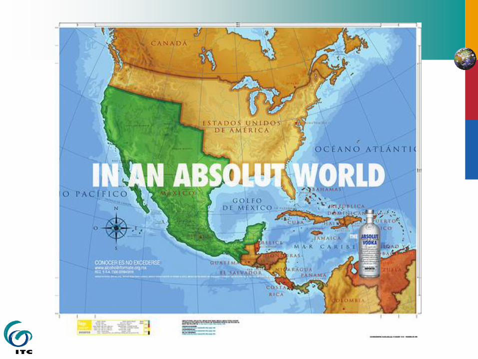
Cosmovision - Mexico
This deep
knowledge
frequently holds
obligations of
stewardship of the
land, and
specialised,
location-specific,
problem-oriented
ITK

Cosmovisions

Local Spatial Knowledge
Ontology of LSK (local spatial
knowledge)
Spatial
representation
(communication
Inscriptive /
Incorporative
3 levels of increasing complexity, ‘otherness’, and ‘distance’ from standard positivist ‘scientific’ spatial knowledge
Local (technical) spatial
knowledge
(c.f. ITK)
Conventional maps &
GIS products
(dynamic GIS, )
Geo-referenced,
Geodetic.
Inscriptive
communication
Community & Individual
(spatial) values & needs.
Secret spaces
Sacred locations
Counter Maps
Sketch / ephemeral
maps
Pictorial imagery
Both Inscriptive &
Incorporative
Cosmological visions &
explanations. (c.f. creation
myths, sacred stories)
Images, music,
dance, stories
Incorporative
communication

Looking for Mental Maps
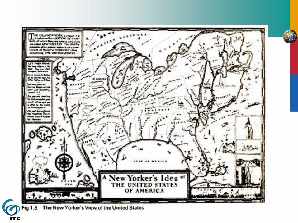

Bostonian‟s Image

Bushie World

Mental Maps – Los Angeles
white elite, black, latino
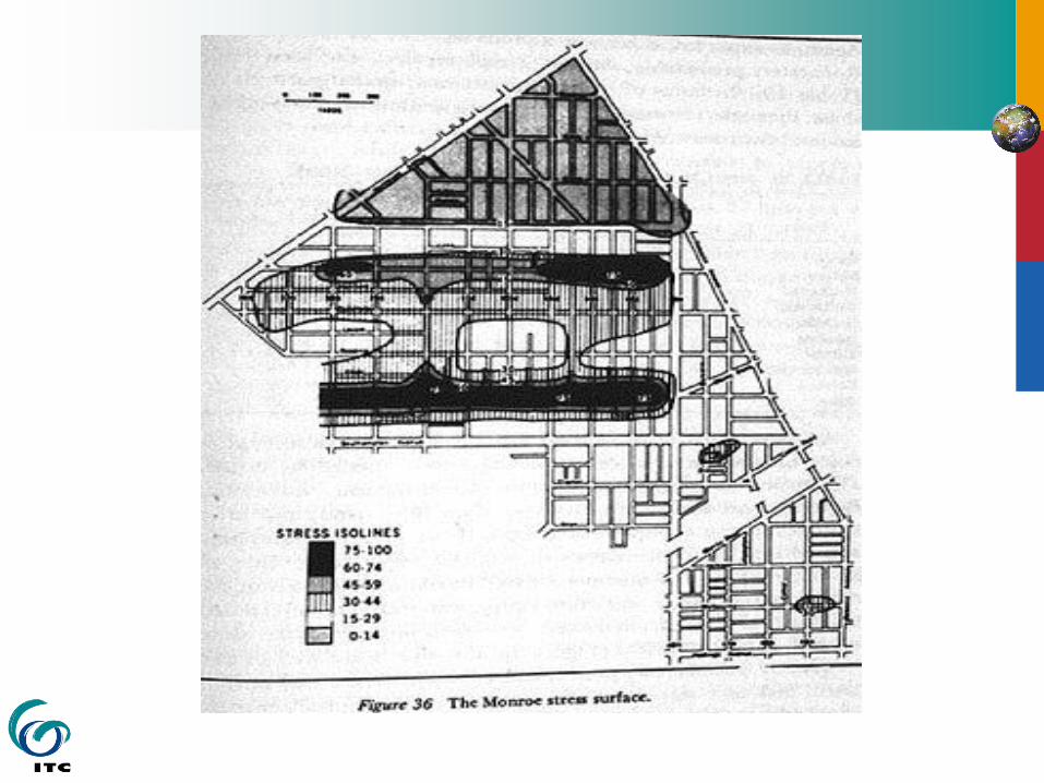


Cataclysm Linda Tam Dreamsongs
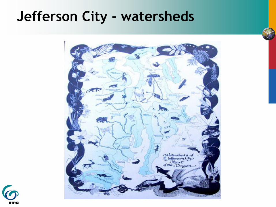
Jefferson City - watersheds
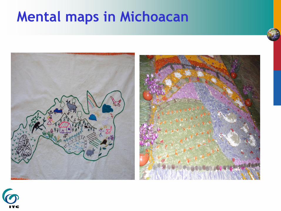
Mental maps in Michoacan

Children‟s Mental maps
Children´s mental maps
urban examples
Animals´Mental maps

Mapping Lost Homes
Drawing, painting therapeutic after trauma of surviving tsunami, especially for children
Memories of home & community need preserving, a “home map” recreates child‟s mental map of a lost home & neighbourhood
TOOLS
Sketch maps; plastic overlays on topo maps, tourist map; best on aerial photos; 3D models.
Symbology (map legend) from the children
Digitally photograph for preservation

Indigenous Spaces
“the Inuit don‟t make maps.. even though they could.
… their mapping behavior reflects – not potential
ability (the Inuit suffer no cognitive deficit) – but
cultural values and social needs. (Wood 1993
´Places emerge as sites of the hybrid articulation of
representations, practices, & things, as spatialized
imaginaries´. The meanings of ´locations´ can be
extended to describe the intricate topologies of
bodies and things, as well as landscapes. (Thule Inuit
people. (Whitridge 2004)

Indigenous Space - Songlines
It is the act / process of making the “map” or
the spatial representation which is the
significant activity, not the material product.
´Singing the map´ by Australian Aborigines.

Songlines
Songlines – are the paths /
tracks along which
ancestral and mythical
beings travelled during
the Dreamtime
(Creation), and
therefore connect sacred
sites widespread in
Australia.
Digital Songlines website
http://songlines.interactiondesig
n.com.au

Inscribing & Incorporating Local Spatial
Knowledge - Rich Pictures & Stories
Inscribing K.: reports, maps, cadastres
Incorporating K.: ceremony, stories, dance,
song, pictograms
Qualitative, implicit, & emotional knowledge
elicited through qualitative methods
- discourse, story-recording, sketching, video,
before transcribing to visual and
geoinformation
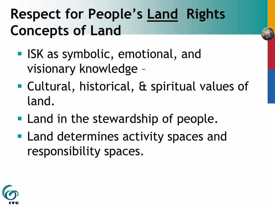
Respect for People‟s Land Rights
Concepts of Land
ISK as symbolic, emotional, and
visionary knowledge –
Cultural, historical, & spiritual values of
land.
Land in the stewardship of people.
Land determines activity spaces and
responsibility spaces.

Representing Land Tenure Customary Land Tenure System
e.g. Aboriginal Australia
Market-oriented Land Tenure
e.g. Australian Cadastral System
Spiritual physical connection to land Land as a marketable commodity
Communal Ownership. Stewardship. Register land@cadastre. Exclusive ownership.
Land transferred through inheritance Transfer land sale, lease, inheritance.
Evidence tenure via song, dance,
stories, pictures, ceremony –
„incorporating‟
Written Records by Certificate of Title
granted by state. Long-term „inscribed‟
storage in databases.
Boundaries are „limits of influence‟
topography, sacred spaces.
Boundaries geodetic, demarcated by
monuments. State regulation.
Overlapping rights, responsibilities,
negotiate with neighbour peoples
Rights on neighbouring lands restricted &
controlled by the State
Soft boundaries.
Temporary/Seasonally flexible bound
Hard boundaries
Mostly fixed boundaries
Richer Meanings – holistic
GIS cannot handle – Maybe PGIS
Preciser meanings – reductionist
GIS handles very well

Stewardship of the Land
Maori : Tapu – respect for resources
Mana - authority Mauri - Life force life energy
Stewardship - Land is held in trust:
NZ, India, islamic law, Solomon Islands, First Nations
International Court of Justice,
FoE : “our grandchildren´s grandchildren”
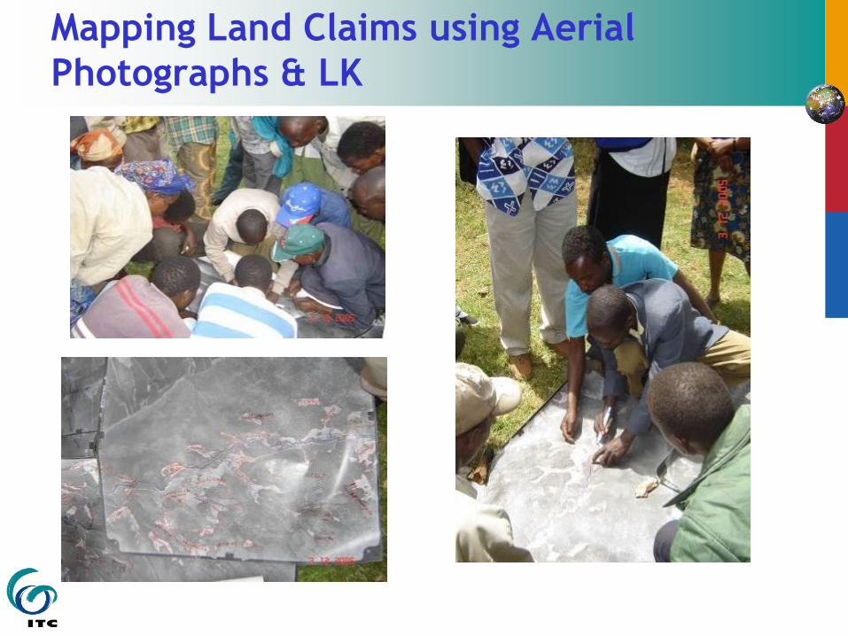
Mapping Land Claims using Aerial
Photographs & LK

Naive Geography – “real space”
Real space tightly coupled with Time
Distances are non linear
Distances are asymmetric
Key nodes are the interest, not the space between –
space jumps
Fuzzy, Flexible, boundaries & zones
Layered zones
Continuous or discrete space
Uncertain and Restricted spaces

Representing Real Space –
special capabilities:-
Natural language uses near, far, isolated, crowded, etc.
3 dimensions of space not universal. E.gs. of Ethnospace adding diurnal, seasonal, centrality, zenith, nadir
„jump scale‟: enabling people at scales relevant to their daily lives or long-term interests;
Real space tightly coupled with Time – short & long term
represent counter-maps of disadvantaged or genders;

Representing Real Space on maps or GIS
requires special capabilities:-
represent some areas as fuzzy or fading
zones, or as multi-layered zones;
represent fuzzy, blurred boundaries,
flexible, or multiple boundaries;

Representing Real Space –
special capabilities:-
represent flows of resources, information, ideas,
or flows of influence, power, and control;
dynamic, showing changes over time in resource management, in locations, boundaries, or in conflicts.
Space includes soundscape, smellscape, memoryscape
Spatial learning – Landmarks, Routes, Survey Area

Representing Real Space on maps or GIS
requires special capabilities:-
represent some data as uncertain spatial locations, or as hidden (e.g. sacred) or restricted locations;
provide immediate access to linked information, via hyperlinks;
transparent representation, e.g. of multiple land rights and entitlements, correlating with transparency of information;
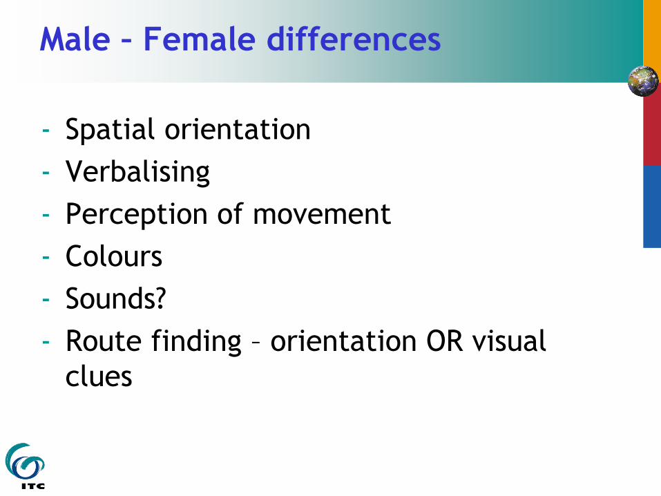
Male – Female differences
- Spatial orientation
- Verbalising
- Perception of movement
- Colours
- Sounds?
- Route finding – orientation OR visual
clues

Gendered Differences in Navigation
Hypotheses
Males:
directions, distance, movement,
simplicity, certainty,
Females:
landmarks, verbal information, colours,
complexity, ambiguity,

3 Wise Men (los tres reyes) Route Finding -without a
Woman
“We are lost, but, No need to ask the way – we
have a GPS”

3 Wise Men Route Finding – with a woman
“We are lost - For heaven‟s sake, just ask
someone!”

Spatial Certainty &
Representational Certainty
Failure to distinguish between positional accuracy and representational accuracy
• False precision because of legitimising elite control, professional arrogance, closed shop - precision as fetish.
• Precision as (deliberate) distraction, or obfuscation – the hiding of process, of realities of power and control
• Precision as step towards external expropriation – a market for land requires legal recognition needing high level of precision
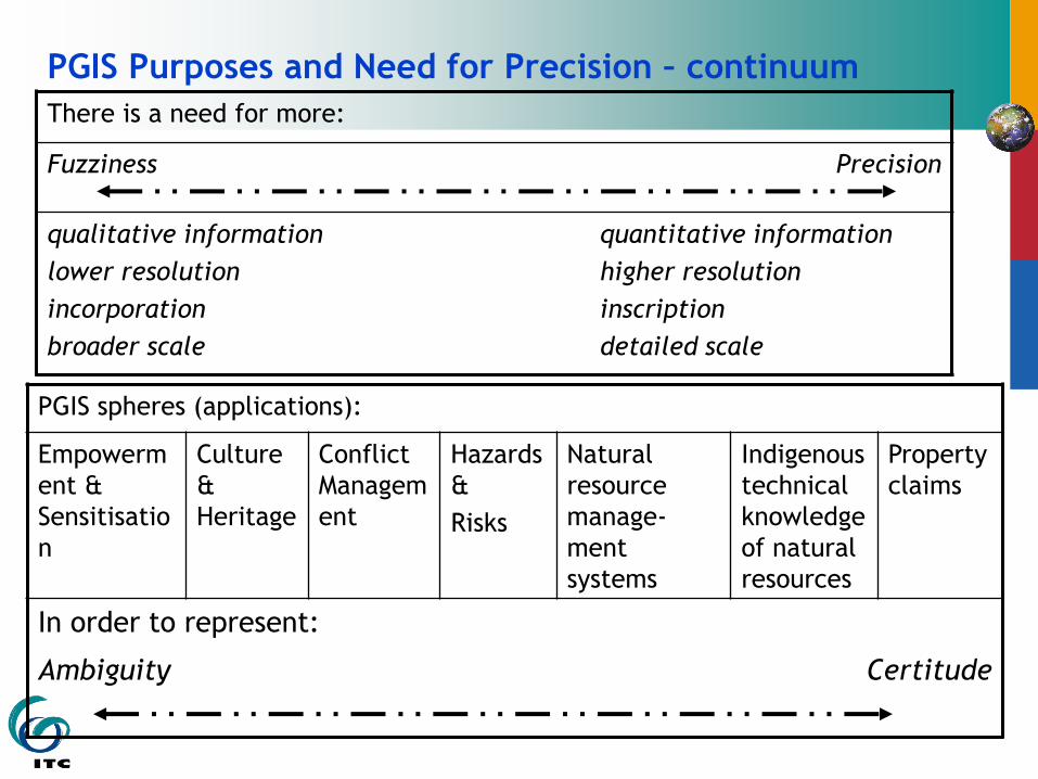
PGIS Purposes and Need for Precision – continuum There is a need for more:
Fuzziness Precision
qualitative information
lower resolution
incorporation
broader scale
quantitative information
higher resolution
inscription
detailed scale
PGIS spheres (applications):
Empowerm
ent &
Sensitisatio
n
Culture
&
Heritage
Conflict
Managem
ent
Hazards
&
Risks
Natural
resource
manage-
ment
systems
Indigenous
technical
knowledge
of natural
resources
Property
claims
In order to represent:
Ambiguity Certitude