Lectures on Tropical Cyclones - uni-muenchen.deroger/Lectures/Tropical... · tropical cyclones,...
55
Lectures on Tropical Cyclones Chapter 1 Observations of Tropical Cyclones
Transcript of Lectures on Tropical Cyclones - uni-muenchen.deroger/Lectures/Tropical... · tropical cyclones,...

Lectures on Tropical Cyclones
Chapter 1Observations of Tropical Cyclones
R di t i lReading material
Anthes (1970), Tropical Cyclones, AMS Monograph
Anthes (1974) The d namics and energetics of mat reAnthes (1974), The dynamics and energetics of mature tropical cyclones, Rev. Geophys. Space Phys., 12, 495-522
WMO Tech. Note (1995) Ed. R. L. Elsberry
H E Will hb M t t t d l ti• H. E. Willoughby Mature structure and evolution
• J. L. McBride Tropical cyclone formationJ. L. McBride Tropical cyclone formation
• I. Ginis Ocean response to tropical cyclones
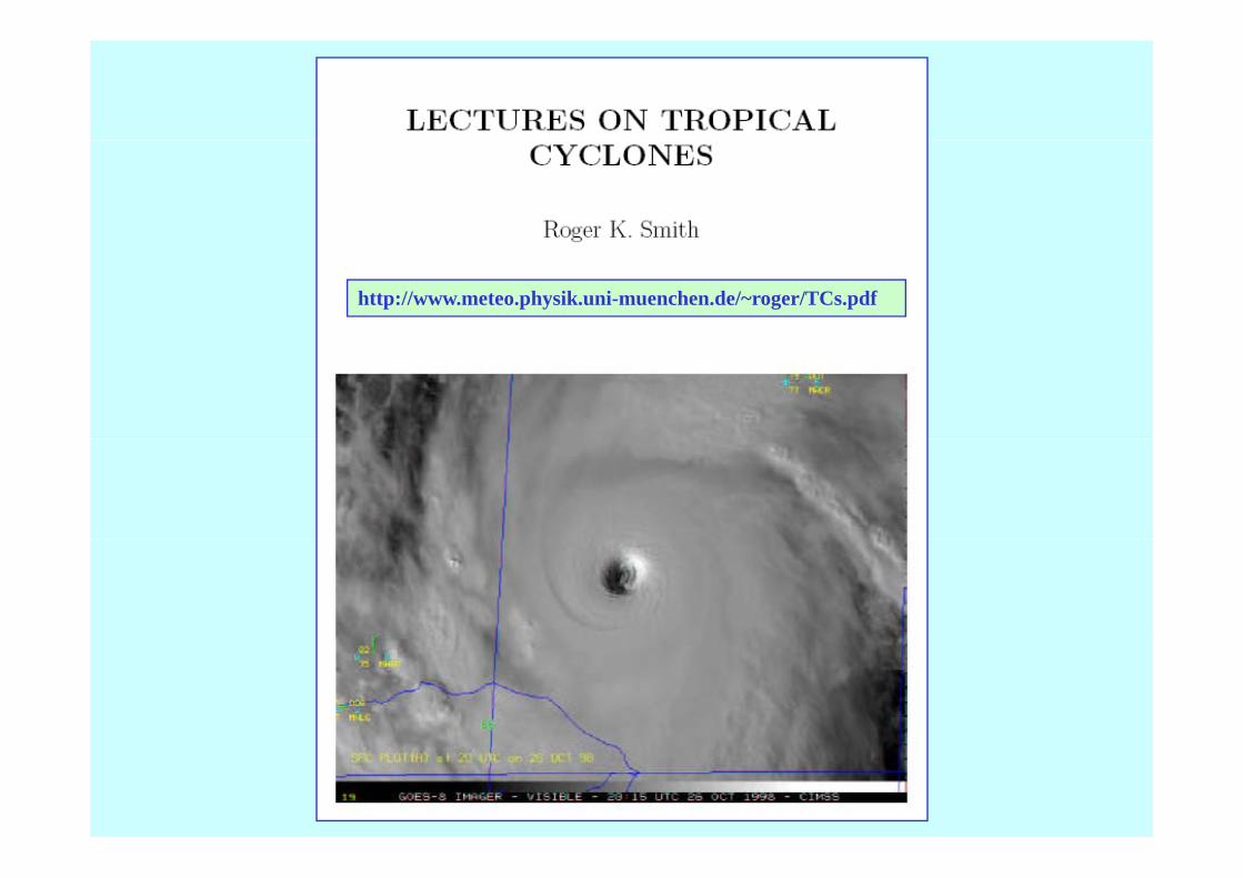
Lecture NotesLecture Notes
http://www.meteo.physik.uni-muenchen.de/~roger/TCs.pdf
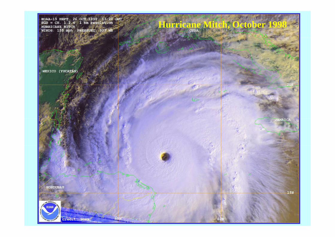
Hurricane Mitch, October 1998
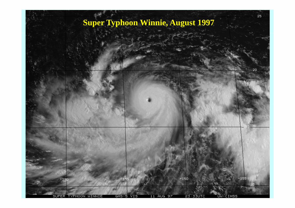
Super Typhoon Winnie, August 1997


Atlantic hurricane tracks in 1998

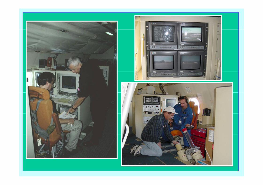
Hurricane Research Aircraft, NOAA WD-P3
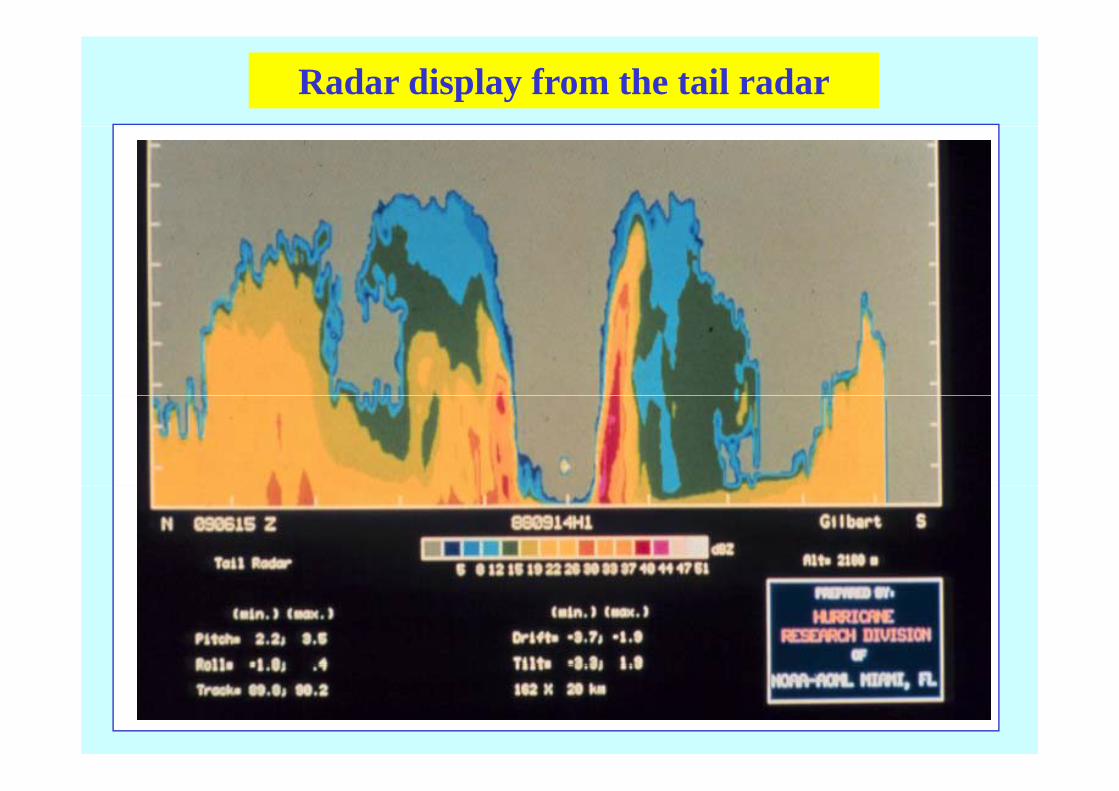
Radar display from the tail radar
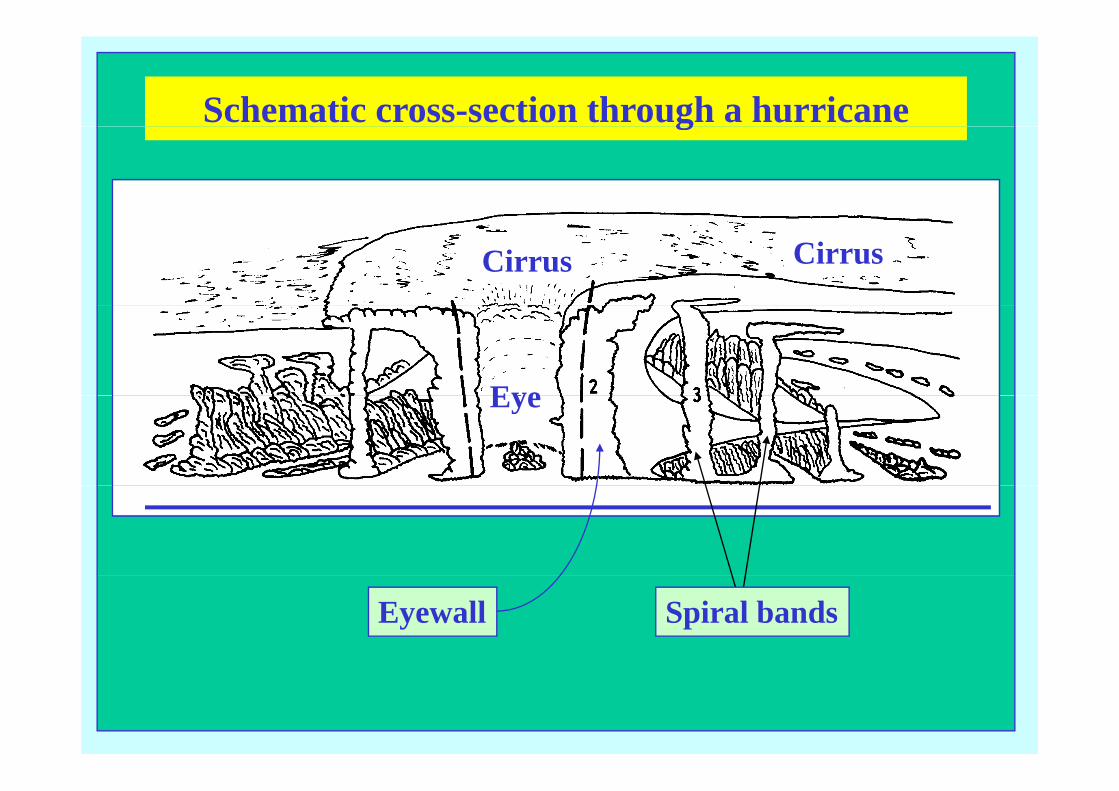
Schematic cross-section through a hurricaneg
CirrusCirrus
EyeEye
Spiral bandsEyewall
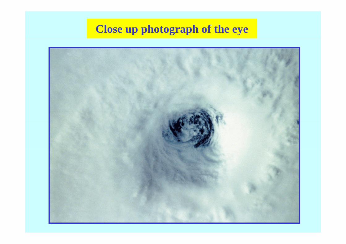
Close up photograph of the eye
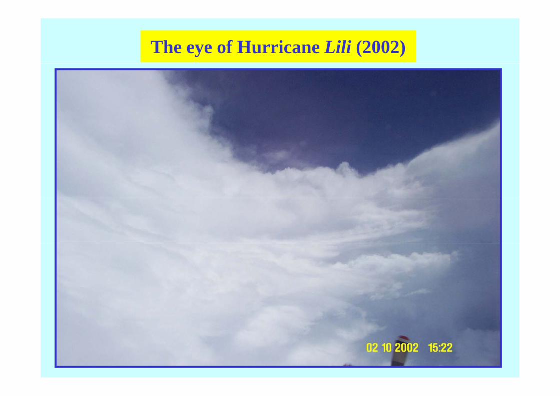
The eye of Hurricane Lili (2002)

Dropwindsonde sounding in the eye of a hurricane
From Willoughby (AMM, 1988)

Radar PPI in Hurricane Gilbert (1988)
From Black & Willoughby (JAS, 1992)

Flight level data from a Hurricane traverse
From Willoughby (WMO, 1995)
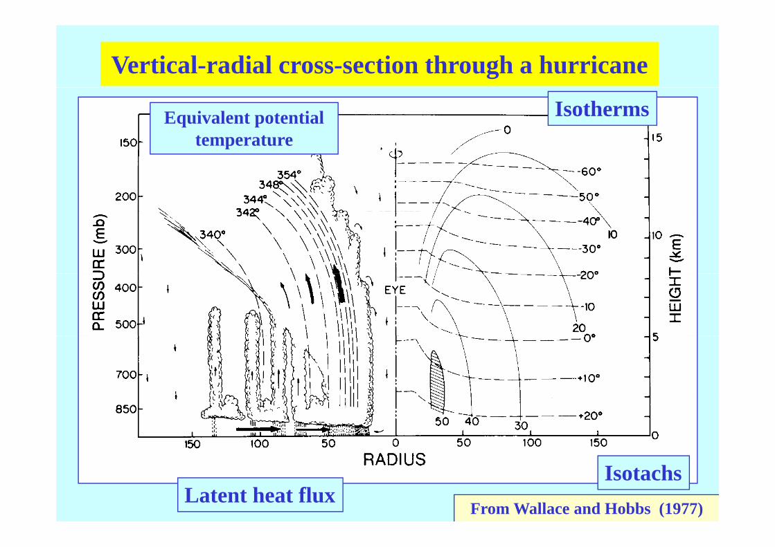
Vertical-radial cross-section through a hurricane
Equivalent potential temperature
Isotherms
θewarm
p
warm
Houze Fig. 10.11
From Wallace and Hobbs (1977)Latent heat flux
Isotachs
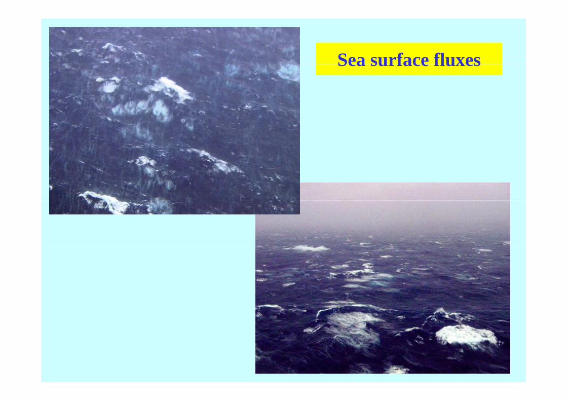
Sea surface fluxesSea surface fluxes
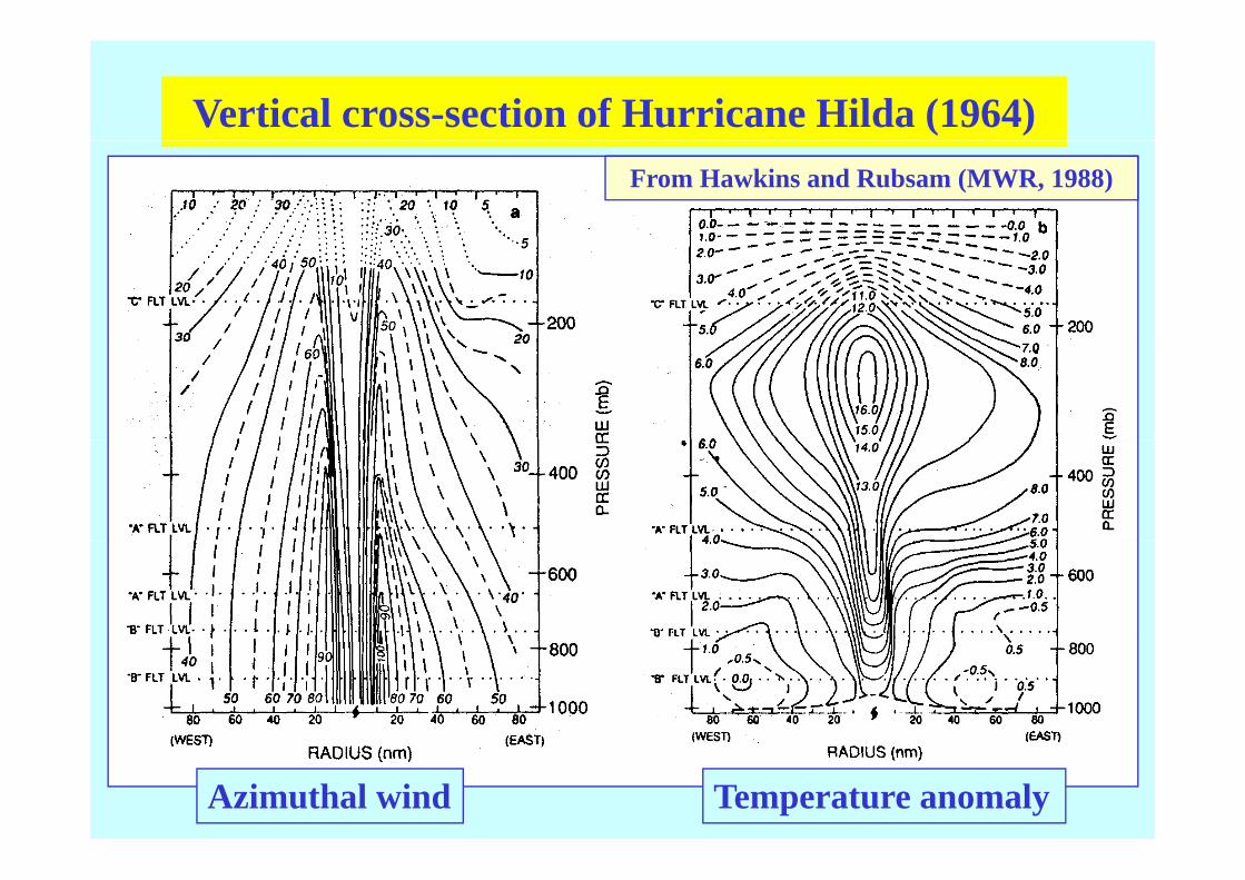
Vertical cross-section of Hurricane Hilda (1964)From Hawkins and Rubsam (MWR, 1988)
Azimuthal wind Temperature anomaly
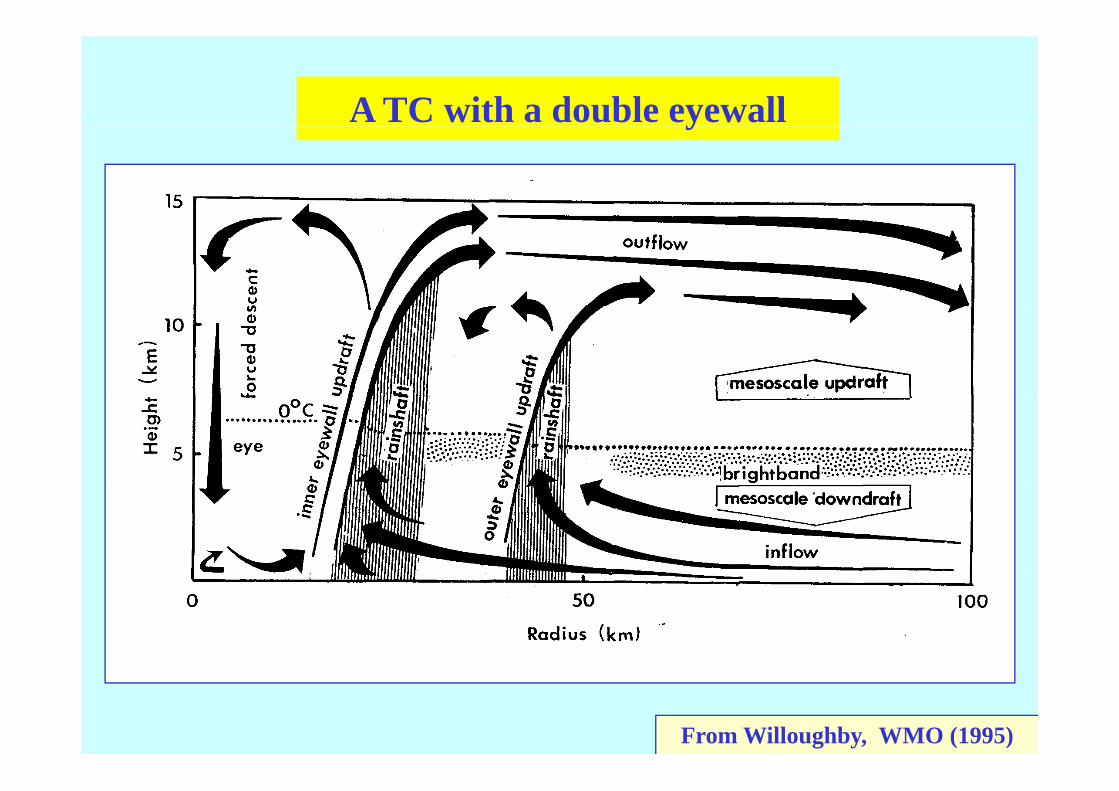
A TC with a double eyewally
From Willoughby, WMO (1995)

Cross-section from composite datap
From Gray (1979)
Radial wind Azimuthal wind
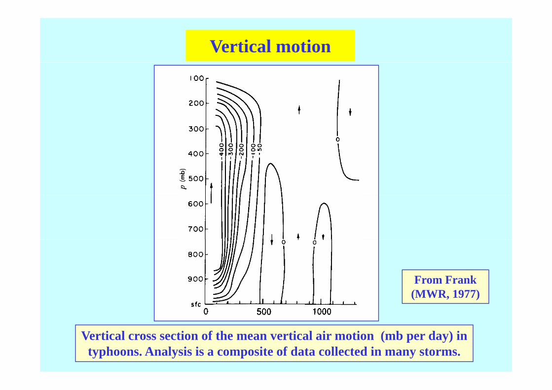
Vertical motion
From Frank From Frank (MWR, 1977)
Vertical cross section of the mean vertical air motion (mb per day) in typhoons. Analysis is a composite of data collected in many storms.

Asymmetries
250 mb 500 mb250 mb 500 mb
From Holland (AMM, 1984)
850 mb
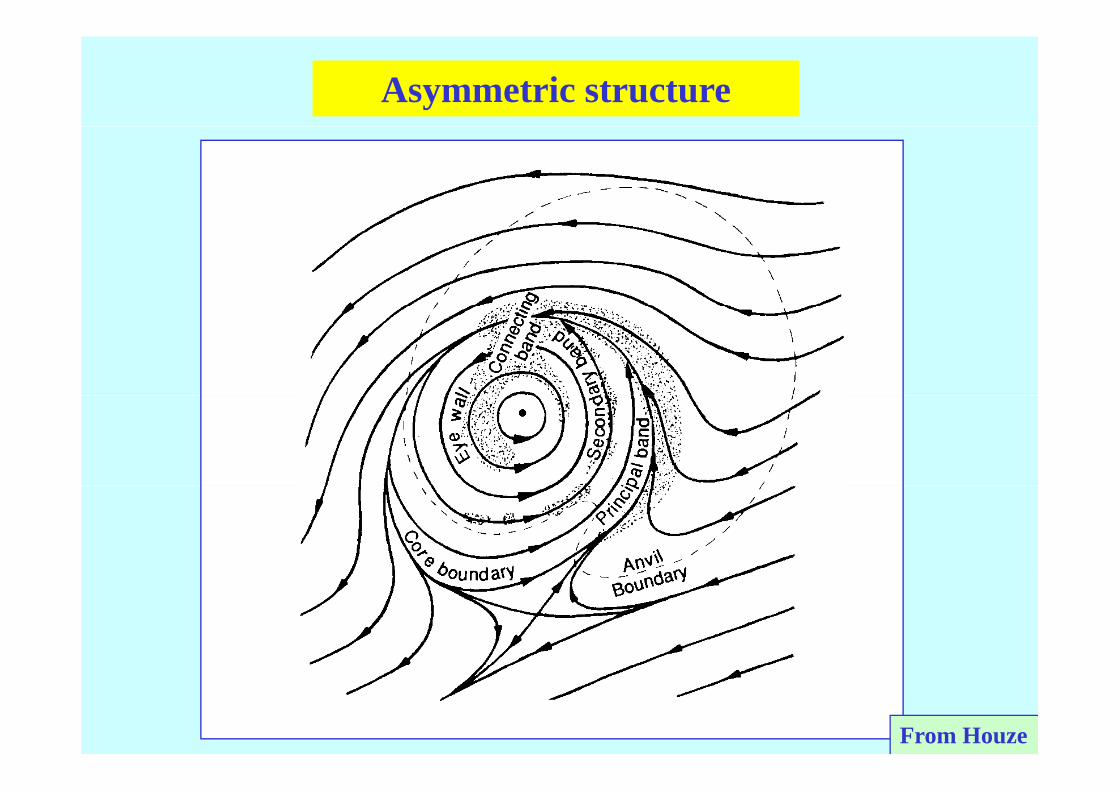
Asymmetric structure
From Houze

Typical radar echo pattern
From Marks and Houze, 1987

A TC with a double eyewally
From Willoughby, AMM (1988)
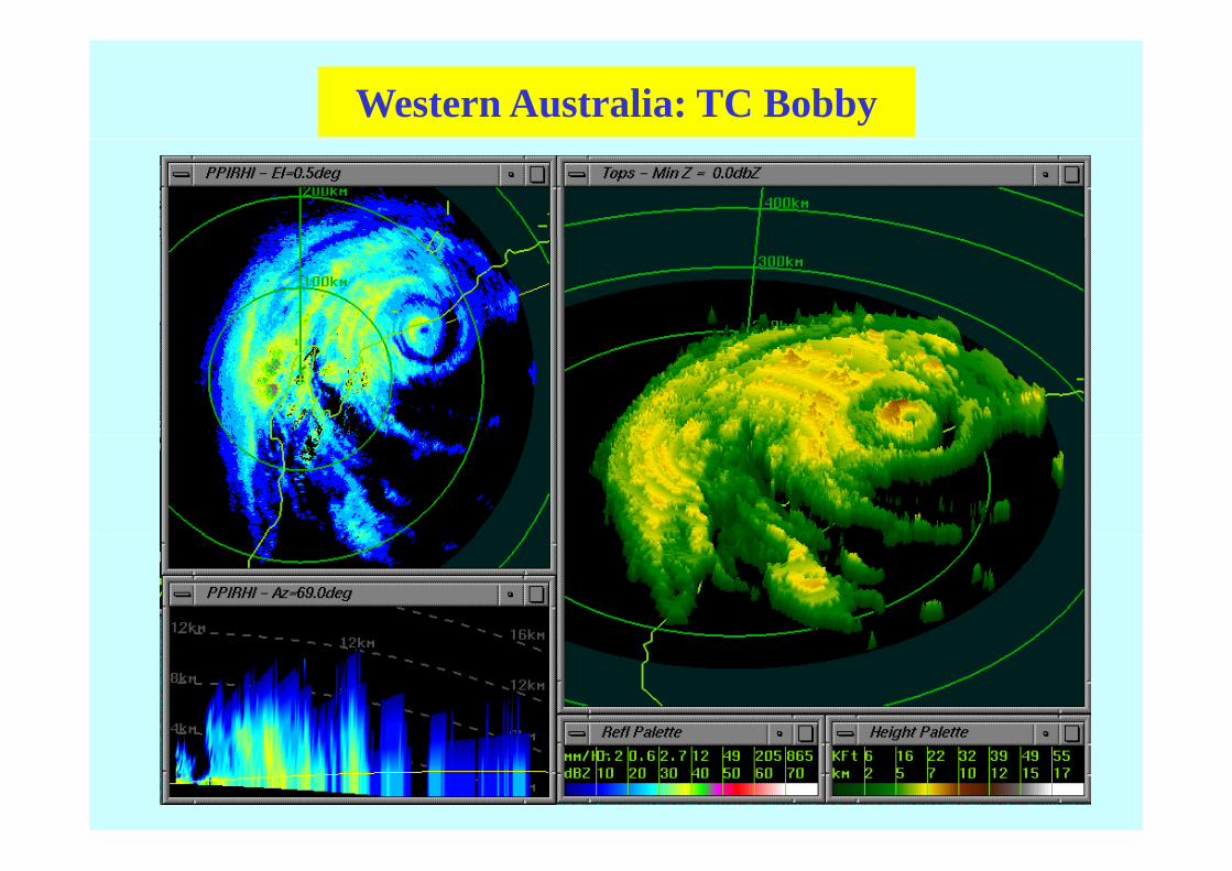
Western Australia: TC Bobby

H i JHurricane Jeanne


Regions of TC formationTyphoons
Cyclone HurricaneTropical Cyclone
Tropical cyclogenesis requires a water temperature of at least 26 5 oCleast 26.5 oC
From Gray (1975)

Annual mean sea surface temperatures
SST
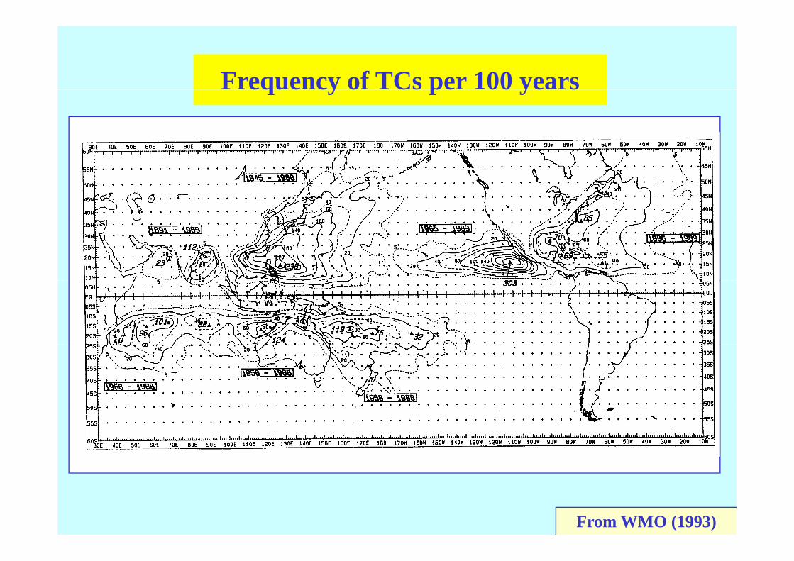
Frequency of TCs per 100 yearseque cy o Cs pe 00 ye s
From WMO (1993)

Mean latitude of formation
Latitudes at which initialLatitudes at which initial disturbances later became tropical cyclones were first
detecteddetected
From Gray (MWR, 1975)

Tracks of TCs in relation to SSTc s o Cs e o o SS

Climatology in Atlantic BasinC o ogy c s
Number of North Atlantic tropical cyclones reaching at least 17.5 m s-1 (34 kt) intensity (open bar) and reaching at least 33( ) y ( p ) gm s-1 (64 kt) intensity (solid bar) each year during 1886-1985. (From McBride, 1995)
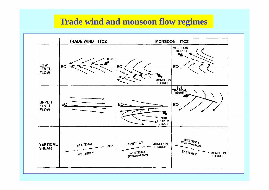
Trade wind and monsoon flow regimes
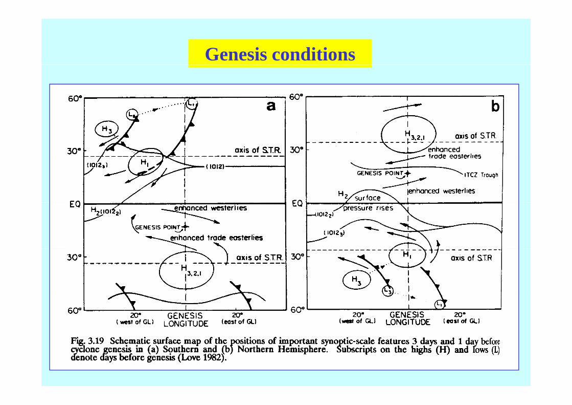
Genesis conditions

Satellite imagery - classificationS e e ge y c ss c o
Large-scale conditions for formation
Tropical cyclones form from pre-existing disturbancesop c cyc o es o o p e e s g d s u b cescontaining abundant deep convection;
The pre-existing disturbance must acquire a warm coreThe pre existing disturbance must acquire a warm corethermal structure throughout the troposphere;
Formation is preceded by an increase of lower troposphericFormation is preceded by an increase of lower troposphericrelative vorticity over a horizontal scale of approximately1000 to 2000 km;
A necessary condition for cyclone formation is a large-scaleenvironment with small vertical wind shear;
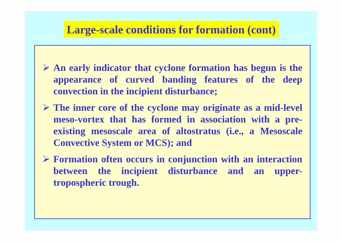
Large-scale conditions for formation (cont)
A l i di t th t l f ti h b i thAn early indicator that cyclone formation has begun is theappearance of curved banding features of the deepconvection in the incipient disturbance;convection in the incipient disturbance;
The inner core of the cyclone may originate as a mid-levelmeso-vortex that has formed in association with a pre-meso vortex that has formed in association with a preexisting mesoscale area of altostratus (i.e., a MesoscaleConvective System or MCS); and
Formation often occurs in conjunction with an interactionbetween the incipient disturbance and an upper-p pptropospheric trough.
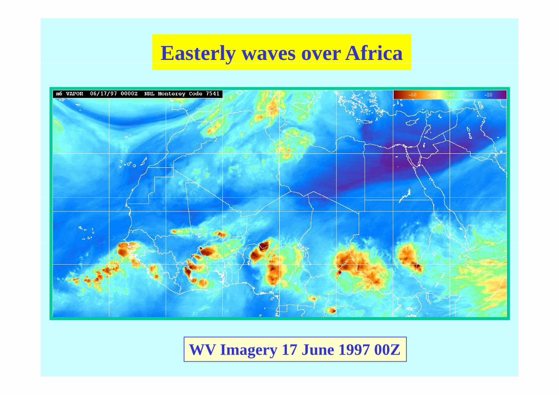
Easterly waves over Africay
WV Imagery 17 June 1997 00Z
Movie of Atlantic July Basin 2003Movie of Atlantic July Basin 2003
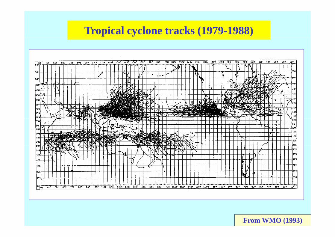
Tropical cyclone tracks (1979-1988)
From WMO (1993)
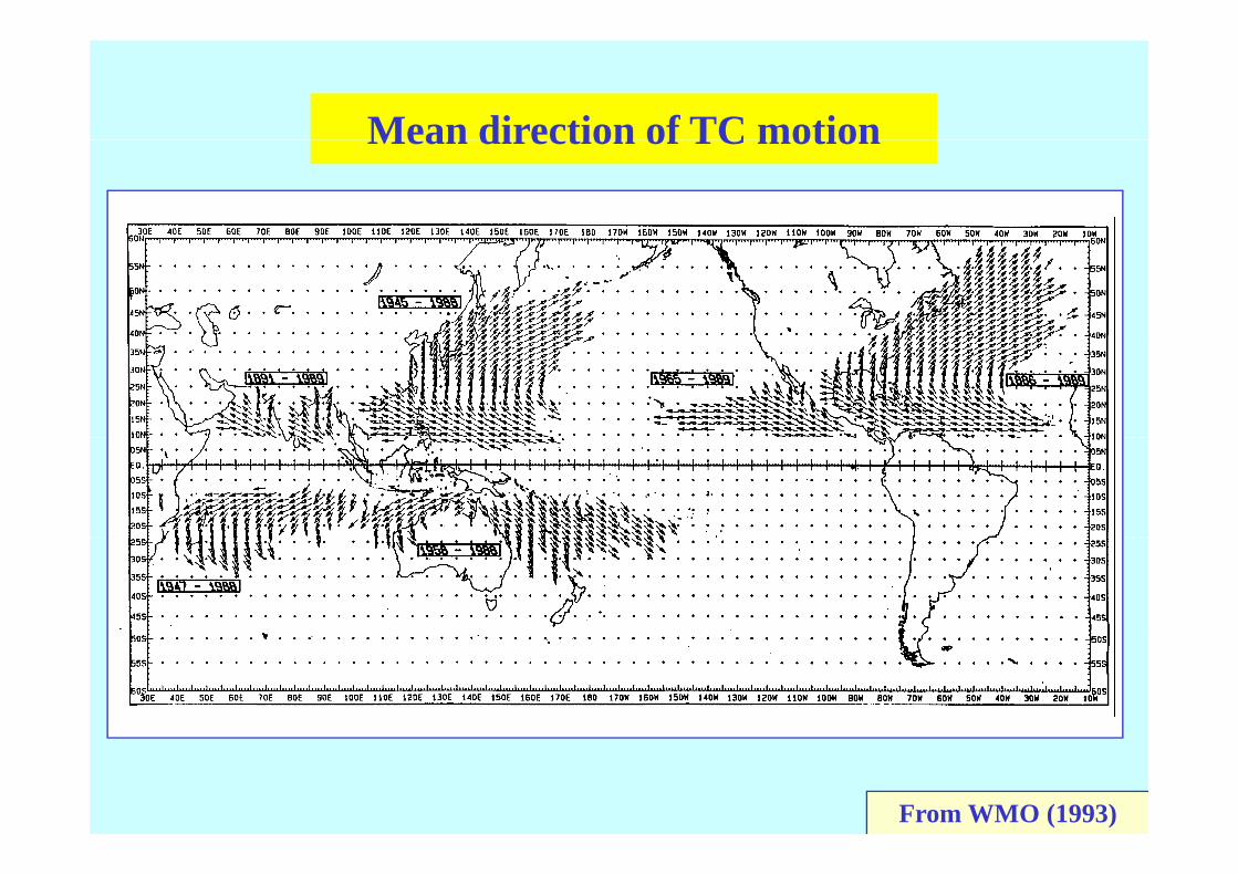
Mean direction of TC motionMean direction of TC motion
From WMO (1993)

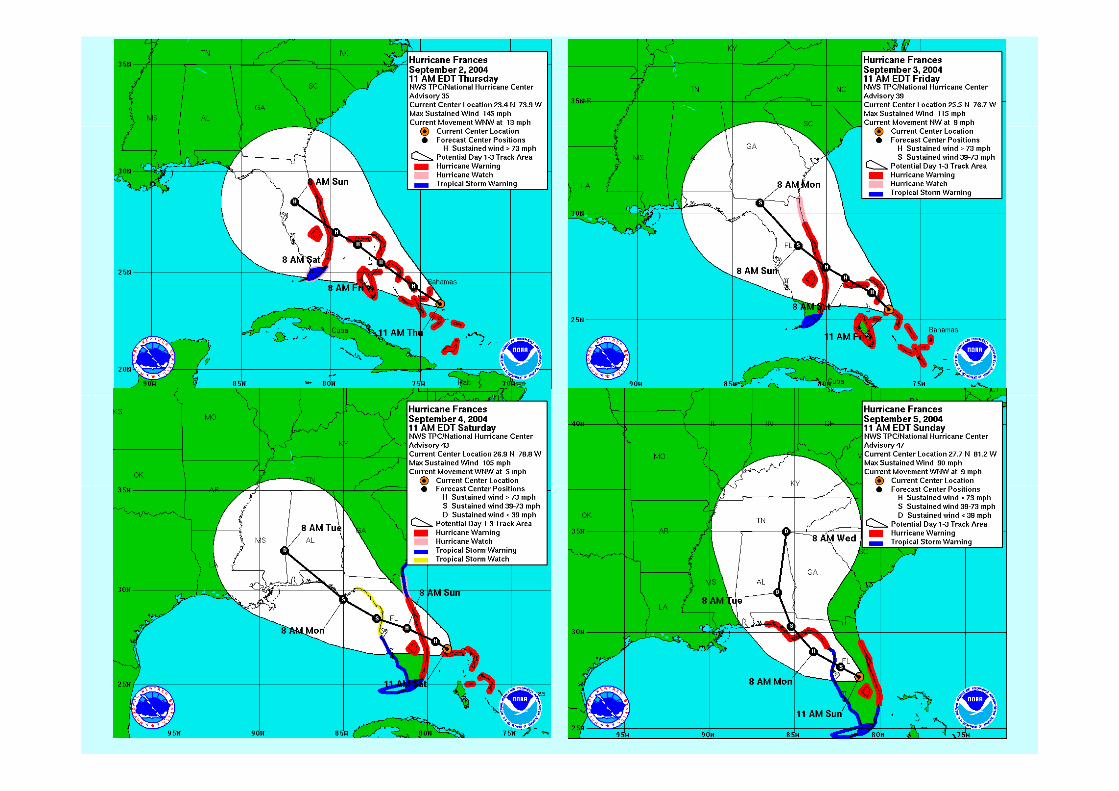
Track forecasting

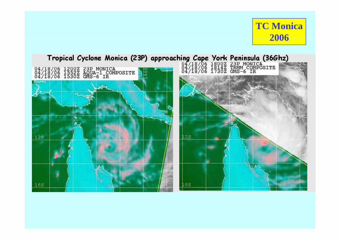
TC Monica20062006
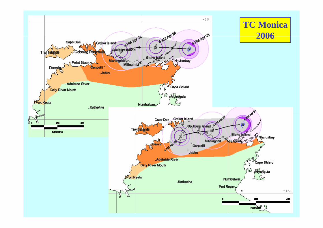
TC Monica20062006
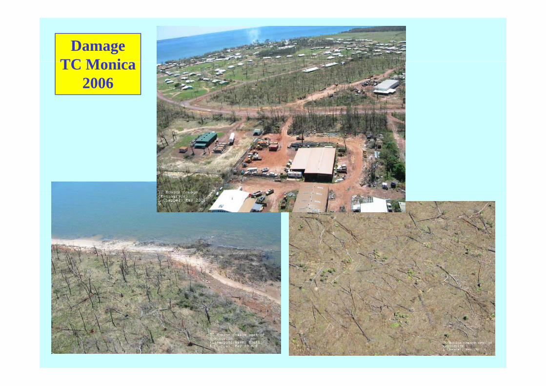
DamageTC M iTC Monica
2006
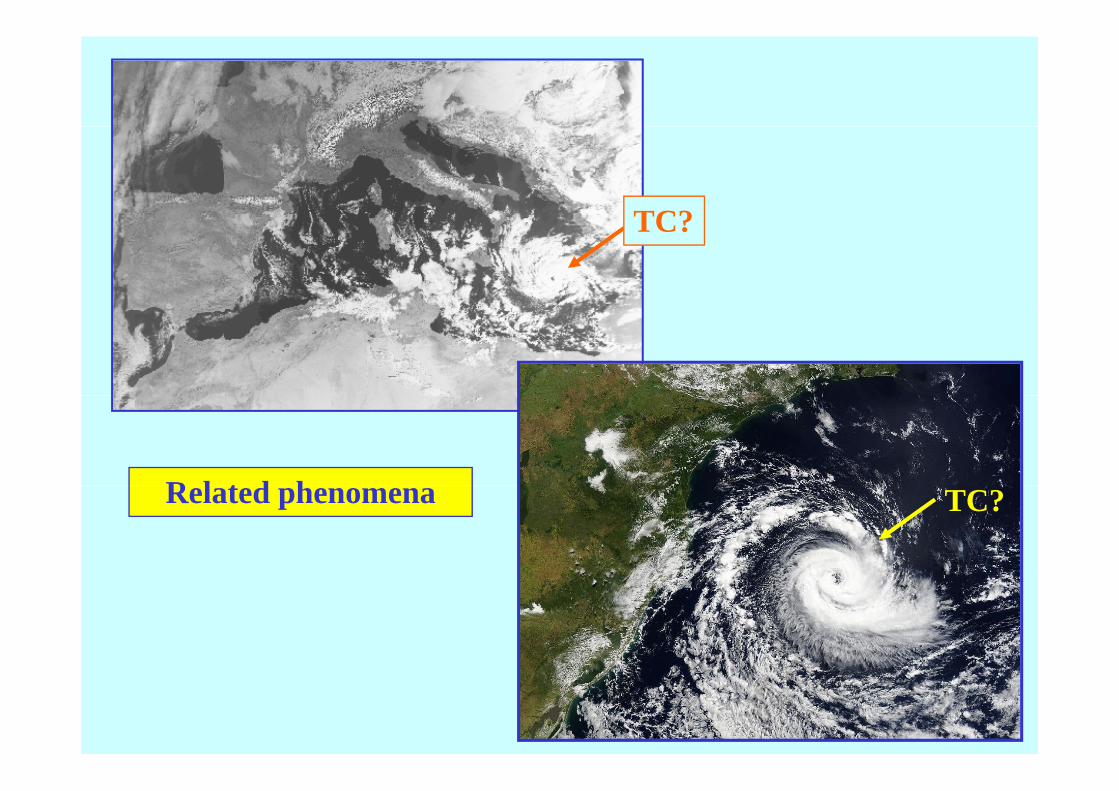
TC?TC?
R l t d hRelated phenomena TC?


EndEnd