
lect 14 groundwater 07 - UT Arlington – UTA · • water flows down through soil and rock in...
49
groundwater
-
Upload
phungxuyen -
Category
Documents
-
view
216 -
download
0
Transcript of lect 14 groundwater 07 - UT Arlington – UTA · • water flows down through soil and rock in...

groundwater!
2
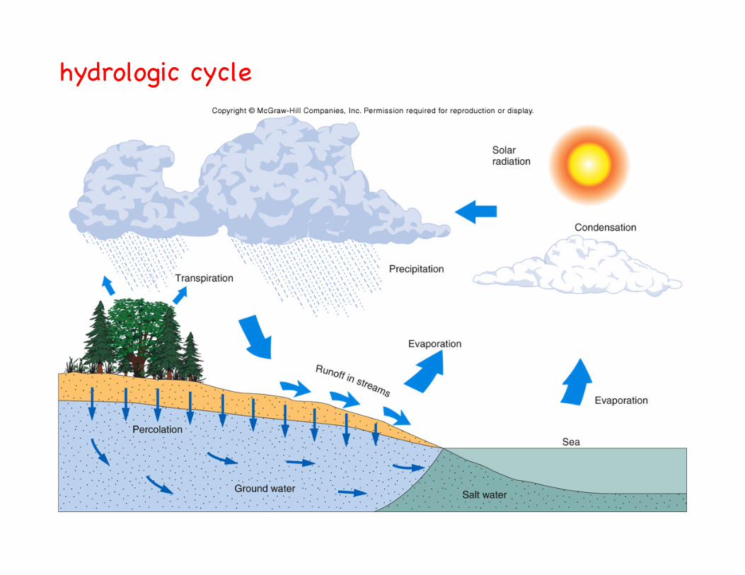
hydrologic cycle!

global distribution of water !
Source Volume PercentOcean 97.2000Glaciers and other ice 2.1500Ground Water 0.6100Lakes
fresh 0.0090saline 0.0080
Soil Moisture 0.0050Atmosphere 0.0010Rivers 0.0001
• need 400 million gallons for basic biological needs per day for US!• need 1.8 trillion gallons per day for other purposes in US!
"---domestic, agriculture, industry!

water use in the US from 1950-2000!(ground water in red)!
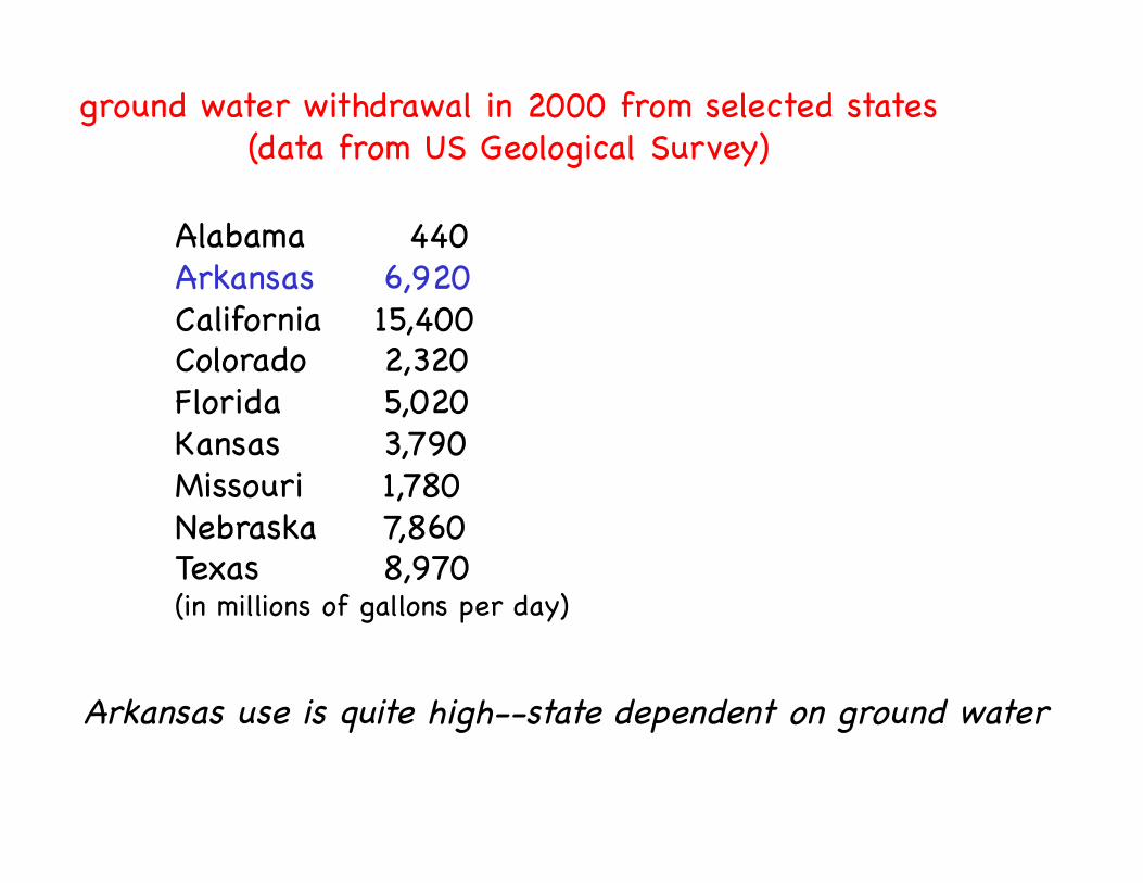
Alabama " 440!Arkansas "6,920!California 15,400!Colorado "2,320!Florida "5,020!Kansas "3,790!Missouri "1,780!Nebraska "7,860!Texas " "8,970!(in millions of gallons per day)!
ground water withdrawal in 2000 from selected states!(data from US Geological Survey)!
Arkansas use is quite high--state dependent on ground water!
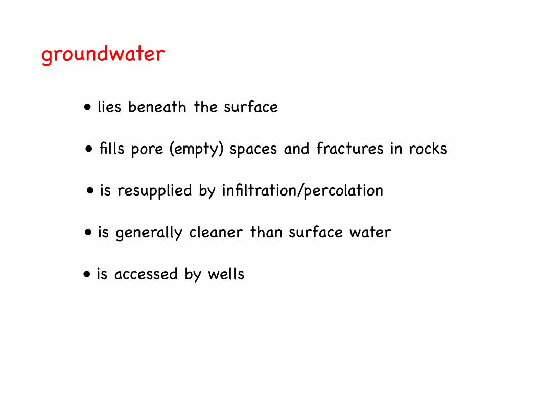
groundwater!
• lies beneath the surface!
• fills pore (empty) spaces and fractures in rocks!
• is resupplied by infiltration/percolation!
• is generally cleaner than surface water!
• is accessed by wells!
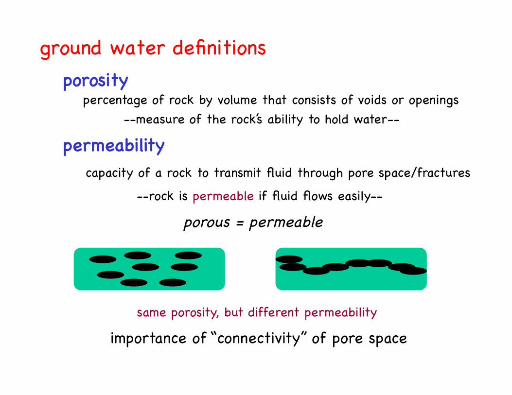
ground water definitions !porosity!
porous = permeable!
importance of “connectivity” of pore space!
--measure of the rock’s ability to hold water--!percentage of rock by volume that consists of voids or openings!
permeability!capacity of a rock to transmit fluid through pore space/fractures!
--rock is permeable if fluid flows easily--!
same porosity, but different permeability!
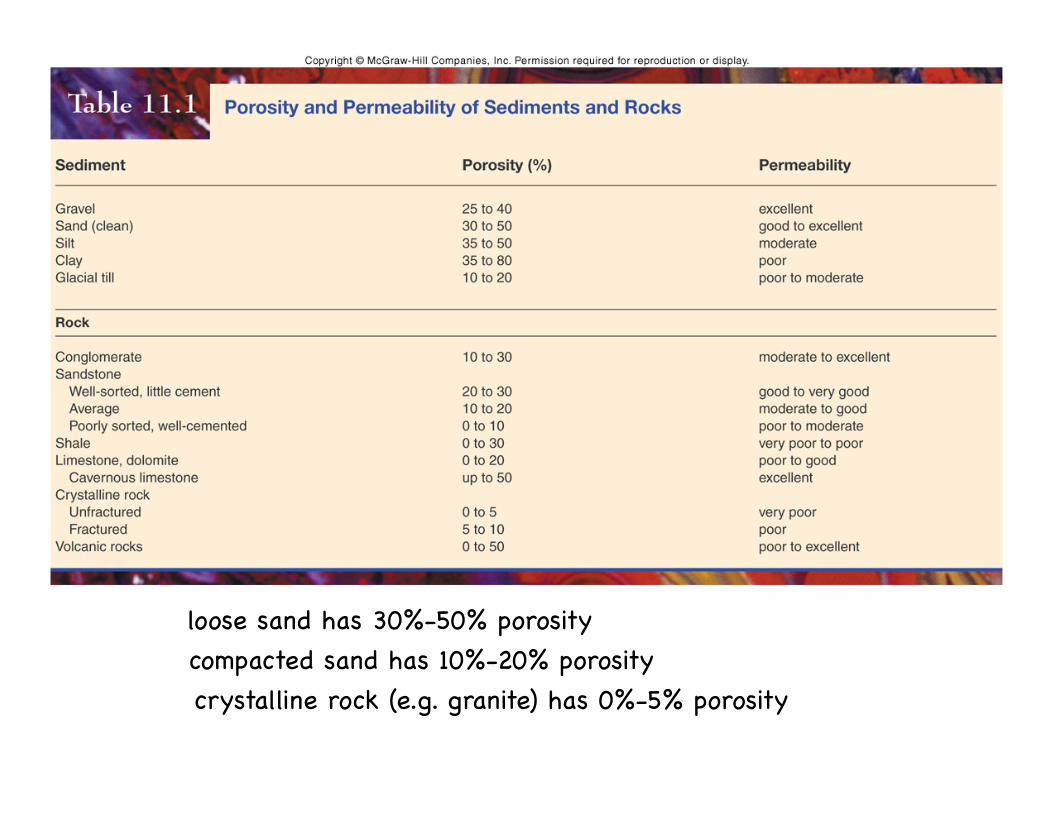
loose sand has 30%-50% porosity!compacted sand has 10%-20% porosity!crystalline rock (e.g. granite) has 0%-5% porosity!

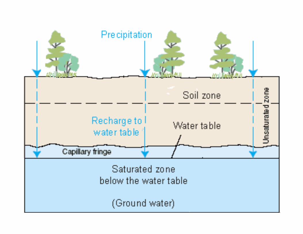
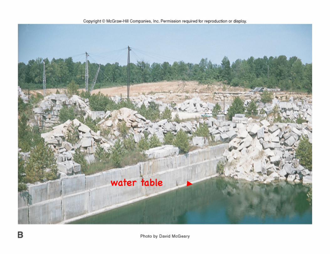
water table!top of saturated zone!
zone in subsurface where!all pore space is filled!
with water!
water level of most!lakes and rivers!corresponds to!
local water table!
zone in subsurface above!water table that!is unsaturated!
saturated zone!
vadose zone!
capillary fringe: downward flow is!counteracted by upward attraction of molecules (like paper towels absorbing water) !

perched water table: water table above zone of saturation!" " " " "…isolated… !
water table!
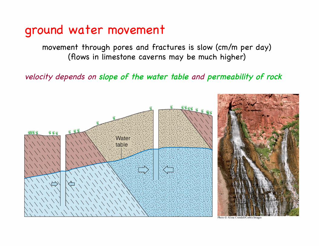
ground water movement !movement through pores and fractures is slow (cm/m per day)!
(flows in limestone caverns may be much higher)!
velocity depends on slope of the water table and permeability of rock!
water flows from zones of high!high hydraulic gradient to !
low hydraulic gradient!
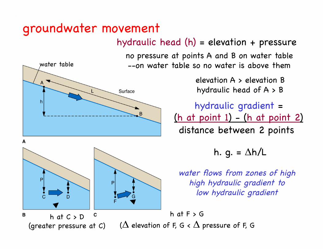
h. g. = h/L!
groundwater movement!
water table!
hydraulic head (h) = elevation + pressure!
hydraulic gradient = !(h at point 1) - (h at point 2) !distance between 2 points!
no pressure at points A and B on water table !--on water table so no water is above them!
elevation A > elevation B!hydraulic head of A > B!
h at F > G!( elevation of F, G < pressure of F, G !
h at C > D!(greater pressure at C) !
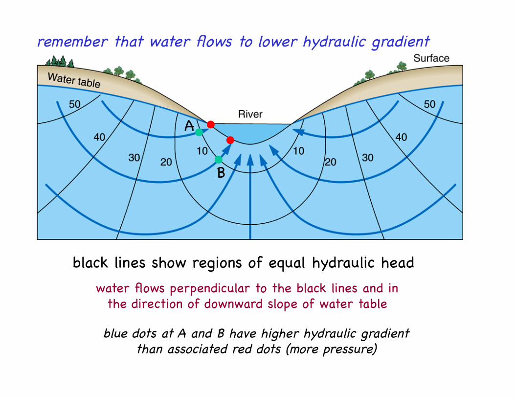
remember that water flows to lower hydraulic gradient!
black lines show regions of equal hydraulic head!water flows perpendicular to the black lines and in!
the direction of downward slope of water table!
A!
B!
blue dots at A and B have higher hydraulic gradient!than associated red dots (more pressure)!
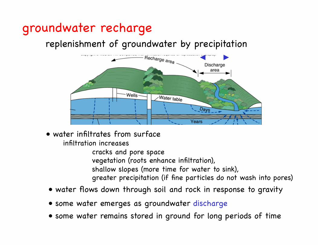
groundwater recharge!
• water infiltrates from surface!
• water flows down through soil and rock in response to gravity!
• some water emerges as groundwater discharge !• some water remains stored in ground for long periods of time !
infiltration increases!"cracks and pore space!"vegetation (roots enhance infiltration), !"shallow slopes (more time for water to sink), !"greater precipitation (if fine particles do not wash into pores) !
replenishment of groundwater by precipitation!
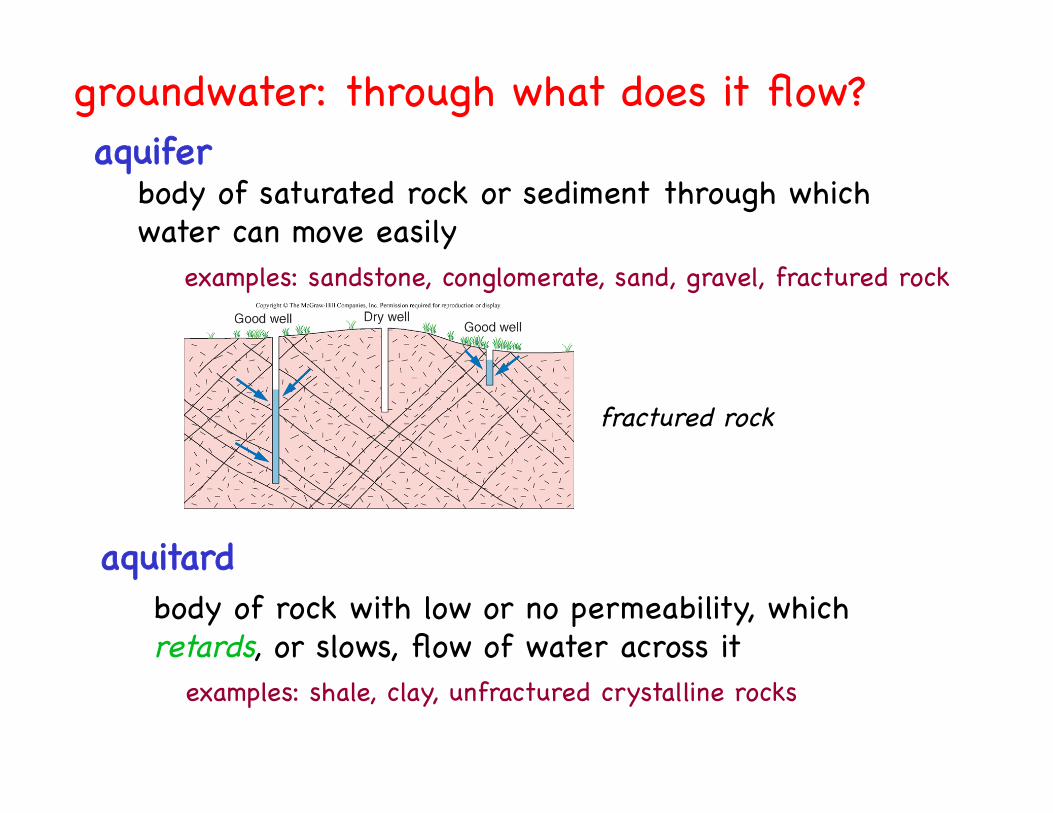
aquifer!body of saturated rock or sediment through which !water can move easily!
examples: sandstone, conglomerate, sand, gravel, fractured rock!
aquitard!body of rock with low or no permeability, which!retards, or slows, flow of water across it!
examples: shale, clay, unfractured crystalline rocks!
groundwater: through what does it flow?!
fractured rock!
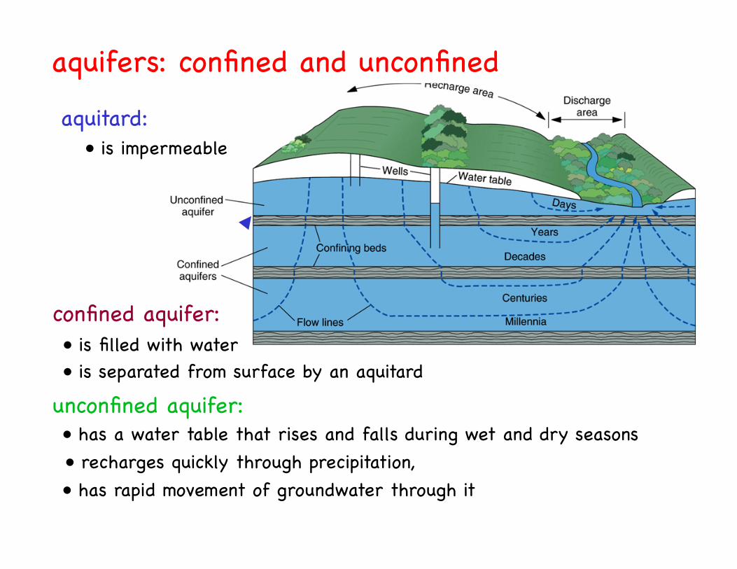
• has a water table that rises and falls during wet and dry seasons !• recharges quickly through precipitation,!• has rapid movement of groundwater through it!
aquifers: confined and unconfined!
• is filled with water !• is separated from surface by an aquitard !
• is impermeable !
confined aquifer:!
aquitard:!
unconfined aquifer:!
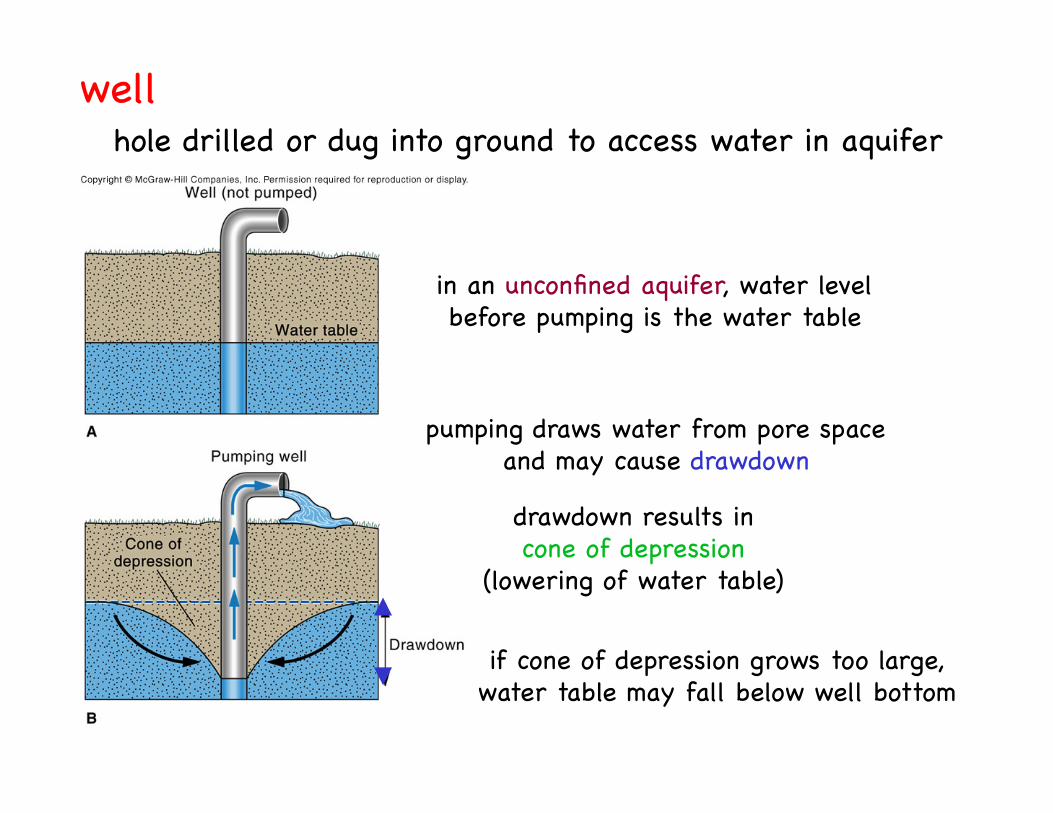
well!hole drilled or dug into ground to access water in aquifer!
in an unconfined aquifer, water level!before pumping is the water table!
pumping draws water from pore space!and may cause drawdown!
drawdown results in!cone of depression!
(lowering of water table)!
if cone of depression grows too large,!water table may fall below well bottom!
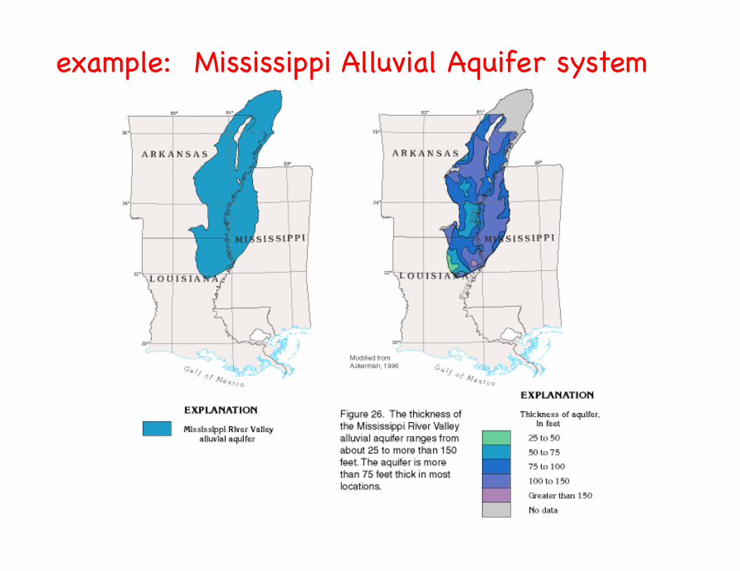
example: Mississippi Alluvial Aquifer system!

DeWitt
Stuttgart
map shows growth of region!where drawdown has!
produced a !cone of depression!
at a depth of 110 feet !
when pumping began!in 1930’s,!
depth to water table!was about 50 feet!
central Arkansas!
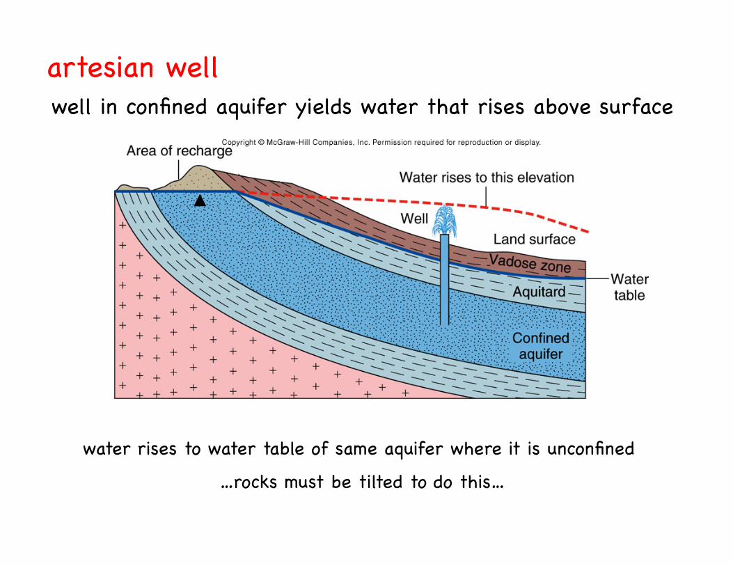
artesian well!well in confined aquifer yields water that rises above surface !
water rises to water table of same aquifer where it is unconfined!
…rocks must be tilted to do this…!
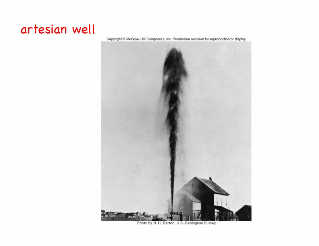
artesian well!
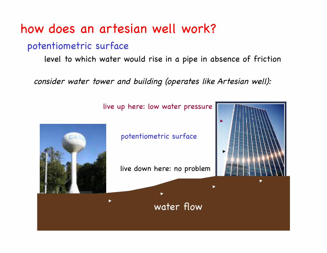
potentiometric surface!
consider water tower and building (operates like Artesian well):!
potentiometric surface!
live up here: low water pressure!
live down here: no problem!
water flow!
how does an artesian well work?!
level to which water would rise in a pipe in absence of friction!
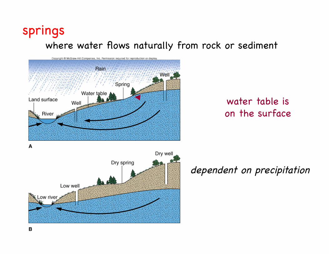
springs!where water flows naturally from rock or sediment!
dependent on precipitation!
water table is!on the surface!
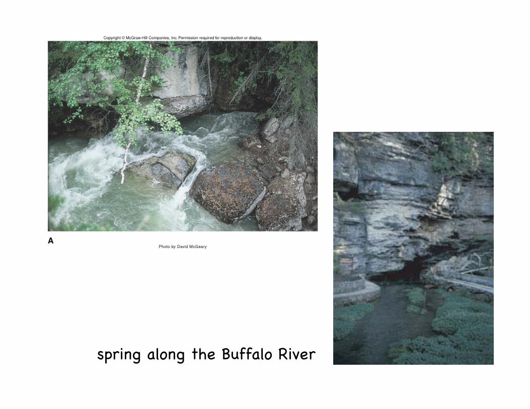
spring along the Buffalo River!

gaining stream!
streams: gaining vs. losing!
gets water from saturated zone!and top of stream is!
water table!
losing stream!loses water to saturated zone!
and creates!“mound” on water table!
continued loss of water!results in dry stream!
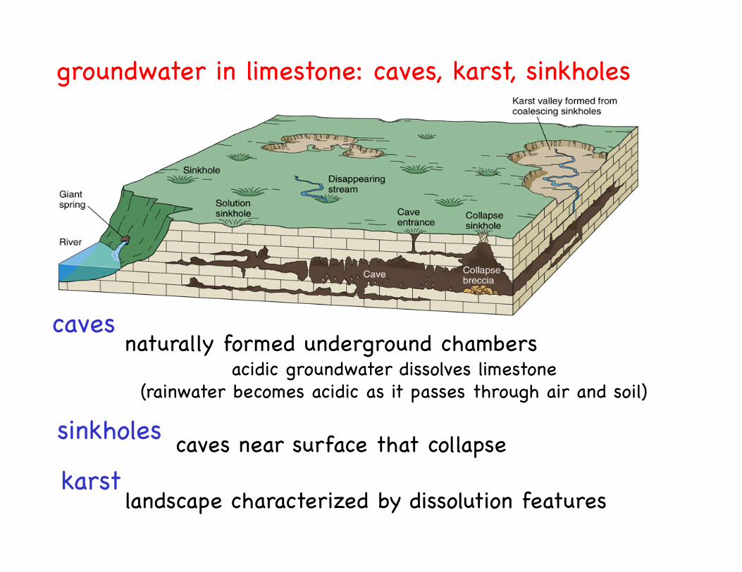
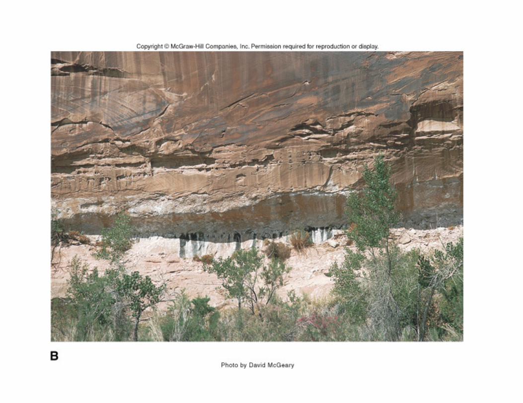
groundwater in limestone: caves, karst, sinkholes!
caves!naturally formed underground chambers!
acidic groundwater dissolves limestone!(rainwater becomes acidic as it passes through air and soil)!
sinkholes! caves near surface that collapse!karst!
landscape characterized by dissolution features!
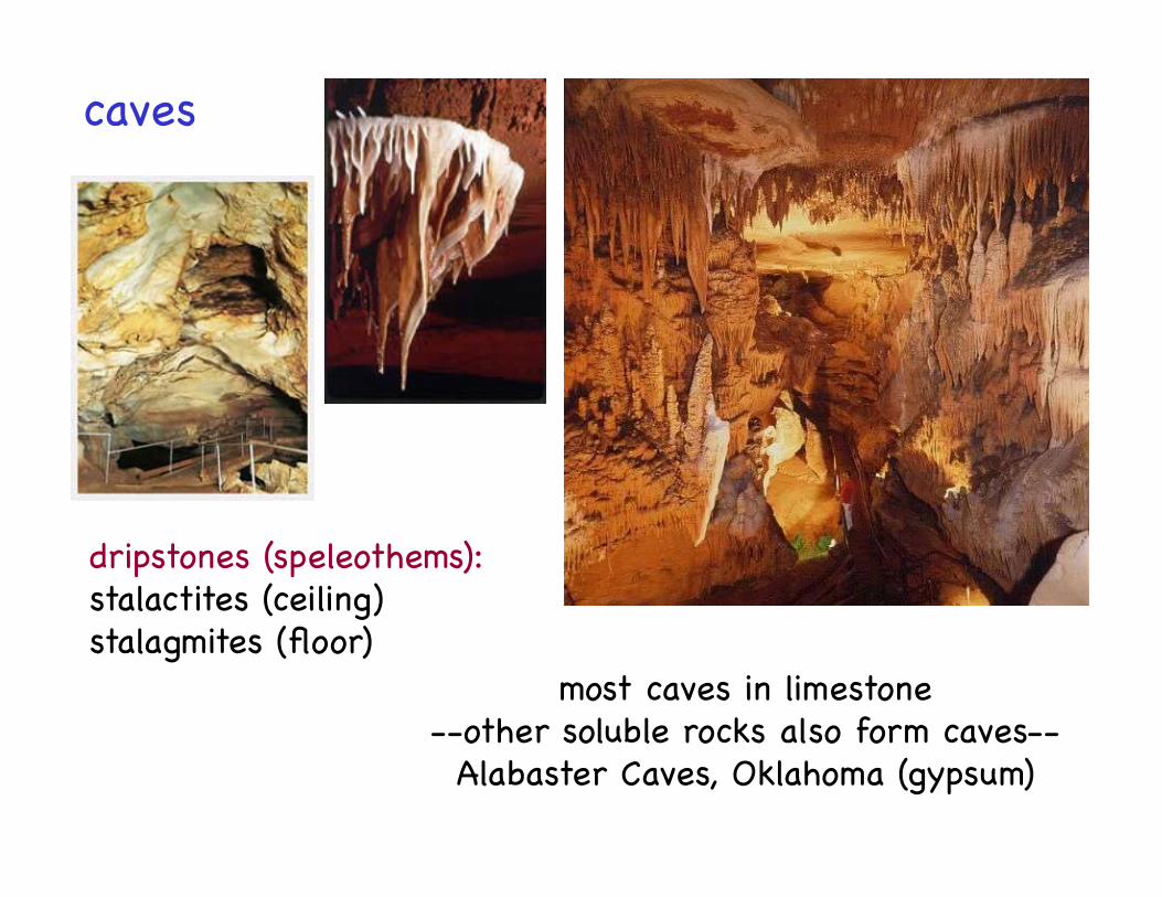
caves!
dripstones (speleothems): !stalactites (ceiling)!stalagmites (floor)!
most caves in limestone!--other soluble rocks also form caves--!Alabaster Caves, Oklahoma (gypsum)!
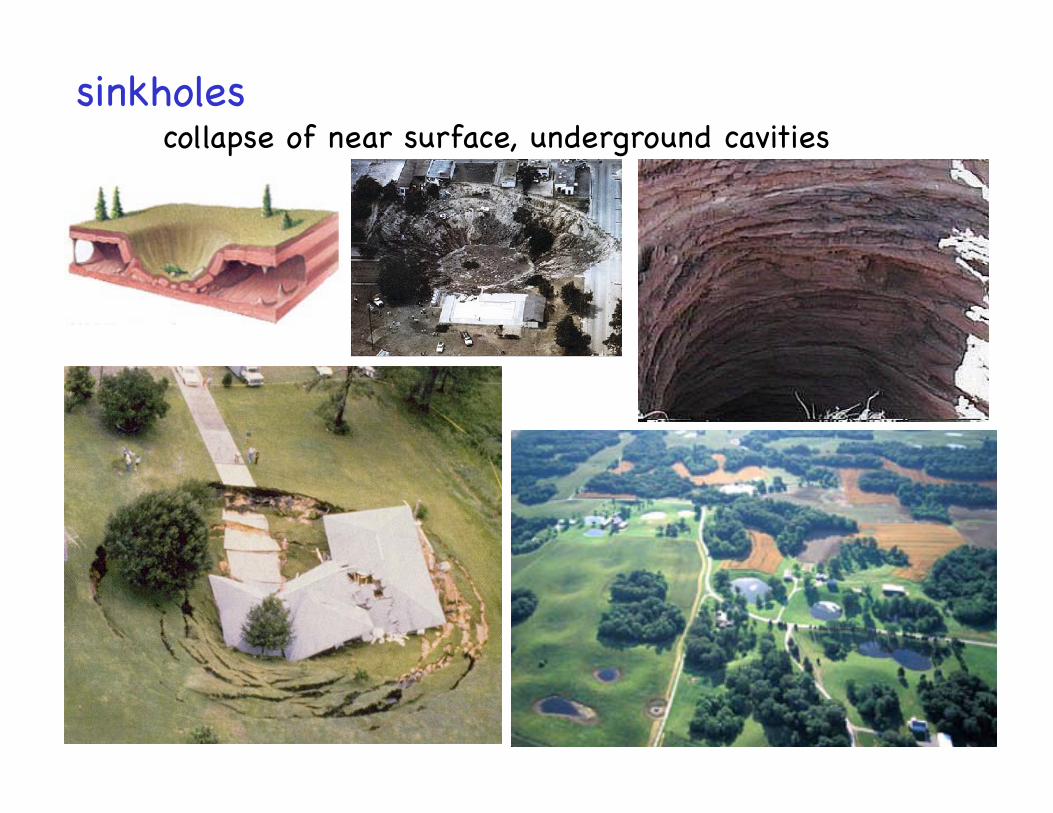
sinkholes!collapse of near surface, underground cavities!
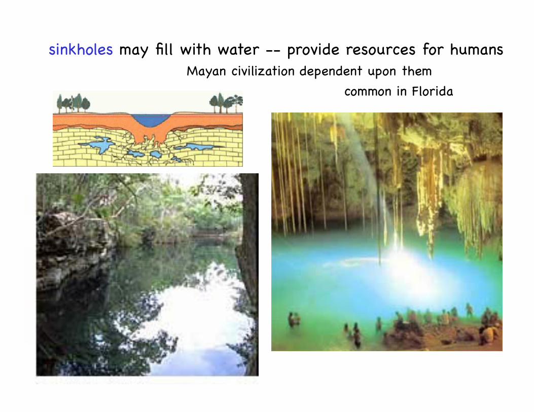
sinkholes may fill with water -- provide resources for humans!Mayan civilization dependent upon them!
common in Florida!
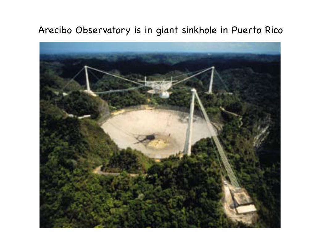
Arecibo Observatory is in giant sinkhole in Puerto Rico!

sinkhole lakes can disappear when debris that clogs lower opening …becomes unclogged…
Lake Jackson, Tallahassee, Florida!…dried up and re-filled at least 4 times in 20th century…!
2002! 2003!
sinkhole lakes!
lake drains when material “plugging” hole in subsurface is removed!
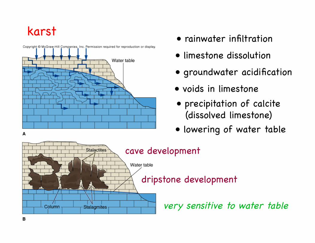
cave development!
dripstone development!
karst! • rainwater infiltration!
• limestone dissolution!
• groundwater acidification!
• voids in limestone!• precipitation of calcite!
(dissolved limestone)!• lowering of water table!
very sensitive to water table!
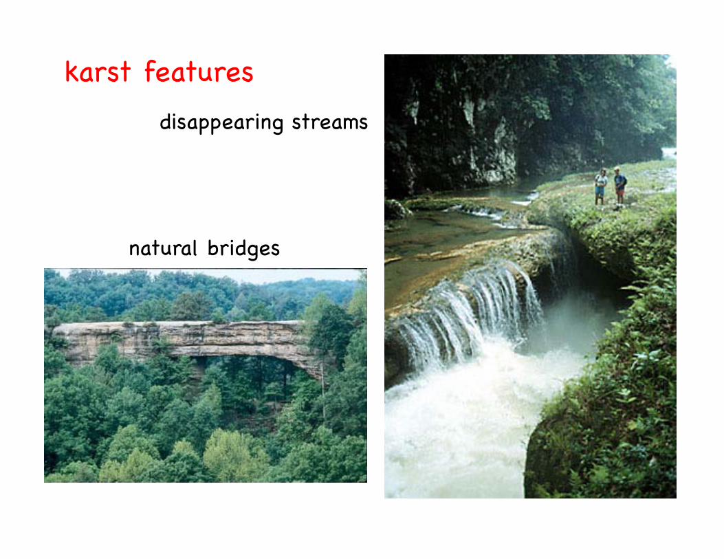
karst features!disappearing streams!
natural bridges!
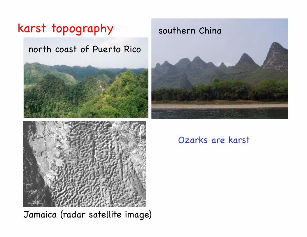
southern China!
north coast of Puerto Rico!
karst topography!
Jamaica (radar satellite image)!
Ozarks are karst!
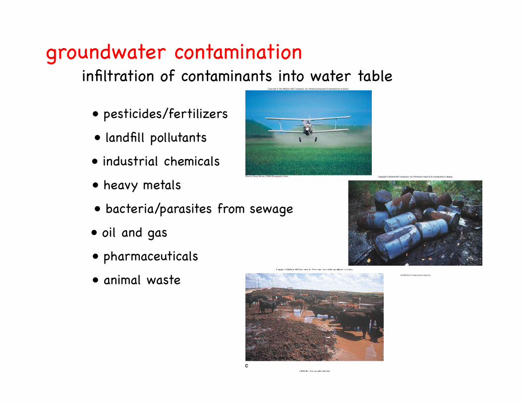
groundwater contamination!infiltration of contaminants into water table!
• pesticides/fertilizers!
• landfill pollutants!
• heavy metals!
• bacteria/parasites from sewage!
• industrial chemicals!
• oil and gas!
• pharmaceuticals!
• animal waste!
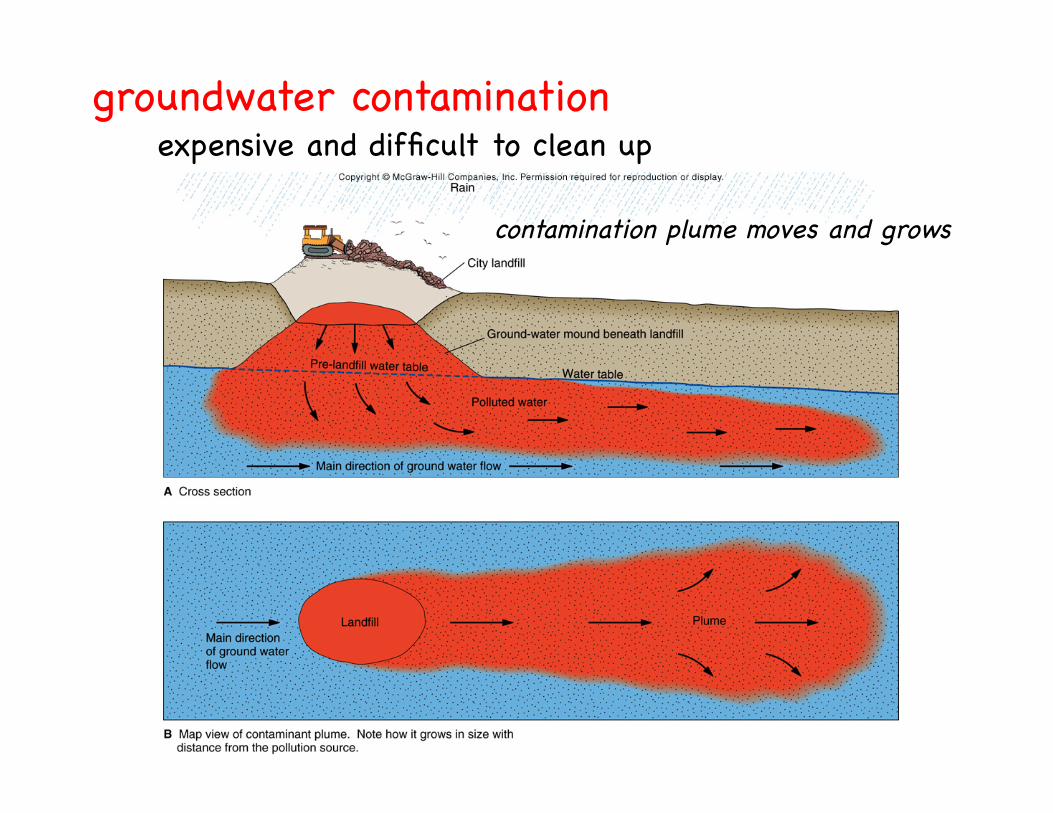
groundwater contamination!expensive and difficult to clean up!
contamination plume moves and grows!

different materials lead to different problems!groundwater contamination!
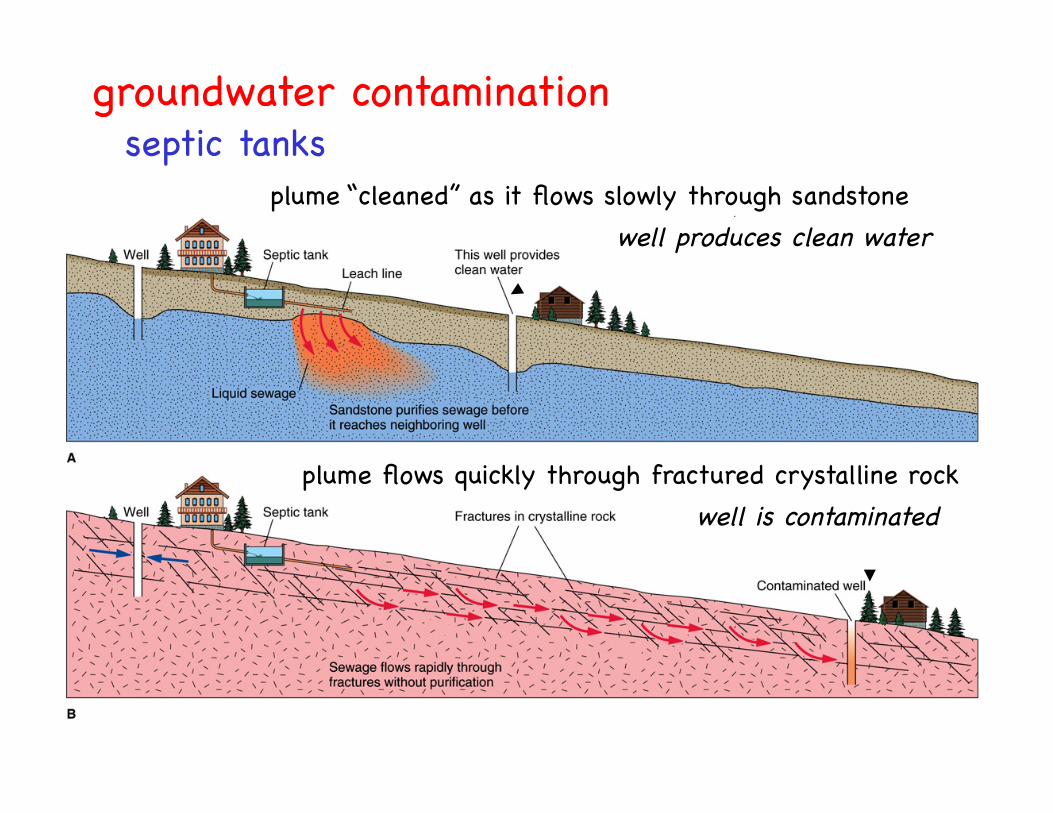
groundwater contamination!septic tanks!
plume “cleaned” as it flows slowly through sandstone!well produces clean water!
plume flows quickly through fractured crystalline rock!well is contaminated!
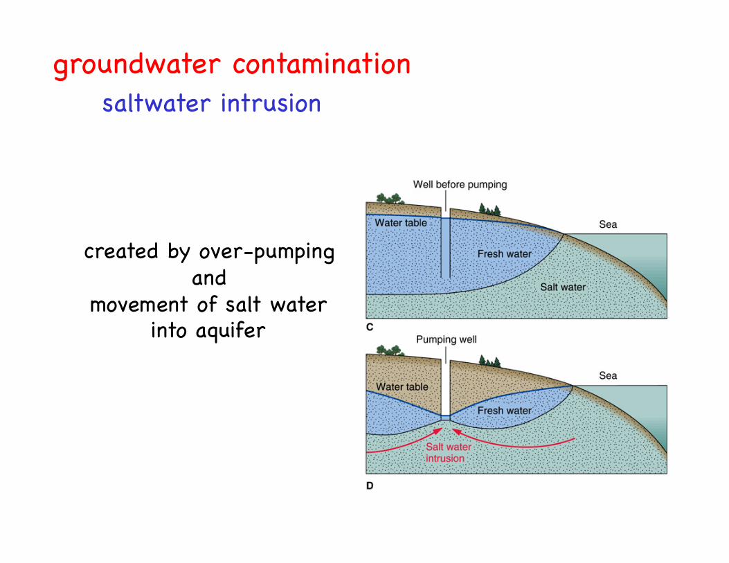
groundwater contamination!saltwater intrusion!
created by over-pumping !and !
movement of salt water !into aquifer!
dump something in !hole here….!
it may end up here…!
and be pumped to!surface here!
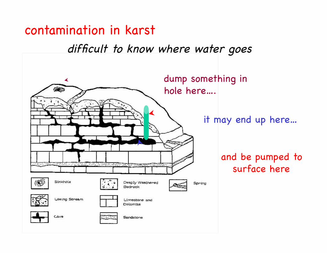
contamination in karst!difficult to know where water goes !
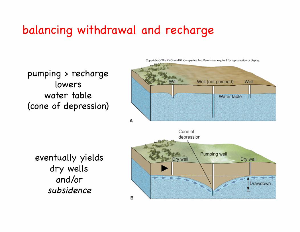
balancing withdrawal and recharge!
pumping > recharge!lowers!
water table!(cone of depression)!
eventually yields!dry wells!and/or!
subsidence!
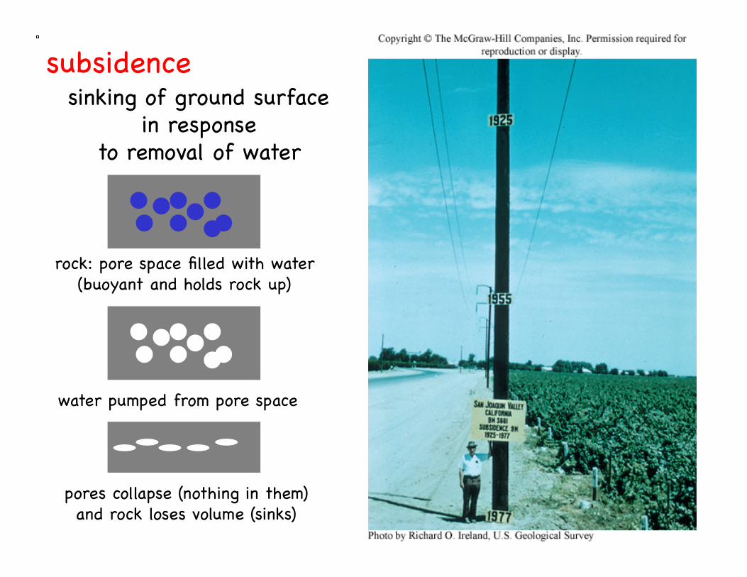
subsidence!sinking of ground surface!
in response!to removal of water!
rock: pore space filled with water!(buoyant and holds rock up)!
water pumped from pore space!
pores collapse (nothing in them)!and rock loses volume (sinks)!
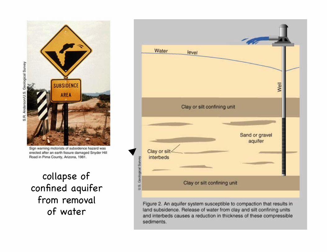
collapse of!confined aquifer!from removal!
of water!

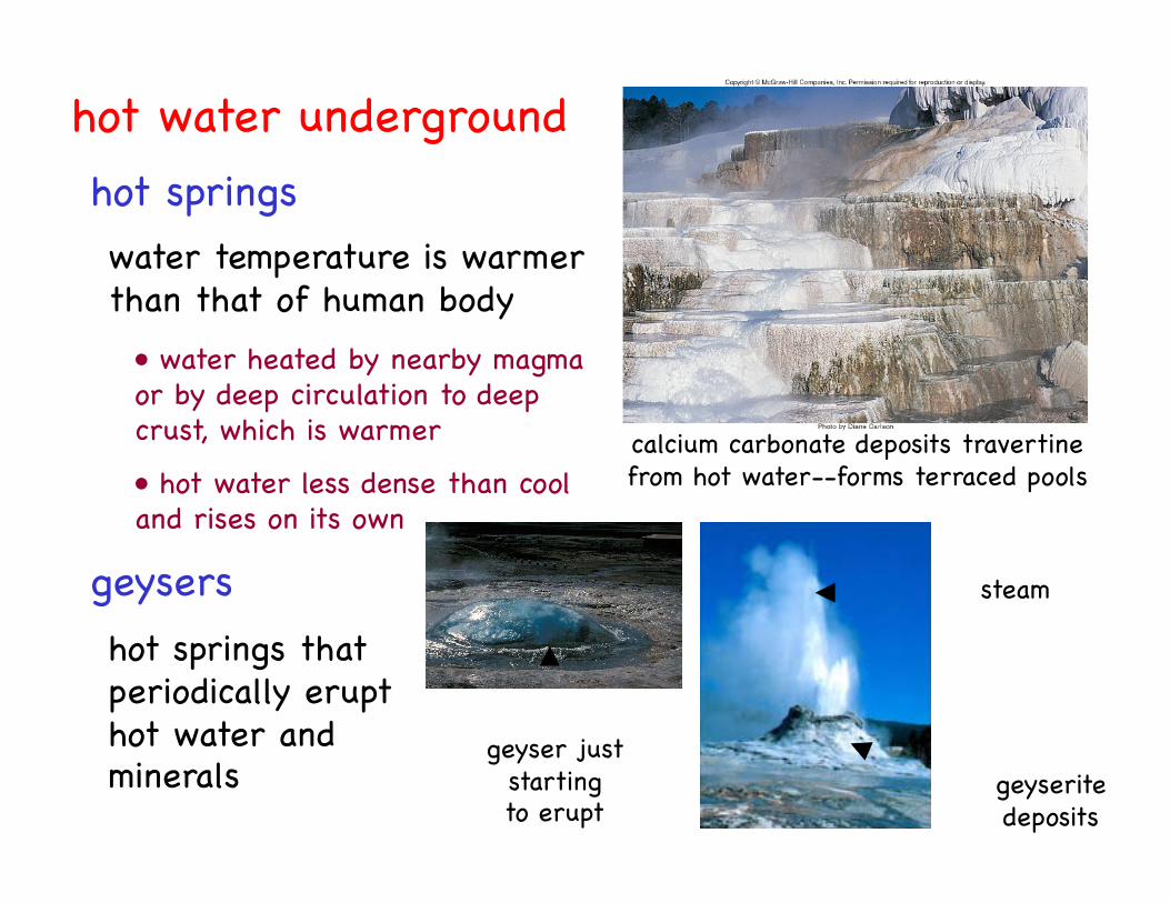
hot water underground!
water temperature is warmer!than that of human body!
hot springs that !periodically erupt !hot water and !minerals!
• water heated by nearby magma!or by deep circulation to deep!crust, which is warmer!
• hot water less dense than cool!and rises on its own!
geyserite!deposits!
steam!
calcium carbonate deposits travertine!from hot water--forms terraced pools!
hot springs!
geysers!
geyser just !starting!to erupt!
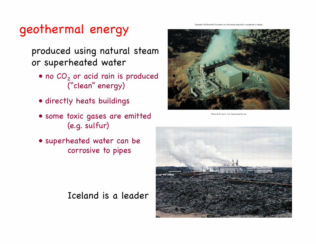
geothermal energy!produced using natural steam!or superheated water!
• no CO2 or acid rain is produced!"(“clean” energy)!
• directly heats buildings!
• some toxic gases are emitted!"(e.g. sulfur)!
• superheated water can be !"corrosive to pipes!
Iceland is a leader!


![GreyOne: Data Flow Sensitive Fuzzingforming implicit data flows. It causes either under-taint if the implicit flows are ignored, or over-taint if such flows are all counted [19].](https://static.fdocuments.us/doc/165x107/6112bfcf77132112af284db7/greyone-data-flow-sensitive-fuzzing-forming-implicit-data-iows-it-causes-either.jpg)


