Latitude/ Longitude Parts of a Map Types of Maps 5 Themes Definitions 5 Themes Questions 10 20 30 40...
53
Geography Edition
-
Upload
griffin-thompson -
Category
Documents
-
view
215 -
download
0
Transcript of Latitude/ Longitude Parts of a Map Types of Maps 5 Themes Definitions 5 Themes Questions 10 20 30 40...

Geography Edition

Latitude/ Longitude
Parts of a Map
Types of Maps
5 Themes Definitions
5 Themes Questions
10 10 10 10 10
20 20 20 20 20
30 30 30 30 30
40 40 40 40 40
50 50 50 50 50

Question 1 - 10
• These imaginary lines run East and West on the Earth. They also measure distances North and South of the Equator.

Answer 1 – 10
• What are latitude lines

Question 1 - 20
• These imaginary lines run North and South on the Earth. They also measure directions East and West of the Prime Meridian.

Answer 1 – 20
• What are longitude lines.

Question 1 - 30
• Parallels are also called what?
• Meridians are also called what?

Answer 1 – 30
• Parallels = Latitude
• Meridians = Longitude

Question 1 - 40
• This major line of latitude runs East and West, splits the earth into Northern and Southern hemispheres, and is measured at 0°

Answer 1 – 40
• Equator
Question 1 - 50
• This line of longitude runs through Greenwich, England

Answer 1 – 50
• What is the Prime Meridian

Question 2 - 10
• This part of the map will tell you your cardinal directions.

Answer 2 – 10
• Compass Rose

Question 2 - 20
• This part of the map tells you what the symbols and colors of a map mean.

Answer 2 – 20
• Legend/key

Question 2 - 30
• This direction always faces up on a map.
Answer 2 – 30
• North

Question 2 - 40
• This tool on the map is used to measure and compare distances on a map, to real life.

Answer 2 – 40
• What is a scale

Question 2 - 50
• These imaginary lines create a grid on the map, which in return, helps you to find certain locations. These lines use degrees to help you pinpoint a location.
Answer 2 – 50
• Latitude and Longitude
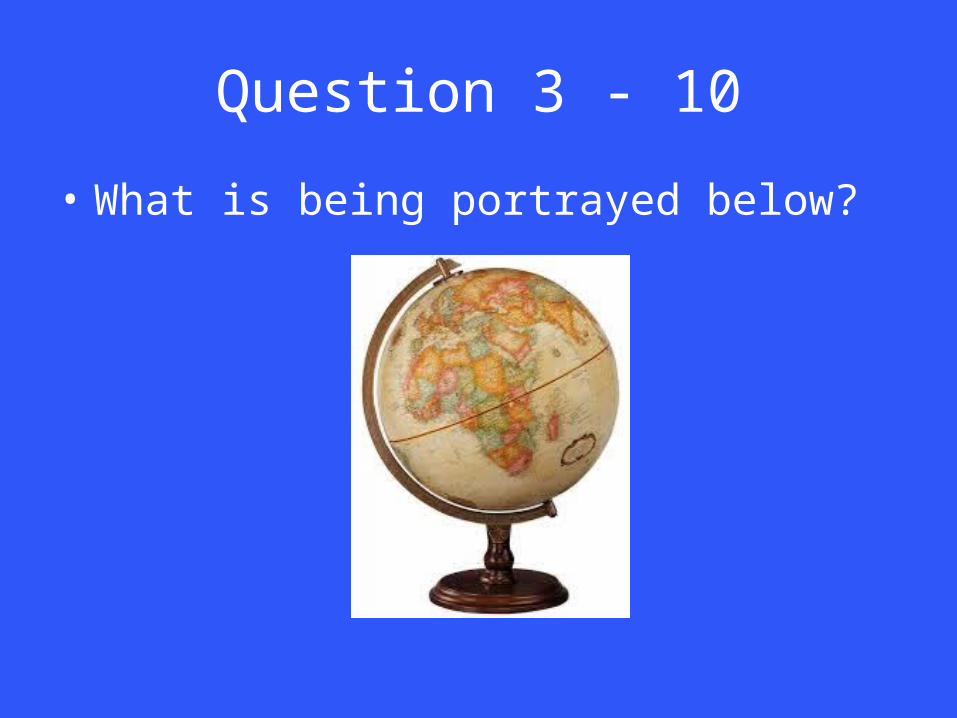
Question 3 - 10
• What is being portrayed below?

Answer 3 – 10
• A globe

Question 3 - 20
• This type of map includes illustrations. These illustrations can be a part of a battle, migrations, the economy and more
Answer 3 – 20
• Historical Map
Question 3 - 30
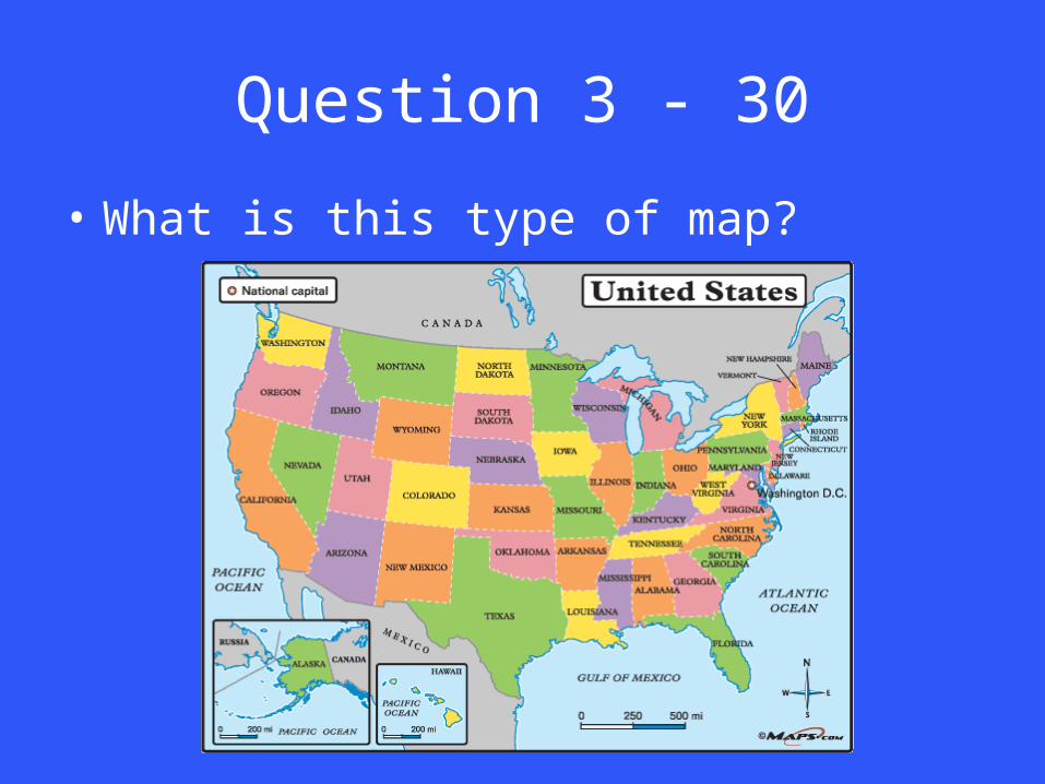
• What is this type of map?

Answer 3 – 30
• Political map

Question 3 - 40
• What is this type of map?

Answer 3 – 40
• Physical map

Question 3 - 50
• What is this type of map?
Answer 3 – 50
• Road map

Question 4 - 10
• This theme can be described as “Where is it at?”

Answer 4 – 10
• Location

Question 4 - 20
• This theme can be described as “What is it like when you get there?”

Answer 4 – 20
• Place

Question 4 - 30
• This theme can be described as “What do the people do to the environment?”

Answer 4 – 30
• Interaction

Question 4 - 40
• This theme can be described as “How do people and ideas get around?”

Answer 4 – 40
• Movement

Question 4 - 50
• This theme can be described as “What do locations have in common?”

Answer 4 – 50
• Regions

Question 5 - 10
• The country of Guam is at 13 degrees N. latitude, 145 degrees E. longitude is an example of what theme?
Answer 5 – 10
• Location – absolute location

Question 5 - 20
• In England, you can visit the Buckingham Palace, London Eye and Big Ben. It is also very rainy throughout the year.

Answer 5 – 20
• Place

Question 5 - 30
• High school juniors have emailed their applications to their favored colleges. They mentioned that it was much faster to email, than mail their applications.
Answer 5 – 30
• Movement

Question 5 - 40
• Most people who live in the Middle East are Muslim. What am I?

Answer 5 – 40
• Region

Question 5 - 50
• In Oregon, it is very common for lumberjacks to chainsaw trees for lumber purposes

Answer 5 – 50
• Interaction

• What are the 7 continents and 5 oceans?