Water Vapour Assessment Jörg Schulz, EUMETSAT Christian Kummerow, CSU Bojan Bojkov, ESA.
Upload
dangkhuongCategory
view
221download
0
This project has received funding from the European Union’s Horizon 2020 research and innovation programme under grant agreement No 640276.
www.gaia-clim.eu This project has received funding from the European Union’s Horizon 2020 research and innovation programme under grant agreement No 640276.
www.gaia-clim.eu
The GAIA-‐CLIM Virtual Observatory
Jörg Schulz Bill Bell, Jacques Descloitres, Marie Doutriaux-‐Boucher, Paul
Green, Jean-‐Christopher Lambert, Arndt Meier, Tony Reale, Kuldar Taveter, Kalev Rannat
GAIA-CLIM User Workshop, Rome, Italy, 6 October 2015

This project has received funding from the European Union’s Horizon 2020 research and innovation programme under grant agreement No 640276.
www.gaia-clim.eu
Content
❶ ObjecMves and ApplicaMon Areas for a Virtual Observatory
❷ IndicaMons from the User Survey and Current Plan for the Virtual Observatory
❸ InteracMon with Users

This project has received funding from the European Union’s Horizon 2020 research and innovation programme under grant agreement No 640276.
www.gaia-clim.eu
• Unearth potential of and enhance exploitation of ground-based and in-situ reference data for satellite sensor and product validation by systematically organising access to data and comparison results including the respective uncertainties;
• Integrate non-satellite reference data with existing satellite-satellite comparisons and observation feedback from NWP/reanalysis model and eventually climate model outputs;
• Increase awareness among scientist and other users on the concept of traceable uncertainty estimates;
• Develop a sustainable facility that supports Copernicus Services and science to analyse product quality in routine mode;
• Address current shortcomings as laid out in the GAIA-CLIM Gaps Assessment and Impacts Document (GAID).
❶ Objec+ves

This project has received funding from the European Union’s Horizon 2020 research and innovation programme under grant agreement No 640276.
www.gaia-clim.eu
❶ Ini+al Applica+on Areas of the VO • Assessment of satellite retrieval quality, e.g., EUMETSAT IASI L2 (T, q,
trace gases);
• Assessment of long term stability of satellite retrievals at specific locations using homogeneous ground-based series including uncertainty estimates;
• Assessment of radiance data quality for sensors with frequent sampling such as geostationary radiometer and polar orbiter - May support cal/val of new satellite mission in future;
• Assessment of reference data quality by satellite data, e.g., space based Radio Occultation has demonstrated this for conventional sondes;
• Could have a role in general satellite product assessments, e.g., GEWEX water vapour assessment currently running;

This project has received funding from the European Union’s Horizon 2020 research and innovation programme under grant agreement No 640276.
www.gaia-clim.eu
❶ Example: IASI Cal/Val Ac+vi+es
• Observed IASI radiances (OBS) are compared to calculated radiances (CALC) using GRUAN;
• Sonde profile + Radiative Transfer Model (LBLRTM 12.2);
• OBS-CALC should fall within ―3σ IASI instrument noise: is this even possible?
Calbet et al. AMT 2011.

This project has received funding from the European Union’s Horizon 2020 research and innovation programme under grant agreement No 640276.
www.gaia-clim.eu
❷ Indications from the User Survey and Current Plan for the Virtual Observatory

This project has received funding from the European Union’s Horizon 2020 research and innovation programme under grant agreement No 640276.
www.gaia-clim.eu
❷ Indica+ons from User Survey • The most frequent intended applica+ons are model evalua+on, climate analysis and quality assessment of satellite and ground-‐based data;
• Uncertain+es: Will be included but representa+on needs to be reviewed.
• Online sub-‐seKng by variable, +me and loca+on, but also by observing system and by surface type.
• Online data post-‐processing (on iden+fied subsets): Re-‐gridding to a specified resolu+on and or +me step and average data in space and/or +me. At a later stage possibly ver+cal smoothing.
• Flexible forward radia+ve transfer modelling capability will be included.
• Easy online data extrac+on: Comparison of collocated data files/specified subsets. At a later stage trend and step-‐change analysis, stability tests, and anomaly calcula+ons.
• Online visualisa+on: Graphical maps and +me series. Add plots with comparison sta+s+cs at a later stage.
• Timeliness: Offline or delayed fine for now. However, the design needs to foresee an eventual opera+onal near real +me capability.
• Meta data: Large agreement for using CF standard
• Data format: Large agreement for NetCDF4. • Concise documenta+on needed, in par+cular on the meaning of provided uncertainty informa+on.

This project has received funding from the European Union’s Horizon 2020 research and innovation programme under grant agreement No 640276.
www.gaia-clim.eu
❷ ECV Priori+es • Temperature profiles , IR+MW sounding with GRUAN, possibly ARSA radiosondes (always together with humidity)
• Humidity – 3 disMnct and complemenMng products (GCOS ECVs):
− Total column water vapour (TCWV), passive microwave, IR, VIS, Radio OccultaMon versus GRUAN and ARSA radiosonde data base, lidar, GPS, etc.
− Profiles of abs. Humidity (kg/kg), IR+MW sounding, Radio OccultaMon versus GRUAN
− Upper troposphere humidity: relaMve humidity, microwave sounders (183 GHz) and IR from polar and geostaMonary orbit e.g., 30 years of METEOSAT data

This project has received funding from the European Union’s Horizon 2020 research and innovation programme under grant agreement No 640276.
www.gaia-clim.eu
❷ ECV Priori+es • Aerosols, AOD at 550nm from space with reference data from AERONET and possibly LIDAR
• GCOS Greenhouse gases, in parMcular Ozone. Reference data from ground-‐based Dobson/Brewer measurements. Others reference data (TCCON, NDACC, etc.) to be added depending on level of completeness of traceability within given Mmeframes (the more the merrier) .
• All ECVs will be augmented with informaMon from NWP/reanalysis systems and eventually CMIP-‐5 data could be integrated if feasible;
• Forward radiaMve transfer will be implemented where feasible.

This project has received funding from the European Union’s Horizon 2020 research and innovation programme under grant agreement No 640276.
www.gaia-clim.eu
NPROVS
Colloca+on Archive
NPROVS NPROVS+
NCEP GTS & CFSR
Radiosondes
GRUAN & DOE/ARM
Radiosondes
NUCAPS (STAR SCDR)
NOAA IASI MetOp-‐A (OSPO) MetOp-‐B (STAR FTP)
MIRS NOAA-‐18,19 MetOP-‐A,B DMSP F18 (STAR FTP &
OSPO)
AIRS (NASA)
EUMETSAT IASI
MetOp-‐A,B (OSPO)
GOES (OSPO)
ATOVS NOAA-‐18,1
9 MetOp-‐A,B (OSPO)
COSMIC (UCAR)
GRAS (EUMETSAT)
NPROVS+ Colloca+on Archive
2-day delay
Users VALAR
14-day delay
Internal Users
Algorithm Development (re-retrieval)
Visualiza+on and
Monitoring Programs
ftp
Web ftp
65.5 GB

This project has received funding from the European Union’s Horizon 2020 research and innovation programme under grant agreement No 640276.
www.gaia-clim.eu

This project has received funding from the European Union’s Horizon 2020 research and innovation programme under grant agreement No 640276.
www.gaia-clim.eu
Kursinski et al., 2014 ECMWF/EUMETSAT ROM-SAF Workshop MOOG June 17, 2014
547 hPa Specific Humidity Comparisons
ECMWF & NCEP analyses don’t like really dry air
General underesMmate of very high humidity air except MERRA
GPS, MERRA & AIRS agree well on very dry end in mid-‐troposphere
NCEP & AIRS overesMmate mid-‐humidity air
~5 km alMtude, 30S-‐30N 2007
Courtesy Rob Kursinski, MOOG

This project has received funding from the European Union’s Horizon 2020 research and innovation programme under grant agreement No 640276.
www.gaia-clim.eu
❷ Virtual Observatory Design • Design based on user requirements derived from user survey and potential
further input from this user workshop; • Benefit from existing tools, e.g. for co-location and sub-setting (STAMP,
ICARE, NPROVS+, EUM CM SAF, ESA CCI, Felyx, …); • Benefit from ongoing GEWEX water vapour assessment; • Benefit from FIDUCEO, EUMETSAT and ESA CCI satellite data records; • Benefit from NWP/reanalysis capability on radiative transfer; • Compliance with C3S standard (Copernicus Services) and EUMETSAT
standards for operational software; • Take only data that we can redistribute without constraints; • VO will be extendable in terms of reference data, satellite missions and
ECVs (covering other domains); • Agile (iterative) development with strong user interaction is envisioned.

This project has received funding from the European Union’s Horizon 2020 research and innovation programme under grant agreement No 640276.
www.gaia-clim.eu
❸ Next Steps and Interac+on with Users • Start with 4 ECVs (temperature, humidity, ozone, aerosol); • Implement core functionality based on user survey and
eventual input at this workshop; • Would like to include users in development of the VO in
particular diagnostic measures and associated graphical displays;
• Development cycles including tests performed by users; • First test round most likely to start Q3/2016; • Next User Workshop could offer first practical exercise. -> Indicate interest to me or [email protected].

This project has received funding from the European Union’s Horizon 2020 research and innovation programme under grant agreement No 640276.
www.gaia-clim.eu
SPARES

This project has received funding from the European Union’s Horizon 2020 research and innovation programme under grant agreement No 640276.
www.gaia-clim.eu
ECVs Envisaged
• Selecting satellite products is ongoing and input from the WS encouraged.

This project has received funding from the European Union’s Horizon 2020 research and innovation programme under grant agreement No 640276.
www.gaia-clim.eu
Satellite-‐to-‐site collocaMon (2/2)
Extract tool http://www.icare.univ-lille1.fr/extract
User-specified parameters: § Time range of sat. observations § Extract radius around sites § Extract site or network of sites
Output: all satellite observations within the specified vicinity of any site of the selected network over the selected time period
This project has received funding from the European Union’s Horizon 2020 research and innovation programme under grant agreement No 640276.
www.gaia-clim.eu
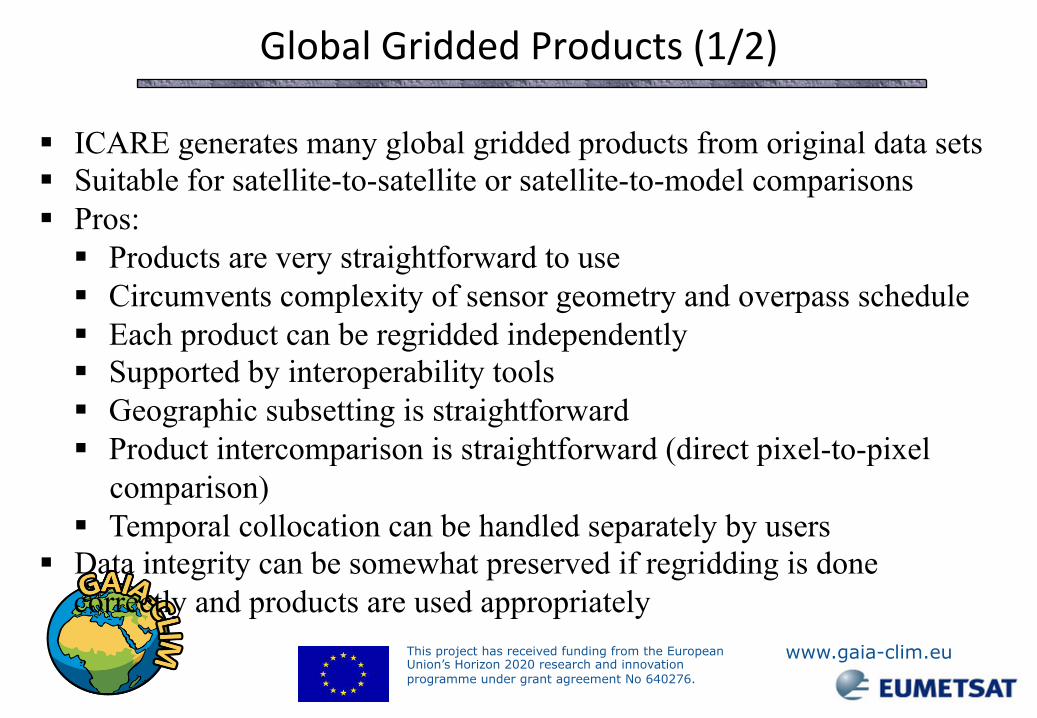
Global Gridded Products (1/2)
§ ICARE generates many global gridded products from original data sets § Suitable for satellite-to-satellite or satellite-to-model comparisons § Pros:
§ Products are very straightforward to use § Circumvents complexity of sensor geometry and overpass schedule § Each product can be regridded independently § Supported by interoperability tools § Geographic subsetting is straightforward § Product intercomparison is straightforward (direct pixel-to-pixel
comparison) § Temporal collocation can be handled separately by users
§ Data integrity can be somewhat preserved if regridding is done correctly and products are used appropriately

This project has received funding from the European Union’s Horizon 2020 research and innovation programme under grant agreement No 640276.
www.gaia-clim.eu
MSG/SEVIRI AOD
ECMWF/MACC
AERONET
Aqua/MODIS RGB
Global Gridded Products (2/2) Multi-sensor browse interface http://www.icare.univ-lille1.fr/browse
• A user-friendly interface where multiple products can be displayed over the user-defined region of interest
• Top-down selection (Product>Date>Region) coupled with transverse selection (i.e., modify date or product or region selection)
• Orbit tracks overlay available • X/Y comparison plot available • Link to AERONET sunphotometer database • Some models and analyses are available
(e.g., MACC aerosol forecast)

This project has received funding from the European Union’s Horizon 2020 research and innovation programme under grant agreement No 640276.
www.gaia-clim.eu
nors-‐server.aeronomie.be

This project has received funding from the European Union’s Horizon 2020 research and innovation programme under grant agreement No 640276.
www.gaia-clim.eu
Full report with traceability, staMsMcs, and download opMons

This project has received funding from the European Union’s Horizon 2020 research and innovation programme under grant agreement No 640276.
www.gaia-clim.eu
User interface examples from CRISMA DynMap client-server application with GUI, programmed in Google Maps API:

This project has received funding from the European Union’s Horizon 2020 research and innovation programme under grant agreement No 640276.
www.gaia-clim.eu
User interface examples from CRISMA GUI from integrated widgets (in Wirecloud):
World State OOI Summary Resource Status OOI Table

This project has received funding from the European Union’s Horizon 2020 research and innovation programme under grant agreement No 640276.
www.gaia-clim.eu
❷ Technical Design
PCL: Product Command Layer PDL: Product Data Layer APL: Algorithm Private Layer
3-Layers algorithm approach: 1st Layer: PCL • Handles the reading of input and
writing of output. • It is modular with defined interfaces. • One plug-in per data format. • It is the only interface to an external
system framework (plug & play feel) • Visualization would be just another form
of output. 2nd Layer: PDL • Exclusive I/O and memory management
– where the data is after it has been read in or before it is written out – independent of how it was read in.
• Provides the scientific core of the algorithm with all relevant input data
3rd Layer: APL • Contains the scientific part of the
algorithm, e.g. all the procedures for defining the co-locations
• It is completely independent from both the external framework and the format of the input data.