Jason-3 - NOAA National Environmental Satellite, Data, and ... 15 v2.pdf · Background Jason-3 will...
4
Jason-3 Gathering environmental intelligence from the world’s oceans NOAA Satellite and Information Service
Transcript of Jason-3 - NOAA National Environmental Satellite, Data, and ... 15 v2.pdf · Background Jason-3 will...
Jason-3
Gathering environmental intelligence from the world’s oceans
NOAA Satel l i te and Information Ser vice
BackgroundJason-3 will maintain the Nation’s satellite altimetry observations of global sea surface height that began in 1992 with the TOPEX/Poseidon mission. It follows the Ocean Surface Topography Mission on the cur-rent operational altimeter satellite, Jason-2. As with Jason-2, Jason-3 is an international cooperative mis-sion, in which NOAA is partnering with NASA, the Centre National d'Etudes Spatiales (CNES, France’s governmental space agency) and European Organi-sation for the Exploitation of Meteorological Satel-lites (EUMETSAT). A nominal three year lifetime is planned for Jason-3 with a possibility of a two year extended mission.
The data taken from the Jason satellite series will sup-port scientific, commercial, and practical applications related to sea level rise, ocean circulation, and climate change. It will be used in weather modeling for sea-sonal forecasts, tropical storm intensification forecasts, and coastal forecasts. It will also be applied to fisheries management, marine industries, and research into hu-man impacts on the world’s oceans, all of which sup-port NOAA’s mission to protect life and property.
ApplicationsThe Jason series of satellites provide the most accurate global measurements of sea surface height for appli-cations in:
Ocean climatology ● Global sea-level rise: This is a fundamental in-dicator of climate change and is one of the pri-mary impacts of human-produced warming. An altimeter record of several decades will be needed to clarify whether the rate of sea-level rise is ac-celerating.
● Decadal variability in the ocean: This variability has been shown to have an impact on fishery re-gime changes and correlates with droughts and changes in hurricane activity. An altimeter time series of several decades will be needed to distin-guish signals related to anthropogenic warming from those related to natural variability.
● Seasonal and inter-annual variability: On sea-sonal to inter-annual timescales, ocean atmo-sphere interactions in the tropical Pacific, the El Niño-Southern Oscillation (ENSO) phenomena, currently provide much of the signal for seasonal forecasts.
Ocean weather ● Operational Oceanography: Input to operational integrative services based on global and regional ocean models are necessary to provide real time and prognostic information on the state of the global ocean. This capability helps users understand and monitor the world’s marine environment and facil-itate a safe, non-polluting, and sustainable human exploitation of the ocean environment.
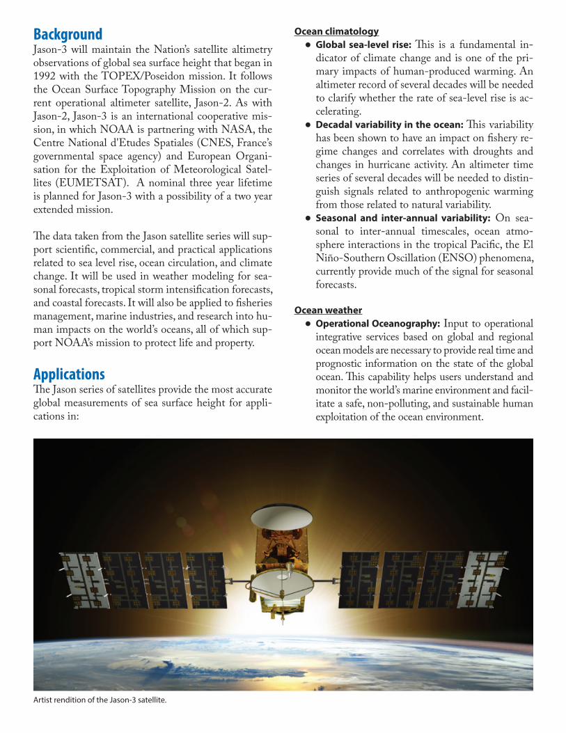
Artist rendition of the Jason-3 satellite.

● Surface wave forecasting and evaluation: Accu-rate surface wave forecasts are a major require-ment for offshore operators. Over the last decade, altimeter-derived significant wave height data have been critical for improvements in wave pre-diction systems.
● Hurricane intensity forecasting: The knowledge of the upper ocean heat content (OHC) is a crit-ical factor in forecasting the intensity of hurri-canes as they approach the U.S. East and Gulf Coasts where high OHC is quite variable.
● Coastal variability: Observations for modeling the ocean basin and the broader coastal area are critical for understanding the impact of coastal variability on ecosystems, including marine mam-mal and coral reef research. Coastal forecasting is needed in responding to environmental problems such as oil spills and harmful algal blooms, as well as forecasting tides and currents important to commercial shipping and ship routing.
Observational Gap and MitigationJason-3 will succeed Jason-2, which was launched in 2008 and was designed to last for three years (with a goal of five years). NOAA will continue to rely on Jason-2 as long as possible, but if Jason-2 fails before Jason-3 is launched and calibrated/validated, there will be a break in the long-term record of sea surface height observations.
Space Segment DetailsThe satellite’s main instrument, the radar altimeter, measures the round-trip travel time of microwave pulses bounced off the sea surface, from which the precise distance between the satellite and sea surface can be determined. The difference between this dis-tance and the geo-centric height of the satellite deter-mined from a combination of precise orbit tracking systems (DORIS, GPS, LRA) provides a measure-ment of sea surface height and the topography of the ocean surface. The shape of the returned radar pulses also gives information on wind speed and significant wave height.
Jason-3 will be approximately 510kg at launch and has dimensions of 3.8m x 10m x 2m with the solar panels deployed, and the orbit will be positioned at 1336 km at 66° inclination. It will carry the following instru-ments:
Ground Segment DetailsThe ground segment is a distributed system that uses resources from NASA, CNES, EUMETSAT and NOAA. Raw altimetry data from POSEIDON3B, DORIS and the radiometer will be processed by the NOAA and EUMETSAT centers to produce near-re-al time altimetry products, which are then distributed to users. The CNES mission center will produce and distribute delayed time altimetry products. NOAA
Using data from the Jason-2 satellite and other altimetry missions, this dataset is an integral component of global estimates of sea level rise. On shorter time scales, the sea surface height data is critical for understanding hurricane intensification, along with areas of ocean swell that may impede oceanic shipping.
Instrument Measurement Responsible Agency
Poseidon-3B Altimeter
Radar altimeter that measures sea level, wave heights and wind speed
CNES (on behalf of EU-METSAT)
DORIS Provides Precise Orbit Determination (POD) and locates the satellite on orbit in real time
CNES (on behalf of EU-METSAT)
Advanced Microwave Radiometer (AMR)
Measures radar travel time delay caused by water vapor content in the atmosphere
NASA/JPL (on behalf of & fully funded by NOAA)
GPS Receiver Tracking system used to enhance the POD perfor-mance of DORIS and LRA
NASA/JPL (on behalf of & fully funded by NOAA)
Laser Retro-re-flector Array (LRA)
Allows the satellite to be tracked with centimeter accuracy by 40 ground-based, satellite laser ranging stations
NASA/JPL (on behalf of & fully funded by NOAA)
Passenger -Experimental: Joint Radiation Experiment (JRE) (Car-men3+LPT)
Includes Carmen-3 (radia-tion and particle detec-tors) and Light Particle Telescope (LPT), used to measure the influence of space radiation on advanced components
CNES and JAXA
3/2015
will operate Jason-3 from its NOAA Satellite Oper-ations Facility in Suitland, Md. and process data and distribute the data and products to its users and partner agencies. EUMETSAT will provide backup ground services from their European ground station and will process and distribute data and products to their user community. The data collected by each agency will be shared with the other.
Acquisition DetailsJason-3 is a five-year development and integration effort that started in FY 2010. NOAA is providing a microwave radiometer, precision orbit determination (POD) components (e.g., GPS, LRA), launch services, ground system and operations, and associated engi-neering services for Jason-3. Through an interagency agreement, NASA is NOAA’s space segment acquisi-tion and development agent for the radiometer and POD components, as well as the launch vehicle. The U.S. provided instruments were developed by the Jet Propulsion Laboratory (JPL) and the launch vehicle was procured by NASA's Launch Services Program at Kennedy Space Center. NOAA retains overall pro-gram management responsibility. CNES is providing the PROTEUS bus and all the system engineering and operations. EUMETSAT is providing the space-craft integration, altimeter, additional precision orbit components, ground system, and operations. Jason-3 will follow in the tradition of the previous altimetry missions, Topex/Poseidon, Jason-1 and -2. The Jason series has been transitioned as a research endeavor from NASA and the CNES to NOAA and EUMETSAT for joint implementation as a sustained operational capability. All U.S. sensors have been delivered and completed integration and testing with the spacecraft in France. The launch vehicle selected by NASA is the SpaceX Falcon 9 v 1.1, which will be certified for the Jason-3 launch.
For more information, please visit: www.nesdis.noaa.gov/jason-3
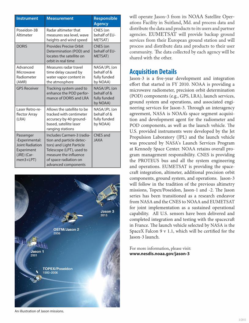
An illustration of Jason missions.