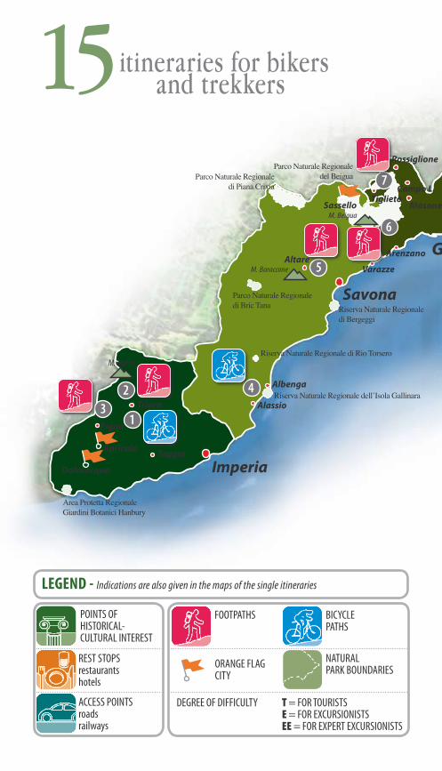
HIGHLIGHTS Europe ITINERARIES HIGHLIGHTS LOCAL EXPERTS ITINERARIES
�
15itinerariesfor bikersand trekkersin Liguria


�
A long and narrow strip of land with mountains that hug the seacoast and hillsides that rapidly rise in a thousand roads that become paths, mule tracks and, at times, simple trails.
The fun of easily discovering natural settings that often hide unbelievable environmental and artistic treasures, local customs which have flourished thanks to long periods of isolation, the indelible mark left by the remnants of a past made up of wayfarers and pilgrims who travelled the ancient salt roads leading from the sea to the Po valley.
And these ancient roads are perfect for biking and trekking enthusiasts who want to combine their holiday with a full immersion in nature for an active vacation, on foot or on bike or even on horseback. Routes for trekkers and mountain bikers, for amateurs and experts.
Itineraries from west to east, from the mountains towering over Ventimiglia to Lunigiana and vice versa. Generally following the Alta Via dei Monti Liguri, a road that runs almost parallel to the sea.
440 kilometres, divided into 43 stages (in each there are food and rest stops, either on or in the near vicinity of the routes) which uncover a fascinating hinterland which at times opens onto the sea, and at others onto panoramas that extend beyond the Alps and the Apennines. Yes, because in Liguria the Bocchetta di Altare, behind Savona, confines with these two mountain systems.
One of the 15 stages proposed in the following pages, takes the trekker right into that area, surrounded by mountains and fortresses. The routes have been chosen on the basis of various criteria which touch all of the areas of Liguria: excellence (like the Sentiero degli Alpini, a high mountain route for expert excursionists with stretches carved into the rock), classic itineraries (the Cinque Terre), curiosity (like the two mountain bike trails that cross the Julia Augusta Roman road between Albenga and Alassio or the old tramway that went from Genoa Bolzaneto to the Santuario della Guardia) or for the breathtaking views offered. A mix of itineraries for seeing Liguria from above and falling in love with this land.
And for discovering that while many cities on the Ligurian Coast have been awarded Blue Flags (a European acknowledgement of clean seas as well as a liveable environment), in the heart of Liguria there are many Orange Flags, a symbol of quality and environmental excellence in the hinterland cities and towns. The National Association of the Orange Flag Cities has its headquarters at Dolceacqua in Liguria.
In fact, the Orange Flag was born here, in Sassello, which was the first town in Italy to boast this recognition. And others are on their way. Because the hinterland has everything it takes to truly become the “other” Riviera.
The hinterland,an added value for Liguria
REST STOPS restaurantshotels
ACCESS POINTSroadsrailways
POINTS OFHISTORICAL-CULTURAL INTEREST
DEGREE OF DIFFICULTY T = FOR TOURISTS E = FOR EXCURSIONISTS EE = FOR EXPERT EXCURSIONISTS
Savona
Imperia
Genova
BICYCLEPATHS
FOOTPATHS
LEGEND - Indications are also given in the maps of the single itineraries
15 itineraries for bikers
and trekkers
M. Marta
M. Baraccone
Parco Naturale Regionale del Beigua
Parco Naturale Regionale di Bric Tana Riserva Naturale Regionale
di Bergeggi
Riserva Naturale Regionale dell’Isola Gallinara
Riserva Naturale Regionale di Rio Torsero
Area Protetta Regionale Giardini Botanici Hanbury
M. Beigua
Parco Naturale Regionale di Piana Crixia
��
2
Taggia
Dolceacqua
Apricale
4
6
Albenga
AlassioTriora
Rossiglione
7Campo L.
TiglietoMasone
ArenzanoAltare
5
ORANGE FLAGCITY
NATURALPARK BOUNDARIES
Pigna
Varazze
Sassello

Savona
Genova
Golfo del Tigullio
LEGEND - Indications are also given in the maps of the single itineraries
in Liguria
At the Santuario della Guardia for the ex-tramway road
8
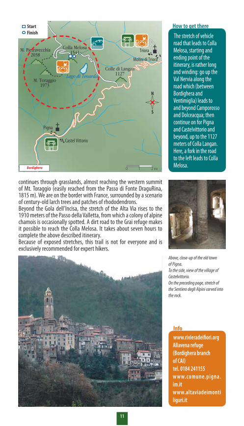
A climb up to Colle di Langan and descent through the alleyways of Dolceacqua
1 The Mt. Santa Croce, above Pieve, opening onto the Gulf of Genoa
9
Breathtaking views from Balcone di Marta
2 10 At the top of Mt. Lavagnola amid mule tracks and milestones
The Sentiero degli Alpini,a dizzying route
3 Pedalling in the Val d’Aveto towards the Lago delle Lame
11
From Albenga to Alassio by bike, on a 2000-year-old road
4 By bike (and then on foot) up to the top of Mt. Porcile
12
On the Bocchetta di Altare,where the Alps begin
5 In search of unusual itineraries in the heart of the Cinque Terre
13
A Centre dedicated to birdsof prey in the Beigua Park
6 On mountain bike amid the castles surrounding Sarzana
14
Woodlands and ruins on Orba around the Tiglieto Abbey
7 In Montemarcello Park, a botanical garden without fences
15
ITINERARIES
Parco Naturale Regionale di Montemarcello-Magra
Riserva Naturale Regionale di Bergeggi
Riserva Naturale Regionale dell’Isola Gallinara
M. Aiona
M. MaggiorascaM. Antola
Parco Naturale Regionale di Portofino
Parco Naturale Regionale dell’Aveto
�5
Parco Naturale Regionale dell’Antola
Parco Nazionale delle Cinque Terre
Santo Stefanod’Aveto
Castelnuovo Magra
8��
�2
9
�0
Pieve L.Camogli
Portofino
Rossiglione
Campo L.
Masone
Arenzano
Vernazza
Sarzana�4
La Spezia
Torriglia
Neirone
Magnasco
Lavagna
��
6
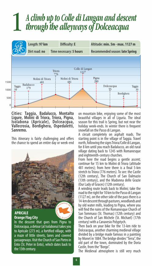
on mountain bike, enjoying some of the most beautiful villages in all of Liguria. The ideal season for this trail is Spring, but not near the holiday week-ends. In winter there is frequent snowfall on the Passo di Langan.A circuit completely on asphalt roads. The starting point is in the village of Taggia. Travel north, following the signs Triora/Colle di Langan, for 8 km until you reach Badalucco, an old rural village dating back to 1245 with Romanesque and eighteenth-century churches. From here the road begins a gentle ascent; continue for 15 km to Molini di Triora (altitude 481 metres); from here there is a final 5-km stretch to Triora (776 meters). To see: the Castle (12th century), The Church of San Dalmazio (13th century), and the Madonna delle Grazie (Our Lady of Graces) (12th century).A winding route leads back to Molini; take the road to the right for 10 km to the Passo di Langan (1127 m), on the other side of the pass there is a 14-km descent through pastures, woodlands and by old water mills, leading to Pigna, where you will find the ruins of the Romanesque Church of San Tommaso (St. Thomas) (12th century) and the Church of San Michele (St. Michael) (17th century) with a Canavesio Polyptych.Then back on your bike for the 13-km ride to Dolceacqua, another charming medieval village divided by a bridge made famous in a painting by Monet in 1884. The bridge divides “Terra”, the old part of the town, dominated by the Doria Castle, from the “Borgo”. The Medieval atmosphere is still very much
Cities: Taggia, Badalucco, Montalto Ligure, Molini di Triora, Triora, Pigna, Isolabona (Apricale), Dolceacqua, Vallecrosia, Bordighera, Ospedaletti, Sanremo.
This itinerary is fairly challenging and offers the chance to spend an entire day or week-end
1
APRICALE Orange Flag CityIn the descent that goes from Pigna to Dolceacqua, a detour (at Isolabona) takes you to Apricale (273 m), a fortified village, with a maze of little streets, lanes and covered passageways. Visit the Church of San Pietro in Ento (St. Peter in Ento), which dates back to the 13th century.
0
500
1000
1500
Taggia39
Badalucco179
Molini di Triora481
Triora776
Colle di Langan1127
Pigna280
Dolceacqua55
Taggia39
Molini di Triora481
Length: 97 km Difficulty: E Altitude: min. 5m - max. 1127 m
Time necessary: 5 hoursDirt road: no Recommended season: late Spring
Bordighera 5
A climb up to Colle di Langan and descent through the alleyways of Dolceacqua

7
alive here, with very picturesque corners where time seems to have stood still. The ride through the alleyways is difficult and technical, but even if you have to walk your bike, don’t miss taking a full tour of them, and a stop at Eugenio Andrighetto’s 3D Visionarium, where a beautiful
and complete multi-vision slide show takes you through the villages of the Val Nervia and beyond. Another 9 km and you reach the Aurelia highroad; turn left and continue another 27 km to Taggia, back the starting point of the excursion.
Web sites www.rivieradeifiori.org www.cmaa.it www.cmintemelia.it
Info
A10 Genoa-Ventimiglia Motorway:exit at Arma di Taggia, then take Provincial Road 548 in the direction of Taggia, Badalucco/Triora.
How to get there
DOLCEACQUA Orange Flag City, Prehistory and ChurchesThe oldest vestiges are fortifications - called “castellari” - from the Iron Age, along the watershed between the Val Nervia and Val Roia. It is dominated by the Doria Castle, which dates back to the 11th century and is currently being renovated, and by a humpback bridge which joins the two parts of the city. In “Terra”, visit the Parish Church of St. Antonio Abate (12th century), with its rich internal decorations and a Polyptych of St. Devota, and the Church of San Giorgio (St. George), (11th century), with a painted wooden ceiling. There are also numerous country chapels worth visiting: San Bernardo (St. Bernard) (15th century), San Rocco (St. Rocco), San Cristoforo (St. Christopher). Don’t miss the Oratory of San Sebastiano (St. Sebastian), with a sculpture by Maragliano.
Montalto Ligure
Molini di TrioraTriora
Pigna
Isolabona Apricale
Dolceacqua
Bordighera
Ospedaletti
Sanremo
S48
1
Arma di Taggia
Colle di Langan1127
Cima di Marta2138
M. Pietravecchia2038
M. Toraggio1973
Castel Vittorio
Colla Melosa1541
Vallecrosia
Taggia
A10
Badalucco
N
S
A10 M
otor
way
- Gen
ova
A10 M
otor
way
- Ven
timig
lia
0 1 2 KM
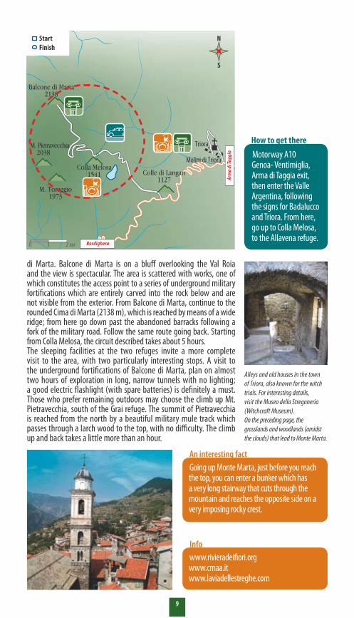
StartFinish
8
Breathtaking viewsfrom Balcone di Marta
is unattended and the keys may be requested at the Allavena refuge. The trek: starting from the Melosa refuge, go uphill towards the west along the mule track that bypasses the long hairpin curves of the vehicle military road, the trail rises rapidly until the Grai refuge is reached, just below the panoramic Grai summit which can be easily reached by a turn off the main trail.From the refuge, follow the dirt road to the north, crossing wide open grasslands and crossing Mt. Ceriana on its east side, until a you reach a small group of rundown barracks. From here take the cart-road that goes west and leads to Balcone
Cities: Molini di Triora, Triora, Realdo.
The Cima di Marta (2138 m) is the highest on the watershed between the Val Roia and Valle Argentina, south of Mt. Saccarello. It consists in a wide grassy hilltop from which a vast crest leads towards the Val Roia, culminating in the panoramic Balcone di Marta. The entire zone is high-altitude grazing land, with large alpine prairies broken by an occasional beautiful larch wood, enchanting in autumn when the leaves turn a reddish colour. The starting point for the excursion is the Franco Allavena refuge at Colla della Melosa (1541 m) with sleeping facilities and open all year, the refuge is owned by the Bordighera branch of CAI. Or, in alternative, the higher Grai refuge (1920 m), of the Ventimiglia branch; it
The Valle ArgentinaThe Valle Argentina offers spectacular alpine passages and villages like Molini di Triora, Triora and Realdo, which truly merit a visit. The valley has been inhabited since the most ancient times by tribes that found refuge in grottoes and natural recesses. Several archaeological sites, like the Arma della Gastéa and the Tana della Volpe (the Fox’s Den), near to Triora, bear witness to these tribal communities. The area in proximity to Realdo offers a wide choice of equipped trails for sports climbing.
2Length: – Difficulty: T Difference in level: 597 m
Recommended season: AutumnTime necessary: 5 hoursDirt road: yes
9
di Marta. Balcone di Marta is on a bluff overlooking the Val Roia and the view is spectacular. The area is scattered with works, one of which constitutes the access point to a series of underground military fortifications which are entirely carved into the rock below and are not visible from the exterior. From Balcone di Marta, continue to the rounded Cima di Marta (2138 m), which is reached by means of a wide ridge; from here go down past the abandoned barracks following a fork of the military road. Follow the same route going back. Starting from Colla Melosa, the circuit described takes about 5 hours.The sleeping facilities at the two refuges invite a more complete visit to the area, with two particularly interesting stops. A visit to the underground fortifications of Balcone di Marta, plan on almost two hours of exploration in long, narrow tunnels with no lighting; a good electric flashlight (with spare batteries) is definitely a must. Those who prefer remaining outdoors may choose the climb up Mt. Pietravecchia, south of the Grai refuge. The summit of Pietravecchia is reached from the north by a beautiful military mule track which passes through a larch wood to the top, with no difficulty. The climb up and back takes a little more than an hour.
Rocca Bruna1418
M. Aiona1692L. d. Abeti
L. d. Lame
Magnasco
Farfanosa Villa Cella
T. Gramizza
Rezzoàglio
d’Aveto
Villa Noce
Allegrezza
873Amborzarsco
M. Maggiorasca1799
T. Aveto
654
S. Stefano
M. Penna1692
Capp. delle Lame
Taggia
Badalucco
Montalto Ligure
Molini di Triora
Triora
Pigna
IsolabonaApricale
Dolceacqua
Ospedaletti
SanremoVallecrosia
S48
1
Arma di Taggia
A10
Colle di Langan1127
Balcone di Marta2138
M. Pietravecchia 2038
M. Toraggio1973
Castel Vittorio
Colla Melosa1541
Alleys and old houses in the town of Triora, also known for the witch trials. For interesting details, visit the Museo della Stregoneria (Witchcraft Museum).On the preceding page, the grasslands and woodlands (amidst the clouds) that lead to Monte Marta.
Motorway A10 Genoa- Ventimiglia, Arma di Taggia exit, then enter the Valle Argentina, following the signs for Badalucco and Triora. From here, go up to Colla Melosa, to the Allavena refuge.
How to get there
Going up Monte Marta, just before you reach the top, you can enter a bunker which has a very long stairway that cuts through the mountain and reaches the opposite side on a very imposing rocky crest.
An interesting fact
www.rivieradeifiori.org www.cmaa.it www.laviadellestreghe.com
Info
N
S
Arm
a di T
aggi
a
0 1 2 KM
StartFinish
Bordighera

�0
The Sentiero degli Alpini,a dizzying route
beginning of the trail, which is very steep in the first stretch. Continue to a fork to the left, and then, once the middle of the incline is reached, enter a thick wood full of rhododendrons. Beyond the woods, the view opens onto the rugged face of Mt. Corma and on the valleys that dip to the sea.The most intense stretch of the trail begins here: with the 2038 metres of Mt. Pietravecchia behind you, the route continues along a narrow, exposed trail. In the most difficult stretches, several ropes facilitate walking. Beyond a fountain-head, rises the striking south face of Mt. Toraggio (1973 m). A route fitted with cables and iron steps – for alpine climbers – leads to the summit, while the path descends and continues through a trail carved into the rock until it reaches the Gola dell’Incisa (1680 m), which is reached by a series of hairpin curves. The most spectacular stretch of the Sentiero degli Alpini unwinds east of the ravine, ending in the vicinity of the Alta Via: here the landscape radically changes, the trail
Cities: Castelvittorio, Pigna, Triora.
This is the most spectacular route of the Ligurian Alps and probably in all of Liguria; it partially includes trail no. 4 of the Alta Via (Colle Scarassan-Sella d’Agnaira).The route develops around the slopes of Mt. Pietravecchia and Mt. Toraggio (these are not the highest summits of Liguria, they are surpassed by the 2200 metres of Mt. Saccarello, but they are certainly among the most picturesque and panoramic) in a landscape which at times reflects the Dolomites, with the presence of particular and rare botanical species. The starting point of the excursion is Colla Melosa (1541 metres) located well beyond the old villages of Pigna and Castelvittorio; the route continues through the high Val Nervia. The start is easy: for one kilometre an old military road continues in the direction of the Mt. Grai refuge. However, in the vicinity of a hairpin curve, the Italo fountain-head marks the
Colla Melosa A 5-km long Nordic ski loop passes around the Allavena refuge at Colla Melosa (shown in the photo). The refuge is open and supervised all year long; it belongs to the Bordighera branch of CAI. Colla Melosa and Allavena are about an hour’s ride from the Arma di Taggia motorway exit.
3Length: – Difficulty: EE Difference in level: 432 m
Recommended season: April - OctoberTime necessary: 7 hoursDirt road: yes
��
www.rivieradeifiori.orgAllavena refuge (Bordighera branch of CAI)tel. 0�84 24��55w w w.comune.pigna.im.it www.altaviadeimontiliguri.it
Info
Rocca Bruna1418
M. Aiona1692L. d. Abeti
L. d. Lame
Magnasco
Farfanosa Villa Cella
T. Gramizza
Rezzoàglio
d’Aveto
Villa Noce
Allegrezza
873Amborzarsco
M. Maggiorasca1799
T. Aveto
654
S. Stefano
M. Penna1692
Capp. delle Lame
Taggia
Badalucco
Montalto Ligure
Molini di Triora
Triora
Pigna
IsolabonaApricale
Dolceacqua
Bordighera
Ospedaletti
SanremoVallecrosia
S48
1
Arma di Taggia
A10
Colle di Langan1127Lago di Tenarda
Cima di Marta2138
M. Pietravecchia2038
M. Toraggio1973
Castel Vittorio
Colla Melosa1541
Lunghezza: –Lunghezza: –Lunghezza: –
The stretch of vehicle road that leads to Colla Melosa, starting and ending point of the itinerary, is rather long and winding: go up the Val Nervia along the road which (between Bordighera and Ventimiglia) leads to and beyond Camporosso and Dolceacqua; then continue on for Pigna and Castelvittorio and beyond, up to the 1127 meters of Colla Langan. Here, a fork in the road to the left leads to Colla Melosa.
How to get there
N
S
Bordighera 0 1 2 KM
StartFinish
continues through grasslands, almost reaching the western summit of Mt. Toraggio (easily reached from the Passo di Fonte DraguRina, 1815 m). We are on the border with France, surrounded by a scenario of century-old larch trees and patches of rhododendrons.Beyond the Gola dell’Incisa, the stretch of the Alta Via rises to the 1910 meters of the Passo della Valletta, from which a colony of alpine chamois is occasionally spotted. A dirt road to the Grai refuge makes it possible to reach the Colla Melosa. It takes about seven hours to complete the above described itinerary.Because of exposed stretches, this trail is not for everyone and is exclusively recommended for expert hikers.
Above, close-up of the old town of Pigna.To the side, view of the village of Castelvittorio.On the preceding page, stretch of the Sentiero degli Alpini carved into the rock.

�2
From Albenga to Alassio by bike, on a 2000-year-old road
Piazza del Popolo, in Albenga. We follow Via Pia, crossing the Centa river, and turn right on Via Ruffini where, after about 200 metres, we go up to the left towards the archaeological area, the Via Julia Augusta (80 m.). A steep two-hundred-metre ride brings us to the entrance to the road, marked by a sign indicating points of historical interest. After the first paved stretch, the road is unpaved. We pass by Roman ruins which, according to experts, are funerary monuments from the 2nd century A.D.When you come to an asphalt road, turn right and follow it, and then immediately leave it to go down to the left on a road, which after a short distance becomes a mule track which at this point shows the original roadbed, over 2000 years old, complete with parapets and constructions for channelling water. When you reach the vicinity of a camp ground (50 m), the road crosses an asphalted street, the right side of which leads to Sant’Anna (70 m).The historical section ends here and the route continues, following the main asphalt road until a crossroads is reached. At this point, we have two choices. The first is very easy; detour to the left and go to the Aurelia to quickly return to Albenga. The second choice is to turn right and go uphill to the Church at Solva (120 m), then continue on for about 100 m., until a large open area is reached. From here we take the road that goes off to the right and make a hairpin curve; after about 200 m. there is a mule track which goes up to the right and leads to Mt. Bignone, shortly thereafter it leads back
Cities: Albenga, Alassio.
The Roman Road between Albenga and Alassio offers the starting point for an interesting historical itinerary, perfect any time of the year and easy enough for everyone that follows one of the oldest roads in Italy, the Via Julia Augusta. A route that runs parallel to the Via Aurelia, on which we find monuments and Roman constructions as we pedal along many stretches on the original pavement from those times.The point of reference for our starting point is
The via Julia AugustaOpened by Emperor Augustus between 13 and 12 B.C., it linked the Po Valley with Spain and Gaul. Thanks to a long series of archaeological works, most of it is about to be recovered, as was the case for the stretch proposed for easy exploration on mountain bike.
4
0
250
500
750
Albenga 2
Imbocco via Augusta80 Campeggio
50
Selva120
Monte Brignone440
Albenga 2
S. Anna70
Length: 14,5 km Difficulty: T Altitude: max. 520 m
Recommended season: allTime necessary: 1.30 hoursDirt road: yes

��
on the road. Turn right but, in the vicinity of a new hairpin curve, we once again leave the road to take the mule track to the right that leads up to the summit. This is the most difficult stretch, which we follow until we reach the small saddle (440 m) below. From here, continue along the airy, panoramic crest, which in a little more than 2 km crosses a small road which goes up from Albenga and quickly leads to the starting point of the route.
Web sites www.inforiviera.it www.comune.alassio.sv.itwww.comune.albenga.sv.itwww.comingauna.it
Info
Rocca Bruna1418
M. Aiona1692L. d. Abeti
L. d. Lame
Magnasco
Farfanosa Villa Cella
T. Gramizza
d’Aveto
Villa Noce
Allegrezza
873Amborzarsco
M. Maggiorasca1799
T. Aveto
654
S. Stefano
M. Penna1692
Capp. delle Lame
Rezzoàglio
Isola Gallinara
Capo S. Croce
Capo LenaMonte Bignone
520
Albenga
Alassio
Vegliasco Solva
S. Fedele
Bastia
Caso
Moglio
F. Centa
R. Garenda
T. Neva
Greenhouses in the Albenga valley; here to the side, Gallinara Island seen from the beach between Alassio and Albenga.
Recommended season: all
A10 Motorway - Genova
A10 Motorway - Ventimiglia
A10 Genoa - Ventimiglia Motorway, exit at Albenga. The itinerary starts from Piazza del Popolo, in the centre of the city.
How to get there
Riserva Naturale
Regionale dell’Isola Gallinara
N
S
0 1 2 KM
StartFinish

�4
On the Bocchetta di Altare, where the Alps begin
Forte Teggia (Teggia Fortress) which rises directly over the state road, is reached from Altare.On the Po side of the pass, take the path which cuts into the woods in the direction of the ridge. Once the asphalted road is crossed, take the small, slightly uphill road that leads to Monte Burotto the long way around, where a fort bearing the same name, and built in the last years of the 19th century, rises. Continue the more or less flat trail along the watershed in a southerly direction, observing Vado Ligure and the sea to the left, and the Val Bormida to the right. In a short time, you will reach Mt. Baraccone (821 m), on which we find the Baraccone battery fortifications which also date to the end of the 19th century. Continuing to the south, there is a steep decline along the wooded ridge which borders on the Po slope in certain stretches, until an evident hill is reached, called the “Colle del Baraccone” for the presence of an old barracks, where you meet a cart-road coming from Roviasca.The old border between the territory of Genoa and
Cities: Altare, Quiliano.
The Bocchetta di Altare, 459 m above sea level, connects the Alpine and Apennine mountain ranges. Known for many years as Colle di Cadibona, recently the correct historical denomination has been once again attributed to this pass, Bocchetta di Altare, from the name of the town it is located in. The proposed itinerary is an easy loop on the southern side of the pass during which three fortifications can be visited and which crosses luxuriant beech woods. Also suitable for mountain bikers, this route is particularly beautiful in early autumn because of the gorgeous colours of the woodlands. The first part of the route follows the itinerary of the Alta Via dei Monti Liguri, the ridge route (over 400 km) that joins Ventimiglia to Sarzana, marked by the white and red road sign with the acronym AV. Bocchetta di Altare, dominated by the imposing
Strategic passageSince Roman times, and probably even earlier, this pass has played a strategic role in communications from Liguria (Vada Sabatia, in Roman times, and later Savona), to southern Piedmont (Ceva, the Langhe and the Monregalese area), through the Letimbro and Bormida di Mallare valleys. Since ancient times, the passages have been fortified in various ways. Still today, the 19th century fortresses are well-preserved and are a particular attraction.
5Length: – Difficulty: T Difference in level: 600 m
Recommended season: AutumnTime necessary: 5 hoursDirt road: yes

�5
L. d. Abeti
T. Trexenda
F. Bormidadi Mallare
T. Lavanestro
T. Letimbro
Mallare
Carcare
Quiliano
Bocch. di Altare
o di Cadibona
Colle di Cadibona
Montagna
Roviasca
Valleggia
Cadibona
Tecci
SAVONA
T. Quazzola
29
Altare
M. Baraccone821
M. Burotto745
the Kingdom of Sardinia passed from the Colle del Baraccone. Continuing on, after a short distance, you reach the Colle del Termine, characterised by lovely, shaded clearings, where you will meet a cart-road coming from Altare. There are two alternatives for the return route. On warm summer days, we suggest returning to Altare on the cart-road which runs along the Po side and is shadier and cooler. The path is slightly downhill all the way and reaches the village of San Lorenzo, from there it leads to the asphalted road and the starting point of the route. Instead, in winter, it is better to return to the Colle del Baraccone and take the cart-road to the east in the direction of Roviasca. Just before the village of Nocette, at about 500 m of altitude, there is an evident fork in the road; take the little road to the north, cutting through the Bosco Grande, to reach the beginning of the route a little before the Forte Teggia.
www.inforiviera.it www.comune-altare.com www.comune.quiliano.sv.it www.altaviadeimontiliguri.it
InfoThe glass of AltareUpon arriving in Savona, the visitor is greeted by a billboard: “Altare, antica università del vetro e dell’arte vetraria”. (Altare, ancient University dedicated to Glass and the Art of Glassmaking) The glassmaking tradition, which continues to thrive although it is solidly rooted in the past. Villa Rosa, in art nouveau style, houses a complete Glass Museum.
Altare is easy to reach from both the Ligurian and the Po sides thanks to the numerous roadways: the main road from Savona to Ceva, the Savona-San Giuseppe di Cairo-Acqui railway line and the Savona-Turin Motorway.
How to get there
The tunnel under the Forte di Altare. On the facing page, the milestone that marks the beginning of the Alps and, at the bottom, the Forte Baraccone.
N
S
A10 Motorway
Savo
na
0 1 2 KM
StartFinish
A6 M
otor
way
- Tor
ino
�6
A Centre dedicated to birdsof prey in the Beigua Park
area as opposed to the 700 in 2004; for this the European Community has recognised it as a Special Protection Area (SPA). However, there are not only birds of prey: during the mating season, numerous other species can be observed. How can I recognise them, if I am not an expert? Along the route there are special illustrative panels which explain the various environments the various species nest or live in. Can anyone who wants to learn more use the Centre? A modern facility, equipped with the latest equipment and multimedia programs,
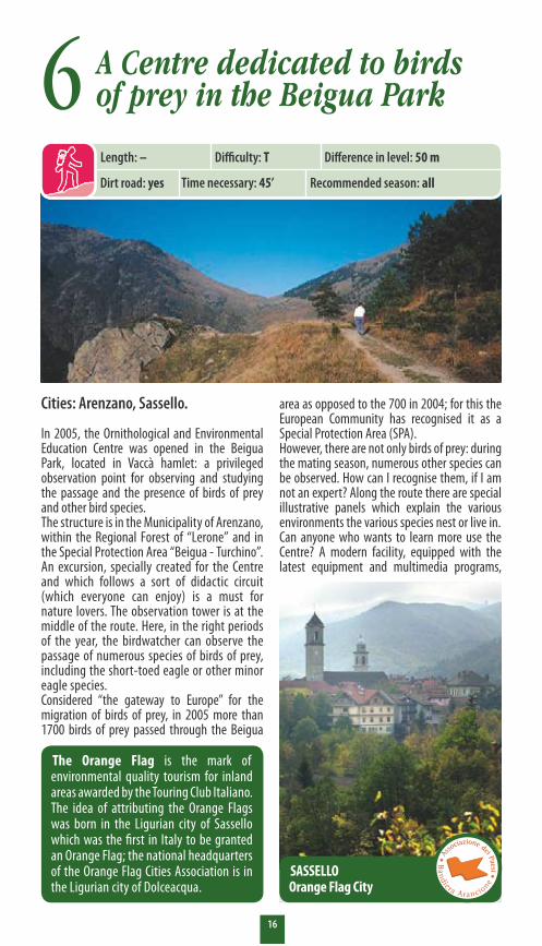
Cities: Arenzano, Sassello.
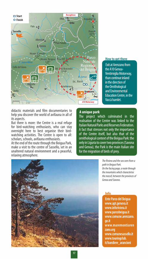
In 2005, the Ornithological and Environmental Education Centre was opened in the Beigua Park, located in Vaccà hamlet: a privileged observation point for observing and studying the passage and the presence of birds of prey and other bird species. The structure is in the Municipality of Arenzano, within the Regional Forest of “Lerone” and in the Special Protection Area “Beigua - Turchino”. An excursion, specially created for the Centre and which follows a sort of didactic circuit (which everyone can enjoy) is a must for nature lovers. The observation tower is at the middle of the route. Here, in the right periods of the year, the birdwatcher can observe the passage of numerous species of birds of prey, including the short-toed eagle or other minor eagle species. Considered “the gateway to Europe” for the migration of birds of prey, in 2005 more than 1700 birds of prey passed through the Beigua
The Orange Flag is the mark of environmental quality tourism for inland areas awarded by the Touring Club Italiano. The idea of attributing the Orange Flags was born in the Ligurian city of Sassello which was the first in Italy to be granted an Orange Flag; the national headquarters of the Orange Flag Cities Association is in the Ligurian city of Dolceacqua.
6
SASSELLOOrange Flag City
Length: – Difficulty: T Difference in level: 50 m
Recommended season: allTime necessary: 45’Dirt road: yes
�7
didactic materials and film documentaries to help you discover the world of avifauna in all of its aspects. But there is more: the Centre is a real refuge for bird-watching enthusiasts, who can stay overnight here to best organise their bird-watching activities. The Centre is open to all: scholars, schools, avifauna enthusiasts.At the end of the route through the Beigua Park, make a visit to the centre of Sassello, set in an unaltered natural environment and a peaceful, relaxing atmosphere.
Ente Parco del Beiguawww.apt.genova.it www.inforiviera.it www.parcobeigua.it www.comune.arenzano.ge.it www.maremontiarenzano.org www.comunesassello.it www.touringclub.it/bandiere_arancioni
Info
Stella Arenzano
Sassello
Badia
Acquabona
Obicella
Olba
Pian Paludo
Rif. Prà Rotondo1148
R. Lerca
T. Sansobbia
T. OrbaSturaR. Gargassa
T. Orba
Monte Beigua1287
Praioli1079
M. Pavaglione890
Alberola
PaloUrbe
Tiglieto
Campo Ligure
Rossiglione
Masone
Sciarborasca
Colle del Giovo
R.ca del Turnon1195
Monte Ermetta1267
Veirera
Alpicella
Acquabianca
loc. Vaccà
The Riviera and the sea seen from a path in Beigua Park.On the facing page, a route through the mountains which characterise the massif, between the provinces of Genoa and Savona.
A unique parkThe project which culminated in the realisation of the Centre was linked to the Italian Natural Parks and Reserves Federation. A fact that stresses not only the importance of the Centre itself, but also that of the ornithological context of the Beigua Park: the only in Liguria to cover two provinces (Savona and Genoa), the Park is the main Italian site for the migration of birds of prey.
Exit at Arenzano from the A10 Genoa-Ventimiglia Motorway, than continue inland in the direction of the Ornithological and Environmental Education Centre, in the Vaccà hamlet.
How to get there
N
S
0 1 2 KM A10 Motorway
Rossiglione
Parco Naturale
Regionale del Beigua
StartFinish

�8
Woodlands and ruins on Orba around the Tiglieto Abbey
for everyone, around the Abbey in the Beigua Park which combines the historical-artistic interest of the Cistercian complex with panoramic stretches on the Orba river, important botanical specimens and testimonies to rural culture.The excursion starts from the crossroads between Provincial Road 1 and the detour for Olbicella (the road sign is a slashed yellow circle), and follows the natural, unpaved trail to the Abbey. Turning to the left, the trail ascends slightly into a woods dominated by conifers. After a brief stretch, you reach a small bridge over the Fornace river which, for the time being, cannot be used. You must take a detour along the Provincial Road, and then, once again, follow the trail.The vegetation in the woods changes, going
Cities: Masone, Campo Ligure, Rossiglione, Tiglieto.
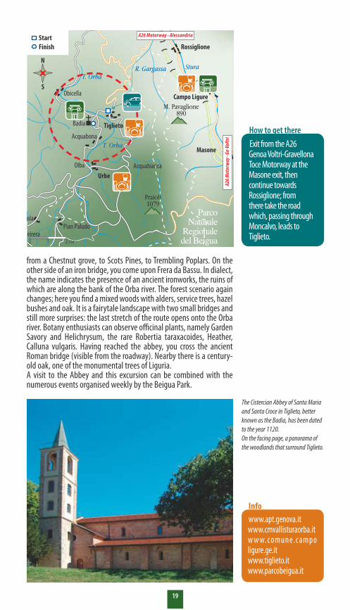
Just 30 kilometres from Genoa, the Valle Stura and Val d’Orba offer almost wild landscapes side-by-side with areas worked by man. Woods and cultivated land, mule tracks that rise through uninhabited, silent valleys, kilometres of paths to take on foot and on horseback, restaurants, eateries and agricultural tourism lodges are scattered among villages rich in important traces from the past. At the centre of the itinerary, the Badia di Tiglieto (the Tiglieto Abbey), the first Cistercian Abbey in Italy (where St. Bernard of Clairvaux is believed to have lodged). Standing in the beautiful plain that stretches along the Orba river, this complex, almost 1000 years old, has been recently restored to its ancient splendour and in 2001, after a 600-year absence, the monks have returned to live here. The trek proposed is a looped path, appropriate
MasoneIn Masone, you find an arched gate from the 17th century and a 16th-century Augustine convent which houses the Tubino Museum with objects that tell the story of the Stura valley from prehistoric times: you will find archaeological artefacts, minerals, coins and nativity statues, as well as the reconstruction of life settings.
Campo LigureCampo Ligure is also famous outside of Italy for filigree work, an ancient art practiced by the Etruscans, Indians, Africans, Latin Americans and Russians, whose masterpieces can be admired in the fantastic museum, created by a private collector, which holds 200 pieces from all over the world and all ages. The Master goldsmith, Antonio Oliveri, opened the first filigree shop here in 1884; others followed suit and the craftsmen can be admired up to this very day as they weave and braid gold and silver threads to make jewellery, lamps, jewel cases and thousands of other objects.
7Length: – Difficulty: T Altitude: min. 470 m - max. 570 m
Recommended season: AutumnTime necessary: 2 hoursDirt road: yes
�9
www.apt.genova.it www.cmvallisturaorba.it w w w. co m u n e. c a m p oligure.ge.it www.tiglieto.itwww.parcobeigua.it
Info
Stella Arenzano
Sassello
Badia
Acquabona
Obicella
Olba
Pian Paludo
Rif. Prà Rotondo1148
R. Lerca
T. Sansobbia
T. OrbaSturaR. Gargassa
T. Orba
Monte Beigua1287
Praioli1079
M. Pavaglione890
Alberola
PaloUrbe
Tiglieto
Campo Ligure
Rossiglione
Masone
Sciarborasca
Colle del Giovo
R.ca del Turnon1195
Monte Ermetta1267
Veirera
Alpicella
Acquabianca
loc. Vaccà
The Cistercian Abbey of Santa Maria and Santa Croce in Tiglieto, better known as the Badia, has been dated to the year 1120.On the facing page, a panorama of the woodlands that surround Tiglieto.
from a Chestnut grove, to Scots Pines, to Trembling Poplars. On the other side of an iron bridge, you come upon Frera da Bassu. In dialect, the name indicates the presence of an ancient ironworks, the ruins of which are along the bank of the Orba river. The forest scenario again changes; here you find a mixed woods with alders, service trees, hazel bushes and oak. It is a fairytale landscape with two small bridges and still more surprises: the last stretch of the route opens onto the Orba river. Botany enthusiasts can observe officinal plants, namely Garden Savory and Helichrysum, the rare Robertia taraxacoides, Heather, Calluna vulgaris. Having reached the abbey, you cross the ancient Roman bridge (visible from the roadway). Nearby there is a century-old oak, one of the monumental trees of Liguria.A visit to the Abbey and this excursion can be combined with the numerous events organised weekly by the Beigua Park.
Exit from the A26 Genoa Voltri-Gravellona Toce Motorway at the Masone exit, then continue towards Rossiglione; from there take the road which, passing through Moncalvo, leads to Tiglieto.
How to get there
N
S
0 1 2 KM
A26 Motorway - Alessandria
A26 M
otor
way
- Ge-
Voltr
i
Parco Naturale
Regionale del Beigua
StartFinish

20
At the Santuario della Guardiafor the ex-tramway road
where a flat, 500-m asphalted straight road (via Sareto) leads us to an unpaved rest area with tables and swings, called “Pilastrino” because of a pillar marking the start of the Fie trail (two red stamps) for the Sanctuary. We continue straight, in the direction of a white and black rail (km 6,200) which marks the start of a 13-station athletic course. We begin to go uphill, following the tramway track (Guidovia) which includes the Arpexella and Cà Bianca tunnels (before which there is an aerial passage on a suspended artificial curve). The gradient is constant. At km 10.750 we reach the Poggio dell’Incisa (Incisa knoll, 740 m) and after a short distance we reach the crossroads with the Provincial road which goes up from Bolzaneto
Cities: Genova.
The starting point is Bolzaneto. From here (50 m), continue north for about 500 m to the Ponte del Serro crossroads. Turn left and after a short distance take the road to Scuole di S. Biagio, which begins with a steep incline and continues for a kilometre. At km 3 the surface improves and after a short descent the slope constantly rises until km 4.5 where it once again evens out as it enters the village of Gaiazza. Continue for one hundred metres to the north. Then to the right of a small bar the real, unpaved cycle track marked by a sign (km 4,600) begins. We begin with 500 metres in the woods, we cross the asphalted road and, with a second unpaved stretch we reach the village of Sareto (400 m),
The Santuario della Guardia - Our Lady of the Guard Sanctuary (in the foto)The Sanctuary is always a good reason for a visit, and this is, undoubtedly, one of the most beautiful bike rides, just outside of the centre of Genoa, that you can take any time of the year. The altimetry says that it is quite a difficult route, but the good road surface, the gradients with rare steep spurts, the relaxing setting and the majesty of the arrival point are more than acceptable. Water only at the Gaiazza square and at the Sanctuary.Relax a moment in the “saletta del pellegrino” (the pilgrim’s room) under the Church portico.
8
0
500
1000
1500
Bolzaneto50
Gaiazza328
Galleria Arpexela610
Incisa740 Trattoria del Bossaro
657
Bolzaneto50
Santuario805
Prov. da Bolzaneto770 Incisa
740
Panigone482 Gaiazza
328S. Biagio
195
Length: 21,4 km Difficulty: E Altitude: max. 805 m
Recommended season: allTime necessary: 2 hoursDirt road: yes
Difference in level: max. 750 m
2�
(770 m). We turn left for the last 450 metres of flagging (16% gradient) which brings to the Sanctuary, at an altitude of 805 m (km 11,700). From here we can enjoy the panorama of the surrounding valleys. The descent: from the fountain just below the square, we take the trail descending to the right which, after 300 m, intersects with the road going up to the Poggio dell’Incisa (740 m). We descend for another 100 metres and we reach the old asphalt Trattoria del Bossaro road (657 m) until the next rest area on the right identified by a no-thoroughfare sign (km 0.850). We continue down to the right on the trail and what
remains of an old asphalt road for about 100 metres, until the intersection with an unpaved road that comes up on the left (600 m). We take it, turning right and following the main road to km 2,600, we intersect the uphill “tramway road” in the village of Panigone (492 m).We turn left and we are on the same route that we took up, but in the other direction, to the village of Gaiazza (328 m), where we reach km 5.200. We go down the road we took on the way up and at km 7.450 we take Via San Biagio di Val Polcevera (195 m) to the right, an alternative road that descends amid the little houses of the new village until Bolzaneto.
www.apt.genova.it www.nsguardia.orgwww.altavallepolcevera.com
Info
35
Madonna della Guardia
A7
Bolzaneto
The old tram and, to the side, a girl mountain biking on what is left of the route.
Exit from the A7 Genoa-Milan Motorway at Bolzaneto, then go north for about 500 m. and cross the river overpass.
How to get there
Recommended season: all
N
S
0 1 2 KM
A10 M
otor
way
- Ven
timig
liaA7 Motorway - Milano
GENOVA
StartFinish

22
The Mt. Santa Croce, above Pieve, opening onto the Gulf of Genoa
that passes alongside several cottages in an enchanting setting. After a short distance, you will pass the votive pillars (aediculae) of the Via Crucis which accompany you along the ascent up to the little church of Santa Croce (Holy Cross). About a half hour from the crossroads, we meet a small wood of cluster pines hiding the view of the summit for much of the ride. Once we cross the woods, we find ourselves near the summit where the church of Santa Croce and a small sanctuary stand. They are reached by a good stretch of mule track.From the grassy clearing on the side of the church, you can enjoy the extraordinary panorama over the Gulf of Genoa, from the Isola del Tino to the east and Capo Mele to the west. On clear winter days it is not unusual to even see Corsica, with Monte Stella (Capo Corso) to the left and Monte Cinto to the right.
Cities: Pieve Ligure.
This is a short loop route, suitable for everyone and with a spectacular panorama; the route links Pieve Alta with San Bernardo. Particularly suited to clear winter days, it is not recommended in summer because of the heat. The trip is, without a doubt, short, but it makes it possible to enjoy typically Ligurian landscapes on a fairly flat, easy route. The route leaves from upper Pieve Ligure: from the main piazza (square), take the little road between the church and the cemetery (Fie trail mark “two red squares” from the Sori railway station and to Monte Cordona) which begins to go uphill to the east in the midst of an olive grove.After about 15 minutes, you leave the road and take a steep, old mule track to the right
The Mimosa FestivalEach year at Pieve Ligure, the Mimosa Festival is celebrated on the first Sunday of February. During the festival the Mimosa is blessed and given out in the Church of San Michele Arcangelo (St. Michael the Archangel). In the morning, the traditional exhibition of the majorettes; in the afternoon a parade with flower-covered floats that go up from Pieve Bassa to Pieve Alta where the most beautiful floats are awarded prizes. Since 1957, the year of the first edition, the Mimosa has become the town symbol.
9Length: – Difficulty: E Difference in level: 300 m
Recommended season: winterTime necessary: 2.30 hoursDirt road: yes
2�
We pass the church and on the other side we find a steep, rocky trail that descends along the west coast towards San Bernardo (Fie trail mark “dash red dot” from the Bogliasco station and to Monte Bado). After a water tank, the trail becomes less steep and meets the first houses until you enter San Bernardo along a mule track from upstream. From the square of the village, take the small flat, non vehicle road, without trail marks yet evident, from San Bernardo back to the starting point in an easterly direction. The road unwinds in the midst of houses and olive plants and the route takes you up back to the square of Pieve Ligure. In all, this route takes about two and a half hours. In another hour and a half, you can follow the Fie trail marks from the Sori Station to the Bogliasco station, on good trails.
www.apt.genova.it www.cailiguregenova.it www.comune.pieveligure.ge.it www.ali-autolineeliguri.it
Info
Sori
Pieve
Bogliasco
Recco
Camogli
Nervi 1
A12
Monte Cadorna803
Monte Santa Croce
T3
Santa Croce (Holy Cross) (in the background). On the facing page, Pieve Alta with Paradise Gulf and Mt. Portofino.
Leave the Aurelia main road at Pieve Ligure (Genoa-Nervi or Recco exits from the Genoa-Livorno Motorway) and, head 2 km by car or bus to Pieve Alta, the starting point of this route.
How to get there
Recommended season: winter
N
SA1
2 Mot
orw
ay - L
ivor
no A1
2 Mot
orw
ay- G
enov
a
0 1 2 KM
StartFinish

24
At the top of Mt. Lavagnola amid mule tracks and milestones
Rossi, from where the road descends to Rossi and San Marco d’Urri. Stay on the crest, continue northeast with the beautiful panoramas on the mountains of the Riviera di Levante, and after several ups and downs the road reaches the Colle della Casa, where it meets the mule track coming up from Gattorna, characterised by the “red triangle” Fie trail mark.From here the slope gets steeper, even if only for a short stretch, and it begins to ascend along the southern side of Monte Lavagnola. The mule track becomes gentler on the Valle Scrivia side, and crosses several beautiful beech woods. The gradient progressively decreases, and the north hill of Mt. Lavagnola is reached, where the mule tracks coming from Torriglia (“yellow triangle” Fie trail mark) and from the Passo del Portello (AV trail mark) meet. From the hill an evident and
Cities: Torriglia, Neirone.
Monte Lavagnola is a beautiful shale mountain constituting the orographical node between the Valle Scrivia, Val Fontanabuona and Val Trebbia. The southern slope is very rugged, while the northern slope is covered by large patches of beech wood. Because of its nodal position, Monte Lavagnola is skirted by old mule tracks that connected Soffera, Torriglia, San Marco d’Urri and Neirone over the Passo del Portello. The route starts from the Passo della Scoffera, at 674 m on Main Road 45 of Val Trebbia. The route begins right on the pass, and follows the trail marks of the Alta Via dei Monti Liguri (AV). It ascends rapidly into a beech wood and it meets and follows stretches of a provincial road, until it reaches Colla di
Battles and memorial stonesThis area witnessed several battles in 1747 to defend the Republic of Genoa. On the very scenic summit of Mt. Lavagnola, there is a large memorial stone erected by the Ligurian Section of the CAI in memory of its members who died in the course of the First World War. Before the construction of the vehicle roads, the ascent to Mt. Lavagnola was an extensive excursion. Today, we suggest taking the panoramic road crossing the ridge from the Passo della Scoffera to Torriglia with the good bus connections from Genoa.
10Length: – Difficulty: T Difference in level: 450 m
Recommended season: allTime necessary: 4 hoursDirt road: yes

25
steep trail goes up towards the south leading you to the panoramic summit in a few minutes. There is a vast view of the mountains of the Ligurian Apennines, the Alps and, in particular, of the nearby Antola mountain chain. Once you return to the hill, we suggest you follow the mule track for the Passo del Portello for a few minutes, until you reach the very panoramic saddleback between Mt. Lavagnola at the altitude of 1132 m.; from here, continuing through the beech woods, in less than an hour, you meet the Passo del Portello (1092 m) characterised by a small old stone church dedicated to the Madonna della Neve (Our Lady of the Snow).Take, once again, the route from the north hill of Mt. Lavagnola, and follow the mule track to
the north and then northeast, along the wide ridge of the Costa delle Scabbie, the watershed between the Valle Scrivia and the Val Trebbia.The route’s altitude progressively decreases until the mule track becomes a cart-road and you meet the first houses. Once you are past the small village of Scagno, you will shortly arrive above the Boffalora tunnel, crossed by main road 45, and shortly thereafter, a depression at an altitude of 867 m, where you will find the Costa Chapel. This was the pass of the old road which went from Genoa to Bobbio, before the construction of the tunnel in 1870.From the pass, take the clearly marked evident mule track heading south which rapidly reaches the centre of Torriglia.
www.apt.genova.it www.cailigure.it Comunità Montana Alta Val Trebbiatel. 010-950299Ente Parco dell’Antolatel. 010-944931
Info
M. Lavagnola1118
L. Brugneto
T. Trebbia
Bargagli
PassoDella Sco�era
Vallebuona
Torriglia
T. Bisagno
R. Laccio
225
45
226
The town of Torriglia. On the facing page, the ruins of the castle. Top, Mt. Lavagnola.
A12 Genoa-Livorno Motorway, exit at Genoa East (Genova Est), then continue on the main road that leads to Bargagli and go up the valley to the Passo della Scoffera.
How to get there
Recommended season: all
N
S
0 1 2 KMA12 Motorway - Genova Est
StartFinish

26
Genoa-Livorno Motorway at the Lavagna exit and taking the provincial road for Santo Stefano d’Aveto; once you reach Rezzoaglio, take the fork for Santo Stefano d’Aveto. At Magnasco (830 m.), leave your car and go up by bike. Follow the directions for Lago delle Lame (1067 m), following a winding, asphalt road that leads to the area of the hotel next to the lake. From there, follow the forest path (you can see the refuge) and, following the “Cappelletta” directions, take the unpaved road further to the right which immediately ascends, passing by a spring.
Cities: Rezzoaglio, S. Stefano d’Aveto.
The Val d’Aveto is the perfect place for mountain bike excursions or hikes on foot. Mt. Aiona and Mt. Penna are two summits that every heights enthusiast must see.A piece of Liguria that has won the Touring Club’s “orange flag” for its excellent man-environment relationship and for the quality of the valley air and water. The Riserva delle Lame (Lame Reserve) has unique naturalistic features, especially for some of its lake zones and its vegetation.The route: you enter Magnasco after leaving the
At the foot of Mt. PennaThis area truly deserves a visit, and it may be interesting to add the climb up to Mt. Penna (1735 m.) to the excursion. From Amborzasco, continue to the forest ranger station on Mt. Penna (1387 m.), where you can leave your car. Take a trail in the woods in an east-south-east direction ("solid yellow triangle" Fie trail mark) until you meet a mountain pass between Mt. Penna and Mt. Pennino. Continue near the north-east ridge on the steep north side, where the more exposed stretches are fitted with metal cables, and you will shortly reach the summit. The descent is along the western rib of the mountain ("yellow cross" Fie trail mark) until the Passo dell’Incisa (1463 m.) from which an unpaved road takes you back to the forest ranger station.
Pedalling in the Val d’Aveto towards the Lago delle Lame11
0
500
1000
1500Magnasco830
Lago delle Lame1067
Passo della Gonella1315
Cappella delle Lame
1306 Rifugio Prato Moro
1498
Passo della Spingarda1551
Re di Coppe1282
Costa M.te Rocchetta1130
Amborzasco870
Ponte sul Gramizza
760Villa Noce
890
Magnasco830
Length: 40 km Difficulty: T/E Altitude: max. 1561 m
Recommended season: allTime necessary: 2 hoursDirt road: yes
Dislivello: max. 1000 m
27
Rocca Bruna1418
M. Aiona1692L. d. Abeti
L. d. Lame
Magnasco
Farfanosa Villa Cella
T. Gramizza
d’Aveto
Villa Noce
Allegrezza
873Amborzasco
M. Maggiorasca1799
T. Aveto
654
S. Stefano
M. Penna1692
Capp. delle Lame
Rezzoàglio
Following the road, you will see the signs “Riserva Integrale delle Agoraie” and continue to proceed until you reach a clear crossroads, recognisable by a statue of the Madonna inside a huge rock.Turn right and you will reach the Passo della Gonnella and then the Cappella delle Lame.As you continue, the road ascends slightly and then descends amid woods and panoramic views on Lago di Giacopiane. Ignore the secondary intersections until you come to a crossroads, where there is a sign for the Prato Mollo Refuge.Fifty metres before the shelter, next to a small
chapel, there is a track to the left (“red rhomb” Fie trail mark) that leads to the Passo della Spingarda (1561 m.). From here, along an unpaved road, the route descends and intersects a new unpaved road (“empty yellow diamond” Fie trail mark) which you go down to the right until you reach a wide forest path in proximity to a clearing on the left which follows the ridge. Just past this point, descend a steep little road in the middle of the woods. Once you pass a river, the road gets better: now the roadbed is flagged and ends in the town of Amborzasco, from where you will return to Magnasco, on an asphalt road.
www.apttigullio.liguria.it Ente Parco dell’Aveto tel. 0185-340311 www.valdaveto.com
Info
A12 Genoa-Livorno Motorway, Lavagna exit, then the provincial road in the direction of Santo Stefano d’Aveto; when you reach Rezzoaglio, take the fork to the right to Santo Stefano and stop in the town of Magnasco.
How to get there
SANTO STEFANO D’AVETOOrange Flag CityOne of the first towns to have earned the quality mark, it is at the foot of Mt. Maggiorasca; it is very active in summer and also in winter because of the Temerlo cross-country skiing trails.
Dislivello: max. 1000 m
A12 M
otor
way
Bobbio-Piacenza
The Santo Stefano d’Aveto town under the snow.Here to the side, the Lago delle Lame.
N
S
0 1 2 KM
StartFinish
Parco Naturale Regionale dell’Aveto

28
almost flat and easily takes us to the foot of Mt. Porcile in the vicinity of a grassy clearing. We go up a difficult hill to the right which, with a few hairpin curves, brings us just under the summit. We leave our bikes and in 10 minutes we reach the spacious, panoramic summit of Mt. Procile at just over 1200 metres of altitude.We go back to where we left our bikes, and go down to the clearing at the beginning of the ramp; to the left there is a small trail that takes us to the Passo Broccheie (973 m). We continue, crossing the east slope of Mt. Capra with a nice trail which is not always practicable by bike. We pass a saddleback and reach a H.V. pylon.We turn right and follow the road for about ten metres and, before the next pylon, we find a trail on the right and just after the trail, the beginning of a uneven road. We follow it down with difficulty due to the gradient and the gravel; when we reach a small house, the mule track becomes a road until it reaches Statale (550 m). We turn right
Cities: Ne Valgraveglia.
We leave from an unpaved clearing in the vicinity of the old mining constructions of Pian di Fieno (200 m) and we go uphill following the provincial road; at the first intersection we turn right onto a winding road that first brings us to the beautiful town of Nascio (400 m) and then to the little town of Cassagna (430 m). Without entering the town, we follow the road on the right which becomes an unpaved road and, after about 2 km, it meets the asphalt road just before Statale (550 m).We turn right and after 500 m. we pass the Santa Rita Springs, we continue on a narrow road which shortly becomes an unpaved road which we follow until we reach the provincial road. Slightly past the Passo della Biscia (892 m) we turn right and, when we reach the pass, we take the unpaved road on the right which is closed by a bar. We take the closed road which is
The Gambatesa MinesThe Gambatesa Mines are a museum inside a manganese mine which is still open. A small train takes visitors into the tunnels which stretch over several kilometres; the ride takes about 2 or 3 hours. The visitor can learn about the excavation and extraction methods, the type of explosive, the laying of the charges in the bores and can even see the explosion.
0
500
1000
1500
Pian di Fieno200
Nascio400
Cassagna430
Statale550
Passo Broccheie973
Pian di Fieno200
Passo della Biscia892
Monte Porcile1249
Statale550 Cassagna
430
Length: 32 km Difficulty: E Altitude: max. 1249 m
Recommended season: allTime necessary: 5 hoursDirt road: yes
Difference in level: max. 1000 m
By bike (and then on foot) up to the top of Mt. Porcile12

29
Statale
NascioGravegliaM. Bianco
876
SestriLevante
NeM. Porcile
1249
M. Bossea730
A12
1
and immediately to the left, without entering the town. When we reach the provincial road, we go down to the left and after about 500 metres we reach an intersection on a hairpin curve. Here we turn left and follow the road we took coming which takes us to Cassagna (430 m).From here, entering the small village, we can
reach Nascio (400 m) over a difficult mule track with steps that crosses a beautiful stone bridge; otherwise we can continue on the asphalt road. When we reach Nascio, we go down over a number of hairpin curves until we reach the provincial road on the left and after about 300 m we reach the large square of Pian di Fieno.
Pro Loco Ne Valgraveglia tel. 0185 387022 www.apttigullio.liguria.itwww.minieragambatesa.it www.nevalgraveglia.it
Info
The village of Cassagna, 462 metres of altitude, with stone face construction.On the facing page, the small town of Nascio.
A12 Genoa-Livorno Motorway, exit at Lavagna and follow the directions for the Val Graveglia: a few kilometres beyond Conscienti, you reach Pian di Fieno.
How to get there
StartFinish
0 1 2 KM
A12 M
otor
way
- Gen
ova
A12 Motorway - La Spezia
Recommended season: all
�0
In search of unusual itineraries in the heart of the Cinque Terre
CAI no. 1 trail is taken; it runs through the entire park, from Porto Venere to Levanto along the ridge. The descent, much more gradual than the ascent, passes through Volastra, the ancient Vicus oleaster (town of the olive trees), of probable Roman origin. In the midst of the splendid views of Corniglia, the trail is bordered by dry-stone walls and easily leads to Manarola. From the centre of Vernazza follow the directions for trail 2 (all of the trails are marked by white/red CAI trail marks showing the trail mark) in the direction of Corniglia, and follow it until it intersects with trail 7, near a small military station. Go up along a steep ridge, until you reach a group of renovated houses, pass them and continue along the northern slope. After a several hundred metres, you come to an unpaved road. Cross it and continue along the trail which becomes quite narrow in some spots as it passes through meadows and gardens until it reaches the small farmer village of San Bernardino from which you can take in a splendid panoramic view of Corniglia. The trail continues through a chestnut grove and
Cities: Monterosso, Vernazza, Riomaggiore.
In the heart of the Cinque Terre National Park itineraries can be found which are less known and less taken that the classic ridge road or the trail between the mountains and the coast that links the famous marine villages. For example, the trail from Vernazza to Manarola, which passes through Volastra. Along the initial ascent at the Passo della Cigoletta (612 m), which is the most difficult part of the route, the landscape constantly changes: it goes from the cliffs that drop to the sea, to vineyards, from abandoned terracing overgrown with maquis to pine groves. When the pass is reached, a short stretch of the
he MaquisThe vegetation varies along the route. It passes from the abandoned roadside strip characterised by a rich maquis formation with arboreal heather, holm-oaks, myrtle and broom, to meadows and to the mesophilic woodlands mainly populated by chestnuts, along the northern slope. Then it is once again a predominance of vineyards, and along the way you will find several old wine cellars with huge barrel rings resting against their walls. In the last stretch, from the cultivated strips the trail rapidly passes to the seaside, in a rainbow of colours scented by the Mediterranean sea breeze.
13Length: – Difficulty: T/E Difference in level: 600 m
Recommended season: allTime necessary: 4 hoursDirt road: yes
The Santuario di VolastraVolastra is an ancient agricultural village set in a splendid position. The Santuario di Nostra Signora della Salute (Sanctuary of Our Lady of Health) is worth visiting. It dates back to the 12th century, but it is believed that the plan can be traced back to the 10th century.

��
www.cailigure.it www.aptcinqueterre.sp.it Parco Nazionale Cinque Terre, Riomaggiore (Sp)tel. 0187-760000www.parconazionale5terre.it
Info
Riomaggiore
Vernazza
Manarola
Monterosso
A12
T3
Corniglia
Monte Capri785
Pignone
Volastra
PuntaMesco
1
Monte Pizzolo702
370
S. Bernardino
Breathtaking panoramas on the trails of the Cinque Terre.On the facing page, the town of Vernazza.
A12 Genoa-Livorno Motorway, exit at La Spezia.From the railroad station take the train for the Cinque Terre (La Spezia – Genoa line). Get off at Vernazza. On the return trip, take the train in Manarola to return to La Spezia.
How to get thereRecommended season: all
then returns along the ridge. The trail crosses the asphalt road in several points, until it meets an unpaved road and follows it for a stretch in the midst of a cluster pines. Following the trail marks, leave the unpaved road on the right and you will shortly reach the Passo della Cigoletta. Once the pass is reached, follow trail 1 on the right, in the direction of Porto Venere. After a short stretch, you will reach a meadow; trail 7/A leaves from the right side of the meadow for Case Pianca and Corniglia. Until Case Pianca the
0 1 2 KM
StartFinish
Gen
ova
La Sp
ezia
more or less easy descent passes through a cool, shady holm-oak woods. Past Case Pianca the trail descends rather steeply until it meets the intersection for Porciano and Volastra, at about 375 m of altitude (trail 6/D). Without any particular variations in altitude, the trail winds among the vineyards, passing through the ancient village of Porciano which offers splendid views of Manarola and back over Corniglia and Punta Mesco. When you reach Volastra, descend to Manarola along track 6.

�2
than 2 km, on a rather steep descent, there is a road that goes uphill to the right leading to a road on the slope of Mt. Chiappero, passing through Il Monte (400 m) and which continues with lovely views over Val di Magra and on the Spezia Gulf. Along the trail there are many minor intersections, ignore them all, until you reach an evident crossroads where the trail goes to the right. Up to this point the road is uphill, at this point it levels out for a good stretch, as it skirts the slopes of Mt. Boscoleto (530 m), after which it descends to the clearing in front
Cities: Sarzana, Castelnuovo Magra.
From Sarzana, on the Aurelia main road, follow the directions for Falcinello (303 m), on a road which initially is not particularly difficult, but which becomes increasingly challenging as it gets closer and closer to Falcinello, with hairpin turns near the town. Past the village, continue in the direction of Ponzano Superiore (292 m), on a road which is asphalted but in poor condition which, with several ups-and-downs meets a crossroads in proximity to the town. At the crossroads, take the small road to the right in the direction of Caprigliola. After less
The three castlesThe three castles that the itinerary passes, are worth visiting, starting with La Fortezza (The Fortress, in the photo), which majestically dominates the Magra valley from atop the Sarzanello hill. The keep, the glacis, the underground passages, the trenches and the panorama take you into another, thrilling dimension. Then, the Ponzanello castle which, thanks to its strategic position, was probably one of the most important settlements connected with the access to the Upper Tyrrhenian coast from the hinterland. The walls of the fortified city have three gates in a scenario with an exceptional visual impact. Finally, there is the Malaspina di Fosdinovo Castle which dates back to the 12th century.
14 On mountain bike amid the castles surrounding Sarzana
0
250
500
750
Sarzana28
Falcinello303
Il Monte400
Ponzano Superiore
292
Sarzana28
MonteBoscoleto
530 Ponzanello530
Foce Cuccu520 Castello
di Fosdinovo500
Fortezza Castracane
500
Paghezzana210
Length: 33 km Difficulty: E Altitude: max. 610 m
Recommended season: allTime necessary: 2.5 hoursDirt road: yes
Difference in level: max. 780 m
1000
Le Prade510
Monte Nebbione610
��
of a restaurant and then on to the vehicle road coming from Sarzana. Follow the road uphill, after about 1.5 km you will reach the crossroads for Ponzanello, where the white-red markers start for the “Lunigiana Trekking”; follow them and you will reach Ponzanello (530 m), where you can visit the ruins of the Castle. Follow the route back to the crossroads just mentioned and, after a short stretch, go down to the right on a mule track which meets the road a little further down, just after the town of Le Prade (510 m). When you reach the road, turn left and then right and uphill until you reach the slopes
of Mt. Nebbione (610 m), until the road begins to descend, first to the Foce Cuccu (520 m), and then on to Fosdinovo Castle (500 m – always following the white-red markers). Past the castle and once you have crossed the village, you come to main road 446 which you follow to the crossroads for Paghezzana (210 m). From here we leave the state road, go down along a narrow road until you reach via Fusicchio (road sign), and you are back on the flagged road that leads first to the Castruccio Castracane Fortress (88 m) and then continues down to Sarzana (28 m).
The Malaspina di Fosdinovo Castle can be visited by appointment, every day except Tuesday. tel. 0187-68891www.aptcinqueterre.sp.it www.comune.sarzana.sp.it
Info
Riomaggiore
ManarolaA12
T3
Monte Capri785
M. Boscoleto530
1
CastelnuovoMagra
Fosdinovo
FoceIl Cuccu
Falcinello
PonzanoSuperiore
Paghezzana
Ponzanello
Caprigliola Il Monte
Santo Stefano Magra
1
1
44662
A12
F. Magra
Sarzana
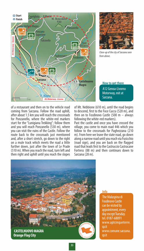
Close-up of the city of Sarzana seen from above.
A12 Genoa-Livorno Motorway, exit at Sarzana.
How to get there
CASTELNUOVO MAGRAOrange Flag City
Recommended season: all
0 1 2 KM
StartFinish
A12 Motorway - Livorno
A12 M
otor
way
- Gen
ova
�4
Length: 33 km Difficulty: E/F Altitude: max. 610 m slm
Recommended season: tutto l’annoTime necessary: XXXDirt road: XX
Dislivello: max. 780 m
15 In Montemarcello Park, a botanical garden without fences
forest, and then a “patchy” area which, in the spring, blooms with dwarf iris and white rock roses. Then there is a level stretch, with a few houses, after which the ascent begins again: to the right of the right, more maquis, with strawberry trees, heather, holm-oaks and Aleppo pines; on the opposite side there is an oak wood, populated mostly by downy oak. Leaving an unpaved road to your right, continue towards the top of the hill, crossing a thick woods with turkey oak and downy oak. When it is almost at the top, the trail levels out: it is about a half-hour walk to the Botanical Gardens, divided into various sections: Garigue, Maquis, Aleppo Pine, Deciduous Oak-wood. Each section
Cities: S. Stefano Magra, Sarzana, Lerici, Ameglia.
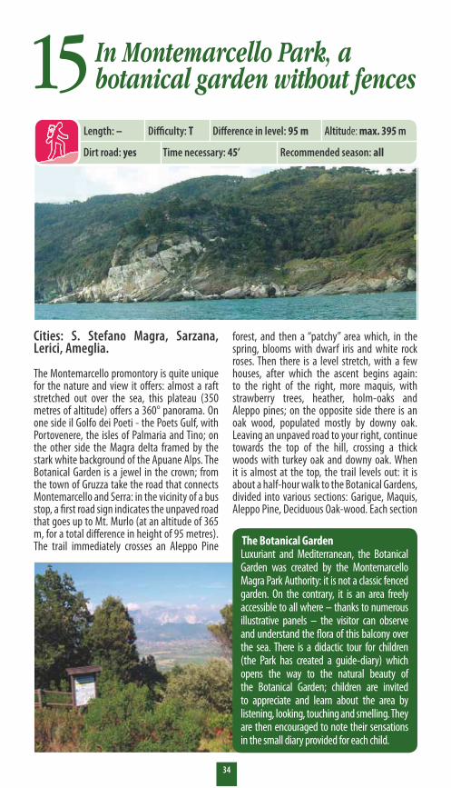
The Montemarcello promontory is quite unique for the nature and view it offers: almost a raft stretched out over the sea, this plateau (350 metres of altitude) offers a 360° panorama. On one side il Golfo dei Poeti - the Poets Gulf, with Portovenere, the isles of Palmaria and Tino; on the other side the Magra delta framed by the stark white background of the Apuane Alps. The Botanical Garden is a jewel in the crown; from the town of Gruzza take the road that connects Montemarcello and Serra: in the vicinity of a bus stop, a first road sign indicates the unpaved road that goes up to Mt. Murlo (at an altitude of 365 m, for a total difference in height of 95 metres). The trail immediately crosses an Aleppo Pine
Length: – Difficulty: T Difference in level: 95 m
Recommended season: allTime necessary: 45’Dirt road: yes
Altitude: max. 395 m
The Botanical GardenLuxuriant and Mediterranean, the Botanical Garden was created by the Montemarcello Magra Park Authority: it is not a classic fenced garden. On the contrary, it is an area freely accessible to all where – thanks to numerous illustrative panels – the visitor can observe and understand the flora of this balcony over the sea. There is a didactic tour for children (the Park has created a guide-diary) which opens the way to the natural beauty of the Botanical Garden; children are invited to appreciate and learn about the area by listening, looking, touching and smelling. They are then encouraged to note their sensations in the small diary provided for each child.

�5
www.aptcinqueterre.sp.it www.comune.santostefanodimagra.sp.it www.parcomagra.it www.comune.sarzana.orgwww.comune.lerici.sp.it www.comune.ameglia.sp.it
Info
Bottom, Lerici with the castle.On the facing page, the Montemarcello Park seen from the sea and, below, the entrance to the Botanical Garden.
The Botanical Garden may be reached in several ways: by car, exit at Sarzana (A12 Genoa-Livorno) and follow the directions for Romito Magra and Ameglia. Beyond Ameglia, continue for Montemarcello, then towards Lerici until you reach the town of La Gruzza. Alternatively, you can exit at Santo Stefano Magra, continuing towards Lerici, then on to Montemarcello. By train, get off at Sarzana (Genoa-Rome line) and then continue by bus, with the ATC interurban Spezia line (Sarzana-Ameglia-Montemarcello).
How to get there
Recommended season: tutto l’anno
Dislivello: max. 780 m
is described by a panel. Reading the panel, we learn that “Garigue” refers to “patchy” vegetation constituted by small bushes. This area is dominated by thyme, rue, helichrysum and pitch trefoil. The Maquis is evergreen: low maquis refers to a zone of shrubs, the high maquis is made up of small trees. The most widespread species in this area are lentisk, myrtle, alaternus, phillyrea, strawberry trees and holm-oak. The Aleppo Pine forest is sparse: the underbrush gets a lot of sun, favouring the development of maquis and garigue. The section dedicated to deciduous oak-woods, typical of cooler environments, are dominated by turkey oak and downy oak; the underbrush is populated by hawthorn, scorpion senna, ruscus, privit, primrose, hellebore. The traditional local plants are gathered in a small area: among these, binello fig, known and used since ancient times. A visit to the Botanical Garden takes about three quarters of an hour, on average, and there is no need for a guide. For a more detailed visit, guides can be contacted through the Montemarcello Magra Park Authority.
1
Montemarcello Boccadi Magra
AmegliaSerra
432
Sarzana
A12Lerici
LA SPEZIA
F. Magra
Isola della Palmaria
GOLFO DELLA SPEZIA
Recommended season: all
Altitude: max. 395 m
0 1 2 KM
StartFinish
A12 M
otor
way
- Liv
orno
A12 M
otor
way
- Gen
ova
A12 Autostrda - Parma
Santo Stefano Magra
Parco Naturale Regionaledi Montemarcello - Magra

For information:
Liguria Regional Tourism Promotion Agency
Palazzo Ducale – Piazza Matteotti, 916123 Genova
tel. +39 010 530821fax +39 010 5958507
[email protected] www.turismoinliguria.it
Publisher
Dogma S.r.l.Savonawww.dogma.it
Text and photographs
In collaboration withGuide Weekend del Secolo XIX
Printing
Erredi Grafiche - Genova
Printed in the month of March 2006
DISTRIBUTED FREE OF CHARGE