INVESTIGATING THE ADOPTION RATE OF GLOBAL POSITIONING SYSTEM TECHNOLOGY IN CADASTRAL SURVEYING IN...
69
THE POLYTECHNIC FACULTY OF THE BUILT ENVIRONMENT DEPARTMENT OF LAND MANAGEMENT INVESTIGATING THE ADOPTION RATE OF GLOBAL POSITIONING SYSTEM TECHNOLOGY IN CADASTRAL SURVEYING IN MALAWI SEAN-CLAIR JOB CHIHANA NOVEMBER 2012
-
Upload
sean-clair-chihana -
Category
Documents
-
view
71 -
download
0
Transcript of INVESTIGATING THE ADOPTION RATE OF GLOBAL POSITIONING SYSTEM TECHNOLOGY IN CADASTRAL SURVEYING IN...

THE POLYTECHNIC
FACULTY OF THE BUILT ENVIRONMENT
DEPARTMENT OF LAND MANAGEMENT
INVESTIGATING THE ADOPTION RATE OF GLOBAL POSITIONING
SYSTEM TECHNOLOGY IN CADASTRAL SURVEYING IN MALAWI
SEAN-CLAIR JOB CHIHANA
NOVEMBER 2012
ii
UNIVERSITY OF MALAWI
THE POLYTECHNIC
FACULTY OF THE BUILT ENVIRONMENT
DEPARTMENT OF LAND MANAGEMENT
INVESTIGATING THE ADOPTION RATE OF GLOBAL POSITIONING
SYSTEM TECHNOLOGY IN CADASTRAL SURVEYING IN MALAWI
By
SEAN-CLAIR JOB CHIHANA
A DISSERTATIONSUBMITTED TO THE DEPARTMENT OF LAND
MANAGEMENTINPARTIALFULFILLMENTOFTHEREQUIREMENTS FOR THE
AWARD OF BACHELOR OF SCIENCE DEGREE IN LAND SURVEYING
NOVEMBER 2012

iii
DECLARATION
I, Sean-clair Job Chihana, do hereby declare that this dissertation represents my own
work and that, to the best of my knowledge, it has not been previously submitted to this
or any other university for the award of a degree.
Signature : ___________________________
Date : ___________________________

iv
CERTIFICATE OF APPROVAL
This dissertation by Sean-clair Job Chihana has been approved as fulfilling part of the
requirements for the award of the degree of Bachelor of Science in Land Surveying by
the University of Malawi.
Supervisor’s name Signature Date
Dr E.J.W Chikhwenda : ____________________ ____________

v
DEDICATION
I dedicate this work to my late mother Ms MATHOPIA GRACE CHIHANA who
always wanted to see me excel in life and wanted so much to see me grow up and
become a responsible citizen. It is so heartrending that I have become all that without her
bearing witness. She inspired my life to this far. I therefore, celebrate my mother’s life
and promise myself to keep on working hard in everything I do.

vi
ACKNOWLEDGEMENTS
To My Guardians: Mr. and Mrs. Mumba, I thank you very much for
the general support I have enjoyed the entire time I have been with you since the
passing of my mother. I thank you mostly for giving me educational, spiritual and
moral support. I thank God for you.
To Other Family Members: Ms Martha Chihana, I thank you for everything
you supported me with during my elementary education. Uncle Moses Chihana, I
thank you for being there for help even in tough times you encouraged me to
stand strong. Uncle Hastings Honde, thank you for all the support you gave me
during this work.
To My Girlfriend: Thank you for your support towards this work. You inspired
and encouraged me so much. With your presence in my life, I had a very good
reason to work hard.
To My Lecturers: I am very grateful for professionally grooming me into what I
am today. Owing to you, I am now ready to face the corporate and professional
world.
To My Supervisors: I am thankful for the confidence and trust you had in me. I
appreciate the constructive criticism you gave me which pushed me in the right
direction of the project study.
To My Close Friends: Thank you for everything you did for me the whole time I
have been with you.
There are several people, who also contributed nevertheless partially, but it meant
loads and I am grateful for the support although you did not get specific mention.

vii
ABSTRACT
The use of Global Positioning System (GPS) in cadastral surveying has ignited much
interest over the past decades. To take advantage of the rapid expansion of the GPS
technology in both developed and developing countries, cadastral surveying firms and
government agencies are increasingly turning their attention to the delivery of services
through the GPS technology. GPS has made inroads in those applications requiring lower
precision surveys and is fast becoming a primary technology for acquiring data for input
into geographical and information system.
Unfortunately, cadastral surveyors in Malawi have a task of catching up to this
technology since Malawi is poor and undeveloped. The adoption rate of GPS technology
in cadastral surveying is not known. Therefore, to get on the same standard with our
colleagues worldwide, there is a need to find out how fast we are updating our
technology in cadastral surveying.
The research aimed at investigating the rate of adopting the use of Global Position
System technology in Malawi’s cadastral surveying industry.
The research was carried out through structured questionnaires. The questionnaire forms
were given to nine cadastral firms and were assessed using simple percentage
calculations and displayed on both tables and pie charts.
After the study, a rate of adopting the GPS technology in the cadastral surveying industry
was produced. The results showed a high rate of adopting the GPS technology at 71.43%
which as compared to the rate of both developed (78.0%) and developing (70.1%)
countries, is an indicator of progress in Malawi’s surveying industry.
Despite Malawi being poor, it can still facilitate access to the GPS technology which can
contribute towards its Economic Recovery Plan and Malawi Growth and Development
Strategy especially on poverty reduction and rural development.

viii
TABLE OF CONTENTS
DECLARATION ............................................................................................................................. iii
CERTIFICATE OF APPROVAL ............................................................................................... iv
DEDICATION .................................................................................................................................. v
ACKNOWLEDGEMENTS .......................................................................................................... vi
ABSTRACT..................................................................................................................................... vii
TABLE OF CONTENTS ............................................................................................................viii
LIST OF TABLES ........................................................................................................................... x
LIST OF FIGURES ........................................................................................................................ xi
LIST OF PLATES .......................................................................................................................... xii
LIST OF APPENDICES ............................................................................................................. xiii
ABBREVIATIONS AND ACRONYMS .............................................................................. xiv
1.0 INTRODUCTION ..................................................................................................................... 1
1.1 Background Information .................................................................................... 1
1.2 Problem Statement ............................................................................................... 3
1.3 Objectives of the Study ....................................................................................... 3
1.3.1 Overall Objective .............................................................................................. 3
1.3.2 Specific Objectives ........................................................................................... 4
1.4 Research Questions .............................................................................................. 4
1.5 Justification for the Study .................................................................................. 5
2.0 LITERATURE REVIEW ........................................................................................................ 6
2.1 CONVENTIONAL METHODS OF CADASTRAL SURVEYING IN MALAWI .......................................................................................................................................... 6
2.1.1 General Scope and Applications ................................................................... 6
2.1.2 Implication of Conventional Survey Methods .......................................... 7
2.2 CADASTRAL SURVEY SYSTEM OF MALAWI ................................... 8
2.2.1 Land Survey Act on Cadastral Surveying .................................................. 8
2.2.2. Land Registration System .......................................................................... 11
2.3 ADVENT OF GLOBAL POSITIONING SYSTEM .............................. 12
2.3.1 Land Surveying GPS .................................................................................... 12

ix
2.3.2. History of GPS Development .................................................................... 14
2.3.3. Navigation with the GPS ............................................................................ 14
2.3.3.1 The Space Segment .................................................................................... 15
2.3.3.2 The Control Segment ................................................................................ 18
2.3.3.3 The User Segment ...................................................................................... 22
2.4 GPS CAPABILITIES ...................................................................................... 25
2.5 FINDING LOCATION WITH GPS ............................................................ 25
2.6 GPS IN CADASTRAL SURVEYS ............................................................. 26
2.7. COMPARING CONVENTIONAL AND GPS SURVEYS ................ 27
2.8. GPS REQUIREMENTS AND LIMITATIONS ...................................... 28
2.8.1 The Dual Height Demon .............................................................................. 28
2.9 ADOPTING GPS AND OTHER TECHNIQUES IN CADASTRAL
SURVEYING............................................................................................................ 30
3.0 METHODOLOGY................................................................................................................. 33
3.1 Study Area........................................................................................................... 33
3.2 Sampling Technique ......................................................................................... 33
3.3 Data Collection Materials and Methods ...................................................... 34
3.4 Data Analysis ..................................................................................................... 34
3.5 Validation of method and data selected ....................................................... 36
4.0 RESULTS AND DISCUSSION ......................................................................................... 37
4.1 Response rate to questionnaires ..................................................................... 37
4.2 Questionnaire Analysis .................................................................................... 37
4.2.1 Sole GPS Users .............................................................................................. 37
4.2.2 GPS and Conventional methods Users..................................................... 38
4.2.3 Sole Conventional Methods Users ............................................................ 38
4.2.4 The Overall Rate of Conventional Methods ........................................... 39
4.2.5 The Overall Rate of Adopting the GPS in Cadastral Surveying ........ 39
4.3 Implication and Interpretation of the Results ............................................. 42
5.0 CONCLUSIONS AND RECOMMENDATIONS ........................................................ 44
5.1. Conclusions ....................................................................................................... 44
5.2. Recommendations...................................................................................... 45
5.3. Study Limitations ....................................................................................... 46
REFERENCES ............................................................................................................................... 47
APPENDICES ................................................................................................................................ 50

x
2xLIST OF TABLES
Table 1 Methods of Data Collection and Analysis .......................................................... 35
Table 2 Response rate ....................................................................................................... 37

xi
LIST OF FIGURES
Figure 1 Showing constellation of satellites in their orbits around earth ..................... 17
Figure 2 Showing GPS and other Mobile Technology adoption per 100 inhabitants
(2000-2010) ............................................................................................................ 32
Figure 3 Showing a Pie chart of the Rate of Adopting GPS .......................................... 41
Figure 4 Showing a Pie chart of the Overall Rate of Adopting GPS ............................. 42

xii
LIST OF PLATES
Plate 1 Showing constellation of satellites in their orbits around earth ........................ 18
Plate 2 Showing the Ground monitor station used from 1984 to 2007, on display at
the Air Force Space & Missile Museum .............................................................. 20
Plate 3 Showing Samples of GPS receivers ..................................................................... 23
Plate 4 Showing Samples of GPS receivers ..................................................................... 24

xiii
LIST OF APPENDICES
Questionnaire

xiv
ABBREVIATIONS AND ACRONYMS
2SOPS 2nd
Space Operations Squadron
AFSCN Air Force Satellite Control Network
AUSPOS Online GPS Processing Service provided by Geosciences Australia
COPAN Software for Computing and Managing Plane Land Surveying Coordinates
DGPS Differential GPS
DoD US Department of Defense
DOS Director of Overseas Surveys
EDM Electronic Distance Measuring tool
ESE East of South East
GIS Geographic Information System
GPS Global Positioning System
GPS III Next Generation GPS
GNSS Global Navigation Satellite System
L1C, L2C, L5: GPS Carrier Signals
LIS Land Information System
MGA Map Grid of Australia

xv
MCS Master Control Station
NGA National Geospatial-Intelligence Agency
NMEA National Marine Electronics Association
OCS Operation Control Segment
OCX Next Generation GPS Operations Control System
PC Personal Computer
PNT Positioning, Navigation and Timing
PPS Precise Positioning Services
RTCM SC-104 Standard Serial Data Format for DGPS corrections
RTK Real Time Kinematic
RS-22 Form of RTCM SC-104 format
SCIMS Survey Control Information Management System
SiRF Silicon Monolithic Integrated Circuits in RF Systems
SPS Standard Positioning Services
SS Space Segment
SURPAC Software for Computing Survey works
SV Satellite/Space Vehicle
USB Universal Serial Bus

xvi
WAAS Wide Area Augmentation System
1
1.0 INTRODUCTION
1.1 Background Information
Malawi as a developing nation has experienced problems in the development and implementation
of surveying and mapping. The first surveying and mapping was done by the British who were the
colonial masters of then Nyasaland now Malawi. The country has had predominantly fixed
boundary cadastral system. However the general boundary cadastral system is also accepted
especially where the adjudication of title has been effected. The surveying exercise was mainly for
cadastre purpose in the cities and urban centers of Blantyre, Zomba, Lilongwe and Mzuzu.
Grootscholten (2011) observes that in the early days cadastral surveys were carried out using
conventional methods of surveying: the chain and compass survey methods which were much
laborious. These surveys were conducted for mainly the white communities who needed to lease
pieces of land for different purposes but most of it was for agricultural purposes. Most of the maps
were produced by hand drawing methods and the surveyors had to go to very extreme measures to
keep from getting lost. They elected monumental landmarks, laboriously drafted detailed maps and
learned to read the stars in the night sky
The fast growing technology in the use of computers and the Global Positioning System (GPS) in
the surveying and mapping sector have made many countries to lag behind in terms of adopting the
new mapping technology. In Malawi, the advent of new technology in Surveying and Mapping has
affected the mapping industry in both positive and negative manner (Gomani, 2011). The different
fields of surveying and mapping are affected differently. For instance, science has been a dynamic
aspect in most of the arts today and cadastral surveying is one of them. The production of maps
and Deed Plans in Malawi has been heavily affected by the changing technology. As technology
evolves and expands throughout the world, the surveying and mapping community is steadily
redefining the tools required to increase productivity and obtain highly accurate data.

2
HEMCO (1995) observes that for many years the development of cadastral surveying and other
mapping sciences have been static. The main cadastral surveying tools were designed to last for
many years. For example, tools that included the Tripods, Theodolites, Surveying Compass, and
also other cadastral cartography instruments like the Set squares and much other drafting
equipment which were used in the production of maps. Gradually we experienced a drift from the
dominant traditional methods to the more dynamic computerized system of GPS, which is a total
shift from the traditional system to the new mapping methods. These changes have brought new
different approaches to the mapping system and cadastral survey system all together.
The GPS is a space-based satellite navigation system that provides users with positioning,
navigation, and timing (PNT) services in all weather, anywhere on or near the Earth, where there is
an unobstructed line of sight to four or more GPS satellites, anywhere in the world, 24 hours a day.
The GPS was developed and is run by the United States Department of Defense (DoD). It has been
fully operational for various purposes including cadastral surveying, for over eighteen years. There
are no subscription fee or setup charges to use GPS. It was declared an international resource in
1996 by United States of America President Clinton and since then, it has been widely used
(Grootscholten, 2011).
Barnes et al. (1994) observes that over the past ten years GPS has emerged as a major tool for
undertaking precise surveys. More recently, it has made inroads in those applications requiring
lower precision surveys and is fast becoming a primary technology for acquiring data for input into
geographical and land information systems (GIS/LIS).
Nevertheless, with the fast growing use of the GPS worldwide in the surveying and mapping
sector, Cadastral Surveyors in Malawi have a task of catching up to this technology. Additionally,
despite the fact that GPS technology can be used in many fields, and people keep finding new
applications, it is still dubious as to how many people in Malawi are using it or have adjusted to
this new positioning system when it comes to the surveying and mapping field. The adoption rate

3
of GPS techniques in cadastral surveying is not known. Therefore, in order to get on the same
accepted pace with our friends all over the world, there is a need to find out how we are updating
our technology
1.2 Problem Statement
The surveying and mapping profession in Malawi entirely consists of old but still practicing
surveyors who have been in the business for an equally long period. These surveyors are well
conversant with all the Conventional surveying methods developed ever since the establishment of
the cadastral surveying discipline. The UN Report (2006) says these cadastral surveyors, used
compass and chain, and later the transit and tape methods in establishing many of today’s
boundaries.
With the fast growing use of the GPS worldwide in the surveying and mapping sector, Cadastral
Surveyors in Malawi have a task of catching up to this technology. GPS was established in 1978
and has been used in surveying ever since. However, in Malawi, the adoption rate of the GPS
technology in cadastral surveying is hardly known. Therefore, in order to get on the same accepted
pace with our colleagues worldwide, there is a need to find out how we are updating our
technology in the cadastral surveying field. Thus the rate of adoption to this technology has to be
precisely known and understood.
1.3 Objectives of the Study
1.3.1 Overall Objective
The overall objective of the study is to investigate the rate of adopting the use of GPS technology
in Malawi’s cadastral surveying industry based on the current trends of cadastral survey standards
in the world.

4
1.3.2 Specific Objectives
The specific objectives of this study are as follows:
1 To determine the exact percentage number of change and transformation rate from the use
of conventional methods of cadastral surveys to the use of GPS in Malawi.
2 To find out the number of cadastral surveyors who are still using conventional survey
methods and those who are using the GPS techniques in their surveys, separately.
3 To find out the number of cadastral surveyors who are combining the conventional
survey methods with the GPS techniques in their surveys.
4 To determine those cadastral surveyors who have moved from using old methods of
cadastral surveying to using the GPS.
5 To investigate whether conventional methods of cadastral surveying are being totally
replaced or are being integrated with the GPS technology in surveying and mapping field.
1.4 Research Questions
1 What is the percentage rate of change of adopting GPS technology in Malawi’s cadastral
surveying industry?
2 What is the standard and level of the most common and currently used cadastral
surveying technology in Malawi?
3 Is the GPS technology, as the modern method of cadastral surveying, being used or
known at all to Malawi’s cadastral surveyors?
4 How is the knowledge of adoption rate of GPS technology in cadastral surveying going
to benefit Malawi?
5 What is the preferred equipment or technology used for cadastral surveying in Malawi?

5
1.5 Justification for the Study
Knowing the adoption rate of the state of the art technology specifically the GPS, Malawian
cadastral surveyors will be able to know how much change they will have to make in order to
collect data in the field and download it into the computer to come up with plans and even the data
to update maps using modern software like Surpac, COPAN or ArcView.
Throughout the world, government agencies, scientific organizations, and commercial operations
are using the surveys and maps deriving from GPS and GIS for timely decision-making and wiser
use of resources. Therefore, any organization or agency that requires accurate location information
can benefit from the efficiency and productivity provided by the positioning capability of GPS.

6
2.0 LITERATURE REVIEW
2.1 CONVENTIONAL METHODS OF CADASTRAL SURVEYING IN MALAWI
2.1.1 General Scope and Applications
A country Report was done for Malawi in 18th – 22nd
September 2006 on Problems and
Experience in surveying and Mapping by Action items for the seventeenth United Nation’s
Conference for Asia and the Pacific – Bangkok Thailand. Among the issues discussed was the
concern of conventional methods of cadastral surveying in Malawi and its struggle to adapt to the
ever-changing technology throughout the world. Some of these issues were as argued as in the
subsequent paragraphs.
In Malawi, cadastral surveying can be traced from the Europeans who colonized the country. The
first surveying and mapping was done by these colonial masters of then Nyasaland (Malawi). The
Surveying exercise was mainly for cadastre purpose in the cities and urban centers. Hence most of
the early surveys were for urban centers like Blantyre, Zomba, Lilongwe and Mzuzu. These
cadastre Surveys were carried out using the conventional chain and compass survey methods.
Trigonometric surveys were carried out to establish surveys controls as demand for demarcated
parcels increased. This led to the densification of controls in the 1st and 2nd order to allow for the
expansion of surveys to some of the district centers. In the early days, surveys were conducted for
mainly the white communities who needed to lease pieces of land for different purposes. Many
hectares of land were surveyed for agriculture purpose. These included mainly areas in tea growing
districts of Thyolo and Mulanje.
The report (UN. 2006), continues to explain that the mapping was limited to some selected areas.
Most of these maps were produced by hand drawing methods. It was until the early 1960s when
the British government through the Director of Overseas Surveys (DOS) started producing maps
7
using photogrammetric methods. This was a step forward in producing maps for the country.
Under this new method maps were produced in 1:50000, 1:250000 and 1:1m scale. Malawi was
then one of the first countries to have full coverage of mapping of the basic map series in this part
of Africa.
The fast growing technology in the use of computers in the surveying and mapping sector have
made many countries to lag behind in terms of adopting the new mapping technology. In Malawi
the advent of new technology in Mapping has affected the mapping industry in many ways. The
different fields of surveying and mapping are affected differently.
2.1.2 Implication of Conventional Survey Methods
Gomani (2011) found out that many cartographers could not accept the change from the old system
to the new system as a result they voluntary retired or lost their jobs. The change could not be
easily accepted in many organizations as a result there has been misunderstanding between the two
groups of people, those advocating the change and those against. Some management of change
procedures were put in place in order to a smooth transition.
According to Gomani (2011) the adoption of the new technology has rendered some of the
materials, which were used in map production obsolete. This has led to the scarcity of the materials
in turn making map production impossible. In this regard the cartographers have been forced to
learn the new technology. This in other cases has led to redundancy of staff that could not cope
with the new technology.
The adoption of new mapping technology means people have to be trained in the new skills in
cartography. This has not been very possible due the lack of training institutions in Malawi. On the
other hand efforts have been put in place to provide on the job training for those who are willing to
accept the change. Many technical colleges do not provide the surveying and mapping courses in
Malawi as a result there is a cute shortage of skilled personnel in mapping technology.

8
According to Barnes (2000), the most vital need in Malawi as of 2000 was for technician-level
surveyors and land administrators. It is imperative that the capacity to provide high level of
training be developed in-country, either through existing institutions (such as the NRC and the
Malawi Polytechnic), or through a public/private training centre that can offer specialized training
on the surveying discipline in general and the GPS technology. The District and National Land
Management Mapping Project (DNLMMP) as according to Barnes (2000), has the potential to
serve the latter role in the future.
Since 1992/93 no scholarship funding has been available for Malawians to pursue a surveying
degree overseas, says Barnes (2000). Within the country, limited educational opportunities in
surveying are available at the Natural Resources College (NRC) in Lilongwe and through the
University of Malawi, the Polytechnic. There is therefore not only a shortage of licensed
surveyors, but very limited capacity in-country for education and training in the field of surveying.
2.2 CADASTRAL SURVEY SYSTEM OF MALAWI
2.2.1 Land Survey Act on Cadastral Surveying
There is a well-defined system for cadastral surveying in Malawi that is described in Laws of
Malawi 2010 software, on the Land Survey Act of 1986 based on the Act of 1955 and the
accompanying Land Survey Rules. Cadastral surveying is the responsibility of licensed and
government surveyors. Under the Land Survey Act Cap 59.03, Part III, the laws deals with
Licensing, Registration and Duties of Surveyors as will be expounded herein.
Under the Qualifications of licensed surveyor it says that: No person shall be licensed as a
surveyor unless— he is immediately prior to the 1st day of January, 1975, a licensed surveyor duly
licensed under section 6 of this Act; or he has attained the age of twenty-one years; he furnishes

9
testimonials or other evidence of good character to the satisfaction of the Board; he produces
evidence that he has served at least two years as an assistant in practical field surveys to a
Government surveyor or licensed surveyor in, Malawi or in any other country approved for the
purposes of surveying. The laws continue to say that the person must either hold a degree in land
surveying from a university approved for the purposes of surveying or he possesses a commission
or a license entitling him lawfully to practice as a land surveyor in any country approved for the
purposes of surveying. The aforementioned are some of the many pre-qualifications for a licensed
surveyor in Malawi stipulated by the laws.
Notwithstanding subsection (1) the Board may, in its discretion, require any person who applies to
be licensed as a surveyor to satisfy the Board, either by carrying out to the satisfaction of the Board
a trial survey, or by such other evidence as the Board may think fit, that he is capable of
conducting surveys in accordance with this Act.
Under Section 6 of Licensing of surveyors, the Act stipulates that any person who is qualified to be
licensed as a surveyor under section 5 (1), and who, if required by the Board so to do under section
5 (2), has satisfied the Board that he is capable of conducting surveys under this Act, shall be
entitled, upon application to the Board, accompanied by the prescribed declaration and upon
payment of the prescribed fee, to receive a license as a surveyor in such form as may be prescribed.
In section 8 the Act deals with the issue of surveying instruments and measuring tapes accuracy. It
states that:-
(1) It shall be the duty of every surveyor to assure himself that all surveying instruments used
by him for the purpose of carrying out surveys are in a proper state of adjustment and that
all measuring tapes so used have been properly standardized.
(2) It shall be the duty of every surveyor, when called upon so to do by the Commissioner, to
produce to the Commissioner any such surveying instrument or measuring tape and the
Commissioner may apply such test to such surveying instrument or measuring tape as he
may think fit.

10
(3) If the Commissioner finds that any such surveying instrument or measuring tape is
defective or inaccurate, the Commissioner may order such surveyor to remedy such defect
or to rectify such inaccuracy and such surveyor shall not use such surveying instrument or
measuring tape until such defect is remedied or inaccuracy rectified.
(4) If the Commissioner is of the opinion that any such surveying instrument or measuring tape
is in such a condition as to render it impossible to remedy such defect or to rectify such
inaccuracy the Commissioner may condemn such surveying instrument or measuring tape
and thereafter such surveyor shall no longer use such surveying instrument or measuring
tape for the carrying out of any survey, or the Commissioner may by order in writing
specify the class of work upon which such surveying instrument or measuring tape may be
used.
As explained under the section 8 above, the Act is dwelling much on the measuring tape and such
kind of equipment belonging to the conventional methods of cadastral surveying. It is silent or it
does not consider the new technologies like the Global Positioning System.
On the duties of surveyor, the Act states that every surveyor shall carry out every survey
undertaken by him in accordance with the Act and in such a manner as will ensure the accuracy of
such survey and of any plan, survey data, or other record of such survey. The surveyor shall
deposit with the Commissioner for filing in the Commissioner’s office such plans, survey data
and records of survey as he may be required to do under this Act. He shall, when required by the
Commissioner, without delay— correct, in conformity with this Act, any inaccuracy or error in
any plan, survey data or other record where such error or inaccuracy exceeds the limit of error
prescribed under this Act to be allowed in the execution of surveys and the preparation of plans,
survey data and other records and adjust the position of any survey mark which has been fixed,
placed or set up in accordance with any incorrect survey.

11
As of 2000, there were 13 licensed surveyors in the country, 10 of whom were in private practice,
(Barnes, (2000). According to Barnes (2000), about half of the licensed surveyors were computer-
literate and only one firm was using GPS.
All records pertaining to cadastral surveys are maintained at the Surveyor-General’s Office (SGO)
in Blantyre. Typically licensed surveyors have to submit the following documentation for each
survey to the SGO:
Report
Original copy of field book
Working Plan showing graphically how the survey was done
Computations (including a full coordinate list)
The SGO examines all submitted surveys and approves them if they meet all requirements. As
Barnes (2000), states that although this process has been reduced from two years to 9-12 months,
this backlog is still unacceptable. The benefit and value of this examination must be analysed
against the cost and delays that are involved in this examination process. The Cadastral Drawing
Office in the SGO is responsible for maintaining an index map which reflects all surveys approved
by this office.
2.2.2. Land Registration System
According to Chikhwenda, (2012), Malawi adopted a fixed boundary system because it
did not have enough physical features that could be used in the general boundary system and the
system was adopted from the Roman Dutch system being practiced in most former British
colonies. The British also required surveys to be of high accuracy which could only be achieved in
the fixed boundary system.
12
The corners of each surveyed property are denoted by beacons to show its extent.
The problems of the system are that processes of this system are longer and it is expensive to be
afforded by a poor Malawian because setting up beacons is expensive due to the expertise and
materials used. In addition people easily tamper with beacons. The witness to the beacons is the
surveyor and his measurements. In 1994 the adjudication exercise was carried out using the general
boundary for title registration. This system proved cheaper and simple over the
fixed system. In addition there are so many witnesses to the extent of the property than in the
fixed system. In both methods their end result is title registration. The main purpose of the survey
is to have property whose extent is known.
2.3 ADVENT OF GLOBAL POSITIONING SYSTEM
2.3.1 Land Surveying GPS
The technique widely known as land surveying has been in use for centuries and is known as the
second oldest profession humanity has ever conceived. Because humans always had the need to
know exactly where they were located and accurately determine their position in the planet,
surveying was created back in ancient Egypt with the use of rope extensions and the applications
of uncompounded geometry. Since those times, many things have evolved making tools and other
accessories easier to use and to find accurate data, especially in the always important field of land
surveying.
According to a website http://www.landsurveyors.com/index.php (2012), by the 1990s, simple and
almost remote tools were still used in land surveying, like tape measurements, rulers and
Theodolites. These were uncomplicated items that helped scientists to find their three-dimensional
position in the planet. But the need for more sophisticated and less time consuming tools pushed
scientists and researchers around the globe to find better ways to locate themselves.

13
The first top of the line tools used in land surveying would contain prisms, also known as
reflectors, so they could find the measurements of the lights that would return and make it possible
for one to know the distancing of a determined spot. Nowadays the distancing measurements tools
are fully robotic, and the locations are completely satellite automated. The Global Positioning
System (GPS) is a more secure and fast way to measure a vast piece of land without having to
waste so much time to determine the area you're trying to ascertain.
The GPS tool works as a type of triangulation which does not involve any angles but is actually a
trilateration, which only means that it is a method to find the positioning of some objects using
simple geometry. This entire task is orchestrated by satellites. The GPS receiver will find the
coordinates and measurements of the distance desired using the radio signals' traveling time. To get
to a traveling time accurately, the system will use the time the signal took to reach the receiver
times the speed of light and by doing so it will have the exact distance to the satellite.
Holms (2005) say that this technology has changed immensely being used for a lot of different
purposes than its original. The uses of GPS helped land surveying turn into more than just a
profession for a few. GPS helps all types of people by giving them time and tools to help their
work to get delivered faster and more accurately.
Aside from discovering the exact location of things, the GPS is also used for navigation purposes,
mapping the Earth's areas and territories, tracking people and objects and to bring precisely timing
into our lives.
The use of land surveying and GPS by governments is widely known. It is called cadastral land
surveying and in many countries it is conducted mostly by government surveyors and this branch
of land surveying is usually needed for the re-establishing of territory and land lining.
14
2.3.2. History of GPS Development
The discovery of navigation seems to have occurred early in human history.
According to Tsui (2000), the compass was discovered and used in wars during foggy weather
before recorded history. There have been many different navigation techniques to support
ocean and air transportation.
Satellite-based navigation started in the early 1970s, explains Tsui (2000). Three satellite
systems were explored before the GPS programs: the U.S. Navy Navigation Satellite
System (also referred to as the Transit), the U.S. Navy’s Timation (TIMe navigATION), and U.S.
Air Force project 621B. The Transit project used a continuous wave (CW) signal. The closest
approach of the satellite can be found by measuring the maximum rate of Doppler shift.
The Timation program used an atomic clock that improves the prediction of satellite orbits and
reduces the ground control update rate. The Air Force 621B project used the pseudorandom noise
(PRN) signal to modulate the carrier frequency. The GPS program was approved in December
1973. The first satellite was launched in 1978. In August 1993, GPS had 24 satellites in orbit and
in December of the same year the initial operational capability was established. In February 1994,
the Federal Aviation Agency (FAA) declared GPS ready for aviation use.
2.3.3. Navigation with the GPS
Grootscholten et al. (2011), attempts further to discuss the advent of the GPS as an integral tool of
navigation in general, but with much emphasis to surveying and mapping profession. He says our
ancestors had to go to very extreme measures to keep from getting lost. They erected monumental
landmarks, laboriously drafted detailed maps and learned to read the stars in the night sky. Things
are much far easier today; a pocket-sized gadget can be bought and can tell exactly where an object
or person is, on earth at any moment. As long as there is a Global Positioning System receiver and
a clear view of the sky, it is hardly possible to get lost.

15
The Global Position System is a United States-owned utility that provides users with positioning,
navigation, and timing (PNT) services. According to Grootscholten et al. (2011), the GPS is made
up of a network of 24 satellites placed into orbit by the United States Department of Defense (U.S
DoD), giving positions in real time to around 5-20m accuracy. GPS was originally intended for
military applications, but in the 1980s, the United States government made the system available for
civilian use (including individual cadastral surveyors). It works in any weather conditions,
anywhere in the world, 24 hours a day. There are no subscription fee or setup charges to use GPS.
It was declared an international resource in 1996 by U.S President Clinton and since then, it has
been widely used.
The system consists of three segments: the space segment, the control segment, and the user
segment.
2.3.3.1 The Space Segment
Air Force Space Command News Service (2011) says that the United States Air Force develops,
maintains and operates the space and control segments. The space segment (SS) is composed of the
orbiting GPS satellites or Space Vehicles (SV) in GPS parlance. The GPS design originally called
for 24 SVs, eight each in three approximately circular orbits, but this was modified to six orbital
planes with four satellites each. The orbits are centered on the Earth, not rotating with the Earth,
but instead fixed with respect to the distant stars. The six orbit planes have approximately 55°
inclination (tilt relative to Earth's equator) and are separated by 60° right ascension of the
ascending node (angle along the equator from a reference point to the orbit's intersection). The
orbital period is one-half a sidereal day, specifically hours and 58 minutes. The orbits are arranged
so that at least six satellites are always within line of sight from almost everywhere on Earth's
surface. The result of this objective is that the four satellites are not evenly spaced (90 degrees)
apart within each orbit. In general terms, the angular difference between satellites in each orbit is
30, 105, 120, and 105 degrees apart which, of course, sum to 360 degrees.
16
Orbiting at an altitude of approximately 20,200 km; orbital radius of approximately 26,600 km,
each SV makes two complete orbits each sidereal day, repeating the same ground track each day.
This was very helpful during development because even with only four satellites, correct alignment
means all four are visible from one spot for a few hours each day. For military operations, the
ground track repeat can be used to ensure good coverage in combat zones.
The Air Force Space Command News Service (2011) says that as of November 2008, there were
31 actively broadcasting satellites in the GPS constellation, and two older, retired from active
service satellites kept in the constellation as orbital spares. The additional satellites improve the
precision of GPS receiver calculations by providing redundant measurements. With the increased
number of satellites, the constellation was changed to a non-uniform arrangement. Such an
arrangement was shown to improve reliability and availability of the system, relative to a uniform
system, when multiple satellites fail. About nine satellites are visible from any point on the ground
at any one time, ensuring considerable redundancy over the minimum four satellites needed for a
position. This is shown by Figure1 and Plate 1 below.

17
Figure 1 Showing constellation of satellites in their orbits
around earth
Source: http://en.wikipedia.org/wiki/ConstellationGPS

18
Plate 1 Showing constellation of satellites in their orbits
around earth
Source: Microsoft Student with Encarta Premium 2009
2.3.3.2 The Control Segment
According to the Air Force Space Command News Service (2011), the control segment consists of
worldwide monitor and control stations that maintain the satellites in their proper orbits through
occasional command maneuvers, and adjust the satellite clocks. It tracks the GPS satellites,
uploads updated navigational data, and maintains health and status of the satellite constellation.
Specifically, the control segment is composed of
1. a master control station (MCS),
2. an alternate master control station,
3. four dedicated ground antennas and

19
4. six dedicated monitor stations
The MCS can also access U.S. Air Force Satellite Control Network (AFSCN) ground antennas for
additional command and control capability and National Geospatial-Intelligence Agency (NGA)
monitor stations. The flight paths of the satellites are tracked by dedicated U.S. Air Force
monitoring stations in Hawaii, Kwajalein, Ascension Island, Diego Garcia, Colorado Springs,
Colorado and Cape Canaveral, along with shared NGA monitor stations operated in England,
Argentina, Ecuador, Bahrain, Australia and Washington DC. The tracking information is sent to
the Air Force Space Command's MCS at Schriever Air Force Base 25 km ESE of Colorado
Springs, which is operated by the 2nd Space Operations Squadron (2 SOPS) of the U.S. Air Force.
Then 2 SOPS contacts each GPS satellite regularly with a navigational update using dedicated or
shared (AFSCN) ground antennas. These updates synchronize the atomic clocks on board the
satellites to within a few nanoseconds of each other, and adjust the ephemeris of each satellite's
internal orbital model. The updates are created by a Kalman filter that uses inputs from the ground
monitoring stations, space weather information, and various other inputs.

20
Plate 2 Showing the Ground monitor station used from 1984 to 2007, on
display at the Air Force Space & Missile Museum
Source: United States AFSCN
According to Johnny (2011), Satellite maneuvers are not precise by GPS standards. So to change
the orbit of a satellite, the satellite must be marked unhealthy, so receivers will not use it in their
calculation. Then the maneuver can be carried out, and the resulting orbit tracked from the ground.
Then the new ephemeris is uploaded and the satellite marked healthy again.
According to John (2009), the Operation Control Segment (OCS) currently serves as the control
segment of record. It provides the operational capability that supports global GPS users and keeps
the GPS system operational and performing within specification.OCS successfully replaced the
legacy 1970’s-era mainframe computer at Schriever Air Force Base in September 2007. After
installation, the system helped enable upgrades and provide a foundation for a new security
architecture that supported the U.S. armed forces. OCS will continue to be the ground control
system of record until the new segment,
21
Next Generation GPS Operation Control System (OCX) is fully developed and functional. The
new capabilities provided by OCX will be the cornerstone for revolutionizing GPS’s mission
capabilities, and enabling Air Force Space Command to greatly enhance GPS operational services
to U.S. combat forces, civil partners and myriad of domestic and international users. The GPS
OCX program also will reduce cost, schedule and technical risk. It is designed to provide
50%sustenance cost savings through efficient software architecture and Performance-Based
Logistics. In addition, GPS OCX expected to cost millions less than the cost to upgrade OCS while
providing four times the capability.
John (2009) continues to elucidate that the GPS OCX program represents a critical part of GPS
modernization and provides significant information assurance improvements over the current GPS
OCS program.
OCX will have the ability to control and manage GPS legacy satellites as well as the next
generation of GPS III satellites, while enabling the full array of military signals.
Built on a flexible architecture that can rapidly adapt to the changing needs of today’s and
future GPS users allowing immediate access to GPS data and constellations status through
secure, accurate and reliable information.
Empowers the war-fighter with more secure, actionable and predictive information to
enhance situational awareness.
Enables new modernized signals (L1C, L2C, and L5) and has M-code capability, which the
legacy system is unable to do.
Provides significant information assurance improvements over the current program
including detecting and preventing cyber attacks, while isolating, containing and operating
during such attacks.
Supports higher volume near real-time command and control capability.
On September 14, 2011, the U.S. Air Force announced the completion of GPS OCX Preliminary
Design Review and confirmed that the OCX program is ready for the next phase of development.
22
The GPS OCX program has achieved major milestones and is on track to support the GPS IIIA
launch in May 2014
2.3.3.3 The User Segment
The user segment is composed of hundreds of thousands of U.S. and allied military users of the
secure GPS Precise Positioning Service (PPS), and tens of millions of civil, commercial and
scientific users of the Standard Positioning Service (SPS). According to a website
http://en.wikipedia.org/wiki/GPS, it is said that in general, GPS receivers are composed of an
antenna, tuned to the frequencies transmitted by the satellites, receiver-processors, and a highly
stable clock (often a crystal oscillator). They may also include a display for providing location and
speed information to the user. A receiver is often described by its number of channels: this
signifies how many satellites it can monitor simultaneously. Originally limited to four or five, this
has progressively increased over the years so that, as of 2007, receivers typically have between 12
and 20 channels.
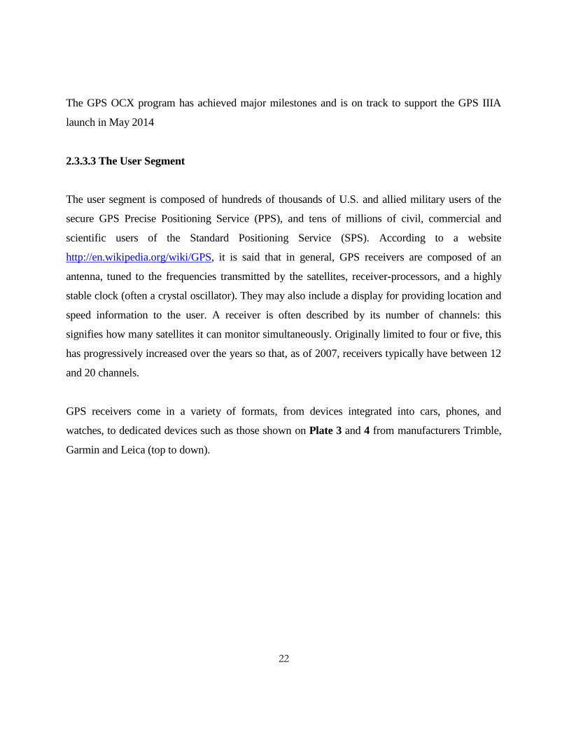
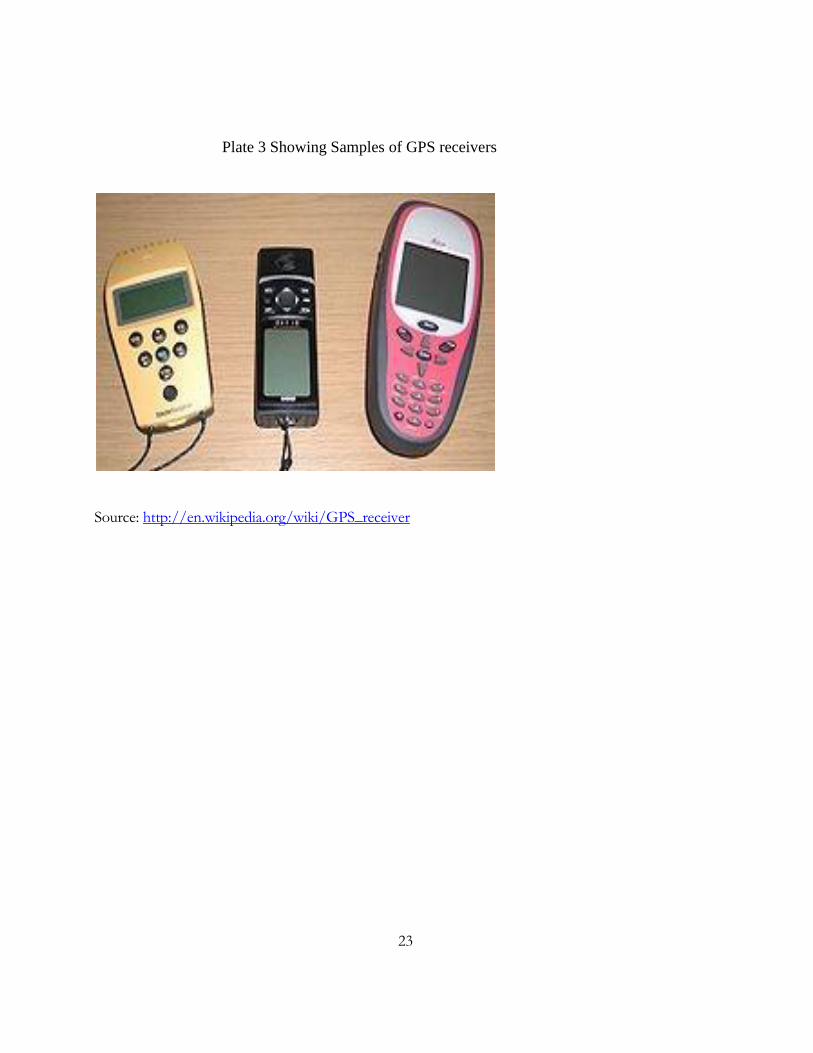
GPS receivers come in a variety of formats, from devices integrated into cars, phones, and
watches, to dedicated devices such as those shown on Plate 3 and 4 from manufacturers Trimble,
Garmin and Leica (top to down).
23
Plate 3 Showing Samples of GPS receivers
Source: http://en.wikipedia.org/wiki/GPS_receiver

24
Plate 4 Showing Samples of GPS receivers
Source: http://en.wikipedia.org/wiki/GPS_receiver
The Inside GNSS - January/February (2011) issue, explains further on GPS receivers saying that
the receivers may include an input for differential corrections, using the standard serial data format
called RTCM SC-104format. This is typically in the form of an RS-232 port at 4,800 bit/s speed.
Data is actually sent at a much lower rate, which limits the accuracy of the signal sent using
RTCM. Receivers with internal DGPS receivers can outperform those using external RTCM data.
According to http://en.wikipedia.org/wiki/GPS_receiver (2012), as of 2006, even low-cost units
commonly include Wide Area Augmentation System (WAAS) receivers. Many GPS receivers can
relay position data to a PC or other device using the National Marine Electronics Association
(NMEA) 0183 protocol. Although this protocol is officially defined by the NMEA, references to
this protocol have been compiled from public records, allowing open source tools like DGPS to
read the protocol without violating intellectual property laws. Other proprietary protocols exist as

25
well, such as the SiRF and MTK protocols. Receivers can interface with other devices using
methods including a serial connection, USB, or Bluetooth.
2.4 GPS CAPABILITIES
According to Kruczynski (2008), GPS is available in two basic forms: the standard positioning
service (SPS), or civilian signal, and the precise positioning service (PPS), or military signal. Prior
to 2000 the U.S. military intentionally corrupted or degraded the SPS signal for national security
purposes by using a process known as Selective Availability. As a result, the SPS signal was much
less accurate than PPS. In May 2000 President Bill Clinton announced that the military would stop
Selective Availability. This increased the accuracy and reliability of SPS by a factor of ten. Today,
the military and civilian GPS signals are believed to be of the same accuracy. For national security
reasons the Defense Department retained the ability to jam the SPS signal on a regional basis if
necessary. Both the SPS and the PPS signals provide a horizontal position that is accurate to about
10 m.
2.5 FINDING LOCATION WITH GPS
GPS satellites orbit high above the surface of Earth at precise locations. They allow a user with a
GPS receiver to determine latitude, longitude, and altitude. The receiver measures the time it takes
for signals sent from the different satellites (A, B, and C) to reach the receiver. From this data, the
receiver triangulates an exact position. Kruczynski (2008) says that at any given time there are
multiple satellites within the range of any location on Earth. Three satellites are needed to
determine latitude and longitude, while a fourth satellite (D) is necessary to determine altitude.
Kruczynski (2008) observes that several techniques have been developed to enhance the
performance of GPS. One technique, known as differential GPS (DGPS), employs two fixed
stations on Earth as well as satellites. DGPS provides a horizontal position accurate to about 3 m.
26
Another technique, known as WAAS, or Wide Area Augmentation System, was developed by the
Federal Aviation Administration (FAA) to improve the safety of aircraft navigation. WAAS
monitoring stations around the United States catch GPS signals, correct errors, and send out more-
accurate signals. A technique involving the use of carrier frequency processing, known as survey
grade GPS, was pioneered by surveyors to compute positions to within about 1 cm. SPS, DGPS,
WAAS, and carrier techniques are accessible to all users.
2.6 GPS IN CADASTRAL SURVEYS
Roberts (2005) conducted a research on GPS for Cadastral Surveying – Practical Considerations
which looked upon issues of how the GPS technology, in particular real-time kinematic (RTK)
GPS, has matured to the stage where it has become another tool for the professional surveyor. He
found out that among other factors, Commercial products of GPS offer user-friendly
hardware/software and suggest techniques that can improve productivity at a high accuracy.
Government services such as Survey Control Information Management System (SCIMS} in New
South Wales and AUSPOS (Geosciences Australia) support improved GPS positioning and
surveying for the user community.
He attempted to give an overview of the pertinent GPS theory to support the practical
considerations presented when using GPS for cadastral surveying. GPS surveying always uses high
precision carrier phase measurements. The GPS surveyor may choose to use techniques ranging
from post processed single frequency measurements up to high productivity dual frequency RTK
procedures.
GPS is just another measurement tool and that GPS techniques will rarely be used in isolation on a
cadastral survey. There will almost always be the need to connect to a mark or feature under a tree
using a total station and hence there will always be a hybridization of techniques. Many cadastral
surveyors are increasingly using GPS techniques to strengthen traverse closures, locate marks in

27
the field, eliminate unnecessary setups in difficult terrain and connect to existing Map Grid of
Australia (MGA) control over distances considered unfeasible using traversing techniques.
2.7. COMPARING CONVENTIONAL AND GPS SURVEYS
Magellan (1999) says that the GPS measurement is a three-dimensional vector from mark to mark.
It contains distance, direction and difference in height between survey points. Generally the
software will report the vector as the difference in the earth-centered earth-fixed X, Y, Z
coordinates of the survey points. A GPS vector can also be defined using a local E, N, U system or
a geodetic Distance, Azimuth, Height format. The receiver makes its measurements between its
antenna’s electrical phase centers, and the surveyors use the measured antenna heights to correct
the measurement down to the survey marks. The latter statement confirms that the antenna height
is a very important part of the measurement. In conventional surveying measurements are often
separated into horizontal (angle and distance) and vertical (elevation) parts. However, a GPS
measurement is fully three-dimensional and parts cannot be separated.
The vertical component affects the horizontal and vice versa, which is why it s critical to use fixed-
height antenna poles for performing all GPS work. Conventional tripods are fine for static work,
but the operator must be extremely careful to measure and record the antenna height correctly at
each setup. A fixed-height pole needs to be checked only periodically for wear and tear, or if there
is a change in the antenna being used. Using a fixed-height antenna pole will help to eliminate the
possibility of antenna height errors in our measurements.
According to Magellan (1999), conventional survey measurements involve a relative angle and a
distance. It is this relative direction, or direction on a backsight that causes the conventional survey
vectors to be strung together between the beginning and ending points as a traverse. Closure errors
in a conventional survey traverse are typically removed by equally distributing the angular closure
error and then prorating the remaining errors based on the lengths of the traverse legs. This method
assumes that the errors occur systemically and evenly throughout the traverse, which in reality is
28
seldom the case. However, without any information other than the closure error, nothing else can
be assumed. If a series of independent traverses are tried to be adjusted using the compass rule, it is
seen that the closure errors start to increase significantly after as few as two traverses. This occurs
because the errors have been prorated instead of being dealt with where they actually occurred.
On the other hand, Magellan (1999) explains that GPS vectors are independent of any backsight
requirements and can be put together in a format wanted. Ideally, GPS vectors should be put
together in strong interlocking networks that will allow making multiple measurements to each
point. These multiple measurements will allow identifying and dealing with any vectors that
contain a significant error (blunder). If there are no significant errors, the residual errors (random
errors) will be adjusted using the Least-squares method which will provide the most accurate
adjusted positions possible.
2.8. GPS REQUIREMENTS AND LIMITATIONS
According to Roberts (2005), even though some professional surveyors have embraced GPS
survey methods into their businesses, mainly for a range of engineering and topographic detail
tasks like the cadastral surveyors, many practitioners are still reluctant to invest in the technology.
This has been due to a number of reasons such as prohibitive cost, a lapsed understanding of
geodesy, confusion about GPS surveying capabilities and best practice techniques, uncertainty over
how to best utilize existing GPS services and infrastructure, lack of time/resources to invest into
GPS surveying training, and for the cadastral surveyor uncertainty over what is acceptable practice
to satisfy current survey regulations in their particular state or territory. This last point is of
particular importance because if a professional surveyor can justify using RTK-GPS for
engineering, detail and cadastral surveying then suddenly RTK-GPS does indeed become “just
another tool” like the ubiquitous total station.
2.8.1 The Dual Height Demon

29
Traditionally the major stumbling block in using GPS for cadastral surveying has been its
shortcomings in establishing elevation. According to Magellan (1999), the basic problem is that it
is impossible to directly measure elevation difference with GPS. With GPS, we can directly
measure ellipsoidal height differences only. To directly measure elevation differences, we need to
use a surveyor’s level. Therefore, it is possible to pace very good GPS- derived elevations on our
survey points with the help of a good geode model. This dual height system has been one of the
hardest concepts for new users to grasp.
Elevation is defined as the height of a point above a gravity surface. Magellan (1999) explains that
historically they have used the concept of mean sea level to describe the zero point, or datum, for
elevation. Today in the United States they are using a surface defined by gravity values because of
difficult in describing a mean sea level from coast to coat. This gravity surface is irregular because
it varies depending on the strength of pull of gravity in an area. The surface of a potato is a good
model for a world-wide gravity surface. Under the influence of the pull of gravity, water seeks its
lowest level (sea level). Specifically water flows downhill from a lower to a higher gravity as it
seeks this level. The only way to accurately measure the difference in height above this undulating
gravity surface is to use a spirit level and differential leveling.
Magellan (1999) defines ellipsoid height as the height of a point above a reference ellipsoid. GPS
positions are referenced to the WGS 84 ellipsoids. The center of this reference ellipsoid coincides
with the center of the mass of the earth, which is also the origin point of the earth-centered earth-
fixed X, Y, Z Cartesian coordinate system. Ellipsoid height of a point can be easily determined by
determining its distance from the center of the earth and subtracting the radius of the ellipsoid from
it. Using GPS, the ellipsoid height differences between points can be very accurately determined,
but because of the absolute positioning errors inherent in the system, there is a need to reference
the differences to points of known ellipsoidal height, just as a spirit level has to be referenced to
some benchmark.

30
The fundamental problem is that these two height systems are completely separate. Magellan
(1999) and Chikhwenda (2012), agrees that we cannot directly measure heights in one system with
the tools of the other system. We can however model the undulations of the geode surface and
extrapolate the separation between this surface and the surface of the WGS 84 ellipsoid. These
differences can then be used to derive elevations from our ellipsoid heights. Currently, for instance,
in the United States they have a very good model of the undulating surface of the geode which is
referenced to WGS 84 ellipsoid surface within about a decimeter of absolutes accuracy. If they use
this model and tie their GPS measurements to points of known elevation, they can provide very
good GPS-derived relative elevations for their new survey points in many areas of the country.
There are places where the model is not sufficiently accurate to measure elevations with survey
precision, but in many places it is quite possible to achieve relative elevation measurements with
centimeter accuracy.
One of our tasks as surveyors is to find good benchmarks, to which we can reference our model,
and to find and use a sufficient number of them to accurately align the two surfaces. If we have
only one benchmark, or if our benchmarks are distributed in a line, we will not be able to properly
align the geode with the ellipsoid, and we could have unacceptable errors in our GPS-derived
elevations. These errors will increase as we get farther away from our controlling elevations. We
should have a base minimum of three well spaced control benchmarks if we want to use GPS to
derive elevations, although the recommended minimum number is four. Having four benchmarks
allows some redundancy and provides some indication of the accuracy of the control benchmarks.
2.9 ADOPTING GPS AND OTHER TECHNIQUES IN CADASTRAL SURVEYING
Seventeenth United Nations (UN) Regional Cartographic Conference for Asia and the Pacific
Bangkok, 18 -22 September 2006 Item 6 (b) of the provisional agenda looked at several
technology issues of cadastral surveying that are affected as the techniques in the technology itself
changes in the cadastral system in Malawi. One of the issues discussed was of the GPS technology
in cadastral surveying.

31
The UN (2006) report continues to clarify that the cadastral surveying sector has not been able to
match with time technologically. The field teams are using old equipment like Theodolites. There
is advanced equipment like totals station, Electronic Distance Measuring instruments (EDMs) and
even more highly developed RTK-GPS which could be used in data capture and analysis. However
the lack of resources and skilled personnel to use the modern equipment has affected the adoption
of these new technologies.
Modern education and training programs in surveying are striving to strike a balance between the
measurement science component and the broader aspects associated with land administration and
information management (Barnes et al 1994). Barnes et al (1994) suggest that the diversity of land
tenure system to be regularized and the pressure of finding more suitable cadastral systems will
change the role of the land surveyor to a more diversified land management position. The
University of KwaZulu-Natal has responded to this demand, offering a Masters in Land
Management within the Surveying program and a Master of Environment and Development in
Land Information Management. Both programs are dominated by participants with professional
survey degrees and survey Bachelor of Technology degrees. This positive situation will facilitate
the smooth technological migration or integration of GPS-based methods.
Furthermore, like most technologies, as time goes by GPS equipment is becoming cheaper.
However, newer models offer higher accuracy and more functionality and so prices stay in the
same range. A handheld unit of < 1m accuracy is currently costing about MK 630, 000.
The rapid adoption of RTK systems of GPS and other high accuracy technologies in surveying and
other applications from the year 2000 through 2010 has increased at a rate that surprised many
industry experts. The plate below shows the rate of adopting the GPS technology and other
Information Communication Technology worldwide.

32
Figure 2 Showing GPS and other Mobile Technology
adoption per 100 inhabitants (2000-2010)

33
3.0 METHODOLOGY
This chapter looks at how the study was carried out to achieve its objectives. It
details methods of data collection on cadastral survey firms using the GPS or/and Conventional
methods when conducting their cadastral survey works. Field work was carried out from
mid July2012 to end October 2012 both in Lilongwe and to obtain the necessary information
for the research.
3.1 Study Area
The project was carried out in the two main cities and regions of Malawi, which are Lilongwe
(Central Region) and Blantyre (Southern Region). These are the capital and commercial cities of
Malawi respectively. These cities virtually cover all cadastral surveyors in Malawi and many
surveys are carried out in these cities than any other city in Malawi. The capital city has both the
Surveyor General’s office at the headquarters and Regional Surveyor’s office while Blantyre has
the Regional Surveyor offices only.
3.2 Sampling Technique
The research is looking at the rate of adopting the use of the GPS technology in the cadastral
survey industry of Malawi, therefore the survey was a qualitative survey.
All the registered cadastral survey firms in the study areas were covered as the research population.
Blantyre has a total number of seven known cadastral survey firms. These are: Land Management
Consultants, Marathon Surveyors; LACOSUS; Surveys Department; Lamport-Stokes; Theka
Surveys, and Alinafe Surveys. Lilongwe has the Surveys Department and Malawi Surveys.

34
3.3 Data Collection Materials and Methods
Questionnaires were designed and disseminated to firms of cadastral surveyors and survey
department offices in all the selected regions. These questionnaires were used to source qualitative
data from the cadastral survey firms on the use of GPS and Conventional methods when
conducting their cadastral survey works. However, the focus of the data collected was on whether
these firms use the GPS in their survey works or are still using the conventional techniques.
3.4 Data Analysis
The collected data were analyzed in the way that the total number of cadastral surveyors using the
GPS were divided by the total number of the cadastral surveyors used in the study and were
multiplied by 100%. The result was the percentage number of cadastral surveyors who have
adopted the GPS. Conversely, percentage numbers of those cadastral surveyors who are still using
the conventional methods of cadastral surveying were determined by dividing the total number of
the cadastral surveyors used in the study into the total number of the cadastral surveyors who are
still using conventional methods of cadastral surveying. Then a 100% was multiplied to the results.
The results for those combining the methods were obtained in the same way as the other two.
When all the percentage calculations were done, they were also represented on charts.

35
Table 1 Methods of Data Collection and Analysis
Item
Description
Objective 1
Kind of equipment being
used for cadastral
surveying
Objective 2
Adopting the GPS in
cadastral surveying
Objective 3
Knowing the rate of
adopting the GPS
1
Data needed
Number of cadastral
surveyors using the GPS
technology
Number of cadastral
surveyors using the GPS
technology
Number of cadastral
surveyors using the
GPS technology
2
Data Location
Registered cadastral
surveying firms in
Lilongwe and Blantyre
Registered cadastral
surveying firms in
Lilongwe and Blantyre
Registered cadastral
surveying firms in
Lilongwe and
Blantyre
3
Collection of data
Questionnaires
Questionnaires
Questionnaires
4
Treatment of data
Using simple percentage
calculations and charts
Using simple percentage
calculations and charts
Using simple
percentage
calculations and
charts
5
Interpretation of data
Conclusion basing on data
collected and the
Questionnaire
Conclusion basing on
data collected and the
Questionnaire
Conclusion basing
on data collected
and the
Questionnaire

36
3.5 Validation of method and data selected
The research is about acquiring information from registered cadastral surveying firms concerning
their survey equipment use and the GPS technology as well as their awareness and experience with
the technology that they use in their line of duty. Phiri (2009) affirms that Leedy and Ormrod
(2005: 183) wrote that the researcher poses a series of questions to willing participants,
summarizes the participants’ responses with percentages, frequency counts or more sophisticated
indexes and draws inferences about a particular population from the responses of the sample.
Descriptive research solves the research problems through the interpretation of the data that have
been gathered, concludes Phiri (2009).

37
4.0 RESULTS AND DISCUSSION
4.1 Response rate to questionnaires
Nine Questionnaires were sent to the nine cadastral firms concerned with the study. The table
below shows that out of the nine (9) questionnaires sent, seven (7) questionnaires were responded
to, representing seventy-seven point eight (77.8 %) percent response rate.
Table 2 Response rate
Item
Description
Quantity
Percentage (%)
1 Number of respondents 7 77.8
2 Number of Non-Respondents 2 22.2
Total Questionnaires Sent
9
100
As shown by the table, there was a response rate of 77.8 percent to the questionnaires sent to the
cadastral surveying firms. This therefore, as according to Phiri (2009) who affirms Babie (1989)
and Boussabaine (1999): and Idrus and Newman (2002), is above the 50 percent recommended
response rate to questionnaires in a research.
4.2 Questionnaire Analysis
Since only seven (7) out of nine (9) cadastral survey firms responded to the questionnaires, the
following analysis was done out of the seven questionnaires.
4.2.1 Sole GPS Users
Out of the seven (7) cadastral firms, four (4) firms were found using only the GPS technology
when carrying out their survey works.

38
Therefore:
=
= 57.14%
57.14 % is taken as the percentage rate representing the adoption of GPS technology by these
cadastral firms in Malawi.
4.2.2 GPS and Conventional methods Users
Out of the seven (7) cadastral firms, only one (1) firm was found combining both the GPS and
some Conventional methods when conducting its cadastral surveys.
Thus:
=
% = 14.29 %
Hence, 14.29 % represents the percentage rate of adopting the combination of both the GPS and
Conventional methods of Cadastral surveying by this firm.
4.2.3 Sole Conventional Methods Users
Two (2) Cadastral surveying firms out of the seven (7) were found still using only the
Conventional methods of Cadastral surveying.
Therefore:

39
=
= 28.57 %
The 28.57 % represents the rate of those firms who have not adopted the GPS technology rather
still interested in the Conventional methods of Cadastral surveying.
4.2.4 The Overall Rate of Conventional Methods
The overall rate of using conventional methods of cadastral surveying was found by combining
percentage rates of those firms using both the GPS and conventional techniques and those firms
using only conventional methods of cadastral surveying.
Therefore: 28.57% + 14.29% = 42.86%
As a result, the percentage rate of those cadastral surveying firms that are still using conventional
methods is at 42.86%.
4.2.5 The Overall Rate of Adopting the GPS in Cadastral Surveying
With the results as given above, the overall rate of adopting the Global Positioning System in
Malawi was found by combining the rates of those firms using the GPS only and those that
combine the methods when conducting cadastral surveying.
Thus: 57.14 % + 14. 29 % = 71.43 %
Therefore, 71.43 % is the overall rate of adopting the use of GPS in the Cadastral surveying
industry in Malawi.
Using tables and pie charts illustrations:

40
Group of Cadastral
Surveying Firms
Adoption
Percentage (%)
1
Adopting GPS
57.14
2 Adopting GPS plus Conventional
Methods
14.29
3 Not Adopting GPS 28.57
Total Percentage of Adopting GPS 71.43
Total Percentage of Conventional Method use 42.86

41
Figure 3 Showing a Pie chart of the Rate of Adopting
GPS
57%
14%
29%
Rate of Adopting GPS
GPS GPS & Conventional Conventional

42
Figure 4 Showing a Pie chart of the Overall Rate of
Adopting GPS
4.3 Implication and Interpretation of the Results
As it has been reviewed in the literature, the rate of adopting the GPS technology in surveying by
the entire world is at 78.0%, for developed countries is at 114.2%, and for developing countries
like Malawi is at 70.1%. Therefore, based on the findings by this study (71.43%) and as compared
to the findings of ITU World Telecommunication and as suggested by Barnes et al (1994), the rate
of adopting the GPS technology is high.
62%
38%
Overall Rate of Adopting GPS
Estimated Total Percentage of Adopting GPS
Estimated Total Percentage of Conventional Method use

43
The study found that the adoption of GPS techniques in cadastral surveying, which encompasses a
suite of high-level technologies like the RTK systems and the DGPS, can improve the efficiency of
cadastral surveying works.
However, in the course of carrying out this study, it was found that individual cadastral surveyors
have a preference to the old methods of surveying as compared to the GPS. Most surveyors are old
and said the GPS technology was complex to understand and operate, despite all its advantages.
Additionally, the fact that the GPS technology is expensive, no individual Malawian surveyor can
afford to purchase it. Thus only cadastral firms own the GPS in Malawi. This is a huge setback on
the nation positioned to move forward with technology.

44
5.0 CONCLUSIONS AND RECOMMENDATIONS
5.1. Conclusions
From the study it can be concluded that the adoption rate of the GPS technology in cadastral
surveying industry in Malawi is high. Currently, most cadastral surveying firms are found using
the GPS technology despite it being very expensive and complicated to understand to most of the
surveyors. Some of these surveying firms combine the old/conventional methods and the GPS
techniques, while some are still using and preferring the conventional techniques of cadastral
surveying. However, most of these cadastral surveyors borrow the available few GPS equipment
from a small number of wealthy cadastral surveying firms. Thus, the GPS equipment is owned by
few cadastral surveying firms and throughout this study, there were only four GPS equipment
known to be readily available for use in the whole Malawi.
Conversely, scholarship money for overseas study in the surveying discipline has dried up in recent
years and institutions like the NRC and the Polytechnic in the University of Malawi have not been
able to fill this gap. The lack of educational facilities in the field of surveying is becoming
apparent in the entire Southern African region. There is perhaps only one or two vibrant
university programs in the region, as according to Barnes (2000), both are in South Africa.
Resources are needed to expand the ranks of professionals in land administration through study at
programs available in the region.
Since the rapid rate at which technology advancement is occurring has outpaced the ability of
many individuals and organizations to react quickly and properly adjust the determined rate of
adoption to the GPS technology will aid Malawian cadastral surveyors to assess how far the
adjustment or change they will have to make. They will be able to collect data in the field and
download it into the computer to come up with plans and even update maps using modern software
like Surpac, COPAN or ArcView. Generally, many GPS units have enough memory capacity to

45
store maps so that users can pinpoint their map location and use it to plot routes to their next
destination.
Based on this research’s findings, the adoption rate of GPS technology in cadastral surveys is high
and accepted therefore, there should be fast and accurate information processed within a very short
period of time. Checking of information should be done within the system before the results are
produced.
The project has also established a platform that will be used for further research on the
improvement and updating of the upcoming technologies in Malawi’s cadastral surveying industry.
5.2. Recommendations
GPS and land surveying is everywhere we look at in our lives, and those who work exhaustively
for the evolution of such tools and what they can do for us do not show signs of slowing down.
Thanks to this art of land surveying, the world's population will always be aware of their stand and
what time it is, enabling societies and civilization as a whole to find better ways to use the land and
resources the earth has provided us with.
Although, the rate of adopting the GPS technology in Malawi’s cadastral surveying industry is
found to be high through this study, there is more to be done in order to improve and maintain the
pace with other cadastral surveyors worldwide.
It is therefore recommended that:-
The cadastral surveying firms in Malawi should accept the GPS technology as an
effective and most accurate tool of surveying so far.
The Malawi government should revise and reform the Land Survey Act so that it includes
surveying equipment like the GPS and other forthcoming high technologies and software
of surveying as the surveying industry itself is vastly developing.

46
The cadastral surveying firms and the Malawi government should work jointly in
promoting and training personnel on the use of the GPS in cadastral surveys.
The government of Malawi should facilitate means of finding market from where to
acquire the cheapest GPS equipment for its citizens since the GPS technology is very
expensive.
Professional cadastral surveyors and the Malawi government through the NRC and its
constituent college of the University of Malawi, the Polytechnic, should work together in
acquiring GPS equipment and offer training to land surveying undergraduates on how to
use the equipment.
Malawi should also consider educational opportunities through the Internet.
5.3. Study Limitations
This survey was targeting cadastral surveying firms in Malawi. Out of nine (9) Cadastral surveying
firms that were given an opportunity to respond to a questionnaire form, only seven (7) responded
and this represented 77.8 percent, which was a major limitation to the effective compilation of the
research.
There was failure on the part of the study’s fund financier to provide the needed funds on time;
hence time became a limiting factor in the course of carrying out data collection.
Moreover, owing to the former reason given about funds being late, the author was under pressure
in the early stages of the research to constantly try to contact the concerned cadastral firms of
which most of them needed to be relentlessly reminded about the questionnaire form.

47
REFERENCES
Air Force Space Command News Service (2011). GPS Completes Next Generation Operational
Control System PDR, USA
Anderson, J.M. and Mikhail, E. (1998). Surveying: Theory and Practice (Seventh Ed.). Boston:
WCB McGraw-Hill.
Barnes, G. (2000). Decentralizing and Modernizing Land Administration in Malawi, Gainesville,
Florida
Barnes, G. and Mark, E. (2011). Pioneering a GPS Methodology for Cadastral Surveying. Florida,
Gainesville, USA: University of Florida.
Barry, J., Hall, D., and Parker, J.; (1995). A Vision: New Zealand-Australia Cadastral Conference.
New Zealand: Department of Survey.
Chikhwenda E, (2012) Cadastral Surveying, Unpublished notes, Polytechnic, Blantyre, Malawi.
FIG (International Federation of Surveyors). (1995). FIG Statement on Cadastre. United Kingdom:
FIG.
Fourie, C. (2002). Cadastral Reform for Good Governance and Poverty Alleviation. . Washington,
D.C., USA: FIG.
Gomani, L. (2011). New Developments in Cadastre. Lilongwe.
Grootscholten, N. (2012). The Social Effects of the Global Positioning System, Coffs Harbour

48
HEMCO. (1995). Basic Principles and Procedures of the Hellenic Cadastre.
Holms, A. (2005). Social Impacts of Global Positioning System {GPS}. Writing 2E.
Inside GNSS - January/February 2011 issue
John P, (2009). GPS III Operational Control Segment (OCX), Globalsecurity.org. USA
Johnny, A. (2011). G P S - The Theory and Practice of GPS, Brisbane
Kadir, M. (1986). Map Projection used for the National Mapping of Peninsular Malaysia. (D. o.
Surv. Ed.) Columbus, USA: The Ohio State University.
Kadir, S. S. (1998). Potential Use of GPS for Cadastral Surveys in Malaysia. Malaysia: Johor
50578.
Kruczynski, L. R. (2008). Global Positioning System. Microsoft® Student 2009 [DVD].
Redmond, WA: Microsoft Corporation.
Laws of Malawi, (2010). Software, Lilongwe.
Leedy, P.D. and Ormrod, J.E. (2005). Practical Research: Planning and Design, 8th
Ed., Pearson
Education, Upper Saddle River
Leick, A. (2004). GPS Satellite Surveying, 3rd
ed. John Wiley Sons, Inc., Hobokem, New Jersey
Magellan Corp. (1999). Practical GPS Surveying, USA
Phiri, A.G. (2009). Investigating Awareness of Contractual Claims by Small Building Contractors,
Polytechnic, Blantyre, Malawi.

49
Roberts, C. (2005).GPS for cadastral surveying: Practical considerations, in Proceedings of SSC
2005, Melbourne, Australia.
Tsui, B.Y.J. (2000). Fundamentals of Global Positioning System Receivers: A Software
Approach, John Wiley & Sons, Inc.
UN. (2006). Problems and Experience in Surveying and Mapping. Seventeenth United Nations
Regional Cartographic Conference for Asia and the Pacific, Item 6 (b) of the provisional agenda. 6,
p. 10. Bangkok: Malawi's Surveys Department.
Volker Janssen, T. G. (2011). Can RTK GPS be used to Improve Cadastral Infrastructure? Sydney,
Australia: Bathurst NSW 2795.
http://www.landsurveyors.com/index.php[Accessed NOVEMBER. 01, 2012]
http://www.trimble.com/gps/index.html [Accessed Feb. 3, 2012].
http://www.colorado.edu/geocharty/gcraft/notes/gps/gps_f.html [Accessed Feb. 5, 2012].
http://www.gmat.unsw.edu.au/snap/gps/gps_survey/principles_gps.htm[Accessed Feb. 5, 2012].
http://www.lpma.nsw.gov.au/about_us/publications/guidelines/surveyor_generals_directions
[Accessed Jan. 11, 2012].
http://www.lpma.nsw.gov.au/survey_and_maps/surveying/survey_information [Accessed Jan. 11,
2012].
http://www.insidegnss.com/node/2432[Accessed Jan. 11, 2012]

50
APPENDICES
Questionnaire
INTRODUCTION
Bachelor of Science in Land Surveying year 5 (BLS5) student, Sean-clair Job Chihana is
currently collecting and analyzing survey data as part of his final year project assessment. This
questionnaire seeks to Investigate the Rate of Adopting the Use of Global Positioning System
(GPS) Technology in Cadastral Surveying in Malawi. Your participation will greatly be
appreciated. Write, tick and give reasons wherever appropriate.
1. Your name
2. What is your gender?
a) Male
b) Female
3. Name and address of your cadastral surveying firm.
51
4. What kind of equipment do you use for your survey work?
5. Do you use GPS?
1. Yes
2. No
6a. If you are using a GPS, do you;
1. Own it? Or
2. Borrow?
b. How often do you use the GPS? For example, always or once a month in a survey(s).
7a. Is it easy for you to access and use the GPS technology in your cadastral surveys?
1. Yes
2. No
b. Give reason(s) to your answer above (in 7a).
8a. Which equipment do you prefer to use?
1. GPS
2. Other ( Conventional)
b. Why do you prefer the equipment you have chosen above (in 8a)?

52
9a. Do you combine the GPS with other (Conventional) equipment? For example, GPS with a
measuring tape, etc.
1. Yes
2. No
b. If you combine GPS with other equipment, list them down.
10. Any other relevant information about the GPS or other equipment you use in your cadastral
survey works?

53
THANK YOU