Introduction to Human Geography Rubenstein Ch. 1.
104
Introduction to Human Geography Rubenstein Ch. 1
-
date post
19-Dec-2015 -
Category
Documents
-
view
221 -
download
1
Transcript of Introduction to Human Geography Rubenstein Ch. 1.
Introduction to Human Geography
Rubenstein Ch. 1

Key Issue #1
Thinking About Space

Thinking About Space
• Spatial thinking is the most important skill we have to understand the arrangement of people and places.
• Spatial thinking is defined as the knowledge, skills, and habits of mind to use concepts of space, tools of representation, and processes of reasoning to structure problems, find answers and express solutions to these problems.

History vs. Geography
• History’s concern for time is comparable to geography’s concern for space.
• Historians ask “when and why”
• Geographers ask “where and why.”

Distribution
• Geographers study space in order to locate the distribution of people and objects.
• Distribution has 3 main characteristics…– Density– Concentration– Pattern

• Density = the frequency with which something occurs in space.
• The easiest measurement of density is arithmetic density… = total objects / area
• Great Britain… • 59 million people / 93,278 miles² =
– 633 people per mile²
• Warning…• A high population does not mean high density. Ex:
China = 327 people per mile²• A high population does not mean high poverty either.
Ex: Netherlands = 432 people per mile², while Mali = 8 people per mile².
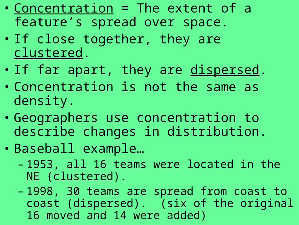
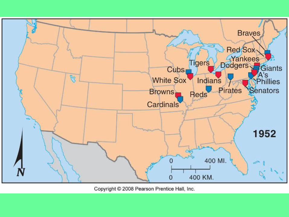
• Concentration = The extent of a feature’s spread over space.
• If close together, they are clustered.• If far apart, they are dispersed.• Concentration is not the same as density.• Geographers use concentration to describe
changes in distribution.• Baseball example…
– 1953, all 16 teams were located in the NE (clustered).
– 1998, 30 teams are spread from coast to coast (dispersed). (six of the original 16 moved and 14 were added)

• Pattern – the geometric arrangement of objects in space.
• Sometimes we see geometric patterns, sometimes things are irregular.
• Patterns can be linear like along a street or river.
• Streets can be in a grid pattern, cities can be square shaped.
• Baseball Example…• The thirty baseball teams are located in
America’s 27 largest cities. (3 cities have two teams).
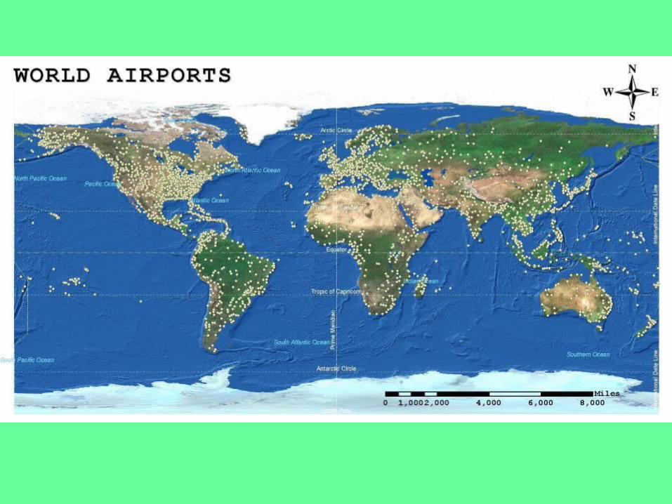
Maps
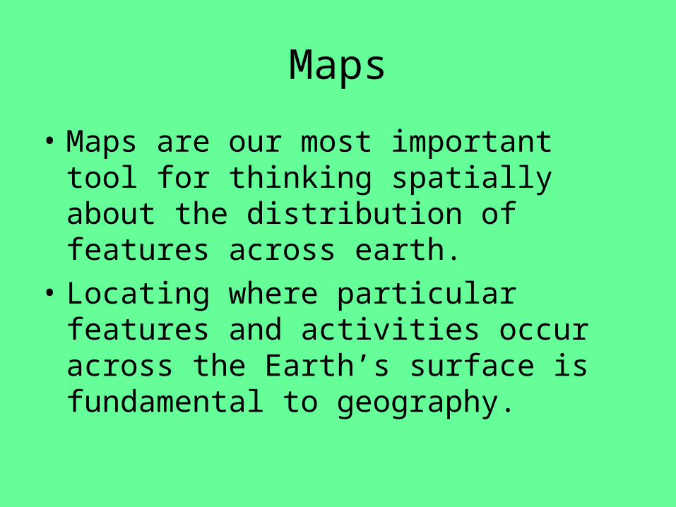
• Maps are our most important tool for thinking spatially about the distribution of features across earth.
• Locating where particular features and activities occur across the Earth’s surface is fundamental to geography.
• Three main projections are used in chapter 1 and throughout Rubenstein.

• The “Robinson Uninterrupted” map (Figure 1-15, 3-7) shows the oceans uninterrupted.
• Robinson is good for showing global interaction.
• It does not preserve direction or shape and lat. and long. do not always intersect at right angles.

Robinson Uninterrupted


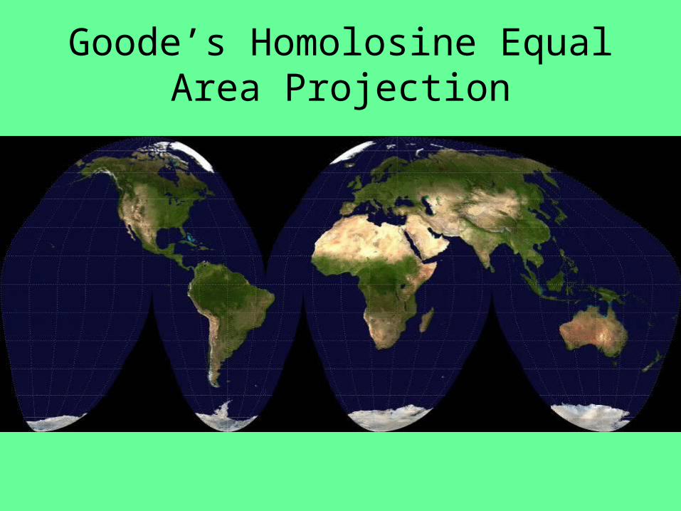
• Goode’s Homolosine Equal Area Projection (figure 3-3) interrupts the oceans and projects Australia and New Zealand. Land mass appears larger than in reality, but it minimizes distortion.
Goode’s Homolosine Equal Area Projection


• The Mercator projection was created for navigational purposes. It was designed so that direction between any two points on Earth could be plotted using a straight line.
• It has extreme distortion near the poles.

Time

Map Distortion
• It is impossible to represent a sphere perfectly on paper. Every map has flaws. Among them…– Shape– Distance– Relative Size– Direction


Early Mapmaking• The Babylonians (2300 BC) created the earliest
surviving maps. The main purpose was navigation.• Ptolemy (AD 127-145, Alexandria) wrote Guide to
Geography, which recorded the basic principles of mapmaking and prepared many maps, the techniques of which were not improved upon for more than 1,000 years.
• The “Age of Discovery” presented a need for new, accurate maps. Explorers needed a reliable way to get back home. – Mercator: best cartographer of the period.
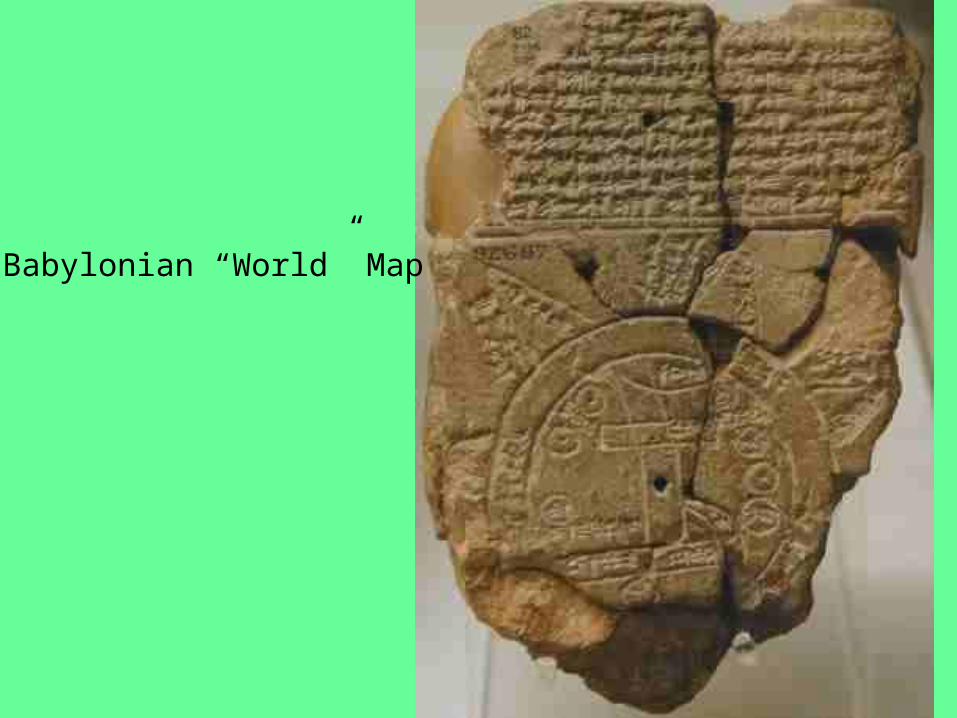
Babylonian “World” Map

Ptolemy's “World” Map – 15th century copy of original
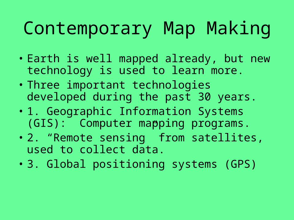
Contemporary Map Making
• Earth is well mapped already, but new technology is used to learn more.
• Three important technologies developed during the past 30 years.
• 1. Geographic Information Systems (GIS): Computer mapping programs.
• 2. “Remote sensing” from satellites, used to collect data.
• 3. Global positioning systems (GPS)

GIS – add layers to see detail

GPS – Satellites orbiting Earth help you find your exact position.

Using the reflection of the sun, satellites are able to scan the Earth’s surface for details as directed by scientists.
Key Issue #2 –
Thinking About Place

• Location = the position that something occupies on Earth’s surface.
• There are 4 ways to identify location…– Place names– Site– Situation– Mathematical location

• Place names – aka toponyms.
• - can be named for a person, religion, history, etc.• -can tell us a lot about places
• Can you name some toponyms that are unusual or very telling about the history of that area?
• Link

• Site – physical character of a place
• Climate, water sources, soil, vegetation, latitude, elevation
• Note that humans can modify a place, so site can change.

• Situation – the location of a place relative to another place.
• Valuable for (1) finding an unfamiliar place (comparing location to a familiar place) and (2) understanding its importance (accessibility to other place)

• Mathematical Location – “geographic grid”
• Meridian – line drawn from N pole to S pole. Numbered according to the system of longitude. 0°-180° East or West
• Parallel – circles drawn around the globe parallel to the equator


Time
• The Earth is divided into 360° of longitude (180° E or W).
• 15° E or W is equivelant to 1 hour – 360°/24 hours=15°
• Earth is divided into 24 time zones. Created in 1883.
• The time at the prime meridian (GMT) is Earth’s master reference time for all points on Earth.
• We are in EST and are 5 hours behind GMT.– 75°/15 = 5 hours

12345
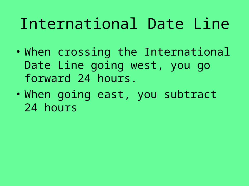
International Date Line
• When crossing the International Date Line going west, you go forward 24 hours.
• When going east, you subtract 24 hours

Sunlight
First place to start new day
Last place to end old day


• Longitude is a human creation. Any point on Earth could have been 0° Longitude.
• 0° Latitude had to be the equator. Even the ancients could calculate latitude based on the sun.

Key Issue #3 –
Thinking About Region

• Region is an area of Earth defined by one or more unique characteristics.
• Can be cultural (language, religion), economic (agriculture, industry), etc.
• We can distinguish parts of a whole like “northern” SC or “southern” SC
• Geographers divide the world into regions.
• Regional Studies is how modern geography is taught – one region at a time.

7th Period
• Name some regions.
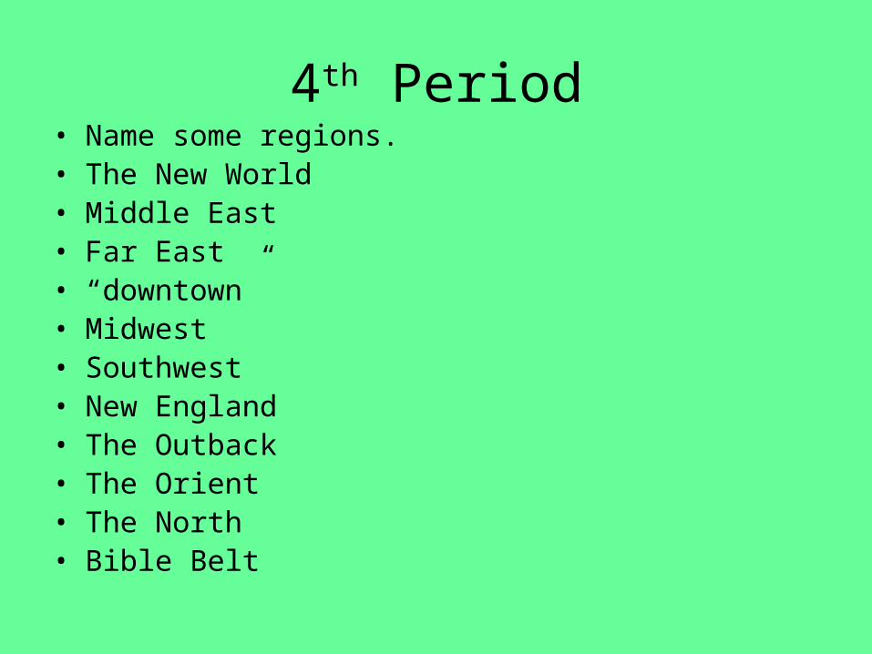
4th Period• Name some regions.• The New World• Middle East• Far East• “downtown”• Midwest• Southwest• New England• The Outback• The Orient• The North• Bible Belt
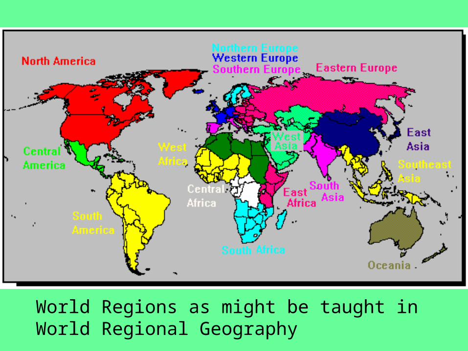
World Regions as might be taught in World Regional Geography

• A region can be larger than a point and smaller than the planet.
• Usually consists of several countries or localities.

TYPES OF REGIONS (3)
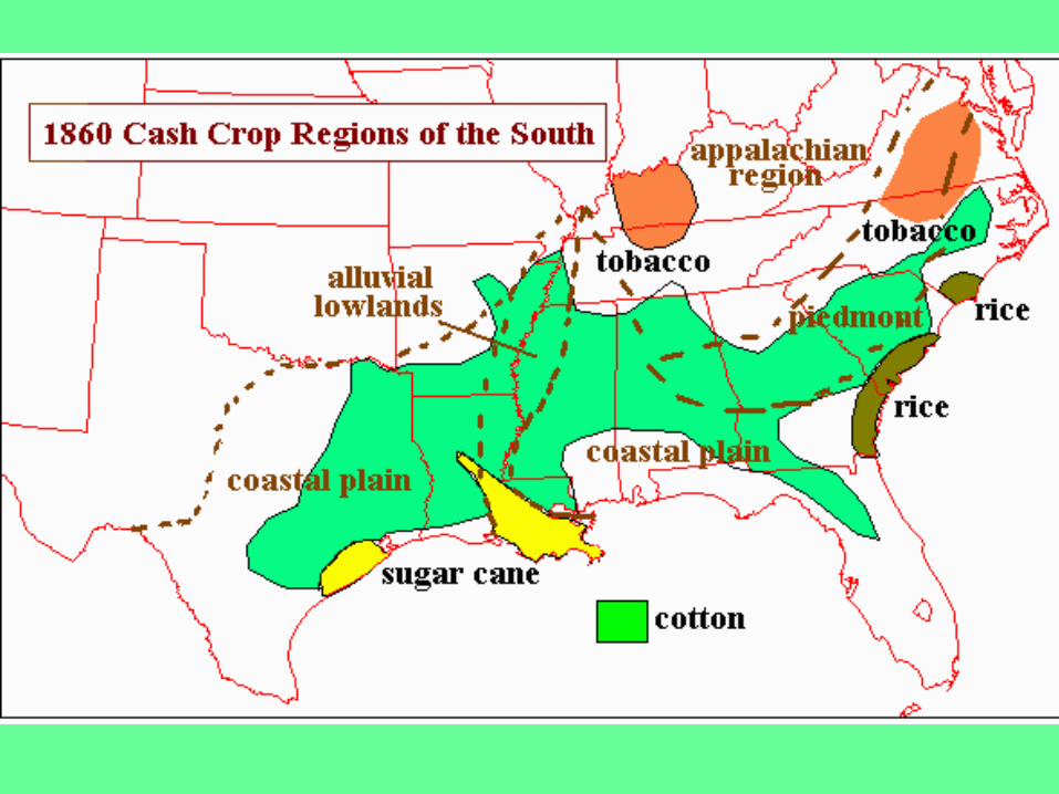
• Formal Region (aka uniform region) – an area within which everyone shares in common one or more characteristics.
• Can be a crop, climate, language, etc.
• Characteristic is common throughout the region.
• South Carolina is a formal region – why?
• Wheat Belt or Corn Belt

• Functional Region – an area organized around a focal point.
• Reception of a tv station, circulation of a newspaper, or a school attendance zone.
• Technology is interfering – internet stores, satellite tv, etc.

Functional Regions of the EPA


DVD Regions
• Vernacular Region (aka perceptual region) – a place people believe as part of their cultural identity.
• “The South,” “The Middle East, “The North Country”


CULTURE• Culture – the body of customary beliefs that tie
people together through tradition.• Comes from Latin word, “cultus” meaning “to
care for.”• This is very complex b/c “to care for” has two
very different meanings…– 2 versions of “cultus”…
• To care about = cult (ideas, values, beliefs)• To take care of = cultivate (earning a living,
obtaining food, clothing, and shelter).• Geography looks at both of these concepts.
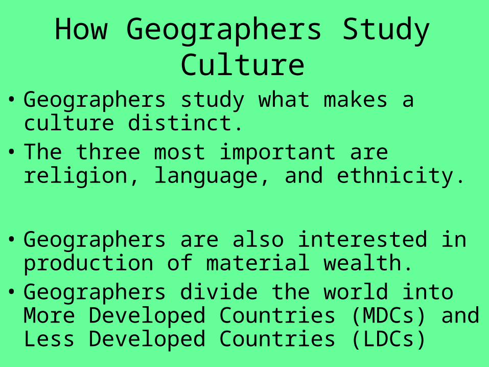
How Geographers Study Culture
• Geographers study what makes a culture distinct.
• The three most important are religion, language, and ethnicity.
• Geographers are also interested in production of material wealth.
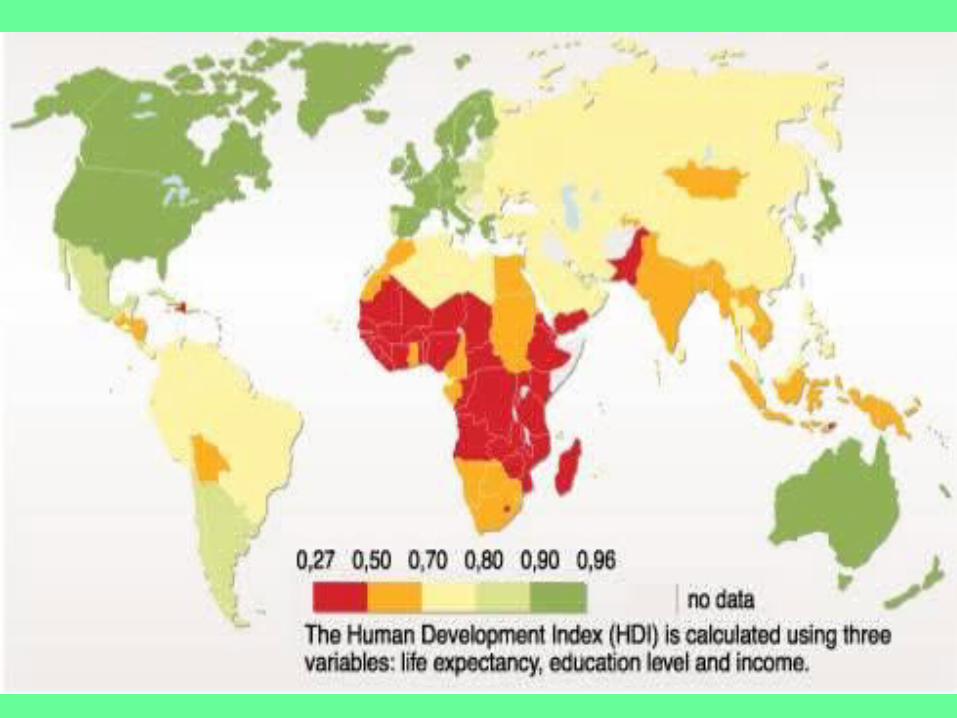
• Geographers divide the world into More Developed Countries (MDCs) and Less Developed Countries (LDCs)

Cultural Ecology
• Cultural Ecology: human-environment relationships.
• Ex: The climate and/or resources of any area influences humans.
• The Netherlands – probably the most modified place on Earth.– ½ of land area is below sea level. – Created with polders (16% of land area… drained
areas) and earthen dams.

Key Issue #4 –
Thinking About Scale

SCALE
• Scale – relation of a feature’s size on a map and its actual size on Earth.
• Scale can be from local to global.– Local = unique, Global = broad
• It can be written as a fraction (1/24,000), a ratio (1:24,000) or written (one inch equals one mile)
• Without appropriate scale, accurate map reading would be impossible.

Small/Large Scale
• We often refer to maps as small scale or large scale.
• Large scale maps are called so b/c objects appear large on the maps.
• Small scale maps are the opposite.
• For example, an island displayed on a 1:10,000 map will appear larger than if displayed on a 1:100,000 map. Thus, the former is large scale.

Large Scale Map of Edinburgh, Scotland
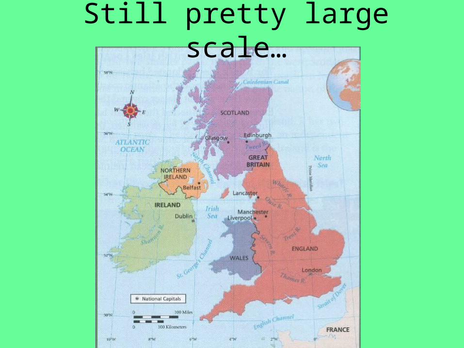
Still pretty large scale…
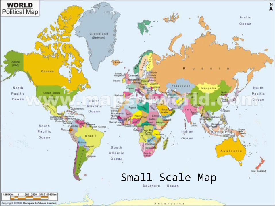
Small Scale Map

Homework
• Look at the “Made In” labels on the clothes in your closet.
• Make a tally sheet by continent for the clothes that you check.
• Turn in tomorrow.
• Try to find “Made in America”
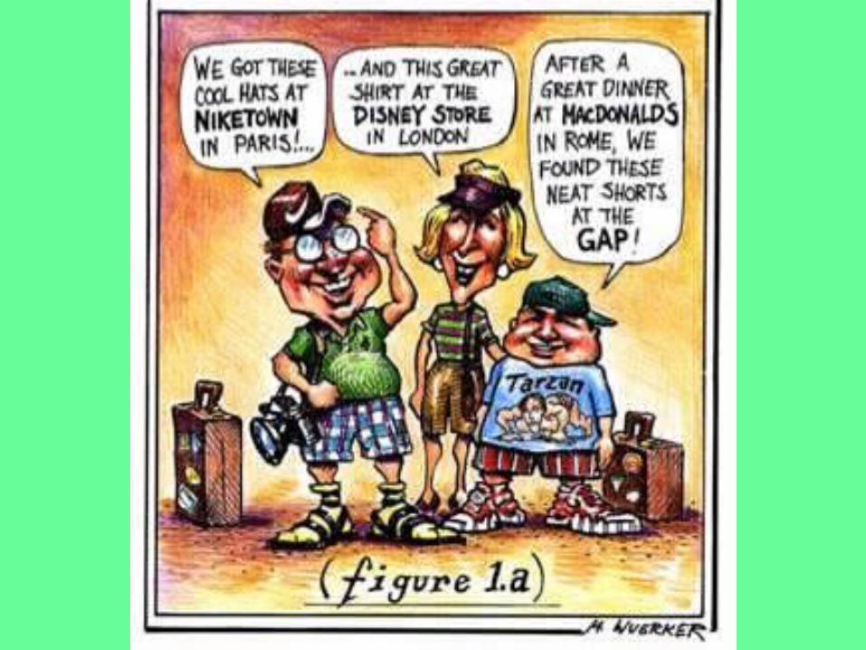
GLOBALIZATION
• Globalization – a force or process that involves the entire world and results in making something worldwide in scope.
• Globalization means that the scale of the world is shrinking – at least in the ability of a person, object, or idea to interact with a person, object, or idea in another place.
• *The world is becoming more uniform and interdependent.


• People in parts of the world with traditional cultures are turning to Islam and Christianity.
• Groups are threatened with extinction of their local cultural beliefs and traits due to other cultures showing up in their every day lives.

• Communication helps some people stay more culturally intact, such as satellite tv. – Expatriates can watch programs in their home
country.
– Dish Network

• Geographers know that a lot of disputes are b/c of those wanting to “globalize” and those who want to preserve things.
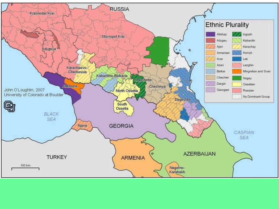
• Different cultural groups have been unable to share the same space in SE Europe, E Africa, and the Middle East.

In Class Essay…
• Pick one of the following and write an essay…
• Globalization is a good thing…
• Globalization is a bad thing…
• Globalization is good in some ways, bad in others…

Key Issue #5 –
Thinking About Connections

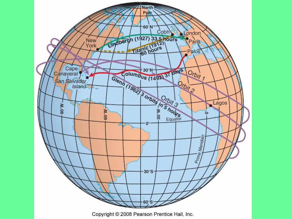
Space-time Compression
• Space-time compression – the reduction in the time it takes for something to reach another place
• Distant places are less remote and more accessible.
• We know what is happening on the other side of the world and we know it sooner than ever before.
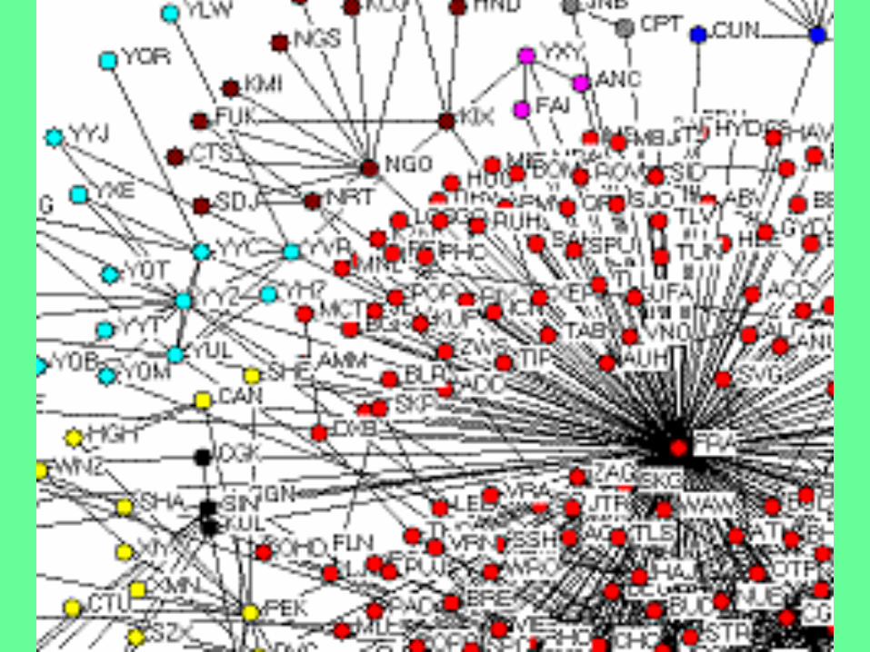
SPATIAL INTERACTION
• When places are connected through a network, geographers say there is spatial interaction between them.
• Spatial interaction is established through the movement of people, goods, or ideas.
• Today, we are connected to the globe through satellite tv, phones, and the internet.

• Networks are chains of communication that connect people.
• Examples…
• Tv networks: ABC, NBC, CBS, FOX all broadcast the same thing across the country simultaneously
• Airlines: hubs and spokes


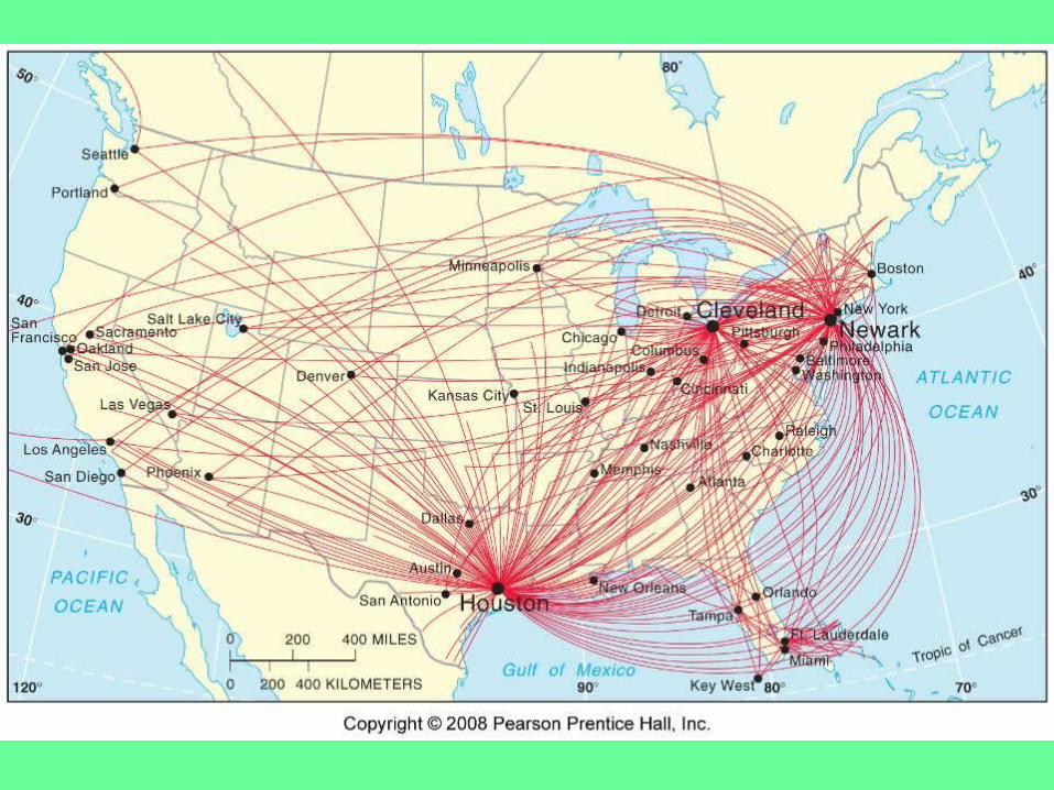

• The further away a country is, the less likely you are to interact with it.
• Contact diminishes with distance and eventually disappears – this is called distance decay.
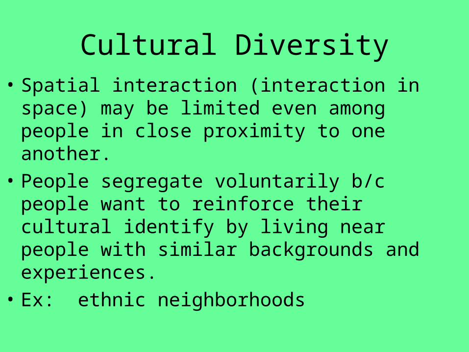
Cultural Diversity• Spatial interaction (interaction in space) may be
limited even among people in close proximity to one another.
• People segregate voluntarily b/c people want to reinforce their cultural identify by living near people with similar backgrounds and experiences.
• Ex: ethnic neighborhoods


DIFFUSION
• The process by which a characteristic spreads from one place to another over time.
• Ideas today move very quickly. It makes the world very complex. Ideas are constantly traveling everywhere all of the time.

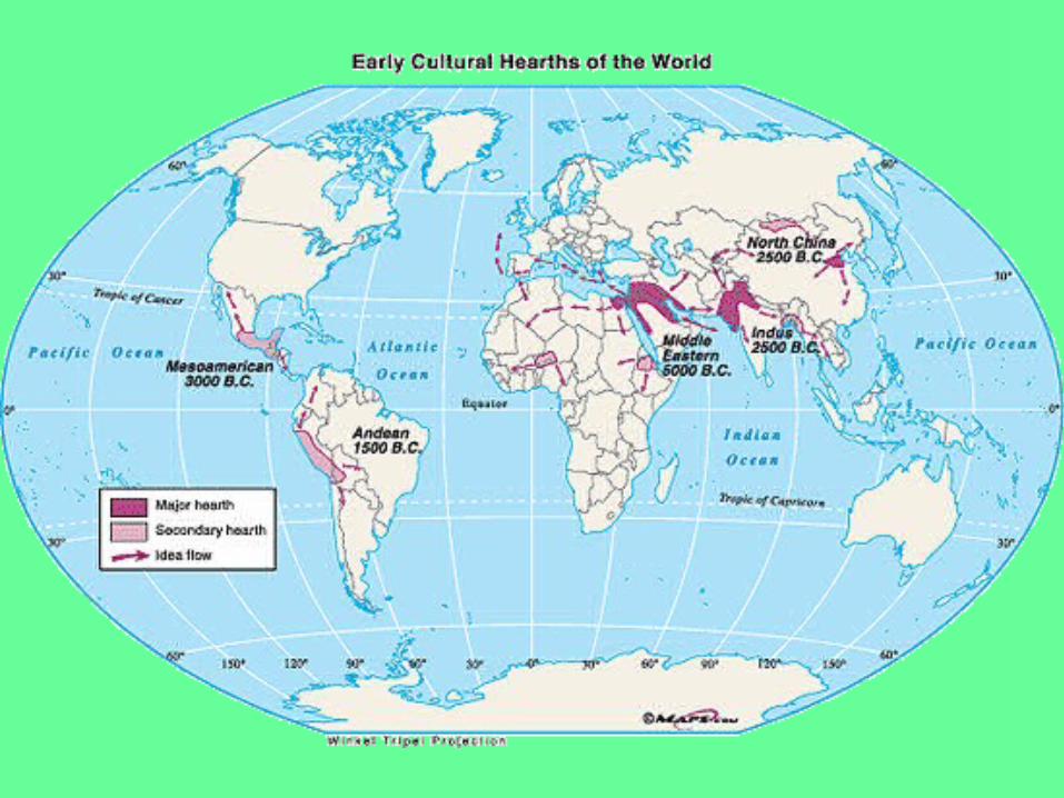
• The place an innovention originates from is called a hearth. It diffuses to other places from there.
• Where are the hearths for…
• Reggae?
• Fashion?
• Soccer?
• Democracy?


• Using some of the examples we just saw, how do they diffuse over space with regard to the role of transportation and communication?
• Our own (American) traditions, including government, can be traced to the hearth of England.

TYPES OF DIFFUSION
• For a person, object, or idea to have interaction with a person, object, or idea in another place, diffusion must occur.
• Geographers observe two types of diffusion… Relocation and Expansion Diffusion.

Relocation Diffusion
• Ideas spread through physical movement of people from one place to another.
• French, English, Spanish, Portugeuse spoken in N and S America b/c of migrants.

Most languages can be traced back to W. Europe.

Expansion Diffusion
• The spread of a feature from one place to another in a snowballing process.– Happens 1 of 3 ways…

• Hierarchical diffusion – spread from the top-down… political leaders, social elite, etc.
• “T. Boone Pickens” – Pickens Plan

• Contagious diffusion – rapid, widespread.
• Disease like influenza, or ideas that everyone has access to, like on the Internet or TV. “Going Green”
• Mecca Example… article, map


• Stimulus diffusion is a genuine invention sparked by an idea that diffused in from another culture. “Direct Borrowing”
• Kind of like seeing something from another culture, being “stimulated” by it and modifying it to fit your needs.
• The invention of a unique Cherokee writing system by Sequoyah around 1821 after seeing English.
• Point and click mouse used in IBM machines, though invented by Apple.