Introduction to GIS Geography Matters! October 4, 2015October 4, 2015October 4, 2015.
22
Introduction to GIS Introduction to GIS Geography Matters! Geography Matters! March 23, 2022 March 23, 2022
-
Upload
frederica-walton -
Category
Documents
-
view
223 -
download
2
Transcript of Introduction to GIS Geography Matters! October 4, 2015October 4, 2015October 4, 2015.
Introduction to GISIntroduction to GIS
Geography Matters!Geography Matters!
April 19, 2023April 19, 2023
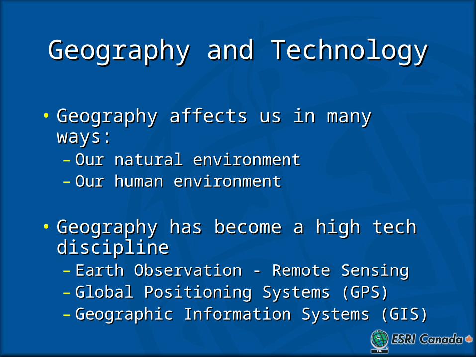
Geography and TechnologyGeography and Technology
• Geography affects us in many ways:Geography affects us in many ways:– Our natural environmentOur natural environment– Our human environmentOur human environment
• Geography has become a high tech Geography has become a high tech disciplinediscipline– Earth Observation - Remote SensingEarth Observation - Remote Sensing– Global Positioning Systems (GPS)Global Positioning Systems (GPS)– Geographic Information Systems (GIS)Geographic Information Systems (GIS)
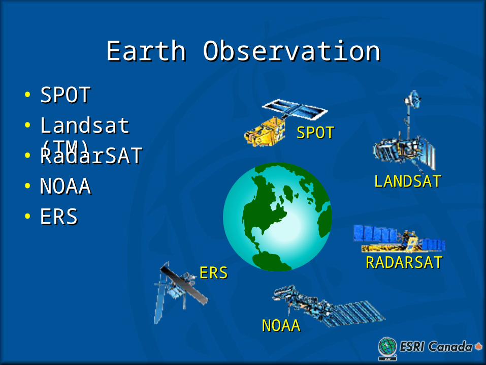
Earth ObservationEarth Observation
LANDSATLANDSAT
• Landsat (TM)Landsat (TM)
RADARSATRADARSAT
• RadarSATRadarSAT
NOAANOAA
• NOAANOAA
ERSERS
• ERSERS
SPOTSPOT
• SPOTSPOT
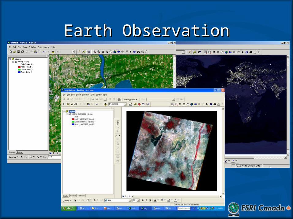
Earth ObservationEarth Observation
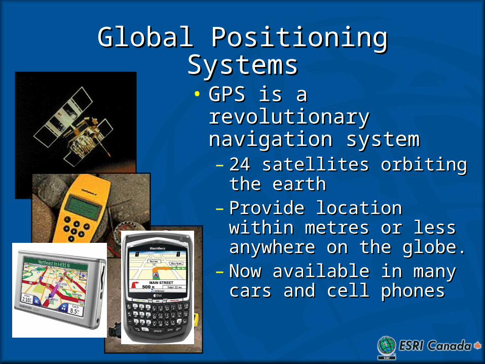
Global Positioning SystemsGlobal Positioning Systems
• GPS is a revolutionary GPS is a revolutionary navigation systemnavigation system– 24 satellites orbiting the 24 satellites orbiting the
earthearth– Provide location within Provide location within
metres or less anywhere on metres or less anywhere on the globe.the globe.
– Now available in many cars Now available in many cars and cell phonesand cell phones
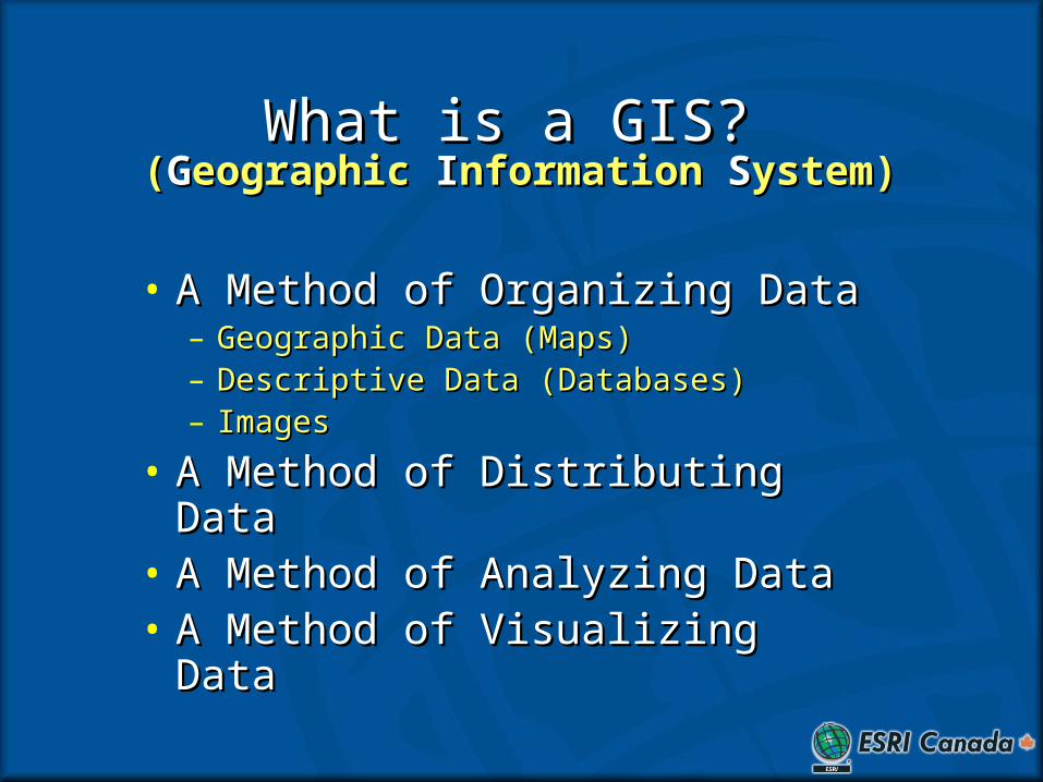
What is a GIS?What is a GIS?
• A Method of Organizing DataA Method of Organizing Data– Geographic Data (Maps)Geographic Data (Maps)– Descriptive Data (Databases)Descriptive Data (Databases)– ImagesImages
• A Method of Distributing DataA Method of Distributing Data• A Method of Analyzing DataA Method of Analyzing Data• A Method of Visualizing DataA Method of Visualizing Data
((GGeographic eographic IInformation nformation SSystem)ystem)
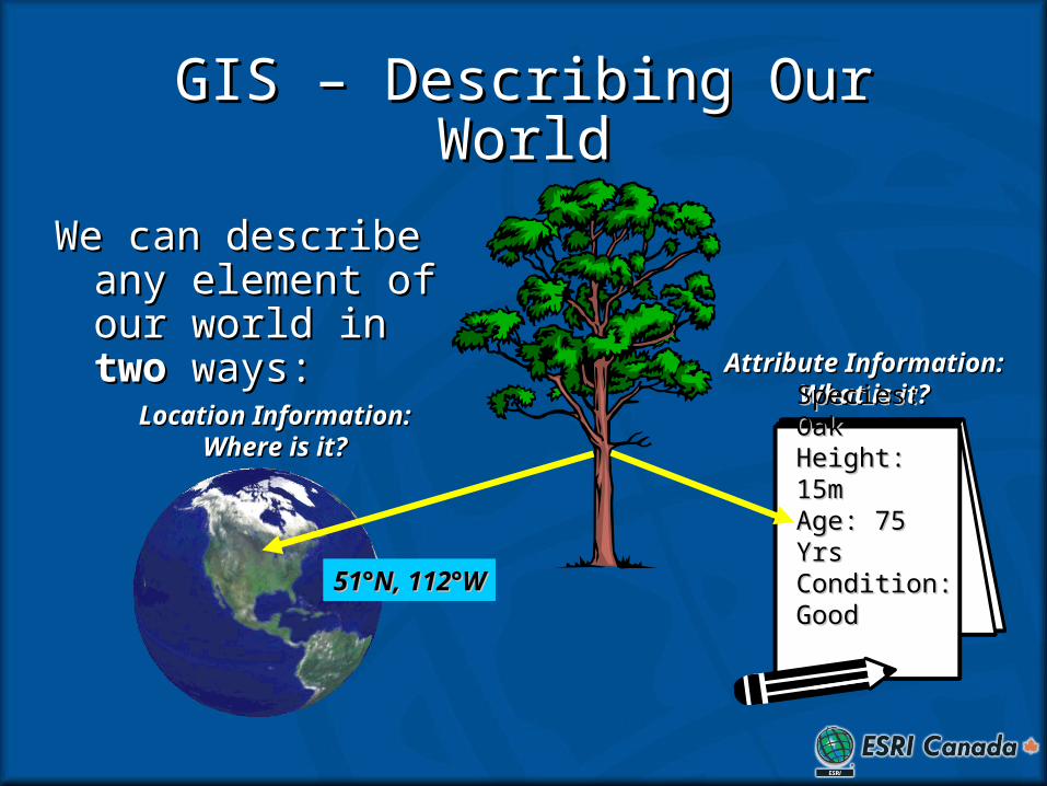
GIS – Describing Our WorldGIS – Describing Our World
We can describe any We can describe any element of our world element of our world in in twotwo ways: ways:
Attribute Information:Attribute Information:What is it?What is it?
Species: OakSpecies: OakHeight: 15mHeight: 15mAge: 75 YrsAge: 75 YrsCondition: Condition: GoodGood
Location Information: Location Information: Where is it?Where is it?
51°N, 112°W51°N, 112°W
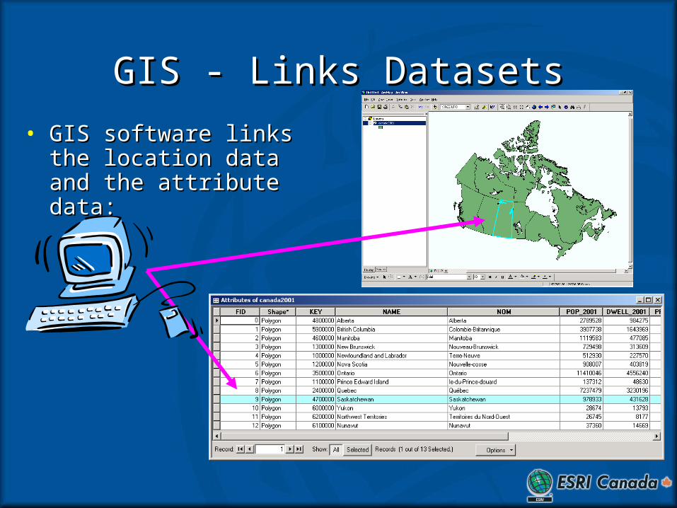
GIS - Links DatasetsGIS - Links Datasets
• GIS software links the GIS software links the location data and the location data and the attribute data:attribute data:
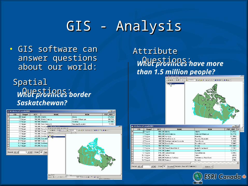
GIS - AnalysisGIS - Analysis
• GIS software can answer GIS software can answer questions about our world:questions about our world:
What provinces border Saskatchewan?
Spatial Questions:Spatial Questions:
What provinces have more than 1.5 million people?
Attribute Questions:Attribute Questions:
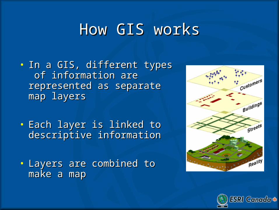
How GIS worksHow GIS works
• In a GIS, different types of In a GIS, different types of information are represented information are represented as separate map layersas separate map layers
• Each layer is linked to Each layer is linked to descriptive informationdescriptive information
• Layers are combined to make Layers are combined to make a mapa map
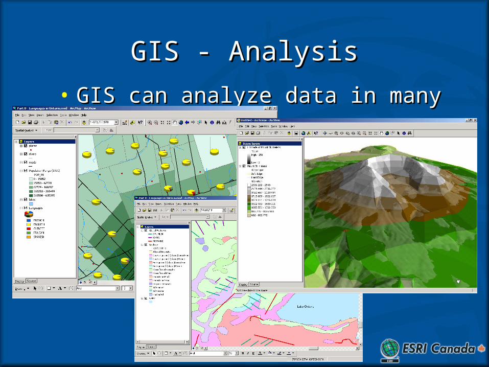
GIS - AnalysisGIS - Analysis
• GIS can analyze data in many ways:GIS can analyze data in many ways:
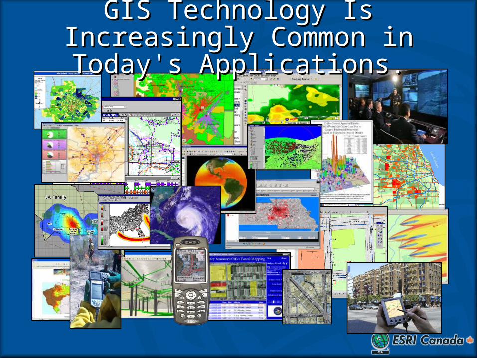
GIS Technology Is Increasingly GIS Technology Is Increasingly Common in Today's Applications.Common in Today's Applications.
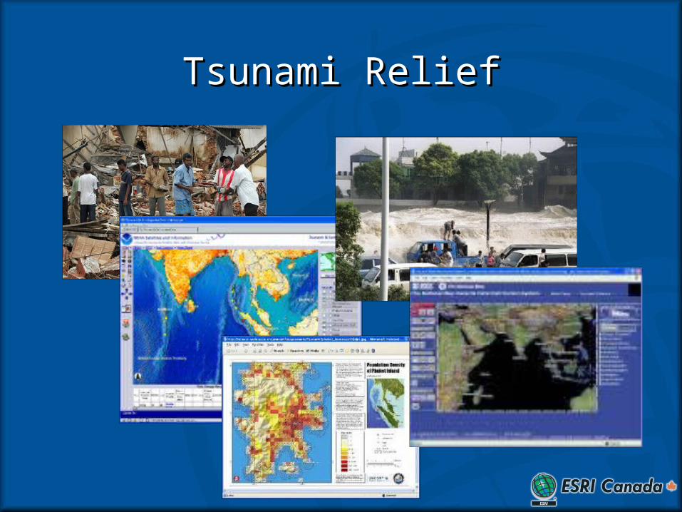
Tsunami ReliefTsunami Relief
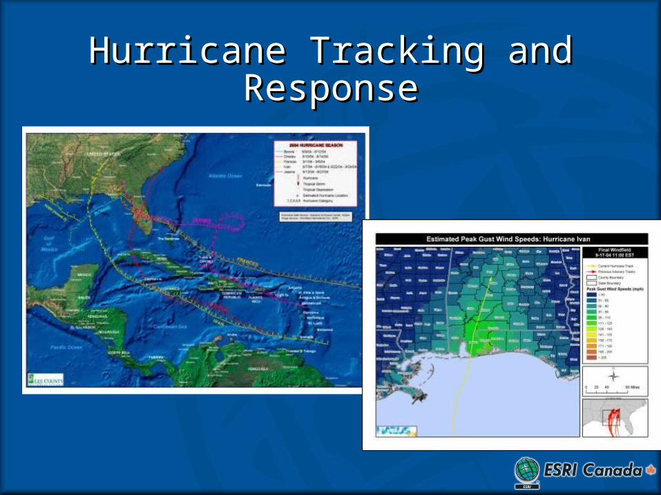
Hurricane Tracking and Hurricane Tracking and ResponseResponse
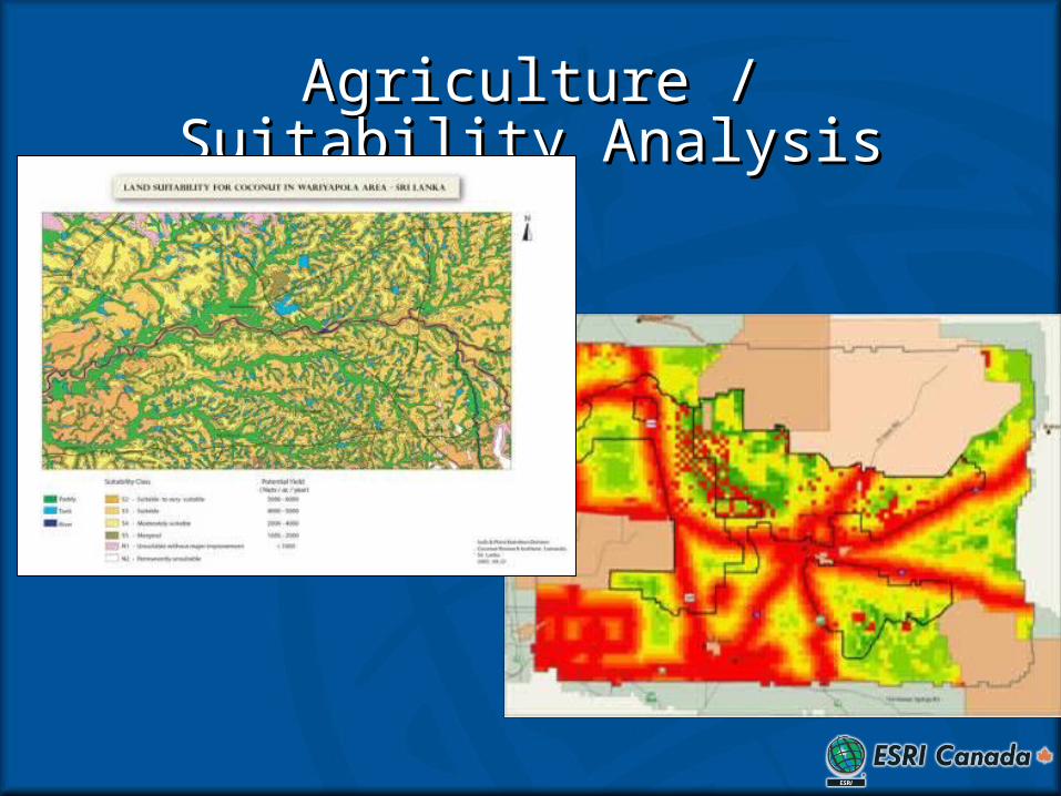
Agriculture / Suitability AnalysisAgriculture / Suitability Analysis
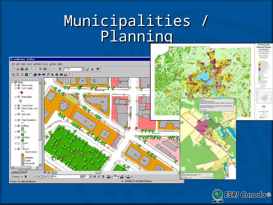
Municipalities / PlanningMunicipalities / Planning
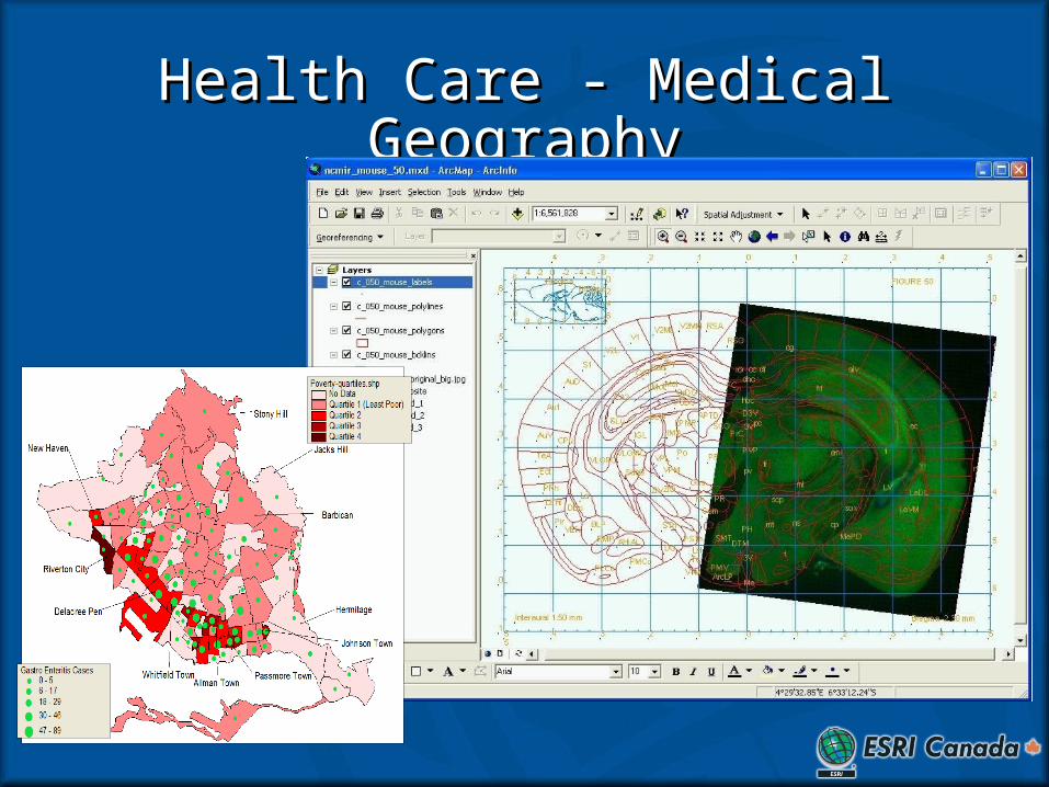
Health Care - Medical GeographyHealth Care - Medical Geography
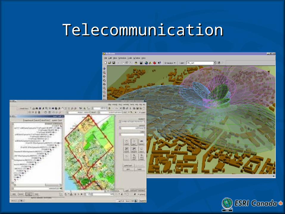
TelecommunicationTelecommunication
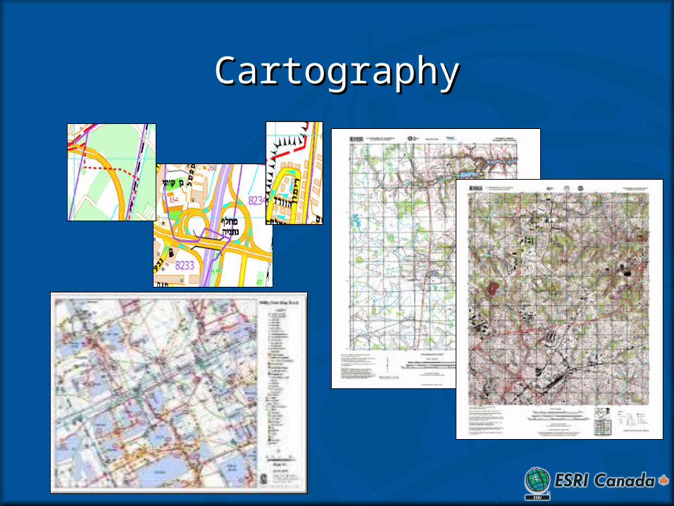
CartographyCartography
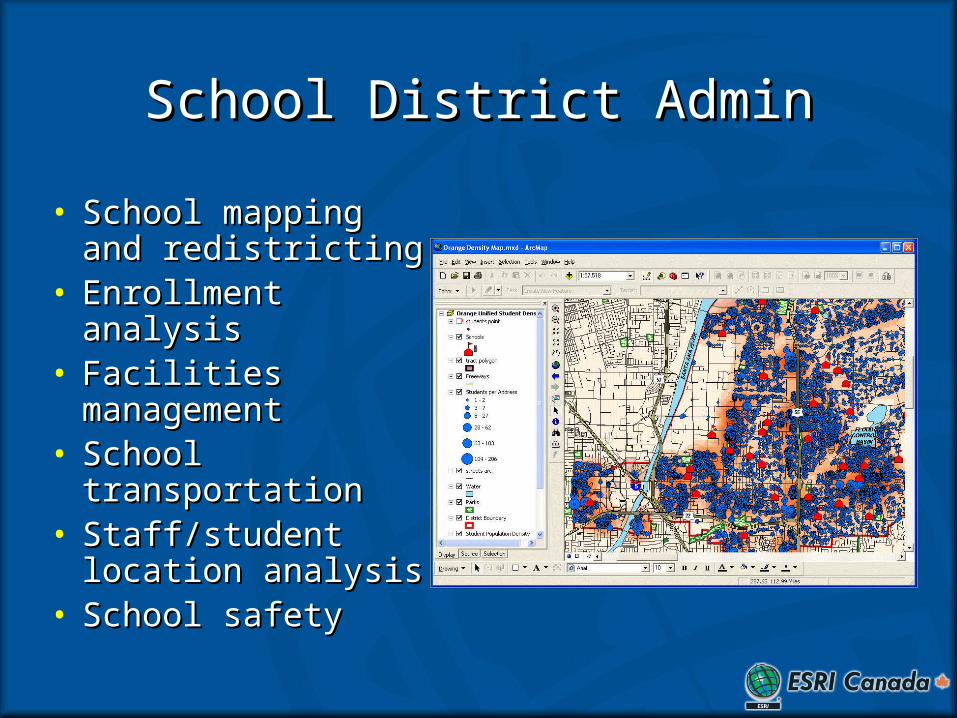
School District AdminSchool District Admin
• School mapping and School mapping and redistrictingredistricting
• Enrollment analysisEnrollment analysis• Facilities Facilities
managementmanagement• School School
transportation transportation • Staff/student Staff/student
location analysislocation analysis• School safetySchool safety
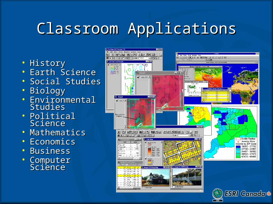
Classroom ApplicationsClassroom Applications
• HistoryHistory• Earth ScienceEarth Science• Social StudiesSocial Studies• BiologyBiology• Environmental Environmental
StudiesStudies• Political SciencePolitical Science• MathematicsMathematics• EconomicsEconomics• BusinessBusiness• Computer Computer
ScienceScience
The End